p.l. 94-171 county block map (2010 census) · st. lucas 70050 randalia 65550 maynard 50610 hawkeye...
TRANSCRIPT

1 2 3
5 7 8
9
13 15
17 18 19 20
4
6
10 11 12
14 16
Volga Lk
Dover twp 91071
Pleasant Valley twp 93411
Putnam twp 93522Scott twp 93771
Auburn twp 90090
Oran twp 93183
Smithfield twp 93930
Union twp 94206
Westfield twp 94662
Windsor twp 94761
Harlan twp 91845
Center twp 90603
Fairfield twp 91278
Fremont twp 91473
Illyria twp 92013
Jefferson twp 92220
Banks twp 90120
Bethel twp 90231
Clermont twp 90729
Eden twp 91143
Fayettecity° 91324
West Unioncity° 94702
Sumner city° 94045
Sumner city°
Franklin twp
Sumner No. 2 twp
Lester twpBuffalo twp
Fairbank twp Hazleton twpMadison twp Richland twp
Dayton twp
Fredericksburg twp
Stapleton twp
Utica twp
Post twp
Cass twp
Grand Meadow twp
Highland twp
Jackson twp Military twpWashington twp
Marion twp
Sperry twp
Bloomfield twp
CH
ICK
AS
AW
03
7
FA
YE
TT
E 0
65
WIN
NE
SH
IEK
19
1
CH
ICK
ASA
W 037 CLAYTON 043
ALLAMAKEE 005
CLAYTON 043
DELAWARE 055
BREMER 017
CHICKASAW 037
BREMER 017
BLACK HAWK 013
BU
CH
AN
AN
01
9
DE
LAW
AR
E 0
55
BR
EM
ER
01
7
FA
YE
TT
E 0
65
FAYETTE 065
BUCHANAN 019
CLA
YT
ON
04
3
FA
YE
TT
E 0
65
WINNESHIEK 191
FAYETTE 065
West Union84765
Westgate 84180
Waucoma 82650
Wadena 81570
St. Lucas 70050
Randalia 65550
Maynard50610
Hawkeye 35310
Fayette 27165
Elgin24645
Clermont14250
Arlington02845
Sumner 76260
Oelwein58620
Stanley 74955Fairbank 26355
Sumner
StanleyFairbank
Lawler
StrawberryPoint
JacksonJunction
Postville
Volga
150
13
3
410
193
24
150
150
150
56
410
24
3
18
52
18
18
18
G
E
H
F
D
B
C
J
A
K
I
LEGEND
SYMBOL DESCRIPTION SYMBOL LABEL STYLE
Federal American IndianReservation L'ANSE RES 1880
Off-Reservation Trust Land,Hawaiian Home Land T1880
Oklahoma Tribal Statistical Area,Alaska Native Village Statistical Area,Tribal Designated Statistical Area
KAW OTSA 5340
American Indian TribalSubdivision EAGLE NEST DIST 200
State American IndianReservation Tama Res 4125
State Designated TribalStatistical Area Lumbee STSA 9815
Alaska Native RegionalCorporation NANA ANRC 52120
State (or statisticallyequivalent entity) NEW YORK 36
County (or statisticallyequivalent entity) ERIE 029
Minor Civil Division(MCD)1 Bristol town 07485Census County Division (CCD),Census Subarea (CSA),Unorganized Territory (UT)
Jemez CCD 91650
Consolidated City MILFORD 47500
Incorporated Place 1,2 Davis 18100Census Designated Place(CDP) 2 Incline Village 35100
Voting District (VTD) 100015State Legislative District -Upper (Senate)
SLDU14
State Legislative District -Lower (House)
SLDL26
Census Tract 33.07
Census Block 3 3012
DESCRIPTION SYMBOL DESCRIPTION SYMBOL
Interstate 3
U.S. Highway 2
State Highway 4
Other RoadMarsh Ln
Cul-de-sac
Circle
4WD Trail, Stairway,
Alley, Walkway, or Ferry
RailoadSouthern RR
Pipeline orPower Line
Ridge or Fence
Property Line
Perennial StreamTumbling Cr
Intermittent StreamPiney Cr
Nonvisible Boundaryor Feature NotElsewhere Classified
Geographic Offsetor Corridor
Water Body Pleasant Lake
Swamp, Marsh, orGravel Pit/Quarry
Okefenokee Swamp
Glacier Bering Glacier
Military Fort Belvoir
National or State Park,
Forest, or Recreation AreaYosemite NP
AirportOxnard Arprt
Selected Mountain PeaksMt Baker
Inset Area A
Outside Subject Area
Where state, county, and/or MCD/CCD boundaries coincide, the map shows theboundary symbol for only the highest-ranking of these boundaries. Where AmericanIndian reservation and American Indian tribal subdivision boundaries coincide, the mapshows only the American Indian reservation boundaries. Where Oklahoma tribalstatistical area boundaries and American Indian tribal subdivision boundariescoincide, the map shows only the Oklahoma tribal statistical area boundaries.
1 A ' ° ' following an MCD name denotes a false MCD. A ' ° ' following a place name indicates that a false MCD exists with the same name and FIPS code as the place; the false MCD label is not shown.
2 Place label color correlates to the place fill color.
3 A ' ' following a block number indicates that the block number is repeated elsewhere in the block.
*
U S C E N S U S B U R E A U
Location of County within State
2010 PL BLOCK MAP (INDEX)
201019065000
INDEX SHEET
43.101339N92.158798W
43.092815N91.51629W
42.621984N91.530222W
42.630444N92.167953W
All legal boundaries and names are as of January 1, 2010. The boundaries shown on thismap are for Census Bureau statistical data collection and tabulation purposes only; theirdepiction and designation for statistical purposes does not constitute a determination ofjurisdictional authority or rights of ownership or entitlement.
U.S. DEPARTMENT OF COMMERCE Economics and Statistics Administration U.S. Census Bureau
Geographic Vintage: 2010 Census (reference date: January 1, 2010)Data Source: U.S. Census Bureau's MAF/TIGER database (TAB10ST19)Map Created by Geography Division: January 06, 2011
ENTITY TYPE: County or statistically equivalent entity
NAME: Fayette County (065) Projection: Albers Equal Area Conic
Datum: NAD 83
Spheroid: GRS 80
1st Standard Parallel: 40 53 46
2nd Standard Parallel: 42 58 46
Central Meridian: -93 23 22
Latitude of Projection's Origin: 40 22 31
False Easting: 0
False Northing: 0
Total Sheets: 32- Index Sheets: 1- Parent Sheets: 20- Inset Sheets: 11
ST: Iowa (19)
0 2 4 6 8 10 Kilometers10 Kilometers
0 1 2 3 4 5 Miles5 Miles
The plotted map scale is 1:71645
P.L. 94-171 COUNTY BLOCK MAP (2010 CENSUS): Fayette County, IA

Dry Run
Little Turtle Riv
Crane C
rk
Crane Crk
Simpson Crk
Little Tu
rkey Riv
Crane Crk
Little Turkey R
iv
Sim
pson Crk
Crane Crk
C rane Crk
I & M Rail L
ink
Stapleton twp 94008
Utica twp 94299
Jackson twp 92181
Eden twp 91143
2096*
2028
2018
2025
2127*
2094*
2063*
2001*
2051
2083*
2140*
2098*2103*
2011
2125*
2101*
2082*
2068
2056*
2006
2022
2072*
2021
2017
2019
2013
2007
2015
20092005
2093*
2033
2065*
2084*
2000*
2010
2002
2066
2003
2067
2034
2008
2030
2027
2126*
2102*
2055
2061
2062
2023
2100
2076
2099
2026
2020
2014
2074
2012
2073
2004
2092
2075
2024
2060
2029
2077
807
WIN
NE
SH
IEK
19
1
CH
ICK
AS
AW
03
7
WINNESHIEK 191
FAYETTE 065
CH
ICK
AS
AW
03
7
FA
YE
TT
E 0
65
Jackson Junction 39135
Waucoma 82650
SLDL15
SLDL18
SLDU8
SLDU9
191019037004
037006
191018191018
065001
29
5th
Ave
Youn
g W
ay
31
5th
Ave
200th St
195th St
210th St
220th St
343rd Ave
33
0th
Ave
315th Ave
240th St
Will
ow R
d
York
Ave
280th St
Spr
uce
Rd
Xavi
er R
d
X Ave
290th St
Will
ow R
d
3rd
Ave
NW
T Ave
White Tail Rd
Uni
corn
Rd
W A
ve
Vine
Rd
270th St
Xray Rd
310th St
3rd St NW
300th St
Sunset Rd
Upp
er R
d
W A
ve
Tower Rd
275th St
Scenic Rd
1st A
ve NW
300th St
306th St
Usher Rd
260th St
Uni
corn
Rd
4th Ave NE
U A
ve
4th StNW
4th Ave NW
V Ave
X Ave
Riverview Dr
Riverview Dr
Riverv
iew Dr
5th
Ave
NW
193
24
193
193
142
A
LEGEND
SYMBOL DESCRIPTION SYMBOL LABEL STYLE
Federal American IndianReservation L'ANSE RES 1880
Off-Reservation Trust Land,Hawaiian Home Land T1880
Oklahoma Tribal Statistical Area,Alaska Native Village Statistical Area,Tribal Designated Statistical Area
KAW OTSA 5340
American Indian TribalSubdivision EAGLE NEST DIST 200
State American IndianReservation Tama Res 4125
State Designated TribalStatistical Area Lumbee STSA 9815
Alaska Native RegionalCorporation NANA ANRC 52120
State (or statisticallyequivalent entity) NEW YORK 36
County (or statisticallyequivalent entity) ERIE 029
Minor Civil Division(MCD)1 Bristol town 07485Census County Division (CCD),Census Subarea (CSA),Unorganized Territory (UT)
Jemez CCD 91650
Consolidated City MILFORD 47500
Incorporated Place 1,2 Davis 18100Census Designated Place(CDP) 2 Incline Village 35100
Voting District (VTD) 100015State Legislative District -Upper (Senate)
SLDU14
State Legislative District -Lower (House)
SLDL26
Census Tract 33.07
Census Block 3 3012
DESCRIPTION SYMBOL DESCRIPTION SYMBOL
Interstate 3
U.S. Highway 2
State Highway 4
Other RoadMarsh Ln
Cul-de-sac
Circle
4WD Trail, Stairway,
Alley, Walkway, or Ferry
RailoadSouthern RR
Pipeline orPower Line
Ridge or Fence
Property Line
Perennial StreamTumbling Cr
Intermittent StreamPiney Cr
Nonvisible Boundaryor Feature NotElsewhere Classified
Geographic Offsetor Corridor
Water Body Pleasant Lake
Swamp, Marsh, orGravel Pit/Quarry
Okefenokee Swamp
Glacier Bering Glacier
Military Fort Belvoir
National or State Park,
Forest, or Recreation AreaYosemite NP
AirportOxnard Arprt
Selected Mountain PeaksMt Baker
Inset Area A
Outside Subject Area
Where state, county, and/or MCD/CCD boundaries coincide, the map shows theboundary symbol for only the highest-ranking of these boundaries. Where AmericanIndian reservation and American Indian tribal subdivision boundaries coincide, the mapshows only the American Indian reservation boundaries. Where Oklahoma tribalstatistical area boundaries and American Indian tribal subdivision boundariescoincide, the map shows only the Oklahoma tribal statistical area boundaries.
1 A ' ° ' following an MCD name denotes a false MCD. A ' ° ' following a place name indicates that a false MCD exists with the same name and FIPS code as the place; the false MCD label is not shown.
2 Place label color correlates to the place fill color.
3 A ' ' following a block number indicates that the block number is repeated elsewhere in the block.
*
Key to Sheets
5
2
6
1
U S C E N S U S B U R E A U
Location of County within State
43.095174N92.088751W
43.093711N91.9632W
43.001695N91.965286W
43.003156N92.090653W
All legal boundaries and names are as of January 1, 2010. The boundaries shown on thismap are for Census Bureau statistical data collection and tabulation purposes only; theirdepiction and designation for statistical purposes does not constitute a determination ofjurisdictional authority or rights of ownership or entitlement.
U.S. DEPARTMENT OF COMMERCE Economics and Statistics Administration U.S. Census Bureau
Geographic Vintage: 2010 Census (reference date: January 1, 2010)Data Source: U.S. Census Bureau's MAF/TIGER database (TAB10ST19)Map Created by Geography Division: January 06, 2011
ENTITY TYPE: County or statistically equivalent entity
NAME: Fayette County (065) Projection: Albers Equal Area Conic
Datum: NAD 83
Spheroid: GRS 80
1st Standard Parallel: 40 53 46
2nd Standard Parallel: 42 58 46
Central Meridian: -93 23 22
Latitude of Projection's Origin: 40 22 31
False Easting: 0
False Northing: 0
Total Sheets: 32- Index Sheets: 1- Parent Sheets: 20- Inset Sheets: 11
ST: Iowa (19)
0 0.4 0.8 1.2 1.6 2 Kilometers2 Kilometers
0 0.2 0.4 0.6 0.8 1 Miles1 Miles
The plotted map scale is 1:14000
P.L. 94-171 COUNTY BLOCK MAP (2010 CENSUS): Fayette County, IA
Sheet Location within Entity
2010 PL BLOCK MAP (PARENT)
201019065001
PARENT SHEET 1
Tur
key
Riv
Gou
ldsb
urg County Park
Crane Crk
Tu
rkey Riv
Little Turkey Riv
Little Turkey Riv
Turner Crk
Washington twp 94587
Military twp 92937
Auburn twp 90090
Dover twp91071
Eden twp 91143
1012
1045
1009
1032
1030
1151
1150
1039
1033
10621061
1015
1055
1075
1073
1098
1041
2057
2085
1019
1038
1037
1070
1047
1060
1013
1069
1072
1052
1054
1053
2064
1096
1105
1082
10
02
1003
1034
1104
10431040
1046
1079
1097
1057
2087
1067
1058
1010
1011
1008
1056
1152
1103
1050
1049
10631064
1066
1065
1099
1059
1051
2086
1007
1024
1020
1017
1074*
1022
1025
1016
1001
1101*
2094*
2063*
1023
1000
2001*
1081*
1083*
2083*
1080*
1020
1036
1077*
1094*
1019
1067*
1060*
1058*
2056*
10
61
*
1024*
1018*
1076*
1084*2093*
1078*
2065*
1059*
2084*
1095*
2088*
1021
2000*
1018
1005
1028
1044
1026
1035
1042
1048
1071
1031
1068
1004
1143
2089
1006
1029
1014
1144
1102
1027
806
807
WINNESHIEK 191
FAYETTE 065
St. Lucas70050
SLDL15
SLDL18
SLDU8
SLDU9
191020 191022
065003
065001
065002
105th St
Litt
le C
hurc
h R
d
25
5th
Ave
241s t St
Co R
d W1
4
Hwy 150
231s
t Av
e
280t
h Av
e
S Hilltop Dr
Lime St
Muskra t R
d
SW Summer Dr
SE
Fore
st
Dr
SW A
utum
n
Dr
SE H
illside Dr
Muskrat Rd
Front St
N A
ve
Meadow
Dr
265th St
S Main St
2 82nd
St
Pilot Rd
Linc
oln
Rd
N Main St
Ada
ms
St
P Ave
Oak Rd
R A
ve
270th St
Natu
re R
d
Quarry Rd
290th St
Ros
e R
d
Co Hwy B44
Maple R
d
P Ave
Nickel Rd
Co Hwy W14
Nes
t Rd
Great River Rd
Otter Rd
Suns
et R
d
292nd St
NW
Spr
ing
St
Rav en R
d
275th St
State St
Pheasant Rd
310th St Lion R
d
Major Rd
Madison
St
Nor
th
St
N C
anada S t
E Main St
Neo
n Rd
P Ave
300th St
Vine St
King Rd
Pine St
Neon
Rd
MAve
S Ave
NW Winter
Dr
W Main St
282nd St
Bn Rd
Qua
il R
d
Orange Rd
Ott
er R
d
150
LEGEND
SYMBOL DESCRIPTION SYMBOL LABEL STYLE
Federal American IndianReservation L'ANSE RES 1880
Off-Reservation Trust Land,Hawaiian Home Land T1880
Oklahoma Tribal Statistical Area,Alaska Native Village Statistical Area,Tribal Designated Statistical Area
KAW OTSA 5340
American Indian TribalSubdivision EAGLE NEST DIST 200
State American IndianReservation Tama Res 4125
State Designated TribalStatistical Area Lumbee STSA 9815
Alaska Native RegionalCorporation NANA ANRC 52120
State (or statisticallyequivalent entity) NEW YORK 36
County (or statisticallyequivalent entity) ERIE 029
Minor Civil Division(MCD)1 Bristol town 07485Census County Division (CCD),Census Subarea (CSA),Unorganized Territory (UT)
Jemez CCD 91650
Consolidated City MILFORD 47500
Incorporated Place 1,2 Davis 18100Census Designated Place(CDP) 2 Incline Village 35100
Voting District (VTD) 100015State Legislative District -Upper (Senate)
SLDU14
State Legislative District -Lower (House)
SLDL26
Census Tract 33.07
Census Block 3 3012
DESCRIPTION SYMBOL DESCRIPTION SYMBOL
Interstate 3
U.S. Highway 2
State Highway 4
Other RoadMarsh Ln
Cul-de-sac
Circle
4WD Trail, Stairway,
Alley, Walkway, or Ferry
RailoadSouthern RR
Pipeline orPower Line
Ridge or Fence
Property Line
Perennial StreamTumbling Cr
Intermittent StreamPiney Cr
Nonvisible Boundaryor Feature NotElsewhere Classified
Geographic Offsetor Corridor
Water Body Pleasant Lake
Swamp, Marsh, orGravel Pit/Quarry
Okefenokee Swamp
Glacier Bering Glacier
Military Fort Belvoir
National or State Park,
Forest, or Recreation AreaYosemite NP
AirportOxnard Arprt
Selected Mountain PeaksMt Baker
Inset Area A
Outside Subject Area
Where state, county, and/or MCD/CCD boundaries coincide, the map shows theboundary symbol for only the highest-ranking of these boundaries. Where AmericanIndian reservation and American Indian tribal subdivision boundaries coincide, the mapshows only the American Indian reservation boundaries. Where Oklahoma tribalstatistical area boundaries and American Indian tribal subdivision boundariescoincide, the map shows only the Oklahoma tribal statistical area boundaries.
1 A ' ° ' following an MCD name denotes a false MCD. A ' ° ' following a place name indicates that a false MCD exists with the same name and FIPS code as the place; the false MCD label is not shown.
2 Place label color correlates to the place fill color.
3 A ' ' following a block number indicates that the block number is repeated elsewhere in the block.
*
Key to Sheets
1
5 6
3
7
2
U S C E N S U S B U R E A U
Location of County within State
43.093711N91.9632W
43.092113N91.837656W
43.000099N91.839925W
43.001695N91.965286W
All legal boundaries and names are as of January 1, 2010. The boundaries shown on thismap are for Census Bureau statistical data collection and tabulation purposes only; theirdepiction and designation for statistical purposes does not constitute a determination ofjurisdictional authority or rights of ownership or entitlement.
U.S. DEPARTMENT OF COMMERCE Economics and Statistics Administration U.S. Census Bureau
Geographic Vintage: 2010 Census (reference date: January 1, 2010)Data Source: U.S. Census Bureau's MAF/TIGER database (TAB10ST19)Map Created by Geography Division: January 06, 2011
ENTITY TYPE: County or statistically equivalent entity
NAME: Fayette County (065) Projection: Albers Equal Area Conic
Datum: NAD 83
Spheroid: GRS 80
1st Standard Parallel: 40 53 46
2nd Standard Parallel: 42 58 46
Central Meridian: -93 23 22
Latitude of Projection's Origin: 40 22 31
False Easting: 0
False Northing: 0
Total Sheets: 32- Index Sheets: 1- Parent Sheets: 20- Inset Sheets: 11
ST: Iowa (19)
0 0.4 0.8 1.2 1.6 2 Kilometers2 Kilometers
0 0.2 0.4 0.6 0.8 1 Miles1 Miles
The plotted map scale is 1:14000
P.L. 94-171 COUNTY BLOCK MAP (2010 CENSUS): Fayette County, IA
Sheet Location within Entity
2010 PL BLOCK MAP (PARENT)
201019065002
PARENT SHEET 2

Nutting C
rk
Dry Br
Nut
tin
g
Crk
Nut
ting
Crk
Dry Br
Quinn C
rk
Turkey Riv
Military twp 92937Bloomfield twp 90273
Clermont twp 90729
Dover twp 91071
1009
1117*
1109*
1074*
1038*
1000*
1114*
1097
1071
1032
1063
10
37
1093
1028
1003*
1004
1125*
1083*
1012
1013
1023
1110
10761077
1080
1100
1094
1095
1036
1005
1105*
1067*
1060*
1058*
1102*
1081*
1007
1061*
1024*
1086*
1018*
1107
1045
1044
1151
1064
1153
1066
1108
1084
1099
1029
1034
1030
1050
1126
1079 1041*
1042*
1084*
10
59
*
1014
1065
1068
1155
1154
1111*
1092
1047
1116
11
27
1085
1090
1075
1072
1078
1031
1055
1026
1074
1088
1021
1051
1022
1101
1106
1073
1027
1056
1070
1082
1057
1035
1091
1098
1096
1054
1048
1069
1052
1006
1043
1089
1046
1017
1008
1010
1062
1083
1053
1049
1025
1033
10111015
1016
806
807
WINNESHIEK 191
FAYETTE 065
SLDL15
SLDL16
SLDL18
SLDU8
SLDU9
191022191023
065003
065004
Co Rd 42
160
th A
ve Co Rd W
42
17
2nd
Ave
105th St
202nd Ave
185th Ave
280t
h St
287th St
275th St
260th St
K Av
e
L Ave
L Ave
290th St
292nd St
265th St
Co Hwy W42
Iris Rd
Fortune Rd
J Ave
Jelly
Rd
310th St
267th St
Harness Rd
275th St
258th St
292nd St
Main St
Eagl
e Rd
Kitty Rd
Ironw
ood
Rd
Linc
oln
Rd
Granite
Rd
Holly Rd
Grea
t Rive
r Rd
Harve
st Rd
State
S
t
300th St
Hamlet Rd
Maple
St
Kale
Rd
310th St
270th St
Junipe
r Rd
Nature Rd
Wal
nut
St
Plumb
Rd
300 S
t
King Rd
Pine
St
Flee
tR
d
Garden Rd
Plumb St
150
LEGEND
SYMBOL DESCRIPTION SYMBOL LABEL STYLE
Federal American IndianReservation L'ANSE RES 1880
Off-Reservation Trust Land,Hawaiian Home Land T1880
Oklahoma Tribal Statistical Area,Alaska Native Village Statistical Area,Tribal Designated Statistical Area
KAW OTSA 5340
American Indian TribalSubdivision EAGLE NEST DIST 200
State American IndianReservation Tama Res 4125
State Designated TribalStatistical Area Lumbee STSA 9815
Alaska Native RegionalCorporation NANA ANRC 52120
State (or statisticallyequivalent entity) NEW YORK 36
County (or statisticallyequivalent entity) ERIE 029
Minor Civil Division(MCD)1 Bristol town 07485Census County Division (CCD),Census Subarea (CSA),Unorganized Territory (UT)
Jemez CCD 91650
Consolidated City MILFORD 47500
Incorporated Place 1,2 Davis 18100Census Designated Place(CDP) 2 Incline Village 35100
Voting District (VTD) 100015State Legislative District -Upper (Senate)
SLDU14
State Legislative District -Lower (House)
SLDL26
Census Tract 33.07
Census Block 3 3012
DESCRIPTION SYMBOL DESCRIPTION SYMBOL
Interstate 3
U.S. Highway 2
State Highway 4
Other RoadMarsh Ln
Cul-de-sac
Circle
4WD Trail, Stairway,
Alley, Walkway, or Ferry
RailoadSouthern RR
Pipeline orPower Line
Ridge or Fence
Property Line
Perennial StreamTumbling Cr
Intermittent StreamPiney Cr
Nonvisible Boundaryor Feature NotElsewhere Classified
Geographic Offsetor Corridor
Water Body Pleasant Lake
Swamp, Marsh, orGravel Pit/Quarry
Okefenokee Swamp
Glacier Bering Glacier
Military Fort Belvoir
National or State Park,
Forest, or Recreation AreaYosemite NP
AirportOxnard Arprt
Selected Mountain PeaksMt Baker
Inset Area A
Outside Subject Area
Where state, county, and/or MCD/CCD boundaries coincide, the map shows theboundary symbol for only the highest-ranking of these boundaries. Where AmericanIndian reservation and American Indian tribal subdivision boundaries coincide, the mapshows only the American Indian reservation boundaries. Where Oklahoma tribalstatistical area boundaries and American Indian tribal subdivision boundariescoincide, the map shows only the Oklahoma tribal statistical area boundaries.
1 A ' ° ' following an MCD name denotes a false MCD. A ' ° ' following a place name indicates that a false MCD exists with the same name and FIPS code as the place; the false MCD label is not shown.
2 Place label color correlates to the place fill color.
3 A ' ' following a block number indicates that the block number is repeated elsewhere in the block.
*
Key to Sheets
2
6 7
4
8
3
U S C E N S U S B U R E A U
Location of County within State
43.092113N91.837656W
43.090380N91.712118W
42.998369N91.71457W
43.000099N91.839925W
All legal boundaries and names are as of January 1, 2010. The boundaries shown on thismap are for Census Bureau statistical data collection and tabulation purposes only; theirdepiction and designation for statistical purposes does not constitute a determination ofjurisdictional authority or rights of ownership or entitlement.
U.S. DEPARTMENT OF COMMERCE Economics and Statistics Administration U.S. Census Bureau
Geographic Vintage: 2010 Census (reference date: January 1, 2010)Data Source: U.S. Census Bureau's MAF/TIGER database (TAB10ST19)Map Created by Geography Division: January 06, 2011
ENTITY TYPE: County or statistically equivalent entity
NAME: Fayette County (065) Projection: Albers Equal Area Conic
Datum: NAD 83
Spheroid: GRS 80
1st Standard Parallel: 40 53 46
2nd Standard Parallel: 42 58 46
Central Meridian: -93 23 22
Latitude of Projection's Origin: 40 22 31
False Easting: 0
False Northing: 0
Total Sheets: 32- Index Sheets: 1- Parent Sheets: 20- Inset Sheets: 11
ST: Iowa (19)
0 0.4 0.8 1.2 1.6 2 Kilometers2 Kilometers
0 0.2 0.4 0.6 0.8 1 Miles1 Miles
The plotted map scale is 1:14000
P.L. 94-171 COUNTY BLOCK MAP (2010 CENSUS): Fayette County, IA
Sheet Location within Entity
2010 PL BLOCK MAP (PARENT)
201019065003
PARENT SHEET 3

Dale Delight Arprt
Dry Run
W B
r
Sand
y Crk
Qu
inn Cr
k
Fitzg
erald Crk
Dibb le Crk
Tur
key
Riv
Qu
inn
C
rk
Fitzger
ald Crk
Dibble Crk
I & MRail Link
Bloomfield twp 90273Post twp 93468
Grand Meadow twp 91605
Clermont twp 90729
1111*
2011
2100
1109*
2045
1146*
2061
1038*
2007
20002002
1000*
2058
2013
2005
2053
2018
2025
2009
1039
2031
2021
2014
2051
1112
2022
20
012010
1003*
2059
2030
2023
2020
2003
2102
2049
2008
1040 2016
2004
20
50
2046
2054
2048
2052
2044
20351102*
2095* 2113*
2113*
2027
2029
2015
1001
2152
1002
2033
2032
2056
1103
2024
2037
2026
2019
2012
2060
2055
2047 2155
2153
2065
2154
2028
2017
2036*
1041*
1042*
2006
2034
1104
2057
806
ALLA
MA
KE
E 0
05
WIN
NE
SH
IEK
19
1
WINNESHIEK 191
FAYETTE 065
ALLAMAKEE 005
CLAYTON 043
CLA
YT
ON
04
3
FA
YE
TT
E 0
65
Postville 64290
Clermont 14250
SLDL24
SLDL16
SLDL18
SLDU12
SLDU8
SLDU9
043001
191023
005016 005017
065004
065005
15
0th
Ave
100th St
14
0th
Ave
Apple Rd
Empire Dr
Apric
ot R
d
120th St
130th St
110th St
115t
h Av
e
13
0th
Ave
North St
Deer Run Rd
Alb
erta
Rd
Clay St
Thompson St
A A
ve
280th St
300th St
Great River Rd
Mill
St
Mill
St
Dee
rfie
ld R
d
Birch Rd
Olive St
AAve
C A
ve
Eastern Rd
Bee
chnu
t R
d
Eagl
e Rd
310th St
AAve
Union St
Union St
306th St
Birch R
d
Crystal Rd
Apple
Rd
Apple Rd
Eagle Rd
100th St
Stone St
Stone St
100th St
Sprin
g St
Basswood Rd
Olive Ct
Fort
une
Rd
Mill St
Bassw
ood Rd
Gunde
r Es
tate
s Blv
d
290th St
Harding
Rd
18
18
52
18
18
52
18
B
LEGEND
SYMBOL DESCRIPTION SYMBOL LABEL STYLE
Federal American IndianReservation L'ANSE RES 1880
Off-Reservation Trust Land,Hawaiian Home Land T1880
Oklahoma Tribal Statistical Area,Alaska Native Village Statistical Area,Tribal Designated Statistical Area
KAW OTSA 5340
American Indian TribalSubdivision EAGLE NEST DIST 200
State American IndianReservation Tama Res 4125
State Designated TribalStatistical Area Lumbee STSA 9815
Alaska Native RegionalCorporation NANA ANRC 52120
State (or statisticallyequivalent entity) NEW YORK 36
County (or statisticallyequivalent entity) ERIE 029
Minor Civil Division(MCD)1 Bristol town 07485Census County Division (CCD),Census Subarea (CSA),Unorganized Territory (UT)
Jemez CCD 91650
Consolidated City MILFORD 47500
Incorporated Place 1,2 Davis 18100Census Designated Place(CDP) 2 Incline Village 35100
Voting District (VTD) 100015State Legislative District -Upper (Senate)
SLDU14
State Legislative District -Lower (House)
SLDL26
Census Tract 33.07
Census Block 3 3012
DESCRIPTION SYMBOL DESCRIPTION SYMBOL
Interstate 3
U.S. Highway 2
State Highway 4
Other RoadMarsh Ln
Cul-de-sac
Circle
4WD Trail, Stairway,
Alley, Walkway, or Ferry
RailoadSouthern RR
Pipeline orPower Line
Ridge or Fence
Property Line
Perennial StreamTumbling Cr
Intermittent StreamPiney Cr
Nonvisible Boundaryor Feature NotElsewhere Classified
Geographic Offsetor Corridor
Water Body Pleasant Lake
Swamp, Marsh, orGravel Pit/Quarry
Okefenokee Swamp
Glacier Bering Glacier
Military Fort Belvoir
National or State Park,
Forest, or Recreation AreaYosemite NP
AirportOxnard Arprt
Selected Mountain PeaksMt Baker
Inset Area A
Outside Subject Area
Where state, county, and/or MCD/CCD boundaries coincide, the map shows theboundary symbol for only the highest-ranking of these boundaries. Where AmericanIndian reservation and American Indian tribal subdivision boundaries coincide, the mapshows only the American Indian reservation boundaries. Where Oklahoma tribalstatistical area boundaries and American Indian tribal subdivision boundariescoincide, the map shows only the Oklahoma tribal statistical area boundaries.
1 A ' ° ' following an MCD name denotes a false MCD. A ' ° ' following a place name indicates that a false MCD exists with the same name and FIPS code as the place; the false MCD label is not shown.
2 Place label color correlates to the place fill color.
3 A ' ' following a block number indicates that the block number is repeated elsewhere in the block.
*
Key to Sheets
3
7 8
4
U S C E N S U S B U R E A U
Location of County within State
43.090380N91.712118W
43.088512N91.586587W
42.996504N91.589223W
42.998369N91.71457W
All legal boundaries and names are as of January 1, 2010. The boundaries shown on thismap are for Census Bureau statistical data collection and tabulation purposes only; theirdepiction and designation for statistical purposes does not constitute a determination ofjurisdictional authority or rights of ownership or entitlement.
U.S. DEPARTMENT OF COMMERCE Economics and Statistics Administration U.S. Census Bureau
Geographic Vintage: 2010 Census (reference date: January 1, 2010)Data Source: U.S. Census Bureau's MAF/TIGER database (TAB10ST19)Map Created by Geography Division: January 06, 2011
ENTITY TYPE: County or statistically equivalent entity
NAME: Fayette County (065) Projection: Albers Equal Area Conic
Datum: NAD 83
Spheroid: GRS 80
1st Standard Parallel: 40 53 46
2nd Standard Parallel: 42 58 46
Central Meridian: -93 23 22
Latitude of Projection's Origin: 40 22 31
False Easting: 0
False Northing: 0
Total Sheets: 32- Index Sheets: 1- Parent Sheets: 20- Inset Sheets: 11
ST: Iowa (19)
0 0.4 0.8 1.2 1.6 2 Kilometers2 Kilometers
0 0.2 0.4 0.6 0.8 1 Miles1 Miles
The plotted map scale is 1:14000
P.L. 94-171 COUNTY BLOCK MAP (2010 CENSUS): Fayette County, IA
Sheet Location within Entity
2010 PL BLOCK MAP (PARENT)
201019065004
PARENT SHEET 4

Haugh Crk
Lit
tle
Wap
sip
inic
on R
iv
Spring Crk
Haugh Crk
Haugh Crk
Hau
gh C
rk
C
rane Crk
Crane Crk
Lit
tle
Wap
sip
inicon Riv
Stapleton twp 94008
Fredericksburg twp 91437
Bethel twp 90231
Eden twp 91143
4042*
2096*
2107*
2127*
4105
2094*
2094*
2137
2128
4101*4103*
4052*
4025*
4004*
2106*
2139
4100*
4035
2140*2140*2098*
2103*
4054*
2125* 2101*2082*
2108*
4050*
4017
4015
4049*
2072*
2093*
4036
4104
2126*2102*
4041
2135
4016
2138
2095
2079
21122130
2078
21
19
4009
4120
2118
2110
2109
2114
2129
4021
4024
4014
4011
2115
2121
2132
2120
4033
4046
2113
4027
4026
4034
4047
40
32
4023
4102
4013
2131
2116
4022
4045
4029
4031
4037
4018
4019
4038
2104
2134
2111
2124
4010
2080
2105
2136
4028
4020
4012
4007
4006
4048
4039
4121
2117
4008
2081
4051
4053
2097
4040
4030
21
33
807
CH
ICK
AS
AW
03
7
FA
YE
TT
E 0
65
SLDL15
SLDL18
SLDU8
SLDU9
037006
037015
065010
065001
260th St
250th St
300th St
270th St
280th St
290th St
Spr
uce
Rd
U A
ve
240th St
220th St
Spru
ce R
d
245th St
Mill St
YAve
210th St
U A
ve
Spr
uce
Rd
U A
ve
X Ave
250th St
230th St
Xavi
er R
d
X Ave
Davis St
V Ave
200th St
250 St
Harley St
John
sons
Mill
Rd
Uni
corn
Rd
W A
ve
Xray Rd
T Ave
255th St
247th St
193
18
LEGEND
SYMBOL DESCRIPTION SYMBOL LABEL STYLE
Federal American IndianReservation L'ANSE RES 1880
Off-Reservation Trust Land,Hawaiian Home Land T1880
Oklahoma Tribal Statistical Area,Alaska Native Village Statistical Area,Tribal Designated Statistical Area
KAW OTSA 5340
American Indian TribalSubdivision EAGLE NEST DIST 200
State American IndianReservation Tama Res 4125
State Designated TribalStatistical Area Lumbee STSA 9815
Alaska Native RegionalCorporation NANA ANRC 52120
State (or statisticallyequivalent entity) NEW YORK 36
County (or statisticallyequivalent entity) ERIE 029
Minor Civil Division(MCD)1 Bristol town 07485Census County Division (CCD),Census Subarea (CSA),Unorganized Territory (UT)
Jemez CCD 91650
Consolidated City MILFORD 47500
Incorporated Place 1,2 Davis 18100Census Designated Place(CDP) 2 Incline Village 35100
Voting District (VTD) 100015State Legislative District -Upper (Senate)
SLDU14
State Legislative District -Lower (House)
SLDL26
Census Tract 33.07
Census Block 3 3012
DESCRIPTION SYMBOL DESCRIPTION SYMBOL
Interstate 3
U.S. Highway 2
State Highway 4
Other RoadMarsh Ln
Cul-de-sac
Circle
4WD Trail, Stairway,
Alley, Walkway, or Ferry
RailoadSouthern RR
Pipeline orPower Line
Ridge or Fence
Property Line
Perennial StreamTumbling Cr
Intermittent StreamPiney Cr
Nonvisible Boundaryor Feature NotElsewhere Classified
Geographic Offsetor Corridor
Water Body Pleasant Lake
Swamp, Marsh, orGravel Pit/Quarry
Okefenokee Swamp
Glacier Bering Glacier
Military Fort Belvoir
National or State Park,
Forest, or Recreation AreaYosemite NP
AirportOxnard Arprt
Selected Mountain PeaksMt Baker
Inset Area A
Outside Subject Area
Where state, county, and/or MCD/CCD boundaries coincide, the map shows theboundary symbol for only the highest-ranking of these boundaries. Where AmericanIndian reservation and American Indian tribal subdivision boundaries coincide, the mapshows only the American Indian reservation boundaries. Where Oklahoma tribalstatistical area boundaries and American Indian tribal subdivision boundariescoincide, the map shows only the Oklahoma tribal statistical area boundaries.
1 A ' ° ' following an MCD name denotes a false MCD. A ' ° ' following a place name indicates that a false MCD exists with the same name and FIPS code as the place; the false MCD label is not shown.
2 Place label color correlates to the place fill color.
3 A ' ' following a block number indicates that the block number is repeated elsewhere in the block.
*
Key to Sheets
1
9
2
6
10
5
U S C E N S U S B U R E A U
Location of County within State
43.003156N92.090653W
43.001695N91.965286W
42.909681N91.967365W
42.911140N92.092549W
All legal boundaries and names are as of January 1, 2010. The boundaries shown on thismap are for Census Bureau statistical data collection and tabulation purposes only; theirdepiction and designation for statistical purposes does not constitute a determination ofjurisdictional authority or rights of ownership or entitlement.
U.S. DEPARTMENT OF COMMERCE Economics and Statistics Administration U.S. Census Bureau
Geographic Vintage: 2010 Census (reference date: January 1, 2010)Data Source: U.S. Census Bureau's MAF/TIGER database (TAB10ST19)Map Created by Geography Division: January 06, 2011
ENTITY TYPE: County or statistically equivalent entity
NAME: Fayette County (065) Projection: Albers Equal Area Conic
Datum: NAD 83
Spheroid: GRS 80
1st Standard Parallel: 40 53 46
2nd Standard Parallel: 42 58 46
Central Meridian: -93 23 22
Latitude of Projection's Origin: 40 22 31
False Easting: 0
False Northing: 0
Total Sheets: 32- Index Sheets: 1- Parent Sheets: 20- Inset Sheets: 11
ST: Iowa (19)
0 0.4 0.8 1.2 1.6 2 Kilometers2 Kilometers
0 0.2 0.4 0.6 0.8 1 Miles1 Miles
The plotted map scale is 1:14000
P.L. 94-171 COUNTY BLOCK MAP (2010 CENSUS): Fayette County, IA
Sheet Location within Entity
2010 PL BLOCK MAP (PARENT)
201019065005
PARENT SHEET 5

Turner Crk
Crane Crk
N B
ranc
h V
olga
Riv
Cou
lee Crk
Ott
er C
rk
Windsor twp 94761
Eden twp 91143
Auburn twp 90090
Uniontwp
94206
Dover twp91071
Betheltwp
90231
3011*
2107*
1101*
2094*
2094*
4067
1081*
3003*
3006*
3009*
1147*
4042*
4025*
4004*
2106*
3000*
1085*
4043
4065
4055
1080*
4052*
4054*
4106
1077*
1094*
2108*
1128*
1076*
1084*
2060*
2093*
1078*1095*
3005*
2088*
4064
4075
4082
3002*
1009*
3004*
1008*
1087*
4074
2123
4044
1114
1123
1115
11111107
4001
4002
1141
4005
1121
1113
1112
1093
4066
41
11
1137
1120
1118
1109
2090
1127
1088
4109
1124
1116
1108
1091
1090
1139
1126
1125
1092
4110
1136
1133
4112
1140
1119
2091
2122
10861146
1089
1145
1110
4107
4056
4108
3010
4000
3007
3008
1106
1132
4003
1122
1100
1138
1117
11351134
801
802
807
Hawkeye 35310
SLDL18
SLDU9
065009
065010
065003
065007
065001
065002
N M
oore
St
Rav
en R
d
Rose Rd
W Burger
St
Muskrat Rd
Neo
n R
d
Co Hwy B66
250th St
200th St
250 St
Qua
rry
Rd
R A
ve
S Ave
Otter Rd
O A
ve
E Wilbur St
230th St
245th St
P Ave
R A
ve
E Main St
Nest R
d
W Main St
Q A
ve
Pilo
t R
d
N H
ull S
t
W Wilbur St
MAve
Peoria St
N A
ve
250th St
210th St
Ros
e R
d
S H
ull S
t
Qua
rry
Rd
E Burger St
Pete
rs S
t
Qua
rtz
Rd
210th St
240th St
Qua
rter
Rd
242nd St
N B
urre
ll S
t
220th St
M Ave
18
E
LEGEND
SYMBOL DESCRIPTION SYMBOL LABEL STYLE
Federal American IndianReservation L'ANSE RES 1880
Off-Reservation Trust Land,Hawaiian Home Land T1880
Oklahoma Tribal Statistical Area,Alaska Native Village Statistical Area,Tribal Designated Statistical Area
KAW OTSA 5340
American Indian TribalSubdivision EAGLE NEST DIST 200
State American IndianReservation Tama Res 4125
State Designated TribalStatistical Area Lumbee STSA 9815
Alaska Native RegionalCorporation NANA ANRC 52120
State (or statisticallyequivalent entity) NEW YORK 36
County (or statisticallyequivalent entity) ERIE 029
Minor Civil Division(MCD)1 Bristol town 07485Census County Division (CCD),Census Subarea (CSA),Unorganized Territory (UT)
Jemez CCD 91650
Consolidated City MILFORD 47500
Incorporated Place 1,2 Davis 18100Census Designated Place(CDP) 2 Incline Village 35100
Voting District (VTD) 100015State Legislative District -Upper (Senate)
SLDU14
State Legislative District -Lower (House)
SLDL26
Census Tract 33.07
Census Block 3 3012
DESCRIPTION SYMBOL DESCRIPTION SYMBOL
Interstate 3
U.S. Highway 2
State Highway 4
Other RoadMarsh Ln
Cul-de-sac
Circle
4WD Trail, Stairway,
Alley, Walkway, or Ferry
RailoadSouthern RR
Pipeline orPower Line
Ridge or Fence
Property Line
Perennial StreamTumbling Cr
Intermittent StreamPiney Cr
Nonvisible Boundaryor Feature NotElsewhere Classified
Geographic Offsetor Corridor
Water Body Pleasant Lake
Swamp, Marsh, orGravel Pit/Quarry
Okefenokee Swamp
Glacier Bering Glacier
Military Fort Belvoir
National or State Park,
Forest, or Recreation AreaYosemite NP
AirportOxnard Arprt
Selected Mountain PeaksMt Baker
Inset Area A
Outside Subject Area
Where state, county, and/or MCD/CCD boundaries coincide, the map shows theboundary symbol for only the highest-ranking of these boundaries. Where AmericanIndian reservation and American Indian tribal subdivision boundaries coincide, the mapshows only the American Indian reservation boundaries. Where Oklahoma tribalstatistical area boundaries and American Indian tribal subdivision boundariescoincide, the map shows only the Oklahoma tribal statistical area boundaries.
1 A ' ° ' following an MCD name denotes a false MCD. A ' ° ' following a place name indicates that a false MCD exists with the same name and FIPS code as the place; the false MCD label is not shown.
2 Place label color correlates to the place fill color.
3 A ' ' following a block number indicates that the block number is repeated elsewhere in the block.
*
Key to Sheets
1
5
9
2
10
3
7
11
6
U S C E N S U S B U R E A U
Location of County within State
43.001695N91.965286W
43.000099N91.839925W
42.908088N91.842187W
42.909681N91.967365W
All legal boundaries and names are as of January 1, 2010. The boundaries shown on thismap are for Census Bureau statistical data collection and tabulation purposes only; theirdepiction and designation for statistical purposes does not constitute a determination ofjurisdictional authority or rights of ownership or entitlement.
U.S. DEPARTMENT OF COMMERCE Economics and Statistics Administration U.S. Census Bureau
Geographic Vintage: 2010 Census (reference date: January 1, 2010)Data Source: U.S. Census Bureau's MAF/TIGER database (TAB10ST19)Map Created by Geography Division: January 06, 2011
ENTITY TYPE: County or statistically equivalent entity
NAME: Fayette County (065) Projection: Albers Equal Area Conic
Datum: NAD 83
Spheroid: GRS 80
1st Standard Parallel: 40 53 46
2nd Standard Parallel: 42 58 46
Central Meridian: -93 23 22
Latitude of Projection's Origin: 40 22 31
False Easting: 0
False Northing: 0
Total Sheets: 32- Index Sheets: 1- Parent Sheets: 20- Inset Sheets: 11
ST: Iowa (19)
0 0.4 0.8 1.2 1.6 2 Kilometers2 Kilometers
0 0.2 0.4 0.6 0.8 1 Miles1 Miles
The plotted map scale is 1:14000
P.L. 94-171 COUNTY BLOCK MAP (2010 CENSUS): Fayette County, IA
Sheet Location within Entity
2010 PL BLOCK MAP (PARENT)
201019065006
PARENT SHEET 6

Echo ValleyState Park
Volga RiverState Rec
Area
Scott Field Municipal Arprt
George L Scott Municipal Arprt
Glo
ver
Crk
G lover C
rk
Glover C
rk
Otter C
rk
Otter C
rk
Bell Crk
Pleasant Valleytwp 93411
Union twp 94206
Clermont twp 90729
Dover twp 91071
West Union city° 94702
1121
1124
1149
2001
1118
3001
1007
1140
2002
1119
3002
1081
1168
2062
1086
1156
1000*
1067
2061
1125*
1122
1003
1148
1079
1076
1073
1147*
3004
1085*
1105*
2000
2068
1080
2058
1131
1157
1128
1120
1123
1068
1150*
30033012
1115
1152
2069
1197
1131*
1081*
3005
2065
1003
1075
1129
1001
1002
2059
1169
1143
1015
1087
1145
10002054
1086*
1128*
1002*
3034*
1167*
1138*
1134*
1142
1129
1074
1163
1130
2064
1196
1195
1085
2011
2003
1004*
1014
1001*
1006*
1083
1082
1084
1077
1141
1084*
2060*
1162*
2063
1135*
1004
1078
1072
1071
1070
2067
2066
1130
1111*
1009*
1008*
1149*
1006
1087*
1005
1144
1142
3000
1117*
1066
1114*
1028 801
806
802
807
West Union 84765
SLDL24
SLDL18
SLDU12
SLDU9
065003
065004
065006
065007
Union Ridge Dr
Willow St Iv
ory
Rd
Nes
vik
St
Cherry
St
Union
Ct
L Ave
Ironw
ood
Rd
Elgin St
Sandra Ter
I Ave
210th St
Jeffe
rson
Northwestern Ave
Meadow
Ln
Impe
rialR
d
East
St
220th St
Golden Rd
Rai
nbow
Ave
Hornet Rd
Gar
den
Rd
230th St
Swimming Pool Dr
Swimming Pool Dr
Linc
oln
Rd
4th
St
SE
Har
vest
Rd
Hans
enB
lvd
G Ave
Russell Ave
250th St
Imperial Rd
R St
E Plum St
Fleet St
J Ave
J Ave
Easy St
E Main St
Central Ave
G Ave
E Bradford St
E Bradford St
Gar
den
Rd
IAve
Juni
per
Rd
W Linden St
210th St
Otter St
H A
ve
K A
ve
Lynx Rd
H A
ve
Lincoln Rd
W Franklin St
Filmore Rd
Ironwood R
d
N P
ine
St
N P
ine
St
S P
ine
St
S Pine S
t
25
0th
St
W Jefferson St
Western
Ave
Western Ave
S Industrial Pkwy
Echo Valley Rd
W Bradford St
4th
St
NE
240th St
200th St
208th St
Haz
elR
d
200th St
Jasper Rd
N Industrial Pkwy
Harding Rd
150
150
150
150
56
150
150
18
18
C
LEGEND
SYMBOL DESCRIPTION SYMBOL LABEL STYLE
Federal American IndianReservation L'ANSE RES 1880
Off-Reservation Trust Land,Hawaiian Home Land T1880
Oklahoma Tribal Statistical Area,Alaska Native Village Statistical Area,Tribal Designated Statistical Area
KAW OTSA 5340
American Indian TribalSubdivision EAGLE NEST DIST 200
State American IndianReservation Tama Res 4125
State Designated TribalStatistical Area Lumbee STSA 9815
Alaska Native RegionalCorporation NANA ANRC 52120
State (or statisticallyequivalent entity) NEW YORK 36
County (or statisticallyequivalent entity) ERIE 029
Minor Civil Division(MCD)1 Bristol town 07485Census County Division (CCD),Census Subarea (CSA),Unorganized Territory (UT)
Jemez CCD 91650
Consolidated City MILFORD 47500
Incorporated Place 1,2 Davis 18100Census Designated Place(CDP) 2 Incline Village 35100
Voting District (VTD) 100015State Legislative District -Upper (Senate)
SLDU14
State Legislative District -Lower (House)
SLDL26
Census Tract 33.07
Census Block 3 3012
DESCRIPTION SYMBOL DESCRIPTION SYMBOL
Interstate 3
U.S. Highway 2
State Highway 4
Other RoadMarsh Ln
Cul-de-sac
Circle
4WD Trail, Stairway,
Alley, Walkway, or Ferry
RailoadSouthern RR
Pipeline orPower Line
Ridge or Fence
Property Line
Perennial StreamTumbling Cr
Intermittent StreamPiney Cr
Nonvisible Boundaryor Feature NotElsewhere Classified
Geographic Offsetor Corridor
Water Body Pleasant Lake
Swamp, Marsh, orGravel Pit/Quarry
Okefenokee Swamp
Glacier Bering Glacier
Military Fort Belvoir
National or State Park,
Forest, or Recreation AreaYosemite NP
AirportOxnard Arprt
Selected Mountain PeaksMt Baker
Inset Area A
Outside Subject Area
Where state, county, and/or MCD/CCD boundaries coincide, the map shows theboundary symbol for only the highest-ranking of these boundaries. Where AmericanIndian reservation and American Indian tribal subdivision boundaries coincide, the mapshows only the American Indian reservation boundaries. Where Oklahoma tribalstatistical area boundaries and American Indian tribal subdivision boundariescoincide, the map shows only the Oklahoma tribal statistical area boundaries.
1 A ' ° ' following an MCD name denotes a false MCD. A ' ° ' following a place name indicates that a false MCD exists with the same name and FIPS code as the place; the false MCD label is not shown.
2 Place label color correlates to the place fill color.
3 A ' ' following a block number indicates that the block number is repeated elsewhere in the block.
*
Key to Sheets
2
6
10
3
11
4
8
12
7
U S C E N S U S B U R E A U
Location of County within State
43.000099N91.839925W
42.998369N91.71457W
42.906360N91.717015W
42.908088N91.842187W
All legal boundaries and names are as of January 1, 2010. The boundaries shown on thismap are for Census Bureau statistical data collection and tabulation purposes only; theirdepiction and designation for statistical purposes does not constitute a determination ofjurisdictional authority or rights of ownership or entitlement.
U.S. DEPARTMENT OF COMMERCE Economics and Statistics Administration U.S. Census Bureau
Geographic Vintage: 2010 Census (reference date: January 1, 2010)Data Source: U.S. Census Bureau's MAF/TIGER database (TAB10ST19)Map Created by Geography Division: January 06, 2011
ENTITY TYPE: County or statistically equivalent entity
NAME: Fayette County (065) Projection: Albers Equal Area Conic
Datum: NAD 83
Spheroid: GRS 80
1st Standard Parallel: 40 53 46
2nd Standard Parallel: 42 58 46
Central Meridian: -93 23 22
Latitude of Projection's Origin: 40 22 31
False Easting: 0
False Northing: 0
Total Sheets: 32- Index Sheets: 1- Parent Sheets: 20- Inset Sheets: 11
ST: Iowa (19)
0 0.4 0.8 1.2 1.6 2 Kilometers2 Kilometers
0 0.2 0.4 0.6 0.8 1 Miles1 Miles
The plotted map scale is 1:14000
P.L. 94-171 COUNTY BLOCK MAP (2010 CENSUS): Fayette County, IA
Sheet Location within Entity
2010 PL BLOCK MAP (PARENT)
201019065007
PARENT SHEET 7

Sand C
rk
M ill Race
Dry R
un
Beaver Cr k
Tu
r key Riv
Beaver Crk
Turkey Riv
Bell Crk
Bea
ver
Crk
Ott
er C
rk
Marion twp 92841
Highland twp 91929
Grand Meadow twp 91605
Pleasant Valley twp 93411
Illyria twp 92013
Clermont twp 907292123
1113
1173
30
62
3061
3004
3060
3012
3011
1148
1139
11
58
3007
2160
1134*
3080
1184
1177
2114
1180
2036*
1185
3078
1162*
3047
3069
3072
1171
2145
1176
3082
3001
1183
1160
1133
2143
2142
3081
3010
3074 3076
3071
1191
1182
1159
1161
1136
1181
30
79
3013
1174
1146*
3002
3009
3055
1150*
1175 1172
3083
21
18
2117
30
73
3084
3070
3014
3059
1170
3058
1132
2119
1187*1186*
1178
1149*
3000
3008
2095*
1131*
2116
1147
2113*
1188*
1135*
2115
3077
1190*
1192*
3075
2144
2127
1179
3003
2124
1138*
3005
3015
3017
1111*
2121
1137
806
FA
YE
TT
E 0
65
CLA
YT
ON
04
3
Elgin24645
Clermont 14250
SLDL24
SLDL18
SLDU12
SLDU9
043010
043011
043001
065015
065004065004065005
065006
212th St
Abbey Rd
Arm
ada
Rd
Agate Rd
Sandy Ln
Moore St
Hill St
Shi
n B
one
Dr
Boye
r Ln
Oak Ridge Dr
Oliv
e St
Alm
ira S
t
Plea
sant
Dr
Ceda
r Ln
Kellonto Ln
Deer Run Rd
Circ
leDr
Gunder Estates Blvd
Clermont
St
Flee
t R
d
195th St
D A
ve
English Ct
Wes
t S
t
Center
St
29
5th S t
Drake Rd
Golden Rd
Harding
Rd
Franklin St
Diamond St
Dra
ke R
d
Dog
woo
d R
d
Mill
Ave
AAve
Lutra Center St
215th St
Diamon
d Rd
Acorn Rd
Hidden Valley Dr
Diagon
al St
Railr
oad
St
Rai
lroad
St
Dove
Rd
Riv
er P
ark
Dr
F Ave
Lake
view
Dr
200th St
Abbey Rd
Cle
rmon
t S
t
Great River Rd
Pleasant St
Clermont Rd
Canoe R
d
Edge Rd
A Av
e
Main
St Main St
Alm
ira S
t
Water St Agate Rd
Union St
Mill S
t
Mill St
Nor
dic
Way
East
St
245th St
Center St
Can
oe R
d
Mill
Ave
Mill r
ace
Dr
Echo Vall
ey R
d
Ceda
r Rd
Apple Rd
Otter St
Echo
Rd
Center St
Clements Rd
18
18
B
D
LEGEND
SYMBOL DESCRIPTION SYMBOL LABEL STYLE
Federal American IndianReservation L'ANSE RES 1880
Off-Reservation Trust Land,Hawaiian Home Land T1880
Oklahoma Tribal Statistical Area,Alaska Native Village Statistical Area,Tribal Designated Statistical Area
KAW OTSA 5340
American Indian TribalSubdivision EAGLE NEST DIST 200
State American IndianReservation Tama Res 4125
State Designated TribalStatistical Area Lumbee STSA 9815
Alaska Native RegionalCorporation NANA ANRC 52120
State (or statisticallyequivalent entity) NEW YORK 36
County (or statisticallyequivalent entity) ERIE 029
Minor Civil Division(MCD)1 Bristol town 07485Census County Division (CCD),Census Subarea (CSA),Unorganized Territory (UT)
Jemez CCD 91650
Consolidated City MILFORD 47500
Incorporated Place 1,2 Davis 18100Census Designated Place(CDP) 2 Incline Village 35100
Voting District (VTD) 100015State Legislative District -Upper (Senate)
SLDU14
State Legislative District -Lower (House)
SLDL26
Census Tract 33.07
Census Block 3 3012
DESCRIPTION SYMBOL DESCRIPTION SYMBOL
Interstate 3
U.S. Highway 2
State Highway 4
Other RoadMarsh Ln
Cul-de-sac
Circle
4WD Trail, Stairway,
Alley, Walkway, or Ferry
RailoadSouthern RR
Pipeline orPower Line
Ridge or Fence
Property Line
Perennial StreamTumbling Cr
Intermittent StreamPiney Cr
Nonvisible Boundaryor Feature NotElsewhere Classified
Geographic Offsetor Corridor
Water Body Pleasant Lake
Swamp, Marsh, orGravel Pit/Quarry
Okefenokee Swamp
Glacier Bering Glacier
Military Fort Belvoir
National or State Park,
Forest, or Recreation AreaYosemite NP
AirportOxnard Arprt
Selected Mountain PeaksMt Baker
Inset Area A
Outside Subject Area
Where state, county, and/or MCD/CCD boundaries coincide, the map shows theboundary symbol for only the highest-ranking of these boundaries. Where AmericanIndian reservation and American Indian tribal subdivision boundaries coincide, the mapshows only the American Indian reservation boundaries. Where Oklahoma tribalstatistical area boundaries and American Indian tribal subdivision boundariescoincide, the map shows only the Oklahoma tribal statistical area boundaries.
1 A ' ° ' following an MCD name denotes a false MCD. A ' ° ' following a place name indicates that a false MCD exists with the same name and FIPS code as the place; the false MCD label is not shown.
2 Place label color correlates to the place fill color.
3 A ' ' following a block number indicates that the block number is repeated elsewhere in the block.
*
Key to Sheets
3
7
11
4
12
8
U S C E N S U S B U R E A U
Location of County within State
42.998369N91.71457W
42.996504N91.589223W
42.904498N91.591851W
42.906360N91.717015W
All legal boundaries and names are as of January 1, 2010. The boundaries shown on thismap are for Census Bureau statistical data collection and tabulation purposes only; theirdepiction and designation for statistical purposes does not constitute a determination ofjurisdictional authority or rights of ownership or entitlement.
U.S. DEPARTMENT OF COMMERCE Economics and Statistics Administration U.S. Census Bureau
Geographic Vintage: 2010 Census (reference date: January 1, 2010)Data Source: U.S. Census Bureau's MAF/TIGER database (TAB10ST19)Map Created by Geography Division: January 06, 2011
ENTITY TYPE: County or statistically equivalent entity
NAME: Fayette County (065) Projection: Albers Equal Area Conic
Datum: NAD 83
Spheroid: GRS 80
1st Standard Parallel: 40 53 46
2nd Standard Parallel: 42 58 46
Central Meridian: -93 23 22
Latitude of Projection's Origin: 40 22 31
False Easting: 0
False Northing: 0
Total Sheets: 32- Index Sheets: 1- Parent Sheets: 20- Inset Sheets: 11
ST: Iowa (19)
0 0.4 0.8 1.2 1.6 2 Kilometers2 Kilometers
0 0.2 0.4 0.6 0.8 1 Miles1 Miles
The plotted map scale is 1:14000
P.L. 94-171 COUNTY BLOCK MAP (2010 CENSUS): Fayette County, IA
Sheet Location within Entity
2010 PL BLOCK MAP (PARENT)
201019065008
PARENT SHEET 8

Little Wapsipin
icon
R
iv
Little W
apsipinicon R
iv
Stoe Crk
Volga Riv
Sumner No. 2 twp 94059
Sumner No. 2 twp 94059
Fredericksburgtwp 91437
Banks twp 90120
Fremont twp 91473
Bethel twp 90231
Sumner city° 94045
Sumner city° 94045
4115
3141
3174
3177*
3143
3074
2006*
3180*
2005*
3175*
3167*
4116
3093*
3140
3014*
3144
3163
4101*4103*
3069*
2004*
3077
3162
3160
4100*4052*
2000*2002*
3131*
3068*
4050*4049*
3102*
3104*
3092*
2003*
3156
4119
3158
3176
3165
3164
3159
3168
3166
3170
3150
3171
3147
3082
3073
4117
4114
3173
3178
31
79
3091
30863076
3075
3138
3169
3149
3090
3139
3078
3153
3088
3151
3152
3161
4113
3148
31363137
3135
3134
3154
3181
4118
3083
3182
3172
3142
3085
3084
3081
3079
3080
3155
3089
3071
3133
3132
3146
3157
3070
3192
3087
3072
3145
803
807
CH
ICK
AS
AW
03
7
FA
YE
TT
E 0
65
CHICKASAW 037
BREMER 017
BR
EM
ER
01
7
FA
YE
TT
E 0
65
Sumner 76260
SLDL15
SLDL18
SLDU8
SLDU9
017005
017005
017006
037015065010
065011
065012
065019
150th St
E 1st St
120th St
310th St
110th St
150th St
E 2nd St
E 13th St
A Ave
Loga
n S
t
S W
alnu
t S
t
N W
al nut St
Yuma Ave
N W
alnu
t S
t
V Ave
175th St
V Ave
185th St
YAve
130th St
140th St
160th St
X Ave
YAve
Y Ave
190th St
U Ave
X Ave
U A
ve
150th St
170th St
190th St
X Ave
V Ave
180th St
T Ave
W A
ve
165th St
180th St
93
LEGEND
SYMBOL DESCRIPTION SYMBOL LABEL STYLE
Federal American IndianReservation L'ANSE RES 1880
Off-Reservation Trust Land,Hawaiian Home Land T1880
Oklahoma Tribal Statistical Area,Alaska Native Village Statistical Area,Tribal Designated Statistical Area
KAW OTSA 5340
American Indian TribalSubdivision EAGLE NEST DIST 200
State American IndianReservation Tama Res 4125
State Designated TribalStatistical Area Lumbee STSA 9815
Alaska Native RegionalCorporation NANA ANRC 52120
State (or statisticallyequivalent entity) NEW YORK 36
County (or statisticallyequivalent entity) ERIE 029
Minor Civil Division(MCD)1 Bristol town 07485Census County Division (CCD),Census Subarea (CSA),Unorganized Territory (UT)
Jemez CCD 91650
Consolidated City MILFORD 47500
Incorporated Place 1,2 Davis 18100Census Designated Place(CDP) 2 Incline Village 35100
Voting District (VTD) 100015State Legislative District -Upper (Senate)
SLDU14
State Legislative District -Lower (House)
SLDL26
Census Tract 33.07
Census Block 3 3012
DESCRIPTION SYMBOL DESCRIPTION SYMBOL
Interstate 3
U.S. Highway 2
State Highway 4
Other RoadMarsh Ln
Cul-de-sac
Circle
4WD Trail, Stairway,
Alley, Walkway, or Ferry
RailoadSouthern RR
Pipeline orPower Line
Ridge or Fence
Property Line
Perennial StreamTumbling Cr
Intermittent StreamPiney Cr
Nonvisible Boundaryor Feature NotElsewhere Classified
Geographic Offsetor Corridor
Water Body Pleasant Lake
Swamp, Marsh, orGravel Pit/Quarry
Okefenokee Swamp
Glacier Bering Glacier
Military Fort Belvoir
National or State Park,
Forest, or Recreation AreaYosemite NP
AirportOxnard Arprt
Selected Mountain PeaksMt Baker
Inset Area A
Outside Subject Area
Where state, county, and/or MCD/CCD boundaries coincide, the map shows theboundary symbol for only the highest-ranking of these boundaries. Where AmericanIndian reservation and American Indian tribal subdivision boundaries coincide, the mapshows only the American Indian reservation boundaries. Where Oklahoma tribalstatistical area boundaries and American Indian tribal subdivision boundariescoincide, the map shows only the Oklahoma tribal statistical area boundaries.
1 A ' ° ' following an MCD name denotes a false MCD. A ' ° ' following a place name indicates that a false MCD exists with the same name and FIPS code as the place; the false MCD label is not shown.
2 Place label color correlates to the place fill color.
3 A ' ' following a block number indicates that the block number is repeated elsewhere in the block.
*
Key to Sheets
5
13
6
10
14
9
U S C E N S U S B U R E A U
Location of County within State
42.911140N92.092549W
42.909681N91.967365W
42.817668N91.969438W
42.819125N92.09444W
All legal boundaries and names are as of January 1, 2010. The boundaries shown on thismap are for Census Bureau statistical data collection and tabulation purposes only; theirdepiction and designation for statistical purposes does not constitute a determination ofjurisdictional authority or rights of ownership or entitlement.
U.S. DEPARTMENT OF COMMERCE Economics and Statistics Administration U.S. Census Bureau
Geographic Vintage: 2010 Census (reference date: January 1, 2010)Data Source: U.S. Census Bureau's MAF/TIGER database (TAB10ST19)Map Created by Geography Division: January 06, 2011
ENTITY TYPE: County or statistically equivalent entity
NAME: Fayette County (065) Projection: Albers Equal Area Conic
Datum: NAD 83
Spheroid: GRS 80
1st Standard Parallel: 40 53 46
2nd Standard Parallel: 42 58 46
Central Meridian: -93 23 22
Latitude of Projection's Origin: 40 22 31
False Easting: 0
False Northing: 0
Total Sheets: 32- Index Sheets: 1- Parent Sheets: 20- Inset Sheets: 11
ST: Iowa (19)
0 0.4 0.8 1.2 1.6 2 Kilometers2 Kilometers
0 0.2 0.4 0.6 0.8 1 Miles1 Miles
The plotted map scale is 1:14000
P.L. 94-171 COUNTY BLOCK MAP (2010 CENSUS): Fayette County, IA
Sheet Location within Entity
2010 PL BLOCK MAP (PARENT)
201019065009
PARENT SHEET 9

Hawk Landing Strp
Volga Riv
Cou
lee
Crk
Volga Riv
Little Volga Riv
N Branch V
olga Riv
N Br
Harlan twp 91845
Windsor twp 94761Bethel twp
90231
Center twp 90603
Fremont twp 91473
Banks twp90120
Westfield twp 94662
Union twp 94206
Smithfield twp 93930
3120
3016
3117
3013
3098
3095
3109
3034
3018
3015
3032
3023
3024
30213019
3116
3187
3186
3001
3017
3193
3184
3185
3108
3097 30663094
3036
3123
3121
30383065
3037
3067
3130
31133112
3110
3190*1004*1006*
3063
3122
3129
3106
3035
3029
3107
3128
3126
3101
1010*
3002* 1009*3004*
3104*
3092*
3061
1058*
1002*
3041
3005*
1005*
3060
3093*
2000*
3014*
3011*
1022*
3003*
3006*3009*
3069*
3000*
1067*
11
39
*
4052*
3039
3114
1066*
1117*
1008*1009*
3131*
20
20
*
3068*
3189*1000*1001*
3102*
3025
3026
31
27
3043
3022
3012
31253124
3115
3028
3042
3099
3191
3100
3096
3062
3027
3020
3031
3119
3118
3033
3103
3111
1007
1010
3064
3105
3030
3183
803803
802
807
Randalia65550
SLDL24
SLDL18
SLDU12
SLDU9
065009065010
065011
065014
065017065018065019
065007
065013
140th St
New
Don
nan
Rd
Neo
n R
d
160th St
Banks St
130th St
O A
ve
140th St
P Ave
130th St
Opa
l Rd
P Ave
165th St
152nd
St
R A
ve
S Ave
Neon Rd
O A
ve
140th St
160th St
130th St
N A
ve
Pearl Rd
Pala
ce R
d
Q A
ve
175th St
170th St
150th St
M A
ve
190th St
Qua
rry
Rd
170th St
180th St
N A
ve
93
F
LEGEND
SYMBOL DESCRIPTION SYMBOL LABEL STYLE
Federal American IndianReservation L'ANSE RES 1880
Off-Reservation Trust Land,Hawaiian Home Land T1880
Oklahoma Tribal Statistical Area,Alaska Native Village Statistical Area,Tribal Designated Statistical Area
KAW OTSA 5340
American Indian TribalSubdivision EAGLE NEST DIST 200
State American IndianReservation Tama Res 4125
State Designated TribalStatistical Area Lumbee STSA 9815
Alaska Native RegionalCorporation NANA ANRC 52120
State (or statisticallyequivalent entity) NEW YORK 36
County (or statisticallyequivalent entity) ERIE 029
Minor Civil Division(MCD)1 Bristol town 07485Census County Division (CCD),Census Subarea (CSA),Unorganized Territory (UT)
Jemez CCD 91650
Consolidated City MILFORD 47500
Incorporated Place 1,2 Davis 18100Census Designated Place(CDP) 2 Incline Village 35100
Voting District (VTD) 100015State Legislative District -Upper (Senate)
SLDU14
State Legislative District -Lower (House)
SLDL26
Census Tract 33.07
Census Block 3 3012
DESCRIPTION SYMBOL DESCRIPTION SYMBOL
Interstate 3
U.S. Highway 2
State Highway 4
Other RoadMarsh Ln
Cul-de-sac
Circle
4WD Trail, Stairway,
Alley, Walkway, or Ferry
RailoadSouthern RR
Pipeline orPower Line
Ridge or Fence
Property Line
Perennial StreamTumbling Cr
Intermittent StreamPiney Cr
Nonvisible Boundaryor Feature NotElsewhere Classified
Geographic Offsetor Corridor
Water Body Pleasant Lake
Swamp, Marsh, orGravel Pit/Quarry
Okefenokee Swamp
Glacier Bering Glacier
Military Fort Belvoir
National or State Park,
Forest, or Recreation AreaYosemite NP
AirportOxnard Arprt
Selected Mountain PeaksMt Baker
Inset Area A
Outside Subject Area
Where state, county, and/or MCD/CCD boundaries coincide, the map shows theboundary symbol for only the highest-ranking of these boundaries. Where AmericanIndian reservation and American Indian tribal subdivision boundaries coincide, the mapshows only the American Indian reservation boundaries. Where Oklahoma tribalstatistical area boundaries and American Indian tribal subdivision boundariescoincide, the map shows only the Oklahoma tribal statistical area boundaries.
1 A ' ° ' following an MCD name denotes a false MCD. A ' ° ' following a place name indicates that a false MCD exists with the same name and FIPS code as the place; the false MCD label is not shown.
2 Place label color correlates to the place fill color.
3 A ' ' following a block number indicates that the block number is repeated elsewhere in the block.
*
Key to Sheets
5
9
13
6
14
7
11
15
10
U S C E N S U S B U R E A U
Location of County within State
42.909681N91.967365W
42.908088N91.842187W
42.816077N91.844443W
42.817668N91.969438W
All legal boundaries and names are as of January 1, 2010. The boundaries shown on thismap are for Census Bureau statistical data collection and tabulation purposes only; theirdepiction and designation for statistical purposes does not constitute a determination ofjurisdictional authority or rights of ownership or entitlement.
U.S. DEPARTMENT OF COMMERCE Economics and Statistics Administration U.S. Census Bureau
Geographic Vintage: 2010 Census (reference date: January 1, 2010)Data Source: U.S. Census Bureau's MAF/TIGER database (TAB10ST19)Map Created by Geography Division: January 06, 2011
ENTITY TYPE: County or statistically equivalent entity
NAME: Fayette County (065) Projection: Albers Equal Area Conic
Datum: NAD 83
Spheroid: GRS 80
1st Standard Parallel: 40 53 46
2nd Standard Parallel: 42 58 46
Central Meridian: -93 23 22
Latitude of Projection's Origin: 40 22 31
False Easting: 0
False Northing: 0
Total Sheets: 32- Index Sheets: 1- Parent Sheets: 20- Inset Sheets: 11
ST: Iowa (19)
0 0.4 0.8 1.2 1.6 2 Kilometers2 Kilometers
0 0.2 0.4 0.6 0.8 1 Miles1 Miles
The plotted map scale is 1:14000
P.L. 94-171 COUNTY BLOCK MAP (2010 CENSUS): Fayette County, IA
Sheet Location within Entity
2010 PL BLOCK MAP (PARENT)
201019065010
PARENT SHEET 10

Volga River State Rec Area
Volga Lk
Gran
nis C
rk
Mink Crk
Alexander C
rk
Cou
lee Crk
V olga Riv
Volga
Riv
Pleasant Valley twp 93411
Illyria twp 92013
Union twp 94206
Westfield twp 94662
Fairfieldtwp 91278
Smithfield twp 93930
Fayette city° 91324
10
20
1027
3161
1135
1128
3162
3042
1062
1194
1165
1119
1057
1054
1026
1100
1061
1123
1069
1068
3031
1166
3165
1070
3033
1064
1120
1132
1018
1029
3037
3061
1095
3062
3069
3040
3066
3055*
1006*
1044
2001*
1022*
3054*
1000*
3019*
1130
1098
1067*
1056
1050
3039
3038
1099
1078
1077
2015*3
03
6*
1060
1079
2018*
1124
1127
3052*
3059*
1010*
1009*
1134
2020*2005*2014*
3029*
1139*
1066*
1117*
3026*
1138
1031
1094
1049
3027
3067
1002*
1164*
3034* 1167*
2000*
1004*1001*
3018*
3018*
3035*
1058*
1024
3070*2019*
3068*
1162*
3032
1140
1131
3063
2017
2016
1015
1052
1051
1125
1121
3159
1030
1016
1053
2159
1063
1013
1012
1017
1019
1023
1059
1101
1122 1137
1021
1014
3060
3041
3030
1065
1118
1011
1096
3065
3064
1025
1136
10
28
1055
806
802
Fayette 27165
SLDL24
SLDL18
SLDU12
SLDU9
065015
065016065017
065014
065006
065007
Kni
ght
Rd
Colgrove Dr
Stone Man Ct
Uni
on S
t
Lovers
Lane Ct
I Ave
Wes
tfie
ld S
t
S M
ain St
W Madison St
Lovers Ln
Gran
nis Rd
W College St
Hill
Rd
L Ave
Ivy Rd
Hill Rd
Linc
oln
Rd
150th St
W Clark St Volga S t
G A
ve
185th St
Hill Rd
I Ave
Ham
mer
Rd
Kornhill Rd
W Water St
Bolger D
r
Lane
Rd
Lantern Rd
Knight R
d
Gra
in R
d
Old Hwy 150 N
Mechanic St
H A
ve
Kornhill Rd
J Ave
Big Rock Rd
Hero
n Rd
Kloc
k Rd
I Ave
Hill
Rd
165th St
152nd St
W
7th St
130th St
Was
hing
ton
St
Fox Rd
Fox Rd
Hemlock Rd
Wadena Rd
Wadena Rd
K A
ve
K A
ve
Kor
nhill
Rd
146th St
180th St
Lim
a Rd
175th St
Filmore Rd
190th
St
Station Rd
130th
St
Jade Rd
Ivy Rd
Wadena Rd
Jasp
er Rd
E 7th
St
130th St
Empire Rd
150
56
150
93
150
G
LEGEND
SYMBOL DESCRIPTION SYMBOL LABEL STYLE
Federal American IndianReservation L'ANSE RES 1880
Off-Reservation Trust Land,Hawaiian Home Land T1880
Oklahoma Tribal Statistical Area,Alaska Native Village Statistical Area,Tribal Designated Statistical Area
KAW OTSA 5340
American Indian TribalSubdivision EAGLE NEST DIST 200
State American IndianReservation Tama Res 4125
State Designated TribalStatistical Area Lumbee STSA 9815
Alaska Native RegionalCorporation NANA ANRC 52120
State (or statisticallyequivalent entity) NEW YORK 36
County (or statisticallyequivalent entity) ERIE 029
Minor Civil Division(MCD)1 Bristol town 07485Census County Division (CCD),Census Subarea (CSA),Unorganized Territory (UT)
Jemez CCD 91650
Consolidated City MILFORD 47500
Incorporated Place 1,2 Davis 18100Census Designated Place(CDP) 2 Incline Village 35100
Voting District (VTD) 100015State Legislative District -Upper (Senate)
SLDU14
State Legislative District -Lower (House)
SLDL26
Census Tract 33.07
Census Block 3 3012
DESCRIPTION SYMBOL DESCRIPTION SYMBOL
Interstate 3
U.S. Highway 2
State Highway 4
Other RoadMarsh Ln
Cul-de-sac
Circle
4WD Trail, Stairway,
Alley, Walkway, or Ferry
RailoadSouthern RR
Pipeline orPower Line
Ridge or Fence
Property Line
Perennial StreamTumbling Cr
Intermittent StreamPiney Cr
Nonvisible Boundaryor Feature NotElsewhere Classified
Geographic Offsetor Corridor
Water Body Pleasant Lake
Swamp, Marsh, orGravel Pit/Quarry
Okefenokee Swamp
Glacier Bering Glacier
Military Fort Belvoir
National or State Park,
Forest, or Recreation AreaYosemite NP
AirportOxnard Arprt
Selected Mountain PeaksMt Baker
Inset Area A
Outside Subject Area
Where state, county, and/or MCD/CCD boundaries coincide, the map shows theboundary symbol for only the highest-ranking of these boundaries. Where AmericanIndian reservation and American Indian tribal subdivision boundaries coincide, the mapshows only the American Indian reservation boundaries. Where Oklahoma tribalstatistical area boundaries and American Indian tribal subdivision boundariescoincide, the map shows only the Oklahoma tribal statistical area boundaries.
1 A ' ° ' following an MCD name denotes a false MCD. A ' ° ' following a place name indicates that a false MCD exists with the same name and FIPS code as the place; the false MCD label is not shown.
2 Place label color correlates to the place fill color.
3 A ' ' following a block number indicates that the block number is repeated elsewhere in the block.
*
Key to Sheets
6
10
14
7
15
8
12
16
11
U S C E N S U S B U R E A U
Location of County within State
42.908088N91.842187W
42.906360N91.717015W
42.814351N91.719454W
42.816077N91.844443W
All legal boundaries and names are as of January 1, 2010. The boundaries shown on thismap are for Census Bureau statistical data collection and tabulation purposes only; theirdepiction and designation for statistical purposes does not constitute a determination ofjurisdictional authority or rights of ownership or entitlement.
U.S. DEPARTMENT OF COMMERCE Economics and Statistics Administration U.S. Census Bureau
Geographic Vintage: 2010 Census (reference date: January 1, 2010)Data Source: U.S. Census Bureau's MAF/TIGER database (TAB10ST19)Map Created by Geography Division: January 06, 2011
ENTITY TYPE: County or statistically equivalent entity
NAME: Fayette County (065) Projection: Albers Equal Area Conic
Datum: NAD 83
Spheroid: GRS 80
1st Standard Parallel: 40 53 46
2nd Standard Parallel: 42 58 46
Central Meridian: -93 23 22
Latitude of Projection's Origin: 40 22 31
False Easting: 0
False Northing: 0
Total Sheets: 32- Index Sheets: 1- Parent Sheets: 20- Inset Sheets: 11
ST: Iowa (19)
0 0.4 0.8 1.2 1.6 2 Kilometers2 Kilometers
0 0.2 0.4 0.6 0.8 1 Miles1 Miles
The plotted map scale is 1:14000
P.L. 94-171 COUNTY BLOCK MAP (2010 CENSUS): Fayette County, IA
Sheet Location within Entity
2010 PL BLOCK MAP (PARENT)
201019065011
PARENT SHEET 11
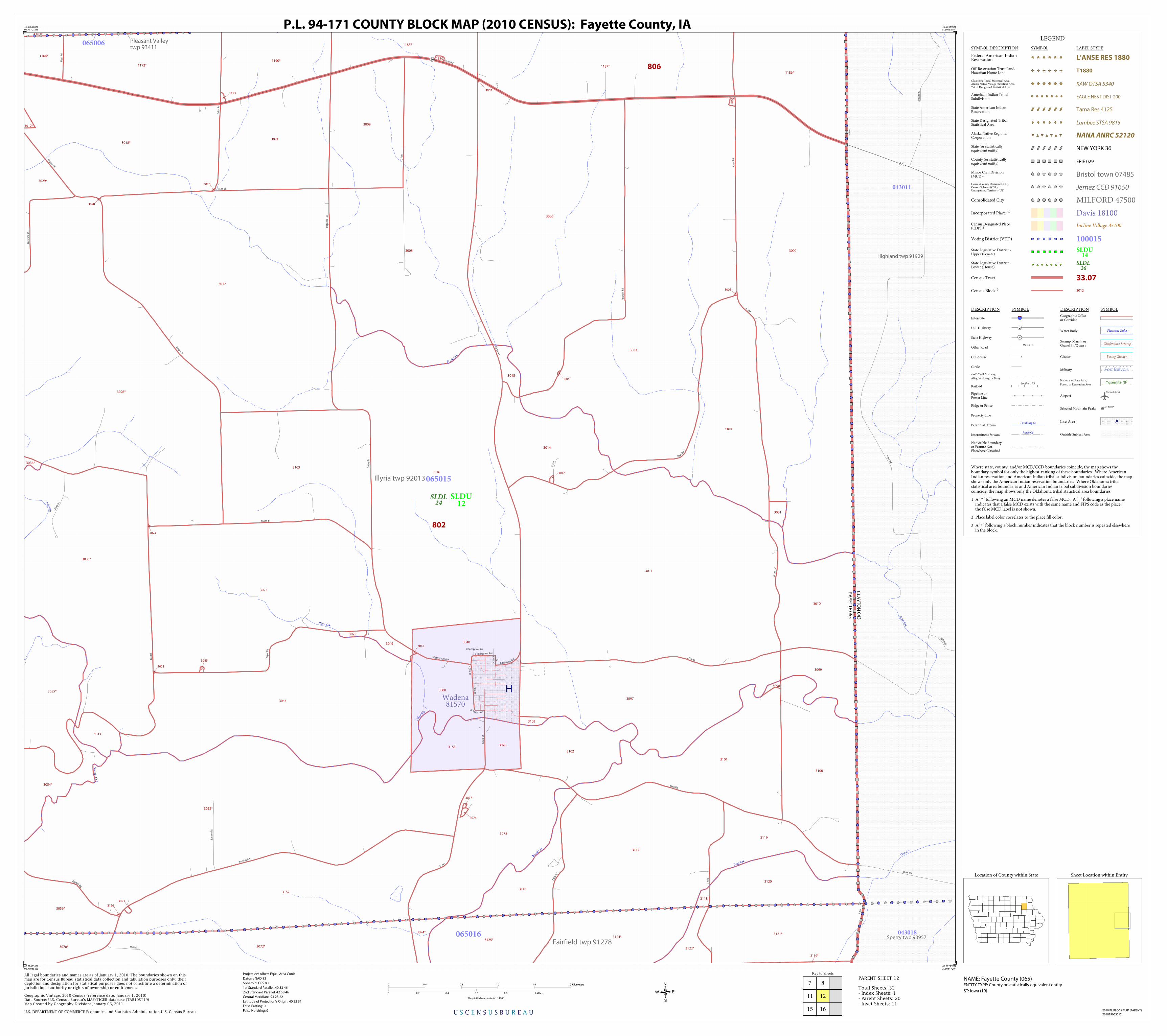
Gran
nis C
rk
Deep Crk
Mink C
rk
Volga R
iv
Vol
ga
Riv
M ink Crk
Deep Crk
Plum Crk
Bru
sh C
rk
Sperry twp 93957
Highland twp 91929
Pleasant Valleytwp 93411
Illyria twp 92013
Fairfield twp 91278
3163
3026*
3124*
3000
1164*
3130*
3097
3098
3001
3014
3016
3118
3025
3046
3015
3053
3075
3018*
3035*
3072*3070*
1162*
3099
3010
1188*
3103
3011
3036*
1190*
1192*
3100
3052*
3122*
3007
30
02
3006
3021
3012
3043
3164
3047
3005
3156
3101
3004
3028
3024
3116
3048
3080
3078
3125*
3055*
3074*
3119
3117
3076
3077
3045
3023
1189
1193
3009
3044
3155
3059*
1187*
1186*
3019*
3120
3102
3121*
3054*
3029*
3022
3157
3020
3017
3008
3003
806
802
FA
YE
TT
E 0
65
CLA
YT
ON
04
3
Wadena81570
SLDL24
SLDU12
043011
043018
065015
065016
065006
Aztec Rd
Bush Rd
265th St
Arm
ada
Rd
East
ern
Rd
128th St
C A
ve
Flee
t Rd
B A
ve
AAve
Big
horn
Rd
Der
by R
d
E Springwater Ave
S Cli ne S
t
Do g
woo
d Rd
N C
line St
180th St
Filmore Rd
D A
ve
W Herriman Ave
Empire Rd
157th St
W Springwater Ave
Aco
rn R
d
147th St
D Ave
AAve
N Io
wa
St
Acorn
Bear Rd
Fox
Rd
Flee
t R
d
E Herriman Ave
Bush Rd
Kornhill Rd
Aco
rn R
d
Cedar Rd
Dep
ot R
d
Ham
mer
Rd
Cabl
e Rd
W Wa ter Ave
Grannis Rd
Empire Rd
S M
ill S
t
Echo
Rd
56
56
H
LEGEND
SYMBOL DESCRIPTION SYMBOL LABEL STYLE
Federal American IndianReservation L'ANSE RES 1880
Off-Reservation Trust Land,Hawaiian Home Land T1880
Oklahoma Tribal Statistical Area,Alaska Native Village Statistical Area,Tribal Designated Statistical Area
KAW OTSA 5340
American Indian TribalSubdivision EAGLE NEST DIST 200
State American IndianReservation Tama Res 4125
State Designated TribalStatistical Area Lumbee STSA 9815
Alaska Native RegionalCorporation NANA ANRC 52120
State (or statisticallyequivalent entity) NEW YORK 36
County (or statisticallyequivalent entity) ERIE 029
Minor Civil Division(MCD)1 Bristol town 07485Census County Division (CCD),Census Subarea (CSA),Unorganized Territory (UT)
Jemez CCD 91650
Consolidated City MILFORD 47500
Incorporated Place 1,2 Davis 18100Census Designated Place(CDP) 2 Incline Village 35100
Voting District (VTD) 100015State Legislative District -Upper (Senate)
SLDU14
State Legislative District -Lower (House)
SLDL26
Census Tract 33.07
Census Block 3 3012
DESCRIPTION SYMBOL DESCRIPTION SYMBOL
Interstate 3
U.S. Highway 2
State Highway 4
Other RoadMarsh Ln
Cul-de-sac
Circle
4WD Trail, Stairway,
Alley, Walkway, or Ferry
RailoadSouthern RR
Pipeline orPower Line
Ridge or Fence
Property Line
Perennial StreamTumbling Cr
Intermittent StreamPiney Cr
Nonvisible Boundaryor Feature NotElsewhere Classified
Geographic Offsetor Corridor
Water Body Pleasant Lake
Swamp, Marsh, orGravel Pit/Quarry
Okefenokee Swamp
Glacier Bering Glacier
Military Fort Belvoir
National or State Park,
Forest, or Recreation AreaYosemite NP
AirportOxnard Arprt
Selected Mountain PeaksMt Baker
Inset Area A
Outside Subject Area
Where state, county, and/or MCD/CCD boundaries coincide, the map shows theboundary symbol for only the highest-ranking of these boundaries. Where AmericanIndian reservation and American Indian tribal subdivision boundaries coincide, the mapshows only the American Indian reservation boundaries. Where Oklahoma tribalstatistical area boundaries and American Indian tribal subdivision boundariescoincide, the map shows only the Oklahoma tribal statistical area boundaries.
1 A ' ° ' following an MCD name denotes a false MCD. A ' ° ' following a place name indicates that a false MCD exists with the same name and FIPS code as the place; the false MCD label is not shown.
2 Place label color correlates to the place fill color.
3 A ' ' following a block number indicates that the block number is repeated elsewhere in the block.
*
Key to Sheets
7
11
15
8
16
12
U S C E N S U S B U R E A U
Location of County within State
42.906360N91.717015W
42.904498N91.591851W
42.812492N91.594472W
42.814351N91.719454W
All legal boundaries and names are as of January 1, 2010. The boundaries shown on thismap are for Census Bureau statistical data collection and tabulation purposes only; theirdepiction and designation for statistical purposes does not constitute a determination ofjurisdictional authority or rights of ownership or entitlement.
U.S. DEPARTMENT OF COMMERCE Economics and Statistics Administration U.S. Census Bureau
Geographic Vintage: 2010 Census (reference date: January 1, 2010)Data Source: U.S. Census Bureau's MAF/TIGER database (TAB10ST19)Map Created by Geography Division: January 06, 2011
ENTITY TYPE: County or statistically equivalent entity
NAME: Fayette County (065) Projection: Albers Equal Area Conic
Datum: NAD 83
Spheroid: GRS 80
1st Standard Parallel: 40 53 46
2nd Standard Parallel: 42 58 46
Central Meridian: -93 23 22
Latitude of Projection's Origin: 40 22 31
False Easting: 0
False Northing: 0
Total Sheets: 32- Index Sheets: 1- Parent Sheets: 20- Inset Sheets: 11
ST: Iowa (19)
0 0.4 0.8 1.2 1.6 2 Kilometers2 Kilometers
0 0.2 0.4 0.6 0.8 1 Miles1 Miles
The plotted map scale is 1:14000
P.L. 94-171 COUNTY BLOCK MAP (2010 CENSUS): Fayette County, IA
Sheet Location within Entity
2010 PL BLOCK MAP (PARENT)
201019065012
PARENT SHEET 12

Lit
t le
Wap
sipi
nic
on R
iv
Stoe C rk
Otter C
rk
Sumner No. 2 twp 94059
Dayton twp 90900
Franklin twp 91389
Fremont twp 91473
Oran twp 93183
Banks twp 90120
3177*
2011
2112*2113*
2017
2166*
2081
2006*
3180*
2005*
3175*
3167*
2129*
2168
2130*
2043*
2084
2126*
2016
2004*
2102*
2127*
2036*
2042*
2000*
2002*
2080
2136*
2109*
2082
2003*
2097*
2064
2258
2062
2033
2009
2012
2032
2070
2091
2021
2090
2022
2063
2025
2015
2007
2027
2108
2008
2026
2068
2069
2024
21312087
2088
2089
2028
2010
2020
2067
2132
2074
2092
2066
2018
2019
2071
2034
2041
2051 2045
2086
20532052
2029
2096
2095
2085
2057
2060
2083
2094
2065
2048
2058
2103
2014
2013
2076
2040
2049
20542059
2031
2077
2047
2044
2061
2072
2038
2050
2039
2035
2106
2056
2055
2046
2107
2001
2093
2078
2023
2079
2114
2104
2105
2030
2073
2075
807
803
BR
EM
ER
01
7
FA
YE
TT
E 0
65 Westgate
84180
SLDL18
SLDU9
017007
017019
017005 065011
065019
065020
190th St
200th St
215th St
205th St
160th St
180th St
U A
ve
W A
ve
X Ave
U A
ve
95th St
Main St
110th St
78th St
T Ave
Iowa
St
Chu
rch
St
Will
ow R
d
Xavie
r Rd
East
line
St
Railroad St
90th St
Tow
n R
d
Minnesota St
Cas
s S
t
V Ave
Jam
ison
St
80th St
Hig
h St
70th
St
Tow
n R
d
110th St
U A
ve
Main St
Pearl St
Olive St
100th St
Fron
t
St
120th St
YAve
Uni
corn
Rd
X Ave
130th St LEGEND
SYMBOL DESCRIPTION SYMBOL LABEL STYLE
Federal American IndianReservation L'ANSE RES 1880
Off-Reservation Trust Land,Hawaiian Home Land T1880
Oklahoma Tribal Statistical Area,Alaska Native Village Statistical Area,Tribal Designated Statistical Area
KAW OTSA 5340
American Indian TribalSubdivision EAGLE NEST DIST 200
State American IndianReservation Tama Res 4125
State Designated TribalStatistical Area Lumbee STSA 9815
Alaska Native RegionalCorporation NANA ANRC 52120
State (or statisticallyequivalent entity) NEW YORK 36
County (or statisticallyequivalent entity) ERIE 029
Minor Civil Division(MCD)1 Bristol town 07485Census County Division (CCD),Census Subarea (CSA),Unorganized Territory (UT)
Jemez CCD 91650
Consolidated City MILFORD 47500
Incorporated Place 1,2 Davis 18100Census Designated Place(CDP) 2 Incline Village 35100
Voting District (VTD) 100015State Legislative District -Upper (Senate)
SLDU14
State Legislative District -Lower (House)
SLDL26
Census Tract 33.07
Census Block 3 3012
DESCRIPTION SYMBOL DESCRIPTION SYMBOL
Interstate 3
U.S. Highway 2
State Highway 4
Other RoadMarsh Ln
Cul-de-sac
Circle
4WD Trail, Stairway,
Alley, Walkway, or Ferry
RailoadSouthern RR
Pipeline orPower Line
Ridge or Fence
Property Line
Perennial StreamTumbling Cr
Intermittent StreamPiney Cr
Nonvisible Boundaryor Feature NotElsewhere Classified
Geographic Offsetor Corridor
Water Body Pleasant Lake
Swamp, Marsh, orGravel Pit/Quarry
Okefenokee Swamp
Glacier Bering Glacier
Military Fort Belvoir
National or State Park,
Forest, or Recreation AreaYosemite NP
AirportOxnard Arprt
Selected Mountain PeaksMt Baker
Inset Area A
Outside Subject Area
Where state, county, and/or MCD/CCD boundaries coincide, the map shows theboundary symbol for only the highest-ranking of these boundaries. Where AmericanIndian reservation and American Indian tribal subdivision boundaries coincide, the mapshows only the American Indian reservation boundaries. Where Oklahoma tribalstatistical area boundaries and American Indian tribal subdivision boundariescoincide, the map shows only the Oklahoma tribal statistical area boundaries.
1 A ' ° ' following an MCD name denotes a false MCD. A ' ° ' following a place name indicates that a false MCD exists with the same name and FIPS code as the place; the false MCD label is not shown.
2 Place label color correlates to the place fill color.
3 A ' ' following a block number indicates that the block number is repeated elsewhere in the block.
*
Key to Sheets
9
17
10
14
18
13
U S C E N S U S B U R E A U
Location of County within State
42.819125N92.09444W
42.817668N91.969438W
42.725655N91.971506W
42.727110N92.096325W
All legal boundaries and names are as of January 1, 2010. The boundaries shown on thismap are for Census Bureau statistical data collection and tabulation purposes only; theirdepiction and designation for statistical purposes does not constitute a determination ofjurisdictional authority or rights of ownership or entitlement.
U.S. DEPARTMENT OF COMMERCE Economics and Statistics Administration U.S. Census Bureau
Geographic Vintage: 2010 Census (reference date: January 1, 2010)Data Source: U.S. Census Bureau's MAF/TIGER database (TAB10ST19)Map Created by Geography Division: January 06, 2011
ENTITY TYPE: County or statistically equivalent entity
NAME: Fayette County (065) Projection: Albers Equal Area Conic
Datum: NAD 83
Spheroid: GRS 80
1st Standard Parallel: 40 53 46
2nd Standard Parallel: 42 58 46
Central Meridian: -93 23 22
Latitude of Projection's Origin: 40 22 31
False Easting: 0
False Northing: 0
Total Sheets: 32- Index Sheets: 1- Parent Sheets: 20- Inset Sheets: 11
ST: Iowa (19)
0 0.4 0.8 1.2 1.6 2 Kilometers2 Kilometers
0 0.2 0.4 0.6 0.8 1 Miles1 Miles
The plotted map scale is 1:14000
P.L. 94-171 COUNTY BLOCK MAP (2010 CENSUS): Fayette County, IA
Sheet Location within Entity
2010 PL BLOCK MAP (PARENT)
201019065013
PARENT SHEET 13

Little Volga R
iv
Little Volg
a Riv
Jefferson twp 92220
Oran twp 93183
Harlan twp 91845
Fremont twp 91473
Smithfield twp 93930
1093
1100
2099
2101
1037
1040
1033
1042
2098
10991127
1098
1097
1094
1103
1171
1028
1116
10311032
1089
1105
1104
1102
1090
1092
1017
10
95
1027
1016
1014
1015
1013
1011
1041
1036
1005*
2120*2109*
1120*
1000*
1001*
3190*
1004*
1004*
1006*
1020
2097*
1126*
1002*
2043*
1122*
2110*
1110*1109*
1118*
2102*
1035
1075
1112*
1113*
1106
1111*
2036*
1025*
1108
1023*
1060
10
58
1034
1043
1056
2042*
1008*1009*
2000*
2020*
1121*
3189*
1125*
1139*
2037
1022
1030
1019
1115
2100
1012
1029
1018
1003
1114
10
57
1101
1119
2111
1091
1096
1021
803
802807
Maynard 50610
SLDL24
SLDL18
SLDU12
SLDU9
065021
065017
065018
065019
065020
Dejavi e w Ct
1st
St
N
90th St
Neo
n R
d
Main St W
R A
ve
S Ave
1st
St
S
120th St
Neon R
d
2nd
Eas
t
St
90th St
110th St
Q A
ve
70th
St
1st St W
80th St
Long Grove St Clover St
MAve13
0th
St
100th St
Park S t
100th St
3rd
Eas
t
St
N A
ve
P Ave
Pember St
Eas
t St
Pearl
St
120th St
4th
St
S
Main St E
115th St
150
150
I
LEGEND
SYMBOL DESCRIPTION SYMBOL LABEL STYLE
Federal American IndianReservation L'ANSE RES 1880
Off-Reservation Trust Land,Hawaiian Home Land T1880
Oklahoma Tribal Statistical Area,Alaska Native Village Statistical Area,Tribal Designated Statistical Area
KAW OTSA 5340
American Indian TribalSubdivision EAGLE NEST DIST 200
State American IndianReservation Tama Res 4125
State Designated TribalStatistical Area Lumbee STSA 9815
Alaska Native RegionalCorporation NANA ANRC 52120
State (or statisticallyequivalent entity) NEW YORK 36
County (or statisticallyequivalent entity) ERIE 029
Minor Civil Division(MCD)1 Bristol town 07485Census County Division (CCD),Census Subarea (CSA),Unorganized Territory (UT)
Jemez CCD 91650
Consolidated City MILFORD 47500
Incorporated Place 1,2 Davis 18100Census Designated Place(CDP) 2 Incline Village 35100
Voting District (VTD) 100015State Legislative District -Upper (Senate)
SLDU14
State Legislative District -Lower (House)
SLDL26
Census Tract 33.07
Census Block 3 3012
DESCRIPTION SYMBOL DESCRIPTION SYMBOL
Interstate 3
U.S. Highway 2
State Highway 4
Other RoadMarsh Ln
Cul-de-sac
Circle
4WD Trail, Stairway,
Alley, Walkway, or Ferry
RailoadSouthern RR
Pipeline orPower Line
Ridge or Fence
Property Line
Perennial StreamTumbling Cr
Intermittent StreamPiney Cr
Nonvisible Boundaryor Feature NotElsewhere Classified
Geographic Offsetor Corridor
Water Body Pleasant Lake
Swamp, Marsh, orGravel Pit/Quarry
Okefenokee Swamp
Glacier Bering Glacier
Military Fort Belvoir
National or State Park,
Forest, or Recreation AreaYosemite NP
AirportOxnard Arprt
Selected Mountain PeaksMt Baker
Inset Area A
Outside Subject Area
Where state, county, and/or MCD/CCD boundaries coincide, the map shows theboundary symbol for only the highest-ranking of these boundaries. Where AmericanIndian reservation and American Indian tribal subdivision boundaries coincide, the mapshows only the American Indian reservation boundaries. Where Oklahoma tribalstatistical area boundaries and American Indian tribal subdivision boundariescoincide, the map shows only the Oklahoma tribal statistical area boundaries.
1 A ' ° ' following an MCD name denotes a false MCD. A ' ° ' following a place name indicates that a false MCD exists with the same name and FIPS code as the place; the false MCD label is not shown.
2 Place label color correlates to the place fill color.
3 A ' ' following a block number indicates that the block number is repeated elsewhere in the block.
*
Key to Sheets
9
13
17
10
18
11
15
19
14
U S C E N S U S B U R E A U
Location of County within State
42.817668N91.969438W
42.816077N91.844443W
42.724066N91.846692W
42.725655N91.971506W
All legal boundaries and names are as of January 1, 2010. The boundaries shown on thismap are for Census Bureau statistical data collection and tabulation purposes only; theirdepiction and designation for statistical purposes does not constitute a determination ofjurisdictional authority or rights of ownership or entitlement.
U.S. DEPARTMENT OF COMMERCE Economics and Statistics Administration U.S. Census Bureau
Geographic Vintage: 2010 Census (reference date: January 1, 2010)Data Source: U.S. Census Bureau's MAF/TIGER database (TAB10ST19)Map Created by Geography Division: January 06, 2011
ENTITY TYPE: County or statistically equivalent entity
NAME: Fayette County (065) Projection: Albers Equal Area Conic
Datum: NAD 83
Spheroid: GRS 80
1st Standard Parallel: 40 53 46
2nd Standard Parallel: 42 58 46
Central Meridian: -93 23 22
Latitude of Projection's Origin: 40 22 31
False Easting: 0
False Northing: 0
Total Sheets: 32- Index Sheets: 1- Parent Sheets: 20- Inset Sheets: 11
ST: Iowa (19)
0 0.4 0.8 1.2 1.6 2 Kilometers2 Kilometers
0 0.2 0.4 0.6 0.8 1 Miles1 Miles
The plotted map scale is 1:14000
P.L. 94-171 COUNTY BLOCK MAP (2010 CENSUS): Fayette County, IA
Sheet Location within Entity
2010 PL BLOCK MAP (PARENT)
201019065014
PARENT SHEET 14

Gra
nnis
Crk
Gund
lach C
rk
Brush Crk
Little
V
ol
ga Riv
Bea
r C
rk
Alex ander Crk
Jefferson twp 92220
Putnamtwp
93522Scott twp 93771
Smithfield twp 93930
Harlantwp
91845
Fairfieldtwp 91278
2088
2034
20302043
2042
2004
2003
2091
2045
20372038
2094
2029
2090
2011
2092
2050
2010
2095*2048*
2001*
2046*
4012*
1110*
1112*
1113*
1111*
1025*
1023*
2019*
3068*
3147*
4008*
3142*
2018*
2085*2086*
2015*
2020*2005*
2014*
2000*
1000*
2049*
4009*
3072*
3070*
2087*
2021
2041
2006
3071
1024
2040
20262025
2028
2012
2036
2039
2002
2032
3145
2009
3146
3143
2093
2033
2007
2022
201320232024
1026
2089
2035
2008
2044
20312027
803
802SLDL
24
SLDL18
SLDU12
SLDU9
065008
065016
065017
065018
065021065024
70th
St
L Ave
95th St
G Ave
Kornhill Rd
MAve
80th St
110th St
118th St
K A
ve
100th St
90th St
J Ave
120th St
Impe
rial R
d
H A
ve
Hill
Rd
70th
St
120th St
I Ave
187
150
LEGEND
SYMBOL DESCRIPTION SYMBOL LABEL STYLE
Federal American IndianReservation L'ANSE RES 1880
Off-Reservation Trust Land,Hawaiian Home Land T1880
Oklahoma Tribal Statistical Area,Alaska Native Village Statistical Area,Tribal Designated Statistical Area
KAW OTSA 5340
American Indian TribalSubdivision EAGLE NEST DIST 200
State American IndianReservation Tama Res 4125
State Designated TribalStatistical Area Lumbee STSA 9815
Alaska Native RegionalCorporation NANA ANRC 52120
State (or statisticallyequivalent entity) NEW YORK 36
County (or statisticallyequivalent entity) ERIE 029
Minor Civil Division(MCD)1 Bristol town 07485Census County Division (CCD),Census Subarea (CSA),Unorganized Territory (UT)
Jemez CCD 91650
Consolidated City MILFORD 47500
Incorporated Place 1,2 Davis 18100Census Designated Place(CDP) 2 Incline Village 35100
Voting District (VTD) 100015State Legislative District -Upper (Senate)
SLDU14
State Legislative District -Lower (House)
SLDL26
Census Tract 33.07
Census Block 3 3012
DESCRIPTION SYMBOL DESCRIPTION SYMBOL
Interstate 3
U.S. Highway 2
State Highway 4
Other RoadMarsh Ln
Cul-de-sac
Circle
4WD Trail, Stairway,
Alley, Walkway, or Ferry
RailoadSouthern RR
Pipeline orPower Line
Ridge or Fence
Property Line
Perennial StreamTumbling Cr
Intermittent StreamPiney Cr
Nonvisible Boundaryor Feature NotElsewhere Classified
Geographic Offsetor Corridor
Water Body Pleasant Lake
Swamp, Marsh, orGravel Pit/Quarry
Okefenokee Swamp
Glacier Bering Glacier
Military Fort Belvoir
National or State Park,
Forest, or Recreation AreaYosemite NP
AirportOxnard Arprt
Selected Mountain PeaksMt Baker
Inset Area A
Outside Subject Area
Where state, county, and/or MCD/CCD boundaries coincide, the map shows theboundary symbol for only the highest-ranking of these boundaries. Where AmericanIndian reservation and American Indian tribal subdivision boundaries coincide, the mapshows only the American Indian reservation boundaries. Where Oklahoma tribalstatistical area boundaries and American Indian tribal subdivision boundariescoincide, the map shows only the Oklahoma tribal statistical area boundaries.
1 A ' ° ' following an MCD name denotes a false MCD. A ' ° ' following a place name indicates that a false MCD exists with the same name and FIPS code as the place; the false MCD label is not shown.
2 Place label color correlates to the place fill color.
3 A ' ' following a block number indicates that the block number is repeated elsewhere in the block.
*
Key to Sheets
10
14
18
11
19
12
16
20
15
U S C E N S U S B U R E A U
Location of County within State
42.816077N91.844443W
42.814351N91.719454W
42.722344N91.721885W
42.724066N91.846692W
All legal boundaries and names are as of January 1, 2010. The boundaries shown on thismap are for Census Bureau statistical data collection and tabulation purposes only; theirdepiction and designation for statistical purposes does not constitute a determination ofjurisdictional authority or rights of ownership or entitlement.
U.S. DEPARTMENT OF COMMERCE Economics and Statistics Administration U.S. Census Bureau
Geographic Vintage: 2010 Census (reference date: January 1, 2010)Data Source: U.S. Census Bureau's MAF/TIGER database (TAB10ST19)Map Created by Geography Division: January 06, 2011
ENTITY TYPE: County or statistically equivalent entity
NAME: Fayette County (065) Projection: Albers Equal Area Conic
Datum: NAD 83
Spheroid: GRS 80
1st Standard Parallel: 40 53 46
2nd Standard Parallel: 42 58 46
Central Meridian: -93 23 22
Latitude of Projection's Origin: 40 22 31
False Easting: 0
False Northing: 0
Total Sheets: 32- Index Sheets: 1- Parent Sheets: 20- Inset Sheets: 11
ST: Iowa (19)
0 0.4 0.8 1.2 1.6 2 Kilometers2 Kilometers
0 0.2 0.4 0.6 0.8 1 Miles1 Miles
The plotted map scale is 1:14000
P.L. 94-171 COUNTY BLOCK MAP (2010 CENSUS): Fayette County, IA
Sheet Location within Entity
2010 PL BLOCK MAP (PARENT)
201019065015
PARENT SHEET 15

Brush Creek Canyon State Park
Moi
ne Crk
N
agle Crk
Hewett Crk
Willow
Crk
Deep
Crk
Maquoketa R
iv
Bear Crk
Brush C
rk
Sperry twp 93957
Cass twp 90498
Putnam twp 93522
Fairfield twp 91278
4006
4010
4022
4024
31603148
3134
3135
3150
3144
4068
4070
4052
4023
4021
4074
4016
4015
3136
3131
3128
3129
3126
4020
3158
40
50
4051
40534048
4011
4014
4064
3141
3127
3154
4063
3153
4071*
4008*
3142*
4000
3122*
3125*
4069
4061
3074*
4062
4040
3132
3121*
2061*
4012*
4017
4058
4018
4025
4027
2060*
4072*
3147*
4067
4073*
4059
3124*
3130*
4054
4013*
2059*
4009*
4066
3072*
3070*
3073
4019
3138
3152
4007
3133
3123
3140
4001
4005
4075
4004 4003
3151
3149
3139
3137
4002
4049
4065
802
FA
YE
TT
E 0
65
CLA
YT
ON
04
3
Arlington 02845
SLDL24
SLDU12
043018
043019
065008
065016
320th St
Bell R
d
345th St
Acr
e R
d
Ber
ry R
d
F Ave
128th St
E Ave
Liberty St
B A
ve
Cab
le R
d
Fairfield St
C A
ve
F Ave
AAve
Forest Rd
120th St
90th St
Clay St
High St
Delta Rd
Diagonal Rd
Eisenhower Rd
Bel
l Rd
AAve
D A
ve
ParkAve
95th St
Liber
ty St
80th St
80th St
Amission Rd
E Ave
Carroll S
t
D A
ve
110th St
Kornhill Rd
Dog
woo
d R
d
115th St
110th St
South St
Main St
Main St
70th
St
Eisenhower Rd
95th St
Del
ta R
d
Uppe
r St
Low
ery
St
Elm Rd
East St
187
187
J
LEGEND
SYMBOL DESCRIPTION SYMBOL LABEL STYLE
Federal American IndianReservation L'ANSE RES 1880
Off-Reservation Trust Land,Hawaiian Home Land T1880
Oklahoma Tribal Statistical Area,Alaska Native Village Statistical Area,Tribal Designated Statistical Area
KAW OTSA 5340
American Indian TribalSubdivision EAGLE NEST DIST 200
State American IndianReservation Tama Res 4125
State Designated TribalStatistical Area Lumbee STSA 9815
Alaska Native RegionalCorporation NANA ANRC 52120
State (or statisticallyequivalent entity) NEW YORK 36
County (or statisticallyequivalent entity) ERIE 029
Minor Civil Division(MCD)1 Bristol town 07485Census County Division (CCD),Census Subarea (CSA),Unorganized Territory (UT)
Jemez CCD 91650
Consolidated City MILFORD 47500
Incorporated Place 1,2 Davis 18100Census Designated Place(CDP) 2 Incline Village 35100
Voting District (VTD) 100015State Legislative District -Upper (Senate)
SLDU14
State Legislative District -Lower (House)
SLDL26
Census Tract 33.07
Census Block 3 3012
DESCRIPTION SYMBOL DESCRIPTION SYMBOL
Interstate 3
U.S. Highway 2
State Highway 4
Other RoadMarsh Ln
Cul-de-sac
Circle
4WD Trail, Stairway,
Alley, Walkway, or Ferry
RailoadSouthern RR
Pipeline orPower Line
Ridge or Fence
Property Line
Perennial StreamTumbling Cr
Intermittent StreamPiney Cr
Nonvisible Boundaryor Feature NotElsewhere Classified
Geographic Offsetor Corridor
Water Body Pleasant Lake
Swamp, Marsh, orGravel Pit/Quarry
Okefenokee Swamp
Glacier Bering Glacier
Military Fort Belvoir
National or State Park,
Forest, or Recreation AreaYosemite NP
AirportOxnard Arprt
Selected Mountain PeaksMt Baker
Inset Area A
Outside Subject Area
Where state, county, and/or MCD/CCD boundaries coincide, the map shows theboundary symbol for only the highest-ranking of these boundaries. Where AmericanIndian reservation and American Indian tribal subdivision boundaries coincide, the mapshows only the American Indian reservation boundaries. Where Oklahoma tribalstatistical area boundaries and American Indian tribal subdivision boundariescoincide, the map shows only the Oklahoma tribal statistical area boundaries.
1 A ' ° ' following an MCD name denotes a false MCD. A ' ° ' following a place name indicates that a false MCD exists with the same name and FIPS code as the place; the false MCD label is not shown.
2 Place label color correlates to the place fill color.
3 A ' ' following a block number indicates that the block number is repeated elsewhere in the block.
*
Key to Sheets
11
15
19
12
20
16
U S C E N S U S B U R E A U
Location of County within State
42.814351N91.719454W
42.812492N91.594472W
42.720487N91.597084W
42.722344N91.721885W
All legal boundaries and names are as of January 1, 2010. The boundaries shown on thismap are for Census Bureau statistical data collection and tabulation purposes only; theirdepiction and designation for statistical purposes does not constitute a determination ofjurisdictional authority or rights of ownership or entitlement.
U.S. DEPARTMENT OF COMMERCE Economics and Statistics Administration U.S. Census Bureau
Geographic Vintage: 2010 Census (reference date: January 1, 2010)Data Source: U.S. Census Bureau's MAF/TIGER database (TAB10ST19)Map Created by Geography Division: January 06, 2011
ENTITY TYPE: County or statistically equivalent entity
NAME: Fayette County (065) Projection: Albers Equal Area Conic
Datum: NAD 83
Spheroid: GRS 80
1st Standard Parallel: 40 53 46
2nd Standard Parallel: 42 58 46
Central Meridian: -93 23 22
Latitude of Projection's Origin: 40 22 31
False Easting: 0
False Northing: 0
Total Sheets: 32- Index Sheets: 1- Parent Sheets: 20- Inset Sheets: 11
ST: Iowa (19)
0 0.4 0.8 1.2 1.6 2 Kilometers2 Kilometers
0 0.2 0.4 0.6 0.8 1 Miles1 Miles
The plotted map scale is 1:14000
P.L. 94-171 COUNTY BLOCK MAP (2010 CENSUS): Fayette County, IA
Sheet Location within Entity
2010 PL BLOCK MAP (PARENT)
201019065016
PARENT SHEET 16
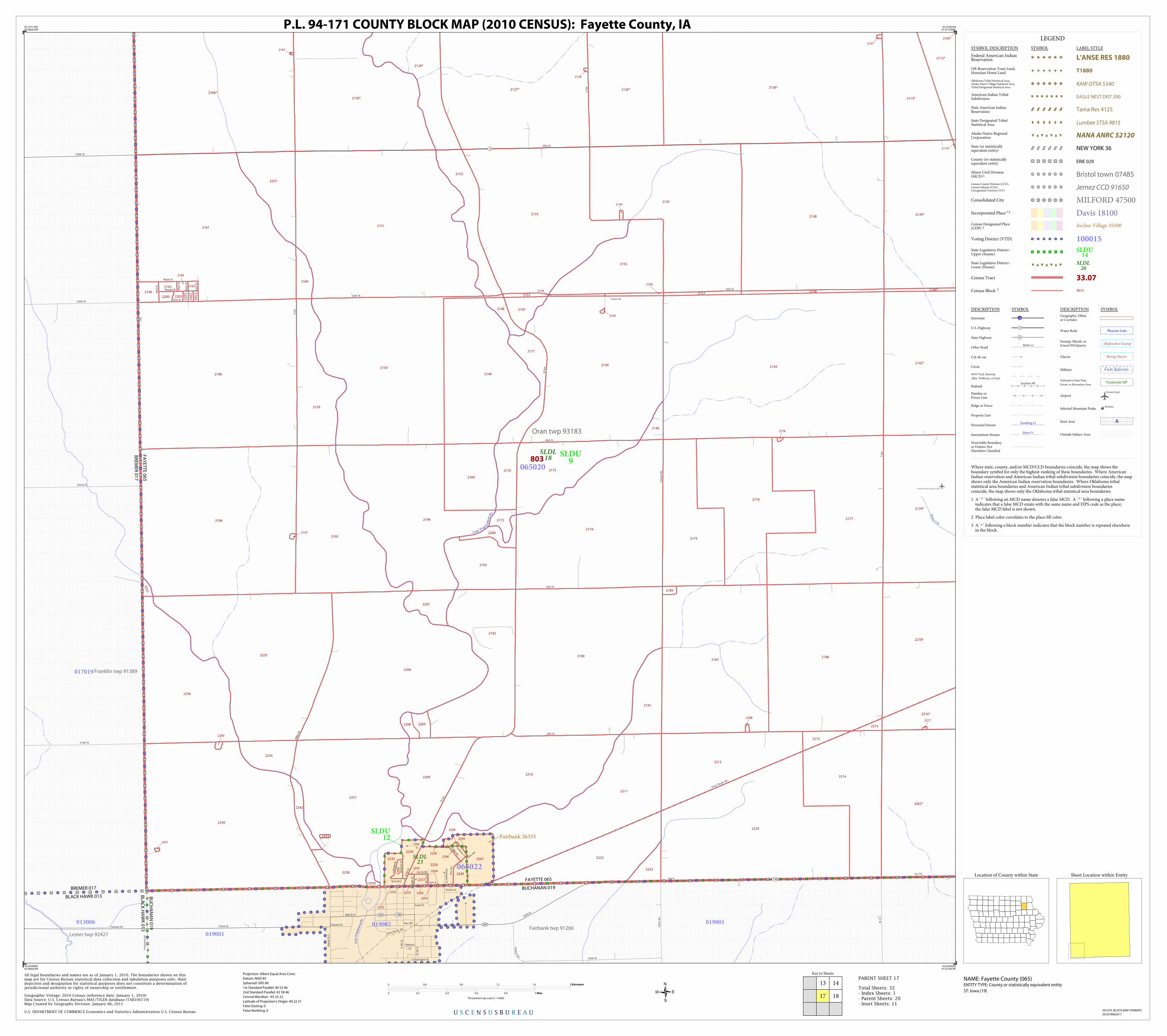
Oelwein Municipal Arprt
Lit
tle
Wap
sipi
nico
n R
iv
Hu
nte r Crk
Little W
apsi
pin
icon
Riv
Union Pacific RR
Union Pacific RR
Franklin twp 91389
Lester twp 92427Fairbank twp 91266
Oran twp 93183
2151
2197
2207
2169
2242
2129*
2130*
2251
2252
2194
2188
2212
22
032200
22
02
2210
2191
2229
2193
2192
2195
2179*
2247
2173
2146
2216*
2136*
2245
2126*
2224
2139*
2112*
2115*
2250
2232
2255
2262*
2142*
2214
2231
2127*
2140*
2218*
2253
2128
2153
2155
21
642201
2165
2163
2134
2152
2135
2230
2137
2249
2167
22052206
2144
2148
2259
2243
2222
2223
2149
2150
2233
2241
2109*
2244
2236
2196
2198
2161
2113*
2254
2199
2239
2238
2166*
22
37
2204
2235 2190
21742208
2157
2175
2176
2186
2213
2138
2170
2248
2246
2177
2234
2171
2211
2228
2133
2162
2158
2172
2217
2240
2187
2159
2215
2178
2143
2154
2160
22
56
2189
2145
2209
2257
2156
2147
803
BLACK HAWK 013
BREMER 017
BR
EM
ER
01
7
FA
YE
TT
E 0
65
BUCHANAN 019
FAYETTE 065
BLA
CK
HA
WK
01
3
BU
CH
AN
AN
01
9
Fairbank 26355
SLDL23
SLDL18
SLDU12
SLDU9
017019
019001
019001
019002013006
065020
065022
Hwy 281
Forest St
Main St W
Centra
l Ave
S 4
th S
t
102nd St
S 5
th St
270th St
Dill
on A
ve
240th St
252nd St
230th St
W-1
3
Fairbank Rd
105th St
Fairbank St
S Washington St
Patterson
StN B
ucha
nan
Rd
Wal
nut
St
S
102nd St
Cedar
Dr
30th St
Collins Rd
Rox
anne
Dr
60th St
50th St
2nd St NE
Wes
t S
t
Unicorn Rd
5th
St 6th
St
N A m
y Av
e
Mai
n S
t
Rhonda Rd
Christopher C
t
Rainbow Dr
Uni
corn
Rd
Oran St
Amy Ave
ChristiansTrl
N 4
th S
t
Pleasant St
Maple St
W A
ve
YAve
40th St
10th St
Hwy 281
V Ave
Sho
rt S
t
20th St
Front St
East
St
W A
ve
X Ave
50th St
Lake
side
Dr
T Ave
5th
St N
Willo
w R
d
3
190
281
281 190
LEGEND
SYMBOL DESCRIPTION SYMBOL LABEL STYLE
Federal American IndianReservation L'ANSE RES 1880
Off-Reservation Trust Land,Hawaiian Home Land T1880
Oklahoma Tribal Statistical Area,Alaska Native Village Statistical Area,Tribal Designated Statistical Area
KAW OTSA 5340
American Indian TribalSubdivision EAGLE NEST DIST 200
State American IndianReservation Tama Res 4125
State Designated TribalStatistical Area Lumbee STSA 9815
Alaska Native RegionalCorporation NANA ANRC 52120
State (or statisticallyequivalent entity) NEW YORK 36
County (or statisticallyequivalent entity) ERIE 029
Minor Civil Division(MCD)1 Bristol town 07485Census County Division (CCD),Census Subarea (CSA),Unorganized Territory (UT)
Jemez CCD 91650
Consolidated City MILFORD 47500
Incorporated Place 1,2 Davis 18100Census Designated Place(CDP) 2 Incline Village 35100
Voting District (VTD) 100015State Legislative District -Upper (Senate)
SLDU14
State Legislative District -Lower (House)
SLDL26
Census Tract 33.07
Census Block 3 3012
DESCRIPTION SYMBOL DESCRIPTION SYMBOL
Interstate 3
U.S. Highway 2
State Highway 4
Other RoadMarsh Ln
Cul-de-sac
Circle
4WD Trail, Stairway,
Alley, Walkway, or Ferry
RailoadSouthern RR
Pipeline orPower Line
Ridge or Fence
Property Line
Perennial StreamTumbling Cr
Intermittent StreamPiney Cr
Nonvisible Boundaryor Feature NotElsewhere Classified
Geographic Offsetor Corridor
Water Body Pleasant Lake
Swamp, Marsh, orGravel Pit/Quarry
Okefenokee Swamp
Glacier Bering Glacier
Military Fort Belvoir
National or State Park,
Forest, or Recreation AreaYosemite NP
AirportOxnard Arprt
Selected Mountain PeaksMt Baker
Inset Area A
Outside Subject Area
Where state, county, and/or MCD/CCD boundaries coincide, the map shows theboundary symbol for only the highest-ranking of these boundaries. Where AmericanIndian reservation and American Indian tribal subdivision boundaries coincide, the mapshows only the American Indian reservation boundaries. Where Oklahoma tribalstatistical area boundaries and American Indian tribal subdivision boundariescoincide, the map shows only the Oklahoma tribal statistical area boundaries.
1 A ' ° ' following an MCD name denotes a false MCD. A ' ° ' following a place name indicates that a false MCD exists with the same name and FIPS code as the place; the false MCD label is not shown.
2 Place label color correlates to the place fill color.
3 A ' ' following a block number indicates that the block number is repeated elsewhere in the block.
*
Key to Sheets
13 14
1817
U S C E N S U S B U R E A U
Location of County within State
42.727110N92.096325W
42.725655N91.971506W
42.633643N91.973567W
42.635096N92.098205W
All legal boundaries and names are as of January 1, 2010. The boundaries shown on thismap are for Census Bureau statistical data collection and tabulation purposes only; theirdepiction and designation for statistical purposes does not constitute a determination ofjurisdictional authority or rights of ownership or entitlement.
U.S. DEPARTMENT OF COMMERCE Economics and Statistics Administration U.S. Census Bureau
Geographic Vintage: 2010 Census (reference date: January 1, 2010)Data Source: U.S. Census Bureau's MAF/TIGER database (TAB10ST19)Map Created by Geography Division: January 06, 2011
ENTITY TYPE: County or statistically equivalent entity
NAME: Fayette County (065) Projection: Albers Equal Area Conic
Datum: NAD 83
Spheroid: GRS 80
1st Standard Parallel: 40 53 46
2nd Standard Parallel: 42 58 46
Central Meridian: -93 23 22
Latitude of Projection's Origin: 40 22 31
False Easting: 0
False Northing: 0
Total Sheets: 32- Index Sheets: 1- Parent Sheets: 20- Inset Sheets: 11
ST: Iowa (19)
0 0.4 0.8 1.2 1.6 2 Kilometers2 Kilometers
0 0.2 0.4 0.6 0.8 1 Miles1 Miles
The plotted map scale is 1:14000
P.L. 94-171 COUNTY BLOCK MAP (2010 CENSUS): Fayette County, IA
Sheet Location within Entity
2010 PL BLOCK MAP (PARENT)
201019065017
PARENT SHEET 17

Oelwein Muni Arprt
LkOelwein
Haz
elto
n C
rk
Hu
nter Crk
Hazelton Crk
W Branch Buf f alo Crk
Otter Crk
Otter C
rk
Otter Crk
Union Pacific RR
Union Pacific RR
Union Pacific RR
Fairbanktwp 91266
Hazleton twp 91902
Jefferson twp 92220
Oran twp 93183
2183
1131
1128
1124
2117
10671091
2004
2000
1156
1099
2124
1121*
1125*
1139*
2109*
1163*
2011
2179*
1136
2220
2002
1089
2139*
1000
2120*
2112*
2115*
1104
3018
1036
2261 1032
2123
1101
1046
1095
1082
2225
1132
1035
2110*
1102
2262*
1100
1073
2142*
1065
1110*1109*
1001
1019
1118*
3026
2010
2006
2219
2121
3027
2002
1170
1150
2184
2009
2119
1158
2116
1138
2007
2000
2012
1137
2009
1152*
1029
1099
1167
1120*
1034
1097
2003
1005
2260
2140*
2218*
2141
1133
1147
1129
1134
1130
2181
10741042
1094 1084
1080
1175*
1165*
1153*
1117*
1126*
1037
2012
2026
1070
1090
1060
2118
1151
1078
1145
1075
1044
1041
2010
10
71
1148
2185
1168
1146
1149
2011
2005
1086
1140*
2001
1008
1083
1088
2021
2216*
1077
1076
2003
11591123
1098
1085
1072
1033
1039
2122
2001
1157
2006
2125
2008
1135
1103
1093
2227
2226
2221
1002
1155
1021
1031
1020
1040
1105
2182
1030
1169
1122*
1087
1081
1092
1038
1096
1079
1045
1043
2180
1066
804
805
803
FAYETTE 065
BUCHANAN 019
Oelwein 58620
SLDL23
SLDL18
SLDU12
SLDU9
019001019003
065020
065021
065023
105th St
Keokuk Ave In
dian
a Ave
108th St
Har
rison
Ave
Jack
son
Ave
Technology Dr
Park
lane
Rd
Rose
Rd
Sou
thla
wn
Ter
45th St
1st Ave SW
16th St SE
7th Ave
NE
1st
Ave
NE
E Knoll Ct
8th
Ave
SE
E K noll
11
th
Ave
SW
Rose Rd
S La
wn C
t
20th St SE
Old Rd
Pala
ce R
d
7th St SE
9th
Ave
SW
Wildwood Ln
Out
er R
d
Shady Ln
2nd St SE
40th St
25th St
20th St Out
er R
d
11th St SW
5th St SE
50th St
Ros
e R
d
Great Western Ave
40th St
N F
rede
rick
Ave
6th
Ave
NW
10th St SW
Rock Island R
d
East
line
Rd
S
P Ave
Palace Rd
60th St
ELi
neR
d
8th
Ave
SE
12
thAve
SE
10th St SE
10th St SE
12th St SE
50th St
25th St
6th St NE
3rd St SW
9th St NE
8th
Ave
NE
8th
Ave
NE
60th St
2nd
Ave
SW
1st
Ave
SW
40th St
30th St
35th St35th St
R A
ve
3rd St NW
35th St
W Charles St
1st
Ave
NW
Industrial Park Rd
3rd A
ve NW
4th
Ave
NW
Old Rd
45th St
10th St SE
N A
ve
60th St
100th St
12th
St SW
Hw
y 15
0 S
S Ave
Park
Rd
E Li
ne
Rd
S13
th
Ave
SW
Q A
ve
4th St
NW
14th St SE
9th
Ave
SE
6th St NW
Neo
n R
d
Hwy 281
Hw
y 15
0 S
5th Ave NW
6th
Ave
SW
2nd St NW
Maplewood
Dr NW
13
th A
ve N
W
18th St
30th St
RAve
Q A
ve
1st St NW
2nd Ave SE
10th St SE
R A
ve
3
150
150
150
190
3
3
150
281
3
150
281 190
K
LEGEND
SYMBOL DESCRIPTION SYMBOL LABEL STYLE
Federal American IndianReservation L'ANSE RES 1880
Off-Reservation Trust Land,Hawaiian Home Land T1880
Oklahoma Tribal Statistical Area,Alaska Native Village Statistical Area,Tribal Designated Statistical Area
KAW OTSA 5340
American Indian TribalSubdivision EAGLE NEST DIST 200
State American IndianReservation Tama Res 4125
State Designated TribalStatistical Area Lumbee STSA 9815
Alaska Native RegionalCorporation NANA ANRC 52120
State (or statisticallyequivalent entity) NEW YORK 36
County (or statisticallyequivalent entity) ERIE 029
Minor Civil Division(MCD)1 Bristol town 07485Census County Division (CCD),Census Subarea (CSA),Unorganized Territory (UT)
Jemez CCD 91650
Consolidated City MILFORD 47500
Incorporated Place 1,2 Davis 18100Census Designated Place(CDP) 2 Incline Village 35100
Voting District (VTD) 100015State Legislative District -Upper (Senate)
SLDU14
State Legislative District -Lower (House)
SLDL26
Census Tract 33.07
Census Block 3 3012
DESCRIPTION SYMBOL DESCRIPTION SYMBOL
Interstate 3
U.S. Highway 2
State Highway 4
Other RoadMarsh Ln
Cul-de-sac
Circle
4WD Trail, Stairway,
Alley, Walkway, or Ferry
RailoadSouthern RR
Pipeline orPower Line
Ridge or Fence
Property Line
Perennial StreamTumbling Cr
Intermittent StreamPiney Cr
Nonvisible Boundaryor Feature NotElsewhere Classified
Geographic Offsetor Corridor
Water Body Pleasant Lake
Swamp, Marsh, orGravel Pit/Quarry
Okefenokee Swamp
Glacier Bering Glacier
Military Fort Belvoir
National or State Park,
Forest, or Recreation AreaYosemite NP
AirportOxnard Arprt
Selected Mountain PeaksMt Baker
Inset Area A
Outside Subject Area
Where state, county, and/or MCD/CCD boundaries coincide, the map shows theboundary symbol for only the highest-ranking of these boundaries. Where AmericanIndian reservation and American Indian tribal subdivision boundaries coincide, the mapshows only the American Indian reservation boundaries. Where Oklahoma tribalstatistical area boundaries and American Indian tribal subdivision boundariescoincide, the map shows only the Oklahoma tribal statistical area boundaries.
1 A ' ° ' following an MCD name denotes a false MCD. A ' ° ' following a place name indicates that a false MCD exists with the same name and FIPS code as the place; the false MCD label is not shown.
2 Place label color correlates to the place fill color.
3 A ' ' following a block number indicates that the block number is repeated elsewhere in the block.
*
Key to Sheets
13
17
14 15
1918
U S C E N S U S B U R E A U
Location of County within State
42.725655N91.971506W
42.724066N91.846692W
42.632057N91.848934W
42.633643N91.973567W
All legal boundaries and names are as of January 1, 2010. The boundaries shown on thismap are for Census Bureau statistical data collection and tabulation purposes only; theirdepiction and designation for statistical purposes does not constitute a determination ofjurisdictional authority or rights of ownership or entitlement.
U.S. DEPARTMENT OF COMMERCE Economics and Statistics Administration U.S. Census Bureau
Geographic Vintage: 2010 Census (reference date: January 1, 2010)Data Source: U.S. Census Bureau's MAF/TIGER database (TAB10ST19)Map Created by Geography Division: January 06, 2011
ENTITY TYPE: County or statistically equivalent entity
NAME: Fayette County (065) Projection: Albers Equal Area Conic
Datum: NAD 83
Spheroid: GRS 80
1st Standard Parallel: 40 53 46
2nd Standard Parallel: 42 58 46
Central Meridian: -93 23 22
Latitude of Projection's Origin: 40 22 31
False Easting: 0
False Northing: 0
Total Sheets: 32- Index Sheets: 1- Parent Sheets: 20- Inset Sheets: 11
ST: Iowa (19)
0 0.4 0.8 1.2 1.6 2 Kilometers2 Kilometers
0 0.2 0.4 0.6 0.8 1 Miles1 Miles
The plotted map scale is 1:14000
P.L. 94-171 COUNTY BLOCK MAP (2010 CENSUS): Fayette County, IA
Sheet Location within Entity
2010 PL BLOCK MAP (PARENT)
201019065018
PARENT SHEET 18

E Branch Buf f alo Crk
W Branch Buf f alo Crk
W Branch Buf f alo C
rk
Gu
ndl
ach
Crk
S Fo
rk Maquoketa Riv
E Branch
Bu
f f alo Crk
Buffalo twp 90384
Hazletontwp 91902
Madison twp 92751
Putnamtwp
93522
Jeffersontwp
92220
Scott twp 93771
2103
2105
2106
1142
2110
2080
2109
1141
2069
2084
2082
1143
2051
2079
2081
2122
2123
1176
1154
2099
2097
1160
2101
2121
2075
2113
2108
1172
1162
2083
1166
2102
1161
2047 2078
2119
1164
2076
1174
2111
2158
2052*
2049*
2118
2074*
2131
21
24
*
2124*
2115
1178
2130
2133*
2129
1140*
2117
2085*
2086*
1163*
2087*2095*
1173
2048*
2046*
4012*
1110*
2073*
2073*
2132*
1152*
2128
2068*
1175*
1165*
1153*
1117*
1177
2112
2114
2116
2120
2107
2104
2077
2100
1144
20962098
802
803
BUCHANAN 019
FAYETTE 065
Stanley 74955
SLDL23
SLDL24
SLDL18
SLDU12
SLDU9
019005
019006
019003
019004
065008
065021
065024
065025
Win
slow
St
S
Nel
son
Ave
S
Nel
son
Ave
108th St
Nat
hen
Bet
hel A
ve
Qui
nn A
ve
Sla
ter
Ave
Ree
d Ave
L Ave
Knig
ht R
d
G Ave
30th St
H A
ve
60th St
35th St
40th St
30th St
K A
ve
J Ave
60th St
100th St
50th St
MAve
I Ave
20th St
18th St
3
LEGEND
SYMBOL DESCRIPTION SYMBOL LABEL STYLE
Federal American IndianReservation L'ANSE RES 1880
Off-Reservation Trust Land,Hawaiian Home Land T1880
Oklahoma Tribal Statistical Area,Alaska Native Village Statistical Area,Tribal Designated Statistical Area
KAW OTSA 5340
American Indian TribalSubdivision EAGLE NEST DIST 200
State American IndianReservation Tama Res 4125
State Designated TribalStatistical Area Lumbee STSA 9815
Alaska Native RegionalCorporation NANA ANRC 52120
State (or statisticallyequivalent entity) NEW YORK 36
County (or statisticallyequivalent entity) ERIE 029
Minor Civil Division(MCD)1 Bristol town 07485Census County Division (CCD),Census Subarea (CSA),Unorganized Territory (UT)
Jemez CCD 91650
Consolidated City MILFORD 47500
Incorporated Place 1,2 Davis 18100Census Designated Place(CDP) 2 Incline Village 35100
Voting District (VTD) 100015State Legislative District -Upper (Senate)
SLDU14
State Legislative District -Lower (House)
SLDL26
Census Tract 33.07
Census Block 3 3012
DESCRIPTION SYMBOL DESCRIPTION SYMBOL
Interstate 3
U.S. Highway 2
State Highway 4
Other RoadMarsh Ln
Cul-de-sac
Circle
4WD Trail, Stairway,
Alley, Walkway, or Ferry
RailoadSouthern RR
Pipeline orPower Line
Ridge or Fence
Property Line
Perennial StreamTumbling Cr
Intermittent StreamPiney Cr
Nonvisible Boundaryor Feature NotElsewhere Classified
Geographic Offsetor Corridor
Water Body Pleasant Lake
Swamp, Marsh, orGravel Pit/Quarry
Okefenokee Swamp
Glacier Bering Glacier
Military Fort Belvoir
National or State Park,
Forest, or Recreation AreaYosemite NP
AirportOxnard Arprt
Selected Mountain PeaksMt Baker
Inset Area A
Outside Subject Area
Where state, county, and/or MCD/CCD boundaries coincide, the map shows theboundary symbol for only the highest-ranking of these boundaries. Where AmericanIndian reservation and American Indian tribal subdivision boundaries coincide, the mapshows only the American Indian reservation boundaries. Where Oklahoma tribalstatistical area boundaries and American Indian tribal subdivision boundariescoincide, the map shows only the Oklahoma tribal statistical area boundaries.
1 A ' ° ' following an MCD name denotes a false MCD. A ' ° ' following a place name indicates that a false MCD exists with the same name and FIPS code as the place; the false MCD label is not shown.
2 Place label color correlates to the place fill color.
3 A ' ' following a block number indicates that the block number is repeated elsewhere in the block.
*
Key to Sheets
14
18
15 16
2019
U S C E N S U S B U R E A U
Location of County within State
42.724066N91.846692W
42.722344N91.721885W
42.630337N91.724309W
42.632057N91.848934W
All legal boundaries and names are as of January 1, 2010. The boundaries shown on thismap are for Census Bureau statistical data collection and tabulation purposes only; theirdepiction and designation for statistical purposes does not constitute a determination ofjurisdictional authority or rights of ownership or entitlement.
U.S. DEPARTMENT OF COMMERCE Economics and Statistics Administration U.S. Census Bureau
Geographic Vintage: 2010 Census (reference date: January 1, 2010)Data Source: U.S. Census Bureau's MAF/TIGER database (TAB10ST19)Map Created by Geography Division: January 06, 2011
ENTITY TYPE: County or statistically equivalent entity
NAME: Fayette County (065) Projection: Albers Equal Area Conic
Datum: NAD 83
Spheroid: GRS 80
1st Standard Parallel: 40 53 46
2nd Standard Parallel: 42 58 46
Central Meridian: -93 23 22
Latitude of Projection's Origin: 40 22 31
False Easting: 0
False Northing: 0
Total Sheets: 32- Index Sheets: 1- Parent Sheets: 20- Inset Sheets: 11
ST: Iowa (19)
0 0.4 0.8 1.2 1.6 2 Kilometers2 Kilometers
0 0.2 0.4 0.6 0.8 1 Miles1 Miles
The plotted map scale is 1:14000
P.L. 94-171 COUNTY BLOCK MAP (2010 CENSUS): Fayette County, IA
Sheet Location within Entity
2010 PL BLOCK MAP (PARENT)
201019065019
PARENT SHEET 19

Bruce Crk Bruce C
rk
Bruce Crk
S Fork M
aquoketa Riv
Maquoketa Riv
Maq
uok
eta
Riv
S Fork M
a quo keta Riv
Madison twp 92751
Richland twp 93582
Cass twp 90498
Putnam twp 93522
2160
2068*
4073*
2150
2052*
4013*
2059*
2074*
2124*
4071*
2133*
2133*
2061*
4012*
2155
2073*
2132*
2136
2060*
4072*
2149
2157
21532154
2156
2148
2062
2070
2135
2065
2134
2125
2066
2144
2056
2146
20552053
2058
2071
2140
2138
2067
2145
2143
2142
2072
2064
2054
2127
2063
2147
2057
2152
2141
2151
2126
2137
2139
802
BU
CH
AN
AN
01
9
DE
LAW
AR
E 0
55
DELAWARE 055
CLAYTON 043
FAYETTE 065
BUCHANAN 019
CLA
YT
ON
04
3
FA
YE
TT
E 0
65
SLDL23
SLDL24
SLDU12
043019
055001019006
065008
Buc
hana
n D
elaw
are
Ave
Tayl
or A
ve
Was
hbur
n Ave
Vict
or A
ve
360th St
390th St
400th St
110th St
Uni
on A
ve
Yanc
y Ave
105th St
Amission Rd
20th St
Amission Rd
40th St
AAve
C A
ve
AAve
60th St
100th St
Alberta Rd
50th St
30th St
F Ave
E Ave
B A
ve
D A
ve
B A
ve
3
187
3
LEGEND
SYMBOL DESCRIPTION SYMBOL LABEL STYLE
Federal American IndianReservation L'ANSE RES 1880
Off-Reservation Trust Land,Hawaiian Home Land T1880
Oklahoma Tribal Statistical Area,Alaska Native Village Statistical Area,Tribal Designated Statistical Area
KAW OTSA 5340
American Indian TribalSubdivision EAGLE NEST DIST 200
State American IndianReservation Tama Res 4125
State Designated TribalStatistical Area Lumbee STSA 9815
Alaska Native RegionalCorporation NANA ANRC 52120
State (or statisticallyequivalent entity) NEW YORK 36
County (or statisticallyequivalent entity) ERIE 029
Minor Civil Division(MCD)1 Bristol town 07485Census County Division (CCD),Census Subarea (CSA),Unorganized Territory (UT)
Jemez CCD 91650
Consolidated City MILFORD 47500
Incorporated Place 1,2 Davis 18100Census Designated Place(CDP) 2 Incline Village 35100
Voting District (VTD) 100015State Legislative District -Upper (Senate)
SLDU14
State Legislative District -Lower (House)
SLDL26
Census Tract 33.07
Census Block 3 3012
DESCRIPTION SYMBOL DESCRIPTION SYMBOL
Interstate 3
U.S. Highway 2
State Highway 4
Other RoadMarsh Ln
Cul-de-sac
Circle
4WD Trail, Stairway,
Alley, Walkway, or Ferry
RailoadSouthern RR
Pipeline orPower Line
Ridge or Fence
Property Line
Perennial StreamTumbling Cr
Intermittent StreamPiney Cr
Nonvisible Boundaryor Feature NotElsewhere Classified
Geographic Offsetor Corridor
Water Body Pleasant Lake
Swamp, Marsh, orGravel Pit/Quarry
Okefenokee Swamp
Glacier Bering Glacier
Military Fort Belvoir
National or State Park,
Forest, or Recreation AreaYosemite NP
AirportOxnard Arprt
Selected Mountain PeaksMt Baker
Inset Area A
Outside Subject Area
Where state, county, and/or MCD/CCD boundaries coincide, the map shows theboundary symbol for only the highest-ranking of these boundaries. Where AmericanIndian reservation and American Indian tribal subdivision boundaries coincide, the mapshows only the American Indian reservation boundaries. Where Oklahoma tribalstatistical area boundaries and American Indian tribal subdivision boundariescoincide, the map shows only the Oklahoma tribal statistical area boundaries.
1 A ' ° ' following an MCD name denotes a false MCD. A ' ° ' following a place name indicates that a false MCD exists with the same name and FIPS code as the place; the false MCD label is not shown.
2 Place label color correlates to the place fill color.
3 A ' ' following a block number indicates that the block number is repeated elsewhere in the block.
*
Key to Sheets
15
19
16
20
U S C E N S U S B U R E A U
Location of County within State
42.722344N91.721885W
42.720487N91.597084W
42.628483N91.59969W
42.630337N91.724309W
All legal boundaries and names are as of January 1, 2010. The boundaries shown on thismap are for Census Bureau statistical data collection and tabulation purposes only; theirdepiction and designation for statistical purposes does not constitute a determination ofjurisdictional authority or rights of ownership or entitlement.
U.S. DEPARTMENT OF COMMERCE Economics and Statistics Administration U.S. Census Bureau
Geographic Vintage: 2010 Census (reference date: January 1, 2010)Data Source: U.S. Census Bureau's MAF/TIGER database (TAB10ST19)Map Created by Geography Division: January 06, 2011
ENTITY TYPE: County or statistically equivalent entity
NAME: Fayette County (065) Projection: Albers Equal Area Conic
Datum: NAD 83
Spheroid: GRS 80
1st Standard Parallel: 40 53 46
2nd Standard Parallel: 42 58 46
Central Meridian: -93 23 22
Latitude of Projection's Origin: 40 22 31
False Easting: 0
False Northing: 0
Total Sheets: 32- Index Sheets: 1- Parent Sheets: 20- Inset Sheets: 11
ST: Iowa (19)
0 0.4 0.8 1.2 1.6 2 Kilometers2 Kilometers
0 0.2 0.4 0.6 0.8 1 Miles1 Miles
The plotted map scale is 1:14000
P.L. 94-171 COUNTY BLOCK MAP (2010 CENSUS): Fayette County, IA
Sheet Location within Entity
2010 PL BLOCK MAP (PARENT)
201019065020
PARENT SHEET 20

Little Turkey R
iv
Little Turkey Riv
Little T
urkey R
iv
Eden twp 91143
2038
2048
2054
2031
2049
2040
2035
2050
2032
2042
2039
2041
2053
2052
2043
2016
2069
2036
2037
2071
2058
2045
2141
2059
2046
2044
2047
2070
807
Waucoma 82650
SLDL18 SLDU
9
065001
290th St
Vine
Rd
3rd St NW
V Ave
Scenic Rd
4th
Ave
NW
5th
Ave
NW
4th St NW
1st
Ave
SE
4th St SW
2nd
Ave
SW
3rd St NE
2nd
Ave
NE
5th
Ave
SE
Scenic Rd
2nd St NW
1st A
ve NW
1st St NE
4th
Ave
NE
2nd
Ave
SE
1st
Ave
NE
1st St NE
3rd St NW
2nd St SW
2nd St SE
3rd A
ve SW
3rd St SE
2nd A
ve NW
3rd
Ave
NW
Riverview Dr
1st St E
3rd
Ave
NE
3rd St SW
1st A
ve SW
2nd A
ve SW
3rd
Ave
NE
193
LEGEND
SYMBOL DESCRIPTION SYMBOL LABEL STYLE
Federal American IndianReservation L'ANSE RES 1880
Off-Reservation Trust Land,Hawaiian Home Land T1880
Oklahoma Tribal Statistical Area,Alaska Native Village Statistical Area,Tribal Designated Statistical Area
KAW OTSA 5340
American Indian TribalSubdivision EAGLE NEST DIST 200
State American IndianReservation Tama Res 4125
State Designated TribalStatistical Area Lumbee STSA 9815
Alaska Native RegionalCorporation NANA ANRC 52120
State (or statisticallyequivalent entity) NEW YORK 36
County (or statisticallyequivalent entity) ERIE 029
Minor Civil Division(MCD)1 Bristol town 07485Census County Division (CCD),Census Subarea (CSA),Unorganized Territory (UT)
Jemez CCD 91650
Consolidated City MILFORD 47500
Incorporated Place 1,2 Davis 18100Census Designated Place(CDP) 2 Incline Village 35100
Voting District (VTD) 100015State Legislative District -Upper (Senate)
SLDU14
State Legislative District -Lower (House)
SLDL26
Census Tract 33.07
Census Block 3 3012
DESCRIPTION SYMBOL DESCRIPTION SYMBOL
Interstate 3
U.S. Highway 2
State Highway 4
Other RoadMarsh Ln
Cul-de-sac
Circle
4WD Trail, Stairway,
Alley, Walkway, or Ferry
RailoadSouthern RR
Pipeline orPower Line
Ridge or Fence
Property Line
Perennial StreamTumbling Cr
Intermittent StreamPiney Cr
Nonvisible Boundaryor Feature NotElsewhere Classified
Geographic Offsetor Corridor
Water Body Pleasant Lake
Swamp, Marsh, orGravel Pit/Quarry
Okefenokee Swamp
Glacier Bering Glacier
Military Fort Belvoir
National or State Park,
Forest, or Recreation AreaYosemite NP
AirportOxnard Arprt
Selected Mountain PeaksMt Baker
Inset Area A
Outside Subject Area
Where state, county, and/or MCD/CCD boundaries coincide, the map shows theboundary symbol for only the highest-ranking of these boundaries. Where AmericanIndian reservation and American Indian tribal subdivision boundaries coincide, the mapshows only the American Indian reservation boundaries. Where Oklahoma tribalstatistical area boundaries and American Indian tribal subdivision boundariescoincide, the map shows only the Oklahoma tribal statistical area boundaries.
1 A ' ° ' following an MCD name denotes a false MCD. A ' ° ' following a place name indicates that a false MCD exists with the same name and FIPS code as the place; the false MCD label is not shown.
2 Place label color correlates to the place fill color.
3 A ' ' following a block number indicates that the block number is repeated elsewhere in the block.
*
U S C E N S U S B U R E A U
Location of County within State
43.061367N92.042187W
43.061180N92.02608W
43.049369N92.026336W
43.049556N92.04244W
All legal boundaries and names are as of January 1, 2010. The boundaries shown on thismap are for Census Bureau statistical data collection and tabulation purposes only; theirdepiction and designation for statistical purposes does not constitute a determination ofjurisdictional authority or rights of ownership or entitlement.
U.S. DEPARTMENT OF COMMERCE Economics and Statistics Administration U.S. Census Bureau
Geographic Vintage: 2010 Census (reference date: January 1, 2010)Data Source: U.S. Census Bureau's MAF/TIGER database (TAB10ST19)Map Created by Geography Division: January 06, 2011
ENTITY TYPE: County or statistically equivalent entity
NAME: Fayette County (065) Projection: Albers Equal Area Conic
Datum: NAD 83
Spheroid: GRS 80
1st Standard Parallel: 40 53 46
2nd Standard Parallel: 42 58 46
Central Meridian: -93 23 22
Latitude of Projection's Origin: 40 22 31
False Easting: 0
False Northing: 0
Total Sheets: 32- Index Sheets: 1- Parent Sheets: 20- Inset Sheets: 11
ST: Iowa (19)
0 55 110 165 220 275 Meters275 Meters
0 188 376 564 752 940 Feet940 Feet
The plotted map scale is 1:1797
P.L. 94-171 COUNTY BLOCK MAP (2010 CENSUS): Fayette County, IA
2010 PL BLOCK MAP (INSET)
201019065A01
INSET SHEET A1
Sheet Location within Entity

Dry Run
Dib
ble
Crk
Dib
ble
Crk
Tur
key
Riv
Tu
rkey Riv
Turkey Riv
Dibble Crk
Clermont twp 90729
Pleasant Valley twp 93411
2071
2081
2069
2063
2067
2097
2098
2128
2094
2066
2062
2070
2107
2085
2151
2108
2043
2138
2103
2104
2141
2038
2120
2132
2125
2122
2150
2064
2087
2099
2101
2082
2096
2137
2086
2068
2111
2147
2131
2129
2089
2091
2092
20782106
2080
2136
20792105
2148
2039
2109
2083
2076
2073
2074
2139
2112
2140
2041
2084
2134
2126
2159
2158
2090 2149
2110
2146
2093
2135
2156
2088
2157
2133
2077
2042
2072
2075
2130
2040
806
Clermont 14250
SLDL24
SLDL18
SLDU12
SLDU9
065004
065005
065006
Plea
sant
Dr
Sandy Ln
Oak Ridge Dr
Olive
S
t
Circ
le D
r
Crys
tal R
d
North St
Harding Rd
Thompson St
McGregor St
Canoe Rd
Can
oe R
d
Stone St
Eagle Rd
Qua
rry
Heig
hts
Dr
Mar
y St
Quarry H
eights Dr
Apple Rd
River St
North St
Iowa St
Carlton St
Olive
St
Lake
view
Dr
Clay St
Water St
Mad
ison
St
Union St
Brown St
Larra
bee
St
Iowa St
Great River Rd
Blackett St
Thompson St
McGregor St
Stat
e St
Springhill Dr
Oak
St
Oliv
e St
Mill
St
Brown St
Clinton St
Sprin
g St
Sprin
g St
Stone St
Canoe R
d
Stat
e St
Locu
st S
t
Olive Ct
Oliv
e
Larra
bee
St
Pine
St
River St
18
1818
18
LEGEND
SYMBOL DESCRIPTION SYMBOL LABEL STYLE
Federal American IndianReservation L'ANSE RES 1880
Off-Reservation Trust Land,Hawaiian Home Land T1880
Oklahoma Tribal Statistical Area,Alaska Native Village Statistical Area,Tribal Designated Statistical Area
KAW OTSA 5340
American Indian TribalSubdivision EAGLE NEST DIST 200
State American IndianReservation Tama Res 4125
State Designated TribalStatistical Area Lumbee STSA 9815
Alaska Native RegionalCorporation NANA ANRC 52120
State (or statisticallyequivalent entity) NEW YORK 36
County (or statisticallyequivalent entity) ERIE 029
Minor Civil Division(MCD)1 Bristol town 07485Census County Division (CCD),Census Subarea (CSA),Unorganized Territory (UT)
Jemez CCD 91650
Consolidated City MILFORD 47500
Incorporated Place 1,2 Davis 18100Census Designated Place(CDP) 2 Incline Village 35100
Voting District (VTD) 100015State Legislative District -Upper (Senate)
SLDU14
State Legislative District -Lower (House)
SLDL26
Census Tract 33.07
Census Block 3 3012
DESCRIPTION SYMBOL DESCRIPTION SYMBOL
Interstate 3
U.S. Highway 2
State Highway 4
Other RoadMarsh Ln
Cul-de-sac
Circle
4WD Trail, Stairway,
Alley, Walkway, or Ferry
RailoadSouthern RR
Pipeline orPower Line
Ridge or Fence
Property Line
Perennial StreamTumbling Cr
Intermittent StreamPiney Cr
Nonvisible Boundaryor Feature NotElsewhere Classified
Geographic Offsetor Corridor
Water Body Pleasant Lake
Swamp, Marsh, orGravel Pit/Quarry
Okefenokee Swamp
Glacier Bering Glacier
Military Fort Belvoir
National or State Park,
Forest, or Recreation AreaYosemite NP
AirportOxnard Arprt
Selected Mountain PeaksMt Baker
Inset Area A
Outside Subject Area
Where state, county, and/or MCD/CCD boundaries coincide, the map shows theboundary symbol for only the highest-ranking of these boundaries. Where AmericanIndian reservation and American Indian tribal subdivision boundaries coincide, the mapshows only the American Indian reservation boundaries. Where Oklahoma tribalstatistical area boundaries and American Indian tribal subdivision boundariescoincide, the map shows only the Oklahoma tribal statistical area boundaries.
1 A ' ° ' following an MCD name denotes a false MCD. A ' ° ' following a place name indicates that a false MCD exists with the same name and FIPS code as the place; the false MCD label is not shown.
2 Place label color correlates to the place fill color.
3 A ' ' following a block number indicates that the block number is repeated elsewhere in the block.
*
U S C E N S U S B U R E A U
Location of County within State
43.008470N91.665329W
43.008128N91.642315W
42.991238N91.642784W
42.991580N91.665792W
All legal boundaries and names are as of January 1, 2010. The boundaries shown on thismap are for Census Bureau statistical data collection and tabulation purposes only; theirdepiction and designation for statistical purposes does not constitute a determination ofjurisdictional authority or rights of ownership or entitlement.
U.S. DEPARTMENT OF COMMERCE Economics and Statistics Administration U.S. Census Bureau
Geographic Vintage: 2010 Census (reference date: January 1, 2010)Data Source: U.S. Census Bureau's MAF/TIGER database (TAB10ST19)Map Created by Geography Division: January 06, 2011
ENTITY TYPE: County or statistically equivalent entity
NAME: Fayette County (065) Projection: Albers Equal Area Conic
Datum: NAD 83
Spheroid: GRS 80
1st Standard Parallel: 40 53 46
2nd Standard Parallel: 42 58 46
Central Meridian: -93 23 22
Latitude of Projection's Origin: 40 22 31
False Easting: 0
False Northing: 0
Total Sheets: 32- Index Sheets: 1- Parent Sheets: 20- Inset Sheets: 11
ST: Iowa (19)
0 79 158 237 316 395 Meters395 Meters
0 269 538 807 1076 1345 Feet1345 Feet
The plotted map scale is 1:2570
P.L. 94-171 COUNTY BLOCK MAP (2010 CENSUS): Fayette County, IA
2010 PL BLOCK MAP (INSET)
201019065B01
INSET SHEET B1
Sheet Location within Entity

Glover C
rk
Glover Crk
Ott
er C
rk
Otter C
rk
Otter Crk
Union twp 94206
Union twp 94206
West Union city° 94702
3014
2004
2008
1060
2022
2021
2014
1048
3025
2019
1087
1056
1030
2012
30
35
2055
2006
2057
1005
2031
2018
3008
1009
1041
1011
2028
2032
1046
2048 2047
2038
2033
2035
2030
1063
3011
2017
3018
1050
1052
3029
2045
2052
1039
1022
2029
2025
1065
1058
3010
2015
1043 1031
1032
2043
2027
1036
1018
2046
3026
3023
2050
1051
3021
1049
3037
2034
2026
1010
1059
3033
1064
1038
3030
2039
3022
1062
2056
3031
3034
3028
2036
1040
1042
3024
3032
3007
3016
1008
1013
1069
2013
3019
2016
2010
2005
2009
3036
3027
1024
1055
10201027
3020
3013
3017
3015
3009
3006
2023
1061
20491021
2020
1054
1029
1045
10071026
1025
2007
1012
1047
1057
1033
2051
2024
1044
1053
2040 2041
2044
2042
1035
2037 10171023
2053
1034
1037
1016
1019
801
807
West Union 84765
SLDL18
SLDU9
065007
Sandra Ter
W Bradford St
Golden Rd
W Jefferson St
Otter St
Hard
ing R
d
W Franklin St
Echo Valley Rd
E Plum St
W Linden St
Willow St
Meadow Ln
Lynx R
d
Madison St
Laue
r S
t
Linc
oln
Ct
Mill
er S
t
N Park Ct
Guyer St
Sta
te S
t
Cook St
S V
ine
St
Hollywood Blvd
Uni
on S
t
Monroe St
N Walnut St
4th
St
NE
E Main St
Easy St
Sla
yton
St
Adams St
R St
E Elm St
E Plum St
Fleet St
W Plum St E Plum St
Unio
n St
Linc oln Way
East
St
Com
mercial D
r
E Maple St
Hall St
Otter St
S W
ells St
N O
ak S
t
Wal
nut
St
Auburn St
Central Ave
Easy St
Sunse
t Blvd
Russell Ave
S Pi
ne S
t
N P
ine
St
Sta
te S
t
N P
ine
St
N W
ells
St
Was
hing
ton
S O
ak S
t
Cedar St
Armour St
4th
St
SE
Rickel S
t
Aub
urn
St
Hans
en B
lvd
Sw
imm
ing
Pool
Dr
Crestview
Dr
E Railroad St
W Elm St
E Main St
Rai
nbow
Ave
Harding Rd
N Vine S
t
Lincoln Dr
Jone
s S
t
Lilac Ave
Smith St
W Jefferson St
Western A
ve
Hollywood Blvd
E Franklin St
W Elm St
S W
alnu
t S
t
E Railroad St
Wat
er S
t
W Railroad St
FilmoreRd
Lincoln Rd
Maple St
E Bradford St
W Franklin St
W Bradford St
Car
pent
er S
t
W Linden St
Cherry St
N W
alnu
t S
t
150
150
56
18
LEGEND
SYMBOL DESCRIPTION SYMBOL LABEL STYLE
Federal American IndianReservation L'ANSE RES 1880
Off-Reservation Trust Land,Hawaiian Home Land T1880
Oklahoma Tribal Statistical Area,Alaska Native Village Statistical Area,Tribal Designated Statistical Area
KAW OTSA 5340
American Indian TribalSubdivision EAGLE NEST DIST 200
State American IndianReservation Tama Res 4125
State Designated TribalStatistical Area Lumbee STSA 9815
Alaska Native RegionalCorporation NANA ANRC 52120
State (or statisticallyequivalent entity) NEW YORK 36
County (or statisticallyequivalent entity) ERIE 029
Minor Civil Division(MCD)1 Bristol town 07485Census County Division (CCD),Census Subarea (CSA),Unorganized Territory (UT)
Jemez CCD 91650
Consolidated City MILFORD 47500
Incorporated Place 1,2 Davis 18100Census Designated Place(CDP) 2 Incline Village 35100
Voting District (VTD) 100015State Legislative District -Upper (Senate)
SLDU14
State Legislative District -Lower (House)
SLDL26
Census Tract 33.07
Census Block 3 3012
DESCRIPTION SYMBOL DESCRIPTION SYMBOL
Interstate 3
U.S. Highway 2
State Highway 4
Other RoadMarsh Ln
Cul-de-sac
Circle
4WD Trail, Stairway,
Alley, Walkway, or Ferry
RailoadSouthern RR
Pipeline orPower Line
Ridge or Fence
Property Line
Perennial StreamTumbling Cr
Intermittent StreamPiney Cr
Nonvisible Boundaryor Feature NotElsewhere Classified
Geographic Offsetor Corridor
Water Body Pleasant Lake
Swamp, Marsh, orGravel Pit/Quarry
Okefenokee Swamp
Glacier Bering Glacier
Military Fort Belvoir
National or State Park,
Forest, or Recreation AreaYosemite NP
AirportOxnard Arprt
Selected Mountain PeaksMt Baker
Inset Area A
Outside Subject Area
Where state, county, and/or MCD/CCD boundaries coincide, the map shows theboundary symbol for only the highest-ranking of these boundaries. Where AmericanIndian reservation and American Indian tribal subdivision boundaries coincide, the mapshows only the American Indian reservation boundaries. Where Oklahoma tribalstatistical area boundaries and American Indian tribal subdivision boundariescoincide, the map shows only the Oklahoma tribal statistical area boundaries.
1 A ' ° ' following an MCD name denotes a false MCD. A ' ° ' following a place name indicates that a false MCD exists with the same name and FIPS code as the place; the false MCD label is not shown.
2 Place label color correlates to the place fill color.
3 A ' ' following a block number indicates that the block number is repeated elsewhere in the block.
*
U S C E N S U S B U R E A U
Location of County within State
42.975633N91.8251W
42.975155N91.789808W
42.949241N91.790466W
42.949719N91.825744W
All legal boundaries and names are as of January 1, 2010. The boundaries shown on thismap are for Census Bureau statistical data collection and tabulation purposes only; theirdepiction and designation for statistical purposes does not constitute a determination ofjurisdictional authority or rights of ownership or entitlement.
U.S. DEPARTMENT OF COMMERCE Economics and Statistics Administration U.S. Census Bureau
Geographic Vintage: 2010 Census (reference date: January 1, 2010)Data Source: U.S. Census Bureau's MAF/TIGER database (TAB10ST19)Map Created by Geography Division: January 06, 2011
ENTITY TYPE: County or statistically equivalent entity
NAME: Fayette County (065) Projection: Albers Equal Area Conic
Datum: NAD 83
Spheroid: GRS 80
1st Standard Parallel: 40 53 46
2nd Standard Parallel: 42 58 46
Central Meridian: -93 23 22
Latitude of Projection's Origin: 40 22 31
False Easting: 0
False Northing: 0
Total Sheets: 32- Index Sheets: 1- Parent Sheets: 20- Inset Sheets: 11
ST: Iowa (19)
0 122 244 366 488 610 Meters610 Meters
0 413 826 1239 1652 2065 Feet2065 Feet
The plotted map scale is 1:3943
P.L. 94-171 COUNTY BLOCK MAP (2010 CENSUS): Fayette County, IA
2010 PL BLOCK MAP (INSET)
201019065C01
INSET SHEET C1
Sheet Location within Entity

Mill R
ace
Beaver Crk
Beaver C
rk
Turkey Riv
Turkey Riv
Otter C
rk
Turkey R
iv
Otte
r Crk
Pleasant Valley twp 93411
3038
3044
3046
3027
30263025
3020
3016
3024
3018
3019
3036
3042
3030
3023
30403041
3006
3056
3039
3063
3029
3067
3068
30433045
3048
3052 3053 3054
3022
3021
3057
30313051
303530323033
3037
3066
3065
3034
3049 3050
3064
3028
806
Elgin 24645
SLDL24
SLDU12
065006
Nor
dic
Way
Shi
n B
one
Dr
Abbey Rd
Agate Rd
Aco
rn R
d
215th St
River Park
Dr
Ced
ar R
d
Golden Rd
Millr
ace
Dr
Mill
Ave
Otter St
East
St
Hidden Valley Dr
Sunse t Dr
Wes
t S
t
Clements Rd
Switch St
Center St
Hill
St
Forb
es S
t
Emily
St
Mill St
Alm
ira S
t
Scen
ic Heights Dr
Main St
Wat
er S
t
Canoe Rd
Mill
Ave
Wal
thew
St
Nor
th S
t
Sunrise St
Alm
ira S
t
Alm
ira S
t
Was
hing
ton
St
Diamond St
Franklin St
Riv
ervi
ew S
t
Diagon
al St
Rai
lroad
St
Riv
er S
t
Sunset St
Pleasant St
Clermont Rd
Cle
rmon
t S
t
Frem
ont
St
LEGEND
SYMBOL DESCRIPTION SYMBOL LABEL STYLE
Federal American IndianReservation L'ANSE RES 1880
Off-Reservation Trust Land,Hawaiian Home Land T1880
Oklahoma Tribal Statistical Area,Alaska Native Village Statistical Area,Tribal Designated Statistical Area
KAW OTSA 5340
American Indian TribalSubdivision EAGLE NEST DIST 200
State American IndianReservation Tama Res 4125
State Designated TribalStatistical Area Lumbee STSA 9815
Alaska Native RegionalCorporation NANA ANRC 52120
State (or statisticallyequivalent entity) NEW YORK 36
County (or statisticallyequivalent entity) ERIE 029
Minor Civil Division(MCD)1 Bristol town 07485Census County Division (CCD),Census Subarea (CSA),Unorganized Territory (UT)
Jemez CCD 91650
Consolidated City MILFORD 47500
Incorporated Place 1,2 Davis 18100Census Designated Place(CDP) 2 Incline Village 35100
Voting District (VTD) 100015State Legislative District -Upper (Senate)
SLDU14
State Legislative District -Lower (House)
SLDL26
Census Tract 33.07
Census Block 3 3012
DESCRIPTION SYMBOL DESCRIPTION SYMBOL
Interstate 3
U.S. Highway 2
State Highway 4
Other RoadMarsh Ln
Cul-de-sac
Circle
4WD Trail, Stairway,
Alley, Walkway, or Ferry
RailoadSouthern RR
Pipeline orPower Line
Ridge or Fence
Property Line
Perennial StreamTumbling Cr
Intermittent StreamPiney Cr
Nonvisible Boundaryor Feature NotElsewhere Classified
Geographic Offsetor Corridor
Water Body Pleasant Lake
Swamp, Marsh, orGravel Pit/Quarry
Okefenokee Swamp
Glacier Bering Glacier
Military Fort Belvoir
National or State Park,
Forest, or Recreation AreaYosemite NP
AirportOxnard Arprt
Selected Mountain PeaksMt Baker
Inset Area A
Outside Subject Area
Where state, county, and/or MCD/CCD boundaries coincide, the map shows theboundary symbol for only the highest-ranking of these boundaries. Where AmericanIndian reservation and American Indian tribal subdivision boundaries coincide, the mapshows only the American Indian reservation boundaries. Where Oklahoma tribalstatistical area boundaries and American Indian tribal subdivision boundariescoincide, the map shows only the Oklahoma tribal statistical area boundaries.
1 A ' ° ' following an MCD name denotes a false MCD. A ' ° ' following a place name indicates that a false MCD exists with the same name and FIPS code as the place; the false MCD label is not shown.
2 Place label color correlates to the place fill color.
3 A ' ' following a block number indicates that the block number is repeated elsewhere in the block.
*
U S C E N S U S B U R E A U
Location of County within State
42.967064N91.649291W
42.966635N91.620735W
42.945664N91.621324W
42.946093N91.649871W
All legal boundaries and names are as of January 1, 2010. The boundaries shown on thismap are for Census Bureau statistical data collection and tabulation purposes only; theirdepiction and designation for statistical purposes does not constitute a determination ofjurisdictional authority or rights of ownership or entitlement.
U.S. DEPARTMENT OF COMMERCE Economics and Statistics Administration U.S. Census Bureau
Geographic Vintage: 2010 Census (reference date: January 1, 2010)Data Source: U.S. Census Bureau's MAF/TIGER database (TAB10ST19)Map Created by Geography Division: January 06, 2011
ENTITY TYPE: County or statistically equivalent entity
NAME: Fayette County (065) Projection: Albers Equal Area Conic
Datum: NAD 83
Spheroid: GRS 80
1st Standard Parallel: 40 53 46
2nd Standard Parallel: 42 58 46
Central Meridian: -93 23 22
Latitude of Projection's Origin: 40 22 31
False Easting: 0
False Northing: 0
Total Sheets: 32- Index Sheets: 1- Parent Sheets: 20- Inset Sheets: 11
ST: Iowa (19)
0 99 198 297 396 495 Meters495 Meters
0 334 668 1002 1336 1670 Feet1670 Feet
The plotted map scale is 1:3191
P.L. 94-171 COUNTY BLOCK MAP (2010 CENSUS): Fayette County, IA
2010 PL BLOCK MAP (INSET)
201019065D01
INSET SHEET D1
Sheet Location within Entity

Windsor twp 94761
4097
4068
4087
4085
4084
4076
4069
4062
4088
4072
4083
4081
4057
4063
4096
4091
4077
4073
4089
4098
4086
4060
4099
4090
4079
4071
40614058
4059
4094
4093 4092
4095
4080
4078
4070
807
Hawkeye 35310SLDL18
SLDU9
065009
Ros
e R
d
R A
ve
W Burger St
R A
ve
W Graham St S 1
st S
t
S B
urre
ll S
t
N B
urre
ll S
t
S B
even
s S
t
W Graham St S 2
nd S
t
W Cumming's St
S M
oore
St
W Wilbur St
N H
ull S
t
W Burger St
E Cumming's St
N B
even
s S
t
Pearl St
W Main St
E Burger St
N 2
nd S
t
N 1
st S
t
S H
ull S
t
Ros
e R
d
E Main St
W Larrabee St
Pete
rs S
t
E Larrabee St
1st
St
Main St
N B
even
s S
t
E Wilbur St
LEGEND
SYMBOL DESCRIPTION SYMBOL LABEL STYLE
Federal American IndianReservation L'ANSE RES 1880
Off-Reservation Trust Land,Hawaiian Home Land T1880
Oklahoma Tribal Statistical Area,Alaska Native Village Statistical Area,Tribal Designated Statistical Area
KAW OTSA 5340
American Indian TribalSubdivision EAGLE NEST DIST 200
State American IndianReservation Tama Res 4125
State Designated TribalStatistical Area Lumbee STSA 9815
Alaska Native RegionalCorporation NANA ANRC 52120
State (or statisticallyequivalent entity) NEW YORK 36
County (or statisticallyequivalent entity) ERIE 029
Minor Civil Division(MCD)1 Bristol town 07485Census County Division (CCD),Census Subarea (CSA),Unorganized Territory (UT)
Jemez CCD 91650
Consolidated City MILFORD 47500
Incorporated Place 1,2 Davis 18100Census Designated Place(CDP) 2 Incline Village 35100
Voting District (VTD) 100015State Legislative District -Upper (Senate)
SLDU14
State Legislative District -Lower (House)
SLDL26
Census Tract 33.07
Census Block 3 3012
DESCRIPTION SYMBOL DESCRIPTION SYMBOL
Interstate 3
U.S. Highway 2
State Highway 4
Other RoadMarsh Ln
Cul-de-sac
Circle
4WD Trail, Stairway,
Alley, Walkway, or Ferry
RailoadSouthern RR
Pipeline orPower Line
Ridge or Fence
Property Line
Perennial StreamTumbling Cr
Intermittent StreamPiney Cr
Nonvisible Boundaryor Feature NotElsewhere Classified
Geographic Offsetor Corridor
Water Body Pleasant Lake
Swamp, Marsh, orGravel Pit/Quarry
Okefenokee Swamp
Glacier Bering Glacier
Military Fort Belvoir
National or State Park,
Forest, or Recreation AreaYosemite NP
AirportOxnard Arprt
Selected Mountain PeaksMt Baker
Inset Area A
Outside Subject Area
Where state, county, and/or MCD/CCD boundaries coincide, the map shows theboundary symbol for only the highest-ranking of these boundaries. Where AmericanIndian reservation and American Indian tribal subdivision boundaries coincide, the mapshows only the American Indian reservation boundaries. Where Oklahoma tribalstatistical area boundaries and American Indian tribal subdivision boundariescoincide, the map shows only the Oklahoma tribal statistical area boundaries.
1 A ' ° ' following an MCD name denotes a false MCD. A ' ° ' following a place name indicates that a false MCD exists with the same name and FIPS code as the place; the false MCD label is not shown.
2 Place label color correlates to the place fill color.
3 A ' ' following a block number indicates that the block number is repeated elsewhere in the block.
*
U S C E N S U S B U R E A U
Location of County within State
42.943575N91.959181W
42.943375N91.942988W
42.931479N91.943262W
42.931679N91.959451W
All legal boundaries and names are as of January 1, 2010. The boundaries shown on thismap are for Census Bureau statistical data collection and tabulation purposes only; theirdepiction and designation for statistical purposes does not constitute a determination ofjurisdictional authority or rights of ownership or entitlement.
U.S. DEPARTMENT OF COMMERCE Economics and Statistics Administration U.S. Census Bureau
Geographic Vintage: 2010 Census (reference date: January 1, 2010)Data Source: U.S. Census Bureau's MAF/TIGER database (TAB10ST19)Map Created by Geography Division: January 06, 2011
ENTITY TYPE: County or statistically equivalent entity
NAME: Fayette County (065) Projection: Albers Equal Area Conic
Datum: NAD 83
Spheroid: GRS 80
1st Standard Parallel: 40 53 46
2nd Standard Parallel: 42 58 46
Central Meridian: -93 23 22
Latitude of Projection's Origin: 40 22 31
False Easting: 0
False Northing: 0
Total Sheets: 32- Index Sheets: 1- Parent Sheets: 20- Inset Sheets: 11
ST: Iowa (19)
0 56 112 168 224 280 Meters280 Meters
0 189 378 567 756 945 Feet945 Feet
The plotted map scale is 1:1810
P.L. 94-171 COUNTY BLOCK MAP (2010 CENSUS): Fayette County, IA
2010 PL BLOCK MAP (INSET)
201019065E01
INSET SHEET E1
Sheet Location within Entity

Center twp 906033046
3055
3058
3048
3051
30563057
3045
30503053
3054
3047
3188
3049
3059
3052
3040
3044
807
Randalia 65550
SLDL18
SLDU9
065013
160th St
160th St
N 4
th S
t
Elm St
N 3
rd S
t
Oak St
Banks St
S 2nd St
N 2
nd S
t
S 1
st S
t
N 1
st S
t
LEGEND
SYMBOL DESCRIPTION SYMBOL LABEL STYLE
Federal American IndianReservation L'ANSE RES 1880
Off-Reservation Trust Land,Hawaiian Home Land T1880
Oklahoma Tribal Statistical Area,Alaska Native Village Statistical Area,Tribal Designated Statistical Area
KAW OTSA 5340
American Indian TribalSubdivision EAGLE NEST DIST 200
State American IndianReservation Tama Res 4125
State Designated TribalStatistical Area Lumbee STSA 9815
Alaska Native RegionalCorporation NANA ANRC 52120
State (or statisticallyequivalent entity) NEW YORK 36
County (or statisticallyequivalent entity) ERIE 029
Minor Civil Division(MCD)1 Bristol town 07485Census County Division (CCD),Census Subarea (CSA),Unorganized Territory (UT)
Jemez CCD 91650
Consolidated City MILFORD 47500
Incorporated Place 1,2 Davis 18100Census Designated Place(CDP) 2 Incline Village 35100
Voting District (VTD) 100015State Legislative District -Upper (Senate)
SLDU14
State Legislative District -Lower (House)
SLDL26
Census Tract 33.07
Census Block 3 3012
DESCRIPTION SYMBOL DESCRIPTION SYMBOL
Interstate 3
U.S. Highway 2
State Highway 4
Other RoadMarsh Ln
Cul-de-sac
Circle
4WD Trail, Stairway,
Alley, Walkway, or Ferry
RailoadSouthern RR
Pipeline orPower Line
Ridge or Fence
Property Line
Perennial StreamTumbling Cr
Intermittent StreamPiney Cr
Nonvisible Boundaryor Feature NotElsewhere Classified
Geographic Offsetor Corridor
Water Body Pleasant Lake
Swamp, Marsh, orGravel Pit/Quarry
Okefenokee Swamp
Glacier Bering Glacier
Military Fort Belvoir
National or State Park,
Forest, or Recreation AreaYosemite NP
AirportOxnard Arprt
Selected Mountain PeaksMt Baker
Inset Area A
Outside Subject Area
Where state, county, and/or MCD/CCD boundaries coincide, the map shows theboundary symbol for only the highest-ranking of these boundaries. Where AmericanIndian reservation and American Indian tribal subdivision boundaries coincide, the mapshows only the American Indian reservation boundaries. Where Oklahoma tribalstatistical area boundaries and American Indian tribal subdivision boundariescoincide, the map shows only the Oklahoma tribal statistical area boundaries.
1 A ' ° ' following an MCD name denotes a false MCD. A ' ° ' following a place name indicates that a false MCD exists with the same name and FIPS code as the place; the false MCD label is not shown.
2 Place label color correlates to the place fill color.
3 A ' ' following a block number indicates that the block number is repeated elsewhere in the block.
*
U S C E N S U S B U R E A U
Location of County within State
42.869202N91.893795W
42.869009N91.878818W
42.857994N91.879082W
42.858187N91.894056W
All legal boundaries and names are as of January 1, 2010. The boundaries shown on thismap are for Census Bureau statistical data collection and tabulation purposes only; theirdepiction and designation for statistical purposes does not constitute a determination ofjurisdictional authority or rights of ownership or entitlement.
U.S. DEPARTMENT OF COMMERCE Economics and Statistics Administration U.S. Census Bureau
Geographic Vintage: 2010 Census (reference date: January 1, 2010)Data Source: U.S. Census Bureau's MAF/TIGER database (TAB10ST19)Map Created by Geography Division: January 06, 2011
ENTITY TYPE: County or statistically equivalent entity
NAME: Fayette County (065) Projection: Albers Equal Area Conic
Datum: NAD 83
Spheroid: GRS 80
1st Standard Parallel: 40 53 46
2nd Standard Parallel: 42 58 46
Central Meridian: -93 23 22
Latitude of Projection's Origin: 40 22 31
False Easting: 0
False Northing: 0
Total Sheets: 32- Index Sheets: 1- Parent Sheets: 20- Inset Sheets: 11
ST: Iowa (19)
0 52 104 156 208 260 Meters260 Meters
0 175 350 525 700 875 Feet875 Feet
The plotted map scale is 1:1676
P.L. 94-171 COUNTY BLOCK MAP (2010 CENSUS): Fayette County, IA
2010 PL BLOCK MAP (INSET)
201019065F01
INSET SHEET F1
Sheet Location within Entity

Volga Riv
Volga Riv
Volga Riv
Westfield twp 94662
Westfield twp 94662
Westfieldtwp
94662
Fayette city° 91324
1082
1116
1048
1046
1033
1115
1126
1133
11131114
1043
1103
1092
1102
1129
1032
1097
1076
1093
1112
10811083
10851087
1035
1045
10341041
1040
11091108
1042
11071104
1038
1106
1037
1105
10911036
1110
10841086
1080
1072
1111
10881089
10901047
1075
10731074
1071
1039
802
Fayette 27165SLDL
24SLDU
12
065014
S M
ain St
W 7th St
W Clark St
W M
adiso
n St
Colgrove Dr
W Water St
Uni
on S
t
Was
hing
ton
St
Kornhill Rd
Old Hwy 150 N
Hemlock Rd
Lim
a R
d
Bolger D
r
Big Rock Rd
W Jay St
E 7th St
Volga St
E Jay St
E State St
Vine
St
Uni
on S
t
Uni
on S
t
E College St
E Madison St
E Madison St
Was
hing
ton
St
W Madison St
E Clark St
S M
ain
St
Colgrove Dr
Kin
g S
t
W 7th St
Franklin St
W State St
Nor
th S
t
Wadena Rd
Kornhill Rd
W Water St
Mechanic S
t
Pine
St
E Water St
W Clark St
Jone
s S
t
Ale
xand
er S
t
W College St
Vine
St
1/2
Uni
on S
t
E College St
150
93
LEGEND
SYMBOL DESCRIPTION SYMBOL LABEL STYLE
Federal American IndianReservation L'ANSE RES 1880
Off-Reservation Trust Land,Hawaiian Home Land T1880
Oklahoma Tribal Statistical Area,Alaska Native Village Statistical Area,Tribal Designated Statistical Area
KAW OTSA 5340
American Indian TribalSubdivision EAGLE NEST DIST 200
State American IndianReservation Tama Res 4125
State Designated TribalStatistical Area Lumbee STSA 9815
Alaska Native RegionalCorporation NANA ANRC 52120
State (or statisticallyequivalent entity) NEW YORK 36
County (or statisticallyequivalent entity) ERIE 029
Minor Civil Division(MCD)1 Bristol town 07485Census County Division (CCD),Census Subarea (CSA),Unorganized Territory (UT)
Jemez CCD 91650
Consolidated City MILFORD 47500
Incorporated Place 1,2 Davis 18100Census Designated Place(CDP) 2 Incline Village 35100
Voting District (VTD) 100015State Legislative District -Upper (Senate)
SLDU14
State Legislative District -Lower (House)
SLDL26
Census Tract 33.07
Census Block 3 3012
DESCRIPTION SYMBOL DESCRIPTION SYMBOL
Interstate 3
U.S. Highway 2
State Highway 4
Other RoadMarsh Ln
Cul-de-sac
Circle
4WD Trail, Stairway,
Alley, Walkway, or Ferry
RailoadSouthern RR
Pipeline orPower Line
Ridge or Fence
Property Line
Perennial StreamTumbling Cr
Intermittent StreamPiney Cr
Nonvisible Boundaryor Feature NotElsewhere Classified
Geographic Offsetor Corridor
Water Body Pleasant Lake
Swamp, Marsh, orGravel Pit/Quarry
Okefenokee Swamp
Glacier Bering Glacier
Military Fort Belvoir
National or State Park,
Forest, or Recreation AreaYosemite NP
AirportOxnard Arprt
Selected Mountain PeaksMt Baker
Inset Area A
Outside Subject Area
Where state, county, and/or MCD/CCD boundaries coincide, the map shows theboundary symbol for only the highest-ranking of these boundaries. Where AmericanIndian reservation and American Indian tribal subdivision boundaries coincide, the mapshows only the American Indian reservation boundaries. Where Oklahoma tribalstatistical area boundaries and American Indian tribal subdivision boundariescoincide, the map shows only the Oklahoma tribal statistical area boundaries.
1 A ' ° ' following an MCD name denotes a false MCD. A ' ° ' following a place name indicates that a false MCD exists with the same name and FIPS code as the place; the false MCD label is not shown.
2 Place label color correlates to the place fill color.
3 A ' ' following a block number indicates that the block number is repeated elsewhere in the block.
*
U S C E N S U S B U R E A U
Location of County within State
42.849079N91.810638W
42.848794N91.789717W
42.833402N91.790108W
42.833687N91.811023W
All legal boundaries and names are as of January 1, 2010. The boundaries shown on thismap are for Census Bureau statistical data collection and tabulation purposes only; theirdepiction and designation for statistical purposes does not constitute a determination ofjurisdictional authority or rights of ownership or entitlement.
U.S. DEPARTMENT OF COMMERCE Economics and Statistics Administration U.S. Census Bureau
Geographic Vintage: 2010 Census (reference date: January 1, 2010)Data Source: U.S. Census Bureau's MAF/TIGER database (TAB10ST19)Map Created by Geography Division: January 06, 2011
ENTITY TYPE: County or statistically equivalent entity
NAME: Fayette County (065) Projection: Albers Equal Area Conic
Datum: NAD 83
Spheroid: GRS 80
1st Standard Parallel: 40 53 46
2nd Standard Parallel: 42 58 46
Central Meridian: -93 23 22
Latitude of Projection's Origin: 40 22 31
False Easting: 0
False Northing: 0
Total Sheets: 32- Index Sheets: 1- Parent Sheets: 20- Inset Sheets: 11
ST: Iowa (19)
0 72 144 216 288 360 Meters360 Meters
0 245 490 735 980 1225 Feet1225 Feet
The plotted map scale is 1:2342
P.L. 94-171 COUNTY BLOCK MAP (2010 CENSUS): Fayette County, IA
2010 PL BLOCK MAP (INSET)
201019065G01
INSET SHEET G1
Sheet Location within Entity

Volga Riv
Volga Riv
Volga Riv
Illyria twp 92013
3081
3115
3092
3082
3096
3051
3049
3013
3113
3091
3086
3105
3106
3111
3112
31083109
30943093
3089
3087
30953090
3110
3085
3088
3114
3107
3050
3084
3058
3079
3056
3057
3104
3083
802
Wadena 81570 SLDL24
SLDU12 065015
147th St
S M
ill S
t
W Herriman Ave
S M
ill S
t
W Willow Ave
S Io
wa
St
W Water Ave
W 4th Ave
W 5th Ave
E 3rd Ave
Ceda
r Rd
E 5th Ave
E Herriman Ave
N R
iver
St
W Herriman Ave
E 4th Ave
E Springwater Ave
W Sacramento Ave
N C
line St
S C
line St
147th St
E Water Ave
N Io
wa
St
S R
iver
St
E 1st Ave
E 2nd Ave
W Springwater Ave
N M
ill S
t
LEGEND
SYMBOL DESCRIPTION SYMBOL LABEL STYLE
Federal American IndianReservation L'ANSE RES 1880
Off-Reservation Trust Land,Hawaiian Home Land T1880
Oklahoma Tribal Statistical Area,Alaska Native Village Statistical Area,Tribal Designated Statistical Area
KAW OTSA 5340
American Indian TribalSubdivision EAGLE NEST DIST 200
State American IndianReservation Tama Res 4125
State Designated TribalStatistical Area Lumbee STSA 9815
Alaska Native RegionalCorporation NANA ANRC 52120
State (or statisticallyequivalent entity) NEW YORK 36
County (or statisticallyequivalent entity) ERIE 029
Minor Civil Division(MCD)1 Bristol town 07485Census County Division (CCD),Census Subarea (CSA),Unorganized Territory (UT)
Jemez CCD 91650
Consolidated City MILFORD 47500
Incorporated Place 1,2 Davis 18100Census Designated Place(CDP) 2 Incline Village 35100
Voting District (VTD) 100015State Legislative District -Upper (Senate)
SLDU14
State Legislative District -Lower (House)
SLDL26
Census Tract 33.07
Census Block 3 3012
DESCRIPTION SYMBOL DESCRIPTION SYMBOL
Interstate 3
U.S. Highway 2
State Highway 4
Other RoadMarsh Ln
Cul-de-sac
Circle
4WD Trail, Stairway,
Alley, Walkway, or Ferry
RailoadSouthern RR
Pipeline orPower Line
Ridge or Fence
Property Line
Perennial StreamTumbling Cr
Intermittent StreamPiney Cr
Nonvisible Boundaryor Feature NotElsewhere Classified
Geographic Offsetor Corridor
Water Body Pleasant Lake
Swamp, Marsh, orGravel Pit/Quarry
Okefenokee Swamp
Glacier Bering Glacier
Military Fort Belvoir
National or State Park,
Forest, or Recreation AreaYosemite NP
AirportOxnard Arprt
Selected Mountain PeaksMt Baker
Inset Area A
Outside Subject Area
Where state, county, and/or MCD/CCD boundaries coincide, the map shows theboundary symbol for only the highest-ranking of these boundaries. Where AmericanIndian reservation and American Indian tribal subdivision boundaries coincide, the mapshows only the American Indian reservation boundaries. Where Oklahoma tribalstatistical area boundaries and American Indian tribal subdivision boundariescoincide, the map shows only the Oklahoma tribal statistical area boundaries.
1 A ' ° ' following an MCD name denotes a false MCD. A ' ° ' following a place name indicates that a false MCD exists with the same name and FIPS code as the place; the false MCD label is not shown.
2 Place label color correlates to the place fill color.
3 A ' ' following a block number indicates that the block number is repeated elsewhere in the block.
*
U S C E N S U S B U R E A U
Location of County within State
42.844552N91.66043W
42.844400N91.650221W
42.836889N91.650428W
42.837040N91.660635W
All legal boundaries and names are as of January 1, 2010. The boundaries shown on thismap are for Census Bureau statistical data collection and tabulation purposes only; theirdepiction and designation for statistical purposes does not constitute a determination ofjurisdictional authority or rights of ownership or entitlement.
U.S. DEPARTMENT OF COMMERCE Economics and Statistics Administration U.S. Census Bureau
Geographic Vintage: 2010 Census (reference date: January 1, 2010)Data Source: U.S. Census Bureau's MAF/TIGER database (TAB10ST19)Map Created by Geography Division: January 06, 2011
ENTITY TYPE: County or statistically equivalent entity
NAME: Fayette County (065) Projection: Albers Equal Area Conic
Datum: NAD 83
Spheroid: GRS 80
1st Standard Parallel: 40 53 46
2nd Standard Parallel: 42 58 46
Central Meridian: -93 23 22
Latitude of Projection's Origin: 40 22 31
False Easting: 0
False Northing: 0
Total Sheets: 32- Index Sheets: 1- Parent Sheets: 20- Inset Sheets: 11
ST: Iowa (19)
0 35 70 105 140 175 Meters175 Meters
0 119 238 357 476 595 Feet595 Feet
The plotted map scale is 1:1143
P.L. 94-171 COUNTY BLOCK MAP (2010 CENSUS): Fayette County, IA
2010 PL BLOCK MAP (INSET)
201019065H01
INSET SHEET H1
Sheet Location within Entity

Little V
olga R
iv
Little Volga Riv
Little V
olga R
iv
Harlan twp 91845
1038
10871078
1085
1074
1061
1062
10711072
1044
1059
1107
1086
1080
1039
1077
1073
1076
1079
1084
1063
1053
10691047
1055
1051
10521068
1082
1065
1050
1054
1045
10661070
1081
1064
1067
1049
1048
1046
1088
1083
803
Maynard 50610
SLDL18
SLDU9
065018
Dejaview Ct
Long Grove St
Main St W
Oak
St
Clover St
May
nard
St
8th
St
N
Main S
t E
8th S
t N
6th
St
N
Adams St
1st
St
N
Berkey St
7th
St
N
Long Grove St
Maynard St
Heizerman St
1st
St
S
3rd
St
S
Park St
2nd
Eas
t S
t
Pember St
3rd
St
N
2nd
St
N
4th
St
N
1st
Eas
t S
t
Clover S
t
Main St W
Rich St
4th
St
S
5th
St
N
2nd
St
S
Main St E
150
LEGEND
SYMBOL DESCRIPTION SYMBOL LABEL STYLE
Federal American IndianReservation L'ANSE RES 1880
Off-Reservation Trust Land,Hawaiian Home Land T1880
Oklahoma Tribal Statistical Area,Alaska Native Village Statistical Area,Tribal Designated Statistical Area
KAW OTSA 5340
American Indian TribalSubdivision EAGLE NEST DIST 200
State American IndianReservation Tama Res 4125
State Designated TribalStatistical Area Lumbee STSA 9815
Alaska Native RegionalCorporation NANA ANRC 52120
State (or statisticallyequivalent entity) NEW YORK 36
County (or statisticallyequivalent entity) ERIE 029
Minor Civil Division(MCD)1 Bristol town 07485Census County Division (CCD),Census Subarea (CSA),Unorganized Territory (UT)
Jemez CCD 91650
Consolidated City MILFORD 47500
Incorporated Place 1,2 Davis 18100Census Designated Place(CDP) 2 Incline Village 35100
Voting District (VTD) 100015State Legislative District -Upper (Senate)
SLDU14
State Legislative District -Lower (House)
SLDL26
Census Tract 33.07
Census Block 3 3012
DESCRIPTION SYMBOL DESCRIPTION SYMBOL
Interstate 3
U.S. Highway 2
State Highway 4
Other RoadMarsh Ln
Cul-de-sac
Circle
4WD Trail, Stairway,
Alley, Walkway, or Ferry
RailoadSouthern RR
Pipeline orPower Line
Ridge or Fence
Property Line
Perennial StreamTumbling Cr
Intermittent StreamPiney Cr
Nonvisible Boundaryor Feature NotElsewhere Classified
Geographic Offsetor Corridor
Water Body Pleasant Lake
Swamp, Marsh, orGravel Pit/Quarry
Okefenokee Swamp
Glacier Bering Glacier
Military Fort Belvoir
National or State Park,
Forest, or Recreation AreaYosemite NP
AirportOxnard Arprt
Selected Mountain PeaksMt Baker
Inset Area A
Outside Subject Area
Where state, county, and/or MCD/CCD boundaries coincide, the map shows theboundary symbol for only the highest-ranking of these boundaries. Where AmericanIndian reservation and American Indian tribal subdivision boundaries coincide, the mapshows only the American Indian reservation boundaries. Where Oklahoma tribalstatistical area boundaries and American Indian tribal subdivision boundariescoincide, the map shows only the Oklahoma tribal statistical area boundaries.
1 A ' ° ' following an MCD name denotes a false MCD. A ' ° ' following a place name indicates that a false MCD exists with the same name and FIPS code as the place; the false MCD label is not shown.
2 Place label color correlates to the place fill color.
3 A ' ' following a block number indicates that the block number is repeated elsewhere in the block.
*
U S C E N S U S B U R E A U
Location of County within State
42.781334N91.887996W
42.781146N91.873513W
42.770479N91.873769W
42.770667N91.888249W
All legal boundaries and names are as of January 1, 2010. The boundaries shown on thismap are for Census Bureau statistical data collection and tabulation purposes only; theirdepiction and designation for statistical purposes does not constitute a determination ofjurisdictional authority or rights of ownership or entitlement.
U.S. DEPARTMENT OF COMMERCE Economics and Statistics Administration U.S. Census Bureau
Geographic Vintage: 2010 Census (reference date: January 1, 2010)Data Source: U.S. Census Bureau's MAF/TIGER database (TAB10ST19)Map Created by Geography Division: January 06, 2011
ENTITY TYPE: County or statistically equivalent entity
NAME: Fayette County (065) Projection: Albers Equal Area Conic
Datum: NAD 83
Spheroid: GRS 80
1st Standard Parallel: 40 53 46
2nd Standard Parallel: 42 58 46
Central Meridian: -93 23 22
Latitude of Projection's Origin: 40 22 31
False Easting: 0
False Northing: 0
Total Sheets: 32- Index Sheets: 1- Parent Sheets: 20- Inset Sheets: 11
ST: Iowa (19)
0 50 100 150 200 250 Meters250 Meters
0 170 340 510 680 850 Feet850 Feet
The plotted map scale is 1:1623
P.L. 94-171 COUNTY BLOCK MAP (2010 CENSUS): Fayette County, IA
2010 PL BLOCK MAP (INSET)
201019065I01
INSET SHEET I1
Sheet Location within Entity

Fairfield twp 91278
4047
4057
4039
4035
4029
4031
4030
4032
4060
4036
4026
4041
4045
4034
4042
4033
4037
4038
4044
4043
4056
4028
4055
4046
802
Arlington 02845SLDL
24SLDU
12065016
East St
South St
South St
Lowe
ry St
High
St
Park Ave
Clay St
Fairfield St
Main St
Main St
Uppe
r St
Liber
ty St
Fulton St
Warren St
Uppe
r St
Bertha Ave
Car
roll
St
Mon
roe
St
Main St
Col
umbu
s S
t
Clay St
High
St
James
St
Park Ave
South St
Liber
ty S
t
Madison St
Fairfield St
East
St
187
LEGEND
SYMBOL DESCRIPTION SYMBOL LABEL STYLE
Federal American IndianReservation L'ANSE RES 1880
Off-Reservation Trust Land,Hawaiian Home Land T1880
Oklahoma Tribal Statistical Area,Alaska Native Village Statistical Area,Tribal Designated Statistical Area
KAW OTSA 5340
American Indian TribalSubdivision EAGLE NEST DIST 200
State American IndianReservation Tama Res 4125
State Designated TribalStatistical Area Lumbee STSA 9815
Alaska Native RegionalCorporation NANA ANRC 52120
State (or statisticallyequivalent entity) NEW YORK 36
County (or statisticallyequivalent entity) ERIE 029
Minor Civil Division(MCD)1 Bristol town 07485Census County Division (CCD),Census Subarea (CSA),Unorganized Territory (UT)
Jemez CCD 91650
Consolidated City MILFORD 47500
Incorporated Place 1,2 Davis 18100Census Designated Place(CDP) 2 Incline Village 35100
Voting District (VTD) 100015State Legislative District -Upper (Senate)
SLDU14
State Legislative District -Lower (House)
SLDL26
Census Tract 33.07
Census Block 3 3012
DESCRIPTION SYMBOL DESCRIPTION SYMBOL
Interstate 3
U.S. Highway 2
State Highway 4
Other RoadMarsh Ln
Cul-de-sac
Circle
4WD Trail, Stairway,
Alley, Walkway, or Ferry
RailoadSouthern RR
Pipeline orPower Line
Ridge or Fence
Property Line
Perennial StreamTumbling Cr
Intermittent StreamPiney Cr
Nonvisible Boundaryor Feature NotElsewhere Classified
Geographic Offsetor Corridor
Water Body Pleasant Lake
Swamp, Marsh, orGravel Pit/Quarry
Okefenokee Swamp
Glacier Bering Glacier
Military Fort Belvoir
National or State Park,
Forest, or Recreation AreaYosemite NP
AirportOxnard Arprt
Selected Mountain PeaksMt Baker
Inset Area A
Outside Subject Area
Where state, county, and/or MCD/CCD boundaries coincide, the map shows theboundary symbol for only the highest-ranking of these boundaries. Where AmericanIndian reservation and American Indian tribal subdivision boundaries coincide, the mapshows only the American Indian reservation boundaries. Where Oklahoma tribalstatistical area boundaries and American Indian tribal subdivision boundariescoincide, the map shows only the Oklahoma tribal statistical area boundaries.
1 A ' ° ' following an MCD name denotes a false MCD. A ' ° ' following a place name indicates that a false MCD exists with the same name and FIPS code as the place; the false MCD label is not shown.
2 Place label color correlates to the place fill color.
3 A ' ' following a block number indicates that the block number is repeated elsewhere in the block.
*
U S C E N S U S B U R E A U
Location of County within State
42.752355N91.675063W
42.752209N91.665163W
42.744914N91.665362W
42.745061N91.675261W
All legal boundaries and names are as of January 1, 2010. The boundaries shown on thismap are for Census Bureau statistical data collection and tabulation purposes only; theirdepiction and designation for statistical purposes does not constitute a determination ofjurisdictional authority or rights of ownership or entitlement.
U.S. DEPARTMENT OF COMMERCE Economics and Statistics Administration U.S. Census Bureau
Geographic Vintage: 2010 Census (reference date: January 1, 2010)Data Source: U.S. Census Bureau's MAF/TIGER database (TAB10ST19)Map Created by Geography Division: January 06, 2011
ENTITY TYPE: County or statistically equivalent entity
NAME: Fayette County (065) Projection: Albers Equal Area Conic
Datum: NAD 83
Spheroid: GRS 80
1st Standard Parallel: 40 53 46
2nd Standard Parallel: 42 58 46
Central Meridian: -93 23 22
Latitude of Projection's Origin: 40 22 31
False Easting: 0
False Northing: 0
Total Sheets: 32- Index Sheets: 1- Parent Sheets: 20- Inset Sheets: 11
ST: Iowa (19)
0 34 68 102 136 170 Meters170 Meters
0 116 232 348 464 580 Feet580 Feet
The plotted map scale is 1:1110
P.L. 94-171 COUNTY BLOCK MAP (2010 CENSUS): Fayette County, IA
2010 PL BLOCK MAP (INSET)
201019065J01
INSET SHEET J1
Sheet Location within Entity

Otter Crk
Ott
er C
rk
Otter Crk
Otter Crk
Otter C
rk
Union Pacific RR
Union Pacific RR
Union Pacific RR
U
nion Pacif ic RR
Union Pacific RR
Jefferson twp 92220
1026
1025
1085
1004
1000
1001
3051
3050
403540383054
1096
2059
4009
2066
2034
1058
1031
3034
1048
1066
1095
1024
4022
4015
3016
2042
1089
2070
1063
2028
1077
2008
2004
10541047
1007
2031
2080
2039
2023
3021
2005
4000
302430203023
3028
3007
2013
1004
1015
1064
2013
1062
2075
2085
1051
1017
1051
1023
1045
1050
1055
3005
40274021
2091
2083
1059
1047
1023
3033
3041
20582057
2054
201420372035
2030
1055
1067
106520942071
1061
1075
10741073
1039
3017
1027
40424041404040394043
3029
2055
1009
1006
2032
3043
1068
1063
1076
3022
1069
1048 1049
1018
2025
2039
2051
20842037
4023
3044
10032022
1072
1071
2092
40203045
4011 40024008
2042
2045
2018
2047
3037
10441046
2082
105610522078
2088
1049
2056
20431088
3012
3011
3039
3015
3001
30003010 4014
1012
1016
1011
4032
1012
2034
2038
204430023009
1061
2030
2033
1016
10101014 1013
2035 1037
2029
2024
101310141015
1003
10071009 1008
1010
1006
1050
1033 1034
1036
1029 10281024
10191020
1022
1058
2069
2065
2063
10811082108310871090
1093
1097
2093
2040
2015
2041
4036
3006
4025
30553052
4034
4028
3049
4044
2028
1094
2079
20612060
3047
1022
303530363038
1068
1092
4029
4030
1018
4037
1025
1084
1056
1059
2033
1054
20862081
2031
4045 40263060 4018
3030
4004
2043
3032
3013
2015
2062
1041
1053
2072
1032
2053
10421060
2073
4019
1091
20172064
1079
4024
1053
1057
1052
2076
10301027 1026
2095
1017
1086
1062
1043
3014
2046
2020
2050
20
49204420482017
2019
2019
2032 2038
2022
2021
3040
1035
2025
3048
1021
401040164006
3008
3059
30313042
3046
2029
202740123062
3004
3003
4031
3057
1098
3058
2036
2089
40034005
2074
4017
4007
3061
3053
40132026
2024
20202023
2018
2016
2041
1005
2077
4001
1080
1078
2014
2016
10401070
2087
1057
2007
20672068
1002
1011
2090
2052
2040
4033
3019
3025
2036
2027
1038
1064 1069
3056
1028
805
804
Oelwein 58620
SLDL18
SLDU9
065021
065021
065021
0650235th St SE
6th St NE
Q A
ve
Out
er R
d
S Lawn C
t
12th St SW
6th
Ave
SW
25th St 10th St SW
10th St SE
Industrial Park Rd
Park
Rd
N F
rede
rick
Ave
E Li
ne R
d
Hw
y 15
0 S
7th Ave NE
R A
ve
40th St
Out
er R
d
10th St SE
Old Rd
14th St SE
2nd St N E
7th Ave
SW
N Steele Dr
6th
Ave
NE
4th
Ave
SW
3 rd S
t SW
Maplewood Dr NW
6th
Ave
NE
9th
Ave
SE
5th
Ave
NW
W Charles St
Hw
y 15
0 S
2nd
Ave
SE
2nd
Ave
NW
9th
Ave
NW
11th St SW
3 12 St SW
5th
Ave
NE
Great Western Ave
2nd St NE
12
th A
ve N
W
10
th A
ve N
W
3rd St SE
5th
Ave
SW
4th St SE
4th
Ave
SE
E Charles St
5th
Ave
NW
N F
rede
rick
Ave
Rock Island R
d
6th
Ave
NW
11
th A
ve N
W
7th
Ave
SE
5th
Ave
SE
3rd St NE
3rd A
ve SW
3rd
Ave
SW
2 nd Ave SE
5th
Ave
NE
8th St SW
Park
Rd
5th Ave
SW
8th St SE
1st St SW
W Charles St
Mulford Dr
9th
Ave
SE
5th St SE
2nd
Ave
SW
1st
Ave
SW
1st
Ave
NW
5th St SW
Occo Dr
1st St SE
Rose Rd
3rd St NE
6th St SW
2nd St SW
2nd
Ave
SW
4th
Ave
NE
5th St NE
3rd St NW
2nd St NE
9 1
/2 A
ve N
W
12th St SE
Industrial Park Rd
2nd
Ave
SW
35th St
13th
Ave
SE
3rd St NW
9th St SE
7th
Ave
NW
3rd
Ave
NW
6th St SE
6th
Ave
SE
3rd
Ave
SE
1st
Ave
SE
2nd
Ave
SW
Elm St
6th St NE
11
th A
ve S
W
4th St SW
3rd St SW
8th
Ave
NE
1st St NE
4th
Ave
NW
9th St NE
7th St NW
4th St NE
12
th A
ve S
E
8th
Ave
NW
8th St SW
11th St SE
10th St SE
2nd St SW
2nd
Ave
NE
1st St NW
1st St SE
7th St NE
8th
Ave
SE
1st St SW
Hill
side
Dr
W
6th
Ave
SW
3rd
Ave
NE
4th
Ave
NE
3rd
Ave
NE
12th St SW
East
line
Rd
S
ELi
neR
d
4th
Ave
SW
5th St SE
4 1/2 St SW
13
th A
ve S
W
1st
Ave
NE
4th St NW
3rd
Ave
NE
4th St NE
4th
Ave
NE
Elmwood Pkwy
4th
Ave
SW
10th St SW
1st
Ave
SW
9th St SW
12
th A
ve S
W
1st
Ave
SW
7th
Ave
NE
6th
Ave
SW
Hill
side
Dr
1st St SE
7th
Ave
SW
Hill
side
Dr
E
8th St NE
6th St NW
2nd St NW
2nd St NW
1st St SW
2nd St SW 2nd St SE
3rd St SW
10
th A
ve S
W
2nd
Ave
SW
Lincoln Dr NE
Hwy 150
9th
Ave
SW
4th
Ave
SW
1st St NW
2nd St SE
5th St NW
13th Ave NE
7th
Ave
NE
12th Ave NE
40th
St
7th
Ave
NE
13
th A
ve N
W
8th
Ave
SW
5th
Ave
SW
7th St SE
7th St SW
5th
Ave
SW
Oak St
2nd Ave SE
150
3
LEGEND
SYMBOL DESCRIPTION SYMBOL LABEL STYLE
Federal American IndianReservation L'ANSE RES 1880
Off-Reservation Trust Land,Hawaiian Home Land T1880
Oklahoma Tribal Statistical Area,Alaska Native Village Statistical Area,Tribal Designated Statistical Area
KAW OTSA 5340
American Indian TribalSubdivision EAGLE NEST DIST 200
State American IndianReservation Tama Res 4125
State Designated TribalStatistical Area Lumbee STSA 9815
Alaska Native RegionalCorporation NANA ANRC 52120
State (or statisticallyequivalent entity) NEW YORK 36
County (or statisticallyequivalent entity) ERIE 029
Minor Civil Division(MCD)1 Bristol town 07485Census County Division (CCD),Census Subarea (CSA),Unorganized Territory (UT)
Jemez CCD 91650
Consolidated City MILFORD 47500
Incorporated Place 1,2 Davis 18100Census Designated Place(CDP) 2 Incline Village 35100
Voting District (VTD) 100015State Legislative District -Upper (Senate)
SLDU14
State Legislative District -Lower (House)
SLDL26
Census Tract 33.07
Census Block 3 3012
DESCRIPTION SYMBOL DESCRIPTION SYMBOL
Interstate 3
U.S. Highway 2
State Highway 4
Other RoadMarsh Ln
Cul-de-sac
Circle
4WD Trail, Stairway,
Alley, Walkway, or Ferry
RailoadSouthern RR
Pipeline orPower Line
Ridge or Fence
Property Line
Perennial StreamTumbling Cr
Intermittent StreamPiney Cr
Nonvisible Boundaryor Feature NotElsewhere Classified
Geographic Offsetor Corridor
Water Body Pleasant Lake
Swamp, Marsh, orGravel Pit/Quarry
Okefenokee Swamp
Glacier Bering Glacier
Military Fort Belvoir
National or State Park,
Forest, or Recreation AreaYosemite NP
AirportOxnard Arprt
Selected Mountain PeaksMt Baker
Inset Area A
Outside Subject Area
Where state, county, and/or MCD/CCD boundaries coincide, the map shows theboundary symbol for only the highest-ranking of these boundaries. Where AmericanIndian reservation and American Indian tribal subdivision boundaries coincide, the mapshows only the American Indian reservation boundaries. Where Oklahoma tribalstatistical area boundaries and American Indian tribal subdivision boundariescoincide, the map shows only the Oklahoma tribal statistical area boundaries.
1 A ' ° ' following an MCD name denotes a false MCD. A ' ° ' following a place name indicates that a false MCD exists with the same name and FIPS code as the place; the false MCD label is not shown.
2 Place label color correlates to the place fill color.
3 A ' ' following a block number indicates that the block number is repeated elsewhere in the block.
*
U S C E N S U S B U R E A U
Location of County within State
42.692642N91.939135W
42.692054N91.89272W
42.657820N91.89353W
42.658408N91.93992W
All legal boundaries and names are as of January 1, 2010. The boundaries shown on thismap are for Census Bureau statistical data collection and tabulation purposes only; theirdepiction and designation for statistical purposes does not constitute a determination ofjurisdictional authority or rights of ownership or entitlement.
U.S. DEPARTMENT OF COMMERCE Economics and Statistics Administration U.S. Census Bureau
Geographic Vintage: 2010 Census (reference date: January 1, 2010)Data Source: U.S. Census Bureau's MAF/TIGER database (TAB10ST19)Map Created by Geography Division: January 06, 2011
ENTITY TYPE: County or statistically equivalent entity
NAME: Fayette County (065) Projection: Albers Equal Area Conic
Datum: NAD 83
Spheroid: GRS 80
1st Standard Parallel: 40 53 46
2nd Standard Parallel: 42 58 46
Central Meridian: -93 23 22
Latitude of Projection's Origin: 40 22 31
False Easting: 0
False Northing: 0
Total Sheets: 32- Index Sheets: 1- Parent Sheets: 20- Inset Sheets: 11
ST: Iowa (19)
0 0.2 0.4 0.6 0.8 1 Kilometers1 Kilometers
0 546 1092 1638 2184 2730 Feet2730 Feet
The plotted map scale is 1:5209
P.L. 94-171 COUNTY BLOCK MAP (2010 CENSUS): Fayette County, IA
2010 PL BLOCK MAP (INSET)
201019065K01
INSET SHEET K1
Sheet Location within Entity