petroleum resource potential of northern afghanistan of undiscovered technically recoverable...
TRANSCRIPT

Assessment of Undiscovered Technically Recoverable
Conventional Petroleum Resources of Northern Afghanistan
By T.R. Klett, G.F. Ulmishek, C.J. Wandrey, Warren F. Agena, and the U.S. Geological
Survey-Afghanistan Ministry of Mines and Industry Joint Oil and Gas Resource
Assessment Team
Geographic Information Systems, spatial data management, and petroleum-generation
modeling by Douglas Steinshouer
The U.S. Geological Survey-Afghanistan Ministry of Mines and Industry Joint Oil and Gas Resource
Assessment Team includes T.R. Klett1 (Team Leader; [email protected]), Abdulla Amirzada2, Amir Selab2,
Salam Abdul Muty2, Haidari Gulam Nakshband2, Moeen Gul Wardak2, Abdul Hosine2, Aminulah2, Abdul
Wahab2, Gregory F. Ulmishek1, C.J. Wandrey1 (Project Chief, [email protected]), Warren F. Agena1, David
J. Taylor1, Ronald Hill1, Michael Pribil1, J. David King1, Mark J. Pawlewicz1, Charles E. Barker1, Thomas S.
Ahlbrandt1, Ronald R. Charpentier1, Richard M. Pollastro1, Christopher J. Schenk1
1. U.S. Geological Survey, Box 25046, Denver Federal Center, MS 939, Denver, CO 80225 U.S.A. 2. Oil and Gas Affairs, Afghanistan Ministry of Mines and Industry, Great Masaoud Road, Kabul, Afghanistan.
U.S. Geological Survey Open-File Report 2006-1253
U. S. Department of the Interior U.S. Geological Survey
i

U.S. DEPARTMENT OF THE INTERIOR DIRK KEMPTHORNE, Secretary
U.S. GEOLOGICAL SURVEY P. Patrick Leahy, Acting Director
Any use of trade, product, or firm names is for descriptive purposes only and does not imply endorsement by the U.S. Government. Published in the Central Region, Denver, Colorado Manuscript approved for publication
ii

Contents
EXECUTIVE SUMMARY - USGS Fact Sheet 2006-3031ASSESSMENT UNIT MAP (Figure 11.)ASSESSMENT RESULT (Table1.)
Contents ........................................................................................................................................ iii
ABSTRACT..................................................................................................................................... vii
INTRODUCTION............................................................................................................................... 1
ACKNOWLEDGMENTS .................................................................................................................... 2
TRANSLITERATION ......................................................................................................................... 2
REGIONAL GEOLOGY ....................................................................................................................... 3
Basin History ............................................................................................................................... 5
Principal Present-Day Structural Elements ................................................................................. 9
Amu Darya Basin................................................................................................................... 10
North Afghan High................................................................................................................. 12
Repetek zone ......................................................................................................................... 13
Kushka depression and Kushka zone .................................................................................... 14
Parapamiz-Bande Turkestan range....................................................................................... 14
Harrirud fault zone................................................................................................................. 15
Southwest Gissar Meganticline and Spur ............................................................................. 15
Alburz-Marmul fault............................................................................................................... 16
Afghan-Tajik Basin ................................................................................................................ 16
Tectonic Development............................................................................................................... 21
Paleozoic ............................................................................................................................... 22
Triassic .................................................................................................................................. 23
iii
Jurassic................................................................................................................................. 24
Cretaceous ............................................................................................................................ 40
Paleogene ............................................................................................................................. 45
Neogene ................................................................................................................................ 53
Quaternary............................................................................................................................. 58
Stratigraphy............................................................................................................................... 59
TOTAL PETROLEUM SYSTEMS...................................................................................................... 93
Geochemistry ........................................................................................................................ 96
AMU DARYA BASIN ................................................................................................................ 108
Amu Darya Jurassic-Cretaceous Total Petroleum System (115401)........................................ 108
Discovery History:............................................................................................................................108
Petroleum Occurrence: ..................................................................................................................112
Source Rocks: ..................................................................................................................................118
Maturation: .......................................................................................................................................122
Reservoir Rocks: ..............................................................................................................................124
Traps: .................................................................................................................................................126
Seals: .................................................................................................................................................128
Assessment Units: ...........................................................................................................................129
KALAIMOR-KAISAR BASIN..................................................................................................... 133
Kalaimor-Kaisar Jurassic Total Petroleum System (115402) ................................................... 133
Discovery History:............................................................................................................................133
Petroleum Occurrence: ..................................................................................................................134
iv
Source Rocks: ..................................................................................................................................134
Maturation: .......................................................................................................................................135
Reservoir Rocks: ..............................................................................................................................135
Traps: .................................................................................................................................................136
Seals: .................................................................................................................................................136
Assessment Units: ...........................................................................................................................136
NORTH AFGHAN HIGH ............................................................................................................ 137
AFGHAN-TAJIK BASIN ........................................................................................................... 138
Afghan-Tajik Jurassic Total Petroleum System (115601)......................................................... 140
Discovery History:............................................................................................................................140
Petroleum Occurrence: ..................................................................................................................140
Source Rocks: ..................................................................................................................................141
Maturation: .......................................................................................................................................142
Reservoir Rocks: ..............................................................................................................................143
Traps: .................................................................................................................................................144
Seals: .................................................................................................................................................144
Assessment Units: ...........................................................................................................................144
Afghan-Tajik Paleogene Total Petroleum System (115602) ..................................................... 147
Discovery History:............................................................................................................................147
Petroleum Occurrence: ..................................................................................................................147
Source Rocks: ..................................................................................................................................147
Maturation: .......................................................................................................................................149
v

Reservoir Rocks: ..............................................................................................................................150
Traps: .................................................................................................................................................151
Seals: .................................................................................................................................................152
Assessment Units: ...........................................................................................................................152
Conclusions ................................................................................................................................. 157
References Cited ......................................................................................................................... 158
List of tables ................................................................................................................................ 189
List of figures ............................................................................................................................... 190
Appendices
1. Assessment input forms
2. Assessment results reports
3. Description of assessment methodology…………………………………………..…203
4. One page geologic summaries………………………………………………………..212
5. Seismic survey report………………………………………………………………...235
vi
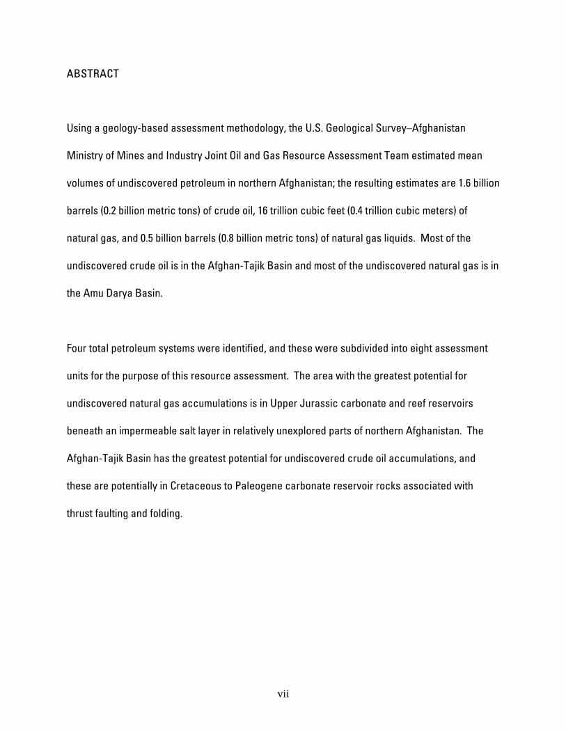
ABSTRACT
Using a geology-based assessment methodology, the U.S. Geological Survey–Afghanistan
Ministry of Mines and Industry Joint Oil and Gas Resource Assessment Team estimated mean
volumes of undiscovered petroleum in northern Afghanistan; the resulting estimates are 1.6 billion
barrels (0.2 billion metric tons) of crude oil, 16 trillion cubic feet (0.4 trillion cubic meters) of
natural gas, and 0.5 billion barrels (0.8 billion metric tons) of natural gas liquids. Most of the
undiscovered crude oil is in the Afghan-Tajik Basin and most of the undiscovered natural gas is in
the Amu Darya Basin.
Four total petroleum systems were identified, and these were subdivided into eight assessment
units for the purpose of this resource assessment. The area with the greatest potential for
undiscovered natural gas accumulations is in Upper Jurassic carbonate and reef reservoirs
beneath an impermeable salt layer in relatively unexplored parts of northern Afghanistan. The
Afghan-Tajik Basin has the greatest potential for undiscovered crude oil accumulations, and
these are potentially in Cretaceous to Paleogene carbonate reservoir rocks associated with
thrust faulting and folding.
vii
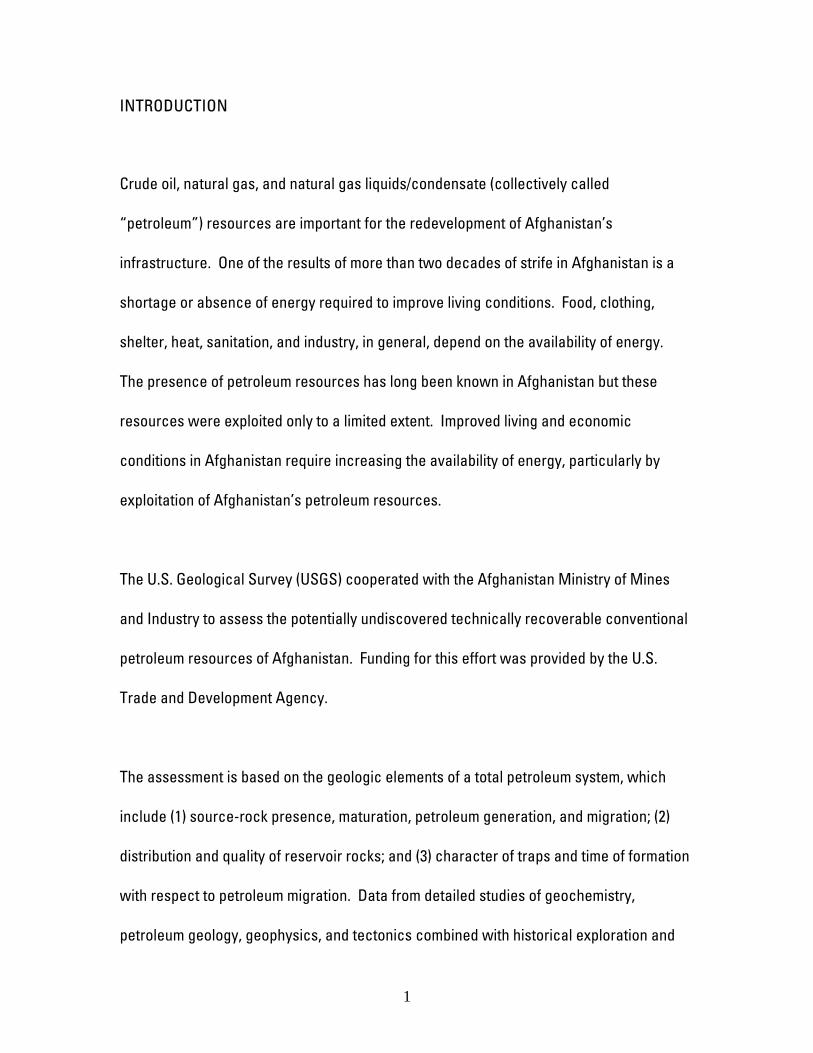
INTRODUCTION
Crude oil, natural gas, and natural gas liquids/condensate (collectively called
“petroleum”) resources are important for the redevelopment of Afghanistan’s
infrastructure. One of the results of more than two decades of strife in Afghanistan is a
shortage or absence of energy required to improve living conditions. Food, clothing,
shelter, heat, sanitation, and industry, in general, depend on the availability of energy.
The presence of petroleum resources has long been known in Afghanistan but these
resources were exploited only to a limited extent. Improved living and economic
conditions in Afghanistan require increasing the availability of energy, particularly by
exploitation of Afghanistan’s petroleum resources.
The U.S. Geological Survey (USGS) cooperated with the Afghanistan Ministry of Mines
and Industry to assess the potentially undiscovered technically recoverable conventional
petroleum resources of Afghanistan. Funding for this effort was provided by the U.S.
Trade and Development Agency.
The assessment is based on the geologic elements of a total petroleum system, which
include (1) source-rock presence, maturation, petroleum generation, and migration; (2)
distribution and quality of reservoir rocks; and (3) character of traps and time of formation
with respect to petroleum migration. Data from detailed studies of geochemistry,
petroleum geology, geophysics, and tectonics combined with historical exploration and
1
production analyses were used to aid in the estimation of the number and sizes of
undiscovered petroleum accumulations.
Much of the petroleum resource potential of Afghanistan and all of the known crude oil
and natural gas reserves are in northern Afghanistan, located in parts of two petroliferous
geologic basins — the Amu Darya Basin to the west and the Afghan-Tajik Basin to the
east (fig. 1). In addition to previous exploration, this study shows that potential still exists
for additional crude oil and natural gas discoveries in northern Afghanistan.
ACKNOWLEDGMENTS
The authors wish to acknowledge the constructive technical reviews by Christopher
Schenk and Vito Nuccio, editorial reviews by Lorna Carter, and graphical assistance by
Phuong Le, L. Steve Cazenave, and Christa Lopez. The authors are grateful to all of the
employees at the Afghanistan Ministry of Mines and Industry for their advice, information,
data, rock and petroleum samples, logistical support, laboratory and facility tours, and
sharing Afghan culture.
TRANSLITERATION
Most geographical and geological names for northern Afghanistan were transliterated
directly from Dari to English by geologists with the Afghanistan Ministry of Mines and
2
Industry and used in this report. Geographical and geological names for neighboring
Turkmenistan, Uzbekistan, and Tajikistan used in this report are transliterations from
Russian. Some obvious discrepancies in the spelling of names among countries are
observed in this report. For example, the word for pilgrim is spelled “Khoja” for
Afghanistan, but spelled “Khodzha” for Turkmenistan, Uzbekistan, and Tajikistan.
REGIONAL GEOLOGY
The Amu Darya and the Afghan-Tajik Basins are located in desert and semi-desert areas
of Turkmenistan, southwest Uzbekistan, southeastern Tajikistan, and northern
Afghanistan (fig. 1) (Ulmishek, 2004). The two basins encompass approximately 87,000
square kilometers (34,000 square miles) in those portions that lie within Afghanistan. The
Amu Darya Basin is west of the Afghan-Tajik Basin, and they are separated from one
another by the southern subsurface extension of the Southwestern Gissar meganticline
and spur. The Amu Darya and the Afghan-Tajik Basins occupy a narrow zone between
the Amu Darya River to the north and west, the Alburz-Marmul fault, North Afghan High,
and Bande Turkestan Range to the south. The east boundary is the Hindu Kush and
Badakhshan.
Northern Afghanistan has pre-Jurassic basement unconformably overlain by Jurassic to
Paleogene oil- and gas-bearing terrigenous and carbonate rocks, which in turn are
unconformably overlain by Neogene orogenic continental clastics (Kulakov, 1979;
3

Brookfield and Hashmat, 2001). Many minor unconformities represent erosion during
orogenies in adjacent folded regions (Kulakov, 1979).
The Afghan-Tajik Basin and the Amu Darya Basin formed a single Mesozoic to Paleogene
sedimentary basin that existed until Neogene time (Ulmishek, 2004). Collision of the Indian
plate with the Eurasian plate at that time uplifted the southern portion of the basin and
divided the northern portion into the Amu Darya and Afghan-Tajik Basins. Pre-Neogene
basin history and stratigraphy of the Amu Darya and Afghan-Tajik Basins are similar,
consisting of (1) Paleozoic to Triassic basement complex, (2) Jurassic to Paleogene
sedimentary cover, and (3) Neogene to Holocene orogenic clastics (Orudzheva and
Kornenko, 1991; Dastyar and others, 1990; VNIGNI, 2005a) (fig. 2).
The basement in both basins comprises peneplaned fold structures composed of
continental and oceanic blocks accreted during Late Paleozoic tectonism (Dastyar and
others, 1990) and consist of intensely deformed and partially metamorphosed sedimentary
rocks at depths of 4 to 16 kilometers (Kulakov, 1979; Orudzheva and Kornenko, 1991). A
Permian to Triassic transitional complex, up to 2,500 meters thick, overlies the pre-
Permian section (Orudzheva and Kornenko, 1991). Undifferentiated Permian and Triassic
marine carbonate and clastic rocks that pass into redbeds fill grabens in the basement
(Kulakov, 1979; Orudzheva and Kornenko, 1991).
4
The Jurassic to Paleogene sedimentary cover is divided into four intervals: (1) Lower to
Middle Jurassic continental to paralic clastic rocks, (2) upper Middle to Upper Jurassic
marine carbonate and evaporite rocks, (3) continental Neocomian clastic rocks and
redbeds, and (4) Aptian to Paleogene marine carbonate and clastic rocks (Orudzheva and
Kornenko, 1991). Clastic sediments become increasingly more continental derived during
late Paleogene time (Orudzheva and Kornenko, 1991).
Neogene to Holocene orogenic clastics were deposited as a result of tectonic
deformation related to the collision of the Indian plate with the Eurasian plate, which
began in latest Oligocene time (Orudzheva and Kornenko, 1991; Ulmishek, 2004).
Basin History
The Afghan part of the Amu Darya and the Afghan-Tajik Basins is located on the extreme
southeastern part of the Turan platform of the Eurasian plate, and is bounded on the south
and southeast by the Harrirud fault system (Kulakov, 1979; Dastyar and others, 1990; VZG,
2004).
The evolution of the Amu Darya and Afghan-Tajik Basins involved the movement of the
Eurasia, Africa, and Indian continental plates (VNIGNI, 2005a). Rocks in these two basins
record the tectonic history of the Tethys region (VNIGNI, 2005a). The major tectonic
events are (1) late Carboniferous to Early Permian compression with the closing of the
5
Paleotethys Ocean, (2) Late Permian to Triassic continental breakup with extensional
rifting, (3) Late Triassic collision of Cimmerian blocks with Eurasia and associated
deformation of the southern Eurasian margin, (4) Early Jurassic to beginning of the Middle
Jurassic extension, (5) Late Jurassic(?) to Early Cretaceous formation of island arcs,
passive margins, and post-rift sags resulting in marine transgression, (6) Late
Cretaceous(?) to early Paleogene movement of micro continents in the Neotethys Ocean,
and (7) Cenozoic compression resulting from the closing of the Neotethys Ocean and
collision of continents and micro continents (VNIGNI, 2005a). Most of sedimentary basins
along the Eurasian plate were formed over aulacogens, grabens, and triple junctions
(VNIGNI, 2005a). The main basin-fill deposits include syn-rift, post-rift sag, and passive
margin (VNIGNI, 2005a). The structural and stratigraphic development of the Amu Darya
and the Afghan-Tajik Basins is summarized in Figure 2.
Two major structures that influenced crude oil and natural gas occurrence developed in
northern Afghanistan during Mesozoic and Cenozoic time; the Parapamiz-Bande
Turkestan Range (a mountainous foldbelt), located in the southern and central parts of the
northern Afghanistan; and the Murgab depression of the Amu Darya Basin, located in the
northern part of the area (fig. 3) (Dastyar and others, 1990; VZG, 2004). The Parapamiz-
Bande Turkestan may have been a rift basin formed on the Eurasian plate behind a
magmatic arc of the Hindu Kush and Parapamiz (Brookfield and Hashmat, 2001; Ulmishek,
2004). A thick section of Permian and Triassic clastic, carbonate, and volcanic rocks, up
to several kilometers thick, filled the rift basin, but was uplifted and deformed in Late
6
Triassic time by Cimmerian orogenesis (Dastyar and others, 1990; Ulmishek, 2004). A
stable passive margin developed over the area and the fold belt was subsequently
peneplaned, subsided, and overlain by Jurassic to Paleogene rocks (Dastyar and others,
1990; Ulmishek, 2004).
The Murgab depression is part of the Amu Darya Basin and is presently subsiding as
indicated by Neogene and Quaternary rocks unconformably overlying, with a sharp
contact, older rocks with thicknesses are up to 2,000 meters (Kulakov, 1979). The Murgab
depression subsided more than the Parapamiz-Bande Turkestan Range (Dastyar and
others, 1990). The block structure of the Amu Darya Basin consists of a series of diagonal
and east to west faults along which some parts of the basin have been uplifted and others
subsided, including the Kalaimor-Kaisar Depression, Badkhyz-Karabil Uplift, North
Karabil-Dauletabad Depression (northern Badkhyz depression), Maimana Step, and
Uchadzhi High (Kulakov, 1979). Neogene to Holocene tectonism deformed much of the
area, but with a pattern that generally follows pre-Jurassic structural grain (Ulmishek,
2004).
Almost all of the deformation in northern Afghanistan began in the Miocene with the
collision of the Indian plate into the Eurasian plate (Brookfield and Hashmat, 2001). The
collision of the Indian plate with the Eurasian plate occurred in three phases, based on
tectonic, structural, magmatic, and geochronologic data (Treloar and Izatt, 1993). The first
phase involved suturing of the Kohistan-Ladakh-East Nuristan island arc to south Eurasia
7
about 100 million years ago (Cretaceous) (Treloar and Izatt, 1993). The second phase
involved the collision of the Indian plate with the Eurasian plate about 55 million years ago
(Paleogene) (Treloar and Izatt, 1993). The third phase was the collision of the Indian plate
with the Turan plate (Afghan Block) during the Pliocene (Treloar and Izatt, 1993).
The Afghan-Tajik Basin was deformed by the northward protrusion of the Pamir block
beginning in late Oligocene time and continuing to present (Orudzheva and Kornenko,
1991; Ulmishek, 2004; VNIGNI, 2005a). The Pamir block was translated northward by at
least 100 kilometers relative to the Turan platform and rotated by at least 30 degrees as a
result of rotation of the Indian Plate (Thomas and others, 1996). Compression and
subhorizontal or gently plunging east to west shortening occurred and a series of
anticlinoria and synclinoria, trending generally north to south, were produced that are
underlain by thrust faults with the principal detachment surface along Upper Jurassic salt
(Loziyev and others, 1984; Orudzheva and Kornenko, 1991; Leith and Alvarez, 1985; Thomas
and others, 1996; Ulmishek, 2004; VNIGNI, 2005a). Fault heaves increase in magnitude
from south to north indicating counter-clockwise rotation (Thomas and others, 1996).
Rotations increase in magnitude from west to east (Thomas and others, 1996). Crustal
shortening ranges from 50 to 90 kilometers; 20 to 60 percent (fig. 4) (Thomas and others,
1996; VNIGNI, 2005a). The thrusts flatten with the depth and continue into but not through
the evaporite interval (VNIGNI, 2005a). The allochthonous slabs moved relative to the
autochthon base on one or multiple surfaces (which converge to a common fault surface)
(VNIGNI, 2005a). Subsalt Jurassic deposits do not participate in the thrusting and likely
8
have platform-type structure similar to that of the southwestern Gissar spur (VNIGNI,
2005a). Synclinoria were filled with thick orogenic sediments during upper Neogene and
Quaternary time; up to 5,000 meters in the Afghan-Tajik Basin with decreasing thickness
westward into the Amu Darya Basin (Orudzheva and Kornenko, 1991; Ulmishek, 2004;
VNIGNI, 2005a). The Alburz-Marmul strike-slip fault separates the Afghan-Tajik Basin
from the North Afghan High to the south. Elongate north to south trending structures of
the Afghan-Tajik Basin are truncated by the Alburz-Marmul fault, having vertical
displacement of approximately 4 kilometers (Bratash and others, 1970; Ulmishek, 2004).
The Alburz-Marmul fault has a Neogene to Holocene oblique strike-slip component
(Brookfield and Hashmat, 2001) and elongate structures of the Afghan-Tajik Basin might
have been deformed by dragging along the fault.
The thrusting does not extend across the Southwest Gissar spur and meganticline into the
Amu Darya Basin (Ulmishek, 2004). Only local uplift of blocks occurred in the Amu Darya
Basin as a result of the collision (Orudzheva and Kornenko, 1991).
Principal Present-Day Structural Elements
Only the southern margins of the Amu Darya and Afghan-Tajik Basins occupy northern
Afghanistan. The Amu Darya Basin deepens to the northwest into Turkmenistan,
becoming a large structural depression surrounded by mountain ranges to the south and
basement highs to the north (Ulmishek, 2004). The Afghan-Tajik Basin deepens northward
9
into Turkmenistan and Uzbekistan, becoming a structural depression having a north to
south trending depocenter, surrounded by mountain ranges to the north and east, and by
basement highs to the south.
Most present-day structures and faults were developed by Neogene to Holocene tectonic
events, which formed new structures and reactivated and modified older structures
(Brookfield and Hashmat, 2001; Ulmishek, 2004). The present-day structural elements are
shown on Figure 3. Older Mesozoic to Paleogene structures were influenced by Triassic
to Jurassic rifting and include inversion uplifts in rifts, such as the Maimana step; and
over-rift sag depressions, such as the Amu Darya Basin (Brookfield and Hashmat, 2001;
VNIGNI, 2005a).
Amu Darya Basin
The basement of the Amu Darya Basin has a fault-block structure (Ulmishek, 2004). A
large number of the faults border main structural units of the basin, separating smaller
uplifted and subsided blocks (Ulmishek, 2004). “The faults either extend upward into the
sedimentary cover or are expressed as flexures” (Ulmishek, 2004). “Many of the
structures are arranged into linear anticlinal zones along the faults” (Ulmishek, 2004).
Little information is available on the existence of pre-Neogene structures (Ulmishek,
2004). Some structures in adjacent areas experienced continuous uplift in Neogene time
whereas others were buried under younger rocks (Ulmishek, 2004).
10

The Amu Darya Basin consists of subordinate depressions and uplifts of varying degrees
of expression. Structures in northern Afghanistan and adjacent areas include the Murgab
depression, Obruchev depression, North Karabil-Dauletabad depression, Andkhoy uplift,
Akhchin step, Sheberghan block, Maimana step, Badkhyz-Karabil uplift, and Repetek
zone.
Murgab depression
The Murgab depression is a large depression located mostly in Turkmenistan and
includes several smaller structural elements (VZG, 2004). The structural elements of this
depression that are in Afghanistan include the Obruchev and Dauletabad depressions;
Andkhoy uplift and its extensions the Yashlar-Andkhoy and Shakhmolla arches, which
divide the Obruchev and North Karabil-Dauletabad depressions; Maimana step and its
extension, the Badkyz-Karabil uplift (VZG, 2004). These structures are expressed as
regional gravity anomalies in geophysical surveys (VZG, 2004).
Obruchev depression is bounded on the south by the Andkhoy uplift and Akhchin step,
and bounded on the north by the Repetek zone (VZG, 2004). On the gravity map, the
depression is expressed as a large negative anomaly (VZG, 2004). The depth of burial to
the top of Kimmeridgian to Tithonian evaporites approaches 4 to 5 kilometers (VZG, 2004).
North Karabil-Dauletabad depression is bounded on the south by the Maimana step and
on the north by the Andkhoy uplift (Seradzhi, 1988, 1993; VZG, 2004). The top of the
11

Kimmeridgian to Tithonian evaporites has not been penetrated, but is supposed to occur
beneath the base of the Neocomian, which is at a depth of 3 to 3.6 kilometers (VZG, 2004).
The thickness of the sedimentary section decreases eastward (VZG, 2004).
Badkhyz-Karabil uplift is an elongate basement high with a thin sedimentary cover that
extends westward from the Maimana step in Afghanistan to the Kopet Dag area of
Turkmenistan and Iran. Triassic, Jurassic, and lowermost Cretaceous rocks are absent
on top of the uplift and on the Maimana step, and the Paleozoic basement is overlain by
Hauterivian or Barremian clastic rocks. The Badkhyz-Karabil uplift bounds the southern
margin of the Murgab depression.
North Afghan High
The North Afghan High is a highland with elevations locally exceeding 2,500 meters
(Ulmishek, 2004). Triassic and Jurassic rocks are absent on the crest of the high but are
present on the slopes (Ulmishek, 2004). The basement is exposed in the southeastern part
and is overlain by Cretaceous to Paleogene rocks at depths of 1,200 to 1,500 meters in
western parts (Bratash and others, 1970; Ulmishek, 2004). On the north, the North Afghan
High is bounded by the Alburz-Marmul sinistral strike-slip fault. Along this fault, the
basement of the North Afghan High is downthrown into the Afghan-Tajik Basin to the
north (Bratash and others, 1970; Ulmishek, 2004).
12
Andkhoy uplift is a buried western protrusion of the North Afghan High. The Andkhoy
uplift is expressed as a positive gravity anomaly 65 kilometers long and 20 to 30 kilometers
wide on the gravity map (VZG, 2004). The uplift is orientated west-to-east and includes
several simple subordinate structures (VZG, 2004).
Akhchin step is a basement high along the northern margins of the Andkhoy uplift and
North Afghan High.
Maimana step is a basement high with a thin sedimentary cover that includes a group of
anticlinal folds that divide smaller depressions (VZG, 2004). The strike of the arch is
generally east to west and is expressed as relatively elevated values of gravity on the
gravity map (VZG, 2004). The Maimana step is along the flank of the North Afghan High
and is the updip continuation the Badkhyz-Karabil uplift.
Repetek zone
The Repetek zone is the largest intrabasinal fault zone of the Amu Darya Basin, extending
west to east from Turkmenistan into northern Afghanistan south of the Uzbekistan border
(Ulmishek, 2004; VNIGNI, 2005b). The zone marks the northern boundary of the Murgab
depression and consists of a series of faults apparently with a dextral strike-slip
component that caused salt diapirism, the intensity of which decreases from east to west
(Ulmishek, 2004; VNIGNI, 2005b). Salt domes are of Upper Jurassic salt and have
amplitudes as high as 1,000 meters along the eastern part of the Repetek zone (Ulmishek,
13

2004). Subsalt Jurassic rocks in this zone are not as deformed as the complex steeply
folded suprasalt rocks (VNIGNI, 2005b). Vertical offset is approximately 1,500 meters on
the eastern portion of the zone and decreases westward (VNIGNI, 2005b).
Kushka depression and Kushka zone
The Kushka zone of folds is an anticlinal zone in southernmost Amu Darya Basin that lies
on the western plunge of the Parapamiz-Bande-Turkistan range (Ulmishek, 2004; VNIGNI,
2005b). The zone is separated from the Badkhyz-Karabil uplift and Maimana step by the
east to west trending Kalaimor/Kaisar depression, which is filled with Cretaceous and
Paleogene rocks (Ulmishek, 2004; VNIGNI, 2005b). Upper Jurassic rocks are absent in
both the anticlinal zone and the depression, and Lower Cretaceous rocks unconformably
overlie Lower to Middle Jurassic coal-bearing clastic rocks.
Parapamiz-Bande Turkestan range
The present-day Parapamiz range is a Triassic volcanic arc. The Bande Turkestan is most
probably a back-arc rift. Both were closed, inverted, and deformed by collision of the
Central Afghanistan (Helmend) block (microcontinent) at the end of Triassic time.
The strong but relatively short-lived downwarping of the Harrirud fault system in the
Triassic led to accumulation of thick, extensively developed terrigenous-volcanic deposits
(north of the fault system), which were intensely folded at the end of the Triassic
(Sborshchikov and others, 1974). Triassic clastic sediments were deposited in a narrow
14

inland sea (Safdari, 1991). Slavin (1970) interprets the Bande Turkestan section as a
northern part of a single trough that includes the Parapamiz section. A very thick, up to
9,000 meter, Triassic section of volcanic rocks (three volcanic intervals, 600 to 6,500
meters) is present in the Parapamiz mountains (Slavin, 1970). The Triassic section in the
Bande Turkestan mountains is thinner, with Middle and Upper Triassic flysch-like rocks or
black mudstone about 3,000 meters thick (Slavin, 1970). At the end of the Late Triassic,
terrigenous coals and thin coal interbeds were deposited in a littoral marine plain with
lagoons and swamps (Safdari, 1991). Early Cimmerian deformation was most intensive in
the Bande Turkistan area (Safdari, 1991).
Harrirud fault zone
The Harrirud fault zone is a Triassic sutural structure that separates the Turanian block of
the Eurasian plate to the north from continental blocks of Gondwanian origin and related
structures to the south (fig. 5) (Sborshchikov and others, 1974; Safdari, 1991). In Neogene
time, the structure was reactivated and became a dextral strike-slip fault in a general
pattern of escape tectonics related to compression from the collision of the Indian plate.
Southwest Gissar Meganticline and Spur
The Southwest Gissar Meganticline and Spur separate the Afghan-Tajik Basin from the
Amu Darya Basin. Only the extreme southern limb of the meganticline is located in
Afghanistan, which includes limbs of the Khamyab, Khan Tepe, and Kleft anticlines
(Dastyar and others, 1990). Southwest Gissar spur is structurally different from the rest of
15
the Afghan-Tajik Basin and might have formed by mixed thrust and block tectonics
(Kravchenko and others, 1990). The spur is a tectonic (Neogene) uplift that is thrust on
margins of both the Afghan-Tajik and Amu Darya Basins. The southwest Gissar spur is
delineated by the outcrops of Cretaceous rocks beneath Quaternary sediments in the
extreme western part of the Afghan bank of the Amu Darya River (Dastyar and others,
1990). The Hercynian basement and Jurassic rocks are exposed in the highest part of the
uplift.
Alburz-Marmul fault
The Alburz-Marmul fault lies between the Afghan-Tajik Basin to the north and the North
Afghan High to the south. The Alburz-Marmul fault may be left-lateral transpression zone
(Thomas and others, 1996).
Afghan-Tajik Basin
The Afghan-Tajik depression is located on a zone of intense negative gravity anomalies
(VNIGNI, 2005a). The thickness of the earth’s crust in the Afghan-Tajik depression
changes from 45 kilometers in the most of the depression to 55 to 60 kilometers along the
eastern margin (VNIGNI, 2005a). The Afghan-Tajik depression is an area of deep
downwarping, whereby the basement is at a depth of 10 to 15 kilometers or more as
determined by geophysical methods (VNIGNI, 2005a). The basement cannot be mapped
because of poor resolution of the geophysical methods employed (VNIGNI, 2005a).
Marginal structural steps, uplifted as much as 3 to 8 kilometers, surround the Afghan-Tajik
16
depression (VNIGNI, 2005a). The major steps include the Dushanbe and Baysun steps,
and the North Afghan High (VNIGNI, 2005a).
Suprasalt post-Jurassic sedimentary cover of the basin was detached along Jurassic salt
in Neogene time and deformed into a series of thrust anticlinoria and synclinoria. In
anticlinoria, Paleogene rocks are commonly exposed on the surface whereas synclinoria
are filled with several kilometers of Neogene to Quaternary continental clastic deposits.
Complex fold-thrust structures are present in the sedimentary cover within the depression
(VNIGNI, 2005a). These structures are typically ridge-like anticlinal folds with thrust fault-
cut cores (VNIGNI, 2005a). The structure of allochthonous plates in the depression is not
well understood (VNIGNI, 2005a). Thrust fault surfaces and allochthonous plates were
folded in some places (VNIGNI, 2005a). Parts of these folds can be traced into the
allochthonous plates at different levels, and the frontal parts of the plates in anticlines are
commonly accompanied by buried underthrust anticline uplifts (VNIGNI, 2005a).
Autochthonous subsalt plates were subthrust under the southwest Gissar spur and under
the Pamir range (Kravchenko and others, 1990). The internal structure of the
autochthonous plate is virtually unknown.
In the center of the Afghan-Tajik Basin, thick allochthonous slabs bury Jurassic subsalt
deposits to depths inaccessible to drilling, 8 to 12 kilometers (VNIGNI, 2005a). Subsalt
Jurassic deposits are much shallower, 2 to 3.5 kilometers only on the uplifted steps where
either the thickness of allochthonous slabs decreases (such as at Gadzhak field on the
17

Baysun step) or the structural style changes from thrusting to block-folding (such as at
Komsomolsk field on the Dushanbe step) (VNIGNI, 2005a).
Only 5 wells drilled in the Afghan-Tajik Basin reached depths of 4.5 to 5 kilometers,
(Krylov, 1980). Two wells encountered Neogene rocks of subthrust sheets (Krylov, 1980;
Kravchenko and others, 1990; VNIGNI, 2005a). On Aktau and North Kurgancha structures
of Tajikistan, Upper Jurassic salt was penetrated (Krylov, 1980).
The sedimentary cover within the inner part of the Afghan-Tajik Basin consists of three
allochthonous synclinal zones: (1) the Surkhan megasyncline and Mazar i Sharif basin, (2)
the Vakhsh megasyncline, and (3) the Kulyab megasyncline (or Badakhshan Foredeep)
(VNIGNI, 2005a). These synclinal zones are divided by (1) the Kafirnigan meganticline, and
(2) the Obigarm meganticline (VNIGNI, 2005a). The anticlinal zones are breached and
cores of salt and suprasalt intervals of Late Jurassic to Paleogene age crop out (VNIGNI,
2005a). The northeastern extremity of anticlinoria is complex and contains mainly
imbricate allochthonous-sheet structures, where anticlinal folds are most closely spaced
(Loziyev, 1976). Synclinoria contain synclinal folds and compressed anticlines with sharp
crests (Loziyev, 1976).
In synclinoria of the Afghan-Tajik Basin, anticlines in the northern parts have regularly
oriented dip of axial planes with the steep limbs broken by reverse faults with throws of
2.5 to 3.5 kilometers; folds become imbricate where throws are large. Structures in the
18

southern parts of synclinoria of the Afghan-Tajik Basin have differing axial dips, crests
commonly contain grabens, and limbs have symmetrical, sharp folds (Loziyev, 1976).
In anticlinoria of the Afghan-Tajik Basin, Neogene rocks unconformably overlie eroded
anticlinal crests down to the Cretaceous section (Loziyev, 1976). The depth of erosion
decreases southward to the Paleogene section (Loziyev, 1976). The unconformity is
absent in synclines and in the Surkhan Darya megasyncline, where the Neogene section
is in normal stratigraphic succession (Oligocene and early Miocene) and early folding
was synsedimentary (Loziyev, 1976). Folding might have been noncontemperaneous over
the Afghan-Tajik Basin; proceeding from northwest to southeast (Loziyev, 1976). Folding is
less pronounced in the synclinoria, where it lagged somewhat and did not develop
unconformities in the cores of local anticlines (Loziyev, 1976). A pronounced unconformity
is present at the base of the Holocene section in the Afghan-Tajik Basin as indicated by
the eroded crests of anticlines in synclinoria (Loziyev, 1976).
Imbricate structures are best developed in the northeastern parts of the anticlinoria in the
Afghan-Tajik Basin and originated at the beginning of Neogene time as indicated by pre-
Neogene unconformity truncating the crests of anticlinal folds (Loziyev, 1976). Structures
in the southern parts of synclinoria of the Afghan-Tajik Basin developed at the beginning
of Holocene time, where pre-Holocene unconformity exists on anticlinal folds, but does
not exist in synclinoria (Loziyev, 1976).
19
Loziyev (1976) recognized two main structural styles in the Afghan-Tajik Basin: (1)
Isombay folds, which involve a thick salt bed as a detachment surface but the bed has no
independent structure-making significance and (2) Kulyab folds, which incorporate salt in
the structures as diapirs and flows.
Surkhan megasyncline and Mazar i Sharif basin contains Mesozoic to Cenozoic rocks
approximately 7 or 8 kilometers thick in northern Afghanistan (Dastyar and others, 1990).
Gravimetry indicates that the megasyncline is divided into two parts by a fault boundary
running longitudinally through Mazar i Sharif. The eastern part contains gravity highs and
lows that trend north to south, representing long, narrow, intensely faulted anticlines with
steep limbs. The anticlines include the Gunj, Mohammad Jandagar, and Aita Tepa
structures. Anticlinal structures to the west are broader, less elongate, less intensely
faulted, and have gentler dipping limbs. An extension of the Repetek zone is expressed by
the Sanduqli anticlinal structure to the west (Dastyar and others, 1990). Salt diapirism is
observed along the Repetek zone farther west in Turkmenistan (VNIGNI, 2005a).
Kafirnigan meganticline is situated east of the Surkhan megasyncline and is divided into
two parts by the Mir Ali trough (Dastyar and others, 1990). The eastern part of the
Kafirnigan meganticline is topographically more elevated than the western part (Dastyar
and others, 1990).
20
Vakhsh megasyncline is deepest south of Qunduz, where the top of the folded basement
is buried under 7.5 to 8 kilometers of Neogene and Quaternary deposits (Dastyar and
others, 1990). Kukushkin and Ramazanova (1989) show that thrust sheets cover older pre-
Kulyab structures on the west side of the Vakhsh depression in Tajikistan.
Obigarm meganticline is the easternmost anticlinorium of the Afghan-Tajik Basin and
situated between the Vakhsh and Kulyab synclinoria.
Kulyab megasyncline (or Badakhshan foredeep) is the easternmost major present-day
structural element in the Afghan-Tajik depression of northern Afghanistan. The Kulyab
megasyncline is a foredeep basin filled with thick Neogene to Quaternary orogenic clastic
sediments (Dastyar and others, 1990).
Kokchin graben is an orthorhombic depression on the eastern edge of the Afghan-Tajik
Basin along the Badakhshan, containing up to 17 kilometers of Neogene and Quaternary
molasse (Dastyar and others, 1990). The origin of the graben is not well understood.
Tectonic Development
The basement of the Afghan-Tajik and Amu Darya Basins is known from outcrops in the
Tian Shan in the north and the Parapamiz-Bande Turkestan range in the south. The
northern Tian Shan is the uplifted part of the Caledonian basement of central Kazakhstan.
21
The southen Tian Shan, called the Gissar range, includes the Hercynian ophiolite suture,
Carboniferous volcanic arc, and large massifs of post-collisional granitoids. In the
Parapamiz-Bande Turkestan range, pre-Jurassic rocks are composed of four tectono-
stratigraphic intervals: (1) Ordovician? to Lower Devonian passive margin interval
developed on oceanic crust, (2) Upper Devonian to lower Carboniferous magmatic arc
and ophiolites developed on the passive margin, (3) lower Carboniferous to Permian rift
and passive margin intervals, (4) Triassic continental magmatic arc (Brookfield and
Hashmat, 2001).
In the basins, the basement is overlain by Upper Triassic to Cenozoic sedimentary rocks,
which are more than 16 kilometers thick in the Afghan-Tajik Basin as evidenced by
geophysical data (VNIGNI, 2005a). A significant part of the section, up to 7 kilometers of
continental rocks, was deposited from the Oligocene to Holocene (VNIGNI, 2005a).
Paleozoic
The basement of the Amu Darya and Afghan-Tajik Basins was probably formed by the
accretion of various tectonic terranes during the Hercynian tectonic event (late
Carboniferous to Permian) based on extrapolation of the basement composition of the
basin margins into the deeper parts of the basins (Ulmishek, 2004). The closing of oceanic
basins and concomitant tectonic activity involving the collision of microplates during the
late Carboniferous to Early Permian time most likely occurred along the southern edge of
Eurasian plate at the modern southern Tian Sh n and northern Pamir ranges (Ulmishek,
22
2004; VNIGNI, 2005a). The Hercynian tectonic event involved two Precambrian
continental microplates. The Karakum microplate is northernmost and extends eastward
into the Tian Shan north of the Gissar range. The Karakum microplate may have included
the Tarim block in northwest China (Zonenshayn and others, 1990; Ulmishek, 2004). The
southern microplate is the Tajik. Gravity and magnetic geophysical surveys indicate that
the Tajik microplate underlies the Afghan-Tajik Basin and extends into the Amu Darya
Basin (Maksimov, 1992; Ulmishek, 2004). Ophiolites in the central part of the Gissar range
are located along the collision zone between the Karakum and Tajik microplates
(Ulmishek, 2004). The Amu Darya Basin basement farther west includes various oceanic
blocks containing basic volcanic rocks of Carboniferous age (Ulmishek, 2004).
Triassic
Subduction of Paleo-Tethyan lithosphere under the southern margin of Eurasia began in
Triassic time. In Afghanistan, this subduction resulted in formation of the Parapamiz
continental volcanic arc and back-arc rifting of the Turanian plate. The largest rift was
formed in Bande Turkestan, but the presence of other rifts under thick post-Triassic rocks
is probable. At the end of the Triassic or earliest Jurassic, the Paleo-Tethys was closed
and the Helmend block of Gondwanian origin (Leven, 1997) collided with the Eurasian
margin. The collision resulted in intense but short-lived early Cimmerian deformation of
the margin and inversion of Bande Turkestan. Uplift of marginal highs (North Afghan High,
Maimana step, and Badkhyz-Karabil uplift) is most likely related to this collision. The
23
collision and deformation completed the formation of the economic basement for
petroleum exploration of the Afghan-Tajik and Amu Darya Basins.
Jurassic
Jurassic rocks unconformably overlie Triassic and older rocks in the Amu Darya and
Afghan-Tajik Basin (Dzhalilov and others, 1982; Dastyar and others, 1990; Ulmishek, 2004;
VNIGNI, 2005a). During the Early to Middle Jurassic in northern Afghanistan, a crust
containing kaolinite formed by weathering of Triassic volcanic rocks under hot and humid
climatic conditions (Dastyar and others, 1990). Most of the Lower Jurassic interval older
than Toaracian is not recognized in the Amu Darya and Afghan-Tajik Basin (Dzhalilov and
others, 1982).
Jurassic rocks are buried 6 to 7 kilometers below upper Mesozoic and Cenozoic rocks in
the Afghan-Tajik Basin (Bebeshev and Makarov, 1989). Although the Jurassic section
was not penetrated by drilling in the Afghan-Tajik Basin, lithologic descriptions were
made from outcrops in the surrounding mountains (Dzhalilov and others, 1982; Polyansky,
1989). The most complete Jurassic section is exposed in the western part of the Afghan-
Tajik Basin and consists of marine and continental deposits (Dzhalilov and others, 1982).
Five depositional stages are identified. (1) During late Early Jurassic to early Middle
Jurassic time, high relief surrounded the Afghan-Tajik Basin and fluvial, lacustrine, and
swamp depositional environments existed that resulted in the deposition of commercial
coal deposits (Bebeshev and Makarov, 1989; Dzhalilov and others, 1982). (2) A sea-level
24
rise occurred during the Aalenian to Bajocian time whereby paralic sediments were
deposited consisting of alternating marine and continental sandstone, siltstone, and
mudstone up to 300 meters thick (Bebeshev and Makarov, 1989; Dzhalilov and others,
1982). (3) Marine transgression continued during the Bajocian to Bathonian time and
deltaic sediments were deposited in the northern part of the Afghan-Tajik Basin grading
southward into more argillaceous shallow-marine deposits (Egamberdyev, 1981;
Bebeshev and Makarov, 1989). Marine rocks include marine mudstone, marl, and
limestone, up to 150 meters thick and the deltaic rocks are potential petroleum reservoirs
(Bebeshev and Makarov, 1989; Dzhalilov and others, 1982). (4) Maximum marine
transgression occurred during Callovian to Oxfordian time resulting in a carbonate system
with the deposition of carbonates up to 650 meters thick (Bebeshev and Makarov, 1989;
Dzhalilov and others, 1982). (5) The final stage occurred during Kimmeridgian to Tithonian
time with the deposition of anhydrite, halite, and mudstone, up to 1,000 meters thick
(Bebeshev and Makarov, 1989; Dzhalilov and others, 1982). In the eastern part of the
Afghan-Tajik Basin, the Jurassic section consists mainly of continental deposits up to
2,200 meters thick (Dzhalilov and others, 1982).
The Early to Middle Jurassic was a time of intercontinental rifting, accompanied by
development of horst and graben and inter-graben zones (early stage) and above-rift
downwarpings or sags with flooding to create shallow marine basins, interior seas, and
embayments (later stage). The region can be divided into the Turan, Karakum, Afghan,
Amu Darya, and Pamir blocks, based on the locations of the horst and graben zones
25
(VNIGNI, 2005a). An Early Jurassic graben exists in northern Afghanistan on the Badkhyz-
Karabil uplift and Maimana step (Ulmishek, 2004). Other such Early Jurassic grabens may
also exist (Ulmishek, 2004).
Boundaries of the blocks are marked by changes in sediment thickness and by presence
of volcanogenic deposits (VNIGNI, 2005a). During Early Jurassic time, rifting resumed
along the earlier-formed rift system (VNIGNI, 2005a). During the Triassic, rifting was most
active in the western part of the region (VNIGNI, 2005a). From Early to Middle Jurassic
time, however, rifting was most active in eastern parts of the region, involving the Turan
and Karakum blocks (VNIGNI, 2005a). The formation of Early to Middle Jurassic rifts in
central Asia was initiated by rapid spreading of the Eurasia and Africa continents, with
the spreading center in the Neotethys Ocean (VNIGNI, 2005a). The rift system extended
hundreds of kilometers through the Caucasus, the south of Kopet Dag, and northern
Afghanistan (VNIGNI, 2005a). Parts of the rift system are probably buried under
allochthonous plates (VNIGNI, 2005a). Separate fragments of the rift system are marked
by flysch deposits and have been identified in northern Afghanistan (VNIGNI, 2005a). The
Early to Middle Jurassic rift system, having a northwest strike, is clearly traced along the
northern flank of the Amu Darya depression (VNIGNI, 2005a). In central parts of the Amu
Darya depression, similar structures were identified by seismic data (VNIGNI, 2005a). The
increase of the salt thickness along the Repetek fault serves as an indirect indicator of the
possible presence of a rift system (VNIGNI, 2005a).
26
During the Early Jurassic, the topography of the Afghan-Tajik Basin was dissected, hilly,
and in some places, mountainous (Timofeev and Polyansky, 1985; Polyansky, 1989). This
topography existed at the Darvaz-Alay and south Tian Shan mountains, and was the
provenance for alluvial deposits and peat bogs (Timofeev and Polyansky, 1985). A band of
alluvial-deltaic, in places, lagoonal coastal environments covered northern Afghanistan
and part of the Afghan-Tajik Basin, the Kugitang, southern Darvaz, and the Gissar Range
(Polyansky, 1985; Egamberdyev, 1987).
The Lower Jurassic section in northern Afghanistan consists of mainly continental
deposits, which include conglomerate, sandstone, siltstone, mudstone, and carbonate
rocks, with coals and detrital bauxite (Egamberdyev, 1987; Dastyar and others, 1990;
VNIGNI, 2005a). Thick fine- to coarse-grained terrigenous rocks with coal overlie
weathered Triassic rocks in northern Afghanistan (Dastyar and others, 1990). Tuffs and
volcanic rocks are present in the Lower Jurassic section near Pul i Khumri in the eastern
part of northern Afghanistan (Dastyar and others, 1990). The Lower Jurassic section
crops out on slopes of Gissar and Darvaz ranges, where it is coarse grained and includes
conglomerate and sandstone (VNIGNI, 2005a). In the northern part of the Afghan-Tajik
Basin, the Jurassic section consists of Lower Jurassic coal-bearing deposits overlapped
by banded sandstone (Dzhalilov and others, 1982). Younger Jurassic deposits are not
observed (Dzhalilov and others, 1982).
27
Starting in Bajocian time, above-rift depressions, or sags, formed, becoming
intercontinental marine basins connected to the Neotethys Ocean (VNIGNI, 2005a). By
the end of Bajocian time, rifting began to cease along the Karakum and Turan plates
(VNIGNI, 2005a). Dissected by rifts, the edges of blocks started to subside under the
weight of the sedimentary cover (VNIGNI, 2005a). In the Afghan-Tajik Basin, sediment
provenance is the Gissar range and local uplifts (Egamberdyev, 1987). Bajocian-age rocks
directly overlay basement rocks on one of the local uplifts (Egamberdyev, 1987). A
Jurassic paleoarch may have existed in the present-day Vakhsh and Kafirnigan area
(Volos and others, 1982).
Alluvial, lacustrine, swamp, and deltaic terrigenous peat-bearing and coastal marine
carbonate-terrigenous sediments were deposited in northern Afghanistan during the
Middle Jurassic. Sediment source was from early Jurassic dissected uplands along the
northern borders (Polyansky, 1985; Timofeev and Polyansky, 1985). The Middle Jurassic
section in northern Afghanistan contains conglomerate, sandstone, carbonaceous
mudstone, and coal (Dastyar and others, 1990; VNIGNI, 2005a). Sediments become more
marine upward (Egamberdyev, 1987) and become more carbonaceous toward the west
(VNIGNI, 2005a).
The Lower and Middle Jurassic section laps onto basement highs (Ulmishek, 2004). Beds
in the lower part of the section pinch out on the slopes of the highs (Ulmishek, 2004). The
Lower and Middle Jurassic section is absent on the Badkyz-Karabil uplift and Maimana
28
step (Ulmishek, 2004). Lower and Middle Jurassic rocks are present in both north and
south of these uplifts in Afghanistan, but the thickness is known only along the margins
and does not exceed several hundred meters (Ulmishek, 2004).
Tectonic events during the Late Jurassic to Early Cretaceous include: (1) marine
transgression and broadening of the marine embayment along the periphery of the
Neotethys Ocean into a sea that occupied the Amu Darya Basin; (2) collision of island
arcs with microcontinents at the northern edge of the Neotethys Ocean, particularly along
the Turan and Karakum plates resulting in uplift and alternating marine and continental
sedimentary sections; (3) changing depositional environments and bioherm development
along margins of plates and blocks; (4) connection of deep marine water between the
Amu Darya and Kopet Dag areas; (5) marine transgression and regression in the Amu
Darya Basin resulted from longitudinal and transverse tectonic movement of blocks
(VNIGNI, 2005a).
The Neotethys Ocean reached maximum size at the end of Late Jurassic time (VNIGNI,
2005a). A marine transgression advancing from the north and northwest, from the Turan
sea basin, flooded the single pre-Neogene combined Amu Darya-Afghan-Tajik Basin at
the end of Bathonian time (Dastyar and others, 1990). The Parapamiz-Bande Turkestan
area of northern Afghanistan remained above sea level (Dastyar and others, 1990;
VNIGNI, 2005a). The deepest part of the sea was in the center of the depression and
seemingly corresponded to the Repetek fault, Obruchev depression, and the southern part
29
of the Afghan-Tajik Basin (VNIGNI, 2005a). The Amu Darya sea deepened from the
northwest to the southeast (VNIGNI, 2005a). A broad shelf was located to the north and
south of sea along the Badkhyz-Karabil uplift, Maimana step, Andkhoy uplift, Akhchin
step, and Afghan-Tajik Basin (VNIGNI, 2005a). Reefs developed on the margins of the
relatively deep-water basin. Reef development is expected in the northern part of the
Kafirnigan and Obigarm zones, and in the Baysun zone of the Afghan-Tajik Basin
(Kravchenko and others, 1990).
In the northern part of the Afghan-Tajik Basin, such as at the Dushanbe step, Oxfordian
through Tithonian sediments may not have been deposited (Dzhalilov and others, 1982).
Upper Jurassic deltaic sediments were observed along the Darvaz range, indicating that
the coastline might have existed along the Gissar range, central Tian Shan, and Darvaz
range (Timofeev and Polyansky, 1985).
At the northern edge of Neotethys Ocean, in present-day Afghanistan and Iran, a
northward dipping subduction zone with associated island arcs was formed in Late
Jurassic time (Boulin, 1988; VNIGNI, 2005a), as indicated by the presence of calci-alkalic
extrusive rocks (VNIGNI, 2005a). Interaction of island arcs with margins of continental
plates probably occurred on the southern edge of the Kabul and North Pamir blocks
(VNIGNI, 2005a). he northern edge of Tethys was bordered by island arcs, which collided
one-by-one with the Iran, Central Afghanistan, and North Pamir blocks, resulting in the
inversion of rifts and undeveloped passive margins, and uplift of eastern regions of central
30

Asia (VNIGNI, 2005a). The collisions only weakly affected the Turan and Karakum plates
(VNIGNI, 2005a). Tectonic movements continued during Kimmeridgian to Hauterivian
time, forming inversion uplifts in synclines and depressions, such as the Uchadzhi high
(VNIGNI, 2005a). The Late Jurassic to Early Cretaceous embayment, which occupied the
Amu Darya Basin, and the Karakum and adjacent microplates, was dissected by uplifts
and became shallow or completely retreated, as in the North Pamir area (VNIGNI, 2005a).
Marine transgression began in latest Bathonian or early Callovian time (Ulmishek, 2004).
A basal mudstone unit was deposited followed by deposition of carbonate rocks of the
Kugitang suite (Ulmishek, 2004). During Callovian and Oxfordian time, a complex of barrier
reefs, pinnacle reefs, and atolls formed along the shelf edge and in marginal areas of the
deep-water basin (Ulmishek, 2004). The sedimentary section decreases in thickness from
the shelf margin toward the nearshore zone, and the section pinches out at the basin
margin (Ulmishek, 2004). The Callovian to Oxfordian shelf sequence is composed of
various shallow-water facies; including oolitic, detrital, and algal limestones and dolomitic
limestones; small nearshore Callovian carbonate buildups; argillaceous limestones and
marls; and local beds of anhydrite in the middle to upper Oxfordian section (Ulmishek,
2004). Siliciclastic material is present and is locally dominant along the basin margins
(Ulmishek, 2004).
The thickest and most hydrocarbon-productive rocks in the Amu Darya Basin part of
northern Afghanistan are middle and upper Oxfordian limestones associated with reefs
31
(Ulmishek, 2004). The reef complex contains much of the discovered natural gas reserves
and most of the estimated undiscovered natural gas resources (Ulmishek, 2004).
The deep-water basinal facies is poorly known because it is deeply buried and has been
penetrated in only a few wells in Turkmenistan and Uzbekistan (Ulmishek, 2004). The
lower and middle Oxfordian section is composed of dark-gray, thin- to medium-bedded,
bituminous, argillaceous limestone (Ulmishek, 2004). The upper Oxfordian section
consists of black, thinly laminated, highly organic-rich argillaceous limestone and
calcareous mudstone and siltstone with an admixture of volcanic ash (Fortunatova, 1985;
Ulmishek, 2004). These rocks, which contain ammonites and other planktonic fossils, are
characterized by high readings on gamma-ray logs and are known collectively as the
radioactive bed (Ulmishek, 2004). Where drilled, the total thickness of the Upper Jurassic
carbonate sequence in the basinal facies is about 200 to 250 meters (Ulmishek, 2004).
The reefs and associated rocks observed on the northeast margin of the Amu-Darya
Basin and at outcrops along the southwest Gissar spur provide stratigraphic information
that can be used to infer the structure and distribution of reefs and carbonate shelf
elsewhere in the basin (Ulmishek, 2004). Reefs and associated rocks provide important
hydrocarbon reservoirs on the Chardzhou step in Uzbekistan (Ulmishek, 2004). The
section consists of middle Callovian thin- to medium-bedded, dark-gray, argillaceous
limestones, which were deposited before reef growth (Ulmishek, 2004). Upper Callovian
to middle Oxfordian reefs, up to 50 meters high and including coral and algal-bryozoan
32
reefs, and associated detrital limestone overlie the argillaceous section (Abdullaev, 1999;
Ulmishek, 2004). Both the reefs and underlying argillaceous carbonate section on the
Chardzhou step produce crude oil and natural gas (Ulmishek, 2004).
Major reef development took place during late Oxfordian and probably early Kimmeridgian
time when the sea was deepest (Ulmishek, 2004). Semicircular barrier reefs developed
that separated the shelf from the deep-water basin (Ulmishek, 2004). Three linear zones
of barrier reefs developed through time (Mirzoev, 1985; Khudaykuliev and others, 1989). A
main upper Oxfordian barrier reef and shelfal reefs are present in the Gaurdak-Kugitang
area of the Chardzhou step (Khudaykuliev and others, 1989). The barrier reef zone
extends westward and southwestward from the Chardzhou step where it separates the
extensive northern shelf from the deep-water basin (Ulmishek, 2004). The exact location
of the reef zone is not well known because few wells have penetrated below the Upper
Jurassic salt in that area (Ulmishek, 2004). Additionally, pinnacle reefs inside basinal
facies have not been reliably identified, probably because of great depths, but their
presence is inferred on the basis of limited drilling and seismic data (Maksimov and
others, 1986; Abdyllaev and others, 1991; Ulmishek, 2004). Farther southwest, the barrier
reef plunges to depths exceeding 5 kilometers, and its location is not known (Ulmishek,
2004).
The location and morphology of the reef zone along the south margin of the Amu Darya
Basin are poorly known (Ulmishek, 2004). Upper Jurassic carbonates are at depths
33
exceeding 4 kilometers, and the quality of seismic data available in the former Soviet
Union was inadequate to map the reef bodies below the thick evaporites (Ulmishek, 2004).
Oxfordian limestone and dolomitic limestone of probable reef origin were penetrated by a
few wells between the Dauletabad and Shatlyk fields in Turkmenistan (Amanniyazov and
Nevmirich, 1985; Ulmishek, 2004). Wells in the Dauletabad field penetrated back-reef
facies (Allanov and others, 1985; Ulmishek, 2004). Reefs in this area were also inferred
from seismic data, but the morphology of the reef bodies is unclear (Ulmishek, 2004).
Seismic data indicate that the Upper Jurassic structure of the southern slope of the
Murgab depression consists of two linear uplifted blocks trending west to east, merging
with the Andkhoy uplift in northern Afghanistan, and separated by a structural low
(O’Connor and Sonnenberg, 1991; Ulmishek, 2004). The uplifted blocks, the Yashlar-
Andkhoy and Shakhmolla arches, are apparently covered by carbonate bank deposits that
contain reefs (Kleshchev and others, 1991; Ulmishek, 2004). Barrier reefs may be located
along the block margins and basinal facies probably fill the low areas (Ulmishek, 2004).
The barrier reef extends eastward into northern Afghanistan (Ulmishek, 2004). The reef is
located northwest and north of the North Afghan High along the Andkhoy uplift, but its
exact position farther east is not known (Ulmishek, 2004). On the crest of the North
Afghan High, the entire Upper Jurassic section is absent due to nondeposition, and
Cretaceous rocks unconformably overlie the Paleozoic basement or thin Lower to Middle
Jurassic and (or) Triassic rocks (Bratash and others, 1970; Ulmishek, 2004).
34

The barrier reef of the Chardzhou step was dissected into segments 4 to 8 kilometers long
by tidal channels 50 to 100 meters deep and from a few hundred meters to 1.5 kilometers
wide (Goryunov and Ilyin, 1994; Ulmishek, 2004). The channels are filled with, and overlain
by, younger evaporites that provide seals for the trapping of hydrocarbons in the barrier
reef complex (Ulmishek, 2004). A number of solitary pinnacle reefs and atolls formed in
deeper water (Ulmishek, 2004). The reefs are commonly surrounded by carbonate
forereef talus deposits (Ulmishek, 2004). A transition from the barrier reef to basinal
facies is observed (Ulmishek, 2004). The reef-carbonate section grades basinward into
highly organic-rich, thinly bedded black mudstone with ammonites, which covers the
basin floor and overlaps some of the reefs (Khudaykuliev and others, 1989; Ulmishek,
2004). Some reefs most likely drowned during the sea-level maxima (Ulmishek, 2004).
Back-reef deposits developed landward from the reef zone and consist of various
shallow-water carbonates interbedded with anhydrite (Ulmishek, 2004). Farther landward,
the carbonate section includes siliciclastic material derived from adjacent land (Ulmishek,
2004).
The Kugitang suite is one of the major petroleum reservoirs in northern Afghanistan and
has been relatively well explored in the Turkmenistan and Uzbekistan portions of the Amu
Darya Basin (VNIGNI, 2005b). Most discovered pools have been in barrier and solitary
reefs (VNIGNI, 2005b). Local reef knolls may have existed (VZG, 2004). To the north and
west, clay-carbonate deposits of the same age were most likely deposited in relatively
deeper water (VZG, 2004). The thicknesses of the reef rocks are up to 400-500 m (600
35
meters in Uzbekistan) and sharply decrease down to 100 to 150 meters for the deep water
sediments (VZG, 2004). The reef zone is hypothetically located at northern slopes of the
Andkhoy uplift and to the east of Etym Tag and Kohi Alburz (VZG, 2004). Back-reef
deposits are observed in Jer Koduq, Assk, Bashi Kurd, Juma, Zigdali, Khuja Bulan, and Gul
Tepe wells (VZG, 2004). Reefal (lagoonal and apron) are observed in Etym Tag and Khuja
Goger Dak wells (VZG, 2004). Fore-reef deposits are observed in some crude oil and
natural gas wells (VZG, 2004).
During Kimmeridgian to Tithonian time in northern Afghanistan, the sea became shallower
and more saline, resulting in deposition of red to variegated terrigenous deposits and
evaporite rocks under hot and dry climatic conditions (Dastyar and others, 1990).
Evaporites of the Kimmeridgian to Tithonian Gaurdak Formation overlie older Upper
Jurassic carbonate rocks in the central part of the Amu Darya Basin where the formation
is more than 900 meters thick in deeper parts of the basin (Ulmishek, 2004). The Gaurdak
Formation extends into the Afghan-Tajik Basin, where it is poorly known because of its
deep burial in synclinoria and complex structure in anticlinoria (Ulmishek, 2004). The
formation is absent on the North Afghan High (Ulmishek, 2004).
The Upper Jurassic salt basin was an evaporite lagoon separated from the Tethys Ocean
by the barrier of the Karabil-Badkhyz uplift and its eastern continuation (Mirzoev, 1985).
The southern boundary of the salt basin is sharp and follows large faults, including those
along the Karabil-Badkhyz uplift and Alburz-Marmul fault (Mirzoev, 1985). In the Kopet
36
Dag foldbelt, Upper Jurassic evaporites and red beds of the Amu-Darya basin grade into
bedded marine limestones in the Kimmeridgian part of the section and into massive
limestones and dolomites with inclusions of anhydrite in the Tithonian part (Amanniyazov,
1989; Ulmishek, 2004). These shallow-water carbonate rocks, probably partly of reef
origin, separated open Tethyan Ocean to the south from the Amu Darya salt basin to the
north (Ulmishek, 2004). The salt basin was limited on the west by the Serakh sill, along the
Ural-Oman lineament, separating open sea on the west from saline lagoon on the east
(Mirzoev, 1985). The Karabil-Badkhyz uplift was structurally raised in the late Oxfordian
and eroded while sedimentation continued to the north of the uplift (Mirzoev, 1985).
Generally, the Gaurdak Formation consists of two salt (halite) layers that are underlain,
and also separated, by anhydrite strata (Ulmishek, 2004). A thinner (15 meters or less)
anhydrite bed lies at the top of the formation (Ulmishek, 2004). Both lower and middle
anhydrites include carbonate beds that are mostly limited to the marginal parts of the
basin (Ulmishek, 2004). Thickness of the lower anhydrite is commonly less on top of the
reefs, but increases on the reef slopes (Goryunov and Ilyin, 1994; Ilyin and Fortunatova,
1988; Ulmishek, 2004). Thicknesses of the anhydrite bed, which adjoins the reefs, are used
as an exploration tool for identifying the location of reef bodies in Turkmenistan and
Uzbekistan (Vakhabov, 1986; Goryunov and Ilyin, 1994; Ulmishek, 2004). However, zones of
thick anhydrite have seismic characteristics similar to that of underlying carbonates and
hinder interpretation of seismic data (Ulmishek, 2004).
37
The lower salt layer fills the topographic irregularities inherited from Oxfordian time; it is
thin or absent on top of the reefs and on the back-reef shelf and thickens abruptly over
Oxfordian deep-water deposits (Ulmishek, 2004). The upper salt layer is less variable,
being several hundred meters thick in the central basin area and thins gradually toward
the basin margins (Ulmishek, 2004). Both salt layers locally contain anhydrite beds and
potassium salt beds (Ulmishek, 2004). In the marginal zone of the Gaurdak Formation, the
salt completely pinches out, and the formation is composed of alternating carbonate and
anhydrite beds with a variable amount of clastic material (Khudaykuliev, 1986; Ulmishek,
2004).
The thickness of the upper salt and anhydrite layers along the Andkhoy uplift generally
increases from the east to the west (VZG, 2004). The thickness of the lower salt, the
middle anhydrite, and the blanket anhydrite are uniform (VZG, 2004). Variation in the
thickness probably resulted from the growth of local structures during Kimmeridgian to
Tithonian time as evidenced by the thinning and pinching out of all units of this section in
wells on crests of the structures (VZG, 2004). Such variations are observed at Juma, Etym
Tag and Khuja Goger Dak (VZG, 2004). At Etym Tag and Khuja Goger Dak, the upper salt
pinches out and the section is represented by anhydrite with interlayers of red-brown
clays (VZG, 2004). In the Obruchev depression, the thickness of the section varies
considerably from full pinch out at Chekh Che to 256 meters at Jangali Kalan (VZG, 2004).
38
Over almost the entire area of its distribution, salt of the Gaurdak Formation is not
deformed by halokinesis (Ulmishek, 2004). The only exception is a narrow linear zone,
which extends along the Repetek fault, having a strike-slip component, where the salt is
deformed into domes (Ulmishek, 2004). Halokinetic deformation along the Repetek zone in
northern Afghanistan may provide migration pathways and traps for hydrocarbon
accumulations. Salt stocks are observed in the northern part of the Hindu Kush sector of
faults, south of the USSR boundary (Nikonov, 1975).
Evaporites of the Gaurdak Formation are conformably overlain by the Karabil Formation,
which is composed of red clastic rocks (VZG, 2004). The boundary between the Jurassic
and Cretaceous remains speculative; different geologists place it at the base or at the top
of the Karabil suite. Fossil ostracods in the red beds indicate these rocks were probably
deposited in a lagoonal to alluvial environment (Ulmishek, 2004). The formation, commonly
believed to be late Tithonian or late Tithonian to earliest Berriasian in age (Beznosov and
others, 1987), is absent in marginal parts of the basin (Ulmishek, 2004).
The Upper Jurassic interval is similar to deposits of the same age in the Amu Darya Basin
(VNIGNI, 2005a). In the Amu Darya Basin, carbonate rocks are distinguished and traced
from those deposited on shallow marine shelf to those deposited on the continental slope
and basin (VNIGNI, 2005a). The Upper Jurassic interval in the Afghan-Tajik Basin is
poorly studied (VNIGNI, 2005a). Rocks of the interval are penetrated by wells only in the
Southwest Gissar spur, Surkhan-Darya syncline and Dushanbe depression (VNIGNI,
39
2005a). Several fields were discovered and produce from this interval, including
Adamtash, Gumbulak, and Gadzhak (VNIGNI, 2005a). In the center of the Afghan-Tajik
Basin, carbonates of the upper part of the interval have not been penetrated by wells
(VNIGNI, 2005a). Based on regional reconstructions, the depth of burial of the interval in
the Afghan-Tajik Basin is 4.5 to 7 kilometers (VNIGNI, 2005a). Limestone is likely the
predominant rock type in the central part of the basin but becomes more clastic along the
eastern edge of the basin at the southwestern Darvaz, where the rocks are predominantly
calcareous sandstone, mudstone, and siltstone (VNIGNI, 2005a). The clastic sediments
were deposited in marine conditions above reefal depressions (VNIGNI, 2005a).
Cretaceous
The tectonic activity that occurred along the Turan platform during Kimmeridgian to
Hauterivian time slowed during Barremian to Coniacian time (VNIGNI, 2005a). Orogens
that were created by island arc accretion onto the microcontinents were intensively
eroded (VNIGNI, 2005a).
Presence of Upper Jurassic and Lower Cretaceous limestone within the Karakum, Turan,
Caucasus, North Caucasus, and Iran areas indicate that they were located in an
equatorial climatic zone (VNIGNI, 2005a). Redbeds deposited during Early Cretaceous
time, such as the Karabil suite, indicate arid conditions (VNIGNI, 2005a). The main source
of sediment was from unroofing of structural highs in eastern regions of central Asia,
northern Afghanistan, and North Pamir (VNIGNI, 2005a).
40
Most of the Lower Cretaceous section in eastern central Asia was deposited under arid
continental conditions with some shallow marine and lacustrine deposition (Ulmishek,
2004; VNIGNI, 2005a). Lakes occupied large depressions and marine transgressions are
identified.
The Lower Cretaceous interval conformably overlies the Jurassic interval in the central
parts of the Amu Darya and Afghan-Tajik Basins (Dzhalilov and others, 1982; Pashaev and
others, 1993; Ulmishek, 2004). Lower Cretaceous rocks unconformably overlie Paleozoic
to Upper Jurassic rocks on the Amu Darya and Afghan-Tajik Basin margins (Dzhalilov and
others, 1982; Ulmishek, 2004). In the Amu Darya Basin, the Lower Cretaceous section is
composed of continental clastic rocks with interbeds of lagoonal and marine clastic rocks
higher in the section (VNIGNI, 2005b). In the Pul i Khumri region of northern Afghanistan,
Lower Cretaceous rocks unconformably overlie Middle Jurassic rocks (Dastyar and
others, 1990). In the foothills of the western Hindu Kush range, Lower Cretaceous-age red
coarse sandstone and conglomerate directly overlie Triassic and older rocks (Dastyar and
others, 1990). The thickness of Lower Cretaceous rocks decreases toward the periphery
of the Amu Darya Basin as lower stratigraphic units consecutively pinch out (VNIGNI,
2005b).
The thickness of Lower Cretaceous rocks in northern Afghanistan ranges up to 300 meters
on the east and up to 850 meters on the west (VZG, 2004). Maximum thickness of the
41

Lower Cretaceous section is in an east-to-west depression along Amu Darya River before
it turns to the north. The depression has an abrupt south slope and a gentle north slope.
In the Kushka area, the Lower Cretaceous section is 345 meters thick at Karachop Field
and 290 meters thick at Islim Field.
In the eastern part of the Amu Darya Basin, the section consists of lagoonal to continental
red and variegated clastics with beds of dolomite, anhydrite, and salt (halite) (Ulmishek,
2004). Fine to coarse terrigenous rocks from several to 1,000 meters thick were deposited
under hot and dry climatic conditions in northern Afghanistan (Dastyar and others, 1990).
A prominent sandstone interval in the Neocomian section is the Hauterivian Qezeltash
sandstone, also called Shatlyk sandstone, which contains the largest gas reserves in
Turkmenistan (Ulmishek, 2004). Qezeltash (Shatlyk) sandstone is of deltaic origin and is
present in the western and central areas of the Murgab depression and slopes (Tashliev
and others, 1985; Ulmishek, 2004). The bed is composed of red and brown sandstones
with interbedded mudstone layers (Ulmishek, 2004). In the eastern part of the Murgab
depression and northwestern Afghanistan, sandstone of the Qezeltash bed grades
laterally into a 20 to 60 meter thick salt mixed with sand grains (Bratash and others, 1970;
Pashaev and others, 1993; Kryuchkov, 1996; Ulmishek, 2004).
In the Afghan-Tajik Basin, the Lower Cretaceous interval contains variegated clastic
rocks, including sandstone and mudstone with subordinate limestone and anhydrite
42

interbeds (VNIGNI, 2005a). Red beds increase to the east, with thicknesses ranging from
800 to 1,200 meters (VNIGNI, 2005a).
Along the southwestern slope of the Gissar Range, basal red-colored sandstone has a
thickness of up to 220 meters (VNIGNI, 2005a). The Hauterivian section is sandy and has a
thickness of 120 meters (VNIGNI, 2005a). The Barremian to Aptian section consists of
gypsum-bearing mudstones with rare layers of dolostone, having a total thickness up to
270 meters (VNIGNI, 2005a). The Albian section contains more marine sediments,
including gray and red-colored marine limestone and arkosic sandstone, with large
concretions. The thickness ranges from 160 to 400 meters (VNIGNI, 2005a).
To the east, in the direction of Darvaz range, sediments of the Lower Cretaceous section
were deposited in continental environment (VNIGNI, 2005a). The clastic rocks are
coarser grained and some conglomerate is present. Toward the Pamir range, the Lower
Cretaceous clastic rocks appear to be orogenically derived.
The sea transgressed into the Amu Darya Basin during late Barremian time, depositing
limestone in the basin center and red marl and mudstone eastward (Ulmishek, 2004;
VNIGNI, 2005b). Barremian rocks provide a seal for crude oil and natural gas
accumulations in Lower Cretaceous reservoirs (VNIGNI, 2005b). Upper Barremian to
middle Aptian section consists of lagoonal to marine deposits (Dzhalilov and others, 1982).
Aptian- to Albian-age rocks include marine mudstone, siltstone, and sandstone with some
43

middle Aptian carbonate beds (Kariev, 1978; Dzhalilov and others, 1982; Ulmishek, 2004;
VNIGNI, 2005b).
In Late Cretaceous time, the Turan Sea covered most of northern Afghanistan except for
some small areas of the Parapamiz-Bande Turkestan Uplift (Dastyar and others, 1990).
Upper Cretaceous rocks consist mainly of clastic terrigenous sediments deposited in a
marine basin (VZG, 2004; VNIGNI, 2005b). Some geologists believe that the Kafirnigan
anticlinorium of the Afghan-Tajik Basin was formed over a pre-Tertiary high similar to the
Central Karakum arch (Egamberdyev and Mayvandi, 1992). In the late Albian to Santonian,
a sea was to the west of this high and a lagoon was to the east (Egamberdyev and
Mayvandi, 1992).
The Upper Cretaceous interval conformably overlies Lower Cretaceous rocks in the
Afghan-Tajik Basin part of northern Afghanistan (Dzhalilov and others, 1982).Upper
Cretaceous sediments were deposited in more marine conditions (VNIGNI, 2005a) and
consist of marine, lagoonal, and continental deposits (Dzhalilov and others, 1982). The
deposits include gray-colored sandstone and mudstone. Limestone and marl become
more abundant in the upper part of the section (VNIGNI, 2005a). Short marine regressions
occurred as indicated by the presence of variegated lagoonal and continental interbeds
(Dzhalilov and others, 1982). Maximum thickness of the interval is at the basin center and
to the east, thinning northward (Dzhalilov and others, 1982). The thickness ranges from
800 to 1,100 meters (VNIGNI, 2005a).
44

Upper Cretaceous rocks in the Amu Darya Basin are dominantly marine and grade
eastward from carbonate into clastic rocks consisting of mostly mudstone and siltstone in
the central basin and coarser clastic rocks on the basin margins (Tashliev and others,
1985; Ulmishek, 2004). Minor limestone and marl beds are present in the Campanian and
Maastrichtian strata (Ulmishek, 2004).
Maximum marine transgression occurred during Maastrichtian to Paleocene time in
northern Afghanistan (Dastyar and others, 1990). Carbonate reef-associated rocks were
deposited at the Parapamiz-Bande Turkestan area and northern Afghanistan (Dastyar and
others, 1990). Clastic rocks up to 600 meters thick were deposited farther west in the Amu
Darya Basin-Murgab depression of Afghanistan (Dastyar and others, 1990).
In the Amu Darya Basin of eastern Turkmenistan, on the Karabil uplift, the top of the Upper
Cretaceous, including Campanian rocks, was deeply eroded before Paleogene time. In
eastern Turkmenistan, the Upper Cretaceous is 1,000 to 1,200 meters thick with few
carbonate beds. However, Upper Cretaceous carbonate beds are present in the Badkhyz
area and in the preserved part of the section on the Karabil high (anonymous).
Paleogene
Marine conditions continued through most of the Paleogene in the then combined Amu
Darya and Afghan-Tajik Basin. Approach and collision of the Arabian, Iranian, and
45
Hindustan continental plates into the Eurasian plate that closed the Neotethys Ocean
occurred 25 to 30 million years ago in the late Paleogene. Uplift, marine regression, and
deposition of continental sediments by the close of the Paleogene resulted from these
collisions (VNIGNI, 2005a).
In the southeastern part of the Afghan-Tajik Basin, in southwest Darvaz and Pul i Khomri,
and in more eastern areas of Afghanistan, a full transition from marine to nearshore to
continental rocks in the Upper Cretaceous to Paleogene interval is observed (Melamed
and others, 1988). Along the rest of the eastern margin, such a transition is not observed,
and marine Paleogene borders older rocks along reverse faults (Melamed and others,
1988). Nearshore Paleogene deposits are observed 50 to 70 kilometers north of the basin
boundary, on the Turkestan Range (Melamed and others, 1988).
Paleogene (Paleocene to middle Oligocene) rocks are at the top of the sedimentary fill of
the Amu Darya basin. Lower Paleocene (Danian) clastics and carbonates are preserved
only in the southern areas of the Amu Darya Basin and in the Afghan-Tajik Basin. Lower
Paleogene rocks were removed by pre-middle Paleocene erosion elsewhere. Paleogene
rocks conformably overlie Cretaceous rocks in northern Afghanistan (Dastyar and others,
1990). In the Afghan-Tajik Basin, evaporites are predominant in the lowermost Paleocene
interval (Dzhalilov and others, 1982).
46
The middle and upper Paleocene rocks (Ghory or Bukhara Formation) are predominantly
shallow-water carbonates, although some beds of clastic rocks and anhydrite are present
(Ulmishek, 2004). The proportion of clastic rocks increases northward and
northwestward, whereas anhydrite beds and anhydrite inclusions in other rock types are
present mainly in the southern areas of the Amu Darya Basin (Ulmishek, 2004).
The Eocene to middle Oligocene section is composed mainly of gray and variegated
mudstone and siltstone, with sandstone commonly present in the southern part of the
basin (Ulmishek, 2004). Carbonate rocks and marl are present throughout the section,
being more abundant in the western areas (Ulmishek, 2004). Beds of basalt, andesite, and
tuff have been penetrated by wells in the upper Eocene section of the Badkhyz-Karabil
uplift and Maimana step (Ulmishek, 2004). Paleogene rocks are more than 2 kilometers
thick in the Kopet Dag foredeep, 500 to 800 meters thick in the Murgab depression, and
only tens to a few hundred meters thick in the basin marginal areas (Ulmishek, 2004).
Eocene rocks conformably overlie Paleocene rocks over most of northern Afghanistan
and represent the last marine conditions (Dastyar and others, 1990). An erosional
unconformity is observed only at the Parapamiz-Bande Turkestan range (Dastyar and
others, 1990). The Eocene section of northern Afghanistan is up to 850 meters thick and
contains fine-grained terrigenous rocks deposited in slightly differentiated shallow normal
marine conditions (Dastyar and others, 1990).
47
The lower Eocene Suzak section is widely distributed across central Asia (VZG, 2004).
The Suzak section consists of mudstone containing abundant organic material, from 100
to 150 meters thick (VZG, 2004). In the Afghan-Tajik Basin, the Suzak section consists of
homogenous gray, greenish-gray mudstone with bituminous mudstone beds, 50 to 200
meters thick (Minakova and others, 1975; Dastyar and others, 1990; VNIGNI, 2005a).
Organic-rich Suzak beds are most likely source rocks for crude oil accumulations in the
Afghan-Tajik Basin.
The lower part of the Givar horizon of the Suzak section, the Kaptar beds, is gray and
dark-gray non calcareous to slightly calcareous mudstone (Buzurukov and others, 1978;
Davidzon and others, 1982). The mudstone commonly becomes calcareous in the central
and southern parts of the basin (Babkov and others, 1972) and sandy to the northeast and
east (Davidzon and others, 1982). Combustible bituminous mudstone or oil shale 0.2 to 1.6
meters thick, commonly about 0.5 meters thick, and containing phosphorites and pyrite
(and marcasite?) concretions is present in the lower half, particularly to the south (Babkov
and others, 1972; Buzurukov and others, 1978; Davidzon and others, 1982). Phosphorite
concretions range in size from 2 to 5 centimeters and pyrite crystals are as large as 2 to 3
centimeters (Babkov and others, 1972; Pokryshkin, 1981). Ferruginous nodules have also
been observed (Dzhalilov and others, 1982). Kaptar beds contain fossils of the Istymtau
fauna, which indicate lack of oxygen (Davidzon and others, 1982). The sea is assumed to
have been deep, especially on the south where bathyal conditions probably occurred
(Babkov and others, 1972). Some corals and mollusks are present eastward and
48

nummulites and discocyclines fossils are found only at the top of the bed (Davidzon and
others, 1982). At the type section, the Kaptar beds are approximately 20 meters thick
(Davidzon and others, 1982). Lenses with numerous large pelecypods have also been
observed (Babkov and others, 1972).
Baymin beds, in the upper part of the Givar horizon of the Suzak section, are greenish-
gray calcareous mudstone (Buzurukov and others, 1978; Davidzon and others, 1982). Marl
beds up to 2 to 2.5 meters thick are present in the middle and upper parts of the section
(Babkov and others, 1972). At the western part of the Afghan-Tajik Basin, Baymin beds
are bluish-gray calcareous mudstone with fossil foraminifera and mollusks (Davidzon and
others, 1982). The Baymin beds are approximately 46 meters thick (Davidzon and others,
1982). The Baymin beds become a monotonous greenish-gray, calcareous mudstone
eastward (Davidzon and others, 1982). Farther east, at the Kafirnigan megaanticline and
Vakhsh megasyncline, division of the Givar horizon into the Kaptar and Baymin beds is
difficult (Davidzon and others, 1982). The section consists of gray and bluish-gray
mudstone, but grades to siltstone to the northeast (Davidzon and others, 1982). An oil
shale bed 0.5 meters thick is present in the type section at Vakhsh Ridge (Davidzon and
others, 1982).
At the easternmost part of the Afghan-Tajik Basin, the Darvaz area, the Givar horizon is 6
to 13 meters thick (Davidzon and others, 1982). The section consists of greenish-gray,
calcareous mudstone and sandstone with phosphorite concretions and glauconite grains
49
(Davidzon and others, 1982). Although this is a proximal area of Givar deposition, thin oil
shales are present (Davidzon and others, 1982). A 0.6 meter thick bed of oil shale and 1.2
meter thick conglomerate bed are present at the type section (Davidzon and others, 1982).
Sandy, fissile (called “paper”) mudstone 0.7 meters thick is exposed at the bottom of the
section (Davidzon and others, 1982).
At the Kortau structure in northern Afghanistan, the bottom of the Suzak section is a
bituminous mudstone bed consisting of 10 meters of brownish-green mudstone with light-
gray marl layers and Gryphea fossils (Ivanov and others, 1963). Higher, five meters of
gypsum with layers of thin-bedded marl with bitumen smell is present (Ivanov and others,
1963). Above is 4.5 meters of light-gray marl with bitumen (Ivanov and others, 1963). In
cores from Konduz(?) well #1, at 815 to 837 meters from the subthrust, gray thin-bedded
bituminous marls with chips of gypsum are present (Ivanov and others, 1963). The
overlying mudstone bed is composed of dark-gray to greenish mudstone with pyrite
crystals to several centimeters and concretions of marl (Ivanov and others, 1963). The
thickness of this bed is 113 meters (Ivanov and others, 1963). The uppermost bed in the
Suzak section is sandstone, 81 meters thick (Ivanov and others, 1963).
At the Khanabad structure in northern Afghanistan, the basal Suzak bituminous bed is
composed of white gypsum with numerous thin, up to 1 meter thick layers of bituminous
marl with oil stains (Ivanov and others, 1963). The overlying bed consists of gray
mudstone 59 meters thick that is sandier than those at the Kortau structure (Ivanov and
50

others, 1963). A two meter thick bed of brown to black paper oil shale is present in the
upper part of the gray mudstone bed (Ivanov and others, 1963). The upper sandstone bed
consists of massive, fine-grained, greenish-gray sandstone (Ivanov and others, 1963). The
uppermost bed in the Suzak section is sandstone, 30 meters thick (Ivanov and others,
1963). The presence of sandstone and gypsum in the Suzak section of both the Kortau and
Khanabad structures indicates that the eastern part of northern Afghanistan was a
proximal area of the Suzak basin.
Bituminous marl and marly limestone of middle Eocene (Lutetian) age are observed in
northern Afghanistan, near Madar on the North Afghan High (Schmitz and Weippert,
1966). The rocks are 8 to 15 meters thick and contain up to 0.7 percent oil-like bitumen
(Schmitz and Weippert, 1966). Bituminous rocks having similar ages and depositional
facies are observed near Kala i Kurchi (Maimana Province) and Tashkurgan in northern
Afghanistan (Schmitz and Weippert, 1966).
Eocene flammable mudstone covers all Uzbekistan and Tajikistan except for the Gissar
and Darvaz Ridges where it is limited to small areas (Khaimov, 1986). Everywhere, the
flammable mudstone is in the lower part of the Suzak unit, 1.5 to 5 meters from the bottom
(Khaimov, 1986). The bed is generally 0.5 to 1.35 meters thick, but can reach 1.8 meters
(Khaimov, 1986). The mudstone covers an area of 36,200 square kilometers (Khaimov,
1986). The mudstone consists of clay, carbonate, and organic matter in an average
proportion of 5:3:2 (Khaimov, 1986). The same bed covers the Kyzylkum basin, where its
51
thickness is 0.75 to 1.4 meters (Khaimov, 1986). The beds crop out in three areas: (1)
Uchkyr-Kulbeskak, south of Bukhara, (2) Baysun step near the southwest Gissar spur,
where the bed is 0.4 to 0.9 meters thick and having 28 percent organic matter and 4.5
percent sulfur; and (3) Urtabulak, where the organic matter contains 7.65 to 8.08 percent
hydrogen (Khaimov, 1986). A chart of stratigraphy of Paleogene rocks in the atlas
“Geology of the USSR” (Tulyaganov, 1972) shows two sections of Suzak beds in
Uzbekistan, one at the town of Guliob where 0.3 meters of flammable bituminous
mudstone is exposed and another at Baysun Mountain, where 0.8 meters are exposed.
Black mudstone interbeds were penetrated by wells northeast and east of Tamdytau and
in the Bukhara depression near Karaulbazar town and north of Kassan town in the Amu
Darya Basin. A full Paleogene section is exposed in the Chil-Darya anticline along the
southwest Gissar spur in Uzbekistan, where the Bukhara beds are a black bituminous
limestone 140 meters thick and the Suzak beds are black, bituminous, bedded marl 17
meters thick (Popov and others, 1962). Paleogene black shales and marls also present in
Turkestan and the Isfarin-Khanbad area (Popov and others, 1962).
The Turan Sea regressed northward at the end of the Paleogene resulting in the
emergence of a dissected continental landscape and deposition of terrigenous rocks over
most of northern Afghanistan (Dastyar and others, 1990). The Parapamiz-Bande
Turkestan range continued to rise and the Amu Darya Basin-Murgab Depression
continued to subside. The Amu Darya Basin-Murgab depression remained submerged
until the end of the Paleogene, possibly under fresh water lacustrine conditions (Dastyar
52
and others, 1990). Volcanism occurred at the Parapamiz-Bande Turkestan area resulting
in the deposition of intermediate to basic porphyry volcanics (Dastyar and others, 1990).
In the Afghan-Tajik Basin, a slight tilt of the Kafirnigan meganticline to the east and only
gentle platform structures were present during Paleogene time through the Oligocene,
until the end of Sumsar deposition (Volos and Makhkamov, 1969). In Sumsar time, the
area west of Kafirnigan River was uplifted, as indicated by the absence of the Sumsar
Formation (Volos and Makhkamov, 1969).
Structural movements of the Amu-Darya Basin and presumably the Afghan-Tajik Basin
during the basinal stage of development (Jurassic through Paleogene) are characteristic
of block-type platform tectonics (Ulmishek, 2004). Structural highs, such as the Badkhyz-
Karabil uplift, Maimana step, North Afghan High, and smaller uplifts experienced slower
subsidence and occasional positive movements that resulted in local disconformities and
the absence of parts of the sedimentary sequence (Ulmishek, 2004). Maximum
subsidence took place in the central parts of the basins (Ulmishek, 2004).
Neogene
Tectonic events of Neogene time were responsible for much of the present-day
geological structure and traps for oil and gas accumulations in the Amu Darya and
Afghan-Tajik Basins (Brookfield and Hashmat, 2001; VNIGNI, 2005a). During this time, the
Neotethys Ocean closed by the convergence of the Eurasia and India plates. Accretion of
53
the Arabian, Iranian and Hindustan plates onto Eurasia deformed and reactivated the
boundaries between adjacent microplates. The creation of an orogenic epiplatform in
eastern central Asia resulted, forming fold belts and overthrust nappes of the Kopet Dag
and thrust faults in the Afghan-Tajik Basin (VNIGNI, 2005a). Block boundaries, such as at
the Repetek zone were reactivated, resulting in flowage, thickening, and diapirism of
Jurassic evaporites, erosion, inversion of aulacogens and grabens, and transform
movements along Alburz-Marmul and Amu Darya faults. Northwestwardly movement of
the Pamir block at the end of the Neogene resulted in thrust faulting of the suprasalt
section of the Afghan-Tajik Basin (VNIGNI, 2005a).
Orogenic movements in mountain ranges bordering the Amu Darya Basin began in late
Oligocene time, and tectonism progressively increased through the Pliocene and into the
Holocene (Ulmishek, 2004). Although Neogene thrusting from the east did not extend into
the Amu Darya Basin, the compression led to active tectonic movements (Ulmishek, 2004).
East-west-trending faults, mainly with dextral slip, were formed in northern Afghanistan
(Brookfield and Hashmat, 2001; Ulmishek, 2004). The Repetek zone strike-slip fault, which
inherited a Jurassic or older fault zone in the Murgab depression was formed at this time
(Ulmishek, 2004). All local structural uplifts along the eastern and southern basin margins
were produced during this stage of tectonic deformation (Ulmishek, 2004). Anomalously
high formation pressure in southeastern Amu Darya Basin is associated with this
movement (VNIGNI, 2005a).
54
The collision of a protusion on the Pamir block of Hindustan into the Turan block during
Miocene to Quaternary time tectonically reactivated and split the Eurasian plate into
several blocks, including the Pamir, Afghan, and Tajik (Ulmishek, 2004; VNIGNI, 2005a).
The Upper Jurassic to Cenozoic suprasalt sedimentary section in the Afghan-Tajik Basin
was uplifted, thrusted, and folded forming anticlinoria and synclinoria (Ulmishek, 2004;
VNIGNI, 2005a). The most intense deformation of the allochthon happened in the east
where, the basement was most likely subject to uplift and overthrusting (VNIGNI, 2005a).
The Afghan-Tajik Basin was bounded on the north and south by strike-slip faults,
including the Ilyak, Alburz-Marmul, and Mirzavalan faults, which were rift zones in the
Early to Middle Jurassic (VNIGNI, 2005a). Strike-slip faults were accompanied by thrust
faulting in the Afghan-Tajik Basin (VNIGNI, 2005a).
The main stage of collision between the Indian plate and the Afghan Block occurred
during Pliocene time (Treloar and Izatt, 1993). Sedimentation occurred during intense
tectonic movements resulting in great variability of composition, thickness, and
stratigraphic completeness of the sections (VNIGNI, 2005a). Orogenic movements
became intensive during Neogene time in northern Afghanistan (Dastyar and others,
1990). The Amu Darya Basin-Murgab Depression of northern Afghanistan rapidly
subsided relative to the Parapamiz-Bande Turkestan Uplift and was filled initially with fine
terrigenous sediments that became progessively coarser through time (Dastyar and
others, 1990).
55
Neogene deformation in the Amu Darya Basin is marked by a widespread pre-late
Oligocene unconformity (Ulmishek, 2004). Upper Oligocene to lower Miocene deposits
are marine to lagoonal, mostly fine-grained clastic rocks with beds of gypsum and
coquina (Ulmishek, 2004). Clastic material was derived primarily from platform
provenances rather than from orogenic uplifts (Ulmishek, 2004). The middle Miocene and
the lower part of the upper Miocene section on the eastern part of the Amu Darya Basin
consist of coarse continental clastic deposits derived from the rising mountains to the
south and southeast (Ulmishek, 2004). The upper Miocene to Quaternary section over the
entire Amu Darya Basin is composed of lacustrine and alluvial orogenic clastic deposits
(Ulmishek, 2004). The upper Oligocene to Quaternary section is 1 to 1.5 km thick in the
Murgab depression and adjoining areas (Ulmishek, 2004).
The thickness of the Neogene to Quaternary section in the Afghan-Tajik Basin, and
northern Afghanistan is 2 to 7 kilometers (Dzhalilov and others, 1982; Egamberdyev and
Mayvandi, 1992; VNIGNI, 2005a). In the Darvaz area of Tajikistan, the Neogene section is
most complete with a thickness of approximately 5 kilometers (Dzhalilov and others, 1982).
Neogene rocks unconformably overlie older rocks in northern Afghanistan (Dastyar and
others, 1990).
In the Afghan-Tajik Basin, a very thick Oligocene to Miocene continental molasse overlies
the marine Paleogene (Nosov, 1972). The total thickness of the Neogene interval ranges
from 1.2 to 3 kilometers (VNIGNI, 2005a). The section contains reddish mudstone with
56
sandstone at the base that grade upward to sandstone and conglomerate (VNIGNI,
2005a). The grain size and thickness of the deposits increase to the east and north-east
(Nosov, 1972). On the east side of the Afghan-Tajik Basin, gypsum appears in the base of
the Neogene (VNIGNI, 2005a). In central parts of synclines and at flanks of
megasynclines, Neogene and upper Oligocene deposits overlap Paleogene, Cretaceous
and Paleozoic rocks transgressively and uncomformably at different horizons (VNIGNI,
2005a).
Maximum thickness of the Miocene section is on the east along Darvaz (Nikolayev, 1990).
In northern Afghanistan, the Pliocene section covers a large area and overlies, with
sharply expressed unconformity, the Miocene down to Upper Jurassic rocks (VZG, 2004).
Neogene unconformities vary in number from 1 to 2 and possibily 3 and their age varies
from pre-Neogene (Oligocene) to pre-Pleistocene in southern Tajikistan (Kukhtikov and
Vinnicheuko, 1994; VNIGNI, 2005a). Older unconformities are observed in the Peter I
Range (Kukhtikov and Vinnicheuko, 1994). The upper Miocene Tavildarin Formation
transgressively overlies Paleozoic, Mesozoic, Paleogene, and lower Miocene rocks
(Nikolayev, 1990). The pre-Pliocene (pre-Karanak Formation) unconformity is less
expressed than the pre-upper Miocene unconformity and is not present everywhere as
determined by seismic profiles (Nikolayev, 1990). Another unconformity is at the base of
upper Pliocene Polizak Formation, which is well expressed on the eastern margin (up to 90
degrees) but only a few degrees to horizontal at the basin center (Nikolayev, 1990). Above
is another unconformity below the upper Pliocene to Pleistocene (to 0.75 million years
57
ago) and younger Kulyab Formation, which lies near horizontally and deformed only near
faults (Nikolayev, 1990). The pre-Kulyab unconformity is well seen on seismic profiles
(Nikolayev, 1990). Interpretation of a seismic section shows orogenic clastic sediments
onlapping and overlapping a fold in Paleogene rocks in the southern part of the Kafirnigan
meganticline (Nikolayev, 1990).
Quaternary
The Vakhsh thrust fault is an important feature in the tectonic history of the Afghan-Tajik
Basin because it cuts a number of northwestern-oriented structural zones (Kleshchev and
others, 1993). The estimated total approximately north to south movement along the cis-
Pamir system of thrusts is 180 to 300 kilometers (Kleshchev and others, 1993). Along the
slopes of Darvaz range, Hindu Kush, and Zaalay mountains, depositional facies change
from marine, gray-colored rocks, to red beds, mudstone, and carbonate, to sandstones
and conglomerates (Kleshchev and others, 1993). This change indicates that no
significant overthrust of the Afghan-Tajik Basin by the Pamir block occurred (Kleshchev
and others, 1993).
The Amu Darya Basin-Murgab depression of northern Afghanistan continued to subside
relative to the Parapamiz-Bande Turkestan range during Quaternary time (Dastyar and
others, 1990). River terraces were formed at different levels throughout northern
Afghanistan during Quaternary time (Dastyar and others, 1990). In the Afghan-Tajik Basin,
terraces are locally deformed (Loziyev, 1976).
58
The maximum thickness and most fully developed Pliocene to Quaternary sections are in
the central part of Afghan-Tajik Basin (Nikolayev, 1990). The Yavan-1 well drilled through
over 5 kilometers of molasse and the age at total depth was only lower Miocene
Baldzhuan Formation (Nikolayev, 1990).
Stratigraphy
A lithostratigraphic column on Figure 6 summarizes the stratigraphy of the Amu Darya and
Afghan-Tajik Basins.
Basement
Basement rocks are a folded complex of the Paleozoic and Triassic rocks, which are
exposed in the Tian Shan and Pamir range (VNIGNI, 2005a). The rocks include crystalline
schists, quartzites, marls of the middle Paleozoic, and volcanogenic argillaceous rocks of
the upper Paleozoic (VNIGNI, 2005a).
The taphrogenic Triassic section is commonly deformed and partially metemorphosed in
outcrops around the Afghan-Taji and Amu Darya Basins. Although undeformed rocks of
this age may be present beneath the Jurasic to Cenozoic sediments in the inner parts of
the basins, the rocks are over mature with respect to petroleum generation and
considered here as an economic basement for petroleum production.
59
Kanonin Formation
Upper Permian to Triassic rift-fill deposits comprise the base of sedimentary cover and
consist of marine clastics and carbonates, and volcanic rocks, grading to red-colored
orogenic clastic sediments and redbeds in some areas (Loziyev, 1976; VNIGNI, 2005a).
The Lower Triassic section in northern Afghanistan is approximately 1,000 meters thick
and consists of conglomerate overlain by dolostone, siltstone, sandstone, volcanic rocks,
and tuff (Dastyar and others, 1990). Near Doab, Lower Triassic rocks are over 400 meters
thick and include thin limestone beds unconformably overlain by conglomerate, dark
mudstone, siltstone, sandstone, volcanic rocks, and tuff (Dastyar and others, 1990).
The Middle Triassic section in northern Afghanistan is approximately 1,000 meters thick
and consists of mudstone, limestone, and sandstone (Dastyar and others, 1990). Near the
Hindu Kush range, Middle Triassic rocks are thicker (4,700 meters) and include thick beds
of intermediate and acidic volcanic rocks and tuff (Dastyar and others, 1990).
The Upper Triassic section in northern Afghanistan consists of sandstone, conglomerate,
mudstone, and siltstone, with some volcanic rocks (Dastyar and others, 1990). The
Triassic section is deformed, metamorphosed, and cut by Early Jurassic granitic
intrusions along the foothills of the western Hindu Kush and Parapamiz ranges (Dastyar
and others, 1990).
60
The Rhaetian sequence is recognized in the eastern part of the Maimana step where it is
from 350 to 1,400 meters thick (Sarwary, 1990). The sequence consists of intermediate
and acid volcanic rocks with a small amount of terrigenous sedimentary rocks (Sarwary,
1990). The volcanic rocks include andesite porphyry, rhyolite, and dacite (Sarwary, 1990).
The Triassic section is known in two areas of the Afghan-Tajik Basin, one in the South
Tian Shan area and the other in the western piedmont of the Pamir range (Dzhalilov and
others, 1982). The south Tian Shan section contains weathered Upper Triassic rocks
unconformably overlying Paleozoic rocks (Dzhalilov and others, 1982). Farther south, the
section contains 2 kilometers of presumed Lower Triassic coarse continental redbeds of
the Khanakin suite (Kanonin Formation) (Dzhalilov and others, 1982). The Khanakin suite
probably continues southward and underlies younger rocks throughout the Kafirnigan
meganticline and Vakhsh megasyncline areas (Dzhalilov and others, 1982). The Lower
Triassic section along the Pamir range is similar to those of northern Afghanistan
(Dzhalilov and others, 1982). The section is up to 1.5 kilometers thick and includes
sandstone and conglomerate of the Vasmikukh suite, marine clays of the Alikagar suite,
and continental conglomerate of the overlying presumed Middle Triassic Iokundj suite
(Dzhalilov and others, 1982). Upper Triassic rocks are not recognized in this area
(Dzhalilov and others, 1982).
Lower to Middle Jurassic
61
The Triassic to Lower Jurassic interval in the northeastern Afghan-Tajik Basin contains a
thick Upper (?) Triassic to Lower Jurassic volcanic section, which is similar to that of the
southern Bande Turkestan (Polyansky, 1973). Both volcanic sections were probably
deposited along the southern basin boundary before deformation.
Lower to Middle Jurassic rocks contain continental clastic rocks with coal. Thick fine- to
coarse-grained continental rocks with coal (Sayghan Series) overlay a kaolinitic crust
that developed on older Triassic volcanic rocks in northern Afghanistan (Dastyar and
others, 1990).
Subdivisions of the Jurassic interval in the Afghan-Tajik Basin of Tajikistan include the
upper Toarcian to lower Bajocian Gurud coal-bearing continental section, 20 to 200
meters thick; (2) Bajocian Gring coal-bearing continental section; (3) Bajocian
Degibadam-Tangiduvalia alternating marine and continental sandstone, siltstone, and
mudstone, up to 300 meters thick; and (4) Shkeldarin varigated mudstone (Dzhalilov and
others, 1982). A regional unconformity exists at the base of the transgressive deposits of
the upper Bajocian Baysun suite (Dzhalilov and others, 1982).
The Baysun suite (Bathonian to Callovian) unconformably overlies formations of the
Upper Triassic to older Jurassic(?), and is onlapped by an argillaceous-carbonate
member of the Kugitang suite (VZG, 2004). The Baysun suite in the Amu Darya Basin is
composed of dark gray mudstone, marl, and clayey limestone up to 200 meters thick
62
(Dzhalilov and others, 1982; VNIGNI, 2005b). The section contains sandstone and the
thickness decreases and pinches out toward the Amu Darya Basin edges (VNIGNI,
2005b). Variegated and red clays with sandstone interlayers representing lagoonal and
continental deposits overlay the Baysun suite to the south (VZG, 2004). Thickness ranges
from about 60 to 140 meters, thickening southward (VZG, 2004). The distribution of the
lithologic composition and the thickness of the Baysun suite rocks indicate deposition in
shoal open shelf conditions with fluctuations in water depth (VZG, 2004). The presence of
sandstone and conglomerate containing poorly rounded dolostone fragments indicate
that the provenance was apparently located within the limits of the modern North Afghan
High (VZG, 2004). Lagoonal conditions existed behind a barrier-reef or bar-reef system as
evidenced by about 100 meters (by thickness of the lagoonal member) of sulphate
mineral-bearing, variegated terrigenous deposits, presumably of early Callovian age, that
overlie the Baysun suite in some wells (VZG, 2004). The reef system (lower Callovian) is
assumed to be north and north-west of Khuja Bulan Field, in the area of Khuja Goger Dak
and Etym Tag Fields and the Andkhoy uplift (figs. 3 and 7) (VZG, 2004). Reef and reef-apron
sediments are represented by sandy, oolitic, and detrital-carbonate bearing limestone and
dolostone (VZG, 2004).
In the southwest Gissar meganticline and spur and Surkhan megasyncline (fig. 3),
sediments in the upper Bathonian to lower Callovian section (Baysun Formation) are
marine, thin-bedded mudstone with some carbonates containing ammonites and other
63
fauna (Egamberdyev, 1987). The section is 20 to 50 meters thick and could serve as a seal
for petroleum accumulations (Egamberdyev, 1987).
From late Bathonian through Oxfordian time, a uniform carbonate section deposited in a
slightly differentiated shallow-water sea of normal salinity was deposited is present in
northern Afghanistan (Dastyar and others, 1990).
Kugitang suite (Callovian-Oxfordian) is represented by mainly carbonate deposits of an
Upper Jurassic barrier-reef system, which extends west-to-east (Dastyar and others,
1990; VZG, 2004). The section is composed of thick limestone deposited in deep basin,
reef, and shelf environments (VNIGNI, 2005b). In northern Afghanistan, the lithologic
distribution indicates deposition in lagoonal and tidal-flat environments to the south,
shelfal bioherms and barrier reefs farther to the north (Etym Tag Field and Kohi Alburz
wells), and basinal deposition is presumed beyond (forereef deposits observed in
Barbulaq 1) (fig. 7) (VZG, 2004). Two members are identified in the Kugitang suite, a lower
terrigenous-carbonate member and an upper carbonate member (VZG, 2004).
The terrigenous-carbonate member represents a transition of depositional
environments from lagoonal/back reef to the south and west (Jer Koduq Field), a
presumed barrier reef system (Khuja Goger Dak and Etym Taq Fields), and basinal to the
north (fig. 7) (VZG, 2004). Thickness of the member increases from about 60 meters along
the Andkhoy uplift to up to 139 meters northward toward deeper parts of the basin (VZG,
64
2004). Rocks representing the lagoonal/back reef depositional environment include gray
to dark-gray limestones and brown-gray, fine-grained dolostones with mudstone layers,
having cavernous porosity (VZG, 2004). Closer to the presumed barrier reef, the member
consists of partially dolomitized limestone with interlayers of gray and dark-gray
mudstone, siltstone, and sandstone (VZG, 2004). Northward of the barrier reef, the
member consists of dark-gray to black marl, containing beds of breccia-like sediments
and dolostone. These rocks represent deposition in a relatively deeper part of a
paleobasin, probably in a zone of the lower slope basinward of the presumed barrier reef
(VZG, 2004).
Carbonate member is composed of dark-gray dense, reefal limestone and dolostone
(VZG, 2004). The upper portion consists of mostly microcrystalline to fine-grained
dolostone, with partings and inclusions of anhydrite (VZG, 2004). The member becomes
thicker northward, from about 70 meters in the south to up to about 440 meters (Kohi
Alburz wells 2 and 3) (VZG, 2004). In the south (Faiz Abad, Zamarud Sai, Bazar Kami, Qash
Qari, Aq Sai, Gul Tepe, and Angut structures, fig. 7), the carbonate member is thin or
absent due to erosion during pre-Valanginian time and nondeposition on uplifted
basement of the North-Afghan High and Maimana step, which were positive structural
elements during the Kugitang time (VZG, 2004).
The upper Oxfordian Khodzhaipak Formation of western and southern Uzbekistan was
deposited as a basinal facies of the main reef complex, but overlaps some reefs
65
(Akramkhodzhaev and Egamberdyev, 1981). The formation is a very thinly bedded
alternation of mudstone, marl, limestone, and rare siltstone of gray to black color
(Akramkhodzhaev and Egamberdyev, 1981). These rocks are most likely a source for
petroleum (VNIGNI, 2005a).
In drilled areas of the Afghan-Tajik Basin, the Upper Jurassic Callovian to Oxfordian
interval consists of light- and dark-gray limestone (VNIGNI, 2005a). The thickness of this
interval ranges from 200 to 700 meters, averaging 400 meters (VNIGNI, 2005a). The Gissar
layers comprise the lower part of the interval and consist of massive bituminous
limestone, about 700 meters thick, with thick beds of mudstone and sandstone (VNIGNI,
2005a). In the northern and western parts of the basin (Baysun step and the junction of
the Dushanbe step with Kafirnigan and Obigarm meganticlines), the interval probably has
a reefal origin, but to the south, the limestone may have been deposited in relatively deep
water (VNIGNI, 2005a). In the east, limestone is replaced by calcareous sandstone of the
Zarbuz suite (Dzhalilov and others, 1982; VNIGNI, 2005a). The age of the Zabuz Formation
is probably Callovian to Oxfordian as indicated by spores and pollen (Luchnikov, 1973). In
the Darvaz area, the Zarbuz Formation consists of well sorted calcareous sandstone
ranging in thickness from 165 to 220 meters in the lower part of the section and of
alternating sandstone and mudstone in the upper part (Luchnikov, 1973). The sediments
were deposited in a submarine delta and on a shallow shelf to the south (Luchnikov, 1973).
The total thickness ranges from 450 meters on the south thinning to 210 meters in the
north (Luchnikov, 1973).
66
In the northern part of the Dushanbe step (fig. 3), the Upper Jurassic is thin, ranging from
5 to 15 meters thick (VNIGNI, 2005a). The section consists of terrigenous clastic rocks,
sandy limestone, and anhydrite. In the Darvaz area, the Upper Jurassic section is 150 to
300 meters thick and is composed of mudstone, marl, and sandstone with salt beds
(VNIGNI, 2005a).
Gaurdak suite (Kimmeridgian-Tithonian) in northern Afghanistan consists of a lower
anhydrite unit and an upper salt and anhydrite unit (Dastyar and others, 1990; VZG, 2004).
The age of the Gaurdak suite southwest of the Gissar spur is determined as Kimmeridgian
by fauna of marine pelecypods and gastropods for the lower part and Tithonian for the
upper part (VZG, 2004). The distribution of evaporites of the Gaurdak suite is controlled by
the North Afghan and Maimana arches and the northwestern edges of the basin (fig. 3)
(VZG, 2004). Salt pinches out north of Jer Koduq and Etym Tag Fields (VZG, 2004). The
pinch out can be traced eastward to the north of Kohi Alburz (VZG, 2004). The salt is
absent in the Chekh Che area, apparently because of the presence of reefal buildup in this
region (VZG, 2004). The thickness generally increases from the south to the north,
exceeding 1,000 meters in the Obruchev depression (VZG, 2004). Later, in the
Kimmeridgian to Tithonian time, the depression was filled by evaporites (VZG, 2004).
Thickness of non-eroded deposits of the Gaurdak suite where they are covered by the
Karabil suite argillaceous rocks, in the Sheberghan oil-and-gas-bearing region, abruptly
changes from 159 meters at Etym Tag Field to 671 meters at Kortamash Field (VZG, 2004).
67
At Jer Koduq Field, a Valaginian sandstone transgressively onlaps an eroded surface
(pre-Valanginian of the lower anhydrite unit (VZG, 2004).
To the east of the Sheberghan area, in the Afghan-Tajik Basin, the lateral equivalent of the
Gaurdak suite consists of about 250 meters of variegated gray and brown mudstone and
siltstone with layers of gypsum and anhydrite (VZG, 2004). The upper part contains a layer
of white and rose gypsum 34 m thick, which is overlain by red mudstone ranging in
thickness from several meters to 70 meters (VZG, 2004). A basal conglomerate of
Neocomian age unconformably overlies the Gaurdak suite (VZG, 2004). Southeast of the
city of Talikan, gypsum, anhydrite and halite of the Gaurdak suite crops out as diapirs (fig.
7) (VZG, 2004). The thickness of the suite in this region is more than 150 meters but can
reach 400 meters and more in the diapirs (VZG, 2004).
The Gaurdak suite provides a regional seal for crude oil and natural gas accumulations in
the Amu Darya Basin (VNIGNI, 2005b).
Anhydrite member (lower anhydrite) consists of anhydrite and gypsum, with some
limestone and dolostone beds (VZG, 2004; VNIGNI, 2005b). The anhydrite is dense, firm,
and fractured (VZG, 2004). The dolostone is fine-grained to microcrystalline (VZG, 2004).
The thickness of the anhydrite member decreases on the apex and crests of presumed
reef buildups, such as the barrier reef at Etym Tag and local pinnacle reefs at Jangali
68
Kalan and Chekh Che (VZG, 2004). The thickness increases sharply along the reef slopes
into deeper parts of the basin (VZG, 2004).
Salt-anhydrite member consists of anhydrite, gypsum, halite, and sylvite (in the central
part of the Amu Darya Basin) containing various amounts of carbonate and terrigenous
material (VZG, 2004; VNIGNI, 2005b). The most complete sections of the salt-anhydrite
member are known on the Andkhoy uplift, where four distinct beds were identified by
borehole logging data (VZG, 2004). These beds are, from the bottom to the top, lower salt,
middle anhydrite, upper salt and blanket anhydrite (VZG, 2004). Similar beds are observed
in the south part of the Chardzhou step of Uzbekistan (VZG, 2004).
In the Afghan-Tajik Basin, the Kimmeridgian-Tithonian section comprises the upper part
of the Jurassic interval and consists of dolomitic limestone, gypsum, and anhydrite at the
base and evaporite deposits, which are covered by mudstone at the top (VNIGNI, 2005a).
Where drilled on the basin margins, the section consists of a lower salt interval, a middle
anhydrite interval, and an upper red-colored mudstone interval. The thickness ranges
from 100 to 900 meters, with an average thickness of 600 meters.
In the Afghan-Tajik Basin, the Kimmeridgian to Tithonian evaporite-bearing mudstone is
called the Sarymak (Sarynamak) Formation (Dzhalilov and others, 1982). In the Darvaz
foothills of the Afghan-Tajik Basin, the Kimmerdgian to Tithonian Sarynamak Formation
consists of red mudstone, siltstone, thin sandstone beds, and gypsum beds with rare
69

lenses of salt (Luchnikov, 1973). To the south, the formation consists of pure gypsum 635
to 675 meters thick with andesite and tuffs 70 to 90 meters thick. To the north, the
formation consists of mudstone with two gypsum beds 7 and 13 meters thick with salt
lenses 1.5 to 17 meters thick and up to 17 meters long observed in outcrops. The total
thickness of the formation ranges from 150 to 800 meters or more.
Karabil suite (Berriasian (or upper Tithonian)-Valanginian) is composed of lagoonal
and continental sediments (VZG, 2004). The formation is divided into a lower red-colored
argillaceous member and an upper member consisting of cross-bedded red-colored
sandstone with conglomerate containing cobble-sized rock fragments (Dastyar and
others, 1990; VZG, 2004; VNIGNI, 2005b). The age of the Karabil suite is Berriasian to
Valanginian (VZG, 2004) or late Tithonian to Berriasian (VNIGNI, 2005b). The thickness of
the lower member increases west and northwest from 17 meters at Khuja Goger Dak Field
to 140 meters at Kortamash to a maximum of 485 meters at Jangali Kalan Field (fig. 7)
(VZG, 2004). On structures of the Andkhoy uplift, the thickness ranges from 70 to 120
meters. Lateral thickness changes are most likely associated with halokinesis and basin
accommodation (deepening) during Karabil and subsequent times. In the Afghan-Tajik
Basin, the Karabil suite consists of red mudstone, siltstone, and sandstone with sparse
freshwater fauna, up to 300 meters thick (Dzhalilov and others, 1982). The Karabil suite is
conglomeratic in the northern part of the Afghan-Tajik Basin and pinches out in the
southern Gissar (Tian Shan) range (Dzhalilov and others, 1982). In the Darvaz area of the
70
Afghan-Tajik Basin, the Tithonian(?) Karabil Fm consists of purple and red well sorted
sandstone (Luchnikov, 1973).
Almurad suite (Valanginian-Hauterivian) overlies the Karabil suite and consists of
continental, lagoonal and, to a lesser degree, marine sediments (Kariev, 1978; VZG, 2004).
A minor marine transgression occurred at this time, during which limestone was
deposited in the western part of the Amu Darya Basin and dolostone and anhydrite in the
eastern part (VNIGNI, 2005b). The Almurad suite is composed of red mudstone, siltstone,
sandstone, gypsum, anhydrite, limestone, and dolostone (Dastyar and others, 1990). Three
members are observed in a complete stratigraphic section (VZG, 2004). The lower two-
thirds of the suite are made up of red-colored silty mudstone (VZG, 2004). An interlayer of
dolostone with marine fauna of Hauterivian age is the middle member (VZG, 2004). The
upper part is brownish-red mudstone interbedded with gypsum (VZG, 2004). In the
Afghan-Tajik Basin, the Almurad suite consists of red mudstone, gypsum, dolostone, and
siltstone up to 120 meters thick and thins northward (Dzhalilov and others, 1982).
Qezeltash suite (Hauterivian-Barremian) overlies the Almurad suite and is laterally
extensive (VZG, 2004). In northern Afghanistan, as well as in neighboring territories of
Uzbekistan and Tajikistan, the Qezeltash suite consists of continental deposits having two
red-colored, variegated and green-colored siltstone and mudstone, with beds of
conglomerate (Egamberdyev and Mayvandi, 1992; VZG, 2004). The lower unit is finer
grained, whereas the upper unit is coarser grained and thicker (VZG, 2004). The thickness
71

of the entire suite reaches 200 meters (VZG, 2004). In the Afghan-Tajik Basin, the
Qezeltash suite consists of red sandstone and siltstone with sparse freshwater fauna
(Dzhalilov and others, 1982; Dastyar and others, 1990).
The Qezeltash suite is assigned to the Hauterivian and Barremian Stages based on the
stratigraphic position between underlying Hauterivian rocks and overlying rocks
containing early Aptian ammonites, as well as the correlation of it with Barremian
deposits of the Shekhitlin suite in more western parts of the Amu Darya Basin (VZG, 2004).
Nearshore marine and paralic conditions with development of sand bars occurred
throughout the Amu Darya Basin in Hauterivian time (Mirzoev, 1985). Well sorted
quartzose sandstone of the Qezeltash suite, called the Shatlyk sandstone, was deposited
in central and southeast parts of the Amu Darya Basin (VNIGNI, 2005b).
In Turkmenistan, provenances of the lower Hauterivian sandstones, including the Shatlyk
sandstone, are from the southeast and north (Balkuliev, 1991). Here, the Shatlyk
sandstone was deposited in a brackish- water basin (Balkuliev, 1991). Shatlyk sand
(Bayramali Formation) is of deltaic origin in southeast Turkmenistan and contain the
principal gas reserves of the country (Tovbina and Tashliev, 1983).
The Shatlyk section in the Afghan-Tajik Basin contains a sandy to argillaceous salt bed 40
to 50 meters thick (Pashaev and others, 1993). Pashaev and others (1993) suggest that the
72

source for the salt was to the northeast, where the Hauterivian directly overlies the salt-
bearing Jurassic section. The salt basin opened to the southeast where the salt is clean
(Pashaev and others, 1993).
Okuzbulak suite (Lower Aptian) The Qezeltash suite grades upward into the Okuzbulak
suite (VZG, 2004). This suite consists of limestone and marl with poorly preserved
ammonites. Upper beds of the suite comprise argillaceous evaporites. The thickness of
the suite ranges from 170 to 200 meters. The age was established recently as lower
Aptian.
In the Afghan-Tajik Basin, the Okuzbulak suite consists of lagoonal to marine mudstone,
gypsum, and coquina in the lower part grading upward to lagoonal gypsum and red
mudstone (Dzhalilov and others, 1982; Dastyar and others, 1990). The marine section thins
eastward and is replaced by more proximal deposits consisting of massive sandstone
overlying red mudstone and siltstone up to 250 meters thick (Dzhalilov and others, 1982).
Kaligrek suite (Aptian) In northern Afghanistan, the Kaligrek suite is an alternating
multi-colored sandy argillaceous unit with interbedded marl and limestone (Dastyar and
others, 1990; VZG, 2004). The thickness ranges from 50 to 100 meters.
In the Afghan-Tajik Basin, the Kaligrek suite consists of marine sandstone, limestone, and
mudstone up to 60 meters thick (Dzhalilov and others, 1982). The marine section is
73

replaced to the east and northeast by more proximal deposits consisting of red and gray
massive sandstone and siltstone (Dzhalilov and others, 1982).
Karakuz suite (Aptian) In the Afghan-Tajik Basin, the Karakuz suite consists of marine
sandstone, mudstone, and conglomerate from 15 to 120 meters thick (Dzhalilov and others,
1982). The marine section is replaced to the east by more proximal deposits consisting of
continental sandstone and mudstone (Dzhalilov and others, 1982).
The Albian Stage has three units in northern Afghanistan: (1) a lower sandy to silty unit
up to 150 m thick assigned to the lower Albian, (2) a middle sandy calcareous unit about 70
meters thick assigned to the middle Albian, and (3) an upper calcareous argillaceous unit
assigned to the upper Albian (VZG, 2004; VNIGNI, 2005b). Sandstone in the middle unit
(middle Albian) is a good reservoir rock (VZG, 2004). The sandstone is gas bearing at Etym
Tag and Khuja Goger Dak Fields and oil bearing at Angut Field (fig. 7). Albian reservoir
rocks pinch out and laterally grade into clays, argillaceous siltstone, and marl on the
Akhchin step, Andkhoy uplift and Maimana step (fig. 3).
The Aulat Formation is the name given to the Albian section of the Afghan-Tajik Basin
(VNIGNI, 2005a). The Albian section is composed of limestone, mudstone, siltstone, and
sandstone. The upper portion of the upper Aptian to lower Albian interval in northern
Afghanistan consists of calcareous sandstone and mudstone overlain by dark gray to
black mudstone (Dastyar and others, 1990).
74
Derbent suite (lower Albian) In the Afghan-Tajik Basin, the Derbent suite consists of
mudstone up to 75 meters thick passing into continental sandstone and mudstone of the
Mingbatman suite containing a freshwater fauna (Dzhalilov and others, 1982).
Luchak suite (middle Albian) In the Afghan-Tajik Basin, the Luchak suite consists of
organogenic limestone, mudstone, and marl from 100 to 150 meters thick (Dzhalilov and
others, 1982; Dastyar and others, 1990). The section is transgressive across the
Mingbatman suite and reached the Darvaz area (Dzhalilov and others, 1982).
Akkapchigai suite (upper Albian) In the Afghan-Tajik Basin, the Akkapchigai suite
consists of mudstone and sandstone from 40 to 110 meters thick (Dzhalilov and others,
1982). The section grades eastward into variegated gypsum-bearing sandy mudstone
with brackish water fauna of the Dzhetymtaus suite (Dzhalilov and others, 1982).
Shirabad suite (upper Albian) In the Afghan-Tajik Basin, the Shirabad suite consists of
green sandstone and gypsum up to 50 meters thick (Dzhalilov and others, 1982; Dastyar
and others, 1990). Eastward, at southwest Darvaz, the section is replaced by up to 110
meters of red sandstone of the Khozretish suite (Dzhalilov and others, 1982).
Rocks of the Cenomanian Stage are divided into a lower sandy siltstone unit and an
upper limestone unit, with a combined thickness of 50 to 300 meters (VZG, 2004).
75
In the Amu Darya Basin, the lower Cenomanian section contains sandstone and limestone
overlain by mudstone and siltstone. The middle Cenomanian section is composed of
sandstone and limestone and the upper Cenomanian section is composed of dark gray to
black mudstone (VNIGNI, 2005b).
In the Afghan-Tajik Basin, the Cenomanian section becomes thicker from west to east.
The section consists of mudstone, sandstone, argillaceous limestone, and gypsum to the
west, with thickness ranging from 65 to 100 meters. To the east, the section consists of
evaporite, limestone, sandstone, and conglomerate, with thickness ranging from 180 to
220 meters (VNIGNI, 2005a).
Three Cenomanian sequences are identified in the central part of the Afghan-Tajik Basin
(Mamadzhanov, 1968). In the lower sequence, limestone and dolomite are in the eastern
areas, calcareous siltstones are in the central basin, and coarser clastic deposits are in
northern areas. The nearshore part of the marine basin was in the northwestern part of
the basin where limestones with beds of siltstone and shale are present. Limestone with
some mudstone is present to the southeast. To the south of the basin, near Tuyuntau and
Aryktau, a thick (up to 80 meters) limestone without clastic material is present (fig. 7). The
second sequence consists of gypsum in the northeast part of the basin and gypsiferous
mudstone with limestone beds in the northwestern and southeastern parts. The overlying
76
Turonian section consists of thick marine mudstone with a rich fauna. Four Cenomanian
suites in the Afghan-Tajik Basin are recognized by Dzhalilov and others (1982).
Tjubegatan suite (Cenomanian) In the Afghan-Tajik Basin, the Tjubegatan suite consists
of nearshore and shelf mudstone, coquina, and sandstone 50 to 80 meters thick, becoming
slope and basinal sediments eastward (Dzhalilov and others, 1982).
Karikansai suite (Cenomanian) In the Afghan-Tajik Basin, the Karikansai suite consists
of mostly of 70 to 130 meters of mudstone to the west, becoming coarser and red in places
eastward, consisting of siltstone and sandstone with gypsum (Dzhalilov and others, 1982).
Tagara suite (Cenomanian) In the Afghan-Tajik Basin, the Tagara suite consists of
sandstone, detrital and oolitic limestone 30 to 50 meters thick with rudistids in western
areas (Dzhalilov and others, 1982; Dastyar and others, 1990).
Gazdahana suite (Cenomanian) In the Afghan-Tajik Basin, the Gazdahana suite consists
of dark gray mudstone with coquina interbeds 25 to 95 meters thick with limestone of the
Idzhudarin suite replacing mudstone in eastern areas (Dzhalilov and others, 1982).
The Turonian Stage section consists of fossiliferous argillaceous rocks, predominantly
mudstone, with marl and limestone beds (VZG, 2004). These rocks are assigned to lower
77
and upper Turonian based on fossils. The maximum thickness is about 430 meters on the
Andkhoy uplift.
In the Afghan-Tajik Basin, the lower Turonian section is calcareous with marl, sandstone,
green mudstone, and limestone (Dastyar and others, 1990; VNIGNI, 2005a). The thickness
is 30 to 200 meters on the west and 15 to 45 meters on the east (Darvaz). The Upper
Turonian section is similar to the lower Turonian section but with increasing limestone to
the east. Reddish mudstone and gypsum are present in the upper part of the section. The
thickness varies from 15 to 45 meters on the east to 50 to 80 meters on the west.
Talhab suite (lower Turonian) In the Afghan-Tajik Basin, the Talhab suite consists of
dark gray mudstone with marl interbeds near the base 10 to 120 meters thick (Dzhalilov
and others, 1982).
Dazgiriak suite (upper Turonian) In the Afghan-Tajik Basin, the Dazgiriak suite is 10 to
55 meters thick and consists of green mudstone with marl and coquina interbeds
(Dzhalilov and others, 1982).
Muzrabat suite (upper Turonian) In the Afghan-Tajik Basin, the Muzrabat suite consists
of gray mudstone with limestone and gypsum interbeds 34 to 45 meters thick in western
areas and red siltstone and sandstone with thicker gypsum and brackish water fauna to
the east (Dzhalilov and others, 1982).
78

Rocks of the Coniacian Stage consist of dark-gray mudstone containing gypsum with
interlayers of fossiliferous limestones (VZG, 2004). Rich fauna in these rocks allows the
section to be divided into lower and upper sub-stages. Fossils at the base of the section
belong to the lower Coniacian sub-stage. The maximum thickness is up to 110 meters. A
marly and calcareous argillaceous member assigned to the upper Coniacian sub-stage is
a regional marker bed. A gas pool with condensate is found in this unit on the Etym Tag
structure. The thickness of this unit ranges from several meters to 65 meters.
Modun suite (Coniacian) In the Afghan-Tajik Basin, the Modun suite consists of
mudstone with coquina interbeds 50 to 1,000 meters thick (Dzhalilov and others, 1982).
Carbonate interbeds become thicker eastward.
Akrabat suite (Coniacian) In the Afghan-Tajik Basin, the Akrabat suite consists of gray
mudstone with pale gray marl and limestone interbeds 50 to 70 meters thick (Dzhalilov and
others, 1982). Carbonate interbeds become thicker eastward.
The Santonian Stage section is eroded over a significant part of the area. The rocks are
predominantly argillaceous of variable thickness, ranging from 50 to 186 meters (VZG,
2004).
79
In the Afghan-Tajik Basin, the lower part of the Santonian section contains marine
sediments, including limestone, mudstone, siltstone, and sandstone at the base (Dastyar
and others, 1990; VNIGNI, 2005a). The upper part was deposited in a lagoonal
environment and consists of mudstone, gypsum, and sandstone. The thickness, from west
to east, is 90 to 220 meters in southern Gissar, 50 to160 meters at the Vakhsh
megasyncline and Kafirnigan meganticline, and 50 to 180 meters in the Darvaz foothills.
Kattakamysh suite (Santonian) In the Afghan-Tajik Basin, the Kattakamysh suite
consists of gray ferruginous mudstone 110 to 200 meters thick in southwestern areas
(Dzhalilov and others, 1982). To the north and east, the suite consists of a lower mudstone
with limestone and siltstone interbeds 40 to 75 meters thick overlain by variegated
siltstone and sandstone with gypsum interbeds 50 to 100 meters thick. The lower part is
mostly limestone in far eastern areas.
Campanian Stage Sedimentation was relatively continuous throughout the Upper
Cretaceous until the end of the Upper Campanian (VZG, 2004). At this time, a significant
part of the North Afghanistan region was uplifted and previously deposited Upper
Cretaceous sediments were eroded. Preserved sections of the lower Campanian consist
of interbedded mudstone, sandstone, and coquinoid limestone, with thickness ranging
from 40 to 80 meters (Dastyar and others, 1990; VZG, 2004).
80
In northern Afghanistan, upper Campanian rocks are divided into two members, a sandy
argillaceous member up to 580 meters thick and a carbonate member (Dastyar and others,
1990; VZG, 2004).
Upper Campanian rocks in northern Afghanistan transgressively overlie rocks of various
Cretaceous and Jurassic ages and have a clastic-rich (transgressive lag?) base (Bratash,
1969; Dastyar and others, 1990).
In the Afghan-Tajik Basin, the Campanian interval is composed of limestone and
mudstone (VNIGNI, 2005a). The thickness is up to 130 meters in the Dushanbe step, 5 to
220 meters in Vakhsh-Kafirnigan region, and 50 to 300 meters in the Darvaz zone. The
Campanian is composed of organogenic limestone 30 to 110 meters thick east of the
Vaksh River (Dzhalilov and others, 1982).
Sarykamish suite (Campanian) The Sarykamish suite consists of gray mudstone and
siltstone with coquina interbeds 15 to 140 meters thick in the Afghan-Tajik Basin (Dzhalilov
and others, 1982).
Daralitau suite (Campanian) In the Afghan-Tajik Basin, the Daralitau suite consists of
gray-blue mudstone and siltstone with coquina interbeds 90 to 200 meters thick west of
the basin center, and mudstone with coquina interbeds and bluish-gray marl 10 to 25
meters thick in eastern areas (Dzhalilov and others, 1982).
81
Ghory suite (Campanian to Paleogene) The Ghory suite represents a continuous series
of rocks from the upper Campanian to the Thanetian Stage of the Paleocene (VZG, 2004).
The thickness of the Ghory limestone ranges from 150 to 170 meters on the Maimana step
to 640 meters on the Shiram structure (fig. 7). The carbonate member of the upper
Campanian together with limestone of the Maastrichtian constitute the lower part of a
thick carbonate series of the Ghory suite. In the Amu Darya Basin, upper Maastrichtian
section contains limestone with rudists (VNIGNI, 2005b).
The Ghory Formation (Maastrichtian to Paleocene) in northern Afghanistan is 150 meters
thick on the Maimana step and at Jangali Kalan Field, 640 meters thick at Sheram
structure, 500 to 600 meters thick at the Qunduz area, and 920 meters thick at the eastern
margin of the Afghan-Tajik Basin (at Dakhanitor or Dahanishor) (Bratash, 1969).
In the Afghan-Tajik Basin, the Maastrichtian consists of mainly limestone (VNIGNI, 2005a).
Sandstone is present in the southwestern Gissar spur. The thickness changes from west
to east, from 15 to 30 meters in foothills of the Gissar range, to 10 to 60 meters in the
Kafirnigan meganticline, to 50 to 170 meters in the Vakhsh megasyncline. In the Dushanbe
step, the Maastrichtian is not identified (VNIGNI, 2005a).
Udantau suite (Maastrichtian) In the Afghan-Tajik Basin, the Udantau suite consists of
gray and variegated sandstone and siltstone 60 to 90 meters thick in western parts of the
82
basin, and bluish-gray limestone and organogenic limestone 25 to 90 meters thick in the
central and eastern parts of the basin (Dzhalilov and others, 1982; Dastyar and others,
1990).
Bulgary suite (Maastrichtian) In the Afghan-Tajik Basin, the Bulgary suite consists of
limestone, arenaceous limestone, and coquina 10 to 50 meters thick (Dzhalilov and others,
1982; Dastyar and others, 1990).
Bukhara series (Paleocene) Paleogene deposits are more complete in the northeastern
and northwestern regions of Afghanistan (VZG, 2004). Paleogene sediments were
deposited in lagoonal and marine conditions. The thickness of the Paleocene deposits
increase from northwest to southeast from 150 to 650 meters. The section increases in
thickness from 40 meters at the basin edge to 350 meters toward the central part of the
basin. In the Afghan-Tajik Basin, the Bukhara member consists of light- and dark-gray
limestone with anhydrite from 150 to 200 meters thick (VNIGNI, 2005a).
The Bukhara series to some extent corresponds to upper massive limestone of the Ghory
suite (VZG, 2004). Three members are identified in the Bukhara series of the Amu Darya
and Afghan-Tajik Basins, the lower Tabakchin or Akdzhar,(carbonates), the middle
Aruktau or Shiram (anhydrite), and the upper Karatag (carbonates and clastics)
(Kreydenkov and Ashurov, 1971; VZG, 2004; VNIGNI, 2005a).
83

The Akdzhar member is a section in the middle of the Ghory suite consisting of laminated
limestone (VZG, 2004). In the Afghan-Tajik Basin, the member consists of white and red
anhydrite with interlayers of mudstone and dolostone from 100 to 200 meters thick
(VNIGNI, 2005a). In the Afghan-Tajik Basin, the Akdzhar member consists of gypsum,
dolostone, and red mudstone, with interbeds of red sandstone and siltstone in some
areas, from 10 to 250 meters thick, which conformably overlies Maastrichtian limestone
throughout much of the area with some exceptions (Dzhalilov and others, 1982). The
Tabakchin member of the Afghan-Tajik Basin consists of limestone, rare dolostone, and
gypsum (Dzhalilov and others, 1982). The Tabakchin in the south-central part of the basin
contains normal marine fossils and many nummulites, which compose most of the rock in
the upper part of the section (Kreydenkov and Ashurov, 1971). To the west (southwest
Gissar spur), east, and north (Kaplaukyr complex), the fauna are not as abundant because
of abnormal salinity conditions (Kreydenkov and Ashurov, 1971).
The Aruktau member of the Afghan-Tajik Basin consists of gray calcareous mudstone and
marl, in places grading into limestone and is overlain by gypsum with rare interbeds of
dolostone (Dzhalilov and others, 1982).
The Karatag member of the Afghan-Tajik Basin consists of gray marl and argillaceous
limestone and calcareous mudstone (Dzhalilov and others, 1982).
84
Eocene The Eocene stratigraphic interval is divided into four sections, the Suzak, Alay,
Turkestan, and Talikan (includes Rishtan, Isfarin, and Khanabad beds) (Dastyar and
others, 1990; VZG, 2004; VNIGNI, 2005b).
The Suzak section is early Eocene in age and includes the Givar horizon, which is
divided into the Kaptar beds in the lower part and Baymin beds in the upper part. The
Suzak section is most complete in the Afghan-Tajik Basin. In the Afghan-Tajik Basin,
distal Suzak beds are grayish green mudstone and proximal beds are composed of sand
and silt material (Babkov and others, 1972; Dzhalilov and others, 1982). The Suzak
mudstone is rich in illite and montmorillonite and ranges in thickness from 10 to 180
meters, thinning to the east and northeast (Pokryshkin, 1981). To the east and northeast,
the mudstone becomes more calcareous, and beds of sandstone and carbonate rocks
appear (Buzurukov and others, 1978). The mudstone beds pass into sandstone toward the
south (Babkov and others, 1972). The change from Bukhara sediments to Suzak mudstone
was caused by a general deepening of the basin and not any paleogeographic event
(Kreydenkov and Ashurov, 1971).
The Alay section is middle Eocene in age and consists of interbedded limestone, marl,
green mudstone and sandstone (Dastyar and others, 1990; VZG, 2004). The thickness
ranges up to 130 meters. The Alay section in the Afghan-Tajik Basin consists of gray and
dark-gray limestone and reddish mudstone 30 to 200 meters thick (VNIGNI, 2005a).
Lagoonal limestone (with some concentrations of shells), mudstone, sandstone, and
85
gypsum are present in the central part of the basin (VNIGNI, 2005a). The section becomes
more terrigenous toward the west and northwest, closer to mountains (VNIGNI, 2005a).
The total thickness ranges from 30 to 120 meters (VNIGNI, 2005a).
Dzhalilov and others (1982) divide the lower Eocene stratigraphic interval of the Afghan-
Tajik Basin into the Jukar and Beshkent horizons. The Jukar horizon consists of
variegated calcareous mudstone, marl, limestone, coquina, and sandstone, with interbeds
of dolostone and gypsum to the west and interbeds of red mudstone, siltstone, and
sandstone eastward (Dzhalilov and others, 1982). This horizon is assumed to be
equivalent to the Alay section. The Beshkent horizon is composed of the Gandzhin layers
and the overlying Turkestan section (Dzhalilov and others, 1982). The Gandzhin layers
consist of gray calcareous mudstone with interbeds of marl, coquina, limestone, and
sandstone up to 60 meters thick and are probably laterally equivalent to the Alay section.
Commercial phosphate deposits are present in upper Alay beds of the Afghan-Tajik Basin
(Pokryshkin, 1981). Upper Alay phosphorites are clasts in sandstone (grain size to 3
millimeters) and phosphatized fossils (Pokryshkin, 1981).
The Galachagar Series of the Parapamiz-Bande Turkestan range consists of
intermediate to basic porphyry volcanic rocks that are from 210 to 1,410 meters thick
(Dastyar and others, 1990).
86
The Turkestan section is lowermost upper Eocene in age (VZG, 2004). The Turkestan
section is eroded over much of northern Afghanistan, but is preserved in the Afghan-Tajik
Basin near the towns of Konduz and Kholm, and at the Maimana step (Badkhyz-Karabil
uplift of northwestern Afghanistan) (VZG, 2004). In the Afghan-Tajik Basin of northern
Afghanistan, the section consists of interbedded variegated sandstone, siltstone, and
mudstone 80 to 120 meters thick (Dastyar and others, 1990; VZG, 2004). The section at the
Maimana step is significantly different, consisting of sandstone interbedded with
mudstone, marl, and beds of basalt and tuff with a thickness of about 160 meters (Dastyar
and others, 1990; VZG, 2004).
In the Afghan-Tajik Basin, the Turkestan section consists of greenish-gray mudstone and
mudstone, 50 to 140 meters thick (Dzhalilov and others, 1982; VNIGNI, 2005a).
Talikan suite The overlying Talikan suite is uppermost upper Eocene in age and consists
of variegated mudstone with sandstone and limestone interlayers (VZG, 2004). Over a
significant portion of the Afghan-Tajik Basin, the Talikan suite is divided into the Rishtan,
Isfarin and, Khanabad members (VZG, 2004). In northern Afghanistan, these members
are identified only in outcrops along the Amu Darya River (VZG, 2004).
In the Afghan-Tajik Basin, the Rishtan, Isfarin and, Khanabad members are present only in
the central part of the region and are mainly mudstone with some sandstone and minor
limestone (VNIGNI, 2005a). The Rishtan member is 80 to 200 meters thick and consists of
87
red mudstone and white anhydrite (VNIGNI, 2005a). The Isfarin and Khanabad members
consist of greenish- and bluish-gray mudstone up to 100 meters thick (VNIGNI, 2005a).
The Tochar horizon in the Afghan-Tajik Basin consists of a lower sandstone member with
mudstone, coarse-grained sandstone, and white gypsum up to 40 meters thick (Dzhalilov
and others, 1982). The upper member consists of mudstone, siltstone, and sandstone with
coarse-grained sandstone lenses up to 175 meters thick (Dzhalilov and others, 1982). The
amount of detrital material and red beds decrease westward (Dzhalilov and others, 1982).
The Kushan horizon of the Afghan-Tajik Basin consists of gray mudstone up to 175
meters thick with rare interbeds of limestone, coquina and, near the top, reddish-brown
mudstone (Dzhalilov and others, 1982).
The top of the Eocene interval is eroded in the Afghan-Tajik Basin, with the brown and red
mudstone and sandstone of the Sanglak horizon preserved only in the eastern part of the
basin (Dzhalilov and others, 1982).
The Oligocene is largely absent (eroded) in southern Uzbekistan and northern Afghanistan
(Egamberdyev and Mayvandi, 1992).
Sumsar section The Sumsar section is Oligocene in age and unconformably overlies the
Turkestan section over much of the southeastern Amu Darya Basin (VZG, 2004). The
88
Sumsar section is composed of marine and continental sandstone and silty argillaceous
rocks, ranging from 30 to 74 meters thick (VZG, 2004; VNIGNI, 2005b).
In the Afghan-Tajik Basin, the Oligocene interval is called the Bol’dzhua suite and has
two members (Dzhalilov and others, 1982). The lowermost member is the Sumsar
member and consists of red-colored marine mudstone 150 meters thick (VNIGNI, 2005a).
The Sumsar member is overlain by the Shurysay member, which consists of red-colored
gypsiferous mudstone, sandstone, and siltstone, ranging from 200 to 250 meters thick
(VNIGNI, 2005a).
In the Afghan-Tajik Basin, the lowermost member, called the Hissarak member,
unconformably overlies older Paleogene rocks and consists of alternating bluish and
greenish-gray sandstone and reddish-brown mudstone, siltstone, and sandstone up to 130
meters thick (Dzhalilov and others, 1982). Stromatolitic limestone and gypsum
intercalations are present in some areas (Dzhalilov and others, 1982).
The Shurysay member in the Afghan-Tajik Basin unconformably overlies the Hissarak and
Sanglak horizons (Dzhalilov and others, 1982). The Shurysay member consists of
alternating brown and red mudstone, sandstone, and siltstone with gypsum and less
common limestone up to 190 meters thick (Dzhalilov and others, 1982).
89

Neogene rocks overlying the Sumsar section include continental lacustrine, fluvial,
deltaic, and lacustrine-marine sediments (in the west) (VZG, 2004; VNIGNI, 2005b). The
formation of the Neogene red-colored and gray-colored continental ororgenic clastic
rocks took place under the conditions of intense downwarping of the earth crust and of
active mountain building (VZG, 2004). Rare fossil fauna and flora allow this interval to be
divided into the Shefai and Koshtangin suites (VZG, 2004). Neogene deposits are part of
an orogenic complex represented by continental sediments in the Afghan-Tajik Basin
(Dzhalilov and others, 1982).
Shefai suite The Shefai suite is composed of interbedded conglomerate with bright-red
calcareous mudstone, sandstone and siltstone up to 660 meters thick (Dastyar and others,
1990; VZG, 2004).
Balzuan suite The lower Miocene Balzuan suite in the Afghan-Tajik Basin is subdivided
into the Kamoli and Childara members (Dzhalilov and others, 1982).
In the Afghan-Tajik Basin, the Kamoli member unconformably overlies Shurysay and
Hissarak rocks and consists of massive and coarse laminated sandstone with rare
interbeds of mudstone, siltstone, and conglomerate ranging from 180 to 310 meters thick
(Dzhalilov and others, 1982). The overlying Childara member consists of red sandstone
and siltstone from 175 to 800 meters thick (Dzhalilov and others, 1982).
90

Koshtangin suite The most complete sections of the overlying Koshtangin suite are in
northeastern Afghanistan (VZG, 2004). The Koshtangin suite is quite similar in lithologic
composition to the Shefai suite, but the Koshtangin suite differs in the presence of more
conglomerate, with orange-brown color in the bottom part of the section (Dastyar and
others, 1990; VZG, 2004). The thickness ranges greatly, from 600 to 2,800 meters (VZG,
2004). Limestone interbeds are present between Sheberghan and Kholm (fig. 7) (Dastyar
and others, 1990). In northern Afghanistan, the Koshtangin conformably overlies the
Shefai suite to the east, but unconformably overlies it to the west (Dastyar and others,
1990).
Kingou and Tavildara suites In the Afghan-Tajik Basin, the upper Miocene interval is
divided into the Kingou and Tavildara suites (Dzhalilov and others, 1982).
The Kingou suite is present only in the eastern part of the Afghan-Tajik Basin and consists
of gray and red-brown sandstone, siltstone, and mudstone with lenses of coarse-grained
sandstone and conglomerate ranging from 230 to 1,500 meters thick (Dzhalilov and others,
1982). The Tavildara suite consists of coarse and massive laminated gray and “lilac”
sandstone and conglomerate up to 2,500 meters thick (Dzhalilov and others, 1982). Fossil
flora indicates desert conditions at the time of deposition (Dzhalilov and others, 1982).
Rustak suite The Rustak suite occurs at the base of the Pliocene section and occupies
vast areas in the eastern part of the Amu Darya Basin (VZG, 2004). Basal layers of the
91
suite are composed of conglomerate (VZG, 2004). Above the basal layers, the section
consists of uneven alternating siltstone, gray-colored poorly sorted sandstone,
conglomerate (VZG, 2004). The thickness ranges from 2,000 to 3,000 meters (VZG, 2004).
Kokchin suite The Kokchin suite is a thick clastic section consisting of alternating gray
sandstone, sandy siltstone and mudstone (Dastyar and others, 1990; VZG, 2004). The suite
has extreme variations in thickness, from several hundreds of meters to 7,000 meters
(VZG, 2004). The Kokchin suite grades unconformably into conglomerate-sandstone rocks
of the Keshm suite (VZG, 2004).
Keshm suite The Keshm suite consists of coarse-grained, cross-bedded sandstone and
conglomerate (VZG, 2004). Mudstone is rare (VZG, 2004). The thickness may reach 4,000
meters (VZG, 2004).
Karanak suite (Pliocene) the Karanak suite of the Afghan-Tajik Basin consists of red-
brown and pale brown siltstone and clay-rich sandstone with interbeds of conglomerate
and some gypsum, ranging from 30 to 1,130 meters thick (Dzhalilov and others, 1982).
Conglomerate content increases towards the basin margins (Dzhalilov and others, 1982).
Polizak suite (Pliocene) In the Afghan-Tajik Basin, the Polizak suite consists of gray
sandstone, intercalations of gray, red-brownish-gray, and red-brown mudstone and
siltstone, and interbeds and lenses, ranging from 190 to 490 meters thick (Dzhalilov and
92
others, 1982). The upper Pliocene Kuruksay suite overlies the Polizak suite (Dzhalilov and
others, 1982). In the Amu Darya Basin, mostly gray- and brown-colored rocks occur in the
upper part of the Pliocene section (VZG, 2004).
Kulyab suite (Quaternary) Quaternary deposits are present at the top of the sedimentary
cover, ranging in thickness from 1,000 to 1,700 meters (VZG, 2004). In the Afghan-Tajik
Basin, the oldest Quaternary deposits are sand, mud, and conglomerate (VNIGNI, 2005a).
The lower Quaternary Kulyab section is 600 to 1,000 meters thick and is probably of
lacustrine origin. The Kulyab section is slightly deformed and unconformably overlies
older rocks (VNIGNI, 2005a). Younger Quaternary sediments consist of alluvial sand, mud,
loess, and massive debris flows. Quaternary eolian deposits are widely present in the
Amu Darya Basin (VNIGNI, 2005b).
TOTAL PETROLEUM SYSTEMS
Afghanistan has five major sedimentary basins with petroleum exploration potential, the
Amu Darya, Afghan-Tajik, and Herat (Tirpul) Basins (fig. 3); and and on the Helmund
(Gelmend or Sistan) and Katawaz (Kundar-Urgan) blocks (fig. 5). The Amu Darya Basin in
the northwest of Afghanistan contains known petroleum reserves and the Afghan-Tajik
Basin to the northeast has undrilled structures in prospective areas (fig. 7). Natural gas is
Afghanistan’s major known petroleum resource and is found in Mesozoic and Cenozoic
93
sediments (Nathan Associates Inc., and Louis Berger International, Inc., 1992; Economic
and Social Commission for Asia and the Pacific, 1995).
Four total petroleum systems were identified in this study; eight assessment units were
defined within these total petroleum systems for the purpose of resource assessment
(table 1, figs. 8 through 11). Three of these total petroleum systems are parts of a pre-
cursor single pre-Neogene total petroleum system that was located mainly in the Amu
Darya Basin but extended into the Afghan-Tajik Basin. The total petroleum systems are
(1) Amu Darya Jurassic-Cretaceous, (2) Kalaimor-Kaisar Jurassic, (3) Afghan-Tajik
Jurassic, and (4) Afghan-Tajik Paleogene.
Thermally mature source rocks of Jurassic age charged predominantly carbonate
reservoirs with natural gas below a thick (up to 800 meters) salt seal. Clastic reservoirs of
Cretaceous age (above the Jurassic section) are charged with natural gas and crude oil
where the salt is absent. A younger Paleogene total petroleum system overlies the
Jurassic System in the Afghan-Tajik Basin. Here, the Jurassic and Paleogene total
petroleum systems are separated by thick Jurassic salt in thrust-fault sheets. The
Paleogene total petroleum system is oil-prone whereas the Jurassic total petroleum
systems are gas-prone.
Elements of the Amu Darya Jurassic-Cretaceous Total Petroleum System and the Afghan-
Tajik Jurassic Total Petroleum System include Lower to Middle Jurassic carbonaceous
94

mudstone and coal and Upper Jurassic basinal marine mudstone source rocks; Upper
Jurassic carbonate and Lower Cretaceous clastic reservoirs; Upper Jurassic evaporites
and Lower Cretaceous mudstones seals; and Mesozoic and Cenozoic structures and reef-
related traps. The third, Kalaimor-Kaisar Jurassic Total Petroleum System includes only
Lower to Middle Jurassic carbonaceous mudstone and coal source rocks; Lower to
Middle Jurassic and Lower Cretaceous clastic reservoirs and Upper Cretaceous
carbonate reservoirs; intraformational Jurassic, Cretaceous, and Paleogene mudstones
seals; and Mesozoic- and Cenozoic-age structures as traps.
The Paleogene Total Petroleum System has not been previously recognized in the Afghan-
Tajik Basin. The source rocks for crude oil in this basin have not been identified by
previous studies. This system is composed of lower Eocene basinal marine mudstone
source rocks; Upper Cretaceous to Paleogene reservoirs; lower Eocene and upper
Paleogene mudstone seals; and Neogene compressional structures associated with
Himalayan orogenesis as traps. Evaporite-evacuation sites (areas where evaporite is
absent) might have allowed local mixing of Jurassic-sourced petroleum with Paleogene-
sourced petroleum. Anticlinal structures in the eastern part of the basin are eroded and
some are breached, resulting in biodegradation and leakage of petroleum.
Another unnamed total petroleum system includes Lower to Middle Jurassic
carbonaceous mudstone and coal on the North Afghan High where coalbed gas
accumulations may be present. The presence and extent of the Lower to Middle Jurassic
95
section on the North Afghan High are unknown and consequently the coalbed gas
resources were not assessed in this total petroleum system.
The eight assessment units were defined with homogeneous geologic traits and
exploration efforts that constitute sufficiently homogeneous populations for resource
assessment. All assessment units are located within Afghanistan.
Geochemistry
Petroleum has not been produced from the Afghan-Tajik part of northern Afghanistan but
petroleum is produced across the border in neighboring Uzbekistan and Tajikistan. The
source rocks for the crude oil have not been definitively identified. Jurassic source rocks
of the Amu Darya Basin exist beneath thrust sheets, but are deeply buried and have been
subjected to gas-generation temperatures. Although these rocks were suspected to be
the source of petroleum in the Afghan-Tajik Basin, their great burial depth below the
impervious Upper Jurassic salt precludes the sourcing of suprasalt reservoirs except
where salt may be absent. Organic-rich Eocene-age Suzak (also called Givar) mudstone
has been described by geologists for many years. Based on petroleum-generation
models and geochemical analyses of source rock extracts and crude oils conducted at
the USGS, the Suzak mudstone may be the source of oil in the Afghan-Tajik Basin. USGS
data indicate the existence of this previously unrecognized Paleogene oil-prone total
petroleum system.
96
Basin-subsidence curves and PETROMOD one-dimensional petroleum-generation models
were constructed for this study based on rock thicknesses derived from two regional
cross sections. One cross section represents northern Afghanistan and the other
represents southern Tajikistan. Profiles from cross sections through synclines were used
for modeling. One interval is immediately west of the Afghanistan Gunj structure and the
other is between the Tajikistan Aryktau and Khodzha Kazian structures (locations on map
on fig. 7). Thicknesses of the individual rock-time intervals were measured directly from
the cross sections and amounts of erosion were estimated by calculating the difference
between the measured thickness of each profile and the maximum thickness in the same
or nearby locations along the cross section. Basin-subsidence curves were then
constructed from these thicknesses (fig. 12). In addition, because late Neogene and
Quaternary tectonic events greatly influenced the maturation of source rocks and timing
of petroleum expulsion and accumulation, the deposition and erosion history of
Quaternary deposits at the nearby mouths of the Vakhsh and Pyandzh Rivers (located
between the two profiles) was incorporated into the basin-subsidence curves.
The basin-subsidence curves are reasonably similar to one another and to a curve
constructed by Yakovets (1976). Some differences in subsidence rates and ages of pre-
Quaternary unconformity result from different rock-unit groups between the two original
cross sections. The pre-Quaternary uplift event and resulting unconformity, as well as
three erosional events during the Quaternary, are shown by both curves. The age of the
97
pre-Quaternary and pre-Neogene erosional events are shown to be a few million years
older on the northern Afghanistan curve. These discrepancies do not significantly change
the interpretation of the overall basin subsidence and basinal heat-flow histories.
A postulated basinal heat flow was used in the PETROMOD model, which was determined
from basin models developed by McCabe (USGS, 2006, personal communication). The
Afghan-Tajik Basin was an intracratonic rift sag basin throughout most of the Cretaceous
and Paleogene and a foreland basin since late Neogene (Miocene) time. Typically, heat
flow in rift sag basins range from 35 to 65 milliwatts per square meter (McCabe, USGS,
2006 personal communication). A mean heat flow for rift sag basins of 50 milliwatts per
square meter was used in this study for both basin types. Typically, higher heat flows are
associated with foreland basins (up to 100 milliwatts per square meter), but because
subsidence and high sedimentation rates occurred very recently, the lower heat flow was
assumed to account for non-equilibrated temperatures.
Geothermal gradients for three depth intervals within the Afghan-Tajik Basin reported by
Gotgilf and others (1969) were incorporated to calibrate the temperatures used in the
model. The gradients are 25 degrees C per kilometer for the Neogene interval, 32 degrees
C per kilometer for the Eocene to Oligocene interval, and 20 degrees C per kilometer for
the Paleocene interval. These geothermal gradients are consistent with those reported
by Krylov (1980) for the Afghan-Tajik Basin; 24 to 30 degrees C per kilometer to 4.5
kilometers depth and 25 to 29 degrees C per kilometer to 6 to 7 kilometers depth.
98
A surface temperature of 20 degrees C was assumed for the entire basin history. The
gradients provide approximate temperatures of 108 degrees C at 3,531 meters depth, 117
degrees C at 3,816 meters depth, and 164 degrees C at 6,164 meters depth for the
Afghanistan section and 150 degrees C at 5,200 meters depth, 163 degrees C at 5,600
meters depth, and 209 degrees C at 7,900 meters depth for the Tajikistan section. Paleo-
geothermal gradients were matched to the measured vitrinite reflectance values. Vitrinite
reflectance was measured by the USGS from two wells in the Afghan-Tajik Basin of
northern Afghanistan that are located along the cross section used to construct the
basin-subsidence curve. The vitrinite-reflectance samples are from Upper Cretaceous to
lower Paleogene rocks (Bukhara beds, 2,658 to 2,667 meters) of the Balkh # 1 well and
Lower to Upper Cretaceous rocks (Barremian to Campanian, 2,935 to 2,942 meters depth)
of the Sanduqli #1 well. The mean and standard deviation of the vitrinite reflectance
values are 0.94 percent and 0.14 (3 samples) for the Balkh well samples and 1.53 percent
and 0.23 (5 samples) for the Sanduqli samples.
The PETROMOD model indicates that the Eocene Suzak mudstone was thermally mature
and in an oil-generation temperature regime (oil window) by early Neogene time, thereby
supporting the hypothesis of the existence of a Paleogene total petroleum system in the
Afghan-Tajik Basin (fig. 13). Late Neogene and Quaternary tectonic events uplifted some
areas to place the Suzak mudstone above the oil-generation conditions. The model
indicates that the Suzak mudstone becomes mature at depths of 2,470 meters in
99
Afghanistan and 3,200 meters in Tajikistan. A map of the present-day distribution of
thermal maturation of Suzak mudstone in terms of burial depth was constructed from the
model (fig. 14).
Many crude oil, natural gas, and source rock samples have been collected from wells,
fields, and outcrops in northern Afghanistan and Tajikistan to relate crude oil and natural
gas to postulated source rocks (fig. 7). Additionally, results of geochemical analyses of
crude oil and source-rock extracts from the Uzbekistan part of the Amu Darya Basin by
British Petroleum (BP) as reported by VNIGNI, (2005a) are used for comparative purposes.
Biomarker and stable carbon isotope analysis of crude oil and source rock extracts
demonstrate different petroleum systems. A database of the analytical results is provided
in the appendix, but a summary and interpretations are given in this part of the text. Crude
oil families, source-rock type, maturity, and relative aerobic/anoxic conditions of the
water-sediment interface during source-rock deposition interpreted from these data
indicate that crude oil in the Amu Darya Basin is different from that of the Afghan-Tajik
Basin. Although geochemical correlation of the proposed Paleogene source rock with
crude oil in the Afghan-Tajik Basin is inconclusive, at present, the geochemical character
of the extracts from these rocks more closely resemble that of the Afghan-Tajik crude oils
than the Amu Darya crude oils.
Outcrop samples of Suzak mudstone from northern Afghanistan and southern Tajikistan,
along with core samples from Qunduz #3 well of northern Afghanistan, and Khodzhasartis
100
#18, Kyzylsu #5, and Tanapchi #5 of Tajikistan were analyzed to determine crude oil source
potential (fig. 7). Samples collected from outcrops in the Afghan-Tajik Basin are poor due
to extreme weathering (fig. 15). Only a few outcrop samples and core samples of the
Suzak mudstone contained enough organic matter to be adequately analyzed
geochemically, although many more samples provided total organic carbon, vitrinite
reflectance, and pyrolysis information (fig. 16). Most of the samples have mean vitrinite
reflectance values between 0.9 and 1.5 percent, indicating that the organic matter is
thermally mature and within the realm of of crude oil generation. Two samples have
vitrinite reflectance values of approximately 2 percent, capable of natural gas generation.
One aberrant sample probably contains reworked (recycled) vitrinite with a reflectance
value of 5.6 percent.
Total organic carbon content of Suzak mudstone outcrop samples is generally low,
averaging approximately 0.4 weight percent (fig. 16). Only two outcrop samples contain
total organic carbon greater than 1 weight percent, both approximately 1.3 weight
percent. Two Suzak mudstone core samples from the Qunduz #3 well of northern
Afghanistan (fig. 7) have total organic matter contents of 13.9 and 19.7 weight percent,
indicating that these rocks are capable of generating petroleum.
Results from pyrolysis analysis (Rock-Eval) indicate that the two core samples are
thermally immature (Tmax less than 435 degrees C), never buried deeply enough to be in
the temperature regime for crude oil generation (fig. 16). Additionally, most of the Suzak
101

mudstone outcrop samples were found to be thermally immature as well. Organic matter
in two outcrop samples, however, is highly mature to post mature (Tmax greater than 465
degrees C).
Pyrolysis analysis of the Suzak mudstone also indicates that most of the outcrop samples
contain natural gas-prone type III kerogen (fig. 16). The Qunduz #3 well core samples and
a few outcrop samples contain crude oil-prone type II kerogen.
Crude oil samples from Tajikistan oil-producing fields of the Afghan-Tajik Basin, Ghory
reservoir rocks in Kaldar #1 well core (northern Afghanistan), and extracts from Suzak
mudstone from outcrops and the Qunduz #3 well were analyzed to determine source rock
potential (figs. 7 and 17A through K). Crude oil samples from the Amu Darya (Angut, Aq
Darya, and Qash Qari Fields) and Herat Basins (Ahmad Abad well) of northern
Afghanistan, as well as the results of BP’s geochemical analysis of crude oil and extracts
from the Uzbekistan part of the Amu Darya Basin (Chardzhou Step) were included for
comparative purposes (fig. 17A).
Crude oil and crude oil extract samples tend to cluster when plotted with respect to the
relative proportions of saturates, aromatics, and polar fractions (fig. 17B). Samples from
Kaldar #1 and Qunduz #3 wells contain the greatest proportion of polar constituents. All
but two of the Tajikistan crude oil samples plot together. The Amu Darya and Herat Basin
samples from Afghanistan have similar proportions of each fraction. One Tajikistan
102
sample has a composition similar to the Afghanistan Amu Darya samples. The Uzbekistan
Amu Darya samples generally contain greater proportions of aromatic hydrocarbons, but
one sample is rich in saturate hydrocarbons and is classified by BP as a condensate (from
the Shurtan #1 well).
The crude oil and extract samples are differentiated with respect to stable carbon isotope
data for saturated and aromatic hydrocarbon fractions (fig. 17C). Suzak mudstone
extracts from the Qunduz #3 well core samples contain saturate and aromatic fractions
that are isotopically light in terms of carbon 13 to carbon 12 ratios (greater than -30 per mil
or parts per thousand, delta 13C). Samples from both the Afghanistan and Uzbekistan parts
of the Amu Darya Basin contain similar isotopic compositions. Most of the Tajikistan
samples and Kaldar #1 samples contain similar isotopic compositions, heavier than those
of the Amu Darya Basin samples. The Herat Basin sample is also isotopically similar to
the Tajikistan samples. Two Tajikistan samples (Shaambari and Khodzhamumyn Fields),
however, are isotopically lighter than the others.
Tajikistan crude oil is different from that of the Afghanistan Amu Darya samples with
respect to sulfur content and crude oil density (as API gravity) (fig. 17D). The Takjikistan
crude oils generally contain smaller amounts of sulfur and have lighter API gravities than
the Amu Darya samples (all from Angut Field). Two Tajikistan crude oils, from Kichikbel
and Akhbashadyr Fields, are different from the other samples having higher percentages
of sulfur (6 to 7 percent) and heavier (11 to 14 degrees API). These two crude oil samples
103
are interpreted to be water washed and partly biodegraded. The character of
chromatographs supports this interpretation and evidence exists that perhaps more than
one episode of migration, remigration, and biodegradation occurred.
Tajikistan crude oil is different from that of the Afghanistan Amu Darya samples with
respect to sulfur content and the ratio of pristane to phytane (fig. 17E). As with crude oil
density, crude oil samples from Kichikbel and Akhbashadyr Fields of Tajikistan are
different from the other Tajikistan samples having much smaller pristane to phytane ratios
(because of biodegradation?) as well as greater sulfur content. A crude oil sample from
Herat Basin is different from the others, having a low pristane to phytane ratio (0.3)
Based on the relative proportions of the C27, C28, and C29 sterane biomarkers, crude oils
from the Tajikistan fields are slightly different from the Afghan crude oils of the Amu Darya
and Herat Basins, having a greater C29 content (fig. 17F, samples from the Uzbekistan part
of the Amu Darya Basin are not included because data are unavailable). Extracts from the
Qunduz #3 samples appear to be more similar to the Tajikistan samples than the other
Afghanistan samples. One Afghanistan crude oil of the Amu Darya Basin, from Aq Darya
Field, has a composition quite different from the other Amu Darya Basin samples.
Crude oil samples from the Tajikistan part of the Afghan-Tajik Basin, one of the Kaldar #1
samples, and the Herat Basin sample were most likely sourced from organic-rich clastic-
rich mudstone, based on the C22/C21 and C29/C30 sterane ratios (fig. 17G). Also based on
104

these ratios, crude oil samples from the Afghanistan part of the Amu Darya Basin were
most likely sourced from organic-rich, fine-grained carbonate rocks. Two of the Kaldar #1
samples most likely had a clastic source rock based on C29/C30, but C22/C21 indicates
that a carbonate source-rock component may have existed.
Source rocks for the Tajikistan crude oils and source rocks from cores and outcrops were
most likely deposited in disoxic conditions based on C35/C34 (fig. 17H). Source rocks for
the Kaldar #1, Herat Basin, and Afghanistan part of the Amu Darya Basin crude oils were
most likely deposited in anoxic conditions as indicated by C35/C34.
Grouping of crude oil samples and extracts are also observed in the relations of
diasterane and sterane ratios with respect to C29/C30 sterane ratio (fig. 17I) and pristane
to phytane ratio (fig. 17J).
The C27 18a trisnorhopane to C27 17a trisnorhopane ratios (Ts/Tm) for the samples
indicate that extracts from the outcrop and core samples of the Afghan-Tajik Basin,
Kaldar #1, and the Herat Basin were derived from thermally immature source rocks (Ts/Tm
less than 0.5) (fig. 17K). The Tajikistan and Afghanistan Amu Darya Basin crude oils were
derived from thermally mature source rocks. Two Tajikistan crude oils, from Kichikbel and
Akhbashadyr Fields, have low Ts/Tm probably as a result of water washing and
biodegradation.
105
Oils in Paleogene reservoirs of the Dushanbe step and Afghan-Tajik Basin have iC19 to iC20
ratios of 0.81 to 1.74 and vanadium to nickel porphyrine ratios of 3.22 to 1.63 (Safranov and
others, 1986). Non-biodegraded oils in Paleogene reservoirs of the Kulyab megasyncline
are light, low sulfur, and the gases are wet (heavy hydrocarbon content of 9.75 to 12.64
percent) with 0.16 to 0.26 percent hydrogen sulfide (Safranov and others, 1986). In the
Kulyab megasyncline, oils in Eocene reservoirs are not biodegraded and gas is mainly
methane with high amounts of carbon dioxide and nitrogen (Safranov and others, 1986).
Paleocene oils are paraffinic, heavy (density of 0.929 to 0.962 grams per cubic centimeter
or 16 to 21 degrees API gravity), and contain abundant resins but few asphaltenes (1.5 to
10 percent) (Yakovets and Gotgilf, 1969). Sulfur content ranges from 1.92 to 4.33 percent
and paraffin content ranges from 3.5 to 18.65 percent in these oils (Yakovets and Gotgilf,
1969). These oils have a paraffinic-naphthenic base (Yakovets and Gotgilf, 1969).
Porphyrine content is high with dominant vanadium concentrations (Yakovets and Gotgilf,
1969). Alay oils (Shaambary and Lyalmikar Fields) are also paraffinic, similar to the
Paleocene oils, but with a lighter hydrocarbon fraction (Yakovets and Gotgilf, 1969). Sulfur
content ranges from 0.26 to 2.10 percent (Yakovets and Gotgilf, 1969). Small amounts of
porphyrines are present, therefore nickel is in greater concentrations than vanadium
(Yakovets and Gotgilf, 1969).
A water sample from the Paleogene (Ghory) reservoir flowing from the Gunj #2 well was
analyzed for traces of hydrocarbons. The water is classified as sodium-calcium-sulfate
composition, containing 773 parts per million sodium, 758 parts per million calcium, and
106

2,520 milligrams per liter sulfate. Other constituents include 1,590 milligrams per liter
chloride, 249 parts per million magnesium, 37 parts per million silicon, 34 parts per million
potassium, 31 milligrams per liter nitrate, 15 parts per million strontium, and minor
concentrations of bicarbonate, bromine, fluoride, boron, lithium, and barium. The
composition indicates that this water is a mixture of formation water associated with
sulfate-rich evaporites and meteoric water. Meteoric water probably invaded from a
recharge area approximately 75 kilometers to the south along the Alburz-Marmul fault
where Ghory beds crop out.
Mineralization of water is not clearly related to depth in the Afghan-Tajik Basin (Safranov
and others, 1983). At Khaudag Field, Tajikistan, formation water from Paleocene rocks at
160 meters contains 190 grams per liter of total dissolved solids (Safranov and others,
1983). At Dzeyrankana Field, Tajikistan, formation water from Paleocene rocks at 2,000
meters contains 5 to 10 grams per liter of total dissolved solids (Safranov and others,
1983). Crude oils are found associated with both low salinity waters with sulfates and
with high salinity waters (Safranov and others, 1983).
In the Dushanbe step and North Afghan High, mineralization of water in Jurassic
reservoirs is only 20 to 40 grams per liter compared to 250 to 400 grams per liter elsewhere
(Safranov and others, 1986). Water in Eocene reservoirs are of different mineralization (20
to 100 grams per liter) having a complex chemical composition and low gas saturation in
water (Safranov and others, 1986).
107
In Amu Darya Basin crude oil fields, such as Angut, formation waters have potassium
carbonate and potassium sulfate compositions indicating meteoric-water invasion
(Seregin and others, 1982).
AMU DARYA BASIN
Amu Darya Jurassic-Cretaceous Total Petroleum System (115401)
Discovery History:
Fifteen fields have been discovered in the Amu Darya Basin part of Afghanistan since
1957, the most recent discovered in 1984; seven are oil fields and eight are gas fields.
Only about 3 of the gas fields are currently producing.
As a result of the discovery of petroleum accumulations in neighboring Uzbekistan and
Turkmenistan, some oil companies began geologic studies of northern Afghanistan
(particularly in the Amu Darya Basin) beginning in the 1930s (VZG, 2004). Exploration was
conducted by gravimetric and magnetic mapping, drilling of shallow core holes, and
reflection seismic surveys (Ulmishek, 2004). An evaluation of high petroleum potential
resulted from work by England Exploration Company, which was corroborated by studies
made later by R. Schlumberger in 1948 (VZG, 2004). Petroleum exploration started in
northern Afghanistan in the middle to late 1950s with the drilling of shallow core wells at
108
the Angut structure by the Swedish company Diamante in 1958 (VZG, 2004). Evidence of
crude oil and natural gas was observed in Lower Cretaceous rocks (VZG, 2004). Crude oil
was first discovered at Saripul in 1959. The first major crude oil field, Angut, was
discovered in 1967, where some oil wells gushered and several thousand barrels per year
of crude oil were produced (Nathan Associates Inc., and Louis Berger International, Inc.,
1992). Five more oil fields have been discovered since Angut; the most recent field is
Zamarud Sai, discovered in 1978. Crude oil production increased by about 20 percent per
year through the 1970s (Nathan Associates Inc., and Louis Berger International, Inc.,
1992). Crude oil is presumed to have been trucked to the USSR during the early 1970s, but
later, the Soviets built two pipelines from the USSR to supply the needs of their military
forces during their occupation of Afghanistan, as well as their Afghan government client
(Nathan Associates Inc., and Louis Berger International, Inc., 1992). Crude oil production
all but ceased following the Soviet military withdrawal in the 1980s. Starting in 2000, small
volumes of crude oil were produced from Angut Field and processed in a “primitive”
refinery in Sheberghan to make fuel. As of 2006, discovered recoverable crude oil in
northern Afghanistan is reported to be approximately 75 million barrels (10 million metric
tons) with approximately 0.2 million barrels (0.03 million metric tons) produced (data from
Gustavson and Associates, 2005, VZG, 2004).
During exploration for crude oil in the 1960s and 1970s, several large natural gas fields
were discovered. Etym Tag (1960) and Khuja Goger Dak Fields (1961), both near
Sheberghan in Jowzjan Province, were among the first to be discovered. Several more
109
large natural gas fields were discovered during the 1970s and early 1980s in this area
(Nathan Associates Inc., and Louis Berger International, Inc., 1992). The most recent
discovery was Bashi Kurd Field in 1984. The annual production of natural gas in 1983 was
100.6 trillion cubic feet (2,850 million cubic meters) per year (Economic and Social
Commission for Asia and the Pacific, 1995). As of 2006, discovered recoverable natural
gas in northern Afghanistan is reported to be approximately 5 trillion cubic feet (142
million cubic meters) with approximately a little over 2 trillion cubic feet (56 billion cubic
meters) produced (data from Gustavson and Associates, 2005, VZG, 2004). Natural gas
production began in 1967 with Khuja Goger Dak Field (Nathan Associates Inc., and Louis
Berger International, Inc., 1992; VZG, 2004). Approximately 80 percent of the natural gas
was piped 200 kilometers to the USSR (Nathan Associates Inc., and Louis Berger
International, Inc., 1992; Economic and Social Commission for Asia and the Pacific, 1995).
The remaining natural gas was delivered to a 28,000 kilowatt thermal power plant and
100,000 tonnes-per-year nitrogen fertilizer plant in Mazar i Sharif (Nathan Associates Inc.,
and Louis Berger International, Inc., 1992; Economic and Social Commission for Asia and
the Pacific, 1995; VZG, 2004). In 1976, construction began on a gas-refining facility to
remove sulfur from natural gas produced at Jer Koduq Field (the Jardak Desulfurization
Project) (Nathan Associates Inc., and Louis Berger International, Inc., 1992; VZG, 2004).
The facility was placed in operation in 1978 (Nathan Associates Inc., and Louis Berger
International, Inc., 1992). Reports since 1979 indicate that natural gas shipments to the
USSR reached over 100 billion cubic feet (3.5 billion cubic meters) per year (Nathan
Associates Inc., and Louis Berger International, Inc., 1992). By 1985, seven natural gas
110
fields and six oil fields were discovered in Afghanistan (Economic and Social Commission
for Asia and the Pacific, 1995). Khuja Goger Dak gas field, Jer Koduq gas field, and Qash
Qari oil field are the largest discoveries to date in this basin. Major producing reservoirs
are in the Upper Jurassic Kugitang carbonates and Lower Cretaceous terrigenous rocks
(Economic and Social Commission for Asia and the Pacific, 1995). In the early 1990s,
natural gas production and shipments to the USSR were terminated (Nathan Associates
Inc., and Louis Berger International, Inc., 1992; VZG, 2004). In 1999, the Afghan Gas
Enterprise restored the only remaining pipeline, which runs between Jer Koduq Field and
Mazar i Sharif (VZG, 2004).
About 370 wells have been drilled in northern Afghanistan, based on data obtained mainly
from the Afghanistan government. Although the exact number is not known, over 100 of
these wells are classified as exploration and over 200 are classified as development. Of
the 100 or so exploration wells, most are probably outpost and new-pool wildcat wells
rather than new-field wildcat wells because many fields contain more than one, and up to
several, of these wells.
Of the 370 or so wells, most were drilled in the Amu Darya Jurassic-Cretaceous Total
Petroleum System; 270 were drilled in the Afghanistan Jurassic Evaporite Basin Margin
(11540107) Assessment Unit and 48 were drilled in the superimposed Afghanistan Jurassic
Evaporite Basin Subsalt Carbonates (11540105) and Afghanistan Jurassic Evaporite Basin
Suprasalt Anticlines (11540106) Assessment Units. Twenty-seven wells were drilled on
111
the North Afghan High along the edge of the Afghanistan Jurassic Evaporite Basin Margin
(11540107) Assessment Unit. These wells tested dry (petroleum absent) and were used to
delineate the assessment unit boundaries.
Estimates of recoverable crude oil and natural gas in discovered fields made through time
by various organizations generally are not significantly different from one another (fig. 18).
Estimates of the recoverable crude oil and natural gas (field sizes) with respect to
discovery year are shown in Figure 19 to provide insight into the discovery history.
Improvements in current recovery efficiency will most certainly result in re-estimation of
volumes of petroleum that might be produced from those fields.
Petroleum Occurrence:
Most of the discovered petroleum in Afghanistan is in the Amu Darya Basin. The
accumulations are in structures, some expressed in topographic relief (fig. 20), on and
along the Akhchin step (Jangali Kalan, Etym Tag, and Khuja Goger Dak natural gas fields),
Andkhoy uplift (Juma, Bashi Kurd, and Jer Koduq natural gas fields), the western flank of
the North Afghan High (Khuja Bulan natural gas field; Angut, Aq Darya, Qash Qari, Bazar
Kami, and Zamarud Sai crude oil fields), and Maimana step (Alli Gul crude oil field). One
accumulation on the Akhchin step (Chekh Che natural gas) and two along the flank of the
North Afghan High (Saripul crude oil and Sha Karak natural gas) may also be fields, but
are not formally recognized as such to date (AMMI, 2002, Gustavson and Associates,
2005). All of these accumulations exist either below Upper Jurassic salt or where salt is
112

absent. Large petroleum accumulations have not yet been found above Upper Jurassic
salt (Kingston, 1990; Kingston and Clarke, 1995).
The main trapping configurations for petroleum are associated with compressional
structures and include (1) Upper Jurassic carbonate rocks sealed by evaporites (Khuja
Goger Dak, Jer Koduq, Juma, Jangali Kalan, Bashi Kurd, Etym Tag Fields); (2) Lower
Cretaceous fine-grained continental sandstone sealed by Aptian to Albian mudstone
(Khuja Goger Dak, Jer Koduq, Etym Tag, Khuja Bulan, Qash Qari, Zamarud Sai, Aq Darya,
Angut, Alli Gul, and Bazar Kami Fields); and (3) potential Upper Cretaceous to Paleocene
carbonate rocks sealed by Paleogene mudstone (fig. 21) (Brookfield and Hashmat, 2001).
The latter may be more important for the Afghan-Tajik Basin.
The Akhchin step and Andkhoy uplift are both westward extensions of the North Afghan
High. The Andkhoy uplift is structurally higher than the Akhchin step. Upper Jurassic salt
is thin on the Akhchin step but is absent on parts of the Andkhoy uplift. Natural gas
accumulations, therefore, exist in Lower Cretaceous reservoirs on the Andkhoy uplift as a
result of salt absence. These highs were positive features during the Late Jurassic, on
and along where reef and reef-associated carbonate rocks were deposited. The reef
trend extends westward into Turkmenistan along the Yashlar-Andkhoy and Shah Mala
(Shakhmolla) arches, then northward into Uzbekistan and wraps around the southwestern
Gissar spur. The trend might also extend eastward from the Akhchin step and Andkhoy
uplift along the northern flank of the North Afghan High into the Afghanistan portion of the
113
Afghan-Tajik Basin. The possibility exists for pinnacle reefs and fore-reef talus having
reservoir potential for petroleum accumulations to have been deposited in more basinal
settings, north of these positive features. Alternatively, reef-associated petroleum
accumulations might also extend around a possible paleo-embayment south of the
Andkhoy uplift, wrapping around to follow the northern flank of the Maimana step and
continuing westward.
Jurassic and Lower Cretaceous sections thin and pinch out along the western flank of the
North Afghan High where the Jurassic evaporite basin margin once existed. On the Angut
and Sheram structures on the western flank of the North Afghan High, crystalline
basement, Paleozoic, Triassic, and Jurassic rocks were penetrated by well bores
(Akhmedzyanov and others, 1973). Crystalline basement rocks consist predominantly of
highly metamorphosed rocks including gneiss with some volcanic rocks, schist and
quartzite (Akhmedzyanov and others, 1973). The Paleozoic section consists of carbonates
and terrigenous deposits of Silurian to Devonian age from 500 to 600 meters thick,
Carboniferous terrigenous deposits of up to 600 to 800 meters thick, and Permian
carbonates approximately 1,500 meters thick (Akhmedzyanov and others, 1973). Triassic
rocks unconformably overlie older rocks in the Angut, Aabdan, and Kariz structures
(Akhmedzyanov and others, 1973). Dark Triassic sandstone and mudstone of less than 100
meters thick are on the Kariz structure, but red continental clastic deposits, 39 to 88
meters thick, are on the Angut structure (Akhmedzyanov and others, 1973). Up to 400
meters of green and dark to black sandstone, mudstone, and coal comprise the Lower to
114
Middle Jurassic section (Akhmedzyanov and others, 1973). Upper Jurassic rocks consist
of red terrigenous rocks with rare anhydrite interbeds less than 100 meters thick in the
San Charak (Sangcharak) area (Akhmedzyanov and others, 1973).
The Badkhyz-Karabil uplift and Maimana step are important for exploration of sulfur free
gas in Cretaceous reservoirs in Turkmenistan (Smirnov and others, 1980). The Maimana
step is structurally higher than the Badkyz-Karabil uplift and the stratigraphic section is
less complete (fig. 22) (Smirnov and others, 1980). An escarpment about 700 to 1,500
meters high is located between the Maimana step and Badkyz-Karabil uplift in
Turkmenistan (Smirnov and others, 1980). Jurassic and Hauterivian rocks are absent on
Maimana step (Smirnov and others, 1980). The Maimana step contains three parallel
elongate structures: (1) southwestern, called Kurukbeli arch, Jekda Lak line with the
Turkmenistan Khwaja Gugert Dag structure; (2) central, Khuja Qul line with the Qara Babi
structure; and (3) northeastern, Qara Qul line with the Dervezekem structure (Smirnov and
others, 1980). The base of sedimentary cover has an average dip of 2° (Smirnov and
others, 1980). In most uplifted area at Khwaja Gugert Dag Field, the base is 1 kilometer
deep but is 5 kilometers deep on the northern slope of the structure (Smirnov and others,
1980). Significant structural changes took place during pre-Ghory unconformity (Smirnov
and others, 1980). The eastern part of the area was uplifted and the southwestern slope
formed (Smirnov and others, 1980). Amplitudes of structures progressively increase at
unconformities, increasing 1.5- to 1.7-fold from Lower to Upper Cretaceous, indicating that
structures were developing during Cretaceous time (Kravchenko and Ivanova, 1997).
115
Callovian to Oxfordian and some Lower Cretaceous intervals pinch out completely under
the pre-Barremian unconformity and are absent on the North Afghan High and Maimana
step (Aleshina and Bluket, 1967; Smirnov and others, 1980; Kravchenko and Ivanova, 1997).
Transgressive sandstone lies at the base of the Barremian where Hauterivian deposits
are absent and Barremian rocks directly overlay Triassic rocks (Kravchenko and Ivanova,
1997). The sedimentary section substantially decreases from west to east (Kravchenko
and Ivanova, 1997). The section becomes thinner mostly because of pre-Neogene, pre-
Ghory, and pre-Barremian erosion, and to a lesser degree, syn-sedimentary
nondeposition (Kravchenko and Ivanova, 1997). The amount of pre-Ghory erosion
becomes less farther east to Alli Gul Field (Kravchenko and Ivanova, 1997).
Some reservoirs are present in the Barremian interval and are locally present in other
Cretaceous sections on the Badkyz-Karabil uplift and Maimana step (Smirnov and others,
1980). In Turkmenistan, good reservoirs are present in upper Paleocene Bukhara beds,
which are 180 to 200 meters thick with an average porosity of 22 percent and permeability
of 44 millidarcies (Smirnov and others, 1980). Eocene mudstone is the seal and the
mudstone ranges from 400 to 600 meters thick (Smirnov and others, 1980).
The Kurukbeli arch (fig. 7) forms the southern margin of the Badkyz-Karabil uplift and
Maimana step. Natural gas reserves (including C1 and C2 reserve categories) along the
Kurukbeli arch in Turkmenistan exceed 3,531 billion cubic feet (100 billion cubic meters)
116
(Melikhov and others, 1997). The fields include Kurukbeli, East Kurukbeli, West Kurukbeli,
and Karabil Fields (Melikhov and others, 1997). In Afghanistan, approximately 3.5 million
barrels (0.5 million tonnes) of recoverable crude oil was discovered in Alli Gul Field in a
sandstone bed overlying basal Aptian mudstone (Smirnov and others, 1980; Kravchenko
and Ivanova, 1997; AMMI, 2002, VZG, 2004). Natural gas production is from clastic and
carbonate reservoirs of Hauterivian, lower Barremian, lower Aptian, and Paleocene ages
(Melikhov and others, 1997). Natural gas and presumably the crude oil migrated from the
Murghab Depression to the north onto the arch (Melikhov and others, 1997). Melikhov
and others (1997) assessed natural gas resources of the Badkyz-Karabil uplift and
westernmost structures of the Maimana step in Turkmenistan (fig. 7), such as
Dervezekem, Lekker, Khwaja Guger Dag, at 7 trillion cubic feet (200 billion cubic meters).
Two other structures (Khuja Seplan and Jekda Lak) in Afghanistan were drilled but are
considered nonproductive. Khuja Seplan contained carbon dioxide-rich natural gas.
Liquid crude oil was observed in cores of Aptian siltstone in the Jekda Lak #1 well
(Kravchenko and Ivanova, 1997). Crude oil seeps were reported along the fault bounding
the Maimana step on the south (Kravchenko and Ivanova, 1997). Potential stratigraphic
traps, primarily in the Shatlyk unit, might be present along the northern slope of the the
Badkyz-Karabil uplift and Maimana step (Smirnov and others, 1980). Jurassic reefs
located along the slope of the Badkhyz-Karabil uplift may exist providing potential
reservoirs (Smirnov and others, 1980).
117
Source Rocks:
The principal source rocks in this total petroleum system are Lower to Middle Jurassic
coaly continental to marine mudstone and coals and Upper Jurassic (primarily Oxfordian)
anoxic basinal black mudstone (Seregin and others, 1982). The source-rock section is thin
or absent on marginal highs, but the section thickens to several hundred meters
basinward. Both source rocks are separated from Cretaceous reservoirs by a regional,
undeformed salt seal.
Maximum penetrated thickness of the Lower to Middle Jurassic interval in the
southeastern part of the Amu Darya Basin is about 200 meters (Seregin and others, 1982).
The Lower to Middle Jurassic coaly mudstone contain from several tenths (0.7) to as
much as 4.3 weight percent of total organic carbon (averaging 1.5 weight percent) with
Type III kerogen and thin coals (Seregin and others, 1982; Seradzhi, 1988; 1993). Ulmishek,
(2004) reported values as high as 2.5 weight percent. Upper Jurassic basinal black
mudstone (Khodzhaipak Formation) has not been penetrated by wells in Afghanistan but is
known from paleogeographically similar areas in adjacent Uzbekistan where it is a few
tens of meters thick and contains from 6 to 8 weight percent and as much as 15 weight
percent, total organic carbon and type II kerogen (Akramkhodzhaev and Egamberdyev,
1981; Ulmishek, 2004). Thickness of the mudstone ranges up to 70 meters and produces a
high gamma-ray response on well logs (Akramkhodzhaev and Egamberdyev, 1981). In
northern Afghanistan, Late Jurassic marine sediments contain total organic matter
contents from 0.22 to 1.2 weight percent (Seradji, 1993). Carbonate rocks deposited in reef
118

and lagoon environments have total organic matter contents from 0.3 to 0.4 weight
percent (Seradji, 1993). Petroleum contribution from possible organic-lean Cretaceous
source rocks is minimal.
According to a British Petroleum geochemical analyses of crude oil and condensate from
the Shurtan #1 and North Urtabulak #1 wells of Uzbekistan, and selected Upper Jurassic
source-rock extracts reported in VNIGNI (2005a), possible major source rocks are Lower
to Middle Jurassic mudstone. Deposition of these oil-source rocks is possibly associated
with restriction of the basin prior to or during the deposition of the Kimmeridgian to
Tithonian evaporite section. These rocks sourced much of the gas and gas-condensate in
Upper Jurassic carbonate and clastic reservoirs. Other source-rock intervals may also
exist in the basin, such as Kimmeridgian to Tithonian mudstone deposited before or during
evaporite deposition. Differing analytical results from the North Urtabulak #1 crude oil
and the Shurtan #1 condensate indicate at least two different source rocks are present in
the basin or different depositional facies of the same source rock.
Before this study, Seradzhi (1988) indicated that no detailed geochemical data existed for
Lower and Middle Jurassic rocks in Afghanistan. Lower to Middle Jurassic rocks are
considered the most likely source for natural gas in the Amu Darya Basin, whereas, based
on carbon isotope analysis, Upper Jurassic rocks are considered the major crude oil
source (Abduazizov, 1976).
119
Crude oils in Hauterivian reservoirs of the Angut and Aq Darya Fields are saturated with
carbon dioxide (82 to 96 percent) and only 1.42 to 17.17 percent of the natural gases are
hydrocarbons (mostly heavy gas) (Safranov and others, 1986). The vanadium to nickel
porphyrine ratio is 0.66 in oils in Hauterivian and Aptian reservoirs (Safranov and others,
1986). Condensate in Lower Cretaceous reservoirs of Etym Tag Field is light (density of
0.846 grams per cubic centimeter or 36 degrees API gravity), low sulfur content (0.53
percent), and paraffinic (5.09 percent) (Yakovets and Gotgilf, 1969). No resins or
asphaltenes are reported (Yakovets and Gotgilf, 1969). The condensate has a paraffinic to
naphthenic base (Yakovets and Gotgilf, 1969).
Hauterivian reservoirs produce high-density, high-sulfur oil at Angut, Aq Darya, and Qash
Qari Fields, with densities up to 0.915 grams per cubic centimeter (23 degrees API gravity)
and 2.12 to 6.4 percent light hydrocarbon fractions at 200 degrees C (Economic and Social
Commission for Asia and the Pacific, 1995). Lower Albian reservoirs contain lighter, lower
sulfur oil, with densities from 0.822 to 0.843 grams per cubic centimeter, 11.3 to 31 percent
light hydrocarbon fractions at 200 degrees C, and 2 to 7 percent paraffin (Economic and
Social Commission for Asia and the Pacific, 1995).
Condensates in Upper Jurassic reservoirs of Etym Tag and Khuja Goger Dak Fields are
heavy, from 0.8 to 0.85 grams per cubic centimeter, because of the low gasoline fractions,
no more than 7 cubic centimeters per cubic meter (Turanov and others, 2004). Oil from the
oil leg of Jer Koduq Field is also heavy, from 0.89 to 0.92 grams per cubic centimeter
120
(Turanov and others, 2004). Oil flows, some with water, were obtained in Jer Koduq Field
and from the bottom part of gas pools in the Sha Karak and Juma Fields (Turanov and
others, 2004).
Natural gas in most Afghanistan fields of the Amu Darya Basin consists of dry methane
containing 0.005 to 6 percent hydrogen sulfide (Economic and Social Commission for Asia
and the Pacific, 1995; this study). Natural gas samples were collected from Khuja Goger
Dak (well #15) and Jer Koduq (wells #21 and #62) Fields. The natural gases are
thermogenic and the Khuja Goger Dak samples are interpreted to be of higher maturity
than the Jer Koduq samples based on molecular and isotopic compositions. Natural gas
from Khuja Goger Dak Field contains approximately 86 percent methane having a δ13C
value of -27.6 per mil whereas gas from Jer Koduq contains 90 to 93 percent methane
having a δ13C value of -31.1 per mil. The 1H/2H ratios for these two samples are between -
157 and -160 per mil. Natural gas of 92.4 percent methane is reported from a Hauterivian
pool in Khuja Bulan Field and 98.6 percent from an Aptian pool at Khuja Goger Dak Field
(Economic and Social Commission for Asia and the Pacific, 1995). Natural gas in
Hauterivian reservoirs of the southeastern Amu Darya Basin is drier than natural gas in
Upper Jurassic reservoirs (Seregin and others, 1982).
Unlike the northern Amu Darya Basin, natural gas with greater than 1 percent sulfur is
ubiquitous in southern areas (Solovyev and others, 1996). Sulfur is widespread in free gas
and in waters along the pinch-out of Jurassic evaporates (Solovyev and others, 1996).
121
Natural gas resources with variable hydrogen sulfide concentrations are identified in
Upper Jurassic carbonates at Juma, Bashi Kurd, Jangali Kalan, and Jer Koduq fields
(Economic and Social Commission for Asia and the Pacific, 1995). Hydrogen sulfide
content in the Khuja Goger Dak and Jer Koduq gases is low, from 0.07 to 0.18 percent.
Hydrogen sulfide content in Hauterivian gases increases toward faults (Seregin and
others, 1982).
Maturation:
Both Lower to Middle and Upper Jurassic source-rock suites are deeply buried and are
within the gas-generation window and are at high stages of maturity. The source rocks
were buried to the upper limit of petroleum generation at 2 kilometers, with a temperature
of 90 degrees C and a geothermal gradient of 45 degrees C per kilometer at the close of
the Early Cretaceous (Seradzhi, 1988; Seradji, 1993). This paleogeothermal gradient was
also assigned for the backarc pull-apart basin at this same time (Brookfield and Hashmat,
2001). In the Late Cretaceous and Paleogene, the Lower to Middle Jurassic rocks were
buried to 3,500 meters and heated to 120 degrees C, well within the zone of oil generation
(Seradji, 1993). The geothermal gradient of 34 degrees C per kilometer calculated from the
data given in Seradji (1993) is consistent with present-day geothermal gradient of
approximately 34.6 degrees C per kilometer in producing wells of northern Afghanistan
(Brookfield and Hashmat, 2001). An initial stage of crude oil generation was followed by a
later stage of catagenic natural gas generation, which displaced oil (Turanov and others,
2004). Oil fields along the Jurassic evaporite basin margin were preserved because late
122

Tertiary faulting prevented later-generated natural gas migration to these areas (Turanov
and others, 2004).
The generation area for hydrocarbon accumulations in northwestern Afghanistan was in
the Murgab depression (Turanov and others, 2004). Turanov and others (2004) suggest
that two stages of expulsion occurred; the first stage expelled oil with little gas and the
second stage involved high temperature-derived gas. As a result of the two expulsion
stages, three areal zones of hydrocarbon accumulations formed, a zone of crude oil pools,
of both natural gas and crude oil (as oil legs) pools, and natural gas pools (Turanov and
others, 2004). Crude oil pools are only in areas where no natural gas pools are present in
underlying rocks (Turanov and others, 2004). Natural gas fields in Cretaceous reservoirs
are only in areas where natural gas pools are also present in Upper Jurassic reservoirs
(Turanov and others, 2004).
Based on the geothermal gradients of the Amu Darya Basin, the crude oil generation
window (mesocatagenesis stage 1, mesocatagenesis stage 2, and probably
mesocatagenesis stage 3) begins at depths of 2,200 to 2,500 meters with
paleotemperatures of 90 to 105 degrees C and increases to 140 degrees C at 2,200 to 4,000
meters and deeper (Seregin and others, 1982). Maximum Neogene erosion on uplifts in
southeastern Amu Darya Basin is estimated at 300 to 500 meters; resulting in cooling by 5
to 20 degrees C (Seregin and others, 1982). In fields of the Amu Darya Basin, the present-
day geothermal gradient changes stepwise with depth from 24 to 25 meters per degree C
123
(40 degrees C per kilometer) to a depth of 1,000 meters, 35 meters per degree C at 1,000 to
2,500 meters (42 degrees C per kilometer; 103 degrees C at 2,500 meters), and to 40 to 45
meters per degree C deeper than 2,500 to 3,000 meters (12 degrees C per kilometer; 109
degrees C at 3,000 meters) (Seregin and others, 1982).
Commercial crude oil and natural gas resources may possibly be found in Jurassic and
Cretaceous rocks, which are separated by Upper Jurassic salt in the basin center but not
at the basin margin (Economic and Social Commission for Asia and the Pacific, 1995). The
precise mechanism of migration from the source to the reservoirs above the salt is not
clear. A possible model, known from the giant Dauletabad-Donmez field in adjacent
Turkmenistan, includes vertical migration beyond the pinch-out boundary of the salt
formation and following lateral migration basinward to traps (Ulmishek, 2004). Shows are
observed at the surface in Lower Cretaceous rocks on the southeastern margins of the
Amu Darya Basin (Seregin and others, 1982). The existence of “windows” in salt, which
provide pathways for vertical migration, in the salt-dome area along the Repetek Zone is
possible, which would allow vertical charging of Lower Cretaceous suprasalt reservoirs.
Reservoir Rocks:
The main reservoir rocks are Upper Jurassic (Callovian to Oxfordian) Kugitang carbonates
that include probable barrier and pinnacle reef facies, and Gissar sandstone and
carbonates.
124
Upper Jurassic carbonate reservoir rocks of the Kugitang and Gissar suites in the Amu
Darya Basin are natural gas-bearing and range in thickness from 224 meters at Jer Koduq
to 380 meters and more at Khuja Goger Dak (Seradji, 1993). Reservoir properties are
variable with total porosity from 5 to 11 percent and effective porosity from 3 to 7 percent
(Seradji, 1993; VZG, 2004). Microfractures in these rocks are 0.01 to 0.08 millimeters wide.
Fields that produce from Upper Jurassic reservoirs include Jangali Kalan, Jer Koduq,
Juma, Etym Tag, Bashi Kurd, and Khuja Goger Dak (Seradji, 1993). Gas shows have been
observed in anhydrites and limestones of the Gaurdak Formation (Seregin and others,
1982).
Cretaceous clastic reservoir rocks in the Amu Darya Basin are also important and include
those of Hauterivian, Aptian, Albian, Cenomanian, and Turonian to Senonian ages (Seradji,
1993). The Hauterivian Qezeltash (Shatlyk) Formation is the main oil- and gas-bearing
reservoir, containing more than 90 percent of the discovered Cretaceous oil and gas, and
ranges from 150 to 200 meters thick (fig. 23) (Seradji, 1993). Porosity ranges from 10 to 23
percent, averaging 14 to 20 percent, and permeability from a few tens to 600 millidarcies,
averaging 100 to 150 millidarcies (Seradzhi, 1988, 1993; VZG, 2004). Fields that produce
from Hauterivian reservoirs in northern Afghanistan include Khuja Goger Dak (natural
gas), Etym Tag (natural gas), Jer Koduq (natural gas), Khuja Bulan (crude oil and natural
gas), Angut (crude oil), Aq Darya (crude oil), Qash Qari (crude oil), Bashi Kurd (crude oil),
and Zamarud Sai (crude oil) (Seradzhi, 1988, 1993; Economic and Social Commission for
Asia and the Pacific, 1995).
125
Other possible reservoir rocks in northern Afghanistan include Lower to Middle Jurassic
clastic rocks, having effective porosity up to 15 percent and permeability up to 228
millidarcies (Seradzhi, 1988). Reservoir quality in these rocks decreases with depth and
basinward because of an increase in clay-mineral content and decrease in grain size
(Seradzhi, 1988).
Traps:
All known fields are in structural traps, particularly broad anticlines, related to the
Neogene compressional event (Brookfield and Hashmat, 2001). Undiscovered fields are
expected in structural traps, in reefs, or combination of the two.
The main tectonic event that affected petroleum accumulation in the Amu Darya Basin
was the development of Neogene to Quaternary structures whereby depressions
continued to subside and blocks continued to be uplifted (Seradji, 1993). Local uplift
decreased pressure that promoted phase separation of water-dissolved natural gas into
free natural gas to form new natural gas accumulations (Seradji, 1993).
Almost all of the petroleum traps are anticlinal (Seradzhi, 1988). Petroleum accumulations
in Hauterivian reservoirs are present only in areas where the Gaurdak evaporite unit is
absent (Seradzhi, 1988). Pinchout traps are inferred in the zone where Jurassic strata
pinch out, such as that along the southern edge of the North Karabil-Dauletabad
126
depression (Seradzhi, 1988). Along the Afghan High, Lower to Middle Jurassic deposits
pinch out first, followed by the Upper Jurassic deposits (Seradzhi, 1988). Crude oil and
natural gas accumulations in Upper Jurassic reefal carbonates may exist (Seradzhi, 1988).
Seradzhi (1988) shows on a map, the salt pinchout line along the margins of the North
Karabil-Dauletabad depression. Seradzhi (1988) shows in a cross section from the North
Karabil-Dauletabad depression toward the North Afghan High (from Jangali Kalan to
Angut Fields) that Middle to Upper Jurassic rocks pinch out first and that overlapping
Upper Jurassic rocks pinch out farther north, leaving only the potential for the existence
of stratigraphic traps.
Horsts in southeastern Turkmenistan, such as at Dauletabad and Kurukbeli, originally
formed in the Early Jurassic during Aalenian time (Yanena and Mamedov, 1982). Uplift
and formation of weathering crust on top of the Triassic occurred later during Early
Jurassic to Middle Jurassic time (Yanena and Mamedov, 1982). The thickness of Upper
Jurassic rocks is up to 300 meters (Yanena and Mamedov, 1982). General subsidence
occurred during the Early Cretaceous with onlapped (overlap) sediment thicknesses from
600 meters in the north to 300 meters in the south (Yanena and Mamedov, 1982). Some
structures formed during the Late Cretaceous by differential movements, causing a
general tilt of the Amu Darya Basin to the north and west, with sediment thicknesses
ranging from 200 to more than 1,000 meters (Yanena and Mamedov, 1982). East to west
tilting continued into the Paleogene with sediment thicknesses ranging from 200 to 500
meters in east to 1,200 to 1,300 meters in the west, but no northern tilt occurred during that
127
time (Yanena and Mamedov, 1982). A reversal in the tilting occurred from the Neogene to
Quaternary time and as a result, sediments range in thickness from 300 to 500 meters in
the west to 500 to 1,000 meters in the southeast and to 1,500 to 1,600 meters in the
northeast (Yanena and Mamedov, 1982).
Seals:
The principal regional seal is the Kimmeridgian to Tithonian Gaurdak Formation,
composed of salt and anhydrite with local carbonate beds (Kingston, 1990; Kingston and
Clarke, 1995; Ulmishek, 2004). In the Amu Darya Basin of northern Afghanistan, the
Gaurdak Formation ranges in thickness from 130 to 180 meters (Seradzhi, 1988). Gaurdak
evaporites are the seals for petroleum accumulations at Khuja Goger Dak, Etym Tag,
Juma, Jangali Kalan, and Bashi Kurd Fields (Seradzhi, 1988).
An extensive Barremian to Aptian mudstone is the seal for Qezeltash Formation reservoirs
and is 130 to 150 meters thick in northern Afghanistan (Seradzhi, 1988; Ulmishek, 2004).
Barremian mudstone is the seal for accumulations at Khuja Goger Dak, Etym Tag, Khuja
Bulan, Jer Koduq, Angut, Aq Darya, and Qash Qari Fields (Seradzhi, 1988). Aptian
mudstone is the seal for accumulations at Khuja Goger Dak, Etym Tag, Alli Gul, and Qash
Qari Fields and Albian mudstone seals accumulations at Angut, Aq Darya, Khuja Goger
Dak, and Etym Tag Fields (Seradzhi, 1988).
128
Intraformational Albian and Cenomanian mudstone seals gas pools in other reservoirs
(Seradzhi, 1988). The Paleogene Suzak Formation mudstone provides seal for Ghory
reservoirs.
Assessment Units:
Assessment units in the Amu Darya Jurassic-Cretaceous Total Petroleum System of
Afghanistan are defined by stratigraphic position above or below the Upper Jurassic salt.
The Afghanistan Jurassic Evaporite Basin Subsalt Carbonates Assessment Unit
(11540105) encompasses Upper Jurassic carbonate and reef reservoirs below the salt
seal. This assessment unit has higher potential for undiscovered natural gas resources
than the other assessment units within this total petroleum system. The Afghanistan
Jurassic Evaporite Basin Suprasalt Anticlines Assessment Unit (11540106) encompasses
predominantly Cretaceous sandstone reservoirs associated with anticlinal structures
above the salt seal. This assessment unit has relatively low potential for undiscovered
petroleum resources. The Afghanistan Jurassic Evaporite Basin Margin Assessment Unit
(11540107) is located where Jurassic salt is absent and extends up the North Afghan High
where maximum petroleum migration is projected. This assessment unit is the most
explored and contains the greatest number of known accumulations and volumes of
discovered crude oil and natural gas.
Assessment Results: The Amu Darya Basin has the least overall geologic uncertainty
with respect to petroleum occurrence in northern Afghanistan. Source rocks are known
129
and the geology and sizes of discovered fields are known in much of the basin. However,
interpretations of the presence and location of traps, particularly Jurassic reefs, from
seismic profiles and other geophysical surveys of northern Afghanistan are questionable
because of poor resolution and older technology.
Discovery-history graphs of only Afghanistan fields are not sufficient to use for size
estimates because of the small number of discoveries (eight gas fields and seven oil
fields). Therefore, the sizes of fields discovered throughout the entire Amu Darya Basin
rather than just the assessment units were analyzed to provide information on the
expected sizes of undiscovered fields (fig. 24). Two hundred and thirteen natural gas
fields have been discovered in the basin. The overall median field size is 134 billion cubic
feet. Considering reserve growth, the overall median size is 203 billion cubic feet. The
median field sizes chosen for input to the resource calculations are somewhat smaller, 80
billion cubic feet, to express the concept that discovered field sizes are well known to
decrease through time and that the accumulations are smaller in Afghanistan than in
other parts of the Amu Darya Basin. Without the old large fields of Turkmenistan, which
do not represent the geology of the Afghanistan accumulations (such as Dauletabad-
Donmez Field), the largest field is approximately 8 trillion cubic feet.
The Afghanistan Jurassic Evaporite Basin Subsalt Carbonates Assessment Unit has the
greatest potential for undiscovered gas than other assessment units, but it also has the
greatest uncertainty as indicated by the ranges in number, sizes, and estimated
130
resources. Both source and reservoir rocks are present below and sealed by the Upper
Jurassic salt, creating a condition conducive for a significant number of accumulations,
some being very large, should traps exist. But this is only one possible geologic scenario.
In another scenario, reservoir rocks and traps may have only limited areal distributions,
resulting in a smaller number of accumulations. The very skewed distributions of
estimated number and sizes express the combination of the two scenarios (fig. 25). The
mean undiscovered natural gas volume is almost 5.5 trillion cubic feet (0.2 trillion cubic
meters) with a range from an F95 of about 2 to an F5 of over 11 trillion cubic feet.
A 50 percent chance of an accumulation exceeding the minimum specified size was
assumed to exist in the suprasalt assessment unit. Should accumulations exist, this
assessment unit has relatively low potential for undiscovered natural gas because the
Upper Jurassic salt inhibits migration from the Upper Jurassic source rocks to the Lower
Cretaceous reservoirs. The lower potential is expressed by the estimated small number of
undiscovered fields. Should natural gas migrate through salt-evacuation sites or diapirs,
the sizes of the largest accumulations could be quite large, as expressed by our estimate
of field sizes going up to 4 trillion cubic feet.
Without geologic risk, the mean of the undiscovered natural gas volume is a little over 0.5
trillion cubic feet (14 billion cubic meters) with a range from an F95 of 0.1 to an F5 of 1.7
trillion cubic feet. With the 50% geologic probability, the mean of the undiscovered
131
natural gas volume is only a third of a trillion cubic feet (9 billion cubic meters) with a
range from an F95 of 0 to an F5 of 1.3 trillion cubic feet.
The Afghanistan Evaporite Jurassic Basin Margin Assessment Unit is the most explored
and contains the greatest number of known accumulations and volumes of discovered
crude oil and natural gas. A number of fields greater than the suprasalt assessment unit
was estimated for the basin margin assessment unit because more reservoirs are
available for petroleum charge. In addition, more structures for traps may be available
due to the proximity to reactivated older structures and the presence of a carbonate shelf
with reef-associated traps surrounding these older structures. The sizes of the
accumulations are expected to be smaller because the assessment unit represents the
updip part of the Amu Darya Basin and seals are poorer. The seals are thinner proximal
mudstone rather than thick basinal mudstone or salt. The mean of the undiscovered
natural gas volume is about 1.2 trillion cubic feet (34 billion cubic meters) with a range
from an F95 of 0.3 to an F5 of 2.6 trillion cubic feet.
Crude oil has been produced from this assessment unit. Parameters estimated for the
assessment-input variables are shown in Figure 26. A small number (4) of undiscovered
crude oil fields was estimated as most likely because of the limited area for crude oil
accumulation and the small number of discoveries in one of the more explored areas of
northern Afghanistan. However, the distribution is skewed to a maximum of 10 in order to
express the degree of uncertainty in our geologic understanding of the areal distribution
132

of crude oil accumulations. The estimated size distribution of undiscovered crude oil
fields reflects the sizes of discovered fields (compare with fig. 19). The maximum size of
100 million barrels of oil expresses great uncertainty and the possibility that the largest
crude oil field may not have yet been discovered. A mean of about 73 million barrels (10
million metric tons) of crude oil is estimated to be undiscovered.
KALAIMOR-KAISAR BASIN
Kalaimor-Kaisar Jurassic Total Petroleum System (115402)
Discovery History:
Three wells were drilled in the Afghanistan Kushka Zone (11540201) Assessment Unit.
Although no discoveries were reported, structures extend into Turkmenistan where
natural gas fields have been discovered. These fields include Morgunovka, Islim,
Karachop, and Mangan.
Recoverable natural gas of Islim, Karachop, and Morgunovka Fields combined are
approximately 350 billion cubic feet (10 billion cubic meters) (Melikhov and others, 1997;
IHS Energy, 2005). Flowing natural gas is reported in Karachop Field (Dmitriev and others,
1990). Undiscovered natural gas resources are not large and are probably concentrated
in the Kushka area (Melikhov and others, 1997). Potential for natural gas resources may
133
also be present in the Adylbek area, where Middle Jurassic sandstone pinches out along
the north slope of the Kalaimor depression (Melikhov and others, 1997).
Petroleum Occurrence:
On the south slopes of the Maimana step and North Afghan High, the thickness of the
Mesozoic to Cenozoic section is small and mainly composed of continental, lagoonal, and
nearshore coarse clastic rocks (Aleshina and Bluket, 1967). Beds of the Upper Jurassic
rocks, including Callovian to Oxfordian beds, and a number of Cretaceous and Paleogene
horizons are absent in the Kushka zone of uplifts and in the Bande Turkestan range
(Aleshina and Bluket, 1967). Cretaceous sandstone reservoirs directly overlie Lower to
Middle Jurassic source rocks in the Kushka zone. Petroleum is likely to occur in
sandstone pinchouts and Cretaceous to Paleogene carbonate rocks on or along structural
highs, and perhaps along the southern margin of the Maimana step in the Kalaimar-Kaisar
depression (figs. 7 and 9).
Source Rocks:
The principal source rocks are probably Lower to Middle Jurassic continental to marine
coaly clastics (total organic carbon content as much as 2.5 weight percent) with some
coal beds in the lower part. The source rocks are estimated to be natural gas-prone.
134
Maturation:
Lower to Middle Jurassic source rocks are probably thermally mature with respect to
petroleum generation. These rocks are buried to depths of about 3 kilometers on the
anticlinal uplifts and significantly deeper in depressions filled with thick Neogene to
Quaternary rocks.
Reservoir Rocks:
Reservoir rocks in fields of Turkmenistan that are close to the country boundary are
present in the section from the upper part of the Middle Jurassic to the Maastrichtian
(Ghory Formation). The Ghory reservoirs are composed of carbonate rocks; other
reservoir rocks are clastics. Reservoir rocks at Karachop Field include Maastrichtian to
Danian sandstone and Ghory Formation carbonate rocks, with porosity ranging from
approximately 6 to 12 percent and permeability from 5 to 150 millidarcies (Bratash and
others, 1970; Selab, 2006, Afghanistan Ministry of Mines and Industry, personal
communication). Reservoir rocks at Islim Field include Middle Jurassic and Lower
Cretaceous (Neocomian) sandstone with approximately 4 to 8 percent porosity and up to
50 millidarcies of permeability, and Turonian carbonate rocks with approximately 6
percent porosity and 10 millidarcies of permeability (Bratash and others, 1970; Selab, 2006,
personal communication). Dmitriev and others (1990) state that reservoirs in Islim and
Karachop Fields have porosity from 3 to 6 percent and permeability from 3 to 7
millidarcies.
135

Traps:
All discovered productive traps in Turkmenistan are local anticlinal uplifts. New
discoveries are expected in undrilled anticlines and, possibly in the pinch-out zone of
Lower to Middle Jurassic clastics along the boundary of the assessment unit with the
Maimana step.
Seals:
Seal rocks are most likely intraformational mudstone, with Barremian- to Albian-age
mudstone acting as a regional seal. Suzak beds also provide a regional seal and range
from 20 to 140 meters thick (Dmitriev and others, 1990).
Assessment Units:
The Afghanistan Kushka Zone Assessment Unit (11540201) encompasses the entire
Kalaimor-Kaisar Jurassic Total Petroleum System within Afghanistan. The assessment
unit encompasses the Kalaimor-Kaisar, Nurbelek, and Kalarin depressions and bounding
uplifts forming the western plunge of Bande Turkestan. A fault bounding the Jekda Lak
anticline on the south marks the boundary with the Maimana step. In the north, the
assessment unit extends to the country boundary of Afghanistan. The Bandigandao Ridge
provides the eastern boundary, and the Siakh-Bubak and Siad-Kohe ranges bound the
southern edge of the assessment unit.
136
Assessment Results: A small number of undiscovered small fields are estimated for this
assessment unit, estimated to contain about 436 billion cubic feet (12 billion cubic meters)
of natural gas (fig. 27). Four undiscovered natural gas fields were estimated as most likely
because of the small number of mapped structures. However, the distribution is skewed
to a maximum of 10 in order to express the degree of uncertainty in our geologic
understanding of the areal distribution of natural gas accumulations. The estimated size
distribution is based on the sizes of fields in the Kushka Zone of Turkmenistan.
NORTH AFGHAN HIGH
The potential for coalbed methane resources in Lower to Middle Jurassic clastics exists
on the flanks of the North Afghan High. The principal source rocks of the Amu Darya and
Afghan-Tajik Basins are absent on the North Afghan High except possibly in some yet
unidentified areas on its slopes where Lower to Middle Jurassic rocks may be present
(fig. 28). If present, Lower to Middle Jurassic coal (source rock) probably occurs at
relatively shallow depths, but the coals could have reached thermal maturity earlier in
geologic history, before late Tertiary uplift of the North Afghan High. Additionally, the
coals could provide the necessary nutrients for the generation of biogenic gas. Most
potential reservoir rocks are basal Neocomian clastics that unconformably overlie the
basement or Triassic rocks. The coals are probably not thick enough to serve as
producing reservoirs. The traps are local anticlinal uplifts. No regional seals in the
137

section are known and many structures are eroded down to Upper Cretaceous rocks. No
assessment units were delineated on the North Afghan High in this study.
AFGHAN-TAJIK BASIN
The Afghan-Tajik Basin is located in the northern and northeastern part of Afghanistan
and consists of more than 10 kilometers of Mesozoic and Cenozoic strata (Economic and
Social Commission for Asia and the Pacific, 1995). Commercial petroleum production is
from Upper Jurassic and Cretaceous reservoirs on marginal structural steps, and
Paleogene reservoirs in the basin center. Oil production in Tajikistan is from Cenozoic
reservoirs and natural gas is produced from older reservoirs (Economic and Social
Commission for Asia and the Pacific, 1995). The oil is heavy, with densities from 0.94 to
0.97 grams per cubic centimeter (Economic and Social Commission for Asia and the
Pacific, 1995). Petroleum resources in Cretaceous to Paleogene and Upper Jurassic
subsalt reservoirs appear promising in the Afghanistan part of the basin, including those
in thrust-fault zones and buried reef complexes, which are difficult to penetrate because
of depth and presence of thick salt.
Present-day structures and fields discovered in Tajikistan and Uzbekistan are shown in
Figure 7 and the geologic model for petroleum occurrence is shown in Figure 9.
138
The Afghan-Tajik Basin was open to the west during Jurassic, Cretaceous, and
Paleogene time and no thinning of sedimentary sections is observed along the eastern
boundary (Dzhalilov and others, 1982). Lower to Middle Jurassic coal-bearing continental
sediments were deposited in alluvial-lacustrine humid coastal plains and had much the
same distribution as the present-day basin (Dzhalilov and others, 1982). All marine
transgressions starting since the Middle Jurassic were from the west (Dzhalilov and
others, 1982). In the Late Jurassic, the sea flooded the entire western and central parts of
the basin, but did not extend to the north farther than the southern flank of the Gissar
range (Dzhalilov and others, 1982). In the Early Cretaceous, the northern boundary of the
Afghan-Tajik Basin extended to the east and arid deltaic conditions were present. The
epicontinental sea occupied the basin only five times and extended east of the Vakhsh
River only in Albian time (Dzhalilov and others, 1982). The basin axis extended east-to-
west and was located along the present-day Amu Darya and Pyandzh rivers (Dzhalilov
and others, 1982). A continental depositional regime was established in Oligocene time
and uplift of basin margins began, ending with mountain building during Pliocene time
(Dzhalilov and others, 1982).
Well data from Cretaceous rocks in 4 petroleum fields of the western Kulyab depression in
southwestern Tajikistan indicate a possibility that the Afghan-Tajik Basin had moved
relative to the southern Tian-Shan range and that the Darvaz area was the southern, not
the eastern margin of the pre-Neogene Afghan-Tajik Basin (fig. 4) (Andreyev and Fursov,
1986).
139
Afghan-Tajik Jurassic Total Petroleum System (115601)
Discovery History:
Only 21 wells have been drilled in the Afghanistan portion of the Afghan-Tajik Basin, none
of which penetrated Jurassic rocks. Likewise, no wells drilled in the Tajikistan portion of
the basin penetrated Jurassic rocks, except on Dushanbe step and southwest Gissar
spur, along the edges of the basin, where Upper Jurassic salt is absent.
Petroleum Occurrence:
As a result of Neogene compressional stacking, the favorable Jurassic carbonate play is
buried to great depths in the Afghan-Tajik Basin and is probably is natural gas-prone
(Orudzheva and Kornenko, 1991). Largest predicted discoveries are expected on Jurassic
subsalt reef buildups (Orudzheva and Kornenko, 1991). Generation of crude oil from
Jurassic source rocks began in Albian and Cenomanian time (Orudzheva and Kornenko,
1991), but this crude oil most likely cracked to natural gas because of the great burial
depths.
Although no discoveries have been made in the main part of the Afghan-Tajik Basin,
natural gas produced from the Uzbekistan Gadzhak Field may provide information on
natural gas in this total petroleum system. The Gadzhak Field produces from Upper
Jurassic carbonates and Karabil Formation sandstone (Grinenko, 1982). Well 8 tested
140
natural gas in fractures in the lower Gaurdak anhydrite (Grinenko, 1982). The natural gas
is wet, contains little sulfur and carbon dioxide, and contains 14.9 percent hydrogen
(Grinenko, 1982). The natural gas is probably from Lower to Middle Jurassic source rocks,
not Upper Jurassic rocks (Grinenko, 1982).
Based on the depth of the Bukhara interval, from 5.5 to 6.5 kilometers in synclines, and
thickness calculations, subsalt deposits are at depths of 9 to 12 kilometers (VNIGNI,
2005a). These depths are confirmed by direct seismic reflections from subsalt deposits in
the Yava zone, at 4.2 to 4.3 seconds (VNIGNI, 2005a). Subsalt deposits are at a depth of
more than 8 kilometers in the area of the Gardanyushti structure (VNIGNI, 2005a).
Source Rocks:
The principal source rocks are Lower to Middle Jurassic coaly continental to marine
clastics and coals, and Upper Jurassic (primarily Oxfordian) anoxic basinal black
mudstone.
The Lower to Middle Jurassic section of the Afghan-Tajik Basin center is believed to be
600 to 700 meters thick (Safranov, 1988). Dominant components of coals known from
marginal sections within the Lower to Middle Jurassic section of the Afghan-Tajik Basin
are vitrinite, semifusinite, and leiptinite (1 to 5 percent) and contain type III kerogen
(Safranov, 1988). The total organic matter content in Lower to Middle Jurassic mudstone
of the Afghan-Tajik Basin is approximately 2 weight percent (Safranov, 1988).
141

Several Lower to Middle Jurassic coal-bearing formations were drilled in wells along the
southwest Gissar spur (Akramkhodzhaev, 1982). Lower to Middle Jurassic rocks were
drilled at depths of 800 to 1,200 meters (Akramkhodzhaev, 1982). Total organic carbon
contents range from a few tenths to 4 weight percent (Akramkhodzhaev, 1982). Much
secondary (migrated) bitumen is present in all of the rocks (Akramkhodzhaev, 1982).
Akramkhodzhaev (1982) calculated that one million metric tons of natural gas could be
generated per square kilometer and from up to 10,000 metric tons of crude oil per square
kilometer from these coal-bearing intervals.
Upper Jurassic sediments that were deposited under weak reducing conditions in reefal
depressions are possible source rocks (VNIGNI, 2005a). Oxfordian to Kimmeridgian
(Khodzhaipak Formation) black, radioactive, bituminous, thinly laminated, ammonite-
bearing limestones are known in the Gaurdak area of the southwest Gissar spur area
(Amanniyazov and Nevmirich, 1985; Egamberdyev and Mayvandi, 1992).
Maturation:
Both Lower to Middle and Upper Jurassic source rocks are buried within the natural gas-
generation window and have been in this maturity zone since at least Late Cretaceous
time. The source rocks are buried to 2 to 3.5 kilometers on the uplifted structural steps
along the basin margins and probably to 12 kilometers in the basin center by
allochthonous thrust sheets and thick Neogene to Quaternary fill.
142
Lower to Middle Jurassic rocks today are in the gas window (mesocatagenesis stages 2
and 3 to apocatagenesis stage 1) (Safranov and others, 1983). Generation of crude oil
started in Cretaceous time in the central area of the Afghan-Tajik Basin and reached a
maximum in Eocene time when the rocks were in crude oil-generation window (Safranov,
1988). The rocks were in crude oil-generation window when deposition of Neogene
orogenic clastic sediments started to accumulate and this burial resulted in their reaching
the natural gas-generation window (Safranov, 1988).
Reservoir Rocks:
Possible reservoir rocks include Jurassic carbonates near the margin of the basin and
possibly some Upper Jurassic clastic rocks. Reservoir quality of these carbonates
deteriorates basinward, as the carbonate rocks become more argillaceous. Based on
data from adjacent areas, Lower to Middle Jurassic clastics lose their reservoir quality at
depths greater than 3 to 3.5 kilometers due to compaction and diagenesis. One gas field
having reservoirs in the Upper Jurassic interval is located at the Surkhan megasyncline
on the Baysun step (VNIGNI, 2005a). Three small fields in the Dushanbe area of Tajikistan
produce Jurassic gas from Tithonian reservoirs, but reservoir quality decreases
basinward because of deep burial (Kingston, 1990; Kingston and Clarke, 1995).
Permeable horizons are connected to fractured limestones, reef bodies, forereef talus
slopes, and tidal bars (VNIGNI, 2005a). Lower Jurassic sandstone in the Afghan-Tajik
143
basin has low porosity ranging from 5 to 10 percent and permeability of a few millidarcies
(Egamberdyev, 1987). A small possibility of reservoir rocks with adequate reservoir quality
in the deeper parts of the basin, but would have to include Jurassic carbonates and
possibly some Upper Jurassic clastic rocks.
Traps:
Possible traps include subsalt anticlinal structures and, possibly stratigraphic traps in the
pinch-out zone of Jurassic clastics along the basin margin.
Seals:
Upper Jurassic evaporites might provide a regional seal for petroleum accumulations.
The regional seal may be present only on the western part of the basin, whereas
argillaceous limestone and mudstone would provide local seals in the eastern part of the
basin (VNIGNI, 2005a).
Assessment Units:
Two assessment units are defined, both below thrust sheets and the Jurassic salt. The
Afghanistan Subsalt Oxfordian Shelf Assessment Unit (11560101) encompasses potential
reservoirs of carbonate and clastic rocks deposited on a shelf along the southern margin
of the Afghan-Tajik Basin, and structures that developed before Neogene thrust faulting
and folding. Reservoir rocks of the Afghanistan Subsalt Basinal Facies Assessment Unit
144

(11560102) are more argillaceous than those deposited on the shelf, are buried to greater
depths, and have low potential for petroleum accumulations.
The Afghanistan Subsalt Oxfordian Shelf Assessment Unit encompasses an area in the
Afghanistan portion of the Afghan-Tajik Basin and covers an undelineated Late Jurassic
(Oxfordian) shelf. This assessment unit is defined to separate reservoir rocks deposited
on the shelf having a high probability of hydrocarbon accumulations from basin rocks
having a lower probability. The assessment unit includes subsalt Jurassic rocks, which
occur in the autochthon below detached and folded Cretaceous and Cenozoic rocks.
The Afghanistan Subsalt Basinal Assessment Unit encompasses an area in the
Afghanistan portion of the Afghan-Tajik Basin that is part of an as-yet undelineated Late
Jurassic basin. The assessment unit is defined to separate reservoir rocks deposited on
the shelf having a high probability of hydrocarbon accumulations from basin rocks having
a lower probability. The assessment unit includes subsalt Jurassic rocks, which occur in
the autochthon below detached and folded Cretaceous and Cenozoic rocks.
Assessment Results:
Parameters estimated for the input variables are shown in Figure 29. The estimated
number of undiscovered natural gas fields is based on the density and areas of mapped
structures. The area of the Afghanistan Subsalt Oxfordian Shelf Assessment Unit is one-
fourth that of the Afghanistan Subsalt Basinal Facies Assessment Unit where potential
145
reservoirs are deeper and presumably of poorer quality. One-fourth of the structures of
the Afghanistan Subsalt Basinal Facies Assessment Unit were assumed to have potential
accumulations, thereby resulting in the same estimated number of undiscovered fields. A
very skewed undiscovered size distribution was estimated based on natural gas field
sizes of Jurassic accumulations in the Amu Darya Basin. A wide range of undiscovered
field sizes was chosen because many different structural and stratigraphic traps may
exist in each assessment unit.
Despite the same estimated number and sizes of undiscovered fields, different
probabilities of geologic occurrence were assigned. The Afghanistan Subsalt Oxfordian
Shelf Assessment Unit was given an 80 percent geologic probability whereas the
Afghanistan Subsalt Basinal Facies Assessment Unit was given only 50 percent for the
assessment unit. Without risk, the mean of the undiscovered gas volume is a little over 1.5
trillion cubic feet (42 billion cubic meters) with a range from an F95 of 0.3 to an F5 of 3.7
trillion cubic feet. With the 80% geologic probability, the mean of the undiscovered
natural gas volume in the Afghanistan Subsalt Oxfordian Shelf Assessment Unit is 1.2
trillion cubic feet (34 billion cubic meters) with a range from an F95 of 0 to an F5 of 3.5
trillion cubic feet. With the 50% geologic probability, the mean of the undiscovered
natural gas volume in the Afghanistan Subsalt Basinal Facies Assessment Unit is 0.8
trillion cubic feet (23 billion cubic meters) with a range from an F95 of 0 to an F5 of 3 trillion
cubic feet.
146
Afghan-Tajik Paleogene Total Petroleum System (115602)
Discovery History:
Crude oil has been discovered and is produced in the Afghan-Tajik Basin in Tajikistan.
Although no discoveries have been made in Afghanistan to date, crude oil shows were
observed in some wells on Gunj and Qunduz (Kortau) structures. Twenty-one wells were
drilled in the Afghan-Tajik Basin part of northern Afghanistan. Because of technical
problems mostly related to overpressure, many of these wells did not penetrate the
objectives or were not tested and completed.
Petroleum Occurrence:
The Afghan-Tajik Paleogene Total Petroleum System is crude oil-prone (Orudzheva and
Kornenko, 1991). Few wells have penetrated Cretaceous rocks of the Surkhan
megasyncline; most wells terminate just below the Paleocene section (Egamberdev and
Abdullaev, 1993).
Source Rocks:
The principal source rock is organic-rich mudstone beds of the Eocene Suzak interval
(Knodur and others, 1992). Total organic carbon content in thin (0.5 to 2 meters) organic-
rich beds in neighboring Tajikistan is typically 11 to 19 weight percent, but up to 48 weight
percent, and have high gamma ray well-log responses (Buzurukov and others, 1978;
Ergashev, 1983; Khaimov, 1986; Egamberdyev and Mayvandi, 1992). In other lower Suzak
147
rocks of both Afghanistan and Tajikistan, the total organic carbon contents range from 0.5
to 3.5 weight percent (Ergashev, 1983; Egamberdyev and Mayvandi, 1992). The organic
matter is type II (marine) kerogen. The organic-rich mudstone has a hydrogen content of
7.65 to 8.08 percent (Khaimov, 1986). No terrestrial organic matter is observed (Khaimov,
1986). Resin content is 10 percent and sulfur content is 4.5 percent (Khaimov, 1986).
Thick green to dark gray Suzak mudstone, up to 130 meters thick, was deposited in a deep
marine basin (Egamberdyev and Mayvandi, 1992). Suzak organic-rich mudstone beds are
commonly 1.5 to 5 meters above the base of the Suzak interval (Khaimov, 1986). The
organic-rich mudstone beds are present throughout the Amu Darya and Afghan-Tajik
Basins, but are present only in small areas in the Gissar and Darvaz ranges (Khaimov,
1986).
In the Baysun and southwest Gissar areas, Paleogene black mudstones (Suzak Formation)
were drilled in two synclines (Ergashev, 1983). Black mudstones in the two wells were
323 and 107 meters deep having thicknesses of 1.2 to 1.5 meters, respectively (Ergashev,
1983). In southern Uzbekistan, Suzak beds include mudstone with organic-rich beds to the
south and mudstone and sandstone to the north (Atkhamor and Kasymov, 1967). In the
Khaudag Field, crude oil shows are observed in Suzak beds along fractures and are
syngenetic (high resin and asphaltene content, only 34% oil fraction) (Atkhamor and
Kasymov, 1967).
148
Total organic carbon content in intervals other than Suzak is typically low, but the Aptian
to Albian section has total organic carbon content up to 18 weight percent (Egamberdyev
and Mayvandi, 1992). Organic matter in this section is mainly of terrestrial origin
(Egamberdyev and Mayvandi, 1992). Other mudstones in the section has total organic
carbon contents from 0.3 to 3.46 weight percent and type III (terrestrial) kerogen
(Egamberdyev and Mayvandi, 1992).
Maturation:
In the deepest area of the Afghan-Tajik Basin, Paleogene rocks are at the onset of crude
oil generation (catagenic zones between protocatagensis stage 3 and mesocatagenesis
stage 1) (Knodur and others, 1992). In synclines, the Suzak source rock reached the
crude-oil generation window during Neogene time. The source rocks are buried by thick
Neogene to Quaternary clastics and by thrust sheets of Cretaceous and Cenozoic rocks.
Based on elemental composition of kerogen, Paleogene rocks in the Surkhan and Vakhsh
megasynclines are in the oil window (middle grades of catagenesis) at depths of 4 to 5
kilometers, and the principal potential is in subthrust zones, in synclines (Volos and
others, 1982).
In the Vakhsh megasyncline and Kafirnigan meganticline, on the Kichikbel and
Akbashadyr structures, the average geothermal gradients are, for the Neogene interval,
2.5 degrees C per 100 meters; for the Oligocene to Eocene interval, 3.2 degrees C per 100
149
meters; and for the Paleocene interval, 2 degrees C per 100 meters (Gotfilf and others,
1969). The average geothermal gradient is slightly higher for the Gissar meganticline and
Vakhsh megasyncline at 3 degrees C per 100 meters (Gotfilf and others, 1969). At 4.5
kilometers, bottom-hole temperatures vary from 110 degrees C at South Aktau to 135
degrees C at Aktau and North Kurgancha (Krylov, 1980). A temperature of 175 degrees C
is calculated for depths of 6 to 7 kilometers (Krylov, 1980).
Anomalously high formation pressure (overpressure) is present in some structures, such
as the Karadum Anticline, which extends into Afghanistan. Overpressure is local rather
than regional (Bratash and others, 1970).
In the Afghan-Tajik Basin, only the Paleogene and Upper Cretaceous rocks are in the oil-
window zone (Yakovets, 1976). Underlying rocks are in the gas window (Yakovets, 1976).
Reservoir Rocks:
The primary potential reservoir rocks are the Upper Cretaceous to Paleogene Ghory suite
carbonates (fig. 30). Paleogene and Neogene clastic reservoirs are probably of
secondary importance. Cretaceous reservoir rocks may have potential only in structural
positions where they could be charged by Eocene Suzak source rocks. Migration of gas
from the underlying subsalt Jurassic petroleum system is possible locally, although no
signs of migration of fluids from Jurassic source rocks have been observed (Safranov,
1988).
150

Reservoir properties of Paleogene carbonate rocks in Tajikistan improve from east to
west mainly because of increasing amounts of dolomite (Knodur and others, 1992).
In Beshtentyak Field, carbonate reservoir rocks have porosities from 0.5 to 16.2 percent;
low porosity (less than 3 percent) rocks account for 75 percent. Higher porosity rocks in
the Ghory suite (Bukhara member) are poorly characterized. Matrix permeability is very
low even in high porosity rocks.
Traps:
Possible primary traps are anticlines and faults associated with anticlines (fig. 31). Most
of the crude oil and natural gas accumulations have been discovered in “blanket-crest
traps” (Orudzheva and Kornenko, 1991). Many anticlines in the upper thrust sheets are
deeply eroded, and conditions for preservation of hydrocarbons are poor. Structural traps
in synclines and lower thrust sheets have better potential. The youngest tectonically
sealed traps in the Afghan-Tajik Basin were formed by the end of the Pliocene and the
beginning of the Quaternary (Knodur and others, 1992). Traps are present in synclinal
zones (tectonically sealed), among anticlinoria, but the best traps are in overthrust zones
of the Vakhsh zone (Knodur and others, 1992).
Stratigraphic traps may exist in the Afghan-Tajik Basin based on the discovery of
stratigraphic and fault traps in Beshtentyak and North Kurgancha Fields (Makhkamov and
151
others, 1985). The most favorable traps are those sealed by salt diapirs in the Cretaceous
and Paleogene intervals of the Obigarm and Kulyab meganticlines in eastern parts of the
basin (Makhkamov and others, 1985). Structures produced by salt tectonics are observed
in the Afghan-Tajik Basin near the town of Taloqan in northern Afghanistan (Dastyar and
others, 1990) and salt diapirs in southern Tajikistan (Loziyev, 1976).
Seals:
Seal rocks include Suzak mudstone and intraformational Paleogene and Neogene
mudstone (Safranov and others, 1983).
Assessment Units:
The Afghanistan Western Suprasalt Gentle Folds Assessment Unit (11560201) and the
Afghanistan Eastern Suprasalt Thrusts and Folds Assessment Unit (11560202) are both
stratigraphically above the Upper Jurassic salt but differentiated with respect to the
intensity of deformation within potential structural traps. The Afghanistan Western
Suprasalt Gentle Folds Assessment Unit is located on a basement structural step that
inhibited intense Neogene deformation thereby having larger, unbroken structures with a
high potential for petroleum resources.
The Afghanistan Western Suprasalt Gentle Folds Assessment Unit encompasses
Cretaceous and Cenozoic rocks of the area where Neogene to Quaternary deformation
was not as intense as in areas farther east. The area coincides with a structural step as
152
indicated by gravimetric surveys. The area extends from the eastern edge of the
southwest Gissar spur meganticline to the western edge of intensive Neogene to
Quaternary folding within the Surkhan synclinorium. The southern boundary of the
assessment unit is along the Alburz-Marmul fault zone.
Afghanistan Eastern Suprasalt Thrusts and Folds Assessment Unit comprises Cretaceous
and Cenozoic rocks in an area of intensive Neogene to Quaternary folding from anticlinal
ridges of the eastern Surkhan synclinorium to the Hindu Kush and Badakhshan ranges in
the east. The southern boundary is along the Alburz-Marmul fault zone.
Fifteen wells were drilled in the Afghanistan Eastern Suprasalt Thrusts and Folds
Assessment Unit and six in the Afghanistan Western Suprasalt Gentle Folds Assessment
Unit.
Assessment Results: The Afghan-Tajik Basin has the greatest geologic uncertainty in
this study. No seismic surveys have been conducted in northern Afghanistan and only
surveys using old technology having poor resolution were made in Tajikistan. The
geology is known primarily from surface mapping. The geologic model of petroleum
occurrence used in this study was constructed using analogues.
Although oil and source-rock samples were collected throughout the basin and analyzed
for this study, no definitive oil-source rock correlations have yet been made. Source
153
rocks for the oil are inferred and the petroleum system is poorly defined. In addition, the
geology and sizes of discovered fields are poorly known. The elements of Jurassic total
petroleum system, as well as subthrust structures below the salt are poorly known.
Despite discoveries in Tajikistan, random success throughout exploration history and
poorly known field sizes make exploration and discovery history analysis inadequate to
use for assessment of northern Afghanistan. Therefore analogs were used in addition to
structure/prospect maps to aid in the estimation of the number and sizes of undiscovered
accumulations.
An assessment unit in the North Caucasus was chosen as an analog because it has
similar but well understood geology and is mature with respect to exploration. As with the
Afghan-Tajik Basin, this analogue has an allochthonous section above a salt detachment
surface; compressional anticlines, folds, and thrusts; and salt-induced structures. In
addition, the source rock age, reservoir rock age, and structural timing are similar.
Figure 32 shows cross sections through this analogue assessment unit. The Terek-
Sunzha thrust belt (fig. 32A) is in the western part of the assessment unit, has a salt
detachment surface, and is where most of the oil accumulations exist. Both the source
rock (Oligocene to Miocene Maykop Formation) and reservoir rocks (Upper Cretaceous to
Miocene) are above the Jurassic salt detachment surface, as in the Afghan-Tajik Basin.
The Dagestan thrust belt (fig. 32B) has a mudstone detachment surface and is in the
154

eastern part of the North Caucasus assessment unit. These cross sections show that
where salt is present, only a small number of thrust sheets are expected to be stacked;
typically two (A) whereas multiple imbricate thrust sheets are stacked where salt is
absent (B).
Analysis of the discovery history of the North Caucasus assessment unit analog (fig. 33)
indicates that about 30 oil discoveries were made and decreasing in size through time of
discovery as expected. The largest field sizes are roughly 500 to 800 million barrels. Most
of the sizes are below 100 million barrels. The median field size is between 10 and 20
million barrels.
Structures and prospects on maps in the Afghan-Tajik Basin were counted to aid in our
estimation of the number of undiscovered accumulations. Only about 40 percent of the
structures are assumed to be mapped, some undrilled structures may not be prospects,
and some drilled “dry” structures may actually be fields. Traps are expected in both
allochthons and subthrusts.
The Afghanistan Western Suprasalt Gentle Folds Assessment Unit is postulated to have a
smaller number of larger fields, whereas the Afghanistan Eastern Suprasalt Thrusts and
Folds Assessment Unit should have a larger number of smaller fields because of the
larger area and a greater degree of deformation (figs. 34 and 35).
155
The largest accumulation in the Afghanistan Western Suprasalt Gentle Folds Assessment
Unit was assumed to not yet have been discovered and a size larger than the analog was
estimated to express uncertainty (3 billion barrels). Despite the large maximum estimated
size, the expected largest crude oil accumulation is only about 300 million barrels because
of the small number of fields estimated.
The estimated sizes for the Afghanistan Eastern Suprasalt Thrusts and Folds Assessment
Unit are more like the Middle Caspian Foldbelt-Foothills Assessment Unit analog.
The mean of the undiscovered crude oil volume in the Afghanistan Western Suprasalt
Gentle Folds Assessment Unit is over 600 million barrels (over 80 million metric tons) with
a range from an F5 of 90 to an F95 of 1,800 million barrels. Although larger accumulations
may be discovered in this assessment unit, most of the undiscovered crude oil is
estimated to be in the Afghanistan Eastern Suprasalt Thrusts and Folds Assessment Unit.
The mean of the undiscovered crude oil volume in the Afghanistan Eastern Suprasalt
Thrusts and Folds Assessment Unit is almost 900 million barrels (123 million metric tons)
with a range from an F5 of 280 to an F95 of 1,600 million barrels. The distribution is
considerably less skewed and the range is narrower than for the Afghanistan Western
Suprasalt Gentle Folds Assessment Unit, reflecting the wider range of numbers and larger
numbers of accumulations with a narrower size distribution.
156

A small number of natural gas fields was estimated for the Afghanistan Western Suprasalt
Gentle Folds Assessment Unit because of the small areal extent of the assessment unit
and few mapped structures. Should a natural gas field exist the size could be quite large,
which is expressed by a maximum of 1,500 billion cubic feet of natural gas in the
estimated undiscovered field-size distribution. Although an undiscovered field-size
distribution that is the same as for the Afghanistan Jurassic Evaporite Basin Margin
Assessment Unit of the Amu Darya Basin was estimated, this distribution was chosen to
express trap volume without a salt seal in allochthons, as well as natural gas generation
from a marginally mature source rock.
In comparison with the Afghanistan Western Suprasalt Gentle Folds Assessment Unit, a
larger number of smaller natural gas fields was estimated for the Afghanistan Eastern
Suprasalt Thrusts and Folds Assessment Unit. Natural gas accumulations are postulated
to exist in highly compartmentalized subthrust structures. Smaller field sizes were
estimated to reflect smaller compartments and the possibility of leakage through faults
and fractures in these intensely deformed structures.
Conclusions
Using a geology-based assessment methodology, the U.S. Geological Survey–Afghanistan
Ministry of Mines and Industry Joint Oil and Gas Resource Assessment Team estimated
mean volumes of undiscovered petroleum in northern Afghanistan. Units for assessment
157
were delineated, and geologic risk was assigned to these assessment units. Number and
sizes of undiscovered petroleum accumulations were estimated and given ranges of
uncertainty. The results of the assessment are probability distributions of the volumes of
undiscovered crude oil, natural gas, and natural gas liquids/condensates.
The resulting estimated mean volumes of the probability distributions are 1,596 million
barrels or 219 million metric tons of crude oil, 15,687 billion cubic feet or 444 billion cubic
meters of natural gas, and 562 million barrels or 77 million metric tons of natural gas
liquids (table 1). The greatest volume of undiscovered crude oil is estimated to be in the
Afghanistan Eastern Suprasalt Thrusts and Folds Assessment Unit (11560202). The
greatest volume of undiscovered natural gas is estimated to be in the Afghanistan
Jurassic Evaporite Basin Subsalt Carbonates Assessment Unit (11540105).
Development of Afghanistan’s petroleum resources is needed for the continued economic
recovery of the country. This development will likely take several forms starting with
verification of reserves through recompletion or twinning of existing wells in producing
fields to increase production and collect data. The viability of petroleum resources in the
Afghan-Tajik Basin should be demonstrated with regional seismic surveys followed up by
appropriate exploratory wells.
References Cited
158
Abduazizov, A., 1976, Oil types of the Amu-Darya petroleum basin on data of the
isotopic composition of carbon: Uzbekskiy Geologicheskiy Zhurnal, no. 4, p. 33-
38.
Abdullaev, G.S., 1999, Detailing of stratigraphy of Upper Jurassic carbonate complex of
western Uzbekistan – Basis for increasing effectiveness of oil-gas exploration:
Petroleum Geology, v. 33, no. 3, p. 297-304.
Abdyllaev, E.Kh., Ashirov, T., and Paytykov, C.M., 1991, Sedimentological model of Upper
Jurassic carbonate formation of eastern Turkmenistan: Sovetskaya Geologiya, no.
12, p. 48-52.
Akhmedzyanov, F.Y., Sherafi, S.C., Savchenko, V.I., Chernenko, A.M., Khaydari, M.R.,
and Yushkevitch, V.I., 1973, Petroleum and gas prospects of Sangcharak Basin:
Geology and Mineral Resources of Afghanistan, Ministry of Mines and Industries
of the Republic of Afghanistan, Department of Geological Survey, Edition 1, p.
97-103.
Akramkhodzhaev, A.A., 1982, Distribution of dispersed organic matter in Lower-Middle
Jurassic rocks of SW Gissar and evaluation of their generative potential:
Uzbekskiy Geologicheskiy Zhurnal, no.6, p.48-51.
159
Akramkhodzhaev, A.M., and Egamberdyev, M.E., 1981, Main oil-generative formations
in the Upper Jurassic carbonate sequence of western and southern Uzbekistan:
Uzbekskiy Geologicheskiy Zhurnal, no.5, p. 47-56.
Aleshina, Z.I., and Bluket, O.A., 1967, South and southeast margin of the Murgab basin –
new petroleum – potential region of the Turan plate, in Varentsev, M.I., ed.,
Tektonika neftegazonosnykh vpadin Sredney Azii i Kazakhstana, Moscow, Nauka,
p. 109-115.
Allanov, A., Khudaykuliev, Kh., Abdyllaev, E., and Kabulov, Kh., 1985, Prognosis of
petroleum productivity of the Tedzhen zone of uplifts: Geologiya Nefti i Gaza,
no. 4, p. 25-31.
Amanniyazov, K.N., and Nevmirich, L.E., 1985, Rifogennye kompleksy verkhney yury
vostochnogo Turkmenistana i perspektivy ikh neftegazonosnosti (Reef complexes
of the Upper Jurassic of eastern Turkministan and their oil and gas potential):
Ashkhabad, Ylym, Academy of Sciences of Turkmenistan, Institute of Geology,
219 p.
AMMI (Afghanistan Ministry of Mines and Industry), 2002, unpublished volumes of
produced crude oil and natural gas and remaining reserves.
160
Andreyev, Yu.N., and Fursov, A.S., 1986, Cretaceous rocks of the western Kulyab
depression (southwestern Tajikistan) on drilling data: Doklady Akademii Nauk
Tadzhikskoy SSR, v. 29, no. 10, p. 812-815.
Atkhamor, A.A., and Kasymov, Kh.K., 1967, Oil source beds in Paleogene rocks of
southern Uzbekistan: Uzbekskiy Geologicheskiy Zhurnal, no. 5, p. 47-50.
Babkov, K.V., Babaeva, V.S., Aliev, S.N., Niyazov, B., and Mamontov, A.N., 1972,
Petrographic and mineralogical characteristics of Paleogene clastic rocks of the
Tajik basin, in Lithologiya i stratigrafiya neftegazonosnykh tolshch Tadzhikskoy
depressii: Dushanbe, Donish, p. 26-43.
Balkuliev, Ch.K., 1991, Lithology and condition of sedimentation of Hauterivian rocks of
the southern Amu Darya basin: Izvestiya Akademii Nauk Turkmenskoy SSR,
Series Fiziko-Matematicheskikh, Tekhnicheskikh, Khimicheskikh i
Geologicheskikh Nauk, no. 5, p. 86-95.
Bebeshev, I.I., and Makarov, Y.V., 1989, Paleogeography of the Afghan-Tadzhik
depression in Jurassic time: Petroleum Geology, v. 23, no. 11/12, p. 408-410.
Beznosov, N.V., Gurari, F.G., Ilyin, V.D., Mesezhnikov, M.S., and Lipatova, V.V., eds.,
1987, Reference book on stratigraphy of petroleum provinces of the USSR
161
[Spravochnik po stratigrafii neftegazonosnykh provintsiy SSSR]: Moscow, Nedra,
336 p.
Boulin, J., 1988, Hercynian and Eocimmerian events in Afghanistan and adjoining
regions: Tectonophysics, v. 148, no. 3-4, p. 253-278.
Bratash, V.I, 1969, Stratigraphy of Upper Cretaceous and Paleocene rocks of the southern
part of the Upper Amu Darya depression: Bulleten Moskovskogo Obshchestva
Ispytateley Prirody, Otd. Geologii, v. 44, no. 4, p. 54-69.
Bratash, V.I., Yegupov S.V., Pechnikov, V.V. and Shelomentsev, A.I., 1964, Map of the
tectonic regions of northern Afghanistan and adjacent regions of the U.S.S.R..
Bratash, V.I., Egupov, S.V., Pechnikov, V.V., and Shelomentsev, A.I., 1970, Geology and
petroleum potential of northern Afghanistan: Proceedings of VNIGNI, v. 80 [Geologiya i
neftegazonosnost severa Afganistana, Trudy VNIGNI, vyp. 80]: Moscow, Nedra, 288
p.
Brookfield, M.E., and Hashmat, A., 2001, The geology and petroleum potential of the
North Afghan platform and adjacent areas (northern Afghanistan, with parts of
southern Turkmenistan, Uzbekistan and Tajikistan): Earth-Science Reviews, v.
55, p. 41-71.
162

Buzurukov, D.D., Kreydenkov, G.P., Safranov, T.A., Davudzon, R.M., Oleynik, V.V., Gotgilf,
A.V., Markov, A.B., and Mamadzhanov, Kh.M, 1978, Neftegazonosnost
paleogenovykh otlozheniy Tadzhikskoy depressii (Petroleum productivity of
Paleogene rocks of the Tajik basin): Dushanbe, Donish, 189 p.
Clarke, J.W., and Kleshchev, K., 1992, Dauletabad-Donmez Field - Commonwealth of
Independent States (former USSR), in Foster, N.H., and Beaumont, E.A., eds.,
Stratigraphic traps III, American Association of Petroleum Geologists Treatise of
Petroleum Geology, Atlas of Oil and Gas Fields, p. 285-300.
Dastyar, A.H., Bakhshi, N.A., and Qadari, M.K., 1990, Mesozoic and Cenozoic of the
southern part of the Afghano-Tajik Basin: New York, United Nations,
Stratigraphic Correlation Between Sedimentary Basins of the ESCAP Region, v.
14, ESCAP Atlas of Stratigraphy 8 - Afghanistan, Australia, Mineral Resources
Development Series No. 58, p. 24-32.
Davidzon, R.M., Kreydenkov, G.P., and Salibaev, G.Kh., 1982, Staratigrafiya
paleogenovykh otlozheniy Tadzhikskoy depressii i sopredelnykh territoriy
(Stratigraphy of Paleogene rocks of the Tajik basin and adjacent areas):
Dushanbe, Donish, 143 p.
163
Dmitriev, A.V., Tashliyev, M.S., Nedirov, B.R., and Annayeva, O., 1990, Paleocene rocks
of southeastern Turkmenistan: Izvestiya Akademii Nauk Turkmenskoy SSR, Series
Fiziko-Teknicheskikh, Khmicheskikh i Geologicheskikh Nauk, no.4, p. 74-80.
Dzhalilov, M.R., Alekseev, M.N., Andreev, Yu.N., and Salibaev, G.Kh., 1982, Mesozoic
and Cenozoic deposits of the northern part of the Afghano-Tajik Basin: New
York, United Nations, Stratigraphic Correlation Between Sedimentary Basins of
the ESCAP Region, v. 8, ESCAP Atlas of Stratigraphy 3 - Australia, Bangladesh,
Fiji, India, Indonesia, Nepal, Solomon Islands, Tajikistan, Mineral Resources
Development Series No. 48, p. 24-32.
Economic and Social Commission for Asia and the Pacific, 1995, Geology and Mineral
resources of Afghanistan: New York, United Nations, Atlas of Mineral
Resources of the ESCAP Region Volume 11, 85 p.
Egamberdyev, M.E., 1981, Neftegazonosnye fatsii mezozoya i paleogena (Yuzhnyi i
zapagnyi Uzbekistan (Petroleum-bearing Mesozoic and Paleogene facies
(southern and western Uzbekistan): Tashkent, Fan, 160 p.
Egamberdyev, M.E., 1987, Lithological characterization of the Jurassic clastic formation
of southwestern and southern Uzbekistan as related to prediction of non-anticlinal
traps for oil and gas: Uzbekskiy Geologicheskiy Zhurnal, no. 6, p. 48-55.
164

Egamberdev, M.E., and Abdullaev, G.S., 1993, Are there commercial oil and gas pools in
Cretaceous rocks of Surkhandarya?: Uzbekskiy Geologicheskiy Zhurnal, no. 5, p.
59-65.
Egamberdyev, M., and Mayvandi, M., 1992, Main geologic and geochemical factors
affecting petroleum potential of southern Uzbekistan and northern Afghanistan:
Uzbekskiy Geologicheskiy Zhurnal, no 3/4, p. 55-65.
Ergashev, S.E., 1983, Metals in Paleogene black shales of the Baysun region: Uzbekskiy
Geologicheskiy Zhurnal, no. 5, p. 49-51.
Fortunatova, N.K., 1985, Genetic types and sedimentological models of carbonate
deposits: Sovetskaya Geologiya, no. 1, p. 32-45.
Goryunov, E.Yu., and Ilyin, V.D., 1994, Methodology of assessment of petroleum
productivity of the barrier reef system in the Dengizkul area of the Amu-Darya
basin (Uzbekistan): Geologiya Nefti i Gaza, no. 11, p. 13-20.
Gotgilf, A.V, Atanasyeva, V.N., and Yusupov, I., 1969, Geothermal characteristic of
Mesozoic-Cenozoic rocks of southwestern Tajikistan, in Problemy
neftegazenosnosti Tadzhikistana, vyp. 1, Dushanbe, Irfon, p. 143-145.
165

Grinenko, T.V., 1982, Gas composition of the Gadzhak field: Neftegazovaya Geologiya
i Geofizika, no. 9, p. 15-16.
Gustavson Associates, 2004, Promotion of oil and gas producing areas to the private
sector: Second Interim Report for Ministry of Mines and Industry, Grant
Agreement Number # H007-AF, November 2004, 23 p. (unpublished).
Gustavson and Associates, 2005, Promotion of oil and gas producing areas to the private
sector: Islamic Transitional State of Afghanistan, Ministry of Mines and Industry,
Emergency Infrastructure Reconstruction Project, Unpublished report, Grant
Agreement No. H007-AF, May 2005, 93 p.
IHS Energy, 2005, [includes data current through December, 2004], International
petroleum exploration and production database: IHS Energy; database available
from IHS Energy, 15 Inverness Way East, Englewood, Colorado 80112 USA.
Ilyin, V.D., and Fortunatova, N.K., 1988, Methods of prediction and exploration for
hydrocarbon-productive reef complexes [Metody prognozirovaniya i poiskov
neftegazonosnykh rifovykh kompleksov]: Moscow, Nedra, 2001 p.
166
Ivanov, S.D., and Didura, V.I., 1978, Geologic maps and cross sections of northern
Afghanistan: Afghanistan National Petroleum Company and Ministry of Geology
of the U.S.S.R., Technoexport, unpublished.
Ivanov, S.D., Didura, V.I. and Lupanosov, V.P., 1978, Geologic maps and cross sections
of northern Afghanistan: Afghanistan National Petroleum Company and Ministry
of Geology of the U.S.S.R., Technoexport, unpublished.
Ivanov, S.D., Naumov, V.A., and Chernyshev, I.V., 1963, Geological framework and oil
and gas potential of Kortaus (Konduz) and Khanabad structures of Kattagan
Province, northern Afghanistan: Mazar-i-Sharif, Report No. 427 (unpublished).
Kariev, A.R., 1978, Litologiya i usloviya formirovaniya melovykh otlozheniy vostochnoy
chasti Tadzhikskoy depressii (Lithology and depositional conditions of
Cretaceous rocks of the eastern Tajik Basin): Dushanbe, Donish, 249 p.
Khaimov, R.N., 1986, Unconventional sources of hydrocarbons in Central Asia, in
Bakirov, A.A., Sudarikov Yu.A., and Marasanova, N.V., eds., Problemy
Neftegazogeologicheskogo prognozirovaniya (Problems in geologic prediction of
oil and gas), Moscow, Nauka, p. 88-95.
167
Khudaykuliev, Kh., 1986, Main characteristics of the Upper Jurassic evaporite formation
and its role in prognosis of buried reefs in the Amu-Darya basin, in Yanshin,
A.L., and Merzlyakov, G.A., eds., New data on geology of salt-bearing basins of
the Soviet Union [Novye dannye po geologii solenosnykh basseynov Sovetskogo
Coyuza]: Moscow, Nauka, p. 101-115.
Khudaykuliev, Kh., Sibirev, V.S., and Ashirov, T., 1989, Composition, types, and
distribution of Upper Jurassic reefal buildups in the Gaurdak-Kugitang area, in
Khodzhakuliev, Ya. A., ed Geologiya i neftegazonosnost Turkmenistana,
Ashkhabad, Ylym, p. 26-34.
Kingston, J., 1990, The undiscovered oil and gas of Afghanistan: U.S. Geological Survey
Open-File Report 90-401, 33 p.
Kingston, J., and Clarke, J.W., 1995, Petroleum geology and resources of Afghanistan:
International Geology Review, v. 37, p. 111-127.
Kleshchev, K.A., Kravchenko, K.N., and Shein, V.S., 1993, Geodynamics of basins of
the Tian-Shan epi-platform orogen, in Khain, V.E., Sokolov, B.A., and
Marasanova, N. V., eds., Riftogenez i neftegazonosnost, Moscow, Nauka, p. 97-
106.
168
Kleshchev, K.A., Slavkin, V.S., Babaev, Kh.K., and Taganov, Yu.A., 1991, Geological-
geophysical model of Greater Yashlar: Geologiya Nefti i Gaza, no. 2, p. 16-20.
Klochko, V.P. and Slobodyanyuk, I.A. 1984, Inventory map of structures of northern
Afghanistan: Democratic Republic of Afghanistan, unpublished.
Kondur, V.P., Korobka, V.S., Safranov, T.A., and Dzhumonkulov, M.Kh., 1992,
Prerequisite for petroleum productivity of subthrust Cretaceous-Paleogene rocks
of the Afghan-Tajik basin: Otechestrennaya Geologiya, no. 9, p. 3-10.
Kravchenko, K.N., and Ivanova, O.V., 1997, Oil and gas exploration potential of the
Khodzhagugerdob field (Maimana step): Oil and Gas of Turkmenistan, no. 3(7),
p. 2-10.
Kravchenko, K.N., Barkhudaryan, A.A., Kondur, V.P., and Korobka, V.S., 1990,
Petroleum potential of subthrust zones of the Tajik depression, in Khain V.E.,
Sokolov, B.A., and Marasanova, N.V., eds., Tektonika i neftegazonosnost
podnadvigovykh zon: Moscow, Nauka, p. 115-123.
Kreydenkov, G.P., and Ashurov, A.A., 1971, Paleocene rocks of the Tajik basin and
southwestern plunge of the Gissar Ridge: Bulleten Moskovsksgo Obshchestva
Ispytateley Prirody, Otd.Geologii, v. 46, no. 4, p. 85-93.
169
Krylov, N.A., ed., 1980, Neftegazonosnost bolshikh glubin (Petroleum potential at great
depths): Moscow, Nauka, 142 p.
Kryuchkov, V.E., 1996, Lithologic composition of the Shatlyk Horizon of the Malay-
Chartak zone of uplifts as related to gas potential of eastern Turkmenistan:
Geologiya Nefti i Gaza, no. 5, p. 4-10.
Kukhtikov, M. M., and Vinnicheuko, G., P., 1994, Tectonic regionalization of the Alpine
fold region of southern Tajikistan: Bulleten moskovskogo Obshchestra
Ispytateley Prirody, Otd. Geol., v. 69, no. 2, p. 28-34.
Kukushkin, R.M., and Ramazanova, S.M., 1989, New data on the geologic framework of
the Vakhsh depression and directions of further exploration for oil and gas, in
Baratov, R.B., ed., Geologiya i geofizika Tadzhikistana, no. 2, Dushanbe, Donish,
p. 175-182.
Kulakov, V.V., 1979, The principal features of the tectonics of western Afghanistan and
the adjoining regions: Geotectonics, no. 4, p. 45-50.
170

Leith, W., and Alvarez, W., 1985, Structure of the Vakhsh fold-and-thrust belt, Tadjik
SSR: Geologic mapping on a Landsat image base: Geological Society of
America Bulletin, v. 96, p. 875-885.
Les'kiv, I.V. 1991, Sheberghan-Saripul oil and gas region structural map on the top of
prospective formations: Ministry of Geology of the U.S.S.R., unpublished.
Leven, E. Ya., 1997, Permian stratigraphy and fusulinida of Afghanistan with their
paleogeographic and paleotectonic implications: Geological Society of America
Special Paper 316, 89 p.
Loziyev, V.P., 1976, Present structure and types of local deformations in the South Tajik
Depression: Geotectonics, v. 10, no. 4, p. 291-297.
Loziyev, V.P., Ishanov, M.K., Tyutin, M.A., and Pilguy, Yu.N., 1984, Anomalous
deformations of the sedimentary cover in the Soviet part of the Afghan-Tajik
basin and their petroleum potential, in Muratov, M.V., Yanshin, A.L., and
Garetsky, R.G., eds., Tectonics of the young platforms [Tektonika molodykh
platform]: Moscow, Nauka, p. 115-120.
Luchnikov, V.S., 1973, Stratigraphy of Jurassic rocks of the Darvaz Range: Sovetskaya
Geologiya, no. 6, p. 38-49.
171

Makhkamov, R., Mavlyanov, S.R., Niyazov, B.N., and Dzhumankulov, M.K., 1985, Non-
anticlinal traps - A source for increasing oil and gas reserves in the Soviet part of the
Afghano-Tadzhik depression: Petroleum Geology, v. 19, no. 11 , p. 436-488.
Maksimov, S.P., ed., 1992, Sedimentary cover of Central Asia and south Kazakhstan
[Osadochnyi chekhol Sredney Azii i yuzhnogo Kazakhstana]: Moscow, Nedra,
148 p.
Maksimov, S.P., Kleshchev, K.A., and Shein, V.S., eds., 1986, Geology and geodynamics
of petroleum regions of the southern USSR [Geologiya i geodinamika
neftegazonosnykh territoriy yuga SSSR]: Moscow, Nedra, 232 p.
Mamadzhanov, Kh.M., 1968, Paleogeography of the central part of the Tajik basin in the
Cenomanian: Doklady Akademii Nauk Tadzikskoy SSR, v.11, no. 5, p. 46-50.
Melikhov, V.N., Babayev, Kh.K., Abdyllaev, E.Kh., Sibirev, Vl.S., and Bliskavka, A.G.,
1997, Analysis of the present state and choosing of priority directions of
exploration for oil and gas in the Badkhyz-Karabil region: Oil and Gas of
Turkmenistan, no. 3(7), p. 2-10.
172
Melamed, Ya.R., Vasilchikov, M.V., and Bekker, Ya. A., 1988, Zones of regional thrusts
important reserve for petroleum exploration in SW Tajikistan: Doklady Akademii
Nauk Tadzhikskoy SSR, v. 31, no.6, p. 410-414.
Melekhin, V.I., 1973, Schematic map of lithofacies and thickness of Kimmeridgian-
Tithonian sediments of the Upper Jurassic of the southeast margin of the Turan
Plate and adjacent areas of the Afghan-Tajik Basin: Afghanistan Ministry of
Mines and Industry, unpublished.
Minakova, N.E., Sotiriadi, K.A., Egamberdyev, M., Nasretdinov, Z.Z., Khikmatullaev, B.S.,
and Talipov, S., 1975, Litologiya, stratigrafiya, geokhimiya i neftegazonosnost
paleogenovykh otlozheniy Surkhandaryinskoy vpadiny (Lithology, stratigraphy,
geochemistry, and petroleum productivity of Paleogene rocks of the Surkhandarya
depression): Tashkent, Fan, 153 p.
Mirzoev, G.G., 1985, Central Asian late Jurassic sedimentary basin: Bulletin
Moskovskogo Obshchestra Ispytateley Prirody, Otd. Geologii, v. 60, no. 1, p. 42-
54.
Nathan Associates Inc., and Louis Berger International, Inc., 1992, Mineral resources in
Afghanistan: Arlington, VA, Office of the A.I.D. Representative for Afghan Affairs,
Contract No. 306-0205-C-00-9385-00, Delivery Order No. 15, February 1992, 96 p.
173
Nikolayev, V.G., 1990, Cenozoic molasses of the Afghan-Tajik and Fergana basins:
Izvestiya Akademii Nauk SSSR, Series Geologicheskaya, no. 10, p. 25-36.
Nikonov, A.A., 1975, Analysis of tectonic movements along the Hindu Kush-Darvaz-
Karakul fault zone in late Pliocene and Quaternary time: Bulleten mosbovskogo
Obshchestva Icpytateley Prirody, Otd.Geologii, v.50, no2, p. 5-23.
Nosov, V.D., 1972, Tretichnye kontinentalnye otlozheniya Tadzhikskoy depressii i
Kukhistana (Tertiary continental rocks of the Tajik depression and Kohistan):
Dushanbe, Donish, 168 p.
O’Connor, R.B., and Sonnenberg, S., 1991, Amu-Darya liquids potential indicated: Oil
and Gas Journal, v. 89, no. 23, June 3, 1991, p. 104-109.
Orudzheva, D.S., and Kornenko, G.Y., 1991, South Tadzhik depression: Petroleum
Geology, v. 25, no. 7/8 (July/August), p. 263-268.
Pashaev, M.S., Gavrilcheva, L.G., and Redzepov, K.A., 1993, Composition and facies
zonality of Lower Cretaceous salt - Formation of non-anticlinal traps in
southeastern Turkmenistan: Geologiya Nefti i Gaza, no. 5, p. 15-18.
174
Pokryshkin, V.I., 1981, Zakonomernosti razmeshcheniya promyshlennykh
mestorozhdeniy fosforitov dokembriya i fanerozoya mira (Distribution
regularities of Precambrian and Phanerozoic commercial phosphorite deposits in
the world): All-Union Research Institute for Geology of Foreign Countries, Trudy,
vol. 38, 217 p.
Polyansky, B.V., 1973, Triassic-Lower Jurassic volcanic-sedimentary rocks of the
northeastern Afghan-Tajik basin: Doklady Akademii Nauk Tadzhikskoy SSR,
v.16, no. 3, p. 51-54.
Polyansky, B.V., 1985, Early Mesozoic landscapes in the Caucasus-Pamirs coal-bearing
formations of the Mediterranean belt: Compte Renu, Dixième Congrès
International de Stratigraphie et de Géologie du Carbonifère, v. 3, Madrid, 12-17
September 1983, p. 71-76.
Polyanskiy, B.V., 1989, Mezozoyskie uglenosnye formatsii severnoy okroeiny
Mezotetisa (Mesozoic coal-bearing formations of the northern margin of the
Mesotethys): Trudy-Geoloicheskogo Instituta Akademii Nauk SSSR, Moskva, v.
435, 180 p.
175

Popov, V.I, and others, 1962, Possible productivity of anticline structures in the middle
reaches of the Obi-Khingou River Doklady Akademii Nauk Tadzhikskoy SSR, v
5, no. 6, p 34-37.
Safdari, N., 1991, Geological evolution of the Afghanistan territory in the Triassic:
Moscow University Geology Bulletin, v. 46, no. 3, p. 19-27 (Vestnik Moskovskogo
Universiteta. Geologiya, UDC 551.761(589)).
Safranov, T.A., 1988, Geochemical prerequisites of petroleum productivity of the
Jurassic clastic formation of the Afghan-Tajik basin: Geologiya Nefti i Gaza, no.
4, p. 16-20.
Safranov, T.A., Gotgilf, A.V., and Deymontovich, E.B., 1983, Prognosis of petroleum
potential of sedimentary rocks of the Afghan-Tajik basin on geochemical criteria:
Geologiya Nefti i Gaza, no. 8, p. 28-34.
Safranov, T.A., Deymontovich, E.B., and Afanasyeva, V.N., 1986, Geochemical and
hydrogeological criteria for identification of oil and gas accumulation zones in
orogenic regions of southeastern Central Asia, in Kleshchev, K.A., and
Kosheleva, N.I., eds., Usloviya formirovaniya neftyanykh i gazovykh
mestorozhdeniy i kriterii prognoza neftegazonosnosti yuga SSSR: Moscow,
VNIGNI, p. 43-54.
176
Sarwary, M.E., 1990, Triassic in Afghanistan: New York, United Nations, Stratigraphic
Correlation Between Sedimentary Basins of the ESCAP Region, v. 14, ESCAP
Atlas of Stratigraphy 8 - Afghanistan, Australia, Mineral Resources Development
Series No. 58, p. 1-23.
Sborshchikov, I.M., Dronov, V.I., Kalimulin, S.M., and Mifzod, S. Kh., 1974, Structural
relationship between the Turanian Platform and folded structures of the Alpine
Region: Geotectonics, no. 2, p. 104-109.
Schmitz, H.-H, and Weippert, D., 1966, Ein Vorkommen eozäner bituminöser Gesteine
bei Madar in Nord-Afghanistan: Geologisches Jahrbuch, Reihe B, Heft 84, p
137-146.
Schmoker, J.W., and Klett, T.R., 2003, U.S. Geological Survey assessment concepts for
conventional petroleum accumulations, in USGS Uinta-Piceance Assessment
Team, eds., Petroleum systems and geologic assessment of oil and gas in the
Uinta-Piceance Province, Utah and Colorado: U.S. Geological Survey Digital
Data Series DDS-69B, 1 CD-ROM.
Seradzhi (Seradji), R., 1988, Geological prerequisites for evaluation of the oil and gas
content of the platform part of northern Afghanistan: Moscow University
177
Geology Bulletin, v. 43, no. 2, p. 98-104 (Vestnik Moskovskogo Universiteta.
Geologiya, UDC 553.98(581), p. 94-99).
Seradji, R., 1993, Tectonic and thermobarometric conditions of separate generation of oil
and gas deposits in North Afghanistan: Moscow University Geology Bulletin, v.
48, no. 2, p. 62-65 (Vestnik Moskovskogo Universiteta. Geologiya, UDC
551.761).
Seregin, A.M., and others, 1982, Conditions of generation and accumulation of oil and
gas in the southeastern Karakum sedimentary petroleum-bearing basin, in
Vassoevich, N.B., Polster, L.A., and Bazhenova, O.K., eds., Metody otsenki nefte-i
gazomaterinskogo potentsiala sedimentitov (Methods of evaluation of oil- and gas-
generative potential of sedimentary rocks), Moscow, Nauka, p. 180-188.
Slavin, V.I, 1970, Triassic deposits of northern Afghanistan: Izvestiya Vysshikh
Uchebnykh Zavedeniy, Geologiya i Razvedka, no.10, p. 41-52.
Smirnov, L.N., Kravchenko, K.N., Koshelev, N.I., Barash, B.I., Butuzov, P.M., Davydov,
A.N., Vasilyev, I.V., Kosarev, L.V., Luvishis, M.G., Nikolaev, A.A., Polkanova, I.N.,
Khziakhmedov, R.M., Kharikov, B.A., Khusnutdinov, Z.B., Cavushin, R.E., and Shichkin,
Yu.V., 1980, Directions of exploration for oil and gas on the Badkhyz-Maimana uplift, in
178
Kosheleva, N.I., and Smirnova, L.N., eds., Geologicheskoye stroeniye i Kriterii
prognoza neftegazonosnosti Sredney Azii, Trudy VNIGNI, vyp. 220, Moscow, p. 5-38.
Solovyev, N.N., and others, 1996, Gas exploration potential in southern areas of the
Turan plate: Geologiya Nefti i Gaza, no. 9, p. 17-23.
Tashliev, M.Sh., Yuferev, R.F., Tovbina, S.Z., Davydov, A.N., Kocoy, D.E., and
Kuryleva, A.M., 1985, Litostratigrafiya neftegazonosnykh otlozheniy Turkmenistana
(Lithostratigraphy of oil- and gas-bearing rocks of Turkmenistan): Ashkhabad, Ylym, 231
p.
Thomas, J.C., Cobbold, P.R., Wright, A., and Gapais, D., 1996, Cenozoic tectonics of the
Tadzhik depression, Central Asia, in Yin, A., and Harrison, T.M., eds., The
tectonic evolution of Asia: Cambridge University Press, p. 191-207.
Timofeev, P.P., and Polyansky, B.V., 1985, Facial zonation of Early Mesozoic peat
accumulation processes within the continental margin of the Tethys Asian part:
Compte Renu, Dixième Congrès International de Stratigraphie et de Géologie du
Carbonifère, v. 3, Madrid, 12-17 September 1983, p. 67-70.
Tovbina, S.Z., and Tashliev, M.Sh., 1983, Paleogeographic reconstructions and
stratigraphy or Lower Cretaceous deposits of Turkmenistan: Izvestiya Akademii
179
Nauk Turkmenskoy SSR, Series Fiziko-Tekhnicheskikh, Khimicheskikh i
Geologicheskikh Nauk, no. 2, p. 72-79.
Treloar, P.J., and Izatt, C.N., 1993 Tectonics of the Himalayan collision between the
Indian Plate and the Afghan Block: a synthesis, in Treloar, P.J., and Searle, M.P.,
eds., Himalayan tectonics: Geological Society Special Publication, No. 74, p. 69-
87.
Tulyaganov, Kh.T., ed., 1972, Geology of the USSR, Part L, v.XXIII, Geologic Description
Uzbek SSR (Geologiya SSSR, Chast L, Uzbekskaya SSR, Geologicheskoye opisaniye):
Moscow, Nedra, 719 p.
Turanov, V.A., Samsonov, Yu.V., and Trunova, M.I, 2004, Phase zonality of hydrocarbon
accumulations in northwestern Afghanistan: Geologiya Geofizika i Razrabotka
Neftyanykh i Gazovykh Mestorozhdeniy, no. 6, p. 20-25.
Ulmishek, G.F., 2001, Petroleum geology and resources of the Middle Caspian Basin,
Former Soviet Union: U.S. Geological Survey Bulletin 2201-A, 38 p.
Ulmishek, G.F., 2004, Petroleum geology and resources of the Amu-Darya Basin,
Turkmenistan, Uzbekistan, Afghanistan, and Iran: U.S. Geological Survey
Bulletin 2201-H, 84 p.
180
U.S. Geological Survey World Energy Assessment Team, 2000, U.S. Geological Survey
World Petroleum Assessment 2000 – Description and results: U.S. Geological
Survey Digital Data Series DDS-60 [4 CD-ROM set].
Vakhabov, A., 1986, Geologic framework of the lower part of Upper Jurassic evaporites
in western Uzbekistan: Uzbekskiy Geologicheskiy Zhurnal, no. 2, p. 29-33.
VNIGNI (All-Union Petroleum Scientific Geological Institute), 2005a, Geological and
geochemical conditions of oil and gas distribution in epi-platform orogenic zone
of the Turan platform: Unpublished report
VNIGNI (All-Union Petroleum Scientific Geological Institute), 2005b, Geological and
geochemical conditions of oil and gas distribution in the southwestern part of the
epi-platform orogenic zone of the Turan plate: Unpublished report, 82 p.
Volos, G.S., Melamed, Ya.R., Yurtayev, Yu.S., and Yakovets, Yu.A., 1982, Petroleum
potential of deeply buried rocks of the Surkhan-Vakhsh petroleum region:
Neftegazovaya Geologiya i Geofizika, no. 7, p. 23-25.
181
Volos, G.S., and Makhkamov, R.M., 1969, History of geologic development of the
Kafirnigan zone of the Tajik basin in late Eocene and Oligocene time, in
Problemy neftegazonosnosti Tadzhikistana, vyp. 1, Dushanbe, Irfon, p. 75-82.
VZG, 2004, Geological structure and oil and gas potential of the southern part of the
Amudarya Basin: Moscow, Unpublished Technical Report, 39 p.
Yakovets, Y.A., 1976, Place and time of formation of oil and gas in the orogenic region
of southeastern Central Asia: International Geology, Review, v. 19, no. 5, p. 552-
558.
Yakovets, Yu.A., and Gotgilf, A.V., 1969, Geochemical peculiarities of hydrocarbon fluids
of the Tajik depression, in Problemy neftegazonosnosti Tadzhikistana, vyp. 1, Dushanbe,
Irfon, p.108-115.
Yanena, R.I., and Mamedov, Kh. M., 1982, History of tectonic development of
southeastern Turkmenia: Izvestiya Akademii Nauk Turkmemskoy SSR, Series
Fiziko-Tekhnicheskikh, Khimireskikh i Geologicheskikh Nauk, no. 5, p. 80-88.
Zonenshayn, L.P., Kuzmin, M.I., and Natapov, L.M., 1990, Tectonics of lithosheric plates
of the USSR [Tektonika litosfernykh plit territorii SSSR], volumes I and II: Moscow,
Nedra, 328 and 336 p.
182
Other Selected References
Abdullah, S. (Shareq, A.), Chmyriov, V.M., Stazhilo-Alekseev, K.F., Dronov, V.I.,
Gannon, P.J., Rossovskiy, L.N., (Lubemov, B.K.), Kafarskiy, A.Kh., and
Malyarov, E.P., 1977, Mineral resources of Afghanistan: Kabul, Ministry of Mines
and Industries, Afghan Geological and Mines Survey, edition 2, 419 p. United Nations
Development Programme, Programme Support Project AFG/74/12.
Amanniyazov, K.N., 1989, Paleogeography and useful minerals of Upper Jurassic rocks
in the western areas of Central Asia [Paleogeografiya i poleznye iskopaemye
verkhney yury zapadnykh rayonov Sredney Azii]: Ashkhabad, Turkmenistan,
Ylym, 128 p.
Amed, I., 1988, Improvement of procedure for interpreting data from logging for gas
fields in northern Afghanistan: Moscow University Geology Bulletin, v. 43, no.
3, p. 102-108 (Vestnik Moskovskogo Universiteta. Geologiya, UDC 550.834(581), p.
95-100).
Arkhipov, I.V., 1989, Structure of Mesozoic sedimentary basins in the Iran-Afghanistan
sector of alpine fold regions: Izvestiya Vysshikh Uchebnykh Zavedeniy,
Geologiya i Razvedka, no. 1, p. 3-20.
183

Azimov, P.K., and Nasretdinov, Z.Z., 1973, Litho-physicial characteristics of the
Paleocene of the Koshtar oil field (Surkhandarya): Uzbekskiy Geologicheskiy
Zhurnal, no.1, p 36-39.
Bard, J.P., and Moudden, A., 1992, Sources des plutonites de l’arc volcanique obducte du
Kohistan [abst.]: Paris, Société Géologique de France (ed.), Société Géologique
de France, Université Paul-Sabatier, Centre National de la Recherche
Scientifique, and Institut National des Sciences de l’Univers 14th Reunion des
Sciences de la Terre, Toulouse, 13-15 April, p. 16.
Boulin, J., 1991, Structures in Southwest Asia and evolution of the eastern Tethys:
Tectonophysics, v. 196, no. 3-4, p. 211-268.
Boulin, J., 1990, Neocimmerian events in Central and Western Afghanistan:
Tectonophysics, v. 175, no. 4, p. 285-315.
Chmyriov, V.M., Stazhilo-Alekseev, K.F., Mirzad, S.H., Dronov, V.L., Kazikhani, A.R., Salah,
A.S., and Teleshev, G.I., 1973, Mineral resources of Afghanistan: Geology and Mineral
Resources of Afghanistan, Ministry of Mines and Industries of the Republic of
Afghanistan, Department of Geological Survey, Edition 1, p. 44-85.
184
Clarke, J.W., and Kleshchev, K., 1992, Dauletabad-Donmez Field - Commonwealth of
Independent States (former USSR), in Foster, N.H., and Beaumont, E.A., eds.,
Stratigraphic traps III, American Association of Petroleum Geologists Treatise of
Petroleum Geology, Atlas of Oil and Gas Fields, p. 285-300.
Dronov, V.I., Kafarskiy, A.K., Denikaev, S.S., Sonin, I.I., Chmyriov, V.M., and Abdullah, J.,
1973, Scheme of stratigraphy of Afghanistan: Geology and Mineral Resources of
Afghanistan, Ministry of Mines and Industries of the Republic of Afghanistan,
Department of Geological Survey, Edition 1, p. 86-96.
Ivanov, S.D., 1970, Upper Cretaceous and Paleogene deposits of the Bandigandao Ridge
in the northern part of the Herat Province of Afghanistan, in Shutskaya, E.K., ed.,
Stratigrafiya i paleontologiya mezozoyskikh i paleogenovykh otlozheniy Sredney
Azii, Trudy VNIGNI, vyp.69, Leningrad, Nedra, p. 180-191.
Kalomazov, R.U., Kariev, A.R., Korobka, V.S., and Yurtaev, Yu.S., 1990, Geologiya i
neftegazonosnost osadochnykh formatsiy mezozoya i kaynozoya Tadzhikistana
(Geology and petroleum productivity of Mesozoic and Cenozoic sedimentary
formations of Tajikistan): Dushanbe, Donish, 138 p.
185
Mavyev, N.Ch., Catagenesis of oil- and gas-bearing Mesozoic and Upper Paleozoic
formations of the southwestern Turan plate: Ashkabad, Academy of Sciences of
Turkmenistan, Institute of Geology, 219 p.
Oil & Gas Journal, 2004, Afghans take first steps toward licensing: Oil & Gas Journal, v.
102.30 (August 9), p. 32-33.
Reykhman, I.R., Guseynov, G.M., and Gulam Sidig, 1986, Oil- and gas-bearing
complexes in the Afghan part of the Turanian Platform: Izvestiya Vysshikh
Uchebnykh Zavedeniy, Neft i Gaz, no. 4, p. 12-16.
Samsonow, J.W., 1994, Afghanistan/Afghanistan, in Kulke, H., ed., Regional petroleum
geology of the world - Part I: Europe and Asia: Stuttgart, Gebüdder Borntraeger
Verlagsbuchhandlung, p. 595-606.
Sborshchikov, I.M., Dronov, V.I., Chmyriov, V.M., Kafarskiy, A.K., Kazikhani, A.R., Salah,
A.S., Slavin, V.L., Teleshev, G.I., and Abdullah, J., 1973, The main features of the
tectonics of Afghanistan: Geology and Mineral Resources of Afghanistan, Ministry
of Mines and Industries of the Republic of Afghanistan, Department of Geological
Survey, Edition 1, p. 1-30.
186

Schindler, J.S., 2002, Afghanistan - Geology in a troubled land: Geotimes, v. 47, no. 2
(February), p. 14-18.
Sediki, A., 1990, Variations of thicknesses of the Hauterivian layer of the Dzhar-Kuduk
deposit, northern Afghanistan: Izvestiya Vysshikh Uchebnykh Zavedeniy, Neft i
Gaz, no. 5, p. 8-13.
engör, A.M.C., 1984, The Cimmeride orogenic system and tectonics of Eurasia:
Geological Society of America Special Paper 195, 82 p.
Stazhilo-Alekseev, K.F., Chmyriov, V.M., Mirzad, S.H., Dronov, V.L., and Kafarskiy, A.K.,
1973, The main features of magmatism of Afghanistan: Geology and Mineral
Resources of Afghanistan, Ministry of Mines and Industries of the Republic of
Afghanistan, Department of Geological Survey, Edition 1, p. 31-43.
Stöcklin, J., 1989, Tethys evolution in the Afghanistan-Pamir-Pakistan region, in engör,
.M.C., ed., Tectonic evolution of the Tethys region: North Atlantic Treaty
Organization Advanced Study Institute Series, Series C: Mathematical and
Physical Sciences, v. 259, Dordrecht, The Netherlands, Kluwer Academic
Publishers, p. 241-264.
187
Thomas, J.C., Gapais, D., Cobbold, P.R., Meyer, V., and Burtman, V.S., 1994, Tertiary
kinematics of the Tajik depression (Central Asia): inferences from fold and fault
patterns, in Roure, F., Ellouz, N., Shein, V.S., and Skvortsov, I.I., eds.,
Geodynamic evolution of sedimentary basins Moscow, Éditions Technip,
Proceedings of the International Symposium (Moscow, 18-23 May 1992), p. 171-
180.
Wolfart, R., and Wittekindt, H., 1980, Geologie von Afghanistan, in Bender, F.,
Jacobshagen, V., de Jong, J.D., and Lüttig, G., eds., Beiträge zur Regionalen
Geologie der Erde, Band 14: Berlin, Gebüdder Borntraeger Verlagsbuchhandlung,
493 p.
Zorkin, Ya.M., Davlyatov, U., Shamuradov, M., and Nasreddinov, Z., 1969, History of
formation of the Amudarya structure (Surkhandarya area): Uzbekskiy
Geologicheskiy Zhurnal, no.4, p. 14-18.
188

List of tables
1. Northern Afghanistan assessment results (reserves not included).
189

List of figures
Figure 1. Map of Afghanistan showing location of Amu Darya and Afghan-Tajik Basins,
and approximate locations of fields and discoveries that contain primarily crude oil
(green), natural gas (red), and both (orange). Field and discovery locations from IHS
Energy (2005).
Figure 2. Chart showing the structural and stratigraphic development of the Amu Darya
Basin (ADB) and Afghan-Tajik Basin (ATB) in northern Afghanistan.
Figure 3. Map showing principal present-day structural elements of northern Afghanistan.
Figure 4. Diagram showing Neogene deformation of the Afghan-Tajik Basin. Modified
from Kleshchev and others (1993). A. Present-day configuration. B. Pre-deformation
configuration.
Figure 5. Sketch map of Afghanistan showing major tectonic blocks and associated
structural features. Red lines are fault zones. Modified from Boulin (1981) and Kingston
and Clarke (1995).
Figure 6. Lithostratigraphic columnar section for the Amu Darya and Afghan-Tajik Basins.
190
Figure 7. Map of northern Afghanistan and surrounding areas showing present-day
structural elements; structures mapped by geophysical methods; boundaries of
assessment units; and locations of crude oil and natural gas fields, cross sections,
collected samples, and profiles used for petroleum-generation models. Data from VNIGNI
(2005a; b), Bratash and others (1964), Clarke and Kleshchev (1992), Gustavson Associates
(2004), Ivanov and Didura (1978), Ivanov and others (1978), Klochko and Slobodyanyuk
(1984), Les'kiv (1991), Melekhin (1973), Melikhov and others (1997), Tulyaganov (1972),
Ulmishek (2004), VZG (2004).
Figure 8. Satellite image of northern Afghanistan showing locations of the Amu Darya and
Afghan-Tajik Basins, as well as the Amu Darya Jurassic-Cretaceous Total Petroleum
System (115401, within blue line), Kalaimor-Kaisar Jurassic Total Petroleum System
(115401, within red line), Afghan-Tajik Jurassic Total Petroleum System (115601, within
yellow line), and Afghan-Tajik Paleogene Total Petroleum System (115602, within yellow
line). Some total petroleum system boundaries extend west and north beyond the view of
the image. Image from National Geospatial Intelligence Agency, unclassified, 12 July
2004.
Figure 9. Geologic models of petroleum occurrence used as basis for assessing
assessment units of total petroleum systems of the Amu Darya and Afghan-Tajik Basins,
northern Afghanistan. See figure 6 for unit index and age. TPS is total petroleum system.
191
Figure 10. Events charts for total petroleum systems of the Amu Darya and Afghan-Tajik
Basins. A. Events chart for the Amu Darya Jurassic-Cretaceous Total Petroleum System.
This total petroleum system is charcterized by Lower to Middle and Upper Jurassic
source rocks, Jurassic to Cretaceous reservoir rocks, and Jurassic to Cretaceous
mudstone seals. Petroleum generation and migration started in Late Cretaceous time, and
trap development occurred in Paleogene to Neogene time.B. Events chart for the
Kalaimor-Kaisar Total Petroleum System. This total petroleum system is charcterized by
Lower to Middle Jurassic source rocks, Jurassic to Cretaceous reservoir rocks, and
Jurassic to Cretaceous mudstone seals. Petroleum generation, migration, and
accumulation, and trap development occurred in Paleogene to Neogene time. C. Events
chart for the Afghan-Tajik Jurassic Total Petroleum System. This total petroleum system
is charcterized by Lower to Middle and Upper Jurassic source rocks, Jurassic to
Cretaceous reservoir rocks, and Upper Jurassic salt and Jurassic to Cretaceous
mudstone seals. Petroleum generation and migration started in Late Cretaceous time.
Traps developed in Paleogene and Neogene time. D. Events chart for the Afghan-Tajik
Paleogene Total Petroleum System. This total petroleum system is charcterized by
Eocene source rocks, Upper Cretaceous to Paleogene reservoir rocks, and Paleogene
mudstone seals. Petroleum generation, migration, and accumulation occurred in
Neogene time. Traps developed in Neogene time.
Figure 11. Sketch map showing locations of assessment units and estimated
undiscovered petroleum volumes. The means of the estimates are given next to the
192

assessment unit name and the ranges are given within the assessment unit boundaries of
the map. BCFG is billion cubic feet of natural gas and MMBO is million barrels of crude
oil. The greatest volume of undiscovered crude oil is estimated to be in the Afghanistan
Eastern Suprasalt Thrusts and Folds Assessment Unit (11560202) and the greatest volume
of undiscovered natural gas is estimated to be in the Afghanistan Jurassic Evaporite
Basin Subsalt Carbonates Assessment Unit (11540105). A. Subsalt assessment units. B.
Suprasalt assessment units. The Afghanistan Jurassic Evaporite Basin Margin
Assessment Unit (11540107) and the Afghanistan Kushka Zone Assessment Unit (11540201)
encompasses both subsalt and suprasalt intervals.
Figure 12. Subsidence curves for the Afghan-Tajik Basin. The locations of the profiles
used to construct these curves are shown on Figure 7. A. Subsidence curve for a profile
located near Gunj structure, northern Afghanistan B. Subsidence curve for a profile
located between Aryktau and Khoja Kazian structures, southern Tajikistan. C.
Subsidence curve for Quaternary deposits at the mouths of the Vakhsh and Pyandzh
Rivers (located between the southern Tajikistan and northern Afghanistan profiles). This
curve was incorporated into curves shown in A and B.
Figure 13. Burial-history curves for the Amu Darya and Afghan-Tajik Basins constructed
using the Petromod petroleum-generation model. The thermal window for crude oil
generation, catagenesis stage, is where vitrinite reflectance values are between 0.5 or 0.7
193

and 1.3 percent. Main zone for natural gas and natural gas liquids/condensate generation
is where vitrinite reflectance values are between 1.3 and 2.0 percent.
Figure 14. Map showing areal distribution of mature organic-rich Suzak mudstone beds in
overriding thrust sheets and location of outcrop samples with measured vitrinite
reflectance values. Mature Suzak beds appear to be absent in some areas, but beds are
most likely present and mature below thrust sheets.
Figure 15. Photographs of Suzak mudstone outcrops; locations are shown on map in
Figure 7. Note that the mudstone is extremely weathered. A. and B. Northern
Afghanistan near the town of Kholm. C. Southern Tajikistan between South Aruktau and
Khoja Kazian structures, 15 kilometers south of the town of Garavoty.
Figure 16. Graphs showing the results of organic matter analysis in Suzak mudstone
outcrop samples. A. Frequency distribution of total organic matter content in weight
percent. B. Modified van Krevelen diagram showing pyrolysis results. C. Frequency
distribution of mean vitrinite reflectance values. D. Graph of hydrogen index with respect
to maximum temperature (Tmax) showing that most outcrop samples are immature with
respect to crude oil generation.
Figure 17. Graphs showing the results of geochemical analyses of crude oils and extracts.
A. Legend. B. Ternary diagram of the relative amounts of saturate, aromatic, and polar
194
molecules. C. Graph showing carbon isotope ratios of aromatic molecules with respect
to carbon isotope ratios of saturate molecules. D. Graph showing sulfur content with
respect to oil gravity. E. Graph showing sulfur content with respect to pristane to phytane
ratio. F. Ternary diagram of C27, C28, and C29 steranes. G. Graph showing C29 to C30
sterane ratio with respect to C22 to C21 sterane ratio indicating type of source rock. H.
Graph showing C35 to C34 sterane ratio with respect to C29 to C30 sterane ratio indicating
type and the depositional environment of source rock. I. Graph showing diasterane to
sterane ratio with respect to C29 to C30 sterane ratio indicating type of source rock. J.
Graph showing diasterane to sterane ratio with respect to pristane to phytane ratio. K.
Graph showing C27 18a trisnorhopane to C27 17a trisnorhopane ratio with respect to C29
to C30 sterane ratio indicating type and maturity of source rock.
Figure 18. Estimates of recoverable crude oil and natural gas in discovered fields (field
sizes) of northern Afghanistan. A. Crude oil fields. B. Natural gas fields.
Figure 19. Recoverable crude oil and natural gas in discovered fields (field sizes) with
respect to year of field discovery of northern Afghanistan. A. Recoverable crude oil with
respect to year of field discovery. B. Recoverable natural gas with respect to year of field
discovery. C. Cumulative recoverable crude oil with respect to year of field discovery. D.
Cumulative recoverable natural gas with respect to year of field discovery.
RETURN TO PREVIOUS VIEW
195
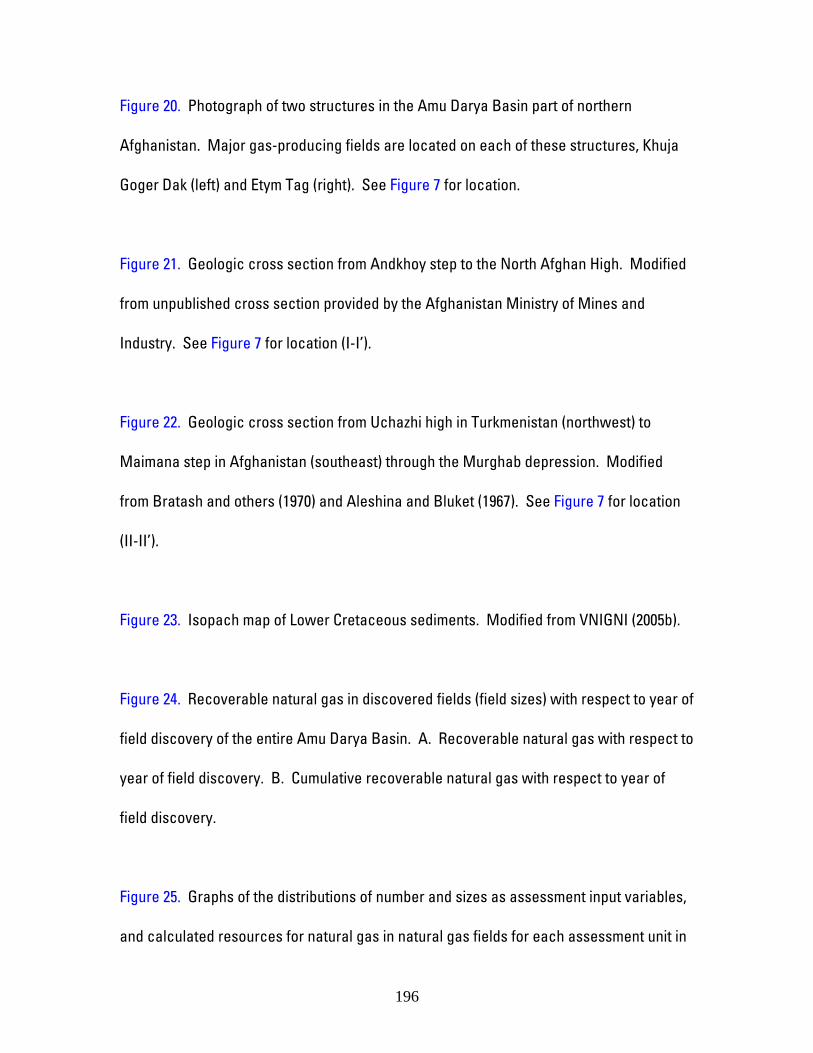
Figure 20. Photograph of two structures in the Amu Darya Basin part of northern
Afghanistan. Major gas-producing fields are located on each of these structures, Khuja
Goger Dak (left) and Etym Tag (right). See Figure 7 for location.
Figure 21. Geologic cross section from Andkhoy step to the North Afghan High. Modified
from unpublished cross section provided by the Afghanistan Ministry of Mines and
Industry. See Figure 7 for location (I-I’).
Figure 22. Geologic cross section from Uchazhi high in Turkmenistan (northwest) to
Maimana step in Afghanistan (southeast) through the Murghab depression. Modified
from Bratash and others (1970) and Aleshina and Bluket (1967). See Figure 7 for location
(II-II’).
Figure 23. Isopach map of Lower Cretaceous sediments. Modified from VNIGNI (2005b).
Figure 24. Recoverable natural gas in discovered fields (field sizes) with respect to year of
field discovery of the entire Amu Darya Basin. A. Recoverable natural gas with respect to
year of field discovery. B. Cumulative recoverable natural gas with respect to year of
field discovery.
Figure 25. Graphs of the distributions of number and sizes as assessment input variables,
and calculated resources for natural gas in natural gas fields for each assessment unit in
196
the Amu Darya part of northern Afghanistan. The mean values of the forecast
distributions are given in the upper right corners of the graphs.
Figure 26. Graphs of the distributions of number and sizes input variables, and calculated
resources for crude oil in crude oil fields for the Afghanistan Jurassic Evaporite Basin
Margin Assessment Unit in the Amu Darya part of northern Afghanistan. The mean value
of the forecast distribution is given in the upper right corner of the graph.
Figure 27. Graphs of the distributions of number and sizes input variables, and calculated
resources for natural gas in natural gas fields for the Afghanistan Kushka Zone
Assessment Unit in the Amu Darya part of northern Afghanistan. The mean value of the
forecast distribution is given in the upper right corner of the graph.
Figure 28. Geologic cross section from the North Afghan High (south, left) to the Amu
Darya River in the Afghan-Tajik Basin. Modified from Bratash and others (1970). See
Figure 7 for location (III-III’).
Figure 29. Graphs of the distributions of number and sizes input variables, and calculated
resources for natural gas in natural gas fields for each of the subsalt assessment units in
the Afghan-Tajik part of northern Afghanistan. The mean values of the forecast
distributions are given in the upper right corners of the graphs.
197

Figure 30. Structure contour map of the top of the Ghory suite (Bukhara series) in
northern Afghanistan. Modifed from Ivanov and Didura (1978).
Figure 31. Photograph of Mohammed Jandager or Bardakh structure in the Afghan-Tajik
Basin part of northern Afghanistan.
Figure 32. Geologic cross sections through the analog Middle Caspian, Foldbelt-Foothill
Assessment Unit. A. The Terek-Sunzha thrust belt is in the western part of the
assessment unit, has a salt detachment surface, and is where most of the oil
accumulations exist. B. The Dagestan thrust belt has a mudstone detachment surface
and is in the eastern part of the North Caucasus assessment unit. From Ulmishek (2001).
Figure 33. Recoverable crude oil in discovered fields (field sizes) with respect to year of
field discovery of the Middle Caspian, Foldbelt-Foothill Assessment Unit. A. Recoverable
crude oil with respect to year of field discovery. B. Cumulative recoverable crude oil with
respect to year of field discovery.
Figure 34. Graphs of the distributions of number and sizes input variables, and calculated
resources for crude oil in crude oil fields for each of the suprasalt assessment units in the
Afghan-Tajik part of northern Afghanistan. The mean values of the forecast distributions
are given in the upper right corners of the graphs.
198
Figure 35. Graphs of the distributions of number and sizes input variables, and calculated
resources for natural gas in natural gas fields for each of the suprasalt assessment units
in the Afghan-Tajik part of northern Afghanistan. The mean values of the forecast
distributions are given in the upper right corners of the graphs.
199
Appendicies
1. Assessment input forms
2. Assessment results reports
3. Description of assessment methodology
4. One page geologic summaries
5. Seismic survey report
200
APPENDIX 1
Assessment input forms
201
APPENDIX 2
Assessment results reports
202

APPENDIX 3
Description of assessment methodology
203

UNDISCOVERED PETROLEUM RESOURCES
USGS Methodology for the Assessment of Undiscovered Technically Recoverable
Conventional Petroleum Resources (modified from Schmoker and Klett, 2003)
Conventional accumulations, as recognized by the USGS for purposes of resource
assessment, are defined by two key geologic characteristics: (1) they occupy limited,
discrete volumes of rock bounded by traps, seals, and down-dip water contacts, and (2)
they depend upon the buoyancy of crude oil or natural gas in water for their existence;
floating bubble-like in water. Because of these properties, conventional accumulations
are commonly assessed in terms of the sizes and numbers of discrete accumulations (for
example, individual crude oil and natural gas fields). This section describes the
fundamental concepts supporting the U.S. Geological Survey “Seventh Approximation”
model for resource assessments of conventional accumulations.
The Seventh Approximation model provides a strategy for estimating volumes of
undiscovered petroleum (crude oil, natural gas, and coproducts) having the potential to be
added to reserves in some (specified) foreseeable future time span. For purposes of this
model, undiscovered petroleum is that which is postulated from geologic knowledge and
theory to exist outside of known accumulations, and which resides in accumulations
having sizes equal to or exceeding a stated minimum volume. Undiscovered petroleum
volumes include initial accumulation sizes as they are perceived at the time of discovery,
204
as well as any reserves anticipated to be added as these discoveries are developed and
produced.
The Seventh Approximation does not attempt to predict volumes of petroleum that will
actually be discovered in a given future time span. To do so would require full knowledge
of future petroleum economics and exploration technologies, and the extent of exploration
effort that will be conducted in the area being assessed. Rather, the Seventh
Approximation is used to estimate volumes of petroleum having potential, from a geologic
standpoint, to be discovered in a specified time frame.
To begin an assessment of undiscovered conventional resources using the Seventh
Approximation, the volume of rocks to be assessed is apportioned into reasonably
homogeneous subunits. These subunits are divisions of total petroleum systems, termed
assessment units. Assessment units are considered and assessed individually.
The assessment of an area requires (1) choice of a minimum accumulation size, (2)
assignment of geologic risk, and (3) estimation of the number and sizes of undiscovered
accumulations in the assessment area. The combination of these variables yields
probability distributions for potential additions to reserves. Computer programs are used
in conjunction with the Seventh Approximation to calculate resource estimates.
However, assessment results are controlled by geology-based input parameters supplied
by knowledgeable geologists, as opposed to projections of historical trends.
205
Documentation for the World Petroleum Assessment 2000 (U.S. Geological Survey World
Energy Assessment Team, 2000) described the Seventh Approximation in considerable
detail, as well as operational procedures and practical considerations associated with its
implementation. The reader is referred to that reference for more detail than is provided
here.
The uncertainties associated with the variables required for an assessment of
undiscovered conventional resources are considerable, leading to a substantial range of
possible input values. Many of the variables that make up the set of input data are
therefore represented by probability distributions rather than by single (point) values.
Resource forecasts derived from these input data are also represented by probability
distributions.
The probability distributions for some input variables show the uncertainty of a fixed but
unknown value, whereas other probability distributions represent input variables that
have a naturally occurring range of values. F100 (minimum), mode, and F0 (maximum)
fractiles are the input parameters estimated for all variables, except size whereby the F50
(median) is recorded for the central tendency. These parameters are represented by
probability distributions. These parameters are not specifically linked to a particular type
of probability distribution (for example, lognormal). The choice of probability-distribution
type is an operational decision that is not constrained by the basic Seventh Approximation
206
assessment model. For this assessment, a truncated, shifted lognormal distribution is
used for the sizes of undiscovered accumulations, and triangular distributions are used
for all other input variables represented by probability distributions.
The essence of the assessment procedure is as follows:
(1) A minimum accumulation size (field size or pool size), expressed as barrels of oil for oil
accumulations and barrels of oil equivalent for gas accumulations, is chosen for the
assessment unit. Petroleum in accumulations expected to be smaller than the minimum
size is not considered to be a significant resource within the specified forecast span and
is excluded from the assessment.
(2) Probabilities for the occurrence of adequate charge, adequate rocks, and adequate
timing for at least one undiscovered accumulation of minimum size or greater are
assigned to the assessment unit; this defines the geologic risk.
(3) The number of undiscovered oil accumulations and the number of undiscovered gas
accumulations in the assessment unit that are greater than or equal to the minimum size
are estimated.
(4) Sizes of these undiscovered crude oil accumulations and undiscovered natural gas
accumulations are estimated. Size estimates include both the reserves estimated at the
207

time of discovery and anticipated reserve additions as accumulations are exploited after
discovery (reserve growth).
(5) For undiscovered oil accumulations, ratios of natural gas/crude oil and natural gas
liquids/natural gas are estimated. For undiscovered natural gas accumulations, the ratio
of total liquids/natural gas is estimated. These ratios are used to assess the coproducts
associated with crude oil in crude oil accumulations and with natural gas in natural gas
accumulations.
The combination of individual geologic probabilities, number of undiscovered
accumulations, sizes of undiscovered accumulations, and coproduct ratios yields
probability distributions for potential additions to reserves of crude oil, natural gas, and
coproducts in the assessment unit.
An important aspect of this assessment procedure is that historical exploration and
discovery patterns serve only as a starting point for the assessment forecast, and they are
not necessarily projected as characteristic of future exploration and development trends.
With historical data as a point of reference, input parameters can be chosen to reflect
perceived impacts of future change, such as improved technologies and newly developed
geologic concepts, as well as the recognition that the larger fields in an assessment unit
tend to be found first.
208

Four input-data elements in addition to those discussed in the previous section are
recorded at the assessment-unit level.
(1) Identification Information
Identification information includes the assessor’s name, the date of the assessment
meeting at which input data were discussed and reviewed, and the names and numerical
codes of the region, province, total petroleum system, and assessment unit. Brief notes
relevant to the assessment can also be recorded.
(2) Characteristics of Assessment Unit
These input data, although not essential elements of the assessment model, provide
information that is useful for the resource-assessment process.
Classification of the assessment unit as crude oil prone or natural gas prone, based on the
criteria that the overall natural gas/crude oil ratio of an crude oil-prone assessment unit is
less than 20,000 cubic feet of natural gas/barrel of crude oil, and that of a natural gas-
prone assessment unit is greater than or equal to 20,000 cubic feet of natural gas/barrel of
crude oil.
209

Number of discovered crude oil accumulations and natural gas accumulations of
minimum size or larger, and the median sizes of three sub-groups of these accumulations
– the first-third discovered, the second-third discovered, and the third-third discovered (or
first-half and second-half discovered if the number of fields is small).
A classification of the exploration maturity of the assessment unit – as established,
frontier, or hypothetical – is also made, based on the number of discoveries equal to or
exceeding minimum size. Established (>13 accumulations discovered) and frontier (1-13
accumulations discovered) assessment units are known to have all the geologic elements
necessary for at least one petroleum accumulation of minimum size. Additionally,
established assessment units have a sufficient number of discovered accumulations for
historic field- or pool-level data to be of help in postulating properties of undiscovered
accumulations. Hypothetical assessment units have no discovered accumulations, and
their assessment is therefore more speculative than for established and frontier
assessment units.
(3) Selected Ancillary Data for Undiscovered Accumulations
These data establish a modest set of information useful for economic and environmental
analyses of assessment results. They do not contribute directly to assessment
calculations. Ancillary data for undiscovered conventional crude oil accumulations are
estimates of API gravity of crude oil, sulfur content of crude oil, drilling depth, and water
210
depth (if applicable). Ancillary data for undiscovered conventional natural gas
accumulations are estimates of inert-gas content, carbon dioxide content, hydrogen
sulfide content, drilling depth, and water depth (if applicable).
(4) Allocations of Assessed Undiscovered Resources
These input data consist of percentages necessary to allocate assessed undiscovered
conventional resources to various land entities of interest within the assessment unit, as
well as to the offshore portion of each entity, if applicable. Such land entities could
include, for example, surface and mineral ownerships, special use categories of state and
federal lands, or ecological zones.
Undiscovered petroleum resources estimated for assessment units can be aggregated to
total petroleum systems, geologic provinces, and regions. If the assessment units or
other areas are assumed to be dependent, that is having a +1 correlation coefficient, the
fractiles of the calculated resources may be added to provide the probabilistic estimates
of the petroleum resources of northern Afghanistan. In addition, aggregation assuming
dependency maintains a broader uncertainty range.
211

APPENDIX 4
One page geologic summaries
212
USGS PROVINCE: Amu Darya Basin (1154)
GEOLOGISTS: T.R. Klett and G.F. Ulmishek
TOTAL PETROLEUM SYSTEM: Amu Darya Jurassic-Cretaceous (115401)
ASSESSMENT UNIT: Afghanistan Jurassic Evaporite Basin Subsalt Carbonates
(11540105)
DESCRIPTION: Assessment unit encompasses Jurassic rocks of the basin area in
boundaries of the Gaurdak salt formation (Kimmeridgian to Tithonian). Known fields are
located dominantly in northern areas of the assessment unit; the rest of its area is mostly
undrilled. The assessment unit is characterized by the presence of the regional salt seal
that generally prevents vertical migration of hydrocarbons into post-Jurassic rocks. As a
result, most fields contain pools only in Upper Jurassic (Callovian to Oxfordian)
carbonates beneath the salt. Several natural gas fields discovered to date in northern
Afghanistan are in this assessment unit.
SOURCE ROCKS: The principal source rocks are Lower to Middle Jurassic coaly
continental to marine clastics and coals and Upper Jurassic (primarily Oxfordian) anoxic
basinal black mudstone. The source rock section is thin on marginal highs, but thickens
to several hundred meters basinward. Both source rocks are separated from Cretaceous
213

reservoirs by a regional, undeformed salt seal. The clastic rocks contain from several
tenths to as much as 2.5 weight percent of total organic carbon with Type III kerogen and
thin coals. Upper Jurassic basinal black mudstone (Khodzhaipak Formation) has not been
penetrated by wells in Afghanistan but is known from paleogeographically similar areas in
adjacent Uzbekistan where it is a few tens of meters thick and contains as much as 15
weight percent total organic carbon and type II kerogen.
MATURATION: Both Jurassic source rock suites are in the gas window and are at high
stages of maturity.
RESERVOIR ROCKS: The main reservoir rocks are Upper Jurassic (Callovian to
Oxfordian) carbonates that probably include barrier and pinnacle reef facies.
TRAPS: All known fields are in structural traps. Undiscovered fields are expected in
structural traps, in reefs, or combination of the two.
SEALS: The principal regional seal is the Kimmeridgian to Tithonian Gaurdak Formation
composed of salt and anhydrite with local carbonate beds.
REFERENCES:
214
Akramkhodzhaev, A.M., and Egamberdyev, M.E., 1981, Main oil- and gas-generative
rocks of the Upper Jurassic carbonate formation of western and southern
Uzbekistan: Uzbekskiy Geologicheskiy Zhurnal, no. 5, p. 47-56.
Bratash, V.I, Yegupov, S.V., Pechnikov, V.V., and Shelomentsev, A.I., 1970, Geologiya
i neftegazonosnost severa Afganistana (Geology and petroleum potential of
northern Afghanistan), Trudy VNIGNI, v. 80, Nedra, Moscow, 288 p.
Brookfield, M.E., and Hashmat, A., 2001, The geology and petroleum potential of the
North Afghan platform and adjacent areas (northern Afghanistan, with parts of
southern Turkmenistan, Uzebekistan and Tajikistan): Earth-Science Reviews, v.
55, p. 41-71.
Kingston, J., and Clarke, J.W., 1995, Petroleum geology and resources of Afghanistan:
International Geology Review, v. 37, p. 111-127.
Seradji, R., 1993, Tectonic and thermobarometric conditions of separate generation of oil
and gas deposits in North Afghanistan: Moscow University Geology Bulletin, v.
48, no. 2, p. 62-65 (Vestnik Moskovskogo Universiteta).
Ulmishek, G.F., 2004, Petroleum geology and resources of the Amu-Darya Basin,
Turkmenistan, Uzbekistan, Afghanistan, and Iran: U.S. Geological Survey
Bulletin 2201-H, 84 p.
215
USGS PROVINCE: Amu Darya Basin (1154)
GEOLOGISTS: T.R. Klett and G.F. Ulmishek
TOTAL PETROLEUM SYSTEM: Amu Darya Jurassic-Cretaceous (115401)
ASSESSMENT UNIT: Afghanistan Jurassic Evaporite Basin Suprasalt Anticlines
(11540106)
DESCRIPTION: Assessment unit encompasses Cretaceous and younger rocks of the
basin area in boundaries of the underlying Upper Jurassic evaporite formation. A regional
salt seal between Jurassic source rocks and potential Cretaceous reservoirs hampers
vertical migration of hydrocarbons. No hydrocarbon accumulations have been
discovered in this assessment unit, and potential for finding gas accumulations is related
to migration through windows in the salt.
SOURCE ROCKS: The principal source rocks are Lower to Middle Jurassic coaly
continental to marine clastics and coals and Upper Jurassic (primarily Oxfordian) anoxic
basinal black mudstone. The contribution from possible organic-lean Cretaceous source
rocks is minimal, if any. The precise mechanism of migration from the source to the
reservoirs is not clear. A possible model, known from the giant Dauletabad-Donmez field
in adjacent Turkmenistan, includes vertical migration beyond the pinch-out boundary of
216

the salt formation and following lateral migration basinward to traps. The existence of
windows in salt, which are suitable for vertical migration, in the salt-dome area along the
Repetek-Kelif fault is also possible.
MATURATION: Both Jurassic source rocks are in the gas window and have resided in
the high maturity zone since at least Late Cretaceous time.
RESERVOIR ROCKS: Principal reservoir rocks are sandstone of the Hauterivian
Qezeltash Formation (also spelled Kyzyltash; stratigraphically equivalent to the Shatlyk
Formation of Turkmenistan), but other Cretaceous reservoir rocks are also present.
TRAPS: Accumulations will most likely be found in structural traps.
SEALS: The Qezeltash Formation reservoirs are sealed by an extensive Barremian to
Aptian mudstone. Intraformational mudstone beds may seal gas pools in other reservoirs.
REFERENCES:
Bratash, V.I, Yegupov, S.V., Pechnikov, V.V., and Shelomentsev, A.I., 1970, Geologiya
i neftegazonosnost severa Afganistana (Geology and petroleum potential of
northern Afghanistan), Trudy VNIGNI, v. 80, Nedra, Moscow, 288 p.
Brookfield, M.E., and Hashmat, A., 2001, The geology and petroleum potential of the
North Afghan platform and adjacent areas (northern Afghanistan, with parts of
217
southern Turkmenistan, Uzebekistan and Tajikistan): Earth-Science Reviews, v.
55, p. 41-71.
Kingston, J., and Clarke, J.W., 1995, Petroleum geology and resources of Afghanistan:
International Geology Review, v. 37, p. 111-127.
Seradji, R., 1993, Tectonic and thermobarometric conditions of separate generation of oil
and gas deposits in North Afghanistan: Moscow University Geology Bulletin, v.
48, no. 2, p. 62-65 (Vestnik Moskovskogo Universiteta. Geologiya, UDC
551.761).
Ulmishek, G.F., 2004, Petroleum geology and resources of the Amu-Darya Basin,
Turkmenistan, Uzbekistan, Afghanistan, and Iran: U.S. Geological Survey
Bulletin 2201-H, 84 p.
218

USGS PROVINCE: Amu Darya Basin (1154)
GEOLOGISTS: T.R. Klett and G.F. Ulmishek
TOTAL PETROLEUM SYSTEM: Amu Darya Jurassic-Cretaceous (115401)
ASSESSMENT UNIT: Afghanistan Jurassic Evaporite Basin Margin (11540107)
DESCRIPTION: Assessment unit consists of Jurassic through Cenozoic rocks along
major structural highs located south and east of the pinch-out zone of Upper Jurassic salt.
The structural highs include the Akhchin step, Andkhoy high, Maimana step and smaller
adjacent structures. Many of the gas and all oil fields discovered to date in northern
Afghanistan are in this assessment unit.
SOURCE ROCKS: The principal source rocks are Lower to Middle Jurassic coaly
continental to marine clastics and coals and Upper Jurassic (primarily Oxfordian) anoxic
basinal black mudstone. The source rock section is thin or absent on marginal highs, but
thickens to several hundred meters basinward. Hydrocarbon contribution from Lower
Cretaceous organic-lean mudstones, if any, is minimal. Apparently, hydrocarbon
accumulations were formed by updip lateral migration to traps from Jurassic source
rocks that occur in depressions adjacent to this assessment unit.
219
MATURATION: In the depressions adjacent to this assessment unit, both Jurassic
source rocks are in the gas window and have resided in the high maturity zone since at
least Late Cretaceous time.
RESERVOIR ROCKS: The Hauterivian Qezeltash Formation sandstone (also spelled
Kyzyltash; stratigraphically equivalent to the Shatlyk Formation of Turkmenistan), several
tens of meters thick, contains most of the oil and gas reserves. The gas contains little or
no sulfur. The sandstone has high porosity and permeability. The second important
reservoir rock interval is Upper Jurassic (Callovian to Oxfordian) shallow-shelf carbonates
that contain sour gas. Other Cretaceous reservoir rocks are of secondary importance.
TRAPS AND SEALS: Most of discovered productive traps are anticlinal uplifts.
Structural traps are expected to contain the majority of resources. Pinch-out zones of
Jurassic and lower Neocomian clastics and carbonates on the northern slope of the
Maimana Step may contain stratigraphic and combination traps.
REFERENCES:
Bratash, V.I, Yegupov, S.V., Pechnikov, V.V., and Shelomentsev, A.I., 1970, Geologiya
i neftegazonosnost severa Afganistana (Geology and petroleum potential of
northern Afghanistan), Trudy VNIGNI, v. 80, Nedra, Moscow, 288 p.
Brookfield, M.E., and Hashmat, A., 2001, The geology and petroleum potential of the
North Afghan platform and adjacent areas (northern Afghanistan, with parts of
220

southern Turkmenistan, Uzebekistan and Tajikistan): Earth-Science Reviews, v.
55, p. 41-71.
Kingston, J., and Clarke, J.W., 1995, Petroleum geology and resources of Afghanistan:
International Geology Review, v. 37, p. 111-127.
Kravchenko, K.N., and Ivanova, O.V., 1997, Potential of oil and gas exploration in the
Khodzhagugirdob field (Maimana step): Oil and gas of Turkmenistan, no.3(7), p.
30-58.
Seradji, R., 1993, Tectonic and thermobarometric conditions of separate generation of oil
and gas deposits in North Afghanistan: Moscow University Geology Bulletin, v.
48, no. 2, p. 62-65 (Vestnik Moskovskogo Universiteta. Geologiya, UDC
551.761).
Ulmishek, G.F., 2004, Petroleum geology and resources of the Amu-Darya Basin,
Turkmenistan, Uzbekistan, Afghanistan, and Iran: U.S. Geological Survey
Bulletin 2201-H, 84 p.
221

USGS PROVINCE: Amu Darya Basin (1154)
GEOLOGISTS: T.R. Klett and G.F. Ulmishek
TOTAL PETROLEUM SYSTEM: Kalaimor-Kaisar Jurassic (115402)
ASSESSMENT UNIT: Afghanistan Kushka Zone (11540201)
DESCRIPTION: Assessment unit encompasses the Kalaimor-Kaisar, Nurbelek, and
Kalarin depressions and separating uplifts forming the western plunge of Bandi-
Turkestan. A fault bounding the Dzhikdalek anticline on the south marks the boundary
with the Maimana High. In the north, the assessment unit extends to the state boundary
of Afghanistan. The Bandigandao Ridge provides the eastern boundary, and the Siakh-
Bubak and Siad-Koh ranges bound the southern edge of the zone.
SOURCE ROCKS: The principal source rocks are probably Lower to Middle Jurassic
continental to marine coaly clastics (total organic carbon content as high as 2.5 weight
percent) with some coal beds in the lower part. The source rocks are largely gas-prone.
MATURATION: Lower to Middle Jurassic source rocks are buried to depths of about 3
kilometers on the anticlinal uplifts and significantly deeper in depressions filled with thick
Neogene to Quaternary rocks and are considered mature for natural gas generation.
222
RESERVOIR ROCKS: Reservoir rocks in drilled fields of Turkmenistan that are close to
the country boundary are present in the section from the upper part of the Middle
Jurassic to the Maastrichtian (Ghory Formation). The Ghory reservoirs are composed of
carbonate rocks; other reservoir rocks are clastics.
TRAPS AND SEALS: All discovered productive traps in Turkmenistan are anticlinal
uplifts. New discoveries are expected in undrilled anticlines and, possibly in the pinch-
out zone of Lower to Middle Jurassic clastics along the boundary of the assessment unit
with the Maimana Step.
REFERENCES:
Bratash, V.I, Yegupov, S.V., Pechnikov, V.V., and Shelomentsev, A.I., 1970, Geologiya
i neftegazonosnost severa Afganistana (Geology and petroleum potential of
northern Afghanistan), Trudy VNIGNI, v. 80, Nedra, Moscow, 288 p.
Brookfield, M.E., and Hashmat, A., 2001, The geology and petroleum potential of the
North Afghan platform and adjacent areas (northern Afghanistan, with parts of
southern Turkmenistan, Uzebekistan and Tajikistan): Earth-Science Reviews, v.
55, p. 41-71.
Kingston, J., and Clarke, J.W., 1995, Petroleum geology and resources of Afghanistan:
International Geology Review, v. 37, p. 111-127.
223
Melikhov, V.N., Babaev, K.Kh., Abdyllaev, E.Kh., Sibirev, V.S., and Bliskavka, A.G., 1997,
Analysis of the present state and directions of exploration for oil and gas in the
Badkhyz-Karabil region: Oil and gas of Turkmenistan, no. 3(7), p. 2-10.
Ulmishek, G.F., 2004, Petroleum geology and resources of the Amu-Darya Basin,
Turkmenistan, Uzbekistan, Afghanistan, and Iran: U.S. Geological Survey
Bulletin 2201-H, 84 p.
224
USGS PROVINCE: Afghan-Tajik Basin (1154)
GEOLOGISTS: T.R. Klett and G.F. Ulmishek
TOTAL PETROLEUM SYSTEM: Afghan-Tajik Jurassic (115601)
ASSESSMENT UNIT: Afghanistan Subsalt Oxfordian Shelf (11560101)
DESCRIPTION: Assessment unit encompasses an area in the Afghanistan portion of the
Afghan-Tajik Basin to cover an undelineated Late Jurassic (Oxfordian) shelf. Assessment
unit is defined to separate reservoir rocks deposited on the shelf having a high probability
of hydrocarbon accumulations from basin rocks having a low probability. The assessment
unit includes subsalt Jurassic rocks, which occur in the autochthon below detached and
folded Cretaceous and Cenozoic rocks.
SOURCE ROCKS: The principal source rocks are Lower to Middle Jurassic coaly
continental to marine clastics and coals and Upper Jurassic (primarily Oxfordian) anoxic
basinal black mudstone.
MATURATION: Both Jurassic source rocks are in the gas window and have resided in
the high maturity zone since at least Late Cretaceous time. The source rocks are buried
to depths of 2 to 3.5 kilometers on the uplifted structural steps along the basin margins
225
and probably as deep as 12 kilometers in the basin center by allochthonous thrust sheets
and thick Neogene to Quaternary fill.
RESERVOIR ROCKS: Possible reservoir rocks include Jurassic carbonates near the
margin of the basin and possibly some Upper Jurassic clastic rocks. Reservoir quality of
these carbonates deteriorates basinward, the carbonate rocks becoming more
argillaceous. Based on data from adjacent areas, Lower to Middle Jurassic clastics lose
the reservoir quality at depths greater than 3 to 3.5 km due to compaction and diagenesis.
Three small fields in the Dushanbe area of Tajikistan produce Jurassic gas from Tithonian
reservoirs, but reservoir quality decreases basinward because of increasing burial depth.
TRAPS AND SEALS: Possible traps include subsalt anticlinal uplifts and the pinch-out
zone of Jurassic clastics along the basin margin. Upper Jurassic evaporites provide a
regional seal.
REFERENCES:
Bratash, V.I, Yegupov, S.V., Pechnikov, V.V., and Shelomentsev, A.I., 1970, Geologiya
i neftegazonosnost severa Afganistana (Geology and petroleum potential of
northern Afghanistan), Trudy VNIGNI, v. 80, Nedra, Moscow, 288 p.
Brookfield, M.E., and Hashmat, A., 2001, The geology and petroleum potential of the
North Afghan platform and adjacent areas (northern Afghanistan, with parts of
226
southern Turkmenistan, Uzebekistan and Tajikistan): Earth-Science Reviews, v.
55, p. 41-71.
Kingston, J., and Clarke, J.W., 1995, Petroleum geology and resources of Afghanistan:
International Geology Review, v. 37, p. 111-127.
227

USGS PROVINCE: Afghan-Tajik Basin (1154)
GEOLOGISTS: T.R. Klett and G.F. Ulmishek
TOTAL PETROLEUM SYSTEM: Afghan-Tajik Jurassic (115601)
ASSESSMENT UNIT: Afghanistan Subsalt Basinal Facies (11560102)
DESCRIPTION: Assessment unit encompasses an area in the Afghanistan portion of the
Afghan-Tajik Basin and covers an undelineated Late Jurassic basin. Assessment unit is
defined to separate reservoir rocks deposited on the shelf having a high probability of
hydrocarbon accumulations from basin rocks having a low probability. The assessment
unit includes subsalt Jurassic rocks, which occur in the autochthon below detached and
folded Cretaceous and Cenozoic rocks.
SOURCE ROCKS: The principal source rocks are Lower to Middle Jurassic coaly
continental to marine clastics and coals and Upper Jurassic (primarily Oxfordian) anoxic
basinal black mudstone.
MATURATION: Both Jurassic source rocks are in the gas window and have resided in
the high maturity zone since at least Late Cretaceous time. The source rocks are buried
to depths of 2 to 3.5 kilometers on the uplifted structural steps along the basin margins
228
and are probably as deep as 12 kilometers in the basin center covered by allochthonous
thrust sheets and thick Neogene to Quaternary fill.
RESERVOIR ROCKS: Low possibility of reservoir rocks with adequate reservoir quality
exists in this assessment unit, but would include Jurassic carbonates and possibly some
Upper Jurassic clastic rocks. Reservoir quality of the carbonates deteriorates basinward,
becoming more argillaceous, and Lower to Middle Jurassic clastics loose the reservoir
quality at depths greater than 3 to 3.5 km due to compaction and diagenesis.
TRAPS AND SEALS: Possible traps include subsalt anticlinal uplifts. Upper Jurassic
evaporites provide a regional seal.
REFERENCES:
Bratash, V.I, Yegupov, S.V., Pechnikov, V.V., and Shelomentsev, A.I., 1970, Geologiya
i neftegazonosnost severa Afganistana (Geology and petroleum potential of
northern Afghanistan), Trudy VNIGNI, v. 80, Nedra, Moscow, 288 p.
Brookfield, M.E., and Hashmat, A., 2001, The geology and petroleum potential of the
North Afghan platform and adjacent areas (northern Afghanistan, with parts of
southern Turkmenistan, Uzebekistan and Tajikistan): Earth-Science Reviews, v.
55, p. 41-71.
Kingston, J., and Clarke, J.W., 1995, Petroleum geology and resources of Afghanistan:
International Geology Review, v. 37, p. 111-127.
229
USGS PROVINCE: Afghan-Tajik Basin (1154)
GEOLOGISTS: T.R. Klett and G.F. Ulmishek
TOTAL PETROLEUM SYSTEM: Afghan-Tajik Paleogene (115602)
ASSESSMENT UNIT: Afghanistan Western Suprasalt Gentle Folds (11560201)
DESCRIPTION: Assessment unit encompasses Cretaceous and Cenozoic rocks of the
area where Neogene to Quaternary deformation was not as intense as in areas farther
east. The area coincides with a structural step indicated by gravimetric surveys. The
area extends from the eastern edge of the southwest Gissar spur meganticline to the
western edge of intensive Neogene to Quaternary folding within the Surkhan
synclinorium. The southern boundary is along the Alburz-Marmul fault zone.
SOURCE ROCKS: The principal source rock is organic rich mudstone of the Eocene
Suzak beds. Total organic carbon content in thin (0.5 to 2 meters) bituminous beds of
neighboring Tajikistan is typically 11 to 19 weight percent, but up to 48 weight percent. In
other lower Suzak rocks of both Afghanistan and Tajikistan, the total organic carbon
content ranges from 0.5 to 3.5 weight percent. The organic matter is type II kerogen.
230

MATURATION: In synclines, the Suzak source rocks were in the oil window during
Neogene time. The source rocks are buried by a thick fill of Neogene to Quaternary
orogenic clastics.
RESERVOIR ROCKS: The primary potential reservoir rock is the Upper Cretaceous to
Paleogene Ghory carbonates. Paleogene and Neogene clastic reservoirs are probably of
secondary importance.
TRAPS AND SEALS: Possible primary traps are anticlines and faults associated with
anticlines. Seal rocks include Suzak mudstone and intraformational Paleogene and
Neogene mudstone.
REFERENCES:
Bratash, V.I, Yegupov, S.V., Pechnikov, V.V., and Shelomentsev, A.I., 1970, Geologiya
i neftegazonosnost severa Afganistana (Geology and petroleum potential of
northern Afghanistan), Trudy VNIGNI, v. 80, Nedra, Moscow, 288 p.
Buzurukov, D.D., Kreydenkov, G.P., Safranov, T.A., Davidzon, R.M., Oleynik, V.V., Gotgilf,
A.V., Markov, A.B., and Mamadzhanov, Kh.M., 1978, Petroleum potential of Paleogene
rocks of the Tajik depression (Neftegazonosnost paleogenovykh otlozheniy
Tadzhikskoy depressii): Dushanbe, Donish, 189 p.
Minakova, N.E., Sotiriadi, K.A., Egamberdyev, M., Nasretdinov, Z.Z., Khikmatullaev, B.S.,
and Talipov, S., 1974, Lithology, stratigraphy, geochemistry, and petroleum productivity of
231

Paleogene rocks of the Surkhandarya depression (Litologiya, stratigrafiya,
geokhimiya i neftegazonosnost paleogenovykh otlozheniy Surkhandarinskoy vpadiny):
Tashkent, Fan, 153 p.
232

USGS PROVINCE: Afghan-Tajik Basin (1154)
GEOLOGISTS: T.R. Klett and G.F. Ulmishek
TOTAL PETROLEUM SYSTEM: Afghan-Tajik Paleogene (115602)
ASSESSMENT UNIT: Afghanistan Eastern Suprasalt Thrusts and Folds (11560202)
DESCRIPTION: Assessment unit encompasses Cretaceous and Cenozoic rocks of an
area of intensive Neogene to Quaternary folding from anticlinal ridges of the eastern
Surkhan synclinorium to the Hindu Kush and Badakhshan ranges in the east. The
southern boundary is along the Alburz-Marmul fault zone.
SOURCE ROCKS: The principal source rock is organic rich mudstone of the Eocene
Suzak beds. Total organic carbon content in thin (0.5 to 2 meters) bituminous beds of
neighboring Tajikistan is typically 11 to 19 weight percent, but up to 48 weight percent. In
other lower Suzak rocks of both Afghanistan and Tajikistan, the total organic carbon
content ranges from 0.5 to 3.5 weight percent. The organic matter is type II kerogen.
MATURATION: In synclines, the Suzak source rock was buried to within the oil window
during Neogene time. The source rocks are buried by thick Neogene to Quaternary
clastics and by thrust sheets of Cretaceous and Cenozoic rocks.
233
RESERVOIR ROCKS: The primary potential reservoir rock is the Upper Cretaceous to
Paleogene Ghory carbonates. Paleogene and Neogene clastic reservoirs are probably of
secondary importance. Cretaceous reservoir rocks may have potential only in structural
positions where they could be charged by Eocene Suzak source rocks. Migration of gas
from the underlying subsalt Jurassic petroleum system is locally possible.
TRAPS AND SEALS: Possible primary traps are anticlines and faults associated with
anticlines. Seal rocks include Suzak mudstone and intraformational Paleogene and
Neogene mudstone. Many anticlines in the upper thrust sheets are deeply eroded, and
conditions for preservation of hydrocarbons are poor. Structural traps in synclines and
lower thrust sheets have better potential.
REFERENCES:
Bratash, V.I, Yegupov, S.V., Pechnikov, V.V., and Shelomentsev, A.I., 1970, Geologiya
i neftegazonosnost severa Afganistana (Geology and petroleum potential of
northern Afghanistan), Trudy VNIGNI, v. 80, Nedra, Moscow, 288 p.
Buzurukov, D.D., Kreydenkov, G.P., Safranov, T.A., Davidzon, R.M., Oleynik, V.V., Gotgilf,
A.V., Markov, A.B., and Mamadzhanov, Kh.M., 1978, Petroleum potential of Paleogene
rocks of the Tajik depression (Neftegazonosnost paleogenovykh otlozheniy
Tadzhikskoy depressii): Dushanbe, Donish, 189 p.
234
APPENDIX 5
Seismic survey report
235
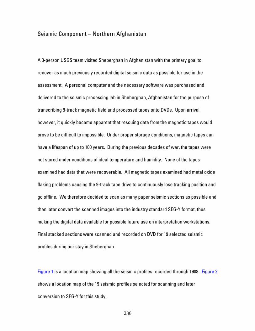
Seismic Component – Northern Afghanistan
A 3-person USGS team visited Sheberghan in Afghanistan with the primary goal to
recover as much previously recorded digital seismic data as possible for use in the
assessment. A personal computer and the necessary software was purchased and
delivered to the seismic processing lab in Sheberghan, Afghanistan for the purpose of
transcribing 9-track magnetic field and processed tapes onto DVDs. Upon arrival
however, it quickly became apparent that rescuing data from the magnetic tapes would
prove to be difficult to impossible. Under proper storage conditions, magnetic tapes can
have a lifespan of up to 100 years. During the previous decades of war, the tapes were
not stored under conditions of ideal temperature and humidity. None of the tapes
examined had data that were recoverable. All magnetic tapes examined had metal oxide
flaking problems causing the 9-track tape drive to continuously lose tracking position and
go offline. We therefore decided to scan as many paper seismic sections as possible and
then later convert the scanned images into the industry standard SEG-Y format, thus
making the digital data available for possible future use on interpretation workstations.
Final stacked sections were scanned and recorded on DVD for 19 selected seismic
profiles during our stay in Sheberghan.
Figure 1 is a location map showing all the seismic profiles recorded through 1988. Figure 2
shows a location map of the 19 seismic profiles selected for scanning and later
conversion to SEG-Y for this study.
236

Many of the 19 profiles were selected on the basis that they were recorded over major
geologic structures and existing gas fields (fig. 3). The remaining profiles were selected
primarily because they were most readily available at the time. Shown in Figures 4
through 6 are three representative seismic profiles recorded over the Jangali Kalan gas
field depicted in Figure 3 as profiles A-A’, B-B’, and C-C’. As can be seen from these
images, the data quality is not sufficient for high-resolution stratigraphic interpretation,
but the quality suffices to allow delineation of gross geologic structures. Future work in
northern Afghanistan should entail the acquisition of modern, multi-channel, higher
resolution seismic data with particular emphasis on the Afghan-Tajik Basin as most if not
all of the seismic data in northern Afghanistan has been previously recorded in the Amu
Darya Basin.
Figure 1. Seismic lines recorded in northern Afghanistan through 1988.
Figure 2. Highlighted in red seismic profiles scanned and converted to SEG-Y format.
Figure 3. Selected seismic profiles recorded over geologic structures (pink) and known
gas fields (orange).
Figure 4. Profile 88335 recorded over the Jangali Kalan gas field in northern Afghanistan.
Figure 5. Profile 88329 recorded over the Jangali Kalan gas field in northern Afghanistan.
Figure 6. Profile 85102 recorded over the Jangali Kalan gas field in northern Afghanistan.
237