penn state department of geography spring 2013 newsletter
DESCRIPTION
News and information from the Department of Geography at Penn StateTRANSCRIPT

Vol. 12, Issue 1 • Spring 2013
physical nature/society gisciences human
GRAPHYGE

“Boundaries and networks” are so important as to be one of a quartet of cross-cutting themes mapping the department’s primary vision of who we are and what we do in teaching, learning, and research. We define boundaries and networks broadly to include borderlands and crosscutting connections in familiar yet multi-faceted examples. While many boundaries and networks are concretely material, others are imposed mentally, whether in geographic space per se or in a broad metaphorical sense. Such wide-ranging ideas of boundaries and networks are found throughout geographic teaching and research. Applications abound in each of the department’s four core sub-fields. If not for the obvious centrality to geography our embracing of boundaries and networks might seem to introduce a quandary. Large numbers of boundaries and networks of both material and metaphorical kinds can be unjustly drawn and imposed. Such delimitations require and in many cases already receive our efforts to abolish or make them more just, humane, and transparent. Many other boundaries and networks are ones that we could not live without. Critical sustaining functions of all sorts depend on them to such high degrees that they’re sometimes taken for granted (e.g., cell walls within our bodies). Still other boundaries and networks stem from conventions of various sorts, many in our daily lives. When we cross such conventional boundaries it often reveals a type of tie, similar to how cross-cutting interdisciplinarity in teaching and research hinges on the individual disciplines.
Several features of this newsletter issue touch on boundaries and networks. • Probably most noticeably you’ll see news of the upcoming annual no)Boundaries graduate student conference that is scheduled for March 23, 2013. As usual, all are invited and welcome, and encouraged to attend this stimulating, well-organized, and purposefully boundary-transcending event. • Then there’s the department’s undergraduate students who are crossing several boundaries and networks as they commence fresh paths and possibilities following graduation. Our up-and-running alumni Affiliate Program Group (APG), has launched a new initiative that includes mentoring and networking with undergraduate students in preparation for these crossings. • The cover photo, taken at a Bolivian research site, shows still another kind of boundary, one at the field-level that is within a globally important land-use system. My teaching and research on the geographic dynamics of food and agriculture, including global hotspots, illustrates the boundaries and networks of changing landscapes and livelihoods. On the whole, boundaries and networks of all types are compellingly complex geographic phenomena. Boundary-crossing and network-building are always ongoing. In many cases we find that we find that we bring big parts of experience across boundaries into new spaces and through the networks connecting them. This spring the new graduates will be doing just that. All the best to these Penn State geographers who will be crossing beyond familiar boundaries while keeping and building many of their networks here.
F R O M T H E D E P A R T M E N T H E A D
ABOUTThis newsletter is a publication of the
Department of Geography in the College of Earth and Mineral Sciences at
Penn State.
Contact us at:Department of Geography
302 Walker BuildingPenn State University
University Park, PA 16802Phone: 814-865-3433
Fax: 814-863-7943URL: www.geog.psu.edu
E-mail: [email protected]
Design/editor content: Angela Rogers
Additional editors: Jodi Vender,
Karl ZimmererU Ed. EMS 13-57
This publication is available in alternative media. Penn State is committed to af-
firmative action, equal opportunity, and the diversity of its work force.
COVER PHOTOField photo showing adjacent parcels
of high-agrobiodiversity Andean maize (left) and intensive peach production
(right). Combined field survey, sampling, and GIS-remote sensing analysis is
providing new insights into balancing the combination of these bounded field
systems. See summary of new PNAS research article on page 12.
Photo credit: Karl Zimmerer.
InsIdEUpcoming Events ... 3
Undergraduate Student Spotlight ... 4no)Boundaries ... 6Graduate News ... 7
Q&A with Christopher Fowler ... 8Alumnus Profile: Brendan Wesdock ... 10
Research Article Summary ... 12Community Updates ...13
Philanthropy ... 16
2
Boundaries and networks in geography and beyond
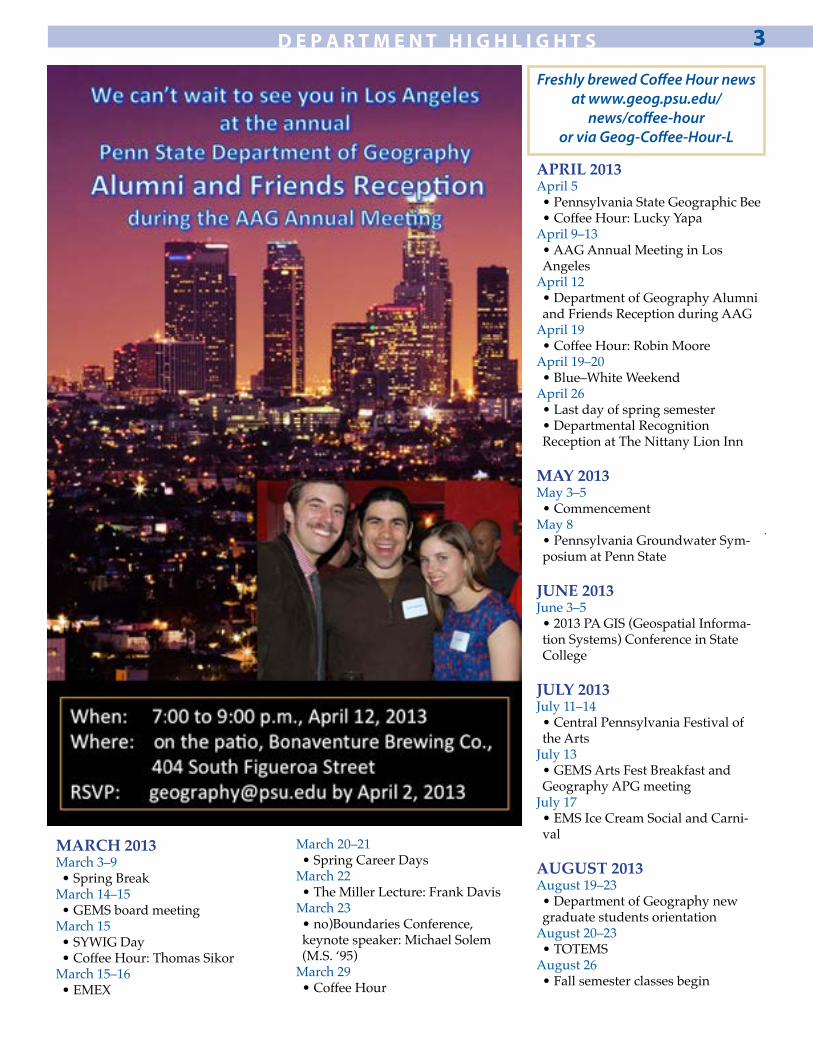
D E P A R T M E N T H I G H L I G H T S 3
MARCH 2013March 3–9• Spring Break
March 14–15• GEMS board meeting
March 15• SYWIG Day• Coffee Hour: Thomas Sikor
March 15–16• EMEX
March 20–21• Spring Career Days
March 22• The Miller Lecture: Frank Davis
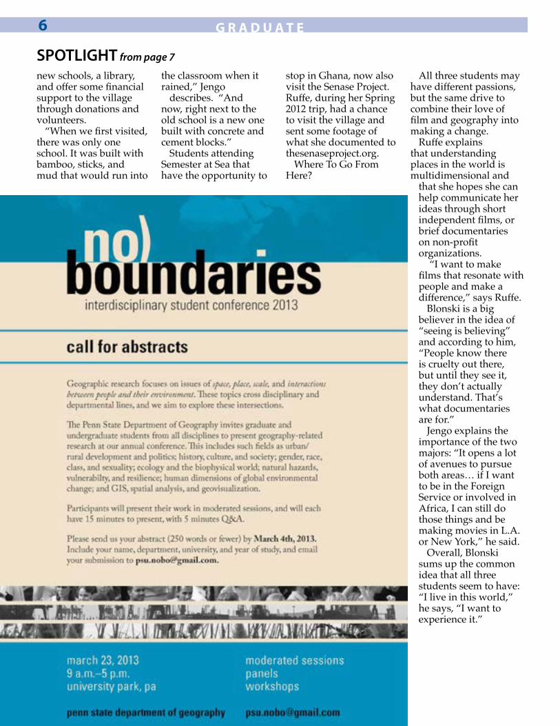
March 23• no)Boundaries Conference, keynote speaker: Michael Solem (M.S. ‘95)
March 29• Coffee Hour
APRIL 2013April 5• Pennsylvania State Geographic Bee• Coffee Hour: Lucky Yapa
April 9–13• AAG Annual Meeting in Los Angeles
April 12• Department of Geography Alumni and Friends Reception during AAG
April 19• Coffee Hour: Robin Moore
April 19–20• Blue–White Weekend
April 26• Last day of spring semester• Departmental Recognition Reception at The Nittany Lion Inn
MAY 2013 May 3–5• Commencement
May 8 • Pennsylvania Groundwater Sym-posium at Penn State
JUNE 2013 June 3–5 • 2013 PA GIS (Geospatial Informa-tion Systems) Conference in State College
JULY 2013 July 11–14 • Central Pennsylvania Festival of the Arts
July 13 • GEMS Arts Fest Breakfast and Geography APG meeting
July 17 • EMS Ice Cream Social and Carni-val
AUGUST 2013 August 19–23 • Department of Geography new graduate students orientation
August 20–23 • TOTEMS
August 26 • Fall semester classes begin
Freshly brewed Coffee Hour news at www.geog.psu.edu/
news/coffee-houror via Geog-Coffee-Hour-L

STUDENT SPOTLIGHT by Rachel Brown
When thinking about film or geography, initially it might be difficult to find a connection between the two. But these three seniors have found a way to combine seemingly different areas of study into plans for their future.
Patrick Blonski, John Jengo, and Megan Ruffe are all seniors who started out on different paths,
but will all graduate with double majors in film and geography.
Patrick Blonski, originally from Queens Rockaway Beach, New York, but currently a resident of Easton, Pennsylvania, came to Penn State as a transfer student after trying his hand at history, crime and law, and media studies. After arriving at University
Park he finally settled on film and geography as majors and eventually hopes to work in making documentaries that support conservation.
“For me it’s kind of about picking something and sticking with it, with majors in film and geography you have so many options,” he says. “…I’m interested in working for conservation, but I also wouldn’t mind working for Saturday Night Live or Comedy Central either.”
Blonksi is already pursuing his dreams of conservation documentaries and filming his senior thesis on the three creators of the local sustainability entrepreneurship, New Leaf, which helps people in the community with sustainability consulting, funding, and supporting innovative ideas.
In addition to his documentary, he is working with the Center for Sustainability research associate, Neil Brown, and hopes to create a reflection project about his time spent traveling around South Africa during spring 2011, with the study abroad program Parks & People. Upon completion of the reflection he will also receive a Science, Society, and the Environment minor.
While he was in Africa, Blonski studied with three geography professors, Brian King, Erica Smithwick, and Petra Tschakert. He is also currently helping Smithwick develop the new Global Sustainability and International Parks (GEOG 97A) class.
“I attended Parks & People before I was a geography major and became really interested in human and environmental aspect of it,” says Blonski. “I enjoy working with people and trying to make conservation work in that way as opposed to just saying, ‘the bear needs
Bringing a human geographer’s perspective to filmmaking
U N D E R G R A D U A T E4
On set. Patrick Blonski (center). Photo provided by Patrick Blonski.

to be protected, put in this fence’.”
Megan Ruffe is a former finance major from New Hope, Pennsylvania who eventually found her way to film and geography majors after visiting Egypt her first year and having an epiphany.
She originally signed up for the trip to Egypt because she had been fascinated with pyramids and the history there. It wasn’t until she arrived in the country that her perspective changed. “It was my first time seeing poverty like that, and we were seeing it from the comfort of an air-conditioned van. Something felt really strange about it,” she says. “The program was great, but the focus was on the history and the sites; we never talked about the other things we saw and those were the things that really changed my perspective.”
Fast forward to 2012. Ruffe is currently working on a senior honors thesis about a local farm, Greenmoore Gardens, which supports sustainable agriculture in the community. She hopes this project will fuse geography and film.
“I want to include a film element and translate this movement into a short documentary to complement the paper I’m writing,” Ruffe says.
In addition to her interest in the local agriculture movement, she also spent time during her spring 2012 semester traveling around the world with the study abroad program, Semester at Sea.
During her semester at sea she decided to record the stories of different people in her program talking and sharing their notions of the countries were visiting. She is now converting these interviews into podcasts.
“A lot of people had these preconceptions before they visited a country…very one-dimensional ideas,” she recalls. “I wanted to capture what they said and later record some of them as they reflected and realized that the societies they were visiting had depth.”
Ruffe puts geography before film when she begins thinking about her future. But ideally she hopes to have a career that encompasses both majors.
“I like human geography and my dream is to communicate to people about it through film,” she says. “I want to make three-minute films that get
messages about geography across to people who don’t want to read a fifty page paper on a topic.”
John Jengo, from West Chester, Pennsylvania, began his studies at Penn State as a film major, and only in his senior year decided to double major in geography.
“I always knew I liked geography, but I never thought that I could major in it. After studying abroad I realized it was applicable to things I wanted to do,” he says.
Like both Ruffe and Blonski, Jengo has also pursued many projects during his time at Penn State. He also works for Neil Brown, as well, creating a documentary about his time spent in South Africa with Parks & People.
Jengo traveled around the world with Semester at Sea in 2010 (on a different voyage than Ruffe). During his time docked in Ghana, he visited the village of Akatim with some of his fellow classmates and started a non-profit organization called the Senase Project (Learn more about the project at http://www.thesenaseproject.org/).
“It was actually quite random how we found this village, but when we visited we just came up with the idea and wanted to help these people,” he says.
The Senase Project officially became a non-profit organization in 2011, and since its beginnings, Jengo and the other founders have been able to build two
Continued on next page
U N D E R G R A D U A T E 5
The world is her studio. Megan Ruffe. Photo provided by Megan Ruffe.
new schools, a library, and offer some financial support to the village through donations and volunteers.
“When we first visited, there was only one school. It was built with bamboo, sticks, and mud that would run into
the classroom when it rained,” Jengo
describes. “And now, right next to the old school is a new one built with concrete and cement blocks.”
Students attending Semester at Sea that have the opportunity to
stop in Ghana, now also visit the Senase Project. Ruffe, during her Spring 2012 trip, had a chance to visit the village and sent some footage of what she documented to thesenaseproject.org.
Where To Go From Here?
All three students may have different passions, but the same drive to combine their love of film and geography into making a change.
Ruffe explains that understanding places in the world is multidimensional and
that she hopes she can help communicate her ideas through short independent films, or brief documentaries on non-profit organizations.
“I want to make films that resonate with people and make a difference,” says Ruffe.
Blonski is a big believer in the idea of “seeing is believing” and according to him, “People know there is cruelty out there, but until they see it, they don’t actually understand. That’s what documentaries are for.”
Jengo explains the importance of the two majors: “It opens a lot of avenues to pursue both areas… if I want to be in the Foreign Service or involved in Africa, I can still do those things and be making movies in L.A. or New York,” he said.
Overall, Blonski sums up the common idea that all three students seem to have: “I live in this world,” he says, “I want to experience it.”
G R A D U A T E6
SPOTLIGHT from page 7

G R A D U A T E 7
From class project to business opportunity:How drones and GIS can aid first responders in a natural disaster
by Rachel Brown
The increased used of unmanned aerial vehicles (UAVs), or drones, is controversial, most notably for their military and surveillance uses, but drones can be also be used to collect scientific data to save lives in the critical hours after a natural disaster. One student in the master of professional studies in Homeland Security, (Geospatial Intelligence option), has developed this idea into a new business concept.
Life experiences prior to starting as an online student are part of what helped 49-year-old Patrick Teagarden to see how drones could become a tool to help first responders.
School of real lifeTeagarden joined the US Army right out of
high school; he has been married to Cathy (his high school sweetheart) for 28 years; he lived on the Black Sea of Turkey as an intelligence analyst during the Cold War; he started three successful technology companies; he is a professional pilot; he was an unmanned aircraft system instructor; and he currently volunteers with the American Red Cross of Alaska in the Disaster Action Team.
“It took me 30 years to get my bachelor’s degree,” he says, laughing. And he earned it on the road. “After spending two years away from my family while working on the Sky Warrior UAV program, my family and I decided we needed to spend some quality time together. So we travelled around America for a year while I was working on my bachelor’s degree in aviation operations from Wayland Baptist University.”
“When I was 45 years old, I reached a point where my career was not progressing because I didn’t have a degree… and so that is where the motivation to go to school came from,” he says.
Now, a resident of Anchorage, Alaska, Teagarden is a full-time student, expecting to complete his master’s degree in April 2013.
Military and aviation backgroundAfter serving in the army from 1982 to 1986,
Teagarden worked as a Department of Defense contractor, eventually started a consulting company in California.
His work required him to travel along the West
Coast. As a way to save time, he learned to fly and bought a twin-engine Cessna. It was after he became instrument-rated that Teagarden says he “caught the flying bug.”
“Flying was amazing and allowed me to work in Los Angeles during the day and then be home in Sacramento in less than two hours,” he explains.
After receiving his airline transport pilot’s and instructor licenses, he flew as a corporate pilot for Intel Corporation and Levi Strauss. He was then hired as a contractor for the army working at the Ronald Reagan Missile Test Site in the Republic of the Marshall Islands, eventually flying people and supplies to remote Alaskan villages.
With the emergence of unmanned aerial vehicles (UAV), Teagarden had an opportunity to attend the army’s Unmanned Aircraft Systems School at Fort Huachuca, Arizona, where he later became an instructor. Eventually, he was selected as one of the first test operators and instructors for the “Sky Warrior” UAV, commonly known as the Predator Drone.
“I realized that there was going to be a transition in the next 20 to 30 years to unmanned aircrafts, so I thought it was important to develop skills in unmanned aviation,” Teagarden says.
Applying new knowledgeAs a Homeland Security master’s degree student,
with an emphasis in Geospatial Intelligence, Teagarden is especially interested in applying his knowledge of unmanned aircrafts to disaster management around the country.
During summer 2012, Teagarden took the Planning for GIS Emergency Management class (GEOG 588) with Anthony Robinson and has been able to apply the knowledge he has learned from this class to a business opportunity.
“Dr. Robinson has been the best professor I have had,” says Teagarden. “He gives incredibly detailed feedback with every assignment with specific advice on how to improve your work.”
For his final class project, Teagarden developed a high-level vehicle design for an unmanned aircraft system which would provide rapid situational awareness and communications using the first responder’s smartphone devices, when the existing cellular and electrical infrastructures are disabled or destroyed.
See DRONE page 13

Q: What is economic geography?
A: At the most abstract level we can show that when an economic system operates across space it will produce different results in different places. That is OK for a starting point, but when we dig in a bit more we find that space and place actually shape economic systems just as they are in turn shaped by them. Delving into the ways in which space and place are intertwined with the economy is the substance of economic geography.
Q: How did you first get interested in the discipline?
A: I found geography as an undergrad because I wanted to think about politics and society and the economy, but didn’t want to have to choose among them. I found economic geography a bit later. I worked as a consultant on issues related to planning and transportation systems and grew frustrated by the limited range of questions my clients were willing to ask about things. “How much does it cost?” is a reasonable starting point, but I am much more interested in the broader questions around “Who pays?” and “Who benefits?” I find economic geography, with its focus on uneven development, offers some compelling tools for pursuing these questions.
Q: What is the most important area of research for you right now?
A: Probably my most significant vein of research deals with my challenge to a core model coming out of economics. By challenging the assumption of general equilibrium in this model I am trying to attack the easy acceptance of what economics has to tell us about the outcomes from complex economic systems. From my perspective, it is challenging this dominant narrative out of economics that opens up the space for serious discussion of how policies are likely to impact local populations.
Q: In your career so far, what deliverable or outcome are you most proud of?
A: My second paper in the Journal of Economic Geography shows how the results of Paul Krugman’s Core-Periphery model (the basis for most of the work in geographical economics) are dependent on the assumption of general equilibrium. Specifically, the model assumes that unemployment doesn’t exist (actually a fairly mundane assumption for economists). I show that if we allow firms and workers to seek each other out and accept that they have difficulty in matching firms to workers at suitable wages, then the results of the Core-Periphery model become much less certain. I am proud of this work because it most depicts the ways that quantitative geography can be critical and in so doing can begin to reshape policy responses.
Q: You’ve taken on the responsibility of teaching GEOG 126, how’s it going?
A: I am having a lot of fun with the class. They are energized and really helping me to be a dynamic teacher. I was worried that my efforts at teaching through questions would fail in the context of a big lecture class, but I am getting very good participation and I am proud of them. We had a big game in class the other week simulating economies with different resource bases and it was absolute bedlam—I loved it!
Q: About teaching GEOG 126, you said, “My hope is that students gain an understanding of how our economy is fundamentally designed to produce uneven outcomes in space and what that means for our society.” Can you explain what you mean by this and give an example?
A: We have a fundamental misconception that the economy is somehow “fair” or “natural.” In fact it is neither. We have worked out a system of markets and exchange with very particular characteristics
and those characteristics inevitably produce winners and losers. More important from my perspective is the idea that success (or lack thereof) in one time period tends to build on itself, so differences among places tend to increase in time. For example, Chicago was an important shipping point for cargo on the Great Lakes. It developed connections with investors and businesses on the East Coast
Q&A with Christopher Fowler
“We have a fundamental misconception that the economy is somehow ‘fair’ or ‘natural.’ In fact it is neither. We have worked out a system of markets and exchange with very particular characteristics and those characteristics inevitably produce winners and losers.”
F A C U L T Y A N D S T A F F8
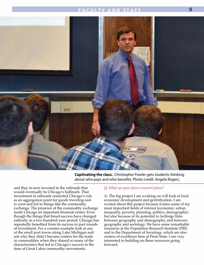
Captivating the class. Christopher Fowler gets students thinking about who pays and who benefits. Photo credit: Angela Rogers.
and they in turn invested in the railroads that would eventually be Chicago’s hallmark. That investment in railroads cemented Chicago’s role as an aggregation point for goods traveling east to west and led to things like the commodity exchange. The presence of the commodity exchange made Chicago an important financial center. Even though the things that breed success have changed radically in a two-hundred-year period, Chicago has repeatedly benefited from its success in past rounds of investment. For a counter example look at any of the small port towns along Lake Michigan and ask why they didn’t become centers for the trade in commodities when they shared so many of the characteristics that led to Chicago’s success in the time of Great Lakes commodity movements.
Q: What are your future research plans?
A: The big project I am working on will look at local economic development and gentrification. I am excited about this project because it joins some of my most important fields of interest (economic, urban, inequality, poverty, planning, politics, demography) but also because of its potential to (re)forge links between geography and demography, and between geography and sociology. We have some remarkable resources at the Population Research Institute (PRI) and in the Department of Sociology, which are also centers of excellence here at Penn State. I am very interested in building on these resources going forward.
F A C U L T Y A N D S T A F F 9
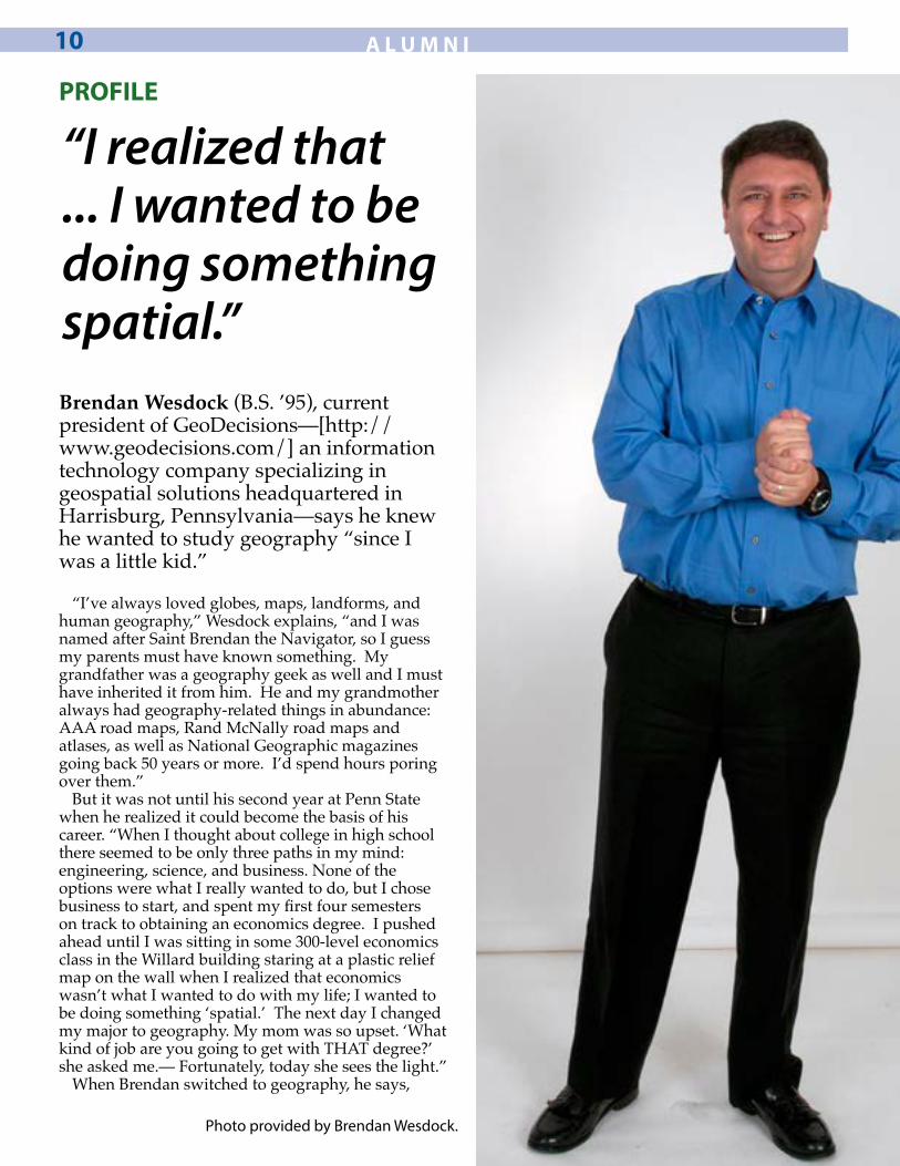
Brendan Wesdock (B.S. ’95), current president of GeoDecisions—[http://www.geodecisions.com/] an information technology company specializing in geospatial solutions headquartered in Harrisburg, Pennsylvania—says he knew he wanted to study geography “since I was a little kid.”
“I’ve always loved globes, maps, landforms, and human geography,” Wesdock explains, “and I was named after Saint Brendan the Navigator, so I guess my parents must have known something. My grandfather was a geography geek as well and I must have inherited it from him. He and my grandmother always had geography-related things in abundance: AAA road maps, Rand McNally road maps and atlases, as well as National Geographic magazines going back 50 years or more. I’d spend hours poring over them.”
But it was not until his second year at Penn State when he realized it could become the basis of his career. “When I thought about college in high school there seemed to be only three paths in my mind: engineering, science, and business. None of the options were what I really wanted to do, but I chose business to start, and spent my first four semesters on track to obtaining an economics degree. I pushed ahead until I was sitting in some 300-level economics class in the Willard building staring at a plastic relief map on the wall when I realized that economics wasn’t what I wanted to do with my life; I wanted to be doing something ‘spatial.’ The next day I changed my major to geography. My mom was so upset. ‘What kind of job are you going to get with THAT degree?’ she asked me.— Fortunately, today she sees the light.”
When Brendan switched to geography, he says,
PROFILE
“I realized that ... I wanted to be doing something spatial.”
A L U M N I10
Photo provided by Brendan Wesdock.

he was initially interested in urban planning. “One of the first classes I took was a locational analysis class with Amy Glasmeier. It was a graduate-level course and I ended up being the only undergraduate in the class. With only eight students, there was nowhere to hide, and I really learned a lot. I ended up working for Dr. Glasmeier as a work/study student the next semester and I really enjoyed it. Dr. Glasmeier definitely shaped my time at Penn State. She was very good to me and I learned a lot from her.”
At the end of his junior year, Wesdock took Lucky Yapa’s Introduction to GIS course. “I knew at that point I was hooked: maps plus computers was the convergence of the two thing I loved to work with!”
Later that year Wesdock had an internship with the Clearfield County Planning Department under the direction of Alex Grazianni. “They had an old copy of MapInfo for DOS that I was able to use with Census data and TIGER files to complete a study on the impact of the then-new state correctional facility in Houtzdale. It was a pretty big deal at the time.”
After graduating from Penn State, Wesdock’s career path lead from working for a very short time for Patton Township as a zoning officer, to Rand McNally in Chicago as a GIS software developer working on TripMaker, StreetFinder, and the New Millennium World Atlas, which was a globe-based atlas and data viewer much like Google Earth today. Wesdock then returned to State College to work for L.R. Kimball developing GIS-based enhanced 911 applications.
He joined GeoDecisions in late 1999 in State College. “I got the chance to work on some very cool GIS applications for the transit and transportation industry, as well as for the military, which is what led me to the Hampton Roads
area of Virginia,” Wesdock explains. “In 2002, GeoDecisions asked me to move to Newport News, Virginia, to support our Intelligent Road and Rail Information System (IRRIS) we were developing for the U.S. military. From there I went from being a lead GIS developer on the program, to being the program manager for IRRIS, the director for all of our military projects, to vice president and, as of 2012, president of GeoDecisions.”
“Now, my days are more about running the business, growing our top and bottom lines, and working with our clients on existing and new business. I still get a chance once in a while to get my hands dirty, but it’s few and far between,” Wesdock says. “My biggest challenge today is implementing my vision for GeoDecisions. We’re about 120 people spread across the Northeast and Midwest U.S., as well as a growing International business in the UAE and in Malaysia. My goal is to evolve GeoDecisions into the premier GIS services company in the world. It keeps me on my toes and in airplanes quite a bit.”
Currently Wesdock is serving on the GEMS board and helping to get the Geography Affiliate Program Group (APG) off the ground. “I really wanted to give back a little to Penn State and to the Department of Geography,” Wesdock says of his motivations. “I feel I’ve been fortunate to have a very successful career so far and that all started there. I believe I can help mentor students to help them have the same great experience that I did. Happiness in your career is doing what you would do if money or other factors weren’t in the picture. Everyone I know who has followed this mantra is very happy and content and has made a career of their choosing. I include myself in that category.”
A L U M N I 11
A productive meeting. APG members met on February 9, 2013 to discuss their focus, how to engage more alumni, and plan future activi-ties. After the meeting, members participated in a networking session with students, which included a career panel, resumé reviews, and mock interviews. Photo credit: Angela Rogers.

R E S E A R C H12
RESEARCH SUMMARY by Karl Zimmerer
Intensification and agrobiodiversity conservation in a global hotspot (Bolivia)Published February 19, 2013; “The compatibility of agricultural intensification in a global hotspot of smallholder agrobiodiversity (Bolivia).” Proceedings of the National Academy of Sciences (PNAS) 110 (8): 2769–2774, and Supplementary Information, SI, pp. 1-4.
Intensive agriculture in general has a bad reputation for destroying local ecosystems, overusing chemical fertilizers and pesticides, and taking control of the lands and livelihoods of indigenous peoples, but a recently published longitudinal and spatially fine-grain study conducted in the Bolivian Andes High Valley—a global biodiversity hotspot— shows that it is possible to balance the right kind of intensification with conservation.
We conducted research on the intensification of peach-growing alongside the continuation and innovation of genetically diverse maize farming among small-scale farmers (cultivating an average field size of less than two hectares) in the High Valley over a ten-year period (2000-2010). The maize is a preferred food crop and the peaches are a profitable cash crop. Using social-ecological field studies, remote sensing, and ArcGIS tools, my students, Bolivian collaborators, and I compiled and analyzed the data on biodiversity, areal processes, irrigation, and other factors for peach and maize fields in the study area.
The co-evolution of and relationship between the intensification of the peach growing and the combined continuation-innovation of maize farms demonstrates social-ecological resilience and provides a model for in situ agrobiodiversity conservation and intensification-based land-change based on realistic opportunities in specific landscapes. These Bolivian smallholder farmers cultivate 2-3 percent of the hemispheric total of maize agrobodiversity. While specific factors in these high-agrobiodiversity landscapes such as access to water, food preferences, land management practices, and innovation contributed to this situation, the study’s findings indicate that a balance can be
successfully implemented in other areas where there is both pressure to intensify agriculture and pressure to preserve the environment amidst global change.
A central question in the growing scientific and policy debate is focused on identifying opportunities and trade-offs among the priorities of so-called land-sparing or farmland sustainability and land-saving or wildland-area maximization. As smallholders in the Bolivian Andes demonstrate, these priorities need not be mutually exclusive.
Karl Zimmerer is the department head and professor in the Department of Geography, the Earth and Environmental Systems Institute (EESI), and the Penn State Institutes for Energy and the Environment (PSIEE).
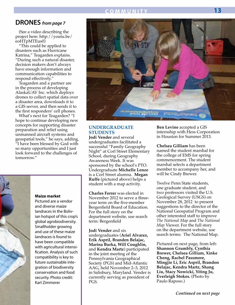
UNDERGRADUATE STUDENTSJodi Vender and several undergraduates facilitated a successful “Family Geography Night” at Corl Street Elementary School, during Geography Awareness Week. It was sponsored by the school’s PTO. Undergraduate Michelle Lenze is a Corl Street alumna. Megan Ruffe (pictured above) helps a student with a map activity.
Charles Ferrer was elected in November 2012 to serve a three-year term on the five-member Bergenfield Board of Education. For the full story on the department website, use search term: Bergenfield
Jodi Vender and six undergraduates (Ariel Alvarez, Erik Aspril, Branden Belajac, Marina Burka, Will Coughlin, and Kendra Martz) participated in the joint meeting of the Pennsylvania Geographical Society (PGS) and Mid-Atlantic AAG, held November 2–3, 2012 in Salisbury, Maryland. Vender is currently serving as president of PGS.
Ben Levine accepted a GIS internship with Hess Corporation in Houston for Summer 2013.
Chelsea Gilliam has been named the student marshal for the college of EMS for spring commencement. The student marshal selects a department member to accompany her, and will be Cindy Brewer.
Twelve Penn State students, one graduate student, and two professors visited the U.S. Geological Survey (USGS) on November 28, 2012 to present suggestions to the director of the National Geospatial Program and other interested staff to improve The National Map and The National Map Viewer. For the full story on the department website, use search terms: The National Map.
Pictured on next page, from left: Shannon Grumbly, Cynthia Brewer, Chelsea Gilliam, Xinke Cheng, Rachel Passmore, Mingjie Li, Eric Aspril, Brandon Belajac, Kendra Martz, Shang Liu, Stacy Nowicki, Yiting Ju, Everleigh Stokes. (Photo by Paulo Raposo.)
C O M M U N I T Y 13
Maize marketPictured are a vendor and diverse maize landraces in the Boliv-ian hotspot of this crop’s global agrobiodiversity. Smallholder growing and use of these maize landraces is found to have been compatible with agricultural intensi-fication. Analysis of such compatibility is key to future sustainable inte-gration of biodiversity conservation and food security. Photo credit: Karl Zimmerer
(See a video describing the project here: http://youtu.be/eoHTpMTEus0)
“This could be applied to disasters such as Hurricane Katrina,” Teagarden explains. “During such a natural disaster, decision makers don’t always have enough information and communication capabilities to respond effectively.”
Teagarden and a partner are in the process of developing AlaskaUAV Inc. which deploys drones to collect spatial data over a disaster area, downloads it to a GIS server, and then sends it to the first responders’ cell phones.
What’s next for Teagarden? “I hope to continue developing new concepts for supporting disaster preparation and relief using unmanned aircraft systems and geospatial tools,” he says, adding, “I have been blessed by God with so many opportunities and I just look forward to the challenges of tomorrow.”
DRONES from page 7
Continued on next page

GRADUATE STUDENTSEmma Gaalaas Mullaney received the 2012 Superior Teaching and Research (STAR) Award from the College of Liberal Arts. This award helped to reimburse the cost of her recent trip to Hyderabad, India, where she led a delegation of U.S. youth to the United Nations Convention on Biological Diversity.
Peter Howe is the lead author of a paper that was published in Nature Climate Change, titled “Global perceptions of local temperature change.” It is coauthored with colleagues at Yale, Columbia, and Princeton and based on his recently completed dissertation research, supervised by Brent Yarnal. Jase Bernhardt presented the following paper at the Annual Meeting of the American Meteorological Society (AMS) in Austin, Texas: “A synoptic climatology of contrail outbreak events and associated surface temperature effects for the southern United States” (with
Andrew Carleton). Research for the paper was partly funded by Carleton’s most recent NSF grant. Bernhardt’s participation in the conference was funded by an EMS Centennial Award for 2013.
FACULTY AND STAFFAndrew Carleton featured in Research Penn State Probing Question: How
does melting Arctic ice affect weather and climate? For the full story on the University website, use search terms: probing sea ice
Karl Zimmerer is one of six Penn state faculty members named Fellows of the American Association for the Advancement of Science (AAAS). For the full story on the department website, use search term: AAAS.
A team including Todd Bacastow, Alan Taylor, and Rob Brooks secured $1.2 million for work at the Fort Indiantown Gap, National Guard facility north of Harrisburg.
Jennifer Balch was interviewed by NPR on cheatgrass and wildfire. For the full story on the department website, use search term: cheatgrass.
Marnie Deibler received the 2012 EMS Circle of Excellence Award. The award was announced and presented at the December 19, 2012 annual Dean’s Staff Luncheon.
Karl Zimmerer’s article, “The compatibility of agricultural intensification in a global hotspot of smallholder agrobiodiversity (Bolivia)” was published in February 2013 by the Proceedings of the National Academy of Sciences (PNAS).
Andrew Carleton and several current and former students reunited to publish “Mid-season climate diagnostics of jet contrail ‘outbreaks,’ and implications for eastern U.S. sky cover trends,” in Climate Research.
The research was funded by Carleton’s most recent NSF grant. Armand Silva was a geography master’s degree student (currently a cartographer with the Federal Aviation Administration in Maryland); Jason Allard was a geography masters and doctoral student (currently an associate professor at Valdosta State University, Georgia); Matt Aghazarian was a geography undergraduate major (now a GIS specialist with a consulting company in the Baltimore area); Jase Bernhardt is a current geography master’s degree student; and David Travis was a doctoral student of Carleton’s when he was at Indiana University (now an associate dean in the College of Letters and Sciences at University of Wisconsin–Whitewater).
Alex Klippel and Anthony Robinson received a grant from the Center for Online Innovation in Learning at Penn State to work on Enhancing Online Geospatial Education with Sketch-based Geospatial Learning Objects.
Leah Wasser, Rick Day, and Alan Taylor had a paper accepted in PLOS ONE titled: “Influence of Vegetation Structure on Lidar-derived Canopy Height and Fractional Cover in Forested
C O M M U N I T Y14
COMMUNITY from page 13
Riparian Buffers During Leaf-off and Leaf-on Conditions.”
Mark D. Aurit, Robert O. Peterson, and Justine I. Blanford had a paper accepted in PLOS ONE titled: “A GIS Analysis of the Relationship between Sinkholes, Dry-Well Complaints and Groundwater Pumping for Frost-Freeze Protection of Winter Strawberry Production in Florida.”
Christopher S. Fowler had a paper accepted to Economic Geography, with co-author Rachel Kleit at Ohio State: “The effects of industry clusters on the poverty rate.”
The Department of Geography welcomed Larry Gorenflo, professor of landscape architecture and geography, as an affiliated member of the faculty.
Doug Miller celebrated 25 years of service at Penn State.
The world’s first massive open online course (MOOC) on mapping will be offered by Anthony Robinson through Coursera this summer.
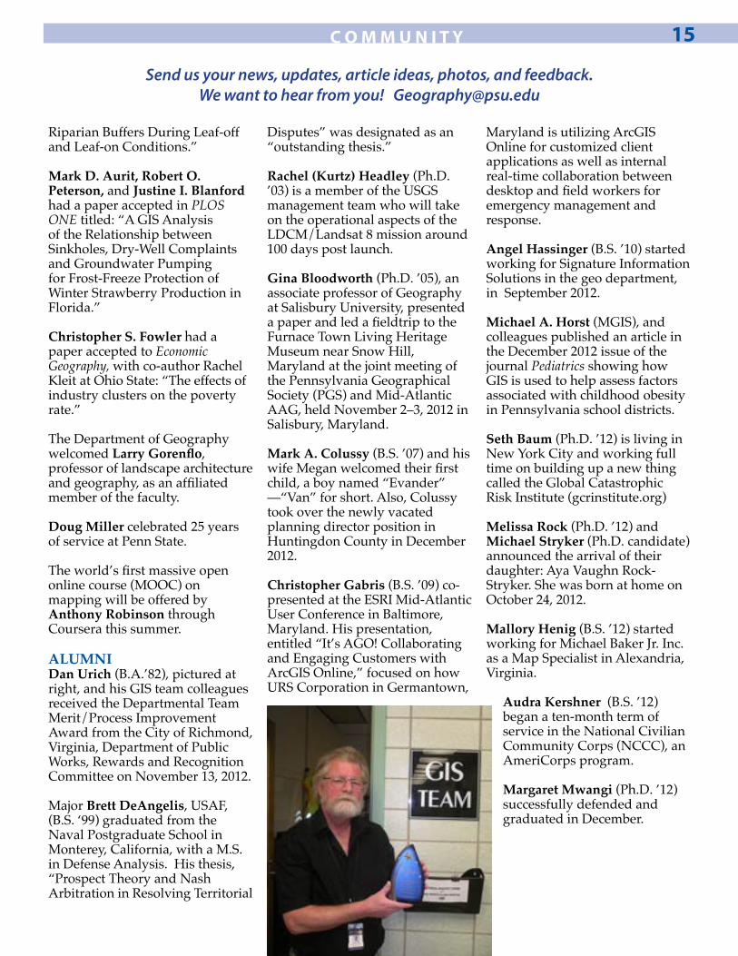
ALUMNIDan Urich (B.A.’82), pictured at right, and his GIS team colleagues received the Departmental Team Merit/Process Improvement Award from the City of Richmond, Virginia, Department of Public Works, Rewards and Recognition Committee on November 13, 2012.
Major Brett DeAngelis, USAF, (B.S. ‘99) graduated from the Naval Postgraduate School in Monterey, California, with a M.S. in Defense Analysis. His thesis, “Prospect Theory and Nash Arbitration in Resolving Territorial
Disputes” was designated as an “outstanding thesis.”
Rachel (Kurtz) Headley (Ph.D. ’03) is a member of the USGS management team who will take on the operational aspects of the LDCM/Landsat 8 mission around 100 days post launch.
Gina Bloodworth (Ph.D. ’05), an associate professor of Geography at Salisbury University, presented a paper and led a fieldtrip to the Furnace Town Living Heritage Museum near Snow Hill, Maryland at the joint meeting of the Pennsylvania Geographical Society (PGS) and Mid-Atlantic AAG, held November 2–3, 2012 in Salisbury, Maryland.
Mark A. Colussy (B.S. ’07) and his wife Megan welcomed their first child, a boy named “Evander” —“Van” for short. Also, Colussy took over the newly vacated planning director position in Huntingdon County in December 2012.
Christopher Gabris (B.S. ’09) co-presented at the ESRI Mid-Atlantic User Conference in Baltimore, Maryland. His presentation, entitled “It’s AGO! Collaborating and Engaging Customers with ArcGIS Online,” focused on how URS Corporation in Germantown,
Maryland is utilizing ArcGIS Online for customized client applications as well as internal real-time collaboration between desktop and field workers for emergency management and response.
Angel Hassinger (B.S. ’10) started working for Signature Information Solutions in the geo department, in September 2012.
Michael A. Horst (MGIS), and colleagues published an article in the December 2012 issue of the journal Pediatrics showing how GIS is used to help assess factors associated with childhood obesity in Pennsylvania school districts.
Seth Baum (Ph.D. ’12) is living in New York City and working full time on building up a new thing called the Global Catastrophic Risk Institute (gcrinstitute.org)
Melissa Rock (Ph.D. ’12) and Michael Stryker (Ph.D. candidate) announced the arrival of their daughter: Aya Vaughn Rock-Stryker. She was born at home on October 24, 2012.
Mallory Henig (B.S. ’12) started working for Michael Baker Jr. Inc. as a Map Specialist in Alexandria, Virginia.
Audra Kershner (B.S. ’12) began a ten-month term of service in the National Civilian Community Corps (NCCC), an AmeriCorps program.
Margaret Mwangi (Ph.D. ’12) successfully defended and graduated in December.
C O M M U N I T Y 15
Send us your news, updates, article ideas, photos, and feedback. We want to hear from you! [email protected]
The Pennsylvania State UniversityDepartment of Geography302 Walker BuildingUniversity Park, PA 16802-5011
Grateful for your continuing supportIf you would like to donate to the department, please email [email protected] or [email protected] or visit: visit www.givenow.psu.edu. When giving online, please be sure to include the code AD322 to the right of the description.
Every gift received is important. The cumulative effect of many gifts makes a significant impact on the quality of education we can provide to our students. The Department of Geography appreciates and recognizes our supporters for their caring commitment.
Thank you!
We are ...