pds 046-2015 flood proofing exemption 719 marion road 046-2015 flood... · report no. pds 046...
TRANSCRIPT

Sa t~A ABBOTSFORD
COUNCIL REPORT
Report No. PDS 046-2015 EXECUTIVE COMMITTEE
Date: File No:
To: From: Subject:
March 30, 2015 3800-20/14-132439
Mayor and Council Bill Ozeroff, , Manager, Building Permits and Licences Flood Proofing Exemption application for the property located at 719 Marion Road (Owner: L. Osell)
RECOMMENDATIONS
1. THAT the request to allow an exemption to the flood proofing requirements as detailed in Report No. PDS 046-2015, be approved in principal, subject to:
a. registration of a Section 219 flood indemnification covenant on title; and b. receiving a report from a professional engineer or geoscientist certifying that the
proposed residence may safely be used for the purpose intended; and
2. THAT the Mayor and Corporate Officer be authorized to execute all documents related to this matter.
SUMMARY OF THE ISSUE
An extensive renovation and addition has been proposed to an existing dwelling located at 719 Marion Road. The owner wishes to construct the "replacement" dwelling at an elevation 3.02 m lower than the flood proofing requirements and requests an exemption.
BACKGROUND
A Building Permit application was received for renovations and additions to an existing home located at 719 Marion Road. During construction the portion of the existing structure that was required to remain intact was demolished to the foundation to replace sections affected by dry rot. This resulted in the structure now being considered as a new building and is now required to meet the current flood proofing requirements. The applicant requests to rebuild the new structure to the previous main floor elevation of 5.48 m geodetic, a reduction of 3.02 m from the 8.5 m minimum flood elevation required for similar buildings located within the protective boundary of the dikes. An exemption to the Zoning Bylaw is requested for the owner to reconstruct the building on the existing foundation.
Report No. PDS 046 -2015 Page 2 of 4
As set out in Section 91 0(5) of the Local Government Act, the exemption may be granted by Council only if it would be:
• consistent with the Provincial guidelines for flood management, or • based on an experienced professional's geotechnical report certifying that the land can
be used safely for the use intended (residential).
Owner I Applicant: L. Osell
Legal Description: Lot 7 Section 3 Township 19 Plan 10096
OCP Designation: Agricultural
Zoning : Agriculture two Zone (A2)
Site Area: 2.14 ha
Description: Reasonably level lot on the West Side of Marion Road
Surrounding Uses: N: Agricultural S: Agricultural E: Marion Road W: Agricultural
DISCUSSION
1. The Zoning Bylaw prescribes elevations for full flood proofing and for reduced flood proofing for buildings located behind standard dikes. The full flood proofing is an elevation which is considered to give full protection from the design flood event. The design flood event is based on the 1898 flood and will provide protection against the 200 year flood event. The reduced flood proofing elevation is an elevation determined by the Ministry of Environment that takes into account sub-area flood threats and the practical difficulty of meeting full flood elevations. Construction is permitted at the reduced elevations subject to registration of a covenant on title holding the City harmless for any damage caused by a flood event.
2. The subject property is located in Flood Proofing Area "B" as outlined in Section 140.7 of the Abbotsford Zoning Bylaw, which is inside the diked areas. The applicant requests that the minimum elevation for flood proofing be varied to 5.48 m Geodetic Survey of Canada (GSC), allowing the replacement dwelling to be constructed at approximately the same elevation as the original non-conforming dwelling. See Attachment "A", Flood Plain Boundaries.
3. Under the Local Government Act (LGA), a local government may not exempt flood proofing elevations in the Zoning Bylaw unless it has received a report from a professional engineer or geoscientist with experience in geotechnical engineering that the land may be used safely for the use intended. The applicant has provided a Geotechnical Flood Hazard Assessment Report, prepared by Cornerstone Engineering Ltd., for Council's consideration. See Attachment "B", Flood Hazard Assessment. Revisions to the report have been requested by staff to ensure that full responsibility will be assumed by the professional engineer providing certification that the dwellings may
Report No. PDS 046 -2015 . Page 3 of 4
safely be used for the purpose intended. This wording is to be consistent with other engineering reports received by the City.
4. Staff has assessed the application on the following criteria:
(a) Will the building or structure survive a flood event? In other words, will the structure be substantially intact when floodwaters recede? The City will require assurance from the owner's structural engineer prior to issuance of building permit that the building structure is designed to resist the anticipated hydrostatic pressures resulting from a flood event.
(b) Is the building designed such that floodwater damages will not damage the building beyond economical repair, despite the structure remaining intact? A residence is more likely to suffer significant damage during a flood than a non-habitable building such as a barn or workshop. Interior finishes, belongings and appliances are all likely to require replacement following a flood, although this may be dependent on the advance warning, and duration of the flood. It is recommended that the area of the building proposed to be constructed below the required flood proofing level be constructed with materials not damageable by flood waters.
(c) In the event that the building is not evacuated prior to the flood, is there an area of refuge where occupants will be safe while awaiting rescue? A house design has been submitted showing a second storey. The second storey will meet the minimum full flood proofing elevation of 8.5 m GSC for similar buildings situated within the protected boundaries of the dikes. In the event of a severe flood, the only area of refuge will be the second storey and roof, as the first storey will be inundated.
(d) Is the City protected against liability for damage to the building? Building permits are issued with a Section 219 Covenant holding the City and Province harmless for any damage resulting from a flood. A covenant would be a requirement of this development. The applicant has provided a Geotechnical Flood Hazard Assessment Report, prepared by Cornerstone Engineering Ltd. (Schedule "8"), for Council's consideration. Revisions to the report have been requested by staff to ensure that full responsibility will be assumed by the professional engineer providing the certification that the house may safely be used for the purpose intended.
(e) Are there exceptional circumstances that set this application apart from others? A building permit was issued for an alteration to the existing dwelling on Sept. 4, 2014. During construction it was noted that the portion of the existing structure originally intended to be retained was deteriorating from dry rot. The exemption is requested to permit a new residence to be built to replace the existing non-conforming residence.
Report No. PDS 046 -2015 Page 4 of 4
FINANCIAL PLAN IMPLICATION
No financial plan implications are anticipated
IMPACTS ON COUNCIL POLICIES, STRATEGIC PLAN AND/OR COUNCIL DIRECTION
There is no impact on council policies, strategic plan and/or council direction.
SUBSTANTIATION OF RECOMMENDATION
As set out in Section 91 0(5) of the Local Government Act, an exemption to the required flood elevations may be granted by Council only if it would be consistent with the Provincial guidelines for flood management, or based on an experienced professional's geotechnical report certifying that the land can be used safely for the use intended (residential) . The owner has provided the required documents to support his request for council 's consideration.
f Bill Ozeroff, RBO r Manager, Building Permits and Licences
ATTACHMENTS
Siri Bertelsen General Manager, Planning and Development Services
Attachment "A": Flood Plain Boundaries and Site Survey Attachment "B": Flood Hazard Assessment
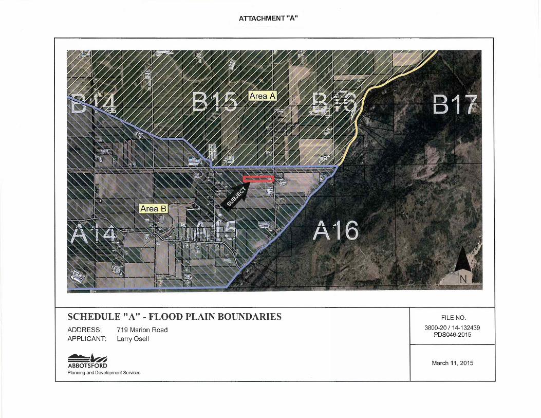
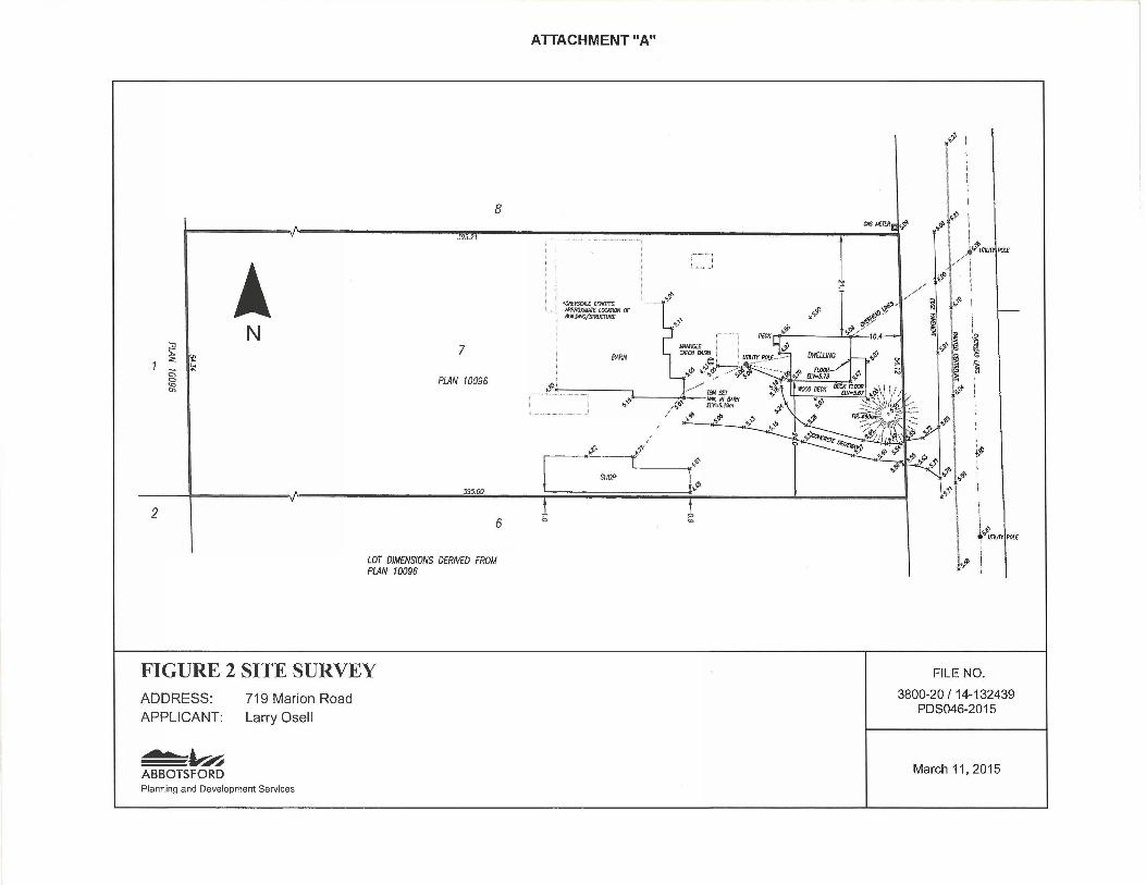
ATTACHMENT "A"
SCHEDULE "A"- FLOOD PLAIN BOUNDARIES ADDRESS: 719 Marion Road APPLICANT: Larry Osell
o ..,...A ABBOTSFORD Planning and Development Services
FILE NO.
3800-20 /14-132439 PDS046-2015
March 11, 2015
A N
~ I <: ~ ""
~ -"'
2
8
gm--
7
PlAN 10096
J95.60
6
LOT DIMENSIONS DERNED FROM PlAN 10096
FIGURE 2 SITE SURVEY ADDRESS: APPLICANT:
- ...... A ABBOTSFORD
719 Marion Road
Larry Osell
Planning and Development Services
ATTACHMENT "A"
/ ~,,
----~~----( ~ { " SHOP r~ b "'
~
ri I : !
~' ' 00 J~JE~~d,ll' .,_<1> 1' :
\ -~ -/
,_. .. ,.f.
// ~I t.;· i :b 1
~~ ~~
·'"'
•g
a
l ~<I'
i ~' +"'UlliJ7l'IPOI£
FILE NO.
3800-20 I 14-132439 PDS046-2015
March 11, 2015
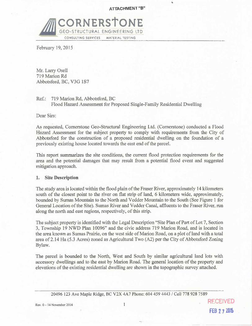
ATTACHMENT "8"
CORNERStONE GEO-STRUCTURAL ENGINEERING LTD
CONSUL liNG SERVICES MATERIAL "TESTING
February 19,2015
Mr. Larry Osell 719 Marion Rd Abbotsford, BC, V3G 1 S 7
Ref.: 719 Marion Rd, Abbotsford, BC
(,
Flood Hazard Assessment for Proposed Single-Family Residential Dwelling
Dear Sirs:
As requested, Cornerstone Geo-Structural Engineering Ltd. (Cornerstone) conducted a Flood Hazard Assessment for the subject property to comply with requirements from the City of Abbotsford for the construction of a proposed residential dwelling on the foundation of a previously existing house located towards the east end of the parcel.
This report summarizes the site conditions, the current flood protection requirements for the area and the potential damages that may result from a potential flood event and suggested mitigation approach.
1. Site Description
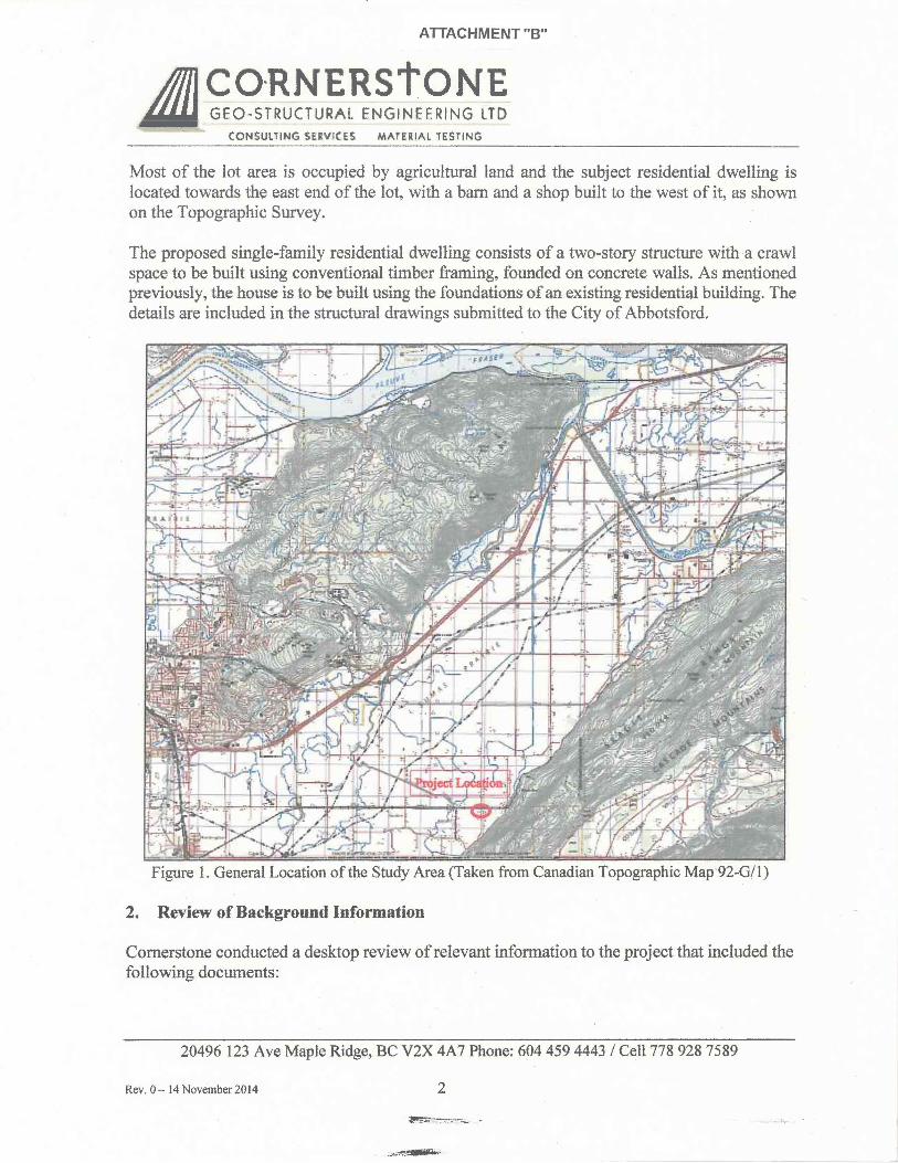
The study area is located within the flood plain of the Fraser River, approximately 14 kilometers south of the closest point to the river on flat strip of land, 6 kilometers wide, approximately, bounded by Sumas Mountain to the North and Vedder Mountain to the South (See Figure 1 for General Location of the Site). Sumas River and Vedder Canal, aflluents to the Fraser River, run along the north and east regions, respectively, of this strip.
The subject property is identified with the Legal Description "Site Plan ofPart of Lot 7, Section 3, Township 19 NWD Plan 10096" and the civic address 719 Marion Road, and is located in the area known as Sumas Prairie, on the west side of Marion Road, on a plot ofland with a total area of2.14 Ha (5.3 Acres) zoned as Agricultural Two (A2) per the City of Abbotsford Zoning Bylaw.
The parcel is bounded to the North, West and South by similar agricultural land ·lots with accessory dwellings and to the east by Marion Road. The general location of the property and elevations of the existing residential dwelling are shown in the topographic survey attached.
20496 123 Ave Maple Ridge, BC V2X 4A7 Phone: 604 459 4443 I Cell778 928 7589
RECEIVED Rev. 0-14 November2014
FEB 27 201~
ATTACHMENT "B"
A ~?s~~~~~~!~Nt;JL~ CONSUlTING SERVICES MATERIAl TESTING
Most of the lot area is occupied by agricultural land and the subject residential dwelling is located towards the east end of the lot, with a barn and a shop built to the west of it, as shown on the Topographic Survey.
The proposed single-family residential dwelling consists of a two-story structure with a crawl space to be built using conventional timber framing, founded on concrete walls. As mentioned previously, the house is to be built using the foundations of an existing residential building. The details are included in the structural drawings submitted to the City of Abbotsford.
Figure 1. General Location of the Study Area (Taken from Canadian Topographic Map 92-G/1)
2. Review of Background Information
Cornerstone conducted a desktop review of relevant information to the project that included the following documents:
20496 123 Ave Maple Ridge, BC V2X 4A7 Phone: 604 459 4443 I Cell778 928 7589
Rev. 0- 14 November 2014 2
ATTACHMENT "B"
JiJ ~?sT~~~~~!8N~L~ CONSUL'TING SERVICES MATERIAL TESTING
);- City of Abbotsford Zoning Bylaws 2400-2014 and 250-1996 > City of Abbotsford Webmap > BC Ministry of Forests, Lands and Natural Resource Operations (2014a). Fraser River
Design Flood Level Update - Hope to Mission. Final Report > BC Ministry of Forests, Lands and Natural Resource Operations (2014b). Simulating the
Effects of Sea Level Riseand Climate Change on Fraser River Flood Scenarios. );- BC Ministry of Forests, Lands and Natural Resource Operations (2011). Fraser freshet
Master Plan Map. );- BC Ministry of Water, Land and Air Protection (2004). Flood Hazard Area Land Use
Management Guideline > Northwest hydraulic Consultants (2008). Fraser River Hydraulic Model Update Final
Report. For the BC Ministry of Environment. > Northwest hydraulic Consultants (2006). Lower Fraser River Hydraulic Model Final
Report. For the Fraser Basin Council );- Association of Professional Engineers and Geoscientists of BC (2012). Legislated Flood
Assessments in a Changing Climate in BC );- Geological Survey of Canada Map 1485A- Surficial geology, Mission.
3. Flood Hazard
Flood Construction Level
According to the Zoning Bylaw 2400-2014, the subject property is located within the Flooding Area "B". Per Section 170 of the Zoning Bylaw 250-1996, the minimum construction elevations for buildings in Area B is 11.1 m GSC (Geodetic Survey of Canada). Reduced Floodproofing conditions of the bylaw for residential dwellings include elevation at 8.5 m GSC, 1.2 m above ground level and 0.3 m above the crown of the nearest road and entering into an indemnification covenant pursuant to Section 219 of the Land Title Act.
Because the existing residential dwelling and adjacent buildings in the property were built before the implementation of the current Floodproofing requirements, the existing foundations are below the minimum flood construction levels of the bylaw and the existing grade is at elevations around the 5.0 m GSC mark. It is noteworthy to mention that the whole Sumas Prairie area has been developed in a similar way. The average elevation at the edge of pavement of Marion Rd in front of the lot is 6 m, approximately.
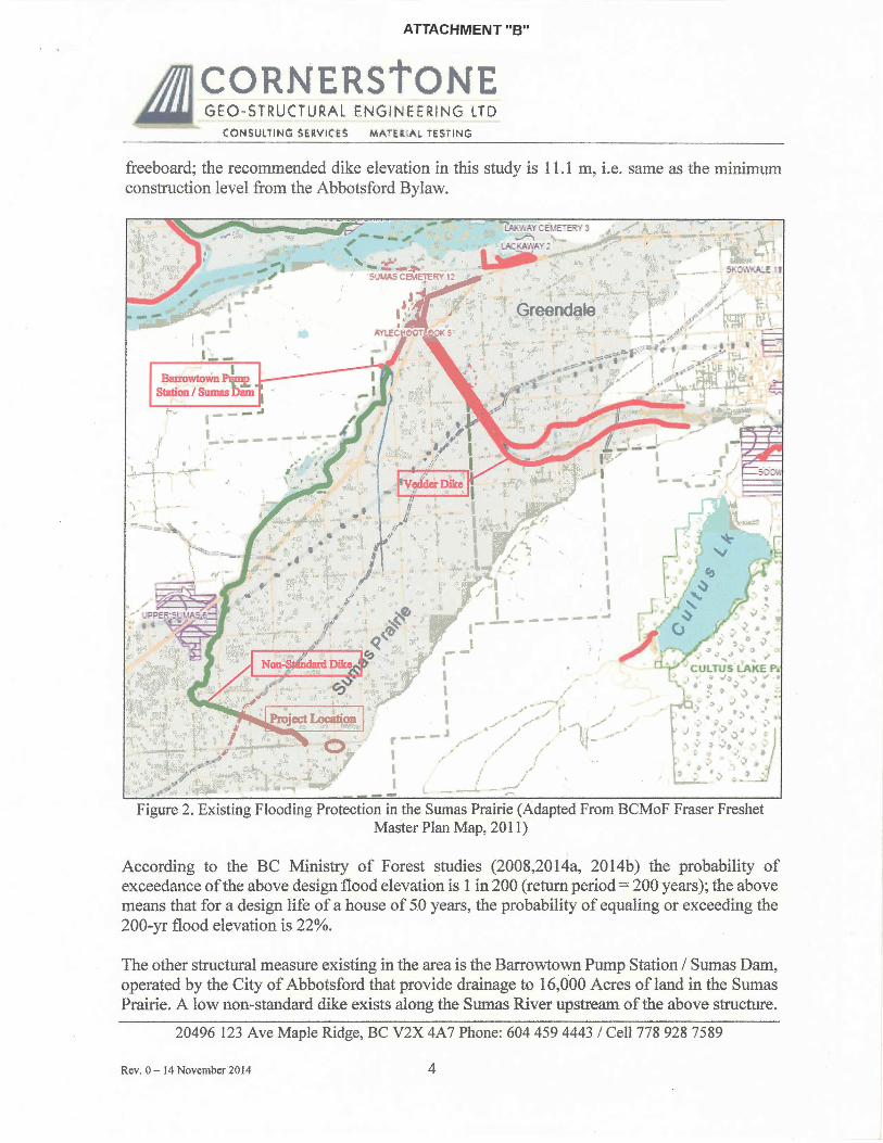
Existing Structural Measures for Flood Protection
The current primary measures for protection against flooding in the Sumas Prairie area include the Dikes along the Left and Right Banks of the Vedder Canal which extend along a portion of the Sumas River. According to the BC Ministry of Forest study (2014a) the lowest elevation of the Vedder left dike is 10.55 m, approximately, that is approximately the flood elevation without
20496 123 Ave Maple Ridge, BC V2X 4A 7 Phone: 604 459 4443 I Cell 778 928 7589
Rev. 0- 14 November 2014 3
ATTACHMENT "B"
CORNERStONE GEO~STRUCTURAL ENGINEERING LTD
CONSUliiNG SEilVI(ES MATEiliAL iESTING
freeboard; the recommended dike elevation in this study is 11.1 m, i.e. same as the minimum construction level from the Abbotsford Bylaw.
Barrowtown~ SUti011 I Sumu bam
.-- -"'
Figure 2. Existing Flooding Protection in the Sumas Prairie (Adapted From BCMoF Fraser Freshet Master Plan Map, 2011)
According to the BC Ministry of Forest studies (2008,2014a, 2014b) the probability of exceedance of the above design flood elevation is 1 in 200 (return period= 200 years); the above means that for a design life of a house of 50 years, the probability of equaling or exceeding the 200-yr flood elevation is 22%.
The other structural measure existing in the area is the Barrowtown Pump Station I Sumas Dam, operated by the City of Abbotsford that provide drainage to 16,0.00 Acres of land in the Sumas Prairie. A low non-standard dike exists along the Sumas River upstream of the above structure.
20496 123 Ave Maple Ridge, BC V2X 4A 7 Phone: 604 459 4443 I Cell 778 928 7589
Rev. 0- 14 November 2014 4
ATTACHMENT "B"
A ~~~~~~~!~N~l~ CONSULTING SERVICES MATERIAL TESTING
Potential Consequences in Case of Flood
In the event of failure of the structural Flood Control measures described above, extensive damage to the subject residential dwelling could be expected as a result of the occurrence of the design flood along with all other properties in the Sumas area. Among the potential damages affecting the structure are:
• Damage to building envelope • Damage to structural elements • Erosion and scour of foundations • Buoyancy
Mitigation Measures
Cornerstone Geo-Structural Engineering Ltd., proposes the following ·solutions:
1) Damage to the Building Envelope- Use peel&stick blue skin or similar on all exterior walls up to flood elevation, in order to protect walls from rising water and give added strength.
2) Damage to the Structural Elements: a) Interior concrete shear walls have been designed, at basement level. It will strengthen the exterior foundation walls and help eliminate caving in, in case of a flood. It will also add weight to the overall structure to decrease buoyancy. b) As additional measures, we have asked existing floor joists to be changed for new TJI 360-11 7 /8" @ 16" ole plus %" plywood and blocking at mid-span. Also second floor joists have been improved and we have asked for 7 /8" plywood to be used. At this level we will use solid blocking at 6' -8" ole. This also will add external strength.
3) Erosion and Scour Foundation- Boulder retaining wall will be used to protectfoundation, where required, to take initial water pressure in case of a flood, and protect the structure from the surge pressure.
4) Buoyancy - Additional shear walls and HDs have been placed to give the structure additional strength and assist in keeping it structural sound, as it is tied to the enhanced foundation. We will also require the existing foundation to be raised 18" to assist in leveling it (15M bars to be drilled min 4" into existing foundation with epoxy HY200@12''o/c), and also to have a better inter-connection between the existing foundation and the additional concrete shear walls.
20496 123 Ave Maple Ridge, BC V2X 4A 7 Phone: 604 459 4443 I Cell 778 928 7589
Rev. 0- 14 November 2014 5
ATTACHMENT "B"
A ~?s!~u~~~!~Nr;sl~ CONSUL"TING SERVICES MATEiliAL TESTING
4. Conclusions and Recommendations
The mitigation of the flooding hazard in the Sumas Prairie area where the subject project is located is mitigated by structural measures including the Vedder Canal Dike and the Barrowtown Pump Station I Sumas Dam. The occurrence of flooding affecting the subject property depends on the reliable operation of the above elements.
In the event of the occurrence of flooding within the Sumas Prairie area would result in damage to all properties in the Sumas Prairie but will be mitigated through the measures described above.
5. Closure
We trust this report satisfies the current requirements from the City of Abbotsford. Please don't hesitate to contact us if you have any questions.
Yours truly,
German A. Cajigas, M.Eng., P .Eng. Senior Geotechnical Engineer
Jorge Silva, P.Eng. Principal
20496 123 Ave Maple Ridge, BC V2X 4A7 Phone: 604 459 4443 I Cell 778 928 7589
Rev. 0- 14 November 2014 6
ATTACHMENT "B" ·~CEIVED
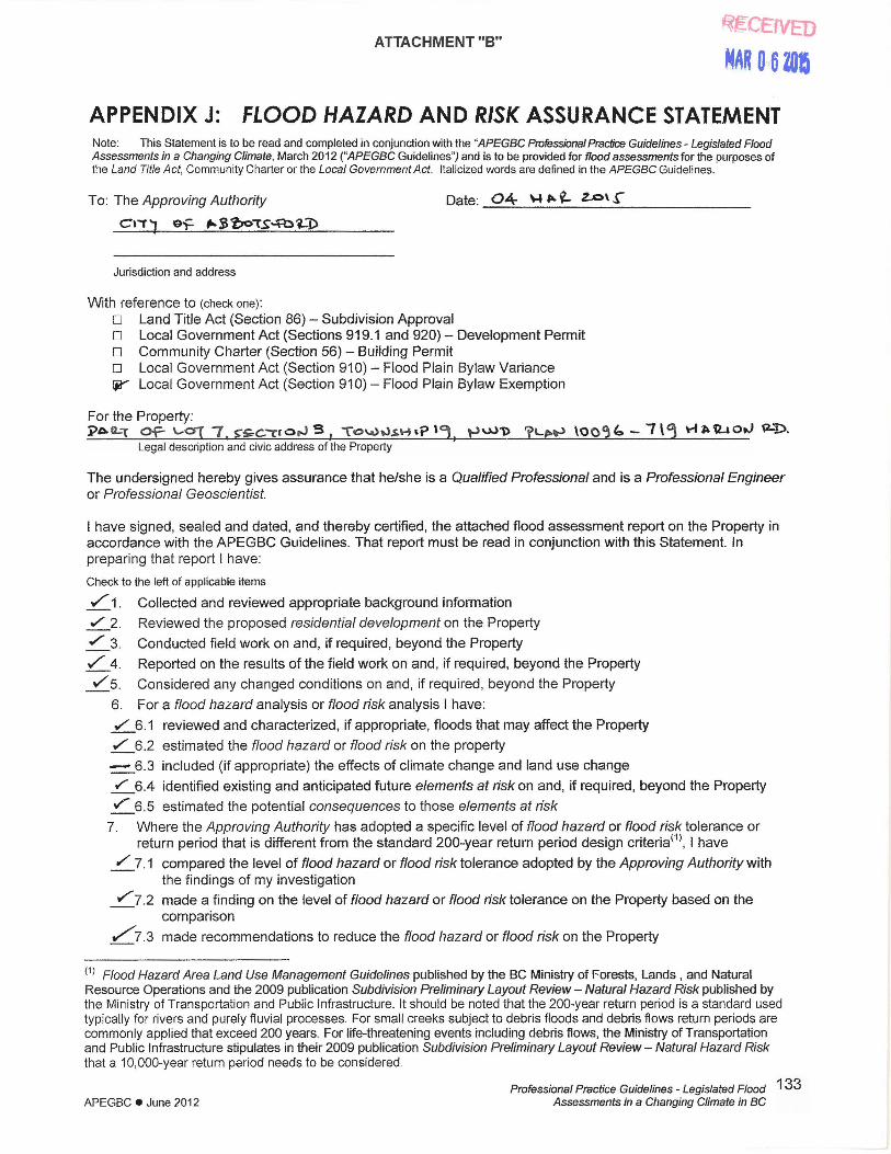
MAR 0 6 zoe APPENDIX J: FLOOD HAZARD AND RISK ASSURANCE STATEMENT Note: This Statement is to be read and completed in conjunction with the "APEGBC Professional Practice Guidelines- Legislated Flood Assessments in a Changing Climate, March 2012 ("APEGBC Guidelines") and is to be provided for flood assessments for the purposes of the Land Title Act, Community Charter or the Local Government Act. Italicized words are defined in the APEGBC Guidelines.
To: The Approving Authority Date: 04 \-1 ~ ~ Z...O\ .r Cl"'1) o~ ~ ~ 'bo'1'S..:A::> i-"D
Jurisdiction and address
With reference to (check one):
D Land Title Act (Section 86) - Subdivision Approval o Local Government Act (Sections 919.1 and 920) - Development Permit o Community Charter (Section 56) - Building Permit o Local Government Act (Section 910)- Flood Plain Bylaw Variance ~ Local Government Act (Section 91 0)- Flood Plain Bylaw Exemption
For the Property: j:>A L"'t Of- '-OJ 7 . ~~C"T' o,J S 1 To\.Utl$•·HP '1, ,._,U)1> "fLE•·-.> \00~ b- I\~ \'"I ~~otJ ~D.
Legal description and civic address of the Property
The undersigned hereby gives assurance that he/she is a Qualified Professional and is a Professional Engineer or Professional Geoscientist.
I have signed, sealed and dated, and thereby certified, the attached flood assessment report on the Property in accordance with the APEGBC Guidelines. That report must be read in conjunction with this Statement. In preparing that report I have:
Check to the left of applicable items
./" 1. Collected and reviewed appropriate background information
"'2. .,/" 3.
./" 4.
V"" 5.
Reviewed the proposed residential development on the Property
Conducted field work on and, if required, beyond the Property
Reported on the results of the field work on and, if required, beyond the Property
Considered any changed conditions on and, if required, beyond the Property
6. For a flood hazard analysis or flood risk analysis I have:
./ 6.1 reviewed and characterized, if appropriate, floods that may affect the Property
./ 6.2 estimated the flood hazard or flood risk on the property
- 6.3 included (if appropriate) the effects of climate change and land use change
.r 6.4 identified existing and anticipated future elements at risk on and, if required, beyond the Property
./ 6.5 estimated the potential consequences to those elements at risk
7. Where the Approving Authority has adopted a specific level of flood hazard or flood risk tolerance or return period that is different from the standard 200-year return period design criteria<1>, I have
/ 7. 1 compared the level of flood hazard or flood risk tolerance adopted by the Approving Authority with the findings of my investigation
./ 7.2 made a finding on the level of flood hazard or flood risk tolerance on the Property based on the comparison
/7.3 made recommendations to reduce the flood hazard or flood risk on the Property
<1
> Flood Hazard Area Land Use Management Guidelines published by the BC Ministry of Forests, Lands , and Natural Resource Operations and the 2009 publication Subdivision Preliminary Layout Review- Natural Hazard Risk published by the Ministry of Transportation and Public Infrastructure. It should be noted that the 200-year return period is a standard used typically for rivers and purely fluvial processes. For small creeks subject to debris floods and debris flows return periods are commonly applied that exceed 200 years. For life-threatening events including debris flows, the Ministry of Transportation and Public Infrastructure stipulates in their 2009 publication Subdivision Preliminary Layout Review- Natural Hazard Risk that a 10, 000-year return period needs to be considered.
APEGBC e June 2012 Professional Practice Guidelines - Legislated Flood
Assessments in a Changing Climate in BC
133

ATTACHMENT "B"
8. Where the Approving Authority has not adopted a level of flood risk or flood hazard tolerance I have:
.1 described the method of flood hazard analysis or flood risk analysis used
RECEIVED
~AR 0 6l05
8.2 referred to an appropriate and identified provincial or national guideline for level of flood hazard or flood risk
8.3 compared this guideline with the findings of my investigation
8.4 made a finding on the level of flood hazard of flood risk tolerance on the Property based on the comparison
.5 made recommendations to reduce flood risks
hReported on the requirements for future inspections of the Property and recommended who should conduct those inspections.
Based on my comparison between
Check one
rtt' the findings from the investigation and the adopted level of flood hazard or flood risk tolerance (item 7.2 above)
o the appropriate and identified provincial or national guideline for level of flood hazard or flood risk tolerance (item 8.4 above)
I hereby give my assurance that, based on the conditions contained in the attached flood assessment report,
Check one o for subdivision approval, as required by the Land Title Act (Section 86), "that the land may be used
safely for the use intended".
Check one
o with one or more recommended registered covenants. u without any registered covenant.
u for a development permit, as required by the Local Government Act (Sections 919.1 and 920), my report will "assist the focal government in determining what conditions or requirements under (Section 920] subsection (7.1) it will impose in the permit".
o for a building permit, as required by the Community Charter (Section 56), "the land may be used safely for the use intended".
Check one o with one or more recommended registered covenants. o without any registered covenant.
o for flood plain bylaw variance, as required by the Flood Hazard Area Land Use Management Guidelines associated with the Local Government Act (Section 91 0), "the development may occur safely".
cY' for flood plain bylaw exemption, as required by the Local Government Act (Section 91 0) , "the land may be used safely for the use intended".
Name (print)
Signature
Address
(Affix Professional seal here) Telephone
If the Qualified Professional is a member of a firm, complete the following.
I am a member of the firm o:>~'t!..TcnJ-6. S>o-s.\(L\)C"t..Ji--""t.. 'S:~'C.,....,~S~\~~ ~.--r:c · and I sign this letter on behalf of the firm. (Print name of firm)
APEGBC e June 20'12 Professional Practice Guidelines - Legislated Flood
Assessments in a Changing Climate in BC
134