a study on landslides and subsidence … of international academic research for multidisciplinary...
TRANSCRIPT

JOURNAL OF INTERNATIONAL ACADEMIC RESEARCH FOR MULTIDISCIPLINARY Impact Factor 1.625, ISSN: 2320-5083, Volume 3, Issue 6, July 2015
436 www.jiarm.com
A STUDY ON LANDSLIDES AND SUBSIDENCE ALONG NATIONAL HIGHWAY 31A, DARJEELING DISTRICT, WEST BENGAL
SANDIPAN GANGULY*
PALASH PATRA** AVIJIT GURAY***
*Guest Lecturer, Dept. of Geography, Suri Vidyasagar College, West Bengal, India **Assistant Teacher in Geography, Ghoga Junior High School, West Bengal, India ***Assistant Teacher in Geography, Muktarpur High School, West Bengal, India
ABSTRACT
The traffic flow on NH 31A, connecting Sevoke of West Bengal with Gangtok of
Sikkim through Kalimpong is frequently hampered due to occurrence of landslides and
subsidence, especially during the rainy season, triggered by faulty constructional activities.
Proper strategies should be adapted to prevent landslides and subsidence in this tectonically
vulnerable zone, a part of Darjeeling-Sikkim Himalaya. Keeping tune with this fact, the paper
attempts to study the landslide phenomena on a specific portion of NH 31A (Sevoke-
Kalimpong section), running parallel to the right bank of river Tista. The paper takes into
account the causes of landslide and description of two landslide and one subsidence zone in
the study area. The paper also deals with some suggestive techniques for the prevention of
landslides. The study was undertaken in the pre-monsoon period of year 2012 with the help
of primary survey.
KEYWORDS: Drainage Density, Landslide, Relative Relief, Slope Failure, Subsidence.
INTRODUCTION
For nearly last three decades, parts of Darjeeling Himalayan ranges have suffered
mass destruction due to initiation and aggravation of large scale landslide causing extensive
danger to communication lines, land and forest, human habitation etc. The problems have
been aggravated since early sixties when human activities progressed at a faster pace.
Consequent to development of a network of roads, new habitable areas were etched out,
cutting through mountain ranges, by resorting to deforestation Thus parts of the slopes after
road cutting and deforestation became unstable and susceptible to slope failure, where left
unprotected. The undercutting of slopes due to heavy monsoon precipitation, deforestation,
unscientific cultivation and construction activities, are known to combine with rather
complex and immature geological formation in the region to generate variety of landslide. A
number of small landslides (in their initial stage of development) have turned into major
JOURNAL OF INTERNATIONAL ACADEMIC RESEARCH FOR MULTIDISCIPLINARY Impact Factor 1.625, ISSN: 2320-5083, Volume 3, Issue 6, July 2015
437 www.jiarm.com
landslide mainly because of causal active factors and the mechanism could not be evaluated
scientifically for design and execution of appropriate control measures and whatever remedial
measures undertaken in the past, have proved to be either partly effective or a total failure.
Objectives:
The objective of the study was to study the characteristics and magnitude of landslide
in such an area with steep slope, high rainfall and precipitous material and to access the
impact of human activity on landslide initiation. The study also attempts to deal with some
effective suggestive measures for the prevention of the landslides.
Methodology:
The methodology of the study can be systematically divided into the following phases:
Pre-field: This includes mainly the library works regarding the information of geology,
physiography, climate, soil and hydrology of the study area and the study of relevant
literature.
Field: It includes the survey with the help of abney’s level, theodolite, clinometers etc to
determine the geomorphological characteristics of the study area.
Post-field: This includes mainly the assimilation and interpretation of the different evidences
which have been collected in the course of pre-field and field study.
The Study Area:
The study area is the Sevoke-Kalimpong section of NH 31A, which takes off from
Sevoke bridge and runs up to Gangtok which has been affected by number of major
landslides. The affected road runs on the right bank of Tista river. The entire hill slope has
been rendered unstable due to steeping of slope by toe erosion by the Tista river. During
monsoon season, the road is totally blocked by the downward movement of loose eroded
materials from the upper part of those slides which continues to be a major problem even
today.

JOURNAL OF INTERNATIONAL ACADEMIC RESEARCH FOR MULTIDISCIPLINARY Impact Factor 1.625, ISSN: 2320-5083, Volume 3, Issue 6, July 2015
438 www.jiarm.com
Fig. 1: Location Map of the Study Area
Results and Discussions:
Physical setting of the study area:
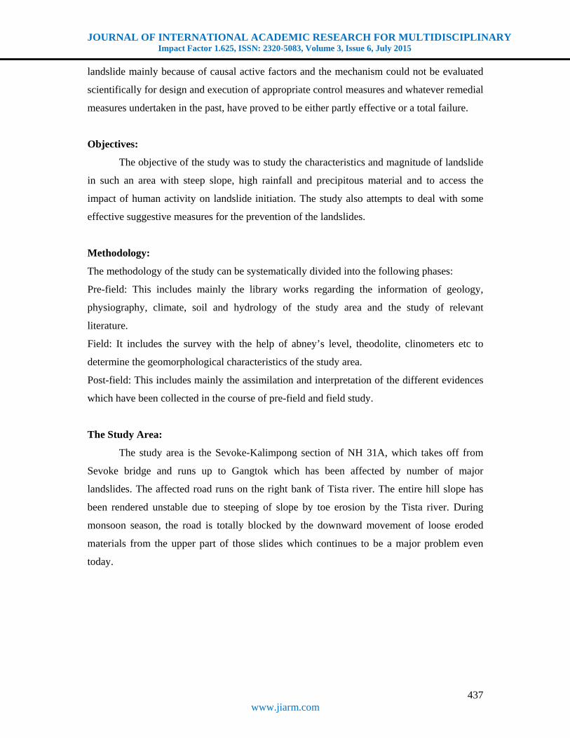
Geology: The Darjeeling Himalaya is separated from the for deep of the Ganga-Brahmaputra
plain by the active tectonic lines (Main Boundary Fault and Himalayan Font Tectonic line) in
JOURNAL OF INTERNATIONAL ACADEMIC RESEARCH FOR MULTIDISCIPLINARY Impact Factor 1.625, ISSN: 2320-5083, Volume 3, Issue 6, July 2015
439 www.jiarm.com
the zone of the subduction of the Indian block. It is built of a sequence of overthrusts pushed
southward and dipping to the north. Coming from the north, there are medium resistant
Darjeeling Gneisses, the Daling series of metamorphic rocks of varying resistance from
phylities to quartzities and the Damuda shales and sandstone interbedded with coal seams.
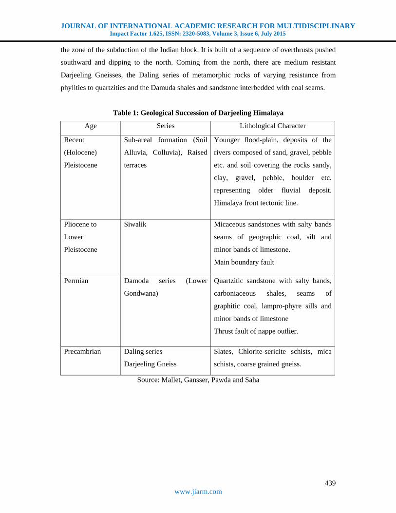
Table 1: Geological Succession of Darjeeling Himalaya
Age Series Lithological Character
Recent
(Holocene)
Pleistocene
Sub-areal formation (Soil
Alluvia, Colluvia), Raised
terraces
Younger flood-plain, deposits of the
rivers composed of sand, gravel, pebble
etc. and soil covering the rocks sandy,
clay, gravel, pebble, boulder etc.
representing older fluvial deposit.
Himalaya front tectonic line.
Pliocene to
Lower
Pleistocene
Siwalik Micaceous sandstones with salty bands
seams of geographic coal, silt and
minor bands of limestone.
Main boundary fault
Permian Damoda series (Lower
Gondwana)
Quartzitic sandstone with salty bands,
carboniaceous shales, seams of
graphitic coal, lampro-phyre sills and
minor bands of limestone
Thrust fault of nappe outlier.
Precambrian Daling series
Darjeeling Gneiss
Slates, Chlorite-sericite schists, mica
schists, coarse grained gneiss.
Source: Mallet, Gansser, Pawda and Saha
JOURNAL OF INTERNATIONAL ACADEMIC RESEARCH FOR MULTIDISCIPLINARY Impact Factor 1.625, ISSN: 2320-5083, Volume 3, Issue 6, July 2015
440 www.jiarm.com
Fig. 2: Geological Map of Darjeeling Hill
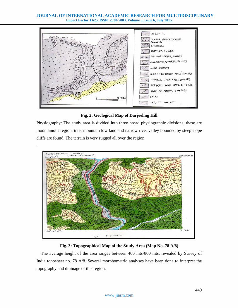
Physiography: The study area is divided into three broad physiographic divisions, these are
mountainous region, inter mountain low land and narrow river valley bounded by steep slope
cliffs are found. The terrain is very rugged all over the region.
.
Fig. 3: Topographical Map of the Study Area (Map No. 78 A/8)
The average height of the area ranges between 400 mts-800 mts. revealed by Survey of
India toposheet no. 78 A/8. Several morphometric analyses have been done to interpret the
topography and drainage of this region.
JOURNAL OF INTERNATIONAL ACADEMIC RESEARCH FOR MULTIDISCIPLINARY Impact Factor 1.625, ISSN: 2320-5083, Volume 3, Issue 6, July 2015
441 www.jiarm.com
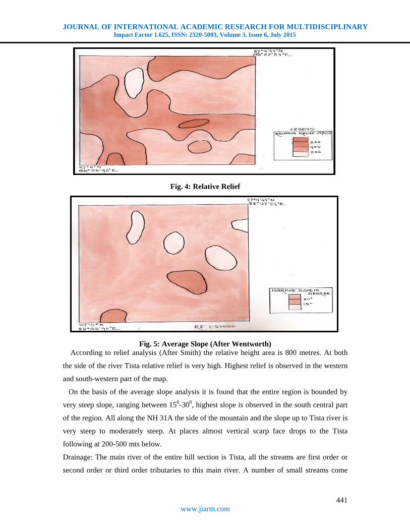
Fig. 4: Relative Relief
Fig. 5: Average Slope (After Wentworth) According to relief analysis (After Smith) the relative height area is 800 metres. At both
the side of the river Tista relative relief is very high. Highest relief is observed in the western
and south-western part of the map.
On the basis of the average slope analysis it is found that the entire region is bounded by
very steep slope, ranging between 150-300, highest slope is observed in the south central part
of the region. All along the NH 31A the side of the mountain and the slope up to Tista river is
very steep to moderately steep. At places almost vertical scarp face drops to the Tista
following at 200-500 mts below.
Drainage: The main river of the entire hill section is Tista, all the streams are first order or
second order or third order tributaries to this main river. A number of small streams come

JOURNAL OF INTERNATIONAL ACADEMIC RESEARCH FOR MULTIDISCIPLINARY Impact Factor 1.625, ISSN: 2320-5083, Volume 3, Issue 6, July 2015
442 www.jiarm.com
down along the steep hill slope, which guide tremendous velocity and exclusive water and
erosion. During monsoon, most of the tributaries join with the main river at right angle and
thus forming parallel drainage pattern. In many parts of this region, drainage density is high.
Sharp water divides lye from north-eastern to south-eastern part of this map.
Fig.6: Drainage Density
Causes of Slope Failures:
Causative factors for landslide phenomena in the study are categorized into five types. A
complex action of more than of these factors creates conditions favourable or otherwise
landslide initiation and need not necessarily be the direct use or trigger mechanism.
Geological factors:
i. Physio-technical properties of the rock.
ii. Existence of tectonic elements such as fold, faults and thrust, adverse dip strike
orientation of the discontinuity planes etc. As a rule the stronger the resistance to
the shearing of rock mass, lesser is the susceptibility to landslide
a) Rock slides are rare in Tista valley north of Tung and in Lachung valley north of
Chungthang because the rock type of the area are hand resistant shearing although
geomorphological features i.e. high energy, relief are conductive to landslides.
b) The weak nature of the rock mass, adverse orientation of the discontinuity planes
Coupled with higher degree of relief explain the higher incidence of landslides.
Geomorphological factors:
The most important factor that is the condition favourable for initiation of landslide is high
degree of relief. The higher the degree of relief, the greater is the susceptibilities of the area
JOURNAL OF INTERNATIONAL ACADEMIC RESEARCH FOR MULTIDISCIPLINARY Impact Factor 1.625, ISSN: 2320-5083, Volume 3, Issue 6, July 2015
443 www.jiarm.com
to landslide incidences. The entire study exhibits high degree of relief. Adverse
geomorphological condition is influenced by favourable geographical conditions namely
existence of high resistant rock mass making high relief slopes. This explains stable nature of
slopes in certain areas of north Sikkim such as Phensong-Phodong, Tung-Chunthang and
those in Lachung and Tista valleys north of Chungthang though these areas possess high
degree of relief and could have been susceptible to landslides.
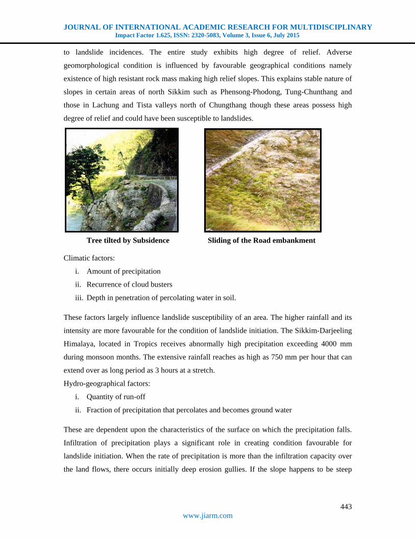
Tree tilted by Subsidence Sliding of the Road embankment Climatic factors:
i. Amount of precipitation
ii. Recurrence of cloud busters
iii. Depth in penetration of percolating water in soil.
These factors largely influence landslide susceptibility of an area. The higher rainfall and its
intensity are more favourable for the condition of landslide initiation. The Sikkim-Darjeeling
Himalaya, located in Tropics receives abnormally high precipitation exceeding 4000 mm
during monsoon months. The extensive rainfall reaches as high as 750 mm per hour that can
extend over as long period as 3 hours at a stretch.
Hydro-geographical factors:
i. Quantity of run-off
ii. Fraction of precipitation that percolates and becomes ground water
These are dependent upon the characteristics of the surface on which the precipitation falls.
Infiltration of precipitation plays a significant role in creating condition favourable for
landslide initiation. When the rate of precipitation is more than the infiltration capacity over
the land flows, there occurs initially deep erosion gullies. If the slope happens to be steep
JOURNAL OF INTERNATIONAL ACADEMIC RESEARCH FOR MULTIDISCIPLINARY Impact Factor 1.625, ISSN: 2320-5083, Volume 3, Issue 6, July 2015
444 www.jiarm.com
consisting of loose broken rocks or poorly consolidated soils, avalanches, slides and mud
flows occur following downpour.
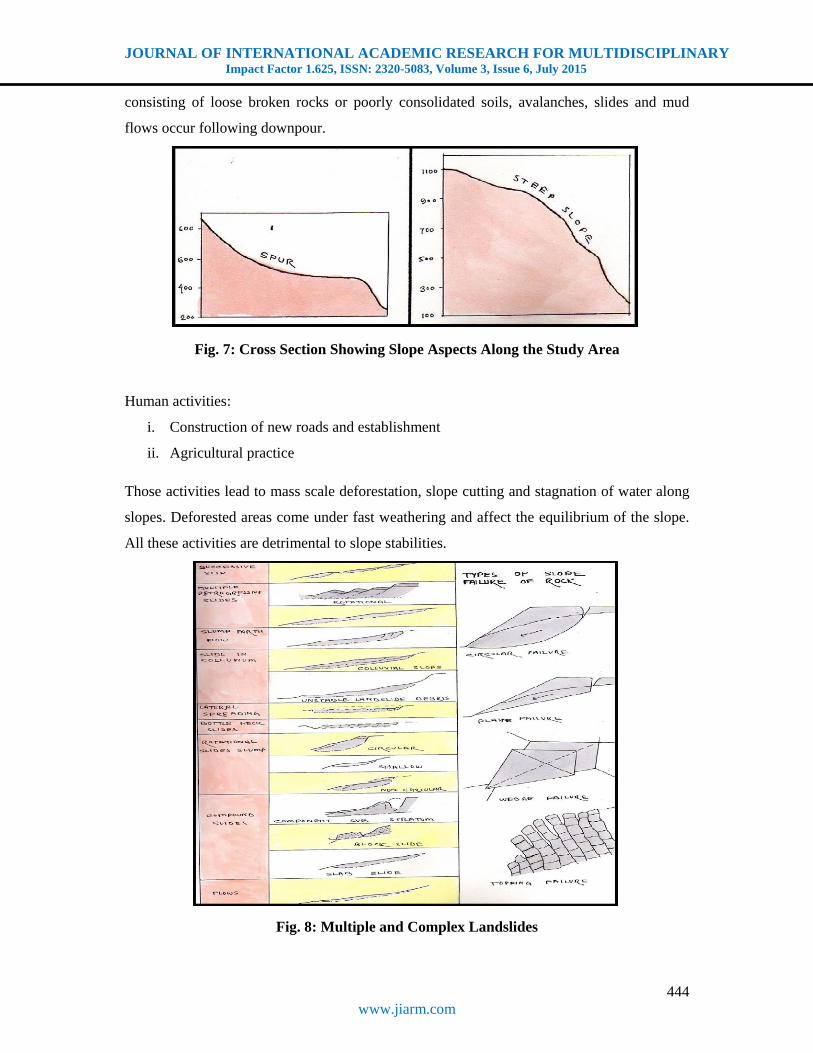
Fig. 7: Cross Section Showing Slope Aspects Along the Study Area
Human activities:
i. Construction of new roads and establishment
ii. Agricultural practice
Those activities lead to mass scale deforestation, slope cutting and stagnation of water along
slopes. Deforested areas come under fast weathering and affect the equilibrium of the slope.
All these activities are detrimental to slope stabilities.
Fig. 8: Multiple and Complex Landslides

JOURNAL OF INTERNATIONAL ACADEMIC RESEARCH FOR MULTIDISCIPLINARY Impact Factor 1.625, ISSN: 2320-5083, Volume 3, Issue 6, July 2015
445 www.jiarm.com
Description of the Landslides:
The NH 31A, which takes off from Sevoke bridge and runs upto Gangtok, (along the Tista
river) has been affected by number of major landslides, especially during the rainy season
leading to the total disruption of vehicular traffic between the hills and the plains with the
consequent disastrous effect on the transport of goods and tourist operation. The undercutting
of slopes due to heavy monsoonal precipitation, deforestation, unscientific cultivation and
construction activities are known to combine with rather complex and immature geological
formation in the region to generate variety of landslides. The landslides in the Tista valley
along the NH 31A, have been dealt separately as their characteristics were compiled mostly
from GSI reports. The valley side of Tista and tributaries were undermined during the flood.
On these slopes were formed big rocks and earth slides, especially in the parts built by the
less resistant daling shales or by thick covers of waste materials. The niches are visible near
Tista bazaar. Most of the tongues were later carried away by the flood waters.
Description of the Transitional Slide: The transitional slide is observed 32.5 km away from
Siliguri on the left side of the road NH 31A. The road runs along the left side of the Tista
river. The base length of the slide is 17.5 mts. Boulders of different size from dust to small
boulders or angular fragments are the main eroded materials of the slide. Inclination of the
rock beds is towards the road. The rocks are mainly quartzite, very few phylite or slates
(slightly oxidized). The foliation plane is also dipping downwards producing a far weak slope
compared to rocks dipping upwards. Therefore the hill-slope itself is comparatively unstable.
Fig. 9: Transitional Slide
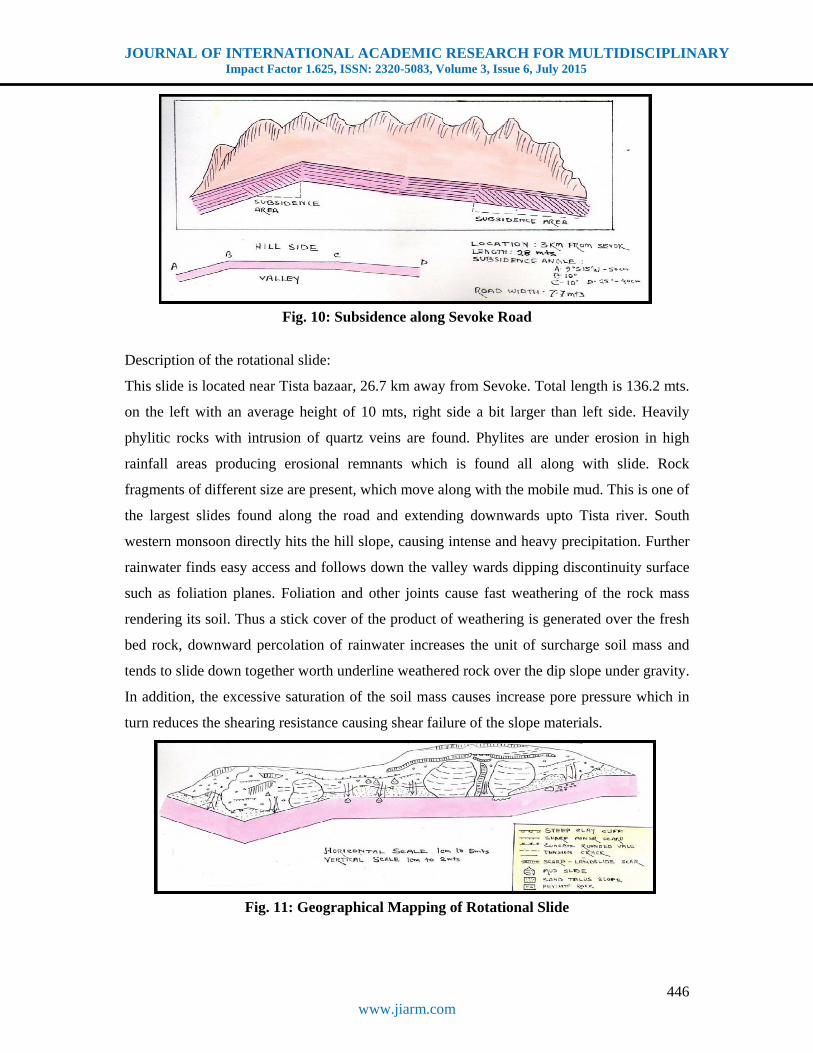
Description of the subsidence:
The subsidence area is observed 3 km away from Sevoke. The road runs along the left side of
Tista river. Total length of the portion of the road is 28 mts. The subsidence may have been
caused by many factors. Some geologically vulnerable areas are found. The vehicular
movement on the road is reciprocally higher than normal.
JOURNAL OF INTERNATIONAL ACADEMIC RESEARCH FOR MULTIDISCIPLINARY Impact Factor 1.625, ISSN: 2320-5083, Volume 3, Issue 6, July 2015
446 www.jiarm.com
Fig. 10: Subsidence along Sevoke Road
Description of the rotational slide:
This slide is located near Tista bazaar, 26.7 km away from Sevoke. Total length is 136.2 mts.
on the left with an average height of 10 mts, right side a bit larger than left side. Heavily
phylitic rocks with intrusion of quartz veins are found. Phylites are under erosion in high
rainfall areas producing erosional remnants which is found all along with slide. Rock
fragments of different size are present, which move along with the mobile mud. This is one of
the largest slides found along the road and extending downwards upto Tista river. South
western monsoon directly hits the hill slope, causing intense and heavy precipitation. Further
rainwater finds easy access and follows down the valley wards dipping discontinuity surface
such as foliation planes. Foliation and other joints cause fast weathering of the rock mass
rendering its soil. Thus a stick cover of the product of weathering is generated over the fresh
bed rock, downward percolation of rainwater increases the unit of surcharge soil mass and
tends to slide down together worth underline weathered rock over the dip slope under gravity.
In addition, the excessive saturation of the soil mass causes increase pore pressure which in
turn reduces the shearing resistance causing shear failure of the slope materials.
Fig. 11: Geographical Mapping of Rotational Slide

JOURNAL OF INTERNATIONAL ACADEMIC RESEARCH FOR MULTIDISCIPLINARY Impact Factor 1.625, ISSN: 2320-5083, Volume 3, Issue 6, July 2015
447 www.jiarm.com
Preparation of Landslide Zonation Map:
For a better understanding of the geographical distribution of landslide prone areas in
between Siliguri to Kalimpong, a map has been produced with the help of a ‘cheque list’(
Modified after Cooke and Doorncamp, 1974) from Topographical sheet 78 A/8 and direct
field observation.
Fig. 12: Landslide Zonation Map
Class-I: Very High Landslide Prone Areas:
These are the areas where landslides occur more frequently within a very short time period.
They are found along both the eastern and western part of the Tista river. It covers the area
which is situated by the side of the road NH 31A. For example, Tista Bazaar area, which is
located near the Tista bridge and west side of the NH 31A, is very high landslide prone area.
In the monsoonal season, landslide occurrence is very high in this area due to heavy rainfall.
Class-II: High Landslide Prone Areas:
It also includes the both side of the Tista river and Rilli Khola. In this area, slope is very
steep, drainage density and relative relief are very high, bed rock is fractured or joint. This
leads to instabilities on the valley side of the streams. Steep river gradient generally indicate a
phase of active and rapid incision, so the area is highly landslide prone.
JOURNAL OF INTERNATIONAL ACADEMIC RESEARCH FOR MULTIDISCIPLINARY Impact Factor 1.625, ISSN: 2320-5083, Volume 3, Issue 6, July 2015
448 www.jiarm.com
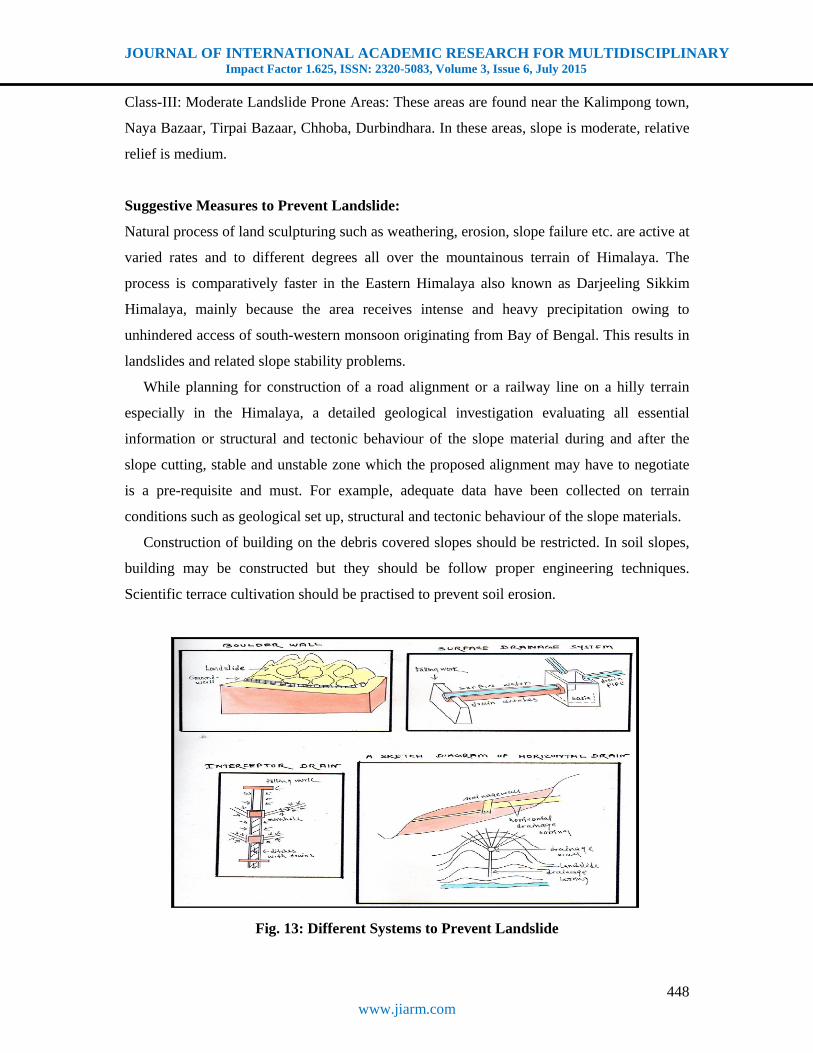
Class-III: Moderate Landslide Prone Areas: These areas are found near the Kalimpong town,
Naya Bazaar, Tirpai Bazaar, Chhoba, Durbindhara. In these areas, slope is moderate, relative
relief is medium.
Suggestive Measures to Prevent Landslide:
Natural process of land sculpturing such as weathering, erosion, slope failure etc. are active at
varied rates and to different degrees all over the mountainous terrain of Himalaya. The
process is comparatively faster in the Eastern Himalaya also known as Darjeeling Sikkim
Himalaya, mainly because the area receives intense and heavy precipitation owing to
unhindered access of south-western monsoon originating from Bay of Bengal. This results in
landslides and related slope stability problems.
While planning for construction of a road alignment or a railway line on a hilly terrain
especially in the Himalaya, a detailed geological investigation evaluating all essential
information or structural and tectonic behaviour of the slope material during and after the
slope cutting, stable and unstable zone which the proposed alignment may have to negotiate
is a pre-requisite and must. For example, adequate data have been collected on terrain
conditions such as geological set up, structural and tectonic behaviour of the slope materials.
Construction of building on the debris covered slopes should be restricted. In soil slopes,
building may be constructed but they should be follow proper engineering techniques.
Scientific terrace cultivation should be practised to prevent soil erosion.
Fig. 13: Different Systems to Prevent Landslide

JOURNAL OF INTERNATIONAL ACADEMIC RESEARCH FOR MULTIDISCIPLINARY Impact Factor 1.625, ISSN: 2320-5083, Volume 3, Issue 6, July 2015
449 www.jiarm.com
Conclusion:
From the analysis it can be said that the study area is highly susceptible to landsliding.
All the environmental factors here are favourable of landsliding. This has been aggravated by
human activities particularly road and building construction which disturb the natural slope.
This implies a practical problem to hill slope. The road remains unstable occasionally during
rainy season in almost each and every year. Thus the communication is greatly affected. So
proper steps should be rigidly implemented in case of construction activities, following the
underlying geological and the surrounding physiographical structures, to prevent the
landslides and ensure a safe and unaffected flow of traffic. Thus the overall equilibrium in
relation to the slope aspects of the study area (part of Darjeeling-Sikkim Himalaya) can be
properly maintained.
References:
1. Bhattacharya, A., Mishra, P., Ghoshal, T. B., Bahuguna, H. and Ghatak, T. 1998. A Geotechnical Appraisal of Landslides on 7th July 1998 along National Highway No. 55. G.S.I. (Editor) Progress Report.
2. Gautam, A. 2009. Geomorphology. Allahabad: Sharda Pustak Bhawan. pp 244-267. 3. Detwyler, T. R. 1971. Man’s Impact on Environment. New York: McGraw Hill. 4. Sarkar, A. 1977. Practical Geography- A Systematic Approach. Kolkata: Orient Longman. 5. Sharpe, C. F. S. 1938. Landslide and Related Phenomena. New York: Columbia University Press. 6. Singh, S. 2007. Geomorphology. Allahabad: Prayag Pustak Bhawan. pp 267-296. 7. Thornbury, W. D. 2004 Principles of Geomorphology. New Delhi: C B S Publishers and Distributors.