outline: description of georeferencing systems cartesian/plane coordinates global systems local...
TRANSCRIPT
OUTLINE: description of georeferencing systems cartesian/plane coordinates global systems local systems
GGEOREFERENCING EOREFERENCING
SSYSTEMSYSTEMS

GEOREFERENCING SYSTEMS
method for representing/identifying locations on earth’s surface
purposes:
location of a specific map feature may be measured and recorded for future use
known coordinates of a feature may be used to find and map its location
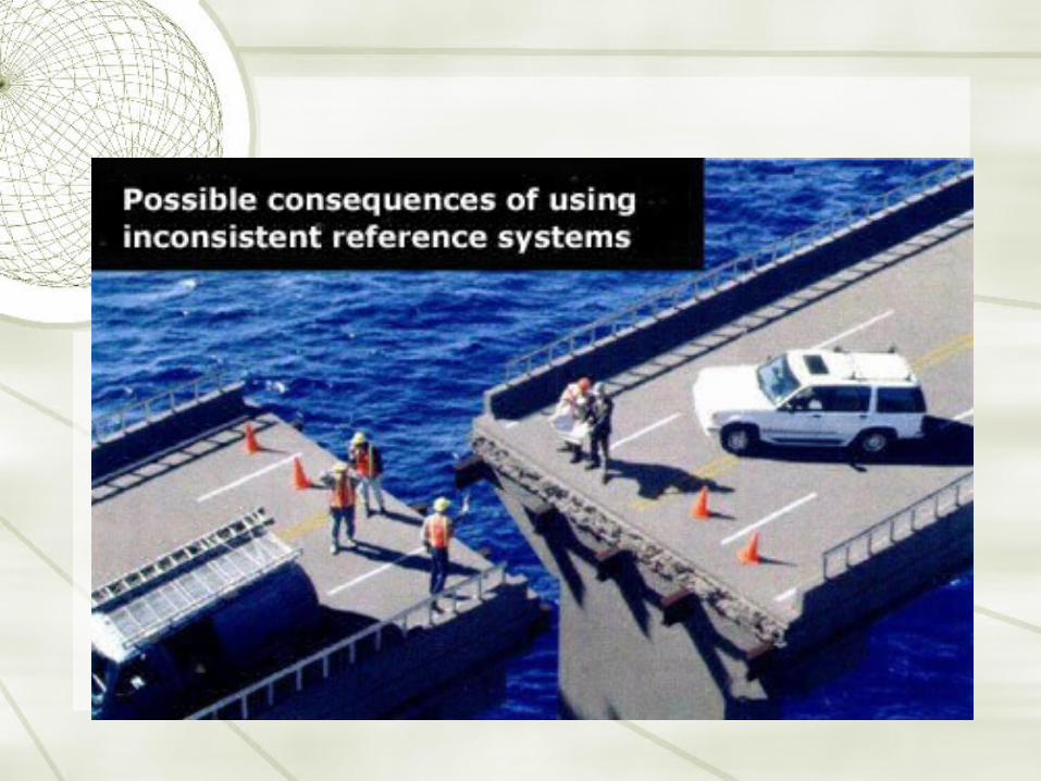
number of different systems based on variety of datums, units, projections and reference systems

TYPES IN USE TYPES IN USE
Plane/Rectangular Coordinates
used for locating points on a flat map
cartesian coordinates and modern form
Geographical Coordinates
primary system
used for locating positions on uniformly curved surface

CARTESIAN SYSTEMSCARTESIAN SYSTEMS
mathematical coordinate system defined by distance away from origin
1. locate an origin
2. set two axes through origin in fixed directions, at right angles to each other
x is horizontal axis (east) and y is vertical axis (north)

CARTESIAN SYSTEMSCARTESIAN SYSTEMS

calculate distance between locations
CARTESIAN SYSTEMSCARTESIAN SYSTEMS

Advantages
based on simple mathematics
Disadvantages
coordinates tied to that particular projection and spatial extent
CARTESIAN SYSTEMSCARTESIAN SYSTEMS
GLOBAL SYSTEMSGLOBAL SYSTEMS
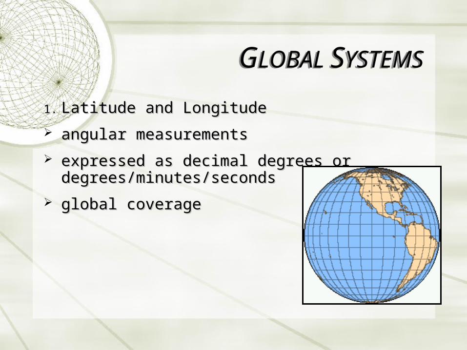
1.1. Latitude and LongitudeLatitude and Longitude
angular measurementsangular measurements
expressed as decimal degrees or expressed as decimal degrees or degrees/minutes/secondsdegrees/minutes/seconds
global coverageglobal coverage
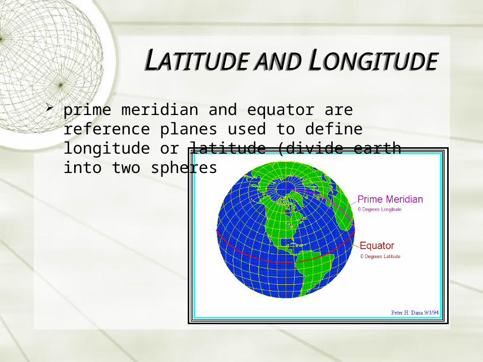
LATITUDE AND LONGITUDELATITUDE AND LONGITUDE
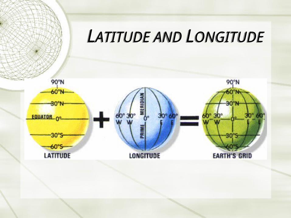
prime meridian and equator are reference planes used to define longitude or latitude (divide earth into two spheres
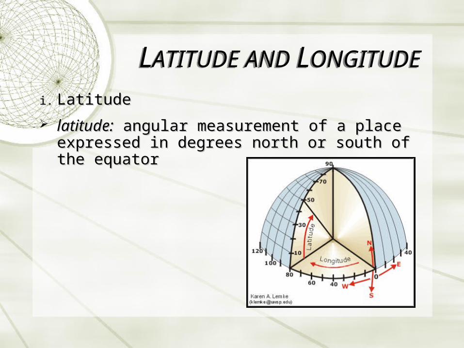
i.i. LatitudeLatitude
latitude:latitude: angular measurement of a place expressed angular measurement of a place expressed in degrees north or south of the equatorin degrees north or south of the equator
LATITUDE AND LONGITUDELATITUDE AND LONGITUDE

i.i. LatitudeLatitude
parallel: line connecting all points along the same latitudinal angle (name of the line).
run from 0o at equator to 90o N/S at poles in an east-west direction
LATITUDE AND LONGITUDELATITUDE AND LONGITUDE

distance between parallels does not change distance between parallels does not change significantlysignificantly
one degree of latitude = ~111 km; one minute = 1.6 km; one second = 30 m
LATITUDE AND LONGITUDELATITUDE AND LONGITUDE
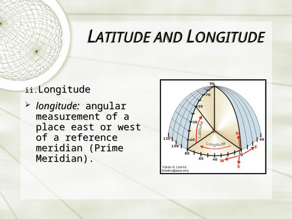
ii.ii. Longitude Longitude
longitude:longitude: angular angular measurement of a place measurement of a place east or west of a east or west of a reference meridian reference meridian (Prime Meridian).(Prime Meridian).
LATITUDE AND LONGITUDELATITUDE AND LONGITUDE

ii.ii. Longitude Longitude
meridian: line connecting all points along the same longitude.
run in N-S direction from pole to pole; from 0o to 180o E/W
LATITUDE AND LONGITUDELATITUDE AND LONGITUDE

meridians converge at poles
longitude varies from 111 km (equator) to 0 (poles)
LATITUDE AND LONGITUDELATITUDE AND LONGITUDE
LATITUDE AND LONGITUDELATITUDE AND LONGITUDE

Prime MeridianInternational Date Line

Degrees to Decimal Degrees
example: 45° 33' 22" (45 degrees, 33 minutes, 22 seconds).
LATITUDE AND LONGITUDELATITUDE AND LONGITUDE

Advantages
global coverage (supports small scale maps)
Disadvantages
parallels are not really equally spaced (approx. 1 km difference from pole to equator)
many significant digits are required for high precision mapping
LATITUDE AND LONGITUDELATITUDE AND LONGITUDE
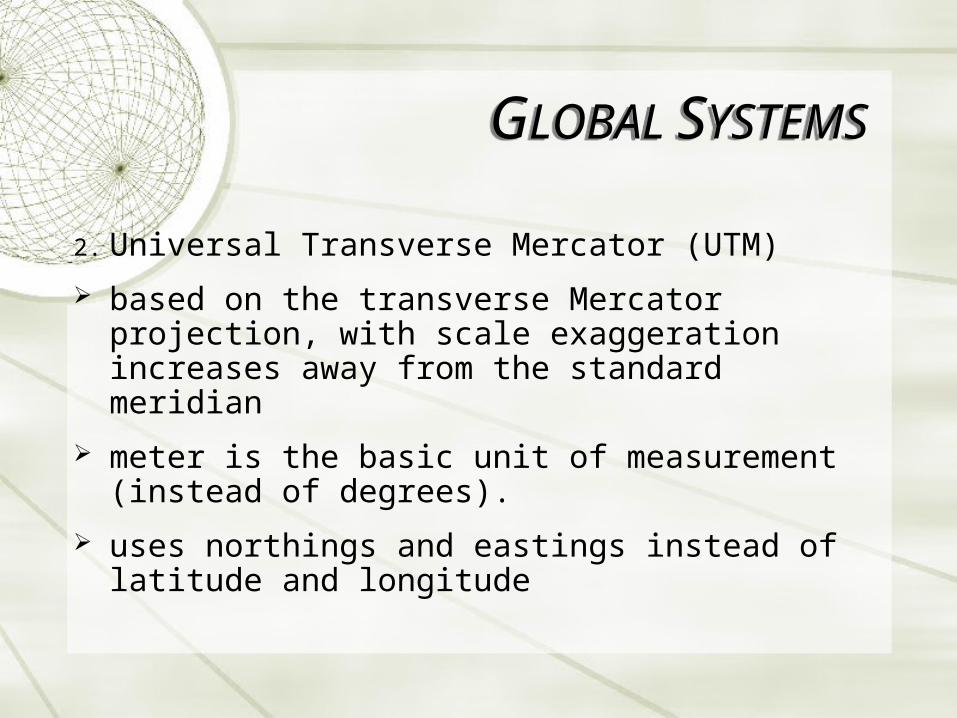
2. Universal Transverse Mercator (UTM)
based on the transverse Mercator projection, with scale exaggeration increases away from the standard meridian
meter is the basic unit of measurement (instead of degrees).
uses northings and eastings instead of latitude and longitude
GLOBAL SYSTEMSGLOBAL SYSTEMS

2.2. Universal Transverse Mercator (UTM)Universal Transverse Mercator (UTM)
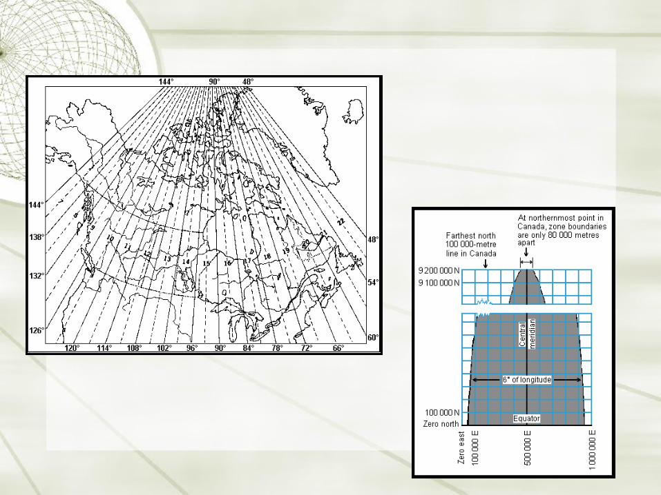
divided into N-S columns 6o of longitude wide – columns are called zoneszones
GLOBAL SYSTEMSGLOBAL SYSTEMS

2.2. Universal Transverse Mercator (UTM)Universal Transverse Mercator (UTM)
each column is divided into quadrilaterals of 8o of latitude
GLOBAL SYSTEMSGLOBAL SYSTEMS

columns numbered 1-60 eastward, rows are assigned letters C to X; each quadrilateral is assigned a number-letter combination
GLOBAL SYSTEMSGLOBAL SYSTEMS
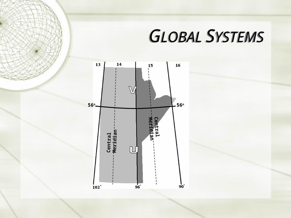
56o56o
Ce
ntr
al
Me
rid
ian C
entral M
eridia
n
GLOBAL SYSTEMSGLOBAL SYSTEMS

UTM GRIDUTM GRID
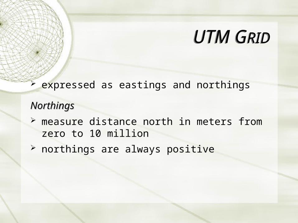
expressed as eastings and northings
NorthingsNorthings measure distance north in meters from zero
to 10 million northings are always positive

northern hemisphere – equator is assigned northing values of 0 m North
southern hemisphere, equator is given “false northing” of 10,000,000 m to avoid (-) Northings.
UTM GRIDUTM GRID

EastingsEastings referenced to the center
line of the zone known as the central meridian
central meridian for each zone is assigned an easting value of 500,000 m
UTM GRIDUTM GRID

EastingsEastings measure distance east in
metres from central meridian (false easting)
an easting of zero will never occur, since a 6o wide zone is never more than 674,000 m wide
UTM GRIDUTM GRID

y
x
N. Hemisphereorigin is
(500,000m, 0)
x
y
S. Hemisphereorigin is
(500,000m, 10,000,000m)
UTM GRIDUTM GRID

ex. 14U 629,443E 5 521 654N
from the left, the first number is the UTM zone (or column), the letter is the row designation
so this location is 626,443 meters left (west) of zone 14's central meridian, and 5,521,654 meters up (north) from the equator.
UTM GRIDUTM GRID

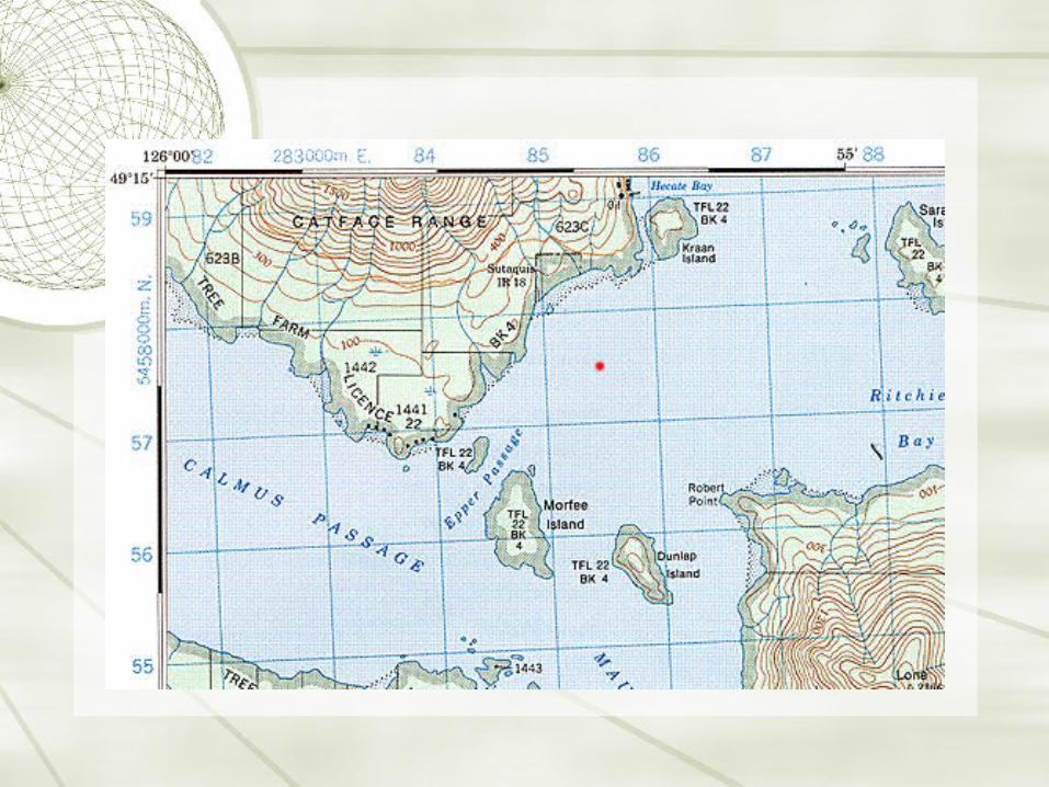
Locating on a UTM Map
1. Look for zone number and mark it down (important to have this indicated)
2. Read right to the grid intersection before your place of interest. Then measuring right in meters from intersection will give the complete easting
3. Do the same in the Y direction.
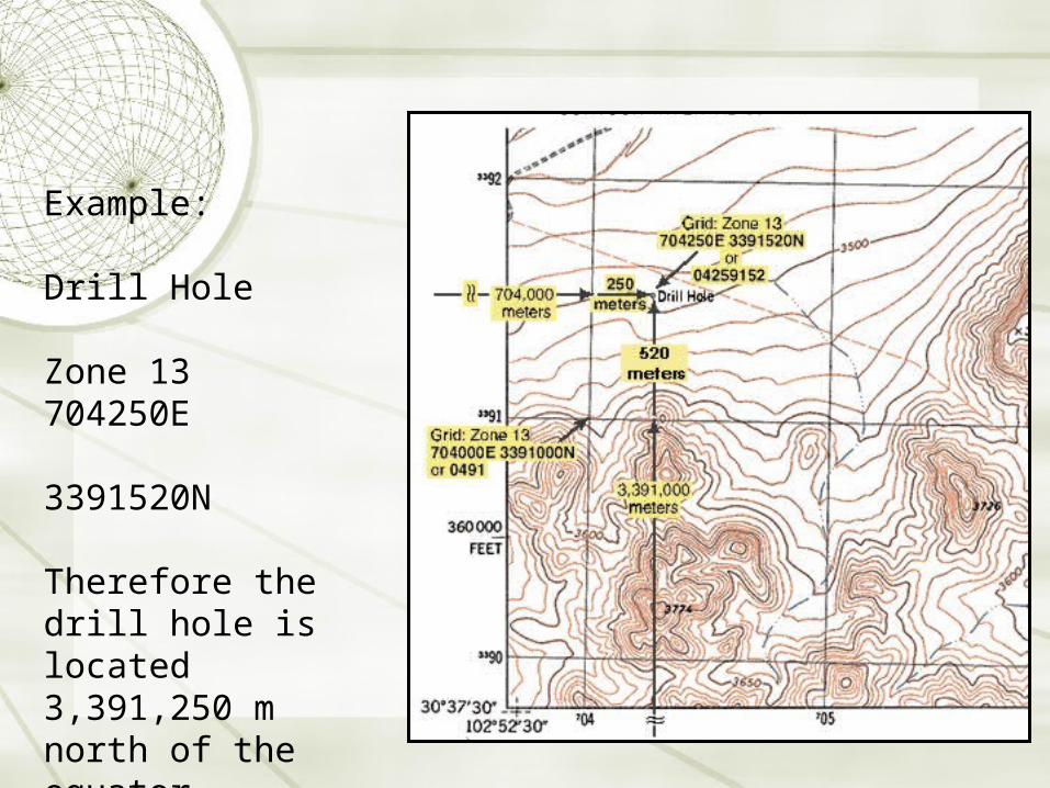
Example:
Drill Hole
Zone 13 704250E 3391520N
Therefore the drill hole is located 3,391,250 m north of the equator
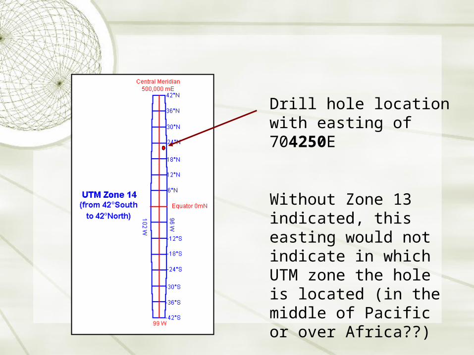
Drill hole location with easting of 704250E
Without Zone 13 indicated, this easting would not indicate in which UTM zone the hole is located (in the middle of Pacific or over Africa??)

Examples
1. Hilltop 3726?Zone 13
705775E
3391395N
2. Hilltop 3774?Zone 13 705580E
3390680N

Advantages
“real” distances (in meters)
excellent for large-scale maps
Disadvantages distortion above 80o latitude non-global coverage
UTM GRIDUTM GRID
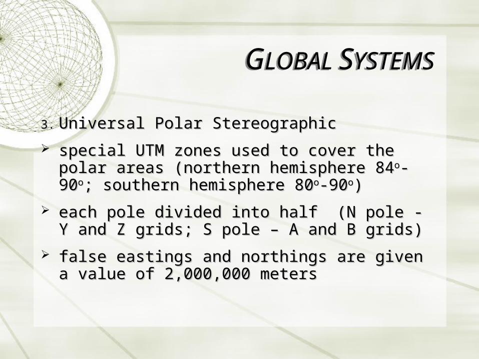
3.3. Universal Polar StereographicUniversal Polar Stereographic
special UTM zones used to cover the polar areas special UTM zones used to cover the polar areas (northern hemisphere 84(northern hemisphere 84oo-90-90oo; southern hemisphere ; southern hemisphere 8080oo-90-90oo))
each pole divided into half (N pole - Y and Z grids; S each pole divided into half (N pole - Y and Z grids; S pole – A and B grids)pole – A and B grids)
false eastings and northings are given a value of false eastings and northings are given a value of 2,000,000 meters2,000,000 meters
GLOBAL SYSTEMSGLOBAL SYSTEMS
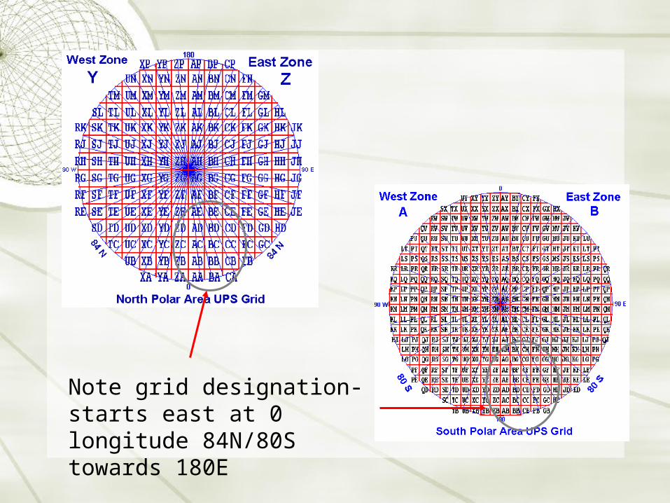
Note grid designation- starts east at 0 longitude 84N/80S towards 180E
World Geographic Reference System (GEOREF)World Geographic Reference System (GEOREF)
used for aircraft navigationused for aircraft navigation
based on latitude and longitudebased on latitude and longitude
globe is divided into 12 bands of latitude and 24 globe is divided into 12 bands of latitude and 24 zones of longitude, each 15zones of longitude, each 15oo in extent in extent
15-degree areas further divided into one degree units 15-degree areas further divided into one degree units identified by 15 charactersidentified by 15 characters
GLOBAL SYSTEMSGLOBAL SYSTEMS

GLOBAL SYSTEMSGLOBAL SYSTEMS
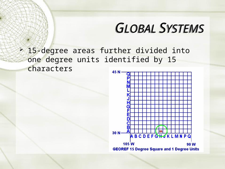
15-degree areas further divided into one degree units identified by 15 characters
GLOBAL SYSTEMSGLOBAL SYSTEMS

two numeric characters designate the integer number of minutes of longitude east of the one degree quadrangle boundary longitude.
two additional numeric characters designate the number of minutes of latitude north of the one degree quadrangle boundary latitude.
GLOBAL SYSTEMSGLOBAL SYSTEMS

Postal codes
Telephone codes
GLOBAL SYSTEMSGLOBAL SYSTEMS