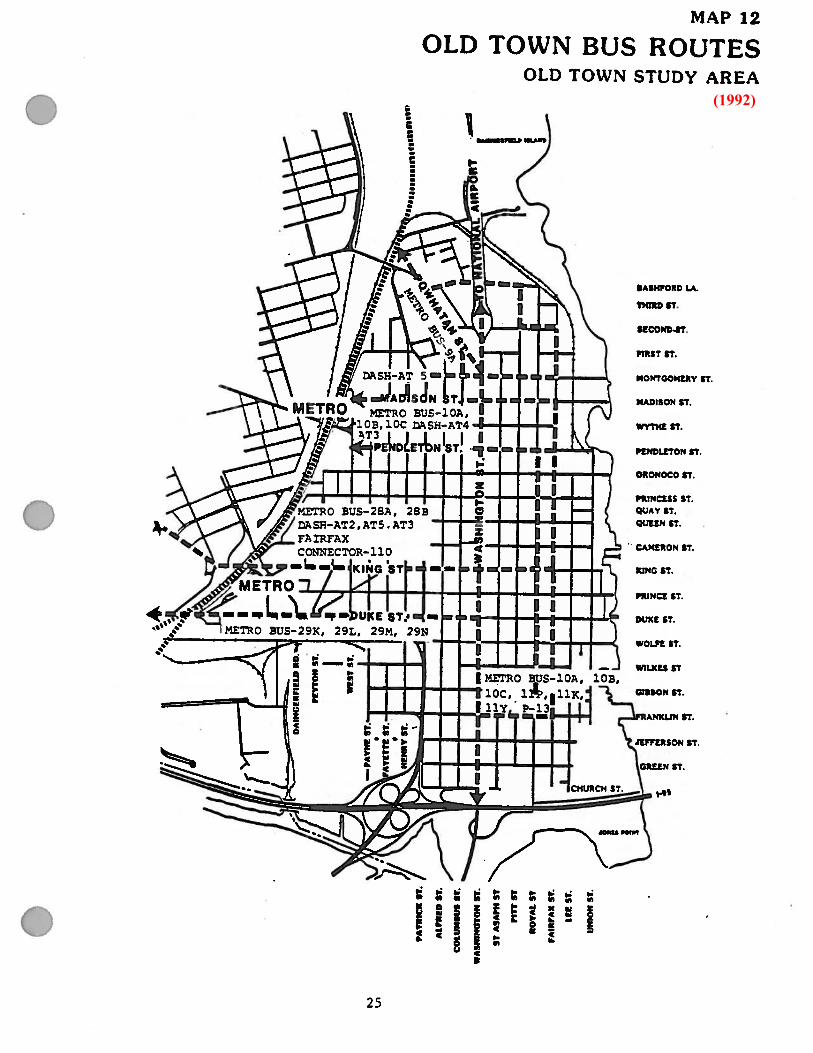
old town - city of alexandria, va · old town bus routes (1992) 25 ... amended 12/11/1993,...
TRANSCRIPT

OLD TOWNSMALL AREA PLAN
ADOPTED 1992 MASTER PLAN
ALEXANDRIA, VIRGINIA
Amended 5/15/1993, Ordinance 3630 Amended 12/11/1993, Ordinance 3686 Amended 12/14/1996, Ordinance 3899 Amended 10/25/1997, Ordinance 3956 Amended 11/14/1998, Ordinance 4030 Amended 1/25/2003, Ordinance 4287 Amended 1/22/2005, Ordinance 4374 Amended 6/21/2005, Ordinance 4412Amended 10/15/2006, Ordinance 4426 Amended 2/25/2012, Ordinance 4749
Amended 6/24/2014; Ordinance 4896 Amended 11/15/2014, Ordinance 4912See Ordinance 3381, 5/31/89 - re: the area south of I-95

Master Plan Amendment # Ordinance # Passage Date Description/Address Small Area Plan Land Use Change
MPA92-0002 3630 5/15/1993 601 Wilkes St (Tannery House) Old Town
Change in land use designation from
CD to RH
MPA92-0003 3630 5/15/1993 121 S Columbus St Old Town
Change in land use designation from
RM to CD
MPA93-0001 3686 12/11/1993
Text updates to OT SAP as outlined: page 49
(Amend policy for restaurants on King Street,
East of Washington Street)
OT/AW/Braddock/L
andmark
Text changes to page 48 & 49 of OT
SAP
MPA96-0006 3899 12/14/1996 310-310A S Columbus St. Old Town
Change in land use designation for OT
West of Washington Street from RM
to CD
MPA97-0003 3956 10/25/1997 323 N Washington St. Old Town
Change in Land Use designation from
RM to CD
MPA98-0003 4030 12/12/1998
208 S. Royal Street; Change Land Use from
RM to P (Old Town Tot Lot)
OT/KSEA/Landmark
/OTN/PW
Change in land use designation from
RM to P
MPA2002-0004 4287 1/25/2003
409 N Pitt Street; blocks bounded by N. Pitt,
N Royal, Princess, Pendleton (Madden
Homes) Old Town/OTN
Change in land use designation from
RM to CRMU-X/Residential
MPA2004-0001 4374 1/22/2005 1323 Duke Street (Beasley Square) Old Town
Change in land use designation from
Single Family to Multi-family
residential
MPA2005-0002 4412 6/21/2005 Approval of King Street Retail Strategy OT/Braddock /KSEA
Incorporate King Street Retail
Strategy in the Master Plan
MPA2005-0003 4426 10/15/2005
Hunting Creek SAP; Addendum of Hunting
Creek Area Plan to OT SAP OT/SWQ
Adopted the Hunting Creek Plan as an
addendum to the OT SAP
MPA2011-0001 4749 2/25/2012 Approval of the Waterfront Small Area Plan OT/OTN/PYPG
Incorporate Waterfront Plan in the
Master Plan
MPA2014-0003 4896 6/24/2014 206, 208, 210 & 212 S. Patrick Street Old Town
Change in land use designation from
CL to RM/Townhouse
MPA2014-0007 4912 11/15/2014 329 N. Washington St. Old Town
Change in land use designation from
RM to CD, w/proffer
AMENDMENTS TO THE 1992 OLD TOWN SMALL AREA PLAN - as of 12/31/14


TABLE OF CONTENTS
Introduction
Background and Issues
Boundaries 1
History of Area 1
Consolidated Master 9
Changes Since 1974 18
Downtown Business 23
W aterfront - Title Dispute - 1981 Plan 23
Highways and Traffic 24
Existing Conditions
Existing Land Use 26
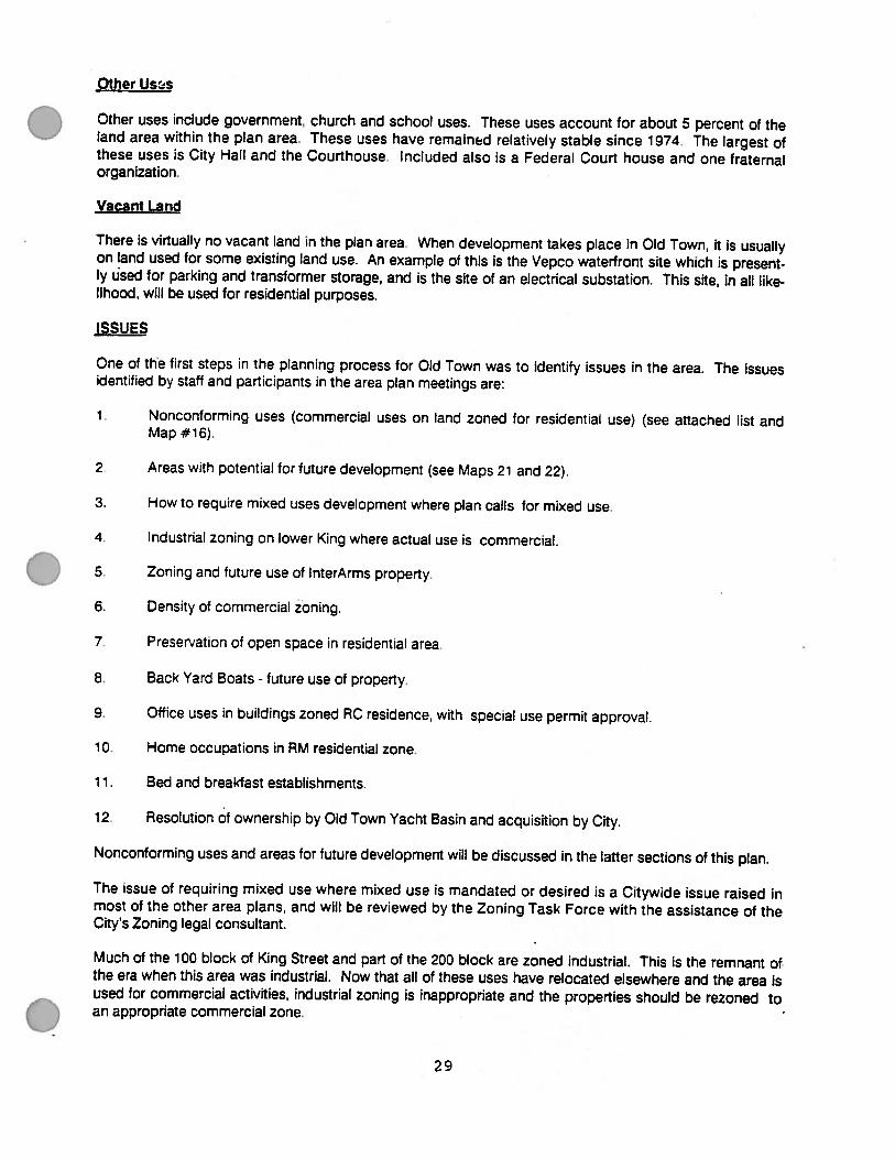
Issues 29
Zoning 33
Height Districts 37
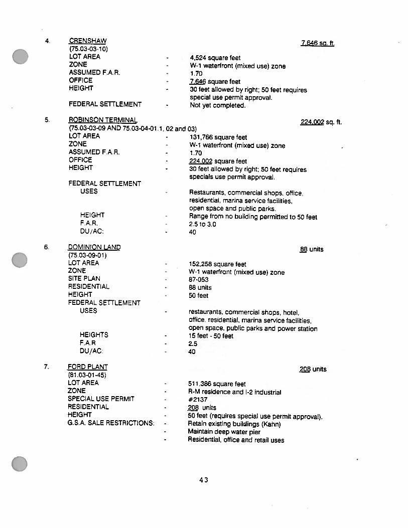
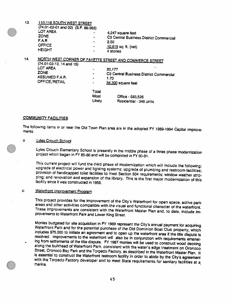
Development Potential Sites 37
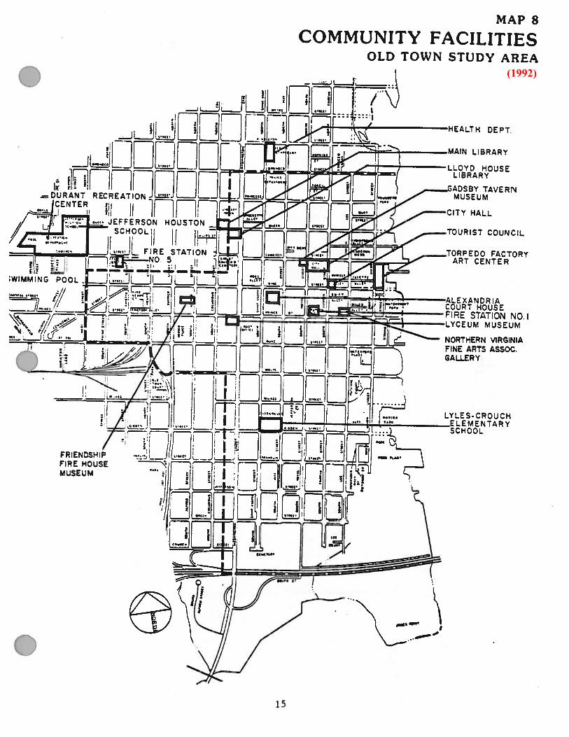
Community Facilities 45
The Future
Goals and Objectives 48
Policies for Old Town 48
Proposed Generalized Land Use Plan 50
Detailed Land Use Plan 50
Changes to the Adopted Land Use Plan 55
Implementation
Plan Adoption 62
Comprehensive Zoning Changes 62
Proposed Zoning 67
Addendum - Area South of 1-95
LIST OF MAPS
1. Study Area 2
2. Original Town Layout 3
3. Growth by Annexation 4
4. Railroad Activities 1900-1905 6
5. Old & Historic Alexandria District (1992) 7
6. 1974 Generalized Land Use Plan as Amended 12
7. 1974 Generalized Land Use Plan As Amended W est of W ashington Street 13
8. Community Facilities (1992) 15
9. Existing Parks (1992) 16
10. Major Thoroughfare Plan (1992) 17
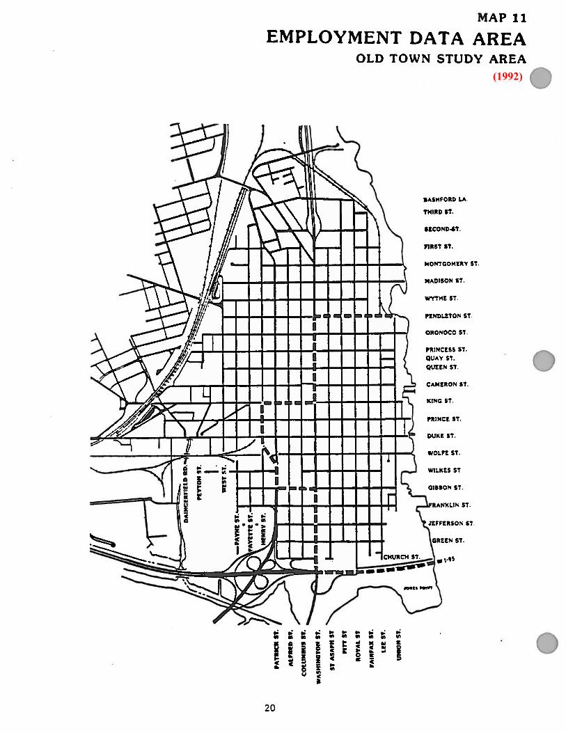
11. Employment Data Area (1992) 20
12. Old Town Bus Routes (1992) 25
13. Existing Land Use (Generalized) (1992) 27
14. Existing Generalized Land Use W est of W ashington Street (1992) 28
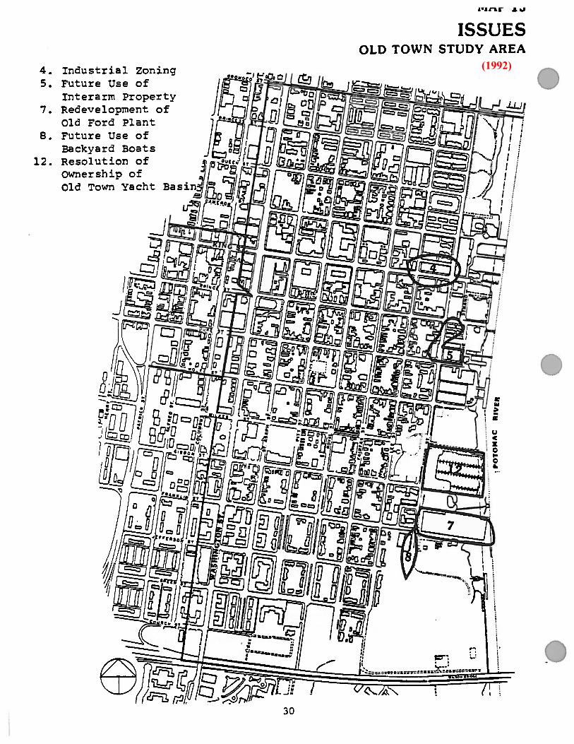
15. Issues (1992) 30
16. Non-Conforming Uses (1992) 31
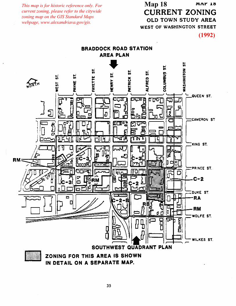
17. Current Zoning 34
18. Current Zoning West of W ashington Street 35
18A. Zoning Detail W est of W ashington Street 36
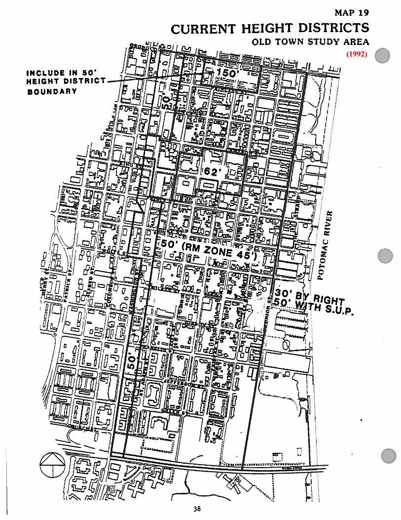
19. Current Height Districts 38
20. Current Height Districts West of W ashington Street 39
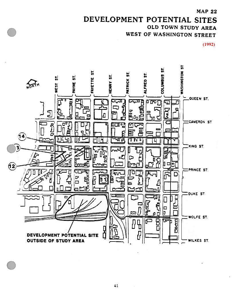
21. Development Potential Sites (1992) 40
22. Development Potential Sites West of W ashington Street (1992) 41
23. Proposed Generalized Land Use Plan (1992) 51
24. Proposed Generalized Land Use Plan W est of W ashington Street (1992) 52
25. Old Town Land Use Plan, as amendedAmended 5/15/1993, Ord.3630; Amended 12/11/1993, Ord.3686; Amended 10/25/1997, Ord.3956; Amended 11/14/1998, Ord.4030; Amended 1/25/2003, Ord. 4287; Amended 6/21/2005, Ord. 4412; Amended 10/15/2006, Ord. 4426; Amended 2/25/2012, Ord. 4749; Amended 6/24/14, Ord. 4896; Amended 11/15/14, Ord. 4912
53

LIST OF MAPS (CONTINUED)
26. Old Town Land Use Plan,West of Washington Street, as amended Amended 5/15/93, Ord. 3630; 12/14/96 Ord.3899; Amended 1/22/05, Ord. 4374; Amended 6/21/05/4412; Amended 6/12/14, Ord. 4896
54
27. Proposed Changes to Adopted Land Use Plan 56
28. Proposed Changes to Adopted Land Use Plan West of W ashington Street 57
29. Proposed Major Thoroughfare Plan 61
30. Proposed Zoning Changes 68
31. Proposed Zoning Changes W est of W ashington Street 69
32. Proposed Zoning Map 70
33. Proposed Zoning Map W est of W ashington Street 71
LIST OF MAPSADDENDUM
A-1 Old and Historic Alexandria South of 1-95 76
A-2 1974 Land Use Plan 77
A-3 Existing Uses 78
A-4 Existing Zoning 79
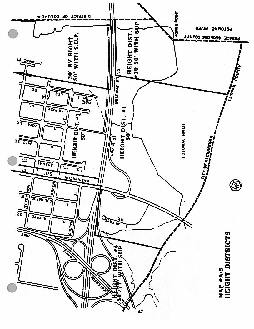
A-5 Height Districts 81
A-6 One Hundred Year Flood Plain and Spot Elevations 82
A-7 Proposed Land Use Plan 83
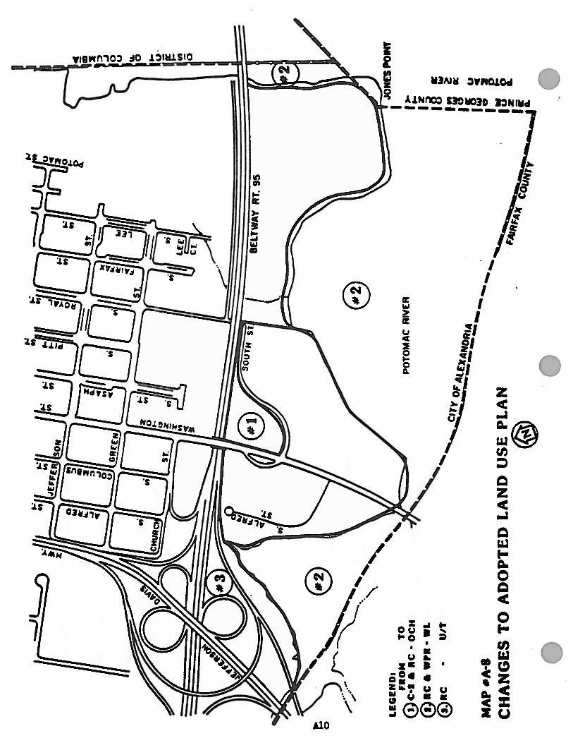
A-8 Changes to Adopted Land Use Plan 84
A-9 Proposed Zoning Changes 86
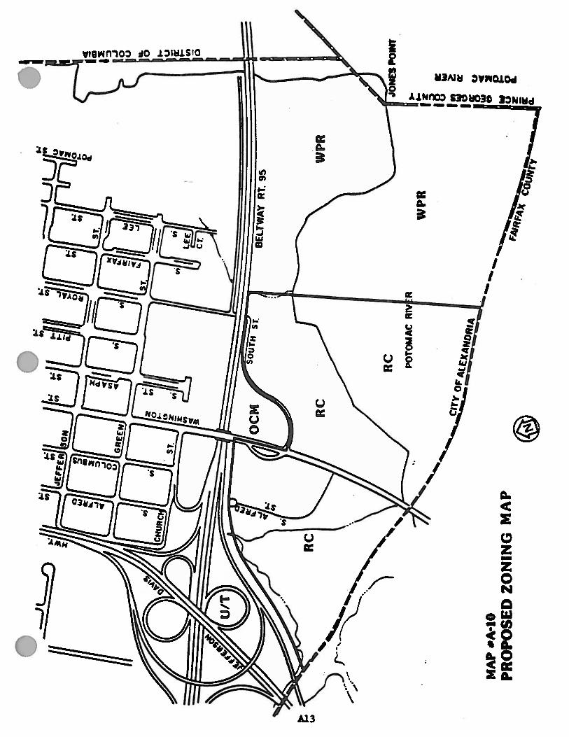
A-10 Proposed Zoning Map 87


Map 1Study Area

Map 2Original Town LayoutOld Town Study Area


Map 4

Map 5
(1992)


(1992)

(1992)

(1992)


(1992)


(1992)


(1992)

(1992)
(1992)

(1992)


(1992)
This map is for historic reference only. For current zoning, please refer to the citywide zoning map on the GIS Standard Maps webpage, www.alexandriava.gov/gis.
(1992)
This map is for historic reference only. For current zoning, please refer to the citywide zoning map on the GIS Standard Maps webpage, www.alexandriava.gov/gis.
Map 18

This map is for historic reference only. For current zoning, please refer to the citywide zoning map on the GIS Standard Maps webpage, www.alexandriava.gov/gis. (1992)

(1992)

(1992)

(1992)
(1992)


48
GOALS AND OBJECTIVES
• Areas presently used for residential purposes should rem ain res identia l.• Route through traffic away from established residential areas.• Encourage maximum use of transit facilities.• W aterfront developm ent should be at a scale compatible with surrounding buildings.• Provide a continuous pedestrian pathway and b ikeway along the entire W aterfront.• Protect buildings and areas of historic and architectural value.• Encourage the tourist potential of the historic and architectural aspects of Old Town.• Encourage mixed use in new development where appropriate, particularly along the W aterfront.• Encourage water-related development along sections of the waterfront.• Encourage the design of new buildings in the O ld Town Plan area on a basis that is com patible
with ex isting developm ent.• Preserve existing open space areas including residential side and rear yards wherever
practicable.• Retain the retail pattern along King Street and W ashington Street. Encourage more neighborhood
serving retail uses and discourage large scale comm ercial buildings.• Protect the appearance of W ashington Street as the gateway to Old Town.• Visual awareness of the waterfront should be preserved.• Encourage developers to consider the open space and recreational requirem ents of their
employees.
POLICIES FOR OLD TOWN
Old Town is unique in that it maintains a very fine residential area in close proximity to the commercialestablishments on King and W ashington Streets. W hile both the residential and the com mercial areas arecurrently strong, there is a fragile balance which must be preserved if both are to remain strong and if theam bience of Old Town is to be preserved. Further, the com mercial areas contain a mix of ac tivities that isunique within the m etropolitan area, and that m ix needs to be protected if the character of O ld Town is tobe preserved.
GOALS AND POLICIES AS AM ENDED OR ADDED BY CITY COUNCIL
Goals of the Old Town Restaurant Policy1. To lessen the on street parking impact of restaurants in Old Town and adjacent areas;2. To prevent rowdiness and vandalism from patrons leaving restaurants, particularly in the late
evening; and3. To control the spread of litter in Old Town
Policies to attain the goals of the restaurant policy.City Council shall not approve a request for special use permit for any new restaurant , carryout or fast food establishment or an expansion of an existing restaurant, carryout or fast food establishm ent, unless it finds that the request does not significantly impact nearby residential neighborhood. City Council shall consider the cumulative impact of the proposal and the number of already establishments and the number of food service eats, bar seats and standing service areas in the imm ediate area. In the case of an expansion or other intensification, the entire operation of the establishm ent may be taken into account in determining its impact upon the nearby residential neighborhoods. In m aking that determination, City Council shall consider the following factors:a) The availability of off-street parking.b) The predicted impact of the restaurant on parking supply in the adjacent neighborhood.c) The extent to which the restaurant is open in the late night hours.d) The extent to which alcohol (such as spirits, mixed drinks, wine and beer) consumption will
predominate over food consumption and would consider the number of bar seats, if any, andthe standing areas in the vicinity of bars.
Amended 12/11/93, Ord. 3686
The predicted extent of litter generated in nearby neighborhoods.e)
City Council shall separately adopt criteria for determining the extent to which each of the factors are met.

49
Amended 12/11/93, Ord. 3686 DiversityThe City should be whatever possible to retain a mix of restaurants and shops providing a diversity of goods and services in the King Street area.
Washington StreetW ashington Street is a street which still retains som e of its historic and mem orial character, and the Cityshould take steps to try to reta in as m uch as possible of the existing character of d iverse, small scaleactivities including retail and residential uses. City Council has already taken steps to reduce the heightsof new development. Where new office 'buildings are proposed, the City should encourage ground floorretail activ ity and should encourage buildings of a small or m ixed scale (i.e., non-monolith ic structures intownhouse design) compatible with nearby historic areas.
WaterfrontThe W aterfront Plan calls for continuous public access along the waterfront: this goal has substantiallybeen achieved. The plan calls for an extensive waterfront open space/recreation zone and this has beenenacted. The major remaining issue for the waterfront is the development of the private parcels on or nearthe water.
The waterfront is an important resource and the quality of the development of the remaining private parcels will have a major impact on the future character of the waterfront. The waterfront plan and the W -1 zone call for mixed use development, but since the zoning allows many uses, the results have been and could continue to be all office development. This would be contrary to the intent of the plan which called for a mix of uses and a diversity of activities, producing a lively waterfront.
This plan recommends the following policies:
1. The zoning of the remaining development parcels should be CRMU (commercial-residential mixeduse) which calls for limiting the densitiy developments not including housing. This zone is similar tothe W
-1 zone, but attempts to put some teeth
into the requirement to include
residential.
2. Because of the importance of the water, and the relationship of inland areas to the water, thedesign of buildings along the water should be subjected to particularly close review. Therefore,staff recom mends retention of the special use perm it requirement for bu ildings over 30 feet inheight in this area, in order to insure that the buildings developed are executed with particulardesign sensitiv ity.
3. Buildings along the waterfront should be designed with a variety of architectural styles compatiblewith the character of the area. They should have varied rooflines and brick colors.
4. Developments along the waterfront should provide ample open space.
5. The City should encourage water-oriented activities both in the water (e.g., marinas) and on landadjacent to the water. There should be public access to the r iver for its entire length within the Cityof Alexandria.
To further these ends, this plan recommends the following policies:
King Street East of Washington Street
1. No additional restaurants should be allowed east of Fairfax Street, and few , if any east of Washington Street.(A major new restaurant has already been approved for the waterfront behind the Torpedo Factory;additional restaurant development could threaten the lively mix of commercial activities and could impactnearby residential areas.)
2. No additional fast food or carry out establishments should be allowed east of Washington Street.(With the addition of several new eating establishments in the pavilion behind the Torpedo Factory, the supplyof these uses will be extensive and additional establishments should be discouraged.)
3. The City should do whatever possible to retain a mix of restaurants and shops providing a diversity of goods andservices in the King Street area.(The small scale of shops and restaurants and the general absence of chain establishments are some of thecharacteristics which distinguish Alexandria from subrurban shopping areas and should be maintained.)
50
Along South W ashington Street and portions of Duke and Prince Streets, CL commercial-low has beenproposed. This low profile, lower density commercial category can exist next to residential uses of sim ilar building profile and density. This low density and scale is particularly appropriate along historic streets andadjacent to moderately low scale historic residential areas.
PROPOSED GENERALIZED LAND USE PLANThe proposed generalized land use plan for the Old Town Plan area, for the most part, follows existing development patterns. The m ajor portion of the area is land used for townhouse residential use. There aresome scattered institutional and comm ercial uses in this area.
Commercial use is concentrated along both King Street and Washington Street, with a small amount ofretail along Union Street both north and south of King Street. There is also some com mercial along PrinceStreet and portions of Duke Street. The plan acknowledges the existence of somewhat more densedevelopment along N. W ashington Street, but proposes to hold down the scale and intensity ofdevelopment on S. W ashington Street.
The W aterfront area continues to be shown for both mixed use and parks. It is recognized that in portions of the area shown for mixed use the primary or even sole use may become residential. This is anacceptable use along the river provided there is public access to the river. Maps 23 and 24 illustrate in ageneral m anner the land use proposed for the Old Town P lan area.
DETAILED LAND USE PLANThe detailed land use plan for Old Town is essentially the same as the Long Range Land Use Plan Map in the 1974 Consolidated Master plan, except for a greater specificity in the commercial land use category.The residential area remains in a medium density residential classification. This covers about 50 percentof the plan area (Maps 25 and 26).
The commercial area is confined to its present boundaries with no expansion envisioned for theforeseeable future. Two com mercial designations are used in this plan: CD and CL. The CD is a categorydesigned for use in the central business district and for areas with s izable office buildings. It is a relativelydense commercial category which would translate to a zoning classification similar to the present C-3central business district commercial zone.

This map is for historic reference only. For currently approved land use, please see Map 25. (1992)

(1992)
This map is for historic reference only. For currently approved land use, please see Map 26.

Amended 5/15/93, Ord 3630 Amended 12/14/96, Ord. 3899 Amended 10/25/97, Ord 3956 Amended 11/14/98, Ord 4030 Amended 1/25/03, Ord 4287 Amended 6/21/05, Ord 4412Amended 10/15/06, Ord 4426 Amended 2/25/12, Ord 4749 Amended 6/24/14, Ord 4896
Amended 11/15/14, Ord. 4912 Map 25Old Town Land Use Plan, as amended
Ord. 4412 Please refer to the King Street Retail Strategy for exact boundaries.
Ord. 4749 Please refer to the Waterfront Plan for exact boundaries.
Ord. 4426Please refer to the Hunting Creek Area Plan for exact boundaries.
Ord. 4287 CRMU-X/Res
Ord. 3956CD
Ord. 3630CD
Ord. 4896 RM/Townhouse
Ord. 3630RH
Ord. 4030P
Ord. 4912 CD with Proffer
INS
Ord. 3899CD

Amended 12/14/96, Ord. 3899 Amended 1/22/05, Ord. 4374 Amended 6/21/05, Ord. 4412 Amended 6/24/14, Ord. 4896
Map 26Old Town Land Use, West of Washington Streetas amended
Ord. 4374Multi-Family Residential
Ord. 4896RM/Townhouse
Ord. 3899CD
Ord. 4412Please refer to the King Street Retail Strategy for exact boundaries.
Ord. 3630CD
Amended 5/15/93, Ord. 3630


This map is for historic reference only. For currently approved land use, please see Map 25.

This map is for historic reference only. For currently approved land use, please see Map 26.


Please see maps 25 and 26 for currently approved land use in the Old Town Small Area Plan.

(1992)


For currently approved zoning, please refer to the citywide zoning map on the GIS Standard Maps webpage, www.alexandriava.gov/gis.

Map 30 - Proposed Zoning Changes, Old Town
This map is no longer being updated. For current zoning, please refer to the citywide zoning map on the GIS Standard Maps page, www.alexandriava.gov/gis.
This map is no longer being updated. For current zoning, please refer to the citywide zoning map on the GIS Standard Maps page, www.alexandriava.gov/gis.
Map 31 - Proposed Zoning Changes, West of Washington Street

Map 32 - Proposed Zoning, Old Town
This map is no longer being updated. For current zoning, please refer to the citywide zoning map on the GIS Standard Maps page, www.alexandriava.gov/gis.

This map is no longer being updated. For current zoning, please refer to the citywide zoning map on the GIS Standard Maps page, www.alexandriava.gov/gis.
Map 33 - Proposed Zoning, Old Town

The area south of I-95 was inadvertently omitted from the 1992 Old Town Small Area Plan (Ord. 3576), but the 1989 Plan for this area (Ord. 3381) was intended to be carried forward.