october 2009 draft - iowa department of transportation · pdf fileijr user guide 2.0 october...
TRANSCRIPT

DRAFT October 2009

IJR USER GUIDE 2.0 October 2009
Acknowledgements
User Guide 2.0, Process for New or Revised Interchange Access, was prepared by the following Project Management Team
Iowa Department of Transportation
Federal Highway Administration
Howard R. Green Company
October 2009

IJR USER GUIDE 2.0 October 2009
Table of Contents USER GUIDE OVERVIEW i 1.0 INTRODUCTION......................................................................................................................................1
1.1 Glossary of Terms and Acronyms .................................................................................................1 1.2 Relationship to the Iowa DOT Can-Do Reference Manual............................................................2 1.3 Relationship to Iowa DOT Local Systems Procedures..................................................................3 1.4 IJR Process Management .............................................................................................................4 1.5 Eligible IJR Highways ....................................................................................................................5
1.5.1 Interstate System and Priority I State Highways ..............................................................5 1.5.2 Non-Interstate, Non-Priority I State Highways..................................................................5
2.0 NEED FOR IJR ........................................................................................................................................6 2.1 Interchange Justification Report (IJR) ...........................................................................................6 2.2 Amendments to IJRs......................................................................................................................6 2.3 Interchange Operations Report (IOR)............................................................................................7 2.4 Interchange Justification Letter (IJL)..............................................................................................8
3.0 IJR DEVELOPMENT AND APPROVAL PROCESS..............................................................................10 3.1 Phase 1 Letter of Request ...........................................................................................................10 3.2 Phase 2 – IJR Criteria..................................................................................................................11
3.2.1 Methodology Letter of Understanding (MLOU)...............................................................12 3.2.2 Methodology Letter of Understanding (MLOU) Content .................................................12 3.2.3 FHWA Policy Point Guidance .........................................................................................15 3.2.4 Preliminary and Final IJR Submittal................................................................................21
3.3 Document Templates and Processing.........................................................................................21 3.3.1 Letter of Request ............................................................................................................21 3.3.2 Methodology Letter of Understanding (MLOU)...............................................................21 3.3.3 Interchange Operations Report (IOR).............................................................................22 3.3.4 Interchange Justification Report (IJR) ............................................................................22 3.3.5 Interchange Justification Letter (IJL)...............................................................................22 3.3.6 Approval – What Does it Mean? .....................................................................................22
3.4 Level of Effort...............................................................................................................................23 4.0 IOWA DOT and FHWA APPROVALS....................................................................................................24 5.0 FUTURE AND RELATED ACTIONS .....................................................................................................26 APPENDICES Appendix A SAMPLE: IOWA DOT SPONSORED PROJECT – CONCEPT STATEMENT Appendix B TEMPLATE: PHASE I – LETTER OF REQUEST
Appendix C TEMPLATE: METHODOLOGY LETTER OF UNDERSTANDING (MLOU)
Appendix D TEMPLATE: INTERCHANGE OPERATIONS REPORT (IOR)
Appendix E TEMPLATE: INTERCHANGE JUSTIFICATION REPORT (IJR)
Appendix F SAMPLE: INTERCHANGE JUSTIFICATION LETTER (IJL)

IJR USER GUIDE 2.0 October 2009
User Guide 2.0 Overview Table of Contents
Purpose of this User Guide............................................................................................................................... i Background for this Guide................................................................................................................................. i Summary of Requirements: General Outline of Steps...................................................................................... i Keys to Success.............................................................................................................................................. iii Priority of the Interstate System ............................................................................................................ iii The Proposal Must Be “A Part of the Plan” ........................................................................................... iii IJR Focus and Relationship to NEPA ................................................................................................... iv Basis of Traffic Analysis ........................................................................................................................ iv Order of Magnitude ................................................................................................................................ v The Need............................................................................................................................................... vi Quantitative Analysis & Vocabulary ...................................................................................................... vi Interchange Spacing ............................................................................................................................. vi Life of an IJR ......................................................................................................................................... vi Can-Do Development Schedule............................................................................................................ vi The IJR Legacy .................................................................................................................................... vii Mindset for Design and Level of Service.............................................................................................. vii Contacts – For More Information ..................................................................................................................... x
IJR USER GUIDE 2.0 October 2009
USER GUIDE 2.0 OVERVIEW Purpose of This User Guide
i
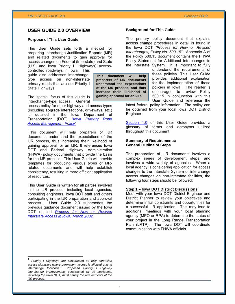
This document will help preparers of IJR documents understand the expectations of the IJR process, and thus increase their likelihood of gaining approval for an IJR.
This User Guide sets forth a method for preparing Interchange Justification Reports (IJR) and related documents to gain approval for access changes on Federal (Interstate) and State (U.S. and Iowa Priority I1 Highways) access-controlled roadways in Iowa. This guide also addresses interchange-type access on non-Interstate primary roads that are not Priority I State Highways. The special focus of this guide is interchange-type access. General access policy for other highway and access types (including at-grade intersections, driveways, etc.) is detailed in the Iowa Department of Transportation (DOT) “Iowa Primary Road Access Management Policy” This document will help preparers of IJR documents understand the expectations of the IJR process, thus increasing their likelihood of gaining approval for an IJR. It references Iowa DOT and Federal Highway Administration (FHWA) policy documents that provide the basis for the IJR process. This User Guide will provide templates for producing various types of IJR-related documents and will help establish consistency, resulting in more efficient application of resources. This User Guide is written for all parties involved in the IJR process, including local agencies, consulting engineers, Iowa DOT staff and others participating in the IJR preparation and approval process. User Guide 2.0 supersedes the previous guidance document issued by the Iowa DOT entitled Process for New or Revised Interstate Access in Iowa, March 2002.
1 Priority I Highways are constructed as fully controlled access highways where permanent access is allowed only at interchange locations. Proposed Priority I Highway interchange improvements constructed by all applicants, including the Iowa DOT, must satisfy the requirements of the IJR process.
Background for This Guide The primary policy document that explains access change procedures in detail is found in the Iowa DOT “Process for New or Revised Interchanges, Policy No. 500.15”. Appendix A of the Policy 500.15 document contains the FHWA Policy Statement for Additional Interchanges to the Interstate System. It is important to fully
understand the requirements of these policies. This User Guide provides additional explanation for the implementation of these policies in Iowa. The reader is encouraged to review Policy 500.15 in conjunction with this User Guide and reference the
latest federal policy information. The policy can be obtained from your local Iowa DOT District Engineer. Section 1.0 of this User Guide provides a glossary of terms and acronyms utilized throughout this document. Summary of Requirements: General Outline of Steps The preparation of IJR documents involves a complex series of development steps, and involves a wide variety of agencies. When a local agency is considering application for access changes to the Interstate System or interchange access changes on non-Interstate facilities, the following four steps should be followed: Step 1 – Iowa DOT District Discussions Meet with your Iowa DOT District Engineer and District Planner to review your objectives and determine initial constraints and opportunities for a successful IJR application. This may lead to additional meetings with your local planning agency (MPO or RPA) to determine the status of your project in the Long Range Transportation Plan (LRTP). The Iowa DOT will coordinate communication with FHWA officials.

IJR USER GUIDE 2.0 October 2009
Step 2 – Submit Concept Statement Step 4 – Prepare and Submit IJR Submittal of concept statements is a fundamental aspect of initiating project development at the Iowa DOT. This is true regardless of whether the project originates with Iowa DOT staff or is a city/county initiative. Concept statements define the project, the issues to be resolved and the potential solutions to remedy these issues. Concept statements also serve as a basis for potential projects to be evaluated by development staff and are a key to begin the process of entering a project within Iowa DOT’s project tracking and development systems. Accordingly, it is recommended that all project activity, including proposals for Interchange Justification Reports, begin with submittal of a concept statement.
Upon approval of the Letter of Request, an IJR is prepared. During preparation of the IJR, the proposer is encouraged to conduct a series of progress meetings with key decision makers at the Iowa DOT and FHWA. This is accomplished through the Advisory Group and depending on the complexity of the proposal, the Advisory Group could be expanded to include a cross section of Iowa DOT technical sections by establishing a Project Management Team (PMT). The composition and role of the PMT are ident-ified in Section 1.0 of this User Guide. Interim submittals of information are encouraged to guide the process. Critical points in the process include:
Concept statement submittal typically follows two distinct paths. For Iowa DOT sponsored IJRs, the common Iowa DOT concept format (sample attached in Appendix A) is followed. For local agency proposals, the Office of Local Systems concept submittal process (See Section 1.3, Relationship to Iowa DOT Local Systems Procedures) is followed. When submitting the concept statement through the Local Systems process, it is often beneficial to provide supporting documentation as shown in the sample in Appendix A to aid in the review of the submittal.
a) Preparation of a Methodology Letter of Understanding (MLOU). The MLOU process provides a dialogue among the Requesting Agency, Iowa DOT and FHWA staff to identify the parameters and primary areas of focus for preparing the IJR. Each situation is different and it is important to discuss the unique features of each request and determine how FHWA’s eight policy points will be evaluated and judged.
b) No-build traffic numbers and forecasted traffic numbers. Consistency with the local planning agency travel demand model is critical to the approval process and traffic data is the foundation of the various analyses in the IJR document. Coordination with the Iowa DOT District Planner and Office of Systems Planning is necessary. In areas where there is no travel demand model, development of traffic forecasts will, at a minimum, need to demonstrate consistency with local planning policies and land use plans.
Step 3 – Submit Letter of Request The first official IJR related submittal is the Letter of Request that outlines the basic attributes of the access change proposal. This letter allows Iowa DOT and FHWA staff to identify problems early and to convey to the Requesting Agency the level of analysis needed to satisfy the various elements of an IJR application. The Iowa DOT will form an Advisory Group to evaluate the letter. The composition and role of the Advisory Group is identified in Section 1.0 of this User Guide. The Letter of Request is submitted to the Iowa DOT District Engineer. 2
c) Design Criteria. It is important that the applicant follow the Iowa DOT’s established highway design and performance criteria to evaluate an access change proposal. The Iowa DOT is the primary criteria source; however, American Association of State Highway and Transportation Officials (AASHTO) and other design standards can be used to supplement and support the Iowa DOT criteria. Should less stringent criteria than the Iowa DOT criteria become necessary, the Iowa DOT provides a formal design exception process for this purpose.
2 As an IJR applicant, the Iowa DOT is exempt from Step 3. The access change request for the Iowa DOT is an internal process and therefore as an IJR applicant, the Iowa DOT will proceed to Step 4. Reference Iowa DOT Policy No. 500.15 for Iowa DOT’s initiation of an IJR process.
ii
Concept Statements - Define the project - Identify the issues to be resolved - Identify potential solutions to remedy
issues

IJR USER GUIDE 2.0 October 2009
iii
An IJR cannot be approved unless the proposed access changes are an official project in the region’s Long Range Transportation Plan.
d) Range of Alternatives. Input from the Advisory Group/PMT is important to establish the range of alternatives that should be examined, including improvements to the local roadway network in lieu of Interstate System access changes.
e) Evaluation of Alternatives and Relationship with NEPA Documentation. The development of the IJR should be integrated with the National Environmental Policy Act (NEPA) documentation process. The Advisory Group/PMT is a good forum in which to work through this process.
f) Submit Draft IJR. A preliminary version of the IJR should be submitted for review once the evaluation of alternatives and initial evaluation of the eight FHWA policy points are completed, but before final conclusions are drawn.
Keys to Success The development of an IJR can be a difficult endeavor, which is only amplified by the cost and duration of the process. The remainder of this Overview identifies 12 key factors that must be incorporated into an IJR analysis to help facilitate approval. 1. Priority of the Interstate System “It is in the national interest to preserve and enhance the Interstate System to meet the needs of the 21st Century by assuring that it provides the highest level of service in terms of safety and mobility. Full control of access along the Interstate mainline and ramps, along with control of access on the crossroad at interchanges, is critical to providing such service.”3 This statement is the foundation for analysis of proposed access changes to the Interstate System. Any application for access changes must demonstrate protection of Interstate System safety and operations. Secondary consideration is given to regional and local traffic flow needs. Applicants must first look to the local arterial street systems or rural highway systems to satisfy local travel demand. Whereas Interstates in urban areas provide critical connectivity among various metropolitan regions, the primary function of the Interstate remains to serve national interests and regional traffic beyond the immediate metropolitan area. If the IJR can demonstrate that these national and regional interests – and not merely local ones – are advanced by the proposed access change, then the case for approval is strengthened. 2. The Proposal Must Be “A Part of the Plan” An IJR can not be approved unless the proposed access changes are an official project in the region’s Long Range Transportation Plan (LRTP). Illustrative projects are typically not included in a financially-constrained plan such as an LRTP. In addition, inclusion of a proposed project in the plan does not guarantee FHWA approval of the IJR. The IJR still must provide supporting analyses that satisfy Iowa DOT and FHWA policies.
3 From FHWA Policy “Access to the Interstate System”, published in the Federal Register, Vol.74, No.165, August 27, 2009, pp. 43743-43746.

IJR USER GUIDE 2.0 October 2009
3. IJR Focus and Relationship to NEPA
iv
It is imperative that the conclusions in the IJR not foreclose opportunities to avoid, minimize or mitigate impacts identified in a NEPA document, yet at the same time the IJR must identify a single alternative for implementation.
The primary focus of an IJR is on traffic operations and determining the access configurations that best satisfy the operational demands of the transportation system. It is critical to explore a wide range of interchange/access options to determine the best configuration to serve the future traffic demand. Integration with regional planning, highway design principles and environmental compliance are all factors that need to be considered. The purpose of an IJR is to prove the operational validity of a project, considered in the context of Iowa DOT and FHWA policies. By contrast, the NEPA process examines the environmental validity of the project, considered within the context of local, state, and federal environmental protection laws and policies. These different perspectives interplay and sometimes conflict. Consequently, the IJR and NEPA documentation should be advanced at the same time so they can be balanced together. The IJR cannot be approved until the NEPA document is approved. However, the IJR can be reviewed for engineering and operational acceptance before NEPA is completed. The following interrelationships exist: a) The NEPA document can be approved
before an IJR is completed; however, the final IJR document could force revisions to the approved NEPA document.
b) An IJR can be completed4 prior to the NEPA document; however, the NEPA document must be approved before the IJR is approved.
It is imperative that the conclusions in the IJR not foreclose opportunities to avoid, minimize or mitigate impacts identified in a NEPA document, yet at the same time the IJR must identify a single alternative for implementation. Important concepts are: a) The implementation of one alternative over
another is evaluated in the NEPA document from an environmental impact perspective.
4 “Completed” in the context of the IJR approval process means a final IJR document that has been conditionally approved by FHWA, pending approval of the NEPA component. This means the IJR has been reviewed for engineering and operational acceptance, but needs NEPA approval before final acceptance of the IJR is granted.
b) The technical traffic operations analysis that determines feasible alternatives and the recommended alternative from a traffic operations perspective resides in the IJR.
c) Environmental factors evaluated in the NEPA document could influence the recom-
mendations in the IJR. d) In some instances, there may
be issues that require attention through a NEPA analysis prior to the completion of the IJR.
e) Both processes must be closely coordinated and analysis in one document can influence the outcome of analysis in the other.
4. Basis of Traffic Analysis Access changes must be examined in the context of the overall system, not just a single point. Therefore in areas where the proposed access change is within the boundaries of an MPO or RPA, the region’s official travel demand model must serve as the basis for traffic forecasting. This provides consistency with other proposals and ensures integration with regional planning efforts. Sometimes the IJR process itself discovers inadequacies or discrepancies within the travel demand model. In such cases, close coordination with the MPO/RPA, the Iowa DOT and FHWA must occur to: a) Amend the travel demand model through
official channels, or b) If there are some local, specific abnormalities
in the travel demand model, establish an analysis process to address the local, specific condition by adjusting the forecasts outside the travel demand model (often referred to as post-processing to correct localized inconsistencies in the data), or
c) In situations where recent, active land development is occurring adjacent to the project area that is not incorporated into the travel demand model, develop a sensitivity set of traffic forecasts to evaluate the changed condition. The official travel demand model must be used to justify the access change, but different traffic forecasts (sensitivity forecasts) can sometimes be utilized to refine the geometric design and satisfy a specific, local traffic situation not represented in the travel demand model, or

IJR USER GUIDE 2.0 October 2009
d) There can be situations where the LRTP and thus the travel demand model contain a future transportation network modification that, if not built, could impact the operations of the proposed access change. In these cases, the Iowa DOT or FHWA could require a sensitivity set of traffic volumes to evaluate the ability of the proposed access change to provide adequate traffic operations if the future transportation network modification did not occur.
Officially amending an MPO/RPA travel demand model can be a very lengthy process and in some cases is the only method to correct a situation where the travel demand model is not representative of the anticipated traffic forecasts. However as mentioned previously, there are situations where the official travel demand model is adequate to justify the proposed access changes, but a different set of traffic forecasts (sensitivity forecasts) are viable to properly define certain geometric design elements and integrate the interchange design with the surrounding transportation system needs. For these cases, it may be appropriate (upon discussion and approval from the MPO, Iowa DOT, FHWA and local agency) to develop low, medium, and/or high growth scenarios to address specific traffic generation conditions that may not be reflected in the travel demand model. Issues beyond the geometric refinements may also be considered, such as operational impacts from land development proposals, annexation and other ongoing land uses that may not be addressed by the official travel demand model.
v
Again, the ability to utilize the sensitivity traffic scenario approach is dependent on the ability of the official travel demand model data to justify the access change. Other important travel demand model information: a) In areas where there is no travel demand
model, such as rural areas outside an MPO/RPA boundary, traffic forecasts must demonstrate consistency with local planning policies and land use plans. Traffic growth rates must be supported by a scientific process and not merely by assumed growth rates. The Iowa DOT maintains a statewide travel demand model, which is available for calculating traffic forecasts in areas outside an MPO/RPA boundary.
b) Travel demand models often provide only daily traffic volume forecasts at a corridor or major street system level. An IJR requires peak hourly traffic forecasts at a finer level, including specific turning movements at intersections, interchange ramp terminals, exit/entrance ramps and other key locations. Determining these finer movements from the travel demand model requires specialized expertise in traffic engineering. MPO/RPA organizations often are unable to provide the level of traffic engineering needed for an IJR. The Requesting Agency should seek assistance from a qualified traffic engineer to prepare the peak hour forecasts.
c) Travel demand models do have the capability
to forecast peak hour volumes; however, the necessary level of detail and data to produce the peak hour information is often not available from the MPO/RPA models. The agency pursuing an IJR should consult with their Iowa DOT District Engineer, technical staff or consulting engineer to determine the necessary steps to obtain forecasted traffic for the particular situation.
5. Order of Magnitude The level of effort required for the IJR approval process can vary greatly depending on the nature of the proposed access change. A new interchange in an urban area could take from 18 to 36 months to develop, whereas minor ramp terminal modifications to an existing interchange could take less than six months. Local agencies should consult with their Iowa DOT District office to review their particular situation and gain an understanding of the necessary steps, timeline and financial commitment necessary to carry out the development of an IJR. There are also certain types of access modifications that do not require an IJR, such as a proposed interchange on a non-Interstate road that is not a Priority I State Highway, or minor ramp or ramp terminal modifications at an interchange on the Interstate or other Priority I Highway. The level of documentation for these situations is considered on a case-by-case basis and can result in the development of an Interchange Operations Report or Interchange
Traffic forecasts utilized in the IJR must be based on a travel demand model at least 20 years beyond the anticipated year the access changes are implemented.

IJR USER GUIDE 2.0 October 2009
vi
A new interchange in an urban area could take from 18 to 36 months years to gain IJR approval. Minor ramp terminal modifications to an existing interchange could take less than six months.
The purpose of the IJR is to define a traffic operation or safety problem and provide operational analyses that lead to a solution.
Justification Letter requiring less effort than a formal IJR. Additional detail is provided in this User Guide to describe the most common types of IJR related documents and the associated levels of effort.
6. The Need The need for access changes must be demonstrated on the basis of interregional and regional traffic operations and safety, and not local economic development. Obviously, new or improved Interstate access frequently stimulates economic development, but that should not be the stated need for the IJR proposal. For this and other reasons, the need statements in the IJR are not necessarily the same as the purpose and need statements in the NEPA submittal, since economic development aspects can be addressed in a NEPA document. Certainly the two documents must be consistent. FHWA Policy Point Eight provides additional guidance on the sequencing of IJR and NEPA evaluations, conclusions and the interrelationship of each process.
7. Quantitative Analysis & Vocabulary An IJR is a highly technical document that must be backed by measurable scientific data. Authors of IJR documents are cautioned about using words such as significant, substantial, major or other similar terms without technical data to support the qualifying term. Anecdotal information or personal opinion does not belong in an IJR document.
8. Interchange Spacing The AASHTO document, A Policy on Design Standards Interstate System, January 2005, states: “Spacing of interchanges has a significant effect on the operation of interstate highways…. As a rule, minimum spacing should be 1.5 km (1 mi) in urban areas and 5 km (3 mi) in rural areas…” However, meeting this general minimum spacing guideline does not necessarily satisfy the criteria for approval of an IJR. From an operations perspective, spacing greater than one mile may be required in urban areas to minimize weaving conflicts between adjacent interchange traffic movements and provide acceptable operating level of service. Moreover, appropriate signage spacing must be accommodated. Therefore in an urban area, there is a preference for 2-mile minimum spacing to address weaving, merging and signage needs. 9. Life of an IJR The approval of an IJR does have a limited shelf-life. FHWA requires an IJR to be reevaluated if the project is not constructed within eight years of receiving an affirmative determination of en-gineering and operational acceptability. FHWA also encourages the reevaluation of an IJR before construction when there are significant changes to the conditions, (e.g. land use, traffic volumes, roadway configuration or design, environmental conditions, etc). An update to the regional travel demand model may necessitate the reevaluation of an IJR approval prior to construction of access changes. These models are typically updated on five year cycles, although it may be appropriate to update the IJR more frequently. 10. Can-Do Development Schedule The Iowa DOT Can-Do Reference Manual defines a process that streamlines the development of Iowa DOT projects from concept to contract, with the goal of reducing development time while maintaining the integrity and quality of the process. Can-Do is also the Iowa DOT’s linear approach to promoting coop-eration between Iowa DOT and the regulatory agencies and merging compliance with NEPA and Section 404 of the Clean Water Act as part of the federal streamlining initiative.

IJR USER GUIDE 2.0 October 2009
In Chapter 2 of the Can-Do manual, development schedules are presented for the various levels of NEPA documents. The IJR is integrated into the process between the Early Coordination Activities/Traffic Data Analysis to a point where the preferred alternative is determined. The Iowa DOT Can-Do Reference Manual’s relevance to the interchange justification process is noted in greater detail in Section 1.2 – Relationship to Iowa Can-Do Reference Manual 11. The IJR Legacy The IJR must provide sufficient roadway design parameters for the preliminary engineering phase to determine lane configurations, number of lanes, turn lane lengths, spacing of access points, nature of traffic control devices (stop sign control or traffic signal) and other pertinent design information related to the configuration of the interchange.
vii
The IJR should summarize the salient traffic operations features to be addressed by design.
The IJR should also identify areas where future capacity expansion would likely need to occur, so the roadway designer can build expandability into the design. Addressing lane continuity along the Interstate is an important consideration when evaluating potential future interchange expan-sions/improvements. 12. Mindset for Design and Level of Service5
The 2004 AASHTO Policy on Geometric Design of Highways and Streets (Green Book) states on Page 508: “Freeways are initially designed to accommodate anticipated traffic for about 20 years and remain in service for a much longer time. Any cost savings realized by initially constructing for lower design speeds may be outweighed by the high costs, disruption to the environment and inconvenience to traffic that accompany the reconstruction of major facilities.” Although this statement directly addresses design speed, it articulates a broader mindset of looking beyond a 20-year horizon. Authors of IJR documents are well advised to bring this same mindset to Level of Service (LOS) and general planning for future needs of the system. The design year of the proposed improvement must be stated in the IJR.
5 The requesting agency is encouraged to refer to Iowa DOT’s design standards for current definitions of Levels of Service and to confirm the values through the District Engineer.
Local agencies frequently adopt LOS D as their criterion for evaluating transportation improve-ments. However, for the Interstate System and Expressways in Iowa, LOS C is the criterion for urban areas and LOS B for rural areas. The Iowa DOT Office of Design, Road Design, Design Manual, Chapter 1C-1, defines the LOS C and LOS B criteria for urban and rural facilities, respectively. Additionally, the 2004 AASHTO Green Book states: “For acceptable degrees of congestion, freeways and their auxiliary facilities (i.e. ramps, mainline weaving sections, and collector-distributor (C-D) roads in urban and developing areas) should generally be designed for level-of-service C. In heavily developed sections of metropolitan areas, achievement of level-of-service C may not be practical and the use of level-of-service D may be appropriate.” Therefore, it is good practice in Iowa to evaluate access changes based on the LOS C (urban)/LOS B (rural) criteria for mainline, interchanges and interchange ramp terminals with the local roadway. Intersections beyond the access control limits of the interchange can be evaluated using local agency criteria for level of service. Should there be unique situations where the stated criteria can not be achieved; a formal design exception process is applied to evaluate changing the criteria. Design Exception Process - CountyDesign Exception Process - City

IJR USER GUIDE 2.0 October 2009
Facts to Understand
An IJR is a technical document backed by measureable scientific data – personal opinion does not belong in an IJR document.
Obtaining Federal, State or Local funding does not equate to approval of an IJR
viii
Inclusion of an interchange in the LRTP or other highway program does not equate to approval of an IJR
Because an interchange is located in an isolated area or there is more than two or three miles to the adjacent interchange, does not in and of itself justify approval of an IJR
Other Helpful Hints
Familiarize yourself with the types of interchange access changes and anticipate the potential types of applicable review.
Coordinate with decision makers early and often.
Use the templates in this User Guide to prepare written documentation.
Prepare detailed information in advance of presenting a request.
Present COMPLETE submittals. “Self-test” the interchange modification/
justification using the review criteria. Keep the lines of communications OPEN. Follow instructions and advice of the
Advisory Group/PMT.

IJR USER GUIDE 2.0 October 2009
ix

IJR USER GUIDE 2.0 October 2009
x
Contacts – For More Information Visit http://www.iowadot.gov/districtshome.html for more information about the Iowa DOT District offices. Table 1 lists the office locations for each district. Table 1 District 1 Office 1020 S. 4th Street Ames, IA 50010 515-239-1635 800-899-0623
District 4 Office 2210 E. Seventh St Atlantic, IA 50022 712-243-3355 800-289-4368
District 2 Office 1420 Fourth St. S.E. Mason City, IA 50401 641-423-7584 800-477-4368
District 5 Office 307 W. Briggs Fairfield, IA 52556-0587 641-472-4171 800-766-4368
District 3 Office 2800 Gordon Drive Sioux City, IA 51102-0987 712-276-1451 800-284-4368
District 6 Office 430 16th Ave. S.W. Cedar Rapids, IA 52406-3150 319-364-0235 800-866-4368
References/Links The following list of references and electronic document links provide additional information helpful in developing an IJR. A short description of each link follows. Iowa DOT “Process for New or Revised Interchanges, Policy No. 500.15”. This document establishes the Iowa DOT policies used to obtain approval to add or revise access points via interchanges on the Interstate, other Priority I highways and primary highways with Priority II or less classifications. (Contact your Local District Engineer for a copy of this document.) Iowa DOT “Iowa Primary Road Access Management Policy” This document identifies the State of Iowa’s primary road access management policies.
Iowa DOT Federal-Aid Project Development Guide for Local Public AgenciesProvides policy and procedures for utilizing federal funds for project development and construction. The Iowa DOT Office of Design, Road Design, Design Manual Provides design criteria and procedures for the design of highway facilities in Iowa. Iowa Can-Do Reference Manual This document provides guidelines for implementing Iowa DOT’s Can-Do project development process. AASHTO, A Policy on Geometric Design of Highways and Streets, 2004 (Green Book) This document establishes the national policy for the design of highways. AASHTO, A Policy on Design Standards Interstate System, January 2005 This document provides additional national policy guidance specifically for the Interstate System, in addition to the information contained in the Green Book. FHWA Publications: The FHWA web site provides information from a national perspective on a wide range of policies and guidance documents relevant to the development of an IJR. Topics specific to Interstate and interchange design can be found at this web site. FHWA NEPA Project DevelopmentThis web site explains the relationship between FHWA’s project development process and the National Environmental Policy Act (NEPA), including the principal elements of NEPA decision-making and required documentation. Transportation Research Board, Highway Capacity ManualThis manual details the methods and procedures for analyzing traffic operations.

IJR USER GUIDE 2.0 October 2009
1.0 INTRODUCTION
1
User Guide 2.0 will help you avoid making a wrong turn through the interchange access change approval process.
The IJR User Guide provides direction on how to apply the tenets of Iowa DOT Policy 500.15, “Process for New or Revised Interchanges”, for a range of applications. It also explains relationships among the various agencies involved in the Interchange Justification Report (IJR) process. The following sections provide background information for the IJR process in Iowa, including a glossary of frequently used terms and acronyms, implementation guidance, management structure and types of roadways eligible for IJR consideration. This policy also provides common practice information for Requesting Agencies to prepare and submit IJRs, based on the specifics provided in Policy 500.15. 1.1 Glossary of Terms and Acronyms There are several key terms and acronyms repeated throughout this document that are useful for the User Guide reader to understand. The following list represents the most commonly used terms and acronyms, along with a brief description. AASHTO – American Association of State Highway and Transportation Officials. A non-profit, nonpartisan association representing state highway and transportation departments which advocates for transportation related policies and provides technical services to support states in their efforts to efficiently and safely move people and goods.
Access – For the purposes of an IJR and this User Guide, an access is any entrance or exit point (including locked gate access) to the mainline.
Advisory Group – Iowa DOT, FHWA and MPO/RPA advisory group assembled to determine the ability of the Requesting Agency’s proposal to satisfy each of the IJR requirements, beginning with the Phase 1 - Letter of Request.
Can-Do – Iowa DOT process that streamlines the development of Iowa DOT projects from concept to contract, with the goal of reducing development time while maintaining the integrity and quality of the process.
Congestion Management Process - a systematic process in Transportation Management Areas (TMAs) that provides for safe and effective integrated management and operation of the multimodal transportation system. The process is based on a cooperatively developed metropolitan-wide strategy of new and existing transportation facilities.
District – Any of the DOT's six Highway Division districts.
DOT or Iowa DOT– Iowa Department of Transportation.
FHWA – Federal Highway Administration. The FHWA is the approval authority for IJRs on Interstate System projects and serves in an advisory role on non-Interstate proposals.
Interchange Justification Report (IJR) – The primary document developed to evaluate FHWA’s Eight Policy Points and the document submitted to Iowa DOT and FHWA to gain approval to modify or add access to the Interstate System. The document is also utilized by the Iowa DOT to modify or add access to a Priority I State Highway.
Interchange Justification Report Amendments - modifications to the original IJR document typically needed to address updating issues due to interchange construction schedule lapses or other changes in an applicant’s proposal that do not require a completely new IJR document.
Interchange Justification Letter (IJL) – The document developed to evaluate the modification or addition of interchange access on Priority II, III or lower classified State Highways.
Interchange Operations Report (IOR) – The document developed to evaluate FHWA’s Eight Policy Points when only minor modifications to an existing Interstate or Priority I State Highway are

IJR USER GUIDE 2.0 October 2009
2
proposed. NOTE: The IOR was formerly referred to as “Technical Memorandum”.
Interchange – A system that provides for the movement of traffic between intersecting roadways via one or more grade separations.
Interstate or Interstate System – A highway that is part of the Dwight D. Eisenhower National System of Interstate and Defense Highways.
Level of Service (LOS) - LOS is a qualitative measure describing operational conditions within a traffic stream, based on service measures such as speed and travel time, freedom to maneuver, traffic interruptions, comfort and convenience (definition from the Highway Capacity Manual 2000, Chapter 5, Glossary). LOS "A" is the best and LOS "F" is the worst.
Long Range Transportation Plan (LRTP) – A long range transportation plan adopted by the DOT, a Metropolitan Planning Organization or a Regional Planning Affiliation. For the purposes of an IJR and this User Guide, only the currently approved LRTP will be considered.
Local Systems – Iowa DOT Local Systems Office. The primary guidance from the Office of Local Systems for the IJR process comes from the Federal-Aid Project Development Guide.
Methodology Letter of Understanding (MLOU) – An outline of the parameters and primary areas of focus for preparing the IJR that is developed during early stages of Phase 2 of the IJR process.
MPO/RPA – Metropolitan Planning Organization and/or Regional Planning Affiliation.
NEPA – National Environmental Policy Act of 1969, as amended.
Phase 1 – Letter of Request – Overview of the proposed access modification prepared to determine if the proposal warrants preparation of an IJR or other form of access modification document.
Phase 2 – IJR – The phase of the process that undertakes the necessary data collection and studies to prepare the IJR or other form of access modification document.
PMT – Project Management Team. A collection of Iowa DOT, FHWA and other agency staff members assembled to provide technical guidance and assist with the decision making process.
Policy 500.15 – Iowa DOT’s official policy defining the process for new or revised interchanges.
Policy Points – Refers to the eight policy points established in the Federal Register on August 27, 2009, that provide guidance for the justification and documentation needed for requests to add access (interchanges and ramps) to the existing Interstate System.
Priority I Highway – A primary road (Interstate or non-Interstate) constructed as a fully controlled access highway. Permanent access to the facility is allowed only at interchange locations. No permanent at-grade access is allowed.
Requesting Agency – The public road jurisdiction (state, county, or city) requesting a change in access to a Priority I Highway or interchange access to other classified State Highways. The Requesting Agency must have jurisdictional authority, i.e. be a city, county or state.
STIP - Statewide Transportation Improvement Program
Transportation Management Area - 1) All urbanized areas over 200,000 in population, and any other area that requests such designation. 2) An urbanized area with a population over 200,000 (as determined by the latest decennial census) or other area when TMA designation is requested by the Governor and the MPO (or affect local officials), and officially designated by the Administrators of the FHWA and the FTA. The TMA designation applies to the entire metropolitan planning area(s). (23CFR500)
Travel Demand Model – A computer model that forecasts traffic volumes on the major transportation grid. For purposes of an IJR, the travel demand model must be the official model maintained by the MPO/RPA and is adopted as part of the LRTP.
1.2 Relationship to the Iowa DOT Can-Do Reference Manual This User Guide is also based on the guiding principles of Iowa DOT’s Can-Do Reference Manual. The Iowa DOT Can-Do Reference Manual outlines a process that streamlines the development of Iowa DOT projects from concept to contract, with the goal of reducing development time while maintaining the integrity and quality of the process. Can-Do is also the Iowa DOT’s linear approach to promoting cooperation between Iowa DOT and the

IJR USER GUIDE 2.0 October 2009
NEPA documents. The IJR is integrated into the process between the Early Coordination activities/Traffic Data Analysis to a point between Concurrence Point 3, Alternatives to Be Carried Forward, and Concurrence Point 4, Preferred Alternative.
regulatory agencies and merging compliance with NEPA and Section 404 of the Clean Water Act as part of the federal streamlining initiative. Whereas the Can-Do process is utilized only for Iowa DOT sponsored projects, it is beneficial for the Requesting Agency to understand the steps involved in a major, federal-aid project for which the Can-Do process is designed. There are parts of the Can-Do process that local agencies can gain benefit for a local agency sponsored IJR, including the multidisciplinary project manage-ment approach, Project Management Teams (PMT) and working through the Iowa DOT Districts. However, there are certain processes such as the merged compliance of NEPA and Section 404 requirements that are available for only DOT sponsored projects. The Iowa DOT District Engineer will help clarify the aspects of the Can-Do process that could help streamline the IJR process.
1.3 Relationship to Iowa DOT Local Systems Procedures When a local agency (City or County) develops a project utilizing federal funds, policies and procedures for project development are set forth in the Office of Local Systems, Federal-Aid Project Development Guide for Local Public Agencies. When a Requesting Agency is considering developing an interchange project, the procedures in the Iowa DOT Federal-Aid Project Development Guide are followed; however, the additional level of involvement from various Iowa DOT offices and the FHWA could require expanded coordination efforts through the Advisory Group and possibly the formation of a Project Management Team (PMT) as described in more detail in Section 1.4. These coordination efforts are initiated through the Iowa DOT District Engineer.
The Can-Do project development philosophy is based on the following principles: 1. Multidisciplinary project management 2. Iowa DOT District leadership 3. Early problem identification 4. Uniform, integrated development process 5. Avoidance of environmental impacts 6. Context Sensitive Solutions 7. Proactive public involvement and con-
sensus building
One of the key components of the Federal-Aid project development process is submittal of the Concept Statement. This form provides information about the proposed location and types of work, possible environmental impacts and proposed design. The Concept Statement is then used by the Iowa DOT to initiate a number of different project reviews and processes. For projects requiring approval of an interchange modification or addition, the completion of the Concept Statement remains the document that initiates the IJR and NEPA processes. After submittal of the Concept Statement, the IJR process will track parallel to the NEPA process activities outlined in the Federal-Aid Project Development Guide.
8. Merged compliance with NEPA and US Army Corps of Engineers Section 404 requirements
Can-Do was developed for Type I6 and some Type II projects requiring an environmental document because these projects encompass all facets of the development process. Although projects that do not require an environmental document are not currently covered in Can-Do, the intent is to have a single development process for all project types. Projects already under development (“pipeline projects”) and projects not requiring an environmental document are also encouraged to take advantage of the enhancements available using Can-Do.
In Chapter 2 of the Can-Do manual, development schedules are presented for the various levels of
6 A Type I project is a major change, a Type II project is a minor change, and a Type III project is a repair, replacement, or operational improvement.
3
For interchange proposals on the Interstate System, FHWA provides full oversight of all aspects of the project through a partnership agreement with the Iowa DOT who manages the daily activities of the IJR and NEPA process. For non-Interstate proposals, the FHWA is not directly involved with exception for necessary environmental documentation requirements.

IJR USER GUIDE 2.0 October 2009
4
1.4 IJR Process Management Another fundamental component of the IJR process is its management and coordination. It is highly recommended to meet with the District Engineer and District Planner as the very first step in the process to discuss the overall approach to the project. A point contact person will be assigned to the process and it will usually be the District Engineer or Assistant District Engineer. This point contact person will handle and manage correspondence and communication with FHWA and other Iowa DOT offices. After initial consultation, there are three primary steps that initiate the IJR process: 1 Verify the proposed project is in the
Statewide Transportation Improvement Program (STIP) and submit the Concept Statement to the Iowa DOT District Engineer or Local Systems Engineer if the project sponsor is a city or county. Include supporting documentation including an overview of the purpose and need for the project.
2 Move to Phase 1 of the process and prepare and submit the Letter of Request to the Iowa DOT District Engineer. A critical coordination element is ensuring the proposed project is an approved project in the MPO/RPA Long Range Transportation Plan (LRTP). The District Engineer will work with the District Planner to initiate the review of the Letter of Request.
3 Should the project move onto Phase 2, meet with the District Engineer or Assistant District Engineer and outline the steps to move forward with the IJR. The District Engineer, Assistant District Engineer or other appointed District staff member will become the point contact person for the duration of the project.
Once the Letter of Request is submitted, the Iowa DOT District Planner forms and chairs the Advisory Group. Members of the Advisory Group typically include staff from: • The DOT District Office • The Requesting Agency • Iowa DOT Office of Design • Iowa DOT Office of Systems Planning • Iowa DOT Office of Traffic and Safety • Iowa DOT Office of Location and
Environment • FHWA • Metropolitan Planning Organization (MPO)
/Regional Planning Agency (RPA)
The Advisory Group’s role is to review the interchange request and determine the ability of the Requesting Agency’s proposal to satisfy each of the requirements, beginning with the Phase 1 - Letter of Request. The Requesting Agency will continue dialogue with the Advisory Group throughout the process. For Iowa DOT sponsored projects, the Letter of Request step is omitted because the access change request is an internal DOT process. Should the Letter of Request gain approval, the process moves onto Phase 2 and the preparation of the IJR. At this point it is determined if the Advisory Group needs to expand to include other Iowa DOT disciplines or agencies similar to a Project Management Team (PMT) described in the Can-Do process. In the Can-Do process, the PMT is the working group of technical professionals skilled to support the project decisions. The PMT is made up of Iowa DOT traffic engineering, roadway design, environ-mental and other technical staff, plus FHWA and the local MPO/RPA representatives. These individuals could remain on the project from concept development through project letting and longer. The members bring different key elements to the team by virtue of their individual experience and responsibilities within Iowa DOT. Specifically, the PMT members’ responsibilities are: • To review the proposed project. • To provide insight and expertise at each step
of the process. • To ensure that their concerns are adequately
addressed throughout the development process, including selection of the preferred alignment/concept.
• To work together with the other PMT members to identify potential problems early and to develop solutions through consensus.
• To bring answers and solutions to potential problems. For example, if a project is in the alternatives development phase and one alternative under consideration has a constraint that would require a design exception, the design project engineer (a PMT member) should bring it to the PMT’s attention and seek resolution.
• To act as a liaison to their offices and areas of specialty.

IJR USER GUIDE 2.0 October 2009
5
For an IJR proposal brought forward by a city or county, the Advisory Group often fulfills the role of the PMT on an Iowa DOT sponsored project. However on more complex locally sponsored projects, the Advisory Group could expand to include more areas of expertise and operate much like a PMT on an Iowa DOT sponsored project. Another important step for carrying out Phase 2 of the IJR process is the preparation of the Methodology Letter of Understanding (MLOU) that outlines the parameters for preparing the IJR. The MLOU process is managed by the District Engineer and the Advisory Group or PMT as appropriate to the project. The MLOU is discussed in detail in Section 3.2 of this User Guide. 1.5 Eligible IJR Highways 1.5.1 Interstate System and Priority I State Highways The IJR process defined in Policy No. 500.15 applies to access changes/additions on the Interstate System and interchange changes/additions on the non-Interstate, Priority I State Highways. There are a few important points: 1. The IJR process applies to all types of
access changes on the Interstate System, meaning both for interchanges and special access points that may not be at an interchange. Special access points are not common in Iowa; however, they do exist to provide emergency or maintenance access, or serve a special use such as a park-and-ride lot or a gated access point. Please refer to the discussion on Policy Point Four later in this document for more discussion.
The procedure that local and state
governments follow in order to add or alter access to the Interstate System is set by the Federal Highway Administration (FHWA) and is defined in Federal Register, dated August 27, 2009, Volume 74, Number 165, Page 43743-43746. Iowa DOT Policy No. 500.15, in addition to the FHWA policy, is also
followed to alter access to the Interstate System in Iowa.
2. The IJR process also applies to Priority I
State Highways; where the only form of access is at an interchange. The process can also apply to Priority II or III State Highways.
3. On non-Interstate projects the general IJR
process is the same as for the Interstate; however, FHWA may serve in an advisory role. FHWA controls access to the Interstate System and Iowa DOT has approval authority on the Priority I State Highways and other state highway classifications.
However, FHWA will likely have additional
roles on the non-Interstate interchange projects that will require their involvement such as the review and approval of the NEPA documents, if the proposal has Federal Funds or requires other Federal permit clearances.
4. The Iowa DOT “Iowa Primary Road Access
Management Policy” also provides information related to access on Interstate System interchange projects, particularly in determining the limits of access control on the crossing roadways, i.e. the nearest intersection or driveway to the ramp terminal intersection on the cross-road.
5. There are access modification situations on
the Interstate System when an IJR is not needed and this is described in more detail in Section 2 of this User Guide.
1.5.2 Non-Interstate, Non-Priority I State Highways Access policies for non-Interstate facilities is outlined in Iowa DOT “Iowa Primary Road Access Management Policy”. There are situations where interchanges are proposed on primary highways that have lower levels of access control than the Priority I State Highway. The procedure for approving an interchange on non-Priority I State Highways is accomplished by an Interchange Justification Letter and this procedure is described later in Section 2.4.

IJR USER GUIDE 2.0 October 2009
2.0 NEED FOR IJR One of the most noticeable features of the Interstate Highway System is that under ideal conditions traffic on the system is a continuous flow. This flow is maintained through the control of access to the network. An IJR must be prepared and approved for any new or revised access point to the Interstate network in Iowa, regardless of the funding source to be used to pay for it. Similar logic is applied to the Priority I State Highway system. 2.1 Interchange Justification Report (IJR) Section II of Policy No. 500.15 provides examples of various types of new or revised access points that require an IJR. The examples are repeated below:
6
An IJR, and in some cases an IOR, must be prepared and approved for any new or revised access point to the Interstate network in Iowa, regardless of the funding source to be used to pay for it.
• New Interstate-to-Interstate interchange • Major modification of Interstate-to-Interstate
interchange configuration, e.g., adding new ramps, abandoning/removing ramps, completing basic movements
• New partial interchange or new ramps to/from a continuous frontage road, resulting in a partial interchange
• New Interstate-to-crossroad interchange • Modification of existing Interstate-to-
crossroad interchange configuration • Completion of basic movements at an
existing partial interchange • Abandonment of ramps or interchanges • Locked gate access The underlying factor in the IJR process is determining if the access change would impact the operations or safety of the Interstate System and/or Priority I State Highway. Following are
some reasons and philosophies behind the IJR process: • Adding a new access point to the highway
will affect operations and/or safety. The key is to quantify the order of magnitude of those impacts and determine if the impacts are acceptable and/or if they can be mitigated. The operational integrity of the Interstate System must be maintained.
• When the location or the geometry of an access point connection to the Interstate or Priority I State Highway is changed, there is the possibility to affect operations of the mainline facility and an IJR will most likely be needed. There are cases when an IOR is adequate as previously described.
• Before access changes are made, appropriate use of the Interstate System or Priority I State Highway system as compared to the local/regional highway systems needs to be evaluated.
• Local land use planning and transportation planning must be coordinated and integrated.
• An access need must be established and is driven by demonstrated travel demand that can not be accommodated by the local roadway network.
• Minimizing access points is not necessarily the objective, but optimizing the location, design, safety and operation of ramps and the overall system is the objective.
2.2 Amendments to IJRs As described in the User Guide Overview, there are situations when an IJR is approved, time passes and a project is not constructed, necessitating an update to the IJR prior to the project moving forward again. There are many cases where the IJR does not need to be re-written in its entirety, but a review of the changed conditions against the eight policy points is conducted to determine the specific areas requiring re-evaluation. The IJR Amendment format is similar to the original IJR; however, items that materially do not change only need summary statements confirming how the new information does not

IJR USER GUIDE 2.0 October 2009
change the evaluations in the original document. In most cases the changed condition needs to consider only evaluation against the approved interchange configuration. It is often the case that the original need for the proposed access modifications does not change, but there is a change in traffic forecasts, adjacent land use, a change in the surrounding Interstate System or a change to the local roadway network that could affect the approved interchange configuration. The new information is analyzed against the approved interchange configuration and the eight policy points to determine the impacts to the approved interchange configuration and identify modifications to mitigate any impacts.
7
The underlying factor in the IJR process is determining if the access change would impact the operations or safety of the Interstate System and/or Priority I State Highway.
Each situation will be different and the Requesting Agency is encouraged to contact their District Engineer and Planner to discuss specifics and prepare an outline for the Advisory Group to review and provide guidance on the items needed for the amendment. When an IJR needs amendment, the NEPA document will also likely need review to determine if a reevaluation is necessary. 2.3 Interchange Operations Report (IOR) On a case-by-case basis, minor interchange modifications on the Interstate System shall be reviewed with the District Engineer and FHWA, and file documentation shall be provided to all affected offices for review and approval. An Interchange Operations Report (IOR), instead of an IJR, is sufficient documentation when only minor modifications are being proposed that infringe on existing points of access to the Interstate System or Priority I State Highway. FHWA will make the final determination for the Interstate System while the Iowa DOT will make the decision for the non-Interstate interchanges if an IOR is an acceptable level of review. Common examples when an IOR is sufficient documentation are when the end of the ramps at the cross road are being modified, bridge modifications, cross road lane modifications or other changes to the cross road that potentially
changes how the interchange operates. The IOR should provide enough information to identify the project background, project purpose (including review of existing geometrics and safety), location and traffic analysis identifying operational and safety impacts to the Interstate and local system. Specifically, Iowa DOT and FHWA are looking for assurances that current and future traffic projections will not impede the level of service on the Interstate System due to the proposed change. Appendix D provides an outline of a typical IOR with information on the document content. Additional information may be needed based on actual site conditions, and the applicant is advised to check with the Iowa DOT for actual situations requiring an IOR. Following are some additional examples of when an IOR might provide sufficient level of analysis; however, some of the below examples could require an IJR depending on the specific circumstances. The Requesting Agency should discuss specific conditions of the proposed access change with the District Engineer, with input from the Advisory Group and potentially others, to determine the proper course of action. • Changing a single lane exit to a dual lane
exit. However, should the Iowa DOT or FHWA have a concern about merge, diverge or weaving operations with an adjacent interchange, an IJR might be necessary.
• Ramp metering, ramp HOV bypass lanes and potentially other travel demand management strategies.
• Minor adjustment of an existing ramp terminal at the Interstate connection for safety or operational purposes. As stated above, potential interaction with an adjacent interchange could require an IJR.
• Increasing the laneage of ramp segments, provided the merge to the existing ramp cross section occurs a sufficient distance from the existing entry point with the Interstate such that the operating conditions of the Interstate are not impacted.
• Modifications of the ramp termini at the cross road to accommodate cross road widening, change ramp lane configurations, installation/modification of traffic control devices, modification of traffic control device timing/phasing, addition of a turn lane from the cross road to the ramp or other modification to the ramp/cross road intersection configuration.

IJR USER GUIDE 2.0 October 2009
• Extending an existing entrance ramp into an auxiliary lane ending at the next adjacent downstream interchange. This condition has the potential to require an IJR.
• Extension of a deficient acceleration lane, deceleration lane or recovery lane at the Interstate connection point.
• Bridge modifications/replacement that change the laneage of the Interstate or cross road.
• Replacement or modification of an interchange “in-kind” to accommodate an Interstate widening project or restore the structural integrity of the infrastructure as long as the interaction with adjacent interchanges is not affected. The term replacement is not intended to include pavement maintenance/restoration activities.
8
Changing the number of exit/entrance lanes or adding ramp metering is likely to require an IJR.
2.4 Interchange Justification Letter (IJL) An Interchange Justification Letter (IJL) is prepared when interchange modifications or a new interchange is proposed on a non-Interstate, non-Priority I State Highway. It is often the case these types of interchanges are not a part of a series of adjacent interchanges and/or the area of influence of the proposed access change is limited. The Iowa DOT, through the District Engineer, will make the determination if an IJL is an adequate level of analysis. Whereas the analysis of the conditions supporting the proposed access modification needs to be thorough and complete, the IJL document is a concise summary of the conditions and recommendations. Supporting technical documentation shall be provided to the Iowa DOT District for review and comment. The IJL typically takes the form of a memorandum, two to three pages in length, which is prepared by the Requesting Agency, but is officially processed as a memorandum from the District Engineer to other Iowa DOT officials. The IJL includes: INTRODUCTION Provide paragraph description of the need for the access modification and a summary statement why the Iowa DOT would be supportive of making the access modification.
SAFETY AND CAPACITY REVIEW Describe the current geometric conditions, crash history, traffic operating conditions or other factors that support the need for the access modification. Describe the general parameters of the proposed access modification and how that will address the project need, citing improved traffic operations or safety metrics. This section can be from two to four paragraphs. PROPOSED FUNDING Similar to the Phase I IJR, provide a summary of the expected project cost and a listing of the funding sources. Include identification of Iowa DOT portions of the funding. It is recommended that the Requesting Agency have a sound financial plan in place prior to finalizing the IJL, meaning that grants, MPO/RPA funding sources, safety funds, Iowa DOT share, etc. have all been discussed and identified as highly probable sources of funding with expected amounts. PROJECT STATUS Describe anticipated project schedule for project development and construction. Include status of project agreements between the Requesting Agency, the Iowa DOT and any other involved parties. Describe any other activities that are under way or will soon begin to advance project development. Appendix F includes a sample IJL. A primary area of evaluation for installation of an interchange on a non-Priority I State Highway is the integration of the interchange with adjacent access points. Adding an interchange, which is a high-speed type facility, adjacent/near at-grade access points such as a signalized intersection or cross-road stop controlled intersection, may cause a safety situation that is not desirable. Traffic circulation patterns around the proposed interchange location and the potential need to close adjacent highway access locations to integrate with the interchange operations requires close examination. The Requesting Agency will need to work closely with the Iowa DOT District to evaluate acceptability of a new interchange proposal.

IJR USER GUIDE 2.0 October 2009
Another example requiring an IJL is the addition of an interchange on a non-Interstate, non-Priority I State Highway that is transitioning to a Priority I State Highway. A general rule of thumb is a single location improvement is likely to require an IJL whereas situations that require evaluation of a corridor will require an IJR. It is
often the case the Iowa DOT will have an overall corridor concept to upgrade the entire corridor or segment of the corridor and therefore the level of documentation supporting the IJL could be less. Each case needs to be reviewed with the Iowa DOT District Engineer.
9

IJR USER GUIDE 2.0 October 2009
3.0 IJR DEVELOPMENT AND APPROVAL PROCESS Section II of Policy No. 500.15 details the IJR process, including a flow chart in the Policy 500.15 Appendix B. This section of the User Guide will focus on providing expanded explanation of policies and requirements for evaluating the eight policy points, levels of effort for different types of IJRs and establishing templates for the various types of IJR related documents. 3.1 Phase 1 Letter of Request
10
The Advisory Group examines five primary criteria to make a determination if the proposed project is feasible and worth additional investigation and analysis: 1. Consistency with the Long Range
Transportation Plan (LRTP) 2. Funding Plan 3. Basic Concept Design 4. Access Spacing 5. Desired function and operation purpose of
the interchange
The Letter of Request does not require an extensive amount of analysis; however, there are critical elements needed to provide the Advisory Group with necessary information to evaluate the proposal and provide the Requesting Agency information need-ed to make an informed decision how to proceed with IJR development. The Advisory Group examines five primary criteria to make a determination if the proposed project is feasible and worth additional investigation and analysis:
1 Consistency with the Long Range Transportation Plan (LRTP)
2 Funding plan 3 Basic concept and design 4 Access spacing 5 Desired function and operational
purpose of the interchange Following is additional guidance for preparation of the Letter of Request, which follows the outline identified in Policy No. 500.15. INTRODUCTIONOne or two paragraph introduction of the proposed project. Provide basic overview of the proposed access modification.
LOCATION Describe the location of the project on the Interstate System and the general nature of the surrounding transportation network and land use. Provide location map. This section should be limited to two or three brief paragraphs. Attaching additional maps such as compre-hensive land use planning and/or transportation network maps is beneficial. PURPOSE AND NEED State the purpose and need for the project in bullet point form. Provide a one paragraph description of each point of the purpose and need.
The purpose of the Interstate is to first accommodate travel across states, then regional travel and lastly to accommodate local travel; therefore, the purpose of an access modification needs to focus on the benefits to the national/regional trans-portation system. Need for access modification can include safety improve-ments, geometric improve-
ments to meet current standards or improved traffic levels of service; the main point being the needs are founded on traffic operations. Economic development or improving the local roadway system functionality are not primary criteria for evaluation of an interchange proposal. Supporting documentation can include readily available data/outputs/analysis from MPO/RPA travel demand models or long-range transportation plans, summaries from local transportation comprehensive plans, synopsis of local traffic impact studies, spot capacity calculations at critical areas that would demonstrate the issues or cursory review of crash statistics. The intent is to utilize readily available information and not require extensive traffic operations analyses at this point of the project development.

IJR USER GUIDE 2.0 October 2009
The Letter of Request is not an advocacy document for local development initiatives, but is an overview of the current traffic operating conditions sufficient to describe the deficiencies and the nature of the surrounding street network such that the Advisory Group can gain an understanding of the situation. PROJECT DEVELOPMENT AND CONSTRUCT-ION SCHEDULE State the desired schedule to complete the project. Key dates to identify include: • IJR Approval • NEPA Document Approval • Design and Right of Way acquisition • Construction Estimating the dates to the nearest year is adequate. Both the IJR process and the NEPA process can take from nine months to three years depending on complexity. Reference Section 3.4 for additional information on various levels of effort associated with a wide variety of IJR proposals.
11
The first - and most important - step of the Phase 2 IJR process is to define the various analysis elements, level of detail, and measures of effectiveness that will be utilized to evaluate the eight policy points.
FUNDING STRATEGY Provide a planning level opinion of construction cost and a breakdown of potential funding sources (identify local, state and federal funding sources with approximate amounts). A detailed cost opinion is not necessary. Local and state funding sources should be within the Requesting Agency’s ability to obtain, i.e. bonding limits, tax receipts, regional funding share, etc. Identify possible grant programs and or federal funding sources and amounts, even if those grants or awards have not been obtained. State if any of the grant or legislative funding amounts have been obtained. LOGICAL TERMINI OF THE PROJECT Provide a two to three paragraph description of the logical limits of the project. This is stated from two perspectives: 1 The limits of the physical improvements 2 The limits of the traffic operations analysis
along both the Interstate and the cross road. These limits are determined by professional judgment at this stage of project development and do not need to be backed by technical traffic operations analysis.
COMPATIBILITY WITH THE EXISITING AND FUTURE ROADWAY NETWORK Provide a two to three paragraph review of the surrounding roadway network, focusing on: • Existing and proposed interchange spacing
along the Interstate in the project vicinity, identifying potential merge, diverge or weaving issues.
• Connectivity with local roadways and their Federal Functional Classification.
• Compatibility with the MPO/RPA Long Range Transportation Plan and/or local comprehensive transportation plan.
COORDINATION AND SUPPORT FROM LOCAL AGENCIES A one to two paragraph statement summarizing the coordination activities and level of support among various involved local agencies, including the area MPO/RPA. Commentary from all the affected local agencies is encouraged. For example, proposals in the fringe of metro areas can often involve adjacent suburbs, counties and the regional planning agency.
SUMMARY Conclude with a two to three paragraph overview of how the proposed access modification would meet the purpose and need and satisfy the eight FHWA policy points. 3.2 Phase 2 – IJR Criteria After approval of the Letter of Request, the IJR production process begins. The first and most important step of the Phase 2 IJR process is to define the various analysis elements, level of detail, and measures of effectiveness that will be utilized to evaluate the eight policy points. Please reference the IJR process flow chart in Appendix B of Policy No. 500.15, Note 7, to identify this critical part of the process. To adequately accomplish the goal of Note 7, a Methodology Letter of Understanding (MLOU) process is utilized to discuss and agree on the level of analysis needed to successfully complete the IJR.

IJR USER GUIDE 2.0 October 2009
3.2.1 Methodology Letter of Understanding (MLOU) The MLOU process provides a dialogue among the Requesting Agency, Iowa DOT and FHWA staff to identify the parameters and primary areas of focus for preparing the IJR. Each situation is different and it is important to discuss the unique features of each request and determine how the eight policy points will be evaluated and judged. The MLOU is a document that is produced after a MLOU meeting with the Advisory Group (or PMT as appropriate) that discusses and reviews the various aspects of the proposed IJR. An outline of a typical MLOU document is attached in Appendix C. This outline can serve as an agenda for the MLOU meeting and format for the meeting minutes that will be the basis of the MLOU. The MLOU is reviewed by the Requesting Agency, Iowa DOT and FHWA and agreed to by all parties. The MLOU is not a document that binds the Iowa DOT or FHWA to approve an IJR nor does it nullify Iowa DOT’s or FHWA’s right to request changes to the study process, evaluation criteria or to request documentation above and beyond what is discussed in the MLOU.
12
In complex situations, the process of finalizing the MLOU may need to be divided into two or more meetings; the first being to resolve traffic forecasts and the second to review existing and no-build traffic operations analyses to better understand the nature of conditions. 3.2.2 Methodology Letter of Understanding (MLOU) Content PHASE 1 LETTER OF REQUEST SYNOPSIS Provide one to two paragraph summary of the approved Phase 1 Letter of Request. Restate the Purpose and Need for the proposed access modification and state if the proposed project is an adopted element in the MPO/RPA Long Range Transportation Plan.
ANALYSIS YEARS State the analysis years to be utilized for the traffic operations analysis. This should match the planning year for the local MPO/RPA and should be at a minimum 20 years beyond the opening year of the proposed project. An opening year analysis and an interim year analysis is often needed to evaluate phasing of improvements over time, the need for traffic signals upon opening of the facility or to evaluate other factors. If the Requesting Agency intends to build all the improvements up front, as determined necessary for the planning year traffic forecasts, then an interim year analysis is not necessary. If the intent is to phase the project over time, then one or more interim year traffic forecasts are necessary to demonstrate the initial phase improvements would provide adequate level of traffic operations for the intended duration. DATA COLLECTION AND SOURCES Provide listing of data sources for crash data (including years analyzed), geometric/structural conditions, existing traffic counts, planning year travel forecasts, existing and future land use plans, existing and future roadway networks and other data sources to be utilized in the various analyses. Attach copies of land use plans (existing and future), long range transportation improvement maps or other documents that provide supporting data for the various analyses. LOCAL ROADWAY NETWORK REVIEW / AREA OF INFLUENCE Provide description and overview of the Interstate and local roadway networks in the area of the proposed access modification to identify the anticipated area of influence of the proposed access modification. Factors that should be discussed and/or shown on maps include: • Interchange spacing • Signal locations • Anticipated traffic impacts • Description of on-going or planned land use
changes • Planned local transportation system improve-
ments • Other planned Interstate or inter-
change/access modifications on the regional Interstate system
• Other local developments/activities that could impact the traffic operations analysis, such as recent zoning amendments, annexations, development petitions/permits, etc.
The IJR process is very dynamic and outcomes of various analyses can redirect the approach to the document preparation. With that said, the MLOU process is very valuable in focusing the efforts of the IJR, saving the Requesting Agency time and money.

IJR USER GUIDE 2.0 October 2009
13
• Ability of the current local roadway network to deliver forecasted traffic to and from the proposed interchange
At a minimum the area of influence around the proposed Interstate interchange modification/ addition is the adjacent interchange ramps along the Interstate and the adjacent intersections along the crossing roadway. However, based on review of factors described above, the traffic operations analysis may need to extend beyond the minimums to a point where the proposed access changes do not influence the traffic volumes. The evaluation of local roadway system improvements associated with Policy Point One may also extend beyond the limits established for the traffic operations analysis. BASIS OF TRAFFIC FORECASTS Identify the travel demand model used as a basis for developing the traffic forecasts. In rural areas where a model may not exist, describe the basis for developing the traffic forecasts and explain how those methods are consistent with any local land use/transportation planning documents. In areas outside urban MPO/RPA boundaries and if a statewide travel demand model is available, the data in the statewide model should be a part of the traffic forecasting methodology. Provide brief outline of the procedures utilized to derive peak hour travel forecasts from the travel demand model. Should modifications to the travel demand model be necessary to account for local inconsistencies or abnormalities in the model, describe the procedures utilized and the logic behind the modifications. If the Requesting Agency recommends the use of an alternative model for certain elements of the analysis, justification and agreement on those procedures must be reached with the MPO/RPA, the Iowa DOT and FHWA. Alternative travel demand models may be utilized to evaluate or refine certain geometric aspects of an interchange proposal; however, the justification for access changes must be based on the official MPO/RPA travel demand model. A separate Traffic Forecast Technical Memorandum is beneficial to document the data, methods and assumptions to calculate forecasted traffic. This separate memorandum is submitted to the Iowa DOT Office of Systems Planning and MPO/RPA for review and approval and includes information for the basis of the traffic forecasts and the traffic forecasts as described below.
TRAFFIC FORECASTS Provide the existing, planning year no-build, planning year build and opening year/interim year build traffic volumes as necessary, both daily and peak hour traffic volumes. Include a.m. and p.m. turning movement volumes, special hourly volumes if needed (such as near a major attraction with non-typical traffic generation), truck percentages, and other relevant traffic data utilized in the traffic operations analysis. The planning year no-build forecasts may or may not be the same as the planning year build forecasts. For example in the case of a new interchange, the planning year no-build forecasts will be based on a travel demand model that does not include the new interchange in the transportation network while the planning year build numbers are based on a travel demand model that includes the proposed interchange. In the case of modifications to an existing interchange where the planning level capacity of the interchange does not change, the no-build and build traffic volumes could be the same. There are situations where the official travel demand model includes future year projects in the overall network that could influence the traffic forecasts in the area of the subject access modification proposal, but the status of the future year project(s) in the regulatory approval process contains many unknowns. In such cases, the Iowa DOT and FHWA may want to examine sensitivity traffic scenarios that exclude those future year project(s) to determine if the proposed access modifications perform at an acceptable level should the future year project(s) not happen. OPERATIONAL ANALYSIS PROCEDURES/ CRITERIA Identify the traffic operation analysis procedures to be utilized for the various elements of the proposal. The main analysis method is the current release of the Highway Capacity Manual (HCM) or Highway Capacity Software (HCS), but, in many cases, the crossing roadway and ramp terminal intersections operations analyses are supplemented with Synchro/Simtraffic software or similar modeling software. The Interstate system is often analyzed using CORSIM or VISSIM computer simulation programs. In complex urban settings, the entire network (Interstate and cross road) might be analyzed in CORSIM or VISSIM.

IJR USER GUIDE 2.0 October 2009
14
In most cases, the Interstate can be analyzed using HCM/HCS, but if the spacing between adjacent interchanges is less than two miles in an urban environment, if there are weaving concerns or if there are major merge/diverge conditions, CORSIM or VISSIM is typically necessary to provide a better understanding and visualization for the operations of the Interstate. Identify the Level of Service (LOS) criteria and other evaluation criteria. Iowa DOT criteria requires LOS C for urban settings and LOS B for rural settings. If the local governing agency accepts LOS D or other criteria for their local system, that criteria may be utilized on the crossing roadway with exception to the ramp terminal intersections at the interchange which must use the Iowa DOT criteria. Overall, the Interstate, interchange and local roadways must be analyzed as a network, demonstrating the system can meet the LOS criteria. However, if the Iowa DOT criteria cannot be met, a formal design exception process must be utilized. The Requesting Agency should reference the latest Iowa DOT Design Manual to verify the LOS criteria for the proposed facility. In addition to LOS criteria, other criteria could include: • Accessibility to community resources such as
hospitals, special traffic generators, park-and-ride lots, etc.
• Accessibility and schedule adherence for transit
• Average speed or density • Travel time or delay for segments of a
corridor or the entire corridor • Average and maximum queue length and
relative impacts on Interstate operations • Travel reliability • Safety improvement (Accident Potential/Risk
Reduction) • Duration/Extent of congestion • Travel time on network (vehicle-hours) • Persons/vehicles served (vehicle-miles) • Average trip length (vehicle/hours per trip) • Number of phase failures on major arterial • Percentage of demand served • Percentage of demand served in peak hour • Percentage of capacity utilized, amount of
reserve capacity • Expandability of various alternatives
GEOMETRIC DESIGN CRITERIA The evaluation of various interchange forms requires a conceptual layout of interchange geometrics to identify intersection spacing, lane configurations, adjacent interchange ramp distances and a wide range of other geometric features. To provide a sound basis for geometric layout, the primary roadway design criteria such as facility type, design speed, horizontal sight distance, vertical sight distance and other design elements need to be defined. Stating the facility type and design speed, and referencing the appropriate Iowa DOT design tables is adequate at this stage of the process. Note the planned provisions for pedestrian accommodation (width of walk/trail and general location). EXISTING CONDITION ANALYSIS Identify the traffic operation and/or safety factors that are driving the need for the access modification. This needs to be supported by a review of crash history against statewide crash averages, existing geometric/structural conditions against current standards and an evaluation of existing traffic operations levels of service. PLANNING YEAR NO-BUILD OPERATIONS ANALYSIS Provide a traffic operations analysis of the existing transportation network (without the proposed access modification) utilizing the planning year no-build traffic numbers. Document the deficiencies in the overall roadway network. ENVIRONMENTAL CONSIDERATIONS Identify the environmental considerations that could influence the outcome of the alternative development and selection process. Provide a status and schedule for the NEPA elements of the project and how the NEPA and IJR processes will integrate. Known or potential human and natural environmental issues need to be noted, but a complete NEPA analysis is not required at this point in the process. ANTICIPATED EXCEPTIONS Identify any known exceptions to Iowa DOT, AASHTO or FHWA rules, policies, standards, criteria or procedures.

IJR USER GUIDE 2.0 October 2009
15
FHWA Policy Point Guidance – In Other Words… Policy Point 1: The Interstate is not primarily for local travel. Can the local network be improved to meet traffic
demand? Policy Point 2: Have you looked at options other than more concrete? Policy Point 3: If you are not having an impact on the Interstate System, you probably cannot justify an
Interstate System access modification or addition. Policy Point 4: Full Access interchanges are required and must connect to a public street. Policy Point 5: There must be one coherent set of data across a region. Policy Point 6: Is the proposed interchange the best proposal from a regional perspective or is the proposal
focused on a local condition? Policy Point 7: Transportation infrastructure connecting to the proposed interchange must be able to deliver the
proposed traffic. Policy Point 8: Complete NEPA analysis is not required for the IJR, but environmental analysis might influence
the alternatives examined in the IJR.
OVERVIEW OF EIGHT POLICY POINTS 1 Provide a summary of how each of the eight
policy points will be evaluated, including types/range of alternatives to be evaluated, evaluation methodologies and a statement on the anticipated level of analysis. Establish if a comprehensive Interstate network study is required to support Policy Point Six and review the parameters of addressing Policy Point Six.
3.2.3 FHWA Policy Point Guidance The Interstate System is designed to provide the highest level of service in terms of safety and mobility, requiring strict adherence to access control policies. Therefore, new or revised access points to the Interstate System will be considered for FHWA approval only if evaluation of the eight policy points as defined in Federal Register, dated August 27, 2009 (Volume 74, Number 165), are satisfactorily met. The philosophy behind the policy centers on: • Maintain the operational integrity of the
Interstate System • Encourage appropriate use of the Interstate
System and local/regional highway systems, i.e. the priority of the Interstate System is: o First – Interstate travel o Second – Regional travel o Third – Local travel
• Ensure coordination of local land use and transportation planning.
Following is an overview of the eight policy points along with commentary to help the Requesting Agency understand the intent of the policy points and types of analyses needed to support the evaluation.
Policy Point One: The need being addressed by the request cannot be adequately satisfied by existing
interchanges to the Interstate, and/or local roads and streets in the corridor can neither provide the desired access, nor can they be reasonably improved (such as access control along surface streets, improving traffic control, modifying ramp terminals and intersections, adding turn bays or lengthening storage) to satisfactorily accommodate the design-year traffic demands (23 CFR 625.2(a)).
The Interstate is not primarily for local travel. Can the local network be improved to meet traffic
demand? It should be demonstrated that an access point will satisfy interregional and regional traffic needs and will not be a substitute for reasonable improvements or additions to the local municipal street, secondary road or primary highway system. The Interstate highway should function as a route carrying longer-distance interregional traffic and not be allowed to become a substitute for a well planned and developed local street and highway system designed to handle local traffic circulation. If a new interchange or a new ramp is being considered, it should be demonstrated that existing or possible future roads or streets generally parallel to the Interstate facility could not be used in lieu of adding a new interchange or ramp(s), and provide the access intended by the proposal.

IJR USER GUIDE 2.0 October 2009
16
The philosophy behind FHWA Policy Point Guidance centers on: • Maintaining operational integrity of the
Interstate System • Encouraging appropriate use of the
Interstate System and local/regional highway systems, i.e. the priority of the Interstate System is:
- First – Interstate Travel - Second – Regional Travel - Third – Local Travel • Ensuring coordination of local land use
and transportation planning
2 The analysis supporting Policy Point One must demonstrate that the local roadway network (existing and improved condition) is incapable of accommodating the forecasted traffic. The analysis methodology for this point will vary from situation to situation. Some of the methodologies include: • Utilize the travel demand model and increase
capacity on various local system roadways, or add new local system roadways, and examine potential reassignment of travel volumes.
• Expand the capacity of crossing or parallel street systems and test the operational performance (Level of Service, Delay, Queuing, etc.) of those local transportation systems to determine the effect on operation of the Interstate access points.
• In the case of an existing interchange, test a scenario that adds turn lanes or auxiliary lanes to the existing interchange ramps (i.e. maintain existing form of interchange) along with capacity expansion of the crossing roadway.
These are just some of the possible analyses that could be considered to help evaluate Policy Point One. From another perspective, the intent of Policy Point One is not to discourage local development or to interject federal policy into local land use policy. Even if local roadway improvements would be feasible, that fact alone does not automatically result in denial of Interstate access approval. There are many factors, including but not limited to, overall transportation network efficiency, safety, environmental and other factors that could lead to support of Interstate access modifications.
Policy Point Two: The need being addressed by the request cannot be adequately satisfied by reasonable transportation system management
(such as ramp metering, mass transit, and HOV facilities), geometric design, and alternative improvements to the Interstate without the proposed change(s) in access (23 CFR 625.2(a)).
Have you looked at options other than more
concrete? It should be demonstrated that all reasonable design alternatives (interchange configurations, ramp designs, etc.) have been assessed, all reasonable interchange locations were considered and assessed, and all non-design type alternative modal solutions, such as mass transit and other travel demand management type improvements have been assessed. This section of the IJR presents a general overview of the alternatives considered, including the non-design type solutions; providing basic descriptions (and schematic diagrams if needed) and thought processes behind the options. Detailed analyses and graphics follow in the next section of the report. Be careful to not favor or rule out alternatives because of environmental factors if the NEPA document has not been completed. Include all alternatives and locations considered. There may be some alternatives considered, but eliminated from further consideration because of various reasons. Include those eliminated alternatives descriptions under Policy Point Two and the reasons for eliminating them from further consideration. Policy Point Three and subsequent sections of the IJR then do not need to discuss the eliminated options. Within this section is a dialogue on transit, High Occupancy Vehicle (HOV) lanes, ramp metering, other multi-modal solutions and other travel demand management solutions. These discussions often need input from the MPO/RPA, Iowa DOT, regional transit authority or other parties as they involve both local and regional policies and programs. Any justification to reduce travel forecasts because of various travel demand management policies must be backed by financially supported and sustainable travel reduction programs managed by regional or state affiliated authorities.

IJR USER GUIDE 2.0 October 2009
The assessment of non-design solutions does not necessarily require extensive analysis or engineering study as many of these policies and programs are already studied and managed by regional and state authorities. The extent of the analysis needs to be tailored to the situation and the Requesting Agency is encouraged to have dialogue with the Iowa DOT District Planner in your area. HOV, transit, ramp metering and travel demand management are not necessarily requirements to achieve access approval; there are situations where they do not apply.
17
3 Policy Point Three: An operational and safety analysis has concluded that the proposed change in access does not have a significant adverse
impact on the safety and operation of the Interstate facility (which includes mainline lanes, existing, new, or modified ramps, ramp intersections with crossroad) or on the local street network based on both the current and the planned future traffic projections. The analysis shall, particularly in urbanized areas, include at least the first adjacent existing or proposed interchange on either side of the proposed change in access (23 CFR 625.2(a), 655.603(d) and 771.111(f)). The crossroads and the local street network, to at least the first major intersection on either side of the proposed change in access, shall be included in this analysis to the extent necessary to fully evaluate the safety and operational impacts that the proposed change in access and other transportation improvements may have on the local street network (23 CFR 625.2(a) and 655.603(d)). Requests for a proposed change in access must include a description and assessment of the impacts and ability of the proposed changes to safely and efficiently collect, distribute and accommodate traffic on the Interstate facility, ramps, intersection of ramps with crossroad, and local street network (23 CFR 625.2(a) and 655.603(d)). Each request must also include a conceptual plan of the type and location of the signs proposed to support each design alternative (23 U.S.C. 109(d) and 23 CFR 655.603(d)).
The area of potential effect for the interchange modification or addition often goes well beyond
the immediate “footprint” of the proposed change, particularly in urban areas
Changing access conditions on the Interstate System will always have an impact, and the key to the analysis is quantifying and mitigating the impacts. This requires examining the various alternatives against the established need for the project and operational criteria to determine the preferred alternative(s) from a traffic operations perspective and to identify needed mitigation on both the Interstate and local roadway systems. For example, attempts to add or revise interchanges in locations with known geometric, capacity or safety problems will be discouraged unless correction of these deficiencies are part of the overall solution. Another example is the addition or expansion of an interchange in a developing area where the existing crossroad is still a rural two-lane facility. The proposal must demonstrate the ability of the crossroad to safely deliver traffic to and from the interchange and the expansion of the crossroad must be a part of the overall solution if the existing roadway does not have adequate capacity. The response to this criterion will in most cases be technical, consisting of traffic forecasts, capacity and operational analysis, conceptual signing plans to demonstrate ability to adequately/safely sign the proposed concept and crash data and safety analysis. Extent and complexity of the analyses will vary, depending on the nature and location of the new or revised access. Responses will range from straightforward capacity analysis for a rural interchange, to a complex operational analysis for multiple system interchanges in an urban area using MPO travel demand models and traffic operations models. In urban areas, it may be necessary to carry out traffic analyses on a system-wide basis, expanding the traffic model to the point where traffic on the Interstate is undisturbed by the proposed access. Sensitivity traffic volume scenarios that consider potential system modifications might be needed to identify mitigation measures, determine reserve capacity of various proposals or to evaluate phasing of a series of related system improvements.

IJR USER GUIDE 2.0 October 2009
Showing a reasonable level of service on the Interstate System does not guarantee acceptability of a proposal. There is no single acceptable level of service for every situation and therefore it is critical to establish acceptable measures of effectiveness early in the IJR process.
18
4 Policy Point Four: The proposed access connects to a public road only and will provide for all traffic movements. Less than ``full
interchanges'' may be considered on a case-by-case basis for applications requiring special access for managed lanes (e.g., transit, HOVs, HOT lanes) or park and ride lots. The proposed access will be designed to meet or exceed current standards (23 CFR 625.2(a), 625.4(a)(2), and 655.603(d)).
5 Full access interchanges are required and must connect to a public street
With very few exceptions, all proposed new or revised interchanges shall provide for all turning movements. Exceptions will be determined on a case-by-case basis. Special purpose access for HOVs, transit vehicles, park and ride lots or locked gate access should be treated as special cases and the movements to be provided decided on a case-by-case basis. The intent of Policy Point Four is to preclude adding of access exclusively serving a narrow, private interest and to provide operational consistency for unfamiliar drivers. Additionally the adherence to Federal standards assures that sufficient engineering is completed at this stage of project development to prove the geometric and operational viability of a proposed solution. There are also situations where Iowa DOT standards are more stringent than Federal standards and the geometry must also be evaluated against the more stringent state criteria. Half interchanges that utilize local roadway systems for connectivity are not automatically precluded; but there needs to be a logical reason for their implementation or retention. Closely-spaced split diamond interchanges connected by directly aligned frontage roads or collector distributor road systems are appropriate in many cases and should not be viewed as ‘half diamonds’.
There are situations where design exceptions to Federal or State standards are acceptable. The need or request for a design exception will not automatically result in rejection of the request for IJR approval, but the design exception must be approved by Iowa DOT and/or FHWA (depending on the nature of the exception) before the IJR can advance towards approval. Only FHWA can grant design exceptions to Federal standards on the Interstate System. Connections from the Interstate to the listed special purpose facilities need to be direct to the special purpose facility. Utilizing local roadways and locating a special use facility some distance from the Interstate is not considered consistent with Policy Point Four.
Policy Point Five: The proposal considers and is consistent with local and regional land use and transportation plans. Prior to
receiving final approval, all requests for new or revised access must be included in an adopted Metropolitan Transportation Plan, in the adopted Statewide or Metropolitan Transportation Improvement Program (STIP or TIP), and the Congestion Management Process within transportation management areas, as appropriate, and as specified in 23 CFR part 450, and the transportation conformity requirements of 40 CFR parts 51 and 93. There must be one coherent set of data across a
region 23 CFR, Part 450 and 40 CFR Parts 51 and 93 provide for the consistent application and integration of local and regional land use and transportation planning. The federal code also puts forth similar requirements for states on a statewide basis.
To effectively carry out the requirements of the federal code, analysis and decisions must be based on data and planning documents that are well coordinated and adopted across the region where the proposed transportation project is being considered. Use of data to support an IJR proposal or proposing a new element in the transportation system that has not been integrated into the overall planning and plan adoption process would not be in alignment with federal code.

IJR USER GUIDE 2.0 October 2009
There are situations where recent land development changes or other factors might be present that are not yet represented in the official long range transportation plan or travel demand model. In these cases, either the Requesting Agency needs to work with their MPO/RPA to have the changed condition officially adopted by the MPO/RPA or the IJR must proceed using the current, official data as a basis for justifying the Interstate access modification/addition. As described in the User Guide Overview, Keys to Success, Item 4, sensitivity sets of traffic data that reflect specific changed or local conditions may be used to refine the geometric features of the proposal or to test reserve capacity of various alternatives to aid in the alternative selection process.
6
The IJR must include a statement of consistency from the appropriate MPO and/or RPA, asserting that the proposed new or revised access considers and is consistent with their respective long-range land use and transportation plans. The request must include a discussion as to how the proposed new or revised access fits into the overall long-range plans for the area. Any proposal must be considered in view of currently known plans for transportation facilities and land use. This is especially important when several new or revised interchanges are anticipated. Should the proposed access modification not be an official, adopted project in the long range transportation plan, the IJR process can begin, but the IJR can not be approved until the proposed project has been officially adopted into the MPO/RPA long range plan.
Policy Point Six: In corridors where the potential exists for future multiple interchange additions, a comprehensive corridor or network
study must accompany all requests for new or revised access with recommendations that address all of the proposed and desired access changes within the context of a longer-range system or network plan (23 U.S.C. 109(d), 23 CFR 625.2(a), 655.603(d), and 771.111).
Is the proposed interchange the best proposal from a regional perspective or is the proposal
focused on a local condition?
The intent of Policy Point Six is to assess and account for the cumulative system effects of added access from a region-wide perspective, to reinforce the need for long range planning for a region’s Interstate System and to be proactive in issues of added or changed access. If there are other future proposed new or revised interchanges adjacent to or in close proximity to the new or revised interchange being considered, all proposed changes in access should be analyzed as a system at the same time. In an urbanized area, the MPO traffic models should be used to conduct a comprehensive traffic study of the multiple interchanges being considered. The key elements in understanding how to address Policy Point Six are: • Potential new access locations need to be
evaluated from the perspective of the best regional location, which is not necessarily a proposed location brought forth by local or private entities. In other words, the study needs to examine various potential interchange locations to determine the best solution(s) for the region.
Inclusion of the project in the regional plan does not guarantee its eventual acceptance by Iowa DOT or FHWA.
• The system needs to be analyzed at full build conditions for the region, meaning the current planning year in the long range transportation plan.
• A system study is not always a pre-requisite for considering a change in access, but it may influence how the request should be addressed. Dialogue with Iowa DOT District staff and members of the Advisory Group/PMT is important.
19

IJR USER GUIDE 2.0 October 2009
• Approving one new interchange that is part of a regional plan does not guarantee that all other proposed new interchanges will also be approved.
• Although AASHTO puts forth minimum interchange spacing guidance, those minimum values do not consider the potential regional impacts of an interchange addition.
20
7
8
Policy Point Seven: When a new or revised access point is due to a new, expanded, or substantial change in current or planned future develop-
ment or land use, requests must demonstrate appropriate coordination has occurred be-tween the development and any proposed transportation system improvements (23 CFR 625.2(a) and 655.603(d)). The request must describe the commitments agreed upon to assure adequate collection and dispersion of the traffic resulting from the development with the adjoining local street network and Interstate access point (23 CFR 625.2(a) and 655.603(d)).
Transportation infrastructure connecting to the
proposed interchange must be able to deliver the proposed traffic
The ability of a proposed new or revised interchange to function as planned may depend on the implementation of related non-Interstate improvements to the local transportation system. This may include, for example, construction or widening of connecting streets, parallel routes, intersection improvements including turn lanes and signalization, or other construction or traffic engineering projects necessary to make the added or revised access fully functional. State, city or county sponsors of new or revised interchange access requests are required to demonstrate coordination of the proposed new or revised interchange project with all such related projects. It should be demonstrated that the public or private entities responsible for construction of those related projects are fiscally capable of completing the projects in a timely manner.
Commitments to fund improvements are not in and of themselves sufficient to demonstrate coordination (Congressionally funded “ear-marks”, for example).
The IJR needs to identify the needed local roadway improvements, i.e. number of lanes, turn lanes, traffic signals, etc., to deliver forecasted traffic levels to and from the proposed interchange. Then, either the associated transportation infrastructure needs to be built ahead of or as part of the interchange project or the Requesting Agency needs to demonstrate commitment to build the improvements within a certain timeframe through inclusion in the local agency capital improvement program or other method of commitment satisfactory to Iowa DOT and FHWA.
Policy Point Eight: The proposal can be expected to be included as an alternative in the required environmental evaluation, review and
processing. The proposal should include supporting information and current status of the environmental processing (23 CFR 771.111).
Complete NEPA analysis is not required for the IJR, but environmental analysis might influence
the alternatives examined in the IJR. Information relative to the status of the planning and National Environmental Policy Act (NEPA) processes with regard to the access request should be reported. This includes but is not limited to: anticipated schedule dates, public meeting/hearing dates, public support or opposition, recent activities, and future activities. It is expected that the NEPA process will be underway at this point. The discussion of environmental process in the IJR is to demonstrate that, through coordination activities, there is consistency with state/local planning, the nature of controversial issues are identified and general environmental features are identified. However, direct references to possible environmental impacts such as cultural, socioeconomic and others should not be discussed since the NEPA document is typically not published at the time the IJR is published. Below is sample language for the closing paragraph of Policy Point Eight. This example is based on an Environmental Assessment (EA) level NEPA document with no anticipated significant impacts.
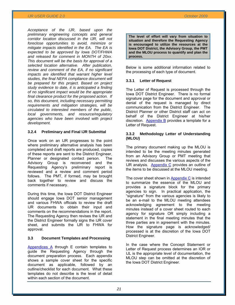
IJR USER GUIDE 2.0 October 2009
Acceptance of the IJR, based upon the preliminary engineering concepts and general corridor location discussed in the IJR, will not foreclose opportunities to avoid, minimize or mitigate impacts identified in the EA. The EA is expected to be approved by Iowa DOT/FHWA and released for comment in MONTH of 20xx. This document will be the basis for approval of a selected location alternative. After publication, review and comment of the EA, if no significant impacts are identified that warrant higher level studies, the final NEPA compliance document will be prepared for this project. Based on project study evidence to date, it is anticipated a finding of no significant impact would be the appropriate final clearance product for the proposed action. If so, this document, including necessary permitting requirements and mitigation strategies, will be circulated to interested members of the public, local governments, and resource/regulatory agencies who have been involved with project development.
21
3.2.4 Preliminary and Final IJR Submittal Once work on an IJR progresses to the point where preliminary alternative analysis has been completed and draft reports are produced, copies of these reports are sent to the District Engineer, Planner or designated contact person. The Advisory Group is reconvened and the Requesting Agency’s preliminary report is reviewed and a review and comment period follows. The PMT, if formed, may be brought back together to review and discuss the comments if necessary. During this time, the Iowa DOT District Engineer should engage Iowa DOT senior management and various FHWA officials to review the draft IJR documents to obtain their input and comments on the recommendations in the report. The Requesting Agency then revises the IJR and the District Engineer formally signs the IJR cover sheet, and submits the IJR to FHWA for approval. 3.3 Document Templates and Processing Appendices A through E contain templates to guide the Requesting Agency through the document preparation process. Each appendix shows a sample cover sheet for the specific document as applicable, followed by an outline/checklist for each document. What these templates do not describe is the level of detail within each section of the document.
Below is some additional information related to the processing of each type of document. 3.3.1 Letter of Request The Letter of Request is processed through the Iowa DOT District Engineer. There is no formal signature page for the document and approval or denial of the request is managed by direct communication from the District Engineer. The District Planner or other District staff can act on behalf of the District Engineer at his/her discretion. Appendix B provides a template for a Letter of Request. 3.3.2 Methodology Letter of Understanding (MLOU) The primary document making up the MLOU is intended to be the meeting minutes generated from an Advisory Group or PMT meeting that reviews and discusses the various aspects of the IJR analysis. Appendix C provides an outline of the items to be discussed at the MLOU meeting. The cover sheet shown in Appendix C is intended to summarize the essence of the MLOU and provides a signature block for the primary agencies to sign. In practical application, the “signature” from the various agencies is likely to be an e-mail to the MLOU meeting attendees acknowledging agreement to the meeting minutes instead of a cover sheet routed to each agency for signature OR simply including a statement in the final meeting minutes that the three parties are in agreement with the minutes. How the signature page is acknowledged/ processed is at the discretion of the Iowa DOT District Engineer. In the case where the Concept Statement or Letter of Request process determines an IOR or IJL is the appropriate level of documentation, the MLOU step can be omitted at the discretion of the Iowa DOT District Engineer.
The level of effort will vary from situation to situation and therefore the Requesting Agency is encouraged to utilize the resources at the Iowa DOT District, the Advisory Group, the PMT and the MLOU process to quantify and plan the process.

IJR USER GUIDE 2.0 October 2009
22
3.3.3 Interchange Operations Report (IOR) During the early stages of an access modification proposal, whether it occurs during initial Iowa DOT District/FHWA meetings, Concept Statement review or Phase 1 Letter of Request review, the District Engineer and FHWA will determine if the access modification proposal qualifies for an Interchange Operations Report. The IOR contains a signature block for the Professional Engineer in responsible charge for preparing the analysis and report; however, the IOR itself does not contain signature blocks for Iowa DOT or FHWA. Approval or denial of the IOR is communicated through written correspondence from the Iowa DOT District Engineer. Appendix D contains a template for an IOR. 3.3.4 Interchange Justification Report (IJR) The preferred format for an IJR is 8 ½ x 11, with one or two columns of text, bound along the left edge. Graphics should be inserted as 11 x 17 landscape inserts, bound along the left edge and folded to 8 ½ x 11. There may be situations where 11 x 17 format is acceptable and needs to be discussed with the District Engineer and Iowa DOT Office of Location and Environment. The IJR includes both a cover sheet and a signature sheet. When the IJR is ready for FHWA final review, (after Iowa DOT has signed-off) the Professional Engineer(s) in responsible charge signs the PE signature block, the Requesting Agency signs, Iowa DOT signs, and the signature page is bound into the document. Both hard copies and an electronic Adobe Acrobat file format document is transmitted to the Iowa DOT District Engineer (verify how many copies are needed). At a minimum three original signature sheets are needed for record copies. Should the Requesting Agency or Consulting Engineer desire additional original signed signature pages, additional sheets should be routed for signature. The Iowa DOT District Engineer may also at this time include endorsements or recommendations through letter transmittal for inclusion in the signed IJR. The official approval of the IJR by FHWA is in the form of a separate memorandum. FHWA does not provide a signature on the IJR document. However, the FHWA approval memorandum needs to be bound into the record copy(ies) of
the IJR to the Iowa DOT District Office, Office of Location and Environment and FHWA. The Requesting Agency is therefore responsible to provide a final electronic Adobe Acrobat format version of the document (.pdf), including the signed signature page and FHWA approval memorandum. A labeled compact disc (CD) with the electronic file of the IJR document should be included in a pocket folder on the back cover of the document. 3.3.5 Interchange Justification Letter (IJL) Section 2.4 of this User Guide provides an overview of the analysis needed to support an IJL. The actual document that is produced for an IJL is an internal Iowa DOT letter written by the District Engineer to the Highway Division and Planning, Programming & Modal Division of Iowa DOT. The Requesting Agency needs to provide the District Engineer with the supporting technical documentation and analysis described in Section 2.4 in the form a technical memorandum or other type of report. Once the Iowa DOT accepts the interchange proposal, the District Engineer prepares the letter. Appendix F contains a sample IJL. The format and content of the technical memorandum from the Requesting Agency to the District Engineer is at the discretion of the District Engineer. 3.3.6 Approval – What Does it Mean? The acceptance of an IJR, or related document such as an IOR, establishes the warrant for the proposed access modification and defines the geometric parameters of the change. An IJR can be reviewed for engineering and operational acceptance before NEPA is completed. However, approval is contingent on completion of NEPA. (All 8 policy points have to be fully addressed before the new or revised access can be approved). It is not a commitment of funding from the Iowa DOT or FHWA and does not assure the NEPA component of the project will be approved. An IJR can be completed and signed prior to the NEPA document approval; however, the IJR approval is contingent upon compliance with NEPA. See Section 4.0 of this User Guide for additional information on the approval process.

IJR USER GUIDE 2.0 October 2009
3.4 Level of Effort
23
The level of effort required to prepare an IJR can vary widely depending on the location (urban or rural), complexity of the surrounding transportation system, likelihood of additional future Interstate modification needs, existing system deficiencies, etc. Table 2 provides a very broad overview of a range of possible interchange proposal types and the associated level of effort. Each situation may require different areas of focus, but in general the table below identifies relative areas of focus for different situations (L – Low, M – Medium, H-High areas of focus). The Phase I Letter of Request and the MLOU process is intended to sequentially clarify the exact level of effort in the various areas for each individual project. ______________________________________
Table 2. FHWA Policy Point Level of Effort
FHWA Policy Point Proposed Action 1 2 3 44 5 6 7 8
Overall Level of Effort1 Comments
Existing Interchange - Minor Modification L L H L L L L L L Based on IOR - Modification2 M M H L L L L L M Based on IJR New Interchange H H H M M L to
H M M M to H Policy Point 6 Effort
Can Vary Multiple, Closely Spaced Interchanges3
H H H M M H M M M to H
IJR Amendment Depends on nature of changed condition L to M Non-Interstate, Non-Priority I Highway Interchange
L L M L L L L L L to M Based on IJL
Following acceptance by the Iowa DOT and FHWA, NEPA procedures must be accomplished as part of the normal project development process.
The Requesting Agency needs to understand the IJR process can be very dynamic; meaning the results of one series of analyses can trigger additional alternatives or analyses to be explored. The scope of work can change as the process progresses.
Table 2 Notes: 1 The required level of effort will vary from proposal to proposal. There is no “one size fits all” IJR. The IJR process is dynamic and the scope of the work is subject to change as the various analyses unfold. The Requesting Agency needs to be prepared to provide additional effort as required. The MLOU process is intended to help quantify the level of effort. 2 Policy Point level of effort assumes the existing interchange provides for all traffic movements. Additional emphasis on Policy Point Four may be required if the existng interchange does not provide full access. A complex systems interchange where two or more Interstates intersect could take more effort.
3 In situations where existing or new interchanges have spacing less than two miles or a series of interchanges in an urban corridor are being affected, additional study may be required to evaluate operationally interrelated interchanges. 4 Proposals that include partial access interchanges (does not provide for all directions of movement) other than the types listed in Policy Point Four will require a high level of effort.

IJR USER GUIDE 2.0 October 2009
4.0 IOWA DOT and FHWA APPROVALS FHWA approvals for IJRs on the Interstate System are conditional upon compliance with all applicable Federal rules and regulations including the NEPA process. Since FHWA approval constitutes a Federal action, NEPA guidelines must be followed for the development of the proposed or revised access. Following approval by the Iowa DOT and FHWA, NEPA procedures must be accomplished as part of the normal project development process. The following is an excerpt from the FHWA Policy Statement: All requests for new or revised access points on completed Interstate highways must be closely coordinated with the planning and environmental processes. The FHWA approval constitutes a Federal action, and as such, requires that the National Environmental Policy Act (NEPA) procedures be followed. The NEPA procedures will be accomplished as part of the normal project development process and as a condition of the access approval. This means the final approval of access cannot precede the completion of the NEPA process. To offer maximum flexibility, however, any proposed access points can be submitted in accordance with the delegation of authority for a determination of engineering and operational acceptability prior to completion of the NEPA process. In this manner, the State highway agency can determine if a proposal is acceptable for inclusion as an alternative in the environmental process. This policy in no way altars the current NEPA implementing procedures as contained in 23 CFR part 771.
IJRs may be approved at either the FHWA Iowa Division Office level, or at the FHWA Washington DC Office level, depending on the type of access change being requested. The approval levels required for different requests are: FHWA Iowa Division Office Level The FHWA Iowa Division Office gives IJR approval for the following types of Interstate System access revisions: • New interstate-to-crossroad interchange not
located in a Transportation Management Area (TMA7)
• Modification of existing Interstate-to-crossroad interchange configuration
• Completion of basic movements at existing partial interchanges
• Locked gate access • Abandonment of ramps or interchanges • Interstate System Traffic Management,
including High Occupancy Vehicle (HOV) ramp or other congestion, incident, and event management Intelligent Transportation Systems (ITS) interchange modifications
FHWA Washington DC Office Level IJR review and approval is required from the FHWA Washington DC Office for specific major Interstate access requests, which are listed below. The IJR will be sent to the FHWA Iowa Division Office for coordination with FHWA Washington DC Office. Advance coordination with the FHWA Washington DC Office might be necessary, and appropriate, on complex and/or controversial projects, especially during the project’s environmental phase. In these cases, Iowa DOT will coordinate directly with the FHWA Iowa Division Office. Major Interstate System access requests that must be approved by the FHWA Washington DC office include the following:
• New Interstate-to-Interstate interchange • Major modification of Interstate-to-Inter-
state interchange configuration
7 A Transportation Management Area (TMA) is defined as an urbanized area with a current population of more than 200,000 people as determined by the latest decennial census, or other area when the TMA designation is requested by the Governor and the MPO (or affected local officials), and officially designated by the Administrators of the FHWA and the FTA. The following areas are TMAs in Iowa: Des Moines, Council Bluffs, and Davenport.
24

IJR USER GUIDE 2.0 October 2009
• New partial interchange or new ramps to/from continuous frontage road that create a partial interchange.
• New Interstate-to-crossroad interchange located in a TMA
25
Review Schedules Review schedules for IJR submittals will generally be 30 to 40 days when involving the Iowa DOT and FHWA Iowa office. Review cycles in Washington D.C. can take up to 3 months. There are situations where the Iowa DOT will review documents prior to sending them to FHWA for review and comment; therefore, the overall review cycle can be one to three months depending on the nature and quality of the submittal. The MLOU should clarify any special review cycle timeframe expectations. Responses to IJR Comments Requesting Agencies should prepare written responses to Advisory Group/PMT comments, including how the Requesting Agency intends to modify the IJR document to address the various comments. In certain situations, scheduling a meeting with the Advisory Group and/or PMT is advisable to discuss comment responses and resolution instead of relying on only written correspondence. Design Exceptions A design exception occurs whenever a project is unable to meet the appropriate standard for any of the design elements established for the project. The Requesting Agency must acknowledge anticipated design exceptions and address the disposition of the issue. Failure to meet any of these standards requires formal approval of a design exception, and approval
must be recommended by a licensed engineer. The Requesting Agency’s documentation will not be considered complete until exceptions are approved. The Iowa DOT Local Systems, Federal-Aid Project Development Guide for Local Public Agencies, Chapter 5 provides links to Iowa DOT’s design exception process. The Requesting Agency must prepare and submit the design exception and its accompanying documentation to the Iowa DOT District Engineer for review and approval. Design exceptions should be submitted as soon as it becomes apparent that an exception will be necessary as the resolution of the exception request needs to be factored into the IJR document before approval. For IJR type projects, it is often the case that design exceptions are driven by issues identified during the environmental concurrence process such as right of way constraints, parks, rivers or other factors. Therefore, it is often beneficial to conduct the NEPA work in parallel with the IJR work. A common design exception in densely urbanized areas is for Level of Service when there are factors that are highly prohibitive to providing additional capacity.

IJR USER GUIDE 2.0 October 2009
5.0 FUTURE AND RELATED ACTIONS As described in this User Guide, the NEPA process should be concurrent with the IJR process. In some cases it may be appropriate to do a “scoping” level effort related to the NEPA process or conceptual design layouts to gather critical input necessary for key decision inputs in the IJR process, such as preparing a location study for a new interchange. As the Iowa DOT Can-Do process describes, an IJR process can benefit from social, economic, and environmental screening analyses so that during the NEPA evaluation of alternatives, a more prudent analysis will have already been made to avoid, minimize, and mitigate potential impacts. Likewise, conceptual level design plans may potentially be needed to demonstrate the relationships between proposed and existing design sections, such as adjacent points of ingress/egress, travel lanes, and, if appropriate, estimated right-of-way needs. Upon IJR document acceptance by FHWA or Iowa DOT as appropriate, the applicant may proceed to future actions with the respective IDOT District Office taking the lead for either project development or monitoring of the development of a locally initiated project. Future actions include but are not limited to:
• Programming and funding • Environmental documentation (note: the
NEPA process must be completed prior to approval of the IJR and beginning of final design)
• Design • FHWA project authorization • Right-of-Way acquisition
26

IJR USER GUIDE 2.0 October 2009
APPENDIX A SAMPLE
IOWA DOT SPONSORED PROJECT – CONCEPT STATEMENT
FINAL PROJECT CONCEPT STATEMENT
Bridge Over I-29/260th St. /D-51 County Road Interchange 1.8 Miles North of Salix
Woodbury County
BRFIM-029-6(158)136--05-97
PIN: 04-97-029-040 Maint. No. 9735.8O029
FHWA No. 53660
Highway Division Office of Design
Kevin K. Patel, P.E. 515-239-1540
February 7, 2007
A - 1

IJR USER GUIDE 2.0 October 2009
I. STUDY AREA
A. Project Description
This project involves the replacement of the 260th St. / County Road D-51 bridge over I-29, 1.8 miles north of Salix.
B. Need for Project
The vertical clearance under the bridge is 14’-10”, resulting in two documented high load hits, one on October 14, 2004, and one on December 13, 2005. Both hits caused damage to the superstructure that had to be heat straightened. Also at the collision impact areas, bolted splice plates had to be added because of the extent of the damage to the bottom flanges of the beams. The bridge is no longer structurally deficient since the damaged area from the last high load hit was repaired. The load capacity, however, is only one ton higher than a structurally deficient condition.
C. Present Facility
The existing structure is a 280’ x 24’continuous “I” beam bridge constructed in 1959. The interchange itself was added to the I-29 mainline in 1960.
I-29 in the project area is 24’ wide PCC pavement with 6’ inside and 10’ outside HMA shoulders with a 50’ wide median constructed in 1959. HMA resurfacing was last accomplished in 1986 with micro surfacing in 1997.
A - 2
D-51 in the project area is 24’ wide PCC pavement with 3’ wide granular shoulders.

IJR USER GUIDE 2.0 October 2009
A - 3
D. Traffic Estimates
I-29 The 2011 average daily traffic has been estimated to be 20,300 with 18% trucks.
The 2031 average daily traffic has been estimated to be 35,400 with 17% trucks.
260th St/D-51
The 2011 average daily traffic has been estimated to be 1,760 with 34% trucks.
The 2031 average daily traffic has been estimated to be 2,610 with 33% trucks.
E. Sufficiency Ratings
I-29 is classified as an “Interstate” route and is a Maintenance Service Level “A” road with a sufficiency rating of 91. The Federal Bridge Sufficiency Rating is 34.
F. Access Control
Access rights will be perpetuated for this project.
G. Crash History
During the five-year study period from January 1, 2002 through December 31, 2006, there were 4 crashes, 1 fatal, 2 minor and 1 personal property damage crash.
II. PROJECT CONCEPT
A. Alternative #1 - Replace
The existing 280’ X 24’ continuous I-beam bridge will be replaced with a 312’ X 40’, 2 span prestressed concrete bridge on existing alignment with a 5’ grade raise. The 5 ft. increase in grade is required in order to obtain a vertical clearance of approximately 16.5 ft. over I-29. This will required approximately 3058 ft. of 260th St. / D-51 to be reconstructed. The cross section of 260th St/ D-51 within the project will be 24’ wide pavement with 8’ granular shoulders with 6:1/3:1 foreslopes. New bridge approaches and guardrail will be required, including new bridge drains with rock flumes. The change in vertical profile along 260th St/ D-51 will also impact the interchange ramps. This in conjunction with the substandard existing horizontal ramp geometry will require the 4 interchange ramps to be reconstructed. The ramps will be 16 ft. wide with 4 ft. inside and 6 ft. outside paved shoulders. The new ramp geometry will require the private entrance into the property in the north east quadrant to be relocated further east. New high tension cable guardrail will be required to protect the median bridge piers along I-29. Right of Way will be required to construct and maintain this project.

IJR USER GUIDE 2.0 October 2009
A - 4
The interchange will be closed during construction. Item Estimated Cost
Proposed Bridge $ 847,000 Removal of Existing Bridge 54,000 Bridge End Drains 9,300 Class 10, Excavation 1,432,000 Granular Shoulder 26,300 Removal of Pavement 227,500 Bridge Approaches Sections 42,700 New PCC (including ramps) 1,823,600 Modified Subbase 176,100 Surfacing, Driveway, Class A Crushed Stone 6,000 Installation of High tension Cable Guardrail 10,000 Removal of Guardrail 1,500 Paved Shoulder 533,400 Granular Subbase 37,500 Subtotal $ 5,226,900 Traffic Control @ 5% 261,300 Mobilization @ 5% 261,300 M & C @ 20% 1,045,400 Total $ 6,794,900
B. Detour Analysis
The interchange at 260th St/ County Road D-51 and I-29 will be closed to all traffic and detoured to the Salix interchange at M.P. 134 or Sergeant Bluff interchange at M.P. 141. I-29 should remain open at all times, with the exception of short closures periods for removing the existing bridge and constructing the new bridge.
C. Recommendations It is recommended that the present structure be replaced, as described above at a total cost of $6,794,900.
D. Construction Sequence It is anticipated that all work on this project will be awarded to one prime contractor. The Office of Design will coordinate the plan preparation with assistance from the Office of Bridges and Structures.
E. Special Considerations
No bike path or sidewalk will be required as part of this project. ROW will be required for this project. The Office of Location and Environment has reviewed this project and advices that a Section 404 Permit will be required for this work.
F. Program Status
Site data has been developed by the Office of Design. This project is listed in the 2007-2011 Iowa Transportation Improvement Program, with $ 1,389,000 for replacement/repair in FY 2011. All costs for this project are eligible for bridge replacement funds. A schedule of events will be developed following approval of the Project Concept.
KKP:MGC

IJR USER GUIDE 2.0 October 2009
APPENDIX B
TEMPLATE PHASE I – LETTER OF REQUEST
Sample Cover Sheet
Project Title
City, County, Iowa
Interchange Justification Report (IJR) – Phase 1
Letter of Request
Project Number IM-xx-x(xxx)xx—xx-xx
Submitted to:
District Engineer, P.E. District X Engineer
Iowa Department of Transportation Address Line City, Iowa Zip
By:
Requesting Agency Representative Requesting Agency
Address Line City, Iowa Zip
Date
B - 1

IJR USER GUIDE 2.0 October 2009
B - 2
Table of Contents
1.0 Introduction
State the request, the requesting agency and the purpose of the project. "The City of Yourtown is initiating an Interchange Justification Report (IJR) to establish a new interchange on I-xx. The proposed interchange is located within the City of Yourtown at Any Street to provide……”
Provide additional information that describes the general nature and location of the proposed interchange addition or modification.
Keep the introduction brief and to the point. Supporting Documentation Included Source None Required N/A
2.0 Location
Describe the location of the project on the Interstate System and the general nature of the surrounding transportation network and land use.
Project Location Map should cover a large enough area to show the surrounding street network within the area of influence of the proposed project with major streets and corporate boundaries labeled.
A separate aerial photo based drawing of the immediate project area or comprehensive land use planning map often helps to portray the nature of the surrounding development.
Supporting Documentation Included Source Project Location Map Various Aerial or Land Use Map MPO/RPA and Local Planning Documents
3.0 Purpose and Need
State the purpose and need for the project in bullet point form. Provide a one paragraph description of each point of the purpose and need.
Land Use Maps should include the official Future Land Use map that is part of the MPO/RPA Long Range Transportation Plan, but additional maps can be provided from City planning documents, comprehensive plans or site specific development plans the Requesting Agency feels is pertinent to the need for the project. If multiple maps are included, attach them in an Appendix.
Include within the purpose and need paragraphs, a brief statement of supporting technical data such as traffic volumes, Level of Service, crash data or geometric information as applicable to the situation. Extensive analysis is not required and a copy of supporting data is not required unless specifically needed to explain the purpose and need.
Supporting Documentation Included Source Land Use Maps MPO/RPA and Local Planning Documents Technical Data as Needed MPO/RPA, Iowa DOT, Local

IJR USER GUIDE 2.0 October 2009
B - 3
4.0 Project Development Schedule
State the desired schedule to complete the project. Key dates to identify include:
• IJR Approval • NEPA Document Approval • Design and Right of Way acquisition • Construction
Supporting Documentation Included Source None Required N/A
5.0 Funding Strategy
Provide a planning level opinion of construction cost and a breakdown of potential funding sources (identify local, state and federal funding sources with approximate amounts). A detailed cost opinion is not necessary and grants do not need to be obtained to be included in the list.
Identify grants or federal funding sources that have been obtained.
Supporting Documentation Included Source None Required N/A
6.0 Logical Termini of the Project
Describe the logical limits of the physical improvements. Describe the limits of the traffic operations analysis along both the Interstate and the cross road.
Supporting Documentation Included Source None Required N/A
7.0 Compatibility with the Existing and Future Roadway Network
Describe existing and proposed interchange spacing along the Interstate in the project vicinity, identifying potential merge, diverge or weaving issues.
Describe connectivity with local roadways and their Federal Functional Classification. Describe compatibility with the MPO/RPA Long Range Transportation Plan and/or local
comprehensive transportation plan, including if the current cross road has the capacity to deliver traffic to and from the Interstate.
Describe any programmed or planned improvements to the cross road. Supporting Documentation Included Source Federal Functional Classification Map Iowa DOT Long Range Transportation Road Network MPO/RPA
IJR USER GUIDE 2.0 October 2009
B - 4
8.0 8.0 Coordination and Support from Local Agencies
Summarize the coordination activities and level of support among various involved local agencies, including the MPO/RPA.
Identify if the proposed project is contained in the MPO/RPA Long Range Transportation Plan and if it is consistent with the local agency comprehensive planning documents.
Supporting Documentation Included Source None Required N/A
However if there are letters of support from local or jurisdictional agencies, those may be included in an Appendix.
9.0 Summary
Summarize how the proposed access modification would meet the purpose and need and satisfy the eight FHWA policy points.
Supporting Documentation Included Source None Required N/A
However if there are schematic drawings or other relevant information they may be included; however, the intent of the Letter of Request is to be brief and to the point.

IJR USER GUIDE 2.0 October 2009
APPENDIX C
TEMPLATE
METHODOLOGY LETTER OF UNDERSTANDING (MLOU)
Sample Cover Sheet
Project Title
City, County, Iowa
Interchange Justification Report (IJR) – Phase 2
METHODOLOGY LETTER OF UNDERSTANDING (MLOU)
Project Number IM-xx-x(xxx)xx—xx-xx
MLOU Meeting Date
The undersigned acknowledge the attached MLOU meeting minutes represent the general parameters and approach for evaluation of the subject IJR proposal and concur with the information presented in the minutes. This MLOU establishes the basis for which the Requesting Agency can proceed with IJR analysis.
Signing this document does not constitute approval of the IJR or commitment of funds. This document is to be used as a guide and reference as the study progresses and is intended to establish initial expectations for the study. This document does not bind the Iowa Department of Transportation or the Federal Highway Administration nor does it nullify the Iowa Department of Transportation’s or Federal Highway Administration’s right to request changes to the study process, evaluation criteria or to request documentation above and beyond the items discussed in this document. The Advisory Group or the Project Management Team will serve as a forum to discuss and agree upon changes to the study.
Signed By:
Date:
Requesting Agency Iowa Department of Transportation
Federal Highway Administration
C - 1

IJR USER GUIDE 2.0 October 2009
C - 2
1.0 Phase 1 Letter of Request Synopsis
Summarize Phase I Letter of Request State the Purpose and Need. Bullet point form is acceptable. State if the project is an official project in the adopted MPO/RPA Long Range Transportation Plan. List the desired project schedule, noting differences from the Letter of Request if any.
Supporting Documentation Included Source None Required N/A
2.0 Analysis Years
State the analysis years: Existing (year), No-build (planning year), Opening (year) if needed, Interim (year) if needed and
Build (planning year) State if the planning year traffic forecasts coincide with the current MPO/RPA travel demand model Explain if the intent is to phase the construction over time and therefore the need for opening year
and interim year forecasts. If all the planning year improvements will be built with the initial construction, opening year and interim year forecasts may not be required.
Supporting Documentation Included Source None Required N/A
3.0 Data Collection and Sources
State the various sources of data: Traffic forecasts based on (state MPO/RPA name and Year) Travel Demand Model Describe coordination activities among City, MPO/RPA, Iowa DOT, adjacent jurisdictions, etc. in
the development of the traffic forecasts. Dates and source of existing traffic count data, including turning movement counts. Date range and source of crash data. Source of geometric information and infrastructure condition ratings utilized to evaluate the existing
conditions. Source of land use plans and other planning documents that are the basis for the traffic forecasts
and review of the surrounding transportation network. Supporting Documentation Included Source Land Use Maps MPO/RPA and City Planning Documents Planned Roadway Network MPO/RPA and City Planning Documents

IJR USER GUIDE 2.0 October 2009
C - 3
4.0 Local Roadway Network Review / Area of Influence
Identify the area of influence associated with the proposed action along the Interstate, noting interchange spacing, anticipated traffic impacts, other planned Interstate or interchange/access modifications, etc.
Identify the area of influence associated with the proposed action along the cross road, noting intersection spacing, traffic signal locations, adjacent access points, local developments/activities that could impact the traffic operations analysis and the ability of the local roadway network to deliver forecasted traffic to and from the proposed interchange.
Supporting Documentation Included Source No-Build vs. Build Comparison Schematic MPO/RPA
It is often necessary to provide a traffic volume schematic that compares the no-build and build traffic volumes to determine the extent of traffic volume impacts the proposed interchange has on the regional Interstate System, including the mainline and ramps of interchanges beyond the interchanges adjacent to the interchange under study. The no-build vs. build comparison is also beneficial information for local roadway system routes parallel to both the Interstate and cross road to aid in discussion of Policy Point One. Note the capacity of each link coded into the travel demand model or the volume to capacity ratio as determined by the travel demand model. If there are maps, aerials or development plans that support this topic in addition to the maps provided for other items, they may be attached.
5.0 Basis of Traffic Forecasts
Identify the travel demand model used as a basis for the traffic forecasts or other basis where no travel demand model is available. If there is no travel demand model for the area, document the methodology for traffic forecasts and demonstrate consistency with local planning documents and policies.
Provide outline of procedures and logic used to make any adjustments to the travel demand model output (post-processing) and also to calculate peak hour traffic forecasts.
Should alternative travel demand models (other than the MPO/RPA adopted model) or peak hour forecasts be proposed, describe the need for the alternative forecasts and the methodology to derive the alternative forecasts.
Supporting Documentation Included Source Existing Peak Hour/Daily Traffic Volume Exhibit Requesting Agency Travel Demand Model Forecasts & Adjustments Exhibit Requesting Agency
Note: The above exhibits are typically schematic drawings of the roadway network depicting peak hour turning movement data and daily, directional traffic volumes. The Travel Demand Model Forecasts & Adjustments exhibit should show data from existing ground counts, base year travel demand model, planning year travel demand model and adjusted (post-processed) planning year data as needed. Other exhibits can be prepared to convey the basis of the traffic forecasts. All roadway links along the Interstate and cross roads within the area of influence, including interchange ramps, need to be shown. Parallel routes on the local roadway system are also important to aid in discussion of Policy Point One. A separate Traffic Forecast Technical Memorandum is beneficial to document the data, methods and assumptions to calculate forecasted traffic. This separate memorandum is submitted to the Iowa DOT Office of Systems Planning for review and approval and includes information for the basis of the traffic forecasts and the traffic forecasts as described below.
IJR USER GUIDE 2.0 October 2009
C - 4
6.0 Traffic Forecasts
Provide the existing, planning year no-build, planning year build and opening year/interim year build (as necessary) traffic volumes, both daily and peak hour volumes.
Include a.m. and p.m. turning movement volumes, special hourly volumes if needed (such as near a major attraction with non-typical traffic generation), truck percentages, and other relevant traffic data utilized in the traffic operations analysis.
Provide alternative or sensitivity traffic volume scenarios if the Requesting Agency proposes to examine traffic scenarios in addition to the official travel demand model, including evaluating a possible change to the transportation network not represented in the travel demand model.
Supporting Documentation Included Source Forecast Peak Hour/Daily Traffic Volume Exhibits Requesting Agency
Note: The above exhibits are typically schematic drawings of the roadway network depicting peak hour turning movement data and daily, directional traffic volumes for the various traffic scenarios.
7.0 Operational Analysis Procedures/Criteria
Identify operational analysis procedures for mainline, i.e. Highway Capacity Manual, CORSIM, VISSIM, etc.
For mainline, identify weaving sections, dual lane exit/entrances or other factors that would require analysis beyond Highway Capacity Manual procedures.
For the cross road and interchange ramp terminal intersections, identify operational analysis procedures, i.e. Highway Capacity Manual, Synchro/SimTraffic, etc.
State the proposed Level of Service criteria for each roadway classification, including mainline, ramps, ramp terminal intersections and the cross road beyond the interchange ramp terminal intersections.
In addition to the Level of Service criteria, state other operational criteria to be utilized for the evaluation of alternatives, including ramp queue lengths, arterial level of service, etc.
Supporting Documentation Included Source None Required N/A
8.0 Geometric Design Criteria
State the facility type for mainline and cross road (including Federal Functional Classification), design speed and reference the appropriate Iowa DOT geometric design criteria table. Include design speeds and criteria for the various types of ramps (diagonal, loop, directional, etc.).
Note the planned provisions for pedestrian accommodation (width of walk/trail and general location).
Supporting Documentation Included Source None Required N/A

IJR USER GUIDE 2.0 October 2009
C - 5
9.0 Existing Conditions Analysis
Identify the traffic operation and/or safety factors that are driving the need for the access modification.
Supporting Documentation Included Source
Supporting documentation could include: Crash Analysis Iowa DOT Crash Statistics Geometric Evaluation to Current Standards As-Built Info, Field Survey Infrastructure Condition Evaluation Iowa DOT Data Existing Traffic Operations Exhibit (LOS) Requesting Agency
Supporting documentation will vary depending on the site conditions. For larger projects that involve multiple interchanges or a significant length of Interstate corridor, a separate Existing Conditions Evaluation Report might be required that would also include the no-build operations analysis described next. The traffic operations exhibit is a schematic of the roadway network showing peak hour traffic volumes, the number of lanes for each roadway link and the a.m./p.m. level of service values for each roadway link, merge/diverge point and intersection. If there are weaving segments on the mainline, show the weaving volumes and distances. It could be beneficial to also report traffic density, speed or delay for the various roadway segments as appropriate. For intersections, note the traffic control (2-way stop, traffic signal, etc.). List the various input values for the traffic operations software.
10.0 Planning Year No-Build Operations Analysis
Provide a traffic operations analysis of the existing transportation network (without the proposed access modification) utilizing the planning year no-build traffic numbers. Document the deficiencies in the overall roadway network.
Supporting Documentation Included Source No-Build Operations Analysis Exhibit (LOS) Requesting Agency
The traffic operations exhibit is a schematic of the roadway network showing peak hour traffic volumes, the number of lanes for each roadway link and the a.m./p.m. level of service values for each roadway link, merge/diverge point and intersection. If there are weaving segments on the mainline, show the weaving volumes and distances. It could be beneficial to also report traffic density, speed or delay for the various roadway segments as appropriate. For intersections, note the traffic control (2-way stop, traffic signal, etc.). List the various input values for the traffic operations software.

IJR USER GUIDE 2.0 October 2009
C - 6
11.0 Environmental Considerations
Identify the environmental considerations that could influence the outcome of the alternative development and selection process.
Provide a status and schedule for the NEPA elements of the project and how the NEPA and IJR processes will integrate.
Quantify and describe potential right of way needs and impacts. Supporting Documentation Included Source None Required N/A
However, provide additional aerial photos, ground photos or “on-file” environmental data/studies that are relevant to the discussion.
12.0 Anticipated Design Exceptions
Identify any known exceptions to Iowa DOT, AASHTO or FHWA rules, policies, standards, criteria or procedures.
Supporting Documentation Included Source None Required N/A
13.0 Overview of FHWA Eight Policy Points
Provide a summary of how each of the eight policy points will be evaluated, including types/range of alternatives to be evaluated, evaluation methodologies and a statement on the anticipated level of analysis.
Provide commentary on the need for a comprehensive Interstate network study for discussion to support Policy Point Six.
Supporting Documentation Included Source None Required N/A

IJR USER GUIDE 2.0 October 2009
APPENDIX D TEMPLATE
INTERCHANGE OPERATIONS REPORT (IOR)
Sample Cover Sheet
Project Title
City, County, Iowa
Interchange Operations Report (IOR)
Project Number IM-xx-x(xxx)xx—xx-xx
Prepared By:
Requesting Agency or Consulting Engineer
Prepared For:
Requesting Agency
and
Iowa Department of Transportation
Date
D - 1
List only if the document is prepared by a consultant for the requesting agency

IJR USER GUIDE 2.0 October 2009
D - 2
Table of Contents
Professional Engineer Signature Page (seal could appear on the cover or table of contents)
1.0 Introduction State the request, the requesting agency and the need for the project. "The City of Yourtown is
proposing modifications to the XYZ interchange located at mile post XXX on I-xx. This Interchange Operations Report documents the existing and future interchange operation conditions; infrastructure deficiencies and recommended interchange improvements. The proposed interchange improvements are needed to provide.... The proposed modifications include….. ”
Supporting Documentation Included Source None Required N/A
2.0 Project Background
2.1 Study Location Describe the interchange location and the surrounding land use.
Supporting Documentation Included Source Location Map Various
2.2 Existing Interchange Geometry Describe the existing form of interchange, interchange geometry, traffic control devices, cross road
geometry, number of lanes, lane widths, adjacent access points, other physical land features, etc. as relevant to the proposed changes and situation.
Supporting Documentation Included Source Aerial Photo, annotated as needed Various
2.3 Crash History Summarize crash history and compare to statewide averages. Identify crash patterns and correlate
to geometric conditions as appropriate. Supporting Documentation Included Source Crash data summary table Iowa DOT Crash Statistics
IJR USER GUIDE 2.0 October 2009
D - 3
2.4 Traffic Volumes Identify the travel demand model used as a basis for the traffic forecasts or other basis where no
travel demand model is available. If there is no travel demand model for the area, document the methodology for traffic forecasts and demonstrate consistency with local planning documents and policies.
Provide outline of procedures and logic used to make any adjustments to the travel demand model
output (post-processing) and also to calculate peak hour traffic forecasts.
Provide the existing, planning year no-build and planning year build traffic volumes, both daily and peak hour volumes.
Include a.m. and p.m. turning movement volumes, special hourly volumes if needed (such as near
a major attraction with non-typical traffic generation), truck percentages, and other relevant traffic data utilized in the traffic operations analysis.
Supporting Documentation Included Source Existing Peak Hour/Daily Traffic Volume Exhibit Requesting Agency Travel Demand Model Forecasts & Adjustments Exhibit Requesting Agency Forecast Peak Hour/Daily Traffic Volume Exhibits Requesting Agency Travel Demand Model Forecasts & Adjustments Exhibit Requesting Agency
Note: The above exhibits are typically schematic drawings of the roadway network depicting peak hour turning movement data and daily, directional traffic volumes. The Travel Demand Model Forecasts & Adjustments exhibit should show data from existing ground counts, base year travel demand model, planning year travel demand model and adjusted (post-processed) planning year data as needed.
2.5 Infrastructure Conditions Provide review of existing pavement condition reports, bridge sufficiency ratings, consistency with
current geometric standards and criteria, etc. Include mainline, ramps, merge/diverge points and cross road.
Supporting Documentation Included Source None Required N/A
2.6 Existing Traffic Operations Analysis Describe the existing traffic operation conditions and the Iowa DOT Level of Service criteria
applicable to the subject interchange. Supporting Documentation Included Source Existing Traffic Operations Exhibit (LOS) Requesting Agency
The traffic operations exhibit is a schematic of the roadway network showing peak hour traffic volumes, the number of lanes for each roadway link and the a.m./p.m. level of service values for each roadway link, merge/diverge point and intersection. If there are weaving segments on the mainline, show the weaving volumes and distances. It could be beneficial to also report traffic density, speed or delay for the various roadway segments as appropriate. For intersections, note the traffic control (2-way stop, traffic signal, etc.). List the various input values for the traffic operations software.

IJR USER GUIDE 2.0 October 2009
D - 4
3.0 Existing Deficiencies
Describe any found deficiencies based on the review of the information noted above. Supporting Documentation Included Source None Required N/A
However supporting summary tables or additional exhibits can be provided to summarize the conditions.
4.0 Proposed Interchange Modifications Describe the proposed modifications that will address the deficiencies and meet the need of the
project. Should the study include the evaluation of various alternatives to meet the project needs, describe the various alternatives.
Supporting Documentation Included Source Improvement schematics Requesting Agency
Drawings should be planning level line work over aerial photo base, showing lane configurations at intersections, merge/diverge points, etc. Show approximate right of way lines.
5.0 Traffic Operation Analyses
Provide traffic operation analysis results for the no-build and proposed build conditions, including commentary on the relative differences between the no-build and build operations. Examine mainline, ramp, merge/diverge and intersection level of service, including review of queue lengths at the ramp terminal intersection that could impact the operations of the Interstate System.
Supporting Documentation Included Source No-build Operations Analysis Exhibit (LOS) Requesting Agency Build Operations Analysis Exhibit(s) (LOS) Requesting Agency Level of Service Comparison Table Requesting Agency Ramp Terminal Intersection Queue Length Comparison Requesting Agency
The traffic operations exhibit is a schematic of the roadway network showing peak hour traffic volumes, the number of lanes for each roadway link and the a.m./p.m. level of service values for each roadway link, merge/diverge point and intersection. If there are weaving segments on the mainline, show the weaving volumes and distances. It could be beneficial to also report traffic density, speed or delay for the various roadway segments as appropriate. For intersections, note the traffic control (2-way stop, traffic signal, etc.). List the various input values for the traffic operations software.

IJR USER GUIDE 2.0 October 2009
D - 5
6.0 Conclusion
Summarize the analysis and how the proposed modifications meet the need for the project. Provide statement regarding the relative change to the interchange and Interstate System traffic
operations as a result of the proposed interchange modification. Supporting Documentation Included Source None Required N/A
Appendices
Traffic Count Data Travel Demand Model Outputs Crash Data Summaries Traffic Operation Model Output Reports Other Data

IJR USER GUIDE 2.0 October 2009
APPENDIX E TEMPLATE
INTERCHANGE JUSTIFICATION REPORT (IJR)
Sample Cover Sheet and Signature Sheet on the following pages
E - 1

IJR USER GUIDE 2.0 October 2009
E - 2
Requesting Agency has the option to place photos, aerial photo or location map on the cover.
Project Title
City, County, Iowa
Project Number IM-XX-X(XXX)XX—XX-XX
Interstate Project
This document has been prepared to obtain FHWA approval to add a new interchange or to modify an existing interchange on a Priority I Highway.
Interchange Justification Report
Prepared by:
Consulting Engineering Firm (If Applicable)
For:
Requesting Agency
And
The Iowa Department of Transportation
Date

IJR USER GUIDE 2.0 October 2009
Project Title
City, County, Iowa
Project Number
IM-XX-X(XXX)XX—XX-XX Interstate Project
This document has been prepared to obtain FHWA approval to add a new interchange or to modify an existing interchange on a Priority I Highway.
Interchange Justification Report
Prepared by
Consulting Engineering Firm
(If Applicable)
E - 3
I hereby certify that this engineering document was prepared by me or under my direct personal supervision and that I am a duly licensed Professional Engineer under the laws of the State of Iowa.
Date:
JOSEPH ENGINEER, P.E. License No. XXXXX
My renewal date is December 31, xxxx
Pages or sheets covered by this seal:
For
Requesting Agency
and The Iowa Department of Transportation
Date
The request for reconfiguration of the Project Title/Project Description is acceptable for engineering and operations. Approval is contingent upon compliance with applicable Federal requirements specifically the National Environmental Policy Act (NEPA). Completion of the NEPA process is considered acceptance of the general project location and concepts described in the environmental document.
Requesting Agency Iowa Department of Transportation
Date Accepted Date - Acceptable for Engineering Operations
JOSEPH ENGINEER
xxxxx

IJR USER GUIDE 2.0 October 2009
E - 4
Table of Contents 1.0 Introduction
1.1 Project Description 1.2 Project Location
1.3 Purpose and Need 1.4 Design Criteria 2.0 FHWA Policy 2.1 FHWA Policy Statement 1 2.1.1 Existing Conditions 2.1.2 Crash Analysis 2.1.3 Traffic Forecasts 2.1.4 System Analysis 2.1.5 Highway Capacity – Existing and Planning Year No-Build 2.1.6 Local System Improvements 2.1.7 Need Summary 2.2 FHWA Policy Statement 2 2.2.1 Alternative Evaluation 2.2.2 Evaluation Factors 2.2.3 Alternative Modal Solutions 2.3 FHWA Policy Statement 3 2.3.1 Baseline Condition Summary 2.3.2 Proposed Planning Year Build Conditions 2.3.3 Planning Year Traffic Forecasts 2.3.4 Interchange Alternatives 2.3.5 Sensitivity Analyses 2.3.6 Preferred Alternative 2.3.7 Phased Construction 2.3.8 Interstate Lane Configurations and Lane Continuity 2.3.9 Pedestrian Mobility 2.4 FHWA Policy Statement 4 2.4.1 Turning Movements 2.4.2 Design Standards 2.5 FHWA Policy Statement 5 2.5.1 Planning Consistency 2.5.2 Other Planned Improvements 2.6 FHWA Policy Statement 6 2.6.1 System Analysis 2.7 FHWA Policy Statement 7 2.7.1 Revised Local System Improvements 2.7.2 Local Agency Commitment 2.8 FHWA Policy Statement 8 2.8.1 Environmental Process 3.0 Conclusion and Recommendations

IJR USER GUIDE 2.0 October 2009
E - 5
List of Figures (Other Figures may be required to support and explain the arguments presented in the text) 1.0 Introduction Project Location Map 2.1 FHWA Policy Statement 1 Existing Condition Graphics Interstate Corridor Traffic Volume Map Existing AM/PM Peak Hour Graphic Planning Year No-Build AM/PM Peak Hour Graphic Existing AM/PM Operations Graphic Planning Year No-Build AM/PM Operations Graphic 2.2 FHWA Policy Statement 2 Future Transportation Network Map Adjacent Interchange Map
2.3 FHWA Policy Statement 3 Planning Year Build AM/PM Traffic Volume Map Planning Year Build AM/PM Operations Graphics Alternative Concept Layouts, including Concept Signing Additional Traffic Volume and Operations Graphics Interstate Lane Continuity/Expansion Schematic Interchange Lane Configuration Schematic Proposed Interchange Modification Concept Plan 2.5 FHWA Policy Statement 5 Existing and Future Land Use Maps 2.6 FHWA Policy Statement 6 Future Transportation Network Map
List of Tables A variety of tables that display and compare various data sets and operations performance metrics are typically required to support and explain the arguments presented in the text. The number and form of the tables are at the discretion of the IJR author. Iowa DOT and FHWA may require certain tables depending on the nature of the analysis. List of Appendices (Other Appendices may be required to support and explain the arguments presented in the body of the report) Traffic Projection Documentation Traffic Operations Analysis Documentation, including software output summary sheets Alternative Concepts Over Aerial Base Supporting Alternative Evaluation Information, including Opinion of Probable Construction Cost
Calculations Preferred Alternative Concept Drawings Local Government Comprehensive Plan/Comments Provide digital CD of the full IJR, traffic software operation summary reports and other supporting output from the traffic operations software in addition to the summary sheets. It is often beneficial to create an index for the various traffic operation reports.

IJR USER GUIDE 2.0 October 2009
E - 6
1.0 Introduction
Explain purpose and intent of report and activities accomplished to date. Sample introductory language can include:
The objective of this report is to provide the necessary background for justifying proposed improvements to the Interstate xx interchange at Yourstreet in Yourtown, Iowa. The information included will help determine if the proposed interchange improvements and new access points satisfy requirements of the Federal Highway Administration (FHWA) policy concerning additional or revised access to the Eisenhower Interstate Highway System. This FHWA policy was set forth in “Access to the Interstate System”, as published in the Federal Register, Volume 74, Number 165 on August 27, 2009. The ultimate intent of the policy is to ensure that the Interstate System provides the highest levels of safety and mobility to the traveling public. Adequate control of access is critical to providing this service. The policy itself contains eight specific requirements that new or revised access points must meet in order to be approved for further development. These requirements, or “policy statements”, are presented in this report along with responses demonstrating how the proposed revisions at the XYZ interchange satisfy each requirement.
1.1 Project Description
• Briefly explain project history and sequence of events that led to the completion of the IJR, including current status and funding.
• Provide overview of the criteria utilized to evaluate the alternatives, specifically the traffic operations and approach to avoid, minimize and mitigate environmental impacts.
• Close with a statement similar to (as appropriate): This project is currently being developed for federal funding participation through FHWA and the Iowa DOT and is currently included in the XYZ Long Range Transportation Plan and the Statewide Transportation Improvement Program (STIP). This project has been classified by the FHWA as an Environmental Assessment (EA) under the National Environmental Policy Act (NEPA) of 1969, as amended in accordance with the definition provided in 23 CFR 771.117(a). The environmental impact analysis and documentation process is ongoing and is expected to be complete in the X quarter of xxxx.
1.2 Project Location
• Describe the project study area, adjacent interchanges and any project features that have an influence on the study.
• Include project location figure and include inset details of the specific project area if needed. Include natural geographic and built environment features including streets. The map needs to show an area outside the limits of the study area (regional map). Identify the interchange location.
1.3 Purpose and Need
• Explain the transportation system purpose and need for the proposed improvement. The purpose and need should describe such factors as traffic operations and safety, roadway network integration, geometric standards and consistency with local transportation network and growth planning.
• Include bullet point list of the top three to five project goals, listing them in the order of priority, the top priority being the first bullet point. The goals need to emphasize protection of the Interstate operations and national/regional transportation objectives.

IJR USER GUIDE 2.0 October 2009
E - 7
1.4 Design Criteria
• Describe the roadway design and performance criteria standards, including specific design criteria and global/regional design objectives that will guide the evaluation process. The design criteria can be limited to design speed and Level of Service for the various roadway classifications plus any specific design criteria item that influenced the outcome of the design analysis.
Supporting Documentation Included Source Project Location Map Various 2.0 FHWA Policy
Describe the FHWA eight policy points and introduce how these policies apply to the sponsor’s project (one closing paragraph). Sample language includes:
The FHWA has developed and issued a policy regarding requests for additional or revised access to the Eisenhower Interstate Highway System. The policy includes guidance for the justification and documentation needed for such requests. The policy’s intent is to ensure that the Interstate System provides the highest levels of safety and mobility to the traveling public. Adequate control of access is critical to providing this service. This policy was originally issued in the Federal Register on October 22, 1990 and was revised as published in the Federal Register on February 11, 1998, and August 29, 2009. The policy contains eight specific requirements that new or revised access points must meet in order to be approved for further development. These eight requirements or “policy statements” are:
1. The need being addressed by the request cannot be adequately satisfied by existing
interchanges to the Interstate, and/or local roads and streets in the corridor can neither provide the desired access, nor can they be reasonably improved (such as access control along surface streets, improving traffic control, modifying ramp terminals and intersections, adding turn bays or lengthening storage) to satisfactorily accommodate the design-year traffic demands (23 CFR 625.2(a)).
2. The need being addressed by the request cannot be adequately satisfied by reasonable
transportation system management (such as ramp metering, mass transit, and HOV facilities), geometric design, and alternative improvements to the Interstate without the proposed change(s) in access (23 CFR 625.2(a)).
3. An operational and safety analysis has concluded that the proposed change in access does
not have a significant adverse impact on the safety and operation of the Interstate facility (which includes mainline lanes, existing, new, or modified ramps, ramp intersections with crossroad) or on the local street network based on both the current and the planned future traffic projections. The analysis shall, particularly in urbanized areas, include at least the first adjacent existing or proposed interchange on either side of the proposed change in access (23 CFR 625.2(a), 655.603(d) and 771.111(f)). The crossroads and the local street network, to at least the first major intersection on either side of the proposed change in access, shall be included in this analysis to the extent necessary to fully evaluate the safety and operational impacts that the proposed change in access and other transportation improvements may have on the local street network (23 CFR 625.2(a) and 655.603(d)). Requests for a proposed change in access must include a description and assessment of the impacts and ability of the proposed changes to safely and efficiently collect, distribute and accommodate traffic on the Interstate facility, ramps, intersection of ramps with crossroad, and local street network (23 CFR 625.2(a) and 655.603(d)). Each request must also include a conceptual plan of the type and location of the signs proposed to support each design alternative (23 U.S.C. 109(d) and 23 CFR 655.603(d)).

IJR USER GUIDE 2.0 October 2009
E - 8
4. The proposed access connects to a public road only and will provide for all traffic movements. Less than ``full interchanges'' may be considered on a case-by-case basis for applications requiring special access for managed lanes (e.g., transit, HOVs, HOT lanes) or park and ride lots. The proposed access will be designed to meet or exceed current standards (23 CFR 625.2(a), 625.4(a)(2), and 655.603(d)).
5. The proposal considers and is consistent with local and regional land use and transportation
plans. Prior to receiving final approval, all requests for new or revised access must be included in an adopted Metropolitan Transportation Plan, in the adopted Statewide or Metropolitan Transportation Improvement Program (STIP or TIP), and the Congestion Management Process within transportation management areas, as appropriate, and as specified in 23 CFR part 450, and the transportation conformity requirements of 40 CFR parts 51 and 93.
6. In corridors where the potential exists for future multiple interchange additions, a comp-
rehensive corridor or network study must accompany all requests for new or revised access with recommendations that address all of the proposed and desired access changes within the context of a longer-range system or network plan (23 U.S.C. 109(d), 23 CFR 625.2(a), 655.603(d), and 771.111).
7. When a new or revised access point is due to a new, expanded, or substantial change in
current or planned future development or land use, requests must demonstrate appropriate coordination has occurred between the development and any proposed transportation system improvements (23 CFR 625.2(a) and 655.603(d)). The request must describe the commitments agreed upon to assure adequate collection and dispersion of the traffic resulting from the development with the adjoining local street network and Interstate access point (23 CFR 625.2(a) and 655.603(d)).
8. The proposal can be expected to be included as an alternative in the required environmental
evaluation, review and processing. The proposal should include supporting information and current status of the environmental processing (23 CFR 771.111).
Supporting Documentation Included Source None Required N/A 2.1 FHWA Policy Statement 1
Restate the policy statement and reiterate its purpose. Summarize the subsections within the response to the policy statement.
Cover the following topics:
2.1.1 Existing Conditions
• Geometry, infrastructure conditions, adjacent planned projects, etc. 2.1.2 Crash Analysis
• Discuss and identify crash patterns and safety concerns. 2.1.3 Traffic Forecasts
• Provide overview of the traffic forecasts, including the basis of the numbers, the procedures and present the various traffic numbers. Additional information can be provided in the Appendix.
2.1.4 System Analysis • Provide introduction and overview of the operations analysis procedures. Describe
Level of Service thresholds for the various types of operations analyzed (weaving segment, signalized intersection, merge point, etc.)

IJR USER GUIDE 2.0 October 2009
E - 9
2.1.5 Highway Capacity - Existing and Planning Year No-Build
• This section is often divided into sections for the freeway (including merge/diverge) and the cross road intersections (including the interchange ramp terminals with the cross road) and presents the existing and planning year No-Build operations analysis.
2.1.6 Local System Improvements • Provide the analysis of the local street system surrounding the proposed interchange
project and identify/demonstrate the local roadway system improvements that could be made to alleviate or improve the traffic operation situation at the proposed interchange.
2.1.7 Need Summary • Summarize the need for the proposed access modifications
In Your Analysis:
• Indicate if improvements to existing access points will not satisfy regional traffic needs. • Show if the proposed access changes will not substitute for other reasonable improvements or
additions to the local municipal street, secondary road or primary highway system. • Demonstrate if this access will serve long distance interregional traffic. • Demonstrate if the proposed changes to the route would not substitute for a well-planned and
developed local street and highway system designed to handle local traffic circulation. • If a new interchange or a new ramp is being considered, demonstrate if existing or possible future
roads or streets generally parallel to the Interstate facility cannot be used or improved to provide the access intended by the proposal in lieu of adding a new interchange or ramp.
Supporting Documentation Included Source Existing Condition Graphics Requesting Agency Interstate Corridor Traffic Volume Map Requesting Agency (Compare Existing, No-Build, Build, etc. volumes) Existing AM/PM Peak Hour Graphic Requesting Agency Planning Year No-Build AM/PM Peak Hour Graphic Requesting Agency Existing AM/PM Operations Graphic Requesting Agency Planning Year No-Build AM/PM Operations Graphic Requesting Agency
Additional summary tables and graphics can be provided to discuss and communicate study results. The traffic forecast and operations graphics can sometimes be combined depending on the complexity of the drawing. The existing condition graphic should be an aerial photo based exhibit showing adjacent land use, roadways and physical features. Annotate roadway names, special feature names, number of lanes and intersection lane configurations. Highlight any geometric deficiencies or areas of safety concern. The traffic forecast exhibits are typically schematic drawings of the roadway network depicting peak hour turning movement data and daily, directional traffic volumes. The traffic operations exhibit is a schematic of the roadway network showing peak hour traffic volumes, the number of lanes for each roadway link and the a.m./p.m. level of service values for each roadway link, merge/diverge point and intersection. If there are weaving segments on the mainline, show the weaving volumes and distances. It could be beneficial to also report traffic density, speed or delay for the various roadway segments as appropriate. For intersections, note the traffic control (2-way stop, traffic signal, etc.). List the various input values for the traffic operations software.
IJR USER GUIDE 2.0 October 2009
E - 10
2.2 FHWA Policy Statement 2
Restate the policy statement and reiterate its purpose. Summarize the subsections within the response to the policy statement.
Cover the following topics:
2.2.1 Alternative Evaluation
• Provide a description of the alternatives evaluated. Provide description of alternatives considered, but eliminated from further review and state the reasons for elimination. Describe each alternative evaluated in the IJR document analysis in the following sections.
• Ensure that all reasonable design alternatives have been considered and assessed. • Ensure that all reasonable interchange locations have been considered and assessed.
2.2.2 Evaluation Factors • Establish the factors that will be utilized to evaluate the various alternatives.
2.2.3 Alternative Modal Solutions
• Ensure that all non-design-type alternative modal solutions, such as mass transit and other travel demand management-type improvements, have been considered and assessed.
Supporting Documentation Included Source Multi-Modal Accommodations MPO/RPA or Systems Planning Regional Travel Demand Management Strategies MPO/RPA Future Transportation Network Map MPO/RPA Adjacent Interchange Map (if not previously covered) Various
2.3 FHWA Policy Statement 3
Restate the policy statement and reiterate its purpose.
Cover the following topics:
2.3.1 Baseline Condition Summary • Summarize the crash analysis, no-build analysis and other factors evaluated under
Policy Statement 1 that are relevant to establishing baseline conditions for the safety and operations of the Interstate System.
2.3.2 Proposed Planning Year Build Conditions
• Describe the planned configuration of the Interstate, cross road and other transportation network elements in the study area. The anticipated changes need to be in the MPO/RPA LRTP, local agency capital improvement program, etc.
2.3.3 Planning Year Traffic Forecasts
• Provide summary tables comparing the various traffic numbers (Existing, No-build, Planning Year, etc.). These tables and discussion in this section provide information related to the order of magnitude of impact the proposed access change has on various segments of the system. Also provide planning year build, peak hour traffic volume exhibit that includes turning movements.

IJR USER GUIDE 2.0 October 2009
E - 11
2.3.4 Interchange Alternatives • Provide results of traffic operations analysis for the various alternatives considered,
including schematic graphics with traffic volumes and level of service and concept drawings over aerial photo base. It is often beneficial to summarize in table form the features of each alternative, traffic operations results and provide commentary on how the alternative meets the need of the project.
• On the concept drawings or separate exhibit, provide conceptual layout of the primary
interchange guide signs to demonstrate the ability to adequately sign the new exit/entrance geometry. In urban areas with closely spaced interchanges, this may require showing existing interchange sequence signing and how the signage system would be modified.
• It is helpful to break down the discussion of the traffic operations into mainline
operations, interchange operations and cross road operations. • At the end of the section, summarize the comparison of the various alternatives.
2.3.5 Sensitivity Analyses • If there are any sensitivity traffic scenarios (in addition to the traffic forecasts based on
the official MPO/RPA travel demand model), provide a separate discussion on how the various alternatives performed with the sensitivity volumes and how that would alter the geometry or proposed interchange configuration(s).
2.3.6 Preferred Alternative
• Describe and justify the preferred alternative, summarizing the evaluation process. Provide schematic of interchange lane configurations, including length of turn lanes, locations of signals, etc. that provide the basic parameters for preliminary design of the interchange.
2.3.7 Phased Construction
• If the interchange proposal includes phased construction, describe the first phase of construction and provide traffic operations analysis to demonstrate adequate levels of service over the anticipated duration before the facility would be completed.
2.3.8 Interstate Lane Configurations and Lane Continuity
• Introducing access modifications can often influence lane continuity along the Interstate System. Describe how the proposed access changes would maintain lane continuity or if mainline changes will be required. Also describe how the interchange would be constructed to allow for future mainline expansion as appropriate to the situation.
2.3.9 Pedestrian Mobility
• Address how pedestrian mobility is accommodated along the cross road, through the interchange, addressing how pedestrian crossings of the various interchange ramps would be safely managed.

IJR USER GUIDE 2.0 October 2009
E - 12
Supporting Documentation Included Source Planning Year Build AM/PM Traffic Volume Map Requesting Agency Planning Year Build AM/PM Operations Graphics Requesting Agency (Schematic for each alternative) Alternative Concept Layouts (over aerial photo) Requesting Agency (Consider placing in Appendix) (May require separate signage exhibits) Additional Traffic Volume and Operations Graphics Requesting Agency (As needed for sensitivity or phased construction) Interstate Lane Continuity/Expansion Schematic Requesting Agency Interchange Lane Configuration Schematic Requesting Agency Proposed Interchange Modification Concept Plan Requesting Agency (Over aerial photo)
2.4 FHWA Policy Statement 4
Restate the policy statement and reiterate its purpose.
Cover the following topics:
2.4.1 Turning Movements
• State if the proposed interchange provides for all turning movements and connects to a public road.
• If the interchange does not provide for all turning movements, provide supporting documentation how the proposed partial access interchange meets the allowed exceptions to full access interchanges, such as HOVs, transit vehicles, park and ride lots or locked gate accesses.
2.4.2 Design Standards
• Provide statement that, “The proposed geometric design of the interchange conforms
to current Iowa DOT and AASHTO design standards and policies.” If there is a design exception, the design exception needs to be approved prior to submitting the IJR for approval and the design exception needs to be summarized in the IJR with supporting documentation in the Appendix (approval letter).
Supporting Documentation Included Source None Required N/A (Unless there is special purpose access, partial access or design exception)
2.5 FHWA Policy Statement 5
Restate the policy statement and reiterate its purpose.
Cover the following topics: 2.5.1 Planning Consistency
• State if the interchange project is in the MPO/RPA Long Range Transportation Plan • Discuss the consistency with the local unit of government’s long-range land use and
transportation plan, including the Congestion Management Process as appropriate.

IJR USER GUIDE 2.0 October 2009
E - 13
2.5.2 Other Planned Improvements • Describe the consideration of other planned improvements along the Interstate System
and cross road. Supporting Documentation Included Source Statement from the MPO/RPA MPO/RPA Existing and Future Land Use Maps MPO/RPA or Local Agency
2.6 FHWA Policy Statement 6
Restate the policy statement and reiterate its purpose.
Cover the following topics: 2.6.1 System Analysis
• Provide statement regarding the status of planning for additional interchanges within the local and regional Interstate system and how the proposed access modifications relate to those potential new interchanges.
• If there are other proposed new or revised interchanges adjacent to or in close proximity to the new or revised interchange being considered, ensure that the proposed changes in access have been analyzed as a system at the same time. This often requires a separate comprehensive corridor study that needs to be referenced and made a part of the IJR.
Supporting Documentation Included Source Future Transportation Network Map MPO/RPA or Iowa DOT Separate Interstate System Study MPO/RPA, Iowa DOT or Local Agency
2.7 FHWA Policy Statement 7
Restate the policy statement and reiterate its purpose.
Cover the following topics: 2.7.1 Required Local System Improvements
• Determine if the proposed new or revised interchange will function as planned without the implementation of related improvements to the local transportation system. If not, quantify the improvements that need to be made to the local system in conjunction with the proposed interchange, including the ability of the cross road to deliver traffic to and from the interchange.
• Explain the coordination between the proposed new or revised interchange and the related non-Interstate improvements.
2.7.2 Local Agency Commitment • Describe how the public or private entity is fiscally able and committed to construct and
complete the related projects in a timely manner. Supporting Documentation Included Source Traffic Operations Analysis (as needed) Requesting Agency

IJR USER GUIDE 2.0 October 2009
E - 14
2.8 FHWA Policy Statement 8
Restate the policy statement and reiterate its purpose.
Cover the following topics: 2.8.1 Environmental Process
• Explain the status of the planning and NEPA processes with regard to the access request. It is imperative that the conclusions in the IJR not foreclose opportunities to avoid, minimize or mitigate impacts identified in a NEPA document.
• Identify anticipated schedule dates. • Identify the public involvement meeting/public hearing date(s). • Describe public support and/or opposition. • Identify recent activities and/or future activities (i.e. land use, zoning, or development
potential). Supporting Documentation Included Source None Required N/A
3.0 Conclusion and Recommendations
Provide a summary of the findings of the eight FHWA policy points and identify the preferred conceptual alternative, including a summary of the reasons for selection and a summary of the items that would be constructed with approval of the IJR.
Supporting Documentation Included Source None Required N/A
Appendices
Appendix data will vary depending on the particular situation; however, below is a summary of the basic required information. • Traffic Projection Documentation • Traffic Operations Analysis Documentation, including software output summary sheets • Alternative Concepts Over Aerial Base • Supporting Alternative Evaluation Information, including Opinion of Probable Construction Cost
Calculations • Preferred Alternative Concept Drawings • Local Government Comprehensive Plan/Comments
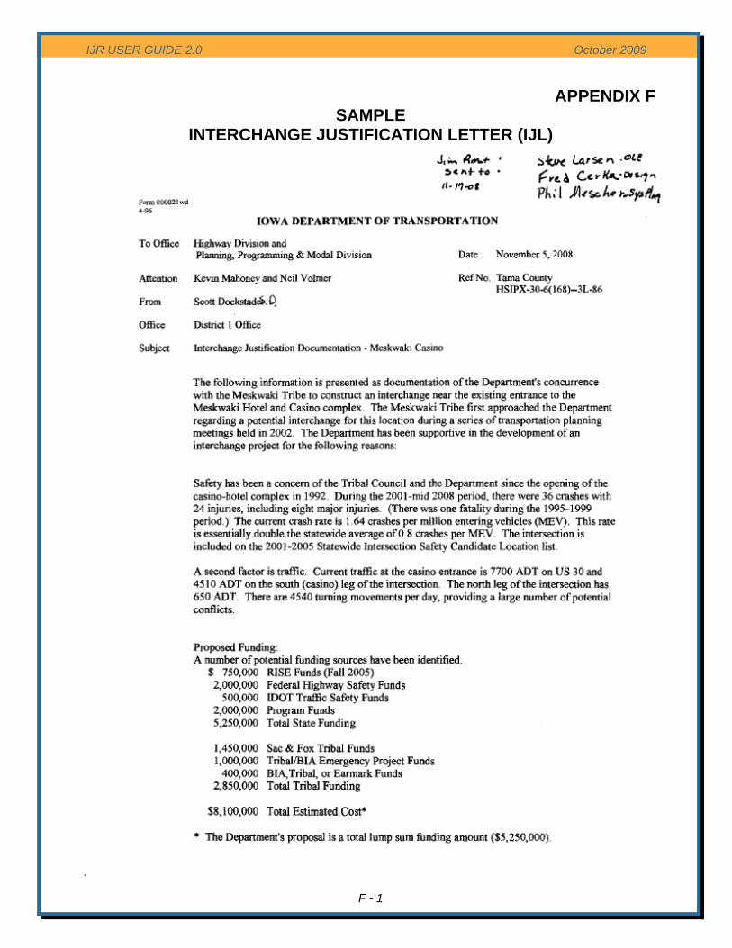
IJR USER GUIDE 2.0 October 2009
APPENDIX F SAMPLE
F - 1
INTERCHANGE JUSTIFICATION LETTER (IJL)
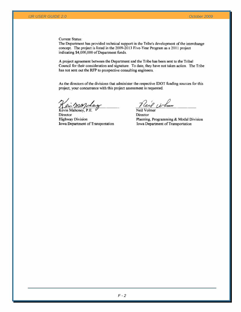
IJR USER GUIDE 2.0 October 2009
F - 2