npu-g community master plan - wordpress.com · npu-g community master plan ... institute of...
TRANSCRIPT

NPU-G Community Master Plan A Live-Work-Play Approach to Upward Mobility Blueprints for Successful Communities Fall 2010
September 2011

Georgia Conservancy—Blueprints Partners
American Council of Engineering Companies of Georgia • American Institute of Architects—Atlanta Chapter
American Society of Landscape Architects, Georgia Chapter • Association County Commissioners of Georgia
Atlanta Neighborhood Development Partnership • Georgia Institute of Technology, College of Architecture
Georgia Municipal Association • Georgia Planning Association • Southface Greater Atlanta Homebuilders Association • Institute of Transportation Engineers
Urban Land Institute—Atlanta District Council • U.S. Green Building Council—Atlanta Chapter
We are Grateful to the Generous Donors who Supported NPU‐G Blueprints:
The Rich Foundation, Inc. The Home Depot Foundation

City of Atlanta, Georgia
Mayor The Honorable M. Kasim Reed
City Council Ceasar C. Mitchell, Council President
Department of Planning and Community Development James E. Shelby, Commissioner
Charletta Wilson Jacks, Director, Office of Planning
City of Atlanta Department of Planning and Community Development
Office of Planning 55 Trinity Avenue SW
Suite 3350 404‐330‐6145
Atlanta GA 30303 www.atlantaga.gov
Carla Smith Alex Wan Keisha Bottoms
Council District 1 Council District 6 Council District 11
Kwanza Hall Howard Shook Joyce Sheperd Council District 2 Council District 7 Council District 12
Ivory Lee Young, Jr. Yolanda Adrean Michael Julian Bond Council District 3 Council District 8 Post 1 At Large
Cleta Winslow Felicia A. Moore Aaron Watson Council District 4 Council District 9 Post 2 At Large
Natalyn Mosby Archibong C.T. Martin H. Lamar Willis
Council District 5 Council District 10 Post 3 At Large
Blueprints for Successful Communities is an education and technical assistance program of the Georgia Conservancy designed to facilitate community‐based planning across the state. The program is committed to achieving successful communities by creating sound conservation and growth strategies, and building consensus for action. Georgia is home to an abundance of natural and cultural resources. Our development patterns over the last 50 years present a very real threat to these resources and to quality of life as a whole. Sprawling, decentralized development, where people must depend on automobiles, is expensive for local governments to serve and has a staggering effect on the environment. Vehicle emissions create toxic air pollution. Stormwater runoff from asphalt poisons rivers and streams. Thousands of acres of farms, woodlands, and open space are lost to wasteful, non‐sustainable forms of development. The Georgia Conservancy partnered with the Urban Land Institute and the Greater Atlanta Homebuilders in 1995 to host its first Blueprints for Successful Communities symposium. Currently the Conservancy maintains an active partnership with thirteen organizations. These diverse organizations and their members provide a great deal of understanding and expertise in the relationships that exist between land use, public infrastructure, economic growth, and environmental quality. Prior to the NPU‐G effort, Blueprints has addressed multi‐jurisdictional watershed planning, heritage corridor preservation, location of commuter rail stations, inner city neighborhood issues, and other planning opportunities all through a collaborative planning process.
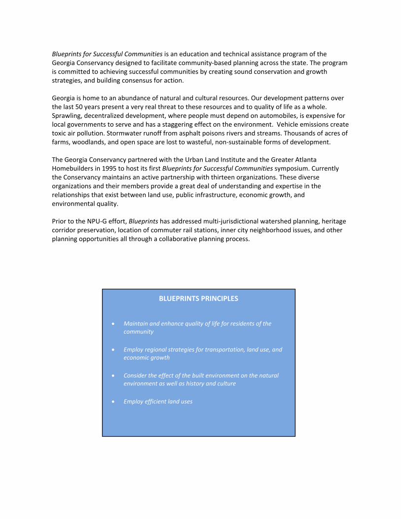
BLUEPRINTS PRINCIPLES • Maintain and enhance quality of life for residents of the
community • Employ regional strategies for transportation, land use, and
economic growth • Consider the effect of the built environment on the natural
environment as well as history and culture • Employ efficient land uses

i
TABLE OF CONTENTS Introduction ......................................................................................................................................... 1
Connections ........................................................................................................................................... 5
2.1 Greenway Trails ................................................................................................................................... 8
2.2 Intersection Improvements ............................................................................................................... 15
2.3 Donald Lee Hollowell Parkway/I‐285 Interchange ............................................................................ 18
2.4 Street Connections ............................................................................................................................ 22
2.5 Transit ................................................................................................................................................ 26
2.6 Transit‐Oriented Development ......................................................................................................... 29
2.7 Bicycle Network and Sidewalk Improvements .................................................................................. 32
Redevelopment ................................................................................................................................. 34
3.1 Hollywood Courts Site Analysis ......................................................................................................... 37
3.2 Bowen Homes Site Analysis............................................................................................................... 40
3.3 Bankhead Courts Site Analysis .......................................................................................................... 43
Opportunities for Advancement ........................................................................................................ 47
4.1 Workforce Development ................................................................................................................... 48
4.2 Green Industry Training Program (GITP) ........................................................................................... 49
4.3 Schools and Education ...................................................................................................................... 51
Food Access ....................................................................................................................................... 54
5.1 Community Gardens .......................................................................................................................... 56
5.2 Urban Agriculture Center .................................................................................................................. 58
5.3 Farmers’ Market And Grocery Stores ................................................................................................ 61
5.4 Street Food and Food Carts ............................................................................................................... 63
Public Art ........................................................................................................................................... 64
6.1 Locations of Public Art ....................................................................................................................... 65
Environment and Natural Amenities .................................................................................................. 67
7.1 Gun Club Road Landfill ...................................................................................................................... 68
7.2 Chattahoochee River Trail Pond ........................................................................................................ 73
7.3 Air Quality .......................................................................................................................................... 77
7.4 Sewer and Stormwater ...................................................................................................................... 79
7.5 Cemetery Rehabilitation ................................................................................................................... 79
Recommendations ............................................................................................................................. 82

ii
TABLE OF FIGURES Figure 1.0a: Neighborhood Planning Unit G Study Area ................................................................................ 2 Figure 2.0a: Map of Proposed Chattahoochee River and Proctor Creek Greenway Systems ........................ 7
Figure 2.1a: Location of Proposed Chattahoochee River Trail ..................................................................... 9 Figure 2.1b: River Trail Example; the Chattahoochee National River Area at Akers Mill ........................... 10
Figure 2.1c: Examples of Parcourse Equipment ......................................................................................... 11
Figure 2.1d: Existing Retention Pond / Future water feature ..................................................................... 12 Figure 2.1e: Proctor Creek at the Johnson Road Bridge ............................................................................. 13
Figure 2.1f: Example of a boardwalk at Big Creek Greenway Trail in Alpharetta, GA ................................ 15
Figure 2.2a: NPU‐G Transportation Map .................................................................................................... 16
Figure 2.3b: roundabout Used as A Gateway in Asheville, North Carolina ................................................ 20
Figure 2.3c: Proposed Diverging Diamond Interchange at Donald Lee Hollowell and I‐285 ...................... 21 Figure 2.3d: Hollywood Road/Perry Boulevard Intersection ...................................................................... 22
Figure 2.3e: Hightower Road/Hollywood Road Intersection ...................................................................... 22
Figure 2.4a: Proposed Street Connections ................................................................................................. 23
Figure 2.4b: Proposed Connection to the Atlanta Industrial Park .............................................................. 25
Figure 2.5a: Blueprints Team Proposed Donald Lee Hollowell Bus Rapid Transit ...................................... 26
Figure 2.5b: Blueprints Team Proposed MARTA Extension ........................................................................ 28
Figure 2.7a: Belle Isle Bridge ....................................................................................................................... 32
Figure 3.0a: Atlanta Housing Authority Vacant Sites .................................................................................. 36
Figure 3.1a: Location of Hollywood Courts ................................................................................................. 37
Figure 3.1b: Mixed‐Use Development Examples ........................................................................................ 38
Figure 3.1c: Hollywood Courts Expansion Analysis ..................................................................................... 38
Figure 3.1d: Proposed Street Connectivity ................................................................................................. 40
Figure 3.2a: Location of Bowen Homes ...................................................................................................... 41 Figure 3.2b: Bowen Homes Proposed Street Connectivity ......................................................................... 43

iii
Figure 3.3a: Location of Bankhead Courts .................................................................................................. 44
Figure 3.3b: Proposed Connections Through Bankhead Courts ................................................................. 46
Figure 4.3a: Locations of NPU‐G Schools .................................................................................................... 52
Figure 5.0a: Locations of All Proposed Gardens, Farms, and Grocery Stores............................................. 55
Figure 5.1a: Proposed Location for Community Garden #1: Rockdale Park ............................................... 57
Figure 5.1b: Proposed Location for Community Garden #2: A.D. Williams Park ........................................ 58
Figure 5.2a: Proposed Site for Urban Agriculture ....................................................................................... 59
Figure 5.2b: Proposed Urban Agriculture Site: Front View ......................................................................... 60
Figure 5.2c: Renderings of Indoor Urban Agriculture Center ..................................................................... 60
Figure 5.3a: Location of Grocery Store ....................................................................................................... 61
Figure 5.4a: Street Food Cart Example ....................................................................................................... 63
Figure 5.4b: Street Food Truck Example ..................................................................................................... 63
Figure 6.1a: Public Art, Bend, OR ................................................................................................................ 65
Figure 6.1b: Public Art in Center Hill Park ................................................................................................... 66
Figure 7.1a: Gun Club Road Landfill Extent ................................................................................................. 70
Figure 7.1b: Smart House Location ............................................................................................................. 72
Figure 7.2a: Floating Islands ....................................................................................................................... 75
Figure 7.2b: Bioretention Basin Illustration ................................................................................................ 76
Figure 7.5a: Hollywood Cemetery Images .................................................................................................. 80

iv

1
Introduction

2
1.0 INTRODUCTION
Neighborhood Planning Unit G (NPU‐G), which is located northwest of downtown Atlanta, includes the neighborhoods of Rockdale, West Highlands, Almond Park, Carver Hills, Scotts Crossing, Carey Park, Brookview Heights, Monroe Heights, Lincoln Homes, Chattahoochee, English Park and the Atlanta Industrial Park. The NPU is bordered approximately by Donald Lee Hollowell Parkway to the south, Perry Boulevard to the north, Marietta Boulevard to the east, and the Chattahoochee River to the west (refer to Figure 1.0a). In the fall of 2010, the NPU‐G community joined with the Georgia Conservancy’s Blueprints for Successful Communities to create a community master plan, emphasizing quality growth and economic development; this report is a result of that collaboration.
NPU‐G is a neighborhood of contrasts, with beautiful natural resources, such as the Chattahoochee River and Proctor Creek, comingled with the challenges of blighted and vacant properties, such as demolished public housing project sites and one of the largest landfills in the City, Gun Club Road Landfill.
Figure 1.0a: Neighborhood Planning Unit G Study Area

3
It is one of the oldest established neighborhoods in the City of Atlanta where residents of 30 or more years still live. While these residents are surrounded by natural amenities, they severely lack everyday living resources, such as retail and grocery stores.
The conditions of NPU‐G supply an ideal opportunity to implement sustainable and innovative solutions. The shortage of existing infrastructure or commercial development provides a clean slate, rare for new projects within the city limits. The natural resources, such as the Chattahoochee River and Proctor Creek, are unique to the area and will generate opportunities for recreation and connectivity. As new development encroaches on the community, this report hopes to provide recommendations that build from the existing neighborhood assets to create a better connected and more sustainable neighborhood.
Blueprints for Successful Communities is a 15‐year sustainable community design program of the Georgia Conservancy. Blueprints uses a community‐based approach to sustainable planning and design and is unique in that it involves key stakeholders – including citizens, businesses, agency and institutional representatives, and elected and appointed officials – throughout the entire process of redeveloping an existing community to better incorporate and focus on natural resource protection, green space accessibility, sustainable land use, and live‐work connectivity. The Blueprints process is one of the most highly respected planning processes in the state because of its inclusiveness, transparency and technical quality. Blueprints was contacted by the NPU‐G Chairperson in 2010 and asked to help the community shape a redevelopment plan and vision for its future. Specifically, NPU‐G leadership wanted a community plan that clearly identified economic development opportunities, building on the success of the Atlanta Industrial Park and shaping that area as a potential source of local jobs, and a plan that identified positive redevelopment concepts for the Atlanta Housing Authority acreage formerly containing public housing. Blueprints solicited the assistance of Dr. Nancey Green Leigh with Georgia Tech’s School of City and Regional Planning as well as a group of graduate students under her direction to address these requested focus areas.
Through a stakeholder‐driven process Blueprints and the Georgia Tech class (studio) conducted a series of community workshops and presentations, collected information and maps, conducted data collection within the community and performed resident and business interviews to develop a set of draft recommendations for consideration by the community. These recommendations were supported by the community and form the basis of this report.
This report is broken into six major sections:

4
• Connections
• Redevelopment
• Opportunities for Advancement
• Food Access
• Public Art
• Environment & Natural Amenities
• Recommendations
Each of the recommendations detailed in this report are made with the goal of increasing economic opportunity and livability within NPU‐G.
The concerns and community‐supported recommendations captured in the Blueprints report, reflect the input of the stakeholders and participants at the time of the Blueprints planning process. As with any significant community project, each recommendation should be revisited as implementation opportunities arise to verify that the recommendation is still supported and appropriate for the community. Over the life of the Blueprints report, it is likely that a community’s population, development/redevelopment pressure, traffic patterns, local leadership, and economic activity will change. Such changes may result in a shift in recommendation priorities for implementation, may render a recommendation no longer applicable, or may result in a change in a community’s needs or wishes. This is expected and part of the normal cycle of change in a community. However, it is important that future community leadership respect the stakeholder effort and community support that resulted in the Blueprints report.

5
Connections

6
2.0 CONNECTIONS NPU‐G suffers from poor connectivity issues. Some of this concern stems from the effects of the natural features of the terrain and some are the result of human‐made obstacles. There are vast swaths of open and undeveloped land, such as the three former public housing project sites and the former Gun Club Road Landfill, all of which segment the community. Proctor Creek runs east to west through the neighborhoods, splitting the NPU in half. I‐285 creates a barrier between the west side of NPU‐G and the rest of the community.
Additionally, residents have few options beyond automobile or bus services to get around, as the NPU severely lacks sidewalk and bicycle infrastructure.
To improve these conditions, several solutions are proposed within this section, including a pedestrian and bicycle trail system within the existing natural greenways of the Chattahoochee River and Proctor Creek, expansion of a bike trail and lane network, pedestrian safety improvements along existing roads, new street connections, existing street improvements, and new public transit proposals (refer to Figure 2.0a for the proposed Chattahoochee River and Proctor Creek greenway systems).
The overarching goals in all of these proposals are to increase economic development potential, augment accessibility for residents and local businesses, encourage alternative modes of transportation, emphasize safety, increase access to natural amenities in the area, and enhance the quality of life.
Please refer to Section 8.1 through 8.7 for a condensed version of the recommendations within this section and for more information about contacts, resources and funding opportunities that may be able to assist with implementation.

7
Figure 2.0a: Map of Proposed Chattahoochee River and Proctor Creek Greenway Systems

8
2.1 GREENWAY TRAILS According to the Project Greenspace Needs Assessment survey conducted by the City of Atlanta in 2007, 84% of responding households listed walking and biking trails as their greatest parks and recreation need. In addition, 55% of households felt that their needs were not met by existing walking and biking trails.1 NPU‐G has two significant natural resources that are opportunities for the development of walking and biking trails: the banks of the Chattahoochee River and Proctor Creek. The greenways along both of these amenities have the potential to be transformed into low impact trails to provide much needed recreation, fitness and connectivity solutions for the community.
Refer to Section 8.1 for a condensed version of the recommendations within this section and information on contacts, resources and funding opportunities that may be able to assist with implementation.
2.1.1 Chattahoochee River Trail
A one‐mile segment of the Chattahoochee River lies in NPU‐G between Donald Lee Hollowell Parkway and I‐285. The entire segment is bordered on the east by the Atlanta Industrial Park (refer to Map 2.0a). The land is heavily forested and ranges in width from about 450 feet to about 600 feet. To the south are Donald Lee Hollowell Parkway and the site of a former public housing project, Bankhead Courts. At the north end is the site of the former General Shale brick factory.
Within this context, the River is greatly under‐utilized, but has the potential to become a strong community asset, becoming a place for neighborhood interaction, exercise, and education. Additionally, this swath of land can improve connectivity by linking the Atlanta Industrial Park (AIP) and new development on the former Bankhead Courts site to the proposed Proctor Creek greenway trail, as discussed in Section 2.2, ultimately connecting this west side amenity to the rest of the NPU. To achieve this, a natural walking trail, anchored on the south end by a nature center and retail development, and on the north end by an outdoor festival/events space, is proposed (refer to Figure 2.1a). Location of a nature center could be included in redevelopment plans for the former Bankhead Courts site (refer to Section 3.3.1).
1 City of Atlanta. (2008). Atlanta’s Project Greenspace Needs Assessment. Retrieved from < http://www.atlantagreenspace.com/docs/Greenspace_Plan_Needs_Assessment%20Report_DRAFT_2‐08.pdf>

9
CHATTAHOOCHEE CORRIDOR PLAN REGULATIONS
This proposed trail development is within the Chattahoochee Corridor and, therefore, must comply with the Chattahoochee River Plan (CCP), which was developed as part of the Metropolitan River Protection Act. The CCP provides the process through which any development must apply for approval of a proposed project, and defines standards of conformity and penalties for discordance.
The following are CCP specifications, which were considered during the development of this proposed Chattahoochee Trail: 50‐foot vegetative buffers; no impervious surface can be added within 150 feet of either bank; 35‐foot vegetative buffer required on both banks of all tributary streams in the corridor, which would include Proctor Creek; maintain current storage capabilities in both the 100‐year and 500‐year floodplain; no amount of sediment can be added to the floodplain without an equivalent volume being removed, as measured from the natural ground level to the flood elevation level; no construction
Figure 2.1a: Location of Proposed Chattahoochee River Trail Source: Blueprint Team’s creation on Google image

10
over 35 feet in height is allowed in the 500‐year floodplain (for more information on the CCP, please refer to Appendix 9.1.1).
DESIGN
Since this segment of land is heavily forested and relatively undisturbed, as opposed to the opposite bank, which is located in Cobb County, there are limits to what can be constructed here, in accordance with the CCP. However, even with the CCP guidelines, this section of the Chattahoochee can be transformed into a natural asset for the local community, and for the City as a whole. There is a demonstrated need in the City of Atlanta for more trails, as detailed in Atlanta’s Project Greenspace Report.2 This land is an ideal spot for a primitive fitness and walking trail, anchored on the south by a nature center and on the north by an outdoor festival space. While this plan does not detail the outdoor event space, it is suggested that the site of the General Shale Brick Factory be considered for this use. The Project Greenspace Report specifically notes that there is a need for an outdoor venue that can host major events, concerts, and festivals in the city. The site at the north end of this proposed Chattahoochee River trail would be an ideal location.3
A trail and land remain should remain as natural as possible, in part, to celebrate the natural amenities of the neighborhood and to provide access to a relatively undisturbed section of the river, and in part, because this land has been identified as undeveloped land with high environmental value in the Atlanta Project Greenspace Report.4 The example of the type of trail proposed is shown in Figure 2.1b. While a
2 City of Atlanta Project Greenspace (2009). Project Greenspace: Embrace your Space Summary Report. Retrieved on 12 October 2010 from http://www.atlantagreenspace.com/mapsdocs.htm.
3 City of Atlanta Project Greenspace (2009). Project Greenspace: Embrace your Space Summary Report. Retrieved on 12 October 2010 from http://www.atlantagreenspace.com/mapsdocs.htm.
4 City of Atlanta Project Greenspace (2009). Project Greenspace: Embrace your Space Summary Report. Retrieved on 12 October 2010 from http://www.atlantagreenspace.com/mapsdocs.htm.
Figure 2.1b: River Trail Example; the Chattahoochee National River Area at Akers Mill Source: http://www.flickr.com/photos/peachy92/3519024325/

11
soft surface trail is proposed, future analysis of material type may determine that a hard surface would better accommodate a higher volume of users.
A utility easement running north to south and crossing Donald Lee Hollowell Parkway and the Chattahoochee River sits at the south end of the proposed trail area. This easement crosses Donald Lee Hollowell Parkway at an ideal spot for the trail to commence. Utility easements can be considered a resource in developing trails, as they can become pathways that connect trail systems, or connect places of interest that are not connected by road right‐of‐way. Current practice advises jurisdictions to think about utility easements as multifunctional space.5 It is proposed that the trail starts at this utility easement and follows it for a tenth of a mile, where it then reaches an existing retention pond (indicated as Water Feature in Figure 2.1a). Adjacent to this site exist two small commercial buildings which could be converted into a welcome center and a facility maintenance building. (Refer to Section 7.2: Chattahoochee River Trail Retention Pond for a proposed improvement plan to better utilize this existing retention pond.)
In this already cleared utility easement area is where an outdoor exercise facility and fitness trail could be located. The fitness trail, also called a parcourse, will extend past the clearing along the trail and beyond the water feature. A parcourse is a path equipped with obstacles or fitness stations along the trail, each designed for stretching, strengthening, cardiovascular work, and other physical activity. At each station a sign is placed to instruct the users on how to use the exercise equipment.6 Examples of exercises include calf raises, push‐ups, pull‐ups, squats, crunches, hip lifts, and more, all of which use just your own body mass, as seen in Figure 2.1c. The exercise equipment should be made of wood to in keeping with the natural, relatively undisturbed, environment of the proposed trail.
5 Thompson, JW and Sorvig, K. (2008). Sustainable Landscape Construction: A Guide to Green Building Outdoors. Second edition. p 48
6 Grudowski, M. (2000). “Parcourse Redux: Outdoor fitness tracks provide a retro‐cool route to strength and endurance.” Outdoor Magazine. Retrieved on 26 October 2010 from http://outsideonline.com/outside/magazine/200005/200005body1.html
Figure 2.1c: Examples of Parcourse Equipment Source: FitTrail and Outdoor Fun Store

12
The trail will continue from the parcourse and will encircle an existing pond / future water feature (pictured in Figure 2.1d). The pathway will continue north, following the river. Along the River, the path will utilize the existing dirt trail. While a trail area may need to be cleared, it is recommended to preserve as much of the canopy as possible, as maintaining and increasing the tree canopy is a goal of
the City’s Project Greenspace Plan.7 Ultimately, the Chattahoochee River Trail will join with the Proctor Creek Greenway system, which is further discussed in Section 2.1.2. As trail planning precedes, it is recommended to make trail connections to the Atlanta Industrial Park (AIP), allowing employees to access this new amenity.
CHATTAHOOCHEE RIVER BOAT PUT‐IN
A boat put‐in is a designated gravel, sand or concrete slope where a kayaker or canoeist can put in and take out boats on the banks of a river. The average kayak or canoe excursion is 7 miles maximium.8 According to the Chattahoochee Riverkeeper, the closest boat put‐in to NPU‐G is 8 miles north upstream and 15 miles south downstream, making the shore of the proposed Chattahoochee River Trail ideal for a boat put‐in.
The proposed boat put‐in should be constructed from gravel and sand, and should have a low impact on the existing environmental conditions. The boat put‐in will only be allowed for non‐motorized boats because of the hydrologic considerations of the River. A concrete or pylon structure, which is necessary for motorized boat put‐ins could significantly disturb and erode the river bank.
7 City of Atlanta Project Greenspace (2009). Project Greenspace: Embrace your Space Summary Report. Retrieved on 12 October 2010 from http://www.atlantagreenspace.com/mapsdocs.htm.
8 Ulseth, J. Office of the Chattahoochee River Keeper, Phone Interview, 11/03/2010
Figure 2.1d: Existing Pond / Future water feature
13
ACCESS
Accessibility to the proposed Chattahoochee River Trail and the boat put‐in will prove to be a challenge as there is no paved public access to the land, and unpaved access is restricted to a service road that circles the existing pond. The proposed solution to address the limited accessibility is to obtain an agreement for flex parking with businesses of the AIP and connect the AIP parking areas to the trail with pedestrian and bike paths. Additionally, ownership of this land along the Chattahoochee River will need to be verified before moving forward with any development.
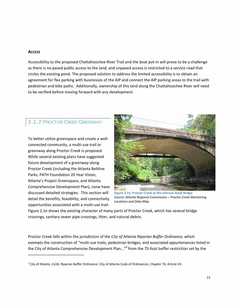
2.1.2 PROCTOR CREEK GREENWAY
To better utilize greenspace and create a well‐connected community, a multi‐use trail or greenway along Proctor Creek is proposed. While several existing plans have suggested future development of a greenway along Proctor Creek (including the Atlanta Beltline Parks, PATH Foundation 20 Year Vision, Atlanta’s Project Greenspace, and Atlanta Comprehensive Development Plan), none have discussed detailed strategies. This section will detail the benefits, feasibility, and connectivity opportunities associated with a multi‐use trail. Figure 2.1e shows the existing character of many parts of Proctor Creek, which has several bridge crossings, sanitary sewer pipe crossings, litter, and natural debris.
Proctor Creek falls within the jurisdiction of the City of Atlanta Riparian Buffer Ordinance, which exempts the construction of “multi‐use trails, pedestrian bridges, and associated appurtenances listed in the City of Atlanta Comprehensive Development Plan...”9 from the 75‐foot buffer restriction set by the
9 City of Atlanta. (n/d). Riparian Buffer Ordinance. City of Atlanta Code of Ordinances. Chapter 74, Article VII.
Figure 2.1e: Proctor Creek at the Johnson Road Bridge Source: Atlanta Regional Commission – Proctor Creek Monitoring Locations and Data Map

14
Metropolitan River Protection Act. However, the impacts of these developments must still be mitigated in accordance with guidance prepared by the Department of Watershed Management. (Refer to Appendix 9.1.2 for more detail on these guidelines.)
GREENWAYS
Greenways are most commonly defined as a linked network of corridors managed for conservation, recreation, and connectivity.10 They typically follow features such as rivers, creeks, or streams, and utility or railroad corridors. Although greenways are most commonly seen as a recreational amenity, they are also beneficial to neighborhood connectivity, environmental conservation, stormwater management, and economic development.
Greenways promote healthy lifestyles by providing a safe and inexpensive means for exercise, while also serving as viable alternative transportation corridors connecting key neighborhood nodes, such as parks, schools, and retail to residential areas. Providing an integrated and well‐connected network of off‐road paths for pedestrians and cyclists is a key aspect of a livable and walkable community. By preserving natural areas within cities, greenways also help to protect wildlife habitat while at the same time serving as hands‐on environmental classrooms for the community. Greenways can also help to maintain existing floodplains by preventing soil erosion, as well as serving as a filter for stormwater runoff.
Additionally, greenways can provide economic benefits by increasing the value of adjacent properties, encouraging tourism, connecting residential areas to retail nodes, creating jobs and revenue, and generally improving the quality of life for the surrounding neighborhoods.11 In fact, Georgia’s own Silver Comet Trail has helped several small communities along the trail become tourist destinations.12
10 Ahern, J. (2003). "Greenways in the USA: theory, trends and prospects. In "Ecological Networks and Greenways: Concept, design, implementation" R. Jongman and G. Pungetti, Editors. Cambridge University Press. Chapter 3.
11 Sherer, P.M. (2003). The Benefits of Parks: Why America Needs More City Parks and Open Space. The Trust for Public Land.
12 Trails and Greenways Clearinghouse. (n.d.) Economic Benefits of Trails and Greenways. Retrieved from http://www.railstotrails.org/resources/documents/resource_docs/tgc_economic.pdf

15
DESIGN
As shown in 2.0a, the proposed greenway along Proctor Creek would connect the proposed Westside Park and the BeltLine to many parts of the neighborhoods in NPU‐G, including the West Highlands development, James Jackson Parkway, Hollywood Road, Lillian Cooper Shepherd Park, A.D. Williams Park, and Williams Elementary. It would also connect to three projects that are proposed within this report – the Chattahoochee River Trail (discussed in Section 2.1.1), the Gun Club Park ‐ Green Education Center and Trail (discussed in Section 7.1), and the Hollywood Courts redevelopment (discussed in Section 3.1).
As the Proctor Creek Greenway trail is proposed within the wetlands and flood‐prone banks of Proctor Creek, an elevated 10‐ to 12‐foot wide multi‐use boardwalk should be considered (refer to Figure 2.1f). The trail should be wide enough to allow for the safe passage of cyclists and pedestrians, but not any wider than necessary, to reduce the amount of impervious surface within the floodplain.
2.2 INTERSECTION IMPROVEMENTS The capacity of a transportation system tends to be constrained by its intersections. A poorly performing intersection will limit the access and efficiency of the roads leading to the intersection, causing congestion and minimizing the economic benefits associated with the road. In addition, a poorly performing intersection leads to increased crashes and delays for roadway users. Fortunately, with a few exceptions, automobile traffic in NPU‐G is largely unconstrained. The following projects deal only
Figure 2.1f: Example of a boardwalk at Big Creek Greenway Trail in Alpharetta, GA

16
with the few specific junctions where traffic concerns have been identified. (Refer to Figure 2.2a for a visual of the transportation system in NPU‐G.)
Refer to Section 8.2 for a condensed version of the recommendations within this section and information about contacts, resources and funding opportunities that may be able to assist with implementation.
2.2.1 TRAFFIC SIGNAL ENHANCEMENTS
The Donald Lee Hollowell Parkway corridor carries a significant portion of the automobile and freight traffic in NPU‐G. It is the primary east‐west corridor through the NPU and between downtown Atlanta and the AIP. Improving travel time reliability on Donald Lee Hollowell Parkway has the potential to directly address the identified Connections opportunities, most notably increasing economic development potential, improving accessibility for residents and local businesses, and enhancing the quality of life. The Signal Timing Manual developed by the Federal Highway Administration states that: “Outdated or poor traffic signal timing accounts for a significant portion of traffic delay on urban
Figure 2.2a: NPU‐G Transportation Map

17
arterials and traffic signal retiming is one of the most cost effective ways to improve traffic flow and is one of the most basic strategies to help mitigate congestion.”13 In relation to traffic signals on the Donald Lee Hollowell Parkway corridor, two specific projects are recommended: update signal timing and apply transit signal priority based on vehicle height.
2.2.2 UPDATE DONALD LEE HOLLOWELL PARKWAY CORRIDOR SIGNAL TIMING
A relatively low cost method of increasing intersection efficiency, vehicular access, and travel time reliability is updating the signal timing on the corridor. In 2005, as part of the Governor’s Fast Forward Transportation Program, a traffic signal management program was introduced. This program was designed to “upgrade and maintain traffic signal equipment and timing for optimal operational efficiency of arterials,” including the Donald Lee Hollowell Parkway corridor.14 Constantly changing conditions in terms of the population, employment and freight have the ability to significantly change neighborhood traffic volumes and travel patterns.
Consequently, it is important that signal timing along the corridor is maintained and updated regularly. Signal improvements will require upgrading communication and other associated equipment.
2.2.3 SIGNAL PRIORITY BASED ON VEHICLE HEIGHT
Signal priority gives special treatment to a certain class of vehicles at signalized intersections. While signal priority is generally implemented for transit vehicles, signal priority can also be given to heavy vehicles, like trucks. Signal priority is accomplished by adjusting the signal timing on the corridor by truncating the red time on the minor streets along the corridor, and extending the green time on the corridor itself. Signal priority allows for increased reliability, efficiency, and mobility along the corridor where it is installed. While the City of Atlanta does not currently utilize signal priority technology to provide priority to heavy vehicles, such as trucks, it is worthwhile to explore this recommendation as a means to address traffic and air quality issues along Donald Lee Hollowell Parkway corridor. Case
13 Federal Highway Administration. Signal Timing Manual, June 2008. Publication Number: FHWA‐HOP‐08‐024
14 Holmes, Carla W. Fast Forward: Full Speed Ahead, September 25, 2006. Presentation at the ITS Georgia/Tennessee Annual Meeting

18
studies and impact assessment studies are needed as a means to disucss and justify this improvement with the City of Atlanta and GDOT.
In King County, Washington (Seattle), signal priority and signal optimization reduced transit delay along two corridors by 40%15. With the Donald Lee Hollowell Parkway corridor also serving as a major freight corridor, the Blueprints team proposes that signal priority be implemented along this corridor based on vehicle height, allowing the many heavy vehicles traveling along the corridor to also experience the same benefits as transit vehicles. In addition to improving travel time reliability, signal priority based on vehicle height also has the potential to reduce the starts and stops of heavy vehicles, which improves air quality and reduces the noise associated with starts and stops. (Refer to Appendix 9.2.1 for more information on signal priority timing.)
2.3 DONALD LEE HOLLOWELL PARKWAY/I-285 INTERCHANGE The Donald Lee Hollowell Parkway/I‐285 Interchange is a key gateway to the Atlanta Industrial Park—one of Atlanta’s largest industrial employment centers. Workers throughout the metropolitan area, as well as freight and delivery trucks from the metro area and the United States, use the Donald Lee Hollowell Parkway/I‐285 Interchange daily. To improve the safety of motorists using this interchange and to enhance the prominence of this area as a gateway to the NPU‐G community, the Blueprints team has created an innovative strategy, utilizing two road improvement tools, the Diverging Diamond Interchange (DDI) and the Roundabout. While the following sections further explore the DDI and roundabout recommendations, it should be noted that the City of Atlanta is interested in consideration of three potential options for this interchange: 1) a standard DDI; 2) a standard dual roundabout interchange; and 3) a hybrid DDI with roundabout interchange. Further analysis is necessary to determine a final design solution. The Hollowell Veterans Memorial LCI also explored various alternatives for an improved I‐285 interchange.
Refer to Section 8.3 for a condensed version of the DDI / Roundabout Interchange recommendations within this section and information about contacts, resources and funding opportunities that may be able to assist with implementation.
15 Federal Highway Administration. Signal Timing Manual, June 2008. Publication Number: FHWA‐HOP‐08‐024

19
2.3.1 DIVERGING DIAMOND INTERCHANGE
The Diverging Diamond Interchange according to Popular Science magazine, creates safer and more efficient highway access by doing “away with risky left turns. The street approaching the highway now diverts to the left, and cars get uninterrupted access to the highway, which, experts say, can reduce clogging by as much as 60 percent. Drivers who want to turn left onto the highway can do so without crossing oncoming traffic. Through‐traffic, meanwhile, stays on the left side of the road until it reaches a second stoplight, where it
passes back over to the right. The Federal Highway Administration estimates that the diverging diamond configuration enables 600 left turns onto the freeway per hour per lane—double that of an ordinary interchange, where drivers cross oncoming traffic.”16 (Refer to Figure 2.3a for an example of a DDI.) Should a DDI solution be determined as the appropriate design solution for this interchange, proper design is critical as DDI’s can have significant negative impacts to bicycle and pedestrian circulation and safety.
2.3.2 THE ROUNDABOUT
The primary benefit of roundabouts is improved safety. In 2007, the National Cooperative Highway Research Program (NCHRP) Report 572: Roundabouts in the United States17 confirmed earlier findings that showed reduced crash rates at intersections converted to roundabouts.18
16 http://www.popsci.com/bown/2009/product/diverging‐diamond‐interchange
17 Rodegerdts, L., Kyte, M., List, G., Flannery, A., Troutbeck, R., Brilon, W., et al. (2007). NCHRP Report 572: Roundabouts in the United States. Washington D.C.: National Cooperative Highway Research Program.
Figure 2.3a: Diverging Diamond Interchange, Springfield, Missouri Source: http://www.divergingdiamond.com/

20
Figure 2.3b: Roundabout Used as A Gateway in Asheville, North Carolina Source: http://safety.fhwa.dot.gov/intersection/roundabouts/presentations/safety_aspects/long.cfm
Most roundabouts are 100 to 200 feet in diameter, and are designed to reduce speeds, and accommodate heavy vehicles, including large freight trucks, transit vehicles, and emergency vehicles. Another important benefit of the roundabout is that it typically experiences significantly less delay than a signalized intersection that has comparable traffic volumes.19 Due to the safety and operational benefits associated with roundabouts, the Georgia DOT recently released an updated policy regarding roundabouts: “Roundabouts are the preferred safety and operational alternative for a wide range of intersections of public roads. A roundabout shall be considered as an alternative in the following instances: (1) Any intersection in a project that is being designed as new or is being reconstructed. (2) All existing intersections that have been identified as needing major safety or operational improvements. (3) All signal requests at intersections...” 20
Life‐cycle cost analysis comparing roundabouts to other intersection alternatives show that roundabouts tend to provide more benefit and cost less than stop‐controlled or signal‐controlled intersections.21 A roundabout can also be used as a gateway feature, providing a clear visual signal to motorists that they
18 Robinson, B. W., & Bared, J. G. (June 2000). ROUNDABOUTS: An Informational Guide. Mclean, Virginia: Federal Highway Administration.
19 ibid
20 Georgia Department of Transportation. Modern Roundabouts in Georgia. Georgia Department of Transportation. [Online] September 2009. [Cited: October 15, 2010.] http://www.dot.state.ga.us/travelingingeorgia/roundabouts/Documents/Modern_Roundabouts_in_Georgia.pdf.
21 Myers, Edward J and Pochowski, Alek. Maryland Roundabout Program, Early Years and Program Growth. Kittelson & Associates, Inc. Baltimore, Maryland: 2008.

21
are entering a particular area or neighborhood. Figure 2.3b displays a roundabout built in Asheville, North Carolina that serves as a gateway to downtown. It is important, however, to consider the amount of space needed for a roundabout and to ensure minimal disturbance to property owners when implementing this traffic control solution.
2.3.3 THE DDI / ROUNDABOUT INTERCHANGE PROPOSAL
The proposed DDI / Roundabout solution at the Donald Lee Hollowell Parkway /I‐285 interchange would serve as a gateway to both the Atlanta Industrial Park and to NPU‐G and resolve some of the automobile conflists at the interchange. The roundabouts could include signage, providing a visible gateway into the community. (Refer to Figure 2.3c for an image of a conceptual DDI / Roundabout Interchange.) It is understood that this is a recommended conceptual solution for the Donald Lee Hollowell Parkway / I‐285 Interchange, which requires analysis and study to determine its validity to address existing issues and to ensure City of Atlanta and GDOT requirements are met.
Figure 2.3c: Conceptual Diverging Diamond Interchange at Donald Lee Hollowell and I‐285 Source: Blueprint Team’s creation on Google image

22
2.3.4 ADDITIONAL ROUNDABOUT PROPOSALS
Within NPU‐G, the following sites have been selected as potential candidates for a roundabout:
The Hollywood Road/Perry Boulevard Intersection (shown in Figure 2.3d)
The Hightower Road/Hollywood Road Intersection (shown in Figure 2.3e)
Technical engineering analysis should be conducted to verify that roundabouts at these intersections would improve public safety and traffic flow while not adversely impacting property owners. Further, the Connect Atlanta Plan would need to be ammended to include these projects, if found to meet City of Atlanta requirements following further study.
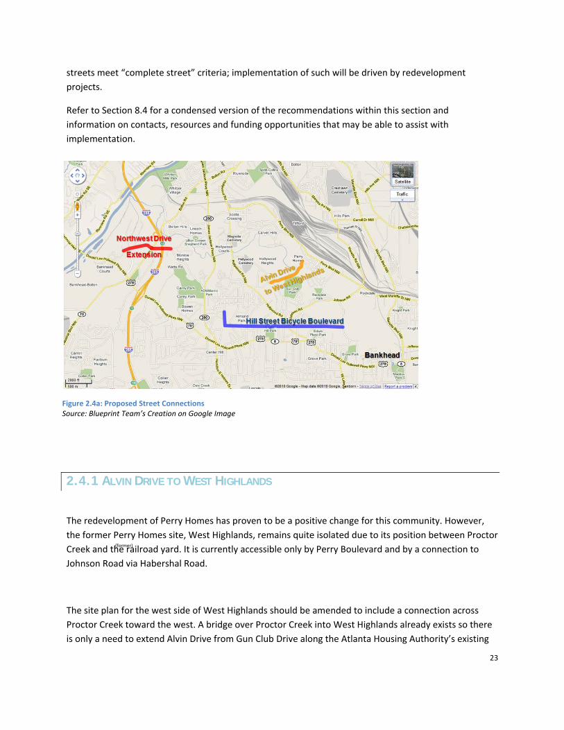
2.4 STREET CONNECTIONS The street network of NPU‐G is characterized by superblocks formed by roads of a rural character, which are partially filled in with a neighborhood street network. Making a few key street connections has tremendous potential for tying the community together. Figure 2.4a highlights the three proposed street connections discussed within this section. The Connect Atlanta Plan will need to be ammended to include these proposed street connections, if the proposals are approved by the City of Atlanta. Please refer to the Appendix for select maps from the Connect Atlanta Plan which detail other new street projects relevant to NPU‐G, as proposed by the City, including projects NS‐045, NS‐047, NS‐092, and NS‐093. Additionally, the PATH Foundation has proposed an extension of the Silver Comet Trail through NPU‐G, between Cobb County and Centennial Olympic Park, which would add recreation and alternative transportation options for the NPU‐G community. Maps and detailed location information were not available at the time of writing this report. Please note that the City of Atlanta requires that all new
Figure 2.3d: Hollywood Road/Perry Boulevard Intersection Source: Bing.com
Figure 2.3e: Hightower Road/Hollywood Road Intersection Source: Bing.com
23
streets meet “complete street” criteria; implementation of such will be driven by redevelopment projects.
Refer to Section 8.4 for a condensed version of the recommendations within this section and information on contacts, resources and funding opportunities that may be able to assist with implementation.
2.4.1 ALVIN DRIVE TO WEST HIGHLANDS
The redevelopment of Perry Homes has proven to be a positive change for this community. However, the former Perry Homes site, West Highlands, remains quite isolated due to its position between Proctor Creek and the railroad yard. It is currently accessible only by Perry Boulevard and by a connection to Johnson Road via Habershal Road.
The site plan for the west side of West Highlands should be amended to include a connection across Proctor Creek toward the west. A bridge over Proctor Creek into West Highlands already exists so there is only a need to extend Alvin Drive from Gun Club Drive along the Atlanta Housing Authority’s existing
Figure 2.4a: Proposed Street Connections Source: Blueprint Team’s Creation on Google Image
(former)

24
right‐of‐way. Since this route runs along the northern edge of Gun Club Park, Alvin Drive could serve as an entryway to this area should it be re‐opened or redeveloped in the future.
2.4.2 HILL STREET BICYCLE BOULEVARD
The Carey and Almond Park neighborhoods were originally platted as a tight grid of small streets. However, although a number of the streets were never built, the rights‐of‐way still remain. The connection of these existing rights‐of‐way has tremendous potential to better unite the neighborhoods of NPU‐G. Of particular interest is the right‐of‐way along the southern boundary of NPU‐G, connecting 5th Street to Grove Park Place, via existing rights‐of‐ways between Hill Street, Summit Avenue and Newman Place. By virtue of the how the original plots of land were platted, this right‐of‐way forms a long, continuous, straight line.
A more detailed study should be conducted of this potential connection along the right‐of‐way for the un‐built sections of 5th Street and Hill Street / Summit Avenue / Newman Place. This route would not only connect the residential portions of Carey Park and Almond Park in NPU‐G, but also better connect the entire NPU‐G community to Center Hill Park. Additionally, this connection would link these neighborhoods with the proposed Westside Park along the Beltline and a possible Proctor Creek Greenway.
The extension of these existing streets to connect Grove Park Place to 5th Street would give residents a new east‐west corridor through the community, of which there are few, potentially reducing congestion on
Donald Lee Hollowell Parkway. However, during Blueprints workshops, community members expressed concern with added automobile presence in these residential areas. A second alternative for these existing street segments is to connect them with a multi‐use, pedestrian and bike trail to form a “bicycle boulevard.” This route parallels Donald Lee Hollowell Parkway, allowing cyclists an alternative east‐west route through the community. In many places, the right‐of‐way along Donald Lee Hollowell Parkway is too narrow to allow for a bike lane in addition to automobile through lanes, storefront sidewalks, and a bus lane for a potential Bus Rapid Transit service. The route could utilize existing on‐road segments as well as new off‐road trail construction. The bicycle boulevard should connect to the proposed Silver Comet Trail extension through NPU‐G (please refer to the Appendix), to the BeltLine trail at the proposed Westside Resevoir Park, and to the Bankhead MARTA Station. Potentail locations for these connections were not explored due to limited time and resources. Figure 2.4a outlines the trail location

25
of the proposed Hill Street Bicycle Boulevard and does not detail other connections as discussed above. Further study is needed to detail this route and connections.
2.4.3 CONNECTIONS FROM ATLANTA INDUSTRIAL PARK
There remains significant disconnection between job opportunities in the industrial park and employment among neighborhood residents. This disconnect is evident in the physical infrastructure as the Atlanta Industrial Park (AIP) is isolated from the community with little street connectivity. There is only one entrance to the AIP, on Donald Lee Hollowell Parkway, and while this intersection is close to the highway
ramp, it is detached from potential workforce housing. This means that those who might otherwise choose to live in the adjacent neighborhoods experience no benefit from being able to walk to work. This dependence on a single roadway is detrimental to businesses as well; emergencies on the entry road can temporarily block a manufacturer’s access to and from their plant, undermining reliable access to the businesses. It may also be a concern of public safety and efficiency in routing buses and other services through the AIP.
The AIP master plan should be amended and subsequent development should be required to create road connections to Atlanta Industrial Way suitable for pedestrian and occasional truck traffic. This will provide an alternate route for emergency vehicles to enter the park, or a detour route for trucks should a street need to be closed. This could also lead to increased demand for AIP workforce housing in the former Bankhead Courts area and the English Park neighborhood.
Another opportunity to better connect NPU‐G residents to the AIP is to bridge over I‐285. A bridge that re‐connects Northwest Drive across I‐285 and into the AIP would provide the residents of Monroe Heights with better access to AIP and English Park. A road crossing would also create a safer alignment
Figure 2.4b: Proposed Connection to the Atlanta Industrial Park

26
for the intersection of Northwest Drive and Bolton Road, resulting in improved travel time for buses traveling on Northwest Drive. (Refer to Figure 2.4b.) In the future, if Georgia Department Of Transportation (GDOT) reconstructs the Exit 13 ramps between I‐285 and Bolton Road, the community should petition for GDOT to construct an I‐285 bridge. In particular, this new bridge could be constructed as part of the proposed collector‐distributor roadway project along I‐285 between Bolton Road and I‐20 (Transportation Improvement Project – AT‐AR‐214) scheduled for right‐of‐way acquisition in 2016 and construction between 2018 and 2030.
2.5 TRANSIT Transit improvements in NPU‐G would not only provide greater mobility to those without automobile access, but would also provide more connections to surrounding neighborhoods, bringing the greater Atlanta community to NPU‐G to enjoy the neighborhood amenities. This section provides recommendations on Bus Rapid Transit (BRT), a Metropolitan Atlanta Rapid Transit Authority (MARTA) heavy‐rail line extension, and Transit Oriented Development (TOD) locations.
Refer to Section 8.5 for a condensed version of the recommendations within this section and information on contacts, resources and funding opportunities that may be able to assist with implementation.
Figure 2.5a: Blueprints Team Proposed Donald Lee Hollowell Bus Rapid Transit Source: Blueprint Team’s Creation on Google Image
(former)

27
2.5.1 DONALD LEE HOLLOWELL PARKWAY BUS RAPID TRANSIT
In 2008, the Transit Planning Board (now the Transit Implementation Board) developed Concept 3, the Atlanta region’s long‐range transit vision. Concept 3 was adopted by numerous agency partners, including Atlanta Regional Commission (ARC), Georgia Regional Transportation Authority (GRTA), and MARTA.22 Contained within Concept 3 was a proposal for arterial Bus Rapid Transit (BRT) service on Donald Lee Hollowell Parkway from the Bankhead MARTA station to I‐285. The Blueprints Team studied this existing proposal and found several opportunities which would better integrate this BRT service with the NPU‐G community. It is important to note that a key element of BRT is fewer stops compared to traditional bus service. By limiting the number of stops, the delay associated with boarding and alighting is reduced. Consequently, travel times are decreased, while travel time reliability is increased.
One recommended opportunity is to extend the BRT service past I‐285 to the AIP and Bankhead Courts. This extension would provide AIP employees a direct mode of transit from MARTA, or from within NPU‐G, to work. Additionally, the bus line would provide future Bankhead Courts residents easy access to MARTA.
A second BRT recommendation is to identify bus shelter or stop locations. The proposed Concept 3 plan did not detail stop locations for this line. The Blueprints Team has identified nine potential stop/shelter locations along the corridor as a starting point for the BRT proposal. The actual stop locations would need to be developed through an intensive public participation process. The identified stop locations in order from east (Bankhead) to west (Bankhead Courts), as indicated on Figure 2.5a, are: Bankhead MARTA station, Grove Park, Hollywood Road, Center Hill Park, James Jackson Parkway, Bowen Homes, I‐285, Atlanta Industrial Park, and Bankhead Courts. Note that BRT stops are typically ¼ to ½ mile apart and these recommendations are separated by a greater distance. While the Blueprints team believes these locations would be important to include in a future BRT line, additional stops could be considered. Future commercial redevelopments would be especially important to include as additional BRT stops. The current recommended stops reflect areas of high activity, as noted by the Blueprints Team’s field observations.
22 http://www.transitboard.org/concept3

28
2.5.2 MARTA FROM BANKHEAD TO CUMBERLAND
Various plans have proposed MARTA extensions in Northwest Atlanta. A MARTA heavy‐rail transit (HRT) line along Proctor Creek continuing from Bankhead station to Perry Homes (now West Highlands), has been discussed in several plans. Rapid transit – such as Light Rail Transit (LRT) – along I‐75 has also been a topic of discussion among Metro Atlanta leaders.
After studying both plans, the Blueprints Team has created a compromised alternative. Instead of connecting Cobb County to the MARTA rail system via the I‐75 route, the current MARTA heavy‐rail transit (HRT) line could be extended from Bankhead Station to West Highlands. From this point, a rail line could be constructed in the freight rail right‐of‐way parallel to the CSX tracks to Cumberland and beyond (Smyrna, Marietta, and Kennesaw). This alternative has considerable merit.
First, it is likely to be of comparable cost to the I‐75 LRT project. Some favor LRT over HRT because it is believed to be less costly; however, this is not necessarily the case. The main additional cost of HRT over LRT comes from the need to elevate tracks with a third rail at road crossings. However, by following existing rail lines (which go under bridges), much of this cost can be avoided. The only major elevated portions required would be for crossing Johnson Road, Perry Boulevard, and the Norfolk Southern and CSX rail yards. The total length of elevated track might be kept as short as one mile. Secondly, the Proctor Creek ‐ CSX extension could provide better service. This line would feed directly into MARTA heavy‐rail, without needing an additional transfer at the Arts Center Station.
Third, this particular routing provides an empowering linkage between low‐income, transit‐dependent workers on Atlanta’s Westside with ample service and retail jobs in the suburbs. This is desirable not only from the worker’s point of view, but also that of businesses that want to be able to pull from a larger pool of qualified workers. Besides the social‐equity value of this alternative, the opportunities offered by this connection could lead to higher ridership levels than with an I‐75 connection, giving this
Figure 2.5b: Blueprints Team Proposed MARTA Extension Source: Blueprint Team’s Creation on Google Image

29
routing a better pay‐back. Moreover, choosing such a route that could overcome the historic divide between suburban business and inner‐city populations may make this project more favorable for federal funding.23
2.6 TRANSIT-ORIENTED DEVELOPMENT The concept of Transit Oriented Development (TOD) involves two concepts: First, that development coincides with transit service, light‐rail, heavy‐rail or bus service, and second, that development is concentrated in nodes. Nodal development provides unique benefits, as it actually improves accessibility by putting a number of people and their destinations in close proximity.
TOD involves a mix of land uses; a variety of housing types, shops, offices, and public services. TODs in NPU‐G would need to have a density of at least 15 residential units per acre or 25 employees per acre, which is considered the minimum for TODs which are serviced by bus systems. TODs are typically laid out such that the edges of the development are still about a quarter mile (five‐minute walk) from a central point. In order to maximize development within this limited space, it is helpful to reduce the amount of parking and carefully manage the spaces available.24
Because of the intended close proximity of residents to stores and transit, it is more important to design TODs for biking and walking rather than for automobile travel. Paths through the development should allow for a direct route to the center. While automobile traffic is not discouraged, it is slowed and dispersed throughout a network of streets, so that it does not discourage other modes of travel. Such a fine grid of narrow streets already exists in many areas of NPU‐G. Future development should build on this strength.
While TODs are attractive to upper income households (TOD real estate tends to sell at higher prices), they do not have to be exclusionary to those of lower income. On the contrary, the concept of Location Efficient Development says that the savings in transportation costs achieved through TOD development principles can be used to make housing more affordable. The savings realized in TODs by minimizing
23 “FY 2009 New Starts and Small Starts Evaluation and Rating Process” Federal Transit Administration. July 20, 2007. Retrieved from www.fta.dot.gov/planning/newstarts/planning_environment_9063.html#IIF_Other_Factors.
24 “Transit Oriented Development: Using Public Transit to Create More Accessible and Livable Neighborhoods.” TDM Encyclopedia. Victoria Transport Policy Institute. 4 June 2010. Retrieved from www.vtpi.org/tdm/tdm45.htm.

30
construction of parking is one example. Further, higher densities reduce the amount of land a developer must acquire in order to yield a certain return. Note that MARTA has adopted guidelines for TOD developments, for MARTA owned properties and stations. Any TOD related to a MARTA station must adhere to these guidelines: Transit Oriented Development Guidelines (MARTA, 2010).
Refer to Section 8.6 for a condensed version of the recommendations within this section and information on contacts, resources and funding opportunities that may be able to assist with implementation.
Below are five potential locations for TODs in NPU‐G.
1. Hightower Crossroads TOD: Intersection of Hamilton E. Holmes Drive / James Jackson Parkway and Hightower Road intersect Donald Lee Hollowell Parkway. It is served by three bus routes and is anchored by a non‐chain, discount grocery and other retail. This was identified as a development node in the 2006 plan for the Donald Lee Hollowell – M. L. King Tax Allocation District (TAD). This site is also identified as a TOD in the Hollowell Veteran’s Memorial LCI.
Transit Service: frequent – 6.2 busses per hour on weekday afternoons
Vision: Urban Mixed‐Use Development
Recommendations: Consolidate parking into paid garages to free land for redevelopment.
Reduce required building set‐backs and increase allowable Floor Area Ratios (FAR) to allow multi‐story buildings along the street.
2. 7th Street TOD: Just north of where Northwest Drive meets Hightower Road is the Carey Park neighborhood, near the center of NPU‐G. This tree‐covered neighborhood of single‐family homes and churches has a unique character. The location of interest lies near the confluence of three bus routes and is home to one convenience store. The diagonal streets make this one of the most accessible points in Carey Park, suggesting it as the neighborhood center.
Transit Service: Frequent – Best in NPU‐G ‐ 7.2 busses per hour on weekday afternoons
31
Vision: Neighborhood center
Recommendations: Promote home ownership and increase density by encouraging the construction of ancillary rental units. Invest public facilities such as libraries and community centers within this area.
3. Hollywood Split TOD: Lies within the Grove Park neighborhood just outside of the NPU, where Hollywood Road splits off Donald Lee Hollowell Parkway. This area has some retail and other businesses along the major streets. It is served by two bus routes.
Transit Service: Intermediate ‐ 5 buses per hour
Vision: Neighborhood center
Recommendations: Consolidate parking into paid garages to free land for redevelopment.
Reduce required building set‐backs and increase allowable FARs to allow multi‐story buildings along the street.
4. Hamilton E. Homes TOD: Hamilton E. Homes Station, at the intersection of Hamilton E. Holmes Drive and Martin Luther King Jr. Drive is currently surrounded by empty parking lots. While well outside the NPU, this is a major transportation hub for neighborhood residents who take transit. This site has the best transportation and transit accessibility in West Atlanta. Hamilton E. Holmes Station is located at the first I‐20 exit inside the perimeter, and is a transfer center for a dozen bus routes. This makes it a prime location for a major retailer that could serve NPU‐G and the rest of Atlanta’s Westside. A 2002 LCI study explores opportunities for a TOD on this site.
Transit Service: Frequent – Best on Westside – 12 routes running multiple times per hour
Vision: Commercial Center
Recommendations: Consider new retail options that would service the needs of the community. Pursue opportunities for urban “big‐box” retail.
5. Mason’s Cemetery TOD: Historically there was a Civil War era church and cemetery at the intersection of Bolton Road and Donald Lee Hollowell Parkway. Only the cemetery remains

32
today, providing the name Mason’s Cemetery for this area. This area now constitutes the short, busy stretch between the I‐285 interchange and the AIP. As such, it functions as a gateway to the AIP and, when traveling east on Donald Lee Hollowell Parkway, the neighborhoods of Atlanta. Long‐term transit plans call for this spot to be a station transferring BRT on Donald Lee Hollowell Parkway and an express bus service on I‐285.
Transit Service: Infrequent – 2 buses per hour – but long‐term plans for more
Vision: Commercial Center
Recommendations: Develop plans for an attractive community entrance.
2.7 BICYCLE NETWORK AND SIDEWALK IMPROVEMENTS The following section describes projects designed to reduce the dependency on automobiles in NPU‐G through non‐motorized alternatives.
Refer to Section 8.7 for a condensed version of the recommendations within this section and information on contacts, resources and funding opportunities that may be able to assist with implementation.
2.7.1 PEDESTRIAN CROSSING OVER THE CHATTAHOOCHEE RIVER
A possible trail connection across the Chattahoochee River is beneath I‐285. The Belle Isle pedestrian bridge beneath the Robert E. Lee Bridge in Richmond, Virginia illustrates this possibility; a pedestrian bridge is suspended from cables beneath US‐1/301. In this case, the highway bridge was designed with the attachments for the cable support in place,25 and the pedestrian bridge was built shortly thereafter using
25 Tang, M‐C Olsson, N D Chan, Y‐K and Lang, P J. abstract of “Robert E. Lee Bridge, Richmond, Virginia” TRR 1991 retrieved from tris.trb.org/view.aspx?id=358975.
Figure 2.7a: Belle Isle Bridge Source: www.discoveringurbanism.blogspot.com/2009/05/exploring‐richmond.html

33
various funding sources. (Refer to Figure 2.7a.) A similar bridge design might be desirable for crossing the Chattahoochee. Further study, including appropriate environmental and feasibility analysis, is necessary to fully explore the viability of this exciting pedestrian concept.
2.7.2 SIDEWALKS
NPU‐G currently lacks sufficient sidewalks. Many of the residential areas in the neighborhood, whether on one or both sides of the street, have limited or no sidewalks. The presence of sidewalks provides a safe place for pedestrians to walk, and also decreases the vehicular crash rate.26 A further study needs to be conducted to determine where sidewalk construction should be focused and prioritized. Note that the City of Atlanta has a citywide assessment priority, dependant upon availability of funds. As streetscape improvement projects happen, the community should petition for sidewalk construction and improvements, which should be supported by the City as current policy is for all streetscape projects to include new or replacement sidewalks.
2.7.3 BIKE FACILITIES
NPU‐G is deficient in bike lanes and bike paths. While bikes can commonly share the road with motorists on streets with posted speed limits of less than 25 miles‐per‐hour, without a separate bike lane, it can be difficult for cyclists to share the road on streets with faster speed limits. Additionally, increased speeds are typically correlated to increased traffic volumes, making it difficult for bikes to travel safely. We suggest that all streets in NPU‐G with posted speed limits greater than 25 mph be considered as possible locations for the addition of a bike lane. On streets where a bike lane is not feasible, alternatives, such as bike paths and trails, or parallel lower speed streets, should be considered. As streetscape improvement projects or street repaving happen, the community should petition for the inclusion of bike lanes, as appropriate.
26 McMahon, Patrick J.; Charles V. Zegeer, Chandler Duncan, Richard L. Knoblauch, J. Richard Stewart, Asad J. Khattak (2002) (PDF). An Analysis of Factors Contributing to "Walking Along Roadway" Crashes, Research Study and Guidelines for Sidewalks and Walkways. Federal Highway Administration. FHWA‐RD‐01‐101.. Retrieved 2008‐03‐24.

34
Redevelopment

35
3.0 REDEVELOPMENT NPU‐G contains a large amount of land that is either undeveloped or underdeveloped. This land ranges from undisturbed, natural rolling hills, to vacant cleared sites, to tax‐delinquent properties with abandoned buildings, to hazardous waste sites. There is a great potential to redevelop much of this land into something that is revenue‐producing for the neighborhood and the City. In addition, these redevelopment opportunities can serve to meet the needs present in the neighborhood by creating jobs, providing places to locate basic services and everyday retail, giving the tax base a much needed increase, and creating a more vibrant community. It should also be noted that the Atlanta Beltline right‐of‐way lies just east of the NPU and as the building of this transit and recreation corridor progresses, new development opportunities associated with this project may arise. The Blueprints proposals for redevelopment focus primarily on the large parcels of land owned by the Atlanta Housing Authority. These sites were all formerly public housing projects, which were crime‐ridden, not well maintained, and isolated from the rest of the neighborhood. All four of the project sites have been torn down, and one has been rebuilt as the West Highlands community. For the rebuilding of the three other sites, which includes Hollywood Courts, Bowen Homes and Bankhead Courts, recommendations are provided that include a mix of uses in addition to a mix of housing types. (Refer to Figure 3.0a for the AHA vacant site locations.) There is a demonstrated need for more service and retail in the neighborhood, and redevelopment of these sites present opportunities to meet these needs, while increasing connectivity and growing in a sustainable way. (Refer to Appendix 9.3 for information on current zoning and land use conditions) New development on the sites is subject to approval by the U.S. Department of Housing and Urban Development (HUD) and must contain a significant portion of low‐income housing or provide for equivalent housing elsewhere on AHA properties.

36
The following section presents tailored solutions for NPU‐G’s vacant AHA properties, taking into account location, density, and community needs. While each location lends itself to a different set of uses, all three have an abundance of possibilities and can be developed in a way that provides benefits to their immediate communities as well as to the City of Atlanta. The main objectives are connecting these sites to their surrounding communities; promoting walkability and interactions through increased density; providing affordable housing and access to employment; and maintaining and preserving a stable community for NPU‐G residents.
Please refer to Section 8.8 for a condensed version of the recommendations within this section and for more information on contacts, resources and funding opportunities that may be able to assist with implementation.
Figure 3.0a: Atlanta Housing Authority Vacant Sites
Hollywood Courts
Bowen Homes
Bankhead Courts

37
3.1 HOLLYWOOD COURTS SITE ANALYSIS Hollywood Courts is a vacant AHA site that formerly consisted of 25 buildings with 202 affordable housing units (refer to Figure 3.1a). The housing project was built in 1969, demolished in 2008, and is currently awaiting redevelopment. Of the three AHA vacant sites within NPU‐G, the Hollywood Courts site is the smallest at 20 acres. It is less than half the size of the 42 acre Bankhead Courts and less than a quarter of the size of Bowen Homes’ 84 acres. However, as can be seen from Figure 3.0a, the site is also the most centrally located within the NPU, representing a strategic opportunity to serve the community and provide development uses that do not currently exist within the surrounding area.
Figure 3.1a: Location of Hollywood Courts Source: City of Atlanta GIS Database
Hollywood Courts

38
3.1.1 DEVELOPMENT FORM, USE AND CHARACTER
In order to integrate a significant amount of commercial space within the redevelopment of Hollywood Courts while, at the same time, recreating a substantial amount of mixed‐income housing in line with the mission of the AHA, a medium density mixed‐used development is recommended. As seen in Figure 3.1b, this development type typically includes compact three‐ to four‐story buildings with commercial space on the ground floor and residential units on top. Additionally this
redevelopment should be built in accordance with the best practices established by LEED Neighborhood Development guidelines.
Given that the Hollywood Courts site is relatively compact compared to the other AHA sites within NPU‐G, land acquisition from surrounding property owners is worth exploring. The parcels identified in Figure 3.1c, as “Phase I Expansion Land” and “Phase II Expansion Land” are owned by a combination of private individuals, the Atlanta Greenspace Initiative, and the Atlanta Board of Education. Expansion would also allow for connections to James Jackson Parkway at the rear of the site and access to Proctor Creek, as outlined in the Section 2.1.2: Proctor Creek Greenway.
Figure 3.1b: Mixed‐Use Development Examples
Sources: Ivy Walk ‐ Georgia Chapter of the Sierra Club
Figure 3.1c: Hollywood Courts Expansion Analysis
Source: Blueprint Team’s creation on City of Atlanta GIS Database

39
RETAIL OPPORTUNITY
NPU‐G lacks a dispersed network of commercial space that residents can easily access through modes of transportation other than automobiles. Thus, the strategic location of Hollywood Courts appears to provide an opportunity for a more central location for residents of the community to shop, work, eat and be entertained. However, in order to fully evaluate the site’s market potential, an analysis of the unmet sales potential in the surrounding area, also known as the “Retail Gap”, was conducted. A report was obtained from a third party data source, ESRI, to analyze the unmet demand within a 0.5‐mile radius of the Hollywood Courts site.27 It was determined that the only industry category that is over‐supplied within this area is beer, wine and liquor stores, illustrating a significant opportunity for new commercial development mixed with the affordable housing that AHA is required to complete per the HUD development restrictions. (Refer to Appendix 9.3.3 for Retail Supply and Demand chart.)
3.1.2 SITE CONNECTIVITY
The existing street network within the Hollywood Courts site is essentially one very large cul‐de‐sac isolated from the surrounding community. This street layout also creates very large blocks that discourage walking, provide fewer chances for social interaction that can help prevent crime and prohibit complete police patroling for security. Within the existing site, additional street connections are recommended in order to provide smaller blocks. In addition, minimum setbacks are recommended to allow for more “eyes on the streets” within the community.
Figure 3.1d shows how the street network could be further expanded to connect to James Jackson Parkway if additional land is assembled. Further, the southmost parcel of adjacent land represents a strategic opportunity to connect Proctor Creek and the potential greenway that could be located there, as described in Section 2.1.2.
27 ESRI Retail Gap methodology: Supply (retail sales) estimates sales to consumers by establishments. Sales to businesses are excluded. Demand (retail potential) estimates the expected amount spent by consumers at retail establishments. Supply and demand estimates are in current dollars. The Retail Gap represents the difference between Retail Potential and Retail Sales. A positive Retail Gap represents 'leakage' of retail opportunity outside the trade area. A negative value represents a surplus of retail sales; a market where customers are drawn in from outside the trade area. ESRI uses the North American Industry Classification System (NAICS) to classify businesses by their primary type of economic activity.

40
3.2 BOWEN HOMES SITE ANALYSIS Bowen Homes is a vacant AHA site that formerly consisted of 101 buildings with 650 affordable housing units (refer to Figure 3.2a). The housing project was built in 1964, demolished in 2009, and is currently awaiting redevelopment. Of the three vacant AHA sites within NPU‐G, the Bowen Homes site is the largest, comprised of over 83 acres. Based on the size and number of bedrooms, the former Bowen Homes facilities could have easily housed over 1,600 residents. As shown in Figure 3.0a, the Bowen Homes site is located adjacent to Donald Lee Hollowell Parkway on the southern boundary of the NPU. The location of the property and its size lends it to many redevelopment opportunities that will be beneficial to the surrounding neighborhoods. In particular, the Blueprints recommendations focus on increased opportunities for residents to gain employment, access to retail, and better connections with the surrounding neighborhoods.
Figure 3.1d: Proposed Street Connectivity
Source: Blueprint Team’s creation on City of Atlanta GIS Database

41
3.2.1 DEVELOPMENT FORM, USE AND CHARACTER
Focusing on street connectivity, walkable blocks, access to MARTA, and paying close attention to the location and needs of the community, the best redevelopment strategy for the Bowen Homes site is mixed use development. The character of the site proposal includes an increase in density, connectivity, and access to everyday retail and neighborhood stores. The redevelopment of this property could be in accordance with the City’s MRC zoning classification; per City of Atlanta Zoning Ordinances, MRC‐1 is low density residential and commercial uses intended to serve a single neighborhood or small group of adjacent neighborhoods.28 As this is a major node, it could also be considered for a higher intensity, such as the MR classification for the residentail areas and the MRC classification for areas with mixed use. Additionally, this redevelopment should be built in accordance with the best practices established by LEED Neighborhood Development guidelines.
28 City of Atlanta Zoning Ordinance, 2010
Figure 3.2a: Location of Bowen Homes
Source: Blueprint Team’s creation on Google image
Bowen Homes

42
As previously described, the parcel is located directly on Donald Lee Hollowell Parkway and is large enough to support residential, civic, open space, and retail uses. There are several density bonuses available to developers based on what percentage of the space is devoted to each particular land use, all of which are ideal for this community. A density bonus would allow the developer to provide more units per acre than originally specified to compensate their providing below‐market rate units. The northern portion of the property which is adjacent to Coretta Scott King Young Women’s Leadership Academy and A.D. Williams Park is a prime location for a community garden and/or recreational field, either of which meets the civic space requirement for the density bonuses. This site is somewhat isolated within the larger community and would operate best as a neighborhood retail location versus a destination retail location. Additionally, the zoning code specifies that at least 20% of units must be affordable in order to receive an increase in density allowance. A partnership between the AHA and a local non‐profit developer could incorporate a mixed‐income development with affordable housing and a mixed‐income community, providing an opportunity for different demographic groups to live and work together. The proposed uses compliment the objectives that have been established by HUD.
The Hollowell Veterans Memorial LCI recommends a mixed‐use node at Donald Lee Hollowell Parkway
and James Jackson Parkway. This node that would include Bowen Homes property and the properties
that front along James Jackson Parkway and Hollowell Parkway. Retail, commercial and other
community supporting services are envisioned within the three blocks at the intersection as well as
diverse residential types; from apartments, condos, senior living, live/work, to town homes and single
family. A compact grid of streets with a large green space and smaller distributed pocket parks are
envisioned as part of creating a compact pedestrian friendly community. The denser uses such as
apartments, live/work and condos would front the Hollowell Parkway and transition to town homes and
single family on to the interior. The LCI plan recommends changing the land use of Bowen Homes from
Medium Density Residential to High Density Mixed Use to allow increased residential densities as well as
non‐residential uses.
3.2.2 SITE CONNECTIVITY
As was mentioned in the design standards and in the recommendations for the Hollywood Courts site, a key objective is to increase connectivity for residents and neighbors; the addition of infrastructure and connectivity will eliminate development patterns that have been detrimental to community development and retail access seen in the past. As is true of the other sites, the existing street network for the Bowen Homes site consisted of two access points and a large cul‐de‐sac. This type of street network can be detrimental to the success and livelihood of a community. Being isolated from neighboring developments and interacting only within a secluded, concentrated area has been shown to breed crime and limit the social development of the residents.29 The addition of cross‐streets and points
29 http://www.accessmylibrary.com/article‐1G1‐20834788/exploring‐effects‐public‐housing.html

43
of ingress, as seen in Figure 3.2b, will reduce the sizes of the blocks, allow for better access to the redevelopment that will occur here, and facilitate more interaction between the residents of Bowen Homes and the surrounding communities. This minor change in the street network would allow for a more central and dense development scheme, leaving vacant land around the northern perimeter for other uses, such as the community garden as proposed in Section 5.1.2.
3.3 BANKHEAD COURTS SITE ANALYSIS Bankhead Courts is a vacant AHA site that formerly consisted of 57 buildings with 386 affordable housing units (refer to Figure 3.3a). The housing project was built in 1970, demolished in 2009, and is currently awaiting redevelopment. Of the three AHA vacant sites within NPU‐G, the Bankhead Courts site falls between Bowen Homes and Hollywood Courts in size, sitting on 42 acres. Bankhead Courts is located on an isolated parcel of land on the west portion NPU‐G. The parcel is divided into two parts by Donald Lee Hollowell Parkway, as seen in Figure 3.3a.
Figure 3.2b: Bowen Homes Proposed Street Connectivity Source: Blueprint Team’s creation on Google image

44
The section north of Donald Lee Hollowell Parkway is bounded by the Atlanta Industrial Park to its north, the warehouse distribution facility to its west, and Blalock Elementary to its east. The south section of the property is boarded by Donald Lee Hollowell Parkway to the north, the Chattahoochee River to the west, and vegetative buffers to the south and east. A key redevelopment issue for Bankhead Courts is
that the development is surrounded by industrial land and the development is isolated from the rest of the neighborhood. Despite these challenges, the redevelopment of Bankhead Courts provides the neighborhood with an opportunity to connect residents to job‐producing land near the Bankhead Courts site, such as AIP, thereby increasing the community’s economic development potential.
3.3.1 DEVELOPMENT FORM, USE AND CHARACTER
Since Bankhead Court’s surrounding land‐use is industrial, the proposed plan for the redevelopment of the site is to build a mixed‐use development that combines residential and industrial land uses. Due to the ordinary operations of the businesses, industrial uses produce various types of nuisances. These nuisances must be mitigated in order to maintain quality of life for residents as well as to keep industrial business profitable in mixed industrial/residential land uses. To mitigate the nuisances that might arise
Bankhead Courts
Atlanta Industrial
P k
Figure 3.3a: Location of Bankhead Courts Source: Blueprint Team’s Creation on Google image

45
from mixing industrial and residential land, the AHA could allow the Atlanta Industrial Park to expand its borders to include the Bankhead Courts site north of Donald Lee Hollowell Parkway. The Parkway will act as a buffer between the industrial use, north Bankhead Courts, and the residential use, south Bankhead Courts. The buffer will reduce the noise and air pollution that might arise from any new business that locates within the Atlanta Industrial Park’s added space.
The south section of Bankhead Courts should be built in accordance with the best practices established by LEED Neighborhood Development guidelines. The site should contain dense, mixed income residential development. A retail and commercial strip should line the north edge of this portion, along Donald Lee Hollowell Parkway. This commercial development on the north edge could house the Nature Center, which will be linked to the entrance of the Chattahoochee River Trail just across the street, as proposed in Section 2.1.1. Streetscape improvements along Donald Lee Hollowell Parkway should be made which would include street parking as appropriate, sidewalks, street trees, a mid‐block pedestrian crossing from the Bankhead Courts site to the river trail, and beautification of the areas abutting the river. These streetscape improvements will both beautify the area and make the corridor safer for pedestrians. Also, the dense residential development on the southern portion will allow the AHA to achieve their housing goals and in order to sell land to the AIP, as envisioned for the northern property. Furthermore, the AHA could use an innovative supportive housing model which links residents in the affordable housing development with job opportunities in the AIP. A supportive housing model that focuses on basic interview skills and job training could be used to give residents the necessary skills to obtain and maintain employment.
At Bankhead Courts and Atlanta Industrial Park node, the Hollowell Veteran’s Memorial LCI recommends green spaces along the river corridor and the expansion of employment base by attracting corporations, hotels, offices, flex‐space, light industrial, mixed‐use with retail/office and residential. This pedestrian‐friendly node has the potential to be a great live‐work‐play environment. The plan recommends a new mixed use land category that would allow residential and industrial uses.
The Green Industry Training Program (GITP) workforce development program, as described later in Section 4.2 of this report, can provide job training to Bankhead Courts residents and better connect these residents to businesses located in the newly expanded AIP, just across Donald Lee Hollowell Parkway. To ensure that this happens, the AHA could seek a community benefits agreement from any newly located AIP business as well as from current AIP employers. A Communitiy Benefits Agreement could include commitments about local job training, mentoring programs and/or commitments for local hiring. By providing job training to residents within the Bankhead Courts redevelopment, AHA can help residents achieve upward mobility while providing affordable housing to lower‐income residents.

46
3.3.2 SITE CONNECTIVITY
The current Bankhead Courts street network provides little connectivity within the site. Also, the current street network does not offer easy access to the AIP. Figure 3.3b shows a proposed grid network (in gray) that could improve connectivity within the Bankhead Courts site. The grid network will also increase the walkability of the neighborhood, which will encourage residents to walk to the various destinations within and close to the redevelopment. One important proposed connection is to build a road that connects Hughes Street NW to Atlanta Industrial Parkway NW. This will both improve the worker’s ability to walk to the AIP and give AIP businesses another route to Donald Lee Hollowell Parkway. Finally, the Bankhead Courts redevelopment will have to provide residents with access to other parts of the neighborhood, especially for residents who may not have access to private transportation. Bus stops located near the site and/or a private shuttle run by the Bankhead Courts development are viable options to increase the residents’ ability to get to other parts of the neighborhood.
Figure 3.3b: Proposed Connections Through Bankhead Courts
Source: Blueprint Team’s Creation on Google image

47
Opportunities for Advancement

48
4.0 OPPORTUNITIES FOR ADVANCEMENT During the Blueprints planning process, it was discovered that, compared to other areas within the City of Atlanta, residents within NPU‐G are generally underserved in employment opportunities commensurate with their skills and education. This, in turn, minimizes their economic advancement opportunities. Even with the presence of employers in areas such as the AIP, this skills gap has led to most skilled jobs in the neighborhood largely being held by people that live outside NPU‐G, while local residents have to leave the area to seek meaningful employment. Concurrently, due to lack of new residential construction and demolition of the four major housing projects, the resulting shifts of the local residential population have led to the closure of more than half of the NPU’s public educational facilities over the past two decades. This has led to the loss of not only the neighborhood’s only high school, but also vital centers for learning and community activity that would serve local schoolchildren.
Therefore, to help close this educational opportunity gap as well as take advantage of the recent rise in the green economy, it is proposed that training programs which increase employment opportunities for residents within NPU‐G be created and implemented. These programs should be designed to encourage employer involvement as well as include practices that promote sustainability measures noted in the City of Atlanta’s 2010 Sustainability Plan. Finally, adaptive reuse for the three closed public schools located in NPU‐G, with an emphasis on integrating the sites with the surrounding communities is recommended.
Please refer to Section 8.9 through 8.10 for a condensed version of the recommendations within this section and for more information on contacts, resources and funding opportunities that may be able to assist with implementation.
4.1 WORKFORCE DEVELOPMENT The NPU‐G employment sectors are composed of manufacturing, construction, and wholesale trade jobs. The residents of the neighborhood, however, tend to work in the Retail Trade, Health Care and Social Assistance, and Accommodation and Food Services sectors. This contributes to the mismatch between employer and employee needs (for more information please refer to Appendix 9.4.1). If neighborhood residents wish to capitalize on the employment opportunities within their neighborhood, they will have to undergo job training to develop the skills that neighborhood employers are looking for in a potential employee. The skill gap between the residents and neighborhood employers presents a unique opportunity to develop a workforce development program within the neighborhood. This

49
program can help to not only improve the employment outcome for local residents, but also help the City of Atlanta fulfill its sustainability education and training program goals, as found in the 2010 Sustainability Plan’s focus on created a green economy in Atlanta.30
4.1.1 GREEN JOBS
The remainder of this section will refer to green economy jobs as green jobs. According to the United States Bureau of Labor Statistics (BLS) green jobs must either be “jobs in businesses that produce goods or provide services that benefit the environment or conserve natural resources” or “jobs in which workers’ duties involve making their establishment’s production processes more environmentally friendly or use fewer natural resources.”31 (For more information on green jobs, please refer to Appendix 9.4.2.)
4.2 GREEN INDUSTRY TRAINING PROGRAM (GITP) One method to enhance the neighborhood’s ability to capitalize on the growth of the green economy is to provide green jobs training through a Green Industry Training Program (GITP) for recent high school graduates and residents looking for improved employment opportunities. A recommended model for a GITP is a partnership between a local community college and the City of Atlanta. NPU‐G currently has several vacant school buildings that would provide the infrastructure needed for a job training facility. Blalock Elementary was closed by the Atlanta Public Schools (APS) system in 2009 because of low attendance and as a cost savings measure (refer to Section 4.3 for more information). The workforce development partnership could lease this facility from the APS. Since Blalock is located right next to the AIP and near the potential solar energy installation at Gun Club Road Landfill, as discussed in Section 7.1.1 of this report, the proposed training facility at Blalock should be focused on training individuals for the industrial (specifically manufacturing) and renewable energy sectors. The program can tailor the job training it provides to local residents by fitting it to the needs of local AIP employers and manufacturers in the surrounding metropolitan region. (Refer to Appendix 9.4.3 for GITP best practices and case studies.)
30 City of Atlanta Sustainability Plan. (2010). Retrieved November, 2010, from http://www.atlantaga.gov/client_resources/mayorsoffice/sustainablity/coa2010%20sustainability%20plan.pdf
31 United States Bureau of Labor Statistics. (2010). Measuring Green Jobs. Retrieved November 24, 2010, from http://www.bls.gov/green/

50
Refer to Section 8.9 for a condensed version of the recommendations within this section and information on contacts, resources and funding opportunities that may be able to assist with implementation.
4.2.1 ATLANTA INDUSTRIAL PARK
The Atlanta Industrial Park (AIP) is a major employment center, located within NPU‐G. The AIP contains manufacturing and distribution businesses that have specific employment needs. The United States Department of Labor (DOL) has established a competency model that shows the general skills that manufacturing employers are looking for in prospective employees.32 The first three levels represent foundational skills that are demanded by manufacturing employers. The proposed GITP should initially focus on these core competencies for the education curriculum. For instance, GITP should offer courses that focus on math and science relating to manufacturing. Furthermore, these courses can be taught in a group to help the student learn problem‐solving techniques in a teamwork setting. The next two levels of the competency model represent industry wide related skills. These competencies are skills that are applicable to the manufacturing industry as a whole.
The last four sections of the competency model focus on occupation related skills. These are skills that are usually specific to the workplace. In order to provide students with a better transition to the workplace, GITP should seek to provide participants and high school students with internship opportunities within the AIP and at other manufacturing firms in the Atlanta area. Such an internship program will help to better connect participants with employers and will also demonstrate that what they are learning in the classroom is important in a real world work environment. (Refer to Appendix 9.4.4 for more information on this competency model.)
While the preceding information has stressed the manufacturing sector, there are other skills that should be taught in the GITP coursework. Due to the current adverse economic environment in which many graduating students are entering the job market, GITP should provide students with the entrepreneurial skills to help them start their own business, be it a manufacturing firm or not. Moreover, GITP could help connect entrepreneurs at the Georgia Institute of Technology who are ready to commercialize and market their green innovation. GITP could lease out underutilized industrial space
32 United States Department of Labor. (2010). Advanced Manufacturing Competency Model. Retrieved Novermber 24, 2010, from http://www.careeronestop.org/COMPETENCYMODEL/pyramid.aspx?HG=Y

51
located in AIP to provide Georgia Tech innovators with industrial incubator space. GITP could then match innovators with students and graduates of the GITP program who have been given the necessary skill set to manufacture green products. Finally, the GITP program needn’t solely focus on green manufacturing. GITP should provide training to the numerous projects within this master plan. For instance, GITP could provide horticulture training for the food access projects recommended in Section 5.0 of this report. Or, GITP could provide training for the renewable energy installations proposed on Gun Club Road Landfill, as discussed in Section 7.1.1 of this report. GITP students could be taught how to install large‐scale solar installations, calculate the most efficient angle to collect solar energy, and regularly adjust, monitor, and maintain the solar installation to achieve the maximum energy output.
4.3 SCHOOLS AND EDUCATION While only two active public elementary schools are located within NPU‐G, Boyd Elementary School and Scott Elementary School, Atlanta Public Schools (APS) owns additional property in the area that in the past has served as operating educational facilities. This additional property is composed of three schools that were closed by APS due to population shifts over the past fifteen years: Archer High School, closed in 1995; Williams Elementary, closed in 2009; and Blalock Elementary, closed in 2009 (refer to Figure 4.3a for the school locations).
In each case, a decrease of local residents within the schools’ attendance zones had resulted in the facility’s closure. The closure of Williams and Blalock was due to the demolition of the four major housing projects within the NPU: Perry Homes, Hollywood Courts, Bowen Homes, and Bankhead Courts, all of which led to a decrease in local population.
Refer to Section 8.10 for a condensed version of the recommendations within this section and information on contacts, resources and funding opportunities that may be able to assist with implementation.

52
4.3.1 ELEMENTARY SCHOOL SITES
Blalock Elementary, as discussed in Section 4.2, is located adjacent to the AIP. The existing classroom buildings could be repurposed for educational settings conducive to serving an adult population, like the GITP concept. This school could be also be the site of a charter school.
Williams Elementary is the most likely of the closed school facilities to be reused as a traditional school given its location in the middle of a residential area, especially if the replacement of Bowen Homes contains a substantial residential component. In addition to use as a school, Williams Elementary could potentially be a community center, not only for the new development, but for residents along the Jackson Parkway corridor.
4.3.2 ARCHER HIGH SCHOOL
Since Archer High School closed as a permanent school fifteen years ago, it has served as a “temporary facility” for other high schools within the City of Atlanta to utilize while students’ home schools are
Figure 4.3a: Locations of NPU‐G Schools
Source: Blueprint Team’s creation on Google Images

53
under renovation. Currently, students at Benjamin E. Mays High School are using the Archer complex through the fall of 2011.
With the expected completion of the Mays High School renovation in December 2011, the Archer site will once again be vacant. It is a possibility that the complex will continue to be used as a temporary school as other APS schools continue to undergo needed renovations that require removal of students. However, with parcel coverage of nearly 27 acres, the site provides multiple opportunities for redevelopment and/or adaptive reuse. One possibility for the Archer site is conversion into a facility for urban agriculture, which would be appropriate given the complex’s location in an underdeveloped urban area. The large amount of land is conducive to growing outdoor crops, particularly on the western edge of the parcel, which is currently comprised of athletic fields and a large parking lot. If necessary, demolition of the existing buildings would free up additional land for crops as well.
Conversely, the use of hydroponic growth techniques (which do not require soil), could allow for the growth of indoor crops using the existing school complex, thereby reducing construction/demolition costs for the operator. An urban agriculture center, as suggested here, would require a longer lease than the five years that is generally allowed by the APS. APS could sell the property outright or continue to operate the school as a partner in an urban agriculture initiative. (Refer to Section 5.2 for more information on Urban Agriculture Centers.)
4.3.3 FACILITY DISPOSAL POLICY
As with most government entities, APS has policies in place regarding the disposal of property assets, especially in cases of unused sites such as the three closed schools. In cases where market conditions do not warrant a sale, APS has provisions that would permit outside entities to lease a property for a specific amount of time. According to the policy, a one year lease requires approval from the Superintendent of APS, while leases up to five years require approval from the full APS Board. Generally, long‐term leases (more than five years) are rarely approved by the Board, largely due to an emphasis on selling the affected property in question. If a property is placed on the market for sale, APS is required as a public entity to solicit bids from interested parties in order to allow for a fair process in disposal of the property. If a parcel is to be redeveloped, the buyer must consult with the local NPU for community input, as well as coordinate with existing public redevelopment plans for the surrounding neighborhood.

54
Food Access

55
5.0 FOOD ACCESS Access to fresh food is a major concern within NPU‐G. As residents expressed during Blueprints workshops, there is nowhere within the neighborhood to shop for fresh, healthy foods, thus, forcing residents to travel far outside the neighborhood to do their grocery shopping. This chronically underserved food condition has caused NPU‐G to be labeled a food desert. (Refer to Appendix 9.5.1 for more information on food deserts.)
Blueprints proposals to increase access to food‐related businesses include traditional solutions like grocery stores, but also incorporate innovative ideas like farmers’ markets, community gardens, urban agriculture centers, and food carts, in order to provide more choices to NPU‐G residents. There are opportunities for job‐creation, education, and providing locally sourced produce with the implementation of these ideas. The following proposals are designed to not only improve quality‐of‐life issues, but also create opportunities for economic development.
In response to the lack of access to fresh food, three key initiatives are recommended:
• The creation of community gardens;
• The development of an urban agriculture center; and
• The development of a grocery store/farmers’ markets.
(Refer to Figure 5.0a for locations of these initiatives.)
Figure 5.0a: Locations of All Proposed Gardens, Farms, and Grocery Stores Source: Blueprint Team’s Creation on Google Image

56
While the development of this plan was underway, a proposal was approved to begin construction in August 2011 on the redevelopment of the Moores Mill Shopping Center, located on Moores Mill Road at Defoors Ferry Road, just north of the NPU‐G neighborhood. The development is to include a CVS Pharmacy, a Publix grocery store, and additional retail and restaurant space. This retail center may be accessible for some residents living in the northern neighborhoods of NPU‐G, providing better food access to a small portion of this community, but not completely addressing food access issues. Therefore, the food access recommendations within this report remain worthy of consideration and implementation.
Please refer to Section 8.11 through 8.14 for a condensed version of the recommendations within this section and for more information on contacts, resources and funding opportunities that may be able to assist with implementation.
5.1 COMMUNITY GARDENS The first proposal to increase food access in NPU‐G is to create a number of community gardens throughout the neighborhood. Community gardens will allow households that participate in the program to grow their own fruits and vegetables for their own consumption, reducing the time and money needed to purchase produce at a grocery store or market. Community gardening stimulates social interaction, encourages self‐reliance, beautifies neighborhoods, and produces nutritious foods, while reducing family food budgets.33 Involvement in the community garden could also improve technical skills used in fields such as food production and agriculture.
Refer to Section 8.11 for a condensed version of the recommendations within this section and information on contacts, resources and funding opportunities that may be able to assist with implementation.
33 “Community Gardens” The Atlanta Food Bank. 2010.www.acfb.org/projects/community_garden/

57
5.1.1 ROCKDALE PARK COMMUNITY GARDEN
The first site chosen to locate a community garden is in Rockdale Park on the eastern side of NPU‐G (refer to Figure 5.1a). This site was chosen due to its location near the West Highlands residential development and Boyd Elementary School. This location is ideal because it allows both residents and Boyd Elementary students to become involved in the creation and success of the community garden.
Elementary school students will be a main focus of involvement in the community garden project for a number of reasons: First, it is important to teach children the importance of healthy eating, living and an active life. Involvement in the community garden would help develop both of these lessons. Second, involvement in the project would teach them a new skill set that would expose students to a career in food production and agriculture. Finally, since NPU‐G has historically had the highest proportion of children in the age groups of 0‐4 and 5‐17 in all of Atlanta,34 it is vital that programs be created to support their mental and physical growth and well‐being.
The Rockdale Park site was also chosen because it follows the guidelines and proposals for food access set forth by the City of Atlanta in its 2010 Sustainability Plan.35 However, in order to fully reap the benefits of the location in Rockdale Park, the walking paths that line the West Highlands development will need to be extended to the garden. This will create greater access for the residents of West Highlands to the community garden, the park, and Boyd Elementary School.
34 United States Census. Block Group Data. 2000.
35 “The City of Atlanta 2010 Sustainability Plan” Division of Sustainability. City of Atlanta. 2010. http://www.atlantaga.gov/client_resources/mayorsoffice/sustainablity/coa2010%20sustainability%20plan.pdf
Figure 5.1a: Proposed Location for Community Garden #1: Rockdale Park Source: Blueprint Team’s creation over Google image

58
5.1.2 A.D. WILLIAMS PARK COMMUNITY GARDEN
The second community garden site is in A. D. Williams Park on the western side of NPU‐G (refer to Figure 5.1b). This site was also chosen due to its proximity to residential developments and a school. This site is located near Williams Elementary School, the proposed mix‐use development site of Bowen Homes, as discussed in Section 3.2, as well as existing residential neighborhoods on the western side of NPU‐G. Similar to the location of the Rockdale Park Community Garden, this location
will allow both residents and elementary school students to become involved in the creation and success of the community garden.
Both the A. D. Williams Community Garden and the Rockdale Park Community Garden allow for expansion of the site from the initial 0.2‐acre as the program grows in popularity and involvement. Both parks are large enough to handle any growth required to expand the program, but there are also a number of other city parks in the NPU that may serve as potential sites for community gardens. Locating community gardens in city parks as set forth by the City’s Sustainability Plan also avoids using tax‐yielding land for uses that produce little or no taxes for the community. This is an important consideration for NPU‐G as it has a large amount of tax‐exempt property. The Hollowell Veteran’s Memorial LCI recommends a farmer’s market adjacent to this location.
5.2 URBAN AGRICULTURE CENTER The second Blueprints proposal to increase food access in NPU‐G is to develop urban agriculture centers within the neighborhood. Urban agriculture is the growing of fruits, vegetables, and/or flowers within the urban or city boundary.36 For the purpose of this report, an urban agriculture center is defined as urban agriculture produced at an industrial scale in one location. Incorporating urban agriculture centers into the neighborhood could provide a number of benefits for the community. First, urban agriculture
36 “The Vertical Farm Project” The Vertical Farm. 2010. http://www.verticalfarm.com/
Figure 5.1b: Proposed Location for Community Garden #2: A.D. Williams Park Source: Blueprint Team’s creation on Google Image

59
centers would make local produce available for purchase within the NPU through a farmers’ market or a new local grocery store, as discussed Section 5.3. Second, an urban agriculture center would provide much needed employment opportunities for the community, as residents learn agriculture skills in the community gardens to use in an agriculture center. Additionally, the skill sets needed for employment at the urban agriculture center can be incorporated into the green workforce development program, as proposed in Section 4.2.
The site recommended for location of the urban agricultural center is the vacant Hollywood Plaza Shopping Center in the northern section of NPU‐G on the corner of Hollywood Boulevard NW and Perry Boulevard NW (Figure 5.2a and 5.2b). It is proposed that the structure be adapted for hydroponic agriculture, or soil‐less agriculture (refer to Figures 5.2c and 5.2d). Indoor hydroponic urban agriculture is desirable because it requires less use of land, soil, and
water, produces less waste, and uses very little, if any, pesticides for the protection of the crops.37 The land behind the strip mall may also allow for some expansion of the agriculture center by either expanding the current structure or building greenhouses to complement the current structure. The site is very visible, as it is located on the heavily traveled thoroughfare of Hollywood Boulevard NW. This visibility can help attract customers for on‐site sales and awareness of the center. Additionally, the redevelopment of this site will create an improved aesthetic gateway into the community from the north. Property ownership or other legal rights of access and use would, of course, be necessary to obtain as part of implementing this recommendation.
37 “The Vertical Farm Project” The Vertical Farm. 2010. http://www.verticalfarm.com/
Figure 5.2a: Proposed Site for Urban Agriculture Source: Blueprint Team’s creation over Google image

60
The success of an urban agricultural center is contingent on a number of parallel programs and other initiatives. First, cooperation with a local grocery store or farmers’ market will be vital to creating an outlet for the urban agriculture products. Having a guaranteed buyer from the beginning of the initiative will reduce the uncertainty and risk of the project. A restaurant and/or a scaled down farmers’ market that complements the proposed grocery store could also be incorporated into the structure to increase the revenue generation of the initiative. Second, a focus on high‐yielding and high‐revenue producing crops should be considered when selecting the types of crops to grow. Some of these crops include various flowers and herbs, soybeans, and even vanilla.10 Crops that are high‐yield both in revenues and quantity are important to consider, as they will ensure the profitability of this initiative at a much faster pace and reduce the time needed for investment recovery.
Refer to Section 8.12 for a condensed version of the recommendations within this section and information on contacts, resources and funding opportunities that may be able to assist with implementation.
10 “Intensify Urban Farming in the City by Growing Crops” CropsReview.com 2010. http://www.cropsreview.com/urban‐farming.html
Figure 5.2b: Proposed Urban Agriculture Site: Front View Source: Google
Figure 5.2c: Renderings of Indoor Urban Agriculture Center Source: www.oneprize.org

61
5.3 FARMERS’ MARKET AND GROCERY STORES The fourth recommendation to improve food access in NPU‐G is the addition of a farmers’ market and/or grocery store. These new facilities would also bring needed jobs to the community. The creation of a new market can spur additional private sector development with complementary services like pharmacies, laundry services, restaurants, or banks.
An ideal location for a grocery store or farmers’ market is across the street from West Highlands, on the north side of Perry Boulevard, as shown in Figure 5.3a. There are several vacant parcels of land, at this site, which are cleared and ready to be developed. Streetscape improvements were recently made to Perry Boulevard when West Highlands was built, so a developer would not have to incur those costs. This area is also within the Perry‐Bolton Tax Allocation District (TAD), a potential funding source for new development. There is an existing MARTA bus stop at the southeastern corner of the proposed development which would make the store accessible to shoppers from a larger geographic area.
In addition to a grocery store/farmers’ market in this retail center, complementary businesses might be spurred to locate here as well: a restaurant, laundry facility, drug store or a bank branch for example. This area can serve to fill the “everyday retail” needs of NPU‐G residents.
To make a grocery store in this area viable, a smaller, independent store should be encouraged. Larger stores have higher capital costs, and supermarkets are focused on the bottom line. With profit margins that average about 1%, their bottom line is very tight. As PolicyLink’s Healthy Food Retailing Toolkit reports, a survey of retail executives found that their top three concerns for locating in areas like NPU‐G are: insufficient customer base, lack of consumer purchasing power, and crime (or the perception of crime). In addition, they cited greater operating costs in urban areas where rents and taxes are higher.
Figure 5.3a: Location of Grocery Store Source: Blueprint Team’s creation on Google image

62
Small stores face the same operating costs and may lack some of the scale advantages that larger stores have, such as being able to offer lower prices to customers. However, creative collaborations can help to overcome this challenge: small stores can form cooperatives and leverage joint buying power, marketing, or sharing storage facilities. An example of a buying cooperative that a small grocery store could model itself after is that of Ace Hardware, whose stores are owned and operated independently, but who purchase collaboratively to obtain the lowest prices.38 Atlanta has several Ace Hardware stores, and NPU‐G could consult with these stores to learn more about starting a cooperative.
The grocery store can also act as a small farmers’ market, where produce from the community gardens and urban agriculture site can be sold. As the Healthy Food Retailing Toolkit suggests, farmers’ markets can serve as small business incubators, giving residents the opportunity to sell goods like baked goods, jams, and other handcrafted items. The ability to sell their locally grown produce provides a full‐circle solution to residents of NPU‐G, where the production of food, the creation of jobs, and the sale of that food within the community meet current needs.
Another option the neighborhood could consider is making improvements to existing stores to enable them to sell fresh food. Public Health Law and Policy, a nonprofit organization, has studied corner stores in low‐income urban areas extensively, and suggests that store owners and fresh food advocates work together to rectify the problem.39 Together, the store owner and the advocate work to make improvements to the store so that healthy food can be sold there. Improvements include adding refrigerator units, improving the nutritional profile of the foods already offered, and tapping into locally grown sources of food, such as the recommended community gardens or urban agriculture site. Making improvements to an existing store is less expensive and less complex than constructing a new store, PolicyLink advises. There are several small convenience stores located within NPU‐G that currently do not have fresh, healthy food, but could, using this method. The Healthy Corner Stores report suggests that linking these existing‐store changes to a larger neighborhood revitalization project can yield positive results. Thus, we stress the importance of upgrading some of the existing, poorly equipped stores in the neighborhood, in addition to creating new stores.
38 PolicyLink (n/d). Equitable Development Toolkit: Health and Place Toolkit Group: Healthy Food Retailing: Existing Stores. http://www.policylink.org/site/c.lkIXLbMNJrE/b.5137413/k.A9A1/Existing_Stores.htm
39 Planning for Healthy Places (December 2009). Healthy Corner Stores: The State of the Movement. Public Health Law & Policy. p. 5. Retrieved 1 December 2010 from http://www.phlpnet.org/php/products/healthy‐corner‐stores

63
Refer to Section 8.13 for a condensed version of the recommendations within this section and information on contacts, resources and funding opportunities that may be able to assist with implementation.
5.4 STREET FOOD AND FOOD CARTS To supplement the proposed grocery stores, farmers’ market, and community gardens, street food carts and trucks are recommended (refer to Figures 5.4a and 5.4b). There is a growing movement to bring food trucks and food carts to the streets, sidewalks, and parks in Atlanta. Street food has a variety of benefits: it creates great opportunities for small business development, provides a wider choice of food options, and as importantly, fosters a sense of place and community by bringing people together in public spaces to enjoy food.
Several proposed developments and projects could serve as great locations for street vendors in NPU‐G. These include the mixed‐use developments at former ADA housing sites and retail nodes along Perry Boulevard and Donald Lee Hollowell Parkway. In addition, parks and greenways are potential areas for locating food carts and food trucks. At the present, the AIP would be a good location for street vendors to target during lunch hours.
Refer to Section 8.14 for a condensed version of the recommendations within this section and information on contacts, resources and funding opportunities that may be able to assist with implementation.
Figure 5.4b: Street Food Truck Example Source: Atlanta Street Food Feasibility Study
Figure 5.4a: Street Food Cart Example Source: Atlanta Street Food Feasibility Study

64
Public Art

65
6.0 PUBLIC ART NPU‐G has a rich culture and history that is largely forgotten in the neighborhood. Residents at Blueprints workshops expressed interest in having the neighborhoods’ history preserved. Public art is one way in which this rich culture can be presented. Public art can be used in a number of different areas‐ from streets and intersections, to parks and trails. Public art can vary from sculptures and structures, to paintings and murals, to performances. Residents from the community can be involved in commissioning or creating the art, and educational programs for children can be created in conjunction with the public art program.
According to the City of Atlanta’s Office of Cultural Affairs, there is currently no public art within NPU‐G.40 Bringing public art to NPU‐G will serve to enhance recognition and community attractiveness, community pride, the development and preservation of their cultural identity, and creation of a sense of place.
Refer to Section 8.15 for a condensed version of the recommendations within this section and information on contacts, resources and funding opportunities that may be able to assist with implementation.
6.1 LOCATIONS OF PUBLIC ART
6.1.1 CHATTAHOOCHEE RIVER TRAIL
Placing public art along the recommended Chatahoochee River Trail has the potential to tie the river and the industrial park back to the rest of the neighborhood. Cultural references to the industrial and agricultural historic nature of the area can be the theme of the art, and would celebrate the community’s heritage. Public art along the trail will also help to draw visitors to the trail. It can also provide a place for local community artists to showcase their work. There have been public art installations along trails already in the City of Atlanta,
40 The City of Atlanta. Public Art in Atlanta: Atlanta Office of Cultural Affairs http://ocaatlanta.com/public‐art
Figure 6.1a: Public Art, Bend, OR Source: Bend Roundabout Art

66
with the Art on the BeltLine project as a prime example. This was a series of visual installations and performance art along the trail.
6.1.2 NODES AND INTERSECTIONS
Public art is often used at gateway intersections, or at significant sites in a neighborhood. Public art could also be incorporated into the proposed roundabouts and nodal development, as discussed in Section 2.0. Bend, Oregon has been recognized for its innovative use of public art in a series of roundabouts in the community.41 The sculptures, a project of Bend’s Art in Public Places initiative, are diverse and reference the history and culture of Bend (Figure 6.1a).
6.1.3 PARKS
Parks are popular locations for pieces of public art. The closest piece of public art to NPU‐G is a water fountain and memorial tribute to Donald Lee Hollowell that is located in Center Hill Park, just outside of the neighborhood (Figure 6.1b).
41 Public Art. Arts Central, The Arts and Culture Council for Central Oregon. http://www.artscentraloregon.org/publicArt.php
Figure 6.1b: Public Art in Center Hill Park Source: Atlanta Office of Cultural Affairs

67
Environment and Natural Amenities
68
7.0 ENVIRONMENT AND NATURAL AMENITIES NPU‐G is home to a very unique environment seldom found within urban areas. Bordered to the west by the Chattahoochee River and with the presence of Proctor Creek, there is real potential for the NPU to better utilize these natural resources. Additionally, NPU‐G contains large amounts of undeveloped land. While some of this undeveloped land, such as the former public housing sites, is recommended to be developed in Section 3.0 of this report, the former Gun Club Road Landfill site lends itself to more passive recreation opportunities. Further, NPU‐G is also home to several cemetery sites, which have the potential to provide more usable greenspace to the community. In this section, new uses for the former Gun Club Road Landfill site are proposed, improvements to the Chattahoochee River area are explored, and cemetery conditions are discussed. These proposals are intended for local residents and visitors to take advantage of these resources as well as protect the integrity of the local environment.
Please refer to Section 8.16 through 8.20 for a condensed version of the recommendations within this section and for more information on contacts, resources and funding opportunities that may be able to assist with implementation.
7.1 GUN CLUB ROAD LANDFILL The Gun Club Road Landfill is located in the heart of NPU‐G. Owned and monitored by the City of Atlanta, since 1974, this closed landfill site covers 163.23 acres.42 Due to landfill closure agreements, the City will continue to monitor this site’s toxic gas emissions levels through 2024. As a solid municipal waste landfill, the site contains household trash and ash. Built before the institution of federal Subtitle D design standards, the landfill does not have a liner sufficient to meet modern environmental and public health protection requirements, making redevelopment opportunities difficult.43 Additionally, the landfill does not currently have a sufficient buffer area and the City of Atlanta may be required to purchase surrounding land to maintain compliance with Georgia Environmental Protection Division (EPD) standards. (Refer to Figure 2.0a for Gun Club Road Landfill’s location within the NPU. See Figure 7.1a for the landfill extents.) This is because, once the landfill had been closed, more fill was discovered than had originally been identified, thereby, enlarging the footprint of landfill area. It should be noted,
42 The City of Atlanta (2006). Regulatory Compliance and Buffer Map Methane Monitoring Plan Minor Modification. (CH2M Hill) Atlanta, GA.
43 Lipscomb, Carla <[email protected]>(2010, October 28). Gun Club Landfill Follow Up Questions. [personal email] (2010, October 28).
69
however, that Gun Club Road Landfill is currently in compliance with all State and Federal rules and regulations.44
Landfill gas monitoring and groundwater monitoring wells are interspersed along the perimeter of the landfill, further limiting potential passive redevelopment. In 1998, vinyl chloride, a toxic component of plastics, was detected above the EPD standard of 2 parts per billion at a depth of 30 feet in the groundwater at two of the monitoring wells.45 As of 2002, the vinyl chloride has only been detected at one monitoring well, however the possibility of groundwater contamination may provide additional incentive for the City of Atlanta to purchase land for the provision of a wider buffer. To address the potential presence of vinyl chloride, an Assessment of Corrective Measures recommending Monitored Natural Attenuation (MNA) was submitted to and approved by the Georgia EPD within the past few years. It should be noted that vinyl chloride contamination at depths of 30 feet will not affect the public water supply, nor is it likely the contaminated water will come in contact with the public in any way. However, given the production of methane as well as other combustible gases, the landfill is highly unsuitable for any intensive human use.
As a solution to utilize this large parcel of undevelopable and uninhabitable land, a solar array field is proposed. Additional environmental installations placed on a pedestrian trail, along the perimeter of the landfill, can provide residents and visitors a way to interact with this site and learn about environmental solutions that counter the negative impacts of the Gun Club Road Landfill site.
Refer to Section 8.16 for a condensed version of the recommendations within this section and information on contacts, resources and funding opportunities that may be able to assist with implementation.
7.1.1 SOLAR ARRAY ON GUN CLUB ROAD LANDFILL Even with the extremely limited development options for the landfill, the large acreage offers opportunities rare within the City limits (any proposal would require approval by the Georgia EPD). Utilizing this site as a large scale solar demonstration has the potential to be profitable for solar
44 Lipscomb, Carla [email protected] (August 15, 2011) Follow Up Questions. [personal email].
45 The City of Atlanta, Department of Public Works. (2005). Fact Sheet Groundwater Impact at Gun Club Road Landfill. Atlana, GA;

70
companies as most demonstration opportunities are residential or small scale, and opportunities to utilize large acreage on visible sites are often prohibitively costly due to land values. Not only could a solar array on Gun Club Road Landfill gain visibility for NPU‐G, it would also provide a link to the economic development of green technology jobs, as discussed in Section 4.0, and allow for the potential of onsite training. Further, such a project has the potential to generate tax revenue on a large property that is currently underutilized.
To become eligible for Environmental Protection Agency (EPA) grant funding, such as RE‐Powering America’s Land that supports landfill conversion into renewable energy sites, the City of Atlanta would have to sell or cede the site to a new owner, as this funding is not available to the entity who caused the contamination, which in this case is the City of Atlanta.46 The new owner would become responsible for maintaining and monitoring the landfill.
46 Olson, Margaret A. <[email protected]>(2010, November 22). Gun Club Landfill Renewable Energy Follow Up. [personal email] (2010, November 22).
Figure 7.1a: Gun Club Road Landfill Extent Source: City of Atlanta Public Works Department
71
7.1.2 GUN CLUB ROAD LANDFILL EDUCATIONAL TRAIL
Developing an educational trail around the landfill allows for citizens to interact with this highly restricted site, in a safe and healthy manner by keeping public access and activity off the monitored property but creating a way for this significant acreage to be a part of the community. The proposed trail has five stations, each demonstrating and explaining a different component of renewable energy and sustainability, connected via a walking trail. Ideally, the educational landfill trail could be connected to the proposed Proctor Creek Greenway for increased connectivity and access throughout the neighborhood.
EDUCATIONAL TRAIL STATIONS
Methane Station: Landfill gases provide the opportunity for energy production. However, the Gun Club Road Landfill has passed peak productivity of energy producing landfill gases such as methane. Including an educational component explaining methane harvesting could help raise awareness and encourage the efficient harvesting of methane from other landfills.
The decomposition of landfill material without oxygen, as occurs in a capped landfill, produces methane (CH4).
47 Methane is considered a gaseous fuel, and can be combusted for thermal generation or used in gas turbines to provide electrical power. Most landfills, including Gun Club Road Landfill, have vents where methane is released and burned. The gas must be disposed of because its nature, toxic and combustible, makes it a public safety hazard. The critical steps for methane education are to: 1. Prevent Land Fill Gas (LFG) from developing by recycling, thereby preventing landfill formation; 2. As operable landfills continue to produce LFG, it should be burned before it escapes into the atmosphere; and 3. Illustrate the benefits of using methane for energy.
Small Wind Station: Although Georgia does not have optimal wind patterns for large‐scale wind turbines, small wind power is a viable option. However, the public is generally unaware of the capabilities of small wind. Therefore, an installation illustrating how small wind can be used is suggested to complement the landfill’s educational potential. This would ideally be composed of one or two turbines with an explanation of how small wind can be captured and utilized by homeowners.
47 Masters, G.M., & Randolph, J. (2008). Energy for Sustainability: Technology, Planning, and Policy. Island Press

72
Recycling Station: This proposal suggests two components to the recycling educational piece. First, a demonstration station regarding recycling facts and figures, including visuals of products made from recycled materials. Second, a community recycling site, which highlights how recycling can prevent future landfills.
Solar Station: Although the entire proposal for the landfill includes a large scale solar array, a small scale photovoltaic cell station is suggested to give the visitor a detailed view of how a solar panel works. In addition, any lighting on the educational trail should be powered by solar panels.
Smart House and Energy Auditing Station: This station is proposed to be located just south of the Gun Club Road Landfill trail (Please refer to Figure 7.1b). The site would contain a “smart” or “green” house that incorporates the use of renewable and alternative energy sources and energy saving appliances. This “green” housing example would bring awareness to these energy saving strategies and provide education to local homeowners, builders, employers, and citizens about steps that can be taken to make homes more sustainable. This first step would hopefully lead to “weatherization” or “retrofitting” programs, focused on the older homes in NPU‐G, providing these residents with better and more cost and energy efficient housing.
Another benefit of the addition of the “green” house and weatherization program is that demand for energy auditing employees has been growing. This initiative has the potential to add to the workforce development program, as discussed in Section 4.0.
Figure 7.1b: Smart House Location
Source: Blueprint Team’s creation on Google image
Potential Smart House
Sit
Gun Club
L dfill
(former)

73
7.2 CHATTAHOOCHEE RIVER TRAIL POND As discussed in Section 2.1: Chattahoochee River Trail, an existing pond sits on an undeveloped parcel(s) adjacent to the AIP and along the Chattahoochee River. The ownership of the pond and the property where it is located could not be positively detailed through resources available during the Blueprints process. Niether the Atlanta Development Authority nor the City of Atlanta Department of Watershed Management could definitively determine the pond’s origin. It is possible that the pond is old sand borrow pits for making bricks.48
One way to create an amenity out of this existing pond is to utilize it for stormwater management. Using the pond in such a way could serve to improve water quality and stream bank conditions. In this section of the report, proposed improvements to this natural amenity will be discussed.
Refer to Section 8.17 for a condensed version of the recommendations within this section and information on contacts, resources and funding opportunities that may be able to assist with implementation.
7.2.1 EXISTING CONDITIONS
If the pond is later determined to be a retention pond, it would be considered a wet pond. While wet ponds are no longer commonly constructed, they can still function effectively for water quality treatment, if maintained properly. (Refer to Appendix 9.6.1 for more information on wet ponds.) If the pond is determined to be simply a pond, man‐made or natural, it could still be engineered to serve as a stormwater management feature.
Engineering this pond to serve stormwater management purposes would contribute to addressing concerns with the City of Atlanta’s stormwater challenges and improve water quality ‐ an initiative of the City’s Sustainable Atlanta Plan.
48 Wickersham, Ellen. <[email protected]> (July 15, 2011) Follow Up Questions. [personal email]

74
7.2.2 DESIGN
The pond as it exists now is simply a collector of rainfall and some surface runoff. To maximize the pond’s ability to address water quality and volume control while minimizing costs, a three pronged approach is proposed for the pond, including water cover, floating islands and shoreline vegetation. For land surrounding the pond, a deliberate emphasis on biological controls is intended, as this approach is deemed to be the most sustainable as well as in line with the policies of the Sustainable Atlanta Plan and current stormwater trends.49 These solutions include wetland and bio‐retention construction.
WATER COVER
According to the Georgia Stormwater Manual “[a] mechanism for pollutant removal is uptake by algae and wetland plants in the permanent pool.” With a high probability of contaminated runoff from adjacent development and impervious surfaces into the pond, in conjunction with the overflow of this pond into the major waterway of the Chattahoochee River, the inclusion of a vegetative cover, as described in the Georgia Stormwater Manual, makes a positive water quality solution for the pond.
To realize the greatest possible benefits from vegetative mechanisms, a water cover of duckweed (Lemna minor) is suggested. The species is native to Georgia, and grows proficiently without human assistance. The benefits of using water cover include suppressing algae growth, removal of heavy metals from the water column through plant uptake, odor reduction, and discouragement of insect breeding.50 It should be noted that permanent removal of heavy metal pollutants and nutrients requires duckweed to be harvested, and ultimately removed from the environment.
49 (2001). Georgia Stormwater Manual. Atlanta Regional Commission. 2(3), 1‐22.
50 Kerr‐Upal, M., Seasons, M., Mulamoottil, G., (2000). Retrofitting a Stormwater Facility with a Wetland Component. Journal of Environmental Science and Health. Part A 35(8), 1289‐1307.

75
Figure 7.2a: Floating Islands
Source: http://nationalaquarium.wordpress.com/category/aquatic-life/
FLOATING ISLANDS
Although the exact depth of the existing pond is unknown, the range is likely between 5 to 8 feet.51 While duckweed provides adequate cover for the majority of the surface of the water, many aquatic plants prefer depths of 15‐30 cm, and would be ineffectual without a structural support in this situation.52 A potential solution that would provide a medium for plants to
grow, without changing the depth of the pond, is constructed islands (refer to Figure 7.2a). Constructed islands are human‐made islands tethered to the bottom of the pond and seeded with aquatic plants which yield water quality benefits through filtering, increase evaporation from the pond, and by providing habitat for aquatic animals, thereby furthering the aesthetic benefit of the pond.53
SHORELINE VEGETATION
The Georgia Stormwater Manual requires a 25‐foot buffer for engineered retention ponds, which encourages aquatic vegetation, and prohibits woody vegetation within 15 feet of the toe of the embankment or 25 feet from the spillway structure.54 Shoreline aquatic vegetation, as recommended by the Georgia Stormwater Manual, can limit sedimentation into the pond, reduce the amount of maintenance necessary and prolong the period of time between pond dredging. Vegetation can also provide a buffer between shallow areas of the pond and pedestrian walkways, clearly delineating off limit areas. If landscape is maintained properly, shoreline vegetation can prove to be one of the most aesthetically pleasing aspects of a retention pond’s design. Therefore, a 25‐foot buffer of appropriate vegetation is recommended for this existing pond, in order to enhance it’s abilty to manage stormwater.
51 Barr Engineering Co. (2010) Retention Systems Extended Storage Ponds. Metropolitan Council. Minnesota Urban Small Sites BMP Manual. 3, 267‐280.
52 Kerr‐Upal, M., Seasons, M., Mulamoottil, G., (2000). Retrofitting a Stormwater Facility with a Wetland Component. Journal of Environmental Science and Health. Part A 35(8), 1289‐1307.
53 Ibid
54 (2001). Georgia Stormwater Manual. Atlanta Regional Commission. 2(3), 1‐22.

76
WETLANDS
Wetland construction has the benefits of improving water quality and providing additional water storage to a site, two important components of stormwater management. Wetlands function to improve water quality in a multitude of ways. Biologically, the expanse of water surface that wetlands provide enables microbial communities to more effectively reduce nitrogen and increase oxygen content. Providing an extended path for water runoff also decreases velocity, reduces sedimentation, and allows longer time periods for gravitational filtering.55
BIORETENTION
Constructing a bio‐retention basin to the east of the existing pond site, between the AIP and the pond, would decrease the velocity of water runoff moving from the AIP parking lot to the pond. A bio‐retention pond utilizes vegetation and ecosystems to reduce runoff velocities and improve water quality. The bio‐retention basin would provide significant pollutant removal of grease and oil as the runoff was filtered through soil and treated with microbial populations.56 (Refer to Figure 7.2b.)
55 Barrett, Michael E., (2005) Performance Comparison of Structural Stormwater Best Management Practices. Water Environment Research, 77(1), 78‐86.
56 Barr Engineering Co. (2010) Retention Systems Extended Storage Ponds. Metropolitan Council. Minnesota Urban Small Sites BMP Manual. 3, 267‐280.
Figure 7.2b: Bioretention Basin Illustration Source:http://isu1.indstate.edu/terc/stormwater/lesson%20template/M3L7/M3L7Bioretention.htm

77
7.2.3 INSPECTION AND MAINTENANCE
Maintenance on the wetlands should only be necessary the first several years, as a properly designed system should become self maintaining after achieving steady state.57 The bioretention basin should only require minimal maintenance if constructed properly, but the soil filter may need to be refreshed if pollutants accumulate beyond the natural capacity of the system.58
Maintenance on a monthly schedule should include vegetation upkeep and debris removal, while annual maintenance should include repair of deteriorated structures and vegetation replacement or harvesting as needed.59 On a longer time scale, sediment should be removed from the system and water flow should be maintained as necessary. Ownership and responsibility for the existing pond must be determined before any improvements to the pond can be pursued.
7.3 AIR QUALITY Air quality concerns in NPU‐G have been raised in association with the heavy truck freight traffic, the rail yard that borders the NPU to the north, and the AIP. According to the Clean Air Task Force, the average lifetime diesel soot cancer risk for a resident in Fulton County is 1 in 1,178, which is 582 times greater than the EPA’s acceptable cancer level of 1 in a million60. This issue is a significant concern for the community as Fulton County bears one of the highest risks in the nation from diesel soot, in the 99th percentile compared to all 3,109 counties nationwide. In addition, the 20‐county Atlanta region is in nonattainment according to the 8‐hour ozone standard as defined in the National Ambient Air Quality Standards (NAAQS). Metro Atlanta is in nonattainment both of the ozone standards and of the annual fine particulate matter (PM2.5) standard. Diesel exhaust is one of the biggest contributors to PM2.5
57 Kerr‐Upal, M., Seasons, M., Mulamoottil, G., (2000). Retrofitting a Stormwater Facility with a Wetland Component. Journal of Environmental Science and Health. Part A 35(8), 1289‐1307.
58 Barr Engineering Co. (2010) Retention Systems Extended Storage Ponds. Metropolitan Council. Minnesota Urban Small Sites BMP Manual. 3, 267‐280.
59 (2001). Georgia Stormwater Manual. Atlanta Regional Commission. 2(3), 1‐22.
60 http://www.catf.us/diesel/dieselhealth//county.php?site=0&c=13121
78
concentrations of any monitor in the Atlanta area. Nonattainment areas must create and implement a plan to meet the standard, or risk losing some forms of federal financial assistance.
Studies have shown rail yards to be a source of diesel particulate matter (PM) emissions. PM consists of both microscopic and submicroscopic particles (solid or liquid) that exist in the atmosphere, as well as multiple pollutants. Specifically, the concern near rail yards is PM2.5, which refers to particulate matter with an aerodynamic diameter less than 2.5 mm. Several strategies for reducing PM associated with rail yards include idling control, switcher replacement, and selective catalytic reduction (SCR) retrofits.61
The Petro Truck Stop, located at I‐285 Exit 12 at Donald Lee Hollowell Parkway is also a concern for NPU‐G in regards to particulate emisions. The truck stop houses 499 truck parking spaces for truck drivers to rest. Recently the truck stop operators removed the IdleAire truck stop electrification equipement, which had enabled truck drivers using the site for rest to remain comfortable in the truck cab without idling engines. This has created the possibility for 499 idling trucks to be emitting particles only .7 miles away from Coretta Scott King Young Women’s Leadership Academy and .6 miles away from Blalock Elementary School. The particulate emissions from the truck stop need to be better monitored and steps need to be taken to reduce the number of trucks idling at this location.
Any potential pollutant regulations in NPU‐G are subject to federal and state laws, including interstate commerce regulations.62 In addition, the economic benefits associated with the freight traffic, truck traffic and rail yards must be evaluated and compared to the potential health impacts, keeping in mind that the beneficiaries of freight movement may not be the same as the group bearing the health risk burden. Consequently, additional research is needed on mitigation strategies, on the movement of the particles from the rail yard and the truck stop into the community, and alternative barriers that could control movement of the particles. It is recommended that NPU‐G form a Health and Wellness Committee to conduct an air quality assessment and to implement mitigation strategies as they are realized.
61 Personal communication, Katherine Moore and Rebecca Watts Hull, Mothers and Others for Clean Air, February 25, 2011.
62 http://latimesblogs.latimes.com/greenspace/2010/09/air‐pollution‐railroads.html

79
Refer to Section 8.18 for a condensed version of the recommendations within this section and information on contacts, resources and funding opportunities that may be able to assist with implementation.
7.4 SEWER AND STORMWATER NPU‐G is served by a separated storm water and sewer system. Stormwater ultimately finds its way into Proctor Creek. Sanitary sewers are part of the Proctor Creek Sub‐basin; sewage flows by gravity to a single pipe, which then conveys sewage to the RM Clayton Water Reclamation facility on Bolton Road.
Of major concern for the neighborhood is the quality of the stormwater runoff that ends up in Proctor Creek. Unfiltered stormwater piped away from NPU‐G streets, buildings, and parking lots only exacerbates water‐quality problems in Proctor Creek. Adopting Low Impact Development (LID) strategies could help mitigate this problem. LID methods involve filtering out pollutants picked up in stormwater and slowing down water runoff with the use of vegetation and soil. Many different types of LID stormwater infrastructure exist – most of which involve some sort of grading of the soil and planting vegetation – these are generally termed “green infrastructure.”63
Refer to Section 8.19 for a condensed version of the recommendations within this section and information on contacts, resources and funding opportunities that may be able to assist with implementation.
7.5 CEMETERY REHABILITATION One of NPU‐G’s most valuable assets is its cemeteries, such as Hollywood Cemetery, Magnolia Cemetery and Monte Vista Cemetery. These sites are rich in history with gravesites dating back to the late 1800s. These beautiful sites also have the potential to provide the neighborhood with usable greenspace. However, these cemeteries are in very poor and neglected states of repair. (Refer to Figure 7.5a.)
63 Personal communication, Susan Rutherford & Tracy Hillick, Atlanta Department of Watershed Management, October 18, 2010.

80
According to Georgia state code, a city or county may assume the role of operating and maintaining an abandoned cemetery. Unfortunately, there are limited resources available for the repair and upkeep of these cemeteries. In many cases, it is the responsibility of the descendants of the deceased to maintain the cemetery plot, but many of these families cannot be located or are unaware of the gravesite. There are local and national organizations that are interested in preserving the historic and cultural value of cemeteries. The Jewish Family & Career Services in Atlanta has shown an interest in seeing the historic Jewish portion of Hollywood Cemetery rehabilitated. A partnership with Jewish Family & Career Services and support from elected officials appears to be a promising avenue for its restoration and maintenance. Further, NPU‐G residents can organize public service days with area residents, local businesses, and volunteer groups to perform periodic clean‐up days. Additionally, concerned residents could form a “Friends Of” group to adopt one of more of the cemeteries for more frequent clean‐up, care and maintenance. Appropriate permission must be obtained before performing the recommended activities.
Refer to Section 8.20 for a condensed version of the recommendations within this section and information on contacts, resources and funding opportunities that may be able to assist with implementation.
Figure 7.5a: Hollywood Cemetery Images

81
7.5.1 LOCAL HISTORY
In addition to better maintenance of NPU‐G’s historic cemeteries, it is recommended that other methods of historic preservation and celebration be explored. Some of the ideas embraced by the NPU‐G community, and implemented successfully in communities across the country, include: documenting community history, creating a community website, using signage to establish a community character and the inclusion of public art in the community (refer to Section 6.0: Public Art).
The histories of the NPU‐G neighborhoods first needs to be researched and collected, then documented and shared. A combination of resources could be utilized to research and collect historical details. A volunteer, or group of volunteers, could form a task force or subcommittee under the NPU‐G leadership. This group could be comprised of individuals who have the time available to perform research as well as the personal interest to see tasks to completion. Resources for community history include neighborhood elders, local historic cemeteries which document family names of previous residents and the Atlanta History Center. The volunteer(s) could also partner with a local school who assigns students smaller tasks as part of their academic lessons. Such tasks might include collecting oral histories by interviewing long‐time community residents, documenting family names in local cemeteries and researching Civil War books and maps to determine what military activities happened in and around NPU‐G communities.
From these research and collection efforts, appropriate documentation and sharing with the larger community would then need to occur. Volunteers and student groups would need to write short reports or findings of their research which could then be reproduced in a community newsletter, presented at future NPU‐G meetings and placed on a community website for broader distribution. The research and documentation need not stop with just a few projects, but should be an ongoing exercise to ensure all aspects of a community’s history is captured.
From this work, signage and public art can be pursued which celebrates historic sites or areas of the community. Guidelines exist for historical markers, but other community‐based signage can also be created and posted, following City of Atlanta sign regulations. Such historical signage, along with neighborhood signs posted at prominent corridors within the community, would begin to establish an identity for NPU‐G, as well as a source of pride for community residents.

82
Recommendations
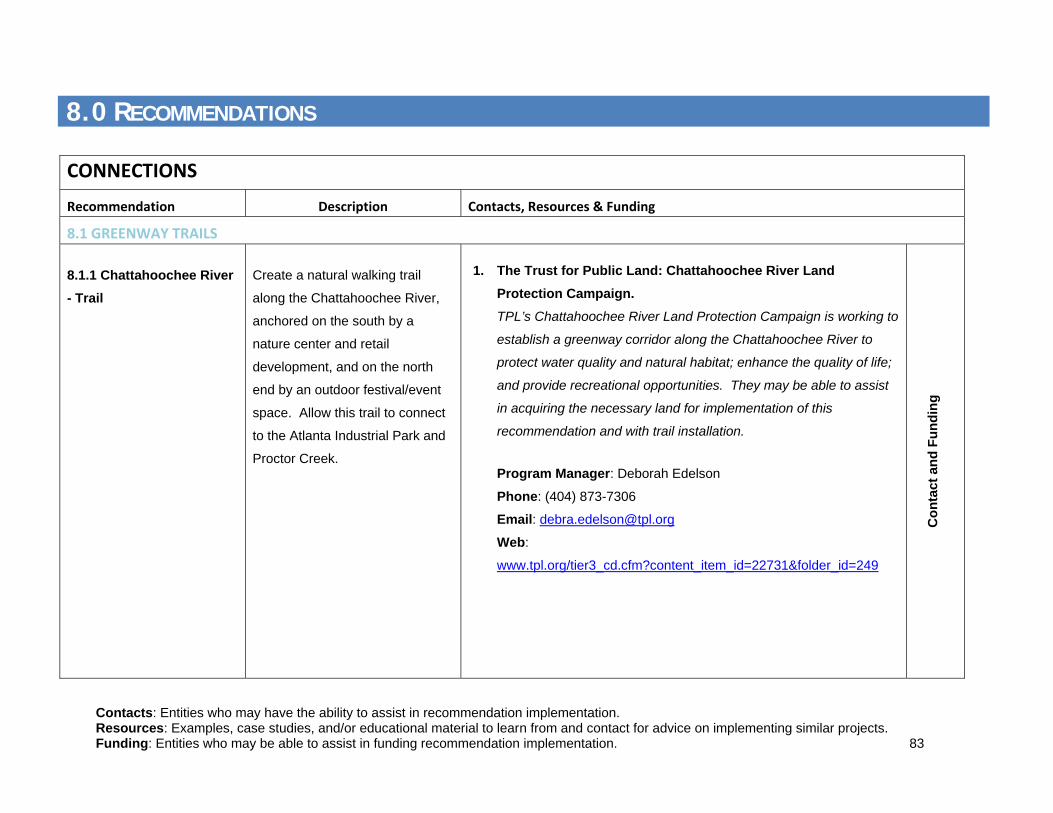
Contacts: Entities who may have the ability to assist in recommendation implementation. Resources: Examples, case studies, and/or educational material to learn from and contact for advice on implementing similar projects. Funding: Entities who may be able to assist in funding recommendation implementation. 83
8.0 RECOMMENDATIONS
CONNECTIONS Recommendation Description Contacts, Resources & Funding
8.1 GREENWAY TRAILS
8.1.1 Chattahoochee River - Trail
Create a natural walking trail
along the Chattahoochee River,
anchored on the south by a
nature center and retail
development, and on the north
end by an outdoor festival/event
space. Allow this trail to connect
to the Atlanta Industrial Park and
Proctor Creek.
1. The Trust for Public Land: Chattahoochee River Land Protection Campaign. TPL’s Chattahoochee River Land Protection Campaign is working to
establish a greenway corridor along the Chattahoochee River to
protect water quality and natural habitat; enhance the quality of life;
and provide recreational opportunities. They may be able to assist
in acquiring the necessary land for implementation of this
recommendation and with trail installation.
Program Manager: Deborah Edelson
Phone: (404) 873-7306
Email: [email protected]
Web:
www.tpl.org/tier3_cd.cfm?content_item_id=22731&folder_id=249
Con
tact
and
Fun
ding
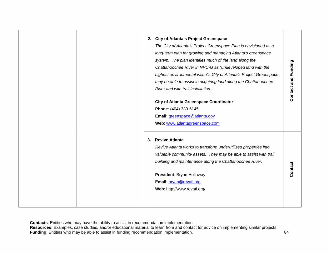
Contacts: Entities who may have the ability to assist in recommendation implementation. Resources: Examples, case studies, and/or educational material to learn from and contact for advice on implementing similar projects. Funding: Entities who may be able to assist in funding recommendation implementation. 84
2. City of Atlanta’s Project Greenspace The City of Atlanta’s Project Greenspace Plan is envisioned as a
long-term plan for growing and managing Atlanta’s greenspace
system. The plan identifies much of the land along the
Chattahoochee River in NPU-G as “undeveloped land with the
highest environmental value”. City of Atlanta’s Project Greenspace
may be able to assist in acquiring land along the Chattahoochee
River and with trail installation. City of Atlanta Greenspace Coordinator Phone: (404) 330-6145
Email: [email protected]
Web: www.atlantagreenspace.com
3. Revive Atlanta Revive Atlanta works to transform underutilized properties into
valuable community assets. They may be able to assist with trail
building and maintenance along the Chattahoochee River.
President: Bryan Hollaway
Email: [email protected] Web: http://www.revatl.org/
Con
tact
and
Fun
ding
C
onta
ct

Contacts: Entities who may have the ability to assist in recommendation implementation. Resources: Examples, case studies, and/or educational material to learn from and contact for advice on implementing similar projects. Funding: Entities who may be able to assist in funding recommendation implementation. 85
4. Atlanta Development Authority (ADA) The ADA works with the Department of Parks, Recreation and
Cultural Affairs and the Department of Planning and Community
Development to facilitate the evaluation, funding and acquisition of
properties that enhance the existing network of parks and trails
throughout the City. The ADA may be able to assist with land
acquisition along the Chattahoochee River.
Parks and Greenspace Program Director: Ellen Wickersham
Phone: (404) 614-8293
Email: [email protected]
Web: http://www.atlantada.com/adaInitiatives/parksGreenSpace.jsp
5. PATH Foundation The PATH Foundation is working to build a network of off-road and
greenway trails in and around Atlanta. They may be able to assist
in trail building and funding.
Phone: (404) 875-7284
Email: [email protected]
Web: http://pathfoundation.org
Con
tact
and
Fun
ding
C
onta
ct a
nd F
undi
ng

Contacts: Entities who may have the ability to assist in recommendation implementation. Resources: Examples, case studies, and/or educational material to learn from and contact for advice on implementing similar projects. Funding: Entities who may be able to assist in funding recommendation implementation. 86
8.1.2 Chattahoochee River - Boat Put-In
Install a boat put-in at the
intersection of Proctor Creek on
the Chattahoochee River.
1. Upper Chattahoochee Riverkeeper The Upper Chattahoochee Riverkeeper advocates and works to
secure the protection and stewardship of the Chattahoochee River.
The Riverkeeper may be able to assist with planning and
implementation of a boat put-in.
Technical Programs Director: Jason Ulseth
Phone: (404) 352-9828
Website: www.chattahoochee.org
2. National Park Service Rivers, Trails and Conservation Assistance Program
This program works to protect natural areas, water resources and
enhance outdoor recreation opportunities. They may be able to
provide technical assistance with planning and implementation of a
boat put-in.
Program Manager: Deirde “Dee” Hewitt
Phone: (404) 507-5691
Email: [email protected]
Web: www.nps.gov/rtca
Georgia Contact: Charlotte Gillis
Phone: (404) 507-5692
Email: [email protected]
Con
tact
C
onta
ct a
nd F
undi
ng

Contacts: Entities who may have the ability to assist in recommendation implementation. Resources: Examples, case studies, and/or educational material to learn from and contact for advice on implementing similar projects. Funding: Entities who may be able to assist in funding recommendation implementation. 87
3. Georgia Canoeing Association The Georgia Canoeing Association is a volunteer group of paddlers
who may be able to assist in the implementation of a boat put-in.
Phone: (770) 421-9729
Website: http://www.gapaddle.com/
8.1.3 Chattahoochee River – Nature Center
Develop a Nature Center at the
south end of the proposed
Chattahoochee River Trail.
1. Chattahoochee Nature Center The Chattahoochee Nature Center provides learning experiences
focuses on the Chattahoochee River that connect people to the
natural world and empower them to positively impact their local
environments. The Chattahoochee Nature Center is a good
example of how a nature center could function in NPU-G. They may
be able to provide advice on how to start a new center.
Contact: Public Relations/Community Affairs
Phone: (770) 992-2055 ext. 224
Email: [email protected]
Res
ourc
e
Res
ourc
e

Contacts: Entities who may have the ability to assist in recommendation implementation. Resources: Examples, case studies, and/or educational material to learn from and contact for advice on implementing similar projects. Funding: Entities who may be able to assist in funding recommendation implementation. 88
8.1.4 Proctor Creek – Trail
Create a greenway trail along
Proctor Creek
1. West Atlanta Watershed Alliance, Inc. (WAWA) WAWA is a community based, non-profit organization whose
mission is to improve the quality of life for the residents in West
Atlanta by protecting, preserving, and restoring the community’s
natural resources. They advocate for preserving greenspace,
protecting and improving water quality, and promoting
environmental health. WAWA focuses part of their work on the
Proctor Creek watershed and may be able to assist in trail
implementation along this creek.
Contact: Darryl Haddock
Phone: (404) 752-5385
Email: [email protected]
Website: www.wawaonline.org
2. PATH Foundation The PATH Foundation is working to build a network of off-road and
greenway trails in and around Atlanta. They may be able to assist
in trail building and funding.
Phone: (404) 875-7284
Email: [email protected]
Web: http://pathfoundation.org
Con
tact
C
onta
ct a
nd F
undi
ng

Contacts: Entities who may have the ability to assist in recommendation implementation. Resources: Examples, case studies, and/or educational material to learn from and contact for advice on implementing similar projects. Funding: Entities who may be able to assist in funding recommendation implementation. 89
3. Atlanta’s Project Greenspace The City of Atlanta’s Project Greenspace Plan is envisioned as a
long-term plan for growing and managing Atlanta’s greenspace
system. The plan identifies much of the land along Proctor Creek
in NPU-G as “undeveloped land with the highest environmental
value”. City of Atlanta’s Project Greenspace may be able to assist
in acquiring land along Proctor Creek and with trail installation. City of Atlanta Greenspace Coordinator Phone: (404) 330-6145
Email: [email protected]
Web: www.atlantagreenspace.com
4. City of Atlanta Department of Watershed Management The Atlanta Department of Watershed Management ensures
professional stewardship of Atlanta’s drinking water, wastewater
and stormwater systems. The Department owns land and
conservation easements along Procter Creek and manages the
stormwater run-off. They may be able to assist with land acquisition
and trail implementation.
Greenway Division Manager of Watershed Protection: Susan
Rutherford
Phone: (404) 546-1251
Email: [email protected]
Con
tact
and
Fun
ding
C
onta
ct

Contacts: Entities who may have the ability to assist in recommendation implementation. Resources: Examples, case studies, and/or educational material to learn from and contact for advice on implementing similar projects. Funding: Entities who may be able to assist in funding recommendation implementation. 90
5. Revive Atlanta Revive Atlanta works to transform underutilized properties into
valuable community assets. They may be able to assist with trail
building and maintenance along Proctor Creek.
President: Bryan Hollaway
Email: [email protected]
Web: http://www.revatl.org/
8.1.5 Explore options for
reclaiming all of or
portions of Gun Club Park
To add to the usable community
recreation space, explore options
for reclaiming portions of Gun
Club Park which are not in West
Highlands and/or released from
West Highlands agreement with
the City of Atlanta. Potential
environmental implications would
need to be explored.
6. City of Atlanta Dept. of Parks, Recreation, and Cultural Affairs The Department of Parks, Recreation, and Cultural Affairs develops,
operates, and maintains the city’s public parks, and recreation and
cultural affairs facilities to create an environment that is deemed
safe, affordable and enriching for all. They should be able to assist
in the exploration and potential reclamation of portions of Gun Club
Park.
Commissioner: George Dusenbury
Email: [email protected]
Web: (404) 546-6788
Con
tact
C
onta
ct

Contacts: Entities who may have the ability to assist in recommendation implementation. Resources: Examples, case studies, and/or educational material to learn from and contact for advice on implementing similar projects. Funding: Entities who may be able to assist in funding recommendation implementation. 91
8.2 INTERSECTION IMPROVEMENTS
Recommendation Description Contacts, Resources & Funding 8.2.1 Donald Lee Hollowell Parkway Signal Timing Update
Update traffic signal timing along
Donald Lee Hollowell Parkway to
increase intersection efficiency,
vehicular access, and travel time
reliability. Amend the Connect
Atlanta Plan (CAP) to include this
recommendation.
1. City of Atlanta Department of Public Works The Public Works Office of Transportation is responsible for
overseeing and maintaining the City’s infrastructure. They may be
able to assist with traffic signal enhancements.
Public Works Manager: Michele Wynn
Phone: (404) 330-6501
Email: [email protected]
Web: http://www.atlantaga.gov/Government/PublicWorks.aspx
C
onta
ct

Contacts: Entities who may have the ability to assist in recommendation implementation. Resources: Examples, case studies, and/or educational material to learn from and contact for advice on implementing similar projects. Funding: Entities who may be able to assist in funding recommendation implementation. 92
2. City of Atlanta Office of Planning The Office of Planning’s Transportation Planning created the
Connect Atlanta Plan (CAP), the City’s first Comprehensive
Transportation Plan (CTP) which ensures mobility, continued
economic growth, and desired quality of life. The CAP identified
Donald Lee Hollowell Parkway as a transit corridor. This
Department may be able to assist with signal timing improvements
on this corridor and amending the CAP
Assistant Director Transportation Planning: Joshuah Mello
Phone: (404) 330-6145
Email: [email protected]
Web:
http://www.atlantaga.gov/government/planning/burofplanning.aspx
Con
tact
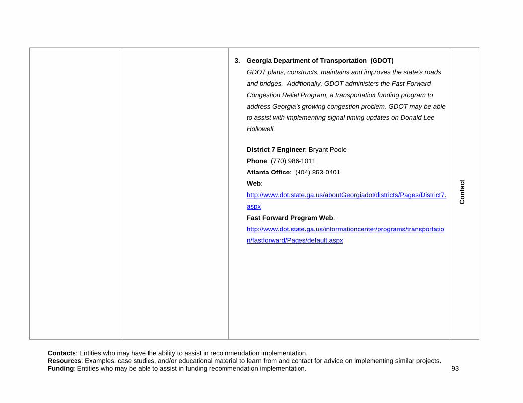
Contacts: Entities who may have the ability to assist in recommendation implementation. Resources: Examples, case studies, and/or educational material to learn from and contact for advice on implementing similar projects. Funding: Entities who may be able to assist in funding recommendation implementation. 93
3. Georgia Department of Transportation (GDOT) GDOT plans, constructs, maintains and improves the state’s roads
and bridges. Additionally, GDOT administers the Fast Forward
Congestion Relief Program, a transportation funding program to
address Georgia’s growing congestion problem. GDOT may be able
to assist with implementing signal timing updates on Donald Lee
Hollowell.
District 7 Engineer: Bryant Poole
Phone: (770) 986-1011
Atlanta Office: (404) 853-0401
Web:
http://www.dot.state.ga.us/aboutGeorgiadot/districts/Pages/District7.
aspx
Fast Forward Program Web:
http://www.dot.state.ga.us/informationcenter/programs/transportatio
n/fastforward/Pages/default.aspx
Con
tact

Contacts: Entities who may have the ability to assist in recommendation implementation. Resources: Examples, case studies, and/or educational material to learn from and contact for advice on implementing similar projects. Funding: Entities who may be able to assist in funding recommendation implementation. 94
8.2.2 Signal Priority Based on Vehicle Height
Implement signal priority based
on vehicle height on Donald Lee
Hollowell Parkway to allow the
many heavy vehicles traveling the
corridor better travel time
reliability, and fewer starts and
stops, which can improve air
quality and reduce noise
associated with starts and stops.
Amend the Connect Atlanta Plan
(CAP) to include this
recommendation. Complete case
studies and impact studies to
justify and further discuss the
value of signal timing updates.
1. City of Atlanta Department of Public Works The Public Works Office of Transportation is responsible for
overseeing and maintaining the City’s infrastructure. They may be
able to assist with signal priority enhancements.
Public Works Manager: Michele Wynn
Phone: (404) 330-6501
Email: [email protected]
Web: http://www.atlantaga.gov/Government/PublicWorks.aspx
2. City of Atlanta Office of Planning The Office of Planning’s Transportation Planning created the
Connect Atlanta Plan (CAP), the City’s first Comprehensive
Transportation Plan (CTP) which ensures mobility, continued
economic growth, and desired quality of life. The CAP identified
Donald Lee Hollowell Parkway as a transit corridor. This
Department may be able to assist with signal priority improvements
on this corridor and amending the CAP.
Assistant Director Transportation Planning: Joshuah Mello
Phone: (404) 330-6145
Email: [email protected]
Web:
http://www.atlantaga.gov/government/planning/burofplanning.aspx
Con
tact
Con
tact

Contacts: Entities who may have the ability to assist in recommendation implementation. Resources: Examples, case studies, and/or educational material to learn from and contact for advice on implementing similar projects. Funding: Entities who may be able to assist in funding recommendation implementation. 95
3. Georgia Department of Transportation The Georgia Department of Transportation plans, constructs,
maintains and improves the state’s roads and bridges. Additionally,
GDOT administers the Fast Forward Congestion Relief Program, a
transportation funding program to address Georgia’s growing
congestion problem. GDOT may be able to assist with implementing
signal priority updates on Donald Lee Hollowell.
District 7 Engineer: Bryant Poole
Phone: (770) 986-1011
Atlanta Office: (404) 853-0401
Web:
http://www.dot.state.ga.us/aboutGeorgiadot/districts/Pages/District7.
aspx
Fast Forward Program Web:
http://www.dot.state.ga.us/informationcenter/programs/transportatio
n/fastforward/Pages/default.aspx
Con
tact
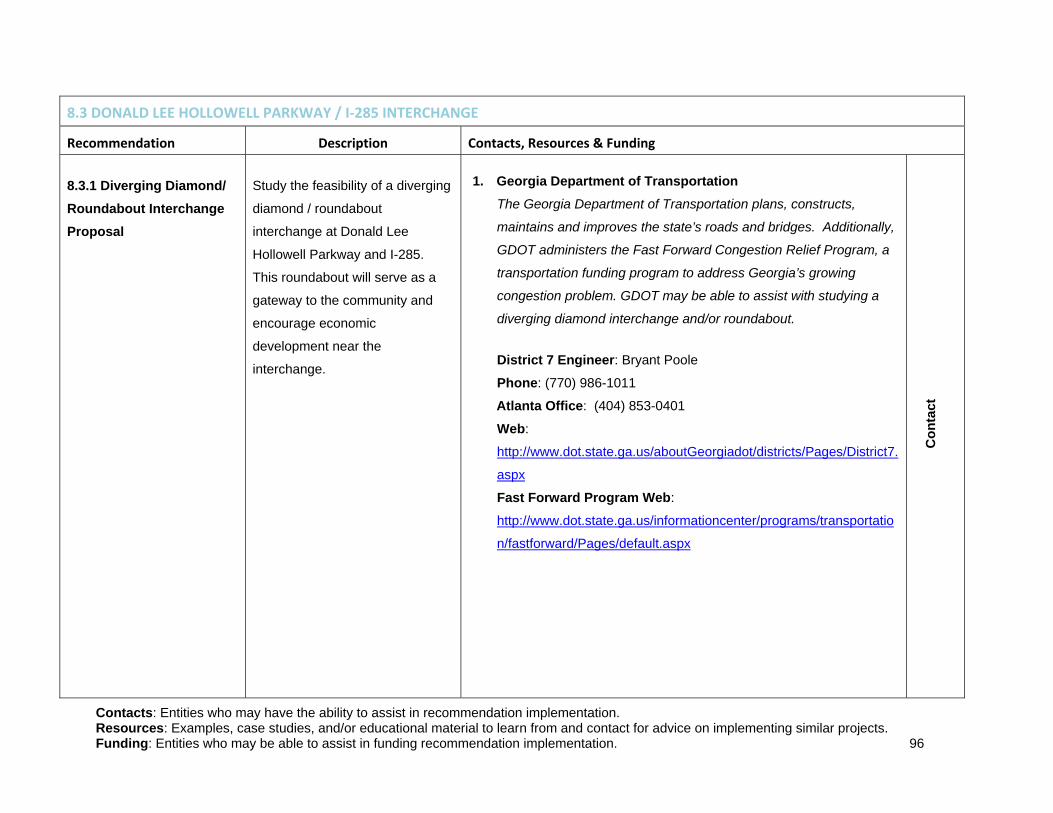
Contacts: Entities who may have the ability to assist in recommendation implementation. Resources: Examples, case studies, and/or educational material to learn from and contact for advice on implementing similar projects. Funding: Entities who may be able to assist in funding recommendation implementation. 96
8.3 DONALD LEE HOLLOWELL PARKWAY / I‐285 INTERCHANGE
Recommendation Description Contacts, Resources & Funding 8.3.1 Diverging Diamond/ Roundabout Interchange Proposal
Study the feasibility of a diverging
diamond / roundabout
interchange at Donald Lee
Hollowell Parkway and I-285.
This roundabout will serve as a
gateway to the community and
encourage economic
development near the
interchange.
1. Georgia Department of Transportation The Georgia Department of Transportation plans, constructs,
maintains and improves the state’s roads and bridges. Additionally,
GDOT administers the Fast Forward Congestion Relief Program, a
transportation funding program to address Georgia’s growing
congestion problem. GDOT may be able to assist with studying a
diverging diamond interchange and/or roundabout.
District 7 Engineer: Bryant Poole
Phone: (770) 986-1011
Atlanta Office: (404) 853-0401
Web:
http://www.dot.state.ga.us/aboutGeorgiadot/districts/Pages/District7.
aspx
Fast Forward Program Web:
http://www.dot.state.ga.us/informationcenter/programs/transportatio
n/fastforward/Pages/default.aspx
Con
tact

Contacts: Entities who may have the ability to assist in recommendation implementation. Resources: Examples, case studies, and/or educational material to learn from and contact for advice on implementing similar projects. Funding: Entities who may be able to assist in funding recommendation implementation. 97
8.3.2 Additional Roundabouts
Study the feasibility of alternative
traffic management solutions for
the intersections of Hollywood
Road/Perry Boulevard and
Hightower Road/Hollywood Road
to slow speeds, reduce
intersection accidents, and
improve travel times. Amend the
Connect Atlanta Plan (CAP) to
include this recommendation.
1. City of Atlanta Department of Public Works The Public Works Office of Transportation is responsible for
overseeing and maintaining the City’s infrastructure. They may be
able to assist with studying roundabout implementation on local
roads.
Public Works Manager: Michele Wynn
Phone: (404) 330-6501
Email: [email protected]
Web: http://www.atlantaga.gov/Government/PublicWorks.aspx
Con
tact
2. City of Atlanta Office of Planning The Office of Planning’s Transportation Planning created the
Connect Atlanta Plan (CAP), the City’s first Comprehensive
Transportation Plan (CTP) which insures mobility, continued
economic growth, and desired quality of life. This Department may
be able to assist with studying roundabout implementation.
Assistant Director Transportation Planning: Joshuah Mello
Phone: (404) 330-6145
Email: [email protected]
Web:
http://www.atlantaga.gov/government/planning/burofplanning.aspx
Con
tact

Contacts: Entities who may have the ability to assist in recommendation implementation. Resources: Examples, case studies, and/or educational material to learn from and contact for advice on implementing similar projects. Funding: Entities who may be able to assist in funding recommendation implementation. 98
3. Georgia Department of Transportation
The Georgia Department of Transportation plans, constructs,
maintains and improves the state’s roads and bridges. Additionally,
GDOT administers the Fast Forward Congestion Relief Program, a
transportation funding program to address Georgia’s growing
congestion problem. GDOT may be able to assist with studying
implementation of roundabouts on state roads.
District 7 Engineer: Bryant Poole
Phone: (770) 986-1011
Atlanta Office: (404) 853-0401
Web:
http://www.dot.state.ga.us/aboutGeorgiadot/districts/Pages/District7.
aspx
Fast Forward Program Web:
http://www.dot.state.ga.us/informationcenter/programs/transportatio
n/fastforward/Pages/default.aspx
Con
tact
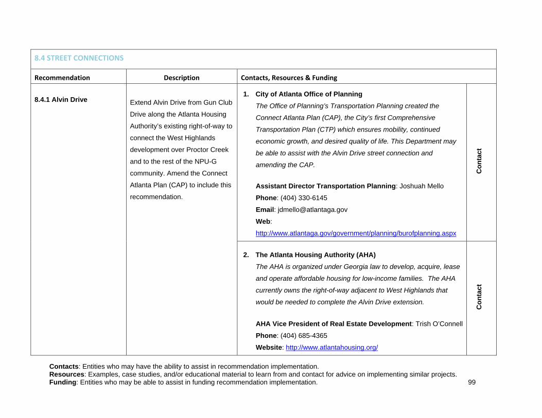
Contacts: Entities who may have the ability to assist in recommendation implementation. Resources: Examples, case studies, and/or educational material to learn from and contact for advice on implementing similar projects. Funding: Entities who may be able to assist in funding recommendation implementation. 99
8.4 STREET CONNECTIONS
Recommendation Description Contacts, Resources & Funding 8.4.1 Alvin Drive
Extend Alvin Drive from Gun Club
Drive along the Atlanta Housing
Authority’s existing right-of-way to
connect the West Highlands
development over Proctor Creek
and to the rest of the NPU-G
community. Amend the Connect
Atlanta Plan (CAP) to include this
recommendation.
1. City of Atlanta Office of Planning
The Office of Planning’s Transportation Planning created the
Connect Atlanta Plan (CAP), the City’s first Comprehensive
Transportation Plan (CTP) which ensures mobility, continued
economic growth, and desired quality of life. This Department may
be able to assist with the Alvin Drive street connection and
amending the CAP.
Assistant Director Transportation Planning: Joshuah Mello
Phone: (404) 330-6145
Email: [email protected]
Web:
http://www.atlantaga.gov/government/planning/burofplanning.aspx
Con
tact
2. The Atlanta Housing Authority (AHA) The AHA is organized under Georgia law to develop, acquire, lease
and operate affordable housing for low-income families. The AHA
currently owns the right-of-way adjacent to West Highlands that
would be needed to complete the Alvin Drive extension.
AHA Vice President of Real Estate Development: Trish O’Connell
Phone: (404) 685-4365
Website: http://www.atlantahousing.org/
Con
tact

Contacts: Entities who may have the ability to assist in recommendation implementation. Resources: Examples, case studies, and/or educational material to learn from and contact for advice on implementing similar projects. Funding: Entities who may be able to assist in funding recommendation implementation. 100
3. City of Atlanta Department of Public Works The Public Works Office of Transportation is responsible for
overseeing and maintaining the City’s infrastructure. They may be
able to assist with the Alvin Drive street connection.
Public Works Manager: Michele Wynn
Phone: (404) 330-6501
Email: [email protected]
Web: http://www.atlantaga.gov/Government/PublicWorks.aspx
Con
tact
8.4.2 Hill Street Bicycle Boulevard
Create a bicycle boulevard by
connecting existing rights-of-way
between Hill Street, Summit
Avenue and Newman Place,
ultimately connecting 5th Street to
Grove Park Place. This new
boulevard would provide
residents with a new east-west
corridor through the community.
Amend the Connect Atlanta Plan
(CAP) to include this
recommendation.
1. PATH Foundation The PATH Foundation is working to build a network of off-road and
greenway trails in and around Atlanta. They may be able to assist
in building this bicycle path.
Phone: (404) 875-7284
Email: [email protected]
Web: http://pathfoundation.org
Con
tact

Contacts: Entities who may have the ability to assist in recommendation implementation. Resources: Examples, case studies, and/or educational material to learn from and contact for advice on implementing similar projects. Funding: Entities who may be able to assist in funding recommendation implementation. 101
2. City of Atlanta Office of Planning
The Office of Planning’s Transportation Planning created the
Connect Atlanta Plan (CAP), the City’s first Comprehensive
Transportation Plan (CTP) which ensures mobility, continued
economic growth, and desired quality of life. The CAP includes
plans for bicycle routes. This Department may be able to assist with
implementing this bicycle boulevard and amending the CAP
Assistant Director Transportation Planning: Joshuah Mello
Phone: (404) 330-6145
Email: [email protected]
Web:
http://www.atlantaga.gov/government/planning/burofplanning.aspx
Con
tact
3. Atlanta Bicycle Coalition (ABC) ABC strives to create a healthier, more sustainable Atlanta by
making it safer, easier and more attractive to bicycle for fun, fitness,
and transportation. ABC may be able to assist in implementing a
bicycle boulevard.
Executive Director: Rebecca Serna
Phone: (404) 881-1112
Email: [email protected]
Web: http://www.atlantabike.org/
Con
tact

Contacts: Entities who may have the ability to assist in recommendation implementation. Resources: Examples, case studies, and/or educational material to learn from and contact for advice on implementing similar projects. Funding: Entities who may be able to assist in funding recommendation implementation. 102
8.4.3 Connections from
Atlanta Industrial Park
Create a connection from the
NPU-G community to the Atlanta
Industrial Park by bridging over I-
285 to provide better access to
this employment center and
improve travel times. Amend the
Connect Atlanta Plan (CAP) to
include this recommendation.
1. Georgia Department of Transportation (GDOT) GDOT plans, constructs, maintains and improves the state’s roads
and bridges. Additionally, GDOT administers the Fast Forward
Congestion Relief Program, a transportation funding program to
address Georgia’s growing congestion problem. GDOT would need
to be involved in the implementation of this street connection, since
it bridges over I-285.
District 7 Engineer: Bryant Poole
Phone: (770) 986-1011
Atlanta Office: (404) 853-0401
Web:
http://www.dot.state.ga.us/aboutGeorgiadot/districts/Pages/District7.
aspx
Fast Forward Program Web:
http://www.dot.state.ga.us/informationcenter/programs/transportatio
n/fastforward/Pages/default.aspx
Con
tact
and
Fun
ding

Contacts: Entities who may have the ability to assist in recommendation implementation. Resources: Examples, case studies, and/or educational material to learn from and contact for advice on implementing similar projects. Funding: Entities who may be able to assist in funding recommendation implementation. 103
2. City of Atlanta Department of Public Works The Public Works Office of Transportation is responsible for
overseeing and maintaining the City’s infrastructure. They may be
able to assist with this new street connection.
Public Works Manager: Michele Wynn
Phone: (404) 330-6501
Email: [email protected]
Web: http://www.atlantaga.gov/Government/PublicWorks.aspx
Con
tact
3. City of Atlanta Office of Planning The Office of Planning’s Transportation Planning created the
Connect Atlanta Plan (CAP), the City’s first Comprehensive
Transportation Plan (CTP) which ensures mobility, continued
economic growth, and desired quality of life. This Department may
be able to assist with implementing this street connection and
amending the CAP.
Assistant Director Transportation Planning: Joshuah Mello
Phone: (404) 330-6145
Email: [email protected]
Web:
http://www.atlantaga.gov/government/planning/burofplanning.aspx
Con
tact

Contacts: Entities who may have the ability to assist in recommendation implementation. Resources: Examples, case studies, and/or educational material to learn from and contact for advice on implementing similar projects. Funding: Entities who may be able to assist in funding recommendation implementation. 104
8.5 TRANSIT
Recommendation Description Contacts, Resources & Funding 8.5.1 Donald Lee Hollowell Parkway - Bus Rapid Transit
Implement Bus Rapid Transit
along Donald Lee Hollowell
Parkway from the Bankhead
MARTA station to the Atlanta
Industrial Park.
1. MARTA Metropolitan Atlanta Rapid Transit Authority (MARTA) is metro
Atlanta’s transit agency, providing bus and rail service to the region.
Community Outreach Planner: Louis Grisoglio
Phone: (404) 848-5337
Email: [email protected]
Web: http://www.itsmarta.com/
Con
tact
2. City of Atlanta Office of Planning The Office of Planning’s Transportation Planning created the
Connect Atlanta Plan (CAP), the City’s first Comprehensive
Transportation Plan (CTP) which ensures mobility, continued
economic growth, and desired quality of life. Transit along Donald
Lee Hollowell has been included in the CAP. This Department may
be able to assist with implementing this bus rapid transit.
Assistant Director Transportation Planning: Joshuah Mello
Phone: (404) 330-6145
Email: [email protected]
Web:
http://www.atlantaga.gov/government/planning/burofplanning.aspx
Con
tact

Contacts: Entities who may have the ability to assist in recommendation implementation. Resources: Examples, case studies, and/or educational material to learn from and contact for advice on implementing similar projects. Funding: Entities who may be able to assist in funding recommendation implementation. 105
8.5.2 Bus Shelters and Stations
Install bus shelters and stations
along the proposed Donald Lee
Hollowell BRT route. Install bus
shelters at current bus stops that
are unmarked.
1. MARTA Metropolitan Atlanta Rapid Transit Authority (MARTA) is metro
Atlanta’s transit agency, providing bus and rail service to the region. MARTA Shelter Group Coordinator: Wendy Prescott
Phone: (404) 848-4199
Email: [email protected]
Web: http://www.itsmarta.com/ Manager of Business Development Sales: Tony Griffin
Phone: (404) 848-5620
Email: [email protected] Manager of Special Projects and Analysis: Richard Wallace
Phone: (404) 848-5208
Email: [email protected]
Con
tact
8.5.3 MARTA Extension from Bankhead to Cumberland
Extend MARTA heavy-rail transit
(HRT) from Bankhead Station to
West Highlands and continue
HRT to Cumberland, Marietta,
and Kennesaw.
1. MARTA Metropolitan Atlanta Rapid Transit Authority (MARTA) is metro
Atlanta’s transit agency, providing bus and rail service to the region.
Community Outreach Planner: Louis Grisoglio
Phone: (404) 848-5337
Email: [email protected]
Web: http://www.itsmarta.com/
Con
tact

Contacts: Entities who may have the ability to assist in recommendation implementation. Resources: Examples, case studies, and/or educational material to learn from and contact for advice on implementing similar projects. Funding: Entities who may be able to assist in funding recommendation implementation. 106
8.6 TRANSIT‐ORIENTED DEVELOPMENT
Recommendation Description Contacts, Resources & Funding 8.6.1 Transit-Oriented Development
Build Transit-Oriented
Developments (TODs) at
locations where bus service is
frequent.
1. MARTA Transit Oriented Development Metropolitan Atlanta Rapid Transit Authority (MARTA) is metro
Atlanta’s transit agency, providing bus and rail service to the region.
Manager of Joint Development and TOD: Ted Tarantino
Phone: (404) 848-5397
Email: [email protected]
Con
tact
2. MARTA Transit-Oriented Development (TOD) Guide Metropolitan Atlanta Rapid Transit Authority’s (MARTA) guidelines
and design standards for building TODs.
http://itsmarta.com/TOD%20Guidelines%202010-11.pdf
Res
ourc
e

Contacts: Entities who may have the ability to assist in recommendation implementation. Resources: Examples, case studies, and/or educational material to learn from and contact for advice on implementing similar projects. Funding: Entities who may be able to assist in funding recommendation implementation. 107
8.7 BICYCLE NETWORK AND SIDEWALK IMPROVEMENTS
Recommendation Description Contacts, Resources & Funding 8.7.1 Pedestrian Crossing Over Chattahoochee River
Create a suspended
pedestrian/bicycle bridge across
the Chattahoochee River using
cables suspended from the I-285
bridge.
1. Georgia Department of Transportation (GDOT) GDOT plans, constructs, maintains and improves the state’s roads
and bridges. GDOT would need to be involved in the
implementation of this pedestrian crossing, since it would connect to
the I-285 bridge.
District 7 Engineer: Bryant Poole
Phone: (770) 986-1011
Atlanta Office: (404) 853-0401
Web: http://www.dot.state.ga.us/
Con
tact

Contacts: Entities who may have the ability to assist in recommendation implementation. Resources: Examples, case studies, and/or educational material to learn from and contact for advice on implementing similar projects. Funding: Entities who may be able to assist in funding recommendation implementation. 108
2. The River Line Historic Area The River Line Historic Area embraces historic and natural
resources near the Chattahoochee River to unite community as a
place of distinction. This organization works in Mableton on the
Cobb County side of the Chattahoochee River. Any connection
across the river and into Mableton should include their input.
River Line Historic Area: Roberta Cook
Email: [email protected]
Web: http://www.mableton.org/RLHA/09.07.06_Handout.pdf
Chair of Chattahoochee River Line Committee: Dobson Harris
Email: [email protected]
Con
tact
and
Res
ourc
e
3. PATH Foundation The PATH Foundation is working to build a network of off-road and
greenway trails in and around Atlanta. They may be able to assist
in creating this pedestrian bridge/trail across the Chattahoochee
River.
Phone: (404) 875-7284
Email: [email protected]
Web: http://pathfoundation.org
Con
tact
and
Fun
ding

Contacts: Entities who may have the ability to assist in recommendation implementation. Resources: Examples, case studies, and/or educational material to learn from and contact for advice on implementing similar projects. Funding: Entities who may be able to assist in funding recommendation implementation. 109
4. Cobb County Community Development Agency This agency is responsible for comprehensive planning throughout
Cobb County. They will need to be involved in the implementation
of this project, as it crosses into Cobb County.
Planning Division Manager: Dana Johnson
Phone: (770) 528-2018
Email: [email protected]
Con
tact
8.7.2 Sidewalk Improvements
Build and improve sidewalks
throughout the community. A
further study needs to be
completed to determine where
new sidewalks are needed.
Routes to schools and new
development should be
considered in this study.
1. GDOT Safe Routes to School Program (SRTS) SRTS works with elementary and middle schools to create
opportunities for children to safely walk and bicycle to school. They
should be able to assist with building and/or improving sidewalks on
school routes.
Contact: State SRTS Coordinator
Phone: (404) 635-8033
Email: [email protected]
Website: www.saferoutesga.org
Con
tact
and
Fun
ding

Contacts: Entities who may have the ability to assist in recommendation implementation. Resources: Examples, case studies, and/or educational material to learn from and contact for advice on implementing similar projects. Funding: Entities who may be able to assist in funding recommendation implementation. 110
2. PEDS PEDS is a pedestrian advocacy organization working to make metro
Atlanta pedestrian-friendly. They may be able to assist with a further
assessment of sidewalk needs and implementation.
President: Sally Flocks
Phone: (404) 685-8722
Email: [email protected]
Website: http://peds.org/
Con
tact
and
Res
ourc
e
3. Hazard Reporting Tool from PEDS Use the link below to report pedestrian hazards.
http://peds.org/take_action/report-hazards/
Res
ourc
e
8.7.3 Bike Facilities
Create bike lanes on streets
throughout the neighborhood that
have a posted speed greater than
25 mph. A further study needs to
be conducted to determine where
bike lane construction should be
focused. NPU-G should work
with the Atlanta Bicycle Coalition
(ABC) to determine amendments
1. Atlanta Bicycle Coalition (ABC) ABC strives to create a healthier, more sustainable Atlanta by
making it safer, easier and more attractive to bicycle. ABC may be
able to assist in conducting a bicycle lane study, amendments to the
Comprehensive Transportation Plan and construction of lanes.
Executive Director: Rebecca Serna
Phone: (404) 881-1112
Email: [email protected]
Web: http://www.atlantabike.org/
Con
tact
and
Res
ourc
e

Contacts: Entities who may have the ability to assist in recommendation implementation. Resources: Examples, case studies, and/or educational material to learn from and contact for advice on implementing similar projects. Funding: Entities who may be able to assist in funding recommendation implementation. 111
to the primary and secondary
routes as identified in the
Comprehensive Transportation
Plan.
2. PATH Foundation The PATH Foundation is working to build a network of off-road and
greenway trails in and around Atlanta. They may be able to assist
in conducting a bicycle lane study and building bicycle lanes.
Phone: (404) 875-7284
Email: [email protected]
Web: http://pathfoundation.org
Con
tact
3. City of Atlanta Office of Planning The Office of Planning’s Transportation Planning created the
Connect Atlanta Plan (CAP), the City’s first Comprehensive
Transportation Plan (CTP) which ensures mobility, continued
economic growth, and desired quality of life. The CAP includes
plans for bicycle routes. This Department may be able to assist with
building bicycle lanes already included in the CAP. They may also
be able to assist with a bicycle facility study in the neighborhood.
Any recommendations from this future study should be included in
the CAP.
Assistant Director Transportation Planning: Joshuah Mello
Phone: (404) 330-6145
Email: [email protected]
Web:
http://www.atlantaga.gov/government/planning/burofplanning.aspx
Con
tact

Contacts: Entities who may have the ability to assist in recommendation implementation. Resources: Examples, case studies, and/or educational material to learn from and contact for advice on implementing similar projects. Funding: Entities who may be able to assist in funding recommendation implementation. 112
REDEVELOPMENT
Recommendation Description Contacts, Resources & Funding
8.8 ATLANTA HOUSING AUTHORITY SITES REDEVELOPMENT
8.8.1 Redevelop the Atlanta Housing Authority Sites
As the Atlanta Housing Authority
redevelops the former Hollywood
Courts, Bowen Homes, and
Bankhead Courts sites, utilize the
recommendations discussed in
Section 3.0. The main objectives
are to connect these sites to the
immediate surrounding
communities; promote walkability
and interactions through
increased density; provide
affordable housing and access to
employment; and maintain and
preserve the core values of NPU-
G. Coordination with NPU-G will
be critical for future
redevelopment success.
1. The Atlanta Housing Authority (AHA) The AHA is organized under Georgia law to develop, acquire, lease
and operate affordable housing for low-income families. The AHA
currently owns the land of the former housing project sites and may
redevelop each site in the future. Utilize the development
recommendations in Section 3.0 to influence the outcome of these
future redevelopments.
AHA Vice President of Real Estate Development: Trish O’Connell
Phone: (404) 685-4365
Website: http://www.atlantahousing.org/
Contact: Chuck Young
Email: [email protected]
Contact: Barkari Brooks
Email: [email protected]
Con
tact

Contacts: Entities who may have the ability to assist in recommendation implementation. Resources: Examples, case studies, and/or educational material to learn from and contact for advice on implementing similar projects. Funding: Entities who may be able to assist in funding recommendation implementation. 113
2. Atlanta Development Authority Tax Allocation Districts (TAD) A TAD is established for the purpose of catalyzing investment by
financing certain redevelopment activities in underdeveloped or
blighted areas using public dollars. The ADA administers TADs in
Atlanta. Perry-Bolton TAD, Hollowell/M.L.King TAD, and Beltline
TAD are all located within NPU-G and should be utilized to
encourage new development.
Contact: Commercial Tax Allocation Districts Department
Phone: (404) 880-4100
Website: www.atlantada.com/buildDev/tadFAQs.jsp
Fund
ing
3. Atlanta’s Sustainability Plan In 2010 the City of Atlanta Mayor’s Office of Sustainability completed
Atlanta’s Sustainability Plan to ensure that the City of Atlanta
becomes one of the top ten sustainable cities in the US. This plan
should be utilized to create more sustainable developments.
Interim Director of Sustainability: Bill Hosken
Phone: (404) 954-8490
Email: [email protected]
Website:
http://www.atlantaga.gov/client_resources/mayorsoffice/sustainablity
/coa2010%20sustainability%20plan.pdf
Res
ourc
e

Contacts: Entities who may have the ability to assist in recommendation implementation. Resources: Examples, case studies, and/or educational material to learn from and contact for advice on implementing similar projects. Funding: Entities who may be able to assist in funding recommendation implementation. 114
OPPORTUNITIES FOR ADVANCEMENT
Recommendation Description Contacts, Resources & Funding
8.9 GREEN INDUSTRY TRAINING PROGRAM 8.9.1 Create a Green Industry Training Program (GITP)
As green jobs move to Atlanta
and into the Atlanta Industrial
Park, a Green Industry Training
Program (GITP) can help prepare
NPU-G residents for employment
at these new businesses.
Additionally, having an
employment workforce available
for relocating and new industries
can contribute to a company’s
decision to locate in NPU-G.
1. City of Atlanta Workforce Development Agency (AWDA) The AWDA provides job seekers with training and employers with
applicant screening, employee recruitment, and tax credit
information, among other assistance. They should be able to assist
and/or advise in starting a workforce training program for NPU-G.
Executive Director: Deborah Lum
Phone: (404) 546-3001
Website: http://atlantaworkforce.org.aster.arvixe.com/
Res
ourc
e
2. Georgia Trade-up Georgia Trade-up is a workforce development program preparing
participants for jobs in the construction and green economies. They
may be able to assist in creating a GITP in NPU-G
Phone: (404) 584-5777
Website: www.gatradeup.org
Res
ourc
e

Contacts: Entities who may have the ability to assist in recommendation implementation. Resources: Examples, case studies, and/or educational material to learn from and contact for advice on implementing similar projects. Funding: Entities who may be able to assist in funding recommendation implementation. 115
3. QuickStart QuickStart provides customized workforce training to qualified
businesses in Georgia. They may be able to assist in implementing
a GITP with new or relocating businesses in the AIP.
Phone: (404) 253-2800
Website: www.georgiaquickstart.org Con
tact
and
Res
ourc
e
4. Southface Southface provides green jobs training at the Southface SWEET
Center. They may be able to advice and assist with implementing a
GITP.
Director of Sustainable Development: Gray Kelly
Phone: (404) 604-3585
Email: [email protected]
Web: www.southface.org
Con
tact
and
Res
ourc
e
Contacts: Entities who may have the ability to assist in recommendation implementation. Resources: Examples, case studies, and/or educational material to learn from and contact for advice on implementing similar projects. Funding: Entities who may be able to assist in funding recommendation implementation. 116
5. Atlanta’s Sustainability Plan In 2010 the City of Atlanta Mayor’s Office of Sustainability completed
Atlanta’s Sustainability Plan to ensure that the City of Atlanta
becomes one of the top ten sustainable cities in the US. Refer to
this plan regarding City of Atlanta support for sustainability education
and training programs.
Interim Director of Sustainability: Bill Hosken
Phone: (404) 954-8490
Email: [email protected]
Website:
http://www.atlantaga.gov/client_resources/mayorsoffice/sustainablity
/coa2010%20sustainability%20plan.pdf
Res
ourc
e
8.9.2 Atlanta Industrial Park (AIP) Business Owners Association
Encourage AIP business owners
to join the Northwest Business
Association and to work more
closely with NPU-G leadership for
mutual success.
1. Atlanta Development Authority (ADA) The ADA works with existing and relocating businesses. The ADA
may be able to assist with creating an AIP business owners
association.
Director of Business Development: Charles Whatley
Phone: (404) 614-8288
Email: [email protected]
Web: http://www.atlantada.com/busExpRelo/index.jsp
Con
tact

Contacts: Entities who may have the ability to assist in recommendation implementation. Resources: Examples, case studies, and/or educational material to learn from and contact for advice on implementing similar projects. Funding: Entities who may be able to assist in funding recommendation implementation. 117
2. Northwest Business Owners’ Association
President: Pastor Larry Hill
Email: [email protected]
8.10 SCHOOLS AND EDUCATION
Recommendation Description Contacts, Resources & Funding 8.10.1 Repurpose Blalock Elementary School as a GITP Training Center.
Repurpose the vacant Blalock
Elementary School into a Green
Industry Training Program (GITP)
education center. Training at this
facility should be closely linked
with business needs at the
Atlanta Industrial Park.
1. Atlanta Public Schools (APS) The APS currently owns Blalock Elementary School. An agreement
would need to be made with APS to lease or sell the space for GITP.
Deputy Superintendent of Operations: Larry Hoskins
Phone: (404) 802-2503
Email: [email protected]
Con
tact
2. City of Atlanta Workforce Development Agency (AWDA) Work with the AWDA to repurpose Blalock Elementary for GITP.
Executive Director: Deborah Lum
Phone: (404) 546-3001
Website: http://atlantaworkforce.org.aster.arvixe.com/
Con
tact

Contacts: Entities who may have the ability to assist in recommendation implementation. Resources: Examples, case studies, and/or educational material to learn from and contact for advice on implementing similar projects. Funding: Entities who may be able to assist in funding recommendation implementation. 118
FOOD ACCESS
Recommendation Description Contacts, Resources & Funding
8.11 COMMUNITY GARDENS 8.11.1 Community Gardens
Create community gardens at
A.D. Williams Park and other
locations as support exists.
Produce from these gardens can
be distributed throughout the
community, sold at local farmers’
markets, or used in local school
cafeterias.
1. Georgia Organics Georgia Organics Farm to School Program provides schools with the
tools, training and funding to implement gardens and orchards that
can provide fresh food to school cafeterias. Additionally Georgia
Organics provides an urban farming mentoring program.
Farm to School Coordinator: Erin Croom
Email: [email protected]
Website: www.georgiaorganics.org Con
tact
, Res
ourc
e an
d Fu
ndin
g
2. Atlanta Local Food Initiative The Atlanta Local Food Initiative partners with many organizations
and agencies to build a local food system. They may be able to
assist in creating community gardens.
Email: [email protected]
Website: www.atlantalocalfood.org
Con
tact
and
Res
ourc
e

Contacts: Entities who may have the ability to assist in recommendation implementation. Resources: Examples, case studies, and/or educational material to learn from and contact for advice on implementing similar projects. Funding: Entities who may be able to assist in funding recommendation implementation. 119
3. Park Pride Park Pride’s Community Gardens Program creates community
gardens in parks. Park Pride also has funding capabilities for park
projects.
Community Garden Program Manager: Amanda Martin
Email: [email protected]
Phone: (404) 546-7981
Website: http://www.parkpride.org/get-involved/community-
programs/community-gardens
Con
tact
and
Fun
ding
4. Revive Atlanta Revive Atlanta works to transform under-utilized properties into
valuable community assets. As of the completion of this report,
Revive Atlanta had begun construction on the Coretta Scott King
Young Women’s Leadership Academy community garden.
President: Bryan Hollaway
Email: [email protected]
Web: http://www.revatl.org/
Con
tact

Contacts: Entities who may have the ability to assist in recommendation implementation. Resources: Examples, case studies, and/or educational material to learn from and contact for advice on implementing similar projects. Funding: Entities who may be able to assist in funding recommendation implementation. 120
5. Truly Living Well Truly Living Well operates urban gardens throughout Atlanta,
provides farming education and runs Community Supported
Agriculture (CSA) which distributes locally grown produce to
subscribers. They may be able to assist and advise with community
garden implementation.
Founder: K. Rashid Nuri
Phone: (404) 520-8331
Email: [email protected]
Website: www.trulylivingwell.com
Con
tact
and
Res
ourc
e
6. Atlanta’s Sustainability Plan In 2010 the City of Atlanta Mayor’s Office of Sustainability completed
Atlanta’s Sustainability Plan to ensure that the City of Atlanta
becomes one of the top ten sustainable cities in the US. Refer to
this plan regarding City of Atlanta support for community gardens,
farmers markets and urban agriculture.
Website:
http://www.atlantaga.gov/client_resources/mayorsoffice/sustainablity/
coa2010%20sustainability%20plan.pdf
Res
ourc
e

Contacts: Entities who may have the ability to assist in recommendation implementation. Resources: Examples, case studies, and/or educational material to learn from and contact for advice on implementing similar projects. Funding: Entities who may be able to assist in funding recommendation implementation. 121
7. The Atlanta Falcons Youth Foundation The Atlanta Falcons Youth Foundation is committed to tackling
childhood obesity. They may be able to provide funding for
community gardens that provide a local healthy food source to
children.
Administrative Assistant: Lea Bond
Phone: (770) 965-2726
Email: [email protected]
Web: http://www.atlantafalcons.com/community/falcons-youth-
foundation/
Fund
ing
8.12 URBAN AGRICULTURE CENTER
Recommendation Description Contacts, Resources & Funding 8.12.1 Urban Agriculture Center
Create an urban agriculture
center at the abandoned
Hollywood Plaza Shopping
Center to grow and sell locally
grown produce to businesses and
individuals.
1. The Organic Farming Research Foundation (OFRF) OFRF works to foster the improvement and widespread adoption of
organic farming systems. They may be able to provide funding and
advice for starting an urban agriculture center.
Grants Program Director: Jane Sooby
Phone: (831) 426-6606
Email: [email protected]
Web: http://ofrf.org/aboutus/aboutus.html
Res
ourc
e an
d Fu
ndin
g

Contacts: Entities who may have the ability to assist in recommendation implementation. Resources: Examples, case studies, and/or educational material to learn from and contact for advice on implementing similar projects. Funding: Entities who may be able to assist in funding recommendation implementation. 122
2. Truly Living Well Truly Living Well operates urban gardens throughout Atlanta,
provides farming education and runs Community Supported
Agriculture (CSA) which distributes locally grown produce to
subscribers. They may be able to assist and advise with community
garden implementation.
Founder: K. Rashid Nuri
Phone: (404) 520-8331
Email: [email protected]
Website: www.trulylivingwell.com
Con
tact
and
Res
ourc
e
3. Atlanta Development Authority (ADA) The ADA works with new, existing and relocating businesses. The
ADA may be able to assist with and provide advice for starting an
urban agriculture center business.
Director of Business Development: Charles Whatley
Phone: (404) 614-8288
Email: [email protected]
Web: http://www.atlantada.com/adaInitiatives/parksGreenSpace.jsp
Con
tact

Contacts: Entities who may have the ability to assist in recommendation implementation. Resources: Examples, case studies, and/or educational material to learn from and contact for advice on implementing similar projects. Funding: Entities who may be able to assist in funding recommendation implementation. 123
4. Atlanta Local Food Initiative The Atlanta Local Food Initiative partners with many organizations
and agencies to build a local food system. They may be able to
assist in creating an urban agriculture center.
Email: [email protected]
Website: www.atlantalocalfood.org
Con
tact
and
Res
ourc
e
5. Atlanta Development Authority (ADA) Perry-Bolton Tax Allocation Districts (TAD) A TAD is established for the purpose of catalyzing investment by
financing certain redevelopment activities in underdeveloped or
blighted areas using public dollars. The ADA administers TADs in
Atlanta. The proposed urban agriculture center site is located within
the Perry-Bolton TAD. This TAD should be utilized to encourage
development of this center.
Contact: Commercial Tax Allocation Districts Department
Phone: (404) 880-4100
Website: www.atlantada.com/buildDev/tadFAQs.jsp
Fund
ing
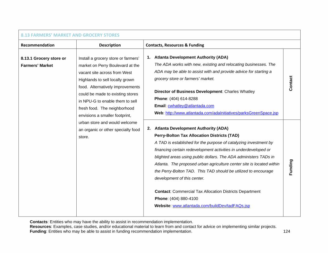
Contacts: Entities who may have the ability to assist in recommendation implementation. Resources: Examples, case studies, and/or educational material to learn from and contact for advice on implementing similar projects. Funding: Entities who may be able to assist in funding recommendation implementation. 124
8.13 FARMERS’ MARKET AND GROCERY STORES
Recommendation Description Contacts, Resources & Funding 8.13.1 Grocery store or Farmers’ Market
Install a grocery store or farmers’
market on Perry Boulevard at the
vacant site across from West
Highlands to sell locally grown
food. Alternatively improvements
could be made to existing stores
in NPU-G to enable them to sell
fresh food. The neighborhood
envisions a smaller footprint,
urban store and would welcome
an organic or other specialty food
store.
1. Atlanta Development Authority (ADA) The ADA works with new, existing and relocating businesses. The
ADA may be able to assist with and provide advice for starting a
grocery store or farmers’ market.
Director of Business Development: Charles Whatley
Phone: (404) 614-8288
Email: [email protected]
Web: http://www.atlantada.com/adaInitiatives/parksGreenSpace.jsp
Con
tact
2. Atlanta Development Authority (ADA) Perry-Bolton Tax Allocation Districts (TAD) A TAD is established for the purpose of catalyzing investment by
financing certain redevelopment activities in underdeveloped or
blighted areas using public dollars. The ADA administers TADs in
Atlanta. The proposed urban agriculture center site is located within
the Perry-Bolton TAD. This TAD should be utilized to encourage
development of this center.
Contact: Commercial Tax Allocation Districts Department
Phone: (404) 880-4100
Website: www.atlantada.com/buildDev/tadFAQs.jsp
Fund
ing

Contacts: Entities who may have the ability to assist in recommendation implementation. Resources: Examples, case studies, and/or educational material to learn from and contact for advice on implementing similar projects. Funding: Entities who may be able to assist in funding recommendation implementation. 125
8.14 STREET FOOD AND FOOD CARTS
Recommendation Description Contacts, Resources & Funding 8.14.1: Street Food Trucks and Carts
Work with the Atlanta Street Food
Coalition to bring street food
trucks and carts to NPU-G, in
order to provide more food
options to the residents of the
neighborhood.
1. Atlanta Street Food Coalition (ASFC) The ASFC campaigns for safe, affordable, and legal access to street
food in metro Atlanta.
President: Greg Smith
Phone: (404) 585-1496
Email: [email protected]
Web: www.atlantastreetfood.com
Con
tact
and
Res
ourc
e

Contacts: Entities who may have the ability to assist in recommendation implementation. Resources: Examples, case studies, and/or educational material to learn from and contact for advice on implementing similar projects. Funding: Entities who may be able to assist in funding recommendation implementation. 126
PUBLIC ART Recommendation Description Contacts, Resources & Funding
8.15 PUBLIC ART 8.15.1: Incorporate public art to present the rich cultural history of NPU-G.
Incorporate public art into the
proposed Chattahoochee River
Trail, at nodes and intersections
and within public parks. The
community would especially
support art utilizing recycled and
reclaimed materials.
1. City of Atlanta’s Office of Cultural Affairs (OCA) OCA’s Public Art Division promotes rich and diverse cultural
experiences through art installations throughout the city. They may
be able to provide assistance and funding, through their Contracts for
Art Services, in public art initiatives.
Public Art Division Program Manager: Eddie Granderson
Phone: (404) 546-6819 Email: [email protected] Web: www.ocaatlanta.com C
onta
ct, R
esou
rce
and
Fund
ing
2. Park Pride Park Pride works with communities to develop conceptual plans for
their parks. Park Pride may be able to provide assistance and funding
for public art in parks.
Interim Executive Director: Allison Barnett
Email: [email protected]
Phone: (404) 546-6760
Website: http://www.parkpride.org
Con
tact
and
Fun
ding
Contacts: Entities who may have the ability to assist in recommendation implementation. Resources: Examples, case studies, and/or educational material to learn from and contact for advice on implementing similar projects. Funding: Entities who may be able to assist in funding recommendation implementation. 127
3. City of Atlanta Office of Parks The Office of Parks preserves, protects and maintains the City’s park
spaces. They will need to be involved in any art installation in the
public parks.
Director: Doug Voss
Email: [email protected]
Phone: (404) 546-6745
Web:
http://www.atlantaga.gov/government/parks/bureau_of_parks091703.
aspx?section=Bureau%20of%20Parks
Con
tact
4. Art on the Beltline Art on the Beltline brings public art installations to the beltline corridor.
They may be able to advise on the public art process.
Director of Community Engagement: Beth McMillian
Email: [email protected]
Phone: (404) 614-8300
Web:
http://www.beltline.org/BeltLineBasics/PublicArt/ArtontheBeltLine/tabi
d/3962/Default.aspx/
Res
ourc
e

Contacts: Entities who may have the ability to assist in recommendation implementation. Resources: Examples, case studies, and/or educational material to learn from and contact for advice on implementing similar projects. Funding: Entities who may be able to assist in funding recommendation implementation. 128
ENVIRONMENT AND NATURAL AMENITIES Recommendation Description Contacts, Resources & Funding
8.16 GUN CLUB ROAD LANDFILL 8.16.1 Solar Array on Gun Club Road Landfill
Create a solar array field on the
closed and undevelopable Gun
Club Road Landfill. Explore the
feasibility of supplying generated
power to community amenities,
such as street lights, park lights
and facilities, and lights at
recreation centers or community
gardens.
1. Environmental Protection Agency (EPA) EPA’s RE-powering America’s Land: Renewable Energy on
Potentially Contaminated Land and Mine Sites utilizes contaminated
sites that cannot be developed and turns them into solar or wind
power fields. For Gun Club Road Landfill to be eligible for the grant
funding the City of Atlanta would need to deed the site over to a new
owner, as the party responsible for contamination (City of Atlanta) is
not eligible for the program.
EPA Region 4 Program Manager: Margaret Olson
Email: [email protected]
Phone: (404) 562-8601
Web: http://www.epa.gov/oswercpa/
Con
tact
, Res
ourc
e an
d Fu
ndin
g
2. Hickory Ridge Landfill, Dekalb County, GA
Hickory Ridge’s solar cap is an example and resource for potential
solar array development on Gun Club Road Landfill.
Web: http://www.ajc.com/business/big-metro-atlanta-landfill-
801180.html
Res
ourc
e

Contacts: Entities who may have the ability to assist in recommendation implementation. Resources: Examples, case studies, and/or educational material to learn from and contact for advice on implementing similar projects. Funding: Entities who may be able to assist in funding recommendation implementation. 129
3. Fort Carson, Colorado Fort Carson’s solar array field is an example and resource for
potential solar array development on Gun Club Road Landfill.
Web: http://www.epa.gov/oswercpa/docs/success_fortcarson_co.pdf
Res
ourc
e
8.16.2 Gun Club Road Landfill Sustainability Educational Trail
Create an educational trail on the
periphery of Gun Club Road
Landfill that demonstrates and
explains components of
renewable energy and
sustainability, such as a methane
station, a small wind station, a
recycling station, a solar energy
station, and a smart house
station.
1. PATH Foundation
The PATH Foundation is working to build a network of off-road and
greenway trails in and around Atlanta. They may be able to assist in
trail building and funding.
Phone: (404) 875-7284
Email: [email protected]
Web: http://pathfoundation.org
Con
tact
and
Fun
ding
2. City of Atlanta’s Project Greenspace The City of Atlanta’s Project Greenspace Plan is envisioned as a
long-term plan for growing and managing Atlanta’s greenspace
system. City of Atlanta’s Project Greenspace may be able to assist
in acquiring land and with trail installation. City of Atlanta Greenspace Coordinator: Phone: (404) 330-6145
Email: [email protected]
Web: www.atlantagreenspace.com
Con
tact
and
Fun
ding

Contacts: Entities who may have the ability to assist in recommendation implementation. Resources: Examples, case studies, and/or educational material to learn from and contact for advice on implementing similar projects. Funding: Entities who may be able to assist in funding recommendation implementation. 130
3. Southface Southface promotes and educates about sustainable energy and
environmental technologies throughout the southeast. They may be
able to assist with implementing the sustainable education stations
along the path.
Director of Sustainable Development: Gray Kelly
Phone: (404) 604-3585
Email: [email protected]
Web: www.southface.org
Con
tact
and
Res
ourc
e
4. Revive Atlanta Revive Atlanta works to transform underutilized properties into
valuable community assets. They may be able to assist with trail
building and maintenance along the Gun Club Road Landfill.
President: Bryan Hollaway
Email: [email protected]
Web: http://www.revatl.org/
Con
tact
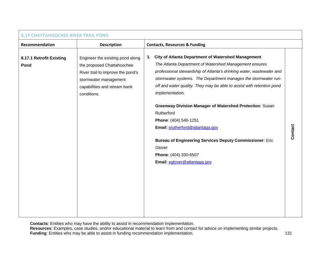
Contacts: Entities who may have the ability to assist in recommendation implementation. Resources: Examples, case studies, and/or educational material to learn from and contact for advice on implementing similar projects. Funding: Entities who may be able to assist in funding recommendation implementation. 131
8.17 CHATTAHOOCHEE RIVER TRAIL POND
Recommendation Description Contacts, Resources & Funding 8.17.1 Retrofit Existing Pond
Engineer the existing pond along
the proposed Chattahoochee
River trail to improve the pond’s
stormwater management
capabilities and stream bank
conditions.
1. City of Atlanta Department of Watershed Management The Atlanta Department of Watershed Management ensures
professional stewardship of Atlanta’s drinking water, wastewater and
stormwater systems. The Department manages the stormwater run-
off and water quality. They may be able to assist with retention pond
implementation.
Greenway Division Manager of Watershed Protection: Susan
Rutherford
Phone: (404) 546-1251
Email: [email protected]
Bureau of Engineering Services Deputy Commissioner: Eric
Glover
Phone: (404) 330-6507
Email: [email protected]
Con
tact

Contacts: Entities who may have the ability to assist in recommendation implementation. Resources: Examples, case studies, and/or educational material to learn from and contact for advice on implementing similar projects. Funding: Entities who may be able to assist in funding recommendation implementation. 132
2. Atlanta Development Authority (ADA) The ADA works with the Department of Parks, Recreation and
Cultural Affairs and the Department of Planning and Community
Development to facilitate the evaluation, funding and acquisition of
properties that enhance the existing network of parks and trails
throughout the City.
Parks and Greenspace Program Director: Ellen Wickersham
Phone: (404) 614-8293
Email: [email protected]
Web: http://www.atlantada.com/adaInitiatives/parksGreenSpace.jsp
Con
tact
and
Fun
ding
8.18 AIR QUALITY
Recommendation Description Contacts, Resources & Funding 8.18.1 Establish an NPU-G Health and Wellness Committee
NPU-G should establish a Health
and Wellness Committee to focus
on resolving air quality issues in
the neighborhood. One of the
first steps of this committee
should be to conduct an air
quality assessment for NPU-G.
1. Mothers and Others for Clean Air Mothers and Others for Clean Air is dedicated to improving air
quality for all Georgians. They may be able to advise and assist with
the formation of a Health and Wellness Committee. Additionally
Mothers and Others may be able to assist with air quality
assessments. Director: Rebecca Watts Hull
Phone: (404) 313-1779
Email: [email protected]
Web: www.mothersandothersforcleanair.org
Con
tact
and
Res
ourc
e
Contacts: Entities who may have the ability to assist in recommendation implementation. Resources: Examples, case studies, and/or educational material to learn from and contact for advice on implementing similar projects. Funding: Entities who may be able to assist in funding recommendation implementation. 133
2. NPU-O Health and Wellness Committee NPU-O’s Health and Wellness Committee may be able to advise
NPU-G in formation of a committee. Chair: Earl Williamson
Phone: (404) 523-2500
Email: [email protected]
Res
ourc
e
3. Southeast Center for Air Pollution and Epidemiology This Center is an EPA-funded collaboration between Emory
University and Georgia Institute of Technology to study and evaluate
health risks of air pollution. They may be able to assist with an air
quality assessment in NPU-G. Rollins School of Public Health at Emory: (404) 727-3990
Georgia Tech’s School of Civil and Environmental Engineering: (404) 894-6016
Con
tact
and
Res
ourc
e
4. Fulton County Department of Health and Wellness The Department of Health and Wellness may be able to assist with
air quality assessments and resolutions. Director of Health Services: Patrice Harris
Phone: (404) 730-1205
Con
tact
and
Res
ourc
e

Contacts: Entities who may have the ability to assist in recommendation implementation. Resources: Examples, case studies, and/or educational material to learn from and contact for advice on implementing similar projects. Funding: Entities who may be able to assist in funding recommendation implementation. 134
8.19 SEWER AND STORMWATER
Recommendation Description Contacts, Resources & Funding 8.19.1 Low Impact Development (LID)
Utilize Low Impact Development
(LID) strategies in retrofits and
new construction throughout
NPU-G. LID strategies attempt
to mimic a site’s predevelopment
hydrology by utilizing design
techniques which store, filter,
evaporate and/or detain
stormwater runoff.
1. City of Atlanta Department of Watershed Management The Atlanta Department of Watershed Management ensures
professional stewardship of Atlanta’s drinking water, wastewater and
stormwater systems. The Department manages the stormwater run-
off and water quality. They may be able to assist with
implementation of LID strategies.
Greenway Division Manager of Watershed Protection: Susan
Rutherford
Phone: (404) 546-1251
Email: [email protected]
Bureau of Engineering Services Deputy Commissioner: Eric
Glover
Phone: (404) 330-6507
Email: [email protected]
Con
tact
2. Low Impact Development Center This Center is dedicated to the advancement of Low Impact
Development technology and may be able to assist with
implementing these strategies.
www.lowimpactdevelopment.org
Res
ourc
e

Contacts: Entities who may have the ability to assist in recommendation implementation. Resources: Examples, case studies, and/or educational material to learn from and contact for advice on implementing similar projects. Funding: Entities who may be able to assist in funding recommendation implementation. 135
8.20 CEMETERY REHABILITATION
Recommendation Description Contacts, Resources & Funding 8.20.1 Partner with interested organizations to revitalize the historic cemeteries in the neighborhood.
Hollywood Cemetery, Magnolia
Cemetery and Monte Vista
Cemetery are all historic
cemeteries located within NPU-G
that have fallen into poor repair.
Partnerships with local, state and
federal programs that are
interested in the preservation and
upkeep of these sites can lead to
revitalization of these
neighborhood amenities.
1. Jewish Family and Career Services (JFCS) Contact JFCS to discuss a partnership to revitalize the historic
Jewish portion of Hollywood Cemetery.
Phone: (770) 677-9300
Email: [email protected]
Website: https://yourtoolsforliving.org
Con
tact
2. Georgia Department of Natural Resources (DNR) – Historic Preservation Division DNR Historic Preservation Division may be able to advise and assist
with certifying cemeteries as historic places, with funding and
revitalization efforts.
Historic Cemetery Preservation Specialist: Rachel Black
Phone: (404) 651-6433
Historic Preservation Grants: Carol Moore
Phone: (404) 463-8434
Website:
http://www.gashpo.org/content/displaynavigation.asp?TopCategory=
23
Con
tact
, Res
ourc
e an
d Fu
ndin
g

Contacts: Entities who may have the ability to assist in recommendation implementation. Resources: Examples, case studies, and/or educational material to learn from and contact for advice on implementing similar projects. Funding: Entities who may be able to assist in funding recommendation implementation. 136
3. Guidelines for Evaluating and Registering Cemeteries in the National Register of Historic Places This guide can be used as a resource to register NPU-G’s historic
cemeteries in the National Register of Historic Places.
Website:
http://www.nps.gov/history/nr/publications/bulletins/pdfs/nrb41.pdf
Res
ourc
e
4. Historic Oakland Cemetery Foundation Oakland Cemetery is a local example of a historic cemetery that was
successfully revitalized.
Website: http://www.oaklandcemetery.com
Res
ourc
e
5. Hollywood Cemetery News Article in the Jewish Times:
Website: http://atlantasupperwestside.com/site/JewishTimes.html
Res
ourc
e

Contacts: Entities who may have the ability to assist in recommendation implementation. Resources: Examples, case studies, and/or educational material to learn from and contact for advice on implementing similar projects. Funding: Entities who may be able to assist in funding recommendation implementation. 137
8.20.2 Documentation of Community History
Collect the history of
neighborhoods, residents, and
past events in NPU-G by
undertaking research, oral
history, interviews, and other
documentation methods. A
school class or individual could
undertake one or more efforts.
Information could be made
publicly available through a
report or website. Explore
opportunities to post signage for
historic locations.
1. Atlanta History Center The Atlanta History Center is home to the Kenan Research Center, a
free public research facility offering a multitude of resources for the
study of Atlanta and Southern regional history and culture. They
should be able to assist with data collection.
Phone: (404) 814-4000
Website: www.atlantahistorycenter.com
Res
ourc
e
2. The River Line Historic Area
The River Line Historic Area embraces historic and natural resources
near the Chattahoochee River to unite community as a place of
distinction. This organization works in Mableton on the Cobb County
side of the Chattahoochee River. They may be able to advise on
data collection and documentation.
River Line Historic Area: Roberta Cook
Email: [email protected]
Web: http://www.mableton.org/RLHA/09.07.06_Handout.pdf
Chair of Chattahoochee River Line Committee: Dobson Harris
Email: [email protected]
Res
ourc
e

Contacts: Entities who may have the ability to assist in recommendation implementation. Resources: Examples, case studies, and/or educational material to learn from and contact for advice on implementing similar projects. Funding: Entities who may be able to assist in funding recommendation implementation. 138

1
APPENDIX

2
9.0 APPENDIX
9.1 GREENWAY TRAILS
9.1.1 CHATTAHOOCHEE CORRIDOR PLAN
The CCP is in effect for ―all land within 200 feet of the bank of the Chattahoochee River including any
impoundments thereon, or within the flood plain, whichever is greater, from directly below Buford Dam
downstream to the downstream limits of Fulton and Douglas counties, including the entire bed of the river
and any improvements and all islands therein‖1
9.1.2 DEPARTMENT OF WATERSHED MANAGEMENT GUIDELINES
The impacts of developments, such as the proposed trail construction along Proctor Creek, must be
mitigated in accordance with guidance prepared by the Department of Watershed Management
Guidelines that includes, at a minimum, the following options:
Stormwater quality improvement measures or stormwater quantity reduction measures as
specified by the Georgia Stormwater Management Manual. These are measures that will reduce
the pollution contained in stormwater runoff or reduce the amount of runoff itself.
Stream or wetland restoration. Polluted or otherwise impacted streams and wetlands must be
returned to their natural, pristine states and extents.
Buffer revegetation as specified in the City of Atlanta Buffer Revegetation Guidelines. This
includes planting trees and grasses on buffer areas in order to compensate for the removal of
trees and/or grasses elsewhere, or to increase stormwater capacity. Reduction of run-off beyond
pre-development levels – bring stormwater run-off levels back to their natural levels by removing
existing impervious surfaces or other stormwater management techniques.
Buffer compensation – the creation of additional buffer areas adjacent to parts of the buffer that
were impacted by the greenway development.
1 Atlanta Regional Commission (1998). Chattahoochee Corridor Plan. Retrieved on 02 Oct 2010 from
http://www.atlantaregional.com/File%20Library/Environment/ep_chatt_corridor_study_7-72.pdf

3
Additionally, parts of the floodplain along Proctor Creek are subject to City of Atlanta Wetland Protection
Regulations – if development is proposed within the 50-foot wetlands buffer, US Army Corps of Engineers
must review the application to determine if these wetlands fall within their management jurisdiction or if
they are managed by the City.2 This may be more of an obstacle than the Riparian Buffer Ordinance, but
it is likely that wetland restoration and/or the construction of artificial wetlands could mitigate the problem.
9.2 INTERSECTION IMPROVEMENTS
9.2.1 SIGNAL PRIORITY TIMING
Figure 9.2a, obtained from the Signal Timing Manual, displays the effect of using signal priority to adjust
signal timing with red truncation and green extension. Red truncation is accomplished when a bus (or
truck) approaches a red signal, and after detecting the vehicle, the signal controller terminates the side
street green phase early. Similarly, green extension is accomplished when a bus (or truck) approaches a
green signal, and after detection, the green phase is extended to allow the vehicle to proceed through the
signal.
2 City of Atlanta. (n/d). Wetland Protection Regulations. City of Atlanta Code of Ordinances. Chapter 74, Article VIII.

4
9.3 STREET CONNECTIONS
9.3.1 CONNECT ATLANTA PLAN
The following maps are from the Connect Atlanta Plan and include street projects that are proposed by
the City of Atlanta within the NPU-G boundaries.
Figure 9.2a: The Effect of Signal Priority to Adjust Signal Timing
Source: Signal Timing Manual

5

6

7

8
9.4 REDEVELOPMENT
9.4.1 ATLANTA HOUSING AUTHORITY PROPERTIES
Figure 9.3a provides information on the former Atlanta Housing Authority (AHA) housing projects in
NPU-G.
Bankhead Courts Hollywood Courts Bowen Homes
Size or Property 42 Acres 20.2 Acres 83.9 Acres
Number of Units 386 Units 202 Units 650 Units
Amenities Daycare Center, Off-
street Parking, 24-hour
Emergency
Maintenance,
Community Center,
Playground, MARTA
Stop
Daycare Center, Off-
street Parking, 24-hour
Emergency
Maintenance,
Community Center,
Playground, Fitness
Center, Basketball
Courts, Laundry
Facilities
Daycare Center, Off-
street Parking, 24-hour
Emergency
Maintenance,
Community Center,
Playground, West End
Medical Center, Library
Density 9.2 Units/Acre 10 Units/Acre 7.7 Units/Acre
Figure 9.3a: AHA Properties Information
Source: Atlanta Housing Authority
9.4.2 LAND USE ANALYSIS
NPU-G lacks a well-dispersed amount of commercial space throughout the community. Most of the
commercial space that serves the community is located along Donald Lee Hollowell Parkway. As can be
seen in Figure 9.3b, NPU-G is primarily zoned residential (R-4, R-4A, and R-G3) and industrial (I-1 and I-
2). Commercial zoning that allows for light commercial and retail spaces (C-1 and C-2) is sparsely located
along the Donald Lee Hollowell Parkway corridor.

9
Other Zoning
Zoning Detail
C-1
C-1-C
C-2
C-2-C
I-1
I-1-C
I-2
I-2-C
MR-3
MR-4A
MR-4B
MRC-1
MRC-2
MRC-3-C
O-I
PD-H
PD-MU
R-4
R-4A
RG-2-C
RG-3
RG-3-C
Figure 9.3b: Current Zoning Map
Source: City of Atlanta GIS Database
Other Zoning
Zoning Detail
C-1
C-1-C
C-2
C-2-C
I-1
I-1-C
I-2
I-2-C
MR-3
MR-4A
MR-4B
MRC-1
MRC-2
MRC-3-C
O-I
PD-H
PD-MU
R-4
R-4A
RG-2-C
RG-3
RG-3-C
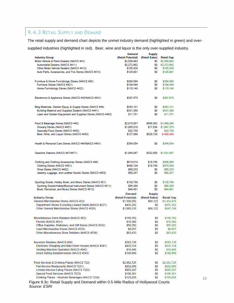
10
9.4.3 RETAIL SUPPLY AND DEMAND
The retail supply and demand chart depicts the unmet industry demand (highlighted in green) and over-
supplied industries (highlighted in red). Beer, wine and liquor is the only over-supplied industry.
Figure 9.3c: Retail Supply and Demand within 0.5-Mile Radius of Hollywood Courts Source: ESRI

11
9.5 OPPORTUNITIES FOR ADVANCEMENT
9.5.1 JOBS-SKILLS MISMATCH
As Figure 9.4a demonstrates, there is a major mismatch between NPU-G residents’ skills and the
employment opportunities within the neighborhood. There are major employment opportunities for the
construction, manufacturing, and wholesale trade industries in NPU-G. The local workforce is not able to
support these jobs, instead they are employed in accommodation and food services, retail trade, health
care and social assistance, and the waste management and remediation industries. The current
workforce would be able to support retailers, banks, and public organizations choosing to locate with in
the neighborhood.
9.5.2 GREEN JOBS
A report issued by the Oregon Employment Department Workforce and Economic Research Division
(OED) found that the Oregon had an estimated 51,402 green jobs in 2008.3 This amounts to 3 percent of
Figure 9.4a: Jobs-Skills Mismatch between Employer and Resident Employment

12
Oregon’s total private, state government, and local government employment. The average wage for a
green job in Oregon was $22.61 per hour while the average wage for all jobs in Oregon during 2008 was
$19.92.4 The study also found that 32 percent of Oregon’s green jobs had no educational requirements
for the position, 64 percent of Oregon’s green jobs require a high school education or below.5 While the
study found that green jobs don’t necessarily need employees to possess high levels of educational
attainment, it also found that those with higher education received higher wages, as demonstrated in
Figure 9.4b.
Michigan is another state that has also completed an analysis of its green employment. The state used
both an employer survey and other qualitative means in order to measure its green employment. Similar
to the results of Oregon, Michigan found that 3.4 percent of its total private employment consisted of
green jobs.6 This amounted to 96,767 green jobs in the State of Michigan.
7 In terms of wages, the report
3 Oregon Employment Department Workforce and Economic Research Division. (2009). The Greening of Oregon's
Workforce: Jobs, Wages and Training. Salem, OR
4 ibid
5 ibid
Figure 9.4b: Green Job Education and Earnings Source: OED 2009

13
found that Michigan’s green jobs do pay high wages. The survey found that the green job hourly wage
ranged from $10.05 to $52.93 per hour for green employment with a $20.22 per hour average wage for a
worker with low levels of educational attainment.8 The average total private employment wage in
Michigan was $20.27 per hour. Moreover, Michigan employers placed a premium on educational
attainment: those with a bachelor degree received $33.62 per hour while those with a vocational degree
earned $22.59 per hour.9 Figure 9.4c shows the hourly wage results for the selected low, medium, and
high wage green jobs.
As Figure 9.4c shows, there is a large wage disparity between specific green jobs. The green jobs that
require little to no formal education, such as farm laborers and construction laborers, earn lower wages
relative to those with higher educational attainment such as electricians and mechanical engineers.
6 Bureau of Labor Market Information and Strategic Initiatives. (2009). Michigan Green Jobs Report: Occupations and
Employment in the New Green Economy. Detrioit: Michigan Department of Energy, Labor and Economic Growth.
7 IBID
8 Bureau of Labor Market Information and Strategic Initiatives. (2009). Michigan Green Jobs Report: Occupations and
Employment in the New Green Economy. Detrioit: Michigan Department of Energy, Labor and Economic Growth.
9 IBID
Figure 9.4c: Green Occupations, Categorized by Wages Source: Michigan Green Jobs Report, 2009

14
Finally, a significant finding of the Michigan study showed that Michigan’s total private employment
declined by 5.4 percent between second quarters 2002 and second quarter 2005, while green employers
added 2,517 jobs.10
Summing up, both the Oregon and Michigan green jobs studies show that the green employment sector
is important for local economies. Green jobs in both states paid higher wages relative to private
employment, with higher wages going to individuals who have higher levels of educational attainment.
However, the majority of green jobs also provide living wages to individuals with low levels of educational
attainment. While these jobs do pay lower hourly wages, green jobs do provide career paths that lead to
higher wages.11
9.5.3 GREEN INDUSTRY TRAINING PROGRAM BEST PRACTICES
The Workforce Strategy Center (WSC) identifies seven effective qualities that successful green job
training programs share:
1) Extensive reliance on data for industry selection, analysis of education and training gaps, and
evaluation of outcomes
2) Responsiveness to demand for skilled workers in the renewable energy and energy efficiency
sectors
3) Industry involvement in helping shape or carry out the program
4) A systemic approach to establishing regional partnerships and/or relationships among education,
workforce development, industry, employer, union, and community-based providers and
organizations
5) Education and training services and programs mapped for clear career advancement
6) Support services to meet the needs and challenges of low-income individuals
7) Track record of training low-income individuals for career advancement in jobs
Source: Workforce Strategy Center 2010
10
Bureau of Labor Market Information and Strategic Initiatives. (2009). Michigan Green Jobs Report: Occupations
and Employment in the New Green Economy. Detrioit: Michigan Department of Energy, Labor and Economic Growth.
11
IBID

15
A successful green jobs training program does not need to have all of these seven categories. Indeed,
most successful green jobs training programs identified by the WSC only fulfill a few of these seven
qualities. The following case studies illustrate the real world application of the best practices described by
the WSC. The following case studies are innovative examples of green job community college training
programs in California and Oregon. Each of the training programs provide solutions to address the
problems inherent in green jobs training:
1) Employers demand for green workers is highly uncertain,
2) Green jobs require high skill-sets that low income individuals may or may not have, and
3) Certificates and standards that provide employers with assurance that the employee has the
required skills are still being developed.12
Lane Community College
Lane College is located in Eugene, Oregon. The college offers two, two-year technical degrees, in Energy
Management and Sustainability Coordination. By the end of the two-year degree, individuals within the
Energy Management program will be able to ―construct energy evaluation technical reports, evaluate
energy use patterns for residential and commercial buildings, and appropriately size and recommend
renewable energy system types for particular situations.‖13
Graduates of the Sustainability Coordination
program will be able to ―demonstrate a holistic understanding of interdisciplinary subjects related to
sustainability, perform environmental audits, laboratory and field tests, conduct and coordinate research,
and prepare written reports for internal and external use.‖14
One applicable practice that this program has
for NPU-G is that Lane Community College allows students to access mechanical and HVAC rooms
across the whole campus.15
This allows students to perform energy audits with a wide variety of building
ages. This practice could be emulated by Green Industry Training Program (GITP) at Blalock Elementary.
The workforce curriculum would entail courses on auditing energy efficiency in industrial facilities as well
as local neighborhood homes. NPU-G has a wide variety of aged industrial and residential buildings in
which the students could audit and make energy efficiency recommendations. Furthermore, students
12
Society of Manufacturing Engineers. (2010). Green Jobs: They're Not Just Limited to the Energy Sector. Retrieved
November 24, 2010, from http://www.sme.org/cgi-bin/get-press.pl?&&20100098&PR&&SME&
13
Lane Community College. (2010). Career and Technical Programs: Energy Management Technician. Eugene, OR.
14
Lane Community College. (2010) Career and Technical Programs: Sustainability Coordinator. Eugene, OR.
15
Workforce Strategy Center. (2010). Building Effective Green Energy Programs in Community Colleges. New York,
New York.

16
could provide knowledge to local Atlanta Industrial Park employers on their energy usage and
recommend ways to reduce their energy usage.
Laney College
Laney College is located in Oakland California. The community college offers four courses in green jobs
training. The college is highly skilled at dealing with the problems embedded in dealing with economically
disadvantaged students. The first method the college uses to improve the educational outcome for
economically disadvantaged students is to provide foundational courses that teach students basic
academic skills.16
These foundational offerings are not the only method the college uses to improve the
outcome for its students: the college also provides its students with full-time case managers.17
These
case managers help the student find resources that will help them stay enrolled in the course and
complete the program. The socio-economic characteristics of the neighborhood point to the fact that the
GITP education professionals will be encountering economically disadvantaged students. GITP should
provide neighborhood students with foundation courses in math and science as well as case managers to
help them succeed. Moreover, the program should offer internship positions with local neighborhood and
regional employers to teach students valuable foundational job skills that can only be acquired in the
workplace.
Columbia Gore Community College
Columbia Gore Community College has a green workforce development program that is highly connected
to industry in the renewable energy field, specifically wind. The program offers a one or two year training
program in Applied Science. Within these degrees are extensive courses directed at providing the student
with up-to-date employer desired skills. The college meets regularly with industry leaders to help alter the
training courses that the community college offers if the industry sees new demand in a particular skill.18
Moreover, the community college, together with the American Wind Energy Association, is attempting to
develop a standardized training certificate for students looking to enter the renewable wind energy field.19
16
Laney Community College. (2010). Green Jobs Training. Retrieved November 24,, 2010, from
http://www.laney.edu/wp/green/
17
Workforce Strategy Center. (2010). Building Effective Green Energy Programs in Community Colleges. New York,
New York.
18
IBID

17
Columbia Gorge College is an excellent example of how workforce development organizations can
connect to key leaders in the industry to develop relevant training programs for their students. When
workforce development organizations are able to produce graduates with the skills employers are looking
for they improve the employment outcome for the graduating student. The neighborhood training program
could emulate this by connecting GITP with manufacturers in the AIP as well as any green business that
locate within it. Any programs offered by GITP must have input from local employers for the development
of a curriculum; the program must maintain this connection throughout the life of the program.
19
Columbia Gorge Community College. (2010). Renewable Energy Technology: Career Opportunities. Retrieved
November 24, 2010, from http://renewableenergycareers.org/career-opportunities

18
9.5.4 DEPARTMENT OF LABOR COMPETENCY MODEL
Figure 9.4d: Advanced Manufacturing Competency Model Source: United Stated Department of Labor, 2010

19
9.6 FOOD ACCESS
9.6.1 FOOD DESERTS
Lack of access to fresh food is a serious problem for many communities across the country and studies
have been conducted to identify where ―food deserts‖—areas where residents have little or no access to
healthy and affordable food—exist. The Brookings Metropolitan Policy Program and The Reinvestment
Fund performed a detailed analysis of supermarket access in ten metropolitan areas around the country,
including Atlanta. The analysis revealed a large portion of NPU-G lacks access to fresh food20
, as shown
in Figure 9.5a. The map, produced by The Reinvestment Fund, shows areas in Atlanta that are
considered Low Access Areas (LAA), which are shaded in purple. LAAs were determined based on low-
and moderate-income communities’ distances from supermarkets, as compared to similar higher-income
counterparts. A large portion of NPU-G is shown as a low access area.
20
The Reinvestment Fund and Brookings Metropolitan Policy Program (2010). PolicyMap: TRF Supermarket Study of
Low Access Areas. http://www.trfund.com/brookings.html
Figure 9.5a: Areas with Low Access to Fresh Foods Source: http;//www.trfund.com/brookings.html

20
PolicyLink and the Food Trust reviewed hundreds of studies on fresh food access, and concluded that the
perception of an inequitable dispersion of fresh food stores in low-income communities is accurate. These
studies have also shown that a lack of access to healthy food is a serious concern for public health.
Organizations like The Food Trust, The Healthy Corner Store Network, the Brookings Institute, and
PolicyLink provide research, information, and solutions on how to address the problem.
9.7 ENVIRONMENT AND NATURAL AMENITIES
9.7.1 WET PONDS
The design of wet ponds, with at least some portion of water being retained indefinitely for most storm
events, allows an estimate of 80% removal of pollutants. The constituent pollutants that comprise the
80% figure are: TSS (Total Suspended Solids): 80%, Total Phosphorous: 50%, Total Nitrogen: 30%,
Fecal Coliform: 70%, Heavy Metals: 50%.21
Generally, particulate pollutants will settle in the first 12 hours
of retention, but greater time is necessary for fine particles, suggesting 24 hours as the minimum
detention time for TSS removal.22
Wet basins are the most effective method for significant removal of nitrogen for stormwater, with a load
reduction of 50% demonstrated over a 3 day period.23
However, pollutant removal at the 80% threshold
requires water input to be steady and continuous. Thus, in flood events water is not detained long enough
for pollutant removal, particularly if wet ponds are not properly maintained as is the case in NPU-G.
21
(2001). Georgia Stormwater Manual. Atlanta Regional Commission. 2(3), 1-22.
22
Barr Engineering Co. (2010) Retention Systems Extended Storage Ponds. Metropolitan Council. Minnesota Urban
Small Sites BMP Manual. 3, 267-280.
23
Barrett, Michael E., (2005) Performance Comparison of Structural Stormwater Best Management Practices. Water
Environment Research, 77(1), 78-86.

PARTICIPANTS
Coordinators Katherine Moore, Georgia Conservancy Deanna Murphy, Georgia Conservancy Leah Barnett, Georgia Conservancy Aria Finkelstein, Georgia Conservancy Ryan Smith, Georgia Conservancy Professor Nancey Green Leigh, Georgia Tech
Blueprints Advisors Shaun Green, Georgia Regional Transportation Authority, Blueprints Partner - Institute of Transportation Engineers Ellen Heath, AECOM, Georgia Planning Association
Stakeholders and Participants Tanicha Allen Kathryn Askew David Ball Kim Ball Vicky Benn-Bundrage Robbie Burr, NPU-G Executive Committee Zoning, Master Plan Co-Chair Sabrina Campbell Pastor Arthur Carson Kathryn Cook Karen Daniely Min. Michael Daniely, NPU-G Executive Committee Public Safety Rebecca DeJesus Mildred Ousley Bill Eisenhauer Kelley Flowers Jovita Grady Wayne C. Grady, NPU-I Chair Andrew C. Greene Elizabeth Goff Duncan Harle Elizabeth Heard Amissa Heath Jaquita Hicks Kathy Hickson Geraldine Hill Dorothy L. Horn Leah Horton Marian Hutchinson Terry Jackson Coretta Jones Damon Jones Ellis Kirby
Elizabeth Lang Adrianne Lewis Tessi Lowe Kelly Marble Theresa Martin Elaine McCoy Sharath Mekala Stacy Menafee Dea. James “Red” Moore Mary Moore Kyle Morris Bryanida Mosley Deborah Parker Craig Pendergrast Francis Razier Elizabeth Reid Ola Reynolds, NPU-G Chair, Master Plan Co-Chair Saudia Roberts Shandreka Rogers Christopher Ruffin Adrian Smith Nathaniel Smith Jancie Stovall Henry Thurston Michelle Uchiyama Millie Walker Jerome West Odeffa L. Wheeler, El-Hajj Iris Williams Nerlandia Williams Velma Wilson Panya Yarber
Advisory Partners Andrea Ahsmore, Georgia Tech Director of Institute Partnerships Bakari Brooks, Atlanta Housing Authority Garnett Brown, City of Atlanta Office of Planning Bill Bryant, Georgia Power Charlotte Gillis, National Park Service Dennis Morris, Atlanta Department of Watershed Management Susan Rutherford, Atlanta Department of Watershed Management Wendy Scruggs-Murray, City of Atlanta Office of Planning Amanda Shailendra, Atlanta Development Authority Gregg Simon, Atlanta Development Authority Karl Smith-Davids, City of Atlanta Office of Planning

Julie Todd, Atlanta Department of Watershed Management Rebecca Watts Hull, Mothers & Others for Clean Air Charles Whatley, Atlanta Development Authority Ellen Wickersham, Atlanta Development Authority Wyman Winston, Atlanta Development Authority Chuck Young, Atlanta Housing Authority
Elected Officials and Agency Staff Emma Darnell, Fulton County Commissioner, District 5 Dr. John H. Eaves, Fulton County Commissioner, District 1 Shelley Lange, Community/Policy Administrator, District 2 Felicia Moore, Atlanta City Councilmember, District 9 Robb Pitts, Fulton County Commissioner, District 2 Jonnie Williams, Atlanta City Council Staff, District 9
Georgia Institute of Technology City Planning Studio, Fall 2010 Colleen Allen Thomas Caiafa Jesse Clark Sarah Gitt Kenneth Liwag Andrew McBurney Emily McClendon Alek Pochowski Evan Robertson Erin Rosintoski
Additionally, we would like to thank the following individuals: Steve Brock, Brock Built Char DeVoursney, PATH Foundation Connie Herrin, Empire Distributors Deirde Oakley, Georgia State University Jim Santos, Atlanta Regional Commission Carla Stroud Rick Tumlin, Lee & Associates Jason Ulseth, Chattahoochee River Keeper Ryan VanSickle, MARTA Dexter White Amy Whitney, Atlanta Jewish Times Ted Zitelli, Empire Distributors


Georgia Conservancy 817 West Peachtree Street
Suite 200 Atlanta, Georgia 30308
404.876.2900 www.georgiaconservancy.org