northern avenue bridge - boston architectural …€¦ · elevation drawing of northern avenue...
TRANSCRIPT
NORTHERN AVENUE
BRIDGE Boston Landmarks Commission Study Report
Petition #194.99


NORTHERN A VENUE BRIDGE
Spanning Fort Point Channel, Boston
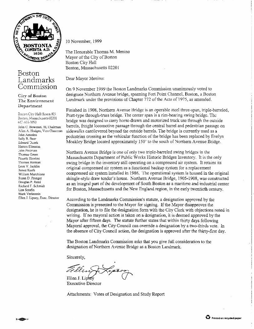
Boston Landmarks Commission Environment Department
City of Boston

Report on the Potential Designation of the
NORTHERN A VENUE BRIDGE
as a Landmark under Chapter 772 of the Acts of 197 5, as amended
Approvedby: ~~ crj...lj.z Ellen ipse
1 1
Executive Director Date
~ r AZ-t-----~. - -;;;--- q 1,. q ~ Approved by: I./~~- "' •
John C. Bowman III Chairman Date
--- ~ --"-· L
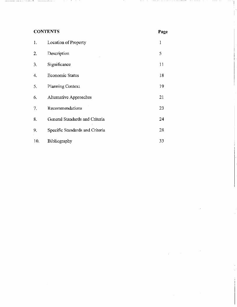
CONTENTS Page
1. Location of Property 1
2. Description 5
3. Significance 11
4. Economic Status 18
5. Planning Context 19
6. Alternative Approaches 21
7. Recommendations 23
8. General Standards and Criteria 24
9. Specific Standards and Criteria 28
10. Bibliography 33

I -- ---------------- ~::_~~=~- __ _:_ ___ L
1.0 LOCATION OF PROPERTY
1.1 Address: Northern Avenue Bridge connects Northern Avenue, from Atlantic Avenue in downtown Boston spanning Fort Point Channel, thence, to Northern Avenue in South Boston. Assessor's parcel number: Bridges and roads are not assigned parcel numbers. The Bridge tender's house is located in ward 6 at parcel2670-1.
1.2 Area in Which Property is Located:
Northern Avenue Bridge spans the mouth of Fort Point Channel, from the eastern shore of Boston proper to the filled and improved flats of South Boston, city of Boston, Suffolk County, Massachusetts. The bridge is a prominent feature from Boston Harbor.
1.3 Map Showing Location: Attached.
1
J ~-

_-__ I
Location Map USGS Topographical Map- Boston South, Massachusetts Bridge Spanning Fort Point Channel at Northern Avenue
Boston, Massachusetts
2
·,
' "'o
"'"' -S'~O.,.
.. /'~a "'
-~
I
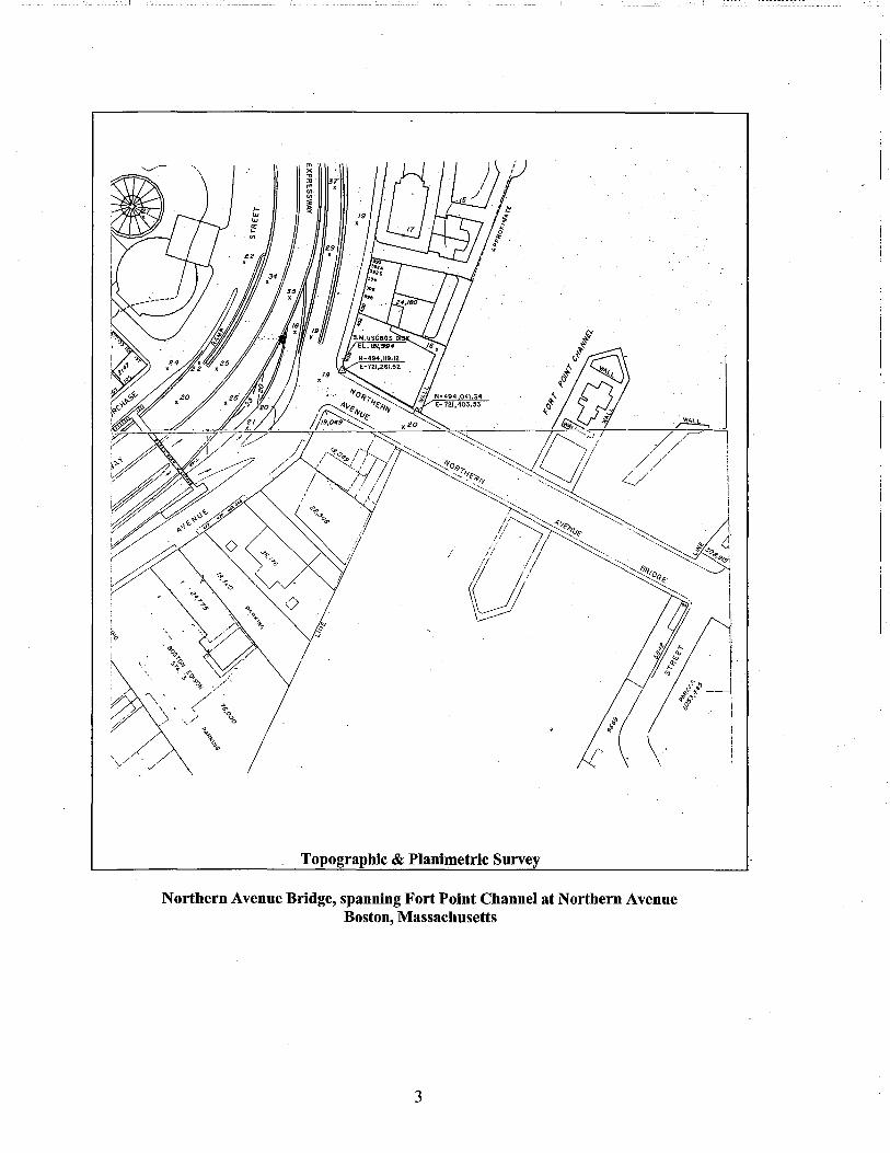
Topographic & Planimetric Survey
Northern Avenue Bridge, spanning Fort Point Channel at Northern Avenue Boston, Massachusetts
3
4
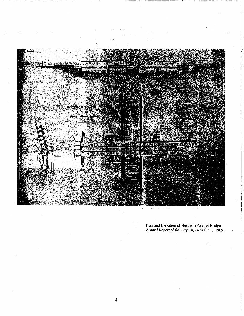
Plan and Elevation ofNorthemAvenue Bridge Annual Report of the City Engineer for - 1909 .

--~ ___ j
2.0 DESCRIPTION
2.1 Type and Use
Finished in 1908, Northern Avenue Bridge is an operable steel three-span, triple-barreled, Pratt-type through-truss bridge. The center span is a rim-bearing swing bridge. City Engineer, William Jackson, patterned Northern Avenue Bridge after the North Washington Street/Charlestown Bridge (1896-1899). The bridge was designed to carry horse-drawn and motorized truck use through the outside barrels, freight locomotive passage through the central barrel and pedestrian passage on sidewalks cantilevered beyond the outside barrels. The City of Boston constructed the bridge to serve maritime industrial needs related to the development of Commonwealth flats as a port in South Boston. The bridge is currently used as a pedestrian crossing as the vehicular function of the bridge has been replaced by Evelyn Moakley Bridge located approximately 150' to the south of Northern Avenue Bridge.
2.2 Physical Description
The 1989 Historic American Engineering Report,# MA-37, prepared by McGinley Hart & Associates, includes a list of over 200 construction drawings and plans for Northern Avenue Bridge as well as a list of collections that include resources on the bridge. The Engineering Department Forty-Third Annual Report of the City Engineer Boston for the Year 1909 includes a very complete description of construction of the bridge. Most of the description of the original bridge in this report was culled from that document. The annual reports for the years 1934-6 describe the most extensive repairs made to the structure of the bridge during those years.
Foundations Northern Avenue Bridge is supported by two abutments and four granite masonry piers set on concrete foundations supported by wood piles. The fixed span on the Boston side is supported by one abutment at the shore end and one pier at the channel end. The fixed span on the South Boston side is supported by two piers. The swing span is supported by one pier at center.
The bridge foundation was constructed and embedded in the clay that underlies the silt at the bottom of Fort Point Channel by driving piles into the channel floor and then pouring Portland cement concrete in a pine sheeting cofferdam around the piles. The foundations for Northern Avenue Bridge were laid in the same manner as Summer Street, Charlestown and Cambridge (Longfellow) bridges, all constructed under the supervision of Boston City Engineer William Jackson.
The channel piers, which support the channel ends of the fixed spans and the ends of the swing span when the bridge is closed, are constructed to identical specifications. These piers have curved faces that approximate the arc of the end of the bridge spans. The curve of the face of the pier, which is 4' in 12' 6", saved materials and load upon the foundations.
The piers are finished with quarry faced granite blocks laid in Portland cement mortar with half-inch joints. The bottom course is laid as headers, which are 4' square. All other courses alternate headers and stretchers. The headers in these courses have a 2' face and extend halfway through the pier, and the stretchers are 5' to 6' long. The coping stones, which extend 6" beyond the face of the body of the pier, are 2' deep, quarry-faced on the vertical sides and peen-hammered on top. The coping stones on the ends are doweled into the
5
blocks below them. The channel piers are surrounded by fender guards constructed of heavy pine.
The channel piers are 78' long at the coping, 77' long under the coping and 85' long at their base. In cross-section, the channel piers are 8.5' wide under the coping increasing in width along a straight line to 9.5' wide at the base. 754 piles were used in the foundation under each channel pier. All piles were driven at an incline, spreading outward from the centers, distributing the load through the foundation over a greater area. These piles were on average 32.5' long and were driven to a depth of not less than 50' below the city base.
"Boston city base" is a surveying standard that establishes a mean base level for construction. It is marked at specific location throughout the city, and the base of individual sites is derived from this standard. The Boston city base is clearly marked in the plan and elevation drawing of Northern Avenue Bridge and the bridge was designed so that the tops of the foundations of the bridge were approximately level with the Boston city base. Boston city base is 5.65' below the standard USGS mean surveying base.
The second pier on the South Boston side fixed span is set near the abutment at the South Boston end of the bridge. It is the same length as the channel pier, but is rectangular in form. It is 7' wide under the coping and 8' at the top of the foundation and at the coping. It is constructed in the same fashion as the channel piers. The bridge was constructed with 320 piles in the foundation of this pier.
The abutment on the South Boston side of the channel was built on the location of an old granite-filled sea wall, erected in 1878, necessitating a different construction technique and materials from the other piers and abutment, as the heavy stones could not be readily removed. The granite was, hence, consolidated with concrete and grout and faced with a cement concrete backed granite wall to allow for increased loading. In section, the abutment is 16'3" thick at the bottom, 20" below the city base. At the top of the abutment, 13 '3" above the city base, it is 10' 7" thick. The bridge seat is set back 8' from the face of the abutment to supply greater stability for the bearings of the bridge girders.
The abutment on the Boston side is a composite masonry structure with a front face like a pier on the harbor line. The foundation and masonry construction of the abutment is similar to that ofthe piers. Its' concrete foundation extends to 20' below city base and is 12' 8" thick at the bottom of the foundation and 11' thick at the top of the foundation. There were 348 piles in the foundation of the abutment.
The masonry portion of the abutment is 7 feet wide at its base, on top of the foundation, and 6' 6" under the bridge seat. The bridge seat is 7' wide a peen hammered area on which the shoe castings set.
There are five piers, set perpendicular to the front face of the abutment that lead back to the face of the old dock wall on the Boston side. These five piers and foundations form the substructure for the roadway that passes out to the fixed span on the Boston side over a tidal shallow at the Boston side of the channel.
The foundations of the longitudinal piers are constructed of the same concrete used in the other foundations. They are laid in steps, 12' below city base adjoining the front pier, 7 '6" below in the middle portion and 3' below at the portion near the old wall. The foundations of the center and outside piers are 6'6" wide and other two are 5' wide in cross section.
6

------------------- I -----------'
The longitudinal piers rise to an elevation of 17' above city base from the five concrete foundations. The two piers on the outside, or street line, are constructed of granite rubble masonry with a concrete backing. They are 4' thick The granite coping stones of these walls form the outside of the sidewalk The three inner piers are constructed of concrete, as they are not in contact with outer air or extreme temperature changes. The center pier is 5' thick, the two on either side, 3' thick Water is discharged from the chambers created by these piers, at each change of tide, through a cast iron pipe 3' below city base. A manhole and openings between the chambers made these spaces accessible.
Steel 1-beams rest on the five longitudinal foundations spanning the chambers at a spacing of 4' on center. The 1-beams are stayed with rods and "Thatcher bars." The beams and rods are encased inPortland cement that extends beyond the bottom flange of the beam, held in place by expanded metal lathing.
The 1-beams support trapezoidal reinforced concrete arches, made of 1-2-4 Portland cement concrete, that carry the street surface. The arches are trapezoidal in form, 14" deep at the center and 24" deep at the beams.
The original builders took great pains to protect the machinery and pivot of Northern A venue Bridge located in the center of the channel. A water -tight, 3' thick, rich Portland cement concrete-backed, granite wall was constructed to a height above the level of extreme high tide around the foundation and pier to protect the track castings and center pedestal pivot. The wall was capped with a granite coping blocks 18" thick and 3 '6" long, laid in cement mortar.
The wall was repainted and repaired, to counteract leakage through the mortarjoints and concrete backing between October 29, 1930 and December 18, 1930, and was partially rebuilt during the 1934-5 reconstruction of the central span.
The circular concrete foundation for the turntable track and center pedestal was built within the watertight wall. The wood mold for the foundation was created with spruce planks spiked and treenailed together horizontally around the perimeter and stabilized vertically with hard pine timbers bolted to the structure. This curbing was 30" tall and rose 4' above the city base. The foundation used the same concrete mixture as the other foundations and is approximately 69' in diameter. It was laid 25' below city base, and dredged 3' deeper than the foundations for the other piers. There were 872 spruce piles supporting this foundation at the date of construction.
The top of the foundation was constructed with four-ply waterproofing. The waterproofing was covered with more rich concrete pitched from the center and terminating in a ring shaped gutter just inside the granite and concrete wall, which was designed to collect any water that might get over the wall. Peen hammered bearing stones were then carefully set in cement mortar on top of the foundation at an elevation of 5.9' above city base. They were 21" thick and form a ring 6' wide, the centerline of which was 40' in diameter with drains through the bearing stones.
The oak pile draw fender pier, which protects the center pier and the bridge when open, is 593' long. It was the largest the city had ever built at its' date of completion. The girder caps, stringers, walling and floor are hard pine. The piles are braced with rough oak or hard
7

------ --_:c:_c __ l
pine braces. The comers were all plated with %" iron plates and 26 heavy ringbolts were provided on the pier. The bridge is currently undergoing work on its' piles and fenders.
Superstructure The bridge has three through truss spans. Spans one and two, the fixed spans, comprised of four pin-connected Pratt trusses 150' long placed 22' 8" apart on-center (ole), which support three roadways between the four trusses and two cantilevered sidewalks to their outside. Span three, the draw span, is a deck plate girder span, made up of six plate girders 55' long, spaced 14'9.5" apart. The draw span is a symmetrical rim-bearing swing draw weighing 1300 tons. It is 283 feet long and 79' 1.5'' wide. It consists of a central tower with two cross trusses supporting two independent spans, 125'2" long. The tower transfers the dead load of swing span and live load from traffic to eight points on the 40' diameter circular drum of the central pier through a system of distributing girders. The planned loading requirements for railroad use made this draw span unusually strong for a swing bridge.
A through truss bridge is recognizable by lateral bracing connecting the tops of the parallel trusses, creating a tunnel-like structure, which traffic passes "through". A Pratt truss is typified by heavy vertical bracing, operating in compression, and lighter diagonal bracing, acting in tension, thus creating a system of stable interlocking right triangles that distribute the forces of the load of the bridge into the system of the truss. The center span ofNorthem Avenue Bridge, 283 feet long, has a polygonal top chord, a later development of the Pratt truss system, which allows for spans up to 300 feet. The fixed spans, 150 feet long, are simple Pratt truss spans, having a straight top chord, which allow for a maximum span of 150 feet.i
The superstructure ofthe draw span was rebuilt with minor changes in 1934-5. A suspension link that supported the top chord of a center truss failed at its connection to the central tower, disconnecting adjacent links as well on January 26, 1934. In order to reinforce and repair the bridge, the draw span was dismantled, the draw pit partially reconstructed and the draw span was reconstructed using the old floor beams, truss posts and some of the minor members. The repairs were undertaken under the aegis of the P.W.A. and work was completed by November 27, 1935 at a cost of $266,983.
The floor beams for all three spans were built-up sections connecting steel stringers. The original roadways for the fixed spans were 6" granite blocks with pitch and pebble joints laid on 6" hard pine planks covered with waterproofing and sand. The sidewalks were 4" pine planks covered with 4" asphalt. The roadway of the draw span was 5" hard pine plank layered under 2" spruce plank. The sidewalks were 2" hard pine planks.
In 1918, railroad track was laid through the center barrel of Northern Avenue Bridge for freight railway passage. The draw span was redecked in conjunction with the 1934-35 repairs. Approach span three was redecked in 1957. The railroad track was abandoned in 1970. The entire bridge was redecked in 1974-5. Approach span deck bracing repairs occurred in 1986-9. Other maintenance and small repairs occurred regularly throughout the years. Presently, the approach spans are finished with concrete, with some asphalt patching. The draw span has webbed steel decking, which is filled with concrete in the portion over the draw pier. The sidewalk is finished contiguous to the roadway on the approach spans, and with wood planks on the draw span.
8

--__ :__-_--:__ __ ~-- -_[
Operational Mechanics A rim-bearing draw span operates by pivoting on a ring of 56 steel wheels, which run between steel faced circular track laid on the bearing stones on the central drum. The draw is turned by two double-cylinder engines attached to the draw.
A system of compressed air operates the draw span. Two double-stage air compressors were geared to a 50 horsepower motor using a 500-volt direct current. The compressors pump into eight steel receivers in the powerhouse, which have a combined capacity of 1500 cubic feet. A 4" pipe main carries the air from the receiver through the operator's stand to the end lifts at 200 p.s.i. and to an engine which turns the draw at 70 p.s.i. The operator's stand is located near the center of the draw span, making road and waterway traffic equally visible.
The eight compressed air tanks, pipes and valves were replaced between July 10, 1931 and October 21, 1931 by Rideout, Chandler & Joyce due to new requirements for a reduction in air pressure from the Massachusetts Department of Safety. A new compressor was installed in 1934-5, and the original (ca. 1908) was retained for secondary use. The 1934 compressor, powered by direct current, was replaced in 1986-9 with an A.C. powered compressor and the original1908 system was still retained, with a rectifier for the D.C. power system.ii
There are eight end lifts, one at the end of each of the four trusses on both ends of the draw span. The end lifts act together to release the draw span from the channel piers where the draw span connects with the fixed spans when the bridge is in the closed position. Each end lift is a system of a 16" diameter cylinder that operates a lever with a cast iron block fulcrum resting on the stone pier. This system is powered by the compressed air being delivered at 200 p.s.i. A lever lifts each truss end about 5" and allows the bearing blocks to slide out from under the truss. The four bearing blocks on each end of the draw span are connected by a shaft operated with a lever by a gate-man from the deck of the fixed spans. Two of the end lifts were damaged on February 7, 1936 necessitating repairs to their blocks, air cylinders, and end lift elements and adjustments to the trusses.
Draw Tender's House The draw tender's house is a wood-shingle vernacular structure constructed to.house the air compressors and act as a residence for the draw tender, who needed to be nearby to operate the bridge. The original contract for the construction of the house was awarded to Jones & Meehan June 4, 1908, and took about three months to complete. The roof has been resurfaced, since that date. The house is a visible landmark from the channel, harbor and bridge. The simple structure reflects the functional aspect of the bridge and reinforces the waterfront character of the Fort Point Channel area.
9

2.4 Photographs (and Maps)
Attached.
··············· .. I
10

Dorchester Neck Before Annexation as South Boston, showing Flats and Channel

\I
I I
I \ 1

Aerial View of Boston and South Boston Looking North and East Compliments of the Boston Public Library, Prints Department
Aerial View of Boston and South Boston Looking South and West One Hundred Years of the Boston Wharf Company
AERIAL Vll'.W OF THE BOSTCJI'\ WHARF COMPANY TODAY. '11\E PROPERTY EXTF.NDS AL()N(; THE CHANNEL AS
FAR AS TilE AMERICAN SUGAR REFINERY--··· THE STRUC'J'liRE WITH TWIN SMOKL(!\TAGKS. IN THE IHCKGlHH;NIJ

I
Construction ofNorthem Avenue Bridge , __
Compliments of the Boston Public Library, Prints Department
--------------------- ---.::__::__::__:::.___[
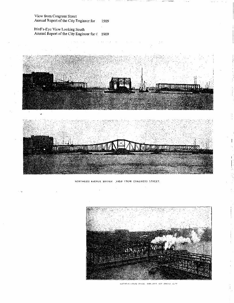
View from Congress Street Annual Report of the City Engineer for 1909
Bird's-Eye View Looking South Annual Report of the City Engineer for D 1909
NORTHI:.RN AVENUE BRID(iE. ,VIEW FROM CONGRESS STREET.

Bird's-Eye View Looking East Compliments of the Boston Public Library, Prints Department
Draw Landing Annual Report of the City Engineer for 1909

Aerial View to the East, Fort Point Channel with Northern Avenue Bridge (background), Congress Street Bridge (middle), and Sununer Street Retractile Bridge (foreground) Courtesy of the Boston Public Library, Prints Department

Reconstruction Photographs 1934-5 • View North, Following Rebuilding • Last of Riveting • Progress • Two Crews with Rivet Pushers Worcester & Co. Consulting Engineers Boston Public Works Department- Bridge Department
~ ... ~ 't
3
t' 1\
~ ~
~ .,
>-. q .., ..,. ~
'::! 10 ~
~ ::1·
'"'f
e-.
~-£ .. ~'
" ~ ~ :t-~~
"" ~ ~ ~ ~ ::: ~ ~-
----------- I
~ "! ...,. ::,. l ~
~ ~
~ .t
~ ~ ... ~ .,_;
'1
~ ~ I.
~-) ~ ~ tl ~
' ~-!'0 ~ ...
I

Reconstruction Photographs 1934-5 • Bottom Chords • DrawDrum • End Lifts • Boston Fixed Span Worcester & Co. Consulting Engineers Boston Public Works Department- Bridge Department
~
il ~ ~ 't ~
~ "' ........ ~
"' ~ ~ ~ '-i
\. ( I

View North from Congress Street Martin Stupich, photographer 7/1/89
View Northwest from Children's Museum Roof Martin Stupich, photographer 7/26/89
I i
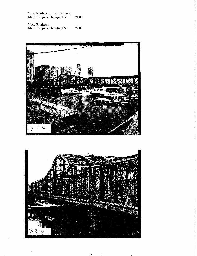
View Northwest from East Bank Martin Stupich, photographer 7/1/89
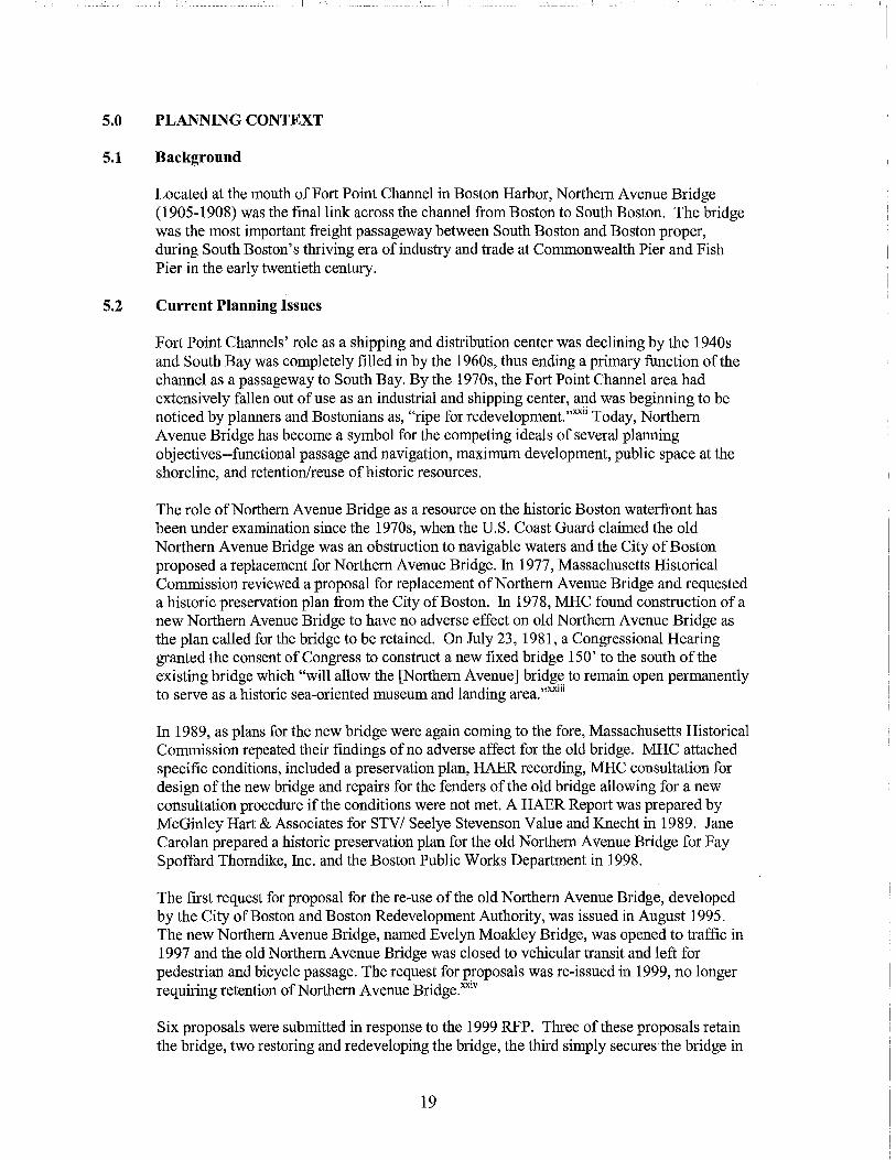
View Southeast Matiin Stupich, photographer 7/2/89

View Northwest, Swing Span Open Martin Stupich photographer 7/1/89
View West, East Portal Mattin Stupich photographer 7/1/89

-------------------- I
I
View East, West Portal Martin Stupich photographer
View Northwest, East Portal Martin Stupich photographer
------------------- -------- -~ I
7/1189
7/1189

View Northeast, South Span, West End Martin Stupich photographer 7/1/89
View West, South Span bracing Members Martin Stupich photographer 7/1/89
7· {t ()

View West, Roadway Surfaces, South and Center Spans 8/99

' __ , ----------- ------- ----------.:_]
View North, Cantilevered Sidewalk from Dock Adjacent to Barking Crab 8/99
View North, Granite Pier from Dock Adjacent to Barking Crab 8/99

View Southwest, Tender's House, From East Bank Martin Stupich Photographer 7/2/89
View Southeast, Roadway and Road Blocks at North Span 8/99

------_I
View Northwest. Draw Tender's House from Fender Wharf Martin Stupich Photographer 7/26/89
View West, Draw Tender's House from Northern Avenue Bridge 8/99
-------------------------- __ I -------------------------- I

- - -- - --- --::::_I
1908 Compressor Martin Stupich, photographer 7/26/89
1908 Compressor Martin Stupich, photographer 7/26/89

View Below Deck-Swing Section Cogged Drive Wheels and Drum Wall Martin Stupich photographer 7/2/89
View from Pit- Swing Section Turntable Mechanism, Drum and Wheels Martin Stupich photographer 7/2/89

--------------------1
i
Detail Below Deck- Swing Section End, Lift Lever and Sliding Block Martin Stupich photographer 7/2/89
Compressed Air Tanks Mattin Stupich photographer 7/26/89
!
I
I
I:
i !

'
·;
,._
CiTr or!Jo:rrolf-~-r;r:lftfll~~.cNr_
NOifTHatN AYENU£ BltJoK.
Dwg. 3653 Plan of Location with Section and Borings Boston Engineering Dept., William Jackson, City Engineer Boston Public Works Department 1906
W );· t F75ezi' &:<···-..· ·'irdlit
J f f
I I
--1
""""- An-....,.... ~-~~~
..er-.s:.-.,r,..,.~
~~ ... ~ -Dwg. 3745 Draw Span and Fixed Spans with Sections ofFloor Boston Engineering Dept., William Jackson, City Engineer Boston Public Works Department 1906

[.
'·I ' _(;;;;.;so,·. ~-~~-&~---.
Dwg. 3663 Steel Superstructure-Draw Span, Truss B Section 3 Boston Engineering Dept., William Jackson, City Engineer Boston Public Works Department 1906
Dwg. 3680 Steel Superstructure-Draw Span, Details of Turntable Boston Engineering Dept., William Jackson, City Engineer Boston Public Works D~partment 1906
'£ ,..,..,. :"' .... ..,. --·•<1'•"4- '1"""~"--··-··
~
. • "l if ...._. 1 "
'y ,_._ --"'·t::::~~-0
~~-====::.t __ ,_.. ~-f"-..4--.lor~t/.--,..
"'~"'----"-' ..... ,....__...... -
77f"----... T~I· .. ....,~,.J •..
-m""------s. .... ....~.,.....~
@·-~---
0
~ . -
0
0
0
ou£?1. ~ -·- .... ·- ........ ,.,. .... , .. --·
HoltrHDIN AV£Nl/£ /JR/Dt;E. JTccL~-DRAWS.PJIW.
.kout--1-

Dwg. 3715 Operating Machinery-Draw Span, Air Brake and Turning Mechanism Boston Engineering Dept., William Jackson, City Engineer Boston Public Works Department 1908
Dwg. 3719 Operating Machinery-Draw Span, Plans of Draw Lifts-Trusses B1 Boston Engineering Dept., William Jackson, City Engineer Boston Public Works Department 1908
.I'Lo·-~ .. --
; ....._ ___ _
-~ ...... 0-#
C-r.,,. iJ<HrrJN- ~ruo~M: b#'f'AifnKHT:
..4MTH£RN AV£Nll£ ilRIDIZ. 01"CIMTIN& Af.ACHINCRY .... 0/TAW ~N.
~NOfAL ri.AN' OF TURNING M£C/114MSH. Jlc•.le. ll>dl~ll&ol ~~~~~i=z.:, -.:; _____ .,_ ___ _
{~:~~~,~~~,~~~--~~~----------------~----~--~~~~~~~=::~~:~~~~--~~--~--~----~--------------------~
@l
.
-A· .
-
~-
' -~ -.. -~ ---.:-.:r-·, _..
No/fTNE/fN AvENUE 8RID6£, 0PCifAnN6 NACHJ~R~- DMW JI:>JN
(it:N£JfAL Fl.;w OF £No Lur3-lir~a 6.
I
i

-------------- ---- ---_-_: __ "_1 ---------------------I
--- ----------- I
3.0 SIGNIFICANCE
3.1 Engineering Significance Northern Avenue Bridge has engineering significance as one of only two examples in Massachusetts of a rare variation of the prevalent form of early metal bridge which was developed in Boston. The City of Boston constmcted Northern Avenue Bridge as a three span, triple-barreled steel, pin-connected, Pratt through tmss rim-bearing swing bridge operating on a compressed air system. The metal tmss bridge was "by far the most common bridge built between 1850 and 1925."iii Within that general category, the pin-connected through Pratt "is representative of perhaps the most common type of early twentieth century tmss bridge."iv However, the triple-barrel form, allowing for both rail and vehicular passage, is exceedingly rare.
In fact, Northern Avenue Bridge is one of only two triple barreled swing bridges in the Massachusetts Department ofPublic Works Bridge Inventory. The bridge was patterned after Charlestown Bridge (1896-1899), which is no longer operable. Northern Avenue Bridge is the only operable swing bridge in the MDPW Bridge Inventory powered by compressed air. The bridge retains the original operational system, as a back-up system to the new compressed air system installed in 1934-6 and replaced 1986-9, housed in the original bridge tender's house.
The visual form ofNorthern Avenue Bridge is a significant feature of Boston Harbor. The form of the Pratt truss is typified by strong vertical steel members supported by delicate diagonal bracing. Thomas and Caleb Pratt patented the Pratt tmss in 1844. Thomas was Boston Assistant City Engineer. The swing bridge attests to the maritime heritage of Fort Point Channel, as a functioning waterway from Boston Harbor to South Bay, as well as the location of extensive docks along Fort Point Channel and Boston Harbor.
City Engineer William Jackson (1848-1910) designed Northern Avenue Bridge. Mr. Jackson was City Engineer for the City ofBoston from 1885 until his death in 1910. He spent one year, 1868, at Massachusetts Institute of Technology. He left MIT to take a position at the City Engineer's office in Boston. Upon the death of City Engineer Henry M. Wightman in 1885, William Jackson was named City Engineer. He was Chief Engineer for the Harvard Bridge Commissioners ( 1896-1900), Charlestown Bridge ( 1898-191 0) and Cambridge (Longfellow) Bridge Commission. Mr. Jackson toured Europe with Edmund Wheelwright, architect for Cambridge Bridge, to study bridges in preparation for the design of that bridge. Jackson was a member of many special commissions including acting as the consulting engineer for the Massachusetts Harbor and Land Commission on the Commonwealth Dock, South Boston, in 1899. He was a director of the American Society of Civil Engineers 1902-1904.v An editorial in the Boston Herald described him thus:
From boyhood to death he was a public servant, filling one post of duty after another, meeting every responsibility, great or small, preferring public service to the greater emoluments which he might have earned in private enterprise. He was a patriot, even though he shouldered a tripod instead of a musket. vi
11

Dwg. 3655 Northern Avenue Draw, Elevation and Cut Through Boston Engineering Dept., William Jackson, City Engineer Boston Public Works Department 1908
Dwg. 3657 Steel Superstructure-Draw Span with Half Sections, Tower, End, and Drum Boston Engineering Dept., William Jackson, City Engineer Boston Public Works Department 1906
J.IDWTH~RN AVCNUC 0JltAN

3.2 Historic Significance
Northern Avenue Bridge, completed in 1908, has historical significance for the City of Boston and Commonwealth of Massachusetts. The bridge was the final link across Fort Point Channel necessitated by the development of South Boston as an industry and rail freight transportation center in the nineteenth century and important port and distribution center in the early twentieth century. The City of Boston constructed Northern Avenue Bridge at the request of the Commonwealth of Massachusetts in response to the plans for development of Commonwealth Pier and Fish Pier, which became, respectively, the center for the nation's largest wool market and the greatest fishing port in the United States. Northern Avenue, spanning Fort Point Channel, was the primary thoroughfare for freight passage from these features to the business center of Boston proper and freight transfer points elsewhere in the surrounding area.
The secondary event that necessitated the construction of Northern Avenue Bridge was construction of South Station (1896-1899) along the channel at Atlantic Avenue and Summer Street. Completion of the station resulted in increased traffic across the channel and conversion of Federal Street Bridge, renamed Dorchester Street Bridge, and Congress Street Bridge for railway use. Summer Street Retractile Bridge ( 1896-1899) was constructed to provide vehicular passage in the area, but the slope of the crossing over the railroad tracks made the crossing difficult for horse-drawn teaming. The north-east section of South Boston, therefore, required a passageway across the channel at grade. Northern Avenue and Northern Avenue Bridge, as planned in 1872, were intended to fulfill these requirements.
Early History of the Channel and Bridges, Industries and Railroads The construction of bridges drove the development of South Boston following its annexation to Boston in 1804. The channel, which connected Boston Harbor with South Bay, divided Boston proper from South Boston. Boston Harbor was the largest port in New England, second only to New York in the United States through most of the nineteenth and twentieth century. South Bay, which covered about 250 acres, was an important secondary waterfront area during approximately the same era. South Boston developed through filling of tidal flats adjacent to the center of Boston and the upper harbor by industrialists, railroads, the City of Boston and the Commonwealth of Massachusetts.
fu 1804, the Legislature, prompted by a petition from several prominent Bostonians who had covertly purchased land on Dorchester Neck, passed a bill annexing Dorchester Neck to Boston and allowed for the construction of a bridge between the two areas, against the will of many of the sixty persons farming that land. vii On that date, Governor Strong also signed a bill that incorporated the proprietors of Boston South Bridge, also William Tudor, Gardner Greene and others, allowing them to charge a toll for animals and persons crossing the bridge and for each vessel passing through on water. viii The bridge and new street were completed during Summer of 1805, at a cost of about $56,000 and opened October l.ix The sale of land along the newly laid out streets of South Boston began immediately after the completion of the first bridge, Boston South Bridge, located at the current location ofWest Fourth Street Bridge. fu the twenty five years following the annexation in 1804, the population of South Boston increased from 60 to nearly 3,000.
Access to waterfront and wharfage made South Boston a natural location for a new manufacturing base. Glass manufacturing, ship building and iron works were among the early businesses that thrived in the area. The filling of land in South Boston across from the city center was begun by South Boston Iron Works under the leadership of Cyrus Alger. fu
12

----------------------1
1814, he established his own business on Foundry Street, near Fourth Street. He purchased a large plot of land between Dorchester Turnpike, now Dorchester A venue, and the channel and from North Free Bridge to the foot of Fifth Street from the association which had facilitated the annexation of South Boston. Alger incorporated South Boston Iron Works in 1827 and began filling the tidal flats along the South Boston side of the channel.x Alger built a wharf and filled and improved the land west of Foundry Street; many other iron works set up shop nearby. In 1850, South Boston Iron Works was the largest in the country, Alger having made important advances in the purifying process for cast-iron.xi
Although the filling of South Boston flats was begun by Cyrus Alger and South Boston Iron Works, the construction of Boston Free Bridge spurred a great deal of the early filling work. Boston citizens fought the toll bridge for twenty years and in 1826, the Legislature authorized a free bridge to be constructed near what is now South Station and Atlantic A venue. This bridge was made City property and was first known as Boston Free Bridge. The construction of the free bridge greatly reduced the value of South Bridge and the City purchased this bridge Apri119, 1832 for $3500. The bridge was henceforth free to the public as well.
Boston Wharf Company, incorporated in 1836, became the largest industrial landholder along Fort Point Channel. BWC purchased a plot ofland on First Street at the foot of what is now Granite and A streets from the South Boston Association, which included the rights to fill the tidal flats and use the waterfront along this land. This land was filled between 1836 and 1882, with much of the fill corning from the great Boston Fire in 1872.xii Boston Wharf Company invited the railroad into the area in the 1850s in order to improve land transport options departing from their wharves and storage warehouses. This was the origin of land that was later owned by the New England Railroad and occupied by the New York, New Haven & Albany.
1872 Agreement Outlining Construction of Northern Avenue Bridge Northern Avenue Bridge was constructed in accordance with an agreement of 1872, between the Commonwealth of Massachusetts, the City of Boston, the Boston & Albany Railroad and Boston Wharf Company. Under the auspices of this agreement, these parties began development of a portion ofthe tidal flats adjoining South Boston, channel side and harbor side. The agreement included provision for two bridges and roads to be built or paid for by the City of Boston within one year of request by the Board of Harbor and Land Commissioners, approved by the Governor and Council. These bridges and roads were intended to be passable at grade in order to connect the filled lands of South Boston with the city proper. The original Congress Street Bridge was constructed in response to this agreement in 1874-1875.
The Commonwealth made an agreement in 1876 to fill in the land for Commonwealth Pier, with fill dredged from the harbor, and build retaining walls. The fill from the harbor was taken in conjunction with dredging of the ship channel to make the harbor accessible to large steamships, which were becoming prevalent. The Commonwealth also filled an area between B and E streets, south of land held, and,already filled, by Boston Wharf Company, and east of pre-existing South Boston land towards the bay at Cypher Street. This was part of the area known as the Commonwealth "1 00 acre lot".
The Boston & Albany, however, had not remitted full payment, nor had they filled their fifty · acre lot by 1879. Filling of this land was a required precursor for the City of Boston to build Northern Avenue and the bridge. By 1880, the New York and New England engineered a
13
-------------------- I ---------------'

...... .1
trade with the Boston & Albany for this property and began to fill it. This, however, did not end difficulties precluding the construction ofNorthern Avenue Bridge. Although the railroad did fill the land required to construct Northern Avenue, they also laid tracks across the path that was intended for the roadway and refused to release the land to allow construction of the passageway and crossing.
Legislation for Northern Avenue Bridge By 1893, the Commonwealth of Massachusetts had filled a total of 170 acres on the harbor side of South Boston. The Commonwealth was anxious to have road access to the harbor frontage, as had been agreed upon in 1872, prior to the date of the completion of Commonwealth Pier (1901). In each annual report of the Harbor and Land Commissioners published between 1896 and 1902, they strongly urged construction of the bridge and release · of the necessary land held and used by the New England Railroad Company in order to construct Northern Avenue and Northern Avenue Bridge.
The push for construction began with a published plan for Northern Avenue and Northern A venue Bridge and piers included in the Harbor and Land Commissioners Annual Report for 1896. Construction of the piers was legislatively authorized by Chapter 513 ofthe Acts of 1897. The railroad, however, was balking at construction of the passage as it would cross the tracks leading to their freight yards at Pier 1. These tracks, however, rendered the Commonwealth lands inaccessible to central Boston.
In March, 1898, the City was served by the Board of Harbor and Land Commissioners with the request, as prescribed by the 1872 agreement, approved by the Governor and Council, to build Northern Avenue bridge. A year later plans were at an impasse and the Harbor and Land Commissioners commented in their Annual Report of 1899 that:
"The awful shadow of some unseen Power" has hitherto persistently prevented the building of Northern Avenue and Northern Avenue bridge; but the time has now come for the public to receive the benefit of these projected improvements, and for that purpose some further legislation will be required, unless the supreme advantages both to the Commonwealth and the city of Boston contemplated by the development of the Commonwealth's flats water front are to be abandonedxiii
In 1901, construction ofNorthern Avenue Bridge was ordered by additional legislation along with the release of the land by the railroad. However, the necessary action by the Mayor to begin construction was not forthcoming. On February 18, 1902, the Mayor held a public hearing at City Hall, the bridge was publicly demanded, and yet action was still not taken. Legislation was passed yet again in 1903, which allowed for a claim for payment for the New England Railroad land taken for the construction of Northern Avenue. Finally, amended plans for Northern Avenue Bridge, as set forth by the City of Boston and the Commonwealth of Massachusetts, were approved on July 18, 1904 at a public hearing.
South Station and the Bridges of Fort Point Channel The railroad terminals in Boston and South Boston greatly increased traffic between the two areas across Fort Point Channel. The New York, New Haven & Hartford Railroad and Boston & Albany maintained extensive freight terminals in South Boston and passenger terminals across the channel in Boston. The increased influx in the area after the opening of the largest and busiest passenger terminal in the United States, South Station (1899), on the Boston proper side of Fort Point Channel, further exacerbated the need for the construction of Northern Avenue Bridge.
14

Furthermore, both Dorchester Street Bridge (Federal Street Bridge) and Congress Street Bridge were converted for railroad use, leaving fewer passageways across Fort Point Channel near the station.xiv Summer Street Retractile Bridge (1896-1899) was constructed to answer this need. However, the extension of Summer Street was required to pass over these same tracks of the New England Railroad in South Boston, which necessitated a grade crossing that was difficult for horse-drawn freight trucking. It was evident, and further stated in the legislative provision of 1896 allowing for the construction of South Station, that Northern Avenue, with stipulated crossing at grade, was still required.
Commonwealth Pier, Fish Pier and Construction of Northern Avenue Bridge Commonwealth Pier, Pier 5, was completed in 1901. This pier was 300' wide and 1,150' long with outer walls of granite blocks resting on a foundation of piles. The area of the harbor surrounding the pier, connected to the main ship channel, was further dredged from 23' to 30' below mean low tide to allow for steamship docking at these wharves. Although freight railroad connections, in conjunction with steamship docks "rendered it the chiefest terminal in the port ofBoston,"xv there was still no direct link for freight trucking.
In the 1896 Harbor and Land Report, Northern Avenue was proposed at a width of 150' through the Commonwealth lands "the proper width, in the light of modern requirements, for an avenue at the head of wharves of the proposed class,"xvi and 100' wide through the property ofthe New England Railroad Company land. The purpose ofNorthern Avenue was described as "to supply additional conveniences for delivering and shipping merchandise at the proposed docks and wharves by both rail-haul and truckage, and to afford more direct and shorter communication at grade with the business centers of the city and with connecting railroads."xvii
More legislation finally cleared the way for construction of the bridge in 1903. Erection of the substructure ofNorthern Avenue Bridge, excluding the South Boston abutment, was begun in September 1905, under a contract with W. H. Ellis ofBoston dated July 31, 1905. This work was finished in early May 1907. A separate contract was signed with the same contractor for the work on the South Boston abutment on May 20, 1907 and was completed by the end ofthat year. A contract was signed on January 28, 1907 with the New England Structural Company for the steel superstructure. The fixed spans were completed by the end of 1907, and the draw span was completed in Summer of 1908. The Ingersoll-Rand Company furnished the air compressors under a contract of February 15, 1908. These were installed by the Walworth Construction and Supply Company who were responsible for the fabrication and erection of the turning and lifting mechanism of the swing span. The bridge was opened to traffic in October 16, 1908. The total cost for the construction of the bridge, as ofJanuary 31, 1910, was $819,984.65.
Fish Pier, opened in 1914, advanced Boston's success as a center of the fishing industry. Access to the pier, via Northern Avenue Bridge was an integral part ofthat success. Boston was the foremost fishing port in America by 1930, having received 285,212,778 pounds valued at $10, 868,671 in that year. The number of fishing vessels working out ofBoston doubled between the opening ofFish Pier and the year 1930.xviii Wholesale fish marketing in Boston was restructured beginning in 1908 with the organization of the New England Fish Exchange. As a middleman between the buyer and boatmen, the Exchange protected the industry's quality of goods for the purchaser and payment to the seller. The next step was the relocation from T Wharf in Boston proper to Fish Pier, ''the biggest and most sanitary fish pier in the world."xix Northern Avenue and Northern Avenue Bridge was the primary connection between South Boston and Boston proper for maritime industry on Boston
15

- ---~c_l ---- -- ! ______ !
Harbor in South Boston. In 1916, two years following the opening ofFish Pier, Northern Avenue was lined with "rows of stores, one being for the use of oyster, clam and lobster dealers, and the other for the bank, restaurants, supply houses, and other small merchants."xx Seafood restaurants, such as the Barking Crab, and lobstering businesses, such as James Hook, located at either end ofNorthem Avenue Bridge, attest to the area's waterfront activity to the present day.
16
I
I
I I

3.4 Relationship to Criteria for Landmark Designation Northern Avenue Bridge has been determined eligible for National Register listing as a part of Fort Point Channel Historic Bridges District.xxi Northern Avenue Bridge meets the following criteria for Landmark designation found in section four of Chapter 772 of the Acts of 1975 as amended:
B. As a structure identified prominently with an important aspect of the economic, social and political history of the city, the commonwealth, and the region. Northern Avenue Bridge, 1905-1908, was constructed as an integral part of the development of South Boston as a maritime and industrial center for Boston, Massachusetts and the New England region, in the early twentieth century.
D. As a structure representative of elements of architectural design embodying distinctive characteristics of a type inherently valuable for study. Northern Avenue Bridge is one of only two triple-barreled swing bridges in the Massachusetts Department of Public Works Historic Bridges Inventory. It is the only swing bridge in the inventory still operating on a compressed air system. It retains its original compressed air system as a functional backup system for a replacement compressed air system installed in 1986. The operational system is housed in the original shingle-style draw tender's house.
17
' I ,I
I:

4.0 ECONOMIC STATUS
4.1 Current Assessed Value
Roadways and bridges are not assigned an assessed value. The assessed value of the draw tender's house is $1000.
4.2 Current Ownership
This property is owned by the City of Boston, Department of Public Works, Boston, Massachusetts.
18
5.0 PLANNING CONTEXT
5.1 Background
Located at the mouth of Fort Point Channel in Boston Harbor, Northern Avenue Bridge (1905-1908) was the final link across the channel from Boston to South Boston. The bridge was the most important freight passageway between South Boston and Boston proper, during South Boston's thriving era of industry and trade at Commonwealth Pier and Fish Pier in the early twentieth century.
5.2 Current Planning Issues
Fort Point Channels' role as a shipping and distribution center was declining by the 1940s and South Bay was completely filled in by the 1960s, thus ending a primary function ofthe channel as a passageway to South Bay. By the 1970s, the Fort Point Channel area had extensively fallen out of use as an industrial and shipping center, and was beginning to be noticed by planners and Bostonians as, "ripe for redevelopment."xxii Today, Northern A venue Bridge has become a symbol for the competing ideals of several planning objectives--functional passage and navigation, maximum development, public space at the shoreline, and retention/reuse of historic resources.
The role ofNorthern Avenue Bridge as a resource on the historic Boston waterfront has been under examination since the 1970s, when the U.S. Coast Guard claimed the old Northern Avenue Bridge was an obstruction to navigable waters and the City of Boston proposed a replacement for Northern Avenue Bridge. In 1977, Massachusetts Historical Commission reviewed a proposal for replacement ofNorthern Avenue Bridge and requested a historic preservation plan from the City of Boston. In 1978, MHC found construction of a new Northern Avenue Bridge to have no adverse effect on old Northern Avenue Bridge as the plan called for the bridge to be retained. On July 23, 1981, a Congressional Hearing granted the consent of Congress to construct a new fixed bridge 150' to the south ofthe existing bridge which "will allow the [Northern Avenue] bridge to remain open permanently to serve as a historic sea-oriented museum and landing area."xxiii
In 1989, as plans for the new bridge were again coming to the fore, Massachusetts Historical Commission repeated their findings of no adverse affect for the old bridge. MHC attached specific conditions, included a preservation plan, HAER recording, MHC consultation for design of the new bridge and repairs for the fenders of the old bridge allowing for a new consultation procedure if the conditions were not met. A HAER Report was prepared by McGinley Hart & Associates for STV/ Seelye Stevenson Value and Knecht in 1989. Jane Carolan prepared a historic preservation plan for the old Northern Avenue Bridge for Fay Spoffard Thorndike, Inc. and the Boston Public Works Department in 1998.
The first request for proposal for the re-use of the old Northern Avenue Bridge, developed by the City of Boston and Boston Redevelopment Authority, was issued in August 1995. The new Northern Avenue Bridge, named Evelyn Moakley Bridge, was opened to traffic in 1997 and the old Northern Avenue Bridge was closed to vehicular transit and left for pedestrian and bicycle passage. The request for proposals was re-issued in 1999, no longer requiring retention of Northern Avenue Bridge.xxiv
Six proposals were submitted in response to the 1999 RFP. Three of these proposals retain the bridge, two restoring and redeveloping the bridge, the third simply secures the bridge in
19
- -- - l ---------------------1
'
the open position. Of the two plans that redevelop the bridge, one raises the swing span and structurally secures it at 16' above mean high water, one fixes the bridge in the open position and adds a pedestrian walkway. Three proposals remove the bridge: one of these proposals retains the exterior structure of the draw tender's house as the shell for a restaurant, and the machinery from the drawtender's house for "interpretive sculpture", two completely remove Northern Avenue Bridge. The proposal put forth by Forest City Enterprises, which does not retain Northern Avenue Bridge, was tentatively chosen by a vote of the BRA with two attached phases: • 180 days to work with the staff of the Boston Redevelopment Authority, Public Works
Department and Boston Landmarks Commission to 1) reduce the density of the development and 2) explore options for retaining elements of the old bridge
• 180 days, subsequent to the above period, to 1) submit final working drawings and specifications 2) demonstrate financial commitments and 3) enter a development schedule.
If the revisions are not found satisfactory to the Boston Redevelopment Authority, or submissions do not occur, the Director of the BRA is allowed to rescind the tentative designation of Forest City as the developer.
A Landmark Petition to designate the old Northern A venue Bridge was received by the Boston Landmarks Commission from Boston citizens on June 11, 1999 and accepted for further study by vote of the Commission on June 22, 1999.
5.3 Current Zoning
In February 1998, the BRA Board approved a proposed Interim Planning Overlay District (IPOD) for the South Boston Waterfront. The IPOD overlays the existing zoning for the seaport district. The underlying zoning for the area consists of a mix of districts, some dating from the 1965 version of the Zoning Code and some of which were adopted as part of the Harborpark program. It is anticipated that upon review and approval of the Seaport plan by the BRA that an amendment to the Boston Zoning Code will be drafted codifying the recommendations of the plan. BRA Board and Boston Zoning Commission approvals and public hearings are required to amend the zoning. New zoning would replace the interim and the underlying zoning for the area. Under the interim zoning, development projects are reviewed on an individual basis. The intention of the IPOD on Fort Point Channel is to maintain the general height and mass of the existing structures.
20

6.0 ALTERNATIVE APPROACHES
6.1 Alternatives available to the Boston Landmarks Commission:
A. Individual Landmark Designation Northern Avenue Bridge was determined eligible for National Register listing in 1976. The bridge was surveyed and documented by Vincent Marsh for Lane/Frenchman, December 2, 1980, for inclusion in Fort Point Channel Historic District National Register nomination and in 1989 by McGinley Hart & Associates for STV/Seelye Stevenson Value and Knecht for Historic American Engineering Report Section 106 Documentation. Northern Avenue Bridge is of sufficient importance to merit individual Landmark designation under Chapter 772 of the Acts of 1975, as amended. Designation ofNorthern Avenue Bridge shall address the following elements hereinafter referred to as the "Specified Features:" • the three bridge spans including: trusses, support members, foundations, piers
and abutments, fenders, mechanical systems and draw tender's house.
B. Denial of Individual Landmark Designation The Commission retains the option of not designating any or all ofthe Specified Features ofNorthern Avenue Bridge as a Landmark.
C. Preservation Restriction The Commission could recommend the owner consider a preservation restriction for any or all of the Specified Features.
D. Preservation Plan The Commission could recommend implementation of a preservation plan for the bridge.
E. National Register Listing Due to the determination of eligibility for listing on the National Register of Historic Places, Northern Avenue Bridge currently is afforded limited protection from federal, federally-licensed or federally-assisted activities. The Commission could recommend the proponent pursue National Register listing and investigate investment tax credit options associated with a certified rehabilitation project.
21
6.2 Impact of Alternatives
A. Individual Landmark Designation Landmark designation represents the City's highest honor and is therefore restricted to cultural resources of outstanding architectural and/or historical significance. Landmark designation under Chapter 772 would require review of physical changes to the Specified Features of the bridge as described in Sec. 6.1A of this report, in accordance with the standards and criteria adopted as part of the designation.
B. Denial of Individual Landmark Designation Without Landmark designation, the City would be unable to offer protection to the Specified Features ofNorthern Avenue Bridge, or extend guidance to present and future owners.
C. Preservation Restriction Chapter 666 of the M.G.L. Acts of 1969, allows individuals to protect the architectural integrity of their property via a preservation restriction. A restriction may be donated to or purchased by any governmental body or non-profit organization capable of acquiring interests in land and strongly associated with historic preservation. These agreements are recorded instruments (normally deeds) that run with the land for a specific term or in perpetuity, thereby binding not only the owner who conveyed the restriction, but also subsequent owners. Restrictions typically govern alterations to exterior features and maintenance of the appearance and condition of the property. Tax incentives may be available for qualified donors.
E. Preservation Plan A preservation plan would allow the owner to work with interested parties to investigate various adaptive use scenarios, analyze investment costs and rates of return, and provide recommendations for subsequent development. (Much of this work bas occurred to date, see section 5.2 of this report.)
E. National Register National Register listing provides an investment tax credit for certified rehabilitation of income-producing properties. The Tax Reform Act of 1986 established: • a 20% tax credit for the substantial rehabilitation of historic buildings for
commercial, industrial, and rental residential uses, and • a straight-line depreciation period of 27.5 years for residential property and
31.5 years for non-residential property for the depreciable basis of the rehabilitated building reduced_by the amount of the tax credit claimed.
22
~-
'' I i ! :

7.0 RECOMMENDATIONS
The staff of the Boston Landmarks Commission stresses the importance of recognizing and affording preservation protection to Boston's industrial resources, a facet of the built environment long overlooked, woefully undervalued, and rapidly disappearing. In terms of industrial significance, Northern Avenue Bridge is an intact, operable swing bridge which represents the historic maritime character of Fort Point Channel district, especially as it came to its ascendancy in the early 20th century. Furthermore, Northern Avenue Bridge meets the criteria for Landmark designation as described in section 3.4 of this report.
Therefore, the staff of the Boston Landmarks Commission recommends Northern A venue Bridge, as described in Section 6.1A of this report, be designated a Landmark under Chapter 772 of the Acts of 197 5, as amended.
23

------I
8.0 GENERAL STANDARDS AND CRITERIA
8.1 Introduction
Per sections, 4, 5, 6, 7 and 8 of the enabling statute (Chapter 772 ofthe Acts of 1975 of the Commonwealth of Massachusetts, as amended) Standards and Criteria must be adopted for each Landmark Designation which shall be applied by the Commission in evaluating proposed changes to the property. The Standards and Criteria established thus note those features which must be conserved and/or enhanced to maintain the viability of the Landmark Designation. Before a Certificate of Design Approval or Certificate of Exemption can be issued for such changes, the changes must be reviewed by the Commission concerning their conformance to the purpose of the statute.
The intent of these guidelines is to help local officials, designers and individual property owners to identify the characteristics that have led to designation, and thus to identify the limitation to the changesthat can be made to them. It should be emphasized that conformance to the Standards and Criteria alone does not necessarily insure approval, nor are they absolute, but any request for variance from them must demonstrate the reason for, and advantages gained by, such variance. The Commission's Certificate of Design Approval is only granted after careful review of each application and public hearing, in accordance with the statute.
As intended by the statute a wide variety of buildings and features are included within the area open to Landmark Designation, and an equally wide range exists in the latitude allowed for change. Some properties of truly exceptional architectural and/or historical value will permit only the most minor modifications, while for some others the Commission encourages changes and additions with a contemporary approach, consistent with the properties' existing features and changed uses.
In general, the intent of the Standards and Criteria is to preserve existing qualities that cause designation of a property; however, in some cases they have been structured as to encourage the removal of additions that have lessened the integrity of the property.
It is recognized that changes will be required in designated properties for a wide variety of reasons, not all of which are under the complete control of the Commission or the owners. Primary examples are: Building code conformance and safety requirements; Changes necessitated by the introduction of modern mechanical and electrical systems; Changes due to proposed new uses of a property.
The response to these requirements may, in some cases, present conflicts with the Standards and Criteria for a particular property. The Commissiqn's evaluation of an application will be based upon the degree to which such changes are in harmony with the character of the property. In some cases, priorities have been assigned within the Standards and Criteria as an aid to property owners in identifying the most critical design features. The treatments outlined below are listed in hierarchical order from least amount of intervention to the greatest amount of intervention. The OV~.p.er, manager or developer should follow them in order to ensure a successful project that is sensitive to the historic landmark.
24

+ Identify, Retain, and Preserve the form and detailing of the materials and features that define the historic character of the structure or site. These are basic treatments that should prevent actions that may cause the diminution or loss of the structure's or site's historic character. It is important to remember that loss of character can be caused by the cumulative effect of insensitive actions whether large or small.
+ Protect and maintain the materials and features that have been identified as important and must be retained during the rehabilitation work. Protection usually involves the least amount of intervention and is done before other work.
+ Repair the character defining features and materials when it is necessary. Repairing begins with the least amount of intervention as possible. Patching, piecing-in, splicing, consolidating or otherwise reinforcing according to recognized preservation methods are the techniques that should be followed. Repairing may also include limited replacement in kind of extremely deteriorated or missing parts of features .. Replacements should be based on surviving prototypes.
• Replacement of entire character defining features or materials follows repair when the deterioration prevents repair. The essential form and detailing should still be evident so that the physical evidence can be used to re-establish the feature. The preferred option is replacement of the entire feature in kind using the same material. Because this approach may not always be technically or economically feasible, the commission will consider the use of compatible substitute material. The commission does not recommend removal and replacement with new material a feature that could be repaired.
• Missing Historic Features should be replaced with new features that are based on adequate historical, pictorial and physical documentation. The commission rnay · consider a replacement feature that is compatible with the remaining character defining features. The new design should match the scale, size, and material of the historic feature.
• Alterations or Additions that may be needed to assure the continued use of the historic structure or site should not radically change, obscure or destroy charac~er defining spaces, materials, features or finishes. The commission encourages new uses that are compatible with the historic structure or site and that do not require major alterations or additions.
In these guidelines the verb Should indicates a recommended course of action; the verb Shall indicates those actions that are specifically required to preserve and protect significant architectural elements.
Finally, the Standards and Criteria have been divided into two levels:
+ Section 8.3 - Those general ones that are common to all landmark designations (building exteriors, building interiors, landscape features and archeological sites).
+ Section 9.0- Those specific ones that apply to eayh particular property that is designated. In every case the Specific Standards and Criteria for a particular property shall take precedence over the General ones if there is a conflict.
25

8.2 Levels of Review
The Commission has no desire to interfere with the normal maintenance procedures for the landmark. In order to provide some guidance for the landmark owner, manager or developer and the Commission, the activities that might be construed as causing an alteration to the physical character of the exterior have been categorized into:
A. Routine activities that are not subject to review by the Commission: 1. Activities associated with routine maintenance, including such items as:
Housekeeping, pruning, fertilizing, mulching, etc. 2. Routine activities associated with seasonal installations, which do not result in any
permanent alterations or attached fixtures.
B. Activities which may be determined by the Executive Director to be eligible for a Certificate of Exemption: 1. Ordinary maintenance and repair involving no change in design, material, color and
outward appearance, including such items as: Major cleaning programs (including chemical surface cleaning), repainting, planting or removal of limited number of trees or shrubs, major vegetation management.
2. In-kind replacement or repair.
C. Activities requiring Landmarks Commission review: Any reconstruction, restoration, replacement, alteration or demolition (This includes but is not limited to surface treatments, fixtures and ornaments) such as: New construction of any type; removal of existing features or element; any alteration involving change in design, material color, location or outward appearance; major plap.ting or removal of trees or shrubs, changes in land forms.
D. Activities not explicitly listed above: In the case of any activity not explicitly covered in these Standards and Criteria, the Executive Director shall determine whether an application is required and if so, whether it shall be an application for a Certificate of Design Approval or Certificate of Exemption.
E. Concurrent Jurisdiction In some cases, issues which fall under the jurisdiction of the Landmarks Commission may also fall under the jurisdiction of other city, state and federal boards and commissions such as the Boston Art Commission, the Massachusetts Historical Commission, the National Park Service and others. All efforts will be made to expedite the review process. Whenever possible and appropriate, a joint hearing will be arranged.
8.3 General Standards and Criteria
1. The design approach to the property should begin with the premise that the features of historical and architectural significance described within the Study Report must be preserved. In general, this will minimize alterations that will be allowed.
2. Changes and additions to the property and its environment that have taken place in the course of time are evidence of the history of the property and the neighborhood. These
26

changes to the property may have developed significance in their own right, and this significance should be recognized and respected. (The term "later contributing features" shall be used to convey this concept.}
3. Deteriorated materials and/or features, whenever possible, should be repaired rather than replaced or removed.
4. When replacement of features that define the historic character of the property is necessary, it should be based on physical or documentary evidence of original or later contributing features.
5. New materials should, whenever possible, match the material being replaced in physical properties and should be compatible with the size, scale, color, material and character of the property and its environment.
6. New additions or alterations should not disrupt the essential form and integrity of the property and should be compatible with the size, scale, color, material and character of the property and its environment.
7. New additions or related new construction should be differentiated from the existing thus, they should not necessarily be imitative of an earlier style or period.
8. New additions or alterations should be done in such a way that if they were to be removed in the future, the essential form and integrity of the historic property would be unimpaired.
9. Priority shall be given to those portions of the property which are visible from public ways or which it can be reasonability inferred may be in the future.
10. Surface cleaning shall use the mildest method possible. Sandblasting, wire brushing, or other similar abrasive cleaning methods shall not be permitted.
11. Should any major restoration or construction activity be considered for the property, the Boston Landmarks Commission recommends that the proponents prepare an historic building conservation study and/or consult a materials conservator early in the planning process.
12. Significant archeological resources affected by a project shall be protected and preserved.
The General Standards and Criteria has been financed in part with funds from the National Park Service, U.S. Department of the Interior, through the Massachusetts Historical Commission, Secretary of Statel Michael Joseph Connolly, Chairman.
The U.S. Department of the Interior prohibits discrimination on the basis of race, color, national origin, age, gender, or handicap in its federally assisted programs. If you believe you have been discriminated against in any program, activity or facility as described above, or
if you desire further information, please write to: Office for Equal Opportunity, 1849 C Street NW, Room 1324, U.S. Department of the Interior, Washington, D.C. 20240.
27
i. I~
9.0 INDUSTRIAL OR ENGINEERED FEATURES- SPECIFIC STANDARDS AND CRITERIA
Northern Avenue Bridge Fort Point Channel, Boston, Massachusetts
9.1 Introduction
1. In these guidelines the verb Should indicates a recommended course of action; the verb Shall indicates those actions that are specifically required to preserve and protect significant industrial or engineering elements.
2. The intent of these standards and criteria is to preserve the overall industrial character and appearance of Northern Avenue Bridge including its structure, function, spatial organization, and relationship. The standards intent specifically speaks to the preservation of the configuration and finish of its three span, triple-barreled Pratt truss steel structure, the placement, configuration and appearance of its foundation, piers and abutments and their surrounding fenders, the structure of the draw-tenders house and its location in relationship with the bridge, and the intact operational swing system.
3. The standards and criteria acknowledge that there will be changes to the bridge and are intended to make the changes sensitive to the industrial character of the bridge.
4. Each specified feature will be separately studied to determine if a later addition(s) and/or alteration(s) can, or should, be removed.
5. Since it is not possible to provide one general guideline, the following factors that will be considered in determining whether a later addition(s) and/or alteration(s) can, or should, be removed include:
a. Compatibility with the original property's integrity in scale, materials and character. b. Historic association with the property. c. Quality in the design and execution of the addition/alteration. d. Functional usefulness.
6. The three bridge spans including: trusses, support members, foundations, piers and abutments, fenders, mechanical systems and draw tender's house are subject to the terms of the guidelines herein stated.
7. Items under Commission review include but are not limited to the following:
9.2 Specific Guidelines.
1. Demolition of the three bridge spans including: trusses, support members, foundations, . piers and abutments, fenders, mechanical systems and draw tender's house shall not be
allowed.
2. New additions shall be confined to the interior of the structural system of the bridge trusses. They should be designed so that they are differentiated from the existing bridge and yet reinforce the industrial character of the structure.
28

~~~~~~~~~~~~ ~~~~~-- -----~-~~ I
3. New additions shall maintain visibility of the steel structure of the bridge, i.e. the Pratt configuration of the trusses, with their strong vertical and delicate diagonal members, as well as the top chords of the bridge, the three-span and triple-barreled structure of the bridge, highlighting the bridge's draw capabilities and use for passage of trains, vehicles and pedestrians.
4. New additions shall maintain visibility of the physical relationship between piers, abutments and bridge structure.
5. New additions shall retain the draw tender's house in its current location if structurally feasible.
6. New additions shall retain, in situ, the mechanical draw system if structurally feasible.
7. Northern Avenue Bridge shall be retained in either the open or the closed position.
8. Deteriorated or missing elements or features (functional and decorative) shall be replaced with material and elements that match the original in material, color, texture, size, and shape. profile, configuration and detail of installation.
9. When replacement of materials or elements is necessary, it should be based on physical or documentary evidence.
10. If using the same material is not technically or economically feasible, then compatible substitute materials may be considered.
11. New signs shall not detract from the essential form and features of Northern Avenue Bridge.
12. New lighting may be added where appropriate to the reuse of Northern Avenue Bridge.
Structural Metals
1. Cleaning of metal elements either to remove corrosion or deteriorated paint shall use the mildest method possible.
2. Abrasive cleaning methods, such as low pressure dry grit blasting, may be allowed as long as it does not abrade or damage the surface.
3. A test patch of the cleaning method( s) shall be reviewed and approved on site by staff of the Boston Landmarks Commission. Test patches
1
should always be carried out well in advance of cleaning.
4. Cleaning to remove corrosion and paint removal should be considered only where there is deterioration and as part of an overall maintenance program which involves repainting or applying other appropriate protective coatings. Paint and other coatings help retard the corrosion rate of the metal. Leaving the metal bare will expose the surface to accelerated corrosion.
29
5. Repainting should be based on original documentation or paint seriation studies. It an adequate record does not exist repainting shall be done with colors that are appropriate to the style and period of the structure.
Masonry (Stone, Concrete and Mortar)
1. All granite and concrete elements and details of the masonry piers, foundations and abutments shall be preserved.
2. Original or later contributing masonry materials, features, details, surfaces and ornamentation shall be retained.
3. Deteriorated or missing masonry materials, features details, surfaces and ornamentation shall be replaced with material and elements that match the original in material, color, texture, size, shape profile and detail of installation.
4. When replacement of materials or elements is necessary, it should be based on physical or documentary evidence.
5. Original mortar shall be retained whenever possible.
6. Deteriorated mortar shall be carefully removed by hand-raking the joints
7. Use of mechanical saws and hammers shall not be allowed.
8. Repainting mortar shall duplicate the original mortar in strength composition, color, texture, joint size, joint profile and method of application.
9. Cleaning of masonry is discouraged and should be performed only when necessary to halt deterioration.
10. If the masonry is to be cleaned, the mildest method possible shall be used.
11. A test patch of the cleaning method( s) shall be reviewed and approved on site by staff of the Boston Landmarks Commission. Test patches should always be carried out well in advance of cleaning.
12. Sandblasting (wet or dry), wire brushing, or other similar abrasive cleaning methods shall not be permitted, doing so changes the visual quality of the material and accelerates deterioration.
13. Waterproofing or water repellents are strongly discouraged. These treatments are generally not effective in preserving masonry and can cause permanent damage. The Commission does recognize that in extraordinary circumstances their use may be requires to solve a specific problem. Samples of any proposed treatment shall be reviewed by the Commission before application.
14. In general, painting masonry surfaces shall not be allowed. Painting masonry will be considered only when there is documentary evidence that this treatment what used at some point in the history of the bridge.
30
----------- --------------- I --------------- '-
1-
the open position. Of the two plans that redevelop the bridge, one raises the swing span and structurally secures it at 16' above mean high water, one fixes the bridge in the open position and adds a pedestrian walkway. Three proposals remove the bridge: one of these proposals retains the exterior structure of the draw tender's house as the shell for a restaurant, and the machinery from the drawtender's house for "interpretive sculpture", two completely remove Northern Avenue Bridge . The proposal put forth by Forest City Enterprises, which does not retain Northern Avenue Bridge, was tentatively chosen by a vote of the BRA with two attached phases: • 180 days to work with the staff of the Boston Redevelopment Authority, Public Works
Department and Boston Landmarks Commission to 1) reduce the density of the development and 2) explore options for retaining elements of the old bridge
• 180 days, subsequent to the above period, to 1) submit final working drawings and specifications 2) demonstrate financial commitments and 3) enter a development schedule.
If the revisions are not found satisfactory to the Boston Redevelopment Authority, or submissions do not occur, the Director of the BRA is allowed to rescind the tentative designation of Forest City as the developer.
A Landmark Petition to designate the old Northern A venue Bridge was received by the Boston Landmarks Commission from Boston citizens on June 11, 1999 and accepted for further study by vote of the Commission on June 22, 1999.
5.3 Current Zoning
In February 1998, the BRA Board approved a proposed Interim Planning Overlay District (IPOD) for the South Boston Waterfront. The IPOD overlays the existing zoning for the seaport district. The underlying zoning for the area consists of a mix of districts, some dating from the 1965 version of the Zoning Code and some of which were adopted as part of the Harborpark program. It is anticipated that upon review and approval of the Seaport plan by the BRA that an amendment to the Boston Zoning Code will be drafted codifying the recommendations of the plan. BRA Board and Boston Zoning Commission approvals and public hearings are required to amend the zoning. New zoning would replace the interim and the underlying zoning for the area. Under the interim zoning, development projects are reviewed on an individual basis. The intention of the IPOD on Fort Point Channel is to maintain the general height and mass of the existing structures.
20

------- --- ------- ------- -~ j
6.0 ALTERNATIVE APPROACHES
6.1 Alternatives available to the Boston Landmarks Commission:
A. Individual Landmark Designation Northern Avenue Bridge was determined eligible for National Register listing in 1976. The bridge was surveyed and documented by Vincent Marsh for Lane/Frenchman, December 2, 1980, for inclusion in Fort Point Channel Historic District National Register nomination and in 1989 by McGinley Hart & Associates for STV/Seelye Stevenson Value and Knecht for Historic American Engineering Report Section 106 Documentation. Northern Avenue Bridge is of sufficient importance to merit individual Landmark designation under Chapter 772 of the Acts of 1975, as amended. Designation of Northern Avenue Bridge shall address the following elements hereinafter referred to as the "Specified Features:" • the three bridge spans including: trusses, support members, foundations, piers
and abutments, fenders, mechanical systems and draw tender's house.
B. Denial of Individual Landmark Designation The Commission retains the option of not designating any or all of the Specified Features of Northern Avenue Bridge as a Landmark.
C. Preservation Restriction The Commission could recommend the owner consider a preservation restriction for any or all of the Specified Features.
D. Preservation Plan The Commission could recommend implementation of a preservation plan for the bridge.
E. National Register Listing Due to the determination of eligibility for listing on the National Register of Historic Places, Northern Avenue Bridge currently is afforded limited protection from federal, federally-licensed or federally-assisted activities. The Commission could recommend the proponent pursue National Register listing and investigate investment tax credit options associated with a certified rehabilitation project.
21

·.·~.·~·····. i ----~~~~---;
6.2 Impact of Alternatives
A. Individual Landmark Designation Landmark designation represents the City's highest honor and is therefore restricted to cultural resources of outstanding architectural and/or historical significance. Landmark designation under Chapter 772 would require review of physical changes to the Specified Features of the bridge as described in Sec. 6.1A of this report, in accordance with the standards and criteria adopted as part of the designation.
B. Denial of Individual Landmark Designation Without Landmark designation, the City would be unable to offer protection to the Specified Features of Northern Avenue Bridge, or extend guidance to present and future owners.
C. Preservation Restriction Chapter 666 of the M.G.L. Acts of 1969, allows individuals to protect the architectural integrity of their property via a preservation restriction. A restriction may be donated to or purchased by any governmental body or non-profit organization capable of acquiring interests in land and strongly associated with historic preservation. These agreements are recorded instruments (normally deeds) that run with the land for a specific term or in perpetuity, thereby binding not only the owner who conveyed the restriction, but also subsequent owners. Restrictions typically govern alterations to exterior features and maintenance of the appearance and condition of the property. Tax incentives may be available for qualified donors.
E. Preservation Plan A preservation plan would allow the owner to work with interested parties to investigate various adaptive use scenarios, analyze investment costs and rates of return, and provide recommendations for subsequent development. (Much of this work has occurred to date, see section 5.2 of this report.)
E. National Register National Register listing provides an investment tax credit for certified rehabilitation of income-producing properties. The Tax Reform Act of 1986 established: • a 20% tax credit for the substantial rehabilitation of historic buildings for
commercial, industrial, and rental residential uses, and • a straight-line depreciation period of27.5 years for residential property and
31.5 years for non-residential property for the depreciable basis of the rehabilitated building reduced by the amount of the tax credit claimed.
22

--------
7.0 RECOMMENDATIONS
The staff of the Boston Landmarks Commission stresses the importance of recognizing and affording preservation protection to Boston's industrial resources, a facet of the built environment long overlooked, woefully undervalued, and rapidly disappearing. In terms of industrial significance, Northern Avenue Bridge is an intact, operable swing bridge which represents the historic maritime character of Fort Point Channel district, especially as it came to its ascendancy in the early 20th century. Furthermore, Northern Avenue Bridge meets the criteria for Landmark designation as described in section 3.4 of this report.
Therefore, the staff of the Boston Landmarks Commission recommends Northern Avenue Bridge, as described in Section 6.1A of this report, be designated a Landmark under Chapter 772 of the Acts of 1975, as amended.
23

~~~~~~~~~~- --~ --- -----~--~:_~I ---------------------I
8.0 GENERAL STANDARDS AND CRITERIA
8.1 Introduction
Per sections, 4, 5, 6, 7 and 8 of the enabling statute (Chapter 772 of the Acts of 1975 of the Commonwealth of Massachusetts, as amended) Standards and Criteria must be adopted for each Landmark Designation which shall be applied by the Commission in evaluating proposed changes to the property. The Standards and Criteria established thus note those features which must be conserved and/or enhanced to maintain the viability of the Landmark Designation. Before a Certificate of Design Approval or Certificate of Exemption can be issued for such changes, the changes must be reviewed by the Commission concerning their conformance to the purpose of the statute.
The intent of these guidelines is to help local officials, designers and individual property owners to identify the characteristics that have led to designation, and thus to identify the limitation to the changes that can be made to them. It should be emphasized that conformance to the Standards and Criteria alone does not necessarily insure approval, nor are they absolute, but any request for variance from them must demonstrate the reason for, and advantages gained by, such variance. The Commission's Certificate of Design Approval is only granted after careful review of each application and public hearing, in accordance with the statute.
As intended by the statute a wide variety of buildings and features are included within the area open to Landmark Designation, and an equally wide range exists in the latitude allowed for change. Some properties of truly exceptional architectural and/or historical value will permit only the most minor modifications, while for some others the Commission encourages changes and additions with a contemporary approach, consistent with the properties' existing features and changed uses.
fu general, the intent of the Standards and Criteria is to preserve existing qualities that cause designation of a property; however, in some cases they have been structured as to encourage the removal of additions that have lessened the integrity of the property.
It is recognized that changes will be required in designated properties for a wide variety of reasons, not all of which are under the complete control of the Commission or the owners. Primary examples are: Building code conformance and safety requirements; Changes necessitated by the introduction of modern mechanical and electrical systems; Changes due to proposed new uses of a property.
The response to these requirements may, in some cases, present conflicts with the Standards and Criteria for a particular property. The Commission's evaluation of an application will be based upon the degree to which such changes are in harmony with the character of the property. fu some cases, priorities have been assigned within the Standards and Criteria as an aid to property owners in identifying the most critical design features. The treatments outlined below are listed in hierarchical order from least amount of intervention to the greatest amount of intervention. The owner, manager or developer should follow them in order to ensure a successful project that is sensitive to the historic landmark.
24
+ Identify, Retain, and Preserve the form and detailing of the materials and features that defme the historic character of the structure or site. These are basic treatments that should prevent actions that may cause the diminution or loss of the structure's or site's historic character. It is important to remember that loss of character can be caused by the cumulative effect of insensitive actions whether large or small.
+ Protect and maintain the materials and features that have been identified as important and must be retained during the rehabilitation work. Protection usually involves the least amount of intervention and is done before other work.
+ Repair the character defining features and materials when it is necessary. Repairing begins with the least amount of intervention as possible. Patching, piecing-in, splicing, consolidating or otherwise reinforcing according to recognized preservation methods are the techniques that should be followed. Repairing may also include limited replacement in kind of extremely deteriorated or missing parts of features. Replacements should be based on surviving prototypes.
+ Replacement of entire character defining features or materials follows repair when the deterioration prevents repair. The essential form and detailing should still be evident so that the physical evidence can be used to re-establish the feature. The preferred option is replacement of the entire feature in kind using the same material. Because this approach may not always be technically or economically feasible, the commission will consider the use of compatible substitute material. The commission does not recommend removal and replacement with new material a feature that could be repaired.
• Missing Historic Features should be replaced with new features that are based on adequate historical, pictorial and physical documentation. The commission may consider a replacement feature that is compatible with the remaining character defining features. The new design should match the scale, size, and material of the historic feature.
• Alterations or Additions that may be needed to assure the continued use of the historic structure or site should not radically change, obscure or destroy character defining spaces, materials, features or finishes. The commission encourages new uses that are compatible with the historic structure or site and that do not require major alterations or additions.
In these guidelines the verb Should indicates a recommended course of action; the verb Shall indicates those actions that are specifically required to preserve and protect significant architectural elements.
Finally, the Standards and Criteria have been divided into two levels:
+ Section 8.3 - Those general ones that are common to all landmark designations (building exteriors, building interiors, landscape features and archeological sites).
+ Section 9.0 - Those specific ones that apply to each particular property that is designated. In every case the Specific Standards and Criteria for a particular property shall take precedence over the General ones if there is a conflict.
25

8.2 Levels of Review
The Commission has no desire to interfere with the normal maintenance procedures for the landmark. In order to provide some guidance for the landmark owner, manager or developer and the Commission, the activities that might be construed as causing an alteration to the physical character of the exterior have been categorized into:
A. Routine activities that are not subject to review by the Commission: 1. Activities associated with routine maintenance, including such items as:
Housekeeping, pruning, fertilizing, mulching, etc. 2. Routine activities associated with seasonal installations, which do not result in any
permanent alterations or attached fixtures.
B. Activities which may be determined by the Executive Director to be eligible for a Certificate of Exemption: 1. Ordinary maintenance and repair involving no change in design, material, color and
outward appearance, including such items as: Major cleaning programs (including chemical surface cleaning), repainting, planting or removal oflimited number of trees or shrubs, major vegetation management.
2. In-kind replacement or repair.
C. Activities requiring Landmarks Commission review: Any reconstruction, restoration, replacement, alteration or demolition (This includes but is not limited to surface treatments, fixtures and ornaments) such as: New construction of any type; removal of existing features or element; any alteration involving change in design, material color, location or outward appearance; major planting or removal of trees or shrubs, changes in land forms.
D. Activities not explicitly listed above: In the case of any activity not explicitly covered in these Standards and Criteria, the Executive Director shall determine whether an application is required and if so, whether it shall be an application for a Certificate of Design Approval or Certificate of Exemption.
E. Concurrent Jurisdiction In some cases, issues which fall under the jurisdiction of the Landmarks Commission may also fall under the jurisdiction of other city, state and federal boards and commissions such as the Boston Art Commission, the Massachusetts Historical Commission, the National Park Service and others. All efforts will be made to expedite the review process. Whenever possible and appropriate, a joint hearing will be arranged.
8.3 General Standards and Criteria
1. The design approach to the property should begin with the premise that the features of historical and architectural significance described within the Study Report must be preserved. In general, this will minimize alterations that will be allowed.
2. Changes and additions to the property and its environment that have taken place in the course of time are evidence of the history of the property and the neighborhood. These
26

changes to the property may have developed significance in their own right, and this significance should be recognized and respected. (The term "later contributing features" shall be used to convey this concept.)
3. Deteriorated materials and/or features, whenever possible, should be repaired rather than replaced or removed.
4. When replacement of features that define the historic character of the property is necessary, it should be based on physical or documentary evidence of original or later contributing features.
5. New materials should, whenever possible, match the material being replaced in physical properties and should be compatible with the size, scale, color, material and character of the property and its environment.
6. New additions or alterations should not disrupt the essential form and integrity of the property and should be compatible with the size, scale, color, material and character of the property and its environment.
7. New additions or related new construction should be differentiated from the existing thus, they should not necessarily be imitative of an earlier style or period.
8. New additions or alterations should be done in such a way that if they were to be removed in the future, the essential form and integrity of the historic property would be unimpaired.
9. Priority shall be given to those portions of the property which are visible from public ways or which it can be reasonability inferred may be in the future.
10. Surface cleaning shall use the mildest method possible. Sandblasting, wire brushing, or other similar abrasive cleaning methods shall not be permitted.
11. Should any major restoration or construction activity be considered for the property, the Boston Landmarks Commission recommends that the proponents prepare an historic building conservation study and/or consult a materials conservator early in the planning process.
12. Significant archeological resources affected by a project shall be protected and preserved.
The General Standards and Criteria has been financed in part with funds from the National Park Service, U.S. Department of the Interior, through the Massachusetts Historical Commission, Secretary of State Michael Joseph Connolly, Chairman.
The U.S. Department of the h1terior prohibits discrimination on the basis of race, color, national origin, age, gender, or handicap in its federally assisted programs. If you believe you have been discriminated against in any program, activity or facility as described above, or
if you desire further information, please write to: Office for Equal Opportunity, 1849 C Street NW, Room 1324, U.S.Department of the Interior, Washington, D.C. 20240.
27
-I ----- --- --- --- -------=_- __ [
9.0 INDUSTRIAL ORENGINEERED FEATURES- SPECIFIC STANDARDS AND CRITERIA
Northern Avenue Bridge Fort Point Channel, Boston, Massachusetts
9.1 Introduction
1. fu these guidelines the verb Should indicates a recommended course of action; the verb Shall indicates those actions that are specifically required to preserve and protect significant industrial or engineering elements.
2. The intent of these standards and criteria is to preserve the overall industrial character and appearance ofNorthem Avenue Bridge including its structure, function, spatial organization, and relationship. The standards intent specifically speaks to the preservation of the configuration and finish of its three span, triple-barreled Pratt truss steel structure, the placement, configuration and appearance of its foundation, piers and abutments and their surrounding fenders, the structure of the draw-tenders house and its location in relationship with the bridge, and the intact operational swing system.
3. The standards and criteria acknowledge that there will be changes to the bridge and are intended to make the changes sensitive to the industrial character of the bridge.
4. Each specified feature will be separately studied to determine if a later addition(s) and/or alteration(s) can, or should, be removed.
5. Since it is not possible to provide one general guideline, the following factors that will be considered in determining whether a later addition(s) and/or alteration(s) can, or should, be removed include:
a. Compatibility with the original property's integrity in scale, materials and character. b. Historic association with the property. c. Quality in the design and execution of the addition/alteration. d. Functional usefulness.
6. The three bridge spans including: trusses, support members, foundations, piers and abutments, fenders, mechanical systems and draw tender's house are subject to the terms of the guidelines herein stated.
7. Items under Commission review include but are not limited to the following:
9.2 Specific Guidelines
1. Demolition of the three bridge spans including: trusses, support members, foundations, piers and abutments, fenders, mechanical systems and draw tender's house shall not be allowed.
2. New additions shall be confined to the interior of the structural system of the bridge trusses. They should be designed so that they are differentiated from the existing bridge and yet reinforce the industrial character of the structure.
28

3. New additions shall maintain visibility of the steel structure of the bridge, i.e. the Pratt configuration of the trusses, with their strong vertical and delicate diagonal members, as well as the top chords of the bridge, the three-span and triple-barreled structure of the bridge, highlighting the bridge's draw capabilities and use for passage of trains, vehicles and pedestrians.
4. New additions shall maintain visibility of the physical relationship between piers, abutments and bridge structure.
5. New additions shall retain the draw tender's house in its current location if structurally feasible.
6. New additions shall retain, in situ, the mechanical draw system if structurally feasible.
7. Northern A venue Bridge shall be retained in either the open or the closed position.
8. Deteriorated or missing elements or features (functional and decorative) shall be replaced with material and elements that match the original in material, color, texture, size, and shape. profile, configuration and detail of installation.
9. When replacement of materials or elements is necessary, it should be based on physical or documentary evidence.
10. If using the same material is not technically or economically feasible, then compatible substitute materials may be considered.
11. New signs shall not detract from the essential form and features ofNorthem Avenue Bridge.
12. New lighting may be added where appropriate to the reuse of Northern A venue Bridge.
Structural Metals
1. Cleaning of metal elements either to remove corrosion or deteriorated paint shall use the mildest method possible.
2. Abrasive cleaning methods, such as low pressure dry grit blasting, may be allowed as long as it does not abrade or damage the surface.
3. A test patch of the cleaning method(s) shall be reviewed and approved on site by staff of the Boston Landmarks Commission. Test patches should always be carried out well in advance of cleaning.
4. Cleaning to remove corrosion and paint removal should be considered only where there is deterioration and as part of an overall maintenance program which involves repainting or applying other appropriate protective coatings. Paint and other coatings help retard the corrosion rate of the metal. Leaving the metal bare will expose the surface to accelerated corrosion.
29
-----I
5. Repainting should be based on original documentation or paint seriation studies. It an adequate record does not exist repainting shall be done with colors that are appropriate to the style and period of the structure.
Masonry (Stone, Concrete and Mortar)
1. All granite and concrete elements and details of the masonry piers, foundations and abutments shall be preserved.
2. Original or later contributing masonry materials, features, details, surfaces and ornamentation shall be retained.
3. Deteriorated or missing masonry materials, features details, surfaces and ornamentation shall be replaced with material and elements that match the original in material, color, texture, size, shape profile and detail of installation.
4. When replacement of materials or elements is necessary, it should be based on physical or documentary evidence.
5. Original mortar shall be retained whenever possible.
6. Deteriorated mortar shall be carefully removed by hand-raking the joints
7. Use of mechanical saws and hammers shall not be allowed.
8. Repainting mortar shall duplicate the original mortar in strength composition, color, texture, joint size, joint profile and method of application.
9. Cleaning of masonry is discouraged and should be performed only when necessary to halt deterioration.
10. If the masonry is to be cleaned, the mildest method possible shall be used.
11. A test patch of the cleaning method( s) shall be reviewed and approved on site by staff of the Boston Landmarks Commission. Test patches should always be carried out well in advance of cleaning.
12. Sandblasting (wet or dry), wire brushing, or other similar abrasive cleaning methods shall not be permitted, doing so changes the visual quality of the material and accelerates deterioration.
13. Waterproofing or water repellents are strongly discouraged. These treatments are generally not effective in preserving masonry and can cause permanent damage. The Commission does recognize that in extraordinary circumstances their use may be requires to solve a specific problem. Samples of any proposed treatment shall be reviewed by the Commission before application.
14. In general, painting masonry surfaces shall not be allowed. Painting masonry will be considered only when there is documentary evidence that this treatment what used at some point in the history of the bridge.
30

- -- --- - -- -- - -- -- --- ~ ~ _l
Wood
1. All wood piles, decking, and fenders shall be preserved. All wood structural elements, surfaces, features, details and ornamentation of the draw tender's house shall be preserved.
2. Original or later contributing wood surfaces, features, details and ornamentation shall be retained.
3. Deteriorated or missing wood surfaces, features, details and ornamentation shall be replaced with material and elements that match the original in material, color, texture, size, shape, profile and detail of installation.
4. When replacement of materials or elements is necessary, it should be based on physical or documentary evidence.
5. If using the same material is not technically or economically feasible, then compatible substitute materials may be considered.
6. Cleaning of wooden elements shall use the mildest method possible.
7. Paint removal should be considered only where there is paint surface deterioration and as part of an overall maintenance program which involves repainting or applying other appropriate protective coatings. Coatings such as paint help protect the wood from moisture and ultraviolet light and stripping the wood bare will expose the surface to the effects of weathering.
8. Damaged or deteriorated paint should be removed to the next sound layer using the mildest method possible.
9. Propane or butane torches, sandblasting, water blasting or other abrasive cleaning and/or paint removal methods shall not be permitted. Doing so changes the visual quality of the wood and accelerates deterioration.
10. Repainting should be based on existing documentation or paint seriation studies. If an adequate record does not exist, repainting shall be done with colors that are appropriate to the style and period of the building.
Mechanical Systems
1. All of the operational elements, including compressed air system, engines, turntable, and · end lifts shall be preserved.
2. Original or later contributing mechanical systems shall be retained, in any instance that does not endanger the structural stability of the bridge.
3. Deteriorated or missing mechanical elements shall be replaced with material and elements that match the original in specification and detail of installation.
31

4. When replacement of materials or elements is necessary, it should be based on physical or documentary evidence.
5. If using the same element is not technically or economically feasible, then compatible substitute elements may be considered.
Accessibility
1. A three-step approach is recommended to identify and implement accessibility modifications that will protect the integrity and historic character of the property: a. Review the historical significance of the property and identify character-defining
features; b. Assess the property's existing and required level of accessibility; c. Evaluate accessibility options within a preservation context.
2. Because of the complex nature of accessibility, the commission will review proposals on a case by case basis. The commission recommends consulting the following document which is available from the commission office:
U.S. Department of the Interior, National Park Service, Cultural Resources, Preservation Assistance Division; Preservation Brief32 "Making Historic Properties Accessible"' by Thomas C. Jester and Sharon C. Park, AI A.
32

10.0 BffiLIOGRAPHY
Books --.Boston's Growth: A Bird's Eye View of Boston's Increase in Territory and Population from its Beginning to the Present. Boston: State Street Trust Co., 1910.
--. A Concise View of Some of the Facts and Arguments, Respecting Another Bridge, to South Boston. Respectfully Addressed to the Citizens of Boston. Boston: 1807(?).
--.Fifty Years ofBoston: A Memorial Volume Issued in Commemoration of the Tercentenary of 1930. Boston: Subcommittee on Memorial History of the Boston Tercentenary Committee, 1932.
--. Professional and Industrial History in Suffolk County Massachusetts. Boston: Boston History Company, 1894.
Bacon, Edwin A. The Book of Boston: Fifty Year's Recollections of the New England Metropolis. Boston: The Book of Boston Company, 1916.
Baker, George P. The Formation of the New England Railroad Systems. Cambridge, MA: Harvard Press, 1949.
Bunting, W. H. Portrait of a Port: Boston, 1852-1914. Cambridge, MA: The Belknap Press of Harvard University Press, 1971.
Clapp, Edwin J. The Port of Boston. New Haven, CT: Yale University Press, 1916.
Gillespie, C. Bancroft. Illustrated History of South Boston issued in Conjunction with and Under the Auspices of the South Boston Citizens' Association Comprising an Historic Record and Pictorial Description of the District Past and Present. Boston: Boston Inquirer Publishing Co., 1900.
Kirkland, Edward C. Men, Cities and Transportation. Cambridge, MA: Harvard Press, 1948.
Toomey, John J. and P. B. Rankin. History of South Boston (Its Past and Present) and Prospects for the Future with Sketches of Prominent Men. Boston: Published by the Authors, 1901.
Magazines and Journals --. "Memoir of William Jackson," Transcript of the American Society of Civil Engineers 74 (December, 1911): 504-505.
Campell, Robert. "Industrial Art," The Boston Globe Magazine, 25 October 1998, p. 13-15, 39.
Newspapers
"Battle lines form on fate of old bridge," The Boston Globe, 8 February 1999.
"Beauty ofNorthern Ave. Bridge eluded Vennochi," The Boston Globe, 8 July 1999.
33

- - - - - - - - - - - - - --- - - -_- -=-~--=---=--~ -- _]
"Boston Harbor," South Boston Bulletin, 23 January 1897, p. 2.
"BRA voices concerns on bridge demolition," The Boston Globe, 2 July 1999.
"The bridge that will not die," The Boston Globe, 8 October 1998.
"A bridge to save and savor," The Boston Globe, 25 May 1998.
"Bridge too far? Hub Landmark is on brink of destruction, resurrection," Boston Herald, 23 · July 1998, p. 41.
"Bridging old and new Boston," The Boston Globe, 19 May 1999.
"Citizens protest," South Boston Bulletin, 6 June 1896, p. 8.
"City to accept ideas on historic bridge revival," The Boston Globe, 9 December 1998.
"City takes double approach on ailing bridge," The Boston Globe, 11 March 1998.
"Congress Street," South Boston Bulletin, 1 January 1898, p. 2.
"Construction of new bridges," South Boston Bulletin, 25 March 1899, p. 1
"Developers want to save old bridge," The Boston TAB 6-12 April1999.
"Firms give OK to plan for bridge," Boston Herald, 5 June 1999, p. 37, 40.
"For safety reasons bridge must be removed," The Boston Globe, 3 August 1998.
"Fort Point Channel site 'ripe' for building," Boston Herald American, 4 June 1975, p. B8.
"A great work: What is being done for the improvement of the South Boston flats," South Boston Bulletin, 8 February 1890, p. 2.
"Hope on Fort Point Channel," The Boston Globe, 12 July 1999.
"Hub bridge on the edge," Boston Herald, 30 March 1998.
"If it goes, build something better," The Boston Globe, 17 July 1998.
"It's time to let go of old things, like Northern Avenue Bridge," The Boston Globe, 6 July 1999, p. All.
"Keep the channel open," Boston Herald, 2 June, 1999, p. 49
"Keeping an old bridge alive," The Boston TAB, 1-7 September 1998, p.22.
"Keeping bridge over troubled waters," The Boston Globe, 11 July 1999.
"Kelly says seaport breaks promises," The Boston Globe, 2 March 1999.
34

"Let's take pride in Boston's bridges," The Boston Globe, 8 March 1999.
"Moakley has rep as preservationist," Boston Herald, 3 August 1998.
"Mayor still seeking developers for old Northern Avenue Bridge," The Boston Globe, 19 June 1996, p. 41,55.
"A Modern Dock," South Boston Bulletin, 16 January 1897, p. 13.
"New Northern Avenue Bridge is Now Rapidly Taking Shape," Boston Herald, 17 September 1907.
"New shipping pier," South Boston Bulletin, 9 October, 1897, p. 4.
"New Union Station," South Boston Bulletin, 13 June 1896, p. 9.
"Nine to make Northern Ave. Bridge proposals," Boston Herald, 23 February 1999, p. 33.
"Officials seen backing demolition ofbridge," The Boston Globe, 1 July 1999.
"Old bridge could still get a new lease on life," Boston Herald, 26 May 1998, p.5.
"Old bridge, new role," The Boston Globe, 6 February 1999, p. A14.
"Old Northern Ave. bridge debate spans wider issues," The Boston Globe, 13 October 1998, p. Bl, B4.
"Old Northern Ave. bridge is closed to pedestrians," The Boston Globe, 23 January 1999.
"Old Northern Ave. bridge may come down," The Boston Globe, 17 July 1998.
"Old South Boston," South Boston Bulletin, 16 January 1897, p. 2-3.
"On waterfront in progress, paths disappearing," The Boston Globe, 29, September 1998.
"Proposals would give old bridge new style,' The Boston Globe, 1 April 1999.
"Reusing old Northern Avenue Bridge: safe and cost-effective alternative," The Boston Globe, 10 August 1998.
"Revised Seaport plan pedestrian-friendly," Boston Herald, 11 November 1998, p. 34-38.
"Save, and reuse, this bridge," The Boston Globe, 30 June 1999.
"Saving bridge would cost $15m, commissioner says," The Boston Globe, 18 July 1998.
"Saving the old Northern Ave. Bridge," The Boston TAB, 6-12 April1999.
"Seaport plan in focus," Boston Herald, 1 March 1999, p. 27, 30.
"South Boston Docks," South Boston Bulletin, 16 February 1895, p. 13.
35

.... I
"South Union Station," South Boston Bulletin, 28 March 1896, p. 3.
"Southern Station," South Boston Bulletin, 11 July 1896, p. 9.
"A Span of attention: Battle line form on fate of Old Northern Ave. Bridge," The Boston Globe, 29 January 1999, p. B1, B5.
"That new depot," South Boston Bulletin, 4 April 1896, p. 2.
"This bridge worth saving," Boston Herald, 17 May 1999, p. 22.
"Tide water lands," South Boston Bulletin, 1 February 1896, p. 2.
"Time is running out for Northern Avenue Bridge," Boston Herald, 25 January 1999.
"Wharf facilities," South Boston Bulletin, 3 August 1895, p.6.
"Will the old Northern Avenue bridge come down?," The Boston TAB, 20-26 October 1998, p. 12, 18.
Government Documents City of Boston. Annual Report of the City Engineer of Boston. Boston City Documents, 1904-1910.
City of Boston. Annual Report of the Division Engineer of the Bridge and Ferry Division. Boston City Documents, 1931-193 7.
Commonwealth of Massachusetts. Annual Report of the Harbor and Land Commissioners. Commonwealth Public Documents, 1896-1912.
United States Government. Annual Report of the Chief of Engineers, Washington D.C.: United States Printing Office, 1885, 1908-1909, 1912.
U.S. Congress, House Committee on Public Works and Transportation, Construct, Maintain, and Operate a Causeway and Fixed-Span Bridge In and Over Fort Point Channel, Boston, Massachusetts, Hearing before the Subcommittee on Water Resources on H. R. 1855, 97 111 Cong., 1st sess., July 23, 1981.
Other Carolan, Jane for Fay Spoffard Thorndike, Inc. and Public Works Department. Historic Preservation Plan for the Old Northern Avenue Bridge Boston, Massachusetts. Boston: 1998.
Camp, T. Allan and Donald Jackson. "Bridge Truss Types: A Guide to Dating and Identifying," History News, 32:5 (May 1977).
City of Boston and Boston Redevelopment Authority. The South Boston Seaport: A Master Plan for the Fort Point and South Boston Waterfront. Boston: City of Boston, 1997.
36

Greater Boston Chamber of Commerce. Physical Change and Programming In and Around the Fort Point Channel. Boston: Greater Boston Chamber of Commerce, 1988.
McGinley Hart & Associates for STV/Seelye Stevenson Value & Knecht. Historic American Engineering Record, HAER # MA-37. Boston: 1989.
Porter, Frank E. One Hundred Years of the Boston Wharf Company. Boston: Boston Wharf Company, 1936.
Roper, Stephan J. Massachusetts Historic Bridge Inventory. Boston: Massachusetts Department of Public Works, 1984.
Stott, Peter. Bridge Row, the Drawbridges of Fort Point Channel. Unpublished maunscript: 1987.
37

i Compand Jackson, diagrams 12-15 ii HAER # MA-37, p. 4, 7 iii Comp and Jackson, p. 1 iv Comp and Jackson, p. 3 v Annual Report of the City Engineer, 1910, p.66 vi Transcript of the American Society of Civil Engineers, 1911, p.505 vii Toomey, p. 100-105 viii Toomey, p. 110 ix Toomey, p. 112 x Toomey, p. 123-124 xi Toomey, p. 232, 234 xii Porter, p. 4-5 xiii Annual Report of the Harbor and Land Commissioners, 1899, p. 11 xiv "Congress Street," South Boston Bulletin, January 1 1898, p. 2 xv Bacon, p. 88 xvi Annual Report of the Harbor and Land Commissioners, 1900, p. 9 xvii Annual Report of the Harbor and Land Commissioners, 1900, p. 9 xviii Fifty Years of Boston, p. 443 xix Bacon, p. 315 xx Bacon, p. 516 xxi Roper, Massachusetts DPW Historic Bridge Inventory, Survey Form, May 1984 xxii Lewis, p. B8 xxiii Hearing on H.R. 1855, 1981, p. 23
-~----I
xxiv Boston Redevelopment Authority, Request for Proposals for the Old Northern Avenue Bridge and Adjoining Parcels, p. 5
38