new orleans harbor chalmette slip to southport orleans harbor chalmette slip to southport . noaa...
TRANSCRIPT

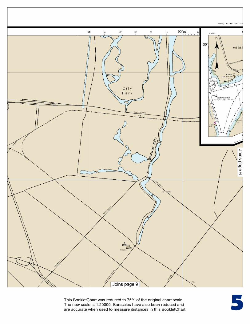
BookletChart™ New Orleans Harbor – Chalmette Slip to Southport NOAA Chart 11368
A reduced-scale NOAA nautical chart for small boaters When possible, use the full-size NOAA chart for navigation.
Included Area

2
Published by the National Oceanic and Atmospheric Administration
National Ocean Service Office of Coast Survey
www.NauticalCharts.NOAA.gov 888-990-NOAA
What are Nautical Charts?
Nautical charts are a fundamental tool of marine navigation. They show water depths, obstructions, buoys, other aids to navigation, and much more. The information is shown in a way that promotes safe and efficient navigation. Chart carriage is mandatory on the commercial ships that carry America’s commerce. They are also used on every Navy and Coast Guard ship, fishing and passenger vessels, and are widely carried by recreational boaters.
What is a BookletChart?
This BookletChart is made to help recreational boaters locate themselves on the water. It has been reduced in scale for convenience, but otherwise contains all the information of the full-scale nautical chart. The bar scales have also been reduced, and are accurate when used to measure distances in this BookletChart. See the Note at the bottom of page 5 for the reduction in scale applied to this chart.
Whenever possible, use the official, full scale NOAA nautical chart for navigation. Nautical chart sales agents are listed on the Internet at http://www.NauticalCharts.NOAA.gov.
This BookletChart does NOT fulfill chart carriage requirements for regulated commercial vessels under Titles 33 and 44 of the Code of Federal Regulations.
Notice to Mariners Correction Status
This BookletChart has been updated for chart corrections published in the U.S. Coast Guard Local Notice to Mariners, the National Geospatial Intelligence Agency Weekly Notice to Mariners, and, where applicable, the Canadian Coast Guard Notice to Mariners. Additional chart corrections have been made by NOAA in advance of their publication in a Notice to Mariners. The last Notices to Mariners applied to this chart are listed in the Note at the bottom of page 7. Coast Pilot excerpts are not being corrected.
For latest Coast Pilot excerpt visit the Office of Coast Survey website at http://www.nauticalcharts.noaa.gov/nsd/searchbychart.php?chart=11368
[Coast Pilot 5, Chapter 9 excerpts] Mississippi River empties into the N central part of the Gulf of Mexico through a number of mouths or passes which, taken together, form the delta of the river. The river and its tributaries form the largest network of navigable waters in the world. The two principal passes, South Pass and Southwest Pass, are about 1,600 nautical miles from New York, 500 nautical miles from Key West, 300 nautical miles E of Galveston, and 440 nautical miles E of
Corpus Christi. The river is the access to the Ports of New Orleans and Baton Rouge, and the numerous cities in the central part of the United States located in the Mississippi River Valley and along its tributaries, the
Ohio, Missouri, Red, Tennessee, and other rivers flowing into it. From the mouth, at the entrance to Southwest Pass, it is about 1,840 miles to Minneapolis, 1,960 miles to Pittsburgh, 1,680 miles to Knoxville, and 1,530 miles to Chicago via the Illinois Waterway. Algiers Alternate Route and Algiers Lock, on the S side of the river about 88.4 miles AHP, connect the Mississippi River with an extensive network of inland waterways W of New Orleans. The route is an alternate route of the Intracoastal Waterway leading W of New Orleans. used by ship service boats and the other by the refinery company Caution.–A submerged drainage line is reported crossing the Inner Harbor Navigation Canal just S of the Florida Avenue bridge; maximum permissible draft over the line is 30 feet. A total of eight bridges cross the canal between the Mississippi River and Lake Pontchartrain. The St. Claude Avenue highway bridge at the S end of the navigation lock has a bascule span with a clearance of zero feet. The North Claiborne Avenue (Seeber) highway bridge, about 0.2 mile N of the lock, has a vertical lift span with a clearance of 40 feet down and 156 feet up. About 1 mile N of the lock, the combination Florida Avenue and Southern Railway vertical lift bridge has a clearance of zero feet down and 156 feet up. An overhead power cable crossing close N of the bridge has a clearance of 166 feet. The combination Gentilly Road highway and Seaboard System Railroad (L&N) bridge, 2.8 miles N of the lock, has a bascule span with a clearance of zero feet. The U.S. Interstate Route 10 highway bridge close N of Gentilly Road bridge has a fixed span with a clearance of 120 feet for the middle 200 feet and 115 feet elsewhere. An overhead power cable crossing close N of this bridge has a clearance of 136 feet. Chef Menteur Highway (U.S. Route 90) bridge, 3 miles N of the lock, has a vertical lift span with clearances of 50 feet down and 120 feet up. The combination Seabrook Highway and Southern Railway Bridge across the N entrance of the canal, about 4.7 miles N of the lock, has a bascule span with a clearance of 1 foot. A highway bascule bridge with a clearance of 44 feet at the center crosses the canal close N of the Seabrook Highway and Southern Railroad Bridge. (See 117.1 through 117.59 and 117.459, chapter 2, for drawbridge regulations.) Bridgetenders of the following bridges monitor VHF-FM channel 16 and work on channel 13:
St. Claude Avenue, WG-401; Florida Avenue, WUG-409; Gentilly Road, KZV-719; U.S. Route 90, KRS-864; and Seabrook Highway, KZV-819.
Anchorages.–General, quarantine, and emergency anchorages are on the W side of the river at New Orleans. (See 110.1 and 110.195, chapter 2, for limits and regulations.) Vessels may also take anchorage as directed by the Coast Guard District Commander. Dangers.–Submerged revetments are located on the river bottom on both sides in the port area; anchorage is prohibited in these areas. (See 207.200, chapter 2, and chart 11368 for revetment areas and regulations.)
U.S. Coast Guard Rescue Coordination Center 24 hour Regional Contact for Emergencies
RCC New Orleans Commander
8th CG District (504) 589-6225 New Orleans, LA

G
NOAA’s navigation managers serve as ambassadors to the maritime community. They help identify navigational challenges facing professional and recreational mariners, and provide NOAA resources and information for safe navigation. For additional information, please visit nauticalcharts.noaa.gov/service/navmanagers
To make suggestions or ask questions online, go to nauticalcharts.noaa.gov/inquiry. To report a chart discrepancy, please use ocsdata.ncd.noaa.gov/idrs/discrepancy.aspx.
Lateral System As Seen Entering From Seaward on navigable waters except Western Rivers
PORT SIDE
ODD NUMBERED AIDS
GREEN LIGHT ONLY
FLASHING (2)
PREFERRED CHANNEL
NO NUMBERS – MAY BE LETTERED
PREFERRED CHANNEL TO
STARBOARD
TOPMOST BAND GREEN
PREFERRED CHANNEL
NO NUMBERS – MAY BE LETTERED
PREFERRED CHANNEL
TO PORT
TOPMOST BAND RED
STARBOARD SIDE
EVEN NUMBERED AIDS
RED LIGHT ONLY
FLASHING (2)
FLASHING FLASHING
OCCULTING GREEN LIGHT ONLY RED LIGHT ONLY OCCULTING QUICK FLASHING QUICK FLASHING
ISO COMPOSITE GROUP FLASHING (2+1) COMPOSITE GROUP FLASHING (2+1) ISO
"1"
Fl G 6s
G "9"
Fl G 4s
GR "A"
Fl (2+1) G 6s
RG "B"
Fl (2+1) R 6s
"2"
Fl R 6s
8
R "8"
Fl R 4s
LIGHT
G
C "1"
LIGHTED BUOY
G
"5"
GR
"U"
GR
C "S"
RG
N "C"
RG
"G"
LIGHT
6
R
N "6"
LIGHTED BUOY
R
"2
"
CAN DAYBEACON
CAN NUN NUN
DAYBEACON
For more information on aids to navigation, including those on Western Rivers, please consult the latest USCG Light List for your area.
These volumes are available online at http://www.navcen.uscg.gov
Navigation Managers Area of Responsibility
Northeast
Lt. Meghan McGovern
Northwest and
Pacific Islands
Crescent Moegling
Great Lakes Region
Tom Loeper
Chesapeake and
Delaware Bay
Steve Soherr
California
Jeff Ferguson
[email protected] Mid-Atlantic
Lt. Ryan Wartick
Alaska
Lt. Timothy M. Smith
Western Gulf Coast
Alan Bunn
Central Gulf Coast
Tim Osborn
[email protected] South Florida
Puerto Rico
U.S. Virgin Islands
Michael Henderson
Southeast
Kyle Ward
2
2 C U 5
1


VHF Marine Radio channels for use on the waterways:Channel 6 – Inter-ship safety communications.Channel 9 – Communications between boats and ship-to-coast.Channel 13 – Navigation purposes at bridges, locks, and harbors.Channel 16 – Emergency, distress and safety calls to Coast Guard and others, and to initiate calls to other
vessels. Contact the other vessel, agree to another channel, and then switch.Channel 22A – Calls between the Coast Guard and the public. Severe weather warnings, hazards to navigation and safety warnings are broadcast here.Channels 68, 69, 71, 72 and 78A – Recreational boat channels.
Getting and Giving Help — Signal other boaters using visual distress signals (flares, orange flag, lights, arm signals); whistles; horns; and on your VHF radio. You are required by law to help boaters in trouble. Respond to distress signals, but do not endanger yourself.
EMERGENCY INFORMATION
Distress Call Procedures
• Make sure radio is on.• Select Channel 16.• Press/Hold the transmit button.• Clearly say: “MAYDAY, MAYDAY, MAYDAY.”• Also give: Vessel Name and/or Description;Position and/or Location; Nature of Emergency; Number of People on Board.• Release transmit button.• Wait for 10 seconds — If no responseRepeat MAYDAY call.
HAVE ALL PERSONS PUT ON LIFE JACKETS!
This Booklet chart has been designed for duplex printing (printed on front and back of one sheet). If a duplex option is not available on your printer, you may print each sheet and arrange them back-to-back to allow for the proper layout when viewing.
QR
Quick ReferencesNautical chart related products and information - http://www.nauticalcharts.noaa.gov
Interactive chart catalog - http://www.charts.noaa.gov/InteractiveCatalog/nrnc.shtmlReport a chart discrepancy - http://ocsdata.ncd.noaa.gov/idrs/discrepancy.aspx
Chart and chart related inquiries and comments - http://ocsdata.ncd.noaa.gov/idrs/inquiry.aspx?frompage=ContactUs
Chart updates (LNM and NM corrections) - http://www.nauticalcharts.noaa.gov/mcd/updates/LNM_NM.html
Coast Pilot online - http://www.nauticalcharts.noaa.gov/nsd/cpdownload.htm
Tides and Currents - http://tidesandcurrents.noaa.gov
Marine Forecasts - http://www.nws.noaa.gov/om/marine/home.htm
National Data Buoy Center - http://www.ndbc.noaa.gov/
NowCoast web portal for coastal conditions - http://www.nowcoast.noaa.gov/
National Weather Service - http://www.weather.gov/
National Hurrican Center - http://www.nhc.noaa.gov/
Pacific Tsunami Warning Center - http://ptwc.weather.gov/
Contact Us - http://www.nauticalcharts.noaa.gov/staff/contact.htm
NOAA’s Office of Coast Survey The Nation’s Chartmaker
For the latest news from Coast Survey, follow @NOAAcharts
NOAA Weather Radio All Hazards (NWR) is a nationwide network of radio stations broadcasting continuous weather information directly from the nearest National Weather Service office. NWR broadcasts official Weather Service warnings, watches, forecasts and other hazard information 24 hours a day, 7 days a week. http://www.nws.noaa.gov/nwr/