navigation training section 10 currents and waves
TRANSCRIPT

NAVIGATION TRAINING
Section 10
Currents and Waves

Table of Contents
• Section 1 Types of Navigation• Section 2 Terrestial Coordinates• Section 3 Charts• Section 4 Compass• Section 5 Nautical Publications• Section 6 Navigational Aids

• Section 7 Buoyage• Section 8 Position Lines and Fixes• Section 9 Tides• Section 10 Currents• Section 11 Weather
Table of Contents

Ocean Currents

• Giant patterns of rotation “gyres” in each of the major ocean basins.
• Caused by natural effects: salinity, temperature, the Coriolis Effect, etc.
• Described in the Sailing Directions• Examples are the Gulf Stream, the Kuro Shio and the
Owa Shio
Ocean Currents

Ocean Currents

Ocean Currents

Tidal Currents

Tidal Currents

• Caused by the rise and fall of tides in coastal waters.• Speed and timing is dependent upon whether it is
spring or neap tides, and the shape of the coast and the sea floor.
Tidal Currents

Tidal Currents
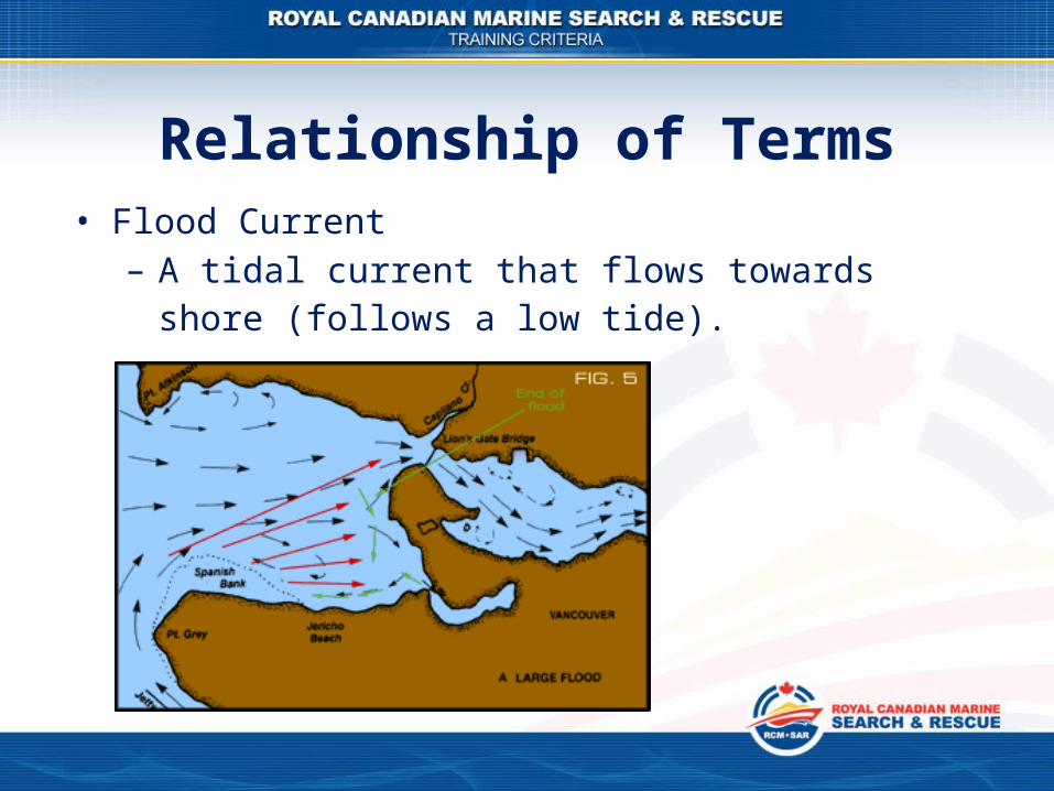
• Flood Current– A tidal current that flows towards shore (follows a
low tide).
Relationship of Terms
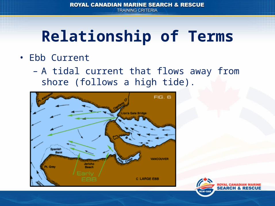
• Ebb Current– A tidal current that flows away from shore (follows
a high tide).
Relationship of Terms

• Slack Water– A period where there is no horizontal movement of
water. Corresponds to the “stand” of the tide.
Relationship of Terms

• Set: the direction of the current pushing; normally expressed in oT.
• Drift: the speed of the water, normally expressed in knots.
• Set and drift combined describe the current.
Set and Drift

Waves

• If the wind is blowing from the water onto the land they are onshore winds. This causes waves to break a little earlier, thus pushing them over.
Waves

• If the wind blows from the land out to sea, they are offshore winds. They blow against the incoming swell and sustain the waves from breaking while they jack up a little higher and steeper before they break.
Waves

• Water temperatures off Vancouver Island vary between the high 40s F in the winter and the low 70's in the height of the summer, whilst temperatures in the inland waters can be a little cooler, some only getting up to only 55°F.
Water Temperature

Swell

• Most of the swells on the British Columbia coast are generated by storms that start in the Aleutians and spin down the coast of North America all fall and winter.
• They get dragged onto the continent by the jet stream anywhere from Alaska to California.
Swell
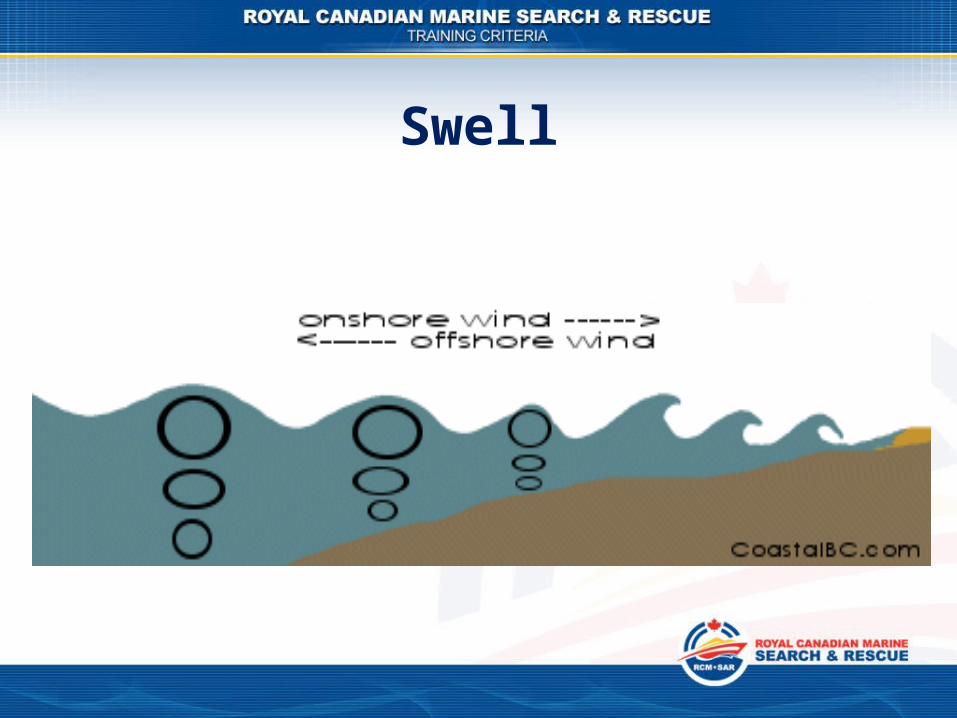
Swell

• This forces the water up and sort of trips the wave and it breaks, the top of the wave falls down in front of itself.
• Here in BC the storms fire swell at us over a shorter distance. As a result, because our beaches slope gradually, our surfing waves are comparatively scaled down in size and power.
Swell
Rip Currents

• A Rip Current is a current of water flowing out to sea.
• Rips form when waves push large volumes of water onto the shore and the water returns seaward thorough channels between sand bars, behind islands and around rocky headlands.
Rip Currents

• On a sea coast, they can be identified by a line of discoloured water, foam and debris floating seaward or an area on choppy or confused water in the swell.
Rip Currents

Rip Currents

• In all outings on the water, observe local currents and waves, what direction they flow at what times, where the areas.
• This will assist in:
1. Plotting the best course in certain weathers.
2. Knowing where floating objects might end up going ashore under the effects of the current.
Local Knowledge