national report of hydrographic service of the russian ... · the hydrographic service of the...
TRANSCRIPT

NATIONAL REPORT
OF HYDROGRAPHIC SERVICE
OF THE RUSSIAN FEDERATION
NAVY
to the 16-th BALTIC SEA
HYDROGRAPHIC CONFERENCE
St Petersburg
2011

THE HYDROGRAPHIC SERVICE OF THE RUSSIAN FEDERATION NAVY
The Hydrographic Service is one of the important national bodies responsible for the
safety of navigation.
Although the Hydrographic Service forms a part of the Navy, it also meets the
requirement of merchant and fishing fleets and vessels of other ministries and agencies.
The Hydrographic Service is under the direction of the Department of Navigation and
Oceanography of the Russian Federation Ministry of Defense (DNO of the RF MD), which
is traditionally located in St Petersburg.
The principle functions of the DNO of the RF MD are:
— to carry out oceanographic, hydrographic and geophysical surveys in the World
Ocean
— to compile and produce Nautical Charts, Publications and Guides to Navigation
— to develop and produce Guides, Instructions, Regulations and Methodical Directions
on carrying out the World Ocean surveys and processing of their results
— to equip the coast of the Russian Federation by aids to navigation
— to organize mariner notification about changes in navigational conditions and
regime
— to develop up navigational instruments and complexes.
To carry out oceanographic surveys some special units have been created as a part of
the Hydrographic Service of the Navy, such as expeditions and parties. The surveys are
being run by oceanographic and hydrographic ships of up to 9000 tons displacement
equipped with modern navigational and oceanographic facilities.

The results of oceanographic, hydrographic and geophysical surveys are submitted to the
Navy Charts Division for compilation and updating of Nautical Charts and Guides to
Navigation.
The Hydrographic Service of the Navy provides the operation of over 5000 aids to
navigation.
The DNO of the RF MD guides the development of
navigational and oceanographic facilities and fitting out with
them the naval ships and vessels of other departments,
arranges their operation and maintenance as well.
In special aspect the DNO of the RF MD has in its
subordination the Hydrographic services of the Fleets. It has
in direct subordination:
Lighthouse service of the RF, Navy Charts Division, Navy
Centre for Automatic Acquisition and Processing of Operational
Hydro meteorological Information, Long-Range Radio-
navigation Centre and other units.
The DNO of the RF MD participates in realization of a series of regional projects of IOC
UNESCO on charting of oceans. It is due to participation in these projects the DNO of the RF
MD obtains new bathymetric data for the World Ocean and uses them for compilation of
nautical charts and also takes into account advanced technologies and methods of
charting used by leading countries in its work. Within the frameworks of Baltic Sea
Hydrographic Commission (BSHC) the DNO of the RF MD actively participated in elaboration of
agreed plan of systematically recurrent surveys of main navigable routes and ports of the Baltic
Sea and the Gulf of Finland. Realization of this plan is performed within HELCOM project —
Commission for the Protection of the Baltic Sea Area Environment.

SURVEY COVERAGE OF THE BALTIC SEA IN 2009-2011
Area of Activity Kind of Activity Scale Year of Activity
Gulf of Finland
The area of Bol'shoy Kronshtadtskiy Roads Sounding 1:5000 2009
Bol’shoy Koabel’niy Fairway from Ostrov Rodsher to Ostrov Gogland Luzhskiy-Zapadniy Fairway
Sounding, area survey 1:10000 2009
Severniy Kronshtadtskiy Fairway (from Sankt-Peterburgskiy Maritime Canal to C-2 and C-2 to Zapadniy Kronshtadtskiy Fairway)
Sounding, area survey 1:2000 2009
Water area of Marine Passenger Terminal on Vasil’evskiy Ostrov
Sounding, area survey 1:2000 2009
Water area of Marine Passenger Terminal on Vasil’evskiy Ostrov
Sounding, area survey 1:2000 2009
Gorskaya Base Canal, Severniy Kronshtadtskiy Fairway, anchorages Nos. 4Б and 4B
Sounding, area survey 1:2000 2008-2009
Proliv Syuvasalmi Water area of planned load transshipment near Mys Putevoy Section of recommended track in the area of Klyuchevoye
Sounding with bottom contour instrument appreciation by
sidescan-sonar
1:500 1:1000 1:5000
2009
Southern approach channel to Port of Ust’-Luga and water area “Sever-1”
Sounding 1:2000 2009
Ust’-Luga maritime commercial port. Berths 3 and 4 Sounding 1:5000 2009
E Part of Gulf of Finland from Mys Kolganpya to Stirsudden Lighthouse
Sounding 1:25000 2009
Bukhta Dal’nyaya Water Area and Berth Approaches
Area survey 1:2000 2010
Area of Strel’na “Boat Naval Station for the Protection Directorate of the Federal Protective Service in the NW Federal District of Russia. Maritime Component”
Topographic survey 1:5000 2010
Luzhskaya Guba Operational Water Area, Approach Channels Spoil Ground No. 315 Estuarine Part of Reka Luga
Area survey
1:2000
1:5000 1:2000
2010
Bukhta Dal’nyaya (Poluostrov Konyok) Berth Water Area and its Approach Channel
Hydrographic sweeping 1:1000 2010
Port Water Area (berth Nos. 1 to 4) and Approach Channel in Vysotsk Maritime Port
Area survey 1:1000 2010
Water Areas of Vnutrenniy Vysotskiy Roads, Vyborgskiy Fairway (No. 6) and Deep Water Route (DW-2)
Sounding 1:2000 2010
Ust’-Luga Maritime Commercial Port Water Areas of Sever-2 and Southern Sections
Sounding 1:2000 2010
Crossing Area of Petrovskiy Canal and Sankt-Peterburgskiy Maritime Canal
Area Survey and 1:1000 2010
Material Offloading Facility for the construction of football stadium on Krestovskiy Ostrov
Topographic Survey 1:1000 2009

In 2009-2011 Russian HO units were equipped with modern multichannel echo sounders,
portable automatic mimeographs, high-precision sound velocity измеритель meters in
water.
Distribution-Transshipment-Oil-Product Complex
SURVEY COVERAGE ON STANDARD S-55
Baltic Sea
Water Area of Russia - 23 460 sq.km. Depth < 200 m - 23 460 sq.km.
Gulf of Finland - 11 990 sq.km.
Southern Part of the Baltic Sea - 11 470 sq.km.
Depth Range Adequate Survey, % Repeated Survey is
required, % Systematic Survey
is absent, %
Depths < 200 m
Depths > 200 m 99.7 0.3 —
Southern Part of Baltic Sea
Kaliningradskiy Maritime Canal Picket Section Nos. 191 to 206 (OOO “Lukoil-Kaliningradmorneft’”)
Area survey and sounding
1:2000 2010


ENCs OF THE BALTIC SEA
The DNO of the RF issues ENCs based on S-57 standard. 32 ENCs for the area of the
Baltic Sea have been issued and their distribution is in progress. All these ENCs passed
testing in Regional ENC Centers (IC-ENC and Primar Stavanger) and they are updated by
mean of issuance of updating sets based on Notices to Mariners. It is possible to buy ENC
set of the DNO of the RF production by two means:
— directly through Regional Centre Primar Stavanger (site: www.primar.org)
— through official distributor of ENCs of the DNO of the RF production — Transas Co.
At present work on creation of ENC set for transfer route Port Sankt-Peterburg-Port
Kaliningrad is in progress.
Number of cell Name (area) Scale 1:
Southern Part of the Baltic Sea
RU4NDJT0 45000
RU4NDJS8 Southern Part Approaches to Baltiysk and Kaliningrad 45000
RU4NDJS9 Southern Part Approaches to Kaliningradskiy Maritime Canal 45000
RU4NEJS0 Mys Gvardeyskiy to Mys Taran 45000
RU4NEK00 South Part Rybachiy Lighthouse to Zelenogradsk 45000
RU4NEK10 South Part of Kurshskiy Gulf 45000
RU5NDJT0 Southern Part Krasnoflotskaya Harbour 4000
RU5NDJT1 South Part Baltiysk Port Entrance to Kaliningradskiy Maritime Canal 4000
RU5NDJT2 Southern Part Kaliningradskiy Maritime Canal Distant mark 24 to Komsomol'skiy Bend
4000
RU5NDK00 Ushakovo Harbour 4000
RU5NDK01 South Part Kaliningradskiy Maritime Canal Izhevskiy Bend 4000
RU5NDK02 South Part Kaliningradskiy Maritime Canal Komsomol'skiy Bend 4000
RU5NEJT0 Kaliningradskiy Gulf North Part of Primorskaya Bay 8000
RU5NEK01 South Part Kaliningradskiy Maritime Canal Vzmor'ye Harbour to Pregolya River Mouth
4000
RU5NEK10 South Part Kaliningradskiy Maritime Canal Mouth of Pregolya River to Port Kaliningrad
4000
Eastern Part of the Baltic Sea
RU4O1KP0 Approaches to Vysotsk and Vyborg 22000
RU4O1KP9 N Part of B'yorkyozund Strait and Klyuchevskaya Bay 22000
RU4O1KN0 Area of Zelenogorsk - Sestroretsk - Fort Krasnoarmeyskiy 22000
RU4O1KO9 Ruonninmatala Bank to Baltiyets Bay 22000
RU4NTKO8 Seskar Island to Stirsudden Point 22000
RU5NTKL0 Bol'shoy Tyuters Island Harbour 8000
RU5NTKP1 Luzhskaya Guba. Old Harbour Ruch'i 4000
RU5NTKP0 Luzhskaya Inlet. Novaya Gavan' Ruch'i 8000
RU5NTKT0 Bol`shoy Kronshtadtskiy Roads 4000
RU5NTKT1 Malyy Kronshtadtskiy Roads 4000
RU5NTKT2 Lomonosovskaya Harbour to Bol`shoy Kronshtadtskiy Roads 12000
RU5NTKT7 Nevskaya Inlet. Strel'na Harbour and Approaches 12000
RU5NTL00 Nevskaya Inlet. Northern Part of Neva River Delta 12000
RU5NTL01 Nevskaya Inlet. Bol'shoy Port Sankt-Peterburg 8000
RU5O0KK0 Gogland Island. Suurkyulan-Lakhti Bay 8000
RU5O0KK1 Gogland Island. Limonnikov Bay 8000
RU5O0KL0 Gogland Island. Kiyskinkyulya Bay 8000
RU5O0KN0 Moshchnyy Island. Rybach'ya Bay 8000
RU5O0KP0 B'yorkezund Gat. Oil Terminal of Port Primorsk and Approaches 8000

RU5O2KP0 Approach to Saymenskiy Canal Dubovyy Light-Beacon to Island Lavola 8000
RU5O2KQ0 Approach to Saymenskiy Canal Zashchitnaya Bay to Brusnichnoye Lock 8000
RU6NTKT0 Lomonosovskaya Harbour 2000
RU6O0KQ0 B'yorkezund Gat. Oil Terminal of Port Primorsk. Berths N 8,9,10 4000
RU6O0KQ1 B'yorkezund Gat. Oil Terminal of Port Primorsk Berths N 1,2,3,4,5,6,7 4000
INTERNATIONAL CHARTS
The DNO of the RF MD started to publish a series of International Charts in accordance
with decision of 4th BSHC Conference (Rostock, 1990) and in accordance with the list of
medium and large scale International Charts which included 23 numbers of nautical charts.
In the course of realization of this plan for creation of International Charts the DNO of
the RF ensured charts for the zone of its responsibility on scales 1:5000 to 1:500 000,
among them Sankt-Peterburg Maritime Port (sc 1:10 000), Approach Channel to Saimaa
Canal (sc 1:5000), Approaches to ports Vyborg and Vysotsk (sc 1:25 000), Vnutrenniy
Vysotskiy Roads (sc 1:20 000), Deep-Water Fairway from Sankt-Peterburg to Krasnaya
Gorka (sc 1:25 000), and also the whole Kaliningradskiy Maritime Channel and Approaches
(sc 1:5000 and 1:50 000).
In the process of publication International numbers of charts were updated and
corresponding update was forwarded to International Charts Catalogue. By present time the
DNO of the RF MD completely fulfilled its assumed obligations to publish International
Charts of the Gulf of Finland and the SE Part of the Baltic Sea. In last years republication of
these charts was only in progress.
In the period from the 15-th BSHC Conference (September 2010) to the 16-th
Conference (September 2011) the DNO of the RF MD reissued 10 numbers of International
Charts for its zone of responsibility. Following is the full list of International Charts of the
Russia zone of responsibility as of August 2012.

LIST
OF INTERNATIONAL CHARTS ISSUED WITHIN THE FRAMEWORK OF THE BALTIC SEA
HYDROGRAPHIC COMMISSION
No INT
number
Produ-cer
number Title Scale
Latest New
edition
Date of print
Estimated date of new edition
Note
1 2 3 4 5 6 7 8 9
1 1023 21001 Baltic Sea Gulf of Finland
500 000 2007 2007
2 1213 22060 Baltic Sea Western part of Gulf of Finland 250 000
2011 2011
3 1214
22061
Baltic Sea Eastern part of Gulf of Finland 250 000 2010 2010
4 1215 22062 Baltic Sea Gulf of Riga 250 000 2009 2010
5 1216 22058 Baltic Sea. Middle Part. Irbenskiy strait to Gotland
250 000 2010 2010
6 1217 22057 Baltic Sea. Middle Part. Pavilosta to Klapeda
250 000 2008 2008
7 1255 25006 Baltic Sea Gulf of Finland Ostrov Rondo to Ostrov Sommers
50 000 2007 2007
8 1256 1132 Baltic Sea Gulf of Finland Bukhta Dalnyaya
10 000 1994 1994
9 1257 28007
Baltic Sea Vyborgskiy zaliv Approaches to Vysotsk and Vyborg
25 000 2008 2008
10 1258 28008 Baltic Sea Gulf of Finland. Povorotnyy Lighthouse to ostrov Malyy Vysotskiy
10 000
2008 2008 Insert A Approach channel to Lukoil-II Oil Terminal
5 000
11 1259 28010 Baltic Sea Vyborgskiy Zaliv Approaches to Saimaa Canal Dubovyy Light - Beacon to Ostrov Lavola
12 500 2008 2008
12 1260 28011 Baltic Sea Vyborgskiy Zaliv Approaches to Saimaa Canal Buhta Zashchitnaya to Brusnichnoye Lock
5 000 2008 2008
13 1261 25004 Baltic Sea Gulf of Finland Kronshtadt to Krasnaya Gorka
25 000 2009 2009 IV q - 2011
14 1262 25002 Baltic Sea Gulf of Finland Sankt-Peterburg to Kronshtadt
25 000 2006 2006 IV q - 2011
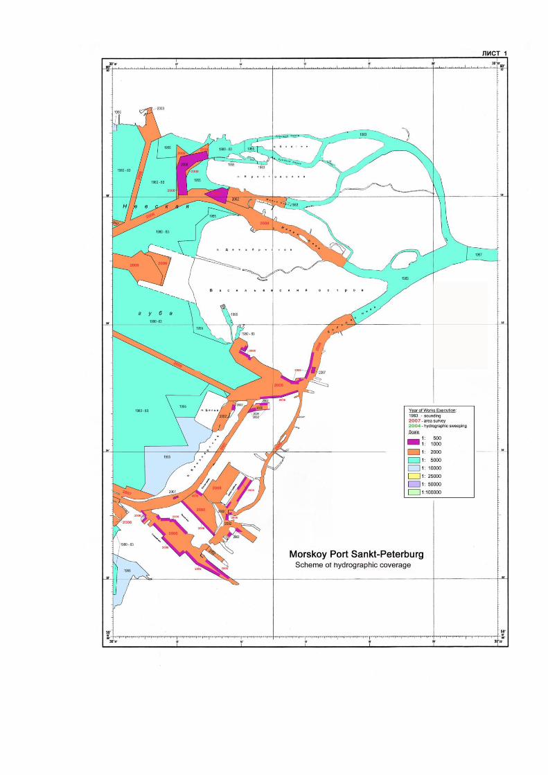
15 1263 27047 Sankt-Peterburg Seaport 10 000 2009 2010
16 1280 25052 South part of Baltic Sea Approaches to Kaliningradskiy Maritime channel
50 000 2007 2007
17 1282 27001 Southern part of Baltic Sea Port Baltiysk Entrance to Kaliningradskiy Maritime channel
5 000 2009 2009
18 1283 27002 Southern part of Baltic Sea Kaliningradskiy Maritime channel. Picket 24 to Komsomolskiy Turn
5 000 2009 2009
19 1284 27003 Southern part of Baltic Sea Kaliningradskiy Maritime channel Komsomolskiy Turn
5 000 2006 2007
20 1285 27004 Southern part of Baltic Sea Kaliningradskiy Maritime channel Turn Izhevskiy
5 000 2007 2007 IV q - 2011
21 1286 27005 South part of Baltic Sea Kaliningradskiy Maritime channel Gavan' Vzmorye to Mouth of Reka Pregolya
5 000 2006 2006
22 1287 27006 South part of Baltic Sea Kaliningradskiy Maritime channel Mouth of Reka Pregolya to Port Kaliningrad
5 000 2007 2008

NATIONAL PAPER CHARTS
For waters under jurisdiction of Russia in the Baltic Sea - the Gulf of Finland,
Vyborgskiy Zaliv and Kaliningradskiy Zaliv - the DNO of the RF MD has a collection of
National paper charts, which includes 76 units.
With account of scales it is shown by the following way:
Gulf of Finland and Vyborgskiy Zaliv
Kaliningradskiy Zaliv
1:250 000 1
1:200 000 2
1:100 000 5 4
1:75 000-1:50 0000 9 6
1:25 000 and larger 35 12
In recent years the DNO of the RF MD has published 2 new charts:
27050. Gulf of Finland. Gavan' Strel'na and Approaches, scale 1:12 500, 1st Edition,
2009. Insert: Gavan' Strel'na, scale 1:3000.
92600. Reference-information chart. Eastern Part of the Gulf of Finland, scale 1:200
000, 1st Edition, 11 November 2009.
As new materials become available the whole collection is reissued.


GUIDES AND PUBLICATIONS TO NAVIGATE IN THE BALTIC SEA
Title, number of guide or publication Year of edition
1 2
The Baltic Sea Pilot. Common review (№ 1200) 1986
The Baltic Sea Pilot. Part I. (№ 1202) 2007
The Baltic Sea Pilot. Part II. (№ 1203) 1993
The Baltic Sea Pilot. Part III. (№ 1204.1) Printing 1 1995
The Baltic Sea Pilot. Part III. (№ 1204.2) Printing 2 1995
The Baltic Sea Pilot. Part IV. (№ 1205) 2002
The Baltic Sea Pilot. Part V. (№ 1207) Printing 1 1995
The Baltic Sea Pilot. Part V. (№ 1208) Printing 2 1993
The Skagerrak Pilot.(№ 1209) Printing 1 1997
The Skagerrak Pilot. (№ 1210) Printing 2 1997
The Onezhskoye Ozero Pilot (№ 1001) 1999
The Ladozhskoye Ozero Pilot (№ 1002)
1999
List of Lights and Beacons of the Baltic Sea Coasts of Russia, Estonia, Latvia and Lithuania (№ 2201)
2001
List of Lights of the Baltic Sea. Part I. The North Coast of the Gulf of Finland and the East Coast of the Gulf of Bothnia (№ 2202)
2000
List of Lights of the Baltic Sea. Part II. The East Coast of Scandinavian Peninsula (№ 2203)
2000
List of Lights of the Baltic Sea. Part III. The South Coast of the Sea (№ 2204) 2001
List of Lights of the South Coast of Scandinavian Peninsula, the Sound, Great Belt, Little Belt, Kattegat and Internal Water Route of Sweden (№ 2205)
2003
List of Lights of Skagerrak (№ 2206) 2006
List of Radio Signals of Arctic and Atlantic Oceans (№ 3001) 20. List of Radio Signals of the European Part of Russia (№ 3003)
2005
Transmission Schedules of navigational warnings and hydrometeorological messages by radiostations of Arctic and Atlantic Oceans (№ 3011)
2006
List of Lights and Beacons of Onezhskoye Ozero (№ 2001) 23. List of Lights and Beacons of Ladozhskoye Ozero (№ 2002)
2005
Navigational Regime in the Baltic Sea and Ladozhskoye Ozero (Summary Description) (№ 4241)
2007

REFERENCE ON
THE OPERATIVE NAVIGATIONAL INFORMATION SYSTEM
AT THE BALTIC SEA
The Baltic Sea water area territorially belongs to the NAVAREA 1 of the World-Wide
Navigational Warning Service (WWNWS) — the coordinator is the United Kingdom — and it
has been singled out as a separate subarea. The subarea coordinator's duties have been
entrusted with Sweden. National coordinators within the WWNWS in the subarea are:
Sweden, Finland, Russian Federation, Estonia, Latvia, Lithuania, Poland, Germany and
Denmark.
The Russian Federation, performing its functions as the WWNWS national coordinator,
announces the coastal warnings (PRIPs) for PRIP Kaliningrad region — in the SE part of
the Baltic Sea — from the boundary with Poland to the boundary with Lithuania, and PRIP
Peter-burg region — in the Gulf of Finland — from the boundary with Estonia to the
boundary with Finland.
In the interest of provision of the
Russian Navy ships and vessels and
the civil agency vessels with the
navigational information at the Baltic
Sea traditional structure of the
national system of navigational
warnings has been retained. The key
link in the chain of navigational
information announcement is the
Information Collection and Processing
Unit (ICPU) of BSF HS. Navigational
information from the NAVAREA 1
area coordinator, national
coordinators, reports from mariners,
on the basic of which navigational
warnings NAVIP, NAVAREA in
Russian are compiled, are received in
the ICPU. According to the data of
domestic sources PRIPs for the
Russian Federation coastal waters

are compiled.
These warnings are sent to the BSF communication centre and radiostation Kaliningrad
of the RF Federal Agency of Fisheries to broadcast them in Russian in the interest of
provision of the Russian Navy ships and vessels and the civil agency vessels with the
navigational information at the Baltic Sea.
At the Baltic Sea four radiostations Bjuröklubb, Gislövshammar, Grimeton (Sweden)
and Tallinn (Estonia) broadcast coastal warnings (PRIPs) within the NAVTEX service. They
provide complete coverage of the water area by zones of positive reception. The reception
onboard the vessels is carried out in the mode of direct printing in English by special re-
ceivers.
PARTICIPATION OF THE DNO WITHIN HELCOM PROJECT
All hydrographic services of the Baltic Sea, among them the DNO of the RF MD, actively
participated in elaboration of agreed plan of systematically recurrent surveys of main
navigable routes and ports of the Baltic Sea and the Gulf of Finland to ensure that safety of
navigation was not exposed to risk owing to inadequate initial information. Realization of this
plan is performed within HELCOM project — Commission for the Protection of the Baltic Sea
Area Environment.
Waters of the Baltic Sea under jurisdiction of Russia include six main ports: Sankt-
Peterburg, Vyborg, Primorsk, Vysotsk, Ust'-Luga and Kaliningrad.
State of coverage by hydrographic survey of water areas of these ports, recommended
tracks and approach channels to them was thoroughly analyzed by the Russian
Hydrographic Office. Analysis showed that hydrographic survey basically met modern
requirements. Nevertheless, three stretches (recommended track from Port Vysotsk to Port
Vyborg, Kaliningradskiy maritime channel, approaches to Port Ust'-Luga) were revealed
which required the repeated survey.
The DNO of the RF took decision to start works at all these stretches and at present all
surveys are performed in recommended track from Port Vysotsk to Port Vyborg and
Kaliningradskiy maritime channel. In approaches to Port Ust'-Luga works are not completely
finished.
Due to the fact that there are no NAVTEX stations at the Baltic Sea in Russia to transmit
PRIP texts in this format, the announced warnings of the ICPU of the BSF HS are transmitted
by means of electronic mail to the Navy Charts Division Bureau of Information Collection and
Processing (BICP). From here, after analysis, they are transmitted to Sweden and there
through subarea coordinator to the service of NAVTEX transmissions coordination for the
Baltic region (UFS — Baltico) where they are forwarded for transmission to the relevant

station. PRIP Kaliningrad warnings are broadcast within NAVTEX service by the Grimeton
radio station (Sweden), PRIP Peterburg — by the Tallinn radio station. Every week the
coordinator of the Baltic Sea subarea distributes to the address of national coordinators the
bulletins of the PRIPs broadcast for the Baltic Sea.
Besides, in Notice to Mariners Department of the Navy Charts Division the information of
national coordinators taken from electronic pages of corresponding hydrographic Websites is
analyzed with a view to update navigational information operatively. At present national
coordinators of all nations but Russia have hydrographic Websites of their own. These sites
were paid particular attention by IHO commission on distribution of radio navigational
warnings for last years. For this reason, although the existing system of supply of the
emergency navigational information at the Baltic Sea meets the requirements of the
WWNWS guiding documents and ensures timely notification of the Navy ships and vessels
and the civil agency vessels about the changes of the navigational conditions and regime at
the Black Sea it should be developed additionally and it should be done by Russian side,
namely.
In particular, it refers to such points as development and implementation of national
hydrographic Website and long ago planned building of NAVTEX station in St Petersburg.
PARTICIPATION OF THE DNO OF THE RF MD IN IOC REGIONAL PROJECTS
ON CHARTING OF THE WORLD OCEAN
The DNO of the RF MD attaches much importance to Intergovernmental Oceanographic
Commission (IOC) and International Hydrographic Organization (IHO) activities in regional
charting of the World Ocean. It is confirmed by the fact that our service contributed to the project
"General bathymetric chart of the oceans" and regional projects:
— International Bathymetric Chart of the Arctic Ocean (IBCAO)
— International Bathymetric Chart of the Mediterranian (IBCM)
— International Bathymetric Chart of the Western Pacific Ocean (IBCWPO)
— International Bathymetric Chart of the Western Indian Ocean (IBCWIO)
— International Bathymetric Chart of the Southern Ocean (IBCSO)

Telephone: +7 812 323 75 48
fax: +7 812 323 70 29
E-Mail: [email protected]
8, 11 Liniya, B-34
St.Petersburg, 199034