mining and infrastructure - gbgmaps
TRANSCRIPT
Mining and Infrastructure
GBGMAPS Mining and Infrastructure
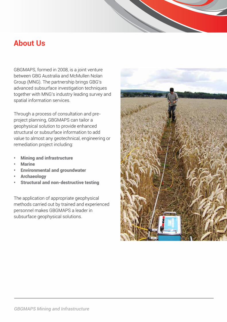
GBGMAPS, formed in 2008, is a joint venture between GBG Australia and McMullen Nolan Group (MNG). The partnership brings GBG’s advanced subsurface investigation techniques together with MNG’s industry leading survey and spatial information services.
Through a process of consultation and pre-project planning, GBGMAPS can tailor a geophysical solution to provide enhanced structural or subsurface information to add value to almost any geotechnical, engineering or remediation project including:
• Miningandinfrastructure• Marine• Environmentalandgroundwater• Archaeology• Structuralandnon-destructivetesting
The application of appropriate geophysical methods carried out by trained and experienced personnel makes GBGMAPS a leader in subsurface geophysical solutions.
About Us
Page 3
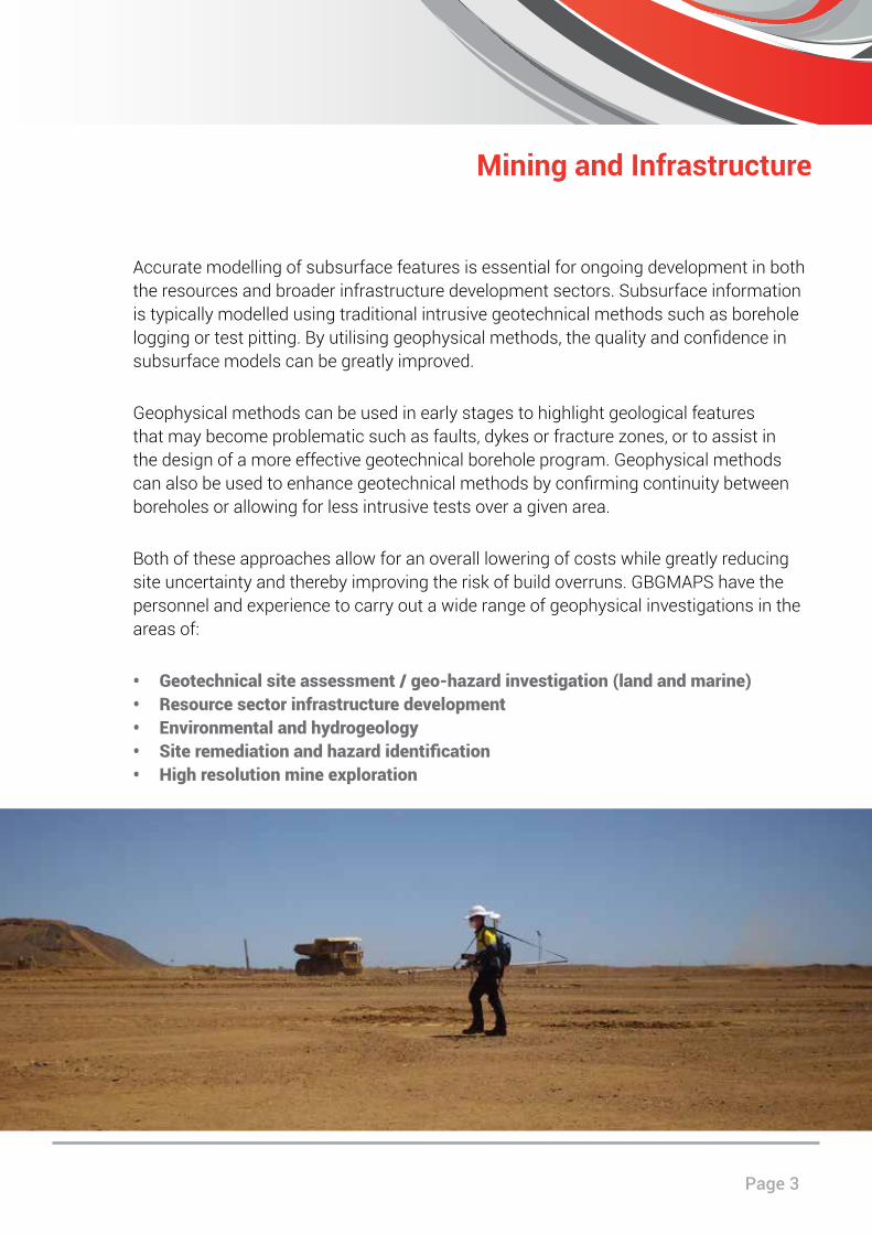
Accurate modelling of subsurface features is essential for ongoing development in both the resources and broader infrastructure development sectors. Subsurface information is typically modelled using traditional intrusive geotechnical methods such as borehole logging or test pitting. By utilising geophysical methods, the quality and confidence in subsurface models can be greatly improved.
Geophysical methods can be used in early stages to highlight geological features that may become problematic such as faults, dykes or fracture zones, or to assist in the design of a more effective geotechnical borehole program. Geophysical methods can also be used to enhance geotechnical methods by confirming continuity between boreholes or allowing for less intrusive tests over a given area.
Both of these approaches allow for an overall lowering of costs while greatly reducing site uncertainty and thereby improving the risk of build overruns. GBGMAPS have the personnel and experience to carry out a wide range of geophysical investigations in the areas of:
• Geotechnicalsiteassessment/geo-hazardinvestigation(landandmarine)• Resourcesectorinfrastructuredevelopment• Environmentalandhydrogeology• Siteremediationandhazardidentification• Highresolutionmineexploration
Mining and Infrastructure
GBGMAPS Mining and Infrastructure
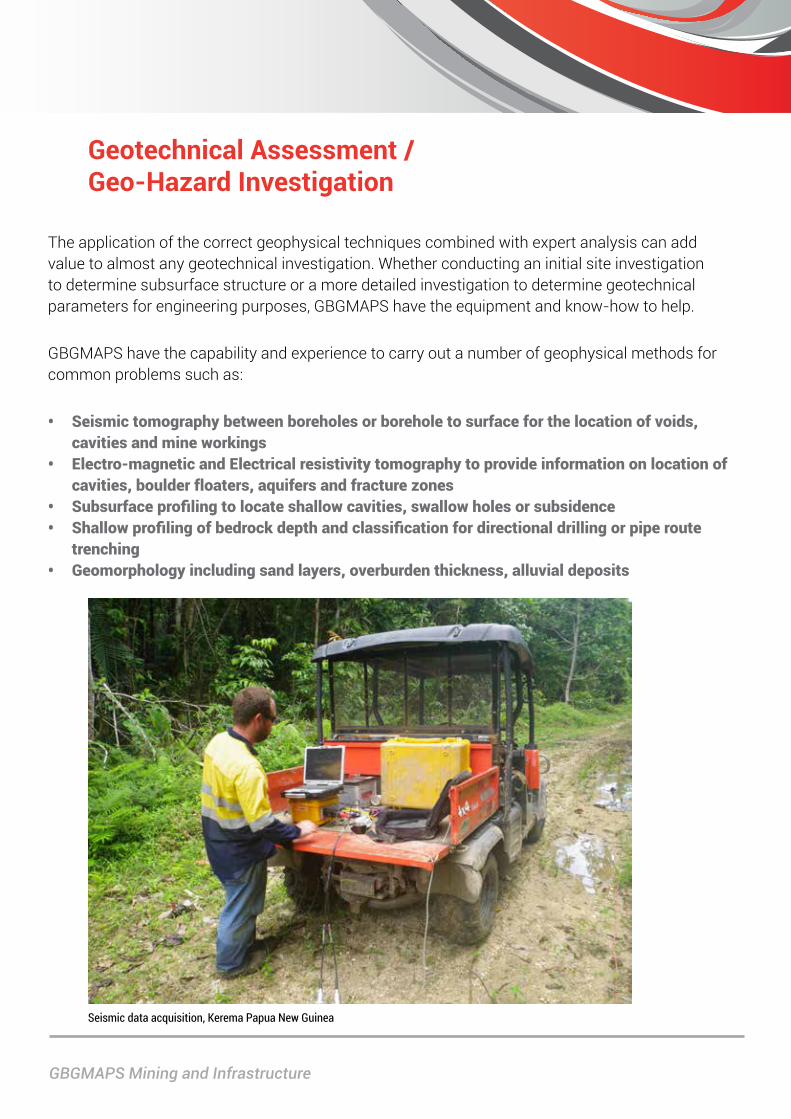
Geotechnical Assessment / Geo-Hazard Investigation
The application of the correct geophysical techniques combined with expert analysis can add value to almost any geotechnical investigation. Whether conducting an initial site investigation to determine subsurface structure or a more detailed investigation to determine geotechnical parameters for engineering purposes, GBGMAPS have the equipment and know-how to help.
GBGMAPS have the capability and experience to carry out a number of geophysical methods for common problems such as:
• Seismictomographybetweenboreholesorboreholetosurfaceforthelocationofvoids,cavitiesandmineworkings
• Electro-magneticandElectricalresistivitytomographytoprovideinformationonlocationofcavities,boulderfloaters,aquifersandfracturezones
• Subsurfaceprofilingtolocateshallowcavities,swallowholesorsubsidence• Shallowprofilingofbedrockdepthandclassificationfordirectionaldrillingorpiperoute
trenching• Geomorphologyincludingsandlayers,overburdenthickness,alluvialdeposits
Seismic data acquisition, Kerema Papua New Guinea
Page 5
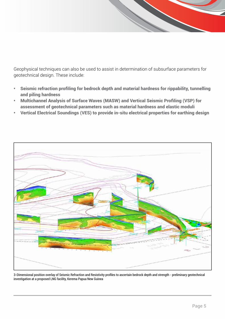
Geophysical techniques can also be used to assist in determination of subsurface parameters for geotechnical design. These include:
• Seismicrefractionprofilingforbedrockdepthandmaterialhardnessforrippability,tunnellingandpilinghardness
• MultichannelAnalysisofSurfaceWaves(MASW)andVerticalSeismicProfiling(VSP)forassessmentofgeotechnicalparameterssuchasmaterialhardnessandelasticmoduli
• VerticalElectricalSoundings(VES)toprovidein-situelectricalpropertiesforearthingdesign
3-Dimensional position overlay of Seismic Refraction and Resistivity profiles to ascertain bedrock depth and strength - preliminary geotechnical investigation at a proposed LNG facility, Kerema Papua New Guinea

GBGMAPS Mining and Infrastructure
Within a resource sector context, environmental investigations can be undertaken prior to development, during the life of the project and during remediation. Geophysical methods have become widely utilised for environmental investigation works due to the ability to cover large areas rapidly providing an overview for targeted physical investigations, and to fill in the gaps between standard physical testing.
GBGMAPS’s consulting services have been utilised across a wide variety of sites. Environmental investigations have been undertaken within resource sector sites including:
• Locationofburiedservices,undergroundstoragetanksandotherremnantfoundationsonbrownfieldssites
• Locationofabandonedmineshafts,additsandgalleries• Assessmentofgeologicalfracturesaffectinggroundwatermovement/leachingfromold
minepits• Delineationoflandfillextents,fillbaseandcappingthickness,andlocationofuncontrolled
fillsuchasburiedwastedrums• Locationofunexplodedordnance(UXOs)withinminingareasoralongpipelineroutes(marine
andland)• Delineationofinorganicandhydrocarboncontaminantplumes
Environmental, Hydrogeology and Site Remediation
Rough terrain ground penetrating radar data collection, Karratha WA
Page 7
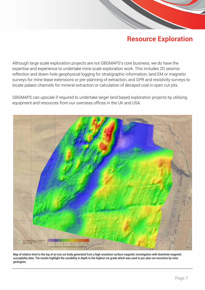
Map of relative level to the top of an iron ore body generated from a high resolution surface magnetic investigation with downhole magnetic suscepbility data. The results highlight the variability in depth to the highest ore grade which was used to pre-plan ore excavtion by mine geologists.
Resource Exploration
Although large scale exploration projects are not GBGMAPS’s core business, we do have the expertise and experience to undertake mine scale exploration work. This includes 2D seismic reflection and down-hole geophysical logging for stratigraphic information, land EM or magnetic surveys for mine lease extensions or pre-planning of extraction, and GPR and resistivity surveys to locate palaeo channels for mineral extraction or calculation of decayed coal in open cut pits.
GBGMAPS can upscale if required to undertake larger land based exploration projects by utilising equipment and resources from our overseas offices in the UK and USA.
www.gbgmaps.com.au
GBGMAPS Contact GBG Australia ContactLevel 1, 2 Sabre Crescent 18 Fennell StreetJandakot WA 6164 North Parramatta NSW 2151PO Box 3526 T: +61 (2) 9890 2122Success WA 6964 E: [email protected]: +61(8) 6436 1599 W: www.gbgoz.com.au E: [email protected]: www.gbgmaps.com.au