methodological approach for the definition of agricultural...
TRANSCRIPT

TECHNICAL ASSISTANCE FOR THE CONVERSION OF RIVER BASIN ACTION PLANS INTO
RIVER BASIN MANAGEMENT PLANS
Technical Assistance for the conversion of
River Basin Action Plans into River Basin Management Plans
(EuropeAid/134561/D/SER/TR)
Methodological approach for the definition of
Agricultural Demand Units in the Konya Closed Basin
Activity 4.6.1 Making a draft version of the river basin management
plans
Output 26, ToR activity 2.2.8 Draft RBMPs for the pilot river basins
Date of delivery
TR2011/0327.21-05-01-001

TECHNICAL ASSISTANCE FOR THE CONVERSION OF RIVER BASIN ACTION PLANS INTO
RIVER BASIN MANAGEMENT PLANS
Document title Methodological approach for the definition of
Agricultural Demand Units in the Konya Closed Basin
Filename AUX_001_4.06.01_GE_EN_V00_R00
Version 00
Review 00
Document date 2016-07-27
Related Technical Offer activity 4.6.1
Related Terms of Reference activity 2.2.8
Due date of deliverable:
Dissemination level
PU Public
RE Restricted to a group specified by the Beneficiary
CO Confidential, only for members of the Consortium and Beneficiary
Deliverable status version control
Version Review Date Comments
00 00 2016-07-27
01 00 2016-09-14
Approved
Version Review Date

TECHNICAL ASSISTANCE FOR THE CONVERSION OF RIVER BASIN ACTION PLANS INTO
RIVER BASIN MANAGEMENT PLANS
PROJECT DETAILS
BENEFICIARY: Ministry of Forestry and Water Affairs, Directorate General for Water Management
Contact details Counterparts
Beştepe Mahallesi Alparslan Türkeş Caddesi No: 71
Yenimahalle – Ankara,
PK: 06510
Phone: +90 312 207 50 00
Abdurrahman ULUIRMAK Deputy Director General
E-mail: [email protected]
Phone: +90 312 207 63 65
Taner KİMENÇE
Head of Basin Management Department
E-mail: [email protected] Phone: +90 312 207 60 97
Burhan Fuat ÇANKAYA
Section Manager for Basin Planning E-mail: [email protected] Phone: +90 312 207 63 54
CONTRACTING AUTHORITY: Central Finance and Contracts Unit
Contact details Counterpart
Eskişehir Yolu 4.Km. 2180 Cadde (Halkbank
Kampüsü) No:63 C-Blok 06510 Söğütözü – Ankara –
Turkey
Phone: + 90 312 295 49 00
Fax : + 90 312 286 70 72
Pakize Berna ERGÜN
Contract Manager
E-mail: [email protected]
MONITORING AUTHORITY: European Union Delegation in Turkey
Contact details Counterpart
Address: Uğur Mumcu Cad. No:88, Kat: 4,
Gaziosmanpaşa 06700 Ankara – Türkiye
Phone: +90 312 459 87 00 Fax: +90 312 446 67 37
Elif TORCU
Sector Manager
E-mail: [email protected]
CONSORTIUM: TRAGSATEC, INITEC INFRASTRUCTURES, AMBISAT and SU-YAPI
Contact details of the Leader Company Counterparts
TRAGSATEC
Julián Camarillo 6B 3A, Madrid – Spain
Alfredo CORROCHANO
Team Leader
E-mail: [email protected] Phone: +90 312 258 63 77 Mobile: +90 537 873 78 46
Marta ROBLEDO JIMENEZ
Project Manager
E-mail: [email protected]
Phone: +34 913226792
Contact details of the Project Office
Beştepe Mahallesi Alparslan Türkeş Caddesi No: 71
Yenimahalle – Ankara,
PK: 06510
Phone: +90 312 207 56 25
Paragon İş Merkezi, Kızılırmak Mah. Ufuk Üniversitesi
Caddesi 1445. Sokak ÇUKURAMBAR – ANKARA
18th Floor, Madrid Office
Phone: +90 312 258 63 77
Commencement project date 2014-12-29
Project duration 36 months

TECHNICAL ASSISTANCE FOR THE CONVERSION OF RIVER BASIN ACTION PLANS INTO
RIVER BASIN MANAGEMENT PLANS
TABLE OF CONTENTS
1 Introduction.......................................................................................................... 1
2 Sources of information ........................................................................................... 1
3 Analysis of topology ............................................................................................... 1
4 Methodology ........................................................................................................ 5
4.1 Surface Agricultural Demand Units in the current scenario (2012) ............................ 5
4.2 Groundwater Agricultural Demand Units in the current scenario (2012) .................... 8
4.3 Surface Agricultural Demand Units in future scenarios .......................................... 12
5 Summary ............................................................................................................ 14
LIST OF TABLES
Table 1. Summary of the methodology .......................................................................................................... 14
LIST OF FIGURES
Figure 1. Example of topology problem.............................................................................................................2
Figure 2. Example of topology problem.............................................................................................................2
Figure 3. Example of topology problem.............................................................................................................2
Figure 4. Example of topology problem.............................................................................................................3
Figure 5. Example of topology problem.............................................................................................................3
Figure 6. Example of topology problem.............................................................................................................3
Figure 7. Example of topology problem.............................................................................................................4
Figure 8. Example of topology problem.............................................................................................................4
Figure 9. Example of topology problem.............................................................................................................4
Figure 10. Big irrigated areas managed by DSI..................................................................................................6
Figure 11. Small irrigated areas managed by DSI ..............................................................................................7
Figure 12. Irrigated areas managed by other institutions and private users ..................................................8
Figure 13. Irrigated areas managed by cooperatives (groundwater resources).............................................9
Figure 14. Irrigated areas managed by privates users (groundwater resources) ........................................ 10
Figure 15. Irrigated areas managed by cooperatives (groundwater and future surface resources) ......... 11
Figure 16. Irrigated areas managed by private users (groundwater and future surface resources) ......... 12
Figure 17. Future surface irrigated areas managed by DSI ........................................................................... 13
Figure 18. Irrigation areas identified in Konya Closed Basin ......................................................................... 15

TECHNICAL ASSISTANCE FOR THE CONVERSION OF RIVER BASIN ACTION PLANS INTO
RIVER BASIN MANAGEMENT PLANS
Page 1 of 15
1 INTRODUCTION
This document contains the methodology to be applied to define the Agricultural Demand Units (ADUs) located in the Konya closed basin.
These demand units are defined as follow: “Demands that have the same use, share the source
of supply and whose returns are reintegrated basically in the same area will be grouped into larger territorial units, called demand units”.
The ADUs will be the unit used in the water budget. For each one, the guarantee of the water
supply and their deficit will be calculated.
2 SOURCES OF INFORMATION
The input data considered have been supplied by official sources of the Turkish government and
are as follow:
Master Plan of the Konya Closed Basin 2014 (Economic analysis of agriculture Section).
Master Plan of the Konya Closed Basin 2014 (Hydrogeology Section).
Shapefiles with irrigation areas managed by the DSI (surface and groundwater) in the
Konya closed basin, included in the named Master Plan (16_Diger_Bilgiler.mdb):
DSI_YUS_SULAMA_SAHALARI.shp
DSI_YAS_SULAMA_SAHALARI.shp
Shapefiles with irrigation surfaces managed by private users (surface and groundwater)
in Konya closed basin, included in the named Master Plan (16_Diger_Bilgiler.mdb):
HALK_SULAMALARI_YUS.shp
HALK_SULAMALARI_YAS.shp
Corine Land Cover 2006 project (geodatabase).
3 ANALYSIS OF TOPOLOGY
After analyzing the geographical information, some topological problems have been detected in
the previously shapefiles. These shapefiles includes the irrigation areas supplied with surface or
groundwater resources.
These problems have been gaps and overlaps between polygons of the same shapefile and they
have been repaired with ArcGIS software.
The figures included below show some of the problems identified.

TECHNICAL ASSISTANCE FOR THE CONVERSION OF RIVER BASIN ACTION PLANS INTO
RIVER BASIN MANAGEMENT PLANS
Page 2 of 15
Figure 1. Example of topology problem
Figure 2. Example of topology problem
Figure 3. Example of topology problem

TECHNICAL ASSISTANCE FOR THE CONVERSION OF RIVER BASIN ACTION PLANS INTO
RIVER BASIN MANAGEMENT PLANS
Page 3 of 15
Figure 4. Example of topology problem
Figure 5. Example of topology problem
Figure 6. Example of topology problem

TECHNICAL ASSISTANCE FOR THE CONVERSION OF RIVER BASIN ACTION PLANS INTO
RIVER BASIN MANAGEMENT PLANS
Page 4 of 15
Figure 7. Example of topology problem
Figure 8. Example of topology problem
Figure 9. Example of topology problem

TECHNICAL ASSISTANCE FOR THE CONVERSION OF RIVER BASIN ACTION PLANS INTO
RIVER BASIN MANAGEMENT PLANS
Page 5 of 15
4 METHODOLOGY
4.1 Surface Agricultural Demand Units in the current scenario (2012)
Several agents manage irrigated areas with surface water resources:
DSI,
other institutions and
private users.
According to the input data, these irrigation areas could be grouped in:
big and small irrigation areas managed by the DSI,
irrigated areas managed by other institutions,
irrigated areas managed by private users and
areas of overlap between those managed by the DSI and private users. These areas will
be included as part of the large irrigation areas managed by the DSI.
The difference between big and small-irrigated areas managed by DSI is stablished by the
Economic analysis section of the Master Plan.
In relation to the initial data, there are not available geographic information for the areas that
are managed by other institutions, but the Master Plan (Economic analysis section) provides the value of gross and net surface for these areas.
The rest of the irrigation areas have geographic information and values of gross and net irrigated
area in line with the economic analysis section of the Master Plan.
To define the surface ADUs, the following criteria will be applied:
1. SW-01: DSI (Big Areas). Big irrigated areas managed by DSI will be considered as an
independent ADU. These ADUs will include the common surface with irrigated areas
managed by private users or other institutions, as well as the overlapping surface with
areas irrigated with groundwater resources.
For these ADUs, gross and net area will be taken in line with the Master Plan (MP) in its
economic section. On the other hand, its geographic delineation will be established
according to the MP (hydrogeology section) GIS layers and their source of water
resources will be identify at level of water body.

TECHNICAL ASSISTANCE FOR THE CONVERSION OF RIVER BASIN ACTION PLANS INTO
RIVER BASIN MANAGEMENT PLANS
Page 6 of 15
Figure 10. Big irrigated areas managed by DSI
2. SW-02: DSI (Small Areas). The small irrigation areas managed by DSI will be considered
as an independent ADU, except in the case of units that share the origin of water
resources, in this case they will be grouped. For the delineation of ADUs, it will consider
that two irrigation areas share the origin of water resources if the diversions of surface
waters are located in the same water body.
These units will include the common surface with irrigated areas managed by private
users or other institutions, as well as the overlapping surface with areas irrigated with
groundwater resources.
For these ADUs, gross and net area will be taken in line with the Master Plan (MP) in its
economic section. On the other hand, its geographic delineation will be established
according to the MP (hydrogeology section) GIS layers and their source of water
resources will be identify at level of water body.

TECHNICAL ASSISTANCE FOR THE CONVERSION OF RIVER BASIN ACTION PLANS INTO
RIVER BASIN MANAGEMENT PLANS
Page 7 of 15
Figure 11. Small-irrigated areas managed by DSI
3. SW-03: Other Institutions and Privates. An individual ADU will be established at
province level to group the irrigated areas managed by other institutions and private
users.
TECHNICAL ASSISTANCE FOR THE CONVERSION OF RIVER BASIN ACTION PLANS INTO
RIVER BASIN MANAGEMENT PLANS
Page 8 of 15
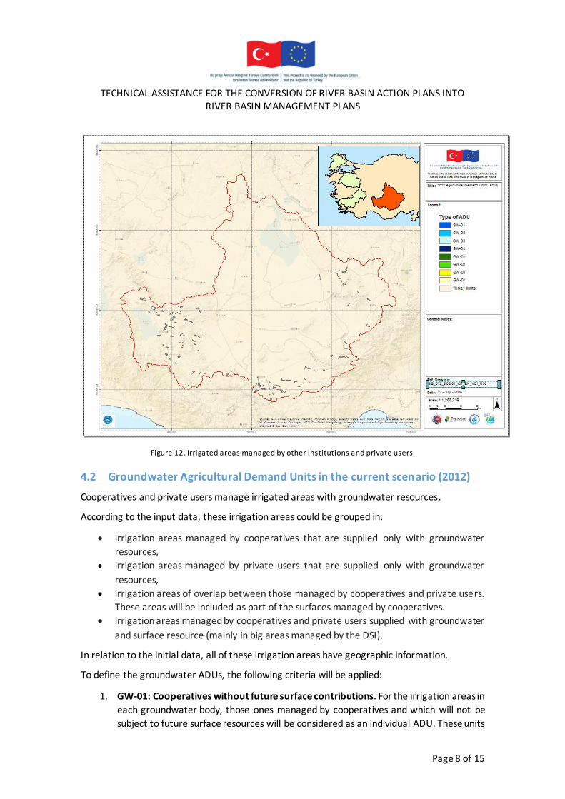
Figure 12. Irrigated areas managed by other institutions and private users
4.2 Groundwater Agricultural Demand Units in the current scenario (2012)
Cooperatives and private users manage irrigated areas with groundwater resources.
According to the input data, these irrigation areas could be grouped in:
irrigation areas managed by cooperatives that are supplied only with groundwater
resources,
irrigation areas managed by private users that are supplied only with groundwater
resources,
irrigation areas of overlap between those managed by cooperatives and private users.
These areas will be included as part of the surfaces managed by cooperatives.
irrigation areas managed by cooperatives and private users supplied with groundwater
and surface resource (mainly in big areas managed by the DSI).
In relation to the initial data, all of these irrigation areas have geographic information.
To define the groundwater ADUs, the following criteria will be applied:
1. GW-01: Cooperatives without future surface contributions. For the irrigation areas in
each groundwater body, those ones managed by cooperatives and which will not be
subject to future surface resources will be considered as an individual ADU. These units

TECHNICAL ASSISTANCE FOR THE CONVERSION OF RIVER BASIN ACTION PLANS INTO
RIVER BASIN MANAGEMENT PLANS
Page 9 of 15
will include the irrigated surfaces managed by private users that are overlapping with
areas managed by cooperatives and will not include the surfaces supplied with surface
resources in the current scenario (2012).
For these ADUs, its geographic delineation will be established according to the MP
(hydrogeology section) GIS layers and their source of water resources will be identify at
level of water body. On the other hand, its gross area will be considered equal than the
GIS area and its net area will be taken in line with the Master Plan (MP) in its
hydrogeology section.
Figure 13. Irrigated areas managed by cooperatives (groundwater resources)
2. GW-02: Privates without future surface contributions. For irrigation areas in each
groundwater body, those ones managed by private users and which will not be subject
to future surface resources will be considered as an individual ADU. These units will not
include the irrigated surfaces managed by private users overlapping with areas
managed by cooperatives and will not include the surfaces supplied with surface
resources in the current scenario (2012).
For these ADUs, its geographic delineation will be established according to the MP
(hydrogeology section) GIS layers and their source of water resources will be identify at

TECHNICAL ASSISTANCE FOR THE CONVERSION OF RIVER BASIN ACTION PLANS INTO
RIVER BASIN MANAGEMENT PLANS
Page 10 of 15
level of water body. On the other hand, its gross area will be considered equal than the
GIS area and its net area will be taken in line with the Master Plan (MP) in its hydrogeology section.
Figure 14. Irrigated areas managed by privates users (groundwater resources)
3. GW-03: Cooperatives with future surface contributions . For irrigation areas in each
groundwater body, those ones managed by cooperatives and which will be subject to
future surface resources will be considered as an individual ADU. These units will
include the irrigated surfaces managed by private users that are coincident with areas
managed by cooperatives and will not include the surfaces supplied with surface
resources in the current scenario (2012).
Areas with future surface contributions are include in the GIS layers of MP (hydrogeology section) as areas managed by the DSI, but programmed to year 2024.
For these ADUs, its geographic delineation will be established according to the MP
(hydrogeology section) GIS layers without overlaps and their source of water resources
will be identify at level of water body (surface or groundwater). On the other hand, its
gross area will be considered equal than the GIS area and its net area will be taken in line with the Master Plan (MP) in its hydrogeology section.

TECHNICAL ASSISTANCE FOR THE CONVERSION OF RIVER BASIN ACTION PLANS INTO
RIVER BASIN MANAGEMENT PLANS
Page 11 of 15
Figure 15. Irrigated areas managed by cooperatives (groundwater and future surface resources)
4. GW-04: Privates with future surface contributions. For irrigation areas in each
groundwater body, those ones managed by private users and which will be subject to
future surface resources will be considered as an individual ADU. These units will not
include the irrigated surfaces managed by private users that are coincident with areas
managed by cooperatives and will not include the surfaces supplied with surface
resources in the current scenario (2012).
Areas with future surface contributions are include in the GIS layers of MP (hydrogeology section) as areas managed by the DSI, but programmed to year 2024.
For these ADUs, its geographic delineation will be established according to the MP
(hydrogeology section) GIS layers and their source of water resources will be identify at
level of water body. On the other hand, its gross area will be considered equal than the
GIS area and its net area will be taken in line with the Master Plan (MP) in its hydrogeology section.

TECHNICAL ASSISTANCE FOR THE CONVERSION OF RIVER BASIN ACTION PLANS INTO
RIVER BASIN MANAGEMENT PLANS
Page 12 of 15
Figure 16. Irrigated areas managed by private users (groundwater and future surface resources)
4.3 Surface Agricultural Demand Units in future scenarios
The initial information also allow to define a number of surface irrigation areas, whose
development will take place in the future (2024), because there are infrastructures not
completed in the base scenario (2012). These areas will be considered as big irrigation areas managed by the DSI.
According to the initial data, these areas have available geographic information and
values of gross and net irrigated areas included in the GIS layers of the MP (hydrogeology section).
For these ADUs, its delineation will be established according to the GIS layers of the MP
(hydrogeology section) and their source of water resources will be identify at level of
surface water body. The delineation of these ADUs will not include the overlaps with the
irrigated areas of the current scenario (2012) defined in the previous paragraphs.
On the other hand, the gross area of these units will be considered equal to the GIS
layers area and its net surfaces will be taken in line with the MP (hydrogeology section),
without the net area of the demands of the current scenario (2012) that overlaps.

TECHNICAL ASSISTANCE FOR THE CONVERSION OF RIVER BASIN ACTION PLANS INTO
RIVER BASIN MANAGEMENT PLANS
Page 13 of 15
Figure 17. Future surface irrigated areas managed by DSI

TECHNICAL ASSISTANCE FOR THE CONVERSION OF RIVER BASIN ACTION PLANS INTO
RIVER BASIN MANAGEMENT PLANS
Page 14 of 15
5 SUMMARY
Below it is shown a summary table with the proposed methodology.
Table 1. Summary of the methodology
Type of Demand Resources GIS Surface
(ha) Gross Surface (ha) Net Surface (ha) Spatial Scale
SW-01: DSI (Big Areas) SW Yes Master Plan surfaces (Economic Section)
Master Plan surfaces (Economic Section) Each Big Area
SW-02: DSI (Small Areas) SW Yes Master Plan surfaces (Economic Section)
Master Plan surfaces (Economic Section)
SWB (Economic
Master Plan)
SW-03: Other Institutions and Privates SW Not Master Plan surfaces (Economic Section)
Master Plan surfaces (Economic Section)
Province
GW-01: Cooperatives without future surface contributions
GW Yes GIS surfaces (without
overlapping with surface irrigated areas)
Master Plan surfaces (Hydrogeological
Section) GWB
GW-02: Privates without future surface contributions
GW Yes
GIS surfaces (without
overlapping with surface irrigated areas)
Master Plan surfaces
(Hydrogeological Section)
GWB
GW-03: Cooperatives with future
surface contributions GW Yes
GIS surfaces (intersection with
future surface irrigated areas)
Master Plan surfaces (Hydrogeological
Section)
GWB
GW-04: Privates with future surface contributions
GW Yes
GIS surfaces (intersection with
future surface irrigated
areas)
Master Plan surfaces (Hydrogeological
Section)
GWB
SW-04: Future DSI (Big Areas) SW
Yes (without
overlapping
with actual demands)
Master Plan GIS (without overlapping
with actual demands)
Master Plan GIS (without overlapping
with actual demands)
SWB
Below it is shown a summary table with the results grouped by typology of ADUs, using
the proposed methodology.
Table 2. Results of ADUs delineation
Type of Demand Number of
ADUs Gross Surface (ha) Net Surface (ha) Spatial Scale
SW-01: DSI (Big Areas) 19 216.823,00 132.741,00 Each Big Area
SW-02: DSI (Small Areas) 27 15.877,00 9.553,70
SWB
(Economic
Master Plan)
SW-03: Other Institutions and Privates 5 36.626,05 34.611,59 Province

TECHNICAL ASSISTANCE FOR THE CONVERSION OF RIVER BASIN ACTION PLANS INTO
RIVER BASIN MANAGEMENT PLANS
Page 15 of 15
Type of Demand Number of
ADUs Gross Surface (ha) Net Surface (ha) Spatial Scale
GW-01: Cooperatives without future
surface contributions 15 160.343,87 156.571,83 GWB
GW-02: Privates without future surface
contributions 15 313.850,29 298.671,05 GWB
GW-03: Cooperatives with future
surface contributions 5 73.391,91 71.630,77 GWB
GW-04: Privates with future surface
contributions 6 95.970,28 93.696,29 GWB
SW-04: Future DSI (Big Areas) 49 84.457,61 56.302,32 SWB
TOTAL 141 997.340,02 853.778,55 SWB
Figure 18. Irrigation areas identified in Konya Closed Basin