metadata kim owens – noaa’s ocean service mike moeller – noaa coastal services center...
TRANSCRIPT

Metadata
Kim Owens – NOAA’s Ocean ServiceMike Moeller – NOAA Coastal Services Center
Understanding the Valueand Importance of Proper
Data Documentation

First things first
Introductions
Logistics
Issues/questions

Presentation Outline
• The What and the Why
• The Value of Metadata
• The FGDC Content Standard for
Digital Geospatial Metadata (CSDGM)
• Writing Quality Metadata

What is Metadata?
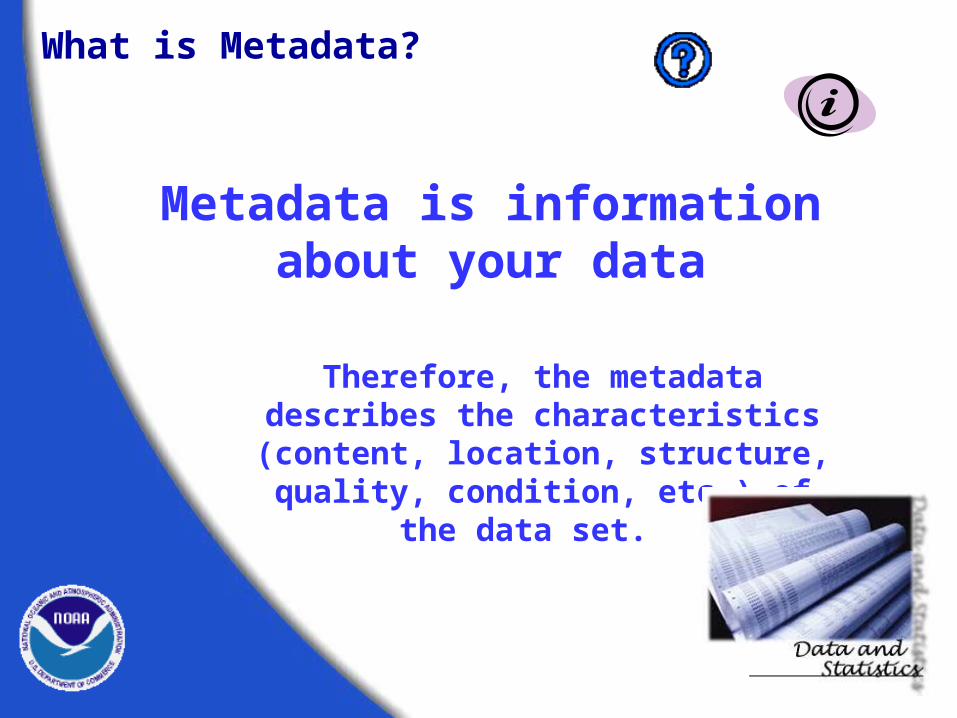
What is Metadata?
Metadata is information about your data
Therefore, the metadata describes the characteristics (content, location,
structure, quality, condition, etc.) of the data set.

This is the metadata for this.
What’s Missing?
Emily and M
adison

This is the metadata for this.
While the card-catalog entry is a form of metadata, it does not address topics such as quality, accuracy, or scale.
Well-written geospatial metadata describes these and many more aspects of the data.
Rodale's illustrated encyclopedia of herbs ISBN: 087596964x (pbk.) : $17.95ISBN: 0878576991 : $24.95Title: Rodale's illustrated encyclopedia of herbs /
Claire Kowalchik & William H. Hylton, editors ; writers, Anna Carr ... [et al.].
Publication info: Emmaus, Pa. : Rodale Press, c1987.Physical descrip: vi, 545 p. : ill. (some col.) ; 24 cm.General Note: Includes index.Subject term: Herbs.Subject term: Herbs--Utilization.Subject term: Herb gardening.Subject term: Herbs--History.Subject term: Herbals.Added author: Kowalchik, Claire.Added author: Hylton, William H.Added author: Carr, Anna, 1955-Added author: Rodale Press.

This is
Identification_Information Citation Citation_Information Originator: NOAA, NESDIS Publication_Date: 20030929 Title: Hurricane Isabel Storm Surge Geospatial_Data_Presentation_Form: Remote Sensing Image/Map Publication_Information Publication_Place: Camp Springs, MD Publisher: NOAA, NESDIS, SSD Larger_Work_Citation Citation_Information
Identification_Information Citation Citation_Information Originator: NOAA, NESDIS Publication_Date: 20030929 Title: Hurricane Isabel Storm Surge Geospatial_Data_Presentation_Form: Remote Sensing Image/Map Publication_Information Publication_Place: Camp Springs, MD Publisher: NOAA, NESDIS, SSD Larger_Work_Citation Citation_Information
the metadata for this.

Metadata
A Component of Data
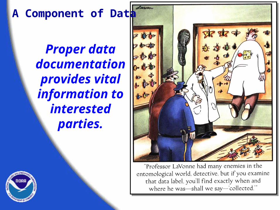
Proper data documentation provides vital information to
interested parties.
A Component of Data

Metadata is that component of data which describes it.
Environmental Sensitivity Index Data
Metadata
RARNUM - unique combination of species, concentration, and seasonality
CONC (concentration) = Density species is found at location
Season_ID = seasonality code like to the seasonal table
Element - Biology group
A Component of Data

It’s data about a data set.
Title
Scale
Source
Content
Location
Publication
Access
Title
Scale
Source
Content
Location
Publication
Access
MetadataMetadataMetadataMetadata
GIS files
Imagery
Geospatial databases
GPS data
GIS files
Imagery
Geospatial databases
GPS data
Data setData setData setData set
A Component of Data

A Component of Data
Because metadata provides vital information about a dataset, it
should never be viewed or treated as a separate entity.
Metadata
Non-spatial orattributes
SpatialTake Home Message
Metadata is a critical and
integral component of any complete
data set.
Metadata is a critical and
integral component of any complete
data set.
The Value of Metadata
Why Bother with Metadata?

The Value of Metadata
The Current ConceptPrimary external value
• Discovery
• Assessment
• Access
• Use

The Value of Metadata
The Current ConceptPrimary internal value
• “Inheritance”“Properly
documenting a data set is the key to preserving its usefulness
through time.”

The Value of Metadata
An Emerging Concept
An aid to data management
Internal value
• Discovery
• Assessment
• Access
• Use

Additional data management benefits
The Value of Metadata
Data Currency
• Date of last edit/update
• Age of source files
Data Utility
• Track source file usage
• Track distribution frequency

The Value of Metadata
Monitoring Data Development
• Data processing steps
• Status of development
Estimate Development Costs
• Data processing – time and extent
• Source file availability
Additional data management benefits

The Value of Metadata
To realize the full potential of
metadata under this new concept,
metadata creation must become
integral to the data development
process.
The question is “How?”
Make metadata part of the process
Approach metadata development from a business perspective
Build administrative support
The Value of Metadata
• Preserves data investment
• Limits liability
• Helps manage data resources
• Aids in external data acquisition
• Facilitates data access and transfer
• Provides for efficient data distribution

Stress the individual benefits of metadata
Build technical support
The Value of Metadata
• Reduces workload over the long term
• Field fewer data inquiries
• Provides a means of documenting personal contributions
• Facilitates sharing of reliable information

Develop strong staff support
The Value of Metadata
• Incorporate metadata expectations into job descriptions and performance standards
Build technical support
• Provide staff development opportunities The three “T’s”
Training Tools Time

Develop templates to facilitate efficient and consistent metadata creation
Build organizational support
The Value of Metadata
• Identify pertinent fields within the metadata structure
• Populate fixed fields Use standardized language Define distribution methods Cite standards used
• Build source and contact libraries

• Map metadata fields to the work flow
• Establish and assign responsibilities
Distribute the effort
The Value of Metadata
Technicians - lineage Analysts – process and methodology Field Scientists – accuracy assessments I.T. Managers – tools, automated collection methods, information management

• Mandate the use of standards and templates.
• Develop boilerplate metadata deliverable language for data contractors.
• Require publication of metadata.
• Create and publish a metadata SOP to document policies and procedures.
Establish standard policies
The Value of Metadata

Why Have a Standard?Federal mandates and legislation
StandardizedMetadata
Mandates, Policy, and Legislation
The Federal Geographic Data Committee (FGDC)
• Organized in 1990 under the Office of Management and Budget (OMB)
• Promotes the coordinated use, sharing, and dissemination of geospatial data on a national basis
Background

Mandates, Policy, and Legislation
“ All Federal agencies must document all Geospatial data that they collect or produce, either directly or indirectly, using the FGDC Content Standard for Digital Geospatial Metadata (CSDGM), and to make that standardized documentation electronically accessible to the FGDC Clearinghouse network.”
President Clinton, 1994
Executive Order 12906:

“ All Federal agencies that collect, produce, acquire, maintain, distribute, use, or archive analog or digital spatial data in the fulfillment of their mission, financed directly or indirectly, in whole or part, by Federal funds are covered by this requirement.”
OMB Circular A-16 (revised)http://www.whitehouse.gov/omb/circulars/a016/a016_rev.html
OMB Circular A-16 (revised)
Mandates, Policy, and Legislation

The Data Quality ActSecion 515 of the Treasury and General
Government Appropriations Act for Fiscal Year 2001 directs OMB to issue government-wide
guidelines that:
“. . . provide policy and procedural guidance to Federal agencies for ensuring and maximizing the quality, objectivity, utility, and integrity of information (including statistical information) disseminated by Federal agencies.”
http://www.noaanews.noaa.gov/stories/iq.htm
Mandates, Policy, and Legislation

Why Have a Standard?
The standard for
metadata ensures a level
of consistency in
data documentation.
Standards ensure consistency.

Why Have a Standard?
Think for a moment how hard it would be to….
… bake a cake without standard units of measurement… put gas into your car without standard nozzle sizes… plug a lamp into a socket without standard electrical outlets

The Content Standard utilizes...
• Common terms
• Common definitions
• Common language
• Common structure Access
constraints
Citation
currentness
entity
attrib
ute
domain
lineage
Process step
Establishing a Standard

The Content Standard helps
the user determine...
• If a set of geospatial data is available, fit for a particular use.
• How to access and transfer the data set.
Establishing a Standard

WhoWho collected the data?Who processed the data?Who wrote the metadata?Who to contact for questions?Who to contact to order?Who owns the data?
WhereWhere were the data collected?Where were the data processed?Where are the data located?
WhatWhat are the data about?What project were they collected under?What are the constraints on their use?What is the quality?What are appropriate uses?What parameters were measured?What format are the data in?
WhenWhen were the data collected?When were the data processed?
HowHow were the data collected?How were the data processed?How do I access the data?How do I order the data?How much do the data cost?How was the quality assessed?Why
Why were the data collected?
Metadata written using the Content Standard answers these important
questions:
Establishing a Standard
Details About the Sections and Terms
of FGDC Metadata Standard
FGDC Metadata Standard

All About the Standard
FGDC Content Standard for Digital Geospatial Metadata (CSDGM)
Defines the 334 metadata elements and their
associated production rules.
“The Workbook”

The Content Standard is organized using numbered chapters called “sections.”
There are 7 main sections3 supporting sections.
Each section is organized into series of elements that define the
content required to document your geospatial data set.
Organization of the Content Standard
Section
Data Element

Warm up Exercise
Tagging the Sections of the Standard

CSDGM- 7 Main Sections
1. Identification_Information: (p. 34)
General bibliographic information about data set:
• title, originator, data contact, status, date, abstract, purpose, keywords, geographic location
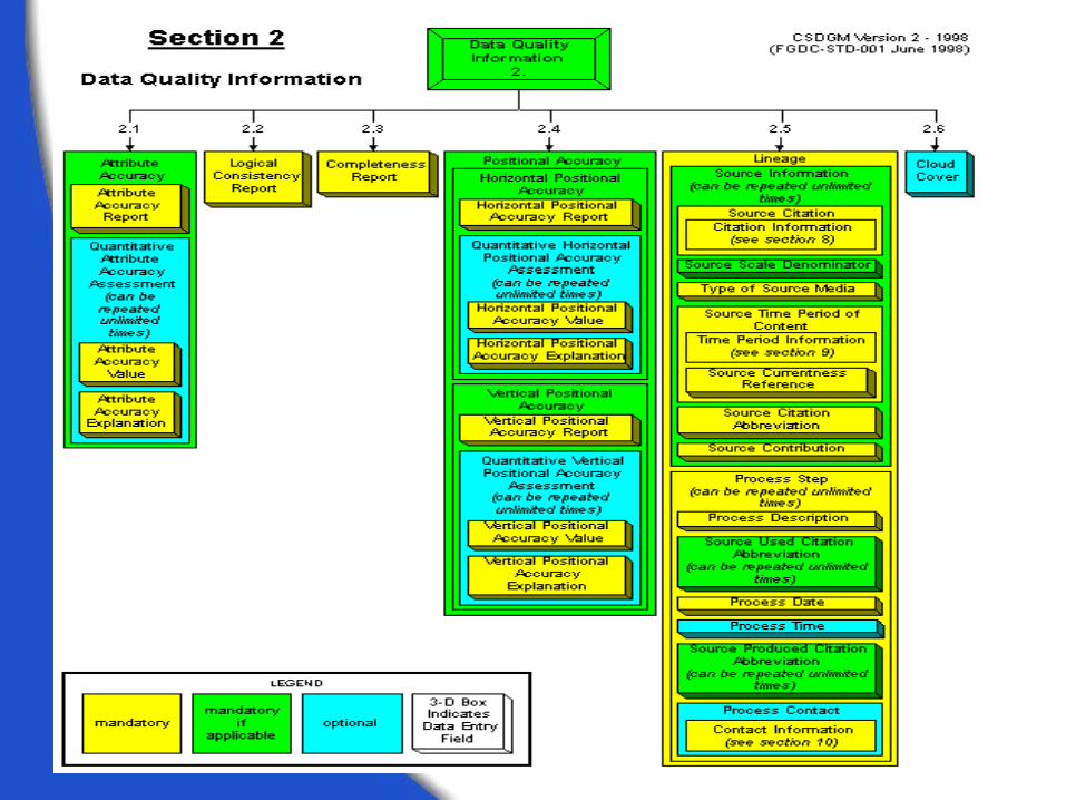
2. Data_Quality_Information: (p. 44)
Lineage and data assessments • sources, process methods, accuracy,
data processing contact

CSDGM- 7 Main Sections
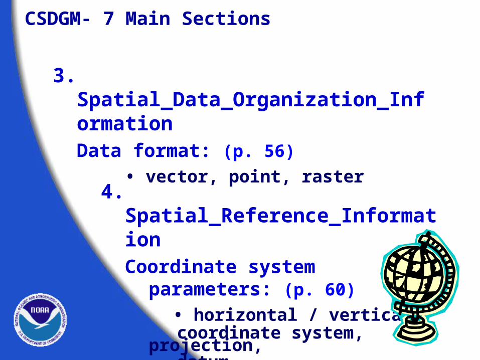
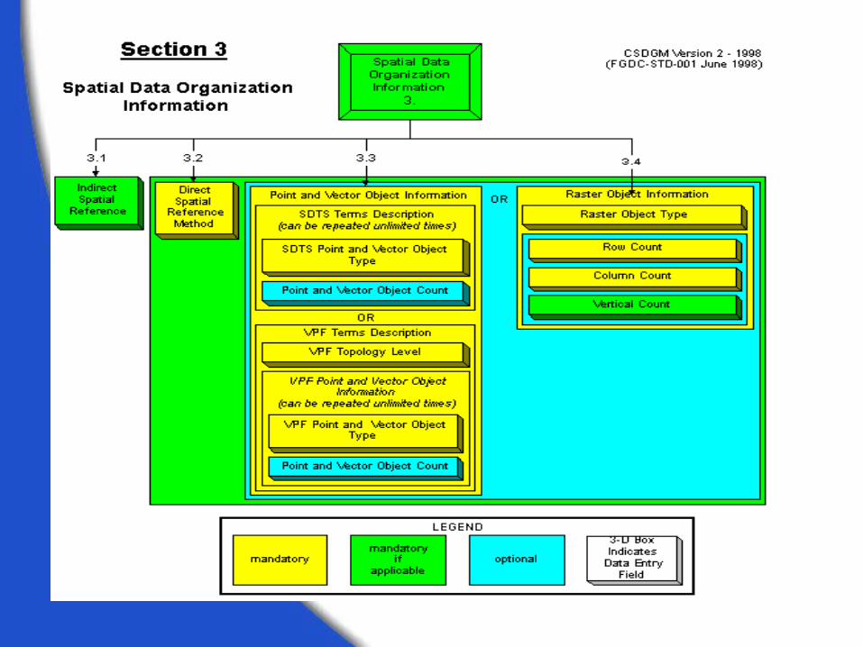
3. Spatial_Data_Organization_InformationData format: (p. 56)
• vector, point, raster
4. Spatial_Reference_InformationCoordinate system parameters: (p. 60)
• horizontal / vertical coordinate system, projection, datum


CSDGM- 7 Main Sections
5. Entity_and_Attribute_Information: (p. 75)
Database design
• entities, attributes, domains, description of data values
6. Distribution_Information: (p. 81)
How to acquire the data
• distribution contact, available formats, online distribution website, liability, costs


CSDGM- 7 Main Sections
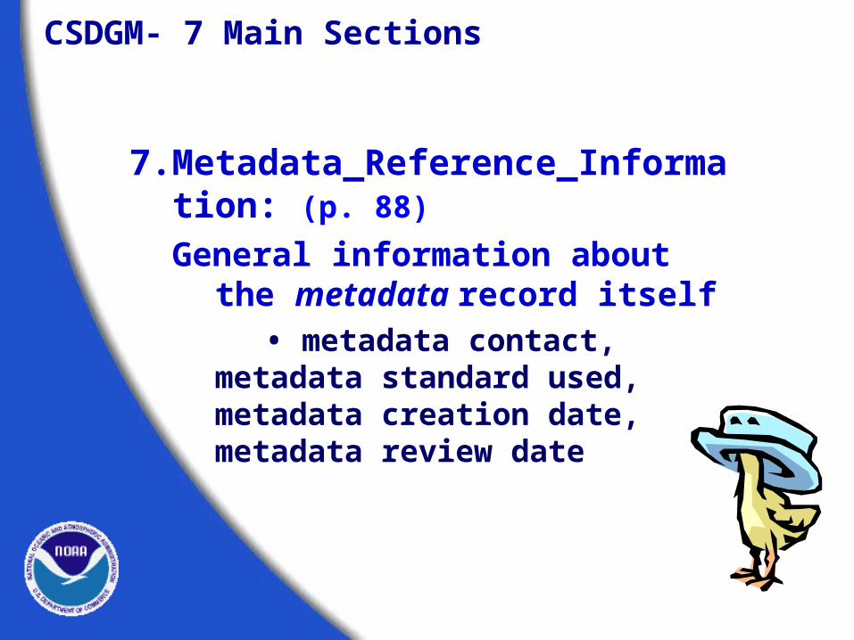
7. Metadata_Reference_Information: (p. 88)
General information about the metadata record itself
• metadata contact, metadata standard used, metadata creation date, metadata review date


CSDGM- 3 Supporting Sections
8. Citation_Information: (p. 91)
• originator, title, publication date, publisher, online linkage, larger work
9. Time_Period_of_Content: (p. 95)
• single date, multiple dates, range of dates
10. Contact_Information: (p. 96)
• contact person/organization, address, phone, email


Exercise 1
Reading A Metadata File
Rules of the Metadata Game
Learning how to read the structure of the standard

DataQuality
Information
SpatialData
OrganizationInformation
SpatialReference
Information
Entityand
AttributeInformation
4 52 6 731
Metadata
The Three Supporting Sections
9 Time PeriodInformation
10 Contact
Information
8 Citation
Information
DistributionInformation
MetadataReference
Information
IdentificationInformation
Organization of the Content Standard
The Seven Main Sections

Interpreting the Graphical Production Rules
The workbook uses graphics to illustrate the production rules of the standard. These graphics include most of the information provided by the production rules, including:
How elements are grouped What is mandatory and what is not What elements can repeat and how many
times they can repeat
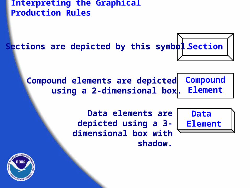
Interpreting the Graphical Production Rules
SectionSections are depicted by this symbol.
Compound Element
Compound elements are depicted using a 2-dimensional box.
Data Element
Data elements are depicted using a 3-dimensional box
with shadow.

Interpreting the Graphical Production Rules
Data Element
A data element is a logically primitive itemof data. Data elements are the things thatyou “fill in.”
The form for a data element is:
Data element name -- definition.Type: (choice of “integer”, “real”, “text”, “date”, or “time”)Domain: (describes valid values that can be assigned)
An example of a data element is:
Abstract -- a brief narrative summary of the data set.Type: textDomain: free text
Note: Data element definitions are containedin the text of the Content Standard,
not in the graphical production rules.

Interpreting the Graphical Production Rules
Turn to page 17 in workbook
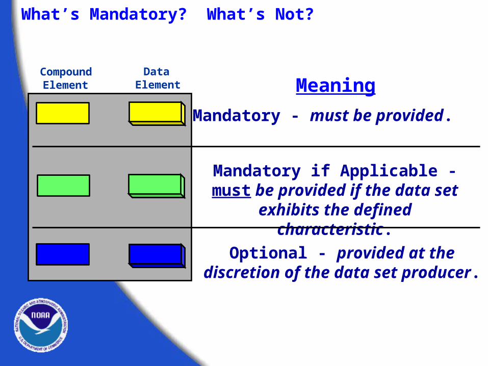
Mandatory - must be provided.
MeaningData
ElementCompound
Element
What’s Mandatory? What’s Not?
Mandatory if Applicable - must be provided if the data set exhibits
the defined characteristic.
Optional - provided at the discretion of the data set producer.

If an element can be repeatedindependently from other elements, itwill be indicated as such below theelement name.
Repeating Elements
CompoundElement 1
(can be repeatedunlimited times)
CompoundElement 1.1
DataElement 1.1.1
DataElement 1.1.2
DataElement 1.2
This group of elements
would repeat.
Compound Element 1 Compound Element 1.1 Data Element 1.1.1 Data Element 1.1.2 Data Element 1.2
See page 34, under Keywords

Using the Graphics to Make Decisions
All elements are colored yellow, so all are mandatory and must be reported.
CompoundElement 1
CompoundElement 1.1
DataElement 1.1.1
DataElement 1.1.2
DataElement 1.2

Compound Element 1 is mandatory.
Compound Element 1.1 is optional.
If yes, Data Elements 1.1.1 and 1.1.2 are mandatory.
If no, do not report Compound Element 1.1, Data Element 1.1.1 or 1.1.2, and skip to Data Element 1.2.
Data Element 1.2 is mandatory.
CompoundElement 1
DataElement 1.1.1
DataElement 1.1.2
DataElement 1.2
CompoundElement 1.1
Using the Graphics to Make Decisions

Compound Element 1 is mandatory.
Compound Element 1.1 is mandatory.
Data Element 1.1.1 is mandatory.
Data Element 1.1.2 is mandatory if
applicable.
Data Element 1.2 is optional.
CompoundElement 1
CompoundElement 1.1
DataElement 1.1.1
DataElement 1.1.2
DataElement 1.2
Using the Graphics to Make Decisions
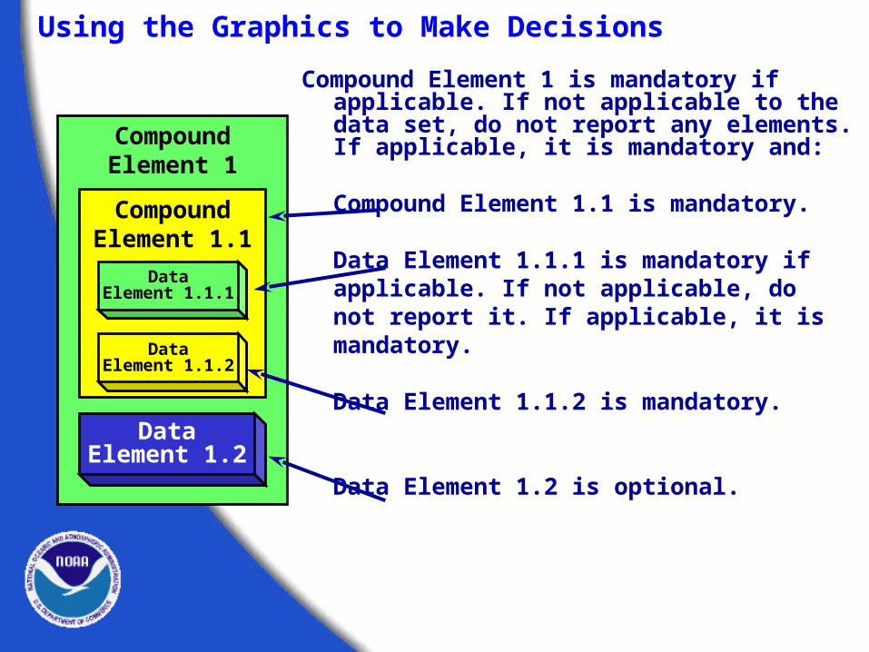
Compound Element 1 is mandatory if applicable. If not applicable to the data set, do not report any elements. If applicable, it is mandatory and:
Compound Element 1.1 is mandatory.
Data Element 1.1.1 is mandatory if applicable. If not applicable,
do not report it. If applicable, it is mandatory.
Data Element 1.1.2 is mandatory.
Data Element 1.2 is optional.
CompoundElement 1
CompoundElement 1.1
DataElement 1.1.1
DataElement 1.1.2
DataElement 1.2
Using the Graphics to Make Decisions

Exercise 2
Using The Workbook
The FGDC Metadata
Clearinghouse
Metadata as aData Discovery
Tool

The FGDC metadata clearinghouse is a decentralized system of Internet
servers you can use to search for available geospatial data.
Discovering Data Through Metadata
Client
FGDCGateway
Servershousingmetadata

A Brief Look at the FGDC Clearinghouse
The FGDC has 6 gateways
to its clearinghouse,
with accessto over 300 spatial data
servers.
www.fgdc.gov/clearinghouse/clearinghouse.html

A Brief Look at the FGDC Clearinghouse
Searches can be performed by place names or by
using a map interface.

The new NSDI Search Wizard bins servers by the types of metadata they house.
A Brief Look at the FGDC Clearinghouse

Searches can be performedusing a map interface that
allows the user to define
an area of interest.
A Brief Look at the FGDC Clearinghouse
An area of interest can be defined bydragging an area of interest box
on the map interface.

The selected area defines the bounding coordinates that will be used in the
search.
A Brief Look at the FGDC Clearinghouse

You can search all the servers listed,
or you can select only those that
interest you.
A Brief Look at the FGDC Clearinghouse

Individual servers are selected by holding the
Ctrl key down and selecting with the mouse.
A Brief Look at the FGDC Clearinghouse

Search criteria can be further refined by
time period of content
and keywords.
A Brief Look at the FGDC Clearinghouse

A Brief Look at the FGDC Clearinghouse
The status of each selected
node is displayed as
search is conducted.

A Brief Look at the FGDC Clearinghouse
When the search is
complete, the status window lets you know
if you were successful in discovering
metadata that matched your
search criteria.

A Brief Look at the FGDC Clearinghouse
Select a server
to see what
metadata is
available.
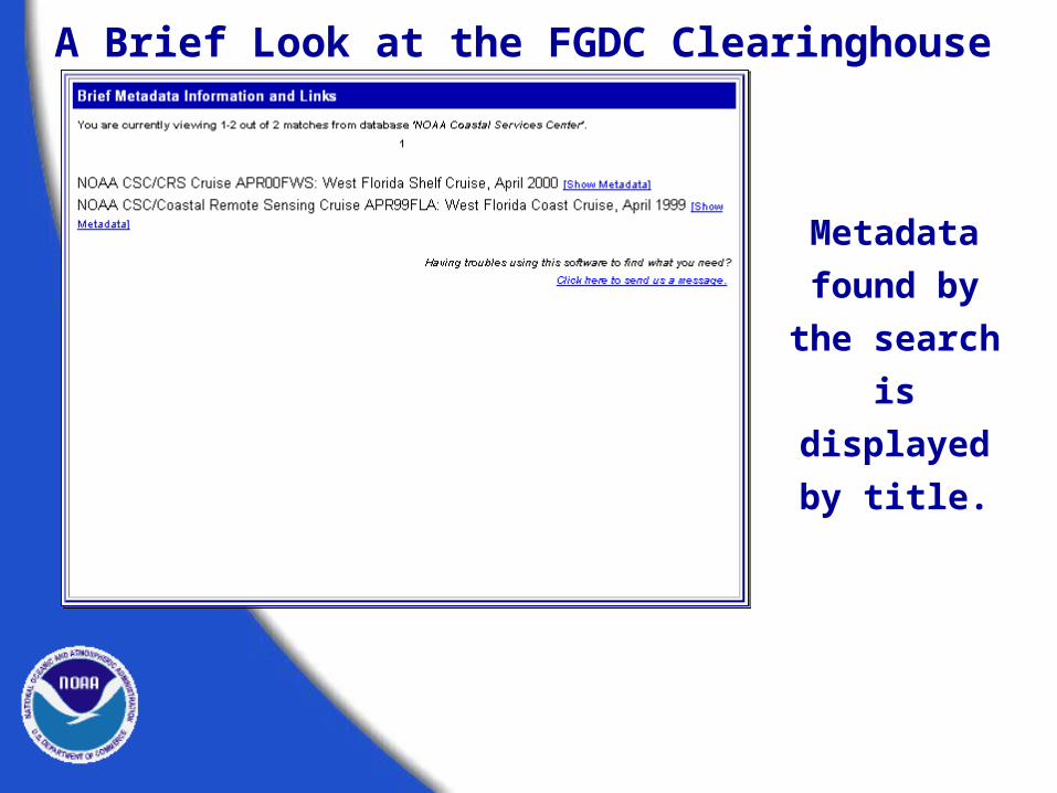
A Brief Look at the FGDC Clearinghouse
Metadata
found by the
search is
displayed by
title.

A Brief Look at the FGDC Clearinghouse
Metadata record
returnedin HTML format.
Links take you to each of the seven main sections of
the record.

A Brief Look at the FGDC Clearinghouse
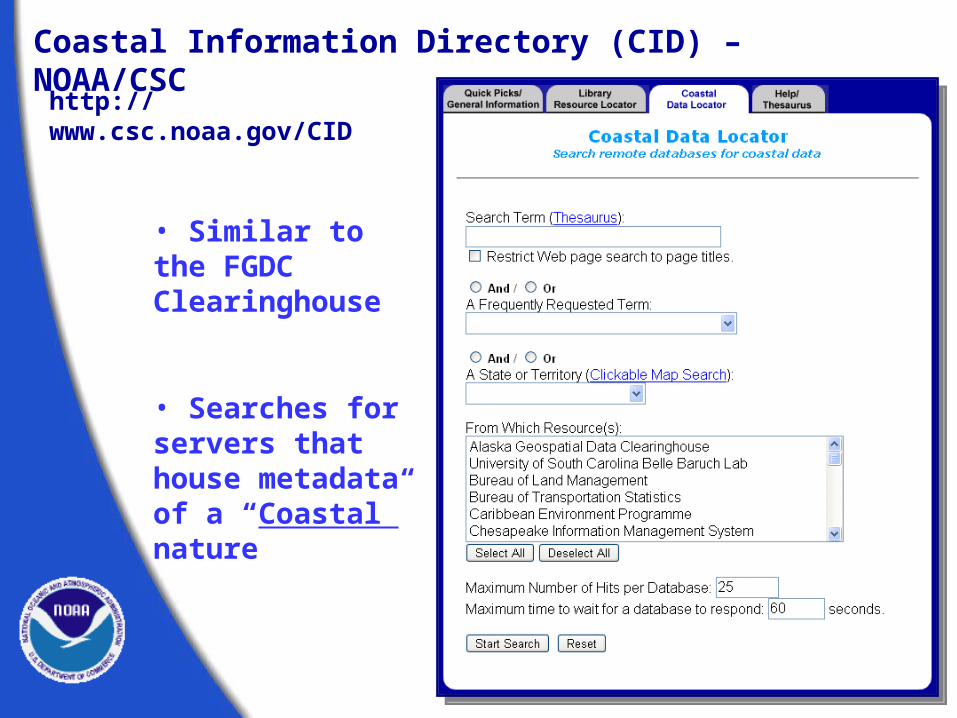
• Similar to the FGDC Clearinghouse
• Searches for servers that house metadata of a “Coastal” nature
Coastal Information Directory (CID) – NOAA/CSC
http://www.csc.noaa.gov/CID

For more information on the clearinghouse system, visit the FGDC Web site (www.fgdc.gov).
Here you can find information on howto establish your own clearinghouse node
using free Isite software.
On-line tutorials provide assistance for setting up and configuring this software.
A Brief Look at the FGDC Clearinghouse

Exercise 3Search for metadata
www.fgdc.gov/clearinghouse/clearinghouse.html
www.csc.noaa.gov/CID/

WritingMetadata

It’s not THAT bad!
• First records are the hardest.• Not all fields may need to be filled in.• Tools are available.• Can often be produced automatically.• Can (and should) be reviewed
for updates.

Document your data as you go.
Writing Metadata

Before you begin writing,get organized.
Writing Metadata
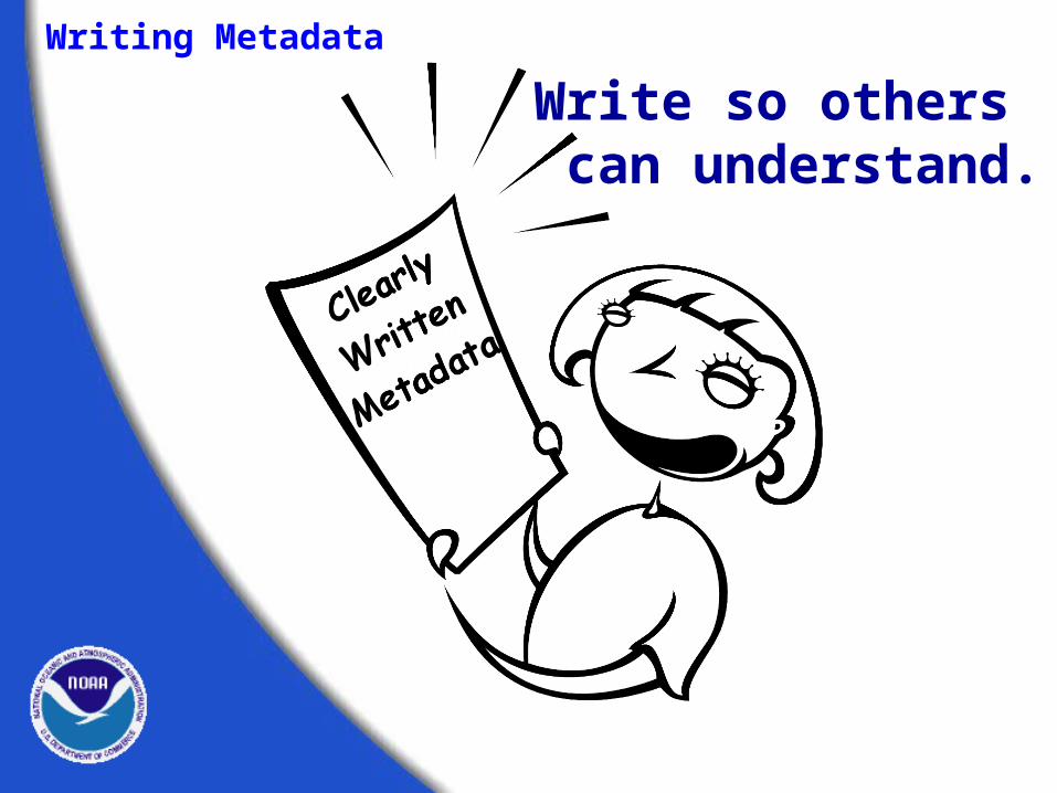
Write so others can understand.
Writing Metadata

Always review your document.
Writing Metadata

• Write simply but completely.
• Document for a general audience.
• Be consistent in style and terminology.
Keep your readers in mind.
Writing Metadata

• Define all acronyms.
• Avoid using jargon.• Clearly state data limitations.
Writing Metadata
Keep your readers in mind.
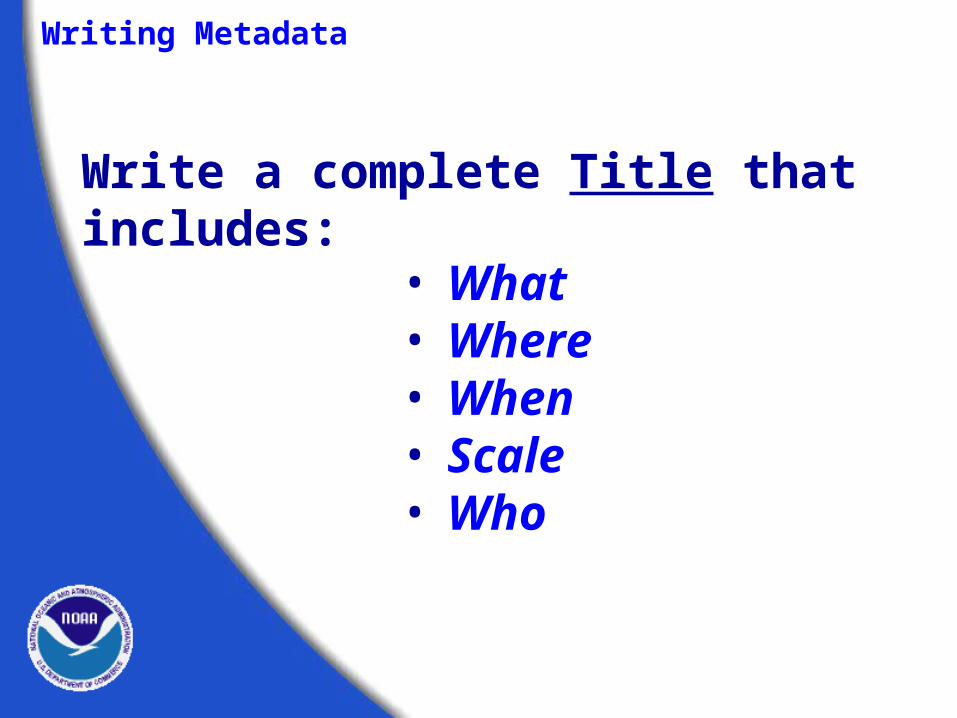
Write a complete Title that includes:
• What• Where• When• Scale• Who
Writing Metadata

The title is critical in helping others find your data.
Greater Yellowstone Rivers from 1:126,700 Forest Visitor Maps (1961-1983)
Writing Metadata

Be specific. Quantify when you can.
Vague: We checked our work and it looks complete.
Specific: We checked our work using 3 separate sets of check plots reviewed by 2 different people. We determined our work to be 95% complete based on these visual inspections.
Writing Metadata

Select your key words wisely.
• Use unambiguous words.
• Use descriptive words.
• Fully qualify geographic locations.
Writing Metadata

• Have someone else read it.
• If you’re the only reviewer, put it away and read it again later.
• Check for clarity and omissions.
Review your final product.
Writing Metadata

• Can a novice understand what you wrote?
• Are your data properly documented for posterity?
When you review your work, ask:
Writing Metadata
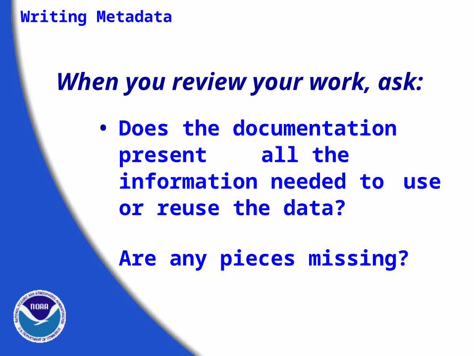
• Does the documentation present all the information needed to use or reuse the data?
• Are any pieces missing?
When you review your work, ask:
Writing Metadata

Writing Metadata
Your audience may be very diverse.
Considerwriting your metadata to reflect this diversity.
Metadata Creation
and Validation
Tools of the Trade

Metadata Tools
Some available tools for metadatacreation, validation, and publication.
• CNS and MP“Chew ‘n spit”- checks and corrects structural errors, and “Metadata Parser”- checks for errors in element compliance; “mp batch” and “mp online tool”
• Template tools CSC’s metaScribe create large numbers of similar records.
• ArcView Tools Extension for ArcView 3.x
ArcCatalog for ArcGIS 8.x
• TKMEText editor used for metadata entry.

TKME, CNS and mp are
FREE downloads!
http://geology.usgs.gov/tools/metadata
See document, “Downloading and Installing CNS and MP”

Tools of the TradeTKME - An editor for formal metadata, TKME is
intended to simplify the process of creating metadata that conform to the FGDC Standard.
- Hierarchical structure - Proper arrangement
Maintains:
of elements
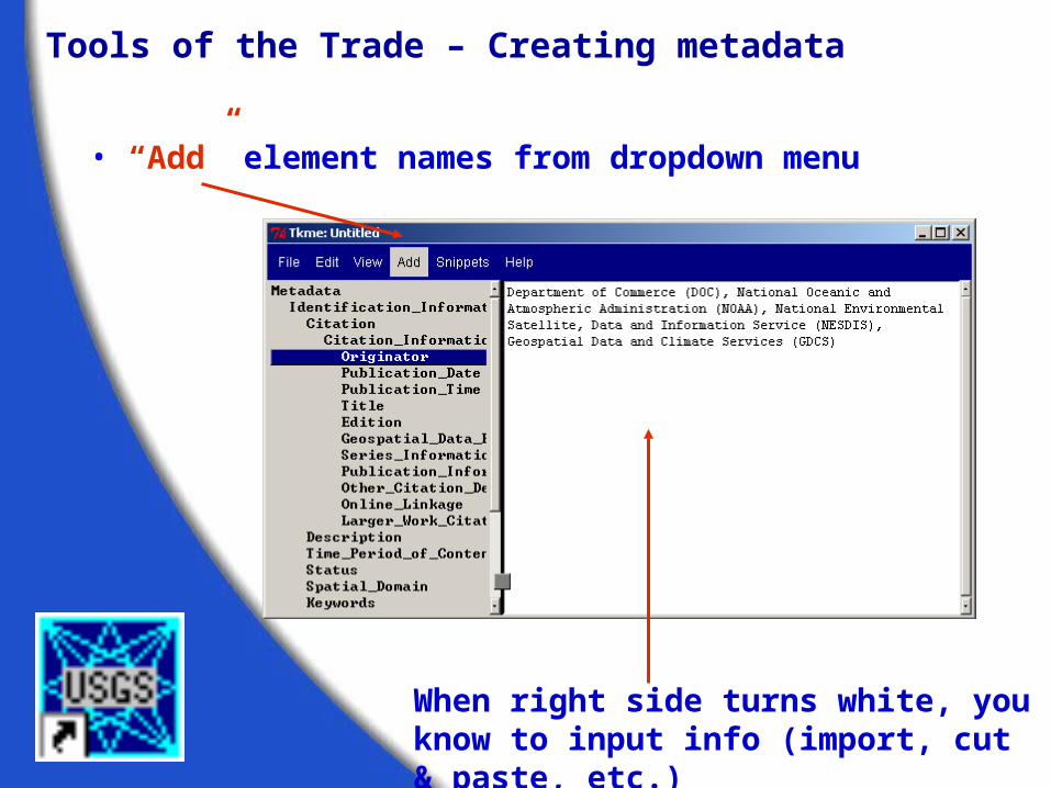
Tools of the Trade – Creating metadata
• “Add” element names from dropdown menu
When right side turns white, you know to input info (import, cut & paste, etc.)

Tools of the Trade – Creating metadata
Help Menu:
- Version (how to use, helpful hints
- Element (definition of element)
- Output (final output look)
- Fonts (choose different fonts
Help Menu

Tools of the Trade – Creating metadata
• Double click on Tkme icon from desktop
• Go to File, Open, and navigate to C:\Metadata\ benthic_bad.txt

Tools of the Trade- Creating metadata
NOAA CSC ArcView ® Metadata Collector

ArcGIS metadata collector
Found in ArcCatalog, this tool allows the user
to write metadata within the Arc environment.
Tools of the Trade
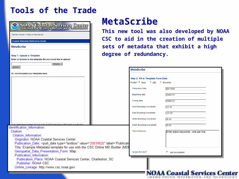
Tools of the Trade
MetaScribeThis new tool was also developed by NOAA CSC to
aid in the creation of multiple sets of metadata that
exhibit a high degree of redundancy.

CNS (“Chew ‘n Spit”)
A pre-parser for formal metadata designed to assist metadata managers convert records
that cannot be parsed by mp into records that can be parsed by mp.
Tools of the Trade - Validation Tools
MP (Metadata Parser)
A compiler to parse formal metadata, checking the syntax against the FGDC Content Standard for Digital
Geospatial Metadata and generating output suitable for viewing with a web browser or text editor.

TKME, CNS, and MP are available as free downloads from the United States Geological Survey (USGS) Website. (geology.usgs.gov/tools/metadata)
TKME will run from a shortcut on the desktop
Both MP and CNS can be run from:• command line in MS-DOS or UNIX• MP Batch tool and • MP online interface
Tools of the Trade

Tools of the Trade
• MP Batch, Integraph®
Check multiple records at one time for CNS and MP compliance
http://imgs.intergraph.com/smms/default.asp
• SMMS Metadata Software
Variety of metadata tools (but it cost)
http://www.intergraph.com/gis/support/ > Free Utilities/Tools
• MP Online Tool, Peter Schweitzer (USGS)
User friendly interface for MP (no command line)

http://www.nature.nps.gov/im/units/mwr/gis/metadata/metadata_tools.htm
• NPS Metadata Tools/Extensions - ArcGIS
• ESRI Metadata Customizations
http://imgssupport.intergraph.com/Tools.asp
- ArcCatalog extension; 5 new buttons (MP, editor, organizational, input/export capabilities)
- Spell checker: understands element names, underscores
- Advanced synchronization: turn on/off different sections so it’s not “automatically updated” (Entity & Attributes)
Tools of the Trade

Optional Exercise
• MP exersise• MP Batch• MP online tool

Tools of the Trade
http://www.fgdc.gov/standards/status/textstatus.html
• NBII Biological Data Profile
• Remote Sensing Extension
FGDC Profiles and Extensions to the CSDGM
• Shoreline Data Profilehttp://www.csc.noaa.gov/metadata/shoreline_profile.html
http://www.fgdc.gov/standards/status/sub5_2.html
http://www.fgdc.gov/standards/status/csdgm_rs_ex.html
http://www.fgdc.gov/standards/status/sub5_6.html
http://www.nbii.gov/datainfo/metadata/standards/index.html

Keyword Lists / Controlled Vocabularies / Thesauri
• Global Change Master Directory's (GCMD)
http://gcmd.gsfc.nasa.gov/Resources/valids/index.html
• Integrated Taxonomic Information System
http://www.itis.usda.gov/
• Master Environmental Library
http://mel.dmso.mil/docs/metadata_guide/section_6.htm
• Aquatic Science and Fisheries Abstracts
http://www4.fao.org/asfa/asfa.htm
• Geographic Names Information System (GNIS)
http://geonames.usgs.gov/

Resources: CSC’s Metadata Website: http://www.csc.noaa.gov/metadata
• Metadata Standards
• How to start writing metadata with Metadata Bob
• Metadata tools
• Metadata Forum
• Metadata Training Materials
. . . and much, much more!
Featuring:
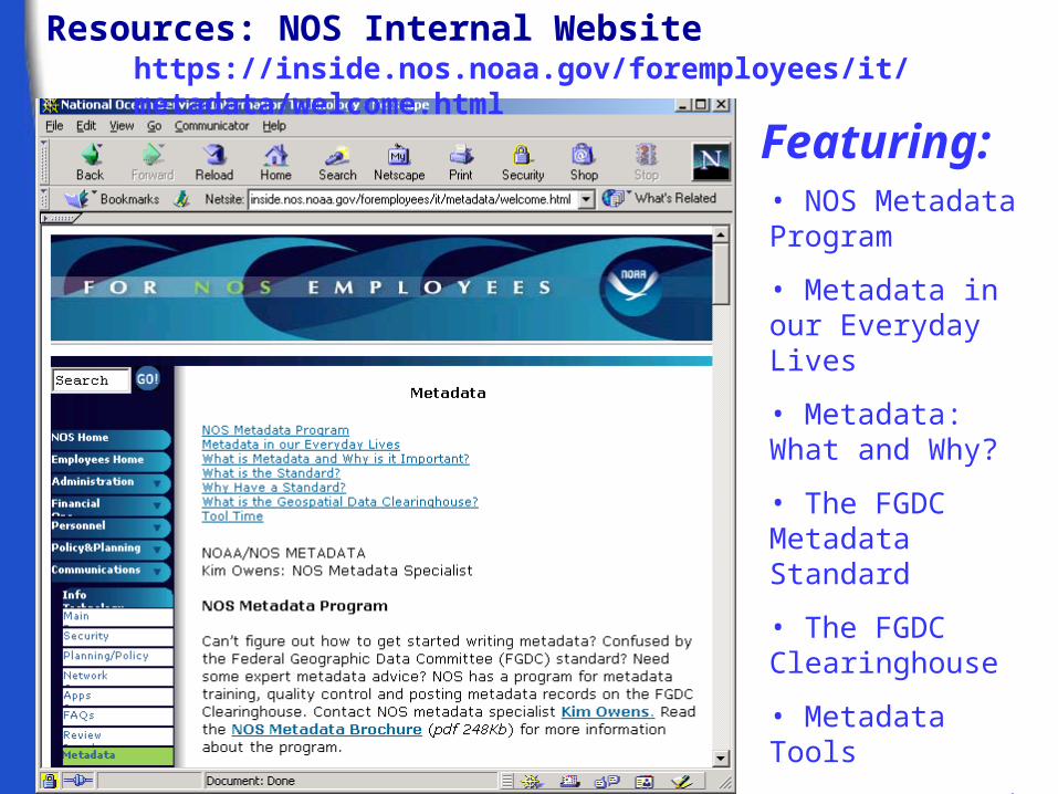
Resources: NOS Internal Website
• NOS Metadata Program
• Metadata in our Everyday Lives
• Metadata: What and Why?
• The FGDC Metadata Standard
• The FGDC Clearinghouse
• Metadata Tools
. . . and much, much more!
Featuring:
https://inside.nos.noaa.gov/foremployees/it/metadata/welcome.html

Finally...
Remember, metadata is a legacy document that
concisely sums up your data or data set.
Without metadata, your data set is
incomplete.

Optional Exercise:
Get Started!
Create a record using Tkme or ArcCatalog
