lidar campaign & products 2014
TRANSCRIPT

TOPOGRAPHIC LIDAR TOPOGRAPHIC LIDAR ACQUISITIONACQUISITION
TTI Production

A characteristic of Lidar data is the separability of laser beam. When the laser beam hits an object it is reflected back to the mirror and the time interval between the pulse leaving the airborne platform and the reflected signal is measured.
The multiple backscattered beams on ground and through some objects (trees, pylons, etc.) are recorded and separated by return time order.
The data is post-processed and the LIDAR time-interval measures are converted to distance and corrected using the aircraft's onboard GPS receiver, IMU, and ground-based GPS stations.
LIDAR ACQUISITION (LIght Detection and Ranging)
LIDAR technology collects a set of 3D points on the Earth’s surface. The system emits toward a target a series of light pulses with a known time interval. Using an averaging process once again a time over distance calculation is able to measure the time of flight between the transmitted and received sensors resulting in an accurate speed and range measurement.
The LiDAR technology collects a huge amount of data and a single survey can easily collect millions of x,y,z points on huge areas with an accuracy between 5 and 20 cm.
Some applications :
Planimetric and slope mapping
Trees or houses height analysis
Images ortho-rectification
Terrain analysis3-D modeling
Floodplain mapping and planning
Disaster management
Coastal erosion
Forestry
Land use mapping and planning
Volumetric studies - 3-D modeling
Electrical lines / pipes corridor mapping
TTI Production

LIDAR TECHNOLOGY AND DEM / DTM PRODUCTS
Sample of Digital Models with vegetation (left) and without vegetation (right)
Topographic productsContours at various intervals
Slopes
TINs
Rasters at various resolution
Points xyz
TTI Production
CONTACT :
David LOY

X Y Z POINTS CLASSIFICATION
A dedicated software for Lidar data processing, classifies xyz points to separate housing or any man-made structures from vegetation using information on the first and last pulses.
Then, filters are applied to separate real ground values and housings.
Filtered points to obtain the class «vegetation»
Filtered points to obtain the class «housing»
Each point (brown) is an X,Y,Z measure of LiDAR acquisition that means at
least 3 pts / m²
TTI Production

By using only ground points, we can construct a partial Digital Terrain Model.
We need to extract housing and structures, then interpolate topography within the “holes” to retrieve a complete and real Digital Terrain Model.
LIDAR DATA PROCESSING
With Lidar data, it is possible to produce vector layers with vertical attributes to built accurate 3D models.
TTI Production

LIDAR DEM AND DTM EXTRACTION
DIGITAL ELEVATION MODEL( DEM )
orDIGITAL TERRAIN MODEL
( DTM )
Lidar first pulse
Lidar first pulse
Interpolation
DEM
DTM (with buildings)
Real DTM interpolated
DEM (first pulse)
DTM (last pulse)
+
+ +
+
TTI Production

APPLICATION: URBAN PROJECT – COTONOU (BENIN)
In 2014, TTI production & IMAO have completed a LiDAR acquisition campaign over the city of Cotonou to produce DTM and DEM for flooding modelling and hydraulic analysis.
LiDAR and aerial image acquisition planning – 90 Km²
CONTACT :

TOPOGRAPHIC MISSION TO CALIBRATE LIDAR DATA
TTI Production has done topographic mission to calibrate LiDAR and optical images acquisition. The post-processing requires reference points with DGPS measurements to obtain an accuracy of ~ 10 cm.Several targets made of large crosses (to be identified on aerial images) have been painted on the ground in open areas.
DGPS measurements using ground targets to calibrate
the airborne mission
DGPS base device installation for the duration of the mission
Position of calibration points

COTONOU AIRBORNE ACQUISITION PROJECT - 2014
Aerial optical images at 10 cm resolution were acquired at the same time that Lidar data TTI Production
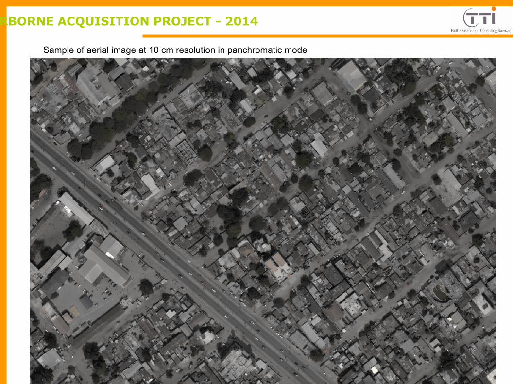
Sample of aerial image at 10 cm resolution in panchromatic mode
COTONOU AIRBORNE ACQUISITION PROJECT - 2014
TTI Production

LIDAR Product : DEM = overall Elevation + Vegetation + Houses + other objects (cars, people, etc.)
In meters
COTONOU AIRBORNE ACQUISITION PROJECT - 2014 TTI Production
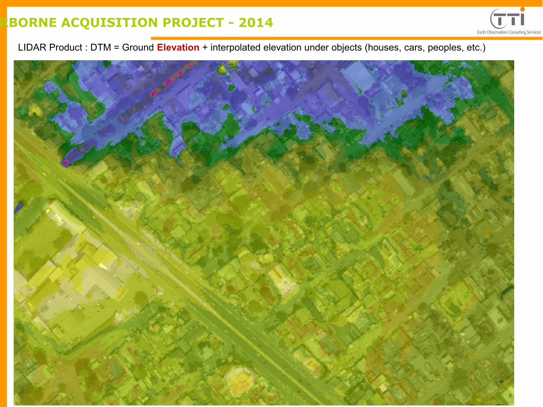
COTONOU AIRBORNE ACQUISITION PROJECT - 2014
LIDAR Product : DTM = Ground Elevation + interpolated elevation under objects (houses, cars, peoples, etc.)
TTI Production
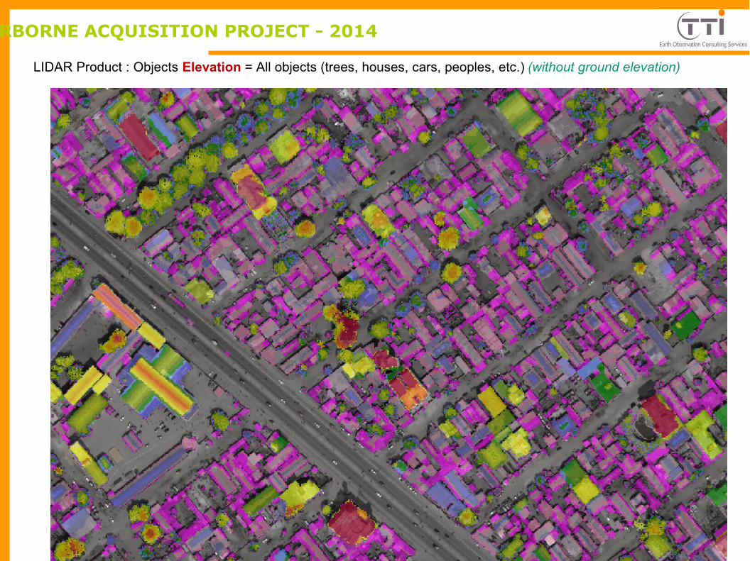
COTONOU AIRBORNE ACQUISITION PROJECT - 2014
LIDAR Product : Objects Elevation = All objects (trees, houses, cars, peoples, etc.) (without ground elevation)
TTI Production

COTONOU AIRBORNE ACQUISITION PROJET - 2014
LIDAR Product : Housing Elevation (without ground, other objects and vegetation)
TTI Production
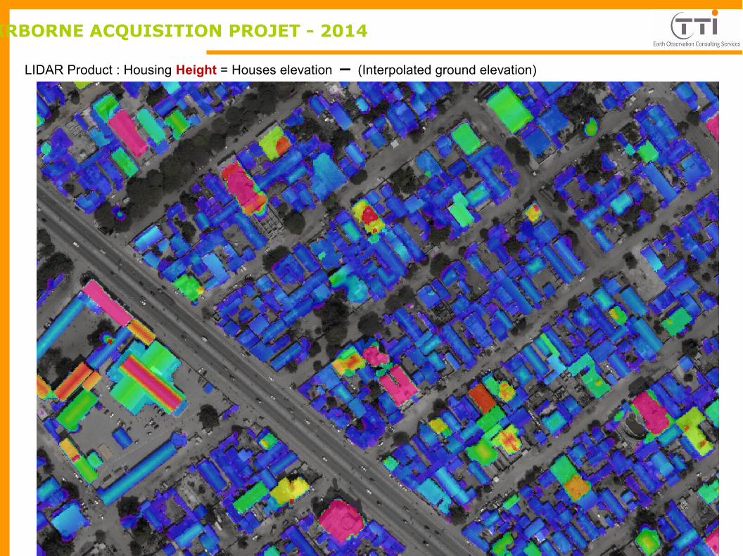
COTONOU AIRBORNE ACQUISITION PROJET - 2014
LIDAR Product : Housing Height = Houses elevation – (Interpolated ground elevation)
TTI Production

COTONOU AIRBORNE ACQUISITION PROJET - 2014
LIDAR Product : Vegetation Height = Vegetation elevation – (Interpolated ground elevation)
TTI Production

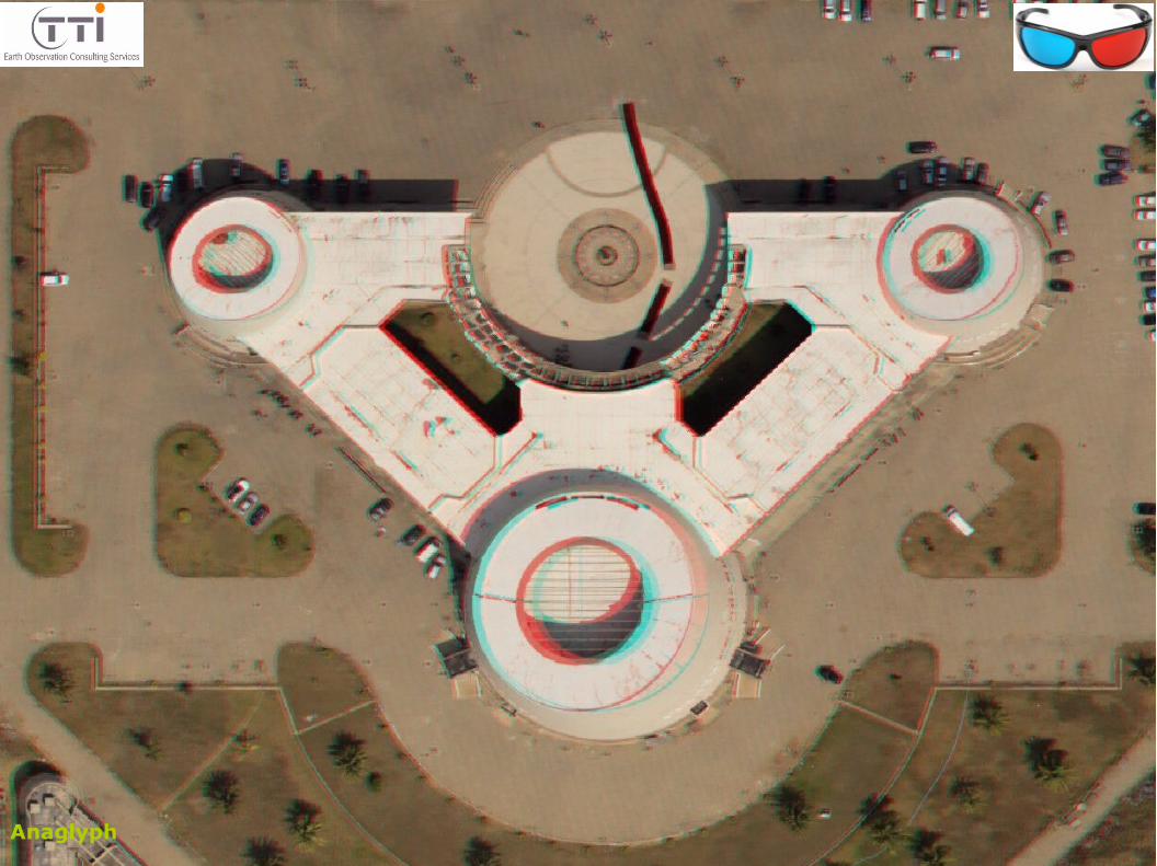
Stereo anaglyph lidar image – TTI Production
Anaglyph

Stereo anaglyph lidar image – TTI Production
Anaglyph

Stereo anaglyph lidar image – TTI Production
Anaglyph
Stereo anaglyph lidar image – TTI Production
Anaglyph

Stereo anaglyph lidar image – TTI Production
Anaglyph

Stereo anaglyph lidar image – TTI Production
Anaglyph

Stereo anaglyph lidar image – TTI Production

Stereo anaglyph lidar image – TTI Production
Anaglyph