lesson 10 - iit bombay
TRANSCRIPT
Lesson 10
River flooding
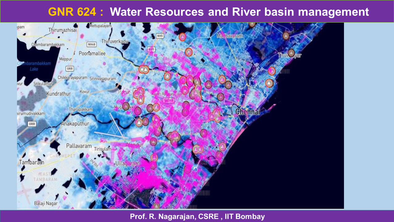
Urban flooding is specific in the fact that the cause is a lack of drainage in an urban area. As there is little open soil that can be used for water storage nearly all the precipitation needs to be transport to surface water or the sewage system.
Multiple uses of floodplain
Different levels of settlement development and disturbance to natural systems have various effects on natural resources. For instance, the management objectives can be different for an already fully developed floodplain community than a community with large open spaces.
TYPES OF FLOODING According to Duration Slow-Onset Flooding, Rapid-Onset Flooding, Flash Flooding.
According to Location -Coastal Flooding, Arroyos Flooding, River Flooding and Urban Flooding.
The urban area is paved with roads etc and the discharge of heavy rain can’t absorbed into the ground due to drainage constraints leads to flooding of streets, underpasses, low lying areas and storm drains
CAUSES OF URBAN FLOODING Natural Causes Heavy Rainfall / Flash floods Water of Heavy rainfall concentrates and flows quickly through urban paved area and impounded in to low lying area raising the water level. It creates more havoc when a main drain or a river passing through the area over-flows or breaches Lack of LakesLakes can store the excess water and regulate the flow of water. When lakes become smaller, their ability to regulate the flow become less and hence flooding. SiltingThe drains carry large amounts of sediments and deposited in the lower courses making beds shallower thus channel capacity is reduced. When there is heavy rain, these silted drains can’t carry full discharge and result in flooding.
Human Causes Population pressureBecause of large amount of people, more materials are needed, like wood, land, food, etc. This aggravates overgrazing, over cultivation and soil erosion which increases the risk of flooding. DeforestationLarge areas of forests near the rivers/catchment of cities are used to make rooms for settlements, roads and farmlands and is being cleared due to which soil is quickly lost to drains. This raises the drain bed causing overflow and in turn urban flooding.
Trespassing on water storm drainsThe areas which were essentially created by the storm water drains to let their flood waters pass freely being tress-passed for developmental purposes result in obstruction of water flow and thus contributed immensely to the fury of floods. Urbanisation leads to paving of surfaces which decreases ground absorption and increases the speed and amount of surface flow. The water rushes down suddenly into the streams from their catchment areas leading to a sudden rise in water level and flash floods.Unplanned urbanisation is the key cause of urban floodingVarious kinds of depression and low lying areas near or around the cities which were act as cushions and flood absorbers are gradually filled up and built upon due to urbanisation pressure. This results in inadequate channel capacity causing urban flooding.
Un Authorised colonies have been developed by the local colonisers on the agriculture land, earlier being used for crop has been purchased at lucrative prices from farmers, without consideration to the city plans, drainage, sewerage etc. and thus subjected to flooding during heavy rain falls.
Poor Water and Sewerage Management Old drainage and sewerage system has not been overhauled nor is it adequate now. All the drainage and sewer system in many parts of Delhi has collapsed resulting in flooding. This can be seen during rainy seasons every year. Lack of attention to the nature of hydrological system. Lack of flood control measures. Multiple authorities in a city but owning responsibility by none.
EFFECTS OF FLOODING/ FLOOD DAMAGES The flooding affects every section of people, systems in a city, some of them are summarised below:
Economic effects•Damage to Public buildings, Public utility works, housing and house –hold assets. •Loss of earning in industry & trade •Loss of earning to petty shopkeepers and workers •Loss of employment to daily earners •Loss of revenue due to Road, Railway Transportation Interruption •High prices for essential commodities.
After flooding, government has to put many resources for aiding e.g., police force, fire control, aid workers and for restoration of flood affected structures, persons, live-stock etc. The flooding cause a great economic loss to the state, individual and to the society.
Environmental effects: Damage to surroundings, forests, ridges, wild-life, zoo, urban community-trees, water bodies, shrubs, grass, fruits / vegetables in go downs etc result imbalance of eco-system of the city.
Effect on Traffic - Flooding results in the damages of roads, collapse of bridges causing traffic congestion which affect day-to-day life and other transportation system.
Reasons of flooding in Delhi
Heavy Rainfall / Flash floods The local drainage system at times found to be inadequate to meet the requirement, when there is heavy rain fall. Delhi normally remained flooded to the extent of 70000 hac (50% of its geographical area of 148300 hacfrom 1953 to 1984).
Urbanisation -urbanisation resulting in increase of paved area and decrease in the agricultural land which used to act as a percolation zone. The catchment area of the Najafgarh drain has been built up and paved resulting increase in water-flow during rainy season. The cross-sectional area of the drain has become inadequate. Unplanned urbanisation is also a key cause of flooding
Unauthorised colonies: There are about 1650 unauthorised colonies which have been developed by the local colonisers on the open/agriculture land without consideration to the city plans, drainage, sewerage etc. and thus subjected to flooding during heavy rain falls. Many more are coming up which would further increase drainage congestion and flooding.
Trespassing on storm water drains: The areas which were essentially created by the storm water drains( or constructed) to let their flood waters pass freely being tress-passed by JJ Clusters, Slum dwellers, small shopkeepers, motor garages, garbage dumping etc result in obstruction of water flow and thus contributed immensely to the fury of floods. Most of the Delhi drains can be seen such trespassing and garbage dumping.
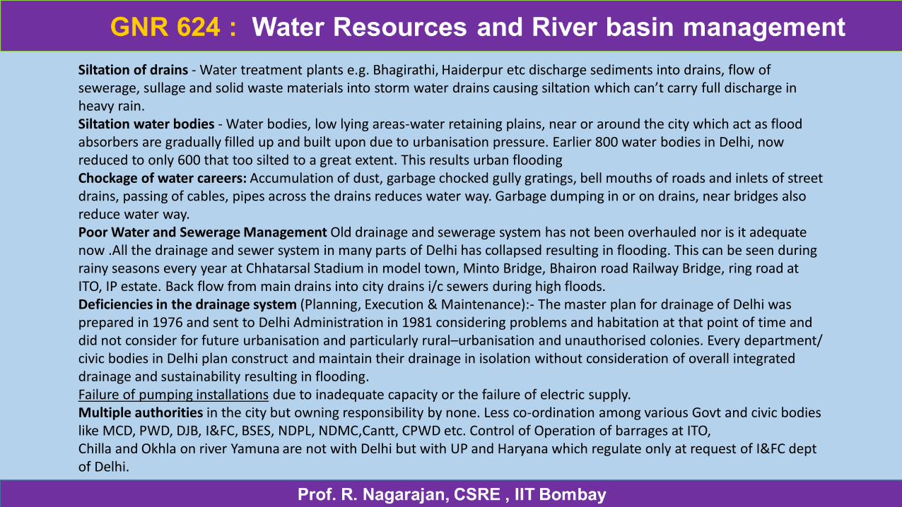
Siltation of drains - Water treatment plants e.g. Bhagirathi, Haiderpur etc discharge sediments into drains, flow of sewerage, sullage and solid waste materials into storm water drains causing siltation which can’t carry full discharge in heavy rain. Siltation water bodies - Water bodies, low lying areas-water retaining plains, near or around the city which act as flood absorbers are gradually filled up and built upon due to urbanisation pressure. Earlier 800 water bodies in Delhi, now reduced to only 600 that too silted to a great extent. This results urban flooding Chockage of water careers: Accumulation of dust, garbage chocked gully gratings, bell mouths of roads and inlets of street drains, passing of cables, pipes across the drains reduces water way. Garbage dumping in or on drains, near bridges also reduce water way.Poor Water and Sewerage Management Old drainage and sewerage system has not been overhauled nor is it adequate now .All the drainage and sewer system in many parts of Delhi has collapsed resulting in flooding. This can be seen during rainy seasons every year at Chhatarsal Stadium in model town, Minto Bridge, Bhairon road Railway Bridge, ring road at ITO, IP estate. Back flow from main drains into city drains i/c sewers during high floods. Deficiencies in the drainage system (Planning, Execution & Maintenance):- The master plan for drainage of Delhi was prepared in 1976 and sent to Delhi Administration in 1981 considering problems and habitation at that point of time and did not consider for future urbanisation and particularly rural–urbanisation and unauthorised colonies. Every department/ civic bodies in Delhi plan construct and maintain their drainage in isolation without consideration of overall integrated drainage and sustainability resulting in flooding.Failure of pumping installations due to inadequate capacity or the failure of electric supply.Multiple authorities in the city but owning responsibility by none. Less co-ordination among various Govt and civic bodies like MCD, PWD, DJB, I&FC, BSES, NDPL, NDMC,Cantt, CPWD etc. Control of Operation of barrages at ITO, Chilla and Okhla on river Yamuna are not with Delhi but with UP and Haryana which regulate only at request of I&FC deptof Delhi.
Effect on Human Beings • Human lives: Every year floods in India cause more than 50 lac people affected dead and become homeless.
• Psychological impact: The people of all ages who stranded in flooding suffer a great Psychological impact disturbing their whole life and the society as whole.
• Live Stock: The live stock is the most affected living being due to urban floods. It is difficult to care for them particularly when human being itself is in trouble.
• Disease: Flooding usually brings infectious diseases, e.g. military fever, pneumonic plagues, dermatopathia, dysentery, common cold, Dengue, break bone fever, etc. Chances of food poisoning also become more where electric supply interrupted in food-storage area due to flooding.
• Public Inconveniences: The flooding causes impairment of transport and communication system due to which all people of all section get stranded e.g. school children, college students, office goers, vegetable, milk venders etc. The basic and essential commodities also do not reach to the common person. This result either starvation to poor persons or high priced to the common persons.
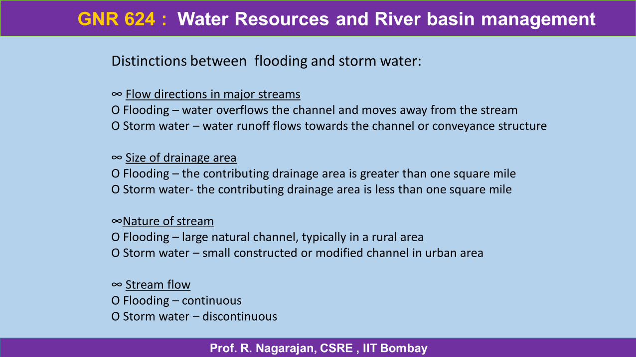
Distinctions between flooding and storm water:
∞ Flow directions in major streams O Flooding – water overflows the channel and moves away from the stream O Storm water – water runoff flows towards the channel or conveyance structure
∞ Size of drainage area O Flooding – the contributing drainage area is greater than one square mile O Storm water- the contributing drainage area is less than one square mile
∞Nature of stream O Flooding – large natural channel, typically in a rural area O Storm water – small constructed or modified channel in urban area
∞ Stream flow O Flooding – continuous O Storm water – discontinuous
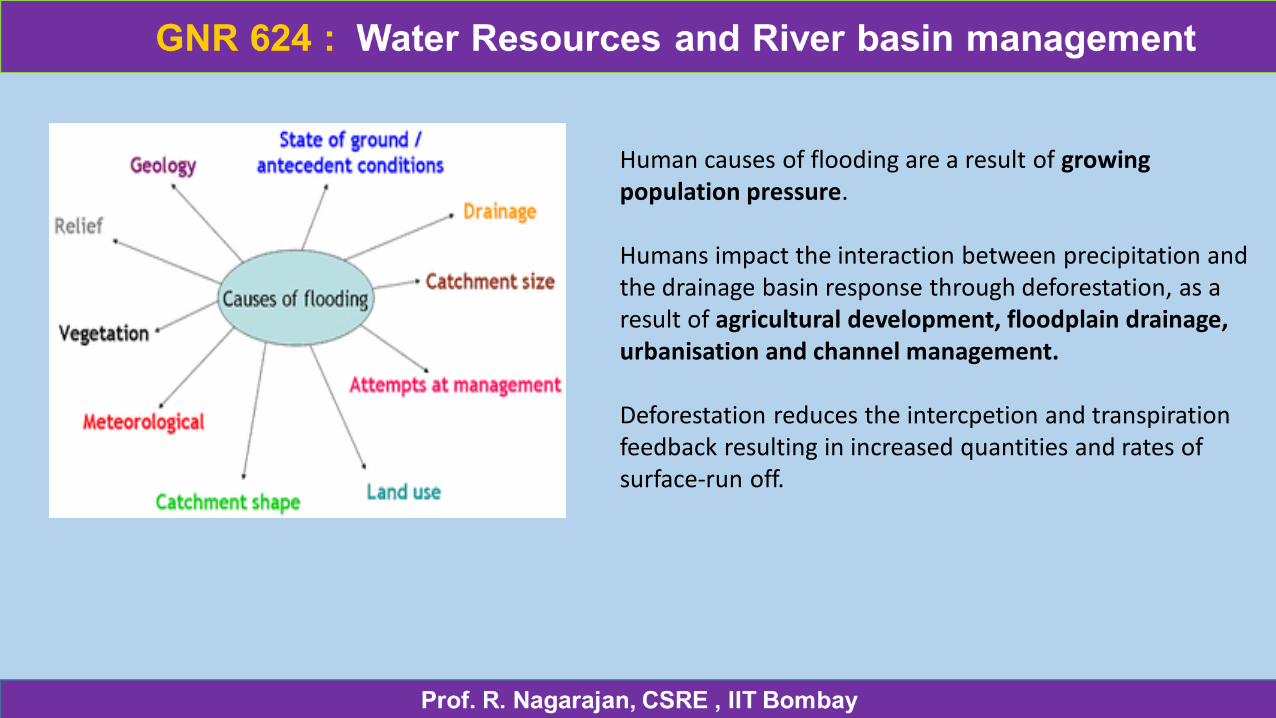
Human causes of flooding are a result of growing population pressure.
Humans impact the interaction between precipitation and the drainage basin response through deforestation, as a result of agricultural development, floodplain drainage, urbanisation and channel management.
Deforestation reduces the intercpetion and transpiration feedback resulting in increased quantities and rates of surface-run off.
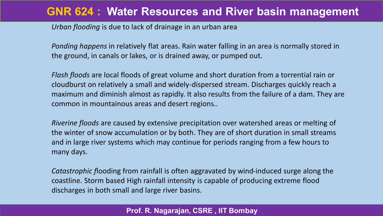
Urban flooding is due to lack of drainage in an urban area
Ponding happens in relatively flat areas. Rain water falling in an area is normally stored in the ground, in canals or lakes, or is drained away, or pumped out.
Flash floods are local floods of great volume and short duration from a torrential rain or cloudburst on relatively a small and widely-dispersed stream. Discharges quickly reach a maximum and diminish almost as rapidly. It also results from the failure of a dam. They are common in mountainous areas and desert regions..
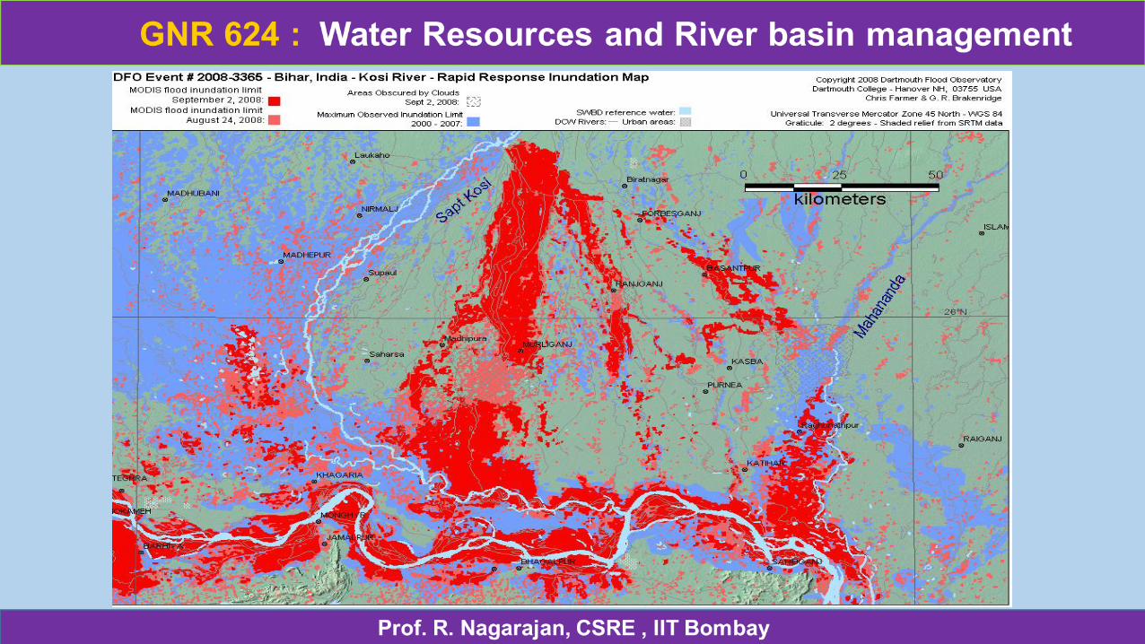
Riverine floods are caused by extensive precipitation over watershed areas or melting of the winter of snow accumulation or by both. They are of short duration in small streams and in large river systems which may continue for periods ranging from a few hours to many days.
Catastrophic flooding from rainfall is often aggravated by wind-induced surge along the coastline. Storm based High rainfall intensity is capable of producing extreme flood discharges in both small and large river basins.
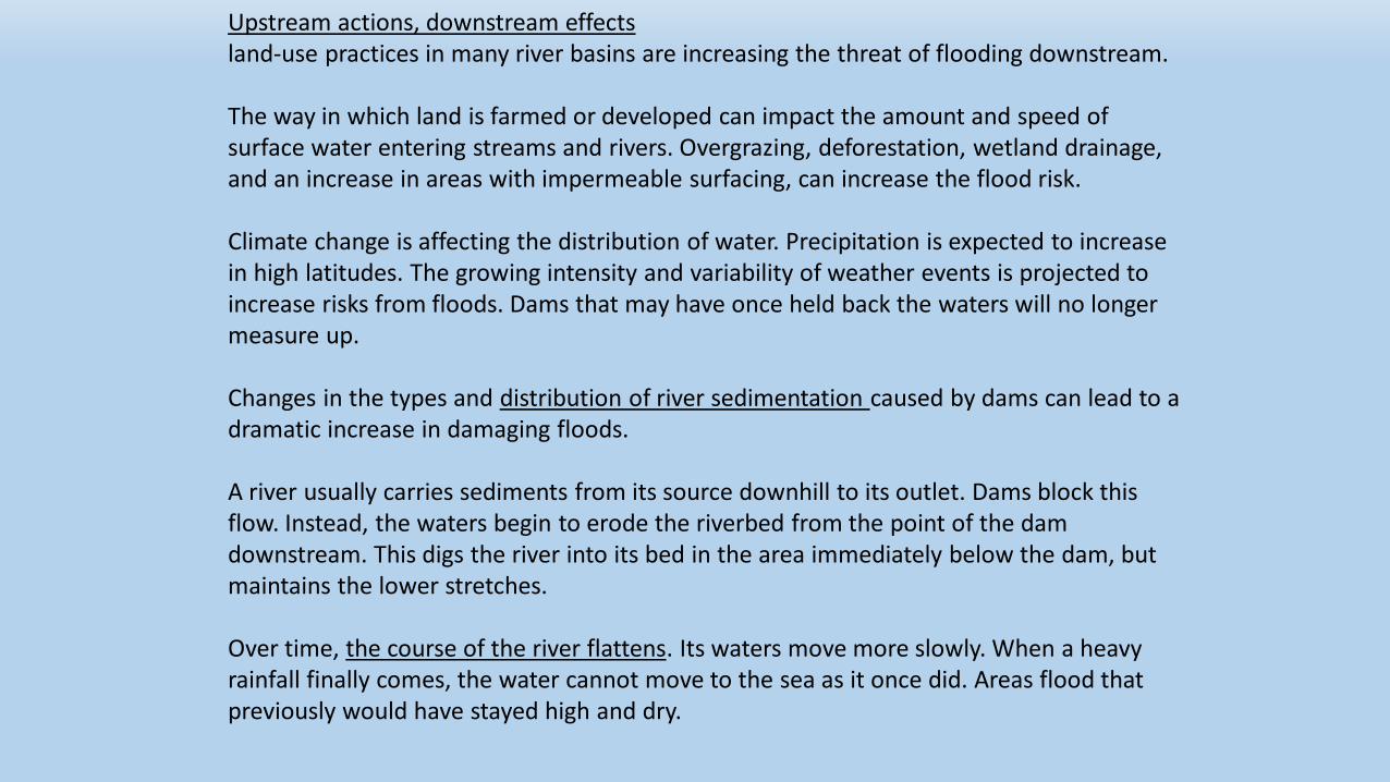
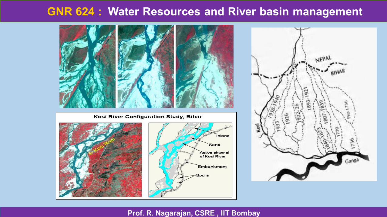
Upstream actions, downstream effectsland-use practices in many river basins are increasing the threat of flooding downstream.
The way in which land is farmed or developed can impact the amount and speed of surface water entering streams and rivers. Overgrazing, deforestation, wetland drainage, and an increase in areas with impermeable surfacing, can increase the flood risk.
Climate change is affecting the distribution of water. Precipitation is expected to increase in high latitudes. The growing intensity and variability of weather events is projected to increase risks from floods. Dams that may have once held back the waters will no longer measure up.
Changes in the types and distribution of river sedimentation caused by dams can lead to a dramatic increase in damaging floods.
A river usually carries sediments from its source downhill to its outlet. Dams block this flow. Instead, the waters begin to erode the riverbed from the point of the dam downstream. This digs the river into its bed in the area immediately below the dam, but maintains the lower stretches.
Over time, the course of the river flattens. Its waters move more slowly. When a heavy rainfall finally comes, the water cannot move to the sea as it once did. Areas flood that previously would have stayed high and dry.
Flooding
Physical causes:
• excessive rainfall == increased overland flow and soil saturation
• intense rainfall, when its > rate of infiltration, overland flow occurs, can be exacerbated by impermeable surfaces.
• rapidly melting snow
• coastal storm surges human causes
• urban areas - impermeable surfaces removes interception store which decreases evaporation. Vegetation store removed, soil has lower infiltration rate increase overland flow • deforestation -. Sediment can also get into the rivers.
• failure of dams
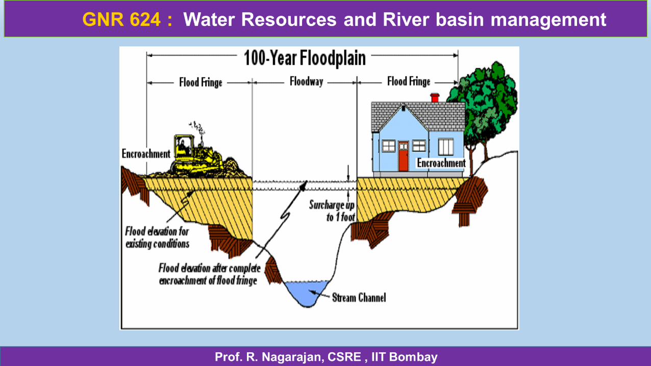
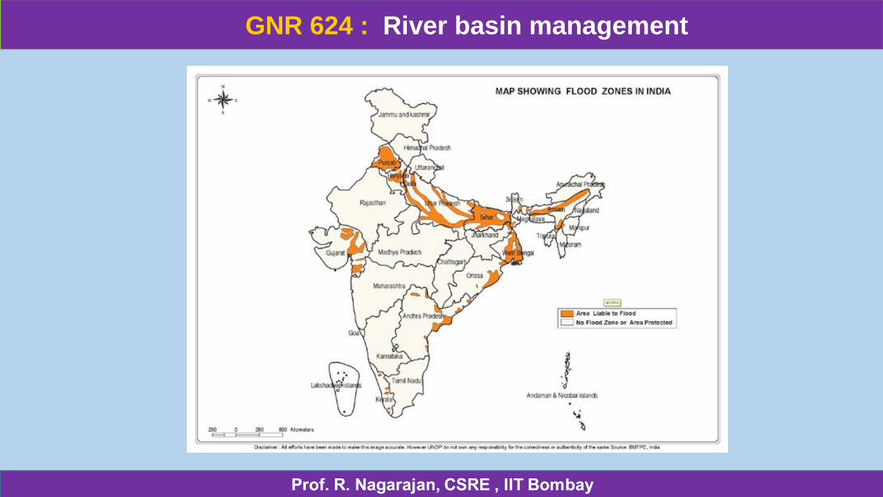
Floodplain is any land area susceptible tobeing inundated by water from any source.
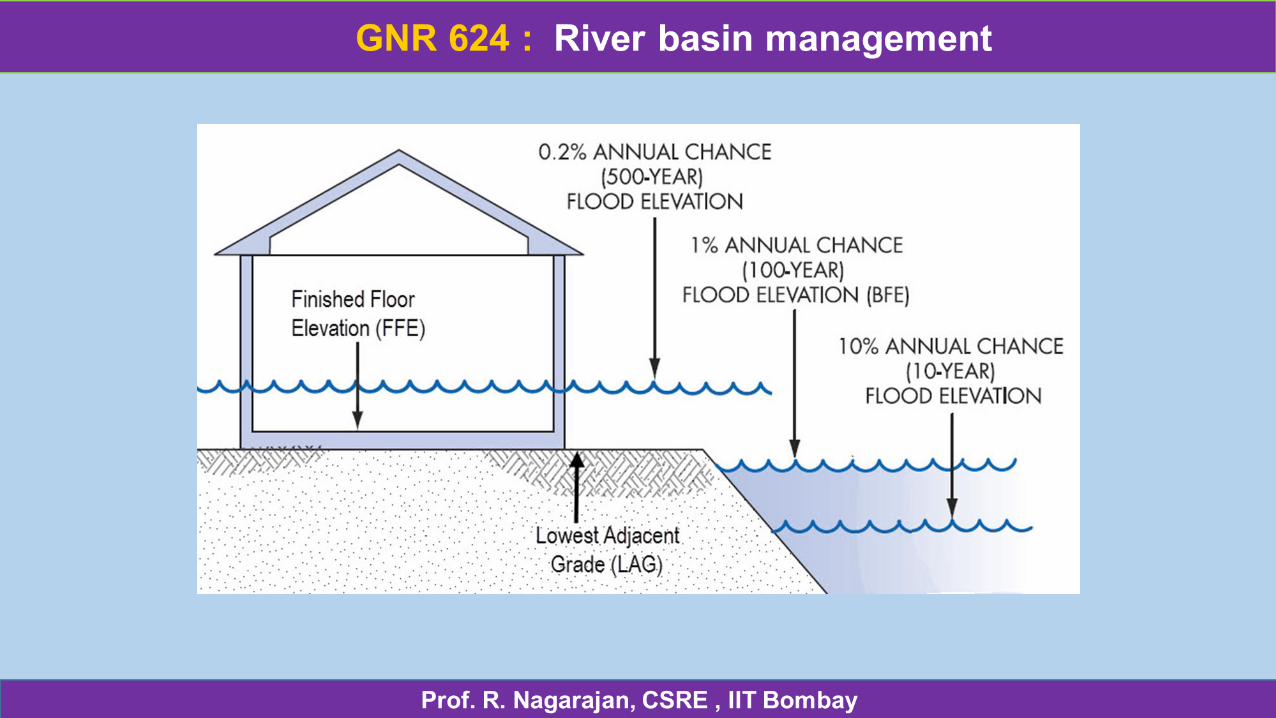
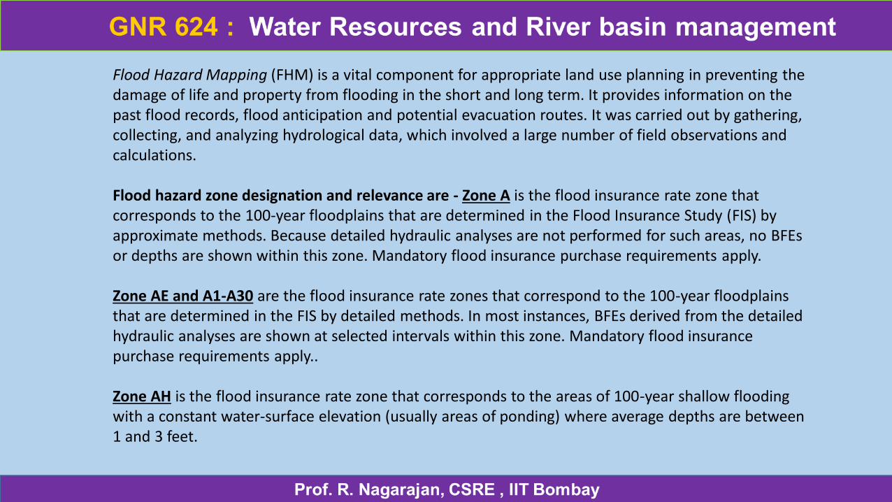
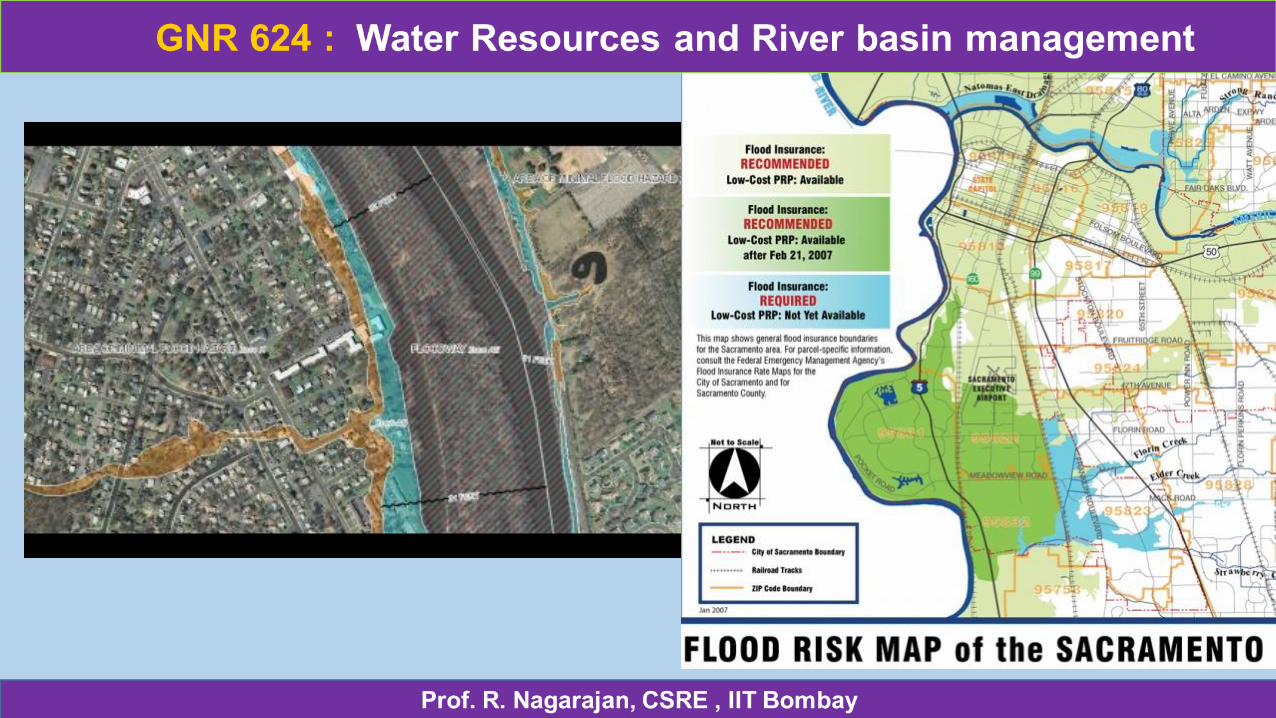
Flood Hazard Mapping (FHM) is a vital component for appropriate land use planning in preventing the damage of life and property from flooding in the short and long term. It provides information on the past flood records, flood anticipation and potential evacuation routes. It was carried out by gathering, collecting, and analyzing hydrological data, which involved a large number of field observations and calculations.
Flood hazard zone designation and relevance are - Zone A is the flood insurance rate zone that corresponds to the 100-year floodplains that are determined in the Flood Insurance Study (FIS) by approximate methods. Because detailed hydraulic analyses are not performed for such areas, no BFEsor depths are shown within this zone. Mandatory flood insurance purchase requirements apply.
Zone AE and A1-A30 are the flood insurance rate zones that correspond to the 100-year floodplains that are determined in the FIS by detailed methods. In most instances, BFEs derived from the detailed hydraulic analyses are shown at selected intervals within this zone. Mandatory flood insurance purchase requirements apply..
Zone AH is the flood insurance rate zone that corresponds to the areas of 100-year shallow flooding with a constant water-surface elevation (usually areas of ponding) where average depths are between 1 and 3 feet.
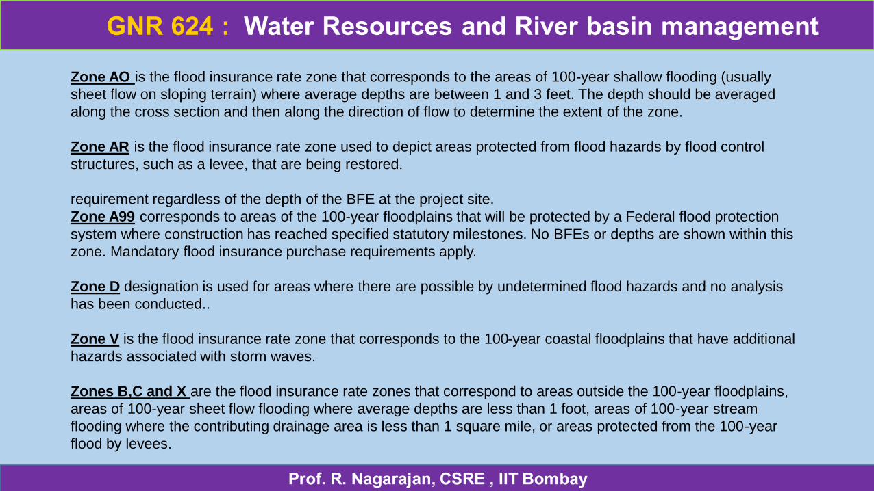
Zone AO is the flood insurance rate zone that corresponds to the areas of 100-year shallow flooding (usually
sheet flow on sloping terrain) where average depths are between 1 and 3 feet. The depth should be averaged
along the cross section and then along the direction of flow to determine the extent of the zone.
Zone AR is the flood insurance rate zone used to depict areas protected from flood hazards by flood control
structures, such as a levee, that are being restored.
requirement regardless of the depth of the BFE at the project site.
Zone A99 corresponds to areas of the 100-year floodplains that will be protected by a Federal flood protection
system where construction has reached specified statutory milestones. No BFEs or depths are shown within this
zone. Mandatory flood insurance purchase requirements apply.
Zone D designation is used for areas where there are possible by undetermined flood hazards and no analysis
has been conducted..
Zone V is the flood insurance rate zone that corresponds to the 100-year coastal floodplains that have additional
hazards associated with storm waves.
Zones B,C and X are the flood insurance rate zones that correspond to areas outside the 100-year floodplains,
areas of 100-year sheet flow flooding where average depths are less than 1 foot, areas of 100-year stream
flooding where the contributing drainage area is less than 1 square mile, or areas protected from the 100-year
flood by levees.
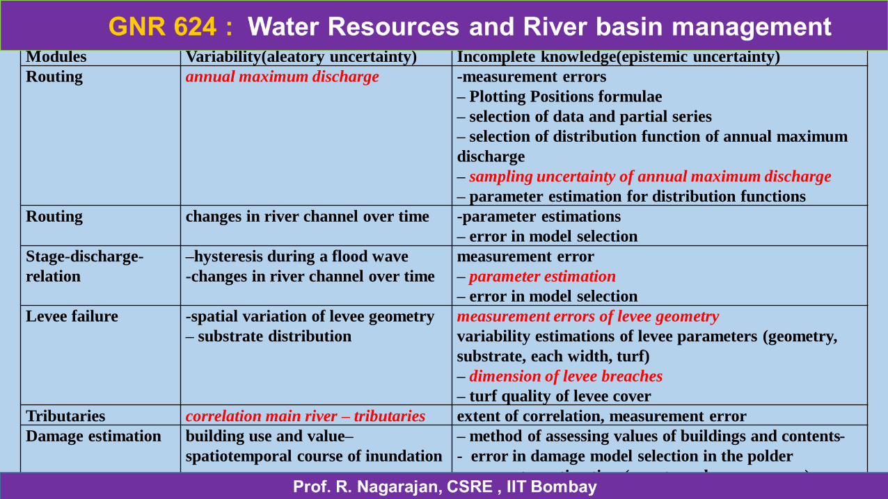
Modules Variability(aleatory uncertainty) Incomplete knowledge(epistemic uncertainty)
Routing annual maximum discharge -measurement errors
– Plotting Positions formulae
– selection of data and partial series
– selection of distribution function of annual maximum
discharge
– sampling uncertainty of annual maximum discharge
– parameter estimation for distribution functions
Routing changes in river channel over time -parameter estimations
– error in model selection
Stage-discharge-
relation
–hysteresis during a flood wave
-changes in river channel over time
measurement error
– parameter estimation
– error in model selection
Levee failure -spatial variation of levee geometry
– substrate distribution
measurement errors of levee geometry
variability estimations of levee parameters (geometry,
substrate, each width, turf)
– dimension of levee breaches
– turf quality of levee cover
Tributaries correlation main river – tributaries extent of correlation, measurement error
Damage estimation building use and value–
spatiotemporal course of inundation
– method of assessing values of buildings and contents-
- error in damage model selection in the polder
- parameter estimation (e.g. stage-damage curves)
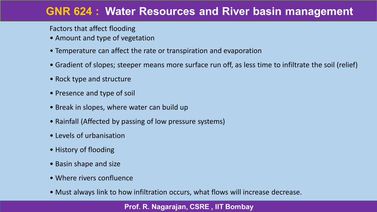
Factors that affect flooding • Amount and type of vegetation
• Temperature can affect the rate or transpiration and evaporation
• Gradient of slopes; steeper means more surface run off, as less time to infiltrate the soil (relief)
• Rock type and structure
• Presence and type of soil
• Break in slopes, where water can build up
• Rainfall (Affected by passing of low pressure systems)
• Levels of urbanisation
• History of flooding
• Basin shape and size
• Where rivers confluence
• Must always link to how infiltration occurs, what flows will increase decrease.
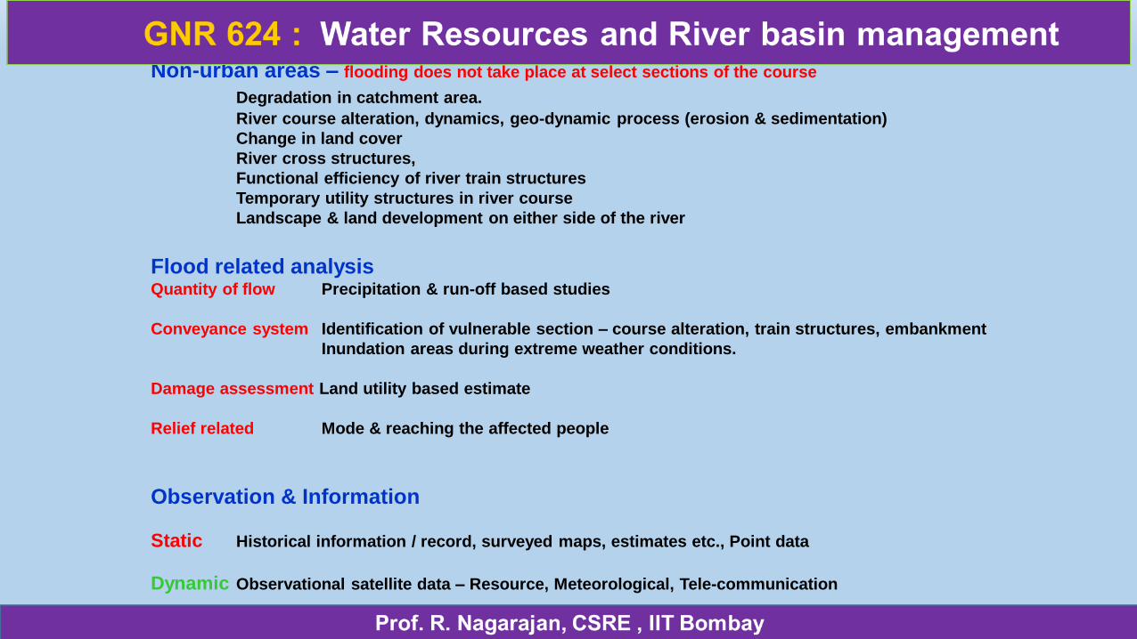
Non-urban areas – flooding does not take place at select sections of the course
Degradation in catchment area.
River course alteration, dynamics, geo-dynamic process (erosion & sedimentation)
Change in land cover
River cross structures,
Functional efficiency of river train structures
Temporary utility structures in river course
Landscape & land development on either side of the river
Flood related analysisQuantity of flow Precipitation & run-off based studies
Conveyance system Identification of vulnerable section – course alteration, train structures, embankment
Inundation areas during extreme weather conditions.
Damage assessment Land utility based estimate
Relief related Mode & reaching the affected people
Observation & Information
Static Historical information / record, surveyed maps, estimates etc., Point data
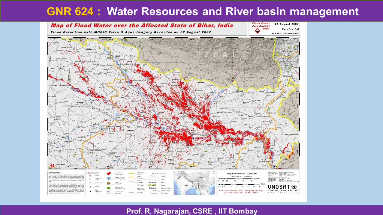
Dynamic Observational satellite data – Resource, Meteorological, Tele-communication
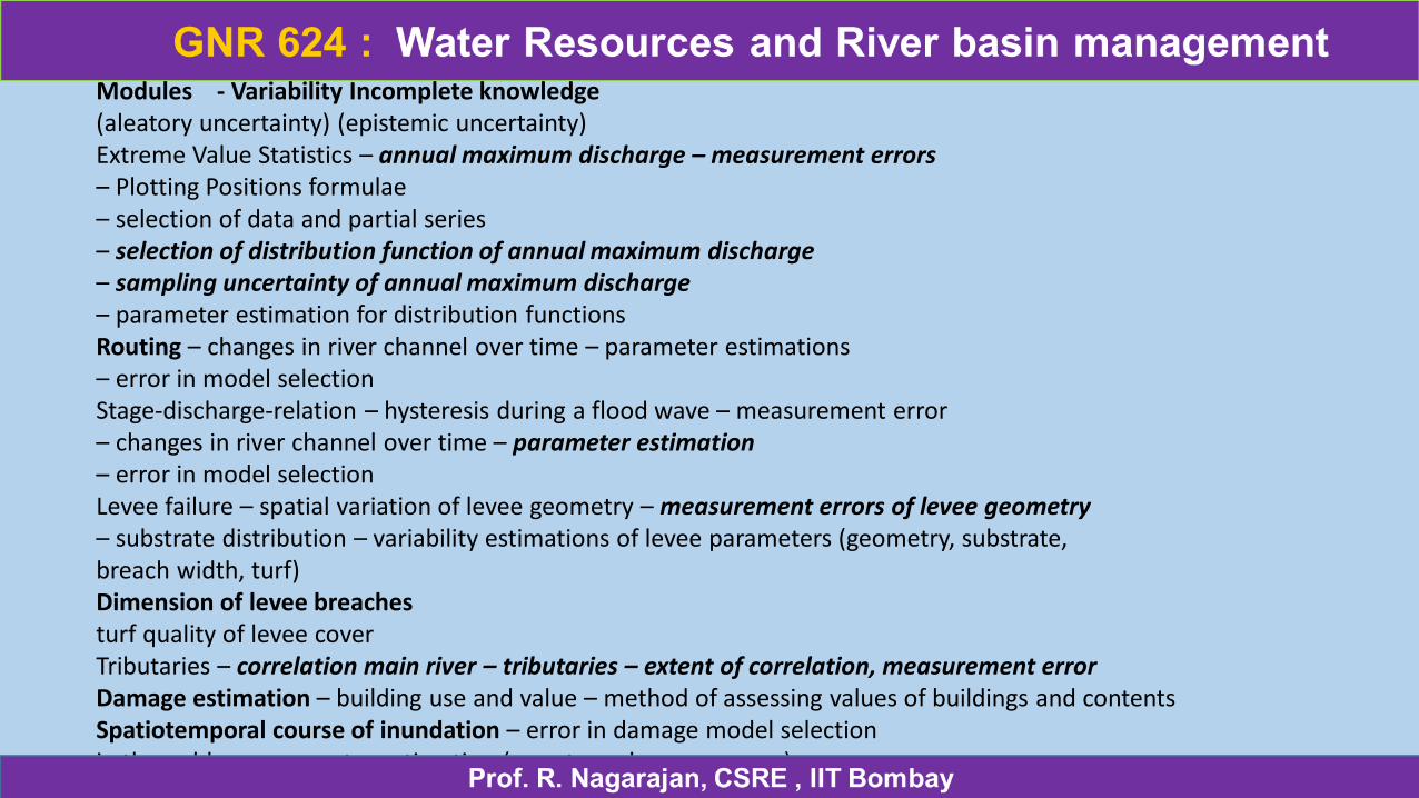
Modules - Variability Incomplete knowledge(aleatory uncertainty) (epistemic uncertainty)Extreme Value Statistics – annual maximum discharge – measurement errors– Plotting Positions formulae– selection of data and partial series– selection of distribution function of annual maximum discharge– sampling uncertainty of annual maximum discharge– parameter estimation for distribution functionsRouting – changes in river channel over time – parameter estimations– error in model selectionStage-discharge-relation – hysteresis during a flood wave – measurement error– changes in river channel over time – parameter estimation– error in model selectionLevee failure – spatial variation of levee geometry – measurement errors of levee geometry– substrate distribution – variability estimations of levee parameters (geometry, substrate,breach width, turf)Dimension of levee breachesturf quality of levee coverTributaries – correlation main river – tributaries – extent of correlation, measurement errorDamage estimation – building use and value – method of assessing values of buildings and contentsSpatiotemporal course of inundation – error in damage model selectionin the polder – parameter estimation (e.g. stage-damage curves)
GNR 624 : River basin management
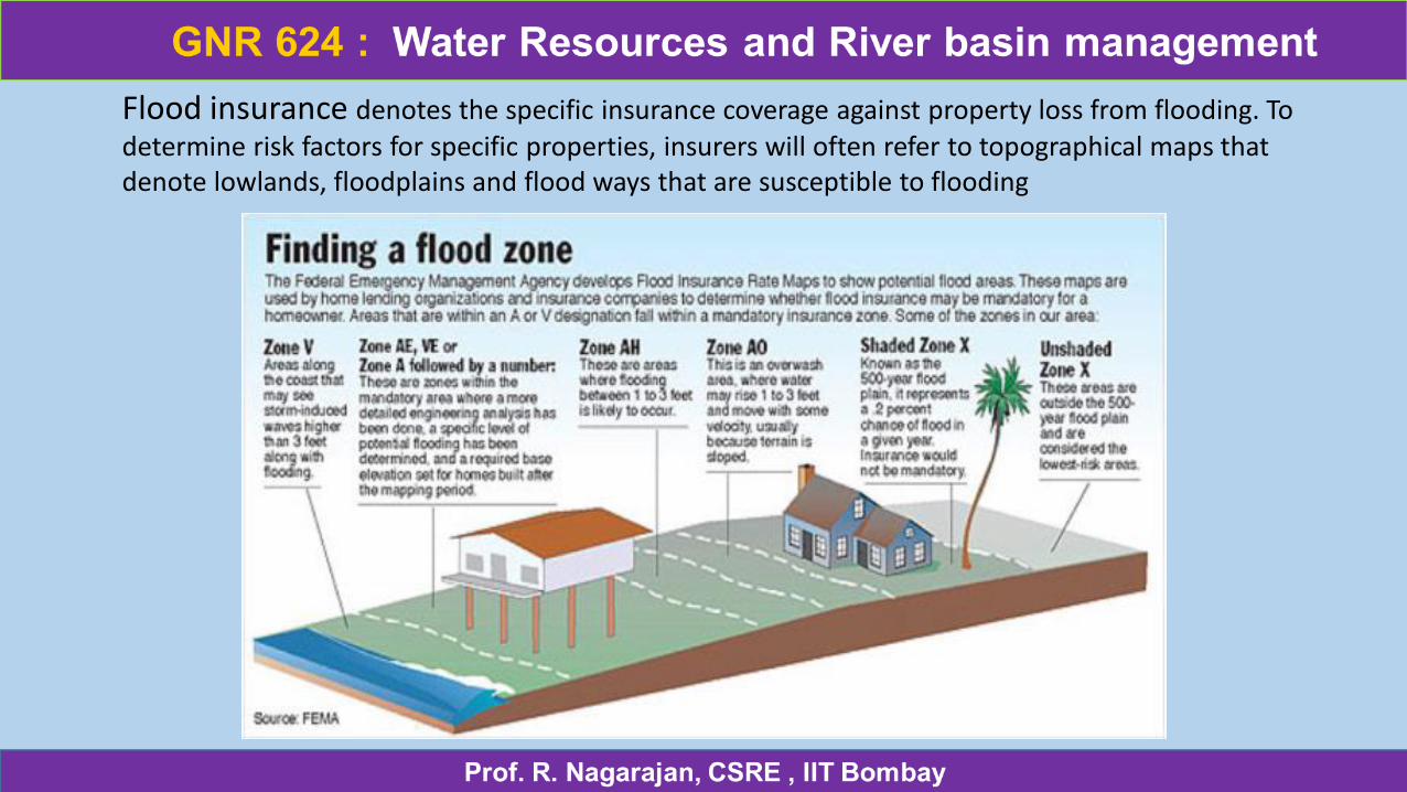
Flood insurance denotes the specific insurance coverage against property loss from flooding. To
determine risk factors for specific properties, insurers will often refer to topographical maps that denote lowlands, floodplains and flood ways that are susceptible to flooding
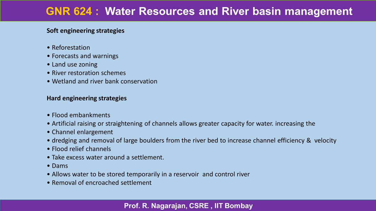
Soft engineering strategies
• Reforestation • Forecasts and warnings • Land use zoning • River restoration schemes • Wetland and river bank conservation
Hard engineering strategies
• Flood embankments • Artificial raising or straightening of channels allows greater capacity for water. increasing the • Channel enlargement • dredging and removal of large boulders from the river bed to increase channel efficiency & velocity • Flood relief channels • Take excess water around a settlement. • Dams • Allows water to be stored temporarily in a reservoir and control river• Removal of encroached settlement
There are four main levels with corresponding considerations.
•Urban Areas: The floodplain in an urban community is probably highly developed already. Restoration of natural areas and the relocation of structures particularly threatened by flood hazards are included in the management options for these areas.
•Suburban Areas/Urban Fringe: Urban fringe areas are frequently threatened by great development pressures, but there might be enough open spaces to work with. Effective planning is of critical importance in these communities, and a special focus can be put on maintaining existing open areas along waterways and restoration of vegetation.
•Rural Areas: Agricultural communities have different concerns of floodplain. The large open spaces in the floodplain of these areas are an advantage. In these areas, management strategies should focus on controlling erosion and excessive nutrient loadings, as well as vegetation of stream banks to restore natural ecosystem functions.
•Wild-lands: The natural system in these communities with very low-density development and much more open spaces should already be functioning. In these areas, there is the opportunity to safeguard floodplain functions at the outset and to maintain valuable habitats and superior water quality
Rehabilitation can be summarized as follows:
•Restoration is aimed at reviving the pristine physical, chemical and biological states of rivers. In its simplest form, it requires a full structural and functional recovery of a pre-disturbance state.
• Renaturalisation or naturalisation represents a natural method of recovering the natural state of a (river-) ecosystem without really aiming the pristine, pre disturbance state.
•Rehabilitation is primarily aimed to recover the partly functional and/or structural conditions of rivers or enabling a functional condition. It is generally considered with regard to ecologic state (biological, hydro-morphological and physico-chemical) through structural and partly non-structural measures.
•Enhancement is the improvement of the present state of rivers and its surrounding areas. It is aimed to evaluate the ecological, social, economic and aesthetic properties.
River ManagementHard Engineering
Multi-Purpose Dams are often built across the channel in order to store water and regulate the discharge of the river. Water is stored in a reservoir upstream of the dam and released in a controlled way. This protects the catchment downstream from potential flooding. Large dam projects are used for clean hydro-electric power, for large scale irrigation schemes and for strategies that open up the interior of countries for transport and trade. The downside of large-scale dams are the expensive costs; 3-Gorges was estimated to cost over $25 billion and despite its ability to produce 10% of the country's power requirements the environmental impacts on its ecology and river system are expected to be immense.
Typical problems concern the disruption of migratory fish, sedimentation and increased rates of erosion downstream. All this said, in the case of 3-Gorges, the number of people now free from the risk of flooding is the equivalent to the entire population of Belgium; 10 million.
Multi-purpose dams therefore offer a country a means of regulating rivers at a vast scale and in doing so they protect the lives of many people.
Some disputed concerns with large scale-dams question their safety and sustainability, especially in regard to weight induced earthquakes and the acceleration of sedimentation due to landslides.
Channelization is a deliberate attempt to alter the natural geometry of the river. The river can be deepened and widened to increase the capacity of the channel. This increases its hydraulic efficiency and allows a larger discharge to be contained within the channel. This will hlep prevent flooding. The channel can be made straighter, through the use of artificial cut-offs. The channel can be realigned to artificially increase the long profile gradient so that there is an increase in velocity and flood waters can be removed more quickly, which speeds up the flow and also aid navigation. Channelisation is often achieved through concrete lining the banks and bed. This prevents bed or bank erosion
Dredging the river is the process by which bedload is removed from the channel of the river through either heavy industrial pumps and diggers or through dislodging sediment that then encourages the natural flow of the river to transport it. It increases the cross-sectional area to reduce channel roughness and increase capacity and hydraulic efficiency. The benefit of using dredging is that it maintains the natural aesthetics of the river channel. However, it is costly and time consuming process that is only suitable for small section of the river, for example close to or within urban environments. The process has high ecological impact on natural ecology.
Providing bank support.
Gabions, which are wire cages containing stones allow for a softer appearance. If used in the right way they can also encourage deposition close to the banks, which over time, will build up deposition and riparian vegetation.
Groynes or spurs achieve the same affect through deflecting the fastest flow away from the bank; deposition builds up on the head ward side of the groyne. Over time, riparian vegetation will develop. An even softer approach is the planting of bank vegetation or by allowing vegetation to develop. This is achieved by simply not cutting it back. This will have different consequences depending on the aim.
Tree planting along the banks provides greater stability and may reduce erosion. However. allowing vegetation to recover in a unregulated way may in fact encourage greater channel roughness and meander migration. When combined with the dismantling of flood plain drainage the effect would be a rise in the water table and an increase in the likelihood of floods.
In contrast vegetation clearance reduces channel roughness, discourages bank deposition and increases the hydraulic efficiency of the river
Thank you