laramie county planning & development … county planning & development department planning...
TRANSCRIPT


Page 1 of 4
LARAMIE COUNTY PLANNING & DEVELOPMENT DEPARTMENT
Planning Building
3966 Archer Pkwy Cheyenne, WY 82009
www.laramiecountyplanning.com Phone (307) 633-4303 Fax (307) 633-4616
MEMORANDUM
TO: Laramie County Board of Commissioners FROM: Nancy M. Trimble, Associate Planner DATE: November 21, 2017 TITLE: Review and action on a Subdivision Permit and Plat for Northridge View,
located in a portion of the North half of Section 6, T.14 N., R.66 W., of the 6th P.M., Laramie County, WY.
EXECUTIVE SUMMARY AVI, PC, on behalf of North Ridgeview LLC and H. Smith Shumway c/o Gloria Milmont, has submitted a Subdivision Permit and Plat application for “Northridge View” located in a portion of the North half of Section 6, T.14 N., R.66 W., of the 6th P.M., Laramie County, WY. The application has been submitted in order to subdivide approximately 55 acres into 11 single-family residential lots. This application is being run concurrently with a zone change application, requesting a change in zone district from A1 (Agricultural and Rural Residential) to AR (Agricultural Residential) to allow a reduction in the minimum lot size requirement from 10 acres to 5 acres for the proposed subdivision. The subdivision permit and plat cannot be approved if the zone change is not approved, given the minimum lot size requirements. BACKGROUND The subject property consists of two unplatted, undeveloped parcels located southeasterly of Yellowstone Road and Iron Mountain Road, north of Riding Club Road, and is primarily surrounded by rural residential properties. Pertinent Regulations
Section 2-1-101 (a-e) of the Laramie County Land Use Regulations governing the criteria for
a subdivision permit and plat.

Page 2 of 4
3966 Archer Pkwy Cheyenne, WY 82009
www.laramiecountyplanning.com Phone (307) 633-4303 Fax (307) 633-4616
Section 4-2-100 of the Laramie County Land Use Regulations governing the AR (Agricultural Residential) zone district.
DISCUSSION The Laramie County Comprehensive Plan designates this area as URI (Urban Rural Interface), intended to accommodate a mix of more intensive land uses than other areas. PlanCheyenne describes this property as best suited for Rural Residential uses, which provides a gradual transition from the urbanized areas of the Cheyenne Area to the rural areas on the periphery. The subject property lies within the A1 (Agricultural and Rural Residential) zone district, which allows a minimum lot size of ten (10) acres. The applicant has submitted an application to change the zone district to AR (Agricultural Residential), which would allow a minimum lot size of 5 acres, as proposed for the subdivision. The proposed subdivision is surrounded by properties ranging in size from approximately 2 to 20 acres. Water service and sewage disposal shall be provided by individual, on-site well and septic systems. With a gross average lot size of 5 acres, the proposed subdivision would meet the minimum lot size requirements for septic system permits. Access for the subdivision will be provided by connection to two existing County roads, Joyce Street to the west and Ridgeview Road at the southeast corner. The roads serving this subdivision shall be dedicated to the public and constructed to County standards, and shall be privately maintained. A private road maintenance agreement shall be approved by Public Works and the County Engineer. A traffic impact study and updated drainage report were submitted for review by the County Engineer. The updated drainage study was determined to be adequate for the subdivision at this time. Revisions to the traffic study were requested and a revised study was submitted on November 8, 2017. The County Engineer confirmed the revisions have addressed his concerns. He added that recommendations in the study include left turn deceleration lanes to be installed on East Riding Club Road at Michigan Street and Kentucky Street as part of this subdivision, which shall be included on the roadway construction plans. Public notice was published and neighbor notice was provided via certified mail regarding this application. Staff received no public comment. Review comments were received regarding property ownership, roadway design and right-of-way connectivity, location of small wastewater systems and utilities, legal description discrepancies, and clerical errors on the plat.

Page 3 of 4
3966 Archer Pkwy Cheyenne, WY 82009
www.laramiecountyplanning.com Phone (307) 633-4303 Fax (307) 633-4616
A revised plat and roadway exhibit were submitted to the Planning Office on October 16, 2017. The County Engineer has confirmed the revisions adequately address the concerns and comments regarding the connectivity for Ridgeview Road. The Laramie County Planning Commission held a public hearing of this application on October 26, 2017. No comment was received from the public. A neighbor concern email received one day prior to the meeting was presented to the members, and Commissioner Moffett asked the applicant to come forward to answer questions. Bruce Perryman, of AVI PC, addressed the concerns to the satisfaction of the commission members. The Planning Commission voted (3 – 0) to recommend approval of the subdivision permit & plat to the Board with conditions 1 through 5. Condition 1 has been satisfied by the approval of the revised traffic study by the County Engineer, and condition 2 satisfied by receipt of the DEQ “non-adverse recommendation” letter on October 27, 2017. Staff finds the proposed Subdivision Permit and Plat is in conformance with the plans and policies of the Laramie County Land Use Regulations and Comprehensive Plan. The attached resolution shall serve as the Subdivision Permit upon approval by the Board. RECOMMENDATION and FINDINGS Based on evidence provided, staff recommends the Laramie County Board of Commissioners find that:
a. This application meets the criteria for a subdivision permit and plat pursuant to section 2-1-101 (a-e) of the Laramie County Land Use Regulations; and,
b. This application is in conformance with section 4-2-100 of the Laramie County Land Use Regulations governing the AR (Agricultural Residential) zone district.
and that the Board approve the Subdivision Permit and Plat for Northridge View with the following conditions:
1. A private road maintenance agreement shall be approved by Public Works and the County Engineer prior to plat recordation.
2. Clerical errors on the plat shall be corrected prior to recordation. 3. Roadway design plans shall be submitted to the County for review and approval, per
County Engineer comments.

Page 4 of 4
3966 Archer Pkwy Cheyenne, WY 82009
www.laramiecountyplanning.com Phone (307) 633-4303 Fax (307) 633-4616
PROPOSED MOTION I move to approve the Subdivision Permit and Plat for Northridge View, located in a portion of the North half of Section 6, T.14 N., R.66 W., of the 6th P.M., Laramie County, WY, with conditions 1 through 3, and adopt the findings of facts a and b of the staff report.
ATTACHMENTS Attachment 1: Location Map Attachment 2: Aerial Map Attachment 3: Comprehensive Plan Map Attachment 4: PlanCheyenne Map Attachment 5: Current Zoning Map Attachment 6: Updated Agency Review Comments Attachment 7: DEQ Non-Adverse Recommendation Letter – October 25, 2017 Attachment 8: Neighbor Concern Email – October 25, 2017 Attachment 9: Planning Commission Meeting Minutes – October 26, 2017 Attachment 10: Roadway Exhibit Attachment 11: Revised Plat Attachment 12: Resolution

WAYN
E RD
MAIN
E ST
MAIN
E ST
DICK
AVE
DICK
AVE
E DONA ST
COLORADO ST
JOYCE ST
YELL
OWST
ONE
SERV
ICER
DE
DELA
WARE
ST
CRESTVIEW DR
YELL
OWST
ONE
SERV
ICER
DW
MICH
IGAN
ST
DE CASTRODR
E DAVID ST MORIAH LN
EVANPL
BEUL
AH AV
E
HODA
HLEE
TRL
RIDGEVIEW
RD
E DONA ST
W IDAHO ST
WPO
L O
PLA
TE E POLO
P LATE
E IOWA ST
IDAHO ST
UTAH ST
ARIZONA ST
KANSAS ST
KERS
EY D
R
E DONA ST
NORT
H ST
AR LO
OP
KENT
UCKY
ST
PORTUGEEPHILLIPS RD
WAYN
E RD
NORTH STAR LOOP
WIND DANCER RD
IRON MOUNTAIN RD
YELL
OWST
ONE
RDHORSECREEK RD
United States Department of Agriculture
Printed on Sep 19, 2017
This map is made possible through the Cheyenne and Laramie County Cooperative GIS Program (CLCCGIS). The data contained herein was collected for its use and is for display and planning purposes only. The CLCCGIS will not be held liable as to the validity, correctness, accuracy, completeness, and/or reliability of the data. The CLCCGIS furthermore assumes no liability associated with the use or misuse of this information.
50 1,000500
Feet
LaramieLaramieCounty,County,
WyomingWyoming
NORTHRIDGE VIEWZONE CHANGE
SUBDIVISION PERMITAND PLAT
PZ-17-00182(183) ----------------------
Location Map
LegendProperty LinesSubject Property

!
! !!
!
!
!
!
!
!
!
!
!
!
!
!
!
!
!
!
!
!
!
!
!
!
!
!
!
!
!
!
!
!
!
!
!
!
!
!
!
!
!
!
!
!
!
!
!
10560WIND
DANCER RD
508E DONA ST
856E DONA ST
734E DONA ST
714E IOWA ST
901E DONA ST
606JOYCE ST
613E DONA ST
612E DONA ST
530E IOWA ST
10616W POLO
PLATE
10711E POLOPLATE 10808
WINDDANCER RD
1404CRESTVIEW DR
10454WIND
DANCER RD
10507E POLOPLATE
1010CRESTVIEW DR
10600W POLO
PLATE
381E DAVID ST
10570WIND
DANCER RD
10458WIND
DANCER RD
10680WIND
DANCER RD
507E DONA ST
10113BEULAH
AVE
492JOYCE ST
10703E POLOPLATE
607JOYCE ST
1150CRESTVIEW DR
1111CRESTVIEW DR
626E IOWA ST
10710E POLOPLATE
10209BEULAH
AVE
909CRESTVIEW DR
411JOYCE ST
906CRESTVIEW DR
1220CRESTVIEW DR
10790WIND
DANCER RD
9858KENTUCKY ST
906E DONA ST
MAIN
EST
E DONA ST
E IOWA ST
E DAVID ST
JOYCE ST
DELA
WARE
ST
CRESTVIEW DR
BEUL
AHAV
E
WPOLO PLATE E POLO PLA
TERIDGEVIEW
RD
E DONA ST
WIND
DAN
CER
RD
United States Department of Agriculture
Printed on Sep 19, 2017
This map is made possible through the Cheyenne and Laramie County Cooperative GIS Program (CLCCGIS). The data contained herein was collected for its use and is for display and planning purposes only. The CLCCGIS will not be held liable as to the validity, correctness, accuracy, completeness, and/or reliability of the data. The CLCCGIS furthermore assumes no liability associated with the use or misuse of this information.
50 500250
Feet
LaramieLaramieCounty,County,
WyomingWyoming
NORTHRIDGE VIEWZONE CHANGE
SUBDIVISION PERMITAND PLAT
PZ-17-00182(183) ----------------------
Aerial Map
LegendProperty LinesSubject Property

!
! !!
!
!
!
!
!
!
!
!
!
!
!
!
!
!
!
!
!
!
!
!
!
!
!
!
!
!
!
!
!
!
!
!
!
!
!
!
!
!
!
!
!
!
!
!
!
10560WIND
DANCER RD
508E DONA ST
856E DONA ST
734E DONA ST
714E IOWA ST
901E DONA ST
606JOYCE ST
613E DONA ST
612E DONA ST
530E IOWA ST
10616W POLO
PLATE
10711E POLOPLATE 10808
WINDDANCER RD
1404CRESTVIEW DR
10454WIND
DANCER RD
10507E POLOPLATE
1010CRESTVIEW DR
10600W POLO
PLATE
381E DAVID ST
10570WIND
DANCER RD
10458WIND
DANCER RD
10680WIND
DANCER RD
507E DONA ST
10113BEULAH
AVE
492JOYCE ST
10703E POLOPLATE
607JOYCE ST
1150CRESTVIEW DR
1111CRESTVIEW DR
626E IOWA ST
10710E POLOPLATE
10209BEULAH
AVE
909CRESTVIEW DR
411JOYCE ST
906CRESTVIEW DR
1220CRESTVIEW DR
10790WIND
DANCER RD
9858KENTUCKY ST
906E DONA ST
MAIN
EST
E DONA ST
E IOWA ST
E DAVID ST
JOYCE ST
DELA
WARE
ST
CRESTVIEW DR
BEUL
AHAV
E
WPOLO PLATE E POLO PLA
TERIDGEVIEW
RD
E DONA ST
WIND
DAN
CER
RD
URI
United States Department of Agriculture
Printed on Sep 19, 2017
This map is made possible through the Cheyenne and Laramie County Cooperative GIS Program (CLCCGIS). The data contained herein was collected for its use and is for display and planning purposes only. The CLCCGIS will not be held liable as to the validity, correctness, accuracy, completeness, and/or reliability of the data. The CLCCGIS furthermore assumes no liability associated with the use or misuse of this information.
50 500250
Feet
LaramieLaramieCounty,County,
WyomingWyoming
NORTHRIDGE VIEWZONE CHANGE
SUBDIVISION PERMITAND PLAT
PZ-17-00182(183) ----------------------Comprehensive
Plan Map
LegendProperty Lines
Future Land Use DistrictsOTHER
Urban-Rural Interface (URI)Rural Metro (RM)Rural Ag Interface (RAI)Ag & Range Land (AGR)
Subject Property

!
! !!
!
!
!
!
!
!
!
!
!
!
!
!
!
!
!
!
!
!
!
!
!
!
!
!
!
!
!
!
!
!
!
!
!
!
!
!
!
!
!
!
!
!
!
!
!508E DONA ST
856E DONA ST
734E DONA ST
714E IOWA ST
901E DONA ST
606JOYCE ST
613E DONA ST
612E DONA ST
530E IOWA ST
10616W POLO PLATE
10718W POLO
PLATE10808WIND
DANCER RD
1404CRESTVIEW DR
10454WIND
DANCER RD
10507E POLO PLATE
1010CRESTVIEW DR
381E DAVID ST
10570WIND
DANCER RD
10458WIND DANCER RD
10680WIND
DANCER RD
507E DONA ST
10113BEULAH
AVE
492JOYCE ST
607JOYCE ST
1150CRESTVIEW DR626
E IOWA ST
10710E POLOPLATE
10209BEULAH
AVE
1015CRESTVIEW DR
411JOYCE ST
906CRESTVIEW DR
1220CRESTVIEW DR
10790WIND
DANCER RD
9858KENTUCKY ST
906E DONA ST
MAIN
EST
E DONA ST
E IOWA ST
E DAVID ST
JOYCE ST
DELA
WARE
ST
CRESTVIEW DR
BEUL
AHAV
EW POLOPLATE E POLO PLA
TERIDGEVIEW
RD
E DONA ST
WIND
DAN
CER
RD
PUB
RR
United States Department of Agriculture
Printed on Sep 19, 2017
This map is made possible through the Cheyenne and Laramie County Cooperative GIS Program (CLCCGIS). The data contained herein was collected for its use and is for display and planning purposes only. The CLCCGIS will not be held liable as to the validity, correctness, accuracy, completeness, and/or reliability of the data. The CLCCGIS furthermore assumes no liability associated with the use or misuse of this information.
50 500250
Feet
LaramieLaramieCounty,County,
WyomingWyoming
NORTHRIDGE VIEWZONE CHANGE
SUBDIVISION PERMITAND PLAT
PZ-17-00182(183) ----------------------PlanCheyenne
Map
LegendProperty Lines
PlanCheyenne (2014)NEW_FLUP
Agriculture/RuralRural ResidentialUrban Transition ResidentialUrban Residential Mixed-use ResidentialMU-EIndustrialMixed-use CommercialCommunity BusinessCentral Business DistrictPublic and Quasi-PublicPUB-FEDOpen Space and ParksROW
Subject Property

!
! !!
!
!
!
!
!
!
!
!
!
!
!
!
!
!
!
!
!
!
!
!
!
!
!
!
!
!
!
!
!
!
!
!
!
!
!
!
!
!
!
!
!
!
!
!
!
10560WIND
DANCER RD
508E DONA ST
856E DONA ST
734E DONA ST
714E IOWA ST
901E DONA ST
606JOYCE ST
613E DONA ST
612E DONA ST
10616W POLO
PLATE
10711E POLOPLATE 10808
WINDDANCER RD
1404CRESTVIEW DR
10454WIND
DANCER RD
10507E POLOPLATE
1010CRESTVIEW DR
10600W POLO
PLATE
381E DAVID ST
10570WIND
DANCER RD
10458WIND
DANCER RD
10680WIND
DANCER RD
507E DONA ST
10113BEULAH
AVE
492JOYCE ST
10703E POLOPLATE
607JOYCE ST
1150CRESTVIEW DR
1111CRESTVIEW DR
626E IOWA ST
10710E POLOPLATE
10209BEULAH
AVE
909CRESTVIEW DR
411JOYCE ST
906CRESTVIEW DR
1220CRESTVIEW DR
10790WIND
DANCER RD
9858KENTUCKY ST
906E DONA ST
MAIN
EST
E DONA ST
E IOWA ST
E DAVID ST
JOYCE ST
CRESTVIEW DR
BEUL
AHAV
E
WPO
LOPL
ATE
E POLO PLATE
RIDGEVIEWRD
E DONA ST
WIND
DAN
CER
RD
AGRICULTURALRESIDENTIALCOMMUNITY
BUSINESS
AGRICULTURAL
AGRICULTURALAND RURAL
RESIDENTIAL
United States Department of Agriculture
Printed on Sep 19, 2017
This map is made possible through the Cheyenne and Laramie County Cooperative GIS Program (CLCCGIS). The data contained herein was collected for its use and is for display and planning purposes only. The CLCCGIS will not be held liable as to the validity, correctness, accuracy, completeness, and/or reliability of the data. The CLCCGIS furthermore assumes no liability associated with the use or misuse of this information.
50 500250
Feet
LaramieLaramieCounty,County,
WyomingWyoming
NORTHRIDGE VIEWZONE CHANGE
SUBDIVISION PERMITAND PLAT
PZ-17-00182(183) ----------------------Current Zoning
Map
LegendProperty LinesAll Other ValuesArcher Special Use District (ASU)Agricultural (A-2)Agricultural and Rural Residental (A-1)Agricultural Residentail (AR)Low Density Residential - Established (LR-1)Low Density Residential - Developing (LR-2)MRMedium Density Residential - Established (MR-1)Medium Density Residential - Developing (MR-2)High Density Residential - Established (HR-1)High Density Residentiial - Developing (HR-2)MUMixed Use with Residential Emphasis (MUR)Mixed Use with Business Emphasis (MUB)Neighborhood BusinessCommunity Business (CB)Light Industrial (LI)Heavy Industrial (HI)Public (P)Planned Unit Development (PUD)Military (M)
Subject Property

Page 1 of 3
PZ-17-00182(183) NORTHRIDGE VIEW – ZONE CHANGE & SUBDIVISION PERMIT/PLAT County Assessor: Clarice Blanton COMMENTS ATTACHED 09/25/2017 H. Smith Shumway will be shown as the assessed owner of Tracts 1, 2, 10 and 11. As of Sept. 21, 2017, no document has been recorded transferring ownership to Gloria Milmont. The Dedication should be changed to show the deeded owner. In an Affidavit filed Oct. 31, 2012, Gloria Milmont, states she is the attorney in fact for Mr. Shumway on a parcel in Section 4, T13N, R63W, but not the parcel being proposed as Northridge View. The Dedication is written for the male gender. North Ridgeview LLC will be shown as the assessed owner of Tracts 3 through 9. County Real Estate Office: Laura Pate COMMENTS ATTACHED 09/25/2017 In the legal description you have the legal as the N2 of sec6 T13N R66W. Vicinity Map also has T13N but everything else has T14N. In the dedication it is N2 of Sec6 T14N R66W. None of the deeds say the N2. The deed is actually under North Ridgeview LLC and their deed says they own the SW4NE4 but their application has the SW4NW4 and has thier name as Northridge View LLC. Then the application by Gloria Milmont the deed for her ownership is where H Smith Shumway received the property when his wife died but the Affidavit after he passed is for property in T13N R63W not this property and there are 11 heirs listed in that affidavit. No clear ownership for Gloria. County Engineer: Scott Larson COMMENTS ATTACHED 10/05/2017 Engineer Review 1. The existing right-of-way for Ridgeview Road curves to the northeast. The proposed right of way for the new Ridgeview Road within this subdivision heads north with no curve. The new right-of-way shall be modified to tie into the existing right-of-way of Ridgeview Road such that a proper curve/curvature of the right of way and roadway can be constructed. The County will not allow for an abrupt change as shown. Properly designed horizontal curves shall be utilized for both the right of way and roadway. 2. The traffic study shows that Joyce Street will exceed 250 vehicles per day as a result of this subdivision. Therefore this developer should pave Joyce Street from Beulah Avenue to Yellowstone Road. 3. Section 4.1 of the Traffic Study states, “We anticipate that 70% of the traffic would be distributed to the east on Joyce Street and 30% to the south on Ridgeview Road”. I believe that it should read “We anticipate that 70% of the traffic would be distributed to the west on Joyce Street…..”. 4. The Traffic Study did not include turning movement information off of Joyce Street onto Yellowstone Road. This information is needed to determine if a left turn lane is warranted on Joyce Street at that intersection. The Traffic Study indicates in Section 6.0 that all intersections are anticipated to operate at acceptable levels, but the report does not include any traffic information for the intersections to back that statement up. 5. Roadway design plans for Joyce Street and Ridgeview Road from the point where the

Page 2 of 3
existing full width of Joyce Street ends (at the existing driveway on the south side of Joyce Street) all the way to the intersection of Crestview Drive and Ridgeview Road shall be submitted to the County for review and approval. 6. The Drainage Study appears to be adequate for this subdivision at this time. The report should be sign/sealed by the engineer. A drainage report shall be submitted with the construction plans for the roadways to address any culverts, roadside drainage ditches, etc. Surveyor Review 1. The DEDICATION for Gloria Milmont should be changed to state “…THE SUBDIVISION OF SAID LAND IS WITH HER FREE ACT AND DEED AND IN ACCORDANCE WITH HER DESIRES,”. 2. Both DEDICATIONS should be changed to say “….GRANT TO THE PUBLIC THE RIGHTS OF WAY AND THE EASEMENTS SHOWN HEREON…..” 3. Plat requirements states that “For subdivisions in the County, survey tie(s) by bearing/azimuth and the distance to nearest public land survey system monument shall be accurately described on the plat.” There is no tie shown to a public land survey system monument nor are there any observation coordinates shown on the plat. 4. There is a very comprehensive note describing the Basis of Bearing and datum utilized, however there are no coordinates shown on the plat and the only reference to a coordinate is in the Basis of Bearing note, example point 100. 5. Plat layout requirements state, C. “The location and dimensions, with boundary ties, for all existing and proposed utility, drainage, access, or other easements.” The unplatted area between lots 2, 3, and 4 indicate the existence of a 10’ and a 40’ utility easement. This needs clarified, are they existing or proposed easements? 6. Plat layout requirements also state, D. “The right-of-way lines, widths and names of all streets or roads within or adjacent to the proposed subdivision/development.” It is not clearly identified how Ridgeview Road is tied into the subdivision. There should be more specific details shown indicating exactly how the existing Ridgeview Road connects at the Southeast corner of Northridge View. 7. As a final note, there was no mention of irrigation water rights on the subdivision so I assume there aren’t any on the subdivision. Engineer Review of Traffic Impact Study 1. Per the recommendations in the Study and based on the Laramie County Regulations, there needs to be a left turn deceleration lane installed on East Riding Club Road at Michigan Street and Kentucky Street as part of this subdivision. However, their roadway plans do not show these improvements and they should be included. Environmental Health Department: Roy Kroeger COMMENTS ATTACHED 10/02/2017 Laramie County Small wastewater System Regulations A copy of the signed final plat and DEQ subdivision study shall be submitted in hard copy form to this office prior to any wastewater permits being issued. A percolation test will be required on each lot.
Page 3 of 3
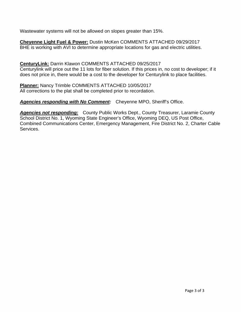
Wastewater systems will not be allowed on slopes greater than 15%. Cheyenne Light Fuel & Power: Dustin McKen COMMENTS ATTACHED 09/29/2017 BHE is working with AVI to determine appropriate locations for gas and electric utilities. CenturyLink: Darrin Klawon COMMENTS ATTACHED 09/25/2017 Centurylink will price out the 11 lots for fiber solution. If this prices in, no cost to developer; if it does not price in, there would be a cost to the developer for Centurylink to place facilities. Planner: Nancy Trimble COMMENTS ATTACHED 10/05/2017 All corrections to the plat shall be completed prior to recordation. Agencies responding with No Comment: Cheyenne MPO, Sheriff’s Office. Agencies not responding: County Public Works Dept., County Treasurer, Laramie County School District No. 1, Wyoming State Engineer’s Office, Wyoming DEQ, US Post Office, Combined Communications Center, Emergency Management, Fire District No. 2, Charter Cable Services.


1
Nancy Trimble
From: Susan Udell <[email protected]>Sent: Wednesday, October 25, 2017 9:43 AMTo: Nancy TrimbleSubject: Northridge View Meeting 10/26/2017 330pmImportance: High
Nancy Trimble: My name is Susan Udell and I live at 607 Joyce Street, which is the property right next to the proposed new subdivision. I will not be able to make the meeting tomorrow, 10/26/2017 at 330pm, so I wanted to make sure my concerns and questions would be heard at said meeting. My first concern is, I want to know what the impact to my well will be if this zone change and subdivision are approved. Right now my well is at 240 feet, I spoke with the George Moser with the Ground Water Department, he said there could possibly be a significant impact. The aquifer has enough water in it, but my well isn’t deep, so if it did impact my well, it would need to be drilled deeper to access the aquifer. I am concerned, as this would be a huge expense to me. So if the development impacts my well or my neighbors well will the developer pay to have the wells drilled deeper, as it is due to there development of the land? Second, the vehicle impact on Joyce Street. The traffic monitoring device was put in on 09/01/2017 at 839am and removed before 830am on 09/02/2017. I am not really sure how this is an adequate test of the impact to the road. They said, at the previous meeting, they were doing the impact based on 12 vehicles, where do they come up with that number? We are at the dead end of Joyce Street where they are planning to make it a through road. I did research and typical statistics for single family homes in this demographic have a minimum of two (2) vehicles per house household, and more if there are campers, trailers, guests, children drivers etc. That would make the impact at minimum 22 vehicles. I want to know why the developer had the courtesy to speak with the residents on Dona and decided to not make Dona a through road, but couldn’t speak with the residents on Joyce to offer the same courtesy. I do not want Joyce Street to be a through road and I want to know if they can make it a cul de sac with the only entrance or exit on Rangeview. Lastly, my concerns are as follows. We live in the county and there is minimal street lighting. I want to know why the developer is going to add street lights as if it were in the city. This is the county and we like to see stars at night, I want to know exactly how man lights are planned and how that will impact the current light situation in our area. If this is going to have a homeowners association, will that impact us in any way? i.e. Fireworks etc. Also, will there be any water run off impacts to the neighboring acres, from the development, and if there will be, how will this be addressed. I greatly appreciate your time and attention to my concerns. Thank you, Susan Udell 607 Joyce Street Cheyenne, WY 82009 (307)631‐8415

1 of 2
Minutes of the Proceedings Laramie County Planning Commission
Prepared by the Laramie County Planning & Development Office Laramie County Wyoming
Thursday, October 26, 2017 171026 00 The Laramie County Planning Commission meet in regular session on Thursday, October 26, 2017, at 3:30 p.m. Members in attendance were: Commissioner Jody Clark, Chairwoman; Commissioners Pat Moffett and Joe Patterson; Dave Bumann, Assistant Director; Nancy Trimble, Associate Planner; Rebekah Puchek, Planning Technician/Recording Secretary. The meeting register was signed by: Gary M. Hickman, 100 Central Avenue, Cheyenne, WY; Bruce Perryman, 1103 Old Town Lane, Suite 101, Cheyenne, WY; and Richard and Jane Gilbert, 1150 Crestview Drive, Cheyenne, WY. 01 Review and action on a Zone Change from A1 (Agricultural and Rural Residential) to AR (Agricultural Residential) for a portion of the North half of Section 6, T.14 N., R.66 W., of the 6th P.M., Laramie County, WY. 02 Review and action on a Subdivision Permit and Plat for Northridge View, located in a portion of the North half of Section 6, T.14 N., R.66 W., of the 6th P.M., Laramie County, WY. Nancy Trimble, Associate Planner, explained that there were technical difficulties which prevented the slideshow from being presented. She asked to present the items concurrently, but noted there would need to be a separate motion for each item. She then introduced the items and Bruce Perryman of AVI PC as agent for the applicants. He briefly described the plan for approximately 55 acres to become 11 residential lots. Ms. Trimble gave an overview of the staff reports. Staff found the proposed zone change and subdivision permit and plat were in conformance with the plans and policies of the Laramie County Comprehensive Plan and Laramie County Land Use Regulations and recommended approval with the conditions as outlined in the staff reports. Commissioner Clark opened the hearing to the public. No comments were heard. Commissioner Moffett noted receipt of an email from an adjacent landowner and asked Mr. Perryman to address each of the concerns outlined in the email, which he did and answered supplemental questions to the Planning Commission’s satisfaction. Commissioner Moffett moved to recommend approval of the zone change application. The motion was seconded by Commissioner Patterson and the item passed with a vote of 3 - 0.

2 of 2
Commissioner Moffett moved to recommend approval of the subdivision permit and plat application. The motion was seconded by Commissioner Patterson and the item passed with a vote of 3 - 0. Meeting adjourned at 3:52 p.m.


