land surveyors regulations - terra · pdf filedavid powell - engineering surveying ian wilson...
TRANSCRIPT
LAND USE POLICY AND ADMINISTRATION PROJECT (LUPAP)
Consultancy Services to The Government of the Republic of Trinidad & Tobago
LAND TENURE CENTER University of Wisconsin - Madison
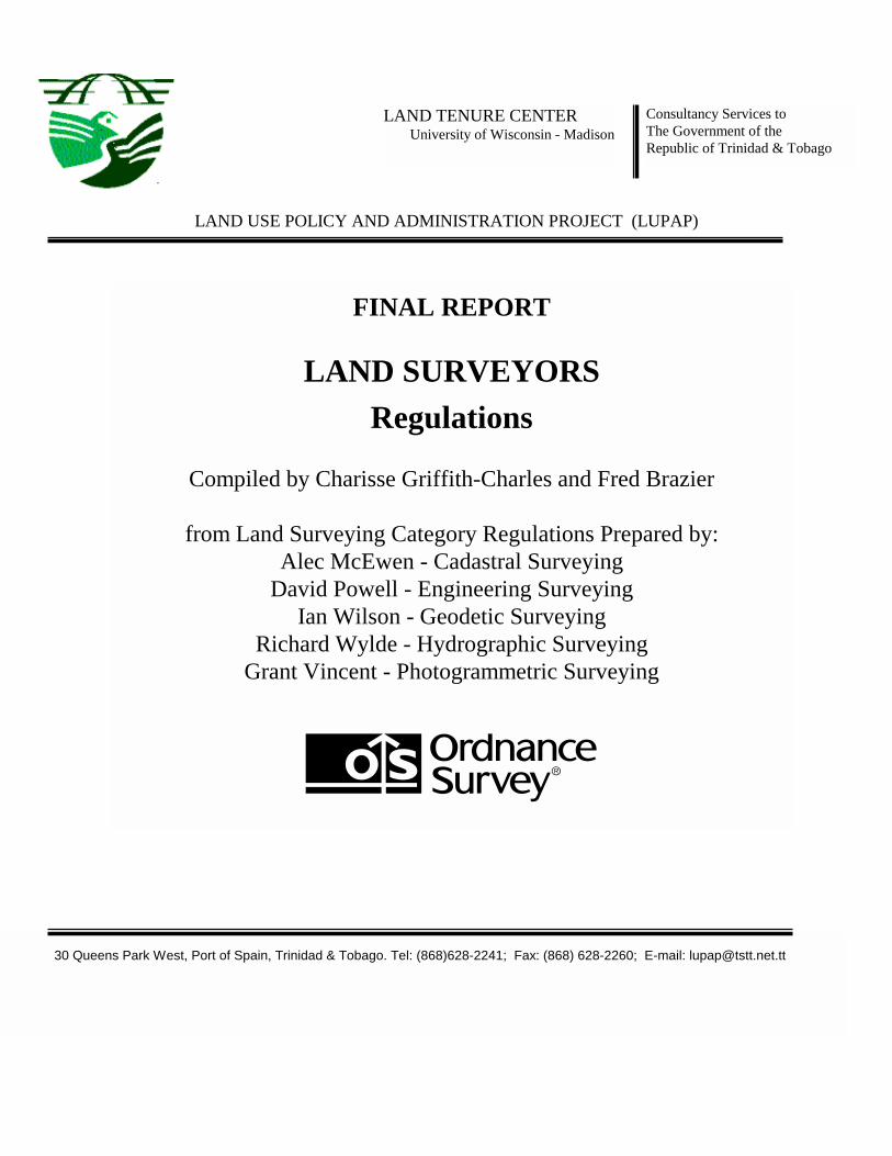
FINAL REPORT
LAND SURVEYORS Regulations
Compiled by Charisse Griffith-Charles and Fred Brazier
from Land Surveying Category Regulations Prepared by:
Alec McEwen - Cadastral Surveying David Powell - Engineering Surveying
Ian Wilson - Geodetic Surveying Richard Wylde - Hydrographic Surveying
Grant Vincent - Photogrammetric Surveying
30 Queens Park West, Port of Spain, Trinidad & Tobago. Tel: (868)628-2241; Fax: (868) 628-2260; E-mail: [email protected]

Land Use Policy & Administration Project: Land Surveyors Regulations Page 2 Printed: 8/20/02 6:55 PM Saved: 7/12/00 8:46 AM
LEGAL NOTICE No. ____
REPUBLIC OF TRINIDAD AND TOBAGO The Land Surveyors Act, 1996
REGULATIONS
MADE BY THE BOARD UNDER SECTION 64 OF THE LAND SURVEYORS ACT 1996
THE LAND SURVEYORS Regulations 2000

Land Use Policy & Administration Project: Land Surveyors Regulations Page 3 Printed: 8/20/02 6:55 PM Saved: 7/12/00 8:46 AM
Arrangement of Regulations
PART I ......................................................................................................................................... 7 PRELIMINARY ......................................................................................................................... 7 1 Citation...................................................................................................................................... 7 2 Interpretation............................................................................................................................. 7
PART II........................................................................................................................................ 9 QUALIFICATIONS ................................................................................................................... 9 3 Qualifications for registration as Land Surveying Graduate..................................................... 9 4 Qualifications for registration as Trinidad and Tobago Licensed Surveyor ........................... 10 5 Qualifications for registration as Land Surveyor (Engineering Surveying)............................ 10 6 Qualifications for registration as Land surveyor (Geodetic Surveying) ................................. 11 7 Qualifications for registration as Land surveyor (Hydrographic Surveying).......................... 12 8 Qualifications for registration as Land surveyor (Photogrammetric Surveying) .................... 13 9 First Schedule.......................................................................................................................... 14
PART III .................................................................................................................................... 15 REGISTRATION ..................................................................................................................... 15 10 Public Registers ...................................................................................................................... 15 11 Applications for registration for individuals........................................................................... 16 12 Applications for registration for corporations, partnerships associations of person............... 16 13 Use of Title ............................................................................................................................. 17 14 Application for renewal of registration................................................................................... 17 15 Second Schedule ..................................................................................................................... 17 16 Professional Indemnity............................................................................................................ 17 17 Compensation Fund ................................................................................................................ 18 18 Code of Ethics......................................................................................................................... 18 19 Continuing professional development .................................................................................... 18 20 Transitional provisions............................................................................................................ 19 21 Practical experience required by persons applying to become Land Surveyors or Trinidad and Tobago Licensed Surveyors ........................................................................................................20 22 Typical projects to be undertaken by applicant for registration.............................................. 20
PART IV .................................................................................................................................... 20 EXAMINATION....................................................................................................................... 20 23 Examination for Registration as a Land Surveyor or a Trinidad and Tobago Licensed Surveyor .......................................................................................................................................20 24 Applications for examination (all categories)......................................................................... 21 25 Examination rules ................................................................................................................... 21 26 Examination arrangements...................................................................................................... 22 27 Council of examiners .............................................................................................................. 22

Land Use Policy & Administration Project: Land Surveyors Regulations Page 4 Printed: 8/20/02 6:55 PM Saved: 7/12/00 8:46 AM
PART V...................................................................................................................................... 22 SEALS........................................................................................................................................ 22 28 Authorised seal........................................................................................................................ 22 29 Certification of documents...................................................................................................... 23
PART VI .................................................................................................................................... 24 NATIONAL DATUM............................................................................................................... 24 30 Basis of National Control System........................................................................................... 24
PART VII................................................................................................................................... 24 REFERENCE DOCUMENTS................................................................................................. 24 31 Reference Document............................................................................................................... 24
PART VIII ................................................................................................................................. 25 CONTROL ................................................................................................................................ 25 32 Geodetic Control ..................................................................................................................... 25 33 Hydrographic Surveying Control ............................................................................................ 26
PART IX .................................................................................................................................... 26 SURVEY MARKS .................................................................................................................... 26 34 Cadastral Surveys precautions to be taken to safeguard survey marks................................... 26 35 Reinstatement of survey marks by Trinidad and Tobago Licensed Surveyors ....................... 26 36 Recovery of buried survey marks............................................................................................ 27
PART X...................................................................................................................................... 27 ACCESS TO LANDS & SURVEYS DIVISION INFORMATION..................................... 27 37 Inspection of plans & survey records...................................................................................... 27 38 Obtaining copies of plans & survey records ........................................................................... 27 39 Access to electronic records.................................................................................................... 27 40 Fees and charges payable to Division ..................................................................................... 27
PART XI .................................................................................................................................... 28 PRACTICE................................................................................................................................ 28 41 Surveys to be made in accordance with regulations ............................................................... 28 42 Survey of State lands............................................................................................................... 28 43 Survey to obtain all information ............................................................................................. 28 44 Survey to disclose doubts and discrepancies .......................................................................... 28 45 Check survey........................................................................................................................... 28 46 Requisitions ............................................................................................................................ 29 47 Principles to be observed ........................................................................................................ 29 48 Differences in measurements .................................................................................................. 29 49 Water boundaries .................................................................................................................... 29 50 Field work survey practice to ensure prescribed accuracy...................................................... 30 51 All evidence to be collected .................................................................................................... 30

Land Use Policy & Administration Project: Land Surveyors Regulations Page 5 Printed: 8/20/02 6:55 PM Saved: 7/12/00 8:46 AM
52 Field notes............................................................................................................................... 30 53 Field survey methods accuracy, marks, plans ......................................................................... 30 54 Surveyor’s certificate .............................................................................................................. 31 55 Survey notices ......................................................................................................................... 31 56 Cadastral surveys under other Acts......................................................................................... 32 57 Capture of Photogrammetric Surveys ..................................................................................... 32
THE FIRST SCHEDULE ........................................................................................................ 33
THE SECOND SCHEDULE ................................................................................................... 39
THE THIRD SCHEDULE....................................................................................................... 40

Land Use Policy & Administration Project: Land Surveyors Regulations Page 6 Printed: 8/20/02 6:55 PM Saved: 7/12/00 8:46 AM
Explanatory notes GEODETIC SURVEYING: Part VIII Control deals with the quality of geodetic surveys. Standards for geodetic surveys are widely available from various authorities throughout the World. The most relevant in the context of Trinidad & Tobago are those published by the Federal Geodetic Sub-committee, National Geodetic Survey, National Geodetic Information Branch, USA. In this standard the required accuracy of a point is defined by the term –
e = a + b.L
where e is the required accuracy
a and b are constant terms
L is the distance from the point to the nearest extant point in the existing geodetic network.
This equation is used to determine the value that must not be exceeded if the point is to meet the standard for a geodetic point. The achieved standard of the point is then determined from the Least Squares computation and is generally know as the ‘standard error’. This value is determined at the 95% confidence level.
It should be noted that the “nearest extant point in the existing geodetic network” may, or may not, be one which is used in the new network under consideration.
PHOTOGRAMMETRIC SURVEYING:
Accuracy achieved by photogrammetric survey is dependent on a range of criteria as shown below. As such, sufficient procedures shall be put in place to ensure that the accuracy requirements, as determined in the specification, are assured.
(a) scale of photography; (b) flying height; (c) focal length of the camera; (d) instrument calibration and maintenance; (e) quality of control used (size of target and positional accuracy of observed point); (f) amount and position of control; (g) quality of photogrammetric equipment used; (h) quality of film processing; (i) quality of observation & positioning of the measuring mark; (j) operator training; (k) quality system; (l) organisation structure.

Land Use Policy & Administration Project: Land Surveyors Regulations Page 7 Printed: 8/20/02 6:55 PM Saved: 7/12/00 8:46 AM
PART I PRELIMINARY
Citation 1 These Regulations may be cited as the Land Surveyors Regulations, 2000.
Interpretation 2 (1) Unless the context otherwise appears the definitions given in section 2 of the Act shall apply to these Regulations.
(2) In these Regulations –
“the Act” means the Land Surveyors Act No. 33 of 1996; “Accuracy” means that term which measures the relationship between the value derived for a quantity and the true value of that quantity. More simply it is the difference between the measured value and the true value. “Bank” of a river, stream or other body of water means the limit or edge of the bed at ordinary high water. “Bed” of a river, stream or other body of water means the land covered so long by water as to wrest it from vegetation, or as to mark a distinct character upon the vegetation where it extends into the water or upon the soil itself;
“Central Plan Office” means the office established in the Department of Lands and Surveys for receiving, registering and filing survey plans and other survey information; “Certified correct” when accompanied by the signature of the Member who signed the statement, is a statement of responsibility and means that the survey and all associated work and documentation to which the statement applies were made under the immediate supervision of the Member who signed the statement, in accordance with instructions, requirements and standards for surveys applicable to the purposes for which the survey work was made; in accordance with instructions, of the client (unless there is a statement by the client, accompanying the member’s statement on the documentation of the survey or other work to the effect that the work was completed in accordance with the instructions of the client); are correct and true to the best of the surveyor’s knowledge; “Continuing Professional Development” means the systematic

Land Use Policy & Administration Project: Land Surveyors Regulations Page 8 Printed: 8/20/02 6:55 PM Saved: 7/12/00 8:46 AM
maintenance, improvement and broadening of knowledge and skill in the development of personal qualities necessary for the execution of the professional and technical duties throughout the practitioner’s working life;
“Datum” means a geodetic datum defined to provide an unambiguous co-ordinate system;
“Diagram” means a drawing, to or near scale, which shows the geographic relationship between points;
“Field Notes” means the original record of the field data collected in
writing, digitally, or in any other form, in connection with any survey; “FIG” means the Federation Internationale des Geometres;
“Geodetic Network” means a series of survey points, which conform with the standards detailed in Part V, and are connected by observations of –
(a) direction and distance and / or; (b) height differences and / or; (c) gravity values;
“GPS” means the Global Positioning System of artificial earth-orbiting satellites. “IHO” means the International Hydrographic Organization; “ITRF” means the International Terrestial Reference Framework which is a refinement of the World Geodetic System 1984 (WGS 84) used by the Global Positioning System (GPS) of artificial satellites. “Least Squares” means the computation process which provides the most probable values for the unknowns from a series of measurements. “Main Employment” is the employment carried out by any one person for at least 75% of a calendar year; “Observation” means a survey observation. Usually but not exclusively –
(a) distance (b) direction
Land Use Policy & Administration Project: Land Surveyors Regulations Page 9 Printed: 8/20/02 6:55 PM Saved: 7/12/00 8:46 AM
(c) gravity (d) height (e) differences in the above quantities
“Person” includes a body corporate; “Photography” applies to all imagery and where appropriate relates to digital satellite imagery; a “Reference” is the process of completing Form 2A of the First Schedule. Form 2A shall be affixed to Form 2 of the First Schedule. “Residual” means the difference between an observation and the computed value derived from the final accepted co-ordinates. “Rules” means the Land Surveyors Rules, 2000 “Satisfactory” is the term used at the discretion of the Board to describe a submitted application form or an attendance at an interview that meets the Boards requirements. “Supervision” means the personal attendance on the site of the land survey, or in the office, for such time during the course of the work and exercise of such immediate oversight and direction as to ensure personal involvement in the survey; “UWI” means the Department of Surveying and Land Information of the University of the West Indies, St Augustine, Trinidad and Tobago.
PART II QUALIFICATIONS
Qualifications for registration as Land Surveying Graduate
3 (1) A person of good character and reputation who – (a) has graduated or passed the examinations entitling him to graduate in the degree of Bachelor of Science in Land Surveying from the UWI; or
(b) has graduated, or passed an examination entitling him to graduate in a land surveying degree accepted by the Board, which must be at least the equivalent of the degree offered by the UWI,

Land Use Policy & Administration Project: Land Surveyors Regulations Page 10 Printed: 8/20/02 6:55 PM Saved: 7/12/00 8:46 AM
may be registered as a Land Surveying Graduate.
(2) Subject to the requirements of section 18(1) of the Act, no person shall remain a Land Surveying Graduate for a period greater than five years without the approval of the Board.
First Schedule Form 1
(3) An application for registration as a Land Surveying Graduate shall be in the form set out in Form 1 of the First Schedule and shall be accompanied with proof of payment of the fees prescribed in the Second Schedule.
Qualifications for registration as Trinidad and Tobago Licensed Surveyor
4 (1) A fit and proper person of good character and reputation who has – a. been registered as a Land Surveying Graduate; and
b. obtained at least the equivalent of the UWI First Degree in Land Surveying including a pass in the subject cadastral studies; and
c. completed two years practical experience in cadastral surveying under the supervision of a Trinidad and Tobago Licensed Surveyor approved by the Board; and
d. completed a professional assessment project in cadastral surveying approved by the Board; and
e. passed any oral or written examination prescribed by the Board; and
f. satisfied any other condition specified in the Act or in these Regulations,
OR
a. been licensed or registered as a land surveyor in another Commonwealth state for more than 15 years; and
b. satisfied any other condition specified in the Act or in these Regulations,
may be registered as a Trinidad and Tobago Licensed Surveyor.
Transitional (2) Notwithstanding any other provision contained in these Regulations, a person who immediately before the commencement of the Land Surveyors Act 1996 was licensed to practice as a Land Surveyor
may be registered as a Trinidad and Tobago Licensed Surveyor.
Qualifications for registration as Land
5 (1) A fit and proper person of good character and reputation who has –

Land Use Policy & Administration Project: Land Surveyors Regulations Page 11 Printed: 8/20/02 6:55 PM Saved: 7/12/00 8:46 AM
registration as Land Surveyor (Engineering Surveying) Transitional
a. been registered as a Land Surveying Graduate; and b. obtained at least the equivalent of the UWI First Degree in Land
Surveying including a pass in the subject engineering surveying; and
c. completed two years of practical experience in engineering surveying as prescribed; and
d. completed any professional assessment projects in engineering surveying as prescribed; and
e. passed any oral or written examination prescribed by the Board; and
f. satisfied any other condition specified in the Act or these Regulations;
OR a. practised engineering surveying in another country for more than 15
years; and b. satisfied any other condition specified in the Act or these
Regulations;
may be registered as a Land Surveyor (Engineering Surveying).
(2) Notwithstanding any other provision contained in these regulations, a person who, –
a. at the time of the commencement of the Land Surveyors Act 1996 had practised as a means of main employment engineering surveying for 10 consecutive years; and
b. provides satisfactory references from three professional persons, those persons to have been registered as professionals in their respective fields for a minimum of five years and be approved by the Board; and
c. provides satisfactory references from five professional persons being either architects and/or civil engineers for whom the applicant has performed engineering surveying; those architects and/or civil engineers to have been registered as professionals for a minimum of five years; and
d. attends an interview at a meeting of the Board, subject to a quorum as prescribed in Section 11 (1) of the Act and
e. satisfies the Board as to their competence, may be registered as a Land Surveyor (Engineering Surveying)
Qualifications for registration as Land surveyor (Geodetic Surveying)
6 (1) A fit and proper person of good character and reputation who has – a. been registered as a Land Surveying Graduate; and

Land Use Policy & Administration Project: Land Surveyors Regulations Page 12 Printed: 8/20/02 6:55 PM Saved: 7/12/00 8:46 AM
Transitional
b. obtained at least the equivalent of the UWI First Degree in Land Surveying including a pass in the subject geodesy; and
c. completed two years of practical experience in geodetic surveying as prescribed; and
d. completed any professional assessment projects in geodetic surveying as prescribed; and
e. passed any other written or oral examination prescribed by the Board; and
f. satisfied any other condition specified in the Act or these Regulations;
OR a. practised geodetic surveying in another country for more than 15
years; and b. satisfied any other condition specified in the Act or these
Regulations;
may be registered as a Land Surveyor (Geodetic Surveying). (2) Notwithstanding any other provision contained in these regulations, a
person who, – a. at the time of the commencement of the Land Surveyors Act
1996 had practised as a means of main employment, geodetic surveying for 10 consecutive years; and
b. provides satisfactory references from three professional persons, those persons to have been registered as professionals in their respective fields for a minimum of five years and be approved by the Board; and
c. provides satisfactory references from five professional persons being engineers or scientists for whom the applicant has performed geodetic surveying; those engineers or scientists to have been professionally qualified for a minimum of five years; and
d. attends an interview at a meeting of the Board, subject to a quorum as prescribed in Section 11 (1) of the Act and
e. satisfies the Board as to their competence, may be registered as a Land Surveyor (Geodetic Surveying).
Qualifications for registration as Land surveyor (Hydrographic Surveying)
7 (1) A fit and proper person of good character and reputation who has – a. been registered as a Land Surveying Graduate; and b. obtained at least the equivalent of the UWI First Degree in Land
Surveying including a pass in the subject hydrography.

Land Use Policy & Administration Project: Land Surveyors Regulations Page 13 Printed: 8/20/02 6:55 PM Saved: 7/12/00 8:46 AM
Transitional
A “category A” approved course in Hydrographic Surveying as defined jointly by Federation Internationale des Geometres and the International Hydrographic Organisation (FIG/IHO) shall be deemed to be a qualification equivalent to degree level within the discipline of Hydrographic Surveying; and
c. completed two years of practical experience in hydrographic surveying as prescribed; and
d. completed any professional assessment projects in hydrographic surveying as prescribed; and
e. passed any oral or written examination prescribed by the Board; and f. satisfied any other condition specified in the Act or these
Regulations; OR a. practised hydrographic surveying in another country for more than 15
years; and b. satisfied any other condition specified in the Act or these
Regulations;
may be registered as a Land Surveyor (Hydrographic Surveying).
(2) Notwithstanding any other provision contained in these regulations, a person who, – a. at the time of the commencement of the Land Surveyors Act 1996
had practised as a means of main employment, hydrographic surveying for 10 consecutive years; and
b. provides satisfactory references from three professional persons, those persons to have been registered as professionals in their respective fields for a minimum of five years and be approved by the Board; and
c. provides satisfactory references from five professional persons being engineers or scientists for whom the applicant has performed hydrographic surveying; those engineers or scientists to have been professionally qualified for a minimum of five years; and
d. attends an interview at a meeting of the Board, subject to a quorum as prescribed in Section 11 (1) of the Act and
e. satisfies the Board as to their competence, may be registered as a Land Surveyor (Hydrographic Surveying).
Qualifications for registration as Land surveyor (Photogrammetric Surveying)
8 (1) A fit and proper person of good character and reputation who has – a. been registered as a Land Surveying Graduate; and b. obtained at least the equivalent of the UWI First Degree in Land
S i i l di i th bj t h t t d

Land Use Policy & Administration Project: Land Surveyors Regulations Page 14 Printed: 8/20/02 6:55 PM Saved: 7/12/00 8:46 AM
Transitional
Surveying including a pass in the subject photogrammetry; and c. completed two years of practical experience in photogrammetric
surveying as prescribed; and d. completed any professional assessment projects in photogrammetric
surveying as prescribed; and e. passed any oral or written examination prescribed by the Board; and f. satisfied any other condition specified in the Act or these
Regulations; OR a. practised photogrammetric surveying in another country for more
than 15 years; and b. satisfied any other condition specified in the Act or these
Regulations;
may be registered as a Land Surveyor (Photogrammetric Surveying).
(2) Notwithstanding any other provision contained in these regulations, a person who, – a. at the time of the commencement of the Land Surveyors Act 1996
had practised as a means of main employment, photogrammetric surveying for 10 consecutive years; and
b. provides satisfactory references from three professional persons, those persons to have been registered as professionals in their respective fields for a minimum of five years and be approved by the Board; and
c. provides satisfactory references from five professional persons being either architects and/or civil engineers for whom the applicant has performed photogrammetric surveying; those architects and/or civil engineers to have been registered as professionals for a minimum of five years; and
d. attends an interview at a meeting of the Board, subject to a quorum as prescribed in Section 11 (1) of the Act and
e. satisfies the Board as to their competence, may be registered as a Land Surveyor (Photogrammetric Surveying).
First Schedule Form 2
9 An application for registration as a Land Surveyor (category) or a Trinidad and Tobago Licensed Surveyor shall be in the form set out in Form 2 of the First Schedule and shall be accompanied with proof of payment of the fees prescribed in the Second Schedule. References, where applicable, completed on Form 2(a), shall be affixed to Form 2.

Land Use Policy & Administration Project: Land Surveyors Regulations Page 15 Printed: 8/20/02 6:55 PM Saved: 7/12/00 8:46 AM
PART III REGISTRATION
Public Registers 10 (1) The Register of all Land Surveying Graduates, Land Surveyors (category), Trinidad and Tobago Licensed Surveyors as referred to in section 20 of the Act shall be maintained with the following information – (a) the name(s) of Certificate of Registration holder;
(b) the date of issue of first Certificate of Registration;
(c) the addresses and telephone numbers;
(d) the date of issue of Certificate of Registration;
(e) the status of Certificate of Registration;
(f) the status of license (where applicable);
(g) the notations requested by the Board and notations requested by the Disciplinary Committee;
(h) proof of indemnity insurance coverage, or proof of exemption therefrom;
(i) information with respect to any claim against the Certificate of Registration holder for professional indemnity; and
(j) such other information which the Board may require.
(2) In the case of Corporations, Partnerships, or Associations of persons, the following additional information shall be included in the Register – (a) name(s) of member(s) who will be personally responsible for
the professional land surveying services;
(b) evidence of its professional responsibility to the satisfaction of the Board that the practice of professional land surveying will be carried on under the direct responsibility of a full time permanent employee member, or a partner who is a member, who holds a license issued by the Board, of indemnity insurance coverage, or proof of exemption therefrom;
(c) name(s) of member(s) who will be personally responsible for the professional land surveying services.
Land Use Policy & Administration Project: Land Surveyors Regulations Page 16 Printed: 8/20/02 6:55 PM Saved: 7/12/00 8:46 AM
Applications for registration for individuals
11 A person who wishes to be registered as a Land Surveyor under this Act shall submit –
(a) an application in writing to the Board for registration as a land surveyor,
(b) the fees prescribed in the Second Schedule;
(c) a copy of any registration certificate authorising the person to practise land surveying in any other country, as applicable;
(d) certification of good character as evidenced by the provision of one or more of the following:
(i) a police record statement;
(ii) a letter of recommendation from a member of the clergy, a doctor, an attorney or other professional, or senior Government Officer, or any person acceptable to the Board; and
(e) any other information required by the Board.
Applications for registration for corporations, partnerships associations of person
12 (1) A corporation, partnership or association of persons as specified in section 27 of the Act may apply for registration by fulfilling the following requirements –
(a) an application to the Board for registration;
(b) evidence of its professional responsibility to the satisfaction of the Board that the practice of land surveying will be carried out under the direct responsibility of a full time permanent employee who is registered under this Act in the appropriate field;
(c) the applicant’s registration number, current office or registered address;
(d) the fees prescribed in the Second Schedule;
(e) the name or names of the surveyors who will be personally responsible for land surveying services;
(f) any other material required by the Board. (2) A Government organisation is exempt from any requirement to
register.
First Schedule Form 3
(3) An application for registration as a corporation, partnership, i ti f h ll b i th f t t i F 3 f th
Land Use Policy & Administration Project: Land Surveyors Regulations Page 17 Printed: 8/20/02 6:55 PM Saved: 7/12/00 8:46 AM
association of persons shall be in the form set out in Form 3 of the First Schedule.
First Schedule Form 4
(4) The Board shall, upon registration of an applicant as a land surveyor, issue a Certificate of Registration in the form set out in Form 4 of the First Schedule.
Use of Title 13 No person shall use the title “Trinidad and Tobago Licensed Surveyor” or
the initials TTLS in connection with the name of the corporation, partnership, firm, association or other entity, unless the person holds a licence issued by the Board pursuant to the Act and these Regulations.
Application for renewal of registration Form 5
14 An application for renewal of registration as specified in section 18 of the Act shall be in the form set out in Form 5 of the First Schedule
Second Schedule 15 Fees prescribed in the Second Schedule shall apply to the registration of
land surveyors and for other purposes set out in these Regulations.
Professional Indemnity
16 (1) Every Registered Land Surveyor and Trinidad and Tobago Licensed Surveyor shall carry indemnity insurance in accordance with the Act, unless similarly protected by virtue of employment, he shall be insured through any other policy that meets the Board’s requirements.
(2) The policy limit for each employee shall be as determined by the Institute of Surveyors from time to time.
(3) Every member holding a policy, shall inform the Registrar/Secretary immediately upon notice of a claim or an impending claim under it.
(4) A policy shall provide at least minimum coverage required under sub-regulation (1) and (2) and shall contain a clause that the Board shall be given thirty (30) days notice before the policy is cancelled or altered.
(5) Every member who is protected by insurance and liability by virtue of employment must furnish documentary evidence that the employer acknowledges the responsibility.
(6) Where an employee or a Director of a Company or a partner of a firm is permitted to work for his own gain, the employer or the company or the firm shall also acknowledge that the coverage will be in force outside of the employment or state duty.

Land Use Policy & Administration Project: Land Surveyors Regulations Page 18 Printed: 8/20/02 6:55 PM Saved: 7/12/00 8:46 AM
Compensation Fund 17 Prior to registration and renewal of registration every year, the following sums shall be paid to the Board for the use of the Trustees of the Compensation Fund – (a) in the case of a Trinidad and Tobago Licensed Surveyor the sum of
two hundred and fifty dollars ($TT250.00);
(b) in the case of a Registered Land Surveyor the sum of two hundred and fifty dollars ($TT250.00),
or such other sums as may from time to time be fixed by the Minister by Order, provided that a Land Surveyor who is in the service of the Government of Trinidad and Tobago as such and who does no land surveying work for reward on his own account, shall be exempt from this payment.
Code of Ethics Third Schedule
18 All persons registered under this Act shall abide by the Code of Ethics set out in the Third Schedule.
Continuing professional development
19 (1) Every Land Surveyor shall, for so long as he is registered under the Act, undergo in each year continuing professional development, in accordance with this Regulation.
(2) Every Registered Land Surveyor shall prove to the satisfaction of the Board that he has completed sixty hours of continuing professional development in every consecutive period of (3) three years computed as follows:
(a) the time attributed to any event shall be the duration from the formal opening to the formal closing of any activity, calculated to the nearest half hour;
(b) when an activity extends over more than one day, only the formal teaching sessions may be counted;
(c) when a member attends for only part of an activity only the time attended shall be counted;
(d) time recorded in sub-regulation (a) can constitute no more than two-thirds of the total requirement;
(e) time spent in administering a qualifying activity shall not be counted.
(3) Members who have completely retired from practice are exempted from these requirements.
(4) Every Land Surveyor shall be responsible for maintaining a record of his participation in qualifying activities, including where

Land Use Policy & Administration Project: Land Surveyors Regulations Page 19 Printed: 8/20/02 6:55 PM Saved: 7/12/00 8:46 AM
relevant, the dates, times, subject matter, speakers and total time computed.
(5) Every Land Surveyor shall keep the record for three years after the qualifying activity and forward a copy to the Board when so requested.
(6) Continuing Professional Development, in these Regulations, referred to as “activity”, may take the following forms:
(a) courses and technical meetings organised by: i the Institute; ii Universities, Polytechnics, or other colleges; iii employers of Registered Land Surveyors; iv other professional bodies; v other relevant Course Providers;
(b) discussion meetings on technical topics;
(c) private studies of a structured nature on specific themes which includes prescribed pre-course reading,
(d) correspondence courses, open University courses, or other supervised study packages;
(e) research or post-qualification studies;
(f) authorship of published technical work or the time spent in the preparation or delivery of lectures in connection with a qualifying Continuing Professional Development event or other similar professional or technical meetings.
(7) To qualify for Continuing Professional Development, the activities described above shall be related to:
(a) technical topics related to a member’s current or potential occupation;
(b) personal or business skills designed to increase a member’s management or business efficiency.
Transitional provisions
20 (1) Every candidate who before the day these Regulations came into effect received from the Board written or verbal notification of admission as a candidate may continue to be examined in accordance with the existing regulations that were in force on the day before these regulations came into effect.
(2) Every person who is registered, or eligible to be registered under the Act and who before these regulations came into effect has been

Land Use Policy & Administration Project: Land Surveyors Regulations Page 20 Printed: 8/20/02 6:55 PM Saved: 7/12/00 8:46 AM
engaged in the practice of land surveying may continue to operate in that field as he did on the day before these regulations came into effect until such time his operation can be registered under these regulations.
Practical experience required by persons applying to become Land Surveyors or Trinidad and Tobago Licensed Surveyors
21 (1) An applicant shall not commence any period of practical experience unless the practical experience proposed is first approved by the Board.
First Schedule Form 6 (2) An application for approval of proposed practical experience shall
be in the form set out in Form 6 of the First Schedule. Typical projects to be undertaken by applicant for registration
22 (1) A registered land surveying graduate may apply to the Board for status in any or all of the projects completed by him as a student in lieu of the corresponding student project required to be undertaken pursuant to this Regulation.
(2) A student or applicant may submit a project to the Board for consideration in fulfilment of the requirements for examination once it can be proved that the project submitted is in accordance with the applicants professional competence and is representative of the applicants field of endeavour.
(3) A completed project shall not be submitted to the Board for approval by a Graduate until two years of practical experience as a Land Surveying Graduate.
First Schedule Form 7 (4) Each completed project shall be accompanied by a certificate in the
form set out in Form 7 in the First Schedule.
PART IV EXAMINATION
Examination for Registration as a Land Surveyor or a Trinidad and Tobago Licensed Surveyor
23 The following subjects may be included in an examination to be registered as a Land Surveyor or as a Trinidad and Tobago Licensed Surveyor:
(a) Acts and Regulations relating to property surveys within Trinidad and Tobago and its continental shelf;
(b) Property ownership, title rights and land transfer systems in Trinidad and Tobago;
(c) Any matter relating to the category of surveying in which he is seeking to be registered.

Land Use Policy & Administration Project: Land Surveyors Regulations Page 21 Printed: 8/20/02 6:55 PM Saved: 7/12/00 8:46 AM
Applications for examination (all categories)
24 (1) No candidate for registration shall be examined by the Board in any subject specified by the Board as being prerequisite for receiving registration, unless the candidate has, in accordance with these regulations, rules and instructions of the Board – (a) submitted an application to be examined;
(b) paid all the fees required in respect of the examination;
(c) complied with all requirements relating to the examination. Form 8 (2) An application for examination shall be made in the form set out in
Form 8 of the First Schedule. Examination rules 25 (1) No person shall be admitted as a candidate unless the evidence
furnished for registration is acceptable to the Board. (2) Pursuant to subsection (1), the information supplied must
indicate achievement to at least the level of education obtained by a graduate in a surveying technology from a college or other educational institution recognised by the Board, or the equivalent thereof.
(3) The Board may admit a person to be a candidate if the information required by the Board is satisfactory and complies with the requirements of the Regulations.
(4) Subject to any exemption from subjects authorised by these Regulations or by the Board, a candidate is required, within a period of not more than seven years, to pass an examination to be determined by the Board.
(5) An applicant who fails to comply with the requirements given above, shall cease to be a candidate, and in order to re-qualify he may reapply for admission as a candidate.
(6) The Board may reject an application where it finds that the applicant has been guilty of fraud in an examination, or has inaccurately reported academic qualifications.
(7) Every person aggrieved by a decision of the Board may appeal to the Board for a review of that decision.
(8) Pursuant to sub-regulation (7), the person shall make a written application to the Registrar/Secretary within twenty-one (21) days of the receipt of the decision, with such fees as specified in the Second Schedule.
(9) Where specific evidence is presented to support an appeal under sub-regulation (8), the Board shall review the decision in

Land Use Policy & Administration Project: Land Surveyors Regulations Page 22 Printed: 8/20/02 6:55 PM Saved: 7/12/00 8:46 AM
accordance with the material presented.
Examination arrangements
26 (1) The Board shall meet prior to each examination cycle to confirm or approve arrangements for examinations.
(2) All examinations shall be conducted in accordance with the rules published and instructions issued by the Board from time to time.
(3) Examinations shall be held at such places and at such times as the Board may determine but where no other arrangements are made, they shall commence on the day following the second Monday in the month of April of each year and continue on successive days exclusive of Saturday and Sunday until completed.
Council of examiners
27 (1) The Board may appoint a Council of Examiners and where such examiners are appointed, the Council shall be composed of –
(a) a member of the Board, who shall preside over the Council; and
(b) four registered land surveyors . (2) The four members appointed by the Board shall have adequate
training and recent practical experience in one or more of the major categories of land surveying.
(3) The Board may appoint qualified persons as special examiners to prepare examination papers and to appraise the response of the candidates in regard to specialist or ancillary subjects.
PART V SEALS
Authorised seal 28 (1) Every Registered Land Surveyor and every Registered Trinidad and Tobago Licensed Surveyor shall obtain from the Registrar/Secretary an authorised seal to be used in the certification of plans, drawings, reports and documents.
(2) Pursuant to sub-regulation (1) the seal shall be returned to the Registrar/Secretary upon suspension or revocation of a Land Surveyor’s registration.
(3) A hard copy of every survey plan or report submitted to every client shall be stamped (or embossed) with the Land Surveyor’s seal.

Land Use Policy & Administration Project: Land Surveyors Regulations Page 23 Printed: 8/20/02 6:55 PM Saved: 7/12/00 8:46 AM
(4) The seal shall be applied to every cadastral plan, which shall be registered with the Director of Surveys before it is supplied to any client.
(5) The seal shall attest to the status of the following information concerning the surveyor:
(a) Current registration;
(b) Compensation Fund Contribution;
(c) Professional Indemnity Insurance coverage. (6) Where the land surveyor is covered for the items outlined in
sub-regulation (5) by virtue of employment, the document to be registered shall also bear the authorised stamp of the Company or Firm of which the Registered land Surveyor is an employee, a partner or an associate.
Certification of documents
29 (1) Every Registered Land Surveyor or Registered Trinidad and Tobago Licensed Surveyor shall certify reports, or field notes of surveys, or corresponding documents, with – (a) a statement of professional responsibility; and
(b) the signature of the land surveyor. (2) Statement of professional responsibility may be in any form,
including the form “certified correct”, but unless it is in the form “certified correct”, it shall specifically identify the responsibilities accepted by the Land Surveyor, as those responsibilities appear in the definition of “certified correct”.
(3) When a boundary of legal rights in Trinidad and Tobago is
defined by a survey using geodetic, hydrographic, photogrammetric or other techniques for which the returns may not be a conventional plan and field notes of survey, the member shall certify the documentation of the work in accordance with the meaning of “certified correct” in sub-regulation (2).
(4) All plans, reports, or other documentation produced under the supervision of a land surveyor who is a partner, associate or employee of a holder of a Certificate of Authorisation shall, in addition to the certification requirements of sub-regulation (1), bear the certificate number of the certificate holder.

Land Use Policy & Administration Project: Land Surveyors Regulations Page 24 Printed: 8/20/02 6:55 PM Saved: 7/12/00 8:46 AM
PART VI NATIONAL DATUM
Basis of National Control System
30 The National Triangulation Network is based on Naparima 1955 datum.
The National GPS Network is based on the International Terrestrial Reference Framework (ITRF). The year and epoch shall be from time to time prescribed by the Director of Surveys.
The National Vertical Datum is defined as follows: (a) In Trinidad, heights above mean sea level are based on
Trinidad Government Railway Datum (TGR). (b) In Tobago, heights above mean sea level are based on
Scarborough datum.
PART VII REFERENCE DOCUMENTS
Reference Document 31 (1) Engineering Surveys shall be carried out by reference to the Land Surveyors Code of Best Practice for Engineering Survey as further defined in the Rules.
(2) Hydrographic Surveys shall be carried out by reference to the IHO standards for Hydrographic Surveys Special Publication No 44 as further defined in the Rules. Hydrographic data collected according to these standards is sufficiently accurate, and the spatial uncertainty of data is adequately quantified to be safely used by mariners (commercial, military or recreational) as primary users of this information.
(3) Photogrammetric surveys shall conform with Internationally accepted standards and specifications which shall at least be the equivalent of the standards identified in the series of FIG Specifications as further defined in the Rules:
(a) Vertical Aerial Photography and Derived Digital Imagery – Client Specification Guidelines
(b) Specification for Mapping at Scales between 1:1000 and 1:10000
(c) Surveys of Land, Buildings and Utility Services at Scales of 1:500 and Larger – Client Specification Guidelines

Land Use Policy & Administration Project: Land Surveyors Regulations Page 25 Printed: 8/20/02 6:55 PM Saved: 7/12/00 8:46 AM
PART VIII CONTROL
Geodetic Control 32 (1) All co-ordinates are quoted using the International Metre. Plane co-ordinates are calculated by reference to the grid on the Universal Transverse Mercator (UTM) projection (Zone 20) (regardless of datum used). In geodetic surveying with redundant observations, co-ordinates shall be calculated using the principle of ‘Least Squares’.
(2) A geodetic survey shall be referred back to either :
(a) In the case of surveys by GPS, the National GPS Network. (b) In the case of surveys by non GPS techniques, the National
Triangulation Network. (3) Where GPS derived positions are to be converted:
(a) to Naparima 1955 datum this shall be done using the transformation from time to time prescribed by the Director of Surveys as stated in the Rules.
(b) To TGR or Scarborough vertical datum this shall be done using the Geoid Model from time to time prescribed by the Director of Surveys as stated in the Rules.
(4) All points in a geodetic survey shall be linked by observation, to a
minimum of two other points in the geodetic network
(5) The required accuracy of any point in either network shall be calculated using the formula :
e = a + b.L where : e is the error of the point
a is a constant (metres) b is a constant (part per million) L is the distance (m) of the point from the nearest fixed point in the controlling network.
The values of a and b shall be prescribed the Director of Surveys and are stated in the Rules. The values may be different for each type of Network (Triangulation and GPS).
(6) The a posteriori standard error of any point in a geodetic survey, as
given by the Least Squares solution of the observations, shall not exceed the value calculated from the formula in (5) above.

Land Use Policy & Administration Project: Land Surveyors Regulations Page 26 Printed: 8/20/02 6:55 PM Saved: 7/12/00 8:46 AM
(7) These accuracy measures shall be applied at the 95% confidence level.
Hydrographic Surveying Control
33 Hydrographic surveys shall explicitly specify the geodetic datum to which the survey data relate. The transformation parameters between that co-ordinate system and that of ITRF shall be stated. A check set of co-ordinates shall be supplied with any report, chart or other output, in both ITRF and the chosen final co-ordinate system such that it is possible both to verify the correct application of the necessary transformation.
PART IX SURVEY MARKS
Cadastral Surveys precautions to be taken to safeguard survey marks
34 (1) Where any person proposes to carry out any work likely to interfere with any survey mark, he shall take all necessary precautions to ensure that any such survey mark is not interfered with, during the course of the work.
(2) Where the work is likely to interfere with any permanent survey mark the person proposing to carry out the work shall give at least ten working days notice to the Director of Surveys, who shall forthwith take all necessary steps to safeguard such permanent survey mark and the proposed work shall not commence until such steps have been taken.
(3) The cost of any work carried out by the Director of survey pursuant to sub-regulation (2) may be recovered from the person carrying out the work.
(4) As an alternative to sub-regulation (2), the person proposing to carry out the work may engage a land surveyor to safeguard any permanent survey mark, in which event he shall include the name of the land surveyor in the notice to the Director of Surveys required pursuant to sub-regulation (2).
(5) It shall not be an offence against this regulation to remove any survey mark defining a boundary to allow a fence, wall or other permanent improvement to be erected along the boundary, but due notice in writing shall be given to the Director of Surveys.
Reinstatement of survey marks by Trinidad and Tobago Licensed Surveyors
35 (1) In the event of any survey mark being interfered with, whether or not during the course of any work, the person responsible for the interference shall forthwith advise the authority which placed the mark, or, if the authority is not known, the Director of Surveys or engage a Trinidad and Tobago Licensed Surveyor to reinstate the
Land Use Policy & Administration Project: Land Surveyors Regulations Page 27 Printed: 8/20/02 6:55 PM Saved: 7/12/00 8:46 AM
mark where practicable. (2) Where the mark is one placed to define a boundary established in
the course of a prescribed cadastral survey, the Director of Surveys shall be advised or a Trinidad and Tobago Licensed Surveyor be engaged to reinstate the mark.
(3) Any person who fails to comply with the provisions of sub-regulation (1) or (2) shall be guilty of an offence.
(4) Any person other than a Trinidad and Tobago Licensed Surveyor, who reinstates or attempts to reinstate a survey mark which has been interfered with, shall be guilty of an offence.
(5) If a Trinidad and Tobago Licensed Surveyor reinstates any permanent survey mark in the same or an alternative position, he shall forthwith deposit a plan with the Director of Surveys showing the new position in relation to the original position.
Recovery of buried survey marks
36 It shall be lawful for a Trinidad and Tobago Licensed Surveyor to break up the surface of any land whether paved or not to the extent necessary to reveal any survey mark which he believes to be buried under the surface.
PART X ACCESS TO LANDS & SURVEYS DIVISION INFORMATION
Inspection of plans & survey records
37 Any person who wishes to examine any record, plan, photographic image or other associated record pertaining to a survey to which they have an interest shall be allowed access to such records by means as time to time prescribed by the Director of Surveys.
Obtaining copies of plans & survey records
38 Any person who wishes to obtain a copy of a diagram, record, photograph or list shall, on payment of the prescribed fee, apply to an authorised officer of the Division for a copy thereof. If it is necessary for a document to be taken off the premises of the Division this shall be done by an authorized officer of the Division and no other person shall be allowed to take a document out of the offices of the Division.
Access to electronic records
39 Where the Lands & Surveys Division stores information electronically, anyone shall be allowed access to such records by means as may be from time to time prescribed by the Director of Surveys.
Fees and charges payable to Division
40 The Director of Surveys may, from time to time, set a scale of fees chargeable for the services provided by the Lands & Survey Division detailed in the Act and Regulations.

Land Use Policy & Administration Project: Land Surveyors Regulations Page 28 Printed: 8/20/02 6:55 PM Saved: 7/12/00 8:46 AM
PART XI PRACTICE
Surveys to be made in accordance with regulations
41 (1) All surveys shall be made in accordance with these regulations. (2) Every survey shall be carried out by a registered land surveyor
personally or by assistants under the supervision of a registered land surveyor.
Survey of State lands
42 Except for redefinition surveys, no Trinidad and Tobago Licensed Surveyor shall survey State lands without obtaining a Survey Order from the Director of Surveys.
Survey to obtain all information
43 Prior to commencing any survey, the Trinidad and Tobago Licensed Surveyor shall obtain all information relevant to the proposed survey from those records normally available in the Land and Surveys Department and the office of the Registrar General.
Survey to disclose doubts and discrepancies
44 Where a Trinidad and Tobago Licensed Surveyor considers that any doubt or discrepancy associated with a survey is relevant he shall disclose that doubt or discrepancy on his plan and in a written report to the Director of Surveys.
Check survey 45 (1) For the purpose of ensuring that any survey complies with these
regulations, the Director of Surveys may cause a check survey to be made.
(2) Before commencing the check survey, the Director of Surveys shall
advise the Trinidad and Tobago Licensed Surveyor (TTLS) responsible for the survey to carry out a check and in all cases of cadastral survey the checking officer shall be a TTLS appointed with prior notice to the TTLS responsible for the survey.
(3) Where the TTLS responsible for the survey does not accept the
appointed TTLS he may, within two weeks of the notice of appointment, inform the Director of Surveys of his objection to the check survey by the appointed TTLS, setting out the reasons for his objection; and the Director or Surveys, if satisfied with the reasons, shall appoint another TTLS to carry out the check survey.

Land Use Policy & Administration Project: Land Surveyors Regulations Page 29 Printed: 8/20/02 6:55 PM Saved: 7/12/00 8:46 AM
Requisitions 46 The Director of Surveys or the Board may request any registered land
surveyor to amend any patent error on his plan, invite comment or explanation on any apparent discrepancy or ambiguity, and following any comment or explanation, may request him to carry out additional survey or submit additional information, and the land surveyor shall comply with all requests as promptly as practicable.
Principles to be observed
47 (1) Boundaries as originally marked are for all purposes true boundaries.
(2) In the re-survey of existing boundaries, the TTLS shall observe the
principle that the boundaries as defined by survey marks set by the original TTLS are the true boundaries even where the survey marks are not the positions assigned to them by the data on the original plan.
(3) Notwithstanding the provisions or sub-regulation (2), if any
difference mentioned in the said sub-regulation is positively identified as arising from the survey mark not having been set originally as intended, and if the plan of the original survey, and the evidence derived from the re-survey clearly show the intention, the TTLS making the re-survey may reset the mark in accordance with the original intention, provided that:
(a) the positions of improvements in relation to the amended
boundary are not adversely affected; (b) the consent of all owners affected is first obtained.
(4) The TTLS shall disclose the discrepancy and the action taken on his plan in a written report to the Director of Surveys.
Differences in measurements
48 Where a re-survey discloses difference in lengths of boundary measurements or areas recorded by previous surveys, the TTLS shall demonstrate that the difference is not due to encroachment on or by adjoining parcels of land.
Water boundaries 49 (1) Subject to the provisions of this Act or any other law to the
contrary and unless there is evidence to the contrary a TTLS shall

Land Use Policy & Administration Project: Land Surveyors Regulations Page 30 Printed: 8/20/02 6:55 PM Saved: 7/12/00 8:46 AM
delineate –
(a) the boundary of a parcel of land abutting the sea coast as the line of high water;
(b) the boundary of a parcel of land abutting a stream as the edge
of the bed of the stream, which is determined by and coincides with the line of ordinary high water.
(2) In defining or redefining boundaries a TTLS shall employ methods
to achieve such accuracy as is warranted by the purpose of the survey and the evidence available.
Field work survey practice to ensure prescribed accuracy
50 Surveys shall be carried out with such equipment and by such methods as shall readily attain the standards of accuracy prescribed by these Regulations and land surveyors shall always apply such checks and tests to their work as to ensure that the said accuracy is attained.
All evidence to be collected
51 All existing survey marks, fences, walls and other features providing or likely to provide evidence as the position of existing boundaries shall be included in any survey.
Field notes 52 (1) Where necessary, field notes shall be reduced to a printed or written
form suitable as a permanent record.
(2) The field notes shall constitute part of the permanent record of any survey and where they are collected in digital form the original shall be in a secure file and the land surveyor shall prepare a printed record of the secure file.
(3) Every Registered Surveyor shall be responsible for the permanent
custody of all field notes and of digital files prepared by him or under his supervision.
(4) A land surveyor shall, on request in writing from the Director of
Surveys or the Board, produce his field notes to the Director of Surveys within fourteen (14) days.
Field survey methods accuracy, marks, plans
53 (1) All rules for the execution of surveys, recording of field notes, and the preparation of plans shall be established from time to time, by the Board, in consultation with the Institute and the Director of Surveys.

Land Use Policy & Administration Project: Land Surveyors Regulations Page 31 Printed: 8/20/02 6:55 PM Saved: 7/12/00 8:46 AM
(2) The rules shall include, but may not be limited to, such matters as:
(a) acceptable perimeter closure for testing the accuracy of field work;
(b) methods for the survey of irregular boundaries;
(c) the type, form, and placement of survey marks;
(d) datum lines for surveys;
(e) the units of measurement to be used on survey plans and the precision for distances, bearings, angles, areas and coordinates;
(f) the construction of survey plans, including scales, sizes, the type of material, the forms to be used;
(g) the data to be shown on survey plans;
(h) methods of collecting and recording field notes;
(i) the types of land surveying equipment to be used on surveys.
Surveyor’s certificate
54 (1) The Trinidad and Tobago Licensed Surveyor responsible for any survey shall apply his seal to every plan of survey and certify to the accuracy of the plan.
(2) No Registered Land Surveyor shall give any certificate whether or not required by the Act or any regulation made under the Act relating to any survey unless the survey was carried out by him personally or under his supervision.
Survey notices 55 (1) Before commencing any cadastral survey, the Trinidad and
Tobago Licensed Surveyor, shall cause notice to be given to all proprietors of lands lying adjacent to the parcel being surveyed.
(2) The notice to be given shall include the name of the TTLS who will be carrying out the cadastral survey, and the date and the time of the cadastral survey.
Ch. 27:11 (3) Where lands are to be brought under the provisions of The Real Property Ordinance, the purpose of the cadastral survey shall be stated and the period of the notice shall be seven clear days but in all other instances three clear days notice shall be given.
(4) Nothing in this regulation shall prevent a Trinidad and Tobago Licensed Surveyor from carrying out a cadastral survey after giving reasonable notice to any neighbouring proprietor, in unforeseen or

Land Use Policy & Administration Project: Land Surveyors Regulations Page 32 Printed: 8/20/02 6:55 PM Saved: 7/12/00 8:46 AM
unavoidable circumstances.
Cadastral surveys under other Acts
56 (1) All cadastral surveys made for the purposes of the State Land (Regularisation of Tenure) Act, the Land Adjudication Act or the Registration of Titles to Land Act shall be made in accordance with these Regulations.
(2) Notwithstanding sub-regulation 56 (1), a parcel that has been demarcated under section 11 of the Land Adjudication Act and assigned a Unique Parcel Reference Number under section 13 of that Act shall not require its boundary measurements, its bearings or its area to be shown on the Parcel Identification Map for the purpose of registering the parcel under the Registration of Titles to Land Act.
Capture of Photogrammetric Surveys
57 (1) No person other than a registered Land Surveyor (Photogrammetric Surveying) shall carry out any photogrammetric survey within the airspace of Trinidad & Tobago for use in photogrammetry, remote sensing or similar purpose without first applying for permission in writing, giving at least one month’s notice of the intended date of the survey. Such persons shall file with the Director of Surveys, in addition to the letter of application, specifications for the photogrammetric survey as detailed at Part VII of these Regulations, outlining the use to which the data shall be put.
(2) Where the person carrying out the survey is registered as a Land Surveyor (Photogrammetric Surveying) they shall wherever practicable, give to the Director of Surveys prior notice of any intended photogrammetric survey.
(3) For the purposes of the Land Survey Act 1996 a Registered Land Surveyor (Photogrammetric surveying) shall assume responsibility for the technical aspects of the photogrammetric survey; and may i) file with the Director of Surveys an application for permission; ii) file with the Director of Surveys the specification for the
photogrammetric survey; iii) file with the Director of Surveys a work programme; iv) file with the Director of Surveys the use to which the data is to
be put.
Land Use Policy & Administration Project: Land Surveyors Regulations Page 33 Printed: 8/20/02 6:55 PM Saved: 7/12/00 8:46 AM
THE FIRST SCHEDULE [Reg. 3(3)]
FORM 1 Land Surveyors Regulations, 1998
APPLICATION FOR REGISTRATION AS A LAND SURVEYING GRADUATE
I, ............................................................................... of ................................................................hereby apply for registration as a Land Surveying Graduate pursuant to regulation 3(1), 3(2) and of the Land Surveyors Regulations, 1998. In support of my application, I enclose the following documentary evidence:* Dated this .............................................................. day of ................................. 19 .............
........................................................... Signature of Applicant
*Copies of degrees, diplomas or other relevant certificates, official transcript and certificate of good character and receipt of payment. FORM 2
[Reg. 9] Land Surveyors Regulations, 1998
APPLICATION FOR REGISTRATION AS A LAND SURVEYOR AND/OR TRINIDAD AND TOBAGO LICENSED SURVEYOR
I, ............................................................................... of ................................................................hereby apply for registration as a Land Surveyor pursuant to regulation 4(1), of the Land Surveyors Regulations, 1998 in the following categories: In support of my application, I enclose the documentary evidence detailed in Form 2A:* Dated this .............................................................. day of .............................. 19 .............
........................................................... Signature of Applicant
*Copies of degrees, diplomas, official transcripts and all relevant certificates including those relevant for the proof of Professional Indemnity Insurance, a certificate of good character and the prescribed fee.

Land Use Policy & Administration Project: Land Surveyors Regulations Page 34 Printed: 8/20/02 6:55 PM Saved: 7/12/00 8:46 AM
FORM 3
[Reg. 12(3)] Land Surveyors Regulations. 1998
APPLICATION FOR REGISTRATION AS A CORPORATION, PARTNERSHIP OR ASSOCIATION OF PERSONS
We, ........................................................................ of ............................................................................................................................................................................................................................................................................................................................................................................................. Hereby apply to be registered as a Corporation, Partnership, Association of persons, pursuant to Regulation 8 of the Land Surveyors Regulations, 1998. In support of our applications, we enclose the following documented evidence:**
......................................................................... Authorised Signature & Stamp
**Proof of Professional Indemnity Insurance name(s) of Registered Land Surveyor(s) who will be personally responsible for land surveying services, and the prescribed fee. FORM 4
[Reg. 12(4)] Land Surveyors Regulations, 1998
LAND SURVEYORS BOARD OF TRINIDAD AND TOBAGO CERTIFICATE OF REGISTRATION
This is to certify that .................................................. having satisfactorily completed the prescribed requirements, has been registered under the provisions of the Land Surveyors Act 1996, and in authorised to practise as a Land Surveyor in Trinidad and Tobago in the following categories ……………………………………………………………………………………….. for the year ....................................... Sealed with the common seal of the Board. This .............................................................. day of.............................. 19.............
............................................................................ Registered Land Surveyor

Land Use Policy & Administration Project: Land Surveyors Regulations Page 35 Printed: 8/20/02 6:55 PM Saved: 7/12/00 8:46 AM
FORM 5 (Reg. 14)
Land Surveyors Regulations, 1998 APPLICATION FOR RENEWAL OF REGISTRATION
I, .......................................................................... of ..................................................................hereby apply to be registered as a Land Surveyor pursuant to the provisions of regulation 10 of the Land Surveyors Regulations, 1998.* I enclose the prescribed fee of: Dated this .............................................................. day of.............................. 19 .............
.................................................................. Registered Land Surveyor
.................................................................. Registar
* Proof of Professional Indemnity Insurance coverage as well as Compensation funding is also to be included. FORM 6
[Reg. 21(2)] Land Surveyors Regulations, 1998
APPLICATION FOR APPROVAL FOR PROPOSED PRACTICAL EXPERIENCE I, ............................................................................... of ................................................................... apply for approval to a period of ..............................................(state period) practical experience with Mr ..................................................................................... a registered land surveyor. I proposed to serve the period of practical experience in the major category of .............................. Surveying pursuant to the Act. Dated this .............................................................. day of.............................. 19 .............
.................................................................. Land Surveying Graduate
FORM 7
[Reg. 22(4)]

Land Use Policy & Administration Project: Land Surveyors Regulations Page 36 Printed: 8/20/02 6:55 PM Saved: 7/12/00 8:46 AM
Land Surveyors Regulations, 1998 CERTIFICATE TO ACCOMPANY EACH COMPLETED PROJECT
I hereby certify that all field and office observations and notes’, computations, plans, and reports were made by me personally with such assistance as were necessary in each operation; that the project was not copied from any material published or deposited in any public record; that the project was commenced ............................. and completed on ........................................ My supervising officer and colleagues were: .................................................................................................................................................................................................................................................................................................................................................................................................................................................................................... (Date) ......................................................................... (Signature) ................................................

Land Use Policy & Administration Project: Land Surveyors Regulations Page 37 Printed: 8/20/02 6:55 PM Saved: 7/12/00 8:46 AM
FORM 8 [Reg. 24(2)]
Land Surveyors Regulations, 1998 (To be submitted in duplicate)
APPLICATION TO BE EXAMINED FOR REGISTRATION TO PRACTICE AS A LAND
SURVEYOR Name of Applicant .......................................................... ......................................................... (Surname) (Other Names)
Date of Birth ............................................................
Place of Birth ............................................................
ID No. ............................................................ Passport No. ...............................
Drivers Permit No. ............................................................
Academic Qualifications Dates ........................................................................................................... ............................................................................................................................................... ............................................................................................................................................... ............................................................................................................................................... ....................................
Experience in Major Categories Dates ........................................................................................................... ............................................................................................................................................... ............................................................................................................................................... ............................................................................................................................................... ....................................
Proposer 2 ..................................................................... ....................................
Proposer’s Address ....................................................................................................................
............................................................................................ ....................................
Signature of Applicant Date NB: The candidate is requested to submit the originals of his transcript, birth certificate, passport, or ID card or driver’s permit to the Secretary of the Board for verification. Originals will be promptly returned. NOTE: If the candidate has been supervised by more than one Land Surveyor he should submit additional completed forms for each individual proposer. Form 2A [Reg 9]

Land Use Policy & Administration Project: Land Surveyors Regulations Page 38 Printed: 8/20/02 6:55 PM Saved: 7/12/00 8:46 AM
LAND SURVEYORS REGULATIONS, 2000
REFERENCE TO ACCOMPANY FORM 2 (application for registration as a Land Surveyor) -----------------------------------------------------------------------------------------------
(A) Applicant’s Section Name: Home address: Category of Application applied for: Land Surveyor ( )
----------------------------------------------------------------------------------------------- (B) Referee’s Section
Name: Professional Qualification: Office (or place of work) address: Date of Registration: If the referee is completing this form in accordance with The Land Surveying Regulations ( ) Part II Para 3, 2, (b), (general professional), proceed to Section C below….. If the referee is completing this form in accordance with The Land Surveying Regulations (Engineering Surveying) Part II Para 3, 2, (c) (specific professional), continue below…... Describe one project within which the applicant has carried out Surveying under your instruction:-
Name of project: Nature of project: Year in which the Surveying took place: Did the applicant perform his/her duties to the accuracy required? (yes/no): Did the applicant perform his/her duties in a professional manner? (yes/no): Would you instruct the applicant on future projects? (yes/no):
----------------------------------------------------------------------------------------------- (C) Declaration:
I, , recommend the applicant to the Land Survey Board of Trinidad and Tobago as being a person of good character. I believe that the facts I have stated in this form are true and that the opinions I have expressed are correct.
Signature ___________________________
Print name___________________________ Date _______/_________/20____

Land Use Policy & Administration Project: Land Surveyors Regulations Page 39 Printed: 8/20/02 6:55 PM Saved: 7/12/00 8:46 AM
THE SECOND SCHEDULE (Reg. 15)
SCHEDULE OF FEES
FEES PAYABLE TO THE LAND SURVEYORS BOARD OF TRINIDAD AND TOBAGO
$ 1 Registration as a Land Surveying Graduate 150.00 2 Renewal of registration – Land Surveying Graduate 100.00 3 Registration as a Land Surveyor per category 500.00 4 Renewal of registration – Land Surveyor per category 300.00 5 Registration of a Corporation/Partnership/Firm 100.00 6 Inspection of the Register 25.00 7 Certified copy of the Register 25.00 8 Application fee for examination for registration as a 500.00
Land Surveyor (per category) 9 Appeal to the Board under regulation 21(8) 100.00

Land Use Policy & Administration Project: Land Surveyors Regulations Page 40 Printed: 8/20/02 6:55 PM Saved: 7/12/00 8:46 AM
THE THIRD SCHEDULE (Reg. 18)
CODE OF ETHICS All persons registered under this Act shall abide by the following code of ethics: Article 1 1 Land Surveyors shall serve the public to the best of their knowledge and ability in order to provide accurate and efficient services for the development and/or peaceful enjoyment of Trinidad and Tobago’s lands and resources. Article 2 2 They shall be honest and trustworthy:
(a) They shall maintain confidentiality with respect to their client’s and employer’s affairs during their services or employment and after the services or employment has been terminated.
(b) They shall not certify work that was not performed under their personal
supervision. (c) They shall not enter into any fee sharing arrangements without the knowledge and
prior agreement of their clients. Article 3 3 They shall be vigilant upholders of the law relating to their profession:
(a) They shall not enter into any arrangement that would enable the unauthorised
practice of their profession. (b) They shall not knowingly and willingly become accessories to a failure to report
any illegal practice of their profession to the Board or the Institute. Article 4 4 They shall avoid professional impropriety:
(a) They shall declare to their clients or employers any conflict of interest which
impairs the quality of their service. (b) They shall not knowingly let their names be used in association with persons or
enterprises of dubious or doubtful ethics. (c) They shall not accept compensation for the same service from more than one

Land Use Policy & Administration Project: Land Surveyors Regulations Page 41 Printed: 8/20/02 6:55 PM Saved: 7/12/00 8:46 AM
source without the full knowledge of all parties involved. Article 5 5 They shall agree to charge and accept only a fair and just compensation for their services:
(a) Their claims for compensation shall be commensurate with the professional and
technical complexity of their services, their level of responsibility and liability. (b) They shall make details relevant to their claims for compensation available to the
client upon request. Article 6 6 Members shall maintain their competence, integrity and respect for their profession in their relation with their colleagues, clients, employees and the public:
(a) They shall assume professional responsibility for authorised works carried out by
their non-professional staff. (b) They shall cultivate into their employees or staff the utmost integrity and a clear
understanding of the professional obligations of surveyors to the society. (c) They shall provide their employees with good working conditions and just
remuneration. (d) They shall not further the application for admission to the profession of anyone
whom they know to be unqualified by education or character. (e) They shall refrain from public criticism of the conduct or practice of colleagues,
but shall report any perceived misconduct or incompetence to the land Survey Board.
(f) They shall keep adequate records of their work such that its quality can be judged
by their colleagues. (g) They shall not accept assignments beyond their competence or beyond the
resources available to them to complete the assignments punctually and professionally.
(h) They shall limit their advertising to a level that provides adequate factual
information.

Land Use Policy & Administration Project: Land Surveyors Regulations Page 42 Printed: 8/20/02 6:55 PM Saved: 7/12/00 8:46 AM
Article 7 7 They shall not be professionally involved in setting the boundaries of any land of which or contiguous with which he is the beneficial owner or to the owner of which he is in a fiduciary relationship, where a discretionary power as the fixing or replacement of boundaries of that land is involved. Article 8 8 They shall fulfil their duty of instructing a Land Surveying Graduate supervising the work of a Land Surveying Graduate or ensuring that a Land Surveying Graduate obtains practical experience in land surveying in the manner prescribed. Article 9 9 They shall respond promptly to correspondence received from the Board or from the Disciplinary Committee and provide information that as may be reasonably requested of them by the Board. Article 10 10 They shall not become associated in responsibility for work with land surveyors who do not conform to the published code of conduct for members published in the these Regulations:
(a) They shall not use the advantage of a salaried position to compete unfairly with
another land surveyor. (b) They shall co-operate to the best of their ability in enhancing the profession of
land surveying by exchanging general information and sharing experiences with their fellow members and participate on a regular basis in the Continuing Professional Development programme as required by the Act.
(Original) Dated 2nd day of November 1998.
T D LEONG Chairman, Land Survey Board of Trinidad and Tobago Approved by the Minister on this 2nd day of November, 1998
J HUMPHREY Minister of Housing and Settlements