land survey research tools -...
TRANSCRIPT
Land Survey Research ToolsAdrian Foster, GIS Technician
March 3, 2011
Santa Barbara County Surveyor’s Office GIS
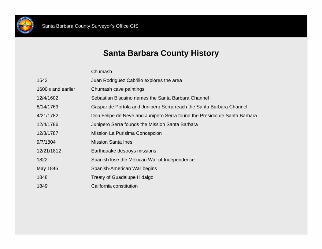
Santa Barbara County History
Santa Barbara County Surveyor’s Office GIS
California constitution1849
Treaty of Guadalupe Hidalgo1848
Spanish-American War beginsMay 1846
Spanish lose the Mexican War of Independence1822
Earthquake destroys missions12/21/1812
Mission Santa Ines9/7/1804
Mission La Purisima Concepcion12/8/1787
Junipero Serra founds the Mission Santa Barbara12/4/1786
Don Felipe de Neve and Junipero Serra found the Presidio de Santa Barbara4/21/1782
Gaspar de Portola and Junipero Serra reach the Santa Barbara Channel8/14/1769
Sebastian Biscaino names the Santa Barbara Channel12/4/1602
Chumash cave paintings1600's and earlier
Juan Rodriguez Cabrillo explores the area1542
Chumash
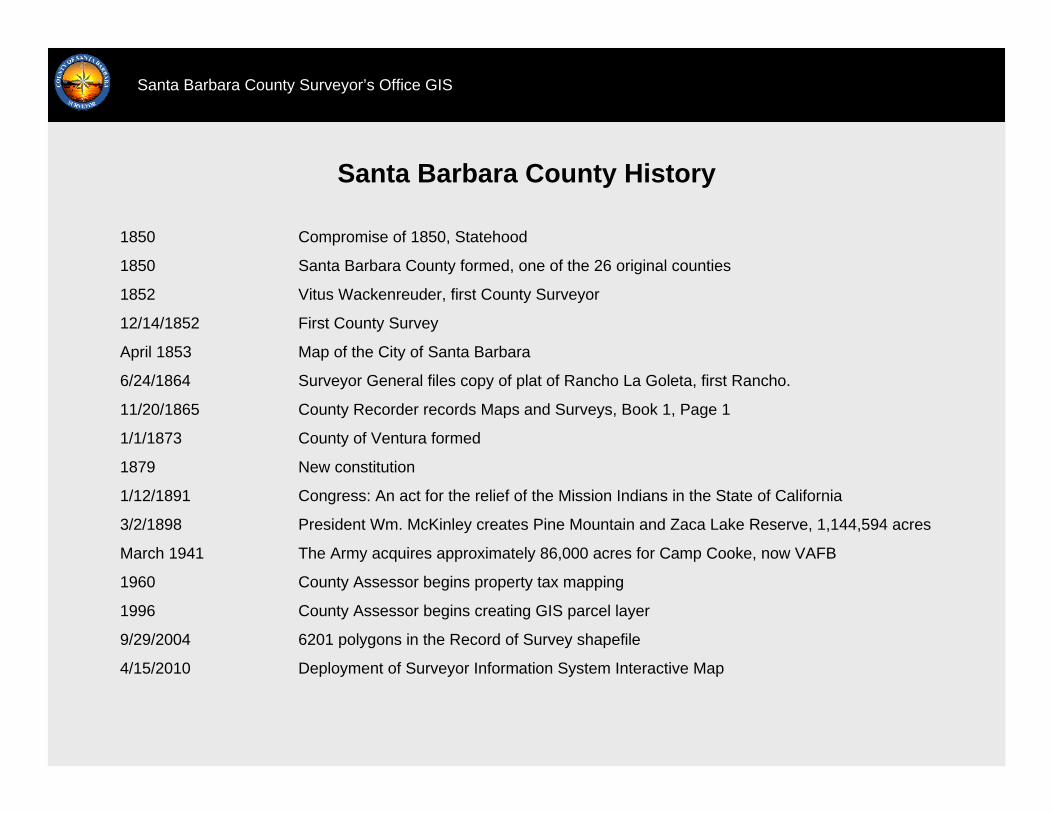
Santa Barbara County History
Santa Barbara County Surveyor’s Office GIS
Deployment of Surveyor Information System Interactive Map4/15/2010
6201 polygons in the Record of Survey shapefile9/29/2004
County Assessor begins creating GIS parcel layer1996
County Assessor begins property tax mapping1960
The Army acquires approximately 86,000 acres for Camp Cooke, now VAFBMarch 1941
President Wm. McKinley creates Pine Mountain and Zaca Lake Reserve, 1,144,594 acres3/2/1898
Congress: An act for the relief of the Mission Indians in the State of California1/12/1891
New constitution1879
County of Ventura formed1/1/1873
County Recorder records Maps and Surveys, Book 1, Page 111/20/1865
Surveyor General files copy of plat of Rancho La Goleta, first Rancho. 6/24/1864
Map of the City of Santa BarbaraApril 1853
First County Survey12/14/1852
Vitus Wackenreuder, first County Surveyor1852
Santa Barbara County formed, one of the 26 original counties1850
Compromise of 1850, Statehood1850
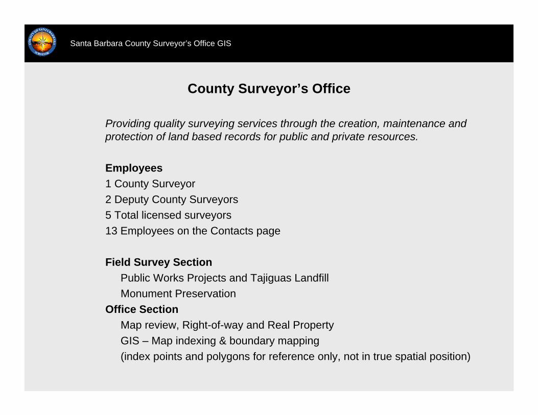
Providing quality surveying services through the creation, maintenance and protection of land based records for public and private resources.
Employees1 County Surveyor2 Deputy County Surveyors5 Total licensed surveyors13 Employees on the Contacts page
Field Survey SectionPublic Works Projects and Tajiguas LandfillMonument Preservation
Office SectionMap review, Right-of-way and Real PropertyGIS – Map indexing & boundary mapping(index points and polygons for reference only, not in true spatial position)
County Surveyor’s Office
Santa Barbara County Surveyor’s Office GIS
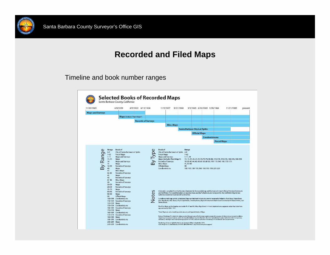
Recorded and Filed Maps
Santa Barbara County Surveyor’s Office GIS
Timeline and book number ranges
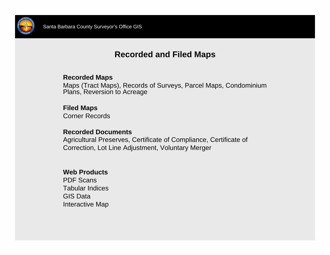
Recorded and Filed Maps
Santa Barbara County Surveyor’s Office GIS
Recorded MapsMaps (Tract Maps), Records of Surveys, Parcel Maps, Condominium Plans, Reversion to Acreage
Filed MapsCorner Records
Recorded DocumentsAgricultural Preserves, Certificate of Compliance, Certificate of Correction, Lot Line Adjustment, Voluntary Merger
Web ProductsPDF ScansTabular IndicesGIS DataInteractive Map

Jurisdiction
Santa Barbara County Surveyor’s Office GIS
-CountyCountyCountyRecorded Map Copies
-CountyCountyCertificate of Compliance, Ag. Preserve
-CountyCountyCountyRecords of Surveys, Corner Records
--CountyCitySubdivision Map Review, Certificate of Correction, Lot Line Adjustment, Voluntary Merger
GLO/BLM PlatsCaltrans MapsField Surveys-Filed Map Examples
FederalStateCountyCityFiled Maps
FederalStateCountyCity
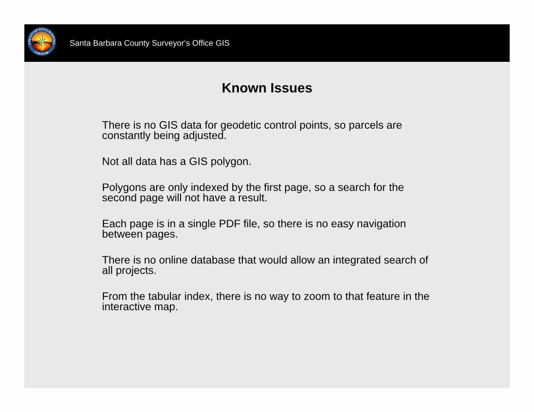
Known Issues
Santa Barbara County Surveyor’s Office GIS
There is no GIS data for geodetic control points, so parcels areconstantly being adjusted.
Not all data has a GIS polygon.
Polygons are only indexed by the first page, so a search for thesecond page will not have a result.
Each page is in a single PDF file, so there is no easy navigation between pages.
There is no online database that would allow an integrated search of all projects.
From the tabular index, there is no way to zoom to that feature in the interactive map.

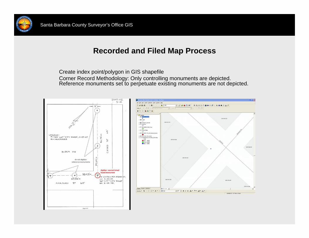
Recorded and Filed Map Process
Santa Barbara County Surveyor’s Office GIS
Create index point/polygon in GIS shapefileRecorded Map Methodology: Older recorded maps are constructed inCAD using distance and bearings. Subdivision maps are are constructed from the parcel layer. Records of Surveys also include slivers to nearby monuments, but not distant CORS.
Recorded and Filed Map Process
Santa Barbara County Surveyor’s Office GIS
Create index point/polygon in GIS shapefileCorner Record Methodology: Only controlling monuments are depicted. Reference monuments set to perpetuate existing monuments are not depicted.
Recorded and Filed Map Process
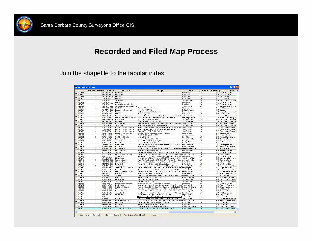
Santa Barbara County Surveyor’s Office GIS
Join the shapefile to the tabular index
Web Access
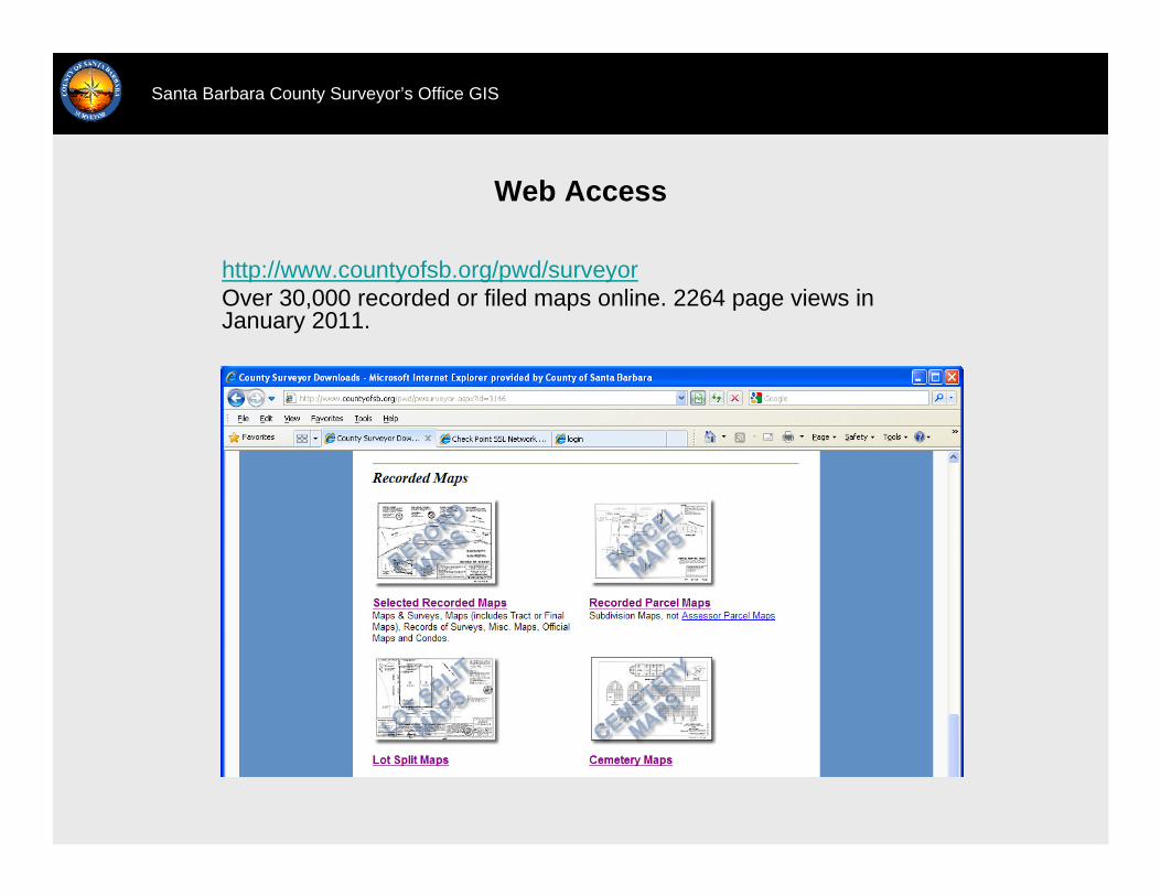
Santa Barbara County Surveyor’s Office GIS
http://www.countyofsb.org/pwd/surveyorOver 30,000 recorded or filed maps online. 2264 page views in January 2011.
Web Access
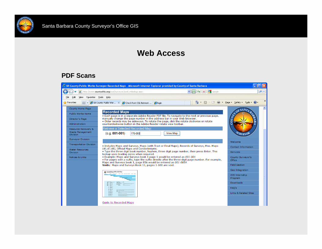
Santa Barbara County Surveyor’s Office GIS
PDF Scans

Web Access
Santa Barbara County Surveyor’s Office GIS
Tabular Index, GIS Data, Status Report
Web Access
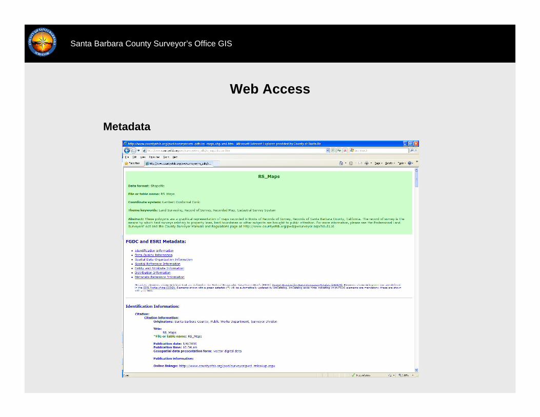
Santa Barbara County Surveyor’s Office GIS
Metadata

Web Access
Santa Barbara County Surveyor’s Office GIS
Interactive Map
Web Access
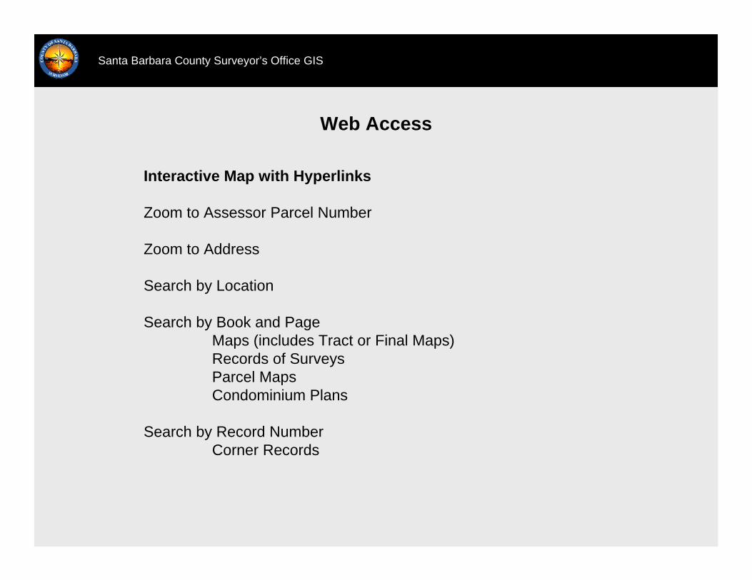
Santa Barbara County Surveyor’s Office GIS
Interactive Map with Hyperlinks
Zoom to Assessor Parcel Number
Zoom to Address
Search by Location
Search by Book and PageMaps (includes Tract or Final Maps)Records of SurveysParcel MapsCondominium Plans
Search by Record NumberCorner Records
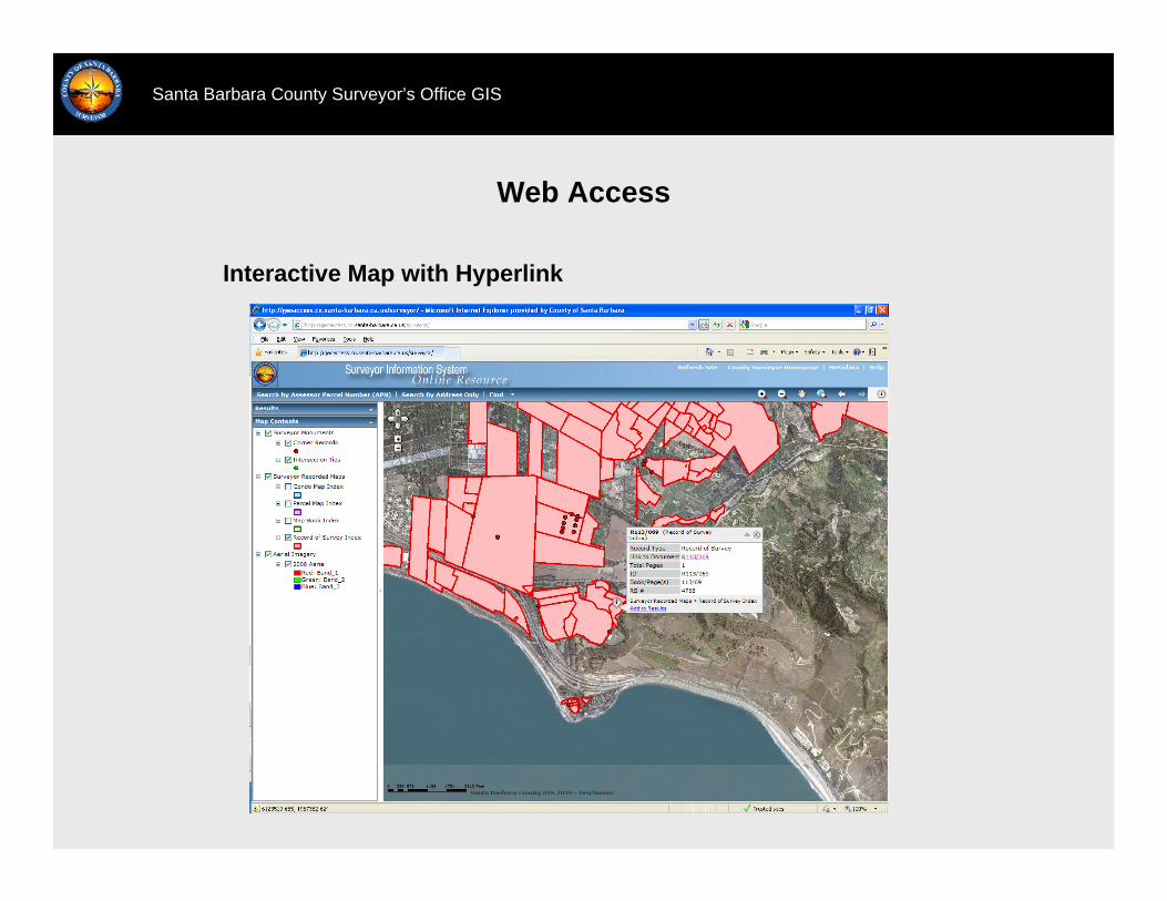
Web Access
Santa Barbara County Surveyor’s Office GIS
Interactive Map with Hyperlink
Governmental Unit Boundaries
Santa Barbara County Surveyor’s Office GIS
ProjectsLAFCO Special DistrictsCitiesPolitical DistrictsSchool Districts
ProductsCompiled GIS BoundaryPDF Compiled MapPDF Boundary Activity Table
1820 total actions counted for LAFCO special district and cities since 1855
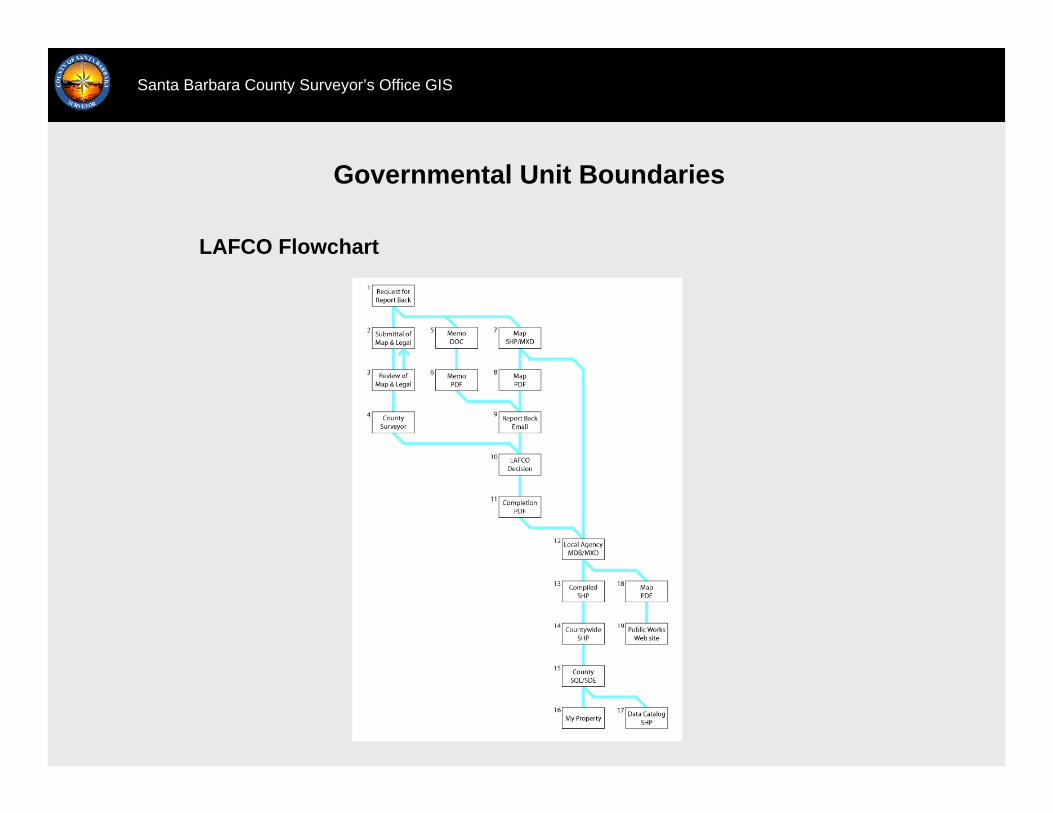
Santa Barbara County Surveyor’s Office GIS
LAFCO Flowchart
Governmental Unit Boundaries
Governmental Unit Boundaries
Santa Barbara County Surveyor’s Office GIS
Known Issues
Hard to find documentation or recordation information for older actions, especially some of the ones from the 1800s.
Recent actions are recorded, so the recorded documents are only available to the public at the County Recorder’s Office.
Not all actions have been scanned.
Reviewing the accuracy of the index polygons takes time.

Governmental Unit Boundaries
Santa Barbara County Surveyor’s Office GIS
LAFCO Request for Report Back

Governmental Unit Boundaries
Santa Barbara County Surveyor’s Office GIS
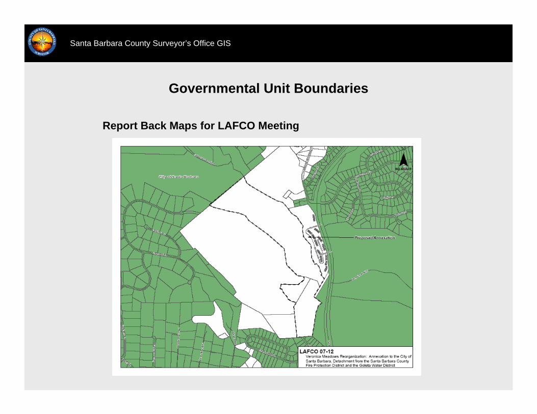
Report Back Maps for LAFCO Meeting
Governmental Unit Boundaries
Santa Barbara County Surveyor’s Office GIS
Report Back Maps for LAFCO Meeting
Governmental Unit Boundaries
Santa Barbara County Surveyor’s Office GIS
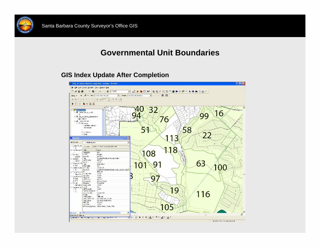
GIS Index Update After Completion
Governmental Unit Boundaries
Santa Barbara County Surveyor’s Office GIS
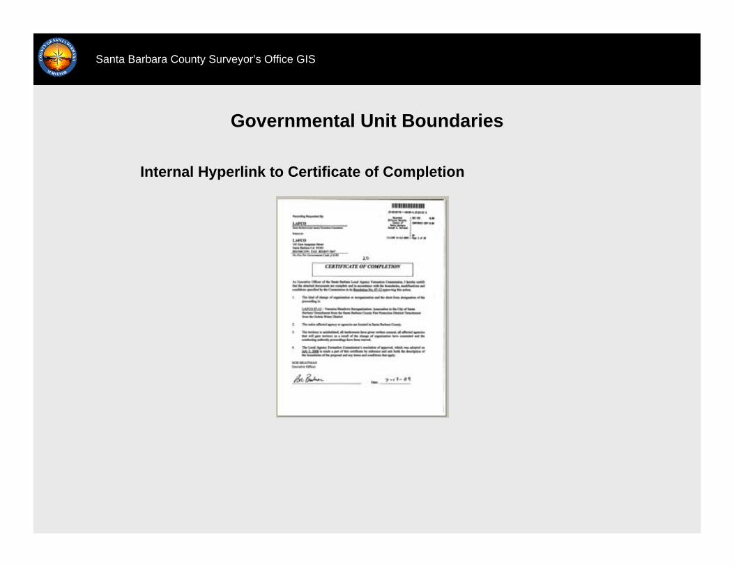
Internal Hyperlink to Certificate of Completion
Governmental Unit Boundaries
Santa Barbara County Surveyor’s Office GIS
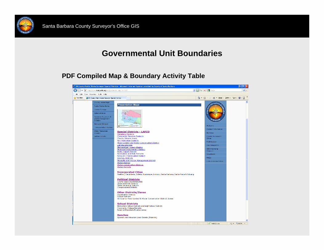
PDF Compiled Map & Boundary Activity Table
Governmental Unit Boundaries
Santa Barbara County Surveyor’s Office GIS
PDF Compiled Map & Boundary Activity Table
Governmental Unit Boundaries
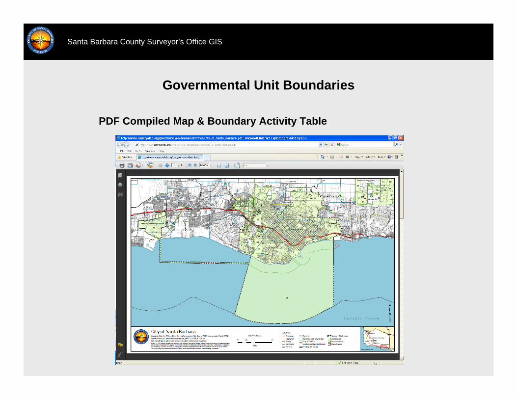
Santa Barbara County Surveyor’s Office GIS
PDF Compiled Map & Boundary Activity Table

Governmental Unit Boundaries
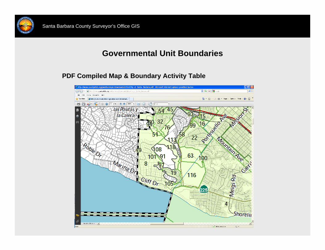
Santa Barbara County Surveyor’s Office GIS
PDF Compiled Map & Boundary Activity Table

Governmental Unit Boundaries
Santa Barbara County Surveyor’s Office GIS
Compiled GIS Boundary
http://countyofsb.org/pwd/surveyor
Santa Barbara County Surveyor’s Office GIS