lake macquarie city lifestyle 2030 strategy · pdf file• urban density is showing an...
TRANSCRIPT

Lake Macquarie City
LIFESTYLE 2030 STRATEGYAdopted by Council 11 March 2013
Lake Macquarie City Lifestyle 2030 Strategy | 1

Contents
IntroduCtIon 3
1 ContEXt And StruCturE oF LS2030 4
2 CItY VISIon 10
3 CorE VALuES 11
4 AIMS 12
5 StrAtEGIC dIrECtIonS 13
6 StrAtEGIC PLAn MAPS And IntEnt StAtEMEntS 23
6.1 urban Structure Map 24
6.2 Movement Systems Map 34
6.3 Green System Map 40
6.4 Sub-regional Context Map 44
7 IMPLEMEntAtIon, rEVIEW And MonItorInG 46
7.1 Implementation 46
7.2 review and monitoring 47
ACknoWLEdGEMEnt: 47
BIBLIoGrAPhY: 47
Adopted by Council 11 March 2013 - F2008/02086
2 | Lake Macquarie City Lifestyle 2030 Strategy

Lifestyle 2030 StrategyIntroduction
Lake Macquarie City Council (LMCC) recognises that the City's prosperity, natural assets, and community are essential elements of residents’ quality of life. It is important to have in place a Strategy that provides the direction for the future urban and rural land use pattern, based on achieving the principles of sustainability.
Lifestyle 2030 Strategy (LS2030) provides the long-term direction for the overall development of the City and describes Council’s high level policies for managing private and public development in Lake Macquarie.
Lifestyle 2020 (LS2020) has served the Lake Macquarie community for ten years; Lifestyle 2030 Strategy is a revised version of that Strategic Plan, reflecting shifts in planning
policy and social, economic and environmental trends through the period 2000 to 2012.
LS2030 is a long-range land use strategic plan and policy document. Supporting documentation to LS 2030 includes:
1. Lifestyle 2020 review discussion Paper 2010
2. Biodiversity Background technical report 2011 – LMCC Sustainability department, and
3. Employment Lands Study 2010 - SGS Economics and Planning.
details of these documents can be located in the Bibliography of this document.
Lake Macquarie City Lifestyle 2030 Strategy | 3

National, State and Regional Planning Framework Planning in Lake Macquarie occurs within a broad national, state, and regional policy framework.
the State of Australian Cities reports (2010 and 2011) provide a national comparative overview of the nature of Australia’s cities with a population over 100,000. the focus of the reports is on the capital cities; however, a number of issues are identified which are of particular relevance for Lake Macquarie:
• Thereisanationalmismatchbetweenthe production of housing and the size of households
• Thereisanationalmismatchbetweenhousingproduction and the need for affordable housing. housing is affordable when households that are renting or purchasing are able to pay their housing costs and still have sufficient income to
meet other basic needs such as food, clothing, transport, medical care and education. real housing prices have more than doubled since 1995.
• Dwellingapprovalshavefallenbelowlevelsofdemand
• Themostcarbon-efficientformofhousingaretownhouses and villas in inner suburban areas
• Urbandensityisshowinganincreasingtrend
• TheNewcastleurbanarea(whichincludesLakeMacquarie) has one of the highest proportions of detached dwellings of any major city in Australia
• TheNewcastleurbanareahasaverylowproportion of trips by public transport
• Thesocialandeconomiccongestioncostsofroad transport are increasing
• Roadfreightmovementwithincitieswillincrease dramatically
Context and Structure of LS2030
4 | Lake Macquarie City Lifestyle 2030 Strategy
1

• Themainemploymentgrowthareasareinskilled and professional workers
• Urbanareasaredisplacinglandpreviouslyused for food production
• Climatechangewillleadtosealevelriseandmore frequent extreme weather.
At the state level, the nSW State Plan sets clear priorities for the nSW Government for the next 10 years. Whilst the Plan identifies many challenges, the following future challenges are specifically mentioned:
• Thepressuresofanageingpopulation
• Economiccompetitionfromgrowingeconomies in the Asia Pacific region
• Pocketsofdisadvantageinthecommunity
• EnvironmentalChallenges,particularlyclimatechange and drought
• Planningchallengesarisingfromcontinuingpopulation growth.
these challenges are as relevant to Lake Macquarie LGA as for nSW overall. of particular interest to Lake Macquarie are the following priorities and targets of the State Plan:
• Increasetheuseofpublictransport
• Reducetheregulatoryburdenonbusiness
• Increasebusinessinvestment
• Maintainandinvestininfrastructure
• Betterenvironmentaloutcomesfornativevegetation, biodiversity, land, rivers and coastal waterways
• Improvehousingaffordability
• Improvetheefficiencyoftheroadnetwork
• Reducegreenhousegasemissions
• Ensureasupplyoflandandmixofhousingthatmeets demand
• Improvingtheaccesstoemploymentcentresby public transport.
At the regional level, the Lower hunter regional Strategy (LhrS) guides the growth of the Lower hunter, ensuring that adequate land is available and appropriately located to accommodate the projected housing and employment needs of the region’s population up to 2031. Its sister document, the Western Corridor Planning Strategy provides key planning principles, including the planning for infrastructure, to accommodate projected urban and employment development in the north-west region of the City.
By 2031, the LhrS projects that the Lower hunter will have 160,000 additional residents and 115,000 new dwellings by 2031. of these, 36,000 additional dwellings are proposed in Lake Macquarie LGA, 15,000 in the new release areas, and the balance within the existing urban areas. the LhrS advocates the majority of new development be in close proximity to major centres and employment lands in order to maximise access to services and employment opportunities.
Within Lake Macquarie, Charlestown is designated a regional centre by the LhrS, with Glendale/Cardiff and Morisset as emerging regional centres
Lake Macquarie City Lifestyle 2030 Strategy | 5

which will experience substantial dwelling and employment growth. Significant urban release areas are proposed at Cooranbong, Morisset, Wyee, and in the north west of the LGA, as well as in the Catherine hill Bay area.
the LhrS also identifies two “renewal corridors” to allow more housing, commercial and employment opportunities to be provided in existing urban areas. these corridors extend from Cardiff to Edgeworth along Main road, and from Charlestown to Bennetts Green along the Pacific highway.
A large area of land in the southeast and west of the Lake Macquarie LGA is regionally significant conservation land, being part of the Watagans Stockton and Wallarah Green Corridor. the LhrS and the Western Corridor Planning Strategy are complemented by the Lower hunter Conservation Plan (LhCP), which also describes the conservation priorities for the Lower hunter.
Policies of adjoining Council’s such as Wyong and newcastle City also complement planning in Lake Macquarie. to the City’s south, the draft
north Wyong Structure Plan and the Central Coast regional Strategy inform future development lands in Wyong. to the north, significant portions of land that cross the border with newcastle City Council continue to be under strategic investigation. Maintaining and enhancing social, environmental and economic connectivity between the cities remains a priority.
6 | Lake Macquarie City Lifestyle 2030 Strategy

Lake Macquarie Integrated Planning frameworkCouncil has developed an Integrated Planning Framework that aligns organisational planning, processes, and performance to the Lake Macquarie 10 Year Community Plan. this supports the vision and directions as set out in LS2030.
the framework consists of the following:
• Lifestyle 2030 Strategy (LS2030) provides the long-term vision for land use in the City. the vision is encapsulated in a series of strategic directions that convey envisaged outcomes for future land use patterns in the City the 10 Year Plan adopts LS2020’s strategic directions and will adopt LS 2030’s strategic directions.
• 10 Year Community Strategic Plan - outlines short (1 year), medium (2-5 years), and long-term (6-10 years) priorities, directions, strategic objectives, and progress indicators that address the community's main priorities and aspirations for the future.
• Four Year Delivery Program - outlines how (actions) Council will deliver the Community Plan's strategic objectives
• One Year Operational Plan & Budget - a financial and resource allocation plan that identifies services and activities to be carried out over a 12-month period. the plan also provides a succinct review of our performance against specific community and organisational indicators
• Annual Report - reflects and reports on Council's objectives, operations, and performance for the preceding financial year
LS2030 is the primary guiding document for the development of local plans, regulations and guidelines that control development of land. two important documents that are informed by Lifestyle 2030 are draft Lake Macquarie Local Environmental Plan 2012 (LEP 2012) and draft Lake Macquarie Development Control Plan 2012 (dCP 2012). draft LEP 2012 is the legal instrument that imposes local standards to control development, including the allocation of land use zones. dCP 2012 provides specific, more comprehensive guidelines for certain types of development. new development must comply with LEP 2012 and dCP 2012. LS2030 is a very important part of Council’s suite of adopted planning policies and tools, and should be considered in the assessment of rezoning and development applications and other matters, such as the preparation of planning policies.
Figure 1: Integrated Strategic Planning Framework
Lake Macquarie City Lifestyle 2030 Strategy | 7
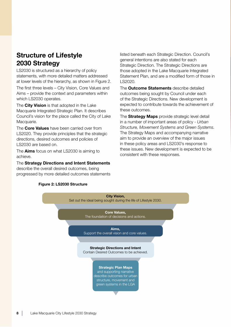
Structure of Lifestyle 2030 StrategyLS2030 is structured as a hierarchy of policy statements, with more detailed matters addressed at lower levels of the hierarchy, as shown in Figure 2.
the first three levels – City Vision, Core Values and Aims – provide the context and parameters within which LS2030 operates.
the City Vision is that adopted in the Lake Macquarie Integrated Strategic Plan. It describes Council’s vision for the place called the City of Lake Macquarie.
the Core Values have been carried over from LS2020. they provide principles that the strategic directions, desired outcomes and policies of LS2030 are based on.
the Aims focus on what LS2030 is aiming to achieve.
the Strategy Directions and Intent Statements describe the overall desired outcomes, being progressed by more detailed outcomes statements
listed beneath each Strategic direction. Council’s general intentions are also stated for each Strategic direction. the Strategic directions are those adopted in the Lake Macquarie Integrated Statement Plan, and are a modified form of those in LS2020.
the Outcome Statements describe detailed outcomes being sought by Council under each of the Strategic directions. new development is expected to contribute towards the achievement of these outcomes.
the Strategy Maps provide strategic level detail in a number of important areas of policy - Urban Structure, Movement Systems and Green Systems. the Strategy Maps and accompanying narrative aim to provide an overview of the major issues in these policy areas and LS2030’s response to these issues. new development is expected to be consistent with these responses.
Figure 2: LS2030 Structure
City Vision,Set out the ideal being sought during the life of Lifestyle 2030.
Core Values,the foundation of decisions and actions.
Aims,Support the overall vision and core values.
Strategic Directions and IntentContain desired outcomes to be achieved.
Strategic Plan Maps and supporting narrative
describe outcomes for urban structure, movement and green systems in the LGA
8 | Lake Macquarie City Lifestyle 2030 Strategy
Technical Studiesthree major technical studies have been completed as part of the review of Lifestyle 2020 and have been used to inform the preparation of LS2030. these are:
• Lifestyle2020ReviewDiscussionPaper–Strategy hunter
• EmploymentLandStudy-SGSEconomics & Planning
• BiodiversityBackgroundTechnicalReport-LMCC
the Lifestyle 2020 Review Discussion Paper analyses environmental, social and economic changes and trends that have occurred in the Lake Macquarie Local Government Area since the adoption of Lifestyle 2020 in 2000. this includes a detailed demographic analysis. the discussion paper has formed the basis for proposed changes to Lifestyle 2020 and has guided the development of LS2030.
the Employment Land Study provides an analysis of supply and demand for commercial and employment land in Lake Macquarie up to the year 2030. the study provides a framework to plan for further floor space to accommodate this demand; and identifies economic strategies that will help Council achieve its economic development objectives.
the Biodiversity Background Technical Report reviews and updates biodiversity issues and indicators, legislation, Strategies, plans and policies, relevant to biodiversity that have evolved since the adoption of Lifestyle 2020 in 2000. Since the adoption of Lifestyle 2020, new legislation, policies, plans and strategies have been introduced at all levels of government which have influenced land use and management decisions about biodiversity.
Lake Macquarie City Lifestyle 2030 Strategy | 9
Centred on the largest coastal salt-water lake in nSW, and flanked by the Watagan Mountains and the Pacific ocean, the City of Lake Macquarie has the social, environmental, and economic potential to be one of the most liveable places in Australia. the vision for the City, held by Council and the community, is that it is a place:
• wheretheenvironmentisprotectedandenhanced.
• wherethescenic,ecological,recreational,and commercial values and opportunities of the Lake and coastline are promoted and protected.
• withaprosperouseconomyandasupportiveattitude to balanced economic growth,
managed in a way to enhance quality of life and satisfy the employment and environmental aims of the community.
• thatrecognizes,encourages,developsitsdiverse cultural life and talents, protects, and promotes its heritage.
• that encourages community spirit, promotes a fulfilling lifestyle, enhances health and social well-being, encourages lifestyle choices, and has opportunities to encourage participation in sport and recreation.
• thatpromotesequalaccesstoallservicesand facilities and enables all citizens to contribute to and participate in the City's economic and social development.
• thatpromotesaffordablehousing.
City Vision
10 | Lake Macquarie City Lifestyle 2030 Strategy
2

to guide future development in the City the four core values of the Strategy are:Sustainability
this means integrating the management of environmental, economic, social, and cultural elements to ensure that all resources of the Lake Macquarie Local Government Area (LGA), as well as those sourced from other places, are respected, preserved, enjoyed, and utilised in a sustainable manner both for current and future generations.Equity
this means fairly distributing and improving access to employment, housing, urban services, community facilities, environmental quality and recreation and providing for a range of lifestyle opportunities to suit all members of the community.Efficiency
this means facilitating infrastructure and a land use structure that provide a more comprehensive approach to the design of movement networks, open space and water management systems and other services across a wide range of living, employment and leisure opportunities that are capable of adapting over time to social, economic or environmental change.
Liveability
this means developing a well designed, attractive and functional land use pattern that results in diverse, accessible, compatible and vibrant environments that support security, safety, identity, historic continuity and cultural diversity, and allows for the efficient and timely provision of necessary
infrastructure.
Core Values
Lake Macquarie City Lifestyle 2030 Strategy | 11
3
LS2030 aims to:
• Provide the community with a realistic expectation about the future development patterns of the LGA, while retaining flexibility for land use decision making in the longer term.
• reinforce and strengthen Centres so that a wide range of commercial and community services may be provided in a timely and accessible manner.
• Provide local employment opportunities for residents and to promote economic development consistent with the LGA’s natural, locational and community resources.
• Guide the development of urban communities which are compact, distinct, and diverse with a range of housing types and activities.
• Achieve a strong sense of positive community identity, through the development of local communities which are safe and liveable and offer a diversity of use, economic opportunity, and ready access to services, while minimising the use of private motor vehicles.
• develop attractive and liveable urban areas in the LGA which reflect its physical and natural environment, and visual character.
• Manage the City's natural environment so that its ecological functions and biological diversity are conserved and enhanced, and contribute to the City's overall well being and amenity.
• Manage the City's heritage and economic resources, in a way that protects the value of these resources and enhances the City's character.
• Integrate land use with the efficient provision of public and private movement systems.
Aims
12 | Lake Macquarie City Lifestyle 2030 Strategy
4

Strategic Direction 1A city responsive to the environment
the Lake Macquarie Local Government Area (LGA) is recognised and appreciated by the community, and visitors, as a place of significant natural assets, including:
• the Lake and its foreshores, bays, islands and other waterways.• the coastline and beaches.• the forested mountain backdrop.• the variety of bushland communities and wetlands.• the diversity and quantity of native fauna.
It is intended that the integrity and sustainability of these assets will be protected, by ecologically sustainable development.
Outcome1.1 Biodiversity connectivity and conservation areas are identified, protected and enhanced with the major
elements shown schematically on the Green Systems Map and the Urban Structure Map.1.2 Biodiversity values are protected and managed.1.3 Any unavoidable removal of native vegetation or fauna habitat associated with development is adequately offset.
1.4 Where not part of an urban development strategy, the development of planned communities on previously undeveloped land (Greenfield development) is limited to areas adjacent to existing development and is preferentially directed to cleared areas, which do not support threatened species.
1.5 Viable populations of threatened species and areas of endangered ecology are maintained and enhanced.1.6 Estuarine, riparian and coastal ecosystems are protected and enhanced.1.7 Community awareness of the importance of biodiversity and biodiversity priorities for Lake Macquarie LGA is
increased and voluntary participation in the management and protection of biodiversity is facilitated.1.8 the health of aquatic habitats, such as the Lake and ocean, are maintained and enhanced by limiting urban
runoff and pollutants. 1.9 urban development incorporates and makes provision for sustainable water cycle management.1.10 Ecosystems and species are assisted to adapt and migrate in response to the impacts of climate change.1.11 healthy, resilient ecosystems, such as coastal ecosystems, have the capacity to assist in protecting
infrastructure and property.1.12 the LGA is prepared for the impacts of climate change, including adaptable infrastructure and buildings.1.13 the scenic natural beauty of the City is maintained and enhanced, and buildings or structures visible from the
Lake and coast (including the coastal walk) exhibit high quality design sympathetic to their setting.1.14 the planting of trees and maintenance of native vegetation are used to assist in improving microclimate and
air quality.
Strategic directions
Lake Macquarie City Lifestyle 2030 Strategy | 13
5
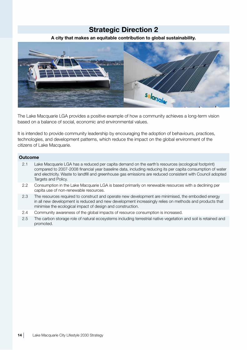
Strategic Direction 2A city that makes an equitable contribution to global sustainability.
the Lake Macquarie LGA provides a positive example of how a community achieves a long-term vision based on a balance of social, economic and environmental values.
It is intended to provide community leadership by encouraging the adoption of behaviours, practices, technologies, and development patterns, which reduce the impact on the global environment of the citizens of Lake Macquarie.
Outcome2.1 Lake Macquarie LGA has a reduced per capita demand on the earth’s resources (ecological footprint)
compared to 2007-2008 financial year baseline data, including reducing its per capita consumption of water and electricity. Waste to landfill and greenhouse gas emissions are reduced consistent with Council adopted targets and Policy.
2.2 Consumption in the Lake Macquarie LGA is based primarily on renewable resources with a declining per capita use of non-renewable resources.
2.3 the resources required to construct and operate new development are minimised, the embodied energy in all new development is reduced and new development increasingly relies on methods and products that minimise the ecological impact of design and construction.
2.4 Community awareness of the global impacts of resource consumption is increased.2.5 the carbon storage role of natural ecosystems including terrestrial native vegetation and soil is retained and
promoted.
14 | Lake Macquarie City Lifestyle 2030 Strategy

Strategic Direction 3A well designed adaptable and liveable city
the Lake Macquarie LGA benefits from a high amenity natural environment. Within this environment, there exists a number of discrete and diverse urban and rural living, working and recreational opportunities.
It is intended to recognise, retain and enhance the character and attributes of the City that make it an attractive and liveable environment for residents, workers, investors and visitors, and to build its capacity to respond to future social, economic and environmental needs and challenges in a positive way.
Outcome3.1 the role of centres is consistent with the Centres hierarchy as discussed, and shown on the urban
Structure map.3.2 More development occurs in the City’s centres by encouraging developments having more than one use
(mixed use developments) and multiunit housing through Council’s land use policies.3.3 More extensive building and development in vacant areas of the City’s centres, such as Charlestown and
Cardiff, (infill redevelopment) occurs. Such development should incorporate medium density housing (approx. 30–40 dwellings per hectare) to achieve a 30% medium density housing (not including duplexes) target by 2030.
3.4 Charlestown Master Plan, Glendale Master Plan, Morisset Structure Plan and Wyee Structure and Local Area Plans are implemented.
3.5 Mt hutton centre grows into a comprehensive town centre with a mix of commercial services, retail, community facilities, and residential development.
3.6 Local Area Plans with location specific development guidelines are developed and implemented for all town centres such as Belmont, Swansea, and toronto.
3.7 the unique character and sense of place of centres, such as Wyee and Cardiff, is reinforced in their buildings, streetscape and public domain.
3.8 there is a stronger functional and urban design relationship between the Lake and the centres at Swansea, Belmont, Valentine, rathmines, Wangi Wangi, toronto and Warners Bay.
3.9 the amenity of centres located on main roads is improved, particularly at Swansea, Belmont, Charlestown and Morisset.
3.10 Large scale commercial and retail development, other than development that sells, hires or displays bulky goods, that is not within or adjacent to a centre is discouraged.
3.11 development on previously undeveloped land (new release urban development) is focused on new centres or reinforces the role of existing centres.
Lake Macquarie City Lifestyle 2030 Strategy | 15

Strategic Direction 3 (cont)A well designed adaptable and liveable city
3.12 urban development, including new release urban development, is more intensive and contains a gradation of density such as multiunit housing surrounding each centre, with lower dwelling densities at the periphery of the development. the impacts associated with urban/non-urban interface are minimised.
3.13 the scenic qualities of the Lake and its setting, such as foreshores, forested ridges, wooded ridges, riparian areas are promoted, protected, and enhanced.
3.14 the scenic and heritage qualities of the coast and its setting, such as headlands, beaches, wetlands and dunes, are protected and enhanced.
3.15 Important rural vistas are protected, such as along Freemans drive and in the south-west of the LGA.3.16 the impact of land uses incompatible with the environmental values of the Watagans and surrounding
area are minimised.3.17 Speers Point Park is developed into the LGA’s premier open space.3.18 A strategy for addressing the risks that climate change may have on urban development is developed
with the community. 3.19 there is a diversity of lot sizes and housing to meet users’ needs.3.20 Public housing areas, such as in Windale, toronto West, Belmont and Booragul/Bolton Point are
rejuvenated (in consultation with housing nSW)3.21 A comprehensive set of Local Area Plans, providing locally specific urban design requirements and
guidance, particularly in character areas such as West Wallsend, Martinsville Valley, and Catherine hill Bay, are prepared and implemented.
3.22 the arrangement, appearance and function (urban design) of industrial developments is improved.3.23 development at major intersections and gateways exhibit a high quality of urban design and sense of
place including such locations as at the Crossroads (Glendale), Charlestown, Cameron Park, Swansea town Centre and Morisset town Centre.
3.24 the heritage of Lake Macquarie and its localities are celebrated in shaping the City’s physical environment in order to improve the quality of life in the City.
3.25 there are adequate buffers between industrial, mining, gas and petroleum activities, including coal seam gas exploration and extraction and other developments, which are sensitive to their impact.
3.26 the social and economic impacts of increased fossil fuel prices, due to climate change policy and “peak oil”, are identified and adaptive strategies are developed.
3.27 Good quality neighbourhood (destination) parks are provided in close proximity to high density urban development.
3.28 A review of rural-residential land is undertaken, including an analysis of the supply and demand for rural-residential land.
3.29 the air quality of the City is maintained and enhanced.3.30 Lake Macquarie Aboriginal heritage Management Strategy is implemented, including Sensitive
Aboriginal Landscapes Mapping.3.31 the north Wallarah Conservation Land use Management Plan and north Wallarah Peninsula Masterplan
are implemented and the Murray’s Beach design Essentials applied.
16 | Lake Macquarie City Lifestyle 2030 Strategy

Strategic Direction 4A well serviced and equitable city
Lake Macquarie is a City of many Centres whose economic viability and ability to provide services is impacted by their distance from each other and the dispersed community they serve.
It is intended to:
· Maximise opportunities for development in existing urban areas in order to limit the extent of urbanexpansion and to provide more efficient use of existing land and infrastructure, and
· recognise community, commercial, and investor needs through accommodating the City'sprojected population growth, where feasible, within Centres and established areas.
this will stimulate and strengthen the viability and ability of Centres to serve community needs.
the size and dispersed nature of Lake Macquarie results in increased travel times, difficult public transport provision, and leads to reliance on private vehicles. residents and visitors should be able to travel safely, economically, comfortably and conveniently within the City as a pedestrian, cyclist or by public or private transport. this includes accommodating the needs of people with disabilities and the ageing population into the designs of public transport and other transit systems.
It is intended that future development will reduce reliance on private vehicles and support an efficient and accessible movement system.
Outcome4.1 there is sufficient infrastructure capacity to support the planned growth of centres, and employment
areas, including new infrastructure such as the Pennant Street overpass and Lake Macquarie transport Interchange at Glendale. Provision will rely on the support and strategies of relevant State Government authorities.
4.2 the capacity of existing urban areas to support more intensive urban development has been assessed and density provisions applied accordingly.
4.3 development on previously undeveloped land should not occur unless essential physical and social infrastructure can be provided and funded.
4.4 new development supports the effective and efficient functioning of both public and private transport infrastructure, including provision for electric vehicle infrastructure. Provision will rely on the support and strategies of transport nSW and Infrastructure nSW.
4.5 no urban area is more than 10 minutes walk from a regular public transport route. the outcome will beachieved through the coordinated activities of Council, transport nSW, hunter Buses and City rail.
4.6 Local scale commercial activities are selectively developed to provide services to the public at a limited number of coastal and lakeside locations, especially as in association with Surf Life Saving Clubs, board riders Clubs, sailing and rowing clubs and public facilities.
Lake Macquarie City Lifestyle 2030 Strategy | 17

Strategic Direction 4 (cont)A well serviced and equitable city
4.7 An improved transport system which offers a choice of safe, direct, and frequent options is provided with Centres as the focus and allows people the freedom to live, connect, engage and be involved in their towns and villages (to be provided in consultation with transport nSW, hunter Buses and City rail).
4.8 new development enhances the amenity, viability and use of public transport.4.9 there are transport interchanges at Charlestown, Glendale, and Morisset. the outcome will be achieved
through the coordinated activities of Council, transport nSW, hunter Buses and City rail.4.10 the pedestrian and cycle network is well maintained, more extensive and better utilised, including the
completion of both commuter and recreational cycle ways such as the Fernleigh track, the Wallsend-Glendale cycleway, and the cycleway around the Lake.
4.11 urban development, including new release urban development, has a high degree of vehicular, pedestrian and cyclist connectivity, such as by utilising a modified grid layout, pedestrian /cyclist friendly intersections, off road paths and linked open space.
4.12 Congestion in the transport system is reduced, by encouraging use of alternative forms of transport and better locating new housing, employment and shopping activities.
4.13 heavy vehicles have direct access to arterial roads and to the F3 freeway from areas such as Cardiff Industrial Estate, and heavy vehicle movements are minimised on local residential streets. the outcome will be achieved with the support and strategies of the roads and Maritime Services and Infrastructure nSW.
4.14 Industrial areas have direct access to arterial roads.4.15 Water based public transport on the Lake is encouraged.4.16 Existing communities are well serviced with physical and social infrastructure.4.17 the location and timing of major infrastructure provision is guided by the Lower hunter regional
Strategy.
18 | Lake Macquarie City Lifestyle 2030 Strategy
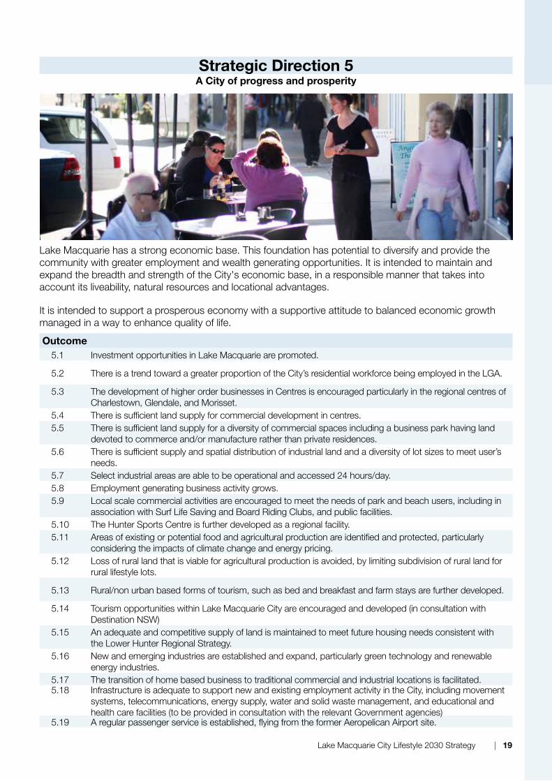
Strategic Direction 5A City of progress and prosperity
Lake Macquarie has a strong economic base. this foundation has potential to diversify and provide the community with greater employment and wealth generating opportunities. It is intended to maintain and expand the breadth and strength of the City's economic base, in a responsible manner that takes into account its liveability, natural resources and locational advantages.
It is intended to support a prosperous economy with a supportive attitude to balanced economic growth managed in a way to enhance quality of life.
Outcome5.1 Investment opportunities in Lake Macquarie are promoted.
5.2 there is a trend toward a greater proportion of the City’s residential workforce being employed in the LGA.
5.3 the development of higher order businesses in Centres is encouraged particularly in the regional centres of Charlestown, Glendale, and Morisset.
5.4 there is sufficient land supply for commercial development in centres.5.5 there is sufficient land supply for a diversity of commercial spaces including a business park having land
devoted to commerce and/or manufacture rather than private residences.5.6 there is sufficient supply and spatial distribution of industrial land and a diversity of lot sizes to meet user’s
needs.5.7 Select industrial areas are able to be operational and accessed 24 hours/day.5.8 Employment generating business activity grows.5.9 Local scale commercial activities are encouraged to meet the needs of park and beach users, including in
association with Surf Life Saving and Board riding Clubs, and public facilities.5.10 the hunter Sports Centre is further developed as a regional facility.5.11 Areas of existing or potential food and agricultural production are identified and protected, particularly
considering the impacts of climate change and energy pricing.5.12 Loss of rural land that is viable for agricultural production is avoided, by limiting subdivision of rural land for
rural lifestyle lots.
5.13 rural/non urban based forms of tourism, such as bed and breakfast and farm stays are further developed.
5.14 tourism opportunities within Lake Macquarie City are encouraged and developed (in consultation with destination nSW)
5.15 An adequate and competitive supply of land is maintained to meet future housing needs consistent with the Lower hunter regional Strategy.
5.16 new and emerging industries are established and expand, particularly green technology and renewable energy industries.
5.17 the transition of home based business to traditional commercial and industrial locations is facilitated.5.18 Infrastructure is adequate to support new and existing employment activity in the City, including movement
systems, telecommunications, energy supply, water and solid waste management, and educational and health care facilities (to be provided in consultation with the relevant Government agencies)
5.19 A regular passenger service is established, flying from the former Aeropelican Airport site.
Lake Macquarie City Lifestyle 2030 Strategy | 19

Strategic Direction 6A City responsive to the wellbeing of its residents
Lake Macquarie is a city committed to improving social equity and the opportunities available to its residents. It is intended to encourage and enable all people to participate fully in the economic and social life of the community as well as enjoy equal life chances and equal opportunity for access to the resources of the community.
It is intended to encourage a community spirit which promotes a fulfilling lifestyle, enhances health and social wellbeing, encourages family life and lifestyle choices, allows opportunities to participate in sport, recreation and cultural pursuits, promotes equal access to all services and facilities, as well as enabling all citizens to contribute to the City’s economic and social development.
Outcome6.1 the well being of residents continues to improve.6.2 the Lake, coastline, and Watagans support a mix of recreation and tourism activities that are
compatible with their environmental values.6.3 Plans of Management identify the appropriate level of intensity of open space development for specific
parks.6.4 A major sporting complex is developed at teralba/Cockle Creek.6.5 there is diverse range of dwelling types and sizes developed in response to demographic change.6.6 there is an increased supply of affordable housing (housing is affordable when households that are
renting or purchasing are able to pay their housing costs and still have sufficient income to meet other basic needs such as food, clothing, transport, medical care and education).
6.7 there is adaptable and universal housing to meet community needs.6.8 there is additional social housing, integrated with privately owned housing . (to be provided with
appropriate consultation with housing nSW). Social housing refers to rental housing which may be owned and managed by the State, by non-profit organisations, or by a combination of the two, usually with the aim of providing affordable housing.
6.9 the heritage of Lake Macquarie LGA and its localities is celebrated in urban design and place making initiatives.
6.10 the City has a rich and diverse cultural life.6.11 Place making initiatives to beautify the community, enhance the public life of streets and common
places, and strengthen the sense of place are grounded in cultural development and the locality’s natural characteristics.
6.12 Facilities and mechanisms that ensure education, health care, community development, income distribution, employment and social welfare (social infrastructure) are developed and recognized as an important component of place making.
6.13 Special places, such as Speers Point Park, rathmines Park, and the Art Gallery, are a focus for specific place making activity.
6.14 Lake based aquatic facilities are upgraded to meet increased community needs.
20 | Lake Macquarie City Lifestyle 2030 Strategy
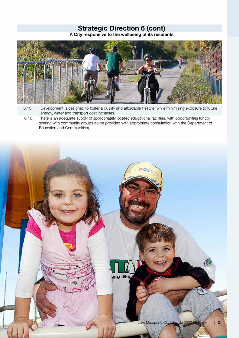
Strategic Direction 6 (cont)A City responsive to the wellbeing of its residents
6.15 development is designed to foster a quality and affordable lifestyle, while minimising exposure to future energy, water and transport cost increases.
6.16 there is an adequate supply of appropriately located educational facilities, with opportunities for co-sharing with community groups (to be provided with appropriate consultation with the department of Education and Communities).
Lake Macquarie City Lifestyle 2030 Strategy | 21
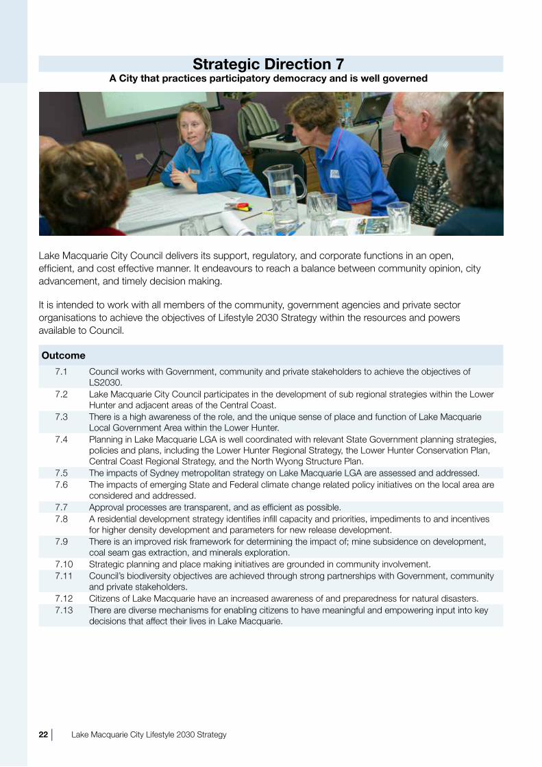
Strategic Direction 7A City that practices participatory democracy and is well governed
Lake Macquarie City Council delivers its support, regulatory, and corporate functions in an open, efficient, and cost effective manner. It endeavours to reach a balance between community opinion, city advancement, and timely decision making.
It is intended to work with all members of the community, government agencies and private sector organisations to achieve the objectives of Lifestyle 2030 Strategy within the resources and powers available to Council.
Outcome
7.1 Council works with Government, community and private stakeholders to achieve the objectives of LS2030.
7.2 Lake Macquarie City Council participates in the development of sub regional strategies within the Lower hunter and adjacent areas of the Central Coast.
7.3 there is a high awareness of the role, and the unique sense of place and function of Lake Macquarie Local Government Area within the Lower hunter.
7.4 Planning in Lake Macquarie LGA is well coordinated with relevant State Government planning strategies, policies and plans, including the Lower hunter regional Strategy, the Lower hunter Conservation Plan, Central Coast regional Strategy, and the north Wyong Structure Plan.
7.5 the impacts of Sydney metropolitan strategy on Lake Macquarie LGA are assessed and addressed.7.6 the impacts of emerging State and Federal climate change related policy initiatives on the local area are
considered and addressed.7.7 Approval processes are transparent, and as efficient as possible.7.8 A residential development strategy identifies infill capacity and priorities, impediments to and incentives
for higher density development and parameters for new release development.7.9 there is an improved risk framework for determining the impact of; mine subsidence on development,
coal seam gas extraction, and minerals exploration.7.10 Strategic planning and place making initiatives are grounded in community involvement.7.11 Council’s biodiversity objectives are achieved through strong partnerships with Government, community
and private stakeholders.7.12 Citizens of Lake Macquarie have an increased awareness of and preparedness for natural disasters.7.13 there are diverse mechanisms for enabling citizens to have meaningful and empowering input into key
decisions that affect their lives in Lake Macquarie.
22 | Lake Macquarie City Lifestyle 2030 Strategy

Strategic Plan Maps and Intent Statements
the Strategic Plan Maps identify the preferred pattern of development for the City and form a graphic description of how LS2030’s Aims and directions will be achieved. they do this by describing the intent for each of the elements, systems, or networks in the following Maps:
Urban Structure Map
Centres
urban zoned land
Growth and expansion corridors
Intensification Corridors
Major remnant vegetation and ecological connections
national Parks, State Forests and proposed conservation lands
Potential and existing employment lands
rural landscape
Urban Change and Investigation Map
Areas zoned for medium and higher density development
Investigation areas
Lower hunter regional Strategy potential urban and employment areas
Movement System Map
road network
rail network
Bus network
Airport
transport Interchanges
Cycleways
Coal haul road
Green System Map
State Significant vegetation and habitat
national Park and State Forest
regionally significant vegetation and habitat
Waterways
State significant waterways
State significant aquatic habitat
Proposed conservation areas
other remnant vegetation
Sub-Regional Context Map
newcastle regional City
Sub-regional Green Corridors
Employment Land
transport Links
Lake Macquarie City Lifestyle 2030 Strategy | 23
6

6.1 Urban Structure Map
Urban Areasthe aim of this Section and the urban Structure Map is to complement the Strategic directions and outcomes of LS2030 by describing the desired spatial pattern of development in the LGA, and the major reasons for this approach to the development of the LGA. Prevailing property and development markets have a significant influence on the delivery of spatial outcomes. to this extent, the timing of development will largely be beyond Council’s direct control. however, describing the desired spatial pattern provides a clear guide to the overall spatial distribution of current and desirable land uses within the City. this is important in order to give effect to the vision, aims and strategic directions of the strategy.
urban areas are those parts of the LGA, which are commonly described as “built up areas.” they are zoned as residential, commercial, and industrial areas, as well as associated open space, services, and transport corridors. they contain housing, shops, schools and services, among other uses.
It is not possible to consider future development in the LGA without considering its context within the broader newcastle urban area/Lower
hunter region and its proximity to urban areas on the Central Coast and the metropolitan area of Sydney. LS2030 recognises these links and influences through the location of the major urban development and infill areas in the north and south of the city, and through measures to strengthen public and non-car based transport between to adjacent urban areas.
the pattern of urban development in the LGA is strongly influenced by the Lake, which provides an attractive setting for many of the LGA’s urban areas as well as being a substantial barrier to movement.
Many of the town and village centres of the LGA have evolved from smaller settlements, which were founded to serve the needs of coal mining, rural, and fishing communities. Although the original reason for settlement has passed in most cases, many settlements have continued to grow to form the urban area we know today.
through this process, previously undeveloped land between the settlements has progressively been developed. Much of the former “vacant” land is now developed or is unsuitable for development, leading to most new suburban growth being located on the urban fringe, such as at Cameron Park, Cooranbong and Wallarah. development on the urban fringe is progressively reducing areas of
24 | Lake Macquarie City Lifestyle 2030 Strategy

native bushland and agricultural land. At the same time, low density fringe growth is not conducive to viable public transport and other alternatives to the motor vehicle.
In response, LS2030 aims to build on the existing urban structure of the LGA. LS2030 aims to reinforce the LGA’s Centres, focus growth and change around these Centres, reduce car dependence, and minimise new urban development on the fringe.
Important components of this approach are:
• A hierarchy of regional, town and local centres which provide a focus for urban development and community activity.
• Encouraging developments having more than one use (mixed use development) in the Centres in order to increase their vitality and adaptability.
• A gradation of development intensity - higher near the Centres and lower at the urban periphery - in order to take advantage of proximity to services and public transport, and provide increased choice.
• A substantial part of the City's urban area remaining relatively low density, and mainly detached housing, achieving approximately 8–15 dwellings per hectare
• An increase in housing diversity, to meet community need.
• A particular focus on increasing the supply of medium density housing, such as retirement homes, townhouses, small lot housing, apartments, shop top housing and dual occupancy, achieving approximately 30–40 dwellings per hectare, generally within a:
- Five minute walk of a centre;
- Five minute walk of bus stops with frequent services to major centres;
- ten minute walk of regional and town Centres;
- ten minute walk of major public transport nodes, such as railway stations or interchanges; and
- In selected areas of high amenity which are suitable for multiunit housing.
• Augment pedestrian systems with improved cycle systems to extend the catchment of urban centres and key public transport
systems. Measures will include:
- Provision of cycleways and/or on-road cycle routes/lanes to all new developments, linking residential areas to shops, schools, urban centres and public transport systems, such as public transport interchanges and train stations.
- Provision of bicycle parking facilities with higher security and/or undercover bicycle parking at major centres.
• Provision of infrastructure to support uptake of private and public electric vehicles.
CentresCentres are the fundamental building block of the urban structure of the LGA, and are intended to be the focus for:
• Commercial and retail activity.
• Service delivery and employment opportunities.
• Safe, convenient, and accessible pedestrian, cycling and public transport.
• Places for social and community interaction and recreation.
• higher density housing, and mixed-use development incorporating housing.
Accordingly, the Strategic directions and outcomes of LS2030 aim to:
• Strengthen the function and character of Centres.
• Provide economic and employment opportunities.
• Provide a diversity of housing opportunities.
• Improve the connectivity of roads, public places, and facilities.
• Improve accessibility by public transport, cycling and walking.
Lake Macquarie City Lifestyle 2030 Strategy | 25

Hierarchy of CentresLS2030 provides for a hierarchy of Centres, which provide various functions, and levels of service. this hierarchy is shown on the urban Structure Map.
Major Regional Centre:
Charlestown:
the Major regional Centre of Charlestown:
• Contains a concentration of mixed use, business, higher order retailing, employment, professional and social services and generally including civic functions and facilities.
• Contains medium and higher density residential within and adjoining the centre.
• Services a number of districts.
• Is a focal point for subregional road and transport networks.
• has public transport interchanges to provide a high level of public transport service and accessibility.
• Is readily accessible by foot and cycling.
• Expresses the character of the area.
• Will be developed in accordance with the Charlestown Masterplan.
Emerging Regional Centres:
Glendale and Morisset:
• the Emerging regional Centres of Glendale and Morisset contain some of the attributes of the Major regional Centre of Charlestown but are expected to grow and encompass all the attributes of major centres in the future.
• the Glendale and Morisset Master Plans will guide development in these Centres.
Town Centres:
Belmont, Cardiff, Mount hutton, Swansea, toronto, Warners Bay and potential emerging town centres
• Provide a range of mixed use, retail, and commercial activities, professional, social services, and community facilities.
• have medium density residential within and adjoining the centre.
• Serve a number of surrounding business and residential communities.
• Are located on the major transport network or arterial roads.
• have frequent public transport services to neighbouring urban areas, other town centres and a regional centre.
• Are readily accessible by foot and cycling.
• Express the character of the area.
• Master Plans, Area Plans and Structure Plans will guide development in the town centres.
Neighbourhood Centres:
• Predominantly serve a local business and residential community.
• Provide convenience, day to day retail, professional and business services and may include local social services or community facilities.
• have medium density residential within and adjoining the centre.
• have frequent public transport services to neighbouring urban areas, and a town centre.
• Are readily accessible by foot and cycling.
• Express the character of the local area.
• Where available, Area Plans or Master Plans will guide development in neighbourhood Centres.
Non-Centre Based Employment Areasthe nature of economic activity in the LGA is changing. As the service based economy grows, the role of Centres in supporting economic activity is increasingly important. non-centre based economic activity is also very important to the prosperity of the LGA. non-centre based employment can include industry, mining, power generation, home-based businesses and home-based industries, tourism, and intensive agriculture.
26 | Lake Macquarie City Lifestyle 2030 Strategy
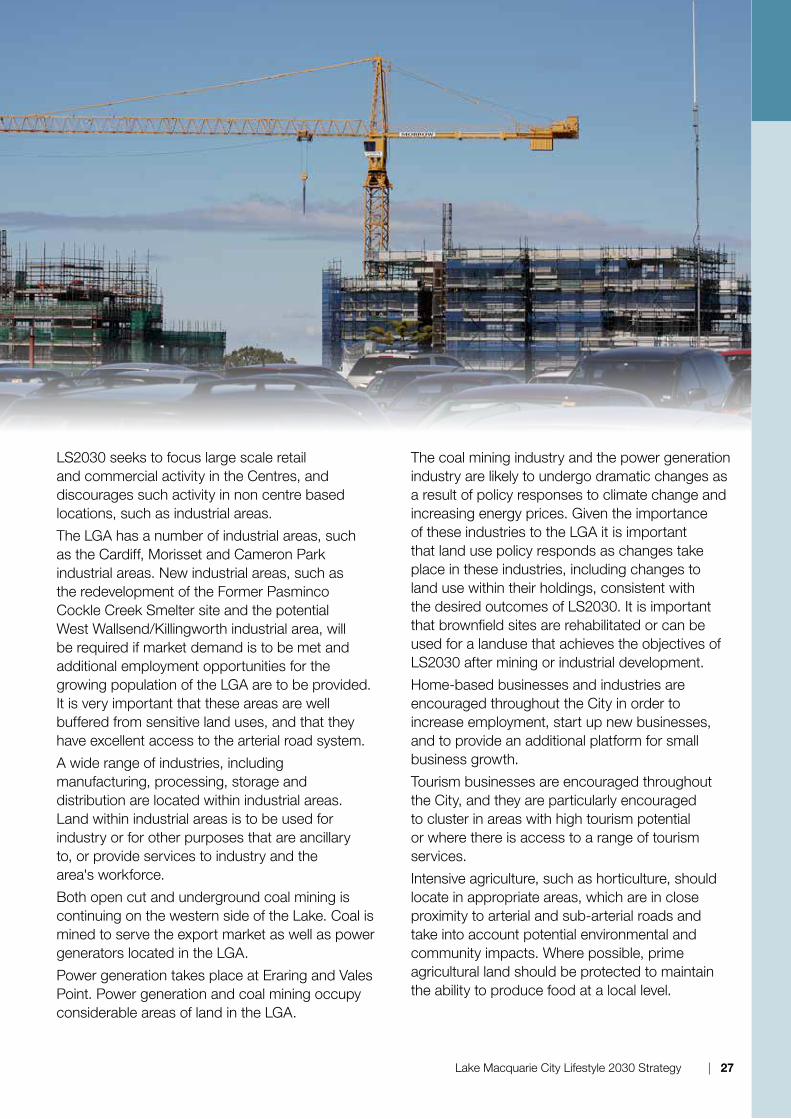
LS2030 seeks to focus large scale retail and commercial activity in the Centres, and discourages such activity in non centre based locations, such as industrial areas.
the LGA has a number of industrial areas, such as the Cardiff, Morisset and Cameron Park industrial areas. new industrial areas, such as the redevelopment of the Former Pasminco Cockle Creek Smelter site and the potential West Wallsend/killingworth industrial area, will be required if market demand is to be met and additional employment opportunities for the growing population of the LGA are to be provided. It is very important that these areas are well buffered from sensitive land uses, and that they have excellent access to the arterial road system.
A wide range of industries, including manufacturing, processing, storage and distribution are located within industrial areas. Land within industrial areas is to be used for industry or for other purposes that are ancillary to, or provide services to industry and the area's workforce.
Both open cut and underground coal mining is continuing on the western side of the Lake. Coal is mined to serve the export market as well as power generators located in the LGA.
Power generation takes place at Eraring and Vales Point. Power generation and coal mining occupy considerable areas of land in the LGA.
the coal mining industry and the power generation industry are likely to undergo dramatic changes as a result of policy responses to climate change and increasing energy prices. Given the importance of these industries to the LGA it is important that land use policy responds as changes take place in these industries, including changes to land use within their holdings, consistent with the desired outcomes of LS2030. It is important that brownfield sites are rehabilitated or can be used for a landuse that achieves the objectives of LS2030 after mining or industrial development.
home-based businesses and industries are encouraged throughout the City in order to increase employment, start up new businesses, and to provide an additional platform for small business growth.
tourism businesses are encouraged throughout the City, and they are particularly encouraged to cluster in areas with high tourism potential or where there is access to a range of tourism services.
Intensive agriculture, such as horticulture, should locate in appropriate areas, which are in close proximity to arterial and sub-arterial roads and take into account potential environmental and community impacts. Where possible, prime agricultural land should be protected to maintain the ability to produce food at a local level.
Lake Macquarie City Lifestyle 2030 Strategy | 27
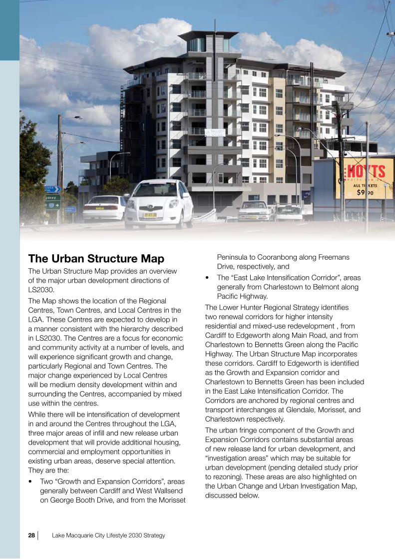
The Urban Structure Mapthe urban Structure Map provides an overview of the major urban development directions of LS2030.
the Map shows the location of the regional Centres, town Centres, and Local Centres in the LGA. these Centres are expected to develop in a manner consistent with the hierarchy described in LS2030. the Centres are a focus for economic and community activity at a number of levels, and will experience significant growth and change, particularly regional and town Centres. the major change experienced by Local Centres will be medium density development within and surrounding the Centres, accompanied by mixed use within the centres.
While there will be intensification of development in and around the Centres throughout the LGA, three major areas of infill and new release urban development that will provide additional housing, commercial and employment opportunities in existing urban areas, deserve special attention. they are the:
• two “Growth and Expansion Corridors”, areas generally between Cardiff and West Wallsend on George Booth drive, and from the Morisset
Peninsula to Cooranbong along Freemans drive, respectively, and
• the “East Lake Intensification Corridor”, areas generally from Charlestown to Belmont along Pacific highway.
the Lower hunter regional Strategy identifies two renewal corridors for higher intensity residential and mixed-use redevelopment , from Cardiff to Edgeworth along Main road, and from Charlestown to Bennetts Green along the Pacific highway. the urban Structure Map incorporates these corridors. Cardiff to Edgeworth is identified as the Growth and Expansion corridor and Charlestown to Bennetts Green has been included in the East Lake Intensification Corridor. the Corridors are anchored by regional centres and transport interchanges at Glendale, Morisset, and Charlestown respectively.
the urban fringe component of the Growth and Expansion Corridors contains substantial areas of new release land for urban development, and “investigation areas” which may be suitable for urban development (pending detailed study prior to rezoning). these areas are also highlighted on the urban Change and urban Investigation Map, discussed below.
28 | Lake Macquarie City Lifestyle 2030 Strategy

Where an existing centre is not nearby, or is not highly accessible, new centres, such as Pambulong Forest, and Cameron Park, will provide a focus for new release urban areas by including mixed use and medium density development, with lower densities predominant at greater distances from the centre.
Within the northernmost Growth and Expansion Corridor, the Cardiff - Edgeworth and Glendale - Argenton areas contain two important redevelopment areas which are located along the arterial road system and capitalise on the nearby Glendale regional Centre.
the redevelopment of the former Pasminco Cockle Creek Smelter site will also provide an opportunity for large scale urban redevelopment in the northernmost Corridor.
In the case of the East Lake Intensification Corridor, most development will involve the redevelopment of existing urban zoned land, frequently with multiunit housing close to the centres and well serviced public transport routes, although some new urban development will occur where ecologic and other constraints permit. the high accessibility of the Eastern Infill Corridor to employment, community services, and facilities, the Charlestown regional Centre, and a number of well developed town centres, makes it especially suitable for urban intensification consistent with the Strategic directions and outcomes of LS2030.
It is important to maintain an adequate supply of industrial “employment” land to ensure a diverse range of jobs is available for residents. the urban Structure Map identifies the large areas of employment land in the LGA, including a number of “investigation areas.”
there is limited ability to expand the supply of employment land within the east of the LGA. It is critical that the function of the existing areas is maintained and protected, including ensuring that other inappropriate uses (such as quasi retail and office uses) do not “creep in” over time.
Manufacturing, in particular, has played an important role in the local and regional economy. this crucial sector is central to the creation and retention of jobs and creates significant economic benefits with the export of goods. Manufacturing industries also provide positive effects beyond manufacturing itself, with each dollar’s worth of
manufacturing creating multiple dollars of activity to other sectors, including services. there is a need to continue to support manufacturing industries in the City.
LS2030 acknowledges that market forces play a large role in influencing development type and location.
In the north of the LGA, the redevelopment of the Pasminco site will provide additional employment land. In the northwest, the employment corridor from Cameron Park to killingworth contains existing and potential employment land, subject to detailed investigation.
to the north of the LGA, the thornton – Beresfield - Black hill area will continue to provide employment land and the latter has been identified as the location for an intermodal freight centre. It is likely to develop strong linkages with employment land in the Lake Macquarie LGA. Additionally, the extension of the F3 Freeway (F3) westwards (the “hunter Expressway”) will provider a faster and closer link from the LGA to employment lands in the kurri kurri - Cessnock and upper hunter areas.
In the southwest of the LGA, the Morisset area contains a growing area of employment land with potential for further expansion, subject to site investigation. the power station buffer areas may also have potential to accommodate additional employment, however this needs to be balanced with protecting the core function of these lands (power generation), mine subsidence, and the ecological values of the buffer lands.
Just south of the LGA boundary, the Warnervale town Centre and employment area will provide substantial numbers of jobs. the draft north Wyong Structure Plan will guide development in
Lake Macquarie City Lifestyle 2030 Strategy | 29

this area, and will have impacts on Wyee. Cross border issues associated with infrastructure, public transport, commercial and employment opportunities and biodiversity conservation will need to be considered in further development of this area.
the urban Structure Map shows the major elements of the green system of the LGA. the Green Systems Map provides greater detail. of importance is the Green Corridor designated by the Lower hunter regional Strategy, which affects most of the land west of the F3. Much of this land is of high ecological significance. A number of significant conservation corridors extend eastwards from the Green Corridor towards the Lake, as well as in a north south direction between the F3 and the railway as well as east of the railway. Important connections occur between Morisset and the Wyong LGA, and between Morisset and toronto. Priority corridors also exist south of Swansea on the Wallarah Peninsula, through the north east of the City, and along the coast from dudley to redhead.
Areas of high ecological significance extend south of the LGA into the Central Coast, westwards to Cessnock and northwards into newcastle. the LGA makes an important contribution to regional biodiversity and plays an important role in the
network of biodiversity corridors of the Lower hunter and Central Coast. It is important that urban fringe growth and other development does not reduce biodiversity or connectivity within the LGA or within the Lower hunter and Central Coast regions unless adequate offset or alternative measures are delivered.
the urban Systems Map also identifies localities that may experience significant impacts resulting from sea level rise. the nature of these impacts will be further identified and any resultant responses will need to be incorporated into LS2030.
Land Suitabilitythe urban Structure Map is schematic. As such, it shows the broad policy intent of LS2030 and does not show the intended uses of specific land parcels. Some areas shown for urban development or conservation may not be appropriate for that purpose. In particular, some land may not be suitable for development because of LS2030’s intent to:
• Protect or preserve areas of significant historical, architectural, topographical, landscape, scenic, bushland, ecological, social, or cultural interest.
• Protect and preserve terrestrial and aquatic habitats and movement corridors.
30 | Lake Macquarie City Lifestyle 2030 Strategy

these matters require detailed assessment when a development is proposed.
In addition, mine subsidence constraints limit the intensity of development in much of the LGA. the impact of mine subsidence constraints can be particularly significant where substantial or multistorey buildings are proposed. Accordingly, the impact of mine subsidence should be confirmed before development is considered on any site within a declared Mine Subsidence district.
In 2008 Council adopted the Lake Macquarie Sea Level rise Preparedness and Adaptation Policy, which was amended in 2012 to incorporate the 2011 Lake Waterway Flood Study and Flood risk Management Plan. the policy, now referred to as Lake Macquarie Waterway Flooding and tidal Inundation Policy,adopts sea level rise benchmarks based on sea level rise predictions by the Intergovernmental Panel on Climate Change (IPCC). In 2010, the nSW department of Planning issued the nSW Coastal Planning Guideline: Adapting to Sea Level rise to provide guidance to Councils on how to consider sea level rise in land use planning and development assessment.
the Guideline adopts the following six principles that Council should apply in decision-making processes for land use planning and development assessment in coastal areas:
Principle 1 – Assess and evaluate coastal risks taking into account the nSW sea level rise planning benchmarks.
Principle 2 – Advise the public of coastal risks to ensure that informed land use planning and development decision-making can occur.
Principle 3 – Avoid intensifying land use in coastal risk areas through appropriate strategic and land use planning.
Principle 4 – Consider options to reduce land use
intensity in coastal risk areas where feasible.
Principle 5 – Minimize exposure of development to coastal risks.
Principle 6. Implement appropriate management responses and adaptation strategies, with consideration for the environmental, social and economic impacts of each option.
Whilst predictions about changes in sea level are uncertain, any change in water level in Lake Macquarie has the potential to affect the value of public and private assets. to address the nSW Guidelines, whilst acknowledging that predicted Lake level is uncertain, Council will engage the community to develop and implement appropriate policy to respond to any risk to asset values.
Urban Change and Urban Investigation Mapthe urban Change and urban Investigation Map shows the areas zoned for medium and higher density residential development, those areas identified by Council for investigation for possible rezoning for urban uses, and those areas identified as proposed employment land or proposed urban area in the Lower hunter regional Strategy. these areas are likely to be the focus for change and development under LS2030. It should be noted that the inclusion of the land as “investigation” by Council , or “potential urban or employment” under the Lower hunter regional Strategy does not necessarily mean that these lands will be rezoned and developed, but that they have been identified as well located for new urban development in need of detailed study to determine environmental, social and economic values. the use of biodiversity offsets would be considered in these areas to allow an optimal urban footprint and layout to be developed.
Lake Macquarie City Lifestyle 2030 Strategy | 31

32 | Lake Macquarie City Lifestyle 2030 Strategy

Lake Macquarie City Lifestyle 2030 Strategy | 33
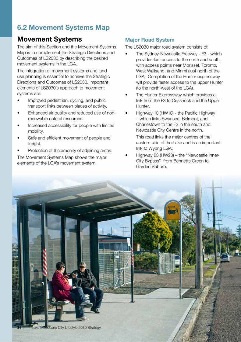
6.2 Movement Systems Map
Movement Systemsthe aim of this Section and the Movement Systems Map is to complement the Strategic directions and outcomes of LS2030 by describing the desired movement systems in the LGA.
the integration of movement systems and land use planning is essential to achieve the Strategic directions and outcomes of LS2030. Important elements of LS2030’s approach to movement systems are:
• Improved pedestrian, cycling, and public transport links between places of activity.
• Enhanced air quality and reduced use of non-renewable natural resources.
• Increased accessibility for people with limited mobility.
• Safe and efficient movement of people and freight.
• Protection of the amenity of adjoining areas.
the Movement Systems Map shows the major elements of the LGA’s movement system.
Major Road Systemthe LS2030 major road system consists of:
• the Sydney-newcastle Freeway - F3 - which provides fast access to the north and south, with access points near Morisset, toronto, West Wallsend, and Minmi (just north of the LGA). Completion of the hunter expressway will provide faster access to the upper hunter (to the north-west of the LGA).
• the hunter Expressway which provides a link from the F3 to Cessnock and the upper hunter.
• highway 10 (hW10) - the Pacific highway – which links Swansea, Belmont, and Charlestown to the F3 in the south and newcastle City Centre in the north.
this road links the major centres of the eastern side of the Lake and is an important link to Wyong LGA.
• highway 23 (hW23) – the “newcastle Inner-City Bypass”- from Bennetts Green to Garden Suburb.
34 | Lake Macquarie City Lifestyle 2030 Strategy
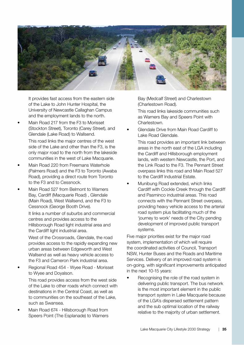
It provides fast access from the eastern side of the Lake to John hunter hospital, the university of newcastle Callaghan Campus and the employment lands to the north.
• Main road 217 from the F3 to Morisset (Stockton Street), toronto (Carey Street), and Glendale (Lake road) to Wallsend.
this road links the major centres of the west side of the Lake and other than the F3, is the only major road to the north from the lakeside communities in the west of Lake Macquarie.
• Main road 220 from Freemans Waterhole (Palmers road) and the F3 to toronto (Awaba road), providing a direct route from toronto to the F3 and to Cessnock.
• Main road 527 from Belmont to Warners Bay, Cardiff (Macquarie road) , Glendale (Main road), West Wallsend, and the F3 to Cessnock (George Booth drive).
It links a number of suburbs and commercial centres and provides access to the hillsborough road light industrial area and the Cardiff light industrial area.
West of the Crossroads, Glendale, the road provides access to the rapidly expanding new urban areas between Edgeworth and West Wallsend as well as heavy vehicle access to the F3 and Cameron Park industrial area.
• regional road 454 - Wyee road - Morisset to Wyee and doyalson.
this road provides access from the west side of the Lake to other roads which connect with destinations in the Central Coast, as well as to communities on the southeast of the Lake, such as Swansea.
• Main road 674 - hillsborough road from Speers Point (the Esplanade) to Warners
Bay (Medcalf Street) and Charlestown (Charlestown road).
this road links lakeside communities such as Warners Bay and Speers Point with Charlestown.
• Glendale drive from Main road Cardiff to Lake road Glendale.
this road provides an important link between areas in the north east of the LGA including the Cardiff and hillsborough employment lands, with western newcastle, the Port, and the Link road to the F3. the Pennant Street overpass links this road and Main road 527 to the Cardiff Industrial Estate.
• Munibung road extended, which links Cardiff with Cockle Creek through the Cardiff and Pasminco industrial areas. this road connects with the Pennant Street overpass, providing heavy vehicle access to the arterial road system plus facilitating much of the ‘journey to work’ needs of the City pending development of improved public transport systems.
Five major priorities exist for the major road system, implementation of which will require the coordinated activities of Council, transport nSW, hunter Buses and the roads and Maritime Services. delivery of an improved road system is on-going, with significant improvements anticipated in the next 10-15 years:
• recognising the role of the road system in delivering public transport. the bus network is the most important element in the public transport system in Lake Macquarie because of the LGA’s dispersed settlement pattern and the sub optimal location of the railway relative to the majority of urban settlement.
Lake Macquarie City Lifestyle 2030 Strategy | 35

Accordingly, the road network should be designed to facilitate efficient use by buses, including bus priority measures.
• recognising the role of the major road system in ensuring safe and efficient transport by bicycle between town centres and major regional centres.
• Supporting the economic prosperity of the LGA and Lower hunter by ensuring ready access for freight vehicles from industrial areas to the arterial road system and the F3/hunter Expressway.
• upgrading the capacity and connectivity of roads, such Main road 217 from the south to the Crossroads Glendale, to allow the network to perform during peak times in the event of minor accidents.
• recognising that several major roads impact adversely on the amenity and functioning of several major centres, and that their transportation functions may need to be balanced against improving the amenity of the major centres in those locations, such as Swansea, Belmont, Charlestown, Warners Bay and Morisset.
Cycle and Pedestrian NetworkLS2030 recognises the importance of the cycle and pedestrian network to the movement system. Many trips in the LGA are for short distances, and can be readily undertaken on foot or by bicycle if safe and convenient infrastructure is provided. Much of the pedestrian and cycle network follows the road system. It is important that the design and implementation of the cycle and pedestrian system receives the same priority as motor vehicles, and results in a system which is equally convenient to use. the pedestrian and cycle system is also located within the LGA’s open space areas.
Cycle and pedestrian paths should be designed to promote user safety and connectivity to enhance accessibility and convenience of use. Cycle facilities should be provided so that cycling is an attractive, practical, and safe form of movement. Where possible cycle paths should be off road rather than on road, to increase safety and ensure the widest possible range of users. Cycle related infrastructure should be provided where appropriate, as part of new development.
the Movement System Map shows a number of regional cycle ways which form the backbone of
36 | Lake Macquarie City Lifestyle 2030 Strategy

the LS2030 cycleway network. these cycle ways are:
• newcastle to Glendale via Wallsend and the university
• newcastle to Swansea via Belmont (Fernleigh track)
• Glendale to toronto
• Cockle Creek to Belmont via Warners Bay
A range of other pedestrian and cycle paths feed into and complement the regional cycleway “backbone” and are shown in the Lake Macquarie Cycleway Plan. the cycleway network should be designed to meet recreational and commuter needs with particular consideration for young riders accessing schools and local shops or public facilities. to meet LS2030 accessibility outcomes, regional, town and local centres and transport interchanges should be the focus of cycleway and pedestrian networks for their surrounding areas, with links to other areas as appropriate to the scale of the centre.
Rail Networkthe LGA’s rail network comprises the Main northern railway line, and several coal loading/unloading loops.
other than bulk movement of coal, in 2010 the rail network is generally not used for freight transport by businesses located within the LGA. LS2030 encourages the consideration of rail freight as a transport alternative that should be considered in the design of industrial areas near the rail system. the potential killingworth employment land provides an opportunity to incorporate rail access if the foreshadowed newcastle rail freight bypass route is built nearby.
the nine railway stations in the LGA provide access to the passenger rail service to the Central Coast, Sydney, and newcastle. the public transport interchanges at Morisset, Fassifern, and Glendale will become increasingly used as the urban intensification, mixed use and sustainability policies of LS2030 are implemented.
three major priorities exist for the rail system, implementation of which will require the coordinated activities of Council, City rail, transport nSW, hunter Buses and the roads and Maritime Services. delivery of an improved rail system is on-going, with improvements anticipated
in the next 10-15 years.:
• Ensuring local and commuter needs of the community are met by providing frequent, reliable, convenient, and safe services, together with supportive interchange and cycling infrastructure.
• Minimising environmental impacts, such as noise and vibration, on surrounding land uses should be incorporated where necessary.
• Encouraging freight with an origin or destination in the LGA to use rail as a mode of transport.
Bus Networkthe bus network should provide direct links between major destinations, such as centres, schools, and health facilities. Centres should serve as an interchange between direct routes and those that serve local urban areas. Generally, the major direct bus routes should correspond to the key and major routes shown on the Movement Systems Map. Local service routes are too numerous to illustrate at a strategic level and are not identified on the Movement System Map.
three major priorities exist for the bus network:
• Ensuring the bus network supports the spatial structure and hierarchy of Centres shown in the urban Structure Map.
• Ensuring local and commuter needs of the community are met by providing frequent, reliable, convenient, and safe services, together with supportive interchange and cyclist infrastructure (including seamless through ticketing across services and modes).
• Linking with other public transport modes at centre based interchanges, as well as with cycle and pedestrian paths.
Transport Interchangesthe LS2030 public transport system is heavily dependent on transport interchanges that allow movement from one service to another and/or one mode to another. these interchanges should be based within Centres, or a railway station in the case of Fassifern. the interchanges should be designed to provide an efficient and effective service that responds to the dispersed nature of travel in the City. through these interchanges, a
Lake Macquarie City Lifestyle 2030 Strategy | 37

higher level of travel frequency and connectivity are available to public transport passengers.
Within the LS2030 Movement System, the primary interchanges are located at Charlestown (bus only), Glendale (bus/rail) and Morisset (bus/rail). Secondary Interchanges are located at Belmont, toronto, Fassifern, and potential new town Centres. Secondary interchanges perform a similar function to their primary partners, but with a lower level of activity.
AirportBelmont airport has ongoing potential for use by light commuter aircraft. While it has had little use for a number of years, it can provide the ability for conveniently located short haul services to Sydney and regional locations, and for aviation related employment and business activity.
Ferry NetworkLinks across the Lake could be improved by a public water-based transport system. the ability for a ferry network to provide a viable service is dependent on the potential customer catchment, Lake depths, suitable jetties, environmental
constraints and the provision of car and bicycle parking at desirable pick-up / set down locations. Locations may include Warners Bay, Swansea, toronto, rathmines, Wangi Wangi, and the Morisset Peninsula. these locations would then form additional minor transport interchange points linking the ferry network to the bus, rail, and pedestrian/cycle networks.
the establishment of such a network is encouraged when it is viable.
Haul Roadsthe privately-owned newstan-Eraring haul road to the west of Lake Macquarie, is used by the newstan underground Coal Mine to transport coal from its mines to the Eraring Power Station for use in the production of electricity. A new private haul road will connect Cooranbong to the newstan-Eraring haul road, approximately 2km north of Eraring. the haul roads serve an important function in keeping haulage off the road system, thus enhancing the safety, amenity, and efficiency of the Movement System. In the long-term, there is the potential for further strategic value in these corridors, providing a trunk transport function especially if the coal haulage function diminishes.
38 | Lake Macquarie City Lifestyle 2030 Strategy
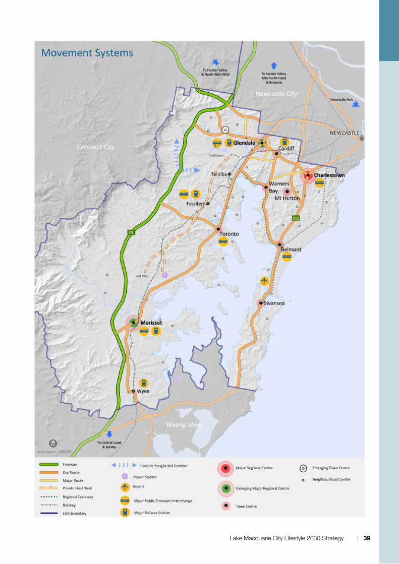
Lake Macquarie City Lifestyle 2030 Strategy | 39

6.3 Green System Mapthe Green Systems Map supports the Strategic directions and outcomes of Lifestyle 2030 Strategy by illustrating the land and water elements that are important to the City’s long-term biodiversity, scenic amenity, and liveability. LS2030 recognises that one of the major challenges for the City is the retention and enhancement of aquatic and terrestrial habitat including native vegetation.
LS2030 seeks to recognise the inter-relationship of the elements of the Green System and to manage them as an integrated system.
It is the extensive waterways, native vegetation cover, and vegetated ridgelines, compared with other cities, that give Lake Macquarie great scenic and natural amenity. these waterways and areas of native vegetation support a high level of biodiversity.
the vegetation and landforms contributing to the scenic quality and liveability of the City typically include:
• the Lake, waterways and wetlands;
• the coast;
• the highly visible wooded ridgelines;
• the undulating hills characteristic of the eastern side of the City; and
• the foothills, mountains and ranges characteristic of the western side of the City.
Lake Macquarie LGA is at an important threshold where the continued loss of native vegetation may result in accelerated decline in biodiversity, particularly if clearing continues in the absence of detailed local level biodiversity information and conservation plans for the species most at risk. Such decline may not be immediately evident. the Green System Map shows that most of the remaining native vegetation in the LGA is of State significance, and a smaller proportion is of regional significance.
It is estimated that climate change will place additional stress on ecosystems and exacerbate existing threats to biodiversity. Maintenance and enhancement of the Green System will assist native flora and fauna to cope with the impacts of climate change on biodiversity. through providing ecosystem services such as carbon storage, filtering surface water, and assimilating pollutants, the Green System is one of the important defences
for the Lake Macquarie community against climate change.
Lake Macquarie is an iconic waterway that contains high value habitat including seagrass beds, salt marsh, sandy beaches, islands, mudflats, rocky headlands, mangroves, and wetlands. these are recognised as being of State significance and support a great diversity of fauna species including invertebrates, fish, migratory birds, marine turtles, and marine mammals. A major 10 year rehabilitation program has been conducted to address the combined effects of urban and rural runoff and sewage discharges. the rehabilitation program has been successful, but work is required to protect the gains made by that program and to continue improvements in lake water quality. the majority of the lake’s catchment lies within the LGA.
LS2030 seeks to protect the areas identified on the Green Systems Map and reduce the impact of development, including new infill and greenfield development on the LGA’s waterways, native vegetation, and fauna habitat.
The Green System Elementsthe elements contributing to the Green system are:
1. terrestrial habitats/native Vegetation
• State Significant Vegetation & habitat
• regionally Significant Vegetation & habitat
• other remnant vegetation
2. Conservation Areas
• national Park Estate
• State Forests
• Proposed Conservation Areas
3. Aquatic habitats
• State significant waterways
• State significant aquatic habitat
4 other Elements
• rural Landscapes
• urban Areas
the areas of the LGA that have one or more of these elements are identified on the Green Systems Map and are described below.
40 | Lake Macquarie City Lifestyle 2030 Strategy

Lake Macquarie City Lifestyle 2030 Strategy | 41
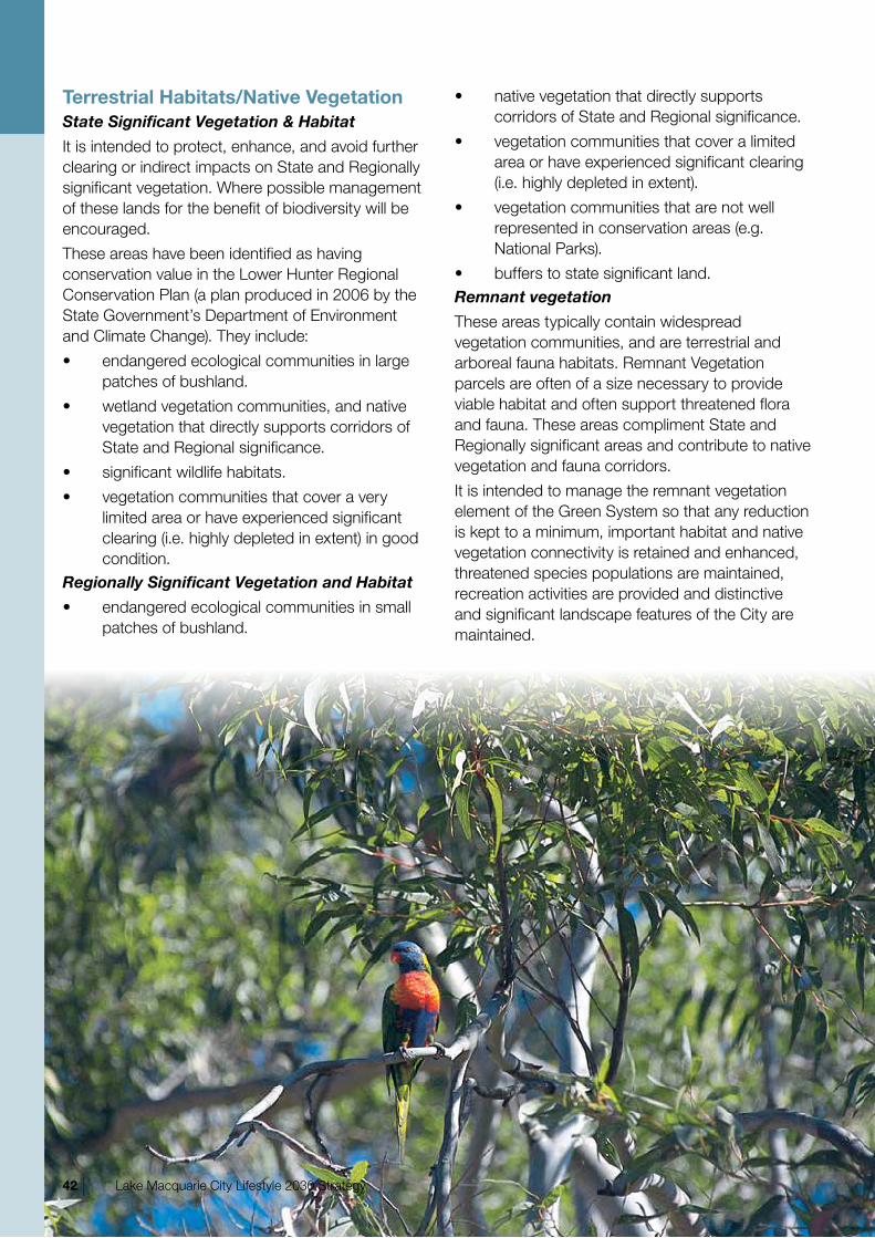
Terrestrial Habitats/Native VegetationState Significant Vegetation & Habitat
It is intended to protect, enhance, and avoid further clearing or indirect impacts on State and regionally significant vegetation. Where possible management of these lands for the benefit of biodiversity will be encouraged.
these areas have been identified as having conservation value in the Lower hunter regional Conservation Plan (a plan produced in 2006 by the State Government’s department of Environment and Climate Change). they include:
• endangered ecological communities in large patches of bushland.
• wetland vegetation communities, and native vegetation that directly supports corridors of State and regional significance.
• significant wildlife habitats.
• vegetation communities that cover a very limited area or have experienced significant clearing (i.e. highly depleted in extent) in good condition.
Regionally Significant Vegetation and Habitat
• endangered ecological communities in small patches of bushland.
• native vegetation that directly supports corridors of State and regional significance.
• vegetation communities that cover a limited area or have experienced significant clearing (i.e. highly depleted in extent).
• vegetation communities that are not well represented in conservation areas (e.g. national Parks).
• buffers to state significant land.Remnant vegetation
these areas typically contain widespread vegetation communities, and are terrestrial and arboreal fauna habitats. remnant Vegetation parcels are often of a size necessary to provide viable habitat and often support threatened flora and fauna. these areas compliment State and regionally significant areas and contribute to native vegetation and fauna corridors.
It is intended to manage the remnant vegetation element of the Green System so that any reduction is kept to a minimum, important habitat and native vegetation connectivity is retained and enhanced, threatened species populations are maintained, recreation activities are provided and distinctive and significant landscape features of the City are maintained.
42 | Lake Macquarie City Lifestyle 2030 Strategy

Adequate offsets are required to compensate for any unavoidable loss of native vegetation, fauna, or aquatic habitat. Such offsets are to conserve and enhance the Green System.Native Vegetation Corridors
native vegetation corridors have been included in the terrestrial habitat/native Vegetation elements of Green System Map.
native vegetation corridors improve the function of the Green System by linking habitats either through bushland or riparian areas of waterways. An important component of the LS2030 Green System is its connectivity. A significant habitat corridor spans from the Watagan ranges to Port Stephens. the southern part of this corridor is within Lake Macquarie City. East-west habitat linkages extend towards the Lake from this corridor.
Existing corridors should be protected and enhanced, disjointed corridors should be restored, and barriers to fauna movement crossed to link habitat areas. native vegetation corridors and barrier crossings allow the Green System to function as an integrated system.
Conservation AreasNational Parks
the LGA benefits from national Parks, and State Conservation Areas that are chiefly concerned with conservation and nature based or passive recreation, camping and other forms of low impact tourist accommodation.State Forests
Whilst these are strictly not conservation areas, they contribute substantially to the LGA’s biodiversity. State Forests are an economic resource, managed using ecologically sustainable practices.Proposed Conservation Lands
these are areas that have been identified as having very high conservation value, making a significant contribution to the reserve system. they include the proposed Awaba Conservation Area and the Coastal Wetlands Park proposal.
It is intended that additional conservation areas will be identified and be added to the reserve system in the future and that offsets will complement conservation areas.
Aquatic Habitats and Waterwaysthe Lower hunter regional Conservation Plan and many other sources identify the waterways and aquatic habitat of Lake Macquarie LGA as State significant.State Significant Waterways
the Lake and coastline and the creeks, lagoons, channels and beaches which combine to form these water bodies and waterway systems are outstanding assets to the City. they provide habitat for over 110 species that are subject to international agreements as well as being habitat to threatened sea turtles.
the ecological, scenic, and recreational qualities of these water bodies and waterways are to be protected from the impact of pollution and detrimental development so that they remain in a healthy state.
It is intended to increase public access to waterways and water bodies in strategic locations. State Significant Aquatic Habitat
Aquatic habitat includes seagrass, salt marsh, and mangroves. these habitats are of State significance and provide foraging and resources for threatened species and species covered by international treaties.Rural Landscapes
rural landscapes of Lake Macquarie are facing increasing pressure from expanding urban areas and increase in land values. It is important to protect and retain viable rural areas for the agriculture, intensive agriculture and rural and eco tourism activities. rural-residential development offers an important lifestyle choice to residents of the City. however, inappropriate rural-residential development has the potential to conflict with agricultural activities, reduce agricultural viability and increase environmental damage. Management
Lake Macquarie City Lifestyle 2030 Strategy | 43
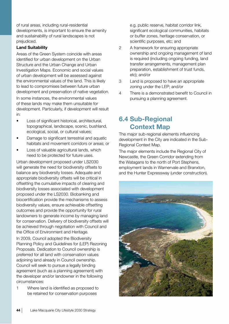
of rural areas, including rural-residential developments, is important to ensure the amenity and sustainability of rural landscapes is not prejudiced.Land Suitability
Areas of the Green System coincide with areas identified for urban development on the urban Structure and the urban Change and urban Investigation Maps. Economic and social values of urban development will be assessed against the environmental values of the land. this is likely to lead to compromises between future urban development and preservation of native vegetation.
In some instances, the environmental values of these lands may make them unsuitable for development. Particularly, if development will result in:
• Loss of significant historical, architectural, topographical, landscape, scenic, bushland, ecological, social, or cultural values;
• damage to significant terrestrial and aquatic habitats and movement corridors or areas; or
• Loss of valuable agricultural lands, which need to be protected for future uses.
urban development proposed under LS2030 will generate the need for biodiversity offsets to balance any biodiversity losses. Adequate and appropriate biodiversity offsets will be critical in offsetting the cumulative impacts of clearing and biodiversity losses associated with development proposed under the LS2030. Biobanking and biocertification provide the mechanisms to assess biodiversity values, ensure achievable offsetting outcomes and provide the opportunity for rural landowners to generate income by managing land for conservation. delivery of biodiversity offsets will be achieved through negotiation with Council and the office of Environment and heritage.
In 2009, Council adopted the Biodiversity Planning Policy and Guidelines for (LEP) rezoning Proposals. dedication to Council ownership is preferred for all land with conservation values adjoining land already in Council ownership. Council will seek to pursue a legally binding agreement (such as a planning agreement) with the developer and/or landowner in the following circumstances:
1 Where land is identified as proposed to be retained for conservation purposes
e.g. public reserve, habitat corridor link, significant ecological communities, habitats or buffer zones, heritage conservation, or scientific purposes, etc; and
2 A framework for ensuring appropriate ownership and ongoing management of land is required (including ongoing funding, land transfer arrangements, management plan preparation, establishment of trust funds, etc); and/or
3 Land is proposed to have an appropriate zoning under the LEP; and/or
4 there is a demonstrated benefit to Council in pursuing a planning agreement.
6.4 Sub-Regional Context Map
the major sub-regional elements influencing development in the City are indicated in the Sub-regional Context Map.
the major elements include the regional City of newcastle, the Green Corridor extending from the Watagans to the north of Port Stephens, employment lands in Warnervale and Branxton, and the hunter Expressway (under construction).
Img_5
44 | Lake Macquarie City Lifestyle 2030 Strategy
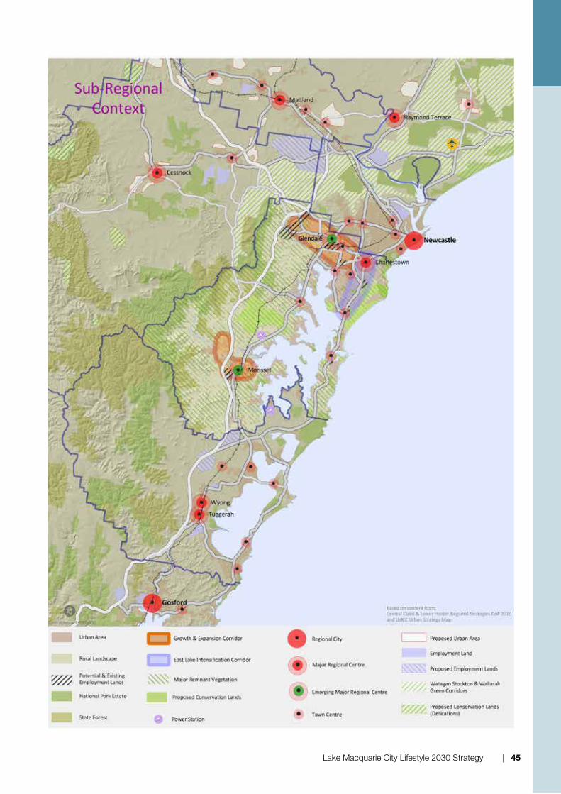
e.g. public reserve, habitat corridor link, significant ecological communities, habitats or buffer zones, heritage conservation, or scientific purposes, etc; and
2 A framework for ensuring appropriate ownership and ongoing management of land is required (including ongoing funding, land transfer arrangements, management plan preparation, establishment of trust funds, etc); and/or
3 Land is proposed to have an appropriate zoning under the LEP; and/or
4 there is a demonstrated benefit to Council in pursuing a planning agreement.
6.4 Sub-Regional Context Map
the major sub-regional elements influencing development in the City are indicated in the Sub-regional Context Map.
the major elements include the regional City of newcastle, the Green Corridor extending from the Watagans to the north of Port Stephens, employment lands in Warnervale and Branxton, and the hunter Expressway (under construction).
Img_5
Lake Macquarie City Lifestyle 2030 Strategy | 45

7.1 ImplementationImplementation of LS2030 will involve a wide range of community and industry groups and individuals, particularly at the local level. As an integral component of Council’s Integrated Planning Framework, LS2030 sets out the need to involve all levels of government, industry and the community in the planning, development and management of the City. draft copies of LS2030 were provided to community and industry groups, individuals and government agencies for comment.
the primary implementation tool for LS2030 will be draft LEP 2012. LS2030 will also guide the drafting of provisions within draft dCP 2012, its associated Local Area Plans and the preparation of Structure Plans and Master Plans for centres. Area Plans, Structure Plans and Master Plans will provide detailed landuse outcomes for centres, including specific planning solutions that suit the existing and desired characters of each centre, and at the same time address local issues.
In addition to draft LEP 2012, Lake Macquarie Community Plan 2008-2018 is also a tool to implement LS2030. the ten-year plan sets out the timing for land-use priorities for Lake Macquarie, identifying priorities for 1-year, 2-5 year and 6-10 year periods. the priorities outlined in the Community Plan have been adapted from Lifestyle 2020, which have been retained and revised in the LS2030.
Secondary implementation tools for LS2030 will also include council policies and developer Contribution Plans.
Preparation of draft LEP 2012 and draft dCP 2012, including future amendments, will follow the consultation requirements prescribed by the Environmental Planning and Assessment Act 1979, as amended. Similar consultation will occur in the preparation of Structure Plans and Master Plans.
the Lifestyle 2020 review discussion Paper 2010 and Employment Lands Study 2010 review current economic conditions and their impact on development in Lake Macquarie. LS2030 acknowledges that the prevailing property and development market will influence the outcomes envisaged in the Strategy. to this extent, the timing of development will largely be beyond Council’s direct control.
LS2030 also acknowledges that other outcomes envisaged in the Strategy may be beyond Council’s direct control. Many outcomes rely on the support and actions of State agencies, including State policy implementation. At times there may be conflict in policy implementation, and it s is acknowledged that issues may need to be resolved at State level.
however, appropriate monitoring of land development, as discussed below, will ensure an appropriate supply of land to balance economic, social and environmental objectives.
Implementation, review and Monitoring
46 | Lake Macquarie City Lifestyle 2030 Strategy
7

7.2 Review and monitoringLand use planning is a dynamic process and will not end with the completion of LS2030. Strategic directions, maps and intent statements should be reviewed in response to changing circumstances. to be successful, therefore, LS2030 will require monitoring on a regular basis to reflect changes to such aspects as the wider policy environment, development pressures and political priorities.
A suite of performance indicators will be developed to enable progress in implementing LS2030 to be readily monitored.
It is anticipated that major reviews of LS2030 will be occur every five years, with the next major review due in 2015 to coincide with the release of results from the 2012 national Census. At that time, the impact of LS2030 on development trends will be more readily apparent. the review process will guide further policy development and assist in setting future priority projects and actions.
the outcome of current review of the Lower hunter regional Strategy will inform future reviews of LS2030.
Council will also regularly monitor development within the City and if necessary, bring forward the next scheduled review. Improved data collection and analysis programs are to be developed to monitor progress and changes in the City, identify new and emerging issues and monitor implementation of the outcomes and Strategic directions of LS2030. Improved programs will also enable Council to deal with emerging issues, especially if identified issues become more urgent or extreme. A program is to be initiated to track development, from identification of potential employment, commercial and residential land through to completion of construction and occupation of development.
the major reviews will include input from government agencies and the community.
these reviews will provide an open and accountable process that will involve and inform the community of the outcome of any local monitoring program.
Acknowledgement:· original participants and authors of Lifestyle 2020.
· the Lake Macquarie City Council reference Group involved in the preparation of the revised document:
· other Lake Macquarie City Council staff and consultants who have provided background information.
Bibliography:LMCC 2010 Lifestyle 2020 Review Discussion paper, Lake Macquarie City Council.
LMCC 2011 Biodiversity Background Technical Report, Lake Macquarie City Council.
Croft. d. 2010 Lifestyle 2020 Review Discussion Paper, Strategy hunter.
Lake Macquarie City Lifestyle 2030 Strategy | 47
