ku-ring-gai local character background study
TRANSCRIPT

Ku-ring-gai Local Character Background StudyDraft Broad Local Character Areas
Character Area Statements
Prepared forKu-ring-gai Council
Issued11 March 2021
Level 2490 Crown StreetSurry Hills NSW 2010AustraliaT. 61 2 9380 [email protected] sjb.com.au

Ref: #6267 Version: 03
Prepared by: TH, JMChecked by: JK
Contact details
SJB ArchitectsLevel 2490 Crown StreetSurry Hills NSW 2010Australia
T. 61 2 9380 [email protected]
SJB Architecture (NSW) Pty LtdABN 20 310 373 425ACN 081 094 724
Adam Haddow 7188 John Pradel 7004
SJB would like to acknowledge the traditional custodians of the land on which we live and practice and pay our respects to elders, past, present and future. In particular, we would like to acknowledge the 60,000+ years of continuous engagement of this land by Aboriginal and Torres Strait culture.
The journey of Aboriginal and Torres Strait Islander people and their knowledge of this land is incredibly rich – its importance to the future of our country should never be underestimated.
Certified Management Systems
ISO 9001:2015 Quality Management System ISO 45001:2018 Occupational Health & Safety Management SystemISO 14001:2015 Environmental Management System
SJB 3
Contents
1 Broad Local Character Area Statements 7
1.1 Draft Local Character Areas 81.2 Green Fingers Character Area 101.3 Kur-ring-gai Ridge and Centres Character Area 261.4 Northern Plateau Character Area 321.5 Western Slopes Character Area 361.6 West Pymble Character Area 381.7 Lower West Character Area 401.8 Lower East 441.9 North Turramurra Table 48

View east from Roseville Station

SJB 5
SJB have been engaged by Ku-ring-gai Council (KC) to undertake research and identify Broad Local Character Areas for the Ku-ring-gai Local Government Area (LGA).
This work is in response to the Ku-ring-gai Local Strategic Planning Statement (KLSPS) Planning Priority K12. The objective of this priority is to manage change and growth in a way that conserves and enhances Ku-ring-gai’s unique visual and landscape character . There are four Actions related to this Planning Priority (KLSPS, page 94) as follows:
Action 1 - Define Ku-ring-gai’s unique visual and landscape character through community engagement
Action 2 - Undertake a Local Character Study in accordance with the Department of Planning, Industry and Environment’s Local Character and Place Guidelines February 2019. The study will include investigation of areas of special landscape, views and vistas, visual quality, topography and the Urban Forest (including bushland, tree canopy, street trees, gardens). It will also consider Green Grid links and biodiversity corridors.
Action 3 - Implement recommendations from the Local Character Study
Action 4 - Prepare Local Character Mapping for LEP Overlay and Local Character Statements for DCP in collaboration with Department of Planning, Industry and Environment
This Background Study is primarily focused on the analysis and identification of Ku-ring-gai’s physical characteristics , relating to Action 1, noted above. The study is intended to provide the basis for further research into ‘local character’ in the future. It is important to note that this study does not include a detailed examination of the social and cultural characteristics of the LGA, which is sought in the Department of Planning Infrastructure and Environment’s (DPIE) Local Character and Place Guidelines, 2019.
Preparation of a Local Character Study, as per Action 2, including ‘desired future character statements’, will be the subject of a future study and further community engagement.
Executive Summary

Home in Turramurra

Broad Local Character Area Statements

SJB8 Ku-ring-gai Local Character Background Study
Broad Local Character Area Statements
1.1 Draft Local Character Areas
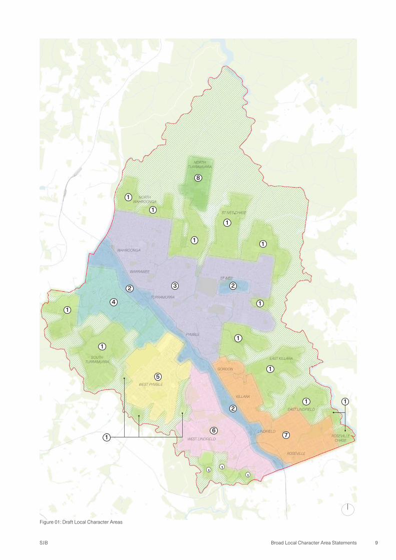
Understanding and interpreting the cluster mapping, number of draft Broad Local Character Areas (LCAs) have been identified. Areas shown together share similarities in their physical and measurable characteristics. A total of eight (8) Broad LCAs are proposed:
1. Green Fingers2. Ku-ring-gai Ridge and Centres3. Northern Plateau4. Western Slopes5. West Pymble6. Lower West7. Lower East8. North Turramurra Table
The ecological zone (shown hatched) is an area of dense bushland which contributes significantly to the character of Ku-ring-gai, especially to areas directly adjacent.
This zone includes parts of Ku-ring-gai Chase, Garigal and Lane Cove National Parks administered by the NSW National Parks and Wildlife Services. It also features limited built form, significant existing biodiversity protections and land use restrictions outlined in Ku-ring-gai Local Environmental Plan 2015 (KLEP 2015).
Due to existing protections which acknowledge and maintain the existing character of these areas, the ecological zone has not been included as a Ku-ring-gai Broad Local Character Area.
SJB 9Broad Local Character Area Statements
Figure 01: Draft Local Character Areas
1
11
4
2 3
5
67
2
8
12
1
1
1
11
1
1
1
1
1
1
1
NORTH TURRAMURRA
NORTH WAHROONGA
ST IVES CHASE
ST IVES
WAHROONGA
WARRAWEE
TURRAMURRA
SOUTH TURRAMURRA
WEST PYMBLE
EAST KILLARA
GORDON
KILLARA
LINDFIELD
EAST LINDFIELD
ROSEVILLE
ROSEVILLE CHASE
PYMBLE
WEST LINDFIELD

SJB10 Ku-ring-gai Local Character Background Study
Broad Local Character Area Statements
1.2 Green Fingers Character Area
Local Character StatementThe Green Fingers Character Area includes a number of suburbs located on the periphery of the LGA, surrounded by the unique and beautiful bushland of Ku-ring-gai. These areas are located along ridgelines that extend out towards Lane Cove, Garigal and Ku-ring-gai Chase National Parks. The dense vegetation, Sydney Turpentine-Ironbark and Blue Gum High Forest hold significant social, environmental and economic value to the community. Refer to Figure 10 - Character Area Location Plan.
The street pattern and built form has a close relationship to the topography and landscape setting of these areas. Flatter areas along ridgelines tend to have more consistent built form and street patterns. These areas have more recently been the focus of redevelopment and the delivery of new homes. Topography falls steeply along the edges of the Green Fingers towards densely vegetated gullies. These edges feature more diverse and unique housing styles and street patterns that follow the topography and take advantage of views across valleys.
By virtue of being set within dense bushland, the outlook in these areas is layered with mature trees and vegetation.
The Green Fingers are predominantly residential in nature, supported by small neighbourhood centres that provide day-to-day services. Generally co-located with local parks, community facilities or playgrounds, they serve as important community focal points and provide opportunities to meet and gather outside of the centres along the Pacific Highway and Mona Vale Road.
There are some larger institutions located in the Green Fingers Character Area including the Sydney Adventist Hospital in Wahroonga, CSIRO Lindfield and the Lindfield Learning Village located on the former UTS Lindfield Site. These institutions take advantage of areas of flatter topography away from the rail/Pacific Highway corridor which is more constrained and under pressure to deliver other uses.
Key Characteristics · Limited access · Extends into bushland · Flatter along ridge-line · Steeper slopes away from ridge-line · Streets follow topography · Diverse built form and styles
Key Features · Rose Seidler House · Sydney Grammar Preparatory School · Killara High School · Lindfield Rollers Bowling Club · Echo Point and Marina · CSIRO Lindfield Site · Sydney Adventist Hospital
Figure 02: Character Area Location Plan

SJB 11Broad Local Character Area Statements
Figure 03: Tip of West Pymble

SJB12 Ku-ring-gai Local Character Background Study
Figure 04: St Johns Avenue adjacent Gordon Golf Club

SJB 13Broad Local Character Area Statements
Figure 05: East Killara
SJB14 Ku-ring-gai Local Character Background Study
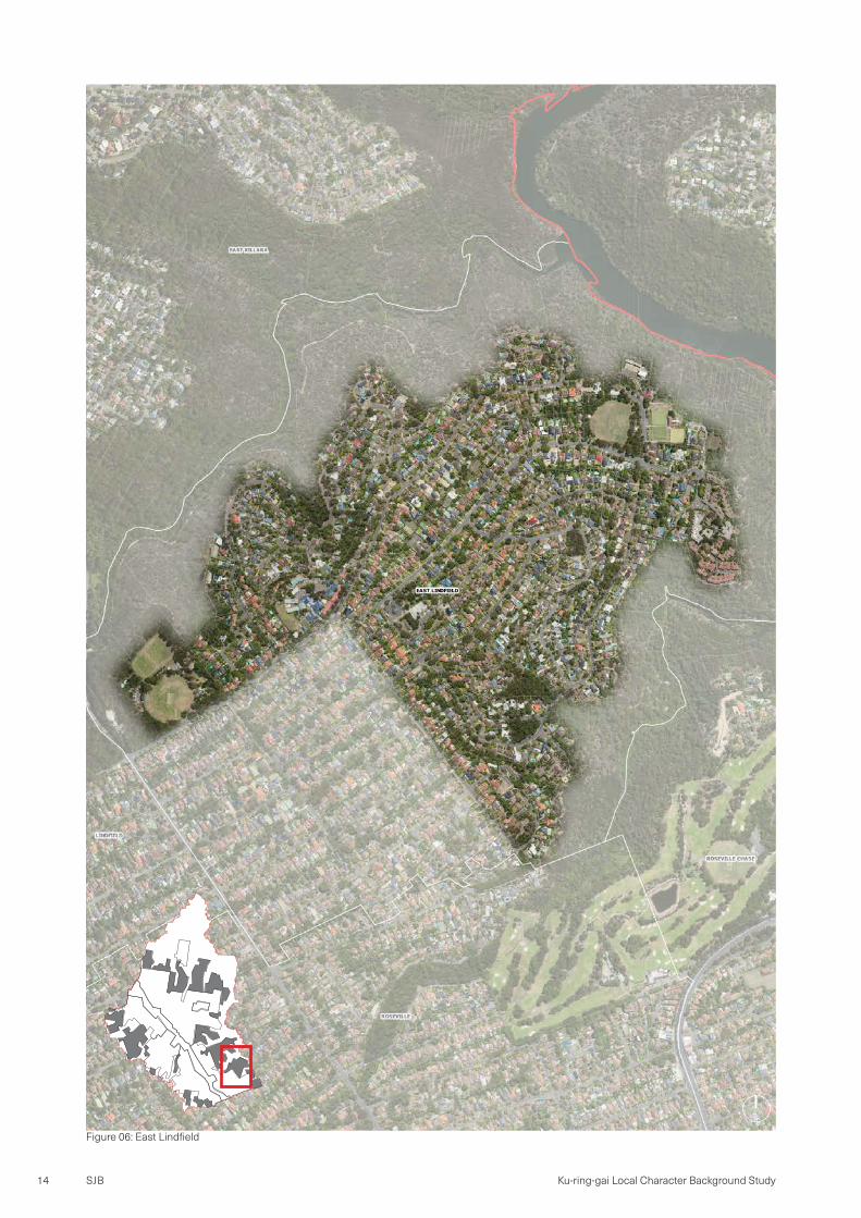
Figure 06: East Lindfield
SJB 15Broad Local Character Area Statements
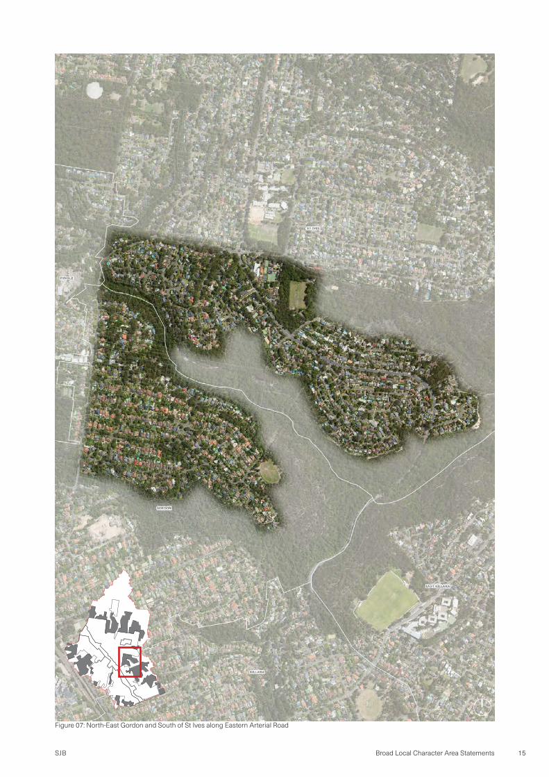
Figure 07: North-East Gordon and South of St Ives along Eastern Arterial Road

SJB16 Ku-ring-gai Local Character Background Study
Figure 08: A Gully in East St Ives bound by Grevillea Avenue and Melaleuca Drive
SJB 17Broad Local Character Area Statements
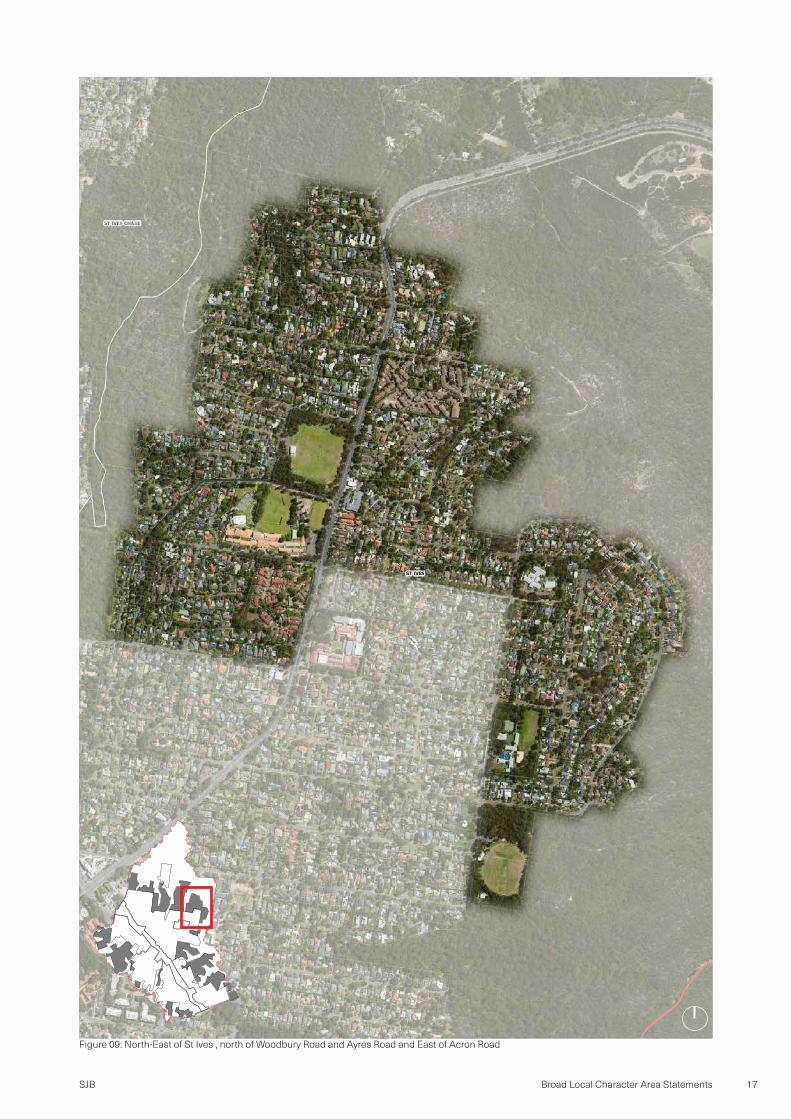
Figure 09: North-East of St Ives , north of Woodbury Road and Ayres Road and East of Acron Road

SJB18 Ku-ring-gai Local Character Background Study
Figure 10: Southern extent of North Turramurra and East Wahroongah

SJB 19Broad Local Character Area Statements
Figure 11: St Ives Chase north of Mudies Road

SJB20 Ku-ring-gai Local Character Background Study
Figure 12: CSIRO Lindfield and Bradfield Road, UTS Ku-ring-gai and south-western parts of Lindfield and Roseville

SJB 21Broad Local Character Area Statements
Figure 13: West end of Turramurra and South Turramurra and parcels along The Comenarra Parkway west of Avondale Golf Club

SJB22 Ku-ring-gai Local Character Background Study
Figure 14: Sydney Adventist Hospital and western extent of Wahroongah
SJB 23Broad Local Character Area Statements
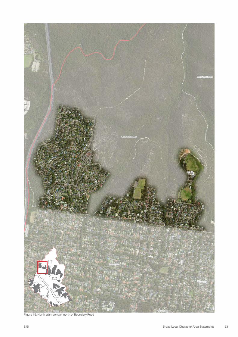
Figure 15: North Wahroongah north of Boundary Road

SJB24 Ku-ring-gai Local Character Background Study
Figure 16: Roseville Chase and areas east of Roseville Gold Club

SJB 25Broad Local Character Area Statements
Page
left
inten
tiona
lly bl
ank

SJB26 Ku-ring-gai Local Character Background Study
Broad Local Character Area Statements
1.3 Kur-ring-gai Ridge and Centres Character Area
Local Character StatementFormed around the rail/Pacific Highway corridor and St Ives Local Centre, the Ku-ring-gai Ridge and Centres Character Area holds the main retail, commercial and residential intensity within the LGA. It is characterised by increased density and diversity of built form and land use. This character area has important social and economic value to Ku-ring-gai.
The Ku-ring-gai Ridge and Centres Character Area includes important movement corridors through the LGA. It is an area through which residents interface with on a daily basis. For many visitors, this area underpins their first impression of Ku-ring-gai. While these elements support good vehicular movement, they also form barriers to pedestrian and cycle movement across Ku-ring-gai. St Ives and the centres along the rail corridor are hubs of activity particularly after school hours and on the weekend.
Accommodating diverse land uses, buildings in this area have larger footprints and greater height than built form across the rest of Ku-ring-gai. This character area features the majority of medium and high-density housing within the LGA, leveraging amenity provided by proximity to arterial roads, public transport, shops and schools.
These areas have less tree canopy and typically flatter topography compared with the rest of Ku-ring-gai. Streets tend to be more varied and accommodate more street planting as they radiate from the rail and Pacific Highway corridor.
Figure 17: Character Area Location Plan
Key Characteristics · Higher density and population · Larger buildings · Commercial and medium/high density residential · Less tree canopy cover · Follows major ridge-line
Key Features · Turramurra, Gordon, St Ives and Lindfield Local
Centres · Pacific Highway and North Shore rail line · Ravenswood School for Girls · Pymble Business Park · Ku-ring-gai Town Hall and Council Chambers · Knox Senior School Academy · Masada College · Abbotsleigh

SJB 27Broad Local Character Area Statements
Figure 18: Wahroongah to Turramurra Centres along Pacific Highway

SJB28 Ku-ring-gai Local Character Background Study
Figure 19: Pymble and Gordon Centres along Pacific Highway

SJB 29Broad Local Character Area Statements
Figure 20: Killara to Roseville Centres along Pacific Highway

SJB30 Ku-ring-gai Local Character Background Study
Figure 21: St Ives centre

SJB 31Broad Local Character Area Statements
Page
left
inten
tiona
lly bl
ank
SJB32 Ku-ring-gai Local Character Background Study
Broad Local Character Area Statements
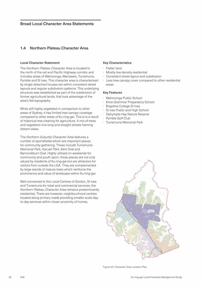
1.4 Northern Plateau Character Area
Local Character StatementThe Northern Plateau Character Area is located to the north of the rail and Pacific Highway corridor and includes areas of Wahroonga, Warrawee, Turramurra, Pymble and St Ives. This character area is characterised by single detached houses set within consistent street layouts and regular subdivision patterns. This underlying structure was established as part of the subdivision of former agricultural lands, that took advantage of the area’s flat topography.
While still highly vegetated in comparison to other areas of Sydney, it has limited tree canopy coverage compared to other areas of Ku-ring-gai. This is is a result of historical tree clearing for agriculture. A mix of trees and vegetation line long and straight streets framing distant views.
The Northern Suburbs Character Area features a number of sportsfields which are important places for community gathering. These include Turramurra Memorial Park, Karuah Park, Kent Oval and Bannockburn Oval. Highly utilised on weekends for community and youth sport, these places are not only valued by residents of Ku-ring-gai but are attractors for visitors from outside the LGA. They are complemented by large stands of mature trees which reinforce the prominence and value of landscape within Ku-ring-gai.
Well connected to the Local Centres of Gordon, St Ives and Turramurra for retail and commercial services, the Northern Plateau Character Area remains predominantly residential. There are however, neighbourhood centres located along primary roads providing smaller scale day-to-day services within closer proximity of homes.
Key Characteristics · Flatter land · Mostly low density residential · Consistent street layout and subdivision · Less tree canopy cover compared to other residential
areas
Key Features · Wahroonga Public School · Knox Grammar Preparatory School · Brigidine College St Ives · St Ives Public and High School · Dalrymple-Hay Nature Reserve · Pymble Golf Club · Turramurra Memorial Park
Figure 22: Character Area Location Plan
SJB 33Broad Local Character Area Statements
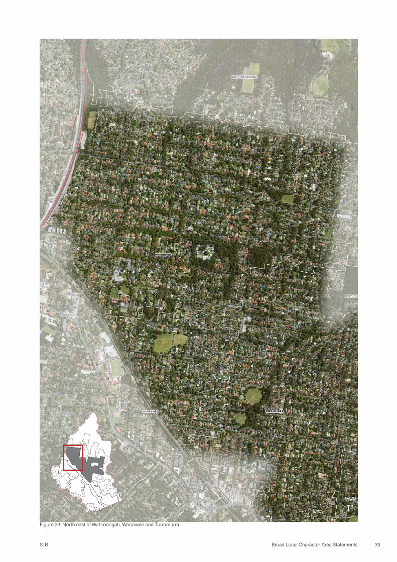
Figure 23: North east of Wahroongah, Warrawee and Turramurra

SJB34 Ku-ring-gai Local Character Background Study
Figure 24: North east part of Pymble and Northern part of Gordon

SJB 35Broad Local Character Area Statements
Figure 25: St Ives (excluding St Ives Centre)
SJB36 Ku-ring-gai Local Character Background Study
Broad Local Character Area Statements
1.5 Western Slopes Character Area
Local Character StatementThe Western Slopes Character Area includes areas of Wahroonga, Warrawee and Turramurra to the south of the rail/Pacific Highway corridor. This area has a close relationship to bushland and is characterised by very high tree canopy coverage. Trees and vegetation in this character area are visually prominent, establishing built form as a secondary recessive feature of the area. Flatter areas in the north fall away to incredibly steep topography to the south-west, a feature that lends this character area its name.
The significance and environmental value of the native flora and fauna of this character area is acknowledged under the Ku-ring-gai Local Environmental Plan 2015 (KLEP 2015) which marks a significant portion of the character area for biodiversity protection. The topography and dense vegetation also creates a cool microclimate.
While areas in the north of the character area have a more consistent street layout and less varied topography, the complexity of the environment in the south has led to more variation in the street layout and built form. The very steep topography had led to more unique and diverse built form and a street layout that conforms to the topography.
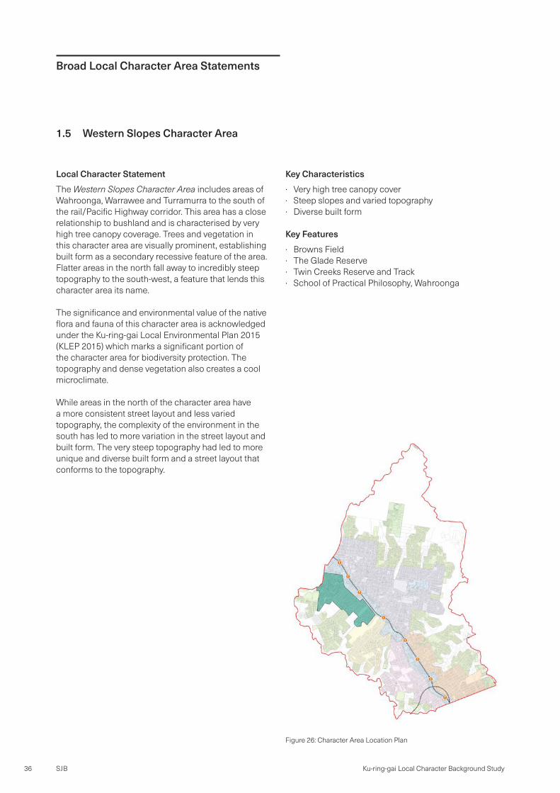
Figure 26: Character Area Location Plan
Key Characteristics · Very high tree canopy cover · Steep slopes and varied topography · Diverse built form
Key Features · Browns Field · The Glade Reserve · Twin Creeks Reserve and Track · School of Practical Philosophy, Wahroonga

SJB 37Broad Local Character Area Statements
Figure 27: Middle extent of Wahroongah, Turramurra and Pymble

SJB38 Ku-ring-gai Local Character Background Study
Broad Local Character Area Statements
1.6 West Pymble Character Area
Local Character StatementThe West Pymble Character Area includes areas of Pymble, West Pymble and Gordon West, south of the rail corridor. While Ryde Road separates Gordon West from the rest of the character area, similarities in setting and built form unify it with areas to the north-west.The character area includes Avondale Golf Club, Pymble Ladies College and Lofberg Oval.
With a direct interface with Lane Cove National Park, the character area has a strong connection with the surrounding bushland and creeks which contribute to its leafy setting. Additionally, Avondale Golf Club, Pymble Ladies College, Lofberg Oval also contribute significant stands of mature trees to the area.
Critically endangered communities of Sydney Ironbark-Turpentine Forest and Blue Gum High Forest are prevalent across the West Pymble Character Area, located both along streets and at the rear of lots. Its significance and environmental value is acknowledged under the Ku-ring-gai Local Environmental Plan 2015 (KLEP 2015) which marks portions of this character area for biodiversity protection.
It is a predominantly residential area characterised by single detached houses in a garden setting. This character area has a mix of different streets, laid out along ridge lines in the north where topography is steepest and as a patchwork of small grids in the south where there is less variation in topography. This part of the character area was developed and subdivided in a piecemeal fashion from the early 1900s through to the 1960s.
Figure 28: Character Area Location Plan
Key Characteristics · Varied street layout and subdivision · Flat land on ridges · Development has not formed around gullies · Consistent built form
Key Features · Ku-ring-gai Fitness and Aquatic Centre · West Pymble Public School · Gordon West Public School · Avondale Golf Club · Pymble Ladies College

SJB 39Broad Local Character Area Statements
Figure 29: Western extent of Pymble and West Pymble

SJB40 Ku-ring-gai Local Character Background Study
Broad Local Character Area Statements
1.7 Lower West Character Area
Local Character StatementThe Lower West Character Area includes areas of Gordon, Killara, Lindfield and Roseville to the west of the rail/Pacific Highway corridor. This area is characterised by large single detached dwellings set out on streets laid predominantly perpendicular from the Pacific Highway. The street layout is distorted around heavily vegetated gullies and golf courses which form barriers to movement in the northern portion of the character area.
The character area interfaces with high density residential, retail and commercial development along the Pacific Highway and has a direct connection with Lane Cove National Park to the west.
Items of heritage significance and areas of heritage conservation are highlighted within Ku-ring-gai Local Environmental Plan 2015 (KLEP 2015). Development within these areas are generally intact examples of Federation and Inter-war housing and subdivision delivered from the mid-1800s to early 1900s. It includes grand homes set within large lots with manicured private gardens.
Figure 30: Character Area Location Plan
Key Characteristics · Streets run perpendicular to Pacific Highway · Low density residential area with large houses · Close to and includes multiple golf courses · Edges to high density and low density residential, and
bushland
Key Features · Killara and Gordon Golf Clubs · Killara Public School · West Lindfield Sport and Recreation Area · West Lindfield Shops on Moore Avenue

SJB 41Broad Local Character Area Statements
Figure 31: Gordon and Central extent of Killara west of Pacific Highway including Gordon Golf Club

SJB42 Ku-ring-gai Local Character Background Study
Figure 32: Killara and Lindfield west of Pacific Highway including Killara Golf Club

SJB 43Broad Local Character Area Statements
Figure 33: Lindfield and Roseville west of Pacific Highway
SJB44 Ku-ring-gai Local Character Background Study
Broad Local Character Area Statements
1.8 Lower East
Local Character StatementThe Lower East includes areas of Roseville, Lindfield, Killara and Gordon, east of the rail/Pacific Highway corridor.
This area is largely acknowledged as having heritage significance as large portions are designated as heritage conservation areas (HCAs) under Ku-ring-gai Local Environmental Plan 2015 (KLEP 2015). Its significance generally relates to Federation and Inter-war housing and subdivision delivered from the mid-1800s to early 1900s. Detached houses on large lots within a garden setting feature heavily in the north of the Lower East. Complemented by mature well-planted streets, these areas are synonymous with the idea of the idyllic and leafy North Shore.
While as the northern extent of the Lower East is almost entirely covered in heritage conservation areas, the southern portion has less coverage and features more diversity in built form quality, style and age of stock. While heritage conservation areas in the south of the Lower East also possess consistent street planting similar to the north, interstitial areas feature reduced and variable street planting.
Key Characteristics · Streets run perpendicular to the Pacific Highway · High amount of heritage items and HCAs · Consistent street layout · Large residential lots with considerable private open
space · Many houses with pools and tennis courts
Key Features · Eryldene Historic House and Garden · Roseville College · Roseville Park and Oval · Roseville Golf Club
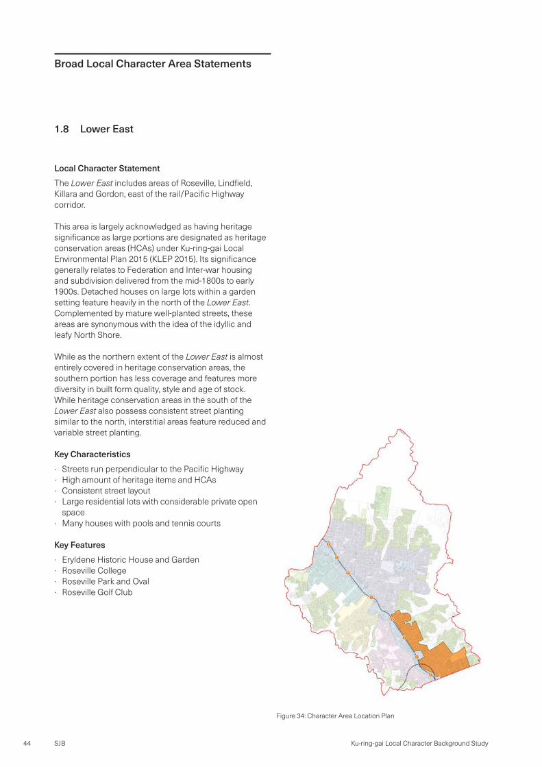
Figure 34: Character Area Location Plan

SJB 45Broad Local Character Area Statements
Figure 35: Eastern extent of Gordon, Killara and Lindfield, east of Pacific Highway

SJB46 Ku-ring-gai Local Character Background Study
Figure 36: Eastern extent of Lindfield, Roseville and western parts of East Lindfield and Roseville Chase

SJB 47Broad Local Character Area Statements
Page
left
inten
tiona
lly bl
ank

SJB48 Ku-ring-gai Local Character Background Study
Broad Local Character Area Statements
1.9 North Turramurra Table
Local Character StatementThe North Turramurra Table is located in the north of the LGA on the edge of Ku-ring-gai Chase National Park. While it shares some similarities to the Green Fingers character area, such as its location and close relationship to bushland, it is exceptionally unique in the diversity of its built form, variation in street layout and subdivision pattern. The area is still however, predominantly residential in use.
The area has a mix of large lot residential developments with densely packed dwellings, large properties with limited development, parks, a high school and a high voltage power line corridor which runs from the north-west to south-east.
Despite being surrounded by bushland, unlike the Green Fingers the topography here is flat and was historically used as agricultural land. This has created a stark and straight demarcation between National Park and development.
Key Characteristics · Isolated with limited access · Large amounts of open space with limited tree canopy · Consistent built form on large lot developments · Surrounded by bushland · Flat land · Very varied and inconsistent street layout · Less tree canopy coverage in residential areas
Key Features · North Turramurra Golf Course and Recreation Area · Lady Davidson Private Hospital · Ku-ring-gai High School
Figure 37: Character Area Location Plan

SJB 49Broad Local Character Area Statements
Figure 38: Northern extent of North Turramurra including North Turramurra Golf Course and recreation area

Level 2, 490 Crown StreetSurry Hills NSW 2010AustraliaT. 61 2 9380 [email protected] sjb.com.au
SJB is passionate about the possibilities of architecture, interiors, urban design and planning. Let’s collaborate.