irrigation engineering - skyscrapers-civilians'...
TRANSCRIPT
Irrigation Engineering
Prepared by
Bibhabasu Mohanty
Dept. of Civil Engineering
SALITER, Ahmedabad
MODULE- 1
Content…
Necessity of irrigation- scope of irrigation
engineering- benefits and ill effects of irrigation-
irrigation development in India- types of
irrigation systems, Soil-water plant relationship:
Classification of soil water- soil moisture
contents- depth of soil water available to plants-
permanent and ultimate wilting point
Course goals
This course has two specific goals:
(i) To introduce students to basic concepts of soil,
water, plants, their interactions, as well as irrigation and
drainage systems design, planning and management.
(ii) To develop analytical skills relevant to the areas
mentioned in (i) above, particularly the design of
irrigation and drainage projects.
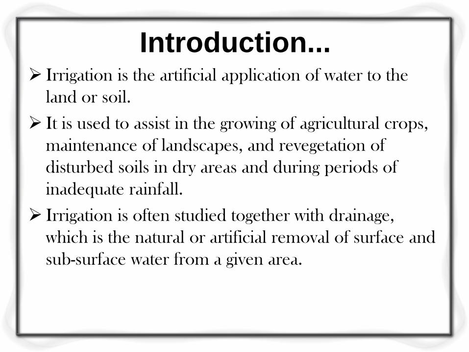
Introduction... Irrigation is the artificial application of water to the
land or soil.
It is used to assist in the growing of agricultural crops,
maintenance of landscapes, and revegetation of
disturbed soils in dry areas and during periods of
inadequate rainfall.
Irrigation is often studied together with drainage,
which is the natural or artificial removal of surface and
sub-surface water from a given area.
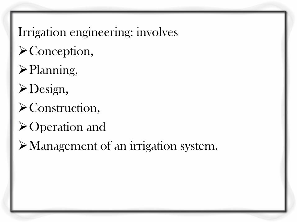
Irrigation engineering: involves
Conception,
Planning,
Design,
Construction,
Operation and
Management of an irrigation system.
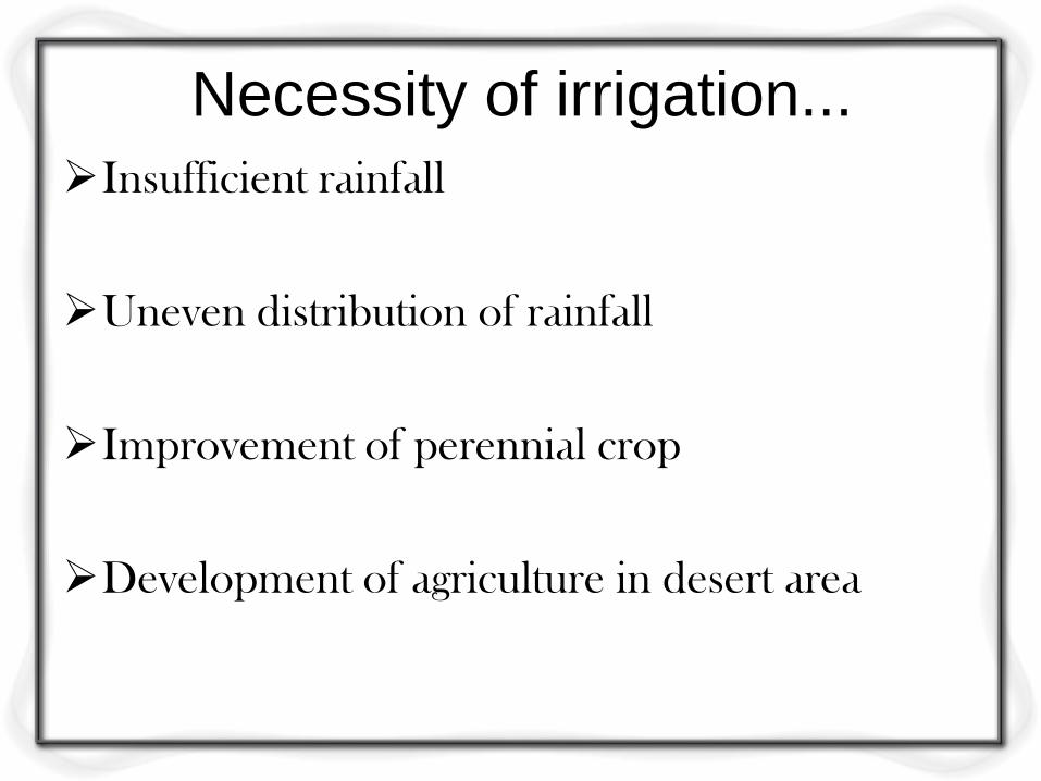
Necessity of irrigation...
Insufficient rainfall
Uneven distribution of rainfall
Improvement of perennial crop
Development of agriculture in desert area
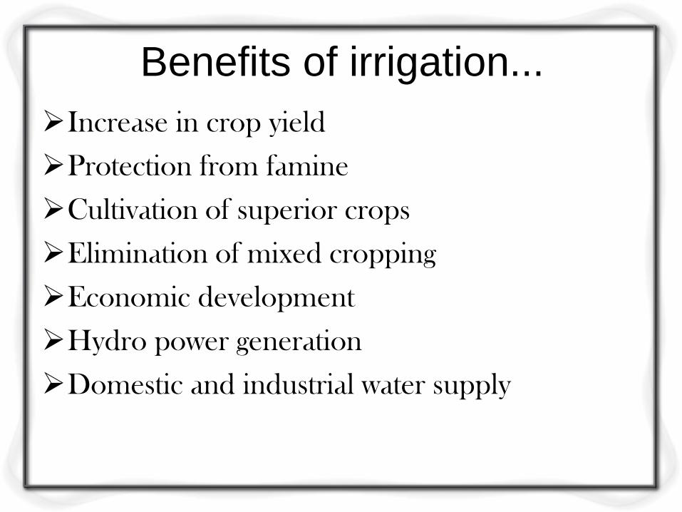
Benefits of irrigation...
Increase in crop yield
Protection from famine
Cultivation of superior crops
Elimination of mixed cropping
Economic development
Hydro power generation
Domestic and industrial water supply

ill effects of irrigation...
Rising of water table
Formation of marshy land
Dampness in weather
Loss of valuable lands
Irrigation development in India...
• Among Asian countries India has largest arable
land (40%).
• Only USA has more arable land than India.
• In a monsoon climate and an agrarian economy
like India, irrigation has played a major role in
the production process. There is evidence of
the practice of irrigation since the establishment
of settled agriculture during the Indus Valley
Civilization (2500 BC).
These irrigation technologies were in the form
of small and minor works, which could be
operated by small households to irrigate small
patches of land and did not require co-operative
effort.
In the south, perennial irrigation may have
begun with construction of the Grand Anicut by
the Cholas as early as second century to provide
irrigation from the Cauvery river.

At beginning of 19th century, there was large no
of water tanks in peninsular India and several
canals in northern India were build.
The upper Ganga canal, upper Bari Doab canal
and the Krishna and Godavari delta system
were constructed between 1836-1866.
During the last fifty years, gross irrigated area
(GIA) of India has increased more than three
fold from 22 to 76 million Hectares.
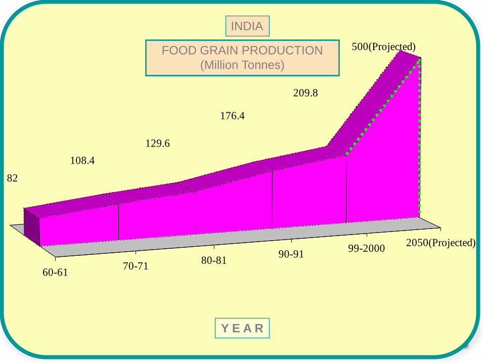
13
60-6170-71
80-8190-91
99-20002050(Projected)
500(Projected)
209.8
176.4
129.6
108.4
82
INDIA
FOOD GRAIN PRODUCTION
(Million Tonnes)
Y E A R
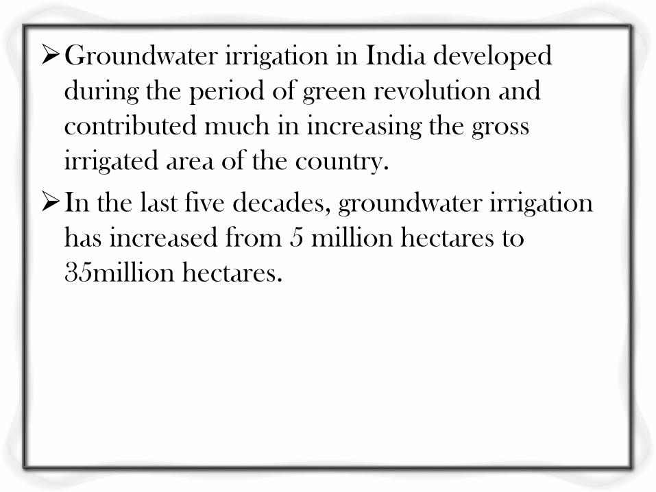
Groundwater irrigation in India developed
during the period of green revolution and
contributed much in increasing the gross
irrigated area of the country.
In the last five decades, groundwater irrigation
has increased from 5 million hectares to
35million hectares.
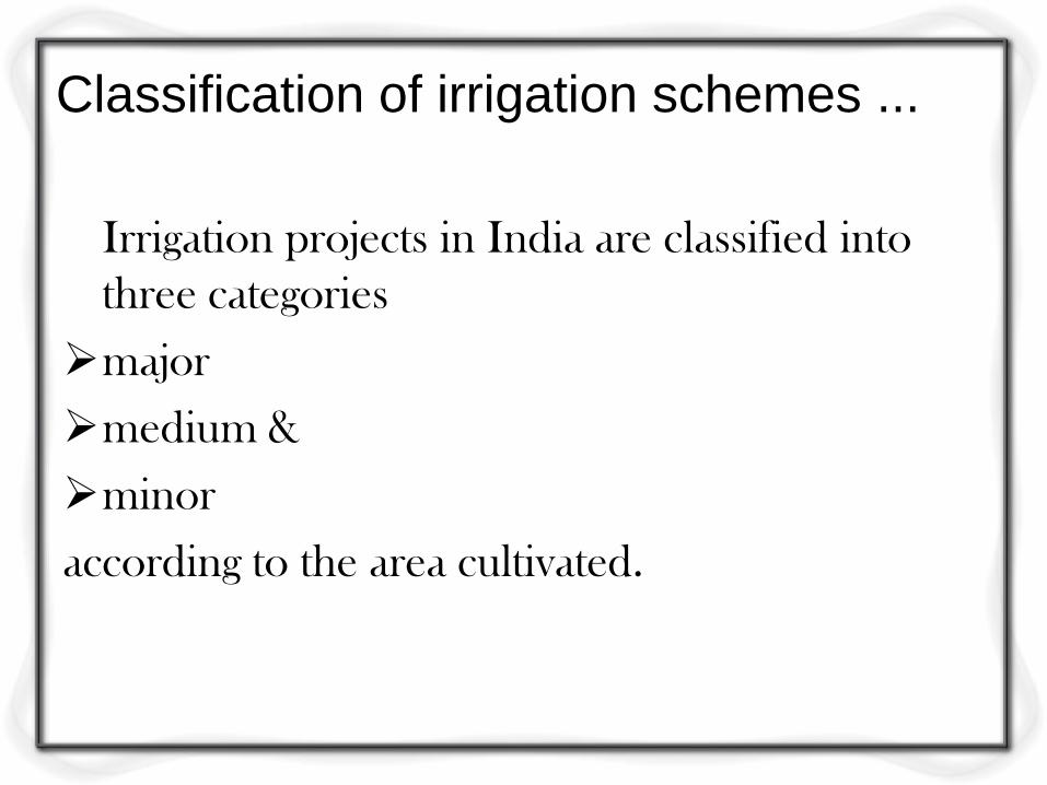
Classification of irrigation schemes ...
Irrigation projects in India are classified into
three categories
major
medium &
minor
according to the area cultivated.
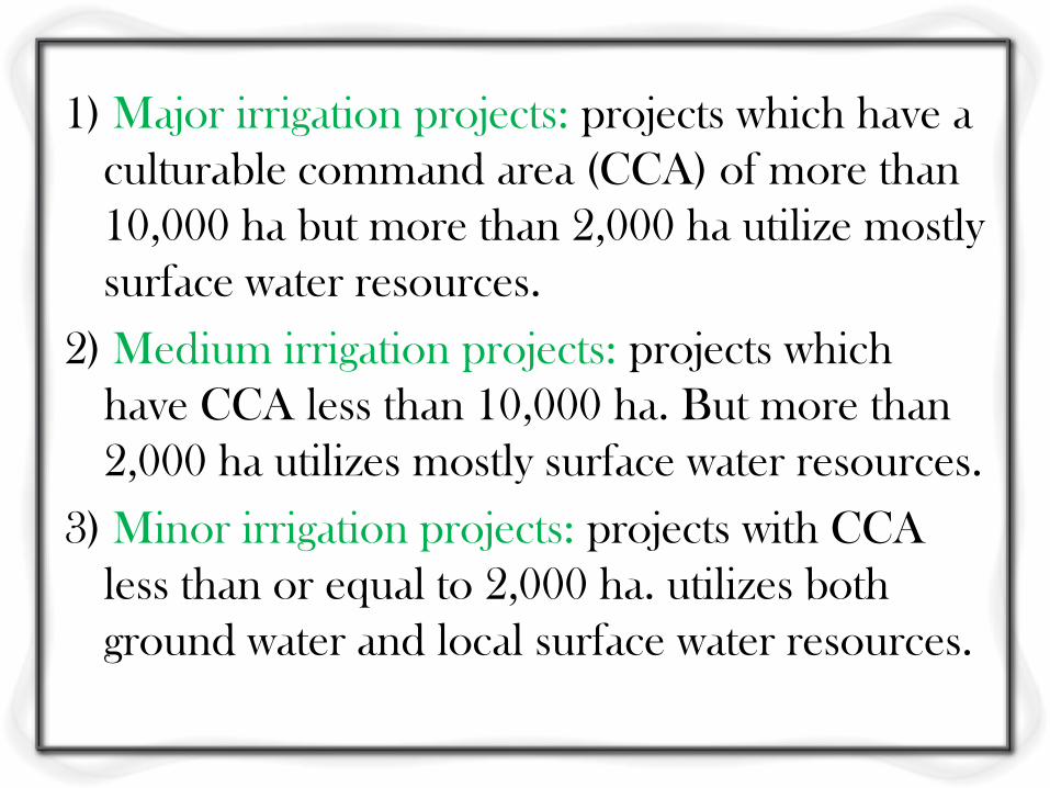
1) Major irrigation projects: projects which have a
culturable command area (CCA) of more than
10,000 ha but more than 2,000 ha utilize mostly
surface water resources.
2) Medium irrigation projects: projects which
have CCA less than 10,000 ha. But more than
2,000 ha utilizes mostly surface water resources.
3) Minor irrigation projects: projects with CCA
less than or equal to 2,000 ha. utilizes both
ground water and local surface water resources.
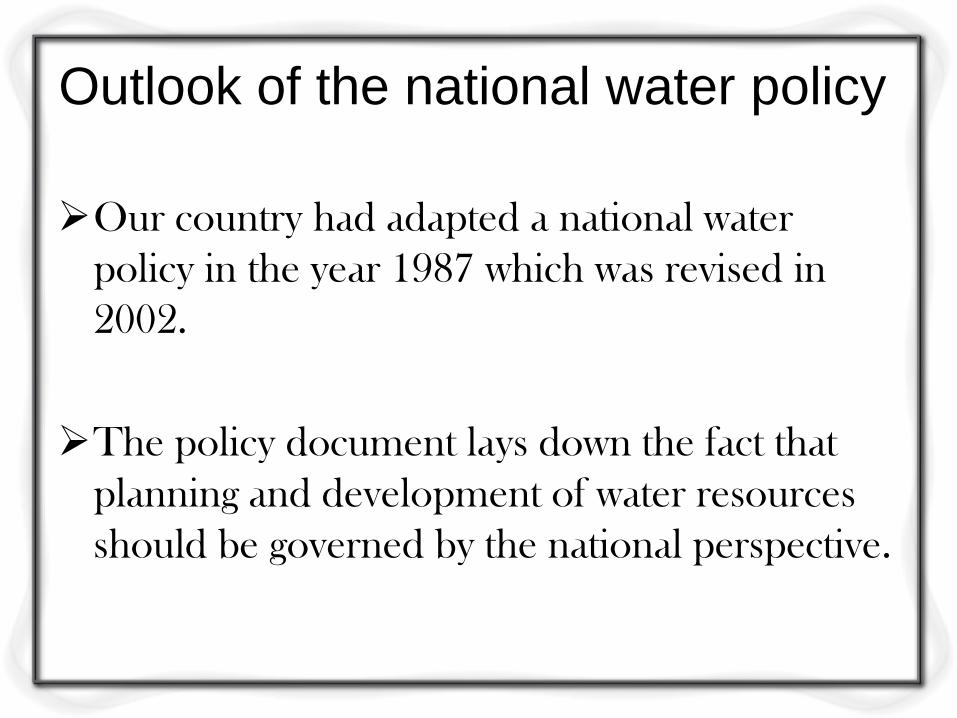
Outlook of the national water policy
Our country had adapted a national water
policy in the year 1987 which was revised in
2002.
The policy document lays down the fact that
planning and development of water resources
should be governed by the national perspective.
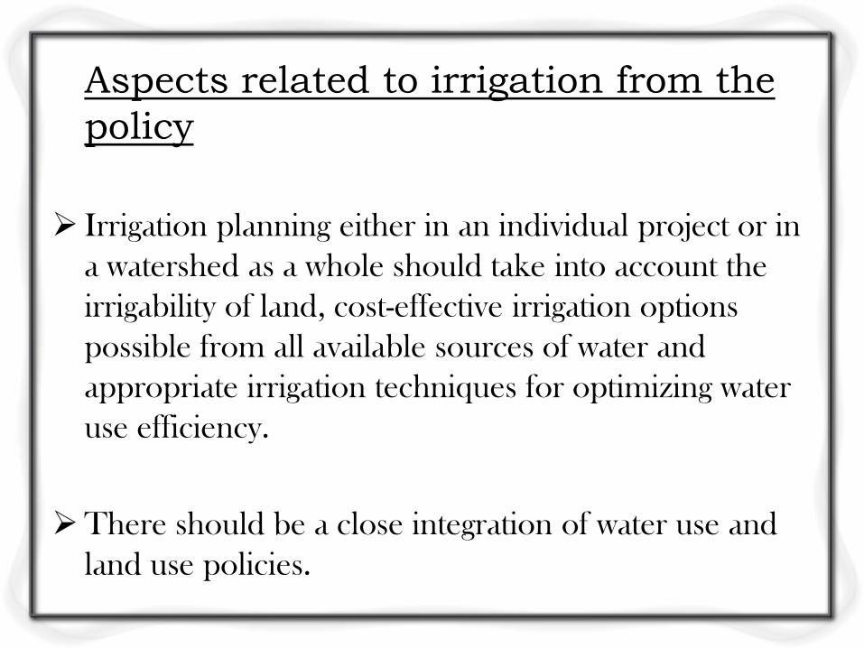
Aspects related to irrigation from the
policy
Irrigation planning either in an individual project or in
a watershed as a whole should take into account the
irrigability of land, cost-effective irrigation options
possible from all available sources of water and
appropriate irrigation techniques for optimizing water
use efficiency.
There should be a close integration of water use and
land use policies.
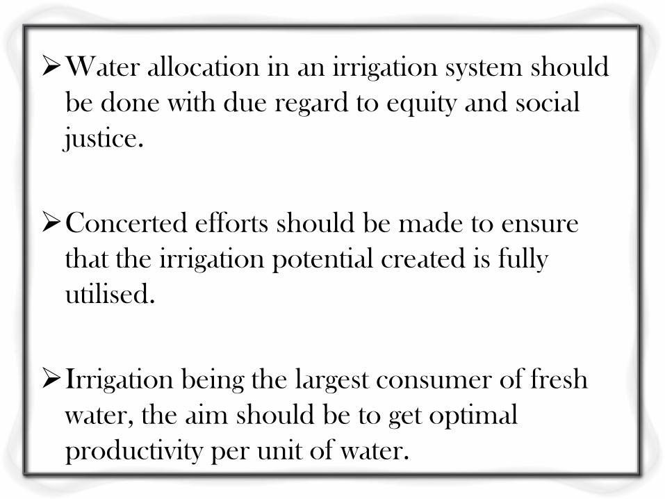
Water allocation in an irrigation system should
be done with due regard to equity and social
justice.
Concerted efforts should be made to ensure
that the irrigation potential created is fully
utilised.
Irrigation being the largest consumer of fresh
water, the aim should be to get optimal
productivity per unit of water.
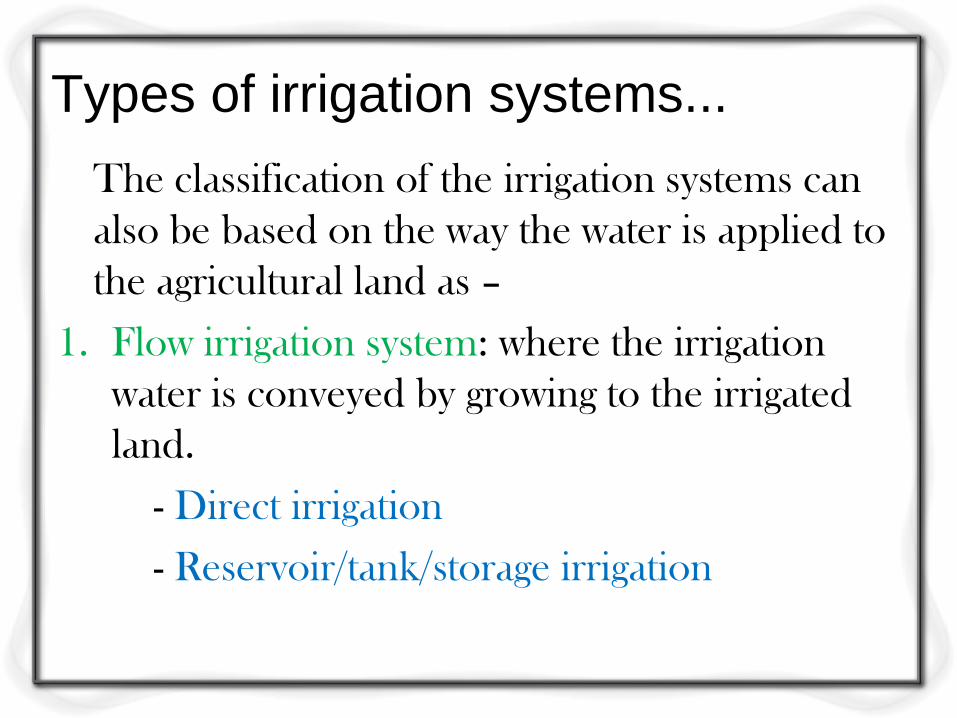
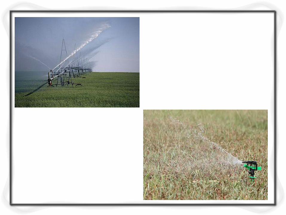
Types of irrigation systems...
The classification of the irrigation systems can
also be based on the way the water is applied to
the agricultural land as –
1. Flow irrigation system: where the irrigation
water is conveyed by growing to the irrigated
land.
- Direct irrigation
- Reservoir/tank/storage irrigation
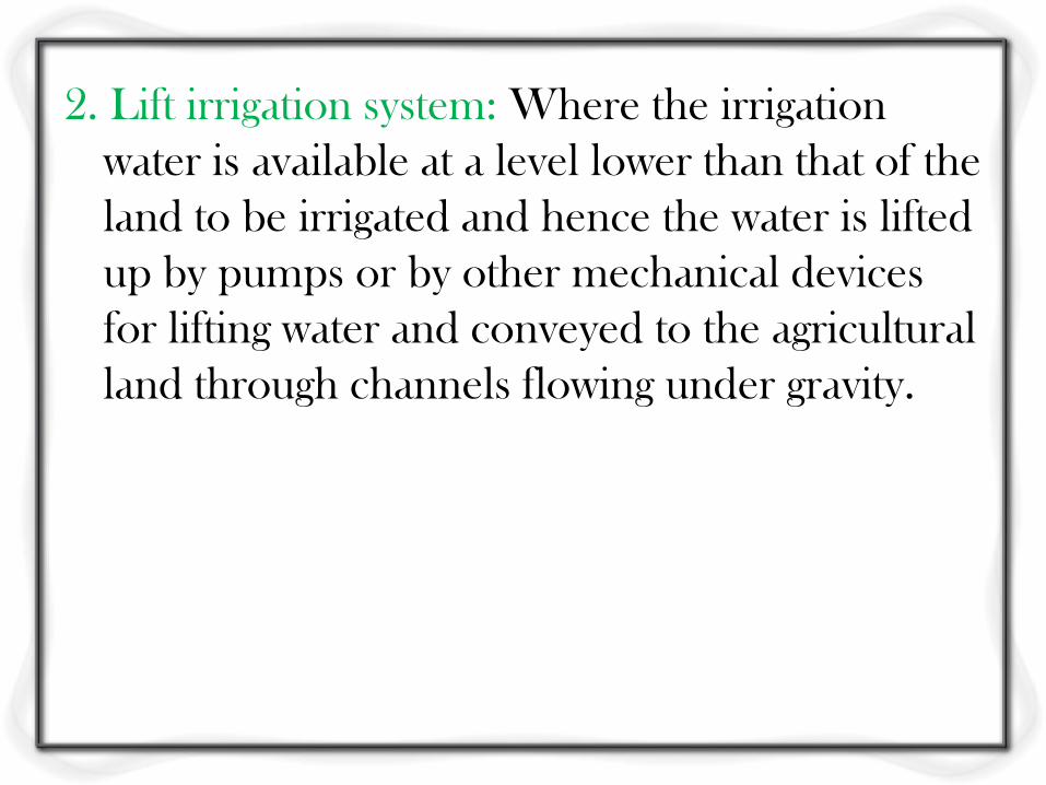
2. Lift irrigation system: Where the irrigation
water is available at a level lower than that of the
land to be irrigated and hence the water is lifted
up by pumps or by other mechanical devices
for lifting water and conveyed to the agricultural
land through channels flowing under gravity.
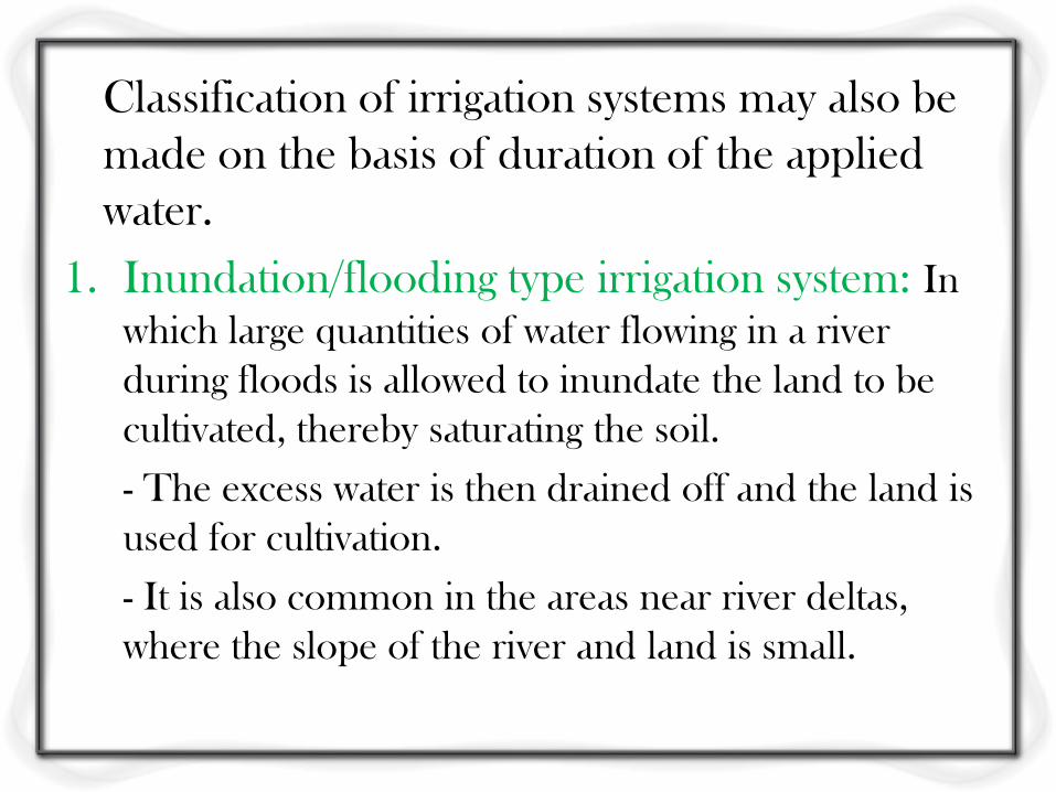
Classification of irrigation systems may also be
made on the basis of duration of the applied
water.
1. Inundation/flooding type irrigation system: In
which large quantities of water flowing in a river
during floods is allowed to inundate the land to be
cultivated, thereby saturating the soil.
- The excess water is then drained off and the land is
used for cultivation.
- It is also common in the areas near river deltas,
where the slope of the river and land is small.

2. Perennial irrigation system: In which irrigation
water is supplied according to the crop water
requirement at regular intervals, throughout the
life cycle of the crop.
- The water for such irrigation may be obtained
from rivers or from wells.
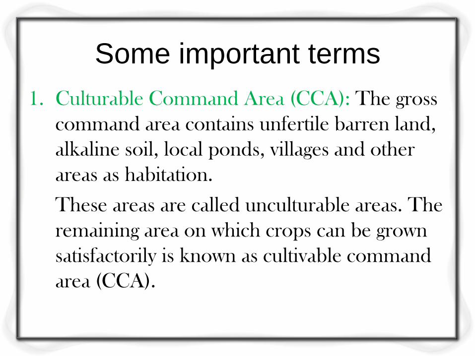
Some important terms
1. Culturable Command Area (CCA): The gross
command area contains unfertile barren land,
alkaline soil, local ponds, villages and other
areas as habitation.
These areas are called unculturable areas. The
remaining area on which crops can be grown
satisfactorily is known as cultivable command
area (CCA).
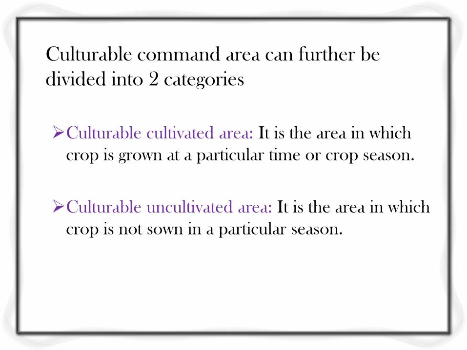
Culturable command area can further be
divided into 2 categories
Culturable cultivated area: It is the area in which
crop is grown at a particular time or crop season.
Culturable uncultivated area: It is the area in which
crop is not sown in a particular season.
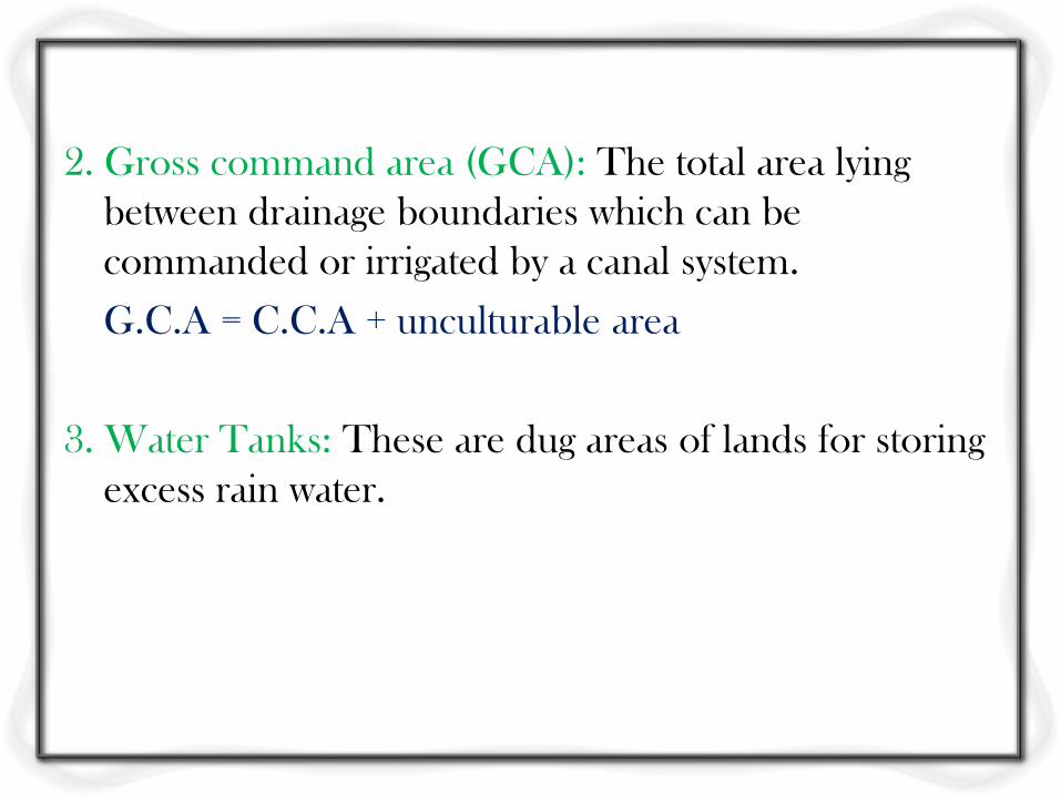
2. Gross command area (GCA): The total area lying
between drainage boundaries which can be
commanded or irrigated by a canal system.
G.C.A = C.C.A + unculturable area
3. Water Tanks: These are dug areas of lands for storing
excess rain water.
4. Water logged area: An agricultural land is said to be
waterlogged when its productivity or fertility is affected
by high water table.
The depth of water-table at which it tends to make the
soil water-logged and harmful to the growth and
subsistence of plant life depends upon the height of
capillary fringe.
The height of capillary fringe is more for fine grained
soil and less for coarse grained ones.
5. Outlet: This is a small structure which admits
water from the distributing channel to a water
course of field channel. Thus an outlet is a sort
of head regulator for the field channel
delivering water to the irrigation fields.
6. Permanent wilting point: or the wilting
coefficient is that water content at which plants
can no longer extract sufficient water from the
soil for its growth.
Soil Water Relationships
Objective 1
Explain the relationships between soil
properties and water retention.
Vocabulary Terms
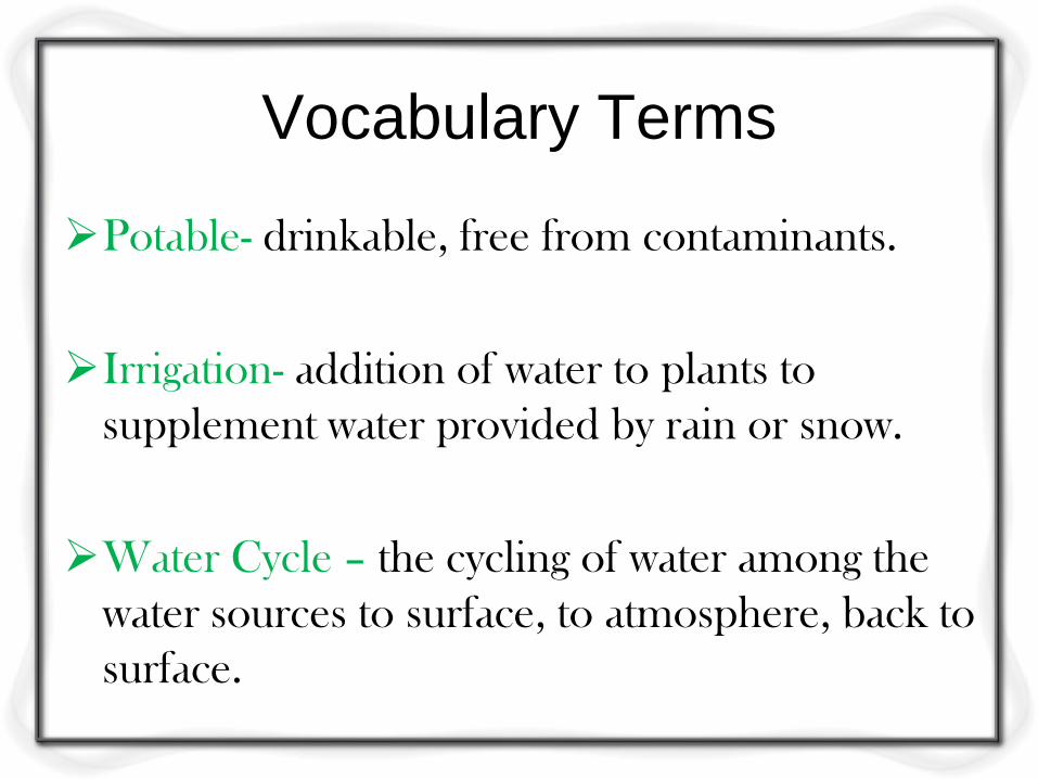
Potable- drinkable, free from contaminants.
Irrigation- addition of water to plants to
supplement water provided by rain or snow.
Water Cycle – the cycling of water among the
water sources to surface, to atmosphere, back to
surface.
Vocabulary Terms
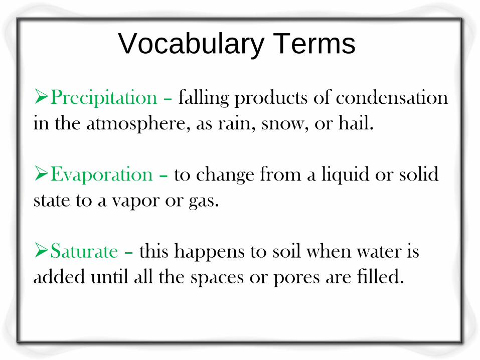
Precipitation – falling products of condensation
in the atmosphere, as rain, snow, or hail.
Evaporation – to change from a liquid or solid
state to a vapor or gas.
Saturate – this happens to soil when water is
added until all the spaces or pores are filled.
Types of Groundwater
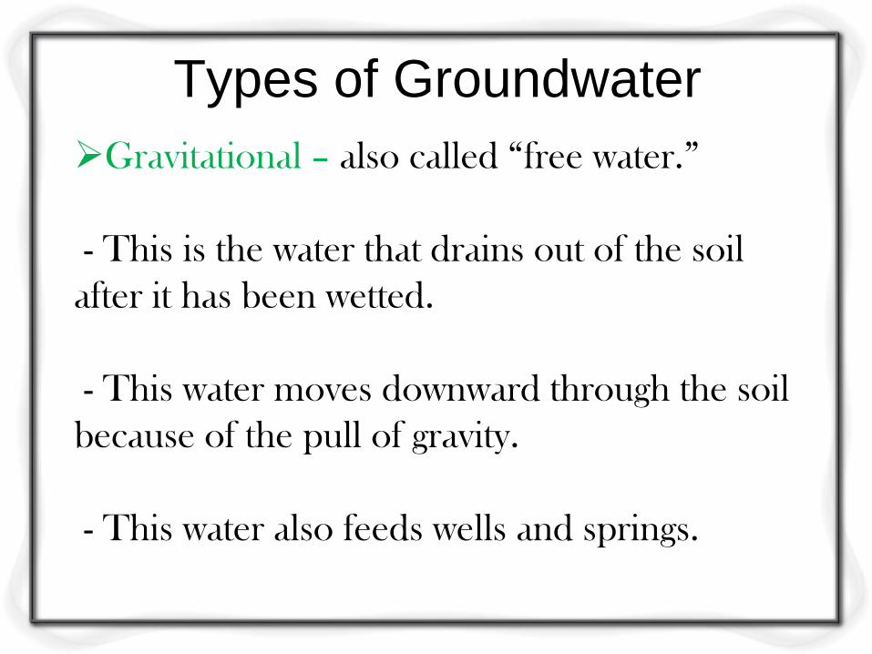
Gravitational – also called “free water.”
- This is the water that drains out of the soil
after it has been wetted.
- This water moves downward through the soil
because of the pull of gravity.
- This water also feeds wells and springs.
Types of Groundwater
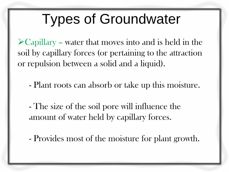
Capillary – water that moves into and is held in the
soil by capillary forces (or pertaining to the attraction
or repulsion between a solid and a liquid).
- Plant roots can absorb or take up this moisture.
- The size of the soil pore will influence the
amount of water held by capillary forces.
- Provides most of the moisture for plant growth.
Types of Groundwater
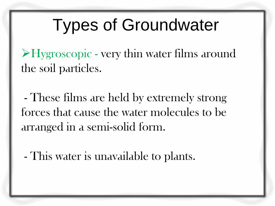
Hygroscopic - very thin water films around
the soil particles.
- These films are held by extremely strong
forces that cause the water molecules to be
arranged in a semi-solid form.
- This water is unavailable to plants.
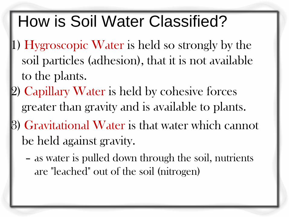
How is Soil Water Classified?
1) Hygroscopic Water is held so strongly by the
soil particles (adhesion), that it is not available
to the plants.
2) Capillary Water is held by cohesive forces
greater than gravity and is available to plants.
3) Gravitational Water is that water which cannot
be held against gravity.
– as water is pulled down through the soil, nutrients
are "leached" out of the soil (nitrogen)
Levels of Water in Soil
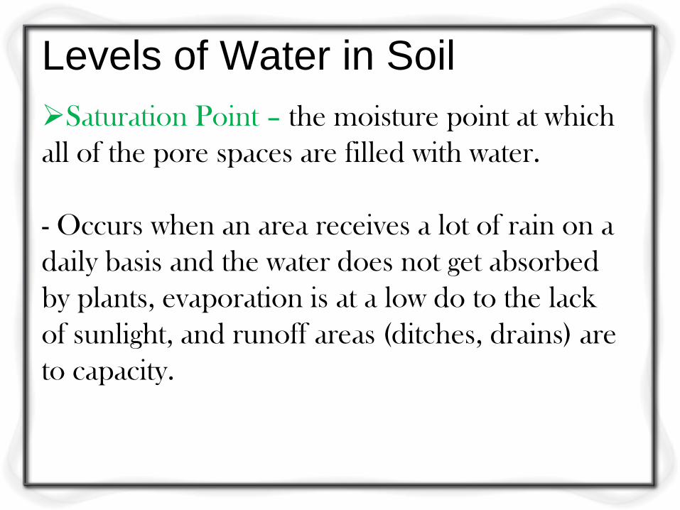
Saturation Point – the moisture point at which
all of the pore spaces are filled with water.
- Occurs when an area receives a lot of rain on a
daily basis and the water does not get absorbed
by plants, evaporation is at a low do to the lack
of sunlight, and runoff areas (ditches, drains) are
to capacity.
Levels of Water in Soil
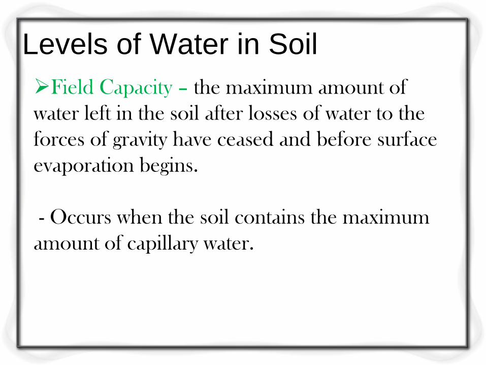
Field Capacity – the maximum amount of
water left in the soil after losses of water to the
forces of gravity have ceased and before surface
evaporation begins.
- Occurs when the soil contains the maximum
amount of capillary water.
Levels of Water in Soil
Wilting Point – the point at which the plant
can no longer obtain sufficient water from the
soil to meet its transpiration needs.
- At this point the plant enters permanent wilt
and dies.
Levels of Water in Soil
Available Soil Water – that amount present
in a soil which can be moved by plants.
- It is designated as the difference between the
field capacity and the wilting point.
The Hydrolic (Water) Cycle
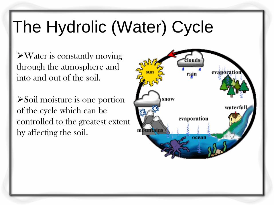
Water is constantly moving
through the atmosphere and
into and out of the soil.
Soil moisture is one portion
of the cycle which can be
controlled to the greatest extent
by affecting the soil.

How Does Water Enter the Soil?
through pores in the soil
sandy soils have the largest pores, but are
often filled with other material
medium textured soils (loamy) have good
water entry properties
clays, pores swell shut when they get wet
Objective 2
Explain the relationships between soil water and
plant growth.
Vocabulary Terms
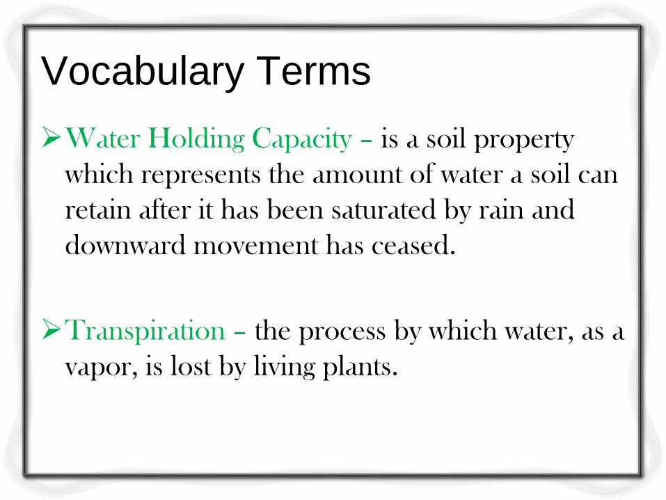
Water Holding Capacity – is a soil property
which represents the amount of water a soil can
retain after it has been saturated by rain and
downward movement has ceased.
Transpiration – the process by which water, as a
vapor, is lost by living plants.
Vocabulary Terms
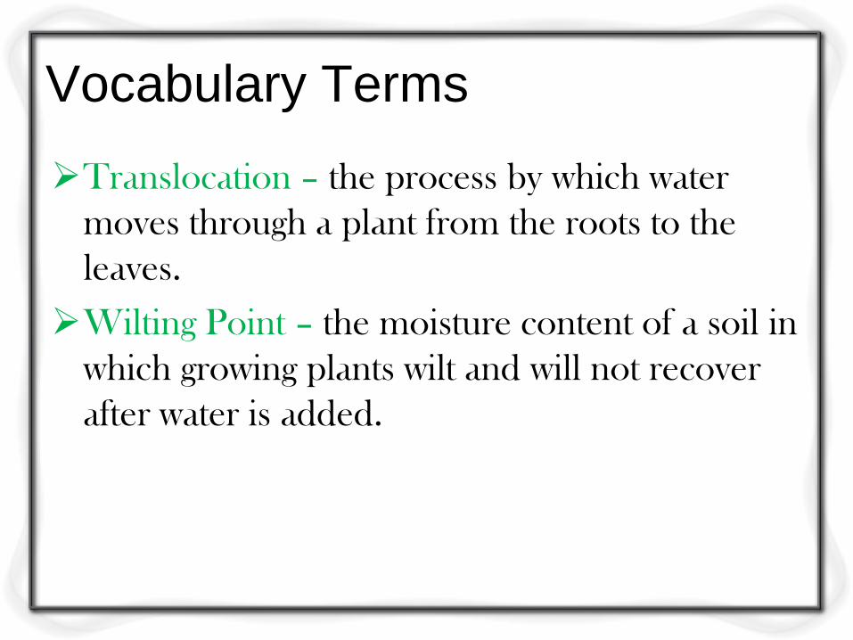
Translocation – the process by which water
moves through a plant from the roots to the
leaves.
Wilting Point – the moisture content of a soil in
which growing plants wilt and will not recover
after water is added.
Vocabulary Terms
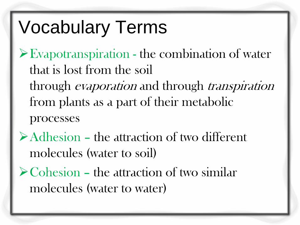
Evapotranspiration - the combination of water
that is lost from the soil
through evaporation and through transpiration
from plants as a part of their metabolic
processes
Adhesion – the attraction of two different
molecules (water to soil)
Cohesion – the attraction of two similar
molecules (water to water)
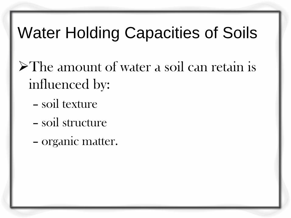
Water Holding Capacities of Soils
The amount of water a soil can retain is
influenced by:
– soil texture
– soil structure
– organic matter.
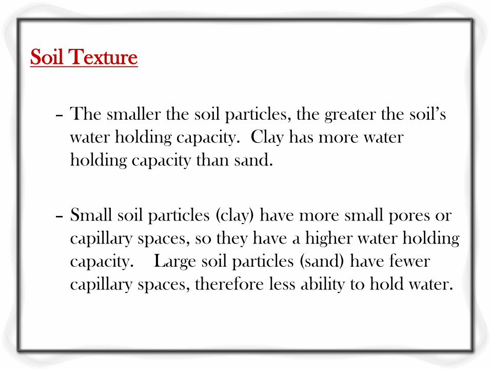
Soil Texture
– The smaller the soil particles, the greater the soil’s
water holding capacity. Clay has more water
holding capacity than sand.
– Small soil particles (clay) have more small pores or
capillary spaces, so they have a higher water holding
capacity. Large soil particles (sand) have fewer
capillary spaces, therefore less ability to hold water.
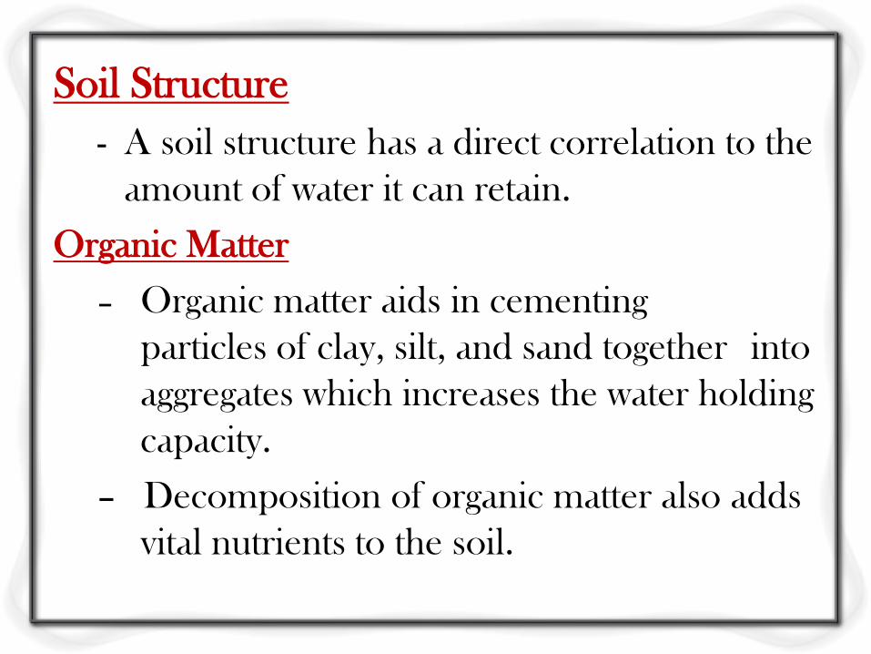
Soil Structure
- A soil structure has a direct correlation to the
amount of water it can retain.
Organic Matter
– Organic matter aids in cementing
particles of clay, silt, and sand together into
aggregates which increases the water holding
capacity.
– Decomposition of organic matter also adds
vital nutrients to the soil.
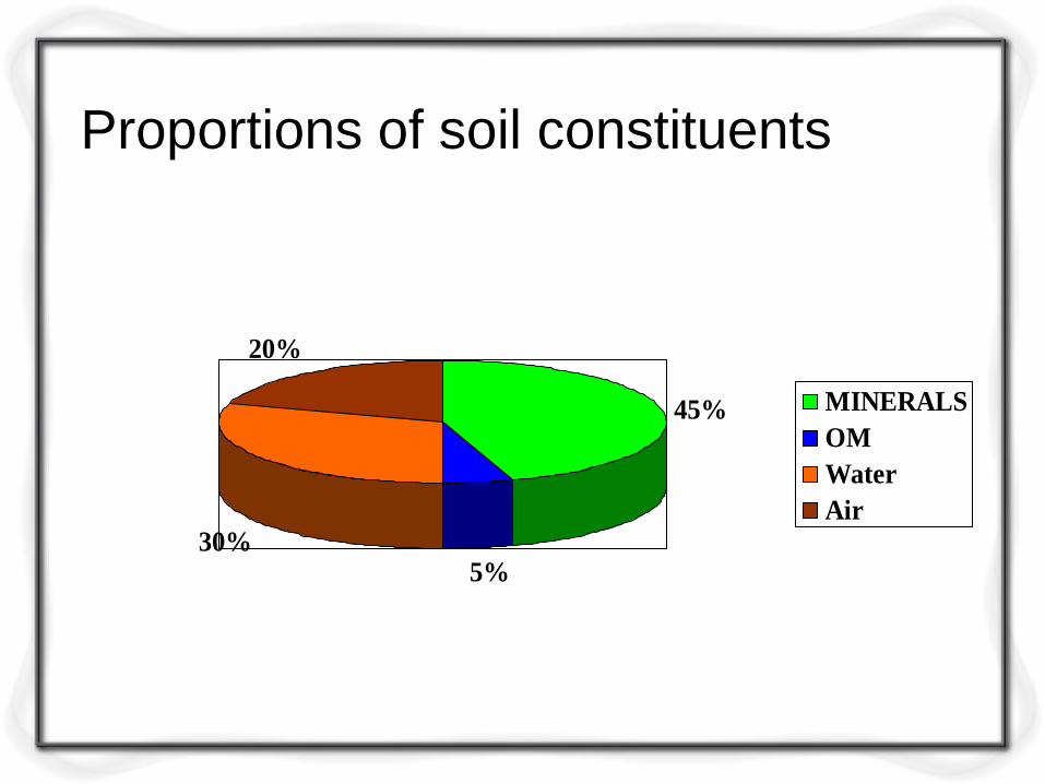
Proportions of soil constituents
45%
5%30%
20%
MINERALS
OM
Water
Air
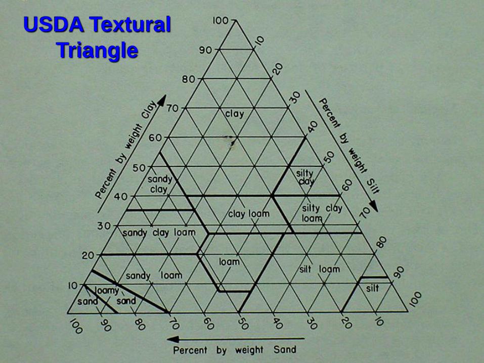
USDA Textural
Triangle
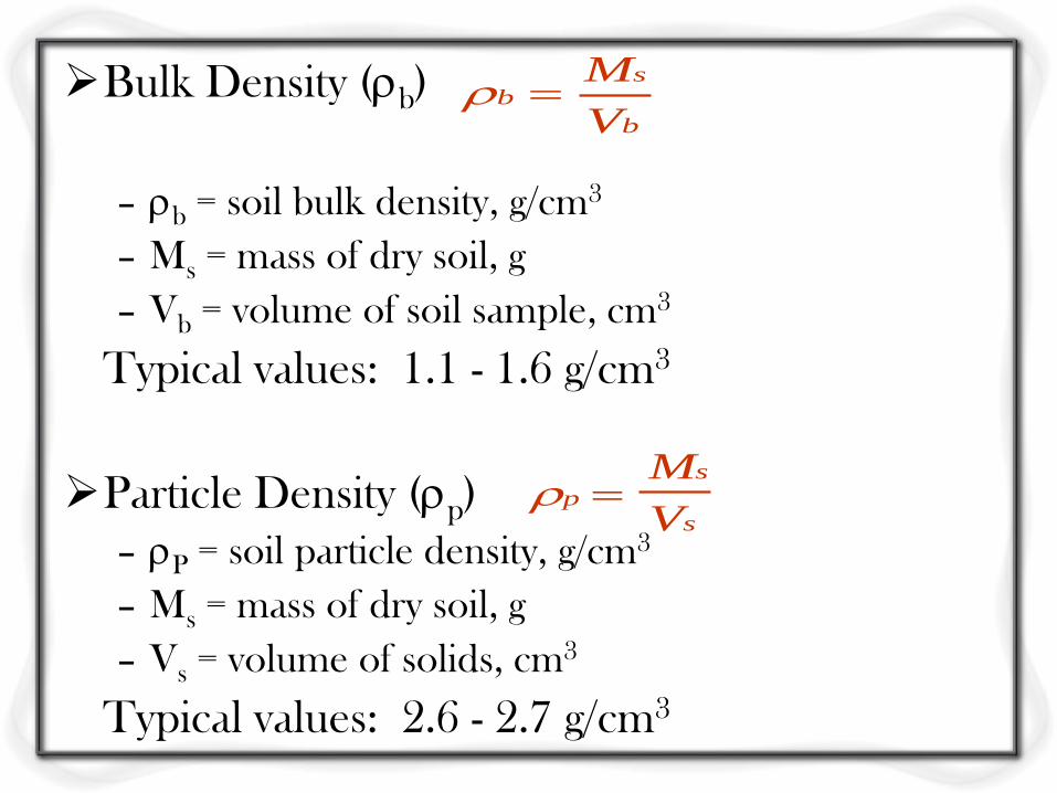
Bulk Density (b)
– b = soil bulk density, g/cm3
– Ms = mass of dry soil, g
– Vb = volume of soil sample, cm3
Typical values: 1.1 - 1.6 g/cm3
Particle Density (p)
– P = soil particle density, g/cm3
– Ms = mass of dry soil, g
– Vs = volume of solids, cm3
Typical values: 2.6 - 2.7 g/cm3
b
sb
V
M
p
s
s
M
V
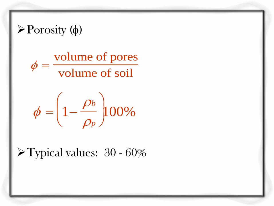
Porosity ()
Typical values: 30 - 60%
volume of pores
volume of soil
1 100%
b
p
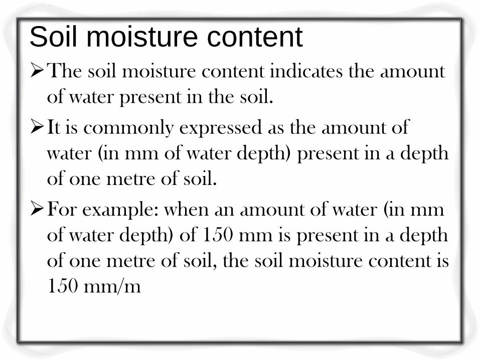
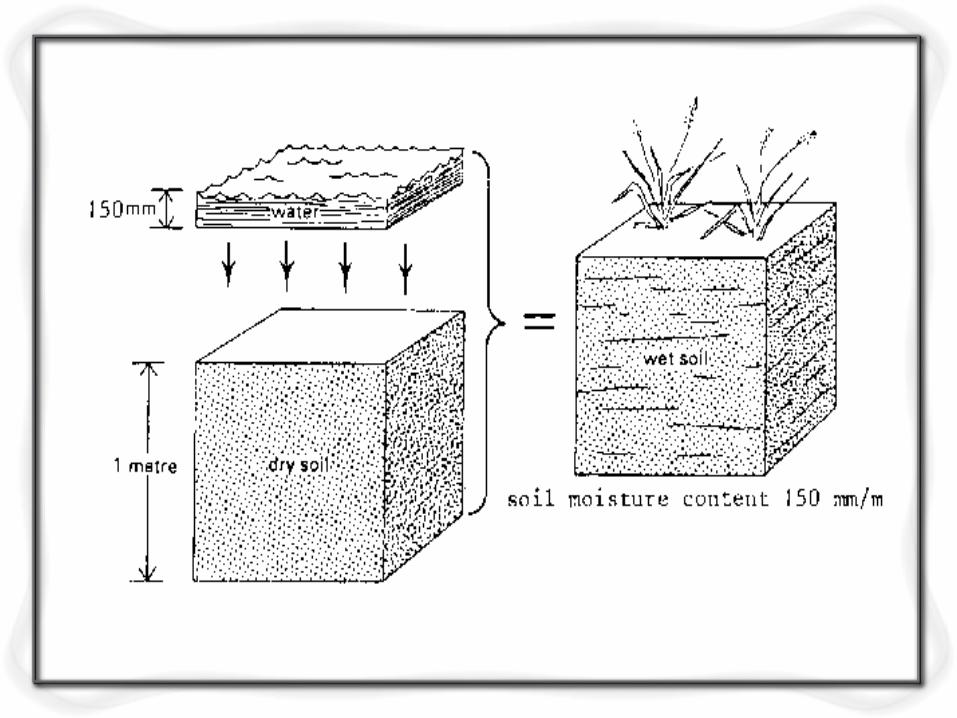
Soil moisture content
The soil moisture content indicates the amount
of water present in the soil.
It is commonly expressed as the amount of
water (in mm of water depth) present in a depth
of one metre of soil.
For example: when an amount of water (in mm
of water depth) of 150 mm is present in a depth
of one metre of soil, the soil moisture content is
150 mm/m
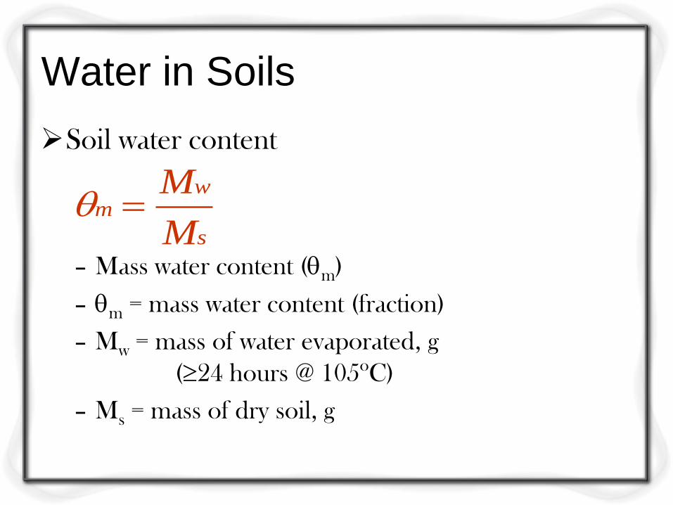
Water in Soils
Soil water content
– Mass water content (m)
– m = mass water content (fraction)
– Mw = mass of water evaporated, g
(24 hours @ 105oC)
– Ms = mass of dry soil, g
s
wm
M
M
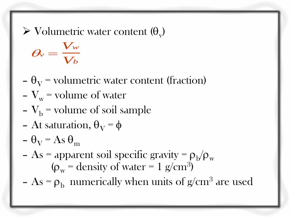
Volumetric water content (v)
– V = volumetric water content (fraction)
– Vw = volume of water
– Vb = volume of soil sample
– At saturation, V =
– V = As m
– As = apparent soil specific gravity = b/w (w = density of water = 1 g/cm3)
– As = b numerically when units of g/cm3 are used
v
w
b
V
V
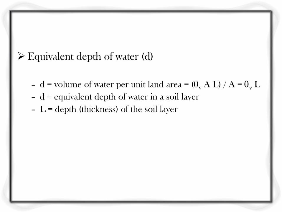
Equivalent depth of water (d)
– d = volume of water per unit land area = (v A L) / A = v L
– d = equivalent depth of water in a soil layer
– L = depth (thickness) of the soil layer
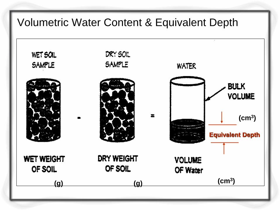
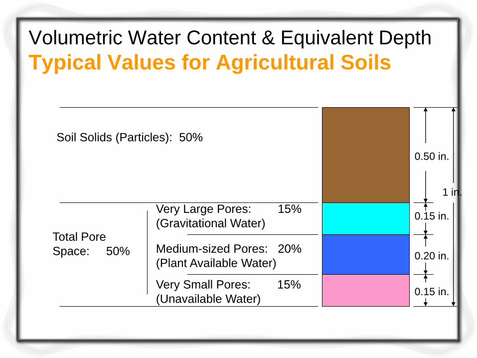
Volumetric Water Content & Equivalent Depth
(g) (g)
(cm3)
(cm3)
Equivalent Depth
Volumetric Water Content & Equivalent Depth
Typical Values for Agricultural Soils
1 in.
0.50 in.
0.15 in.
0.20 in.
0.15 in.
Soil Solids (Particles): 50%
Total Pore
Space: 50%
Very Large Pores: 15%
(Gravitational Water)
Medium-sized Pores: 20%
(Plant Available Water)
Very Small Pores: 15%
(Unavailable Water)
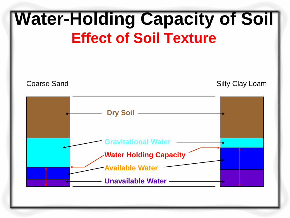
Water-Holding Capacity of Soil Effect of Soil Texture
Coarse Sand Silty Clay Loam
Gravitational Water
Water Holding Capacity
Available Water
Unavailable Water
Dry Soil
Soil water constants
For a particular soil, certain soil water
proportions are defined which dictate whether
the water is available or not for plant growth.
These are called the soil water constants, which
are described below.
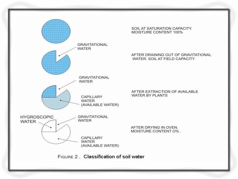
Saturation capacity: this is the total water
content of the soil when all the pores of the soil
are filled with water.
It is also termed as the maximum water holding
capacity of the soil.
At saturation capacity, the soil moisture tension
is almost equal to zero.
Field capacity: this is the water retained by an
initially saturated soil against the force of gravity.
Hence, as the gravitational water gets drained
off from the soil, it is said to reach the field
capacity.
At field capacity, the macro-pores of the soil
are drained off, but water is retained in the
micropores.
Permanent wilting point: plant roots are able to
extract water from a soil matrix, which is
saturated up to field capacity.
However, as the water extraction proceeds, the
moisture content diminishes and the negative
pressure increases.
At one point, the plant cannot extract any
further water and thus wilts.

Two stages of wilting points are recognized and
they are:
Temporary wilting point: this denotes the soil
water content at which the plant wilts at day
time, but recovers during right or when water is
added to the soil.
Ultimate wilting point: at such a soil water
content, the plant wilts and fails to regain life
even after addition of water to soil.
It must be noted that the above water contents
are expressed as percentage of water held in the
soil pores, compared to a fully saturated soil.
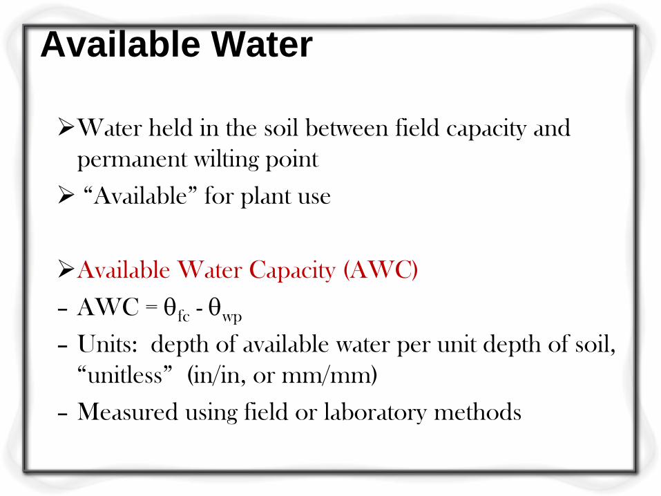
Available Water
Water held in the soil between field capacity and
permanent wilting point
“Available” for plant use
Available Water Capacity (AWC)
– AWC = fc - wp
– Units: depth of available water per unit depth of soil,
“unitless” (in/in, or mm/mm)
– Measured using field or laboratory methods
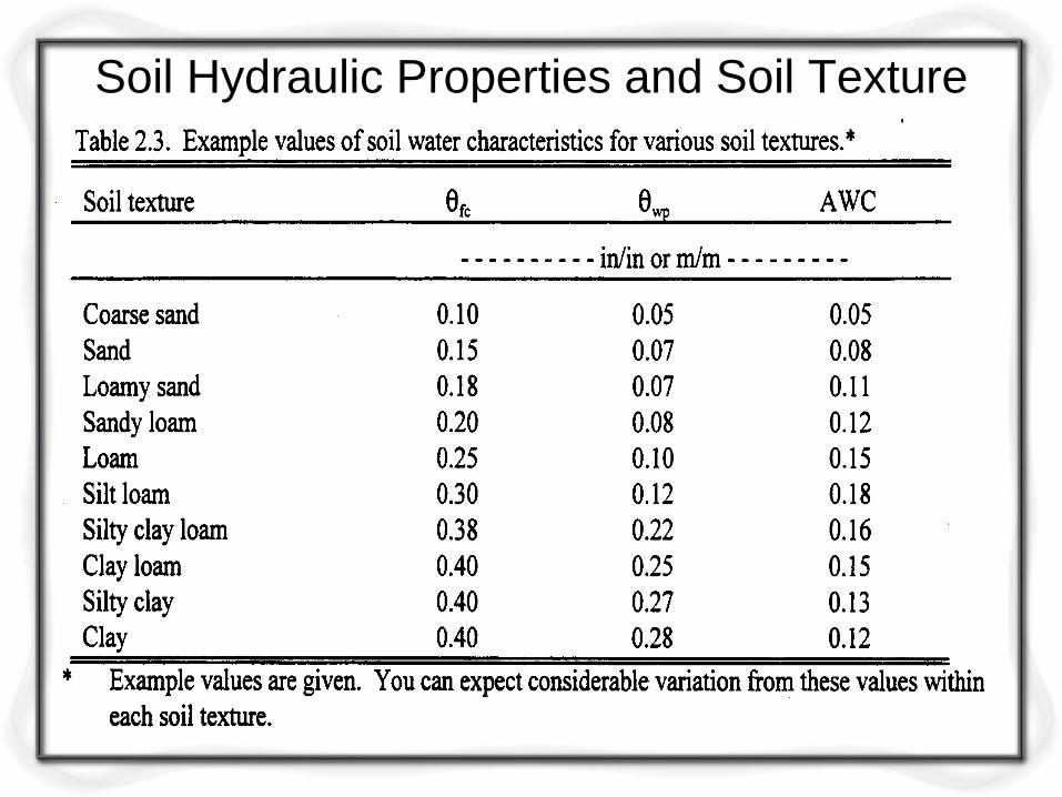
Soil Hydraulic Properties and Soil Texture
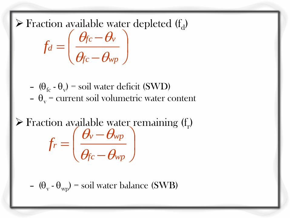
Fraction available water depleted (fd)
– (fc - v) = soil water deficit (SWD)
– v = current soil volumetric water content
Fraction available water remaining (fr)
– (v - wp) = soil water balance (SWB)
wpfc
vfcdf
wpfc
wpvrf
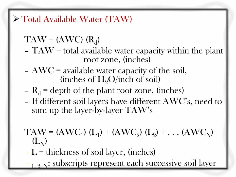
Total Available Water (TAW)
TAW = (AWC) (Rd)
– TAW = total available water capacity within the plant root zone, (inches)
– AWC = available water capacity of the soil, (inches of H2O/inch of soil)
– Rd = depth of the plant root zone, (inches)
– If different soil layers have different AWC’s, need to sum up the layer-by-layer TAW’s
TAW = (AWC1) (L1) + (AWC2) (L2) + . . . (AWCN) (LN)
- L = thickness of soil layer, (inches)
- 1, 2, N: subscripts represent each successive soil layer
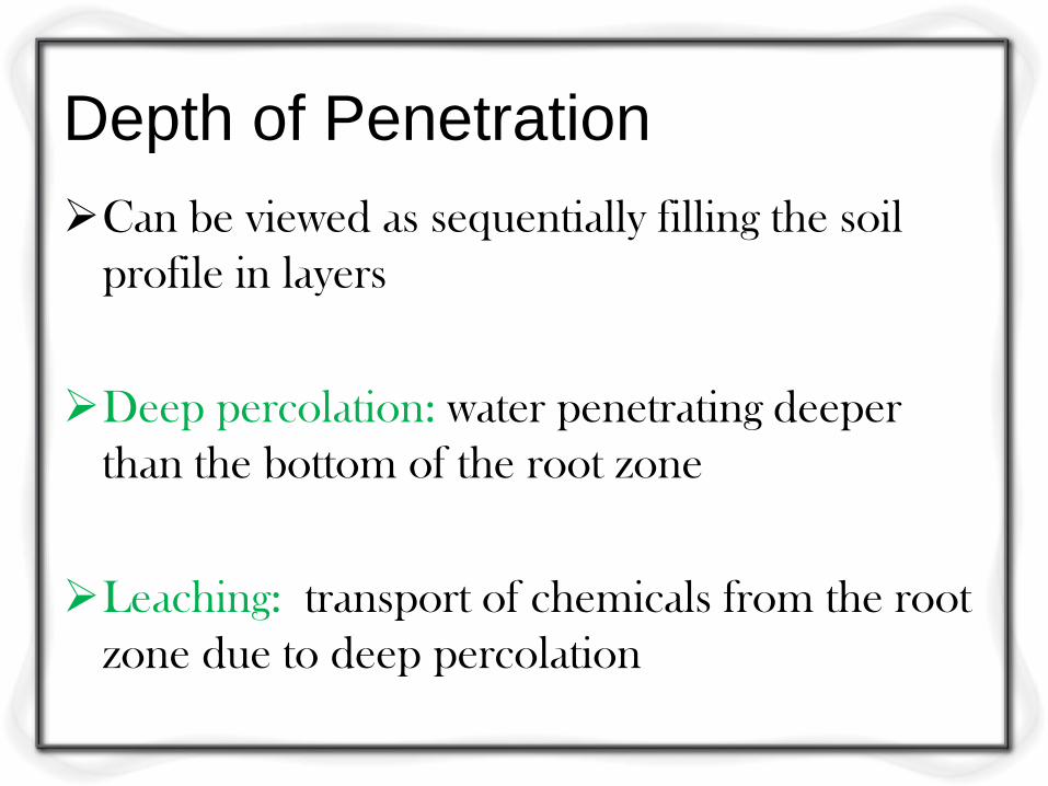
Depth of Penetration
Can be viewed as sequentially filling the soil
profile in layers
Deep percolation: water penetrating deeper
than the bottom of the root zone
Leaching: transport of chemicals from the root
zone due to deep percolation
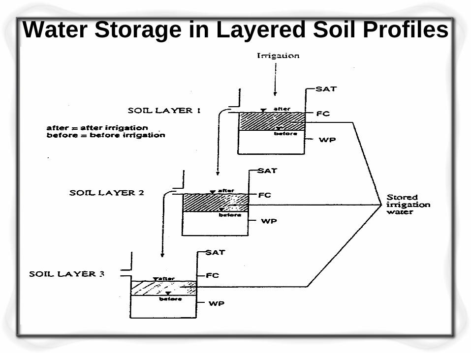
Water Storage in Layered Soil Profiles
Water requirements of crops
Content… Depth of water applied during irrigation- Duty
of water and delta improvement of duty-
command area and intensity of irrigation
consumptive use of water and
Evapotranspiration- irrigation efficiencies-
assessment of irrigation water.
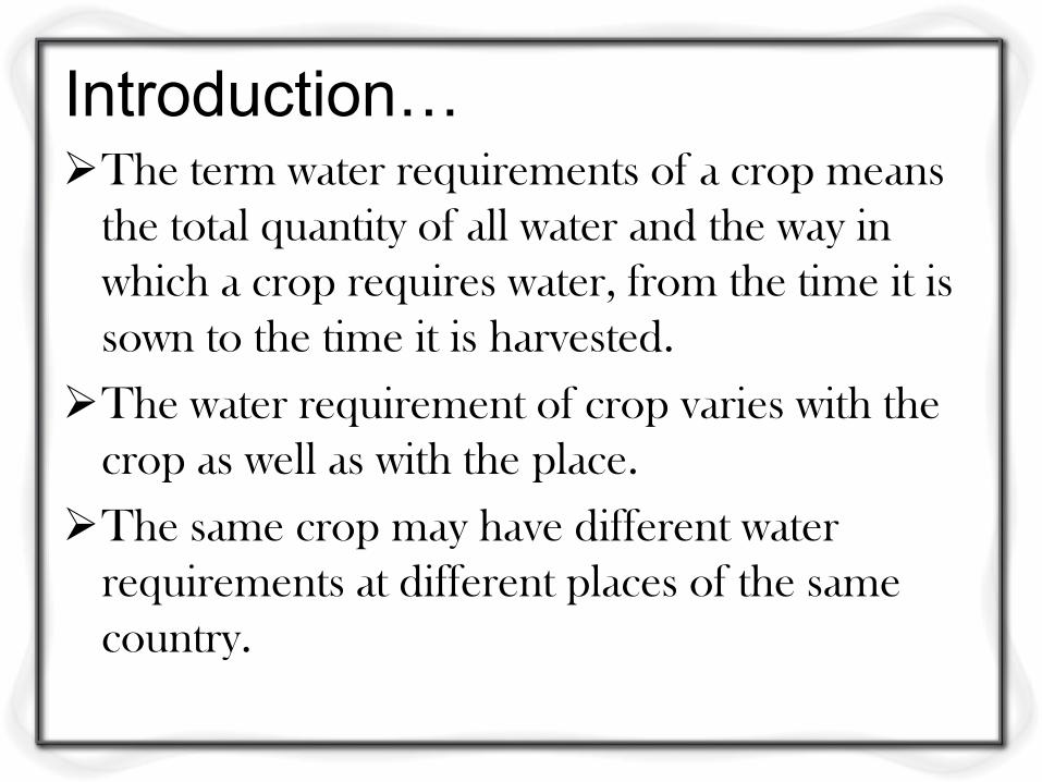
Introduction… The term water requirements of a crop means
the total quantity of all water and the way in
which a crop requires water, from the time it is
sown to the time it is harvested.
The water requirement of crop varies with the
crop as well as with the place.
The same crop may have different water
requirements at different places of the same
country.
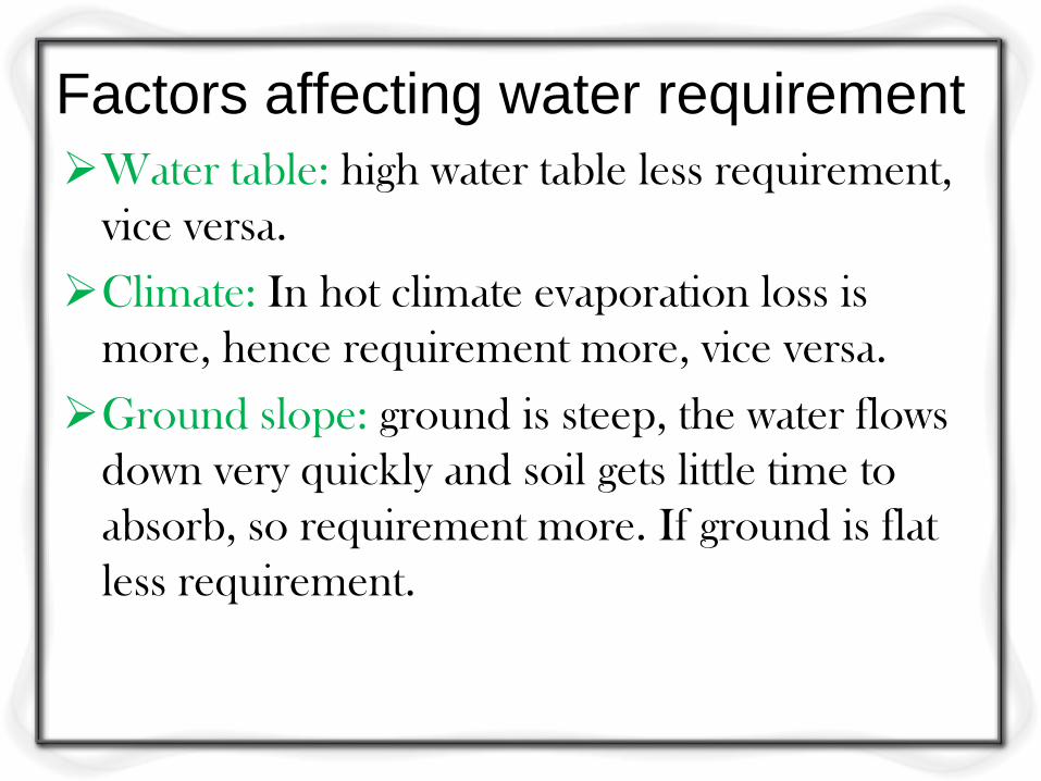
Factors affecting water requirement
Water table: high water table less requirement,
vice versa.
Climate: In hot climate evaporation loss is
more, hence requirement more, vice versa.
Ground slope: ground is steep, the water flows
down very quickly and soil gets little time to
absorb, so requirement more. If ground is flat
less requirement.

Intensity of irrigation: if intensity of irrigation
for a particular crop is high, then more area
comes under the irrigation system and
requirement is more, vice versa.
Type of soil: sandy soil water percolates very
quickly, so requirement is more. Clay soil
retention capacity is more, so less requirement.
Method of application of water: surface method
more water is required to meet up evaporation.
In sub surface and sprinkler method less water
required.

Method of ploughing: In deep ploughing less
water required, because soil can retain moisture
for longer period. In shallow ploughing more
water required.
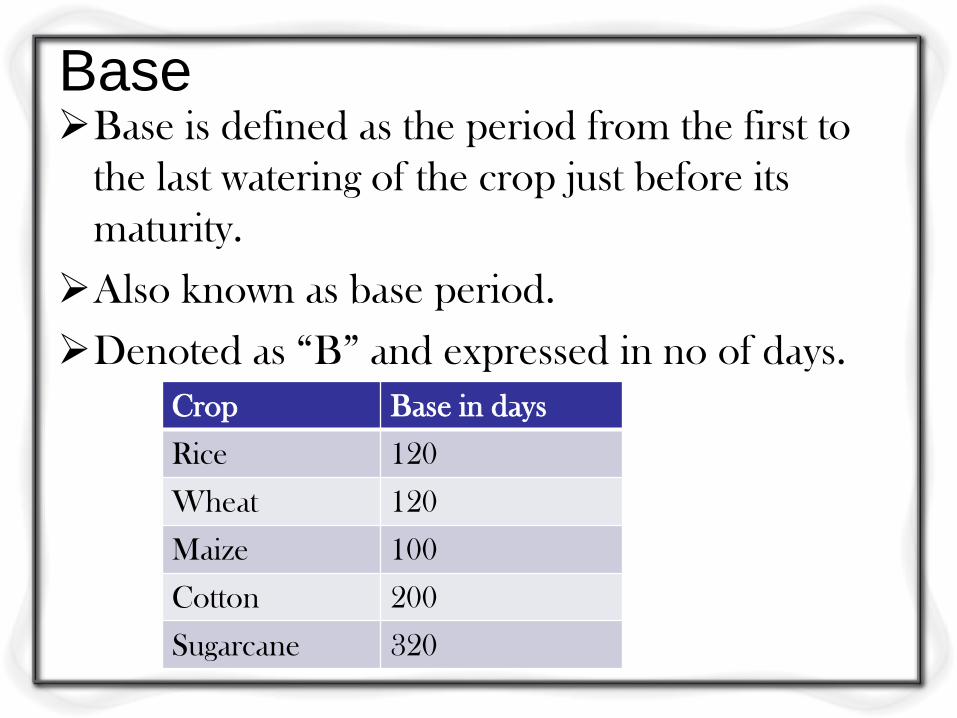
Base Base is defined as the period from the first to
the last watering of the crop just before its
maturity.
Also known as base period.
Denoted as “B” and expressed in no of days.
Crop Base in days
Rice 120
Wheat 120
Maize 100
Cotton 200
Sugarcane 320
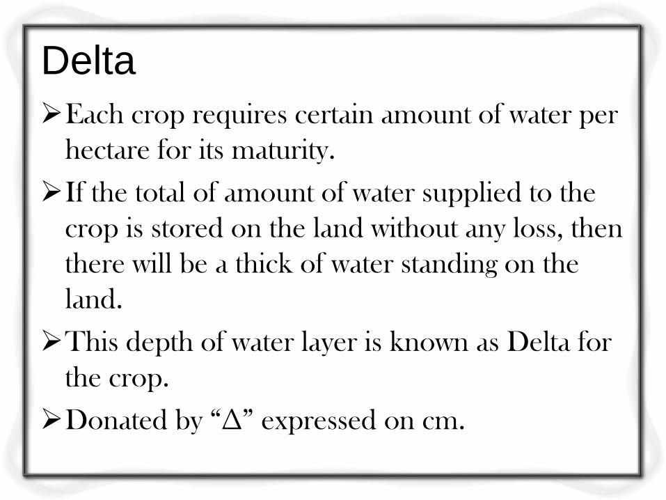
Delta
Each crop requires certain amount of water per
hectare for its maturity.
If the total of amount of water supplied to the
crop is stored on the land without any loss, then
there will be a thick of water standing on the
land.
This depth of water layer is known as Delta for
the crop.
Donated by “∆” expressed on cm.
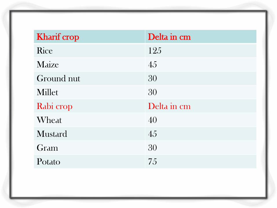
Kharif crop Delta in cm
Rice 125
Maize 45
Ground nut 30
Millet 30
Rabi crop Delta in cm
Wheat 40
Mustard 45
Gram 30
Potato 75
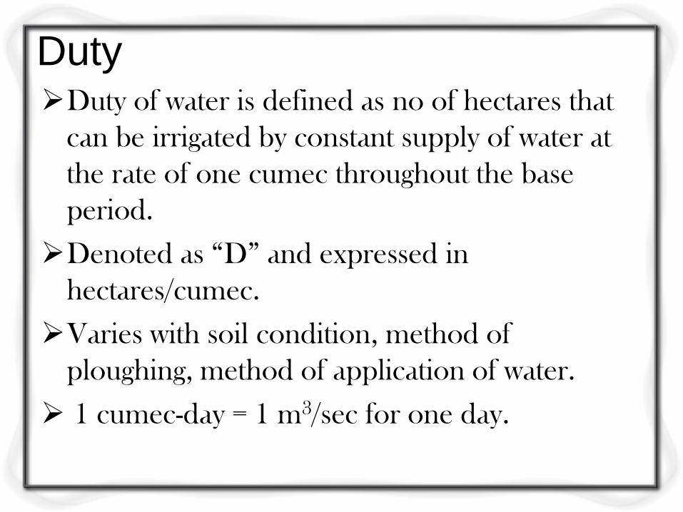
Duty Duty of water is defined as no of hectares that
can be irrigated by constant supply of water at
the rate of one cumec throughout the base
period.
Denoted as “D” and expressed in
hectares/cumec.
Varies with soil condition, method of
ploughing, method of application of water.
1 cumec-day = 1 m3/sec for one day.

Crop Duty in hectares/cumec
Rice 900
Wheat 1800
Cotton 1400
Sugarcane 800
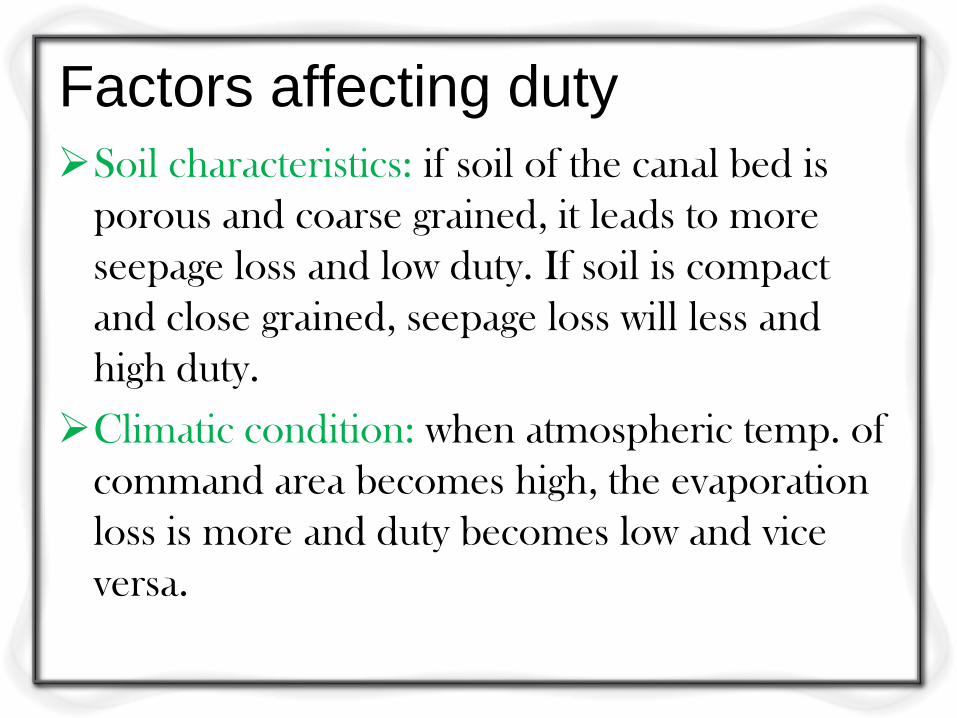
Factors affecting duty
Soil characteristics: if soil of the canal bed is
porous and coarse grained, it leads to more
seepage loss and low duty. If soil is compact
and close grained, seepage loss will less and
high duty.
Climatic condition: when atmospheric temp. of
command area becomes high, the evaporation
loss is more and duty becomes low and vice
versa.
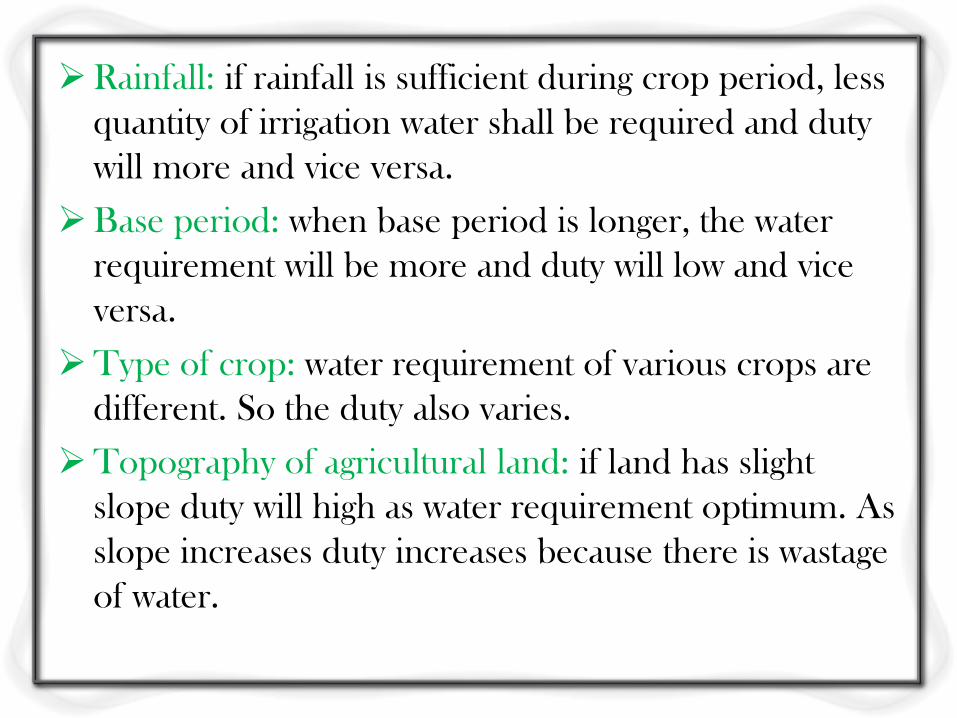
Rainfall: if rainfall is sufficient during crop period, less
quantity of irrigation water shall be required and duty
will more and vice versa.
Base period: when base period is longer, the water
requirement will be more and duty will low and vice
versa.
Type of crop: water requirement of various crops are
different. So the duty also varies.
Topography of agricultural land: if land has slight
slope duty will high as water requirement optimum. As
slope increases duty increases because there is wastage
of water.
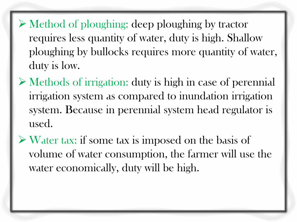
Method of ploughing: deep ploughing by tractor
requires less quantity of water, duty is high. Shallow
ploughing by bullocks requires more quantity of water,
duty is low.
Methods of irrigation: duty is high in case of perennial
irrigation system as compared to inundation irrigation
system. Because in perennial system head regulator is
used.
Water tax: if some tax is imposed on the basis of
volume of water consumption, the farmer will use the
water economically, duty will be high.
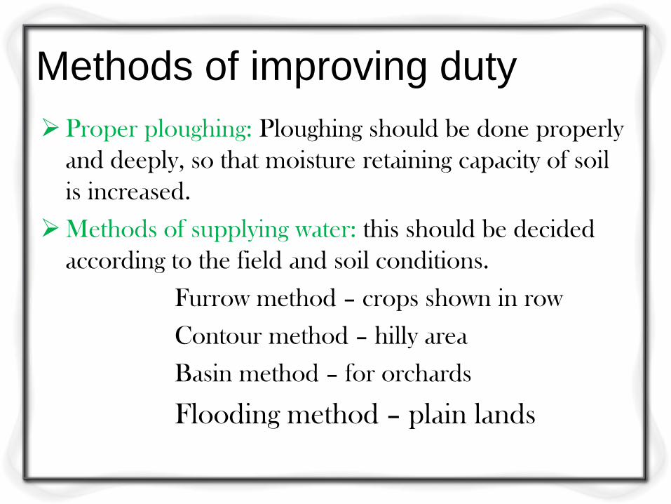
Methods of improving duty
Proper ploughing: Ploughing should be done properly
and deeply, so that moisture retaining capacity of soil
is increased.
Methods of supplying water: this should be decided
according to the field and soil conditions.
Furrow method – crops shown in row
Contour method – hilly area
Basin method – for orchards
Flooding method – plain lands
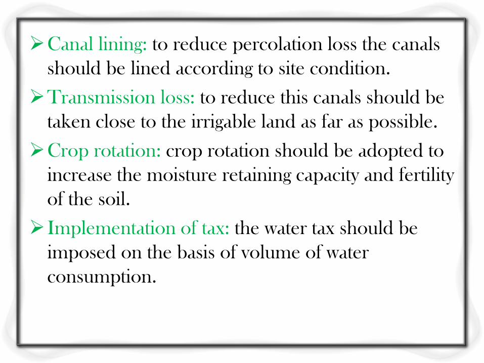
Canal lining: to reduce percolation loss the canals
should be lined according to site condition.
Transmission loss: to reduce this canals should be
taken close to the irrigable land as far as possible.
Crop rotation: crop rotation should be adopted to
increase the moisture retaining capacity and fertility
of the soil.
Implementation of tax: the water tax should be
imposed on the basis of volume of water
consumption.
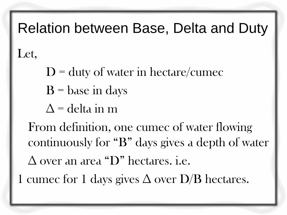
Relation between Base, Delta and Duty
Let,
D = duty of water in hectare/cumec
B = base in days
∆ = delta in m
From definition, one cumec of water flowing
continuously for “B” days gives a depth of water
∆ over an area “D” hectares. i.e.
1 cumec for 1 days gives ∆ over D/B hectares.
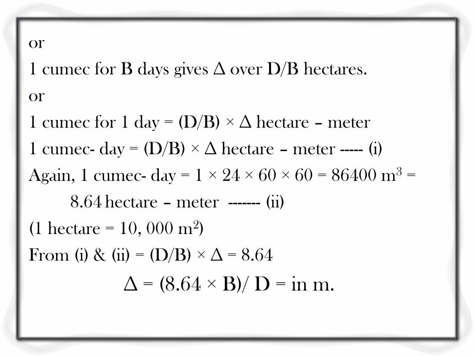
or
1 cumec for B days gives ∆ over D/B hectares.
or
1 cumec for 1 day = (D/B) × ∆ hectare – meter
1 cumec- day = (D/B) × ∆ hectare – meter ----- (i)
Again, 1 cumec- day = 1 × 24 × 60 × 60 = 86400 m3 =
8.64 hectare – meter ------- (ii)
(1 hectare = 10, 000 m2)
From (i) & (ii) = (D/B) × ∆ = 8.64
∆ = (8.64 × B)/ D = in m.
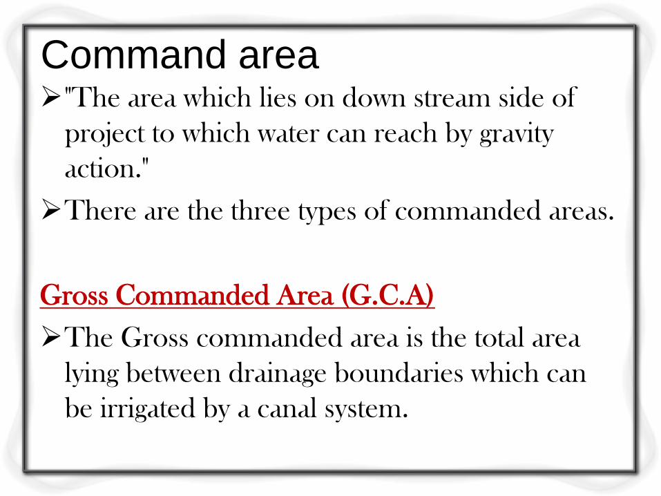
Command area "The area which lies on down stream side of
project to which water can reach by gravity
action."
There are the three types of commanded areas.
Gross Commanded Area (G.C.A)
The Gross commanded area is the total area
lying between drainage boundaries which can
be irrigated by a canal system.
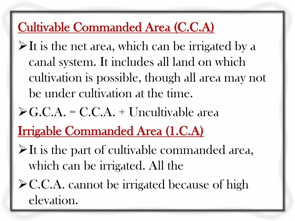
Cultivable Commanded Area (C.C.A)
It is the net area, which can be irrigated by a
canal system. It includes all land on which
cultivation is possible, though all area may not
be under cultivation at the time.
G.C.A. = C.C.A. + Uncultivable area
Irrigable Commanded Area (1.C.A)
It is the part of cultivable commanded area,
which can be irrigated. All the
C.C.A. cannot be irrigated because of high
elevation.
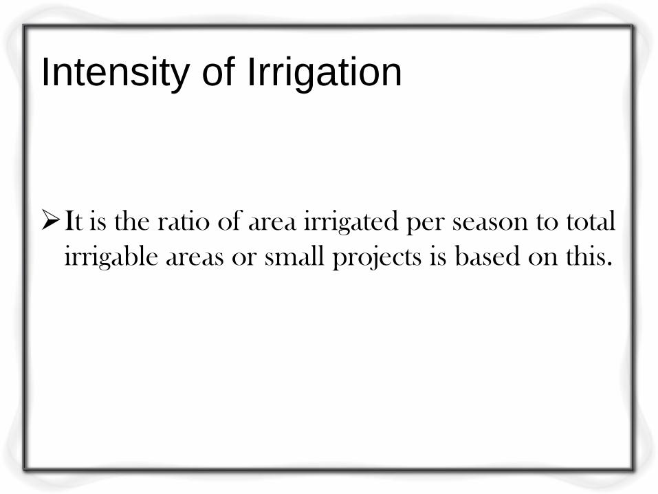
Intensity of Irrigation
It is the ratio of area irrigated per season to total
irrigable areas or small projects is based on this.
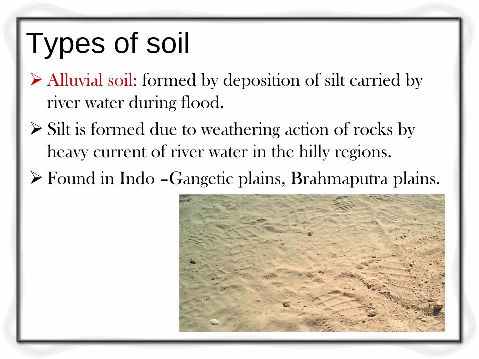
Types of soil Alluvial soil: formed by deposition of silt carried by
river water during flood.
Silt is formed due to weathering action of rocks by
heavy current of river water in the hilly regions.
Found in Indo –Gangetic plains, Brahmaputra plains.
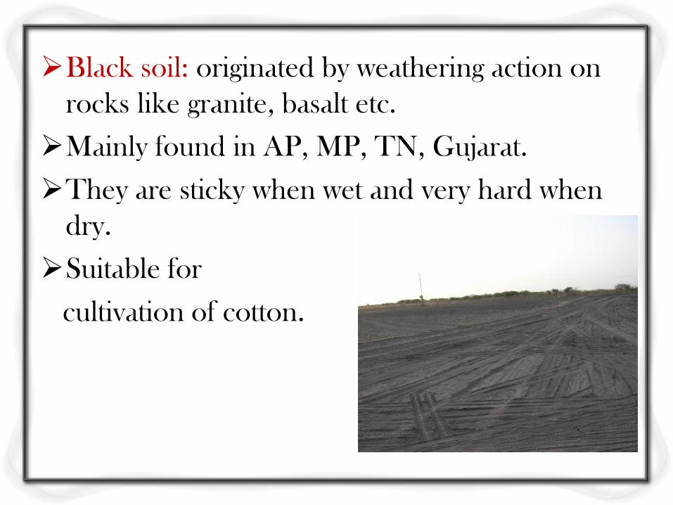
Black soil: originated by weathering action on
rocks like granite, basalt etc.
Mainly found in AP, MP, TN, Gujarat.
They are sticky when wet and very hard when
dry.
Suitable for
cultivation of cotton.
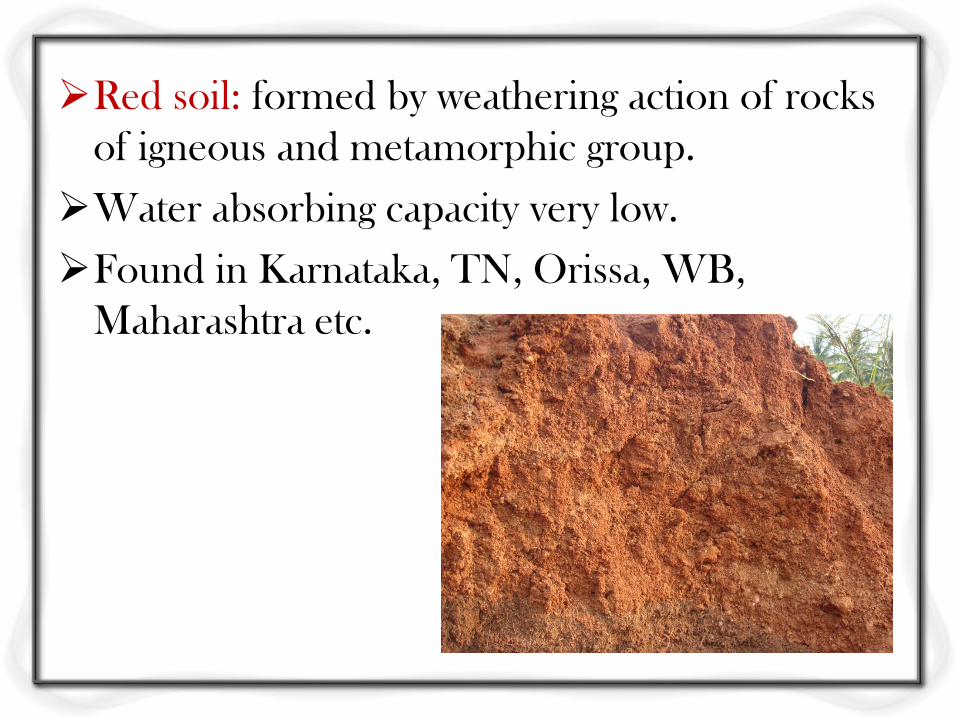
Red soil: formed by weathering action of rocks
of igneous and metamorphic group.
Water absorbing capacity very low.
Found in Karnataka, TN, Orissa, WB,
Maharashtra etc.
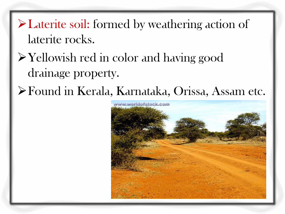
Laterite soil: formed by weathering action of
laterite rocks.
Yellowish red in color and having good
drainage property.
Found in Kerala, Karnataka, Orissa, Assam etc.
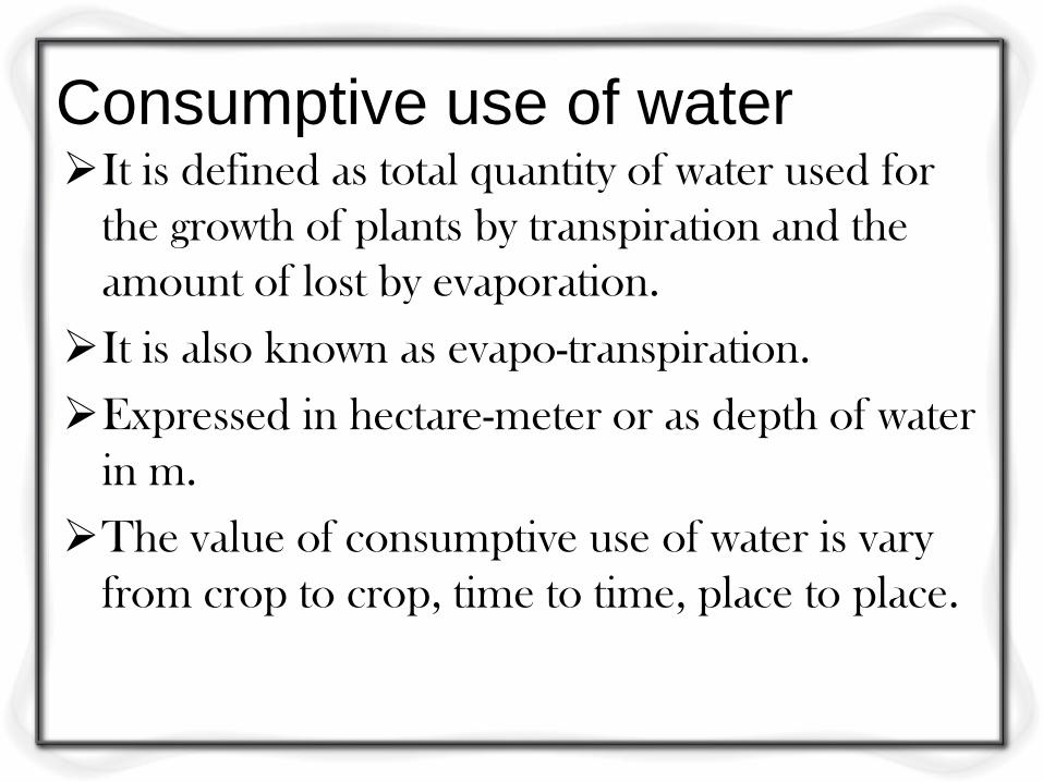
Consumptive use of water It is defined as total quantity of water used for
the growth of plants by transpiration and the
amount of lost by evaporation.
It is also known as evapo-transpiration.
Expressed in hectare-meter or as depth of water
in m.
The value of consumptive use of water is vary
from crop to crop, time to time, place to place.
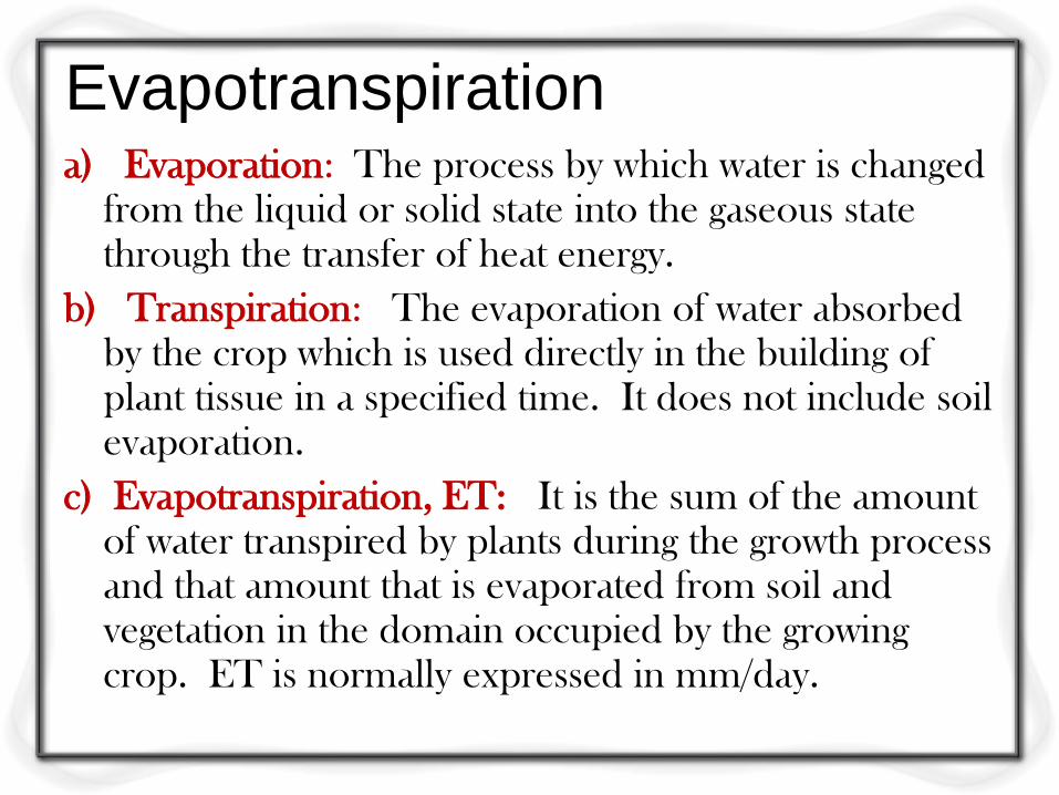
Evapotranspiration a) Evaporation: The process by which water is changed
from the liquid or solid state into the gaseous state through the transfer of heat energy.
b) Transpiration: The evaporation of water absorbed by the crop which is used directly in the building of plant tissue in a specified time. It does not include soil evaporation.
c) Evapotranspiration, ET: It is the sum of the amount of water transpired by plants during the growth process and that amount that is evaporated from soil and vegetation in the domain occupied by the growing crop. ET is normally expressed in mm/day.
Factors that affect Evapotranspiration
Weather parameters
Crop Characteristics
Management and Environmental aspects are factors affecting ET
Weather Parameters:
The principal weather conditions affecting Evapotranspiration are:
Radiation
Air temperature
Humidity and
Wind speed.
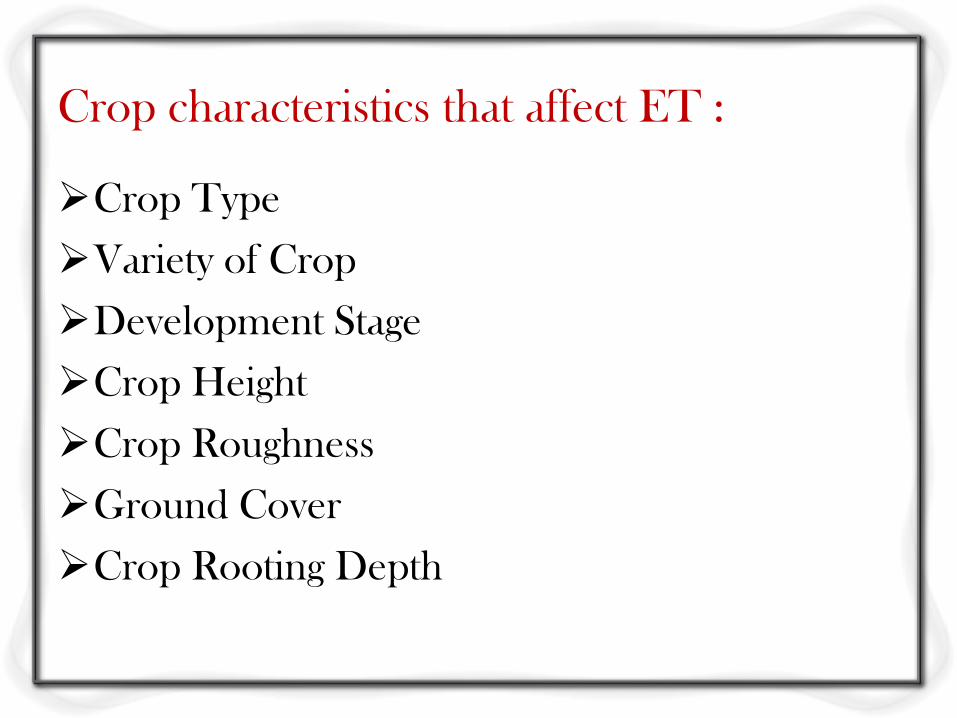
Crop characteristics that affect ET :
Crop Type
Variety of Crop
Development Stage
Crop Height
Crop Roughness
Ground Cover
Crop Rooting Depth
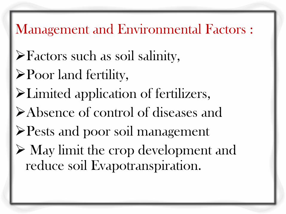
Management and Environmental Factors :
Factors such as soil salinity,
Poor land fertility,
Limited application of fertilizers,
Absence of control of diseases and
Pests and poor soil management
May limit the crop development and reduce soil Evapotranspiration.
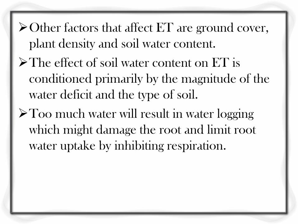
Other factors that affect ET are ground cover,
plant density and soil water content.
The effect of soil water content on ET is
conditioned primarily by the magnitude of the
water deficit and the type of soil.
Too much water will result in water logging
which might damage the root and limit root
water uptake by inhibiting respiration.
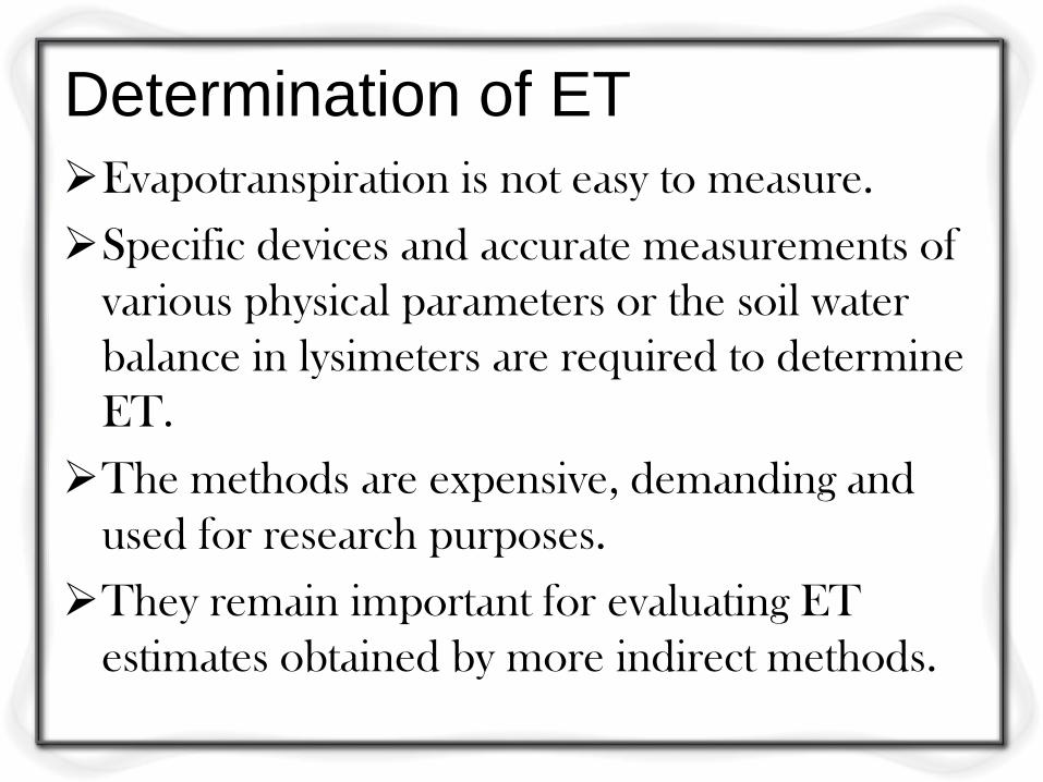
Determination of ET
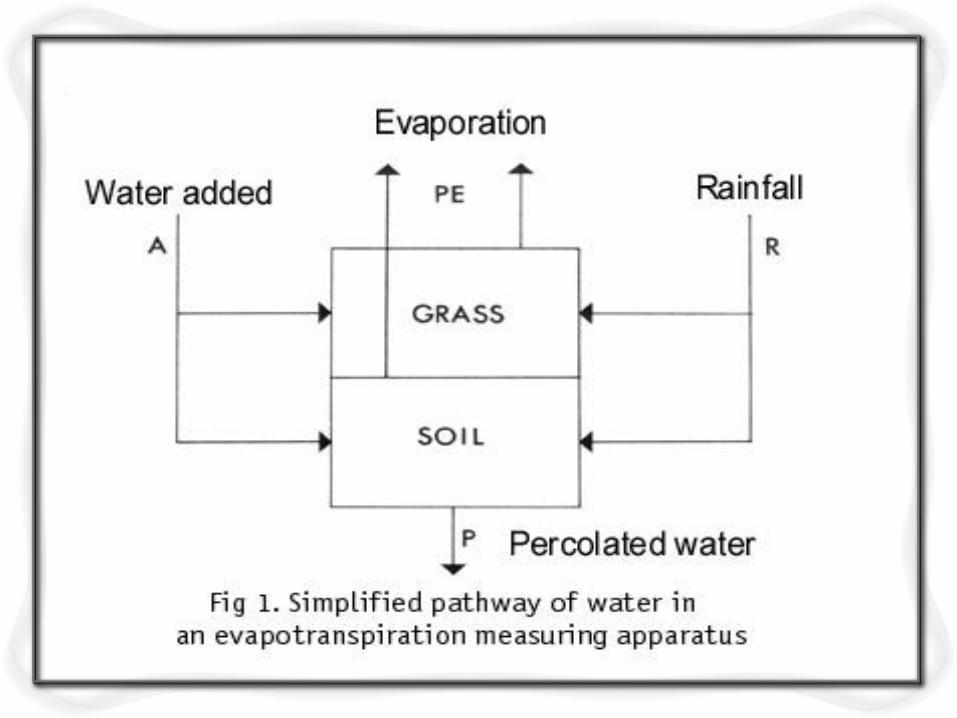
Evapotranspiration is not easy to measure.
Specific devices and accurate measurements of
various physical parameters or the soil water
balance in lysimeters are required to determine
ET.
The methods are expensive, demanding and
used for research purposes.
They remain important for evaluating ET
estimates obtained by more indirect methods.
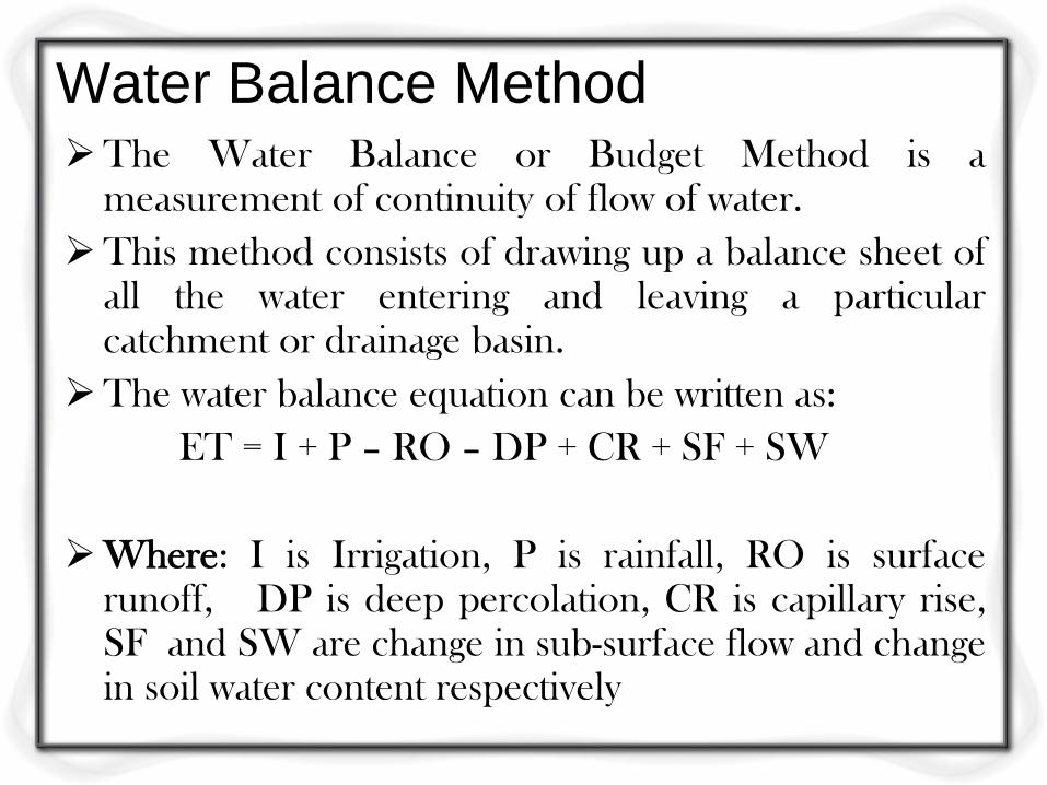
Water Balance Method The Water Balance or Budget Method is a
measurement of continuity of flow of water.
This method consists of drawing up a balance sheet of all the water entering and leaving a particular catchment or drainage basin.
The water balance equation can be written as:
ET = I + P – RO – DP + CR + SF + SW
Where: I is Irrigation, P is rainfall, RO is surface runoff, DP is deep percolation, CR is capillary rise, SF and SW are change in sub-surface flow and change in soil water content respectively
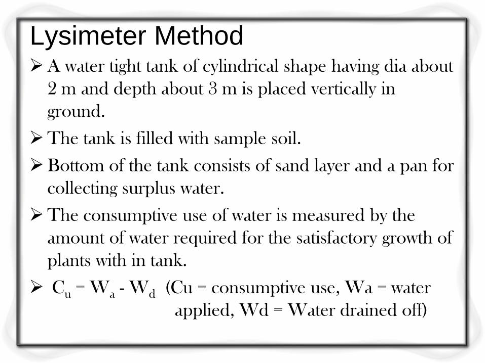
Lysimeter Method A water tight tank of cylindrical shape having dia about
2 m and depth about 3 m is placed vertically in
ground.
The tank is filled with sample soil.
Bottom of the tank consists of sand layer and a pan for
collecting surplus water.
The consumptive use of water is measured by the
amount of water required for the satisfactory growth of
plants with in tank.
Cu = Wa - Wd (Cu = consumptive use, Wa = water
applied, Wd = Water drained off)
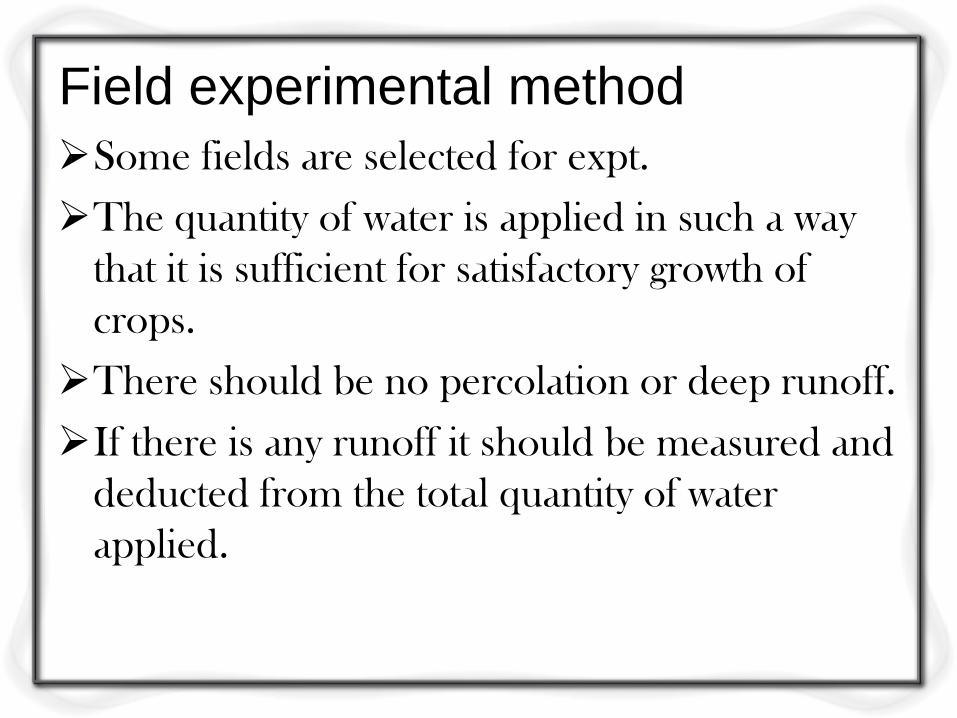
Field experimental method
Some fields are selected for expt.
The quantity of water is applied in such a way
that it is sufficient for satisfactory growth of
crops.
There should be no percolation or deep runoff.
If there is any runoff it should be measured and
deducted from the total quantity of water
applied.
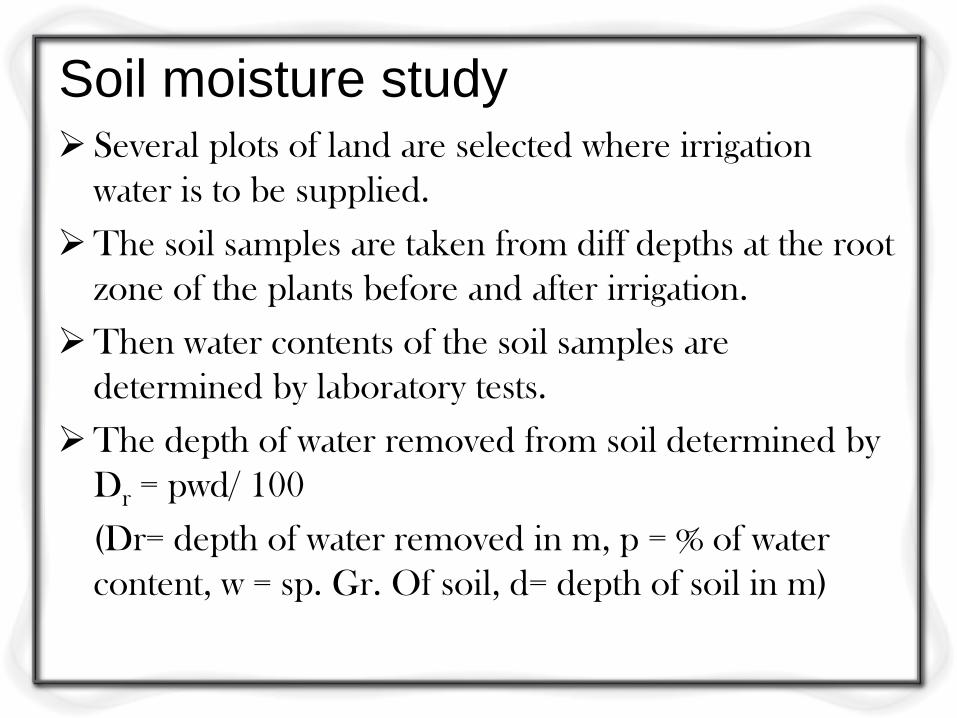
Soil moisture study Several plots of land are selected where irrigation
water is to be supplied.
The soil samples are taken from diff depths at the root
zone of the plants before and after irrigation.
Then water contents of the soil samples are
determined by laboratory tests.
The depth of water removed from soil determined by
Dr = pwd/ 100
(Dr= depth of water removed in m, p = % of water
content, w = sp. Gr. Of soil, d= depth of soil in m)
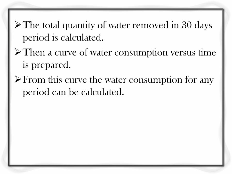
The total quantity of water removed in 30 days
period is calculated.
Then a curve of water consumption versus time
is prepared.
From this curve the water consumption for any
period can be calculated.
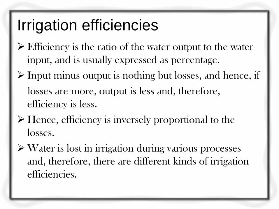
Irrigation efficiencies
Efficiency is the ratio of the water output to the water
input, and is usually expressed as percentage.
Input minus output is nothing but losses, and hence, if
losses are more, output is less and, therefore,
efficiency is less.
Hence, efficiency is inversely proportional to the
losses.
Water is lost in irrigation during various processes
and, therefore, there are different kinds of irrigation
efficiencies.
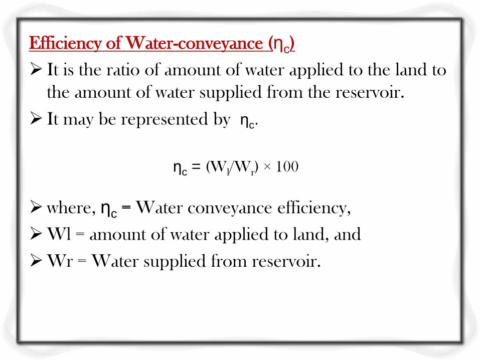
Efficiency of Water-conveyance (ηc)
It is the ratio of amount of water applied to the land to
the amount of water supplied from the reservoir.
It may be represented by ηc.
ηc = (Wl/Wr) × 100
where, ηc = Water conveyance efficiency,
Wl = amount of water applied to land, and
Wr = Water supplied from reservoir.
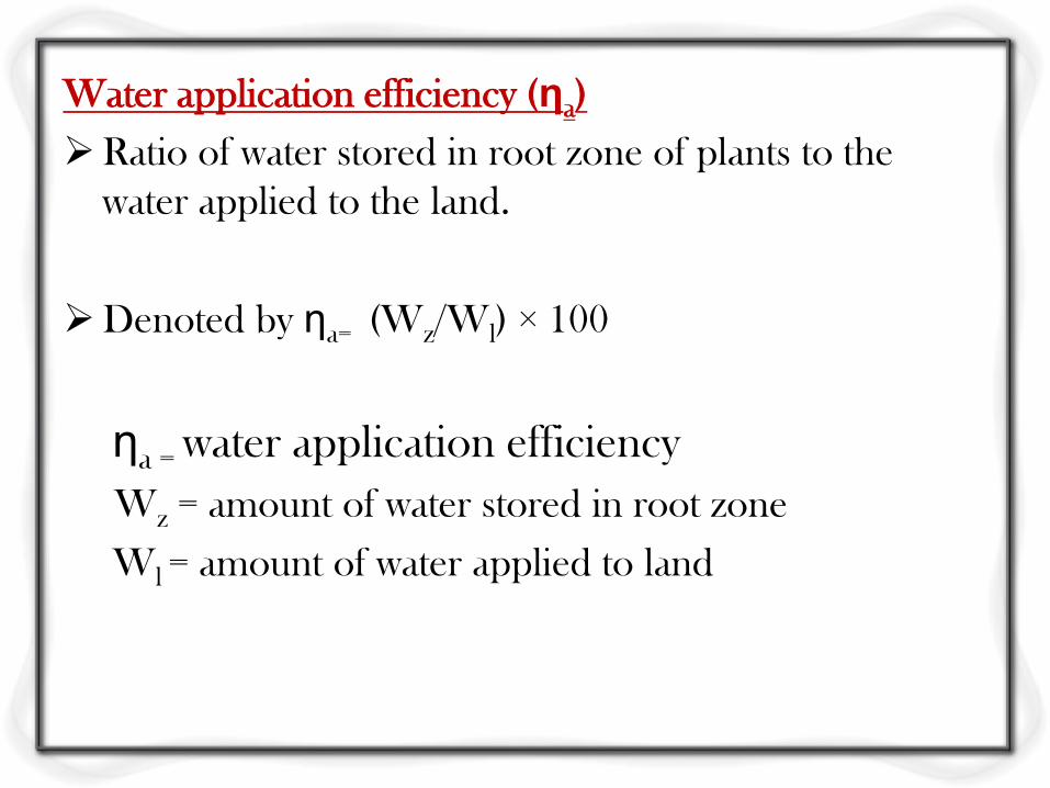
Water application efficiency (ηa)
Ratio of water stored in root zone of plants to the
water applied to the land.
Denoted by ηa= (Wz/Wl) × 100
ηa = water application efficiency
Wz = amount of water stored in root zone
Wl = amount of water applied to land
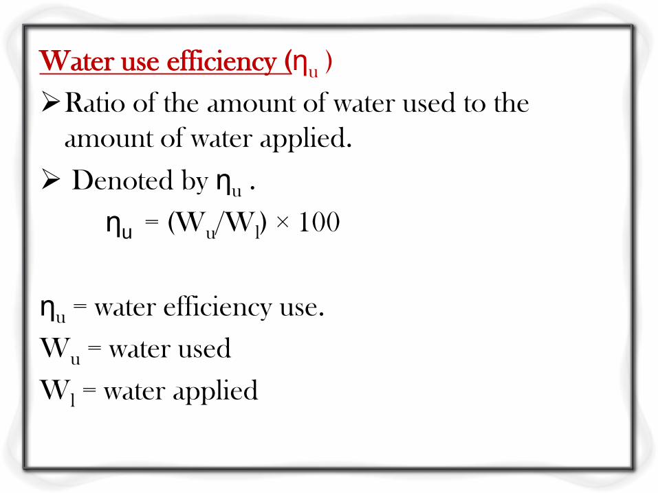
Water use efficiency (ηu )
Ratio of the amount of water used to the
amount of water applied.
Denoted by ηu .
ηu = (Wu/Wl) × 100
ηu = water efficiency use.
Wu = water used
Wl = water applied
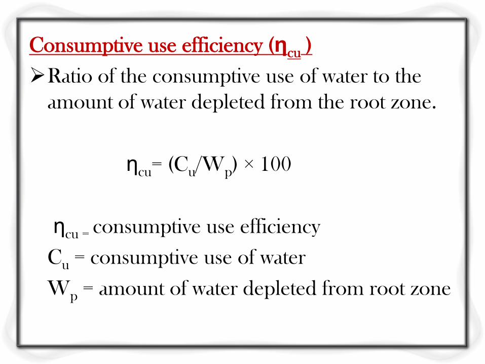
Consumptive use efficiency (ηcu )
Ratio of the consumptive use of water to the
amount of water depleted from the root zone.
ηcu= (Cu/Wp) × 100
ηcu = consumptive use efficiency
Cu = consumptive use of water
Wp = amount of water depleted from root zone
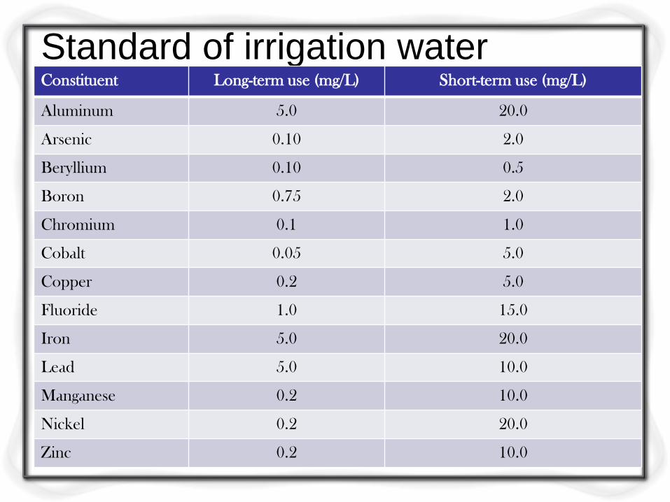
Standard of irrigation water Constituent Long-term use (mg/L) Short-term use (mg/L)
Aluminum 5.0 20.0
Arsenic 0.10 2.0
Beryllium 0.10 0.5
Boron 0.75 2.0
Chromium 0.1 1.0
Cobalt 0.05 5.0
Copper 0.2 5.0
Fluoride 1.0 15.0
Iron 5.0 20.0
Lead 5.0 10.0
Manganese 0.2 10.0
Nickel 0.2 20.0
Zinc 0.2 10.0
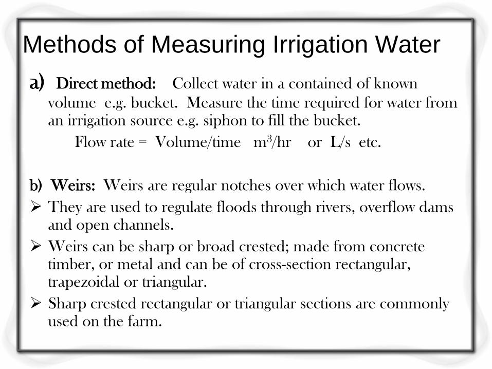
Methods of Measuring Irrigation Water
a) Direct method: Collect water in a contained of known
volume e.g. bucket. Measure the time required for water from an irrigation source e.g. siphon to fill the bucket.
Flow rate = Volume/time m3/hr or L/s etc.
b) Weirs: Weirs are regular notches over which water flows.
They are used to regulate floods through rivers, overflow dams and open channels.
Weirs can be sharp or broad crested; made from concrete timber, or metal and can be of cross-section rectangular, trapezoidal or triangular.
Sharp crested rectangular or triangular sections are commonly used on the farm.
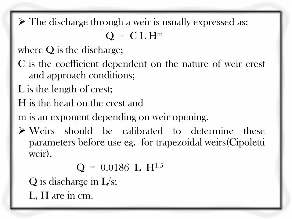
The discharge through a weir is usually expressed as:
Q = C L Hm
where Q is the discharge;
C is the coefficient dependent on the nature of weir crest and approach conditions;
L is the length of crest;
H is the head on the crest and
m is an exponent depending on weir opening.
Weirs should be calibrated to determine these parameters before use eg. for trapezoidal weirs(Cipoletti weir),
Q = 0.0186 L H1.5
Q is discharge in L/s;
L, H are in cm.
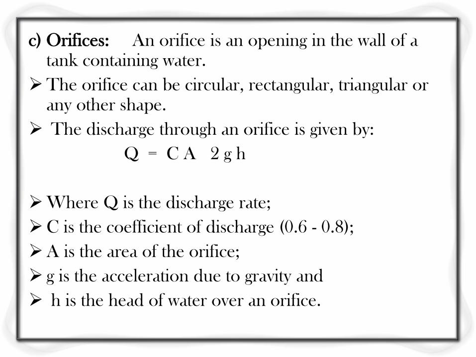
c) Orifices: An orifice is an opening in the wall of a tank containing water.
The orifice can be circular, rectangular, triangular or any other shape.
The discharge through an orifice is given by:
Q = C A 2 g h
Where Q is the discharge rate;
C is the coefficient of discharge (0.6 - 0.8);
A is the area of the orifice;
g is the acceleration due to gravity and
h is the head of water over an orifice.
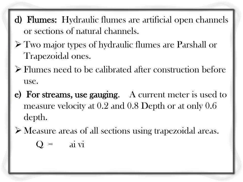
d) Flumes: Hydraulic flumes are artificial open channels
or sections of natural channels.
Two major types of hydraulic flumes are Parshall or
Trapezoidal ones.
Flumes need to be calibrated after construction before
use.
e) For streams, use gauging. A current meter is used to
measure velocity at 0.2 and 0.8 Depth or at only 0.6
depth.
Measure areas of all sections using trapezoidal areas.
Q = ai vi
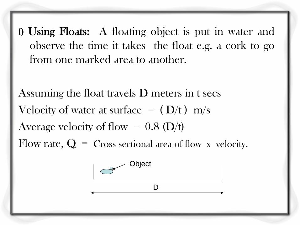
f) Using Floats: A floating object is put in water and
observe the time it takes the float e.g. a cork to go
from one marked area to another.
Assuming the float travels D meters in t secs
Velocity of water at surface = ( D/t ) m/s
Average velocity of flow = 0.8 (D/t)
Flow rate, Q = Cross sectional area of flow x velocity.
D
Object