investigating coral bleaching using real data coral bleaching using real data introduction coral...
TRANSCRIPT

Investigating Coral Bleaching Using Real Data
IntroductionCoral reefs are incredibly diverse and important ecosystems. Yet current
estimates show that 19% of all coral reefs are beyond recovery and
another 15% are in critical condition and may die within 10 to 20 years1.
Middle school students will use the authentic learning environment of
coral reefs and real data to monitor coral bleaching events in order to
determine what is happening to the health of coral reefs in the world's
oceans. They will also learn about and consider the importance of coral
reefs in their own lives.
Table of ContentsLesson Overview......................................................................................3
Coral Bleaching Basics............................................................................4
Using the Technology...............................................................................6
Standards..................................................................................................7
Level 1: Coral Reefs, Satellites, and Sea Surface Temperature................9
Level 2: Monitoring Coral Reefs - Establishing a Baseline....................23
Level 3: Degree Heating Weeks - Duration and Intensity Matter...........57
Level 4: Citizen Scientists Mission - In Search of Evidence..................76
Level 5: Design Your Own Investigation ...............................................86
1 Wilkinson, C. 2008. Status of the Coral Reefs of the World: 2008. Townsville, Australia. Global Coral Reef Monitoring Network and Reef and Rainforest Research Centre.
SummaryFive lessons at increasing
levels of sophistication
incorporate real data from the
National Oceanic and
Atmospheric Administration
(NOAA) to help students
understand coral bleaching.
Grade Level: 6-8
Aligned to Next Generation
Science Standards. See
page 7.

NODE Pedagogical ApproachThe NOAA Ocean Data Education (NODE) project was designed to help
teachers develop skills to access and use real scientific data in order to
integrate more data usage into instructional practices. To accomplish this,
the designers present real online data as part of a systems approach to
learning. In the development of the original National Science Education
Standards, the National Research Council recommended that programs
designed for middle and high school students incorporate ways in which
students can utilize the concept of systems to organize how they
understand and manipulate the natural world .
Students need to learn how to interpret phenomena beyond separate
components and to see the world in terms of an interactive system about
which they can gather information and to which they can apply data.
Many times students do not recognize the differences between parts of a
system and whole systems. Many sources of scientific data are available
on the Internet, but often these data tools have not been successful in
presenting ways to integrate isolated information into an overall system.
In response, the NODE project materials tightly connect the use of online
data tools to specific curriculum activities.
Further, the development of NODE curriculum modules and the choice
of scientific topics have been driven by compelling “stories” that
highlight and dramatize the importance of systems at work. Students will
use actual research stories to study both the natural and human initiated
events that influence our oceans. These stories will illustrate the need for
manipulating real data to monitor these interactions.
The importance of a compelling research story cannot be overestimated.
The story provides a common experience within which students and
teachers can build knowledge and manipulate scientific tools. The real
story context creates an incentive for students to practice core subjects
and share what they learn with others, especially through the virtual
world of the Internet.
Investigating Coral Bleaching Using Real Data 2

Lesson OverviewThis curriculum incorporates a scaled approach to learning. Each module
offers activities at five different levels of student interaction, sometimes
referred to as Entry, Adoption, Adaptation, Interactivity, and Invention.
The early levels are very directed and teacher driven, providing
structured first steps, important when learning new concepts. The levels
of Adaptation through Invention are more student directed and open up
opportunities for student inquiry. The following chart illustrates the five
levels of this module.
5 Invention: Design Your Own Investigation: Students will design an investigation and use real data to try to answer a research question of their choosing.
4 Interactivity: Citizen Scientists Mission - In Search of Evidence: Students will use knowledge and satellite data skills gained in the first three levels to identify data needed to support a simple hypothesis.
3 Adaptation: Degree Heating Weeks: Duration and Intensity Matter: Students will examine how stress on corals depends not only on temperature rise, but also on the duration of time the coral is subjected to temperature anomalies.
2 Adoption: Monitoring Coral Reefs - Establishing a Baseline: This lesson invites students to become “citizen scientist” scuba divers to learn how researchers monitor coral reef health over time and in situ in assigned reef locations.
1 Entry: Coral Reefs, Satellites, and Sea Surface Temperature (SST): Students will become citizen scientists to explore stress on corals that results in coral bleaching. Students begin by examining temperature ranges needed for corals to survive and use maps to read sea surface temperature data collected from satellites.
The levels serve a dual purpose. They are designed to engage students in
increasingly sophisticated modes of understanding and manipulating
data. They are also intended to help you, as a teacher, familiarize
yourself with online tools for accessing real data and to provide you with
models for integrating the use of this data into your classroom practice.2
The levels provide a natural opportunity for you to adapt and customize
2 For more information about the research behind this approach, consult these papers: Dwyer, D. C., Ringstaff, C., & Sandholtz, J. H. (1990). Teacher beliefs and practices, Part I: Pattern of change. ACOT Report # 8. Cupertino, CA: Apple Classroom of Tomorrow Advanced Technology Group, Apple Computer, Inc. Bransford, J.D., Goin, L., Hasselbring, T.S., Kinzer, C.K., Sherwood, R.D., & Williams, S.M. (1999). Learning with technology: Theoretical and empirical perspectives. Peabody Journal of Education. 5-26.
Investigating Coral Bleaching Using Real Data 3

the curriculum module as needed. For example, if students already have
experience with the topic, you may find that you can skip the entry level
activities.
Coral Bleaching BasicsCoral reefs and the extraordinary biodiversity they support are under
thermal stress, which can result in a phenomenon called coral bleaching.
Only one thing causes coral bleaching on a regional or global scale, and
that is sea surface temperature! When the water gets hot and stays hot,
corals will bleach.
Reef-building corals do need warm, tropical water. Generally, most
corals cannot grow in oceans where the water temperature dips below
18°C (64°F) for extended periods in the winter. But how warm is too
warm? Scientists discovered that corals start getting stressed if the water
gets only 1°C warmer than the highest temperature expected in the
summer. This temperature is called the "bleaching threshold," because
the stress caused by warmer-than-normal water can cause the corals to
bleach.
What happens to coral when it bleaches? Each polyp in the coral
community has tiny algae, called zooxanthellae, that grow in the polyp's
body tissue. Normally, these algae absorb energy from the sun and use it
for photosynthesis. When the water gets too warm, however, these plants
cannot use the sun's energy as efficiently. The algae turn this excess
energy from sunlight into chemicals that can damage them and their host
polyps. While polyps normally need the zooxanthellae, they have to get
rid of them to survive the temperature stress. As a result, a polyp will
expel most of the zooxanthellae from its body. The polyp's body tissue is
transparent, and the rock underneath it is white, so when the
zooxanthellae are expelled, what you see is the polyp's white skeleton
instead of the normal golden-brown of the zooxanthellae that were in the
interconnecting tissue. Because the entire coral soon looks pale or white,
we say that it is "bleached."
Investigating Coral Bleaching Using Real Data 4
Web LinksFor links to helpful websites
about coral bleaching, visit
dataintheclassroom.noaa.gov.

Climate LiteracyClimate plays an essential role in the overall health of coral reefs. School
curricula usually point out the differences between weather and climate,
with weather being specific atmospheric conditions expected for a
location in the short-term future, whereas climate shows long-term
averages of conditions in the atmosphere or oceans, which are described
by statistics such as means and extremes. The Coral Bleaching Module
examines coral health over a long period of time. The module integrates
Climate Literacy, The Essential Principles of Climate Sciences 3 by
NOAA partners as a guide to understand how climate can influence coral
health seasonally or change reef health due to extreme events over time.
The appropriate Essential Principle is referenced in the Teacher pages for
you to consider.
Assessment StrategiesEach activity level (Levels 1 through 5) is designed around specific
performance tasks based on Common Core Standards (CCS). CCS stress
that students need authentic learning experiences to prepare presentations
using multimedia graphs, maps, video, and text, which support their
claims and findings. Common Core Standards used in the Coral
Bleaching Module are listed at the end of this guide. These Standards
provide a way for teachers to judge and measure student progress.
For example, in Level 2, students meet CCS WHST.6-8.2 Write
informative/explanatory texts to examine a topic and convey ideas,
concepts, and information through the selection, organization, and
analysis of relevant content. (MS-LS2-2)
In addition, individual activities (Levels 4 and 5) include student self-
assessments and peer review opportunities so that students can give
feedback and guidance on each other’s designs.
3 Climate Literacy, The Essential Principles of Climate Sciences; March 2009, A Climate-Oriented Approach for Learners of All Ages, US Global Change Research Program.
Investigating Coral Bleaching Using Real Data 5

Using the TechnologyTeaching using technology presents some challenges. Because this
curriculum demonstrates strategies for using real scientific data available
on the Internet, its use assumes that you and your students will have
access to the Internet at some point during the investigation. Because the
level and availability of Internet access varies widely from setting to
setting, however, you may need to adapt the activities to suit your
particular situation. To help you, the activities are designed to be flexible.
For example:
When access to real data is needed, the Preparation section
describes steps that can be performed outside of class. Data and
results can be saved for use in class.
Data can be accessed through the dataintheclassroom.noaa.gov
website using special forms that have been designed for this
project. While it is recommended that you familiarize yourself
with how to access data using these tools, the early lessons also
contain blackline masters of important maps, graphs, and other
data products, which can be used in settings where live Internet
access is not available.
An important outcome of these activities, especially at the higher
levels, is for students to learn how to access and manipulate data
themselves. In the ideal case, students will access the Internet
individually or in groups in order to generate maps and graphs
using real data. In settings where this is not possible, the
curriculum provides student masters, which can be reproduced
and used in class. To fully explore the questions posed in the
highest level activities, however, students in these settings will
need to access the Internet in a library or computer center outside
of class.
Investigating Coral Bleaching Using Real Data 6
About the DataData utilized in this
curriculum was developed by
NOAA's Coral Reef Watch.
The mission of Coral Reef
Watch is to utilize remote
sensing and in situ tools for
near-real-time and long-term
monitoring, modeling, and
reporting of physical
environmental conditions of
coral reef ecosystems.

StandardsAll NODE modules follow guiding principles found in the Next Generation Science Standards (NGSS)* and Common Core State Standards**. They are
based on the notion of learning as a developmental progression. Coral Bleaching activity levels are designed to address the NGSS and Common Core in
the following ways:
Investigating Coral Bleaching Using Real Data
Performance Expectations
NGSS MS-LS2 Ecosystems: Interactions, Energy, and Dynamics
MS-LS2-1: Analyze and interpret data to provide evidence for the effects of resource availability on organisms and populations of organisms in an ecosystem.
MS-LS2-4: Construct an argument supported by empirical evidence that changes to physical or biological components of an ecosystem affect populations.
Common Core ELA-Literacy: Science and Technical Subjects
RST.6-8.7: Integrate quantitative or technical information expressed in words in a text with a version of that information expressed visually (e.g., in a flowchart, diagram, model, graph, or table). Suggestion: Encourage students to synthesize information from data products generated online into their own representations (e.g. time series, charts comparing two locations, etc.).
Common Core ELA-Literacy: Writing
WHST.6-8.2 Write informative/explanatory texts, including the narration of historical events, scientific procedures/ experiments, or technical processes. Suggestion: Encourage students to document the research process in their own words.
WHST.6-8.7 Conduct short research projects to answer a question (including a self-generated question), drawing on several sources and generating additional related, focused questions that allow for multiple avenues of exploration. Suggestion: If students are having trouble formulating their own research questions, refer them to model questions used in earlier activities.
* NGSS Lead States. 2013. Next Generation Science Standards: For States, By States. Washington, DC: The National Academies Press. Next Generation Science Standards is a registered trademark of Achieve. Neither Achieve nor the lead states and partners that developed the Next Generation Science Standards was involved in the production of, and does not endorse, this product.
** National Governors Association Center for Best Practices, Council of Chief State School Officers Title: Common Core State Standards. Publisher: National Governors Association Center for Best Practices, Council of Chief State School Officers, Washington D.C. Copyright Date: 2010.
Investigating Coral Bleaching Using Real Data 7

Science and Engineering Practices Disciplinary Core Ideas Crosscutting Concepts
Analyzing and interpreting data: students read and interpret remote sensing data products (Levels 1 & 3); students interpret data from in-situ monitoring simulation (Level 2); students interpret data products generated to investigate a research question (Levels 4 & 5).
Developing and using models: students engage in role play to model data gathering techniques for in-situ monitoring of corals (Level 2).
Using mathematics and computational thinking: students develop a working definition of temperature “anomalies, and use a Degree Heating Week calculator to examine the relationship of derived DHW to satellite-collected sea surface temperature data (Level 3).
Constructing explanations and designing solutions: students develop presentations to communicate findings from their data gathering (Levels 4 & 5).
Engaging in argument from evidence: students present data in support of a research question (Levels 4 & 5).
Obtaining, evaluating, and communicating information: students construct query to select and generate remote sensing data products (Levels 1 & 3); students record, evaluate, and report on findings from in-situ monitoring simulation (Level 2); students develop presentations to communicate findings from their data gathering (Levels 4 & 5).
Planning and carrying out investigations: students design their own investigation using real data to try to answer a research question of their choosing (Level 5).
LS2.A: Interdependent Relationships in Ecosystems: students construct models to understand the symbiotic relationship of corals and zooxanthellae (Level 2) .
LS2.C: Ecosystem Dynamics, Functioning, and Resilience: students examine evidence from in-situ coral monitoring to assess changes in the population over time (Level 2); students examine how temperature anomalies contribute to accumulated thermal stress in corals (Level 3); students generate data products to investigate whether ecosystem changes produce conditions for thermal stress at coral locations (Level 4); students design their own investigation using real data to to examine factors related to thermal stress in coral ecosystems (Level 5).
Patterns: Observed patterns of forms and events guide organization and classification, and prompt questions about relationships and the factors that influence them (Levels 1 & 2).
Systems and System Models: Defining the system under study - specifying its boundaries and making explicit a model of that system - provides tools for understanding and testing ideas that are applicable throughout science and engineering (Level 3).
Scale, Proportion, and Quantity: In considering phenomena, it is critical to recognize what is relevant at different measures of size, time, and energy and to recognize how changes in scale, proportion, or quantity affect a system's structure or performance (Level 4).
Stability and Change: For natural and built systems alike, conditions of stability and determinants of rates of change or evolution of a system are critical elements of study (Level 5).
Investigating Coral Bleaching Using Real Data 8

Level 1: Entry Coral Reefs, Satellites, and Sea Surface Temperature (SST) The study of coral reefs will provide an authentic learning environment
for students to access and interpret data collected by remote sensing
satellites. The activities in these lessons will prepare students to monitor
corals using real data as a way to examine what is happening to the
health of corals on a global scale.
Objectives Students will identify coral reef ecosystems, their locations, and
their importance.
Students will examine temperature ranges needed for coral reefs
to survive.
Students will use false-color maps to read sea surface
temperature data collected from satellites.
Students will color code a map to represent isotherms.
Focus Questions What are we investigating and why should we care?
Where are coral reefs located?
What tools do I need to examine coral health?
Climate LiteracyClimate is determined by the long-term pattern of temperature and
precipitation averages and extremes. Climate descriptions can refer to
areas that are local, regional, or global (CL4A)4.
4 Climate Literacy: The Essential Principles of Climate Science, Second Version: March 2009. http://www.globalchange.gov/browse/educators
Investigating Coral Bleaching Using Real Data 9
Summary Grade Level: 6-8
Teaching Time:
Two 45-minute periods

Background (Teacher)Coral reefs face numerous hazards and threats both globally and locally.
In this study, we will focus on the threat of mass coral bleaching
produced by rising sea surface temperatures.
Students begin their study of coral bleaching by identifying the location
of coral reefs, typically in climate zones between 30° N and 30° S
latitudes. They will also establish why coral reefs are naturally adapted to
conditions in these zones, where water temperatures typically range from
18°C to 29°C.
Once students locate the reefs, they will look at sea surface temperature
(SST) data to identify any patterns and changes in water temperature.
To monitor SST on a large scale, students will use data from instruments
on orbiting satellites that measure infrared radiation from the ocean
surface. These data can be represented on maps. Students will map
temperature zones by examining lines on the maps, called isotherms,
which connect areas of the same temperature. They will use colors to
represent temperature zones, producing what is called a false-color map,
to make it easier to see and measure relative differences in SST.
Once students learn to access and read satellite-generated maps of SST,
they will use them to identify and track stresses causing coral bleaching.
Vocabulary Climate - the long-term 30-year average of conditions in an area—
atmosphere, oceans, ice sheets—described by statistics, such as means
and extremes.
Coral Reef - a seafloor biological community that forms a solid
limestone (calcium carbonate) structure, built upon many generations of
dead coral. The predominant organisms in most reef communities are
corals.
Investigating Coral Bleaching Using Real Data 10

False-Color Map - an image that uses colors, rather than true
appearance, to represent differences in measured values. The color is
“false” in that the land, water, or other surface shown is not really the
color on the map.
Isotherm - a line connecting areas of equal temperature.
Range - determined by upper and lower limits. All living things have a
range of conditions in which they thrive. Corals thrive within a
temperature range of 18°C to 29°C.
Remote Sensing – measuring the property of something without
touching it.
Sea Surface Temperature - the average temperature at the uppermost
layer of the ocean, only a few millimeters deep. Sea surface temperature,
often referred to as SST, can be globally monitored through satellite
remote sensing.
Weather - The specific conditions of the atmosphere at a particular place
and time, measured in terms of variables that include temperature,
precipitation, cloudiness, humidity, air pressure, and wind.
Investigating Coral Bleaching Using Real Data 11

Activity 1: Identifying and Mapping Coral Reef Locations
Preparation If you have access to a computer and projector, you can display a color
version of the SST maps you create online. Use the following steps:
1. Visit www.dataintheclassroom.noaa.gov, and find the Coral Bleaching
module.
2. Follow the link to "Get Data."
3. You will be requesting data for the region displayed on the map. Using
the controls on the left side of the map, zoom out until the map displays
the entire Earth.
3. Select "Sea surface temperature" under "Which dataset?"
4. Using the form, specify the date 15-July-2014.
5. Select “Map” on the menu labeled "Which view?"
6. Select an output format: Image.
7. Click the "Get Data" button.
8. Save the map to your computer. On a PC, right click with the mouse
and select "Save as...." On a Mac, hold down the Ctrl key and click with
the mouse.
Alternatively, you can save a master from page XYZ for display using a
projector.
Procedure1. Pass out a copy of Student Master 1.1: Calling Citizen Scientist
Researchers! to each student. Have the students read the invitation to
Investigating Coral Bleaching Using Real Data 12
Materials Computer, whiteboard, or
projector
Student Master 1.1: Calling
Citizen Scientist
Researchers! (1 per
student)
Teacher Master 1.1: World
Coral Reef Locations
saved to computer
Student Master 1.2: World
Coral Reef Locations (1 per
student)
Teacher Master 1.2:
Monthly Average Sea
Surface Temperature
Student Master 1.3:
Monthly Average Sea
Surface Temperature (with
Isotherms) (1 per student)
Colored pencils

study coral health. Explain that that they are being invited to find
evidence to identify reasons why coral reef health is declining on a
global scale. In order to do this, they will learn where coral reefs are
located and explore the biotic and abiotic characteristics of their
environment.
2. Project an image of Teacher Master 1.1: World Coral Reef
Locations. Point out that coral reefs are distributed around the planet,
but only in limited locations. Ask students the following questions about
reef locations and record student answers.
Where do the reefs seem to be located?
Possible answer:
waters near the shore or on either side of the equator
Where do corals seem to be absent?
Possible answers:
large areas on the west coast of South and Central America, and
the west coast of Africa
upper part of the North American continent, Greenland, Asia,
and to the south near Antarctica
3. Distribute Student Master 1.2: World Coral Reef Locations to each
student. Challenge students to use latitude and longitude to locate the
listed coral reefs on the map. Review how to read latitude and longitude.
x axis = longitude, degrees east and west of the prime meridian.
y axis = latitude, degrees north and south of the Equator.
Ask students to answer the questions regarding coral reef location at the
bottom of the master.
Review with students the answers to the questions:
Where are corals located?
Between what latitudes do most corals live?
Investigating Coral Bleaching Using Real Data 13

Possible answers: Corals live in the tropical climate zone, which is
determined by the distance north and south of the Equator (between 30°
N and 30° S latitude).
Then ask:
Why do you think corals are limited to certain locations on the planet?
Possible answers:
water too cold or too hot
water too shallow
water too deep
not enough sunlight
too much salt
too much sediment in the water
Tell students that they have hit on some of the major physical factors that
limit coral reef development: depth, light, salinity, sedimentation, the
emergence of coral into air, and temperature.
4. Display Teacher Master 1.2: Monthly Average Sea Surface
Temperature on a whiteboard or computer screen. Explain that the map
has been generated using real data collected from orbiting satellites using
a technology called remote sensing.
Tell students that they will compare and relate the maps of coral reef
locations with the map of sea surface temperatures.
Introduce the map’s key features by pointing them out on the screen:
x axis = longitude, degrees east and west of the prime meridian.
y axis = latitude, degrees north and south of the Equator.
Isotherms are connected lines of equal temperature.
The temperatures indicated by each isotherm are measured in
degrees Celsius.
On the color map, the color key at the right also indicates
temperatures in degrees Celsius.
Investigating Coral Bleaching Using Real Data 14

5. Tell students that they will create a color-coded SST map, also known
as a false-color map. They will then answer questions that demonstrate
their ability to read and interpret the false-color maps.
Give each student a copy of Student Master 1.3: Monthly Average Sea
Surface Temperature. Ask students to use colored pencils to color code
the regions on the map defined by each isotherm. The isotherms are
already labeled in degrees Celsius. Students should begin by choosing
colors to represent bands of temperature on the scale to the right of the
map. Traditionally, warmer temperatures are represented in shades of red
while cooler temperatures are blue or purple.
Ask students to use their completed maps to answer the four questions on
the master. Review the answers with students.
Answers:
1. b. degrees north and south of the equator
2. 28°C
3. 24°C
4. 23°C - 27°C
6. Compare the SST map that students colored with the SST map you
displayed.
Ask: How are the maps alike and how are they different? Hint: Look at
the size of the areas of high temperature.
7. Discuss the following questions:
How can using satellite data help researchers to study water conditions
over time?
Possible answer:
Track changes in SST from one year to another and look for
patterns.
Investigating Coral Bleaching Using Real Data 15

Why is it important for researchers to look at data for more than one year
to determine sea surface temperature changes?
Possible answer:
Using SST satellite data from different time periods can show
trends and how the climate changes over time.
8. Discuss the following reflection questions (Level 1 Focus Questions):
What are we investigating and why should we care?
Where are coral reefs located?
What tools do I need to examine coral health?
9. Once students are comfortable reading maps, they can use the online
“Get Data” tool to examine more sea surface temperature data. If you
have Internet access in class, go to dataintheclassroom.noaa.gov and
repeat the Preparation procedure with different dates to generate and
discuss new maps.
Have students consider changes that occur in sea surface temperature at
different times of the year, such as winter compared to summer.
Tell students to generate additional maps from different seasons and
discuss.
Investigating Coral Bleaching Using Real Data 16

Student Master 1.1
Calling Citizen Scientist Researchers!
Dear Citizen Scientist Researcher:
Are you fascinated by coral reefs where every surface, nook, and cranny is bursting with life? These oases of life are found near the Equator, where sunlight and sea surface temperature are fairly even throughout the year.
But there’s a problem! Something is happening to the health of coral reefs around the planet. Scientists estimate that 10 percent of all coral reefs are degraded beyond recovery and 30 percent are in critical condition and may die within 10 to 20 years.
What's going on?
Is the problem caused by local threats, such as overfishing, destructive fishing practices, nutrient runoff, sedimentation, and anchors from boats ripping into the corals? Or is something much bigger at work, a global threat of coral bleaching linked to rising sea surface temperature?
Why should you care? You may not even live near a coral reef or the ocean!
The health of coral reefs can be used to study changes in our climate over time. Changes in the climate may influence us all, no matter where we live. As you research coral health, see if you can identify more reasons why you should care about the reef systems.
What can we do?
We need you to investigate. Your challenge is to use real-time sea surface temperature (SST) satellite data and in situ, right on the coral reef, observations to find evidence to answer this question:
What are the consequences of rising sea surface temperature on coral reefs, and why should you care?
How can you get started?
You will analyze and interpret data streams from instruments on orbiting satellites, which measure infrared radiation from the ocean surface. These powerful tools are at your fingertips, allowing you to monitor corals and figure out what is happening to coral health over time.
You will collect evidence for this scientific problem by learning to monitor globally, locally, and regionally using the power of satellites, scuba gear, maps, and your love of coral reefs. Are you ready?
Welcome to the NOAA Ocean Data Education (NODE) Project. Get ready to start exploring!
Investigating Coral Bleaching Using Real Data 17

Teacher Master 1.1
World Coral Reef Locations
Investigating Coral Bleaching Using Real Data 18

Student Master 1.2
World Coral Reef Locations
Investigating Coral Bleaching Using Real Data 19

Student Master 1.2
World Coral Reef Locations (continued)Directions: Locate each listed coral reef by latitude and longitude and mark it with an "X" on the map.
Location Latitude Longitude
Buzios, Brazil 22.5°S 41.5°W
Cayman Islands 19.5°N 80.5°E
Puerto Rico 18.0°N 67.5°W
Dry Tortugas, Florida 24.5°N 83.0°W
Galapagos, Ecuador 1.0°S 90.0°W
Hilo, Big Island, Hawaii 2.0°N 154.5°W
North Torres Reef, Great Barrier Reef 10.5°N 141.5°E
Red Sea 25°N 38°E
Questions: 1. Where are corals located?
2. Between what latitudes do most corals live?
Investigating Coral Bleaching Using Real Data 20

Teacher Master 1.2
Monthly Average Sea Surface Temperature
Investigating Coral Bleaching Using Real Data 21

Student Master 1.3
Monthly Average Sea Surface Temperature (with Isotherms)
1. Lines of latitude indicate: a. degrees of temperature b. degrees north and south of the equator c. areas of equal temperature d. representations of color to indicate temperature
2. What was the monthly average temperature at 160° E and 10°N?
3. What was the monthly average temperature along 100° W and 10° S
4. What is the range in monthly average temperature along the line 10°S between 150°E and 100°E?
Investigating Coral Bleaching Using Real Data 22

Level 2: Adoption Monitoring Coral Reefs - Establishing a BaselineThis teacher-led lesson invites students to become “Citizen Scientist”
scuba divers to monitor corals in situ in actual assigned reef locations
over a period of years. The lesson will introduce students to coral reef
biology, how to identify conditions of stress in coral reefs, and how
researchers monitor coral reef health.
Objectives Students will learn about the particular susceptibility of corals to
stress caused by changes in temperature.
Students will understand the basic processes behind coral
bleaching.
Students will learn how to establish baseline information.
Focus Questions What does a healthy coral reef look like?
Why is the process of symbiosis important to the health of
corals?
What is coral bleaching?
How do scientists monitor the health of a coral reef?
Why is the collection of baseline data important?
Climate LiteracyOrganisms survive in specific ranges of temperature, precipitation,
humidity, and sunlight. Organisms exposed to climate conditions outside
their normal range must adapt or migrate, or they will perish (CL 3a)5.
5 Climate Literacy: The Essential Principles of Climate Science, Second Version: March 2009. http://www.globalchange.gov/browse/educators
Investigating Coral Bleaching Using Real Data 23
Summary Grade Level: 6-8
Teaching Time:
Three 45-minute periods

Background (Teacher)As highlighted in the previous lesson, part of the value of remote sensing
is that sea surface temperature data can be analyzed over large areas to
determine patterns and changes in reef system health. However,
researchers also need to monitor coral reefs in situ, or right at the reef
site. In this lesson, students will learn that part of the value of monitoring
corals in situ is the ability to ground-truth remote satellite data and
establish baselines.
In order to monitor coral bleaching and establish baseline data in situ,
students need an introduction to coral biology, which includes the
important process of symbiosis between corals and certain algae. Use the
following information to explain to students the symbiotic relationship
between corals and algae during Step 3 of the Procedure. Corals are
animals that have a close relationship with plants, algae called
zooxanthellae, which live within the coral polyp and give the coral its
color. In this partnership, the plants (zooxanthellae) and the animals
(coral polyps) rely on each other for survival. The coral polyp gets much
of its food energy from the zooxanthellae, and the zooxanthellae, in turn,
get a safe place to live and the nutrition they need to grow. The
zooxanthellae also help recycle the coral’s carbon dioxide and waste.
When two species form a partnership with one another, the relationship
is called symbiosis.
Because of the symbiotic relationship between coral and zooxanthellae,
coral reefs, the largest skeletal structures built by animals, are very
successful. But despite their success, corals are subject to environmental
stresses, such as prolonged high sea surface temperatures, that can affect
the symbiotic process.
Under the environmental stress of rising water temperature, coral polyps
may expel the zooxanthellae from their bodies. The affected coral colony
appears to whiten or lose its color. This is called coral bleaching. If the
bleaching persists over a long period of time, the lack of algae and food
stresses the coral, slowing growth and eventually killing the polyps.
Investigating Coral Bleaching Using Real Data 24

Introduce the three activities in this lesson:
Activity 2.1: Building a Model Coral Head
Activity 2.2: How to Establish a Baseline and Monitor a Coral
Reef Location
Activity 2.3: Citizen Scientist Researchers Coral Reef
Monitoring Simulation
Vocabulary Algae – plant or plant like chlorophyll-containing non-vascular
organisms.
Baseline Data - a quantitative level or value from which other data and
observations of a comparative nature are referenced.
Climate Variability - natural ranges in climate that fall within the
normal range of extremes for a particular region, as measured by
temperature and the frequency of precipitation events.
Coral Bleaching - loss of zooxanthellae due to stress caused by
increased sea surface temperature.
In situ - on site at an actual location.
Monitoring - sampling and measuring something in the environment
(air, water, soil, vegetation, animals) over time and comparing findings
with baseline samples.
Mutualism - mutually beneficial association between two species of
organism.
Pin Site - coral location where scientists make repeated visits to observe
coral health.
Polyp - a single coral organism that secretes calcite, which forms a
corallite shell or skeleton. Many polyps together make up a coral colony.
Investigating Coral Bleaching Using Real Data 25

Quadrat Sampling - a classic tool for the study of ecology; in general, a
series of squares of a set size are placed in a habitat, and the species
within those quadrats are identified and recorded.
Symbiosis - a relationship between two species of organisms in which
both members benefit from the association (mutualism), in which only
one member benefits but the other is not harmed (commensalism), or in
which one member benefits at the expense of the well-being of the other
(parasitism).
Temperature - important abiotic factor affecting distribution and
abundance of organisms; influences metabolic rate and affects rate of
growth and reproduction.
Zooxanthellae - a group of dinoflagellates living endosymbiotically in
association with one or a variety of invertebrate groups (e.g., corals). In
corals, they provide carbohydrates through photosynthesis, which are one
source of energy for coral polyps. They also provide coloration for corals
and help corals recycle waste materials.
Investigating Coral Bleaching Using Real Data 26

Activity 2.1: Building a Model Coral Head
Students build model coral polyps and a coral head to learn about
the structure and biological interactions of coral polyps and the
ongoing symbiosis in the coral community.
Preparation1. Download a copy of Teacher Master 2.1.1: Cross-Section of a
Coral Polyp for computer projection. Alternatively, you can make a
transparency of the master.
2. Build a bulletin board display of a coral reef. Before students
construct their individual coral polyp models, prepare a space on a
bulletin board to display built coral heads. Title the bulletin board
display: What Is Coral Bleaching? Turn white egg cartons upside down
with the bottom cups facing up, and cut a hole in each cup the diameter
of a paper towel roll. Staple sets of egg cartons on opposite sides of the
bulletin board. Label one side "Living Coral” and the other side
“Bleached Coral.” The egg cartons represent the skeletal structure where
students will attach their coral polyp models to make coral heads. The
"living" coral head will contain colored twisted tissue paper surrounding
the coral polyps attached by the students. The “bleached” coral skeletal
remains of the polyps will have no soft body parts, only white twisted
tissue paper woven around the egg carton cups attached by students.
Note: To make different coral head shapes (branching, boulder, plate, or
fleshy coral) for the insertion of student made polyps, refer to Student
Master 2.2.1: Coral Reef Monitoring Sheet for ideas.
Procedure1. Display Teacher Master 2.1.1: Cross-Section of a Coral Polyp on a
computer screen and use the bulletin board display "What Is Coral
Bleaching?" as a teaching tool for the model coral heads presentation.
2. Point out key features of the coral polyp using the master image:
Investigating Coral Bleaching Using Real Data 27
Materials Bulletin board
White egg cartons
Paper towel rolls cut into 3
sections (1 per student)
Construction paper
divided in half (1/2 per
student)
Colored pencils (green)
Long balloons (4 per
student)
Colored and white tissue
paper
Scotch tape
Teacher Master 2.1.1:
Cross-Section of a Coral
Polyp
Student Master 2.2.1: Coral
Reef Monitoring Sheet
(from Activity 2.2, for teacher
reference only)
Student Master 2.1.1: Build
a Model Coral Head (1 per
student)

The coral polyp is an animal that has tentacles, mouth, gut, body
cavity, interconnecting tissues, and a limestone skeleton.
The coral polyp is mostly transparent with no pigment of its
own.
At night, tentacles come out of the polyp and capture food.
During the day, the tentacles move into the body cavity.
The inside wall of the polyp is attached to the outside wall with
interconnecting tissue.
Zooxanthellae live in the walls of the interconnecting tissue.
Limestone builds up where the polyp secretes calcite, forming
the reef skeleton.
The skeleton houses millions of polyps on a reef system. (Point
out the egg cartons representing the reef structure in the bulletin
board display.)
3. Review with students the information in Teacher Background about
the symbiotic relationship between coral polyps and microscopic algae
called zooxanthellae. The zooxanthellae live in the polyp’s
interconnective tissue (point this out on the projected image) and use
photosynthesis to make food from sunlight, water, and carbon dioxide,
which the polyp and zooxanthellae share.
4. Tell students that they will build a model of a coral polyp. Distribute
Student Master 2.1.1: Build a Model Coral Head. Follow the
directions on the master.
5. Once students have assembled their coral polyp models, ask them to:
Identify the coral polyp structure.
Explain the process of the symbiotic relationship between corals
and zooxanthellae.
Explain why the process of symbiosis helps keep the coral reef
healthy.
6. Divide the students into teams and have each team attach their coral
polyps to a coral head represented by one egg carton on the "Living
Investigating Coral Bleaching Using Real Data 28

Coral" side of the bulletin board.
7. Have students recall what they learned about sea surface temperature
in the satellite mapping activity. Ask:
What is the average temperature range corals need to live?
Answer: 18°C to 29°C
Make a label for the bulletin board, “Water Temperature: Range 18°C to
29°C.” Attach it to the "Living Coral" side of the board.
8. Ask students what they think would happen if the sea surface
temperature rose above 29°C by 1° or more.
For one hour?
For 2 days?
For 2 months?
Explain that when the water is too warm the coral polyp expels the
zooxanthellae. Ask:
What happens when the zooxanthellae are no longer inside of the coral?
Possible answers:
They can't carry on photosynthesis to feed the coral and take
away the polyp’s waste products.
The color of the coral is lost and it turns white.
The coral is under stress.
The coral and zooxanthallae are no longer in a symbiotic
relationship.
Explain that the loss of the zooxanthallae leads to coral bleaching. The
zooxanthallae are the source of the coral’s color. So when coral polyps,
under environmental stress, expel the symbiotic zooxanthellae from their
bodies, the affected coral colony appears to whiten. If the bleaching
persists, the lack of algae and food stresses the coral, restricting growth
Investigating Coral Bleaching Using Real Data 29

and eventually bleaching the polyps. Point to the right side of the board
that contains the bleached coral.
9. Have the students look at the model coral reef on the bulletin board.
Ask:
Is there any evidence of serious coral bleaching anywhere on the
display?
Possible answers:
On the “Bleached Coral” side, there is no color, only the polyp
skeletons.
Make another label for the bulletin board, “Water Temperature: 1°C
Higher Than Highest Summer Temperature.” Attach it to the “Bleached
Coral” side of the board.
10. As a class, go over the Discussion Questions from Master 2.1.1.
Why are coral polyps important to coral health?
Why is the symbiotic relationship between animal and plant important to
coral health?
Possible answers:
When two species form a partnership with one another, the
relationship is called symbiosis.
The coral polyp gets much of its food energy from the
zooxanthellae, and the zooxanthellae, in turn, get a safe place to
live and the nutrition they need to grow.
The zooxanthellae help recycle the coral’s carbon dioxide and
waste.
Investigating Coral Bleaching Using Real Data 30

Activity 2.2: How to Establish a Baseline and Monitor a Coral Reef Location
Students learn how to examine an actual in-situ coral reef monitoring site
using a coral health key needed to determine coral color and a
monitoring sheet needed to record baseline information.
PreparationDownload the images of Teacher Master 2.2.1: Coral Quadrat
Example and Teacher Master 2.2.1b Bleached and Unbleached Coral
Examples to be projected from your computer.
Procedure1. Project Teacher Master 2.2.1b Unbleached and Bleached Coral
Examples. Point out the differences between the bleached coral example
and the healthy coral example. Guide students to understand that Image 1
shows a golden color, indicating it is living, while Image 2 is white,
indicating the coral is bleached. Explain that the students will be
learning how to identify corals under stress of bleaching in the next
activity just like researchers do.
2. Project the Teacher Master 2.2.1: Coral Quadrat Example. Ask
students to examine the coral quadrat and describe the area. Write down
all responses and add anything the students miss.
Possible descriptions:
There are 9 quadrats, or the image is divided into 9 sections.
There are corals in all quadrats.
One large coral is in quadrat #5.
There are different shaped corals.
There are different colored corals.
Under the coral, there seems to be the same kind of material,
maybe coral skeleton/polyps.
Latitude and longitude are shown.
The name of the coral reef site is listed.
Investigating Coral Bleaching Using Real Data 31
Materials Teacher Master 2.2.1: Coral
Quadrat Example
Teacher Master 2.2.2:
Unbleached and Bleached
Coral Examples
Student Master 2.2.1: Coral
Reef Monitoring Sheet
(1 per student)
Student Master 2.2.2: Coral
Health Key (1 per student)

Ask students: Do you see any other living organisms beside corals?
Answer: Yes, algae surrounding coral
How many different colors of corals do you see?
Answer: Accept any number of colors
3. Tell students they are going to learn how to conduct a baseline study
of a coral reef. Pass out the tools students will use to explore the values
included in the baseline: Student Master 2.2.1: Coral Reef Monitoring
Sheet and Student Master 2.2.2: Coral Health Key.
4. Explain to students that they will fill in the Student Master 2.2.1:
Coral Reef Monitoring Sheet recording observations from the
projected coral quadrat image with the data it contains.
To begin tell students to fill in the “Site name” and “Citizen
Scientists’ names ”that refer to their school and themselves on
the Coral Monitoring sheet.
Have students fill in the “Reef name and location” which is La
Parguera, Puerto Rico at 18.05 N latitude and 67.05 W. longitude
found on the projected image.
Use the date from the image (No exact time is given).
Add Pin # 123 on the monitoring sheet. The Pin or Tag number
indicates that the coral site has been monitored in the past and
has observations already recorded from a different date that can
be used to compare new readings.
5. Next, tell students that they will use Student Master 2.2.2: Coral
Health Key to monitor and log in information regarding the coral sample
and color code on Student Master 2.2.1: Coral Reef Monitoring Sheet.
Explain that the Coral Health Key is a four-sided card with a different
color of coral on each side, either lighter or darker in color to represent
degrees of coral health. Emphasize that corals with color are considered
healthy.
Investigating Coral Bleaching Using Real Data 32

Procedure for using the Coral Health Key:
Choose a random coral in quadrate #5 featured on the projected
coral quadrat image.
Look at the coral and select an area.
Hold the Coral Health Key next to the selected area and find the
closet color match.
Record the identified coral and coral color on the Student Master
2.2.1 Coral Reef Monitoring Sheet in the 3 column data box:
◦ Coral Number, Quadrat 5
◦ Color Code, B1 or B2
◦ Coral Type: Boulder
6. Continue the monitoring activity by discussing theese questions:
Look at quadrat # 5. Is there any evidence of coral stress or bleaching?
What are your observations?
Possible answers:
The boulder coral has a B1 reading taken with the Coral Health
Key. This "light" color might indicate possible future coral
stress, including bleaching.
Do any other quadrats show colors found on the Coral Health Key?
Possible answers:
Quadrat #4 has a smaller boulder coral that has a reading of
B1. Part of the coral in quadrat #5 has the same reading.
Are the corals in quadrats #4 and #5 living? Declining? Dead? Do you
need to conduct further monitoring to answer this question?
Possible answers:
We need to examine more samples at the site, at different times
taking earlier quadrat readings before the image we are
observing or conducting a future monitoring to see if the corals
changed.
Investigating Coral Bleaching Using Real Data 33

How does in situ monitoring, or being at an actual reef site, help
scientists establish a baseline to use for future comparisons?
Possible answers:
Scientists need to establish a baseline reading at the site, in
order to assess what is going on at the time, but also to compare
the baseline reading to future yearly monitoring events to see if
change is taking place.
Investigating Coral Bleaching Using Real Data 34

Activity 2.3: Citizen Scientist Researchers Coral Reef Monitoring Simulation
Students simulate a field survey in which they become Citizen Scientist
Researchers, checking and monitoring the health of corals in assigned
reef locations over a period of years. This interactive activity assesses
students’ ability to apply their knowledge of coral reef biology and coral
monitoring techniques, as they record quantitative baseline data and
make predictions of possible coral bleaching events.
PreparationNote: This activity can be approached in two different ways, depending
on the grade level: 1. Simulated dive to In-Situ or Pin sites as activity
features, or 2. Pin sites displayed on computer for direct student
observations.
1. Print a copy of the coral images in Teacher Master 2.3.1: Coral
Monitoring Image Sets. The locations are:
Set A: Stetson Bank, Pin 26
Set B: Stetson Bank, Pin 37
Set C: Panama, Tag 218
2. Pick three classroom quadrat locations and label them A, B, and C to
correspond with the three image sets.
3. Use masking tape to tack down coral reef image #1 (for the first year)
of each set in the appropriate location.
Note: Teams will monitor their assigned reef site three times during this
activity. Each monitoring event represents a different year. You will need
to change the reef image between each monitoring event.
Investigating Coral Bleaching Using Real Data 35
Materials Teacher Master 2.3.1: Coral
Monitoring Image Sets
(1 per class)
Teacher Master 2.3.2: In
Situ Data Log Sheet with
Locations
Student Master 2.2.1: Coral
Health Key (reuse from
Activity 2.2, at least 1 per
team)
Student Master 2.2.2: Coral
Reef Monitoring Sheet
(copy from Activity 2.2, 3 per
team, one for each dive)
Student Master 2.3.1:
Citizen Scientist Coral
Reef Mission (1 per student)
Clipboards (1 per team)
Safety goggles used as
swim goggles (1 pair for
each student “diver”)
Masking tape

Procedure1. Divide students into three teams and assign each team a coral reef
monitoring site: A, B, or C.
2. Pass out copies of Student Master 2.2.1: Coral Health Key,
Student Master 2.2.2: Coral Reef Monitoring Sheet, and Student
Master 2.3.1: Citizen Scientist Coral Reef Mission, plus a clipboard
and safety goggles (swim goggles) for the team of reef divers.
3. Have students read Student Master 2.3.1: Citizen Scientist Coral
Reef Mission to prepare for the dive to their assigned reef survey site.
Answer any questions students may have.
4. Direct each team to its reef location. Have teams record their Site
Name on the monitoring sheet.
5. Have Citizen Scientists begin their dives to survey their reef sites.
Remind students that each team will monitor their site for three different
years. The first year, the team will collect baseline data, so they can
determine if any changes are taking place in the next two dive years.
Note: To keep track of the three different monitoring years, you may
wish to have students fill in Year 1, Year 2, and Year 3 for the “date of
survey” on the Coral Reef Monitoring Sheet or provide students with
the dates from Teacher Master 2.3.2. In-Situ Data Log Sheet for their
assigned site.
6. Have teams follow the instructions under Multiple Coral Dives to
Coral Location on Student Master 2.3.1, and complete the Coral Reef
Monitoring Sheet for the first year.
7. Change the coral image, and have teams repeat the survey procedure,
for Year 2. Change the image again, and have students complete their
surveys for Year 3. Make sure students work with a new Coral Reef
Monitoring Sheet for each dive.
Investigating Coral Bleaching Using Real Data 36

8. When students have collected data for all three years, ask them to use
their data to answer the questions under Putting Your Data Together on
the master.
9. Discuss team findings as a class by asking the following questions:
What can you tell about the health of your reef from your baseline data?
Give observations.
Possible answer:
You can tell what is happening at that moment in time through
evidence such as coral types, coral color, location, and degree of
coral color.
What can you tell about the health of your reef each year? Present
observations. .
Possible answer:
Because teams are looking at the same location, we will be able
to detect change from year to year.
How does using the quadrat sampling method help monitor the health of
a coral reef?
Possible answer:
Scientists can pinpoint the same precise coral location from one
monitoring time to the next.
From your observations of each year's data, can you tell if your reef has
changed over time?
Possible answer:
Answers will vary; it may stay the same, bleach, or return to
health.
Why is it important to have baseline data to measure if change happens?
Investigating Coral Bleaching Using Real Data 37

Possible answer:
If there is no baseline information, you would only be guessing if
change is taking place.
10. Provide class time for teams to complete the section, Reporting
Your Coral Health Findings, on the master. Then have teams report out
to the class.
Student team class reports must include the following:
What a healthy coral reef looks like
What proof the team has that the reef is healthy
How first year baseline data supported the following years’
findings
What evidence teams found of the consequences of rising and
falling water temperature on coral health.
Note: Remind students to download and project reef images from their
monitoring scenario as part of their class report.
Different outcomes will be seen for each testing site over the three-year
monitoring period. For each monitoring event, the teams will select from
three choices: healthy reef, declining reef, dead reef. Possible outcomes
to choose from within a year are as follows:
Year 1 : healthy reef; : declining reef; : dead reef.
Year 2: healthy reef; : declining reef; : healthy reef.
Year 3: healthy reef; : declining reef; : declining reef.
Investigating Coral Bleaching Using Real Data 38

Teacher Master 2.1.1
Cross-Section of a Coral Polyp
Image: NOAA
Investigating Coral Bleaching Using Real Data 39
Zooxanthellae
interconnecting tissue

Student Master 2.1.1
Build a Model Coral Head 1. Fold a piece of construction paper in half and accordion pleat it. Use a green
colored pencil to draw circles on one side of the paper. These circles represent
zooxanthellae. Zooxanthellae are algae that live inside of corals. They provide
carbohydrates through photosynthesis, which give energy and color to the corals.
2. Hold the ends of the accordion-pleated construction paper together to form a
cylinder with the zooxanthellae on the outside. Next, adjust the cylinder to fit inside
of the paper towel roll. Cut off any excess paper from the top and bottom of the tube.
The accordian-pleated inside of the cylinder forms the gut of the polyp.
3. Tape 4 long un-inflated balloons to the inside of the cylinder at one end. These are the tentacles. The
tentacles feed the coral at night when there is no sun to allow the zooxanthellae to carry out photosynthesis.
4. To build a coral head, insert your coral polyp into the skeletal structure (egg carton) on the What Is Coral
Bleaching? bulletin board display. Put tentacles inside of the polyp to signify day time when the
zooxanthellae is making food. Before leaving class or school, put tentacles outside of the polyp for nighttime
feeding.
Discussion Questions
Why are coral polyps important to coral
health?
Why is the symbiotic relationship
between animal and plant important to
coral health?
Investigating Coral Bleaching Using Real Data 40

Teacher Master 2.2.1
Coral Quadrat Example
Dive date: January 2008
Survey Pin 123
La Parguera, Puerto Rico
18.05 N, 67.05 W
Image: NOAA Center for Coastal Monitoring
and Assessment Biogeography Team
Investigating Coral Bleaching Using Real Data 41

Teacher Master 2.2.2
Unbleached and Bleached Coral Examples
Unbleached CoralImage: Bill Precht, Florida Keys National Marine Sanctuary
Bleached CoralImage: NOAA Center for Coastal Monitoring and Assessment Biogeography Team
Investigating Coral Bleaching Using Real Data 42

Student Master 2.2.1
Coral Health Key
Coral Health Key developed by CoralWatch: www.coralwatch.org
Investigating Coral Bleaching Using Real Data 43

Student Master 2.2.2
Coral Reef Monitoring Sheet
Site name:
Citizen Scientists’ names:
Reef name and location:
Latitude: Longitude:
Date of survey: / / Time collected (i.e., 14:00 or 2pm):
day month year
Your activity: snorkeling Weather: sunny / cloudy / raining
Coral Transect Tag or Pin Number:
Coral Number
Color CodeL=Lightest; D=Darkest
Coral TypeBr = branching; Bo= boulder; Pl = Plate; So = Soft
example L: D2 D: E5 Br Bo Pl So1 L: D: Br Bo Pl So2 L: D: Br Bo Pl So3 L: D: Br Bo Pl So4 L: D: Br Bo Pl So5 L: D: Br Bo Pl So6 L: D: Br Bo Pl So7 L: D: Br Bo Pl So8 L: D: Br Bo Pl So
Coral Types
Branching Boulder Plate Soft / Fleshy
Coral Reef Monitoring Sheet adapted from CoralWatch: www.coralwatch.org
Investigating Coral Bleaching Using Real Data 44

Teacher Master 2.3.1
Coral Monitoring Image Sets
Reef Location: A
Dive date: June 2005
Survey Pin 26
Stetson Bank, Gulf of Mexico
28.0°N, 93.5°W
Image: Flower Garden Banks National Marine Sanctuary (FGBNMS)
Investigating Coral Bleaching Using Real Data 45

Reef Location: A
Dive date: June 2006
Survey Pin 26
Stetson Bank, Gulf of Mexico
28.0°N, 93.5°W
Image: Flower Garden Banks National Marine Sanctuary (FGBNMS)
Investigating Coral Bleaching Using Real Data 46

Reef Location: A
Dive date: March 2009
Survey Pin 26
Stetson Bank, Gulf of Mexico
28.0°N, 93.5°W
Image: Flower Garden Banks National Marine Sanctuary (FGBNMS)
Investigating Coral Bleaching Using Real Data 47

Reef Location: B
Dive date: September 2003
Survey Pin 37
Stetson Bank, Gulf of Mexico
28.0°N, 93.5°W
Image: Flower Garden Banks National Marine Sanctuary (FGBNMS)
Investigating Coral Bleaching Using Real Data 48

Reef Location: B
Dive date: July 2007
Survey Pin 37
Stetson Bank, Gulf of Mexico
28.0°N, 93.5°W
Image: Flower Garden Banks National Marine Sanctuary (FGBNMS)
Investigating Coral Bleaching Using Real Data 49

Reef Location: B
Dive date: March 2009
Survey Pin 37
Stetson Bank, Gulf of Mexico
28.0°N, 93.5°W
Image: Flower Garden Banks National Marine Sanctuary (FGBNMS)
Investigating Coral Bleaching Using Real Data 50

Reef Location: C
Dive date: 2005
Survey Tag 218
Panama
9.3°N, 82.2°W
Image: Benjamin P Neal, Catlin Seaview Survey
Investigating Coral Bleaching Using Real Data 51

Reef Location: C
Dive date: 2006
Survey Tag 218
Panama
9.3°N, 82.2°W
Image: Benjamin P Neal, Catlin Seaview Survey
Investigating Coral Bleaching Using Real Data 52

Reef Location: C
Dive date: 2008
Survey Tag 218
Panama
9.3°N, 82.2°W
Image: Benjamin P Neal, Catlin Seaview Survey
Investigating Coral Bleaching Using Real Data 53

Teacher Master 2.3.2
In Situ Data Log Sheet with Locations
Coral Reef Site A Year/Month Coral Reef Description (circle one)
Stetson Bank, Pin 2628.0°N, 93.5°W
June 2005(Baseline)
Healthy Reef Declining Reef Dead Reef
June 2006 Healthy Reef Declining Reef Dead Reef
March 2009 Healthy Reef Declining Reef Dead Reef
Coral Reef Site B Year/Month Coral Reef Description (circle one)
Stetson Bank, Pin 3728.0°N, 93.5°W
Sept 2003(Baseline)
Healthy Reef Declining Reef Dead Reef
July 2007 Healthy Reef Declining Reef Dead Reef
March 2009 Healthy Reef Declining Reef Dead Reef
Coral Reef Site C Year/Month Coral Reef Description (circle one)
Panama, Tag 2189.3°N, 82.2°W
2005(Baseline)
Healthy Reef Declining Reef Dead Reef
2006 Healthy Reef Declining Reef Dead Reef
2008 Healthy Reef Declining Reef Dead Reef
Investigating Coral Bleaching Using Real Data 54

Student Master 2.3.1
Citizen Scientist Coral Reef MissionCongratulations! You have been chosen as a Citizen
Scientist to join a team to monitor the health of coral reefs.
You and your team will assume the role of Citizen Scientist
coral reef biologists monitoring corals in selected ocean
locations. Put on your goggles and get ready to take the
plunge to observe coral health over time. Your mission is
to monitor the same reef location over three different years
to look for changes in coral heath.
Your question is, "Is there evidence of coral bleaching at my coral reef pin site?" Attach your Coral Health
Key and three Coral Reef Monitoring Sheets to a clipboard. Fill in the information at the top of each
monitoring sheet about your team and site location. Read over the procedures below and ask your teacher any
questions you may have. Now you’re ready to begin your dives.
Multiple Dives to Coral Location
1. Swim to your assigned coral reef site. Remember, you are underwater and can't speak. Use hand
signals to communicate.
2. Observe your coral colony on site or from your computer and begin filling in your Coral Reef
Monitoring Sheet for the first dive with information about the reef. Do you see any other living
organisms beside corals? How many different colors of corals do you see?
3. Use your Coral Health Key to measure the health at your assigned coral site. Pick corals that will be
easy to identify when you return to monitor the dive site again. Remember, you are looking for
changes in specific colonies or coral heads over different years.
4. When you finish surveying, swim out of the quadrat area and return to your lab. Discuss your
findings with your team. Record all data on your monitoring sheet. Your first data sheet is your
baseline and represents Year 1. You will compare the data you collect from subsequent dives with this
baseline data.
5. Repeat steps 1 through 4 two more times. Wait for a signal from your teacher to begin each new dive.
Bring a new Coral Reef Monitoring Sheet to each dive to record observations. Each monitoring of
the coral site represents a different year.
Putting Your Data Together
Organize and examine the three data sheets, one for each year. Use the questions below to guide your work:
Investigating Coral Bleaching Using Real Data 55

What can you tell about the health of your reef from your baseline data?
How does using the quadrat sampling method help you monitor the health of a coral reef over time?
From your observations of each year's data, can you tell if your reef has changed over time?
Why is it important to have baseline data to observe if change is taking place?
Reporting Your Coral Health Findings
Your final step is to publish and present your team’s findings for your peers.
1. First, analyze the data you collected to see if it tells the story of your coral reef's health. Use the
Presentation Discussion Questions below to plan your presentation.
2. Next, share your data with your classmates. Use your collected data, vocabulary words, and your reef
images as part of your presentation.
3. Complete the Data Log below, and present it as part of your report to highlight key information for
each year and compare data from one year to another.
Data Log
Coral Reef Site Year/Month Coral Reef Description (circle one)
Lat: , Lon: (Baseline)Healthy Reef Declining Reef Dead Reef
Healthy Reef Declining Reef Dead Reef
Healthy Reef Declining Reef Dead Reef
Presentation Discussion Questions
Looking at all of the collected data, what can you tell about the health of the coral at this reef over time? What
stays the same? What changes?
Can your team detect any consequences of rising or falling sea surface temperature on your monitored coral
reef? Give evidence.
Is there evidence of coral bleaching taking place? Give evidence.
If coral bleaching is taking place, does it always mean the corals will die?
Why is coral research important?
How was your experience as a Citizen Scientist on this project valuable to you?
Investigating Coral Bleaching Using Real Data 56

Level 3: Adaptation Degree Heating Weeks - Duration and Intensity MatterThis teacher-led lesson examines how stress on corals depends not only
on temperature rise, but also on how long the coral is subjected to
temperature anomalies.
Objectives Students will develop a working definition of rising temperature
“anomalies” and understand their importance relative to
evaluating coral reef health.
Students will develop a working definition of "degree heating
week," and discover why this concept is important in predicting
coral reef health over time.
Students will use satellite false-color data maps and time series
graphs as tools to identify areas where corals are at risk for
bleaching.
Students will use a degree heating week calculator to help them
visualize how to measure accumulated thermal stress to evaluate
coral reef health.
Focus Questions What are temperature anomalies and how are they identified?
Why are degree heating weeks useful in assessing temperature
stress on coral reefs?
How can you use degree heating weeks time series graphs and
maps to find evidence of coral bleaching?
Investigating Coral Bleaching Using Real Data 57
SummaryGrade Level: 6-8
Teaching Time: Three 45-
minute periods

Climate LiteracyIndividual organisms survive within specific ranges of temperature,
precipitation, humidity, and sunlight. Organisms exposed to climate
conditions outside their normal range must adapt or migrate, or they will
perish. (CL3a)6
Background (Teacher)Students have explored coral reef health using remote sensing data on a
global scale and in situ monitoring of reef transects on a local scale.
From these two vantage points, students examined coral's sensitivity to
water temperature and the sea surface temperature (SST) ranges corals
need to survive.
In this lesson, students learn how to assess coral bleaching risk by
measuring accumulated thermal stress. Abnormally warm conditions can
lead to coral stress over time, so scientists use data from satellites to
compute the mean sea surface temperature each month for a given
region. The highest monthly mean represents the maximum temperature
that corals in the region would typically experience. This is called the
MMM or Maximum Monthly Mean sea surface temperature, and it's
different in different places. When temperatures rise above the
maximum monthly mean, scientists refer to the resulting temperature
difference as a “HotSpot.” Sea surface temperature that exceeds the
maximum monthly mean by at least one degree Celsius is considered
above the “bleaching threshold” for corals.
Degree heating weeks values are calculated by adding up the HotSpots
that are above the bleaching threshold over the previous twelve weeks.
Satellite measurements of SST occur twice each week, so dividing the
sum of the previous twenty-four observations by two yields a result in
degree-Celsius-weeks.
6 Climate Literacy: The Essential Principles of Climate Science, Second Version: March 2009. http://www.globalchange.gov/browse/educators
Investigating Coral Bleaching Using Real Data 58

Corals are sensitive to temperatures above the bleaching threshold, but
the heat stress becomes worse the longer high temperatures persist.
That's why degree heating weeks were designed to capture both how far
the temperature rose above the bleaching threshold and how long it
stayed above. Even after temperatures drop below the bleaching
threshold, the computed DHW can remain high for many weeks.
When DHW reaches 4 degree-Celsius-weeks, corals will have high
thermal stress. When DHW reaches 8 degree-Celsius-weeks or more,
widespread bleaching and mortality will likely occur.
This lesson contains two activities to help students understand how to
use DHW to monitor coral bleaching:
Activity 3.1: Using a DHW Calculator to Compute Thermal
Stress
Activity 3.2: Generating DHW False-Color Maps and Time
Series Graphs
Vocabulary Anomaly - the deviation of a particular variable (e.g., temperature) from
the mean or norm over a specified time.
Bleaching Index - indicator based on the strength and duration of local
anomalies, used to monitor bleaching events.
Bleaching Threshold - the typical maximum temperature, generally
occurring in late summer, to which corals in a particular location are
accustomed. When the sea surface temperature (SST) exceeds this
temperature by some threshold (typically 1°C) corals are in danger of
bleaching.
Coral Reef Bleaching Monitoring - the collection of near real-time data
either from satellite images or in situ monitoring stations for the purpose
of improving and sustaining coral reef health throughout the world.
Investigating Coral Bleaching Using Real Data 59

Degree Heating Week (DHW) - a data collection system derived by
NOAA to indicate the accumulated thermal stress experienced by coral
reefs. DHW is measured in degree Celsius weeks (°C-weeks), where 1
DHW is equivalent to 1 week of SST 1°C above the expected summer
maximum.
Degree Heating Week Accumulation - accumulated thermal stress that
coral reefs experience over a typical 12-week period.
HotSpot – temperature anomaly where sea surface temperature is greater
than the maximum of the monthly mean for a given region.
Maximum of the Monthly Mean Sea Surface Temperature (MMM
SST) - the highest monthly mean computed in a given year. Scientists
can compute a mean sea surface temperature (SST) each month, the
highest of which is the maximum of the monthly mean (MMM). The
MMM represents the highest SST that corals would typically experience
in a given location.
Mean - the quotient of the sum of several quantities and their number;
the average or the measure of central tendency.
Sea Surface Temperature (SST) – Sea surface temperature is the
average temperature in the uppermost layer of the ocean, only a few
millimeters deep. Sea surface temperature, often referred to as SST, can
be globally monitored through satellite remote sensing.
Thermal Stress Anomaly (TSA) - an area of the ocean surface
experiencing warmer SSTs than the typical maximum temperature
reached at that location.
Time Series Graph - a way to measure, at periodic intervals, the effect
of the introduction of an experimental variable (X), by the change or gain
immediately before and after its introduction.
Investigating Coral Bleaching Using Real Data 60

Activity 3.1: Using a DHW Calculator to Compute Thermal Stress
Students learn to use a degree heating weeks (DHW) calculator in order
to measure maximum of the monthly mean sea surface temperature
(MMM SST) anomalies.
Preparation Familiarize yourself with the degree heating weeks (DHW) calculator, so
that you can demonstrate how it works to the class. The purpose of this
interactive calculator is to help students see the effects of changing sea
surface temperature (SST) over time. It is a simple model that can be
programmed with values derived from real data to help students visualize
how different factors influence coral health.
Follow these steps to use the DHW calculator:
1. Visit dataintheclassroom.noaa.gov, and find the Coral Bleaching
module.
2. Follow the link to "Calculator."
3. Look below the graph to find the maximum monthly mean (MMM).
Choose any of the example MMM values.
4. Enter a maximum value for sea surface temperature in the box labeled
Max SST. The calculator will use this value to calculate degree heating
weeks (DHW).
5. Enter a number of weeks in the duration field provided. This will be
the length of time over which the maximum SST value is recorded.
DHW combines the intensity with the duration of high temperature
events in order to determine thermal stress on corals.
6. Press the "Play" button to run the calculation. To make a new
calculation with different values, use the "Reset" button.
Investigating Coral Bleaching Using Real Data 61
Materials Computer with Internet
access
Degree Heating Weeks
Calculator
Teacher Master 3.1.1:
Computing Degree Heating
Weeks
Teacher Master 3.1.2: SST
and DHW Time Series
Graphs
To Display
Find the Degree Heating
Weeks Calculator on
dataintheclassroom.noaa.gov

Procedure1. Project the online DHW calculator found on
dataintheclassroom.noaa.gov. Tell students they will use this calculator to
help them understand and monitor thermal (temperature) stress in corals,
using a measure called degree heating weeks, or DHW. Explain that
DHW is not something they can measure directly, like temperature or
rainfall. Instead, DHW is calculated using sea surface temperature data
measured with satellite instruments. Scientists developed DHW in order
to keep track of important factors related to thermal stress in corals. Tell
students that before they use actual satellite data, they will practice using
the calculator to study thermal stress related to the intensity and duration
of temperature anomalies.
2. Define the term “temperature anomalies” for students. Sea surface
temperature, or SST, has a normal seasonal range. Sometimes, however,
there is a sharp temperature increase, where the water temperature heats
up over the highest normal. When temperatures rise above the maximum
monthly mean, scientists refer to the resulting temperature difference as a
“HotSpot.” The anomalies have a beginning and an end. Scientists have
figured out a way to measure when the temperature spike starts, when it
ends, and how many degrees it changed over time.
Help students understand temperature anomalies by guiding them
through the following questions.
What is a "HotSpot"?
Answer:
A HotSpot is a temperature anomaly in which sea surface
temperature exceeds the maximum temperature that is typical for
a region.
Investigating Coral Bleaching Using Real Data 62

Do you remember the SST range where corals are typically found?
Answer:
Corals live in a tropical climate where the SST can range from
18°C to 29°C.
How long can an anomaly last?
Answer:
An anomaly can last a few hours or as long as months.
Why does anomaly duration matter to corals?
Possible answers:
Accept any answer. If it lasts a few hours, it most likely won't
hurt the corals, but if it lasts for weeks or months, the corals are
in danger of bleaching.
Ask students to think about and share their own experiences with
extreme temperatures. Tell them to imagine working outside on a hot
day. Then ask:
Does the stress you feel working in hot conditions get worse with time?
What can you do to bring yourself into a comfortable temperature range?
Possible answers:
turn on the air conditioner
go swimming
hope the weather changes to cooler temperatures
3. As a demonstration using the calculator, select a maximum of the
monthly mean (MMM) value of 27°C (Oahu, Hawaii), and enter values
for a maximum SST of 28.0°C and a duration of 5 weeks. Click play to
run the calculator. The calculator will display two graphs near the top and
bottom of the display. Both are time series graphs covering a
hypothetical 24-week period.
Investigating Coral Bleaching Using Real Data 63

Use the generated graphs to explain calculator features and
computations:
x axis = time in weeks
y axis (left) = SST in °C (15°C to 35°C)
y axis (right) = DHW in °C-weeks
The top graph represents sea surface temperature (SST) data
over time. It rises to the maximum value entered for SST, in this
case 28.0°C. Note the two horizontal lines. MMM is defined as
the maximum of the monthly mean SST in a given region. By
measuring against MMM, scientists are looking for temperature
conditions that are higher than normal for a given region. In
particular, scientists are interested in temperature conditions that
exceed MMM by 1°C. This level is referred to as the bleaching
threshold.
Degree heating weeks are computed by adding up temperature
anomalies – or HotSpots – greater than the bleaching threshold
over a period of 12 weeks. Point out areas where the wavy line
rises above the bleaching threshold. These temperature values
will contribute to DHW.
The bottom of the screen displays a graph of DHW for the site.
DHW values are recorded when SST rises above the bleaching
threshold. These DHW values persist for 12 weeks after SST
falls below the bleaching threshold.
Point out the two horizontal lines. These lines denote SST levels
at 4° and 8°C-weeks. When DHW reaches 4°C-weeks, the
corals will have high thermal stress. When DHW reaches 8°C-
weeks or more, widespread bleaching and mortality will likely
occur.
4. Enter into the calculator other maximum SST numbers and different
durations to show students the resulting DHW values. Discuss the
probable effects on coral health.
5. Display Teacher Master 3.1.2: SST and DHW Times Series Graphs
Investigating Coral Bleaching Using Real Data 64
NoteIf you do not have Internet
access, have students refer to
Teacher Master 3.1.1:
Computing Degree Heating
Weeks as you discuss
calculator features.

using a whiteboard or computer screen. Explain to students that now that
they have used the DHW calculator, they are ready to examine time
series graphs to determine when an anomaly starts and stops.
Remind students that when they used the DHW calculator, they were
looking at the SST in °C and the DHW in °C-weeks all on one screen.
Tell them that now they will be generating two different types of time
series graphs: one showing SST in °C and another showing coral
bleaching DHW in °C-weeks.
6. Direct students to the top graph, which shows night time SST in °C.
Ask:
What is the range on the x axis?
Answer: 15.0 - 35.0°C.
What is the range on the y axis?
Answer: 2 years; 2006 and 2007.
Point out the wavy line showing SST. Ask:
What is the maximum SST measured during this two-year time period?
Answer: about 29.1°C
7. Direct students to the bottom graph. Ask:
What is the maximum DHW computed in this time period?
Answer: about 15°C-weeks
Remind students of the coral bleaching thresholds shown by the
calculator. When the thermal stress reaches 4°C-weeks, the corals will
have high stress. When the thermal stress is 8°C-weeks or higher,
widespread bleaching and mortality is likely to occur. Ask:
Investigating Coral Bleaching Using Real Data 65

Keeping this information in mind, are the corals under stress?
Possible answer:
DHW rose well over 8°C-weeks. Therefore, the corals are under
stress, and bleaching is expected.
8. Now have students study both graphs. Ask the following question:
Did the peak DHW occur at the same time as the peak SST? Why or why
not? Explain the relationship between the SST and DHW graphs.
Possible answers:
No, the peak DHW occurred slightly after the peak SST. Because
DHW calculations look at 12 weeks of data, DHW values may
persist even after anomalously high temperatures have declined.
For this reason, when plotting a time series graph of SST and
DHW, one should expect to see an offset between peaks in SST
and DHW.
Discuss with students what the persistence of DHW values might mean
for coral health. Help them understand that the effects of high
temperatures on coral health may persist even after temperatures drop.
Investigating Coral Bleaching Using Real Data 66

Activity 3.2: Generating DHW False-Color Maps and Time Series Graphs
Students just saw how time series graphs of DHW illustrate thermal
stress for a given location. In this activity, students will examine two
ways to look at real DHW values. False-color maps show degree heating
week conditions over a large geographic area, but at a snapshot in time.
Time series graphs plot DHW data from a single location to enable
scientists to see changes over time.
Preparation Practice following the step-by-step instructions below to generate false-
color maps and time series graphs to show DHW derived from real
satellite data. In this lesson, you will assist students in learning how to
generate maps and save them.
1. Visit dataintheclassroom.noaa.gov, and find the Coral Bleaching
module.
2. Follow the link to "Get Data."
3. Using the controls on the left side of the map, pan and zoom out until
the map displays the region around the Bahamas, between Florida and
Cuba.
4. Select "Degree Heating Weeks" under "Which dataset?"
5. Select “Time series graph” on the menu labeled "Which view?"
6. Using the form, specify a start date of 01-Jan-2004 and an end date of
31-Dec-2005.
7. Click the "Get Data" button.
8. Save the graph to your computer. On a PC, right click with the mouse
and select "Save as...." On a Mac, hold down the Ctrl key and click with
Investigating Coral Bleaching Using Real Data 67
Materials Teacher Master 3.2.1: DHW
False-Color Map and Time
Series Graph
Student Master 3.2.1:
Practice Generating DHW
Maps and Graphs (1 per
student)

the mouse.
9. Now select “Map” on the menu labeled “Which view?”
10. Specify a date of 01-Sep-2005.
11. Confirm that the map still shows the same region you selected earlier.
12. Click the “Get Data” button, and save the resulting map to your
computer.
Procedure1. Display Teacher Master 3.2.1: DHW False-Color Map and Time
Series Graph on a computer screen.
Note: If you do not have Internet access, copy Teacher Master 3.2.1
and distribute a copy to each student before introducing map features.
Explain the key features of the false-color map at the top of the master.
The map shows the region around the Bahamas.
The latitude range is approximately 18° N to 27° N, and the
longitude range is approximately 86° W to 70° W.
This map scale shows DHW in °C-weeks.
The units of measure for DHW (°C-weeks) combine the
intensity and duration of thermal stress into a single number.
Point out the color scale to the right of the map. Purple areas are
0°C-weeks. Have students find the purple areas on the map. In
these areas, corals have not accumulated thermal stress over the
3 months prior to September 1; in other words, the temperature
has not crossed the local bleaching threshold.
Colors with higher numbers on the color scale may indicate
thermal stress to corals. Scientists have determined that when the
thermal stress reaches 4°C-weeks, corals will have high stress,
and one would expect to see significant coral bleaching,
especially in more sensitive coral species. When thermal stress is
Investigating Coral Bleaching Using Real Data 68

8°C-weeks or higher, one would likely see widespread bleaching
and mortality.
Ask students:
Which areas have high DHW values? What DHW values do you see
represented on the map?
Possible answers:
Areas to the west and east of south Florida show DHW values in
the range of 8° to 9°C-weeks.
2. Direct students to the time series graph at the bottom of the master.
Ask:
What does the graph show?
Answer:
DHW data from a single location over a period of time
In contrast, what does the false-color map show?
Answer:
DHW conditions over a large geographic area at a single point
in time.
Discuss the relative advantages of the two different data displays. The
false-color map allows scientists to assess coral bleaching risk over a
large geographic area, whereas the time series graph helps scientists track
the history of threats to coral health in a particular location over a period
of time.
3. Distribute Student Master 3.2.1: Practice Generating DHW Maps
and Graphs. Have students follow the instruction on the master to
practice generating their own maps and graphs, and answer the questions
in step 5.
Investigating Coral Bleaching Using Real Data 69

4. Review with students their answers to the questions on Student
Master 3.2.1: Practice Generating DHW Maps and Graphs:
When you generated your maps, how high did the DHWs get?
What do you think this measurement indicates for the health of corals in
the area?
Consider how you might use this tool to learn more about coral reefs in
different parts of the world.
Investigating Coral Bleaching Using Real Data 70

Teacher Master 3.1.1
Computing Degree Heating Weeks
Investigating Coral Bleaching Using Real Data 71

Teacher Master 3.1.2
SST and DHW Time Series GraphsHowland and Baker islands are two nearby uninhabited U.S. atolls in the Equatorial Pacific. Below are
examples of SST and DHW time series graphs for an area near Howland and Baker islands, generated from
real data available from NOAA.
Investigating Coral Bleaching Using Real Data 72

Teacher Master 3.2.1
DHW False-Color Map and Time Series Graphs
Investigating Coral Bleaching Using Real Data 73
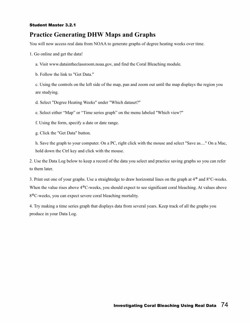
Student Master 3.2.1
Practice Generating DHW Maps and GraphsYou will now access real data from NOAA to generate graphs of degree heating weeks over time.
1. Go online and get the data!
a. Visit www.dataintheclassroom.noaa.gov, and find the Coral Bleaching module.
b. Follow the link to "Get Data."
c. Using the controls on the left side of the map, pan and zoom out until the map displays the region you
are studying.
d. Select "Degree Heating Weeks" under "Which dataset?"
e. Select either “Map” or “Time series graph” on the menu labeled "Which view?"
f. Using the form, specify a date or date range.
g. Click the "Get Data" button.
h. Save the graph to your computer. On a PC, right click with the mouse and select "Save as...." On a Mac,
hold down the Ctrl key and click with the mouse.
2. Use the Data Log below to keep a record of the data you select and practice saving graphs so you can refer
to them later.
3. Print out one of your graphs. Use a straightedge to draw horizontal lines on the graph at 4° and 8°C-weeks.
When the value rises above 4°C-weeks, you should expect to see significant coral bleaching. At values above
8°C-weeks, you can expect severe coral bleaching mortality.
4. Try making a time series graph that displays data from several years. Keep track of all the graphs you
produce in your Data Log.
Investigating Coral Bleaching Using Real Data 74

Data Log
As you use the online data access form to select data about coral reef health and possible coral bleaching,
keep a record of the parameters you select on this Data Log. Your Data Log will help you remember and keep
track of the data you have looked at. The first filled-in row is presented as an example.
Region Date(s) Max DHW Notes
1 18-28° N Latitude80-73° W Longitude
Jan 1, 2004 - Dec 31, 2005
9°C-weeks Saved to disk as DHW_graph
2
3
4
5. Examine your data and answer the following questions:
How high did the DHWs get?
What would this measurement indicate for the health of corals in the area?
Consider how you might use this tool to learn more about coral reefs in different parts of the world.
Investigating Coral Bleaching Using Real Data 75

Level 4: Interactivity Citizen Scientists Mission - In Search of EvidenceIn this teacher/student-led level, students will use the knowledge and
satellite data skills gained in the first three levels to identify data needed
to support a simple hypothesis about a coral bleaching event.
Objective Students will present data in support of a research question.
Focus Questions Can you find evidence for coral bleaching events based on
satellite data?
Why is coral research important?
Climate LiteracyScientific observations indicate that global climate has changed in the
past, is changing now, and will change in the future. The magnitude and
direction of this change is not the same at all locations on Earth (CL 4d)7.
Background (Teacher)The main research question for students' work on coral bleaching in this
module asks: What are the consequences of rising sea surface
temperature on coral reefs, and why should we care? Oceanographers,
marine biologists, Citizen Scientist Researchers, and all those who have
enjoyed the experience of tropical coral reefs have become increasingly
concerned with the health of these biologically rich, but delicately
balanced, regions in the ocean. Your students have become aware that
coral bleaching is one of the many threats to coral reefs and their
associated fragile ecosystems. What if they do not recover? Why should
7 Climate Literacy: The Essential Principles of Climate Science, Second Version: March 2009. http://www.globalchange.gov/browse/educators
Investigating Coral Bleaching Using Real Data 76
Summary
Grade Level: 6-8
Teaching Time: Two 45-
minute periods

we care? Students need to understand that a study of coral reef health,
comparing the past to the present, can help them think about future
climate change and how to prepare for it.
So far, students have learned to generate, read, and interpret different
kinds of data related to coral bleaching. At this level, students will apply
what they have learned to answering a prepared research question.
Students will compare collected satellite data against their in situ field
surveys from Level 2 to see if there is a significant predictive
relationship between accumulated heat stress (measured using NOAA
Coral Reef Watch's degree heating weeks product) and bleaching
intensity. After their study, students can join climate researchers in
considering if severe, widespread coral bleaching and mortality will have
long-term consequences for reef ecosystems, which may suggest a
troubled future for tropical marine ecosystems under a warming climate.
Vocabulary Students are encouraged to use vocabulary words presented in previous
levels of this coral reef module as they write and discuss their coral
bleaching research findings.
Investigating Coral Bleaching Using Real Data 77

Activity 4: Answering and Supporting a Research Question
This activity challenges students to think like Citizen Scientist
Researchers by designing a scientific investigation in which data
collection and analysis are integral to identifying coral bleaching events.
Students are asked to use real data to solve a problem, as they look for
degree heating weeks for a specific coral region.
Preparation1. It is recommended that you not show students any of the SST DHW
maps or graphs before beginning this activity. A goal of this investigation
is to encourage students to apply data gathering skills and techniques
learned earlier in the module to examine unknown data. Specifically,
students will read and interpret data and apply their knowledge to their
observations from the in situ study in Level 2.
2. Reassign students as Citizen Scientist Researchers to their teams from
Level 2 for the three coral reef monitoring sites: A. Stetson Bank, Pin 26;
B. Stetson Bank, Pin 37; or C. Panama, Pin 208 (see Teacher Master 4.1
In Situ Data Log Sheet with Locations). Have each team divide data
search responsibilities according to the following table.
Note: You may want to assign tasks for different monitoring years to
different students if there are more than four students on a team.
Monitoring Year Student #1 Student #2 Student #3 Student#4
Monitoring Year 1 SST Map Coral Bleaching DHW Map
Time Series Graph Coral Bleaching DHW
Manager of Data Entry on Data Log Sheet
Monitoring Year 2 SST Map Coral Bleaching DHW Map
Time Series Graph Coral Bleaching DHW
Manager of Data Entry on Data Log Sheet
Monitoring Year 3 SST Map Coral Bleaching DHW Map
Time Series Graph Coral Bleaching DHW
Manager of Data Entry on Data Log Sheet
Investigating Coral Bleaching Using Real Data 78
Materials Teacher Master 4.1: In Situ
Data Log Sheet with
Locations (same as
Teacher Master 2.3.1 from
Level 2, Activity 2.3)
(1 per team)
Student Master 4.1: Citizen
Scientists Coral Reef
Bleaching Mission - In
Search of Evidence
(1 per student)
Student Master 4.2: Data
Log Sheet (1 per student)

Procedure1. Pass out the following materials to each team:
Completed student team in situ reports and data sheets from
Level 2: Monitoring Coral Reefs—Establishing a Baseline
Teacher Master 4.1: In Situ Data Log Sheet with Locations –
to remind students of the latitude and longitude of their assigned
in situ locations and the dates of their three site monitoring visits
Student Master 4.1: Citizen Scientists Coral Reef Bleaching
Mission - In Search of Evidence (provide a copy for each
student)
Student Master 4.2: Data Log Sheet – to help students identify
and organize the data they will need to collect to study the
research question (provide a copy for each student)
2. Review with students the steps on Student Master 4.1: Citizen
Scientists Coral Reef Bleaching Mission - In Search of Evidence.
Answer any questions students may have.
Ask teams to follow the prompts on the worksheet to:
Identify the kinds of data they want to look at, in what region,
and over what time period.
Go online and generate their own time series graphs of degree
heating weeks for the region they examined in Level 2 to
complete their virtual in situ monitoring.
Analyze the resulting data graphs and maps to identify periods of
thermal stress.
Based on this new information, have teams refine their
presentations about coral reef conditions at their in situ site.
Their revised presentations should include the data products they
generated in this activity and incorporate information about
DHW.
3. Have teams present their revised coral health findings to their
Investigating Coral Bleaching Using Real Data 79

classmates.
4. Ask teams to use their collected in situ data together with newly
collected satellite data and their knowledge of corals to answer the
questions under Discuss Conclusions below:
Discuss Conclusions Do you think the susceptibility of corals to temperature changes
may result in coral bleaching or a decrease in coral health?
Why is it important to examine coral reefs for bleaching events
both locally in situ and globally using satellite SST data?
Why is it important to study coral reef health by comparing past
reef with present reef conditions?
As a Citizen Scientist Researcher, why is it important for you to
care about rising sea surface temperature, and the health of coral
reefs related to a changing climate?
Investigating Coral Bleaching Using Real Data 80

Teacher Master 4.1
In Situ Data Log Sheet with Locations
Coral Reef Site A Year/Month Coral Reef Description (circle one)
Stetson Bank, Pin 2628.0°N, 93.5°W
June 2005(Baseline)
Healthy Reef Declining Reef Dead Reef
June 2006 Healthy Reef Declining Reef Dead Reef
March 2009 Healthy Reef Declining Reef Dead Reef
Coral Reef Site B Year/Month Coral Reef Description (circle one)
Stetson Bank, Pin 3728.0°N, 93.5°W
Sept 2003(Baseline)
Healthy Reef Declining Reef Dead Reef
July 2007 Healthy Reef Declining Reef Dead Reef
March 2009 Healthy Reef Declining Reef Dead Reef
Coral Reef Site C Year/Month Coral Reef Description (circle one)
Panama, Tag 2189.3°N, 82.2°W
2005(Baseline)
Healthy Reef Declining Reef Dead Reef
2006 Healthy Reef Declining Reef Dead Reef
2008 Healthy Reef Declining Reef Dead Reef
Investigating Coral Bleaching Using Real Data 81

Student Master 4.1
Citizen Scientists Coral Bleaching Mission - In Search of Evidence Corals are facing bleaching events related to changing sea surface temperature (SST). Rejoin your Citizen
Scientist Researcher team and recheck your in situ field data. Now you will use satellite degree heating weeks
(DHW) maps and graphs to find more evidence regarding a possible large-scale coral bleaching event at your
monitoring site. Your mission is to determine if coral bleaching is part of your site’s past, present, and/or
future. Let's get started!
Plan Your Investigation
Your Assignment: Collect and use satellite data to investigate whether high SSTs occurred at your site to
cause coral bleaching or stress. Take out your previous Data Log Sheet (Student Master 2.3.1).
Where was your in situ site located? Latitude: Longitude:
What was the day, month, and year of each data collection?
Year 1: _____________ Year 2: _____________ Year 3: _____________
Your Research Question: Did the duration and intensity of changing water temperature affect coral health at
your site?
Your Hypothesis: When there is accumulated thermal stress, with water temperature rising above the
maximum of the monthly mean sea surface temperature (MMM SST), it will cause coral reef stress at the
monitoring location.
Conduct Your Investigation
1. Design a plan to test your hypothesis and answer the research question.
What do you need to get started?
a. More information: Do you need more information about changes in temperature over time and how long
the temperature stayed at a high level?
b. Specific data: When you go online to collect data, how many of the following maps and graphs will you
generate?
SST map
Coral bleaching DHW maps
Coral bleaching DHW time series graphs
Hint: You should download three time series maps, one for each date you observed at your in situ site.
2. Go online and get the data using the following steps:
Investigating Coral Bleaching Using Real Data 82

a. Visit www.dataintheclassroom.noaa.gov, and find the Coral Bleaching module.
b. Follow the link to "Get Data."
c. Using the controls on the left side of the map, pan and zoom out until the map displays the area
immediately around the site you are studying.
d. Select the dataset you wish to access under "Which dataset?"
e. Select either “Map” or “Time series graph” on the menu labeled "Which view?"
f. Using the form, specify a date or date range.
g. Click the "Get Data" button.
h. Save the graph to your computer. On a PC, right click with the mouse and select "Save as...." On a Mac,
hold down the Ctrl key and click with the mouse.
3. Record the data you select and/or save it on Student Master 4.2: Data Log Sheet, and save images to
your computer so you can refer to them later for data analysis and to show your classmates when you present
your findings.
4. Analyze the data by answering the following questions:
What are the local conditions at your reef site for each year observed?
Hint: Look at time series graphs of SST to get a sense of the temperature range at this site.
Were corals at risk for thermal stress?
Look at false-color maps of DHW. Look for areas with DHW values above zero.
Hint: Check the DHW number at the top right of the map for a data point.
How high did the DHWs get?
Hint: Look at a time series graph of DHW for the area. If the DHW value gets above 4°C, you should
expect to see significant coral bleaching. Values above 8°C indicate that you can expect coral mortality.
5. From your observations of each year's data, can you tell if your reef was at risk for bleaching? Give
evidence.
6. Draw conclusions about your data.
Comparing all three years of data sets, would you conclude your reef was under stress?
Hint: Look at your maximum DHW figures/maps. DHWs measure the accumulated thermal stress on the
reef. The maps/figures show the maximum DHW values experienced during each year of your in situ
Investigating Coral Bleaching Using Real Data 83

monitoring.
How did thermal stress compare at each year's monitoring?
How did the severity of coral stress or bleaching compare at each year’s monitoring?
Write down what you learned from your investigation of coral health. Use your data to help you decide if your
hypothesis is supported. If your hypothesis is not supported, think about other data you might need to collect.
Report Your Coral Health Findings
All researchers need to publish and present their findings to their peers.
1. Your first step is to combine the data you collected to see if it tells the story of your coral reef's health.
2. The next step is to share it with your classmates. Use your collected data, vocabulary words, and reef
images as part of your report.
3. Include the maps and graphs that you generated as part of your report, and highlight key information for
each year so you can easily compare one year to another.
Coral Reef Site Year/Month Coral Reef Description (circle one)
Lat: , Lon: (Baseline)
Healthy Reef Declining Reef Dead Reef
Healthy Reef Declining Reef Dead Reef
Healthy Reef Declining Reef Dead Reef
Discuss Conclusions
Do you think the susceptibility of corals to temperature changes may result in coral bleaching or a
decrease in coral health? Give examples for why or why not.
Why is it important to examine coral reefs for bleaching events both locally in situ and globally using
satellite SST data?
Why is it important to study coral reef health by comparing past reef with present reef conditions?
As a Citizen Scientist Researcher, why is it important for you to care about rising sea surface
temperature, and the health of coral reefs related to a changing climate?
Investigating Coral Bleaching Using Real Data 84

Student Master 4.2
Data Log SheetAs you use the online data access form to select data about coral reef health and possible coral bleaching,
keep a record of the parameters you select on this data log sheet. Your data log will help you remember and
keep track of the data you have looked at. Remember to save the maps and graphs to your computer so that
you can access or print them later. The first row is presented as an example.
Data Set Map or Graph?
Region Date (s) Notes
1 DHW Map 18-28° N Latitude80-73° W Longitude
Sep 2, 2005 Max DHW = 9°C-weeks
Investigating Coral Bleaching Using Real Data 85

Level 5: Invention Design Your Own Investigation Level 5 is an important student-driven interactive learning experience
that can be used to measure student progress. This last level provides an
opportunity for students to apply their acquired monitoring and mapping
skills, and their coral content knowledge, to a real coral bleaching
identification project. Students will pick a coral reef location on the
planet, list the time frame in which they will examine coral health, and
make a prediction based on SST time series observations as to whether
their chosen location is experiencing coral bleaching over time.
Objective Students will design their own investigation using real data to try
to answer a research question of their choosing. Their research
question will serve as the Focus Question for this level. Their
study will be based in one of several suggested coral reef
locations.
Climate LiteracyScientific observations indicate that global climate has changed in the
past, is changing now, and will change in the future. The magnitude and
direction of this change is not the same at all locations on Earth (CL 4d)8.
Background (Teacher)At this level middle school students are ready to use the authentic
learning environment of coral reefs and real data to monitor actual
coral bleaching events as indicators of what is happening to the
health of coral reefs in the world's oceans. They will also be
challenged to think about the importance of coral reefs to them
personally.
8 Climate Literacy: The Essential Principles of Climate Science, Second Version: March 2009. http://www.globalchange.gov/browse/educators
Investigating Coral Bleaching Using Real Data 86
Summary Grade Level: 6-8
Teaching Time: Two 45-
minute periods

Students are ready to move beyond interpreting a single selected coral
bleaching site to examining coral reefs as an interactive system on the
planet. Students many times do not recognize the differences between
parts of an individual coral reef and coral reefs as a total system.
Individual students will access and manipulate data regarding a coral reef
site of their choosing, and then all students will join their coral reef
studies together to look at coral reefs as a system within the world’s
oceans.
Investigating Coral Bleaching Using Real Data 87

Activity 5: Designing Your Own Investigation
Students will design and conduct a scientific investigation using real data
to answer a research question of their choosing. They will use
appropriate tools and techniques to gather, analyze, and interpret data.
Based on their experience, students will then communicate their
scientific procedures and findings.
Preparation This activity can be assigned to individuals or to teams of two students.
To assist students, focus their investigation on one of the suggested
student projects below.
Determine whether there is evidence of coral bleaching at a
location of the student's choice; or
Determine whether there is evidence of coral bleaching near the
Hawaiian Islands.
Note: Examine the NOAA Coral Reef Watch Virtual Stations website,
which links to graphs and monitoring stations before students use this
tool to pick a coral reef site. A link to the NOAA Coral Reef Watch
Virtual Stations website can be found in Level 5 of the Coal Bleaching
module at dataintheclassroom.noaa.gov.
The Virtual Stations map shows coral reef locations worldwide. When
you click on a station site, an information box will display a summary of
conditions in that area. This tool will help students make a free choice of
reef locations for their research.
Procedure 1. Distribute Student Master 5.1: Citizen Scientist Researchers -
Design Your Own Investigation and Student Master 5.2: Data Log
Sheet.
Investigating Coral Bleaching Using Real Data 88
Materials Student Master 5.1: Citizen
Scientist Researchers -
Design Your Own
Investigation (1 per student)
Student Master 5.2: Data
Log Sheet (1 per student)
Computer with an Internet
connection
NOAA Coral Reef Watch
Virtual Stations website

Review with students Student Master 5.1: Citizen Scientist
Researchers – Design Your Own Investigation and tell students they
are going to design and carry out their own individual research project on
coral reef health. First, they will need to pick a coral reef site to research.
Project the NOAA Coral Reef Watch Virtual Stations website and show
students how the website can be used to select coral locations and other
information around the planet.
2. Meet with students to assist them in developing a good research
question that can be tested using available data. The questions below can
help students formulate their question.
Is there evidence for a coral bleaching event or stress at your
chosen location this year?
Has there been evidence for coral bleaching or stress at your
chosen location in the past?
Note: If students are having trouble formulating a research question, you
may wish to refer them back to the research question they used in
Activity 4: Did the duration and intensity of changing water temperature
affect coral health at your site?
3. Guide and approve the student selection of a coral reef location using
the online NOAA Coral Reef Watch Virtual Stations map or a listed
Hawaii location. Help students use the tool to answer the following
questions.
Where is your selected site or location?
Over what time period will you observe the selected coral reef?
What is your predicted answer to your research question? Your
predicted answer to your research question is your hypothesis.
4. Have each student or team follow the steps under Plan Your
Investigation and Conduct Your Investigation on Student Master 5.1 to
develop a plan for a research project that will answer their research
question. The plan should include:
Investigating Coral Bleaching Using Real Data 89

A research question (developed in step 2)
A testable hypothesis that addresses the research question
(developed in step 3)
A list of additional information needed
A list of data that will be collected to provide evidence for their
hypothesis
5. Have students follow the steps on Student Master 5.1 to go online
and get their data.
6. Remind students to use Student Master 5.2: Data Log Sheet to
record the data products they select and examine.
7. Have students choose a method to analyze their data. (Some
possibilities are organize a table, generate maps or graphs, or answer
questions.)
8. Have each individual or team draw conclusions from their
investigation.
9. After students complete their research, have them follow the steps
under Report Your Coral Health Findings on the master to organize,
prepare, and present their findings to the class. Their use of the NOAA
Coral Reef Watch Virtual Stations site, showing their individual coral
site, should be part of their presentations.
Note: Project the Virtual Stations website image as a background to the
student presentations (see top of Student Master 5.1). The goal is for
students to see their selected coral sites as part of a total coral reef
system, the health of which is being affected by rising sea surface
temperatures.
10. Encourage students to understand the importance of coral reefs
around the world. Have individuals or teams compare and contrast their
coral reef observations and data with other teams' findings from different
locations. Remind them to include examples of maps, graphs, and other
data.
Investigating Coral Bleaching Using Real Data 90

11. Use student presentations as an opportunity to relate student
investigations about coral bleaching to the debate about global climate
change. Conduct a discussion around the questions at the bottom of
Student Master 5.1:
Do you think the susceptibility of corals to temperature changes
may result in coral bleaching or a decrease in coral health at your
location? Give examples.
Why is it important to study coral reef health by comparing past
reef with present reef conditions?
Is your coral reef location part of a total system of corals? How
do you think rising sea surface temperature is changing the coral
reef system?
As a Citizen Scientist Researcher, why is it important for you to
care about rising sea surface temperature globally, and the health
of coral reefs related to a changing climate?
Answer the Big Question for your study of coral reefs: What are
the consequences of rising sea surface temperature, and why
should you care?
Investigating Coral Bleaching Using Real Data 91

Student Master 5.1
Citizen Scientist Researchers - Design Your Own Investigation
Hello Citizen Scientist Researchers:
Join oceanographers, marine biologists, climatologists, and all of those who have enjoyed the experience of
coral reefs in understanding why they are important to our future lives on the planet.
NOAA's Coral Reef Watch notes that, in many ways, coral reefs directly benefit the nations where they occur.
They provide a huge economic benefit: recreation and commercial fishing on coral reefs generate billions of
dollars each year for local economies. Reefs also act as a natural barrier, a first line of defense in protecting
tropical coasts from storms and floods. Scientists are only beginning to explore the range of potential
medicines that reef organisms can provide, including cancer treatments, painkillers, sunscreen, and antivirals.
But even more importantly, coral reefs host some of the greatest biodiversity on the planet. Coral reefs are a
vital and threatened natural resource.
You have explored the need to compare past coral health with present coral health to measure if changes are
taking place related to rising sea surface temperature (SST). Why is this important? Researchers believe that
coral reefs are sensitive to changes in ecosystems and can show some of the first signs of how rising SST is
affecting our planet's future.
The Big Question for your study of coral reefs is: What are the consequences of rising sea surface
temperature, and why should you care?
Now it’s your turn to help investigate the health of coral reefs worldwide. Choose a coral reef to study,
looking at coral health past and present in order to predict the future. Let's get started!
Investigating Coral Bleaching Using Real Data 92

Pick a Coral Reef Location
Travel online to NOAA's Coral Reef Watch Virtual Stations website. Follow the directions below:
1. What reef site would you like to study? __________________________
2. Where is this coral reef site located? Latitude: Longitude:
3. You will collect data for at least three years, using your first year as a baseline. What are the day, month,
and year of each data collection?
Year 1: _____________ Year 2: _____________ Year 3: _____________
List any additional years: __________________________________________
Plan Your Investigation
Develop a research question you would like to explore about the past and present health of the coral reef you
selected. Then form a hypothesis that helps answer that research question. Check with your teacher to approve
your question.
Research Question: ________________________________________________________________________
Hypothesis: ______________________________________________________________________________
Conduct Your Investigation
1. Design a plan to test your hypothesis and answer the research question.
What do you need to get started?
a. More information: Do you need more information about changes in temperature over time and how
long the temperature stayed at a high level?
b. Specific data: When you go online to collect data, how many of the following maps and graphs will you
generate?
SST map
Coral bleaching DHW map
Coral bleaching DHW time series graphs
Hint: You should download one time series graph for each date you observe at your coral reef site.
2. Go online and get the data using the following steps:
a. Visit www.dataintheclassroom.noaa.gov, and find the Coral Bleaching module.
b. Follow the link to "Get Data."
Investigating Coral Bleaching Using Real Data 93

c. Using the controls on the left side of the map, pan and zoom out until the map displays the area
immediately around the site you are studying.
d. Select the dataset you wish to access under "Which dataset?"
e. Select either “Map” or “Time series graph” on the menu labeled "Which view?"
f. Using the form, specify a date or date range.
g. Click the "Get Data" button.
h. Save the graph to your computer. On a PC, right click with the mouse and select "Save as...." On a Mac,
hold down the Ctrl key and click with the mouse.
3. Record the data you select and/or save it on the Student Master 5.2: Data Log Sheet, and save images to
your computer so you can refer to them later for data analysis and to show your classmates when you present
your findings.
4. Analyze the data by answering the following questions:
What are the conditions at your reef site for each year observed?
Hint: Look at time series graphs of SST to get a sense of the temperature range at this site.
Were corals at risk for thermal stress?
Look at false-color maps of degree heating weeks. Look for areas with DHW values above zero.
Hint: Check the DHW number at the top right of the map for a data point.
How high did the DHWs get?
Hint: Look at time series graphs of DHW for the area. If the DHW value gets above 4°C, you should
expect to see significant coral bleaching. Values above 8°C indicate that you can expect severe coral
bleaching mortality.
5. From your observations of each year's data, can you tell if your reef is/was at risk for coral bleaching? Give
evidence.
6. Draw conclusions about your data.
Comparing data sets for each year you observed, would you conclude that your reef is/was under stress?
Hint: Look at your maximum DHW figures/maps. DHWs measure the accumulated thermal stress on the
reef. The maps/figures show the maximum DHW values experienced during each year of your in situ
monitoring.
Investigating Coral Bleaching Using Real Data 94

How did thermal stress compare at each year's monitoring?
How did the severity of coral stress or bleaching compare at each year’s monitoring?
Write down what you learned from your investigation of coral reef health. Use your data to help you decide if
your hypothesis is supported. If your hypothesis is not supported, think about other data you might need to
collect.
Report Your Coral Health Findings
All researchers need to publish and present their findings to their peers.
1. Your first step is to combine the data you collected to see if it tells the story of your coral reef’s health.
2. The next step is to share your findings with your classmates. Use your collected data, vocabulary words,
reef images, and the NOAA Coral Reef Virtual Stations website as part of your report.
3. Include the maps and graphs that you generated as part of your report, and highlight key information for
each year so you can easily compare one year to another.
Discuss Conclusions
Discuss the following questions with your team partner or team up with students who investigated different
locations:
Do you think the susceptibility of corals to temperature changes may result in coral bleaching or a
decrease in coral health at your location? Give examples.
Why is it important to study coral reef health by comparing past reef with present reef conditions?
Is your coral reef location a part of a total system of corals? How do you think rising sea surface
temperature is changing the coral reef system?
As a Citizen Scientist Researcher, why is it important for you to care about rising sea surface
temperature globally, and the health of coral reefs related to a changing climate?
Answer the Big Question for your study of coral reefs: What are the consequences of rising sea
surface temperature, and why should you care?
Investigating Coral Bleaching Using Real Data 95

Student Master 5.2
Data Log SheetAs you use the online data access form to select data about coral reef health and possible coral bleaching,
keep a record of the parameters you select on this data log sheet. Your data log will help you remember and
keep track of the data you have looked at. Remember to save the maps and graphs to your computer so that
you can access or print them later. The first row is presented as an example.
Data Set Map or Graph?
Region Date (s) Notes
1 DHW Map 18-28° N Latitude80-73° W Longitude
Sep 2, 2005 Max DHW = 9°C-weeks
Investigating Coral Bleaching Using Real Data 96