international programmes gnss monitoring meetings seminars and workshops... · participation to...
TRANSCRIPT

International Programmes &
GNSS Monitoring
Patrizio Vanni ([email protected])
GNSS expert
ICAO PBN and PANS-OPS Provisions Implementation workshop
Lisbon, 26 August 2015

Participation to PBN/GNSS Groups
PBN and associated PANS-OPS Provisions Implementation Workshop - Lisbon - August 2015
2

ENAV expertize in PBN
• Procedure design (Algeria, Lebanon, Malesya)
• Flight inspection (Tunisia, Portugal, Croatia)
• Advanced PANS OPS Training (Marocco)
• Safety Assessment
• Helicopters regional network (RNP 0.3 and PiNs)
• GNSS Monitoring
• BLUEMED FAB PBN TF chairman
PBN and associated PANS-OPS Provisions Implementation Workshop - Lisbon - August 2015
3

PBN and associated PANS-OPS Provisions Implementation Workshop - Lisbon - August 2015
4

Preamble • At ICAO NSP#14 (November 2013) a working paper presented by Italy
identified the need for further guidance on GNSS monitoring, including details on the objectives, acceptable methodology, policy for the retention of data, reporting and notification process in case of anomaly.
• A Drafting Group was established to start preparing guidance material on GNSS monitoring.
• Participants: – USA – UK – Eurocontrol – EC – Canada – Netherlands – Russian Federation – Italy
– ICCAIA
– Germany
– Japan
– Australia
– Spain
5 PBN and associated PANS-OPS Provisions Implementation
Workshop - Lisbon - August 2015

GMDG activities
• As first step, the GNSS Monitoring Drafting Group is preparing guidance material
on GNSS core constellation performance assessment and legal recording and will
propose amendments to relevant documentation.
• Activities:
– Definition of requirements for performance assessment and legal recording
– Definition of a common vocabulary and GNSS Monitoring concept
– Definition of Performance Assessment Methodology
– Identification of documentation impacted
• Since November 2013 several teleconferences have been held. Results have been
presented at NSP#1 (April 2015). The documentation presented reached a good
level of maturity.
6 PBN and associated PANS-OPS Provisions Implementation
Workshop - Lisbon - August 2015
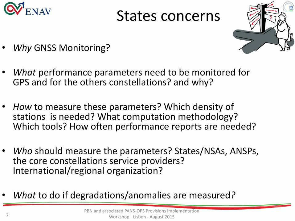
States concerns
• Why GNSS Monitoring?
• What performance parameters need to be monitored for GPS and for the others constellations? and why?
• How to measure these parameters? Which density of stations is needed? What computation methodology? Which tools? How often performance reports are needed?
• Who should measure the parameters? States/NSAs, ANSPs, the core constellations service providers? International/regional organization?
• What to do if degradations/anomalies are measured?
7 PBN and associated PANS-OPS Provisions Implementation
Workshop - Lisbon - August 2015

Requirements identification
Id Ref. Category Requirement
GNSS-1 Att.D #12 Objectives Data recorded can be used periodically to confirm GNSS performance
GNSS-2 Att.D #11.1 General All parameters available to users within a given service area should be recorded at
representative locations in the service area
GNSS-3 Att.D #11.2 General Recording system need not be independent
GNSS-4 Att.D #11.2 Recording Recording System may be delegated to other States or entities
GNSS-5 Att.D #11.2 Recording Data shall be logged continuously at 1Hz rate
GNSS-6 Att.D #11.3 Recording Observed satellite carrier-to-noise density (C/N0)
GNSS-7 Att.D #11.3 Recording Observed satellite raw pseudo-range code and carrier phase measurements
GNSS-8 Att.D #11.3 Recording Broadcast satellite navigation messages, for all satellites in view
GNSS-9 Att.D #11.3 Recording Relevant recording receiver status information
GNSS-10 #2.1.4.2 Objectives State should monitor and record relevant GNSS data to support accident and
incident investigations.
GNSS-11 #2.1.4.2 Recording A State should ensure that GNSS data relevant to the operations required are
recorded
GNSS-12 #2.1.4.3 Recording Recordings should be retained for a period of at least fourteen days. When the
recordings are pertinent to accident and incident investigations, they should be
retained for longer periods until it is evident that they will no longer be required.
GNSS-13 #2.1.4.3 Performance GNSS-6/7/8/9 support periodic confirmation of GNSS performance in the service
area.
8
[1] To be noted that this is a minimum requirement and that could be adjusted in order to be compliant with National Legislations for accident and incident investigations.
Requirements extracted from Annex 10 vol.I
PBN and associated PANS-OPS Provisions Implementation Workshop - Lisbon - August 2015

GNSS Monitoring Concept
GNSS Monitoring
GNSS Performance assessment
GNSS Data recording
GNSS Operational
status monitoring
GNSS Interference monitoring
9 PBN and associated PANS-OPS Provisions Implementation
Workshop - Lisbon - August 2015

Proposal definition • GNSS performance assessment: is a periodic off-line activity performed by a
State, or delegated entity, aiming to demonstrate SIS conformance vs. Annex 10 relevant requirements, it can be done at system and/or application level.
• GNSS operational status monitoring: is an activity performed by a State, or
delegated entity, whose main objective is to provide information to technical staff and ATC services on the operational status of GNSS services in relation to a defined operation.
• GNSS Interference Monitoring: is a monitoring activity performed by a State, or delegated entity, whose main objective is to provide warning to technical staff and/or ATC services in case of detection of interferences on relevant GNSS band for a specific location.
• GNSS recording: is an activity performed by a State, or delegated entity, whose objective is to have GNSS status historical data to support post-incident/accident investigations. It could cover also the legal recording part depending on national regulations.
10 PBN and associated PANS-OPS Provisions Implementation
Workshop - Lisbon - August 2015
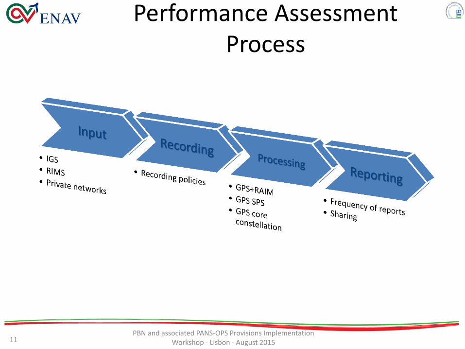
Performance Assessment Process
11 PBN and associated PANS-OPS Provisions Implementation
Workshop - Lisbon - August 2015

Main outcomes [1/2] • Integrity is the most critical parameter, due to its link to safety. It is applicable and
measureable to the total system (including RAIM) and not to the core constellation itself. Different approaches for integrity are taken:
– For ABAS, integrity monitoring is done at airborne level with RAIM. Receivers that are certified in accordance with relevant international standards (e.g. MOPS, TSO series) have been designed to meet the integrity requirement defined in Table 3.7.2.4-1 of Annex 10 assuming GPS is compliant with key parameters defined in GPS SARPs Annex 10 and GPS SPS PS.
– For SBAS, integrity monitoring is done at ground segment level and the verification and assurance is given by the SBAS service provider.
– For GBAS a similar approach to SBAS is taken with responsibilities to local operators .
For ABAS, it is suggested that States do not have to implement monitoring capabilities for integrity since integrity is provided in real time by RAIM.
12 PBN and associated PANS-OPS Provisions Implementation
Workshop - Lisbon - August 2015

Main outcomes [2/2] • Availability, accuracy and continuity may have
a different meanings (e.g. the meaning of continuity parameter for SIS performance requirements is different from the one defined for the SPS).
• Development of criteria (taking in account satellite geometry, tropospheric/ionospheric delay) for the determination of density of stations that can produce representative performance reports and can be used for data recording. – Italy is assessing a criteria (so called 7°) valid for
mid latitudes.
13 PBN and associated PANS-OPS Provisions Implementation
Workshop - Lisbon - August 2015

Parameters proposal Performance Parameter Definition Targets
Positioning Accuracy 95 percentile of the position error measured, intended as difference between
the estimated position by the receiver and the reference position, calculated
over an interval of 24hrs, for any point considered within the service volume.
§3.7.3.1.1.1 for GPS
§3.7.3.2.1.1 for GLONASS
the targets reported referred to space/control segment only
and does not take in account atmospheric or receiver errors.
Range Domain Accuracy
(Instantaneous URE)
Difference between the pseudorange measured at a given location and the
expected pseudorange as derived from the NAV message.
§3.7.3.1.1.3 for GPS
§3.7.3.2.1.3 for GLONASS
The reported targets referred to space/control segment only
and does not take into account atmospheric or receiver
errors.
Service Availability Percentage of time over any 24hrs interval that the position accuracy is less
than a specified value within the service volume.
§3.7.3.1.2 for GPS
§3.7.3.2.2 for GLONASS
The targets do not take into account atmospheric or receiver
errors.
Probability of major service
failure
Probability that over a specific time interval, a healthy satellite’s ranging signal
error (excluding atmospheric and receiver errors) exceeds a specific range error
limit.
Up today only GPS targets exists as defined in §3.7.3.1.4.
Continuity Continuity of service of a core constellation is the capability of the core
constellation to perform its function without unscheduled interruptions (e.g.
loss of availability, loss of PVT computation, etc) during the intended nominal
operation.
§3.7.3.1.5 for GPS
§3.7.3.2.2 for GLONASS
Probability of simultaneous
major failures of 2 or more
satellites
Probability of simultaneous failure (under the same conditions defined for
major service failure) of 2 or more satellites.
1x10⁻⁹
14 PBN and associated PANS-OPS Provisions Implementation
Workshop - Lisbon - August 2015

Observations
• Error components assigned to Space and Control Segments (error budget components assigned to the User Segment such as the atmosphere, multipath, and receiver noise).
• For some parameters the target “average location” is used for stations disseminated globally so sometimes could be more useful to refer to the worst case target only, depending on the geographical extension of the area considered and number of stations used for the performance computation.
PBN and associated PANS-OPS Provisions Implementation Workshop - Lisbon - August 2015
15
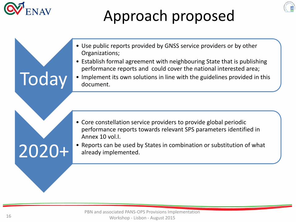
Approach proposed
Today
• Use public reports provided by GNSS service providers or by other Organizations;
• Establish formal agreement with neighbouring State that is publishing performance reports and could cover the national interested area;
• Implement its own solutions in line with the guidelines provided in this document.
2020+
• Core constellation service providers to provide global periodic performance reports towards relevant SPS parameters identified in Annex 10 vol.I.
• Reports can be used by States in combination or substitution of what already implemented.
16 PBN and associated PANS-OPS Provisions Implementation
Workshop - Lisbon - August 2015
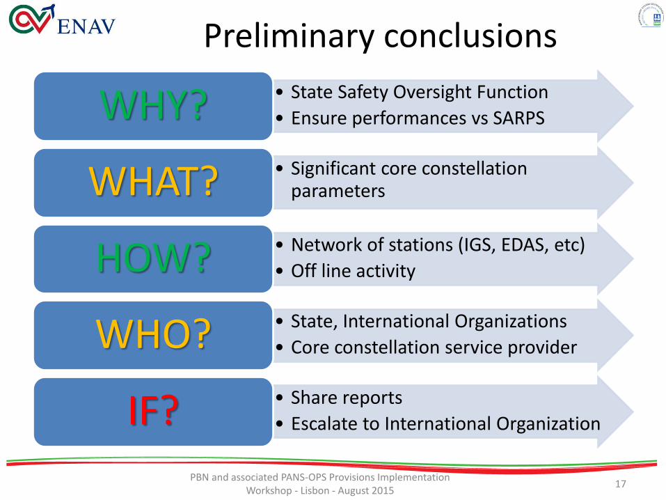
Preliminary conclusions
• State Safety Oversight Function
• Ensure performances vs SARPS WHY?
• Significant core constellation parameters WHAT?
• Network of stations (IGS, EDAS, etc)
• Off line activity HOW?
• State, International Organizations
• Core constellation service provider WHO?
• Share reports
• Escalate to International Organization IF?
PBN and associated PANS-OPS Provisions Implementation Workshop - Lisbon - August 2015
17
Next steps
• Inclusion of definitions in Annex 10 vol. I
• Guidelines to be included in
Doc9849 GNSS Manual
• Real time monitoring concept…
– Output from SESAR activities
18 PBN and associated PANS-OPS Provisions Implementation
Workshop - Lisbon - August 2015

RACOON: the ENAV Initiative
• Demonstration activity in the context of SJU Very Large Scale Demonstrations
• 2-year project (Fall 2014-Fall 2016) • Demo on Milano Linate airport, including remote ATS
service provision from Remote TWR Center located in Milano Malpensa
• Topics: – Remote TWR for Single and Multiple Airports – RNP APCH procedures – GNSS approaches for helicopters – GNSS Monitoring (including real time solutions)
PBN and associated PANS-OPS Provisions Implementation
Workshop - Lisbon - August 2015 19

RACOON: real time monitoring
• An IDS product customized for Tower ATCOs will be tested during RNP approaches demo campaign (dedicated training for ATCOs)
• Information provided to ATCOs based on data measured by a local GNSS station in Linate
• Main interface for ATCOs (green/red light):
– SBAS available/not available
– GPS available/not available
• Advanced info for technical staff:
– Service Availability, PDOP, Accuracy, Interference, etc
PBN and associated PANS-OPS Provisions Implementation Workshop - Lisbon - August 2015
20

Conclusions
• Get confidence on GNSS based on measured data
• Harmonized regional cooperation is key topic
• Need to develop further the operational status monitoring concept
• Prepare to the challenging future for GNSS (new core constellations), are we ready for the introduction of Galileo?
PBN and associated PANS-OPS Provisions Implementation Workshop - Lisbon - August 2015
21

PBN and associated PANS-OPS Provisions Implementation Workshop - Lisbon - August 2015
22