international meeting on - lhac.eu · • video‐guide forthe deaf; ... contemporary art in turin...
TRANSCRIPT

POLYTECHNIC OF TURINDISETDepartment of Building Engineering and Territorial Systems
Working TeamProf. Fabrizio Astrua
Arch. Eugenia Monzeglio
Arch. Mariabeatrice Picco, PhD
Eng. Michele Rella, PhD
TURIN FOR ALLMultisensory itineraries for the discovery of
Turin historic architectureINTERNATIONAL
MEETING ON ACCESSIBILITY
16th and 17th June 2011 Fondazione CRT
Via XX Settembre 31 Turin, Italy
TEACHING
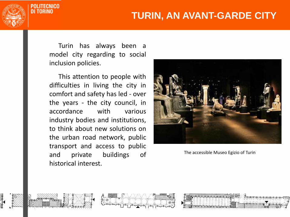
• Turin has always been amodel city regarding to socialinclusion policies.
• This attention to people withdifficulties in living the city incomfort and safety has led ‐ overthe years ‐ the city council, inaccordance with variousindustry bodies and institutions,to think about new solutions onthe urban road network, publictransport and access to publicand private buildings ofhistorical interest.
TEACHINGTURIN, AN AVANT-GARDE CITY
The accessible Museo Egizio of Turin
TEACHING
Something has already been done…………….
TEACHINGTURIN, AN AVANT-GARDE CITY

GTT – Accessible public transport system
TEACHING
The GTT public transport system tactile map and the low‐floor tram
TURIN, AN AVANT-GARDE CITY

Commune of Turin
PUMS ‐ Urban Plan for Sustainable Mobility
The removal of architecturalbarriers
TEACHINGTURIN, AN AVANT-GARDE CITY

TEACHING
Commune of Turin
PUMS ‐ Urban Plan for Sustainable Mobility
Infrastructures for the visually impaired
TURIN, AN AVANT-GARDE CITY
TURIN, AN AVANT-GARDE CITY
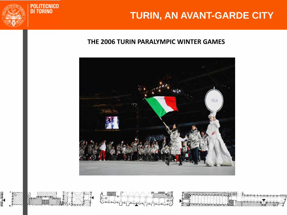
THE 2006 TURIN PARALYMPIC WINTER GAMES

The Venaria Reale disabled project
The Venaria Reale, a baroque urban settlement on the outskirts of Turin, places among its mainobjectives the accessibility as a right of any person to enjoy the artistic and cultural heritage. Toguarantee to every visitor the ability to enjoy the space and cultural events offered, the Venaria Realehas prepared the follow up services to the public, in particular assessing the needs of disabled people,through four different initiatives:
• Tactile path for the blind or visually impaired;
• Video‐guide for the deaf;
• Accessibility for motor disabled;
• Welcome activities for people with mental illness and disabilities.
•
TURIN, AN AVANT-GARDE CITY
The Venaria Reale court of honor

The Dictionary of Contemporary Art in Italian Sign Language
The Dictionary of Contemporary Art in Italian Sign Language, published by Italian UmbertoAllemandi under the patronage of Italian Contemporary Art Museums Association, acollaboration between the Castello di Rivoli Department of Education ,the Museum ofContemporary Art in Turin and the Institute of the Deaf, is the result of a unique project inthe world that has an unusual vocabulary, reported 80 new signs specific to contemporaryart, designed by a research team consisting of representatives of two bodies, deaf andhearing people together.
TURIN, AN AVANT-GARDE CITY
The Dictionary of Contemporary Art in Italian Sign Language presentation
Main contacts :
‐ Comune di Torino / Urban Masterplan for Accessibility (PUMS)
‐ Comune di Torino / Informa DisAbile
‐ TurismoTorino
‐ GTT Gruppo Trasporti TorinesiRegione Piemonte – TurismAbile
‐ Fondazione CRT
‐ IsITT – Italian Institute for Tourism for All
‐ Politecnico di Torino – DISET ‐ Post Graduate Course on Universal Design
‐ Associations for people with disabilities
TEACHINGTURIN, AN AVANT-GARDE CITY

TEACHING
• But we live in a historical heritage………………………….
TEACHINGTURIN, AN AVANT-GARDE CITY

TEACHING
THE PALAZZO CARIGNANO HISTORIC STAIRCASE
TURIN, AN AVANT-GARDE CITY
Our goals:
‐ Use our «state of the art» as a rich and useful information database;
‐ Think a new project of accessible itineraries developing innovativeideas:
1. tematic itineraries in the historical town, including architecture, enogastronomic culture, history
2. independent visiting
3. devices for mobility and comprehension
4. GPS smart device with dedicated software (e.g., NADIA GPS navigation system)
TEACHINGTURIN, AN AVANT-GARDE CITY

Itineraries in the historical town
Symbols:
I = Infopoint
MD = Means Deliveries
HS = Historical Sites
FW= Food & Wine
S= Shops
L= Leisures
In each itinerary you will be connectedto a GPS navigation system, who willprovide, by means of a dedicatedsoftware, the specific informations youneed.
TEACHINGTURIN, AN AVANT-GARDE CITY

The GPS navigation system canfit also the itineraries of the XX and XXI centuries new town.
TEACHING
The Parco Dora urban renovation plan
TURIN, AN AVANT-GARDE CITY
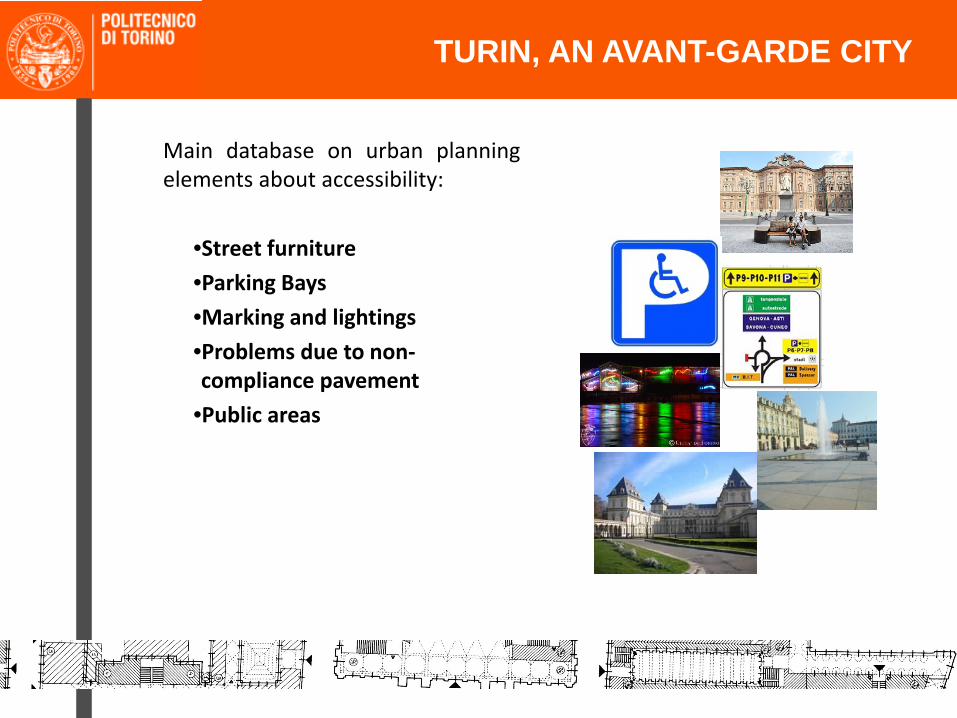
Main database on urban planningelements about accessibility:
•Street furniture•Parking Bays•Marking and lightings
•Problems due to non‐compliance pavement
•Public areas
TEACHINGTURIN, AN AVANT-GARDE CITY

Main database on building elementsabout accessibility:
•Zone surrounding the buildings•Access to the buildings•Comfort and independentusability
•Horizontal mobility and evacuation
•Vertical mobility and evacuation routes
•Toilets•Info, communication and others
•Ticket sale boots
TEACHINGTURIN, AN AVANT-GARDE CITY
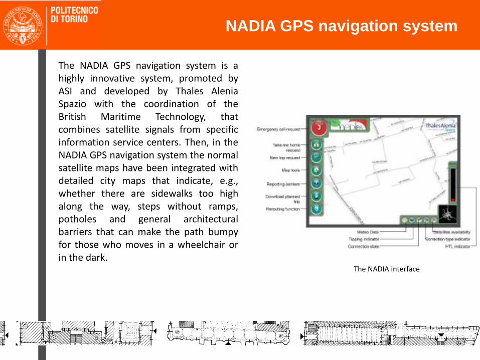
TEACHINGNADIA GPS navigation system
The NADIA GPS navigation system is ahighly innovative system, promoted byASI and developed by Thales AleniaSpazio with the coordination of theBritish Maritime Technology, thatcombines satellite signals from specificinformation service centers. Then, in theNADIA GPS navigation system the normalsatellite maps have been integrated withdetailed city maps that indicate, e.g.,whether there are sidewalks too highalong the way, steps without ramps,potholes and general architecturalbarriers that can make the path bumpyfor those who moves in a wheelchair orin the dark.
The NADIA interface

TEACHING
NADIA is designed to exploit the newgeneration of satellites that ensureaccuracy and reliability in the spatiallocation not guaranteed by the normalGPS system. This performance isachievable, however, with EGNOS (thesystem of geostationary satellites forthe improvement of GPS) andespecially with the Galileo constellationof 30 satellites which, when completed,will represent the flagship of Europeanspace policy in terms of navigation andtelecommunications.
The Galileo satellite constellation system
NADIA GPS navigation system

TEACHING
NADIA has another unique aspect: usersare not only receivers but also activeparts, since they can report to the centralsystem incidental barriers or obstaclesnot foreseen on the way, updating mapsat the same time. This is a method ofreviewing contents that follows theconcepts of Web 2.0.
The ability of users to communicate withthe NADIA system, also allows them tosend requests for assistance, if necessary.
NADIA GPS navigation system
The Palazzo Madama staircase

POLYTECHNIC OF TURINDISETCourse DirectorProf. Fabrizio Astrua – [email protected] CoordinatorsArch. Eugenia Monzeglio – [email protected]. Mariabeatrice Picco, PhD – [email protected]. Michele Rella, PhD ‐[email protected]
Corso Duca degli Abruzzi 24 – 10129 – Torino – TO – ITALY www.unidesign.polito.it
RESEARCHExamples of good practice
ADDRESSES