intergovernmental committee on surveying and mapping · intergovernmental committee on surveying...
TRANSCRIPT

Intergovernmental Committee on Surveying and Mapping
ePlan Protocol LandXML Mapping
Document Status: Released
Version: 2.1.4
Version Date: 30/05/2016

Intergovernmental Committee on Surveying and Mapping ePlan Protocol LandXML Mapping
Version 2.1.4 30/05/2016 ii
Copyright
© The Intergovernmental Committee for Surveying and Mapping, Australia, 2010
Amendment History Version Date Author Comments
2.0.1 18 August, 2010 Vivian Farrell Robert Green
Initial draft for review, distributed at Sydney vendor seminar (19/08/2010).
2.0.2 25 August, 2010 Vivian Farrell Robert Green
Incorporated review comments from Sydney vendor seminar.
2.0.3 31 August, 2010 Mark Deal
Steve Drury
Vivian Farrell
Incorporated review comments from NSW.
2.0.4 31 August, 2010 Rob Green
Nev Cumerford
Incorporated review comments from QLD.
2.0.5 1 September, 2010 Vivian Farrell Minor changes added using track changes.
2.0.6 1 September, 2010 Vivian Farrell Removed pntRef from CgPoint, parcelType now required.
2.0.7 2 September, 2010 Vivian Farrell Modifications made with Nev and Rob
2.0.8 10 September 2010 Vivian Farrell Broke out Complex Requirements into separate document.
2.0.9 13 September 2010 Vivian Farrell Incorporated first pass of changes identified from QA process.
2.0.10 14 September 2010 Vivian Farrell Modified parcel desc description.
2.0.11 21 September 2010 Bert Brujin
Vivian Farrell
Incorporated changes from QA process. Additional review of descriptions. General cleanup.
2.0.12 27 September 2010 Nev Cumerford
Rob Green
Incorporated minor proofing changes.
2.0.13 8 October 2010 Bert Brujin Minor edits and consistency fixes.
2.0.14 11 October 2010 Vivian Farrell Minor consistency fixes pointed out by Mark.
2.0.15 14 October 2010 Nev Cumerford Updates to Coordinate System element.
2.0.16 15 November 2010 Vivian Farrell Final touch ups and inclusion of purposeType against observation desc.
2.0.17 16 November 2010 Vivian Farrell Fixed Location Address cardinality
2.1 16 November 2010 Vivian Farrell Updated Version number to 2.1
2.1.1 12 April 2011 Nev Cumerford Small Editoral Changes and Updated for Location element in Plan Feature re SOP.
2.1.2 6 August 2011 Nev Cumerford Small editorial changes and the addition of some explanatory text in the following

Intergovernmental Committee on Surveying and Mapping ePlan Protocol LandXML Mapping
Version 2.1.4 30/05/2016 iii
elements:
Amendment
Author
Parcels
2.1.3 15 December 2015 Hamed Olfat Amended sections 3.2 and 3.12 following the approved changes in ‘CgPoints Cardinality & Attributes SOP’
2.1.4 30 May 2016 Hamed Olfat Inserted a note in section 3.17 following ‘Parcel Orientation SOP’

Intergovernmental Committee on Surveying and Mapping ePlan Protocol LandXML Mapping
Version 2.1.4 30/05/2016 iv
Table of Contents
1 Introduction ............................................................................................ 1
1.1 Purpose ................................................................................................ 1
1.2 Scope ................................................................................................... 1
1.3 References ........................................................................................... 2
1.4 Abbreviations ....................................................................................... 2
1.5 Audience .............................................................................................. 2
1.6 Using this document ............................................................................. 3
2 CIF Element Trees.................................................................................. 5
2.1 CIF Element Tree with Hyperlinks ........................................................ 5
2.2 CIF Element Tree Diagram .................................................................. 7
3 CIF Elements and Attributes ................................................................. 9
3.1 XML Prolog .......................................................................................... 9
3.2 LandXML .............................................................................................. 9
3.3 Units ................................................................................................... 10
3.4 Metric ................................................................................................. 11
3.5 CoordinateSystem .............................................................................. 11
3.6 Application .......................................................................................... 12
3.7 Author ................................................................................................. 12
3.8 FeatureDictionary ............................................................................... 13
3.9 DocFileRef ......................................................................................... 13
3.10 Amendment ........................................................................................ 14
3.11 AmendmentItem ................................................................................. 15
3.12 CgPoints ............................................................................................. 15
3.13 CgPoint .............................................................................................. 16
3.14 Monuments ........................................................................................ 17
3.15 Monument .......................................................................................... 18
3.16 Parcels ............................................................................................... 19
3.17 Parcel ................................................................................................. 20
3.18 Title .................................................................................................... 22
3.19 Exclusions .......................................................................................... 22
3.20 LocationAddress................................................................................. 23
3.21 ComplexName.................................................................................... 24
3.22 RoadName ......................................................................................... 25
3.23 AdministrativeArea ............................................................................. 26
3.24 AddressPoint ...................................................................................... 27
3.25 Center ................................................................................................ 28
3.26 CoordGeom ........................................................................................ 29
3.27 Line .................................................................................................... 30
3.28 Curve .................................................................................................. 31
3.29 IrregularLine ....................................................................................... 32
3.30 Start .................................................................................................... 33
Intergovernmental Committee on Surveying and Mapping ePlan Protocol LandXML Mapping
Version 2.1.4 30/05/2016 v
3.31 End ..................................................................................................... 33
3.32 PntList2D ............................................................................................ 34
3.33 PntList3D ............................................................................................ 35
3.34 VolumeGeom ..................................................................................... 36
3.35 PlanFeatures ...................................................................................... 36
3.36 PlanFeature ........................................................................................ 37
3.37 Surfaces ............................................................................................. 37
3.38 Surface ............................................................................................... 38
3.39 Definition ............................................................................................ 39
3.40 Pnts .................................................................................................... 40
3.41 Faces ................................................................................................. 41
3.42 P ......................................................................................................... 42
3.43 F ......................................................................................................... 43
3.44 Survey ................................................................................................ 43
3.45 SurveyHeader .................................................................................... 44
3.46 HeadOfPower ..................................................................................... 46
3.47 PurposeOfSurvey ............................................................................... 46
3.48 AdministrativeDate ............................................................................. 47
3.49 Annotation .......................................................................................... 47
3.50 Personnel ........................................................................................... 48
3.51 SurveyorCertificate ............................................................................. 49
3.52 FieldNote ............................................................................................ 49
3.53 ObservationGroup .............................................................................. 50
3.54 ReducedObservation .......................................................................... 51
3.55 ReducedArcObservation .................................................................... 54
3.56 RedHorizontalPosition ........................................................................ 56
3.57 RedVerticalObservation ..................................................................... 58
3.58 InstrumentSetup ................................................................................. 60
3.59 InstrumentPoint .................................................................................. 61
3.60 Location .............................................................................................. 61
Table of Appendices Appendix A Attribute Type Definitions ......................................................... A—1
Table of Figures Figure 1: ePlan LandXML Element Tree - Part 1 ........................................................ 7
Figure 2: ePlan LandXML Element Tree - Part 2 ........................................................ 8
Intergovernmental Committee on Surveying and Mapping ePlan Protocol LandXML Mapping
Version 2.1.4 30/05/2016 1
1 Introduction
The Intergovernmental Committee on Surveying and Mapping (ICSM) is developing a national approach to electronic cadastral survey plans called ePlan. Initial efforts focused on developing an ePlan model, which provides a number of packages and classes (or objects and attributes) to describe a cadastral survey plan. The mechanism chosen for data exchange is LandXML, an international standard for exchanging geospatial information.
An ePlan protocol was developed to map components of the Model to LandXML elements and attributes. A LandXML file that is consistent with the ePlan Model is called a Cadastral Information File (CIF).
To assist the adoption of the ePlan Model, a document is required to provide a mapping from the ePlan Model to LandXML using the Protocol. This document includes much of the information in the ePlan protocol with explanations and examples of how to implement the ePlan model in LandXML as a CIF.
1.1 Purpose
This document specifies the requirements for construction of a CIF using LandXML. It is intended for jurisdictions and 3rd parties interested in implementing the ICSM National ePlan Model into their software and land administration systems.
1.2 Scope
The following are in scope for this document:
Specification of every valid LandXML data element and attribute included in the ePlan CIF.
Cardinality of the data elements according to the requirements of the ePlan Model i.e. whether an element is mandatory or optional and number of allowable occurrences.
The following are not in scope for this document:
LandXML structural requirements to handle scenarios that require LandXML to be structured in a certain way to correctly capture the data.
Specification of jurisdictional-specific requirements for CIFs, these are specified in jurisdictional level documentation. (Note: while this document defines every element required for the ePlan Model, not every jurisdiction will use all of the elements.)
Conceptual level specifications that deal with the fundamental understanding of the ePlan model. These are contained in the National ePlan Model Specification.
The LandXML Schema has many more elements and attributes than are listed in this specification; the ones listed here are those used for an ePlan CIF and satisfy the requirements of the ePlan Model.

Intergovernmental Committee on Surveying and Mapping ePlan Protocol LandXML Mapping
Version 2.1.4 30/05/2016 2
1.3 References
1. ICSM, ePlan Protocol – Data Model, version 1.0, 10 September, 2009, http://icsm-eplan.govspace.gov.au/eplan-model/
2. ICSM, ePlan Protocol – LandXML Structural Requirements, version 1.0, 15 October, 2010, http://icsm-eplan.govspace.gov.au/eplan-protocol/
3. ICSM, ePlan Protocol – Schema Architecture, version 2.0, 19 October, 2010, http://icsm-eplan.govspace.gov.au/eplan-protocol/
4. LandXML.org, LandXML Schema, version 1.2, 29 July, 2008, http://www.landxml.org/schema/LandXML-1.2/LandXML-1.2.xsd
5. W3C, Extensible Markup Language (XML), version 1.0, Fifth Edition, http://www.w3.org/TR/xml/
1.4 Abbreviations
ePlan
A model for cadastral survey information defined by the ICSM
ICSM
The Intergovernmental Committee on Surveying and Mapping.
XML
Extensible mark–up language.
CIF
Cadastral Information File – The file type used to store the data specified by the ePlan Model.
LandXML
An XML schema used as the platform for a CIF.
1.5 Audience
The following is the primary audience of this document:
Australian and New Zealand jurisdictions intending to implement ePlan in their land administration systems.
3rd party/commercial software developers looking to add ePlan functionality to their software.
In addition, this document will assist anyone interested in how cadastral information portrayed on paper cadastral survey plans is represented in a CIF using LandXML elements and attributes.

Intergovernmental Committee on Surveying and Mapping ePlan Protocol LandXML Mapping
Version 2.1.4 30/05/2016 3
1.6 Using this document
Section 1 Introduction
Contains background information on the development of the ePlan CIF, important definitions and references.
Section 2 CIF Element Trees
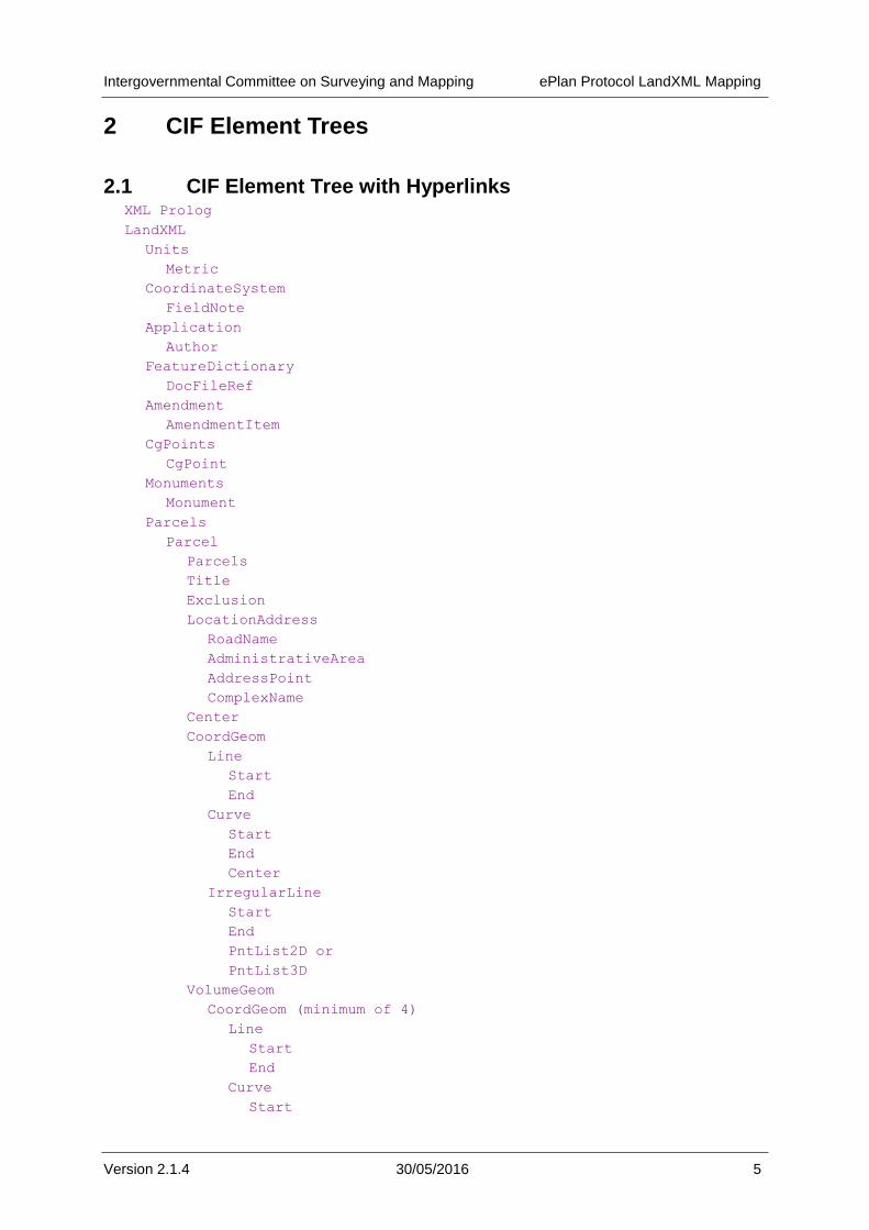
Provides a list of the XML elements used for an ePlan CIF in the order that they appear in the LandXML schema. Each element name is a link to the relevant section of the document.
Section 3 CIF Elements and Attributes
Describes each element and its attributes in detail. Elements are presented in the order that they appear in the LandXML schema, and each element's child and parent elements are provided along with an example of use.
In section 3, tables are used to assist formatting information. Most table sections are self explanatory; however the following have special meaning:
1. Cardinality: this specifies how many child elements of a particular type an element must have, e.g.:
a. 0 - * means zero or more (i.e. the child is optional)
b. 1 means exactly one (i.e. if the parent element is used, it must have this element as a child)
c. 1 - * means at least one and possibly more
2. Type: this specifies the data type of an attribute. The type can be an XML base type such as "string", or custom type that is defined in the schema. Types used by the
Protocol are listed in Appendix A Attribute Type Definitions. The following explains the
difference between types:
a. Base – a raw value type, e.g. "string".
b. LandXML Enumerations – an enumerated type defined in the LandXML Schema, e.g. "stateType".
c. Jurisdictional Enumerations – an enumerated type defined by a jurisdictional enumerations schema, e.g. "parcelClass". These are defined as skeleton types in the LandXML schema that are extended by the jurisdictional enumerations.
d. Custom Jurisdictional Enumerations – defined as a base type in LandXML but with a custom enumeration type specified by a jurisdictional enumerations schema, e.g. string (horizontalDatumType) – string is the type defined by LandXML. horizontalDatumType is the custom enumerated type specified by jurisdictional enumeration schemas with enumerated values. Fields must only contain values from this enumerations list.
e. Other Defined Types – explicitly defined in as a type in LandXML but the underlying type is a base type. These are not extended in the jurisdictional schemas. The underlying LandXML base type is used.

Intergovernmental Committee on Surveying and Mapping ePlan Protocol LandXML Mapping
Version 2.1.4 30/05/2016 4
3. Required: this specifies whether an attribute is:
a. Required (R)—the attribute must be used when the element is used and must have a value that is not an empty string.
e.g. Parcel elements must have a name attribute.
b. Conditionally Required (CR)—the attribute must be used if some condition is met.
e.g. the CgPoints element must have a zoneNumber attribute if the coordinates
being used are MGA
c. Optional (O)—the attribute may be used
e.g. Amendment elements have an optional comments attribute
XML examples
Throughout this document, XML examples use the following formatting:
<Parcel class="road" ...>
<CoordGeom>
<Line>
<Start pntRef="..."/>
<End pntRef="..."/>
</Line>
<Line>
...
</Line>
</CoordGeom>
</Parcel>
Notes:
1. Sections of code that are not important to the example are replaced by an ellipsis (…)
2. In XML, element names start with a capital letter and attribute names start with a lower case letter. These names can't contain spaces or special characters. In LandXML, names reflect the purpose of the element. Capitalisation is used to assist readability,
e.g. CoordinateSystem.
3. XPath notation is used to refer to elements in places, e.g.
Full reference to Parcel elements: /LandXML/Parcels/Parcel
Partial reference to Line elements: //Parcel/Line
4. Where an attribute value says "set to…" the value in the CIF should be exactly the stated value.
Intergovernmental Committee on Surveying and Mapping ePlan Protocol LandXML Mapping
Version 2.1.4 30/05/2016 5
2 CIF Element Trees
2.1 CIF Element Tree with Hyperlinks XML Prolog
LandXML
Units
Metric
CoordinateSystem
FieldNote
Application
Author
FeatureDictionary
DocFileRef
Amendment
AmendmentItem
CgPoints
CgPoint
Monuments
Monument
Parcels
Parcel
Parcels
Title
Exclusion
LocationAddress
RoadName
AdministrativeArea
AddressPoint
ComplexName
Center
CoordGeom
Line
Start
End
Curve
Start
End
Center
IrregularLine
Start
End
PntList2D or
PntList3D
VolumeGeom
CoordGeom (minimum of 4)
Line
Start
End
Curve
Start

Intergovernmental Committee on Surveying and Mapping ePlan Protocol LandXML Mapping
Version 2.1.4 30/05/2016 6
End
Center
IrregularLine
Start
End
PntList3D
PlanFeatures
PlanFeature
CoordGeom
Line
Start
End
Curve
Start
End
Center
IrregularLine
Start
End
PntList2D or
PntList3D
Location
FieldNote
Surfaces
Surface
Definition
Pnts
P
Faces
F
Survey
SurveyHeader
HeadOfPower
PurposeOfSurvey
AdministrativeDate
AdministrativeArea
Annotation
Personnel
SurveyorCertificate
FieldNote
ObservationGroup
ReducedObservation
FieldNote
ReducedArcObservation
FieldNote
RedHorizontalPosition
FieldNote
RedVerticalObservation
FieldNote
InstrumentSetup
InstrumentPoint

Intergovernmental Committee on Surveying and Mapping ePlan Protocol LandXML Mapping
Version 2.1.4 30/05/2016 7
2.2 CIF Element Tree Diagram
CoordGeom Elements
XML Prologue
LandXML Units
Parcels
Author
Amendment
Feature
Dictionary
Application
Coordinate
System
Metric
CgPointCgPoints
Monument
ParcelParcels
Title
Exclusion
Location
Address
VolumeGeom
CoordGeom
CenterComplex
Name
Administrative
Area
RoadName
CoordGeom
Curve
Line
Start
IrregularLine
End
Start
End
Center
Start
End
PntList2D
- - -
CoordGeom
Elements
DocFileRef
PntList3D
Required
Optional
or
FieldNote
AddressPoint
Amendment
Item
Monuments
Figure 1: ePlan LandXML Element Tree - Part 1

Intergovernmental Committee on Surveying and Mapping ePlan Protocol LandXML Mapping
Version 2.1.4 30/05/2016 8
PlanFeatures
HeadofPower
Instrument
Setup
Observation
Group
SurveyHeader
PurposeOf
Survey
Surfaces
Survey
Administrative
Date
Surface
Instrument
Point
RedVertical
Observation
RedHorizontal
Position
ReducedArc
Observation
Reduced
Observation
FieldNote
Surveyor
Certificate
Personnel
Annotation
Administrative
Area
FFaces
PPnts
Definition
PlanFeature CoordGeomCoordGeom
Elements
FieldNote
FieldNote
FieldNote
FieldNote
FieldNote
LandXML
(cont.)
Location
Figure 2: ePlan LandXML Element Tree - Part 2
Intergovernmental Committee on Surveying and Mapping ePlan Protocol LandXML Mapping
Version 2.1.4 30/05/2016 9
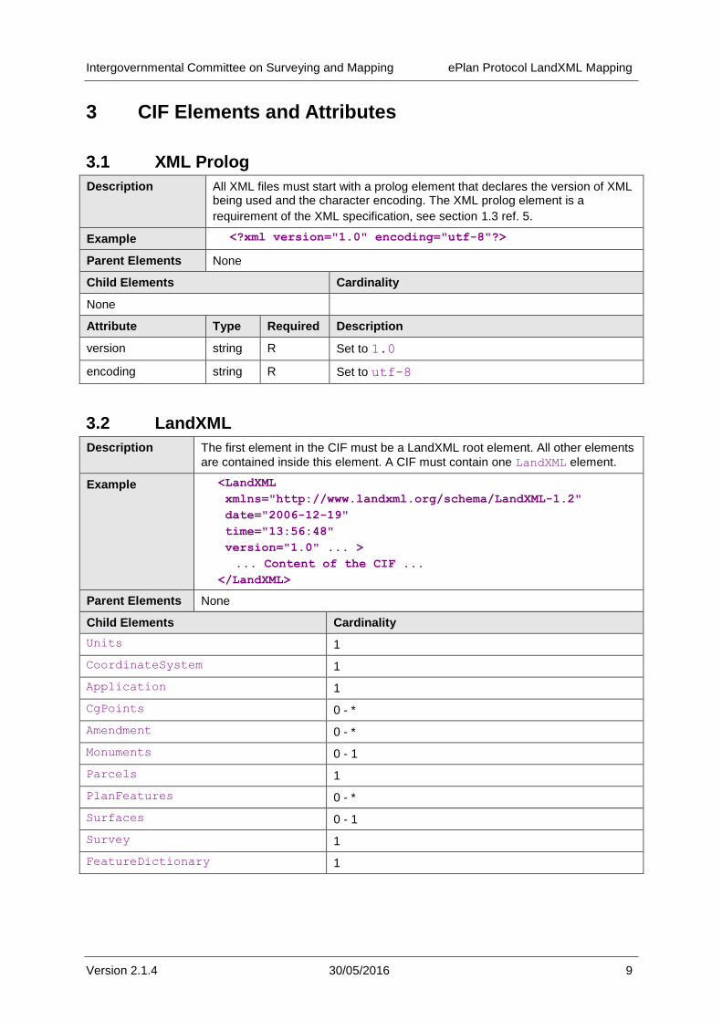
3 CIF Elements and Attributes
3.1 XML Prolog
Description All XML files must start with a prolog element that declares the version of XML being used and the character encoding. The XML prolog element is a
requirement of the XML specification, see section 1.3 ref. 5.
Example <?xml version="1.0" encoding="utf-8"?>
Parent Elements None
Child Elements Cardinality
None
Attribute Type Required Description
version string R Set to 1.0
encoding string R Set to utf-8
3.2 LandXML
Description The first element in the CIF must be a LandXML root element. All other elements
are contained inside this element. A CIF must contain one LandXML element.
Example <LandXML
xmlns="http://www.landxml.org/schema/LandXML-1.2"
date="2006-12-19"
time="13:56:48"
version="1.0" ... >
... Content of the CIF ...
</LandXML>
Parent Elements None
Child Elements Cardinality
Units 1
CoordinateSystem 1
Application 1
CgPoints 0 - *
Amendment 0 - *
Monuments 0 - 1
Parcels 1
PlanFeatures 0 - *
Surfaces 0 - 1
Survey 1
FeatureDictionary 1

Intergovernmental Committee on Surveying and Mapping ePlan Protocol LandXML Mapping
Version 2.1.4 30/05/2016 10
Attribute Type Required Description
date date R Date that this version of the CIF was created. ISO 8601 format.
e.g. 2010-10-31
time time R Time that this version of the CIF was created. ISO 8601 format.
e.g. 13:56:48
version string R Version number of this CIF.
e.g. 1.0
xmlns string CR Required if using namespaces. XML namespace, set to: http://www.landxml.org/schema/LandXML
-1.2
xmlns:xsi string O XML schema instance, set to: http://www.w3.org/2001/XMLSchema-
instance
xsi:schemaLocation string O LandXML Schema Location for validation, set to: http://www.landxml.org/schema/LandXML
-1.2
http://www.landxml.org/schema/LandXML
-1.2/LandXML-1.2.xsd
3.3 Units
Description This element defines the measurement units used by the CIF.
Example <LandXML...>
<Units>
<Metric ...></Metric>
</Units>
...
</LandXML>
Parent Elements LandXML
Child Elements Cardinality
Metric 1
Attribute Type Required Description
None

Intergovernmental Committee on Surveying and Mapping ePlan Protocol LandXML Mapping
Version 2.1.4 30/05/2016 11
3.4 Metric
Description This element specifies the metric units used in the file.
Example <LandXML...>
<Units>
<Metric
linearUnit="meter"
temperatureUnit="celsius" volumeUnit="cubicMeter"
areaUnit="squareMeter"
pressureUnit="milliBars"
angularUnit="decimal dd.mm.ss"
directionUnit="decimal dd.mm.ss">
</Metric>
</Units>
...
</LandXML>
Parent Elements Units
Child Elements Cardinality
None
Attribute Type Required Description
areaUnit metArea R Set to "squareMeter"
linearUnit metLinear R Set to "meter"
volumeUnit metVolume R Set to "cubicMeter"
temperatureUnit metTemperature R Set to "celsius"
pressureUnit metPressure R Set to "milliBars"
angularUnit angularType R Set to "decimal dd.mm.ss"
directionUnit angularType R Set to "decimal dd.mm.ss"
3.5 CoordinateSystem
Description The CoordinateSystem element defines the coordinate system used for
CgPoint coordinates in the CIF.
Example <LandXML...>
<CoordinateSystem horizontalDatum="Local"
verticalDatum="Arbitrary" />
</LandXML>
Parent Elements LandXML
Child Elements Cardinality
FieldNote 0 - *
Attribute Type Required Description
desc string O Used to provide further details about the datum if required.
Intergovernmental Committee on Surveying and Mapping ePlan Protocol LandXML Mapping
Version 2.1.4 30/05/2016 12
datum String (surveyBgDatumType)
CR Required if a local or arbitrary datum is used this is the orientation of the plan. For example it may be a Local Coordinate System using MGA Bearings
horizontalDatum string (horzDatumType) R Datum of CgPoint horizontal coordinates,
e.g. Local, MGA, etc.
verticalDatum string (vertDatumType) CR Enumeration, required if 3D points are used.
Datum of CgPoint z coordinate, e.g. Arbitrary, AHD, etc.
ellipsoidName string (ellipsoidNameType)
CR Enumeration, required if ellipsoid used.
Name of ellipsoid.
3.6 Application
Description The Application element records information about the surveying software
application used to create the CIF.
Example <LandXML...>
...
<Application name="ACME CAD 3D 2011"
version="2011.0.0">
<Author .../>
</Application>
...
</LandXML>
Parent Elements LandXML
Child Elements Cardinality
Author 0 - *
Attribute Type Required Description
name string R The name of the application that created the CIF.
e.g. ACME CAD
version string R The version of the application
e.g. 1.5.63
3.7 Author
Description The Author element records the details of the operator who created the CIF in
the surveying software application. . This is used for contact and training purposes

Intergovernmental Committee on Surveying and Mapping ePlan Protocol LandXML Mapping
Version 2.1.4 30/05/2016 13
Example <LandXML...>
...
<Application ...>
<Author createdBy="CAPTURE\jonesj" />
</Application>
...
</LandXML>
Parent Elements Application
Child Elements Cardinality
None
Attribute Type Required Description
createdBy string R The name of the person operating the application when the CIF was created
3.8 FeatureDictionary
Description The FeatureDictionary element specifies the version of the reference data
and enumerations list used when building the CIF. Only one Feature dictionary is used to refer to the collection of jurisdictionally specific schemas, see “ePlan Protocol – Schema Architecture” Document. For example, LGA reference data lists may be changed more frequently than jurisdictional enumerations lists and therefore are versioned as a separate feature dictionary.
Example <LandXML...>
...
<FeatureDictionary name="ReferenceDataContext"
version="NRWQLD-RD-3" />
...
</LandXML>
Parent Elements LandXML
Child Elements Cardinality
DocFileRef 0 - *
Attribute Type Required Description
name string R The name of the feature dictionary. Names are specified at the jurisdictional level based on the organisation of jurisdictional enumeration and reference data lists.
version string R The version of the feature dictionary used for this CIF.
3.9 DocFileRef
Description The DocFileRef element records the details about the FeatureDictionary
including the names, locations and attributes of the files that comprise the feature dictionary.

Intergovernmental Committee on Surveying and Mapping ePlan Protocol LandXML Mapping
Version 2.1.4 30/05/2016 14
Example <LandXML...>
...
<FeatureDictionary name="ReferenceDataContext"
version="NRWQLD-RD-3">
<DocFileRef
name="au-gov-vic-icsm-cif-enumerated-types.xsd"
location="http://www.someurl.gov.au/au-gov-vic-
icsm-cif-enumerated-types.xsd"
fileType="xsd"
fileFormat="ASCII"/>
</FeatureDictionary>
...
</LandXML>
Parent FeatureDictionary
Child Elements Cardinality
None
Attribute Type Required Description
name string R File name
location anyURI R Uniform Resource Identifier for the file. Should be public or semi-public.
fileType string O The file type (usually denoted by the file extension).
fileFormat string O The format of the file (e.g. the text encoding, image format etc.)
3.10 Amendment
Description The Amendment element is used to record amendments made to the file. This
element would not normally be used by the creator of the CIF, but by an agency that had received a CIF and wished to track amendments made after receipt. Its primary purpose is to track amendments after registration to satisfy legislative requirements. See the “ePlan Protocol – LandXML Structural Requirements for the application of this element as it may affect future import of CIF to applications.
Example <LandXML...>
...
<Amendment dealingNumber="9851236"
amendmentDate="2010/08/30"
comments="Corrections of monument details">
<AmendmentItem... />
<AmendmentItem... />
...
</Amendment>
...
</LandXML>
Parent Elements LandXML
Child Elements Cardinality
AmendmentItem 0 - *
Intergovernmental Committee on Surveying and Mapping ePlan Protocol LandXML Mapping
Version 2.1.4 30/05/2016 15
Attribute Type Required Description
dealingNumber string CR Required if the amendment was made after registration of the CIF and was related to a registered dealing.
amendmentDate date R The date that the amendment took effect.
comments string R A short note about the reason for the change and what it entails.
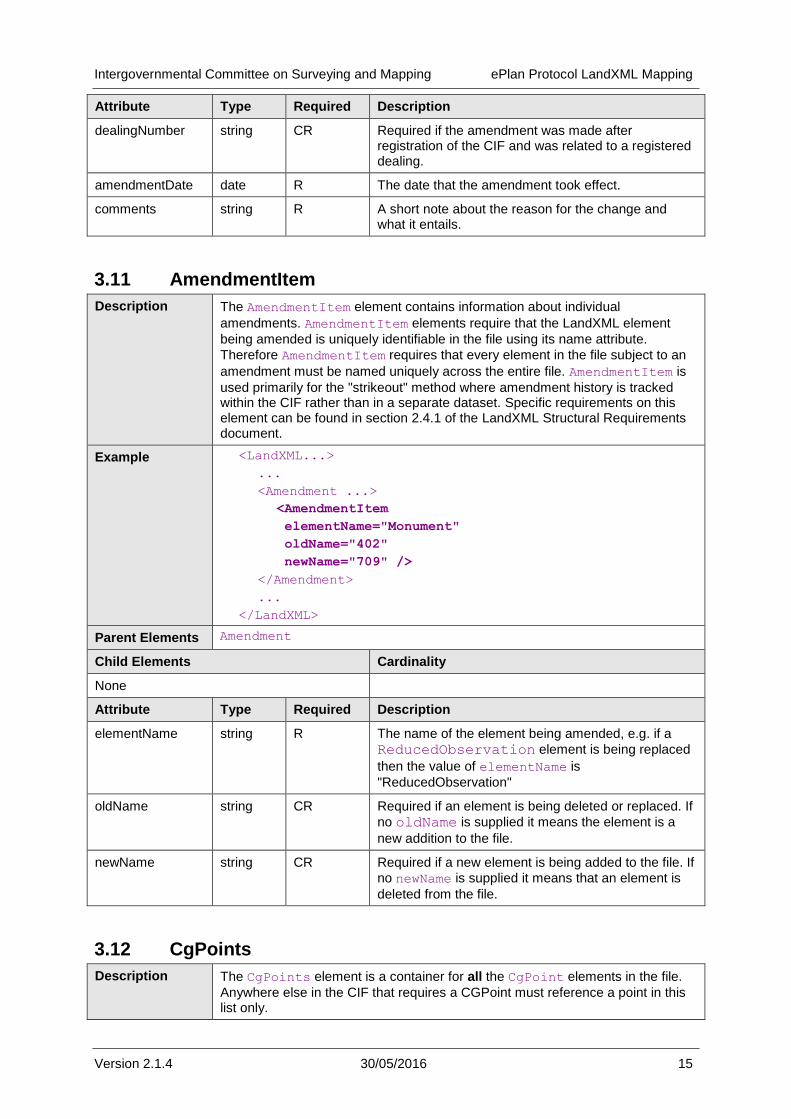
3.11 AmendmentItem
Description The AmendmentItem element contains information about individual
amendments. AmendmentItem elements require that the LandXML element
being amended is uniquely identifiable in the file using its name attribute.
Therefore AmendmentItem requires that every element in the file subject to an
amendment must be named uniquely across the entire file. AmendmentItem is
used primarily for the "strikeout" method where amendment history is tracked within the CIF rather than in a separate dataset. Specific requirements on this element can be found in section 2.4.1 of the LandXML Structural Requirements document.
Example <LandXML...>
...
<Amendment ...>
<AmendmentItem
elementName="Monument"
oldName="402"
newName="709" />
</Amendment>
...
</LandXML>
Parent Elements Amendment
Child Elements Cardinality
None
Attribute Type Required Description
elementName string R The name of the element being amended, e.g. if a
ReducedObservation element is being replaced
then the value of elementName is
"ReducedObservation"
oldName string CR Required if an element is being deleted or replaced. If
no oldName is supplied it means the element is a
new addition to the file.
newName string CR Required if a new element is being added to the file. If
no newName is supplied it means that an element is
deleted from the file.
3.12 CgPoints
Description The CgPoints element is a container for all the CgPoint elements in the file.
Anywhere else in the CIF that requires a CGPoint must reference a point in this list only.
Intergovernmental Committee on Surveying and Mapping ePlan Protocol LandXML Mapping
Version 2.1.4 30/05/2016 16
Example <LandXML...>
...
<CgPoints zoneNumber="55">
<CgPoint ...>...</CgPoint>
<CgPoint ...>...</CgPoint>
...
</CgPoints>
...
</LandXML>
Parent Elements LandXML
Child Elements Cardinality
CgPoint 1 - *
Attribute Type Required Description
zoneNumber zoneNumberType CR If the horizontal datum as specified by the
CoordinateSystem element is MGA
then this field specifies the MGA zone for all the CgPoint coordinates. Note that if a survey crosses a zone boundary all of the CIF must be prepared in a single zone.
desc string O Description of the coordinate geometry points collection.
name string O Name of the coordinate geometry points collection.
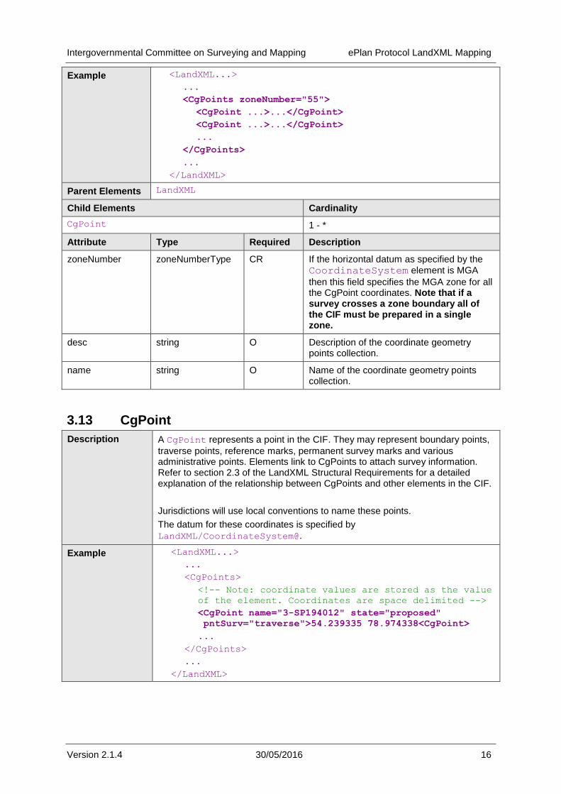
3.13 CgPoint
Description A CgPoint represents a point in the CIF. They may represent boundary points,
traverse points, reference marks, permanent survey marks and various administrative points. Elements link to CgPoints to attach survey information. Refer to section 2.3 of the LandXML Structural Requirements for a detailed explanation of the relationship between CgPoints and other elements in the CIF.
Jurisdictions will use local conventions to name these points.
The datum for these coordinates is specified by
LandXML/CoordinateSystem@.
Example <LandXML...>
...
<CgPoints>
<!-- Note: coordinate values are stored as the value
of the element. Coordinates are space delimited -->
<CgPoint name="3-SP194012" state="proposed"
pntSurv="traverse">54.239335 78.974338<CgPoint>
...
</CgPoints>
...
</LandXML>

Intergovernmental Committee on Surveying and Mapping ePlan Protocol LandXML Mapping
Version 2.1.4 30/05/2016 17
Element Content Coordinate values for the point. Two dimensional coordinates are a coordinate pair of the Northing followed by Easting. Three dimensional coordinates are a coordinate triplet: Northing, Easting and Height. Coordinates are separated by a single space.
Parent Elements CgPoints
Child Elements Cardinality
None
Attribute Type Required Description
name string R Unique ePlan identifier for the point.
oID string O Jurisdictional system identifier for the point, stored in respective jurisdictional point databases or DCDBs. Points created by the survey that have not been allocated an oID by the jurisdiction will not show this attribute.
state stateType R The state of the CgPoint in the context of other CgPoints in the CIF.
pntSurv survPntType R The point type. LandXML enumeration.
localUncertainity double O Local uncertainty of the point in metres
latitude latLongAngle O The latitude of the point
longitude latLongAngle O The longitude of the point
code string O The code of the station, link to other survey systems such as the geodetic framework.
surveyOrder horizOrderType O This is the survey order assigned to the Latitude and Londitude and is usual a defined list.
desc string O Description of the element.
3.14 Monuments
Description The Monuments element is a container for Monument elements.
Example <LandXML...>
...
<Monuments>
...
<Monument ... />
<Monument ... />
<Monument ... />
...
</Monuments>
...
</LandXML>
Parent Elements LandXML
Child Elements Cardinality
Monument 1 - *
Attribute Type Required Description
Intergovernmental Committee on Surveying and Mapping ePlan Protocol LandXML Mapping
Version 2.1.4 30/05/2016 18
None
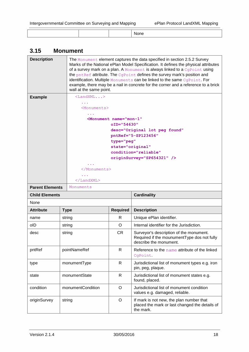
3.15 Monument
Description The Monument element captures the data specified in section 2.5.2 Survey
Marks of the National ePlan Model Specification. It defines the physical attributes
of a survey mark on a plan. A Monument is always linked to a CgPoint using
the pntRef attribute. The CgPoint defines the survey mark's position and
identification. Multiple Monuments can be linked to the same CgPoint. For
example, there may be a nail in concrete for the corner and a reference to a brick wall at the same point.
Example <LandXML...>
...
<Monuments>
...
<Monument name="mon-1"
oID="54630"
desc="Original lot peg found"
pntRef="5-SP123456"
type="peg"
state="original"
condition="reliable"
originSurvey="SP654321" />
...
</Monuments>
...
</LandXML>
Parent Elements Monuments
Child Elements Cardinality
None
Attribute Type Required Description
name string R Unique ePlan identifier.
oID string O Internal identifier for the Jurisdiction.
desc string CR Surveyor's description of the monument. Required if the mounumentType dos not fully describe the monument.
pntRef pointNameRef R Reference to the name attribute of the linked
CgPoint.
type monumentType R Jurisdictional list of monument types e.g. iron pin, peg, plaque.
state monumentState R Jurisdictional list of monument states e.g. found, placed.
condition monumentCondition O Jurisdictional list of monument condition values e.g. damaged, reliable.
originSurvey string O If mark is not new, the plan number that placed the mark or last changed the details of the mark.
Intergovernmental Committee on Surveying and Mapping ePlan Protocol LandXML Mapping
Version 2.1.4 30/05/2016 19
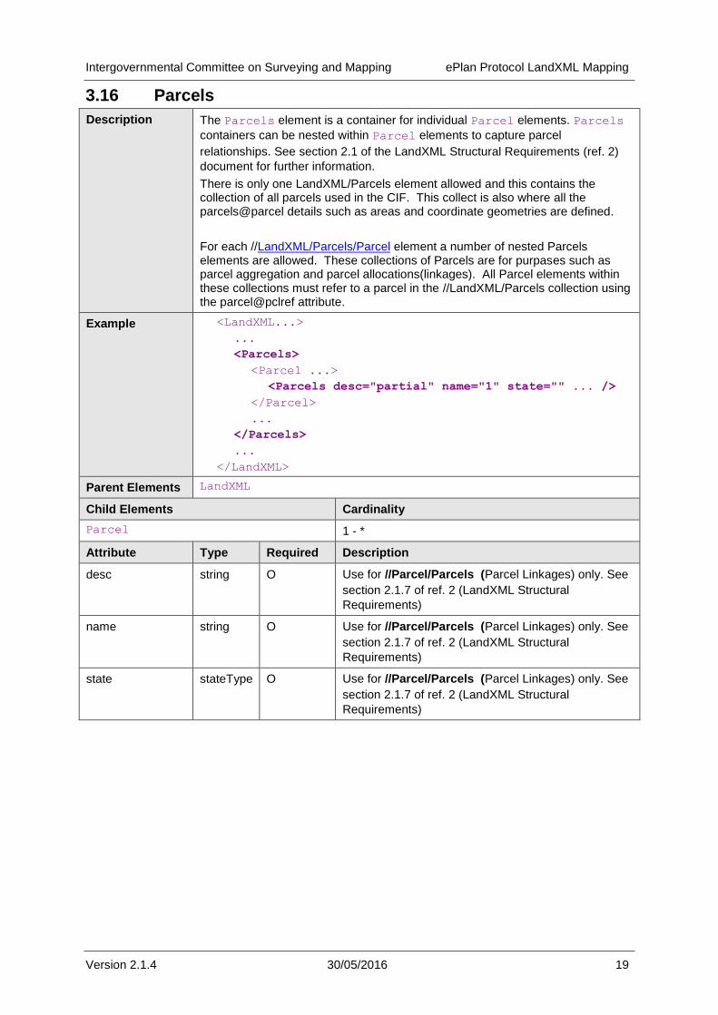
3.16 Parcels
Description The Parcels element is a container for individual Parcel elements. Parcels
containers can be nested within Parcel elements to capture parcel
relationships. See section 2.1 of the LandXML Structural Requirements (ref. 2)
document for further information.
There is only one LandXML/Parcels element allowed and this contains the collection of all parcels used in the CIF. This collect is also where all the parcels@parcel details such as areas and coordinate geometries are defined.
For each //LandXML/Parcels/Parcel element a number of nested Parcels elements are allowed. These collections of Parcels are for purpases such as parcel aggregation and parcel allocations(linkages). All Parcel elements within these collections must refer to a parcel in the //LandXML/Parcels collection using the parcel@pclref attribute.
Example <LandXML...>
...
<Parcels>
<Parcel ...>
<Parcels desc="partial" name="1" state="" ... />
</Parcel>
...
</Parcels>
...
</LandXML>
Parent Elements LandXML
Child Elements Cardinality
Parcel 1 - *
Attribute Type Required Description
desc string O Use for //Parcel/Parcels (Parcel Linkages) only. See
section 2.1.7 of ref. 2 (LandXML Structural
Requirements)
name string O Use for //Parcel/Parcels (Parcel Linkages) only. See
section 2.1.7 of ref. 2 (LandXML Structural
Requirements)
state stateType O Use for //Parcel/Parcels (Parcel Linkages) only. See
section 2.1.7 of ref. 2 (LandXML Structural
Requirements)
Intergovernmental Committee on Surveying and Mapping ePlan Protocol LandXML Mapping
Version 2.1.4 30/05/2016 20
3.17 Parcel
Description The Parcel element provides a basic unit to describe a spatial area. A
Parcel element can contain a nested Parcels element that has Parcel
child elements. There are fewer required attributes for these "sub" parcels,
generally only requiring a name and pclRef. Refer to section 2.1 of
LandXML Structural Requirements (ref. 2).
Note - The orientation of exterior ring of polygons for 2D and 3D Parcels must be clockwise.
Example <LandXML...>
...
<Parcels>
<Parcel class="lot"
parcelFormat="Standard" state="created”
parcelType="single"
name="1"
oID="">
<Center .../>
<CoordGeom ...>
...
</CoordGeom>
<Parcels>
<Parcel .../>
...
</Parcels>
<Title .../>
<Exclusions .../>
</Parcel>
</Parcels>
...
</LandXML>
Parent Elements Parcels
Child Elements Cardinality
Center 0 - 1
CoordGeom 0 - 1
VolumeGeom 0 - 1
Parcels 0 - *
Title 0 - *
Exclusion 0 - *
LocationAddress 0 - *
Attribute Type Required Description
name string R Jurisdictionally defined parcel identifier. Must be unique in the ePlan file. For example, the lot number/parcel number etc. can be used. For multipart parcels, a format defined by jurisdictions ensures unique identification.
oID string O Jurisdictional identifier for internal datasets such as jurisdictional DCDBs.
Intergovernmental Committee on Surveying and Mapping ePlan Protocol LandXML Mapping
Version 2.1.4 30/05/2016 21
area double O The legal area. May be required, must be
in units as specified in Units element
desc string CR Conditional, if the parcel class="road", description must contain a road name or label.
Other conditional requirements are defined at the jurisdictional level.
owner string O For parcels that require a beneficiary e.g. vested roads, easement beneficiaries.
parcelType string (parcelTypeType)
R The parcel construct type.
e.g. single, multipart, part
state parcelStateType R The state of the parcel in the context of other parcels on the plan.
e.g. adjoining, affected, created, extinguished
class parcelClass R In the context of the survey plan, the class that a parcel belongs to i.e. its grouping.
e.g. Lot, Common Property, Road, Easement
useOfParcel useOfParcelType O Where further information is required to define the use of a parcel, the value is specified here.
e.g. Parish, County, Local Government, Public Reserve,
various easement purposes.
parcelFormat parcelFormat O Describes the physical format of a parcel.
e.g. Standard, Building, Volumetric
buildingNo string O Mandatory where parcelFormat="Building"
Assigned by surveyor
buildingLevelNo string O Mandatory where parcelFormat="Building"
Assigned by surveyor
volume string O Mandatory where parcelFormat="Volumetric"
pclRef parcelNameRef CR Reference used to link Parcel elements. See section 2.1 of LandXML Structural Requirements for details on use.
lotEntitlements string CR The lot entitlement for Owners Corporation, Body Corporate or scheme land entity. See
§ 1.3 References - 2 ICSM, ePlan Protocol
– LandXML Structural Requirements, version 1.0, 15 October, 2010, section 2.1.7.6.1
Intergovernmental Committee on Surveying and Mapping ePlan Protocol LandXML Mapping
Version 2.1.4 30/05/2016 22
liabilityApportionment string CR The liability for Owners Corporation, Body
Corporate or scheme land entity. See § 1.3
References - 2 ICSM, ePlan Protocol –
LandXML Structural Requirements, version 1.0, 15 October, 2010, section 2.1.7.6.1
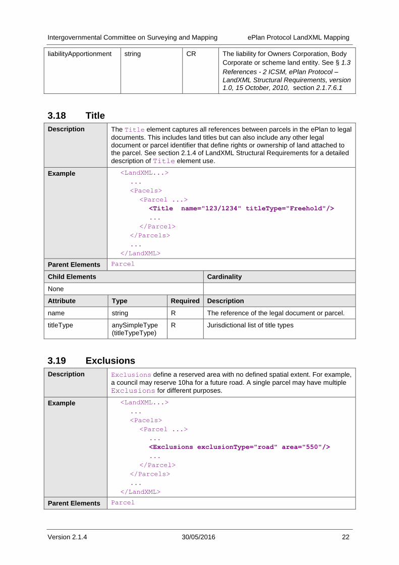
3.18 Title
Description The Title element captures all references between parcels in the ePlan to legal
documents. This includes land titles but can also include any other legal document or parcel identifier that define rights or ownership of land attached to the parcel. See section 2.1.4 of LandXML Structural Requirements for a detailed
description of Title element use.
Example <LandXML...>
...
<Pacels>
<Parcel ...>
<Title name="123/1234" titleType="Freehold"/>
...
</Parcel>
</Parcels>
...
</LandXML>
Parent Elements Parcel
Child Elements Cardinality
None
Attribute Type Required Description
name string R The reference of the legal document or parcel.
titleType anySimpleType (titleTypeType)
R Jurisdictional list of title types
3.19 Exclusions
Description Exclusions define a reserved area with no defined spatial extent. For example,
a council may reserve 10ha for a future road. A single parcel may have multiple
Exclusions for different purposes.
Example <LandXML...>
...
<Pacels>
<Parcel ...>
...
<Exclusions exclusionType="road" area="550"/>
...
</Parcel>
</Parcels>
...
</LandXML>
Parent Elements Parcel
Intergovernmental Committee on Surveying and Mapping ePlan Protocol LandXML Mapping
Version 2.1.4 30/05/2016 23
Child Elements Cardinality
None
Attribute Type Required Description
exclusionType exclusType R The purpose of the area being excluded from the parcel
area double R The area being excluded from the parcel
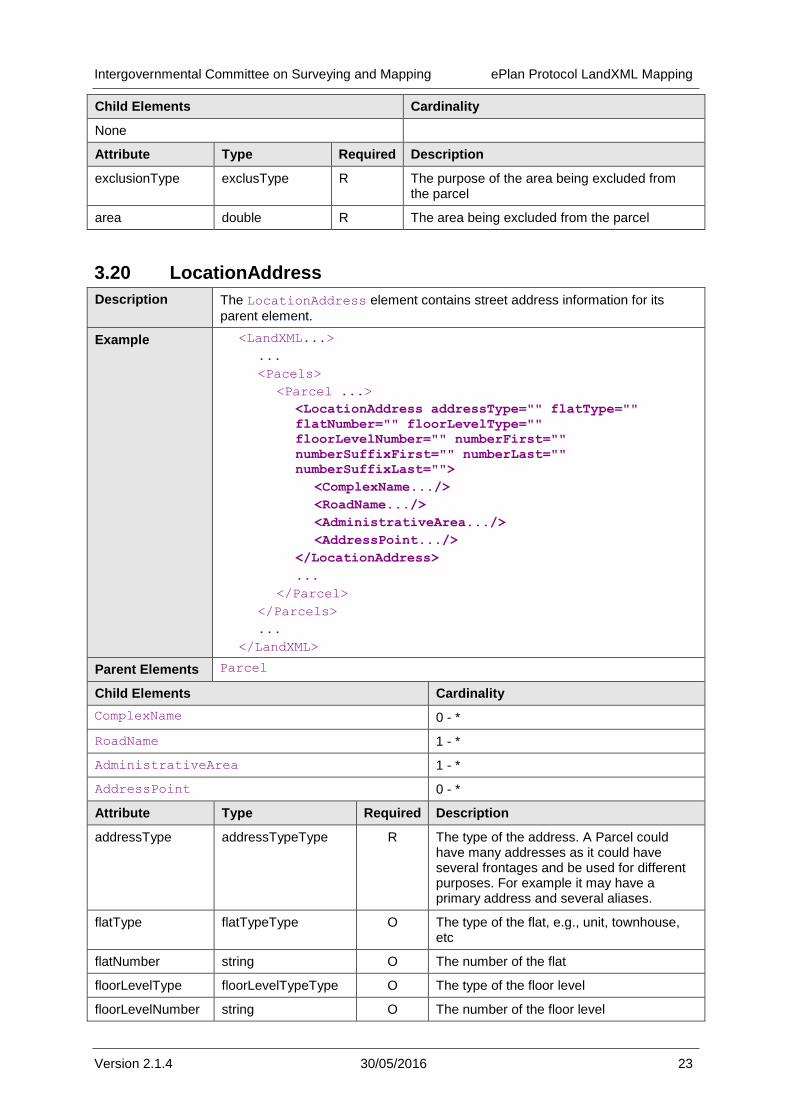
3.20 LocationAddress
Description The LocationAddress element contains street address information for its
parent element.
Example <LandXML...>
...
<Pacels>
<Parcel ...>
<LocationAddress addressType="" flatType=""
flatNumber="" floorLevelType=""
floorLevelNumber="" numberFirst=""
numberSuffixFirst="" numberLast=""
numberSuffixLast="">
<ComplexName.../>
<RoadName.../>
<AdministrativeArea.../>
<AddressPoint.../>
</LocationAddress>
...
</Parcel>
</Parcels>
...
</LandXML>
Parent Elements Parcel
Child Elements Cardinality
ComplexName 0 - *
RoadName 1 - *
AdministrativeArea 1 - *
AddressPoint 0 - *
Attribute Type Required Description
addressType addressTypeType R The type of the address. A Parcel could have many addresses as it could have several frontages and be used for different purposes. For example it may have a primary address and several aliases.
flatType flatTypeType O The type of the flat, e.g., unit, townhouse, etc
flatNumber string O The number of the flat
floorLevelType floorLevelTypeType O The type of the floor level
floorLevelNumber string O The number of the floor level
Intergovernmental Committee on Surveying and Mapping ePlan Protocol LandXML Mapping
Version 2.1.4 30/05/2016 24
numberFirst int O The street address number or the first street address number in a range of numbers.
numberSuffixFirst string O The alpha suffix of the first street address number. E.g., A
numberLast int O The last street address number in a range of numbers.
numberSuffixLast string O The alpha suffix of the last street address number. E.g., B
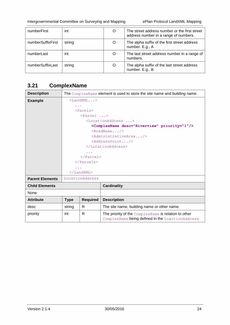
3.21 ComplexName
Description The ComplexName element is used to store the site name and building name.
Example <LandXML...>
...
<Pacels>
<Parcel ...>
<LocationAddress ...>
<ComplexName desc="Riverview" priority="1"/>
<RoadName.../>
<AdministrativeArea.../>
<AddressPoint.../>
</LocationAddress>
...
</Parcel>
</Parcels>
...
</LandXML>
Parent Elements LocationAddress
Child Elements Cardinality
None
Attribute Type Required Description
desc string R The site name, building name or other name.
priority int R The priority of the ComplexName is relation to other
ComplexName being defined in the LoactionAddress
Intergovernmental Committee on Surveying and Mapping ePlan Protocol LandXML Mapping
Version 2.1.4 30/05/2016 25
3.22 RoadName
Description The RoadName element is used to store the details of the road fronted by the
property.
Example <LandXML...>
...
<Pacels>
<Parcel ...>
<LocationAddress ...>
<ComplexName .../>
<RoadName roadNameType="Street" roadName="Smith"
roadNameSuffix="" roadType="Public Highway"
/>
<AdministrativeArea.../>
<AddressPoint.../>
</LocationAddress>
...
</Parcel>
</Parcels>
...
</LandXML>
Parent Elements LocationAddress
Child Elements Cardinality
None
Attribute Type Required Description
roadNameType roadNameTypeType R The type of the road name, e.g. Street, Lane, etc
roadName string R The name of the road (without Type or suffix)
roadNameSuffix roadNameSuffixType O The suffix type of the road name, e.g., East, Upper, West, etc
roadType roadTypeType R the type of the road, e.g., public or private
pclRef parcelNameRefs O Reference to physical road parcel.
Intergovernmental Committee on Surveying and Mapping ePlan Protocol LandXML Mapping
Version 2.1.4 30/05/2016 26
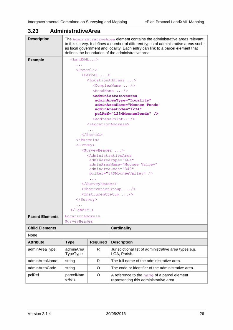
3.23 AdministrativeArea
Description The AdministrativeArea element contains the administrative areas relevant
to this survey. It defines a number of different types of administrative areas such as local government and locality. Each entry can link to a parcel element that defines the boundaries of the administrative area.
Example <LandXML...>
...
<Parcels>
<Parcel ...>
<LocationAddress ...>
<ComplexName .../>
<RoadName .../>
<AdministrativeArea
adminAreaType="Locality"
adminAreaName="Moonee Ponds"
adminAreaCode="1234"
pclRef="1234MooneePonds" />
<AddressPoint.../>
</LocationAddress>
...
</Parcel>
</Parcels>
<Survey>
<SurveyHeader ...>
<AdministrativeArea
adminAreaType="LGA"
adminAreaName="Moonee Valley"
adminAreaCode="349"
pclRef="349MooneeValley" />
...
</SurveyHeader>
<ObservationGroup .../>
<InstrumentSetup .../>
</Survey>
...
</LandXML>
Parent Elements LocationAddress
SurveyHeader
Child Elements Cardinality
None
Attribute Type Required Description
adminAreaType adminAreaTypeType
R Jurisdictional list of administrative area types e.g. LGA, Parish.
adminAreaName string R The full name of the administrative area.
adminAreaCode string O The code or identifier of the administrative area.
pclRef parcelNameRefs
O A reference to the name of a parcel element
representing this administrative area.
Intergovernmental Committee on Surveying and Mapping ePlan Protocol LandXML Mapping
Version 2.1.4 30/05/2016 27
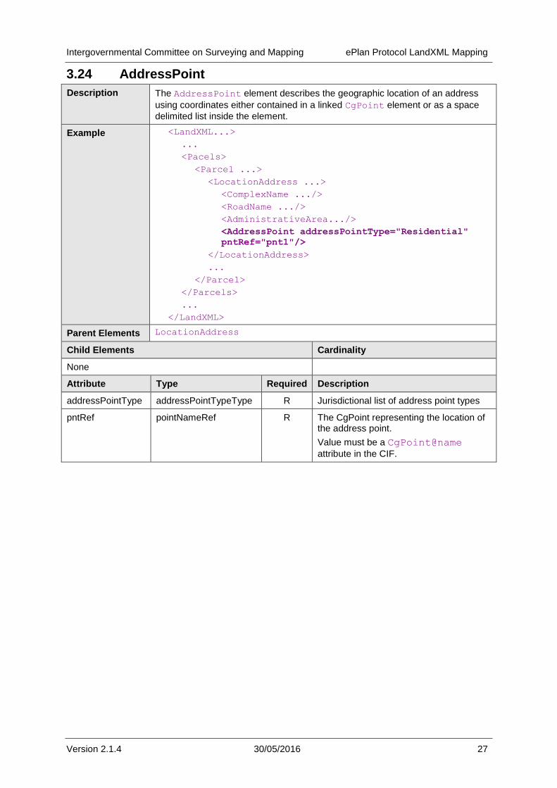
3.24 AddressPoint
Description The AddressPoint element describes the geographic location of an address
using coordinates either contained in a linked CgPoint element or as a space
delimited list inside the element.
Example <LandXML...>
...
<Pacels>
<Parcel ...>
<LocationAddress ...>
<ComplexName .../>
<RoadName .../>
<AdministrativeArea.../>
<AddressPoint addressPointType="Residential"
pntRef="pnt1"/>
</LocationAddress>
...
</Parcel>
</Parcels>
...
</LandXML>
Parent Elements LocationAddress
Child Elements Cardinality
None
Attribute Type Required Description
addressPointType addressPointTypeType R Jurisdictional list of address point types
pntRef pointNameRef R The CgPoint representing the location of the address point.
Value must be a CgPoint@name
attribute in the CIF.

Intergovernmental Committee on Surveying and Mapping ePlan Protocol LandXML Mapping
Version 2.1.4 30/05/2016 28
3.25 Center
Description The Center element represents either:
A nominal centre point for a Parcel element, or
The centre of a Curve element
The coordinates are stored in a CgPoint element. The pntRef attribute
references the CgPoint@name attribute.
Example <LandXML...>
...
<Parcels>
<Parcel ...>
<Center pntRef="pnt1" ></Center>
...
<CoordGeom...>
<Curve>
<Start.../>
<End.../>
<Center pntRef="23" />
</Curve>
</CoordGeom>
</Parcel>
</Parcels>
<CgPoints>
<CgPoint name="pnt1" ...>123.123 321.321</CgPoint>
<CgPoint name="23" ...> 344.543 834.565</CgPoint>
</CgPoints>
...
</LandXML>
Parent Element Parcel
Curve
Child Elements Cardinality
None
Attribute Type Required Description
pntRef pointNameRef R Value must be a CgPoint@name attribute in
the CIF.
Intergovernmental Committee on Surveying and Mapping ePlan Protocol LandXML Mapping
Version 2.1.4 30/05/2016 29
3.26 CoordGeom
Description The CoordGeom element is a container for the spatial components of its parent
element.
Example <LandXML...>
...
<Parcels>
<Parcel ...>
<CoordGeom name="CG-1-PS123456" desc=""
state="existing" oID="">
<Line ...>
<Start ... />
<End ... />
</Line>
...
</CoordGeom>
</Parcel>
</Parcels>
...
<PlanFeatures ...>
<PlanFeature ...>
<CoordGeom name="CG-1-PF1" desc=""
state="existing" oID="">
<Line ...>
<Start ... />
<End ... />
</Line>
</CoordGeom>
</PlanFeature>
</PlanFeatures>
...
</LandXML>
Parent Elements Parcel
PlanFeature
VolumeGeom
Child Elements Cardinality
Line 0 - *
IrregularLine 0 - *
Curve 0 - *
Attribute Type Required Description
desc string O Free text description of the element
name string CR Unique ePlan identifier. Attribute is used to associate observations to parcels and identifies if an observation is used for a boundary.
state stateType O LandXML state type
oID string O

Intergovernmental Committee on Surveying and Mapping ePlan Protocol LandXML Mapping
Version 2.1.4 30/05/2016 30
3.27 Line
Description The Line element represents a line between two points. The line may be 2D or
3D depending on the coordinates of the points that define it.
Example <LandXML...>
...
<Parcels>
<Parcel ...>
<CoordGeom ...>
<Line name="LN-1" desc="" oID="" state=""
note="" >
<Start ... />
<End ... />
</Line>
...
</CoordGeom>
</Parcel>
</Parcels>
...
</LandXML>
Parent Elements CoordGeom
Child Elements Cardinality
Start 1
End 1
Attribute Type Required Description
desc string O Free text description of the element
name string O Unique ePlan identifier
state stateType O LandXML state type
oID string O Jurisdictional identifier
note string O For annotation purposes

Intergovernmental Committee on Surveying and Mapping ePlan Protocol LandXML Mapping
Version 2.1.4 30/05/2016 31
3.28 Curve
Description A Curve is a specific type of regular line between two points. It is defined by its
start and end points, its radius, direction of rotation and centre point (i.e. radius point).
Example <LandXML...>
...
<Pacels>
<Parcel ...>
<CoordGeom ...>
<Curve radius="1" rot="cw" name="5b" desc=""
state="existing" oID="123456" note="">
<Start ... />
<Center ... />
<End ... />
</Curve>
</CoordGeom>
</Parcel>
</Parcels>
...
</LandXML>
Parent Elements CoordGeom
Child Elements Cardinality
Start 1
Center 1
End 1
Attribute Type Required Description
radius double R The radius of the curve
rot Clockwise R Direction from Start to End
name string O Unique ePlan identifier
desc string O Free text description of the element
oID string O Jurisdictional identifier
state stateType O For use with amendments. LandXML enumeration.
note string O
Intergovernmental Committee on Surveying and Mapping ePlan Protocol LandXML Mapping
Version 2.1.4 30/05/2016 32
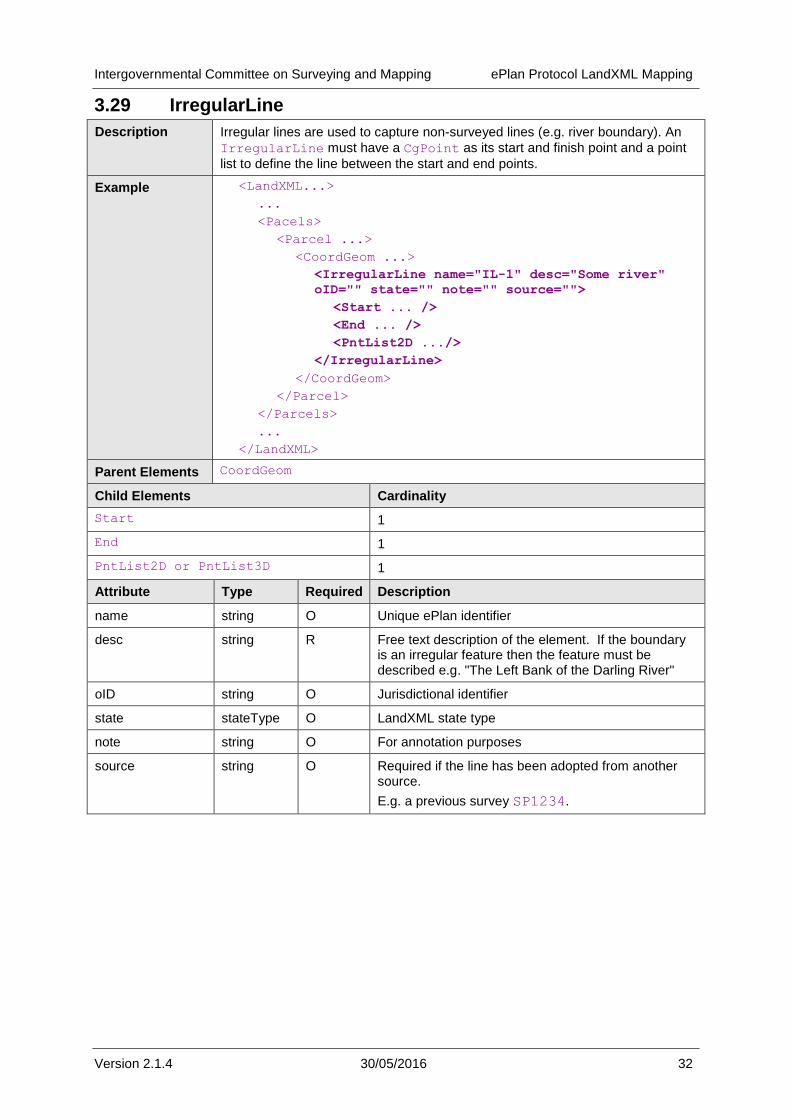
3.29 IrregularLine
Description Irregular lines are used to capture non-surveyed lines (e.g. river boundary). An
IrregularLine must have a CgPoint as its start and finish point and a point
list to define the line between the start and end points.
Example <LandXML...>
...
<Pacels>
<Parcel ...>
<CoordGeom ...>
<IrregularLine name="IL-1" desc="Some river"
oID="" state="" note="" source="">
<Start ... />
<End ... />
<PntList2D .../>
</IrregularLine>
</CoordGeom>
</Parcel>
</Parcels>
...
</LandXML>
Parent Elements CoordGeom
Child Elements Cardinality
Start 1
End 1
PntList2D or PntList3D 1
Attribute Type Required Description
name string O Unique ePlan identifier
desc string R Free text description of the element. If the boundary is an irregular feature then the feature must be described e.g. "The Left Bank of the Darling River"
oID string O Jurisdictional identifier
state stateType O LandXML state type
note string O For annotation purposes
source string O Required if the line has been adopted from another source.
E.g. a previous survey SP1234.

Intergovernmental Committee on Surveying and Mapping ePlan Protocol LandXML Mapping
Version 2.1.4 30/05/2016 33
3.30 Start
Description The Start element represents the start of a number of linear elements such as
Curve, Line, IrregularLine (cf. End).
Example <LandXML...>
...
<Pacels>
<Parcel ...>
<CoordGeom ...>
<Curve ...>
<Start pntRef="214"/>
<End ... />
<Center ... />
</Curve>
</CoordGeom>
</Parcel>
</Parcels>
...
</LandXML>
Parent Elements Curve
IrregularLine
Line
Child Elements Cardinality
None
Attribute Type Required Description
pntRef pointNameRef R Value must be a CgPoint@name attribute in the
CIF.
3.31 End
Description The End element represents the end of a number of linear elements such as
Curve, Line, IrregularLine (cf. Start).
Example <LandXML...>
...
<Pacels>
<Parcel ...>
<CoordGeom ...>
<Curve ...>
<Start .../>
<End pntRef="215" />
<Center ... />
</Curve>
</CoordGeom>
</Parcel>
</Parcels>
...
</LandXML>
Intergovernmental Committee on Surveying and Mapping ePlan Protocol LandXML Mapping
Version 2.1.4 30/05/2016 34
Parent Elements Curve
IrregularLine
Line
Child Elements Cardinality
None
Attribute Type Required Description
pntRef pointNameRef R Value must be a CgPoint@name attribute in the
CIF.
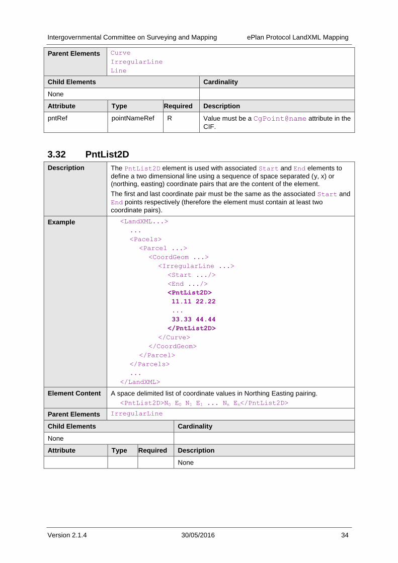
3.32 PntList2D
Description The PntList2D element is used with associated Start and End elements to
define a two dimensional line using a sequence of space separated (y, x) or (northing, easting) coordinate pairs that are the content of the element.
The first and last coordinate pair must be the same as the associated Start and
End points respectively (therefore the element must contain at least two
coordinate pairs).
Example <LandXML...>
...
<Pacels>
<Parcel ...>
<CoordGeom ...>
<IrregularLine ...>
<Start .../>
<End .../>
<PntList2D>
11.11 22.22
...
33.33 44.44
</PntList2D>
</Curve>
</CoordGeom>
</Parcel>
</Parcels>
...
</LandXML>
Element Content A space delimited list of coordinate values in Northing Easting pairing.
<PntList2D>N0 E0 N1 E1 ... Nn En</PntList2D>
Parent Elements IrregularLine
Child Elements Cardinality
None
Attribute Type Required Description
None
Intergovernmental Committee on Surveying and Mapping ePlan Protocol LandXML Mapping
Version 2.1.4 30/05/2016 35
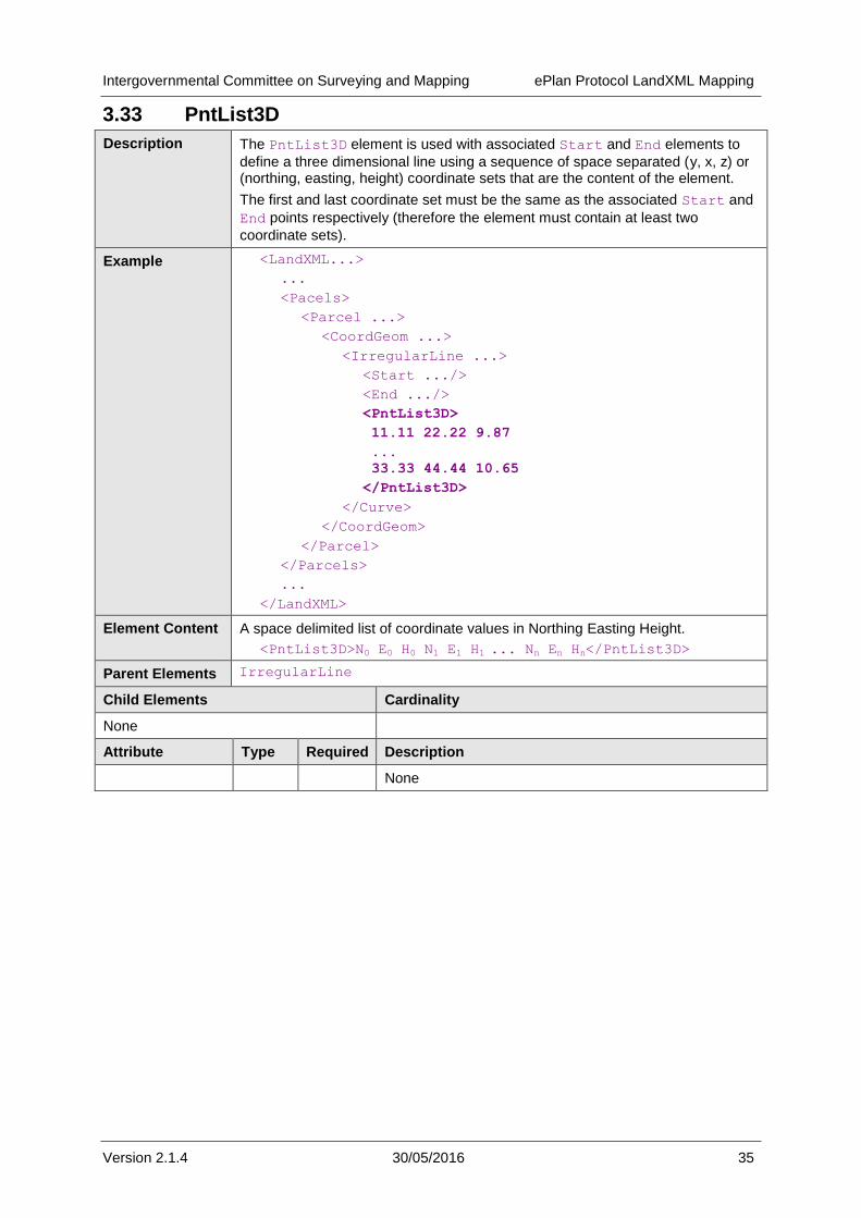
3.33 PntList3D
Description The PntList3D element is used with associated Start and End elements to
define a three dimensional line using a sequence of space separated (y, x, z) or (northing, easting, height) coordinate sets that are the content of the element.
The first and last coordinate set must be the same as the associated Start and
End points respectively (therefore the element must contain at least two
coordinate sets).
Example <LandXML...>
...
<Pacels>
<Parcel ...>
<CoordGeom ...>
<IrregularLine ...>
<Start .../>
<End .../>
<PntList3D>
11.11 22.22 9.87
...
33.33 44.44 10.65
</PntList3D>
</Curve>
</CoordGeom>
</Parcel>
</Parcels>
...
</LandXML>
Element Content A space delimited list of coordinate values in Northing Easting Height.
<PntList3D>N0 E0 H0 N1 E1 H1 ... Nn En Hn</PntList3D>
Parent Elements IrregularLine
Child Elements Cardinality
None
Attribute Type Required Description
None

Intergovernmental Committee on Surveying and Mapping ePlan Protocol LandXML Mapping
Version 2.1.4 30/05/2016 36
3.34 VolumeGeom
Description Defines the properties of a 3D Coordinate Geometry collection.
Example <LandXML...>
...
<Parcels>
<Parcel ...>
<VolumeGeom name="" desc="" state="" oID="">
<CoordGeom ... />
<CoordGeom ... />
<CoordGeom ... />
<CoordGeom ... />
</VolumeGeom>
</Parcel>
</Parcels>
...
</LandXML>
Parent Elements Parcel
Child Elements Cardinality
CoordGeom 4 - *
Attribute Type Required Description
name string O Unique ePlan identifier
desc string O Free text description of the element
state stateType O For use with amendments. LandXML enumeration.
oID string O Jurisdictional identifier
3.35 PlanFeatures
Description A container for PlanFeature elements. Multiple PlanFeatures elements are
used as a container for a specific category of plan feature.
Example <LandXML...>
...
<PlanFeatures name="PFGROUP1" desc="Occupation">
<PlanFeature.../>
...
</PlanFeatures>
<PlanFeatures name="PFGROUP2" desc="Feature">
<PlanFeature.../>
...
</PlanFeatures>
...
</LandXML>
Parent Elements LandXML
Child Elements Cardinality
PlanFeature 1 - *
Attribute Type Required Description
name string R Unique ePlan identifier.

Intergovernmental Committee on Surveying and Mapping ePlan Protocol LandXML Mapping
Version 2.1.4 30/05/2016 37
desc string O Category of plan feature e.g. occupation or feature.
3.36 PlanFeature
Description The PlanFeature element defines any spatial object on a plan where a
Parcel element is not required. Some examples are Features and Occupation.
This element can be used to capture closed polygons, lines and points.
Example <LandXML...>
...
<PlanFeatures ...>
<PlanFeature name="PF1" desc="Driveway">
<CoordGeom ...>
<Line ...>
<Start ... />
<End ... />
</Line>
...
</CoordGeom>
</PlanFeature>
</PlanFeatures>
...
</LandXML>
Or
<LandXML...>
...
<PlanFeatures ...>
<PlanFeature name="PF1" desc="Driveway">
<Location .../>
</PlanFeature>
</PlanFeatures>
...
</LandXML>
Parent Elements PlanFeatures
Child Elements Cardinality
CoordGeom 0..1
Location 0..1
FieldNote 0 - *
Attribute Type Required Description
name string R Unique ePlan identifier
desc string R Free text description of the element
3.37 Surfaces
Elements that fall under Surfaces are used for 3D plans. The specification of these elements has not been finalised and is included for future use only.
Intergovernmental Committee on Surveying and Mapping ePlan Protocol LandXML Mapping
Version 2.1.4 30/05/2016 38
Description The Surfaces element is a container for Surface elements.
Example <LandXML...>
...
<Surfaces name="" desc="" oID="" state="">
<Surface ...>
<Definition ...>
<Pnts>
<P .../>
</Pnts>
<Faces>
<F .../>
</Faces>
</Definition>
...
</Surface>
...
</Surfaces>
...
</LandXML>
Parent Elements LandXML
Child Elements Cardinality
Surface 1 - *
Attribute Type Required Description
name string O The name of the collection of surfaces
desc string O The description of the collection of surfaces
state stateType O LandXML state type
3.38 Surface
Description To be confirmed. The Surface element defines a surface.
Example <LandXML...>
...
<Surfaces ...>
<Surface name="" desc="" oID="" state="">
<Definition ...>
<Pnts>
<P .../>
</Pnts>
<Faces>
<F .../>
</Faces>
</Definition>
...
</Surface>
...
</Surfaces>
...
</LandXML>

Intergovernmental Committee on Surveying and Mapping ePlan Protocol LandXML Mapping
Version 2.1.4 30/05/2016 39
Parent Elements Surfaces
Child Elements Cardinality
Definition 1 - *
Attribute Type Required Description
name string R The unique name of the surface
desc string O The description of the surface
oID string O The jurisdictional identifier of the surface
state stateType O LandXML state type
3.39 Definition
Description To be confirmed. The Definition element contains the elements that define all
or part of the parent Surface element.
Example <LandXML...>
...
<Surfaces ...>
<Surface>
<Definition surfType="Wall" area2DSurf="123"
area3dSurf="234" elevMax="2" elevMin="2">
<Pnts>
<P .../>
</Pnts>
<Faces>
<F .../>
</Faces>
</Definition>
...
</Surface>
...
</Surfaces>
...
</LandXML>
Parent Elements Surface
Child Elements Cardinality
Pnts 1 - *
Faces 1 - *
Attribute Type Required Description
surfType surfTypeEnum R The surface type, e.g. TIN or Grid.
area2DSurf double O The area of the 2D surface
area3DSurf double O The area of the 3D surface
elevMax double O The maximum elevation in the surface
elevMin double O The minimum elevation in the surface

Intergovernmental Committee on Surveying and Mapping ePlan Protocol LandXML Mapping
Version 2.1.4 30/05/2016 40
3.40 Pnts
Description To be confirmed. The collection of points that defined the surface. The "P" point id values are unique per surface.
Example <LandXML...>
...
<Surfaces ...>
<Surface>
<Definition ...>
<Pnts>
<P .../>
<P .../>
</Pnts>
<Faces>
<F .../>
</Faces>
</Definition>
...
</Surface>
...
</Surfaces>
...
</LandXML>
Parent Elements Definition
Child Elements Cardinality
P 1 - *
Attribute Type Required Description
None

Intergovernmental Committee on Surveying and Mapping ePlan Protocol LandXML Mapping
Version 2.1.4 30/05/2016 41
3.41 Faces
Description To be confirmed. The collection of faces that define the surface.
Example <LandXML...>
...
<Surfaces ...>
<Surface>
<Definition ...>
<Pnts>
<P .../>
</Pnts>
<Faces>
<F .../>
</Faces>
</Definition>
...
</Surface>
...
</Surfaces>
...
</LandXML>
Parent Elements Definition
Child Elements Cardinality
F 1 - *
Attribute Type Required Description
desc string O Optional description
name string O Unique ePlan identifier.
state string O For amendment purpose. LandXML enumeration.

Intergovernmental Committee on Surveying and Mapping ePlan Protocol LandXML Mapping
Version 2.1.4 30/05/2016 42
3.42 P
Description To be confirmed. A 3D surface point containing an id attribute and a space delimited northing, easting and elevation values.
Example <LandXML...>
...
<Surfaces ...>
<Surface>
<Definition ...>
<Pnts>
<P id="XYZ">N0 E0 H0 N1 E1 H1 ... Nn En Hn</P>
<P .../>
</Pnts>
<Faces>
<F .../>
</Faces>
</Definition>
...
</Surface>
...
</Surfaces>
...
</LandXML>
Element Content As for CgPoint
Parent Elements Pnts
Child Elements Cardinality
None
Attribute Type Required Description
id positiveInteger R Used by surface faces as a reference to the point

Intergovernmental Committee on Surveying and Mapping ePlan Protocol LandXML Mapping
Version 2.1.4 30/05/2016 43
3.43 F
Description To be confirmed. A surface face. It contains a space delimited list of references
to P elements that define the face: for 3 a TIN or 4 for a grid surface.
Example <LandXML...>
...
<Surfaces ...>
<Surface>
<Definition ...>
<Pnts>
<P .../>
</Pnts>
<Faces>
<F>ID0 ID1 ID2</F>
...
</Faces>
</Definition>
...
</Surface>
...
</Surfaces>
...
</LandXML>
Element Content A space delimited list of P element id attribute values (P@id). 3 for a TIN or 4
for a grid.
Parent Elements Faces
Child Elements Cardinality
None
Attribute Type Required Description
i integer O To be confirmed
n FaceType O To be confirmed
b positiveInteger O To be confirmed
3.44 Survey
Description The Survey element contains the survey components of the ePlan.
Example <LandXML...>
...
<Survey>
<SurveyHeader .../>
<ObservationGroup .../>
<InstrumentSetup .../>
</Survey>
...
</LandXML>
Parent Elements LandXML

Intergovernmental Committee on Surveying and Mapping ePlan Protocol LandXML Mapping
Version 2.1.4 30/05/2016 44
Child Elements Cardinality
SurveyHeader 1
ObservationGroup 1
InstrumentSetup 1 - *
Attribute Type Required Description
None
3.45 SurveyHeader
Description The SurveyHeader element contains administrative information about the
survey.
Example <LandXML...>
...
<Survey>
<SurveyHeader
name="PS123456"
desc="Plan of lot 1 on PS123456"
jurisdiction="Victoria"
surveyorFirm="Reeds Consulting"
surveyorReference="2314jfxd"
surveyFormat="Standard"
type="surveyed"
surveyStatus="Lodged"
documentStatus="Signed"
fieldNoteFlag="N"
fieldNoteReference=""
fieldReport=""
communityTitleSchemeNo=""
communityTitleSchemeName=""
submissionDate="21/12/2010"
>
<HeadOfPower .../>
<PurposeOfSurvey .../>
<AdministrativeDate.../>
<AdministrativeArea .../>
<Annotation .../>
<Personnel .../>
<SurveyorCertificate .../>
<CoordinateSystem .../>
<FieldNote .../>
</SurveyHeader>
<ObservationGroup .../>
<InstrumentSetup .../>
</Survey>
...
</LandXML>
Parent Elements Survey
Child Elements Cardinality

Intergovernmental Committee on Surveying and Mapping ePlan Protocol LandXML Mapping
Version 2.1.4 30/05/2016 45
HeadOfPower 1 - *
PurposeOfSurvey 1 - *
AdministrativeDate 0 - *
AdministrativeArea 0 - *
Annotation 0 - *
Personnel 0 - *
SurveyorCertificate 0 - *
FieldNote 0 - *
Attribute Type Required Description
name string R The identifier of this ePlan file.
desc string O Optional description of the plan.
jurisdiction jurisdictionType R The jurisdiction this plan was created for.
surveyorFirm string O The name of the surveying firm that lodged this file.
surveyorReference string O A space for the surveying firms internal reference ID.
surveyFormat surveyFormatType O Format of the survey. e.g. Standard,
multilevel, strata
type surveyType O The plan type. e.g.
compiled, computed, surveyed
surveyStatus surveyStatusType O Status of the survey
documentStatus documentStatusType O Status of the survey document
fieldNoteFlag boolean O A flag used to indicate whether field notes have been attached as a separate file.
fieldNoteReference string O The reference ID for the attached field notes documents.
fieldReport string O Field report information captured in the ePlan file if necessary.
communityTitleSchemeNo
int O If an Owners Corporation or Body Corporate applies to this plan, the ID is specified here. Note: if the jurisdiction
requires multiple OCs per plan, see § 1.3
References - 2 ICSM, ePlan Protocol –
LandXML Structural Requirements, version 1.0, 15 October, 2010, section 2.1.7.6.1
communityTitleSchemeName
string O If an Owners Corporation or Body Corporate applies to this plan, the name is specified here.
submissionDate date O Date the plan was submitted.

Intergovernmental Committee on Surveying and Mapping ePlan Protocol LandXML Mapping
Version 2.1.4 30/05/2016 46
3.46 HeadOfPower
Description The HeadOfPower specifies the authority that gives the approver the power to
approve the plan and information contained. Generally this relates to an Act of
parliament or Regulation. Multiple HeadOfPower values can be specified if
required where multiple Acts or Regulation documents apply to the plan.
Example <LandXML...>
...
<Survey>
<SurveyHeader ...>
<HeadOfPower name="Survey Act 2003"/>
...
</SurveyHeader>
<ObservationGroup .../>
<InstrumentSetup .../>
</Survey>
...
</LandXML>
Parent Elements SurveyHeader
Child Elements Cardinality
None
Attribute Type Required Description
name headOfPowerType R Enumerated head of power value.
3.47 PurposeOfSurvey
Description The PurposeOfSurvey element describes the purpose of the survey. Multiple
purpose values are permitted as per jurisdictional requirements.
Example <LandXML...>
...
<Survey>
<SurveyHeader ...>
<PurposeOfSurvey name="Subdivision"/>
<PurposeOfSurvey name="Creation of Easement"/>
...
</SurveyHeader>
<ObservationGroup .../>
<InstrumentSetup .../>
</Survey>
...
</LandXML>
Parent Elements SurveyHeader
Child Elements Cardinality
None
Attribute Type Required Description
name purpSurvType R Enumerated survey purpose field
Intergovernmental Committee on Surveying and Mapping ePlan Protocol LandXML Mapping
Version 2.1.4 30/05/2016 47
3.48 AdministrativeDate
Description The AdministrativeDate element captures a list of relevant administrative
dates used in the jurisdictions plan lodgement process.
Example <LandXML...>
...
<Survey>
<SurveyHeader ...>
<AdministrativeDate
adminDateType="Deposited"
adminDate="2010-01-01" />
...
</SurveyHeader>
<ObservationGroup .../>
<InstrumentSetup .../>
</Survey>
...
</LandXML>
Parent Elements SurveyHeader
Child Elements Cardinality
None
Attribute Type Required Description
adminDateType adminDateTypeType R A jurisdictional list of date types
adminDate date R The date value
3.49 Annotation
Description The Annotation element is used in conjunction with the jurisdictional
annotations schema (see § 1.3 References - 3 ICSM, ePlan Protocol – Schema
Architecture, version 2.0, 19 October, 2010, )
Example <LandXML...>
...
<Survey>
<SurveyHeader ...>
<Annotation type="" name=""
desc=""pclRef="" />
...
</SurveyHeader>
<ObservationGroup .../>
<InstrumentSetup .../>
</Survey>
...
</LandXML>
Parent Elements SurveyHeader
Child Elements Cardinality
None

Intergovernmental Committee on Surveying and Mapping ePlan Protocol LandXML Mapping
Version 2.1.4 30/05/2016 48
Attribute Type Required Description
type annotationType R This is a category of annotation and is a defined list per jurisdiction. An Annotation could be based on the plan as a general statement or specific to a parcel or number of parcels, e.g. a Compilation Certificate or Area of New Road statement.
The full text of an annotation is usually defined by jurisdictional regulations and guidelines.
The type field is used to manage the validation process for the annotation.
name string R This is the unique name of the Annotation and is used for tracking the reference and amendments.
desc string R The actual text of the statement e.g. Total area of new road 5.123ha. This description may be required in a specific format as set out in regulations.
pclRef parcelNameRefs CR A list of one or more space separated Parcel@name attributes.
Required if the annotation refers to a parcel, the parcel must be defined in the CIF. The pclRefs attribute allows referencing action statements to one or more parcels. A conditional field as some annotations do not refer to parcels, e.g. "Marks set at all new corners" or an annotation describing a Non-Statutory Easement.
3.50 Personnel
Description The Personnel element captures information about the personnel who
participated in the survey and the surveyor who endorsed the survey.
Example <LandXML...>
...
<Survey>
<SurveyHeader ...>
<Personnel name="" role="" regType=""
regNumber="" />
</SurveyHeader>
<ObservationGroup .../>
<InstrumentSetup .../>
</Survey>
...
</LandXML>
Parent Elements SurveyHeader
Child Elements Cardinality
None
Attribute Type Required Description
name string R Full name of the surveyor as registered.
role surveyorRoleType R The role the surveyor played in the survey.
regType registrationType R Level of registration.
regNumber string R Surveyor's board registration number
Intergovernmental Committee on Surveying and Mapping ePlan Protocol LandXML Mapping
Version 2.1.4 30/05/2016 49
3.51 SurveyorCertificate
Description The SurveyorCertificate element is used in conjunction with the
jurisdictional certificates schema (see § 1.3 References - 3 ICSM, ePlan Protocol
– Schema Architecture, version 2.0, 19 October, 2010, ). The text contained in
textCertificate should conform to the layout specified in the jurisdiction's
certificates schema.
Example <LandXML...>
...
<Survey>
<SurveyHeader ...>
<SurveyorCertificate
name=""
certificateType=""
textCertificate=""
surveyDate="" />
</SurveyHeader>
<ObservationGroup .../>
<InstrumentSetup .../>
</Survey>
...
</LandXML>
Parent Elements SurveyHeader
Child Elements Cardinality
None
Attribute Type Required Description
name string R Unique ePlan identifier.
certificateType string
(certificateTypeType)
R The ID of the certificate type in the certificates schema that this certificate conforms to
textCertificate string R The textual certificate information
surveyDate date O The date the survey was completed if applicable.
3.52 FieldNote
Description Notes are added as content of the FieldNote element. Plain text or any valid
XML structure may be placed inside this element. It is the responsibility of the jurisdiction to supply XML schemas or DTDs for the XML content of this element.
Example <LandXML...>
...
<Survey>
<SurveyHeader ...>
<FieldNote>This is a field note.</FieldNote>
</SurveyHeader>
...
</Survey>
...
</LandXML>
Element Content Free text or any valid XML structure representing the field note information.

Intergovernmental Committee on Surveying and Mapping ePlan Protocol LandXML Mapping
Version 2.1.4 30/05/2016 50
Parent Elements SurveyHeader
PlanFeature
ReducedObservation
ReducedArcObservation
RedHorizontalPosition
RedVerticalObservation
Child Elements Cardinality
None (If custom XML is used, child elements of the custom XML will be shown.)
Attribute Type Required Description
None
3.53 ObservationGroup
Description The ObservationGroup element is a container element for all types of
observation elements.
Example <LandXML...>
...
<Survey>
<ObservationGroup id="OG-1">
<ReducedObservation.../>
<ReducedArcObservation.../>
...
</ObservationGroup>
...
</Survey>
...
</LandXML>
Parent Elements Survey
Child Elements Cardinality
ReducedObservation 0 - *
ReducedArcObservation 0 - *
RedHorizontalPosition 0 - *
RedVerticalObservation 0 - *
Attribute Type Required Description
id ID R As LandXML allows multiple observation groups, each observation group has an “id”. For ePlan files it is expected that there will be only one observation group per file.
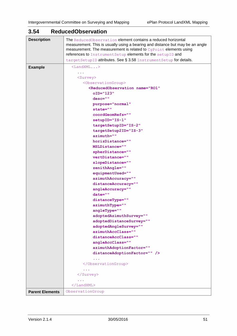
Intergovernmental Committee on Surveying and Mapping ePlan Protocol LandXML Mapping
Version 2.1.4 30/05/2016 51
3.54 ReducedObservation
Description The ReducedObservation element contains a reduced horizontal
measurement. This is usually using a bearing and distance but may be an angle
measurement. The measurement is related to CgPoint elements using
references to InstrumentSetup elements for the setupID and
targetSetupID attributes. See § 3.58 InstrumentSetup for details.
Example <LandXML...>
...
<Survey>
<ObservationGroup>
<ReducedObservation name="RO1"
oID="123"
desc=""
purpose="normal"
state=""
coordGeomRefs=""
setupID="IS-1"
targetSetupID="IS-2"
targetSetup2ID="IS-3"
azimuth=""
horizDistance=""
MSLDistance=""
spherDistance=""
vertDistance=""
slopeDistance=""
zenithAngle=""
equipmentUsed=""
azimuthAccuracy=""
distanceAccuracy=""
angleAccuracy=""
date=""
distanceType=""
azimuthType=""
angleType=""
adoptedAzimuthSurvey=""
adoptedDistanceSurvey=""
adoptedAngleSurvey=""
azimuthAccClass=""
distanceAccClass=""
angleAccClass=""
azimuthAdoptionFactor=""
distanceAdoptionFactor="" />
...
</ObservationGroup>
...
</Survey>
...
</LandXML>
Parent Elements ObservationGroup
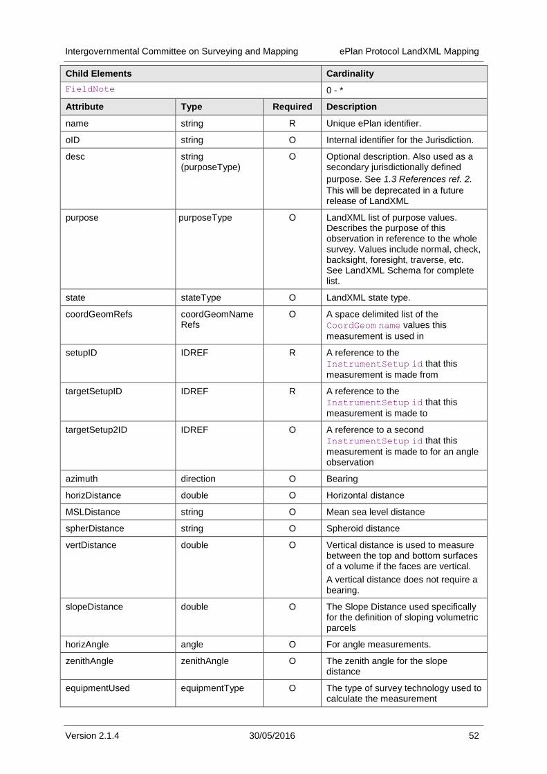
Intergovernmental Committee on Surveying and Mapping ePlan Protocol LandXML Mapping
Version 2.1.4 30/05/2016 52
Child Elements Cardinality
FieldNote 0 - *
Attribute Type Required Description
name string R Unique ePlan identifier.
oID string O Internal identifier for the Jurisdiction.
desc string (purposeType)
O Optional description. Also used as a secondary jurisdictionally defined
purpose. See 1.3 References ref. 2.
This will be deprecated in a future release of LandXML
purpose purposeType O LandXML list of purpose values. Describes the purpose of this observation in reference to the whole survey. Values include normal, check, backsight, foresight, traverse, etc. See LandXML Schema for complete list.
state stateType O LandXML state type.
coordGeomRefs coordGeomNameRefs
O A space delimited list of the
CoordGeom name values this
measurement is used in
setupID IDREF R A reference to the
InstrumentSetup id that this
measurement is made from
targetSetupID IDREF R A reference to the
InstrumentSetup id that this
measurement is made to
targetSetup2ID IDREF O A reference to a second
InstrumentSetup id that this
measurement is made to for an angle observation
azimuth direction O Bearing
horizDistance double O Horizontal distance
MSLDistance string O Mean sea level distance
spherDistance string O Spheroid distance
vertDistance double O Vertical distance is used to measure between the top and bottom surfaces of a volume if the faces are vertical.
A vertical distance does not require a bearing.
slopeDistance double O The Slope Distance used specifically for the definition of sloping volumetric parcels
horizAngle angle O For angle measurements.
zenithAngle zenithAngle O The zenith angle for the slope distance
equipmentUsed equipmentType O The type of survey technology used to calculate the measurement

Intergovernmental Committee on Surveying and Mapping ePlan Protocol LandXML Mapping
Version 2.1.4 30/05/2016 53
azimuthAccuracy double O Accuracy of the bearing
distanceAccuracy double O Accuracy of the distance
angleAccuracy double O Accuracy of the angle (if applicable)
date date O The date the measurement was taken
distanceType observationType O The distance type
azimuthType observationType O Azimuth type
angleType observationType O Angle type
adoptedAzimuthSurvey string O If the observation is adopted from a previous survey, the identifier of the survey it was adopted from
adoptedDistanceSurvey string O If the observation is adopted from a previous survey, the identifier of the survey it was adopted from
adoptedAngleSurvey string O If the observation is adopted from a previous survey, the identifier of the survey it was adopted from
azimuthAccClass string (horzClassType)
O Accuracy class of the bearing
distanceAccClass string (horzClassType)
O Accuracy class of the distance
angleAccClass string (horzClassType)
O Accuracy class of the angle
azimuthAdoptionFactor double O If the observation is adopted from a previous survey, the angle used to bring it onto the datum of this survey (a.k.a swing factor)
distanceAdoptionFactor double O If the observation is adopted from a previous survey, the distance factor used to bring it onto the datum of this survey
or
to convert ground measurement to grid for observations between control marks

Intergovernmental Committee on Surveying and Mapping ePlan Protocol LandXML Mapping
Version 2.1.4 30/05/2016 54
3.55 ReducedArcObservation
Description The ReducedArcObservation element contains a horizontal arc
measurement.
Example <LandXML...>
...
<Survey>
<ObservationGroup>
<ReducedArcObservation
name=""
oID=""
desc=""
purpose=""
state=""
coordGeomRefs=""
setupID=""
targetSetupID=""
chordAzumith=""
radius=""
length=""
rot=""
equipmentUsed=""
arcAzimuthAccuracy=""
arcLengthAccuracy=""
date=""
arcType=""
adoptedSurvey=""
azimuthAccClass=""
lengthAccClass=""
azimuthAdoptionFactor=""
lengthAdoptionFactor=""
/>
...
</ObservationGroup>
...
</Survey>
...
</LandXML>
Parent Elements ObservationGroup
Child Elements Cardinality
FieldNote 0 - *
Attribute Type Required Description
name string R Unique ePlan identifier
oID string O Internal identifier for the Jurisdiction.
desc string (purposeType)
O Optional description. Also used as a secondary jurisdictionally defined
purpose. See 1.3 References ref. 2. This
will be deprecated in a future release of LandXML

Intergovernmental Committee on Surveying and Mapping ePlan Protocol LandXML Mapping
Version 2.1.4 30/05/2016 55
purpose purposeType O LandXML list of purpose values. Describes the purpose of this observation in reference to the whole survey. Values include normal, check, backsight, foresight, traverse, etc. See LandXML Schema for complete list.
state stateType O LandXML state type.
coordGeomRefs coordGeomNameRefs
O A space delimited list of the CoordGeom
name values this measurement is used
in
setupID IDREF R A reference to the InstrumentSetup
id that this measurement is made from
targetSetupID IDREF R A reference to the InstrumentSetup
id that this measurement is made to
chordAzimuth direction R The bearing of the arc chord
radius double R Radius of the arc
length double R Length of the arc
rot clockwise R Direction of rotation from the start to the end
equipmentUsed equipmentType O The type of survey technology for the measurement
arcAzimuthAccuracy double O Accuracy of the arc azimuth
arcLengthAccuracy double O Accuracy of the arc length
date date O The date the measurement was taken
arcType string (observationType)
O Arc type
adoptedSurvey string O If the observation is adopted from a previous survey, the identifier of the survey it was adopted from
azimuthAccClass string (horzClassType)
O Accuracy class of the arc bearing
lengthAccClass string (horzClassType)
O Accuracy class of the arc length
azimuthAdoptionFactor double O If the observation is adopted from a previous survey, the angle used to bring it onto the datum of this survey (a.k.a swing factor)
lengthAdoptionFactor double O If the observation is adopted from a previous survey, the distance factor used to bring it onto the datum of this survey

Intergovernmental Committee on Surveying and Mapping ePlan Protocol LandXML Mapping
Version 2.1.4 30/05/2016 56
3.56 RedHorizontalPosition
Description The RedHorizontalPosition element contains horizontal measurement
information for a point on the ground. This element is used to capture survey and geodetic control information.
Example <LandXML...>
...
<Survey>
<ObservationGroup>
<ReducedHorizontalPosition
name="RHP-1"
oID="123456"
desc=""
purpose="normal"
state="new"
date=""
coordGeomRefs="CG-1-PS123456 CG-3-PS123"
setupID="IS-1"
equipmentUsed=""
horizontalDatum=""
horizontalAdjustment=""
latitude=""
longitude=""
horizontalFix=""
currencyDate=""
positionalUncertainty=""
localUncertaintly=""
class=""
order="" />
...
</ObservationGroup>
...
</Survey>
...
</LandXML>
Parent Elements ObservationGroup
Child Elements Cardinality
FieldNote 0 - *
Attribute Type Required Description
name string R Unique ePlan identifier.
oID string O Internal identifier for the Jurisdiction.
desc string O Optional description.
purpose purposeType O LandXML list of purpose values. Describes the purpose of this observation in reference to the whole survey. Values include normal, check, backsight, foresight, traverse, etc. See LandXML Schema for complete list.
state stateType O LandXML state type
date date O The date the current measurement value was instated.

Intergovernmental Committee on Surveying and Mapping ePlan Protocol LandXML Mapping
Version 2.1.4 30/05/2016 57
setupID IDREF R A reference to the InstrumentSetup id that this measurement is based off.
equipmentUsed equipmentType O The type of survey technology used to calculate the measurement.
horizontalDatum string (horzDatumType)
R The horizontal datum for this measurement.
horizontalAdjustment string O The name of the adjustment (e.g. the project) used to derive the measurement.
latitude string R Official (undistorted) latitude value.
longitude string R Official (undistorted) longitude value.
horizontalFix string (horzFixType)
R The method used to determine position of the mark. Specified by jurisdictions' Survey Control Databases. Alternatively, a description on how the position of the mark was determined (e.g. scaled from map, GPS etc).
currencyDate string O The date that the coordinates were retrieved from the source database. If these were new coordinates then the currency date would be the date of the survey.
positionalUncertainty double O The positional accuracy in relation to other measurements.
localUncertainty double O The precision of the measurement
class string (horzClassType)
O
order string (horzOrderType)
O
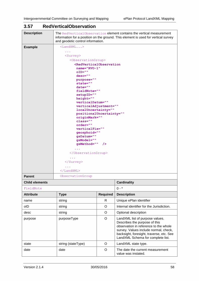
Intergovernmental Committee on Surveying and Mapping ePlan Protocol LandXML Mapping
Version 2.1.4 30/05/2016 58
3.57 RedVerticalObservation
Description The RedVerticalObservation element contains the vertical measurement
information for a position on the ground. This element is used for vertical survey and geodetic control information.
Example <LandXML...>
...
<Survey>
<ObservationGroup>
<RedVerticalObservation
name="RVO-1"
oID=""
desc=""
purpose=""
state=""
date=""
fieldNote=""
setupID=""
height=""
verticalDatum=""
verticalAdjustment=""
localUncertainty=""
positionalUncertainty=""
originMark=""
class=""
order=""
verticalFix=""
geosphoid=""
gsDatum=""
gsModel=""
gsMethod="" />
...
</ObservationGroup>
...
</Survey>
...
</LandXML>
Parent ObservationGroup
Child elements Cardinality
FieldNote 0 - *
Attribute Type Required Description
name string R Unique ePlan identifier
oID string O Internal identifier for the Jurisdiction.
desc string O Optional description
purpose purposeType O LandXML list of purpose values. Describes the purpose of this observation in reference to the whole survey. Values include normal, check, backsight, foresight, traverse, etc. See LandXML Schema for complete list.
state string (stateType) O LandXML state type.
date date O The date the current measurement value was instated.
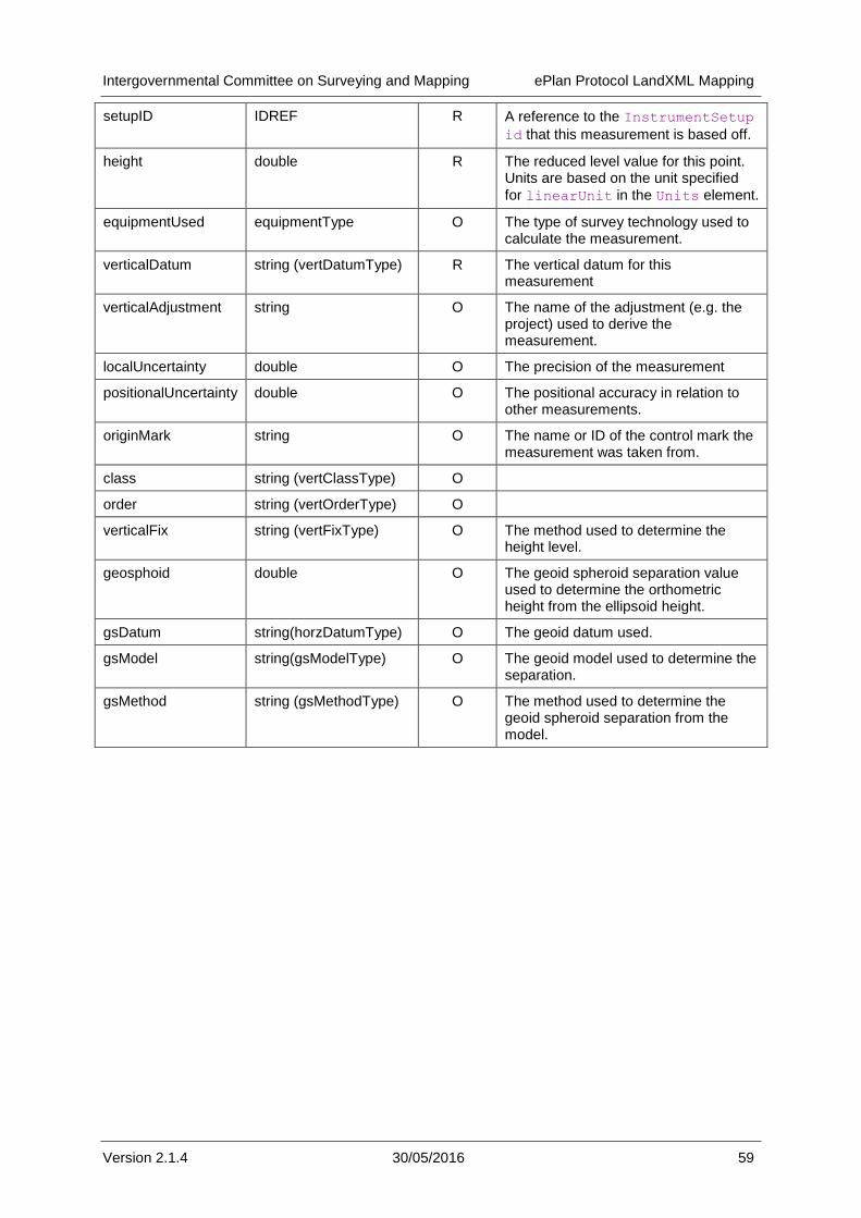
Intergovernmental Committee on Surveying and Mapping ePlan Protocol LandXML Mapping
Version 2.1.4 30/05/2016 59
setupID IDREF R A reference to the InstrumentSetup
id that this measurement is based off.
height double R The reduced level value for this point. Units are based on the unit specified
for linearUnit in the Units element.
equipmentUsed equipmentType O The type of survey technology used to calculate the measurement.
verticalDatum string (vertDatumType) R The vertical datum for this measurement
verticalAdjustment string O The name of the adjustment (e.g. the project) used to derive the measurement.
localUncertainty double O The precision of the measurement
positionalUncertainty double O The positional accuracy in relation to other measurements.
originMark string O The name or ID of the control mark the measurement was taken from.
class string (vertClassType) O
order string (vertOrderType) O
verticalFix string (vertFixType) O The method used to determine the height level.
geosphoid double O The geoid spheroid separation value used to determine the orthometric height from the ellipsoid height.
gsDatum string(horzDatumType) O The geoid datum used.
gsModel string(gsModelType) O The geoid model used to determine the separation.
gsMethod string (gsMethodType) O The method used to determine the geoid spheroid separation from the model.
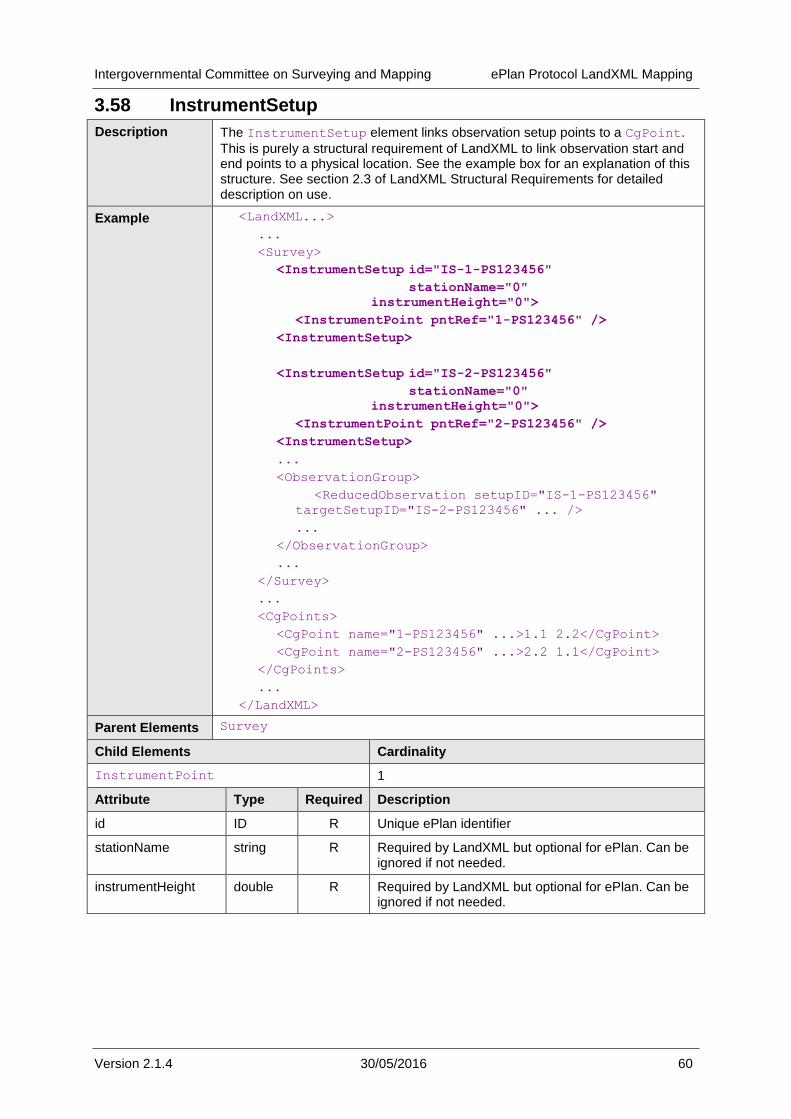
Intergovernmental Committee on Surveying and Mapping ePlan Protocol LandXML Mapping
Version 2.1.4 30/05/2016 60
3.58 InstrumentSetup
Description The InstrumentSetup element links observation setup points to a CgPoint.
This is purely a structural requirement of LandXML to link observation start and end points to a physical location. See the example box for an explanation of this structure. See section 2.3 of LandXML Structural Requirements for detailed description on use.
Example <LandXML...>
...
<Survey>
<InstrumentSetup id="IS-1-PS123456"
stationName="0"
instrumentHeight="0">
<InstrumentPoint pntRef="1-PS123456" />
<InstrumentSetup>
<InstrumentSetup id="IS-2-PS123456"
stationName="0"
instrumentHeight="0">
<InstrumentPoint pntRef="2-PS123456" />
<InstrumentSetup>
...
<ObservationGroup>
<ReducedObservation setupID="IS-1-PS123456"
targetSetupID="IS-2-PS123456" ... />
...
</ObservationGroup>
...
</Survey>
...
<CgPoints>
<CgPoint name="1-PS123456" ...>1.1 2.2</CgPoint>
<CgPoint name="2-PS123456" ...>2.2 1.1</CgPoint>
</CgPoints>
...
</LandXML>
Parent Elements Survey
Child Elements Cardinality
InstrumentPoint 1
Attribute Type Required Description
id ID R Unique ePlan identifier
stationName string R Required by LandXML but optional for ePlan. Can be ignored if not needed.
instrumentHeight double R Required by LandXML but optional for ePlan. Can be ignored if not needed.
Intergovernmental Committee on Surveying and Mapping ePlan Protocol LandXML Mapping
Version 2.1.4 30/05/2016 61
3.59 InstrumentPoint
Description The InstrumentPoint element contains the reference to the CgPoint for the
InstrumentSetup.
Example See example for InstrumentSetup
Parent Elements InstrumentSetup
Child Elements Cardinality
None
Attribute Type Required Description
pntRef pointNameRef R Reference to the CgPoint for this
InstrumentPoint.
3.60 Location
Description The Location element contains the reference to the CgPoint for the
PlanFeature.
Example See example for PlanFeature
Parent Elements PlanFeature
Child Elements Cardinality
None
Attribute Type Required Description
pntRef pointNameRef R Reference to the CgPoint for this Location.
Intergovernmental Committee on Surveying and Mapping ePlan Protocol LandXML Mapping
Version 2.1.4 30/05/2016 A—1
Appendix A Attribute Type Definitions
The following appendix outlines all the LandXML type definitions used by the ePlan Protocol. This includes enumerated types.
A.1 Primitive Data Types
The following are primitive data type definitions used by the CIF. They are defined by the XML standard (see http://www.w3.org/TR/xmlschema-0/#CreatDt).
Type Description
anySimpleType Highest level of simple type. Can store any simple type.
anyURI Uniform Resource Identifier
boolean True of False
date ISO8601 date format (e.g. YYYY-MM-DD)
double A double precision floating point number
IDREF A reference to the ID of another element
int An integer
positiveInteger A positive integer value
string An extended sequence of characters
time ISO8601 time format (e.g. hh:mm:ss)
A.2 LandXML Enumerated Types
The following types are defined in LandXML with an enumerated list of valid values (see
§ 1.3 References, item 4).
Type Description
angularType Angular values expressed in "decimal dd.mm.ss" units have the numeric format e.g. "45.3025" representing 45 degrees 30 minutes and 25 seconds. Both the minutes and seconds must be two characters with a numeric range between 00 and 60.
clockwise Defines direction. Clockwise (cw) or anticlockwise (ccw).
metArea Valid metric units of measure for area.
metLinear Valid metric units of measure for length.
metPressure Valid metric units of measure for pressure.
metTemperature Valid metric units of measure for temperature.
metVolume Valid metric units of measure for area volume.
parcelStateType This is an extension of the LandXML state type, but is specific to parcels
purposeType Used by many of the Survey elements
stateType Survey state of the element
surfTypeEnum TIN is the acronym for "triangulated irregular network", a surface comprised of 3 point faces.
grid is a surface comprised of 4 point faces.
Intergovernmental Committee on Surveying and Mapping ePlan Protocol LandXML Mapping
Version 2.1.4 30/05/2016 A—2
surveyType This enumeration indicates whether the survey was actually performed in the field, compiled from a series of existing surveys, or simply computed using known observations and maths
survPntType Survey point type.
A.3 Jurisdiction Based Enumerated Types
The following types are defined as types in LandXML for the purpose of being extended with jurisdictionally defined enumeration lists. Source files are available from (URL to be confirmed). Refer to documentation on jurisdictionally defined schemas for details on how to use the lists with LandXML (URL to be confirmed).
Type Description
addressPointTypeType This is a string to define the type of Geocode that the address point is for example centroid of parcel, Access Point etc. This will be a jurisdictionally based list.
addressTypeType This Type is to define a jurisdictional specific list of address types such a primary address, alias, secondary, historical etc.
adminAreaTypeType This is a jurisdictionally specific list of types and may include parish, town, local government, locality etc
adminDateTypeType This is the name of the admin date type for the Survey
annotationType An Annotation will be a specific type within a jurisdiction.
documentStatusType This field identifies the legal status for this document, for example it is the legal record of survey, if was data captured from historical data etc. This is used to determine processing of the record
equipmentType This gives a list of equipment used for the observation this list of equipment is used to estimate the accuracy of the observation.
flatTypeType To define a Jurisdictional specific list of address living unit types for addressing
floorLevelTypeType To define a jurisdictionally specific list of floor level types for example, Lower Ground Floor
headOfPowerType Details the legislation or regulation under which the survey was conducted, for example the Land Title Act 2003 This list will be jurisdictionally specific.
jurisdictionType This is the name of the jurisdiction in which the Survey Lies (i.e. which state)
monumentCondition This gives a list of allowable local conditions defined by regulation can be defined by the jurisdiction.
monumentState This is a list of states for a monument each jurisdiction may have a list defined by regulation.
monumentType This is a list of allowable monument types that can be used or identified for a survey, i.e. peg, spike, pillar etc. Local custom will define this list.
observationType This is a list of defined observation types, different jurisdictions may have a list defined by regulation can be defined by the jurisdiction.
parcelClass This is a list of parcel classes which may be jurisdictionally specific defined by regulation and legislation.
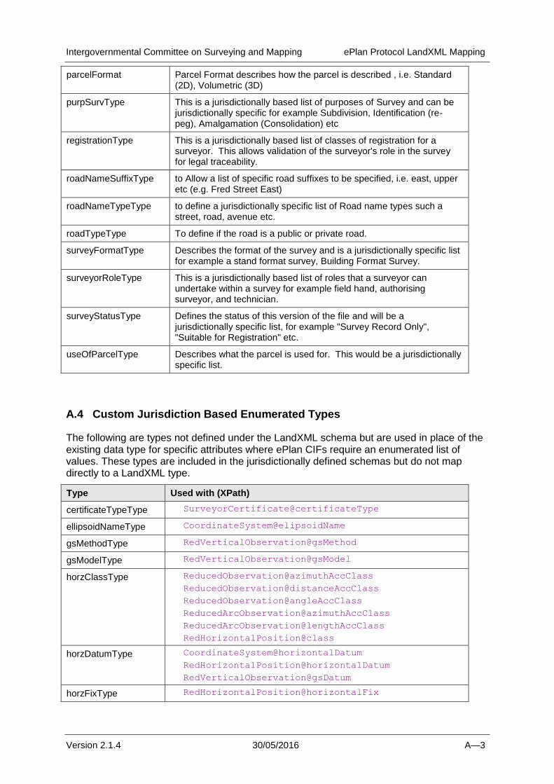
Intergovernmental Committee on Surveying and Mapping ePlan Protocol LandXML Mapping
Version 2.1.4 30/05/2016 A—3
parcelFormat Parcel Format describes how the parcel is described , i.e. Standard (2D), Volumetric (3D)
purpSurvType This is a jurisdictionally based list of purposes of Survey and can be jurisdictionally specific for example Subdivision, Identification (re-peg), Amalgamation (Consolidation) etc
registrationType This is a jurisdictionally based list of classes of registration for a surveyor. This allows validation of the surveyor's role in the survey for legal traceability.
roadNameSuffixType to Allow a list of specific road suffixes to be specified, i.e. east, upper etc (e.g. Fred Street East)
roadNameTypeType to define a jurisdictionally specific list of Road name types such a street, road, avenue etc.
roadTypeType To define if the road is a public or private road.
surveyFormatType Describes the format of the survey and is a jurisdictionally specific list for example a stand format survey, Building Format Survey.
surveyorRoleType This is a jurisdictionally based list of roles that a surveyor can undertake within a survey for example field hand, authorising surveyor, and technician.
surveyStatusType Defines the status of this version of the file and will be a jurisdictionally specific list, for example "Survey Record Only", "Suitable for Registration" etc.
useOfParcelType Describes what the parcel is used for. This would be a jurisdictionally specific list.
A.4 Custom Jurisdiction Based Enumerated Types
The following are types not defined under the LandXML schema but are used in place of the existing data type for specific attributes where ePlan CIFs require an enumerated list of values. These types are included in the jurisdictionally defined schemas but do not map directly to a LandXML type.
Type Used with (XPath)
certificateTypeType SurveyorCertificate@certificateType
ellipsoidNameType CoordinateSystem@elipsoidName
gsMethodType RedVerticalObservation@gsMethod
gsModelType RedVerticalObservation@gsModel
horzClassType ReducedObservation@azimuthAccClass
ReducedObservation@distanceAccClass
ReducedObservation@angleAccClass
ReducedArcObservation@azimuthAccClass
ReducedArcObservation@lengthAccClass
RedHorizontalPosition@class
horzDatumType CoordinateSystem@horizontalDatum
RedHorizontalPosition@horizontalDatum
RedVerticalObservation@gsDatum
horzFixType RedHorizontalPosition@horizontalFix
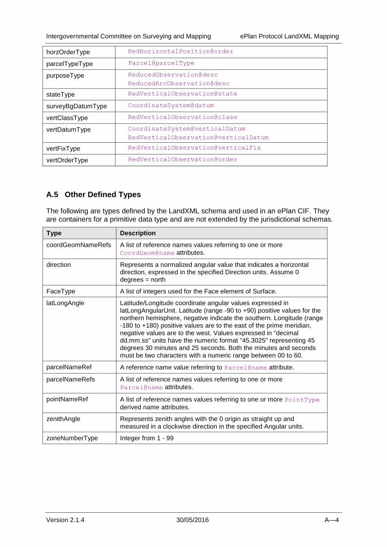
Intergovernmental Committee on Surveying and Mapping ePlan Protocol LandXML Mapping
Version 2.1.4 30/05/2016 A—4
horzOrderType RedHorizontalPosition@order
parcelTypeType Parcel@parcelType
purposeType ReducedObservation@desc
ReducedArcObservation@desc
stateType RedVerticalObservation@state
surveyBgDatumType CoordinateSystem@datum
vertClassType RedVerticalObservation@class
vertDatumType CoordinateSystem@verticalDatum
RedVerticalObservation@verticalDatum
vertFixType RedVerticalObservation@verticalFix
vertOrderType RedVerticalObservation@order
A.5 Other Defined Types
The following are types defined by the LandXML schema and used in an ePlan CIF. They are containers for a primitive data type and are not extended by the jurisdictional schemas.
Type Description
coordGeomNameRefs A list of reference names values referring to one or more
CoordGeom@name attributes.
direction Represents a normalized angular value that indicates a horizontal direction, expressed in the specified Direction units. Assume 0 degrees = north
FaceType A list of integers used for the Face element of Surface.
latLongAngle Latitude/Longitude coordinate angular values expressed in latLongAngularUnit. Latitude (range -90 to +90) positive values for the northern hemisphere, negative indicate the southern. Longitude (range -180 to +180) positive values are to the east of the prime meridian, negative values are to the west. Values expressed in "decimal dd.mm.ss" units have the numeric format "45.3025" representing 45 degrees 30 minutes and 25 seconds. Both the minutes and seconds must be two characters with a numeric range between 00 to 60.
parcelNameRef A reference name value referring to Parcel@name attribute.
parcelNameRefs A list of reference names values referring to one or more
Parcel@name attributes.
pointNameRef A list of reference names values referring to one or more PointType
derived name attributes.
zenithAngle Represents zenith angles with the 0 origin as straight up and measured in a clockwise direction in the specified Angular units.
zoneNumberType Integer from 1 - 99