incident name: rock creek fire jurisdiction: fort apache ... · incident name: rock creek fire...
TRANSCRIPT
Incident Name: Rock Creek FireJurisdiction: Fort Apache AgencyLocation: 8 miles east of Whiteriver, AZTeam: Eastern Arizona Type II, John Philbin ICComm Unit Tech: Ian James COMT, Mark Manor COMT(t), CAT Cisco Lucero, D. McLaughin(t)No. of Repeaters: 1
Repeater Placement: Fire was located between two ridges (33.8255N, 109.8180W). The fire start was next to Indian Rd 55 and progressed NE. The fire ran into a previously burnt area which slowed progress of the fire.
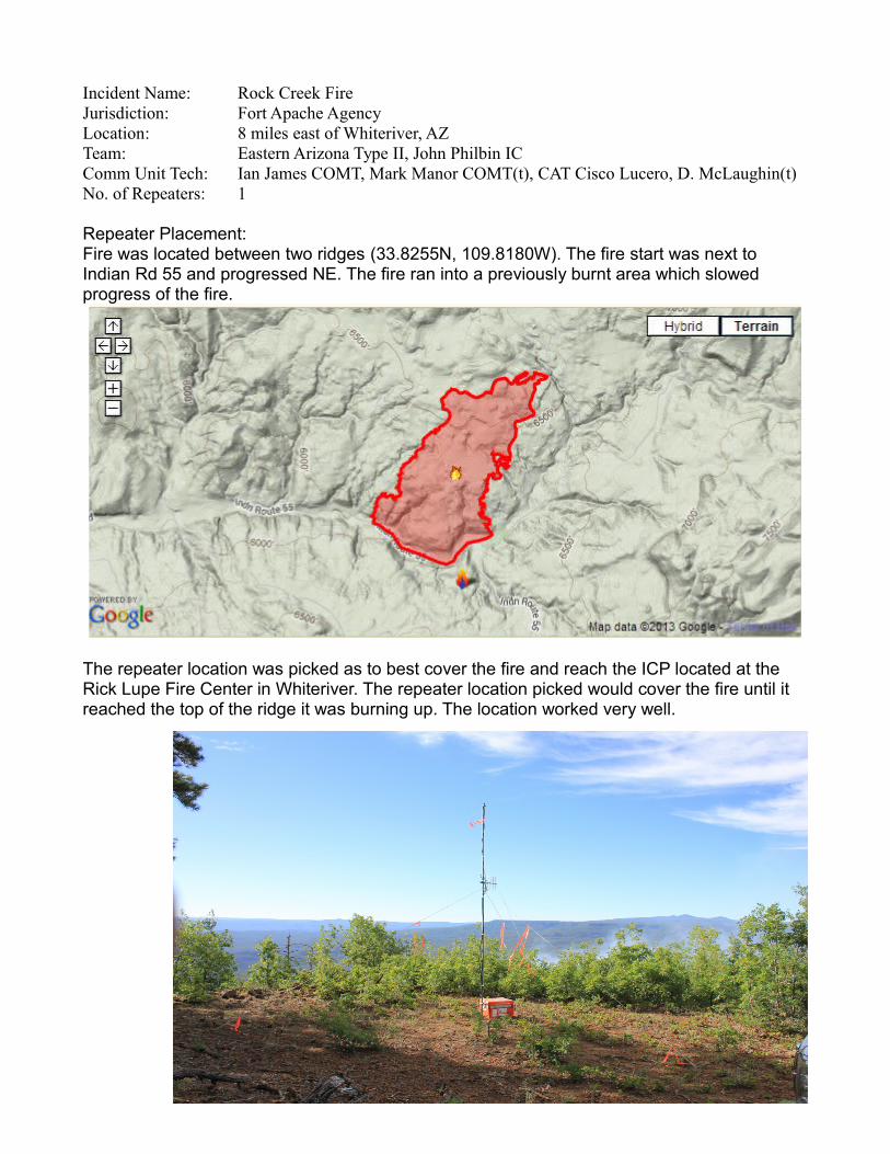
The repeater location was picked as to best cover the fire and reach the ICP located at the Rick Lupe Fire Center in Whiteriver. The repeater location picked would cover the fire until it reached the top of the ridge it was burning up. The location worked very well.

View of the fire from the repeater location. (N 33 47’28.5" W 109 48’ 28.5") Repeater was a drive to location approximately 29 road miles to the site from the ICP. The repeater location was on Corn Creek Plateau. The mountain in the top right of the picture is McKay Peak, which was picked as the second repeater location should the fire have crossed the ridge.
Google earth view of the coverage. KML files can be downloaded HERE. (Google Earth Required)