implementation of the national coral reef action strategy ... · coral reef ecosystems based on...
TRANSCRIPT

REPORT TO CONGRESS
IMPLEMENTATION OF THE NATIONAL CORAL REEF
ACTION STRATEGY REPORT ON U.S. CORAL REEF TASK FORCE AGENCY AC TIVITIES FROM 2004 TO 2006
U.S. Department of Commerce National Oceanic and Atmospheric Administration
Produced in Cooperation with the U.S. Coral Reef Task Force

IMPLEMENTATION OF THE NATIONAL CORAL REEF
ACTION STRATEGY U.S. Department of Commerce
National Oceanic and Atmospheric Administration Produced in Cooperation with the U.S. Coral Reef Task Force

REPORT TO CONGRESS REPORT ON U.S. CORAL REEF TASK FORCE AGENCY ACTIVITIES FROM 2004 TO 2006
IMPLEMENTATION OF THE NATIONAL CORAL REEF
ACTION STRATEGY

http://www.coralreef.gov/
This document was produced by the National Oceanic and Atmospheric Administration (NOAA), U.S. Department of Commerce, in cooperation with the U.S. Coral Reef Task Force, to fulfill requirements of the Coral Reef Conservation Act of 2000 (P.L. 106-562; 16 U.S.C. & 6401 et seq.).
For information or copies, contact: [email protected]
For information on the U.S. Coral Reef Task Force, see http://www.coralreef.gov.
Commonwealth of Puerto Rico
Commonwealth of the Northern Mariana Islands
DHS/USCG Department of Homeland Security/U.S. Coast Guard
DOC/NOAA Department of Commerce/National Oceanic and
Atmospheric Administration
DoD Department of Defense
DOI Department of the Interior
DOJ Department of Justice
DOS Department of State
DOT Department of Transportation
EPA Environmental Protection Agency
Federated States of Micronesia
NASA National Aeronautics and Space Administration
NSF National Science Foundation
Republic of Palau
Republic of the Marshall Islands
State of Florida
State of Hawai‘i
Territory of American Samoa
Territory of Guam
Territory of the U.S. Virgin Islands
USACE Army Corps of Engineers
USAID Agency for International Development
USDA Department of Agriculture

U.S
. Co
ral R
ee
f Ta
sk
Fo
rce
20
04
- 20
06
Re
po
rt to C
on
gre
ss

ementsAcknowledg

Acknowledg
ements This document was produced with the assistance and collaboration of the members and staff of the U.S Coral Reef Task Force (USCRTF). This report involved collecting, assessing, and presenting information on coral reef activities from the 22-member USCRTF. The USCRTF Secretariat thanks the USCRTF, the USCRTF Steering Committee, the USCRTF Working Groups, and all of the individuals who committed their time to drafting and assembling this report for their assistance and collaboration in producing this document.
The USCRTF wishes to thank other federal, state, territory, and local agency partners; non-governmental organizations; academic institutions; and other partners for their dedication to improving the health of coral reef ecosystems.
U.S
. Co
ral R
ee
f Ta
sk
Fo
rce
20
04
- 20
06
Re
po
rt to C
on
gre
ss

Contents
2 Executive Summary
14 Introduction
20 Chapter 1: Mapping U.S. Coral Reefs
30 Chapter 2: Monitoring Coral Reef Health
44 Chapter 3: Supporting Strategic Research
60 Chapter 4: Understanding Social and Economic Factors
68 Chapter 5: Improving the Use of Marine Protected Areas
78 Chapter 6: Reducing the Adverse Impacts of Fishing
90 Chapter 7: Reducing the Impacts of Coastal Uses 1
104 Chapter 8: Reducing Pollution
120 Chapter 9: Restoring Damaged Reefs
128 Chapter 10: Improving Outreach and Education
136 Chapter 11: Reducing Threats to Reefs Internationally
148 Chapter 12: Reducing Impacts from International Trade
154 Chapter 13: Improving Coordination and Accountability
166 Appendix A: List of Acronyms
170 Appendix B: Federal Expenditures for U.S. Coral Reef Task Force Conservation Activities (2004–2006)
176 References
180 Photo Credits
U.S
. Co
ral R
ee
f Ta
sk
Fo
rce
20
04
- 20
06
Re
po
rt to C
on
gre
ss

2
Executive Summary
Executive Summary

Healthy coral reefs are among the most biologically diverse and economically valuable ecosystems on earth. In the United States and around the world, coral reef ecosystems provide economic and environmental benefits worth billions of dollars in the form of food, jobs, natural products, recreation, and shoreline protection. The beauty and biodiversity of coral reefs attract millions of tourists making tourism the top industry in many coral reef areas. With 10.5 million people living adjacent to a U.S. coral reef in mainland coastal communities or on islands (U.S. Census 2002), coral reefs are an integral part of the culture, heritage, and economies of these regions. With effective management, healthy reef ecosystems can continue to provide these valuable services to current and future generations.
However, many coral reef ecosystems are being degraded by natural and anthropogenic impacts including overfishing, pollution, disease, invasive species, climate change,
U.S
. Co
ral R
ee
f Ta
sk
Fo
rce
20
04
- 20
06
Re
po
rt to C
on
gre
ss
3

4
Executive Summary
physical damage, and ship groundings. This combination of stressors has caused a rapid global decline in the health of many coral reef ecosystems, with significant social, economic, and environmental consequences. According to the Status of Coral Reefs of the World: 2004 (Australian Institute of Marine Science, 2005), 70 percent of the world’s coral reefs are threatened, and 20 percent of those reefs are damaged beyond repair. In 2005, coral reefs in the wider Caribbean suffered a widespread and severe bleaching event resulting in extensive coral death in much of the region. This decline and loss of coral reefs has significant impacts on people and communities in the United States and around the world.
In 1998, the United States Coral Reef Task Force (USCRTF) was established by Presidential Executive Order 13089 to coordinate government efforts to protect, restore, and sustain coral reef ecosystems. The USCRTF – composed of 12 federal agencies, seven states and territories, and three Freely
Fish surveys conducted
by Navy civilian marine
ecologist off Marine Corps
Base, Hawaii
Associated States – oversees implementation of the Executive Order and the federal agency responsibilities it sets forth. In 2000, the USCRTF adopted the National Action Plan to Conserve Coral Reefs (National Action Plan), the first national blueprint for U.S. domestic and international action to address the growing coral reef crisis. The National Action Plan calls for U.S. action towards 13 goals in order to protect and conserve valuable coral reef ecosystems. In 2002, the USCRTF developed the U.S. Coral Reef National Action Strategy (National Action Strategy) to further implement the National Action Plan as called for in the Coral Reef Conservation Act of 2000 (CRCA) (16 U.S.C. §6401 et seq.). These documents provide the guiding framework for the priorities, strategies, and actions of the USCRTF and its members.
The CRCA requires the National Oceanic and Atmospheric Administration (NOAA) to report to the U.S. Congress every two years regarding implementation of the National Action

The National Action Plan identified 13 priority goals falling into two key themes: Understanding Coral Reef Ecosystems
1. Create comprehensive maps of all U.S. coral reef habitats. 2. Conduct long-term monitoring and assessments of reef ecosystem conditions. 3. Support strategic research to address the major threats to reef ecosystems. 4. Increase understanding of the social and economic factors of conserving coral reefs.
Reduce the Adverse Impacts of Human Activities
5. Improve the use of marine protected areas (MPAs) to reduce threats. 6. Reduce adverse impacts of fishing and other extractive uses. 7. Reduce impacts of coastal uses. 8. Reduce pollution. 9. Restore damaged reefs. 10. Improve education and outreach. 11. Reduce international threats to coral reef ecosystems. 12. Reduce impacts from international trade in coral reef species. 13. Improve coordination and accountability.
Strategy. In 2005, NOAA, with assistance efforts among USCRTF members and partner from USCRTF member agencies, compiled organizations. The report addresses each goal and submitted to the 109th Congress the first from the National Action Plan and National such report entitled The Report to Congress Action Strategy and charts annual funding by on Implementation of the National Coral federal agencies for activities directly related Reef Action Strategy: Report on U.S. Coral to the National Action Strategy. Federal Reef Task Force Activities from 2002-2003. obligations for coral reef conservation efforts A companion document, The State of Coral totaled 166.4 million in 2004, 203.2 million Reef Ecosystems of the United States and in 2005, and 180.42 million in 2006 (see Pacific Freely Associated States, provides an Appendix B). assessment of the current ecological condition of coral reef ecosystems and is produced This report is not intended to be a in alternating years to this report. The next comprehensive list of agency programs and assessment report will be available in July activities directly or indirectly affecting coral 2008. reefs. More comprehensive information
on USCRTF accomplishments and future This document is the second report on challenges can be found on the USCRTF implementation of the National Action website (http://coralreef.gov) or by contacting Strategy submitted to Congress as required by USCRTF members directly. the CRCA. The report highlights USCRTF activities and accomplishments from 2004 to The report is organized by the 13 goals 2006 with particular emphasis on collaborative of the National Action Plan and National
U.S
. Co
ral R
ee
f Ta
sk
Fo
rce
20
04
- 20
06
Re
po
rt to C
on
gre
ss
5

6
Executive Summary
Action Strategy to reduce threats to coral reef ecosystems worldwide.
Much progress has been made to meet the National Action Strategy’s goals and objectives, and much of this progress is due to partnerships among USCRTF members and the involvement of nongovernmental organizations. These partnerships have been successful at coordinating efforts and leveraging resources to more effectively understand and address threats to coral reef ecosystems. These partnerships are a major focus of this report and are included as highlights wherever possible.
Some highlights of USCRTF member activities in 2004-2006 include:
Mapping all shallow coral reefs. The USCRTF’s goal is to produce comprehensive digital maps of all U.S. shallow coral reefs (<30 m) by 2009. Benthic habitat maps for
Hawai‘i, released in 2003, characterized about 60 percent of shallow-water habitats in the Main Hawaiian Islands, while a separate product characterized shallow-water habitats for most of the islands, banks, and atolls in the Northwestern Hawaiian Islands (NWHI). In 2004-2005, work focused on mapping American Samoa, the CNMI, and Guam. Benthic habitat maps for those jurisdictions were released in 2005.
Monitoring coral reef health. In 2004-2006 USCRTF members continued to develop long-term coral reef monitoring programs as components of the national coral reef monitoring system. The results of these long-term monitoring activities form the backbone of a comprehensive, periodic monitoring report entitled, The State of Coral Reef Ecosystems of the United States and Pacific Freely Associated States. The second report in the series, released in August of 2005, characterized the condition of shallow-water
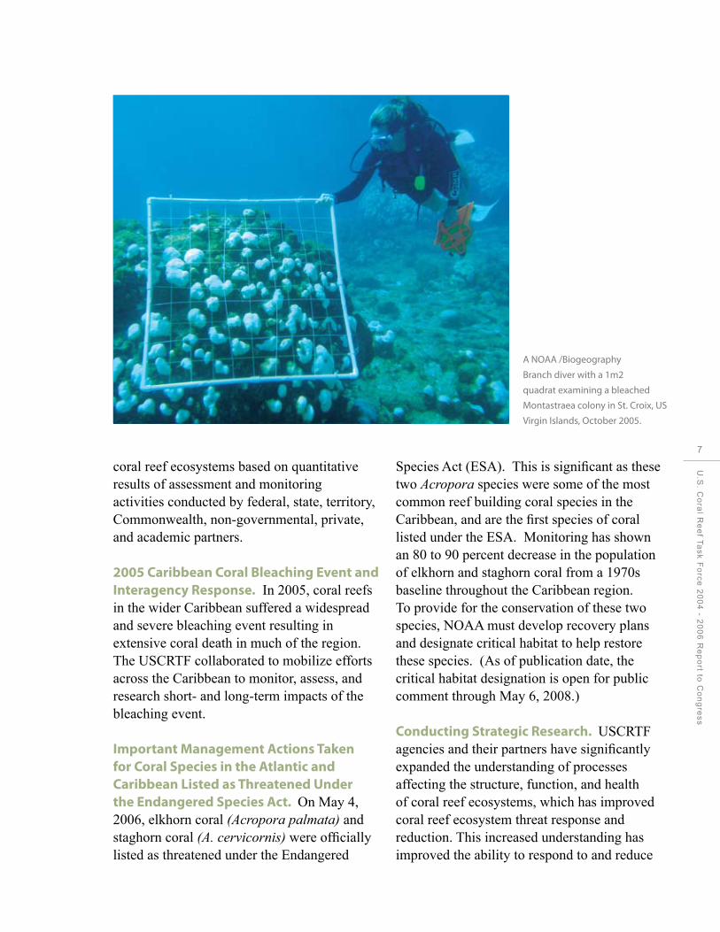
A NOAA /Biogeography
Branch diver with a 1m2
quadrat examining a bleached
Montastraea colony in St. Croix, US
Virgin Islands, October 2005.
coral reef ecosystems based on quantitative results of assessment and monitoring activities conducted by federal, state, territory, Commonwealth, non-governmental, private, and academic partners.
2005 Caribbean Coral Bleaching Event and Interagency Response. In 2005, coral reefs in the wider Caribbean suffered a widespread and severe bleaching event resulting in extensive coral death in much of the region. The USCRTF collaborated to mobilize efforts across the Caribbean to monitor, assess, and research short- and long-term impacts of the bleaching event.
Important Management Actions Taken for Coral Species in the Atlantic and Caribbean Listed as Threatened Under the Endangered Species Act. On May 4, 2006, elkhorn coral (Acropora palmata) and staghorn coral (A. cervicornis) were officially listed as threatened under the Endangered
Species Act (ESA). This is significant as these two Acropora species were some of the most common reef building coral species in the Caribbean, and are the first species of coral listed under the ESA. Monitoring has shown an 80 to 90 percent decrease in the population of elkhorn and staghorn coral from a 1970s baseline throughout the Caribbean region. To provide for the conservation of these two species, NOAA must develop recovery plans and designate critical habitat to help restore these species. (As of publication date, the critical habitat designation is open for public comment through May 6, 2008.)
Conducting Strategic Research. USCRTF agencies and their partners have significantly expanded the understanding of processes affecting the structure, function, and health of coral reef ecosystems, which has improved coral reef ecosystem threat response and reduction. This increased understanding has improved the ability to respond to and reduce
U.S
. Co
ral R
ee
f Ta
sk
Fo
rce
20
04
- 20
06
Re
po
rt to C
on
gre
ss
7

8
Executive Summary
threats to coral reef ecosystems in some areas. For example, the Coral Disease and Health Consortium is coordinating scientific resources to investigate coral health, coral bleaching, and factors affecting the emergence, transmission, and impact of coral diseases.
Improving the use of coral reef-protected areas. USCRTF members and partners increased the use and effectiveness of coral reef Marine Protected Areas (MPAs). For example, new coral reef-protected areas were established or proposed in federal waters and several jurisdictions, including the U.S. Virgin Islands (USVI), Hawai’i, Puerto Rico, Florida, American Samoa, and CNMI. Other key accomplishments include: In conjunction with state, territory, and federal partners on the USCRTF, NOAA completed the first assessment of U.S. coral reef protected areas: Report on the Status of Marine Protected Areas in Coral Reef Ecosystems of the U.S. Volume 1: Marine Protected Areas Managed by U.S.
Divers prepare substrate for
placement of mooring bouys.
States, Territories, and Commonwealths. The assessment focuses on the 207 identified MPAs managed by state and territory governments in the seven USCRTF state and territory member jurisdictions. This report provides an inventory of existing coral reef MPAs and MPA management efforts in these seven jurisdictions, and is the first of several assessments designed to comprehend the scope and effective use of MPAs for coral reef conservation in the United States.
One of the World’s Largest Marine Conservation Areas is Established in the Pacific: The Papahānaumokuākea Marine National Monument. On June 15, 2006, Papahanaumokuakea Marine National Monument in the NWHI was created under a proclamation by President Bush. The Monument is one of the largest conservation areas under the U.S. flag, encompassing 362,062 square kilometers. The coral reefs in Papahanaumokuakea are home to over

Turtle in the Northwestern
Hawaiian Islands
7,000 marine species, one quarter of which are endemic to the Hawaiian Archipelago. Papahanaumokuakea is also of great cultural importance to Native Hawaiians. The Monument is jointly managed by USCRTF members Hawai‘i, NOAA and the Department of the Interior (DOI) (U.S. Fish and Wildlife Service (USFWS).
Reducing the impacts of coastal uses. Ship groundings and anchor damage continue to affect coral reef health throughout U.S. waters. USCRTF agencies have improved planning for and response to grounding events and implemented measures to avoid vessel impacts by improving navigational aids and installing permanent moorings that obviate the need to anchor on coral reefs.
Reducing the impacts of pollution on reefs. Land, sea, and air pollution continue to seriously affect coral reef ecosystems. Many actions have been taken to reduce these impacts, including the removal of more
than 511 metric tons of marine debris from coral reef ecosystems and shorelines in the Northwestern Hawaiian Islands (1996-2006).
Reducing the International Threats to Reef Ecosystems. In an effort to strengthen management of coral reef resources; preserve coastal biodiversity by preventing habitat destruction, pollution, and over-exploitation; and promote sustainable use of coral resources, the United States provides funding and expertise to developing countries. The USCRTF has supported coral reef activities in Latin America, the Caribbean, Southeast Asia, the Middle East, and East Africa. For example:
Response to the Indian Ocean Tsunami. On December 26, 2004, the Indian Ocean Tsunami struck throughout the Indian Ocean basin, affecting hundreds of thousands of people in 12 countries throughout the region and causing widespread devastation. Following the initial disaster response, U.S. efforts were
U.S
. Co
ral R
ee
f Ta
sk
Fo
rce
20
04
- 20
06
Re
po
rt to C
on
gre
ss
9

10
Executive Summary
Mangrove zone, in Roatán, Honduras for Project USAID/MIRA.

shifted to rebuilding lives, livelihoods, and communities through medium- and long-term rehabilitation, with an emphasis on securing and protecting the future of coastal communities, and the natural resources upon which many communities depend. In response to the tsunami event, USCRTF members and partners supported an assessment of the impact of this natural disaster on coral reefs and associated ecosystems. The results were published in a report entitled Status of Coral Reefs in Tsunami Affected Countries: 2005.
Micronesia Challenge. USCRTF jurisdictions in Micronesia committed to expand effective conservation of marine and terrestrial resources through the Micronesia Challenge. The Micronesia Challenge aims to conserve 30 percent of nearshore marine and 20 percent of forest resources across Micronesia by 2020. This challenge is due to the leadership of the President of Palau and includes the Republic of the Marshall Islands, the Federated States of Micronesia (FSM), the Commonwealth of the Northern Mariana Islands (CNMI), and Guam.
A Reef Manager’s Guide to Coral Bleaching articulates the state of knowledge on the causes and consequences of coral bleaching and presents management strategies to help local and regional reef managers prepare for and respond to mass coral bleaching. In 2003, the USCRTF committed to the development of an interagency partnership for planning a comprehensive, integrative program for understanding local and system-wide coral reef responses to climate change, including application of this knowledge for local reef management. Developed as an output of this effort, A Reef Manager’s Guide to Coral Bleaching provides information on responding to mass bleaching events; developing bleaching response plans; assessing
ecological, social, and economic impacts; and applying tools for identifying and building long-term reef resilience.
Improving coordination and accountability. The USCRTF has worked to increase coordination among its members, assess current efforts, and improve effectiveness of these actions. For example, in 2002, state and territory members of the USCRTF, with assistance from federal agency members, developed 3-year local action strategies to identify and implement priority actions to reduce land-based sources of pollution, overfishing, recreational misuse and overuse, lack of public awareness, disease, and coral bleaching and climate change – six key threats to coral reefs. These Local Action Strategies (LAS) help link local action to the national goals and objectives in the National Action Plan. This LAS effort includes approximately 760 projects across the seven jurisdictions and has generated $25 million from numerous government and non-governmental sources applied to project implementation to date (2003-2006). The LAS framework has allowed the USCRTF to more clearly identify and address local needs, connect local priorities to national goals, and coordinate federal agency actions to better support each local jurisdiction’s needs and management of reef resources.
Federal Agency Grant and Opportunities Workshops. To better meet the capacity and funding needs of jurisdictions, USCRTF federal agencies with grants and funding opportunities for coral reef ecosystem conservation participated in training workshops to assist stakeholders in U.S. island states and territories in understanding, applying, and competing for federal grants aimed at coral reef ecosystem conservation.
U.S
. Co
ral R
ee
f Ta
sk
Fo
rce
20
04
- 20
06
Re
po
rt to C
on
gre
ss
11

12
Executive Summary
LOOKING TO THE FUTURE
The above highlights provide only a brief overview of the USCRTF member activities and accomplishments during 2004 to 2006. The activities included in this report represent significant achievements by government and non-governmental partners to reduce the threats to coral reefs and conserve healthy, coral reef ecosystems, and the human communities depending on them. However, these accomplishments represent only intermediate steps toward achieving the goals of the National Action Strategy. Much remains to be done.
NOAA and the USCRTF remain committed to building on this foundation of achievement and collaboration to meet the goals and objectives set forth in the National Action Strategy. This will require the development of new partnerships and opportunities, and developing specific targets for coordinated action to address the National Action Strategy’s goals and objectives. Important opportunities include:
International Coral Reef Initiative. The United States and Mexico will serve as co-hosts of the International Coral Reef Initiative Secretariat from July 2007 to July 2009.
2008 International Year of the Reef. There continues to be an urgent need to increase awareness and understanding of coral reefs. To further conserve and manage valuable coral reef and associated ecosystems, the International Coral Reef Initiative designated 2008 as the International Year of the Reef (IYOR
2008). The USCRTF will celebrate its ten-year anniversary by leveraging planned activities in IYOR 2008 to strengthen and enhance its efforts and collaborative USCRTF activities.
2008 International Coral Reef Symposium. Every four years the International Coral Reef Symposium (ICRS) convenes a major scientific conference to provide the latest knowledge about coral reefs worldwide. Natural scientists, resource managers and users, conservationists, and students meet to advance and share information on coral reef ecosystems. The 11th ICRS will be held in Ft. Lauderdale, FL, USA, July 8-11, 2008. This is the first time in over 30 years the ICRS has been held in the continental United States. Over 2,000 attendees are expected from the international marine science, management, and conservationist communities, making this the largest ICRS ever.
Reauthorization of the Coral Reef Conservation Act. In May 2007, the Administration proposed legislation to reauthorize the Coral Reef Conservation Act of 2000. The proposal would strengthen U.S. Coral Reef Conservation efforts by continuing the provisions of the existing Act and adding new authority for the Secretaries of Commerce and the Interior to hold those responsible for mechanical damage to coral reefs, including vessel groundings and anchor impacts, liable for damages. This new authority would fill an existing gap in current coral reef protection strategies.
Achieving the goals and objectives of the National Action Strategy will also build on future opportunities to continue and improve government efforts at federal, state, territory, and local levels, such as strengthening of existing and new legislation.

13
U.S
. Co
ral R
ee
f Ta
sk
Fo
rce
20
04
- 20
06
Re
po
rt to C
on
gre
ss
Swimmer off the coral reefs of Palmyra Atoll National Wildlife Refuge.

14
Introduction
Introduction

Introduction
In the United States, coral reef resources provide economic and environmental benefits to millions of people in the form of food, jobs, natural products, pharmaceuticals, and shoreline protection. They help communities prevent coastal erosion and the fish species they sustain are a critical source of revenue for the Nation’s fishermen. The intrinsic beauty of coral reefs and their spectacular biodiversity, attract thousands of tourists each year, which makes tourism the top industry in many coral reef areas. Perhaps most important, the biodiversity found in the Nation’s coral reef ecosystems may hold the key to significant medical discoveries.
Coral reef ecosystems have survived for millions of years despite an abundance of natural disturbances. However, natural stressors are now being compounded by impacts from people including pollution, overfishing, physical damage, and contributions to climate change. A combination of stressors has caused a rapid
U.S
. Co
ral R
ee
f Ta
sk
Fo
rce
20
04
- 20
06
Re
po
rt to C
on
gre
ss
15
16
Introduction
decline in the health of many coral reef ecosystems globally, and, left unchecked, this decline could lead to significant social, economic, and environmental consequences.
In response to this growing crisis, Executive Order 13089 (1998) established the United States Coral Reef Task Force (USCRTF) to coordinate efforts to protect, restore, and sustain coral reef ecosystems. The USCRTF – composed of twelve federal agencies, seven state and territory partners, and three nonvoting Freely Associated States – is directed to oversee implementation of the policy and federal agency responsibilities set forth in the Executive Order and to guide and support activities under the U.S. Coral Reef Initiative. USCRTF duties range from planning and priority setting to assisting and coordinating member activities.
Since its inception, the USCRTF has been an important catalyst for federal, state, territory, and local action. By increasing collaboration among federal, state, territory, and local agencies; nongovernmental institutes and organizations; and international partners; the USCRTF has maximized limited funding and resources through joint planning and priority setting, leading to many of the activities that have benefited coral reefs over the past few years. With input from a wide variety of groups and interests, the USCRTF has led efforts to identify key threats to U.S. coral reef ecosystems (see table 1) and to develop local and national action strategies addressing these threats. The USCRTF member agencies and their partners have, in turn, coordinated efforts to carry out these actions.
The U.S. National Coral Reef Action Strategy’s 13 Goals for Addressing Threats to Coral Reefs Worldwide:
THEME 1: Understand Coral Reef Ecosystems— Better understanding of complex coral reef ecosystems will improve management and conservation of these valuable resources.
Goal 1: Create comprehensive maps of all U.S. coral reef habitat. Goal 2: Conduct long-term monitoring and assessments of reef ecosystem conditions. Goal 3: Support strategic research to address the major threats to reef ecosystems. Goal 4: Increase understanding of the social and economic factors of conserving coral reefs.
THEME 2: Reduce the Adverse Impacts of Human Activities—Reducing the impacts of human activities is essential to conserving coral reef ecosystems.
Goal 5: Improve the use of marine protected areas to reduce threats. Goal 6: Reduce adverse impacts of fishing and other extractive uses. Goal 7: Reduce impacts of coastal uses. Goal 8: Reduce pollution. Goal 9: Restore damaged reefs. Goal 10: Improve education and outreach. Goal 11: Reduce threats to coral reef ecosystems internationally. Goal 12: Reduce impacts from international trade in coral reef species. Goal 13: Improve coordination and accountability.
Coral Reef Conservation Act. The CRCA mandates that NOAA study coral reefs in the waters of the U.S. to improve their management and protection. In addition the CRCA requires NOAA to establish programs including: providing matching grants for coral reef conservation projects to states, territories, educational and nongovernmental institutions, and fishery management councils; establishing the Coral Reef Conservation Fund with the non-profit National Fish and Wildlife Foundation to build public-private partnerships to reduce and prevent degradation of coral reefs; and providing grants to state and local governments to respond to unforeseen or disaster-related coral reef emergencies.
The USCRTF developed the National Action Plan to Conserve Coral Reefs (2000) in response to Executive Order 13089. The National Action Plan serves as a blueprint to counteract the continued destruction of coral reef ecosystems and identifies 2 overarching themes and 13 goals with related objectives outlining the main threats to coral reef ecosystems and key actions to help reduce these threats. NOAA, in cooperation with the USCRTF, published A National Coral Reef Action Strategy (2002) as required by the Coral Reef Conservation Act (CRCA), 16 U.S.C. § 6401 et seq. The National Action Strategy is based on the framework presented in the National Action Plan and provides information on the major threats and needs in each jurisdiction, tracks progress in achieving USCRTF goals and objectives, and identifies priority actions needed to achieve the goals and objectives.
Two years after the National Action Strategy was published and every two years thereafter, the CRCA requires NOAA to submit a report describing all activities undertaken to implement the National Action Strategy, including a description of the funds obligated each fiscal year to advance coral reef conservation. This report, Implementation of the National Coral Reef Action Strategy, fulfills this requirement and includes highlights of the full range of USCRTF member activities addressing the threats to coral reef ecosystems. This report is organized by the Strategy’s 13 goals and their related objectives.
This report was produced in collaboration with members of the USCRTF and its partners to provide a summary of activities implemented in 2004-2006 that helped fulfill the goals and objectives of the National Action Strategy. This report is not intended to be a comprehensive list of agency programs and activities directly or indirectly affecting coral reefs. The vast majority of the activities outlined in this report have been accomplished through partnerships and have resulted in onthe-ground achievements in key issues such as capacity building, effective use of marine protected areas, and education and outreach.
Coral reef ecosystems face increasing pressures. However, as this report demonstrates, the USCRTF and its partners remain committed to identifying and reducing the threats to coral reefs and conserving healthy and resilient coral reef ecosystems for current and future generations.
U.S
. Co
ral R
ee
f Ta
sk
Fo
rce
20
04
- 20
06
Re
po
rt to C
on
gre
ss
17

g
class
18
Introduction
Clim
ate
chan
ge &
cor
al b
leac
hing
Dis
ease
s
Trop
ical
sto
rms
Coas
tal d
evel
opm
ent a
nd ru
noff
Coas
tal p
ollu
tion
Tour
ism
and
recr
eatio
n
Fish
ing
Trad
e in
cor
al a
nd li
ve re
ef s
peci
es
Ship
s, bo
ats,
and
grou
ndin
gs
Mar
ine
debr
is
Aqua
tic in
vasi
ve s
peci
es
Secu
rity
trai
ning
act
iviti
es
Off s
hore
oil
and
gas
expl
orat
ion
Oth
er
Juris
dict
iona
l Com
posi
te T
rend
∆ (2
002
to 2
004)
USVI 2002 g g g g g g g g g g g g g g 14
2004 g g g g g g g g g g g g g g 16
Puerto Rico 2002 g g g g g g g g g g g g g g 18
2004 g g g g g g g g g g g g g g 11
Navassa 2002
N/A2004 g g g g g g g g g g g g g g 4
Florida 2002 g g g g g g g g g g g g g g 17
2004 g g g g g g g g g g g g g g 18
Flower Gardens Banks 2002 g g g g g g g g g g g g g g 3
2004 g g g g g g g g g g g g g g 4
MHI 2002 g g g g g g g g g g g g g g 17
-2004 g g g g g g g g g g g g g g 17
NWHI 2002 g g g g g g g g g g g g g g 9
2004 g g g g g g g g g g g g g g 5
American Samoa 2002 g g g g g g g g g g g g g 11
2004 g g g g g g g g g g g g g g 9
PRIAs 2002 g g g g g g g g g g g g g g 7
2004 g g g g g g g g g g g g g g 5
Marshall Islands 2002 g g g g g g g g g g g g g g 8
2004 g g g g g g g g g g g g g g 7
Federated States of Micronesia 2002 g g g g g g g g g g g g g g 11
2004 g g g g g g g g g g g g g g 6
CNMI 2002 g g g g g g g g g g g g g g 14
2004 g g g g g g g g g g g g g g 9
Guam 2002 g g g g g g g g g g g g g g 8
2004 g g g g g g g g g g g g g g 13
Palau 2002 g g g g g g g g g g g g g g 11
2004 g g g g g g g g g g g g g g 6
Stressor Change Assessment 2002 12 6 7 19 17 9 18 9 17 10 10 5 1 8
2004 16 7 8 18 11 9 20 5 13 7 5 2 1 4
∆ (2002 to 2004) - - Temporal Composite Threat g g g g g g g g g g g g g g
*
**

Table 1: Ranking of Major Threats to Coral Reef Ecosystems by Region. This table is a general summary of the relative impact of natural and human-related threats to coral reef ecosystems in the United States and Freely Associated States in 2002 and 2004, based on expert opinion of coastal managers within the jurisdictions. These threat levels may vary over time to reflect changes in natural and anthropogenic impacts or to incorporate new information about impacts. (Source: State of Coral Reef Ecosystems of the United States and the Pacific Freely Associated States: 2004. NOAA/NCCOS)
U.S
. Co
ral R
ee
f Ta
sk
Fo
rce
20
04
- 20
06
Re
po
rt to C
on
gre
ss
19

20
CHAPTER 1: Mapping U.S. Coral Reefs
CHAPTER 1
Mapping U.S. Coral Reefs
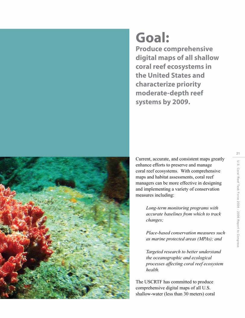
Goal: Produce comprehensive digital maps of all shallow coral reef ecosystems in the United States and characterize priority moderate-depth reef systems by 2009.
Current, accurate, and consistent maps greatly enhance efforts to preserve and manage coral reef ecosystems. With comprehensive maps and habitat assessments, coral reef managers can be more effective in designing and implementing a variety of conservation measures including:
Long-term monitoring programs with accurate baselines from which to track changes;
Place-based conservation measures such as marine protected areas (MPAs); and
Targeted research to better understand the oceanographic and ecological processes affecting coral reef ecosystem health.
The USCRTF has committed to produce comprehensive digital maps of all U.S. shallow-water (less than 30 meters) coral
U.S
. Co
ral R
ee
f Ta
sk
Fo
rce
20
04
- 20
06
Re
po
rt to C
on
gre
ss
21
22
CHAPTER 1: Mapping U.S. Coral Reefs
reef habitats, and to characterize priority moderate-depth (30-200 meters) reef systems (USCRTF 2000). Coral reef mapping efforts are coordinated through the USCRTF Mapping and Information Synthesis Working Group, composed of representatives from the National Oceanic and Atmospheric Administration (NOAA), U.S. Geological Survey (USGS), National Aeronautics and Space Administration (NASA), other federal and state agencies, and academic and non-governmental organizations (NGOs). Although six of the seven primary jurisdictions have been mapped as of 2007, the goal of mapping all U.S. shallow-water coral reef ecosystems by 2009 may not be attainable due to the large area and complexity presented by Florida’s reef ecosystems.
Accomplishments by Objective
Objective 1: Develop high-resolution benthic (sea floor) maps of local and regional coral reef ecosystems using imagery from satellites and aircraft and in situ surveys, with particular
emphasis on marine protected areas, reefs at risk of degradation due to human activities, and other priority sites identified by the U.S. islands representatives.
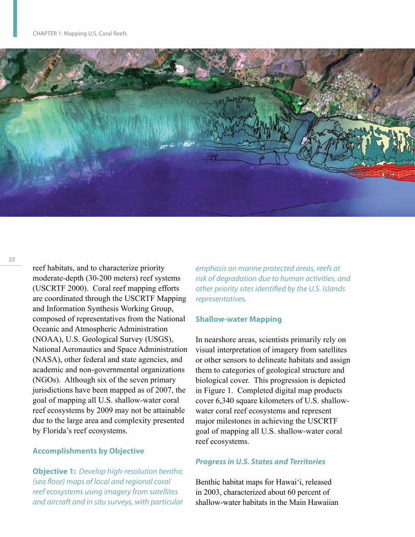
Shallow-water Mapping
In nearshore areas, scientists primarily rely on visual interpretation of imagery from satellites or other sensors to delineate habitats and assign them to categories of geological structure and biological cover. This progression is depicted in Figure 1. Completed digital map products cover 6,340 square kilometers of U.S. shallow-water coral reef ecosystems and represent major milestones in achieving the USCRTF goal of mapping all U.S. shallow-water coral reef ecosystems.
Progress in U.S. States and Territories
Benthic habitat maps for Hawai‘i, released in 2003, characterized about 60 percent of shallow-water habitats in the Main Hawaiian

Islands, and a separate product characterized shallow-water habitats for most of the islands, banks, and atolls in the Northwestern Hawaiian Islands (NWHI). A project to re-map the main Hawaiian Islands, including the 40 percent not captured in the first effort, began in 2005 and was completed in October 2007. In 2004-2005, work focused on mapping American Samoa, the Commonwealth of the Northern Mariana Islands (CNMI), and Guam. Benthic habitat maps for those jurisdictions were released in 2005. Also in 2005, NOAA scientists purchased IKONOS satellite imagery depicting approximately 10,000 square kilometers of coastal southern Florida and developed a Mapping Implementation Plan in preparation for mapping this large area of shallow-water habitat over the next several years. In 2006, Florida project partners georeferenced the imagery acquired in 2005 and produced a common habitat classification scheme. Southern Florida reef ecosystems encompass an area of shallow water greater than all of the other mapped jurisdictions combined.
Figure 1: This image depicts the
transition from georeferenced
satellite imagery (left), to
delineated habitat boundaries
(center), to visual interpretation
and classification of habitat types
(right). The minimum mapping
unit (mmu) or smallest feature
delineated in the map, has an area
of 1 acre (~4,000 square meters).
Partners in Florida, the National Coral Reef Institute (NCRI), the Florida Fish and Wildlife Conservation Commission (FWC), and the Florida Department of Environmental Protection (FDEP) completed development of benthic habitat maps for the nearshore, shallow (< 35m) areas of Broward and Palm Beach Counties in southeast Florida. Data collected using Laser Airborne Depth Sounder bathymetry, multi- and single-beam bathymetry, acoustic sea floor discrimination, ecological assessments, and groundtruthing were integrated to generate the first habitat maps ever produced for this region of Florida. Funding is needed to map adjacent areas of Martin and northern Miami-Dade Counties.
At present, no shallow-water habitat mapping activities have been scheduled for the U.S. Flag Islands (including Navassa and the remote, uninhabited islands in the equatorial Pacific). These jurisdictions were not included in the original 2009 goal to map all U.S. shallow coral reef ecosystems.
U.S
. Co
ral R
ee
f Ta
sk
Fo
rce
20
04
- 20
06
Re
po
rt to C
on
gre
ss
23
24
CHAPTER 1: Mapping U.S. Coral Reefs
Proposals to expand the U.S. Navy anchorage areas available at Saipan and Apra Harbor are being considered by the U.S. Department of Defense (DoD). To support planning, several large-scale studies are in progress. DoD teamed with NOAA to collect high-resolution bathymetric mapping with video transects to use in ground-truthing the bathymetric map and will be converted into a three-dimensional habitat map. In the anchorage at Saipan, sediment, current, and wave activity were modeled, and the models will be used to predict the sediment plumes resulting from potential future activities. (For more information on this project, see page 95 and 101.)
Progress in the Pacific Freely Associated States Since 2004, NOAA scientists have continued to make progress in mapping the Pacific Freely Associated States (FAS), including the Republic of Palau, the Federated States of Micronesia (FSM), and the Republic of the Marshall Islands (RMI). In 2004, FAS governments – with input
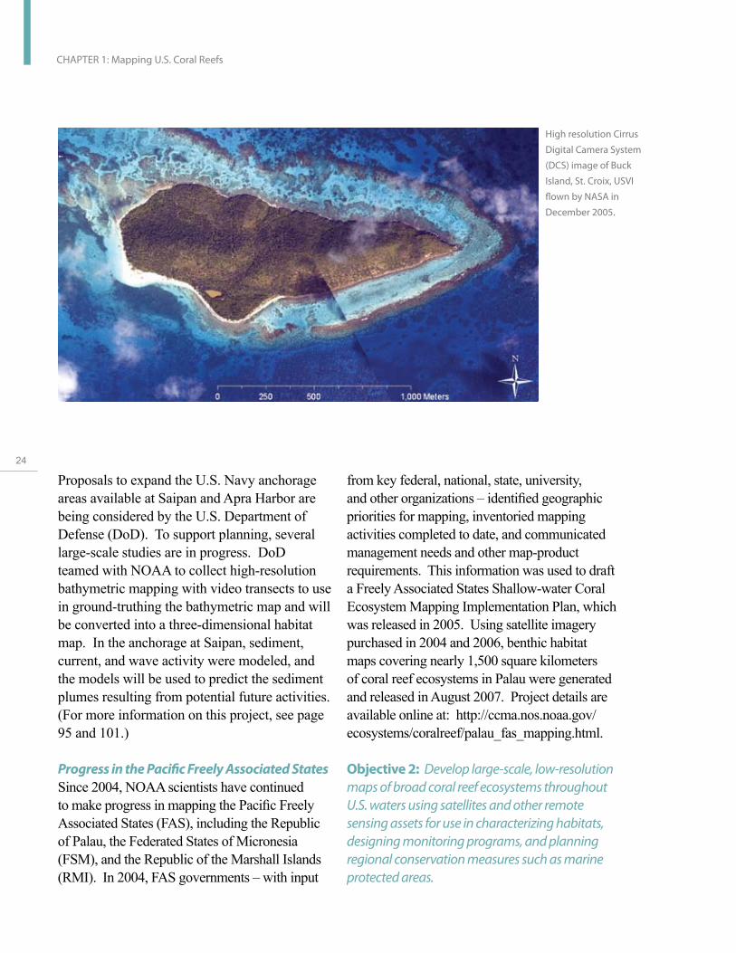
High resolution Cirrus
Digital Camera System
(DCS) image of Buck
Island, St. Croix, USVI
flown by NASA in
December 2005.
from key federal, national, state, university, and other organizations – identified geographic priorities for mapping, inventoried mapping activities completed to date, and communicated management needs and other map-product requirements. This information was used to draft a Freely Associated States Shallow-water Coral Ecosystem Mapping Implementation Plan, which was released in 2005. Using satellite imagery purchased in 2004 and 2006, benthic habitat maps covering nearly 1,500 square kilometers of coral reef ecosystems in Palau were generated and released in August 2007. Project details are available online at: http://ccma.nos.noaa.gov/ ecosystems/coralreef/palau_fas_mapping.html.
Objective 2: Develop large-scale, low-resolution maps of broad coral reef ecosystems throughout U.S. waters using satellites and other remote sensing assets for use in characterizing habitats, designing monitoring programs, and planning regional conservation measures such as marine protected areas.

Millennium Coral Reef Maps
In a NASA-sponsored partnership between remote sensing scientists, international agencies, and NGOs, new efforts are being made to (1) develop low-resolution reef maps encompassing all tropical oceans to provide a foundation for more detailed future investigation, (2) assemble key baseline remote sensing data needed for future research in coral reef environments, and (3) partner with international organizations to use remote sensing data for applied science problems and improved coral reef management. This partnership developed the first uniform global maps of shallow coral reef geomorphology—Millennium Coral Reef Maps—which cover a vast area and include over 80 percent of the Earth’s shallow tropical coral reefs. The project differs from other coral ecosystem mapping efforts in both resolution and geographic focus. The Millennium maps are based on Landsat imagery (a low-resolution satellite source with a pixel size of 30 square meters) and focus on geomorphologic structure in non-U.S. territories, whereas the NOAA maps use imagery with a finer resolution (1- to 4- meter pixels) and provide information on reef zonation, underlying structural characteristics, and biological cover for reef areas in the U.S. territories and Palau. Thanks to close communication among the participants, project scientists were able to minimize geographic overlap and avoid duplication of effort, and as a result, the projects and products complement each other well.
The Millennium Coral Reef Maps are being used by scientists, operational agencies, and various non-governmental entities in the United States and around the world at regional and local scales to:
Study sensitivity of tropical islands to climate change and sea-level rise;
Assess coral reef fisheries of the Pacific islands;
Design large-scale monitoring and conservation actions (MPA implementation);
Assess biodiversity in the Indo-Pacific (i.e., the role of reef diversity and island types in structuring biodiversity);
Determine genetic connectivity of fish populations in the Caribbean;
Detect reef fish spawning sites; and
Strengthen the case for classifying certain reef areas as United Nations Educational, Scientific and Cultural Organization (UNESCO) World Heritage Sites.
Since September 2006, the Millennium Coral Reef Maps and metadata have served as the primary layer of the WorldFish Center’s ReefBase on-line Global Information System (GIS) (http://www.reefbase.org/), which provides access to both the source imagery and the classified maps in the form of GIS layers. More information on the Millennium Coral Reef Maps is available online at: http://imars. marine.usf.edu/corals/.
Objective 3: Develop and adapt new technologies and data sources to increase mapping efficiency while maintaining accuracy; enhance coral reef ecosystem mapping, survey, and assessment capabilities; and, if possible, detect important ecological changes and trends.
U.S
. Co
ral R
ee
f Ta
sk
Fo
rce
20
04
- 20
06
Re
po
rt to C
on
gre
ss
25

26
CHAPTER 1: Mapping U.S. Coral Reefs
The National Coral Reef Institute, in partnership with NOAA, made progress in benthic habitat mapping research by creating and refining a Hybrid Mapping Tool (HMT). This new tool combines automated and visual techniques to expedite the accurate delineation and classification of habitats from satellite imagery.
The USGS developed the Along-Track Reef Imaging System (ATRIS), which provides resource managers with highly detailed and accurately geolocated benthic-substrate observations for monitoring and mapping coral reef ecosystems. ATRIS is a boat-based sensor package that allows rapid mapping of shallow-water (<10 meters) benthic environments. ATRIS combines high-resolution bathymetry, underwater color digital photography, underwater video, vessel-heave compensation, and differential Global Positioning System (GPS) data to provide photographic and video transects of the sea floor keyed to precise geographic locations and water depths. This
Schematic depicting USGS
Along Track Reef Imaging
System (ATRIS)
tool provides a ground-truthing capability for constructing and validating remote sensing maps of coral reef habitats and submarine topography. ATRIS has been used to collect shallow-water observations for several areas in the Florida Keys and Dry Tortugas National Park, and these observations will provide valuable information for mapping in this area.
DoD funded a research project using advanced video technology mounted on a remotely operated vehicle (ROV) to map and inventory coral reefs. DoD sponsored researchers from the University of Miami’s Rosenstiel School of Marine and Atmospheric Science (RSMAS) to conduct initial research into establishing a method for processing the digital data collected and using it to create and interpret mosaic images of coral reef habitats. This method has been tested in collaboration with NOAA for use in reef damage assessment and surveys of endangered species, hurricane impacts, and deep reefs.
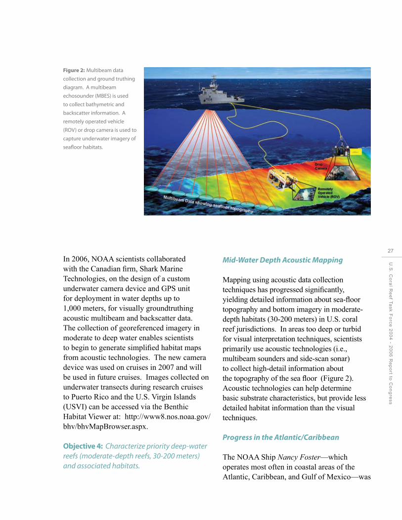
Figure 2: Multibeam data
collection and ground truthing
diagram. A multibeam
echosounder (MBES) is used
to collect bathymetric and
backscatter information. A
remotely operated vehicle
(ROV) or drop camera is used to
capture underwater imagery of
seafloor habitats.
In 2006, NOAA scientists collaborated with the Canadian firm, Shark Marine Technologies, on the design of a custom underwater camera device and GPS unit for deployment in water depths up to 1,000 meters, for visually groundtruthing acoustic multibeam and backscatter data. The collection of georeferenced imagery in moderate to deep water enables scientists to begin to generate simplified habitat maps from acoustic technologies. The new camera device was used on cruises in 2007 and will be used in future cruises. Images collected on underwater transects during research cruises to Puerto Rico and the U.S. Virgin Islands (USVI) can be accessed via the Benthic Habitat Viewer at: http://www8.nos.noaa.gov/ bhv/bhvMapBrowser.aspx.
Objective 4: Characterize priority deep-water reefs (moderate-depth reefs, 30-200 meters) and associated habitats.
Mid-Water Depth Acoustic Mapping
Mapping using acoustic data collection techniques has progressed significantly, yielding detailed information about sea-floor topography and bottom imagery in moderate-depth habitats (30-200 meters) in U.S. coral reef jurisdictions. In areas too deep or turbid for visual interpretation techniques, scientists primarily use acoustic technologies (i.e., multibeam sounders and side-scan sonar) to collect high-detail information about the topography of the sea floor (Figure 2). Acoustic technologies can help determine basic substrate characteristics, but provide less detailed habitat information than the visual techniques.
Progress in the Atlantic/Caribbean
The NOAA Ship Nancy Foster—which operates most often in coastal areas of the Atlantic, Caribbean, and Gulf of Mexico—was
U.S
. Co
ral R
ee
f Ta
sk
Fo
rce
20
04
- 20
06
Re
po
rt to C
on
gre
ss
27

28
CHAPTER 1: Mapping U.S. Coral Reefs
outfitted with a multibeam sounding device in 2004. Since then, 1,623 square kilometers of sea-floor topography has been mapped using the device. In the USVI and Puerto Rico, survey cruises yielded over 261 square kilometers of new bathymetric and acoustic backscatter information for several project areas that support coral reefs and associated habitats, including National Park Service monuments and marine protected areas in St. Croix and St. John, USVI. In Puerto Rico, detailed bathymetry up to 300 meters deep confirms the presence of coral reefs in waters up to 50 meters deep at the Bajo de Cico and Abrir La Sierra reefs. Preliminary results suggest this reef extends to 90 meters. In 2006, 102 square kilometers of shelf area around Navassa Island were surveyed, at depths between 11 and 1000 meters.
Efforts have also focused on acoustic surveys of MPAs at Madison-Swanson and Steamboat Lumps off Florida’s west coast. Building on
This image provides the first depiction
of detailed seafloor topography of
Bajo de Cico Bank(oriented northeast)
located on the insular platform off the
west coast of Puerto Rico as a result of
NOAA ship-based multibeam mapping
acitvities. The color-shaded visualization
shows depth transitions from coral reef
(red, 22 meters) to the precipitous Bank
edge (purple, 250 meters). Seasonally
closed to fishing, Bajo de Cico is a
documented spawning aggregation site
for Red Hind (/Epinephelus
guttalus/).
over 560 square kilometers of multibeam data collected in these areas during 2001-2004, project activities in 2005 and 2006 added nearly 700 square kilometers of bathymetric and backscatter data in areas adjacent to the MPAs These areas are believed to encompass habitats used by grouper species with economic value as migration pathways and spawning aggregation sites. Also in the Gulf of Mexico, extensive side-scan sonar surveys of McGrail Bank and Sonnier Bank have been completed, and habitat characterization efforts are underway. In addition, the entire Florida Middle Ground Habitat Area of Particular Concern has been surveyed using acoustic multibeam techniques.
Progress in the Pacific and Pacific Remote Island Areas
Pacific Island progress in 2004-2006 built on advances reported in 2002-2003, and included efforts to validate acoustic bathymetry and

backscatter information through the use of optical devices and towed diver surveys. Primary accomplishments include multiple data collection cruises to the NWHI, yielding approximately 2,900 square kilometers of multibeam bathymetric data; and collaboration with academic partners to create virtually seamless bathymetric maps of all islands in the Territory of American Samoa covering 1,013 square kilometers of sea floor between 20 and 3,000 meters. Bathymetric surveys in American Samoa documented an extensive relic barrier reef structure around Tutuila and located several shallow submerged offshore banks, with optical validation data from towed camera sleds confirming the presence of high coral cover on these structures. Also, a seamount a few kilometers northwest of the island of Ta‘u was found to be capped with high coral cover, despite its depth of more than 35 meters. These previously unknown reefs will be the focus of greater mapping and monitoring efforts in the future, and possible enhanced consideration by managers.
Multibeam data collected during a cruise to the Mariana Archipelago in 2003 yielded information on over 244 square kilometers of the 14 islands and 12 banks comprising Guam and the CNMI; data collected during a May 2007 cruise will provide additional bathymetric information for the archipelago. In 2004, the survey effort in CNMI was expanded to include a more detailed survey of the Garapan Anchorage near Saipan Harbor. During the project, DoD teamed with NOAA to collect high-resolution bathymetric data and video transects to validate the multibeam data and develop a three-dimensional habitat map. The information generated by the project will be considered as DoD evaluates a possible expansion of U.S. Navy anchorage areas in Saipan and at Apra Harbor, Guam, while trying to minimize impacts to sensitive reef ecosystems.
Elsewhere in the Pacific, a spring 2006 cruise permitted scientists to complete bathymetric surveys of Howland, Baker, and Jarvis Islands in the Pacific Remote Island National Wildlife Refuges (20-2,500 meters) and achieve 85 percent completion of surveys in mid-water depths for Johnston, Kingman, and Palmyra Atoll National Wildlife Refuges. More information and data products for U.S. archipelagos in the Pacific is available online at: http://www.soest.hawaii.edu/pibhmc/.
U.S
. Co
ral R
ee
f Ta
sk
Fo
rce
20
04
- 20
06
Re
po
rt to C
on
gre
ss
29

30
CHAPTER 2: Monitoring Coral Reef Health
Monitoring Coral Reef Health
CHAPTER 2

Goal: Establish a nationally coordinated, long-term monitoring program to assess the condition of U.S. coral reef ecosystems by linking new efforts to successful, ongoing programs.
For successful conservation of coral reef ecosystems, management must be responsive to changes in environmental, economic, and social conditions. Monitoring programs must be implemented to measure, track, and report indicators of ecosystem condition over time. Monitoring allows managers and others to assess reef condition, diagnose reef problems, prioritize and implement solutions, evaluate the results of management decisions, and forecast future conditions.
The National Action Plan (USCRTF 2000) calls for an integrated, nationwide coral reef monitoring system to profile and track the health of U.S. coral reef ecosystems, with the results used to measure the effectiveness of management actions. When linked to comprehensive habitat mapping efforts, a rigorous monitoring and assessment program contributes to coral reef conservation by:
Documenting the status of reef species of ecological and economic importance;
U.S
. Co
ral R
ee
f Ta
sk
Fo
rce
20
04
- 20
06
Re
po
rt to C
on
gre
ss
31

32
CHAPTER 2: Monitoring Coral Reef Health
Tracking and assessing changes in reef communities in response to environmental stressors or human activities;
Evaluating the effectiveness of specific management strategies and identifying actions for future adaptive responses;
Evaluating the natural recovery and/or restoration of injured reefs;
Enabling informed decisions about the location of potentially harmful activities by providing baseline data on community composition and predicted ecosystem response;
Providing baselines for assessing catastrophic damage from natural or anthropogenic events such as storms, disease outbreaks, climate change, coral bleaching, vessel groundings, and toxic spills; and
Serving as an early warning system for identifying declines in coral reef ecosystem health.
Accomplishments by Objective
Objective 1: Working closely with partners and stakeholders, develop and implement a nationally coordinated, long-term program to inventory, assess, and monitor U.S. coral reef ecosystems.
Objective 3: Develop and produce a report on the state of U.S. coral reef ecosystems.
Jurisdiction-Led Efforts
USCRTF member states, territories, and the FAS continued to develop long-term coral reef monitoring programs in 2004-2006 using
funding from NOAA’s State and Territorial Coral Reef Ecosystem Monitoring Grant program and other partners. Cooperative agreements empower state and territorial agency partners in the jurisdictions to collect and share information about local coral reef ecosystems and the biological communities inhabiting them.
Program highlights in 2004-2006 include:
Placement of a monitoring coordinator in Guam, who helped develop a collaborative monitoring plan/strategy for the island;
Implementation of a comprehensive and coordinated long-term monitoring strategy in American Samoa; and
Completion of the fifth year of long-term monitoring for reefs in natural reserves throughout Puerto Rico.
In 2006, the fourth consecutive year of the Southeast Florida Coral Reef Evaluation and Monitoring Project, three new sites were added and the project was completed through a continuing partnership between NCRI, FWC, and FDEP. Other jurisdiction-led achievements include the expansion of existing long-term monitoring programs to increase the number of surveys conducted through the program. For example, in the USVI, grantees expanded the number of monitoring locations from 12 to 19, and partners in Palau added seven new sites.
The results of these long-term monitoring activities form the backbone of a comprehensive, periodic monitoring report, The State of Coral Reef Ecosystems of the United States and Pacific Freely Associated States. The second report in the series, released

in August 2005, characterized the condition of shallow-water coral reef ecosystems based on quantitative results of assessment and monitoring activities conducted by federal, state, territory, commonwealth, nongovernmental, private, and academic partners. The report was produced in close collaboration with teams of experts who authored chapters on the condition of coral reef ecosystems in each of 14 jurisdictions. The report presents the contributions of over 160 scientists and managers working throughout the country as part of a growing coral reef integrated observing system. The report is available online at: http://ccma.nos.noaa.gov/ecosystems/ coralreef/coral_report_2005/. The third report is scheduled for publication in July 2008.
On-going Monitoring Activities in the Pacific
USCRTF partners participate in biannual ecosystem monitoring cruises to Pacific Islands as part of the Pacific Reef Assessment and Monitoring Program (RAMP), coordinated by NOAA. These cruises use various standardized methodologies across all U.S. Pacific archipelagos to collect integrated ecosystem data on fish, coral, algae, marine invertebrates, oceanographic conditions, and sea-floor topography. In 2005, this program was expanded to include the Main Hawaiian Islands (MHI), bringing the Pacific-wide coverage to a total of 322 monitoring sites on 55 islands, banks, and atolls in the State of Hawai‘i, the Territories of Guam and American Samoa, CNMI, and the Pacific Remote Islands Areas (PRIAs). Also in 2005, coral health and disease surveys were initiated to characterize the incidence, prevalence, and abundance and distribution of coral disease at long-term monitoring stations.
Main Hawaiian and Northwestern Hawaiian Islands
Following three years of baseline surveys of approximately 400 sites annual monitoring cruises targeting a subset of approximately 73 sites have been conducted in the NWHI since 2003. In addition to the standard survey methods, cruise leaders collaborated with partners to conduct monitoring projects for nesting sea turtles, Hawaiian monk seals, and cetaceans. Coral disease surveys conducted in the NWHI since 2003 provide researchers with spatial-temporal appraisals of coral reef health and disease dynamics in the region. In 2005, the NWHI Coral Reef Ecosystem Reserve (now Papahanaumokuakea Marine National Monument) organized two research cruises; in addition to bathymetric surveys, scientists performed Rapid Ecological Assessments, set up and surveyed permanent coral disease monitoring transects, tagged and tracked over 100 large predators (primarily sharks and giant trevally), and researched genetic connectivity among fish and invertebrate species.
Management concerns and approaches for the NWHI shifted following the first-ever discovery and documentation of massive coral bleaching in the NWHI in 2002 and again in 2004 (Aeby et al., 2003; Kenyon et al., 2006; Kenyon and Brainard, 2006). In addition to documenting massive coral bleaching, the ecosystem/oceanographic approach of the Pacific RAMP allowed for an understanding of the causes of these bleaching events (Hoeke et al. 2006). Spatial patterns of bleaching during both recorded massive bleaching events in the NWHI were well correlated to high water temperatures. Maximum surface water temperature anomalies in 2002 and 2004 towards the northern end of the NWHI appear to have been the warmest in 30 years, and appear to be trending upwards. On the large scale, these temperature anomalies were associated with a series of atmospheric high-pressure ridges, which kept surface solar radiation high and winds light, causing
U.S
. Co
ral R
ee
f Ta
sk
Fo
rce
20
04
- 20
06
Re
po
rt to C
on
gre
ss
33
34
CHAPTER 2: Monitoring Coral Reef Health
rapid warming of the surface waters. These atmospheric features were centered over the northwestern end of the island chain, where the greatest temperature anomalies occurred. On a smaller scale, reef morphology further restricted water mixing, further elevating water temperatures by as much as 3°C in protected backreef and lagoon areas, particularly at the three northernmost atolls (Kure, Midway, and Pearl and Hermes), where the most severe bleaching was documented. Prior to these findings, coral bleaching was considered a low probability in the NWHI (Turgeon et al., 2002) and thus received minimal management concern and strategic planning.
The first biennial RAMP cruises spanning the entire Hawaiian Archipelago, including the populated MHI and uninhabited NWHI, were conducted in 2006. These ecosystem assessment and monitoring surveys made spatial comparisons across all 18 major islands and reefs of the Archipelago examining fish, coral, macroinvertebrates, and algae at the
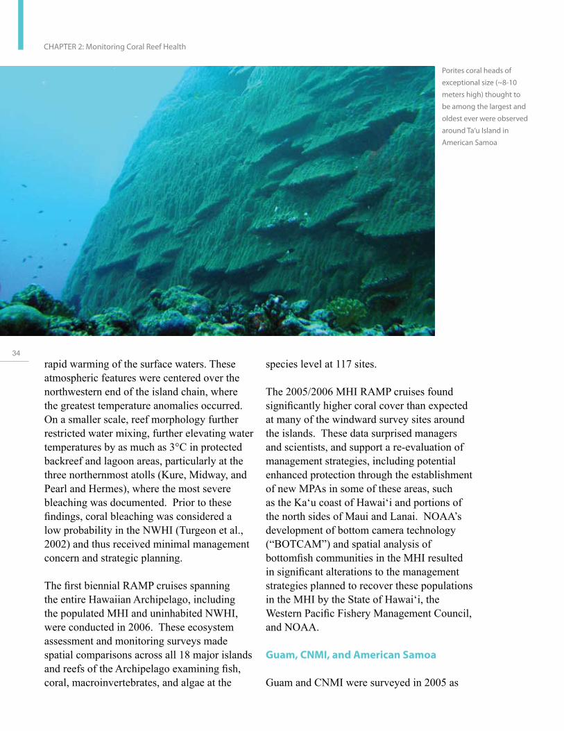
Porites coral heads of
exceptional size (~8-10
meters high) thought to
be among the largest and
oldest ever were observed
around Ta‘u Island in
American Samoa
species level at 117 sites.
The 2005/2006 MHI RAMP cruises found significantly higher coral cover than expected at many of the windward survey sites around the islands. These data surprised managers and scientists, and support a re-evaluation of management strategies, including potential enhanced protection through the establishment of new MPAs in some of these areas, such as the Ka‘u coast of Hawai‘i and portions of the north sides of Maui and Lanai. NOAA’s development of bottom camera technology (“BOTCAM”) and spatial analysis of bottomfish communities in the MHI resulted in significant alterations to the management strategies planned to recover these populations in the MHI by the State of Hawai‘i, the Western Pacific Fishery Management Council, and NOAA.
Guam, CNMI, and American Samoa
Guam and CNMI were surveyed in 2005 as

part of the biennial Marianas Archipelago RAMP cruise program. Building on the first cruise in fall 2003, the team collected a variety of ecological data at 14 islands and 12 banks of the Marianas Archipelago in 2005.
Before the first Marianas Archipelago RAMP (MARAMP) cruise in 2003, management agencies in Guam were considering implementation of a large-scale eradication effort to address concerns about a mass Acanthaster planci (crown-of-thorns seastar) infestation reported around the island of Guam. However, extensive towed-diver surveys during MARAMP 2003 found little evidence to support the infestation claims, and the government redirected funds to other reef conservation activities. In CNMI, before the 2003 surveys, government agencies reported apex-predator-dominated, near-pristine conditions in the northern islands based on limited surveys completed a decade earlier. The 2003 and 2005 RAMP surveys found a significant decrease in large fish abundance in the northern islands, suggesting higher levels of fishing pressure than predicted for the region. In partial response to these findings, CNMI resource management agencies are now investing limited funds to deploy passive Electronic Acoustic Recorders (EARs) during MARAMP 2007 to conduct acoustic monitoring of vessel traffic in the northern islands.
The coral reef ecosystems of the six primary islands/atolls of American Samoa were surveyed during Pacific RAMP cruises to the territory in 2002, 2004, and 2006. ASRAMP fish observations and analyses are being provided to help settle an ongoing controversy among management agencies in American Samoa regarding the abundance of reef fish in the territory. During ASRAMP 2003, towed-diver surveys around Ta‘u Island found areas with Porites coral heads of exceptional size
(~8-10 meters high) thought to be among the largest and oldest ever observed. Based on these findings, the American Samoa government is evaluating the establishment of a marine protected area to conserve these amazing corals. The deployment of four EARs around Tutuila (one in Fagatele Bay National Marine Sanctuary, two in the National Park of American Samoa, and one in Alega Bay) have helped resource managers understand the pattern of vessel intrusion. For example, the EARs deployed in the National Park showed surprisingly high vessel traffic in Park waters after dark.
To communicate the results of the RAMP cruises, NOAA is nearing completion of the Coral Reef Ecosystem Monitoring Report for American Samoa, the first in a series of monitoring reports for each of the jurisdictions. Using easy-to-comprehend visualizations of the complex Pacific RAMP data sets, these reports provide extensive and detailed spatial and temporal information documenting the benthic habitats, oceanography and water quality, and status of fish, corals, other invertebrates, and algae. In addition to the hardcopy reports, the data used to produce them will be made available online.
The National Park Service (NPS), with partner USCRTF members, continued collaborations to advance scientific understanding of coral reefs in National Parks and at regional scales in the Pacific. The NPS has developed scientifically and statistically rigorous protocols for the long-term Vital Signs monitoring program for coral reefs at National Park units in the Pacific Islands. Recruitment of juvenile corals, one of the Vital Signs indicators, has been very low at the NPS sites on the West Hawai‘i Island coast and at the War in the Pacific National Historic Park (NHP) in Guam. The NPS will continue to monitor this indicator and others, and will consider trends in coral recruitment
U.S
. Co
ral R
ee
f Ta
sk
Fo
rce
20
04
- 20
06
Re
po
rt to C
on
gre
ss
35

36
CHAPTER 2: Monitoring Coral Reef Health
when developing adaptive management plans for these parks.
Pacific Remote Island Areas
In 2004 and 2006, RAMP cruises were organized to survey the Pacific Remote Island Areas in the Line and Phoenix Island groups and Johnston and Wake Atolls, where military activities have continued since World War II. The 2004 and 2006 surveys augment data collected in the PRIAs in 2000, 2001, and 2002, and permit scientists to evaluate conditions over time at these seven remote and largely uninhabited islands. First-time coral disease surveys completed in 2006 at uninhabited islands such as Jarvis Island and Kingman Reef National Wildlife Refuge provide a basis against which to compare levels of disease prevalence in human-impacted coral reef environments. These quantitative assessments indicate a low mean overall prevalence of coral disease in the PRIAs, affecting between 0.01 and 2.8 percent of colonies. These values are comparable to the levels reported for the NWHI. NOAA, with the U.S. Fish and Wildlife Service (USFWS), led an effort in the Pacific Remote National Wildlife Refuges to resurvey all 60 accessible permanent transects and establish 10 new permanent transects.
On-going Monitoring Activities in the Atlantic/Caribbean
In contrast to the Pacific, no consistent regional assessment ability exists for coral jurisdictions in the U.S. Caribbean, Atlantic, and Gulf of Mexico. However, in 2006, NOAA co-led a collaborative project to assess the feasibility of implementing a periodic, broad-scale assessment of coral reef communities across the U.S. Caribbean. This ongoing project— the Comprehensive Caribbean Coral Reef Ecosystem Monitoring Project—focuses on
increasing collaboration and integration of current monitoring efforts and expanding monitoring to additional sites through the development of an online project database and GIS link.
In Florida, the USCRTF works with many partners to accomplish long-term, annual monitoring of fish, coral, and macroinvertebrate species in marine protected areas in the Dry Tortugas National Park, the Florida Keys, and throughout southeast Florida.
The Dry Tortugas National Park quadrupled the number of long-term coral reef monitoring sites in 2004 and 2005, in an effort to assess the continued decline of reef-building corals and to better understand coral status and trends. The availability of this information was a key factor in the designation of a 47-nautical-square-mile Research Natural Area in the Dry Tortugas in 2006 (see page 64 and 76 for more information). Common species and shallower, rare coral community types in the park, including the major remaining stands of staghorn coral (Acropora species), are now being monitored, as are seagrass and associated benthic communities. Surveys at 275 sites found increased size and abundance of some targeted reef fishes in the Florida Keys National Marine Sanctuary (FKNMS) Tortugas North Ecological Reserve (compared to findings from 1999 and 2000, before the Reserve was established), and stable species diversity throughout the region. Condition of reef fish stocks varied between management zones: stocks were more abundant and individuals were larger in areas with greater resource protection (i.e. less fishing).
The 12th consecutive year of long-term status and trends monitoring for seagrass, coral reef, and water quality has been completed in the FKNMS at a cumulative cost of about

Mapping the staghorn (Acropora cervicornis) stands off of Broward County, Florida.
$12 million. Multiple stressors acting at local, regional, and global scales continue to negatively impact coral reefs in the FKNMS, and are implicated in the decreases in stony coral cover and species richness documented by the Coral Reef Evaluation and Monitoring Project (CREMP).
The coral reef ecosystem in Florida extends beyond the Florida Keys northward through Miami-Dade, Broward, Palm Beach, and Martin counties. But until the development and implementation of the Southeast Florida Coral Reef Initiative in 2004, coral reef research and long-term monitoring was primarily focused on the Florida Keys and Dry Tortugas. Since 1996, the CREMP has documented changes in reef resources throughout the Florida reef tract from Key West to Carysfort. In 1999, the project was expanded to include three sites in the Dry Tortugas. In 2003, CREMP was further expanded to include 10 sites offshore southeast Florida in Miami-Dade, Broward, and Palm
Beach counties. In 2006, three additional sites were installed in Martin County. This CREMP expansion is referred to as the Southeast Florida Coral Reef Evaluation and Monitoring Project.
In 2004—following creation of a Memorandum of Agreement to facilitate sharing knowledge and best practices for resilience-based management among the State of Florida, NOAA, and Australia’s Great Barrier Reef Marine Park Authority—project partners launched the Florida Reef Resilience Program (FRRP). The FRRP is working to bring together scientists, reef managers, and the people whose livelihoods and recreational pursuits depend on healthy coral reefs to improve the collective understanding of coral reef resilience by exploring the biological and environmental aspects of reef health. The FRRP seeks to develop strategies to improve the health of Florida’s reefs and enhance the economic sustainability of reef-dependent commercial enterprises. The FRRP has
U.S
. Co
ral R
ee
f Ta
sk
Fo
rce
20
04
- 20
06
Re
po
rt to C
on
gre
ss
37
38
CHAPTER 2: Monitoring Coral Reef Health
completed a characterization of different reef zones throughout the entire Florida reef tract from the Dry Tortugas to Martin County, creating a common spatial framework in which to analyze old and new data. The FRRP has designed and successfully completed a pilot deployment of a disturbance response monitoring program to capture data on the impacts of bleaching and other disturbances throughout the reef tract.
Long-term monitoring continues in the coral-rich bank tops in the East and West Flower Garden Banks National Marine Sanctuary (FGBNMS), located in the Gulf of Mexico about 115 miles off the coast of Texas, in water depths of 18 to 49 meters. Monitoring results during the 2004-2006 period continue to highlight the relative health of these reefs. The occurrences of disease and bleaching were low from 0 to 0.50 percent, and the living coral cover continues to be approximately 57 percent. The coral reef ecosystem of the Flower Garden Banks has been well characterized by studies sponsored by the Minerals Management Service (MMS) since the 1970s. When the banks were designated as a National Marine Sanctuary in 1992, NOAA joined with MMS to sponsor the long-term monitoring program that continues today.
DoD (Navy) entered into a cooperative agreement with the University of Miami to compile existing coral reef monitoring data from the Navy’s facility at Andros Island, Bahamas, into a format to facilitate analysis and combination with other datasets. The Navy has been monitoring this area for several decades.
During 2004-2006, federal and territorial partners completed years five to seven of a long-term NOAA-led project monitoring benthic and fish communities in the USVI and Puerto Rico. Semi-annual surveys in the USVI focus on sites at Buck Island Reef
National Monument in St Croix. In late 2006, scientists transferred survey design approaches and data collection methodologies to the adjacent East End Marine Park to ensure easier comparison of data collected around the island. Annual surveys at St. John encircle the island, encompassing National Park and National Monument waters as well as at a deep reef three to four kilometers off the south shore of the island.
Complementary surveys conducted in Puerto Rico by the Department of Natural and Environmental Resources include 18 reefs in seven natural reserves, including the Tres Palmas Marine Reserve which harbors one of the most extensive and healthy populations of Acropora palmata—a species recently designated as threatened under the Endangered Species Act. Sampling efforts for all sites include the monitoring of reef fish and large invertebrates. Because field work in Puerto Rico was completed in August 2005, the massive Caribbean bleaching event was not recorded until the 2006 monitoring cycle. Surveys in 2006 detected a major decline in live coral cover—up to 59 percent at one location—and a shift in organism that make-up the benthic community persisting in late 2006. In all cases, the decline of total live coral cover at the community level was driven by mortality of the Montastrea annularis complex—a highly dominant species in terms of reef substrate cover and the principal reef-building species.
Other monitoring at priority reserves around Puerto Rico resulted in a characterization of La Parguera Natural Reserve reefs, which was submitted to DNER in 2004, with management recommendations to reduce the impacts on the reefs. In 2006, some of these recommendations were implemented, such as the installation of mooring buoys and aids to navigation. Other characterizations focused on the Caja de Muertos and Berberia Islands off

A bleached Acropora palmata
colony in St. Croix, US Virgin
Islands. The quadrat is 1m2.
the coast of Ponce and Cayo Aurora in Guánica State Forest; these projects were completed in 2005. In 2006, a characterization of the reefs in La Cordillera Natural Reserve off the northeast coast of Puerto Rico was conducted.
Biennial monitoring cruises continue to assess fish, benthic habitats, and Acropora status in the Navassa National Wildlife Refuge (see box on page 67 for further detail).
Additional monitoring efforts are conducted by the National Park Service, often in partnership with other federal and academic partners, to enable managers to conserve coral reef ecosystem resources within the National Park System. Scientists with the South Florida/ Caribbean Inventory and Monitoring Network (SFCN) monitor coral reefs within four National Parks: Dry Tortugas National Park and Biscayne National Park (Florida), and Virgin Islands National Park (St. John, USVI), and Buck Island Reef National Monument (St. Croix, USVI). Hurricanes, bleaching
events, and coral disease outbreaks brought unprecedented change and stress to coral reefs in these parks in 2004 and 2005. Using statistically rigorous and peer-reviewed methods, SFCN scientists are able to track changes and advise managers of conditions within these coral reefs before, during, and after major reef-altering events.
The 2005 Caribbean Coral Bleaching Event and Interagency Response
In 2005, coral reefs in the wider Caribbean suffered a widespread and severe bleaching event, which resulted in extensive coral death in much of the region. Persistent elevated sea surface temperatures caused this bleaching event, resulting in severe stress to coral communities, many of which were later killed by disease. More than one year after the 2005 bleaching/disease event, and despite the return of more “typical” sea-water temperatures, many corals continue to suffer lingering effects from the event, and mortality from disease
U.S
. Co
ral R
ee
f Ta
sk
Fo
rce
20
04
- 20
06
Re
po
rt to C
on
gre
ss
39

40
CHAPTER 2: Monitoring Coral Reef Health
continues to claim coral colonies. As of October 2006, coral cover had declined over 50 percent at many sites throughout the region.
Most reef-building tropical corals host symbiotic algae called zooxanthellae, which live inside their tissue. Coral bleaching is the temporary or permanent loss of zooxanthellae from the coral, which can be caused by many types of physiological stress (e.g., ultraviolet rays, excessive warm or cold water temperatures, bacterial infection, etc.). However, recent mass bleaching events, including the 2005 Caribbean bleaching episode, were caused by persistent elevated sea water temperatures and resulted in widespread coral mortality of coral reefs throughout the world.
Since 2000, NOAA has been developing and refining a system to predict and track thermal stress on corals using satellite-based sea surface temperature data. When conditions are detected which may lead to coral bleaching, automated Satellite Bleaching Alerts are e-mailed to managers worldwide. The first alerts issued for the 2005 Caribbean bleaching event were transmitted to the Florida Keys in
August 2005, and to Puerto Rico and the USVI in September 2005. During the 2005 event, satellites detected thermal stress expected to trigger mass bleaching throughout most of the Caribbean and nearly twice this value around the northern Lesser Antilles.
Presented with these data, the USCRTF passed a resolution in November 2005 to mobilize efforts across the Caribbean to monitor, assess, and research short- and long-term impacts of the 2005 warming and bleaching event. The USCRTF Bleaching Committee coordinated the efforts of NOAA, NASA, the DOI’s USGS and NPS, other government agencies, NGO partners, university researchers, and local managers.
NOAA continues to lead an international collaborative effort to fully document the spatial extent and severity of this event. Surveys from more than 3,600 bleaching observations from 100 researchers in 28 jurisdictions indicate the abnormal, warm Caribbean ocean temperatures in 2005 resulted in the most widespread, intense bleaching (Figure 3), and perhaps highest mortality (over 50 percent at many sites) of corals
Figure 3: Thermal stress and bleaching during the 2005 Caribbean bleaching event. (a) Maximum NOAA Coral Reef Watch Degree
Heating Week values (DHW) showing the maximum thermal stress recorded at each pixel during 2005. Each DHW represents
one week of temperatures 1ºC above the maximum highest monthly average. Values of 4 °C-weeks typically results in significant
bleaching; 8 °C-weeks typically results in widespread bleaching and mortality. (b) Jurisdiction averages of bleached percent of live
coral colonies (circles) and cover (diamonds).
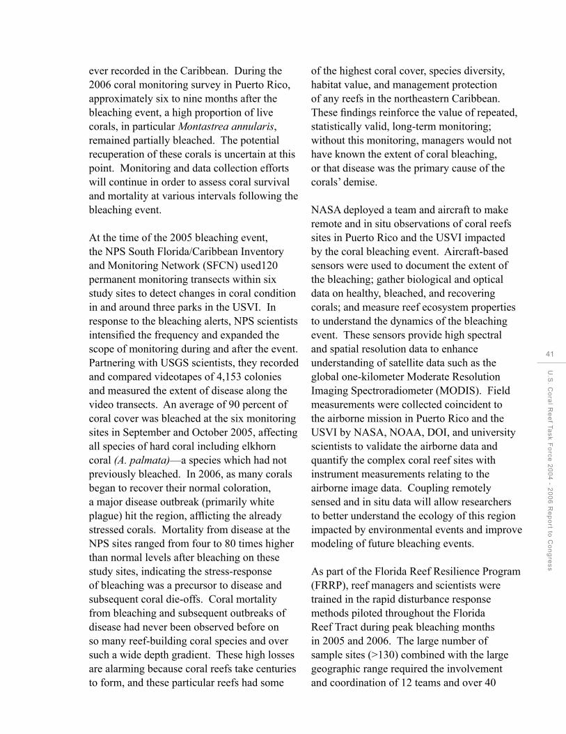
ever recorded in the Caribbean. During the 2006 coral monitoring survey in Puerto Rico, approximately six to nine months after the bleaching event, a high proportion of live corals, in particular Montastrea annularis, remained partially bleached. The potential recuperation of these corals is uncertain at this point. Monitoring and data collection efforts will continue in order to assess coral survival and mortality at various intervals following the bleaching event.
At the time of the 2005 bleaching event, the NPS South Florida/Caribbean Inventory and Monitoring Network (SFCN) used120 permanent monitoring transects within six study sites to detect changes in coral condition in and around three parks in the USVI. In response to the bleaching alerts, NPS scientists intensified the frequency and expanded the scope of monitoring during and after the event. Partnering with USGS scientists, they recorded and compared videotapes of 4,153 colonies and measured the extent of disease along the video transects. An average of 90 percent of coral cover was bleached at the six monitoring sites in September and October 2005, affecting all species of hard coral including elkhorn coral (A. palmata)—a species which had not previously bleached. In 2006, as many corals began to recover their normal coloration, a major disease outbreak (primarily white plague) hit the region, afflicting the already stressed corals. Mortality from disease at the NPS sites ranged from four to 80 times higher than normal levels after bleaching on these study sites, indicating the stress-response of bleaching was a precursor to disease and subsequent coral die-offs. Coral mortality from bleaching and subsequent outbreaks of disease had never been observed before on so many reef-building coral species and over such a wide depth gradient. These high losses are alarming because coral reefs take centuries to form, and these particular reefs had some
of the highest coral cover, species diversity, habitat value, and management protection of any reefs in the northeastern Caribbean. These findings reinforce the value of repeated, statistically valid, long-term monitoring; without this monitoring, managers would not have known the extent of coral bleaching, or that disease was the primary cause of the corals’ demise.
NASA deployed a team and aircraft to make remote and in situ observations of coral reefs sites in Puerto Rico and the USVI impacted by the coral bleaching event. Aircraft-based sensors were used to document the extent of the bleaching; gather biological and optical data on healthy, bleached, and recovering corals; and measure reef ecosystem properties to understand the dynamics of the bleaching event. These sensors provide high spectral and spatial resolution data to enhance understanding of satellite data such as the global one-kilometer Moderate Resolution Imaging Spectroradiometer (MODIS). Field measurements were collected coincident to the airborne mission in Puerto Rico and the USVI by NASA, NOAA, DOI, and university scientists to validate the airborne data and quantify the complex coral reef sites with instrument measurements relating to the airborne image data. Coupling remotely sensed and in situ data will allow researchers to better understand the ecology of this region impacted by environmental events and improve modeling of future bleaching events.
As part of the Florida Reef Resilience Program (FRRP), reef managers and scientists were trained in the rapid disturbance response methods piloted throughout the Florida Reef Tract during peak bleaching months in 2005 and 2006. The large number of sample sites (>130) combined with the large geographic range required the involvement and coordination of 12 teams and over 40
U.S
. Co
ral R
ee
f Ta
sk
Fo
rce
20
04
- 20
06
Re
po
rt to C
on
gre
ss
41

42
CHAPTER 2: Monitoring Coral Reef Health
divers from multiple agencies, universities, and NGOs. This effort documented the extent and severity of this bleaching event and results from these surveys are revealing spatial and temporal patterns in coral bleaching, diseases, and mortality. Although bleaching in Florida was much less severe than bleaching in the U.S. Caribbean, data from the FRRP are yielding important insights, demonstrating how some reef types may be more vulnerable to disturbance than others. To increase the predictability of thermal stress, these results are also being used to help calibrate high-resolution (~one kilometer), satellite-sensed sea surface temperature maps. For more information, see: http://coralreefwatch.noaa. gov/caribbean2005/.
Objective 2: Develop a web-enabled data management and information system for U.S. reef monitoring and data mapping with a user-friendly GIS-based mapping and querying capability to present complex information in usable formats to all potential users while ensuring the security of sensitive place-based biological or cultural resource data.
Data Collection and Dissemination: Coral Reef Information System
Acting on recommendations of the USCRTF, in 2002, NOAA created the Coral Reef Information System (CoRIS) to allow the public to access to an array of diverse scientific data on coral reef ecosystems and new information products.
CoRIS is a web-based information system that functions as a portal to products from coral reef research and management activities funded by and/or conducted in partnership with NOAA. Activities include coral reef mapping, monitoring, and assessment; natural and socioeconomic research and modeling; outreach and education; and management and
stewardship. CoRIS functions as an archive through the NOAA National Oceanographic Data Center (NODC) to preserve coral reef data and project metadata, while offering a variety of search tools to assist users in the discovery of this information. As of December 2006, users had access to:
Over 18,000 data products related to coral reef ecosystems and over 1,600 metadata records;
The CoRIS library, which includes citations of peer-reviewed articles, references to publications, conference proceedings, and links to coral reef websites;
Essays on topics such as coral biology, deep-water corals, coral diseases, other hazards, and descriptions of coral reef ecosystems such as those of the Papahanaumokuakea National Monument of the Northwestern Hawaiian Islands;
An illustrated glossary of over 5,000 scientific and technical terms with definitions, explanations, and illustrative materials to help the public understand the complex language of coral reef ecosystem science; and
Educational resources, including links to the “Coral Kingdom” photo library and transcripts from discussions among coral reef experts and enthusiasts around the world on topics such as coral genetics and the future of coral reefs.
CoRIS is developing a new portal to allow users to search for data by specific region. More information is online at: http://coris.noaa. gov/.
U.S
. Co
ral R
ee
f Ta
sk
Fo
rce
20
04
- 20
06
Re
po
rt to C
on
gre
ss
43

44
CHAPTER 3: Supporting Strategic Research
CHAPTER 3
Supporting Strategic Research

CHAPTER 3
Supporting Strategic Research
Goal: Provide coastal and ocean managers with scientific information and tools to help conserve, protect, restore, and sustain coral reef ecosystems.
The overarching goal of strategic research on coral reef ecosystems is to provide managers with tools to improve the integrity and sustainable use of these ecosystems. The USCRTF and its many partners are conducting short-term strategic and long-term ecosystem-based research to:
1. Understand coral reef community dynamics and the impacts of human-caused and natural stressors; 2. Identify possible management strategies to mitigate negative impacts; and 3. Evaluate the effectiveness of these management actions after they are implemented.
Strategic research enhances national, regional, and local capabilities to measure, understand, analyze, and forecast ecological change in response to stressors. Targeted research answers specific questions and provides coastal and ocean managers with the tools needed to provide effective management and
U.S
. Co
ral R
ee
f Ta
sk
Fo
rce
20
04
- 20
06
Re
po
rt to C
on
gre
ss
45

46
CHAPTER 3: Supporting Strategic Research
protection of local coral reef resources.
To guide priority setting for coral reef ecosystem research, NOAA published the NOAA Coral Reef Ecosystem Research Plan for Fiscal Years 2007 to 2011. The plan provides coastal and ocean managers, scientists, and policymakers with the upto-date scientific information to address the threats facing coral reef ecosystems and identifies priority research needed to advance management action. Covering all coral reef ecosystems under the jurisdiction of the United States and the Pacific FAS, the plan presents a national perspective on the research needed to address the range of stresses affecting the condition of coral reef ecosystems, summarizes the management issues and information needs driving research at the regional level and focuses on the use of research for effective implementation of ecosystem-based management strategies.
Research has improved knowledge of both
A researcher with the Moorea
Coral Reef Long Term Ecological
Research site surveys fishes on the
fore reef along the north shore
of Moorea, French Polynesia.
The data collected during these
surveys will be used by scientists
with the MCR LTER site to track
long term changes in the fish
community associated with
Moorea’s coral reefs and improve
predictions of how coral reefs
and coral reef communities
will respond to changing
environmental conditions.
global coral reef coverage and coral health. Coral disease and restoration research provides information to resource managers on the causes, predisposing factors, and effects of diseases of coral reef organisms. The Coral Disease and Health Consortium (CDHC), established in response to a need recognized by the USCRTF, has been instrumental in developing emergency response protocols to assess and identify potential disease outbreaks in corals. The National Science Foundation (NSF), in addition to contributing over $10 million per year for research and infrastructure to study coral reefs and their associated ecosystems, has initiated the first Long-Term Ecological Research (LTER) site focused on the dynamics of a coral reef ecosystem in French Polynesia; the site addresses the abiotic and biotic influences on the ecological performance of reef-building corals in the tropical Pacific. Other key research activities focus on understanding population connectivity of reef organisms and coral disease to provide fundamental

knowledge to guide management efforts and design of marine protected areas.
Accomplishments by Objective
Objective 1: Conduct a long-term regional and ecosystem-based research program to improve understanding of the processes that govern the structure, function, and health of coral reef ecosystems.
NSF established the U.S. Moorea Coral Reef LTER site through the University of California, Santa Barbara. Research at the site will help scientists better understand coral reef processes affecting the reef ecosystem, the nature of animal and plant community structure and diversity, and the factors determining the abundance and dynamics of related oceanic populations. The Moorea Coral Reef program is coordinating with the Kenting Coral Reef International LTER site in Taiwan to conduct collaborative research.
From 2004 to 2006, NOAA—in partnership with the National Undersea Research Program Centers at the University of North Carolina at Wilmington, University of Hawai‘i, and the Perry Institute for Marine Science—funded several multi-year research projects focused on understanding the processes governing the structure, function, and condition of coral reef ecosystems. Project scientists conducted research to:
Assess the threats to remnant populations of Acropora palmata in the upper Florida Keys National Marine Sanctuary and to establish the ecological significance of each population;
Evaluate the utility of marine protected areas as tools for fisheries management by testing whether demographic rates of the schoolmaster snapper
(Lutjanus apodus) change as a function of population size, documenting the occurrence of the spillover effect, and examining any underlying ecological mechanisms causing this effect; and
Determine the current status of the Hawaiian black coral fishery using both historical and new perspectives, as well as the impact of the alien snowflake coral (Carijoa riisei) on black coral beds.
The Coral Reef Ecosystems Studies (CRES) program, sponsored by NOAA, solicits proposals for projects addressing the causes of regional declines in coral abundance and degradation of coral ecosystems. The intent of this program is to provide timely and high-quality scientific results for use in developing alternative management strategies to restore and protect coral reef ecosystems. During 2004-2006, CRES funded research in the Micronesia region of the Western Pacific. This project contributed 28 peer-reviewed publications, and built local capacity by supporting the graduate work of four students, three them native Pacific Islanders. The project also provided data support and educational outreach for watershed protection in Umatac Bay, Guam; established watershed and marine protected areas in the Enipein area Pohnpei, FSM; assessed coral reef damage cases in Hawai‘i and Micronesia; and initiated a nine-month educational campaign for the Micronesian region. The CRES—Micronesia project also made significant contributions to policy and management in Palau. This project served as the basis for a local moratorium and pending national legislation related to the clearing and grading of mangroves that was having documented adverse impact on the near-shore coral reef ecosystems. This work is one notable example of how effective translation of research can inform policy development and implementation.
U.S
. Co
ral R
ee
f Ta
sk
Fo
rce
20
04
- 20
06
Re
po
rt to C
on
gre
ss
47

48
CHAPTER 3: Supporting Strategic Research
Palmyra Atoll Research Consortium Palmyra Atoll National Wildlife Refuge, Central Pacific Ocean Representing one of the world’s most pristine coral reefs, Palmyra Atoll has been described as “a crown jewel of the Central Pacific.” Its diverse marine habitats feature steeply sloping coral reef walls, extensive and shallow-perimeter coral reef shelves, reef pools, sand flats, and protected lagoons. Palmyra’s submerged coral reefs support three times the number of coral species found in the Caribbean and Hawai‘i, and five times the coral species found in the Florida Keys.
Palmyra Atoll offers an extraordinary opportunity for scientific studies aimed at protecting coral reef ecosystems in the Pacific and around the world. Palmyra’s location near the equator, its phenomenal biodiversity, and its history of minimal human impact make it an unparalleled laboratory to study vital issues affecting tropical island ecosystems, as well as global challenges such as climate change.
Recognizing these unique conditions, scientific researchers capitalized on coral reef study opportunities by forming the Palmyra Atoll Research Consortium (PARC) in July 2004. This partnership between the USFWS and The Nature Conservancy involves researchers from around the globe. With the recent addition of a privately funded $1.5 million research station, Palmyra has a new future as a world-class site for scientific study.
Working together with the USFWS, the Consortium has grouped its proposed studies under three themes: (1) biodiversity of Palmyra; (2) terrestrial/marine interface; and (3) marine biology, climate change, and biogeochemical structure. The largely pristine condition of Palmyra can provide insight about how unaltered ecosystems are structured, how they function, and how they can most effectively be preserved (Agardy, 2001). Research at Palmyra Atoll National Wildlife Refuge will help answer many questions about the ability of coral reef environments to survive into the future.

Research conducted at
Palmyra Atoll National
Wildlife Refuge can
help answer important
questions concerning
the global health of
coral reef ecosystems.
NASA’s Airborne Remote Sensing of Coral Reefs for Ecosystems Research
NASA’s suborbital assets have been used to fly over strategic coral reef sites to collect high-resolution imagery to support coral reef ecosystem biodiversity research. The goal of this research is to better understand how light scatters and reflects in shallow aquatic ecosystems—including coral reefs, seagrass beds, and mangrove stands—so current and future remote sensing sensors and data can be optimized for ecosystem research in the coastal zone. Further, there is a need to identify the spatial resolution detection limits of remote-sensing instruments for discriminating coral assemblages. The airborne sensors consist of a high-resolution digital camera system and the Airborne Visible Infrared Imaging Spectrometer (AVIRIS), a hyperspectral sensor. NASA’s airborne platforms supporting these payloads include the ER-2 and Twin Otter aircraft.
NASA’s airborne missions in 2004 included the Florida Keys following Hurricane Charley, and La Parguera and Mayaguez Bays in Puerto Rico as well as much of the north, south, and west coasts of Puerto Rico, and the north and south coasts of Vieques Island. Airborne missions in 2005 included Kane‘ohe Bay on O‘ahu, Hawai`i; Culebra Island, Puerto Rico; La Parguera, Puerto Rico; Buck Island and the northeast coast of St. Croix, USVI; the entire island of St. John, USVI; and Vieques Island. NASA, NOAA, DOI, and university scientists conducted field sampling coincident with the overflights for atmospheric correction and validation of the AVIRIS data. In addition, field spectra were collected underwater for water column characterization and developing spectral libraries of benthic types (coral, algae, and seagrass) to relate to the AVIRIS data for creating benthic habitat maps and analysis within and between habitat spectral variations. The expected outcomes of this research for coral reef ecosystems are improved
U.S
. Co
ral R
ee
f Ta
sk
Fo
rce
20
04
- 20
06
Re
po
rt to C
on
gre
ss
49

50
CHAPTER 3: Supporting Strategic Research
interpretation of coral reef habitat variability and biodiversity and enhanced benthic habitat classification algorithms. This effort also will contribute to studies of coastal relationships, including assessing coastal habitat composition and distribution, application of remote-sensing techniques to study land-sea interactions, and ridge-to-reef habitat assessments.
More information is available online at: http:// earthscience.arc.nasa.gov/sge/coral-health/.
Objective 2: Build capabilities to address such ecosystem-scale threats as disease, bleaching, and other sources of mass mortalities.
The National Sea Grant College Program works with local communities to understand and prepare for the effects of coastal hazards, including hurricanes, climate change, and other factors affecting the health of coral reefs. Through integrated research, outreach, and education efforts—particularly in Hawai‘i, Florida, and Puerto Rico—Sea Grant is working with local communities and decision makers to build capacity and understanding of ecosystem-scale threats. In addition, as part of the 2006 work plan for the Sub-committee for Integrated Management of Ocean Resources (SIMOR), Sea Grant is facilitating interagency Regional Research and Information Plans to identify the top-priority areas to build research and outreach capacity.
In American Samoa, disease surveys were initiated in 2004 at seven sites around Tutuila to document the baseline levels of disease in the major genera of corals and coralline algae. The same seven sites were resurveyed in January 2005 to look for seasonal differences in disease levels. From these surveys, 15 coral disease states and two crustose coralline algae diseases were described. A member of the NOAA-funded Coral Reef Monitoring Team was trained to continue disease monitoring in the territory.
Objective 3: Develop and transfer technologies for faster and more accurate mapping, assessment, monitoring, and restoration.
Targeted Research: Water Temperature Fluctuation, Coral Bleaching, and Reef Resilience
DoD funded a multi-phase research project to develop new technology for monitoring coral reef health, focusing on how warm temperatures cause coral bleaching at the biochemical level. Objectives of this project included:
Developing advanced techniques to quickly and non-destructively assess the viability and health of coral reef communities, with capabilities to identify and quantify natural and anthropogenic stresses;
Developing prototypes of Fast Repetition Rate Fluorosensors for permanent underwater monitoring stations and ROVs or Diver Propulsion Vehicles; and
Collecting a library of baseline data on physiological, biophysical, bio-optical, and genetic diversity of coral reef ecosystems near DoD installations.
Laboratory work was completed to develop a baseline for measuring the impact of two common natural stresses (elevated temperature and excess light) on the photosynthetic activity and fluorescence of selected coral species. Field trips were then completed in both the Caribbean and Indo-Pacific regions to validate the process. The results showed that Fast Repetition Rate Fluorosensors can detect physiological changes resulting from heat and light stress in target coral species. The researchers are expanding the baseline data set to evaluate
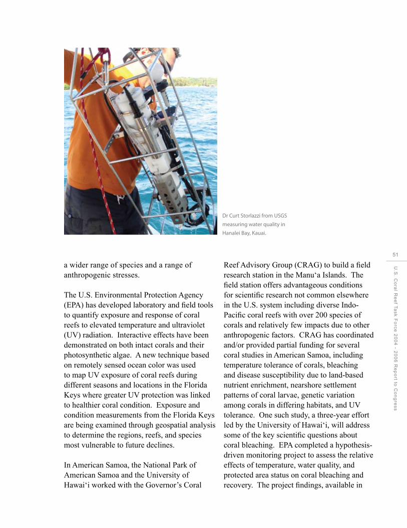
a wider range of species and a range of anthropogenic stresses.
The U.S. Environmental Protection Agency (EPA) has developed laboratory and field tools to quantify exposure and response of coral reefs to elevated temperature and ultraviolet (UV) radiation. Interactive effects have been demonstrated on both intact corals and their photosynthetic algae. A new technique based on remotely sensed ocean color was used to map UV exposure of coral reefs during different seasons and locations in the Florida Keys where greater UV protection was linked to healthier coral condition. Exposure and condition measurements from the Florida Keys are being examined through geospatial analysis to determine the regions, reefs, and species most vulnerable to future declines.
In American Samoa, the National Park of American Samoa and the University of Hawai‘i worked with the Governor’s Coral
Dr Curt Storlazzi from USGS
measuring water quality in
Hanalei Bay, Kauai.
Reef Advisory Group (CRAG) to build a field research station in the Manu‘a Islands. The field station offers advantageous conditions for scientific research not common elsewhere in the U.S. system including diverse Indo-Pacific coral reefs with over 200 species of corals and relatively few impacts due to other anthropogenic factors. CRAG has coordinated and/or provided partial funding for several coral studies in American Samoa, including temperature tolerance of corals, bleaching and disease susceptibility due to land-based nutrient enrichment, nearshore settlement patterns of coral larvae, genetic variation among corals in differing habitats, and UV tolerance. One such study, a three-year effort led by the University of Hawai‘i, will address some of the key scientific questions about coral bleaching. EPA completed a hypothesis-driven monitoring project to assess the relative effects of temperature, water quality, and protected area status on coral bleaching and recovery. The project findings, available in
U.S
. Co
ral R
ee
f Ta
sk
Fo
rce
20
04
- 20
06
Re
po
rt to C
on
gre
ss
51

52
CHAPTER 3: Supporting Strategic Research
fall 2007, address coral reef management in the context of climate variability. A USGS project assessed the potential for coral adaptation and the physiological resilience of corals to high temperatures in American Samoa’s lagoon pools. This research will provide an understanding of the sensitivity and adaptability of coral reef ecosystems to environmental changes and provide insight into which coral reefs are most important to protect from disruptive human activities, informing future site-specific protection efforts.
Rising ocean temperatures threaten all U.S. coral reefs with coral bleaching. The widely distributed and isolated locations of many coral reefs preclude us from using instruments to monitoring conditions on all U.S. coral reefs. Since 1998 NOAA has used polar-orbiting satellites to monitor the thermal bleaching stress that leads to coral reef bleaching. Research into the relationship between thermal stress and bleaching resulted in operational products that NOAA provides via the internet. These include night-time only sea surface temperatures and anomalies, and two products targeted directly at coral bleaching: the Coral Reef HotSpot anomaly product (became operational in 2002), the Degree Heating Week accumulated heat stress product and Virtual Stations webpage (became operational in 2003), and the Satellite Bleaching Alert e-mail system (became operational in 2005). Starting in 2006, NOAA began making gridded data products in HDF and Google Earth formats available as well. This suite of remarkably accurate tools for monitoring potential coral bleaching events has been highly used by researchers and managers alike. NOAA supports these coral bleaching products on a 24-hour, seven-day operational basis. These products proved invaluable to researchers and managers who were able to mobilize resources to assess the record-breaking 2005 Caribbean bleaching event, and alerted monitoring teams
of the 2002 and 2004 bleaching events in the remote Northwestern Hawaiian Islands. Further research has focused on refining these products to improve their ability to predict coral bleaching events.
Ocean acidification, caused by increasing levels of atmospheric carbon dioxide (CO2), can impact coral reef ecosystems by slowing the rate at which corals build and maintain their skeletons, thereby reducing their resiliency. Several USCRTF member agencies are conducting research on impacts of increasing atmospheric CO2 levels on coral reefs. In collaboration with researchers at the University of Hawai‘i, USGS completed a long-term, small-scale controlled investigation of the effects of ocean acidification on coral reef organisms. These studies indicate that projected increases in the partial pressure of CO2 (pCO2 ) in the oceans resulting from anthropogenic burning of fossil fuels could have severe impacts on coral reef ecosystems with critical levels being surpassed by 2100 (Yates & Halley 2006). Other studies examining the community-scale impact suggest net-reef calcification could decline to approximately one-half to two-thirds of preindustrial rates by the year 2100 (Langdon and Atkinson, 2005). There is also concern that the recruitment and growth of encrusting coralline algae, which are very important occupiers of hard substratum on reefs across the globe, could also see a severe reduction.
NOAA data products from three in situ monitoring stations within the Integrated Coral Observing Network provide near real-time (hourly) data in the waters near Lee Stocking Island (LSI), Bahamas; St. Croix, USVI; and La Parguera, Puerto Rico. At the LSI station, the installation of a Pulse Amplitude Modulating fluorometer and a pCO2 sensor to calculate CO2 have improved the understanding of the impacts of increased
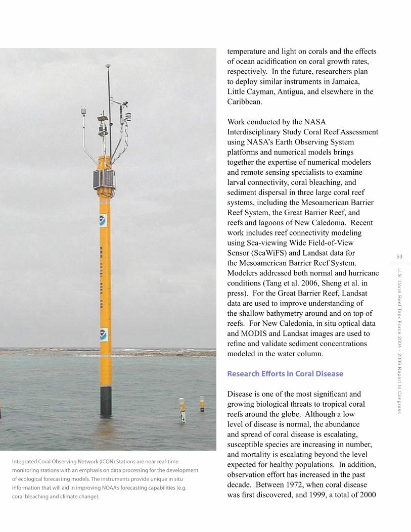
Integrated Coral Observing Network (ICON) Stations are near real-time
monitoring stations with an emphasis on data processing for the development
of ecological forecasting models. The instruments provide unique in situ
information that will aid in improving NOAA’s forecasting capabilities (e.g.
coral bleaching and climate change).
temperature and light on corals and the effects of ocean acidification on coral growth rates, respectively. In the future, researchers plan to deploy similar instruments in Jamaica, Little Cayman, Antigua, and elsewhere in the Caribbean.
Work conducted by the NASA Interdisciplinary Study Coral Reef Assessment using NASA’s Earth Observing System platforms and numerical models brings together the expertise of numerical modelers and remote sensing specialists to examine larval connectivity, coral bleaching, and sediment dispersal in three large coral reef systems, including the Mesoamerican Barrier Reef System, the Great Barrier Reef, and reefs and lagoons of New Caledonia. Recent work includes reef connectivity modeling using Sea-viewing Wide Field-of-View Sensor (SeaWiFS) and Landsat data for the Mesoamerican Barrier Reef System. Modelers addressed both normal and hurricane conditions (Tang et al. 2006, Sheng et al. in press). For the Great Barrier Reef, Landsat data are used to improve understanding of the shallow bathymetry around and on top of reefs. For New Caledonia, in situ optical data and MODIS and Landsat images are used to refine and validate sediment concentrations modeled in the water column.
Research Efforts in Coral Disease
Disease is one of the most significant and growing biological threats to tropical coral reefs around the globe. Although a low level of disease is normal, the abundance and spread of coral disease is escalating, susceptible species are increasing in number, and mortality is escalating beyond the level expected for healthy populations. In addition, observation effort has increased in the past decade. Between 1972, when coral disease was first discovered, and 1999, a total of 2000
U.S
. Co
ral R
ee
f Ta
sk
Fo
rce
20
04
- 20
06
Re
po
rt to C
on
gre
ss
53
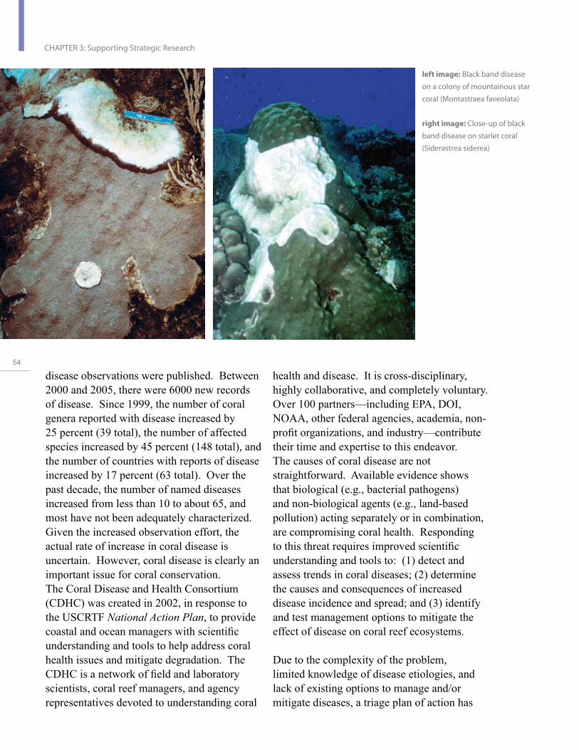
54
CHAPTER 3: Supporting Strategic Research
left image: Black band disease
on a colony of mountainous star
coral (Montastraea faveolata)
right image: Close-up of black
band disease on starlet coral
(Siderastrea siderea)
health and disease. It is cross-disciplinary, highly collaborative, and completely voluntary. Over 100 partners—including EPA, DOI, NOAA, other federal agencies, academia, nonprofit organizations, and industry—contribute their time and expertise to this endeavor. The causes of coral disease are not straightforward. Available evidence shows that biological (e.g., bacterial pathogens) and non-biological agents (e.g., land-based pollution) acting separately or in combination, are compromising coral health. Responding to this threat requires improved scientific understanding and tools to: (1) detect and assess trends in coral diseases; (2) determine the causes and consequences of increased disease incidence and spread; and (3) identify and test management options to mitigate the effect of disease on coral reef ecosystems.
Due to the complexity of the problem, limited knowledge of disease etiologies, and lack of existing options to manage and/or mitigate diseases, a triage plan of action has
disease observations were published. Between 2000 and 2005, there were 6000 new records of disease. Since 1999, the number of coral genera reported with disease increased by 25 percent (39 total), the number of affected species increased by 45 percent (148 total), and the number of countries with reports of disease increased by 17 percent (63 total). Over the past decade, the number of named diseases increased from less than 10 to about 65, and most have not been adequately characterized. Given the increased observation effort, the actual rate of increase in coral disease is uncertain. However, coral disease is clearly an important issue for coral conservation. The Coral Disease and Health Consortium (CDHC) was created in 2002, in response to the USCRTF National Action Plan, to provide coastal and ocean managers with scientific understanding and tools to help address coral health issues and mitigate degradation. The CDHC is a network of field and laboratory scientists, coral reef managers, and agency representatives devoted to understanding coral

been undertaken to (1) build a unified coral community with a solid foundation for cross-disciplinary research (e.g., training workshops, advanced education and professional development opportunities, and information dissemination strategies); (2) conduct strategic laboratory and field-based research; and (3) develop, implement, and test management strategies. During 2003-2006, the CDHC core team implemented a series of strategic objectives focused these three elements. Each objective is geared to improve our ability to forecast, characterize, understand, and mitigate coral diseases.
Efforts to build capacity in the coral disease and health community have included continued development of standardized nomenclature and procedures to allow comparison of information and sharing of tools between the scientists, coral reef stakeholders, and resource managers. A Strategic Plan of Action, Coral Health and Disease in the Pacific: Vision for Action, was developed during a CDHC workshop to help combat a possible health crisis for Pacific coral reefs. The express purpose of this workshop and action plan is to organize and coordinate U.S. scientific resources to focus on coral health issues in the Pacific. Response protocols for disease outbreak and response investigation were developed using an Incident Command Structure, which included the concepts, procedures, techniques for conducting an investigation. In addition, the community has collaborated with the CDHC to initiate regional Outbreak Response Team training efforts intended to build local capacity for responding to coral disease outbreaks.
Additional efforts to better address coral disease have included research activities in both the field and laboratory setting. Laboratory research has used and developed tools and methodologies for diagnosis and assessment including DNA tests for
surveillance of known pathogens and the development and sequencing of coral DNA libraries for use as a resource to identify coral genes and their role in health and disease. To date, over 15,000 DNA (specifically 16S rDNA) sequences submitted to public databases are pointing to key differences between healthy and diseased corals. The diagnoses of the cellular physiology response to environmental and toxicological stressors are being investigated to develop health assessment criteria.
Field activities include directed monitoring and investigation focused on the ESA-listed coral species, Acropora palmata. These activities have provided information in the prevalence estimates for various diseases affecting this species, and on patterns of disease outbreak following hurricane impacts in the Florida Keys (in particular in 2005) and at Navassa Island.
There has also been a focus on establishing disease incidence and baseline information for the following key locations:
Guam, the Commonwealth of the Northern Mariana Islands, Wake Atoll, and the Main Hawaiian Islands;
Maui: island-wide survey to determine the extent and possible causes of coral lesions;
Northwestern Hawaiian Islands: permanent transects for monitoring reef health; and
Puerto Rico: baseline assessment of the temporal variability of coral diseases including subsequent disease incidence due in part to the impact of the 2005 Caribbean-wide bleaching episode.
U.S
. Co
ral R
ee
f Ta
sk
Fo
rce
20
04
- 20
06
Re
po
rt to C
on
gre
ss
55

56
CHAPTER 3: Supporting Strategic Research
The first known occurrence of a disease outbreak (similar to white plague) was observed at the FGBNMS in February, 2005. The CDHC partnered with the FGBNMS to coordinate a rapid response to characterize the event and collect samples for laboratory analysis. Disease outbreaks are of major concern for the FGBNMS, because of their recent emergence on these reefs; an unusually high prevalence and rapid spread observed among colonies during winter and spring when most diseases in other locations are in remission; elevated rates of tissue loss in areas with high coral cover; and the greatest extent of mortality observed among the largest and most abundant reef-building coral taxa (Montastraea spp.). Since May 2005, NOAA has conducted seasonal monitoring of diseases to begin characterizing patterns of spread and impacts of disease.
Coral Reef Biological Criteria and Bioassessment
EPA is providing technical and regulatory guidance for states and territories on the development and implementation of bioassessment procedures and their application in establishing biological criteria (biocriteria) for the protection of coral reefs. Under the authority of the Clean Water Act, U.S. jurisdictions can assess coral reef condition to determine whether reefs are meeting resource expectations or whether they are impaired by human activity. Several regulatory options fall under the Clean Water Act, but they must be supported through scientifically valid bioassessment programs employing biological indicators to distinguish human disturbances from natural fluctuations in reef condition.
Among the most promising and comprehensive regulatory options for protection of coral reefs are water-quality standards based on biocriteria. Narrative or quantitative
thresholds are established to describe levels of expected coral reef condition for different designated waterbody uses. If reefs do not meet these expectations, the water body is listed as impaired and corrective action is implemented in the water body and watershed. EPA has formed a Coral Reef Biocriteria Working Group, composed of staff from several EPA Offices and Regions, to support development and implementation of coral reef biocriteria. The Working Group held an open workshop in conjunction with the May 2006 USCRTF meeting in Washington, D.C., and is completing technical guidance for a standard, rapid bioassessment of stony corals (publication anticipated in 2007). EPA is working directly with jurisdictions to support development of biocriteria in the USVI, American Samoa, CNMI, Florida, and Hawai‘i.
Research to develop defensible indicators and valid monitoring programs has been undertaken by EPA and USVI. In 2006, targeted surveys were performed in St. Croix to examine the potential of stony coral indicators in a biocriteria monitoring program. Transfer of the rapid bioassessment protocol to USVI resource managers was very successful, indicators demonstrated adequate power to detect change, and several indicators showed high sensitivity to human disturbances. A 2007 survey will employ a probability-based sampling design, and its results will inform the development of a balanced, long-term monitoring program designed to support status, trend, and targeted sampling for local and regional needs.
The American Samoa EPA coral reef monitoring program is conducting a long-term investigation to detect change over time resulting from land-based, human disturbance. This effort started in 2003 when six watershed-based survey sites were established around
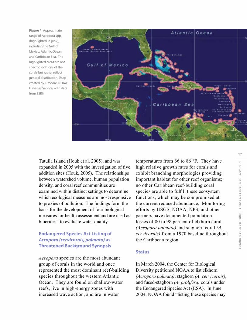
Figure 4: Approximate
range of Acropora spp.
(highlighted in pink),
including the Gulf of
Mexico, Atlantic Ocean
and Caribbean Sea. The
highlighted areas are not
specific locations of the
corals but rather reflect
general distribution. (Map
created by J. Moore, NOAA
Fisheries Service, with data
from ESRI)
Tutuila Island (Houk et al. 2005), and was expanded in 2005 with the investigation of five addition sites (Houk, 2005). The relationships between watershed volume, human population density, and coral reef communities are examined within distinct settings to determine which ecological measures are most responsive to proxies of pollution. The findings form the basis for the development of four biological measures for health assessment and are used as biocriteria to evaluate water quality.
Endangered Species Act Listing of Acropora (cervicornis, palmata) as Threatened Background Synopsis
Acropora species are the most abundant group of corals in the world and once represented the most dominant reef-building species throughout the western Atlantic Ocean. They are found on shallow-water reefs, live in high-energy zones with increased wave action, and are in water
temperatures from 66 to 86 °F. They have high relative growth rates for corals and exhibit branching morphologies providing important habitat for other reef organisms; no other Caribbean reef-building coral species are able to fulfill these ecosystem functions, which may be compromised at the current reduced abundance. Monitoring efforts by USGS, NOAA, NPS, and other partners have documented population losses of 80 to 98 percent of elkhorn coral (Acropora palmata) and staghorn coral (A. cervicornis) from a 1970 baseline throughout the Caribbean region.
Status
In March 2004, the Center for Biological Diversity petitioned NOAA to list elkhorn (Acropora palmata), staghorn (A. cervicornis), and fused-staghorn (A. prolifera) corals under the Endangered Species Act (ESA). In June 2004, NOAA found “listing these species may
U.S
. Co
ral R
ee
f Ta
sk
Fo
rce
20
04
- 20
06
Re
po
rt to C
on
gre
ss
57

58
CHAPTER 3: Supporting Strategic Research
Acropora species exhibit branching morphologies.

be warranted” and initiated a formal review of their biological status. The Atlantic Acropora Biological Review Team (BRT) was formed to compile and analyze the best scientific and commercial information on these species’ life histories, abundances and distributions, and long-term changes. The members of the BRT included experts in the fields of coral biology and ecology, coral monitoring and restoration, climate, water quality, and coral taxonomy, as well as regional experts in coral abundance/ distribution throughout the Caribbean Sea and state and federal resource managers. The comprehensive, peer-reviewed status review report developed by the BRT incorporated and summarized the best available data as of March 2005. Based on the findings of the report, NOAA determined “elkhorn and staghorn corals warrant listing” as threatened species under the ESA; this determination did not include fused-staghorn corals. NOAA finalized the ESA listing of elkhorn and staghorn corals as threatened on May 4, 2006.
Update and On-going Activities
NOAA worked to create an ESA 4(d) rule detailing prohibitions necessary and advisable to provide for the conservation of elkhorn and staghorn corals. The establishment of the 4(d) rule will help NOAA ensure that activities— such as water resources development projects involving dredging and in-water construction—avoid or minimize impacts to threatened coral species through the ESA consultation requirements.
NOAA is also in the process of designating critical habitat in the U.S. Caribbean and Florida where these species are found (see Figure 4 for a general distribution of these coral species). Maps showing known occurrences and habitat characteristics of elkhorn and staghorn corals in Puerto Rico, USVI, and Florida have been created to aid in
critical habitat designation. The designation of critical habitat will aid in the recovery of listed coral species by protecting habitat essential for the conservation of the species. (As of publication date, the critical habitat designation is open for public comment through May 6, 2008.)
An interagency data-gathering effort between NOAA and the USGS is under way to obtain GIS and remote sensing data (e.g., benthic habitat data, water depth, water temperature, and presence/absence data for Acropora species colonies) to aid in the identification and mapping of areas qualifying as critical habitat for listed corals.
NOAA biologists, along with partners at the University of Miami/RSMAS, recently published: Demographic monitoring protocols for threatened Caribbean Acropora species corals. This manual is available online at: http://www.sefsc.noaa.gov/PDFdocs/ Acropora Manual-Electronic.pdf. This manual provides standardized techniques for monitoring these threatened coral species throughout their range.
NOAA, USGS, and other partners are undertaking on-going targeted demographic monitoring in several U.S. locations to document current trends in Acropora species abundance and condition. For example, in 2005 after the March 2005 status review was published, substantial additional losses occurred of monitored Acropora palmata populations in the USVI due to bleaching and in the Florida Keys due to hurricanes and associated disease impacts. Monitored populations have also displayed very low rates of recruitment. This information will be used in developing of demographic models to define and assess recovery targets.
U.S
. Co
ral R
ee
f Ta
sk
Fo
rce
20
04
- 20
06
Re
po
rt to C
on
gre
ss
59

ng
ctors
60
CHAPTER 4: Understanding Social and Economic Factors
CHAPTER 4:
Understandi Social and Economic Fa

CHAPTER 4:
UnderstandiSocial and Economic Fa
ng
ctors
Goal: Assess the human dimension of coral reef resources and incorporate social, economic, and cultural values into conservation and management activities.
Understanding the value and human use of coral reefs is critical to reducing threats and sustaining healthy coral reef ecosystems. In particular, coral reef ecosystems in near-shore waters are vulnerable to the impacts of human activities, both directly by exploitation of reef resources and indirectly by land-based activities. The livelihoods and prosperity of people living in coastal tropical areas depend on, and influence, the conditions of marine resources. Coastal activities and their eventual impacts on reefs are inextricably linked, woven into the social, cultural, and economic fabric of regional coastal communities.
USCRTF members and partners have implemented various research and monitoring projects to determine the economic valuation of reef resources, and the impacts on local communities of coastal management activities such as marine protected areas. Improving our understanding of the underlying human motivations, beliefs, and perceptions
U.S
. Co
ral R
ee
f Ta
sk
Fo
rce
20
04
- 20
06
Re
po
rt to C
on
gre
ss
61

CHAPTER 4: Understanding Social and Economic Factors
Total Economic Value of Coral Reefs in Guam (million US$/year)
Tourism 94.63
Diving and snorkeling 8.69
Fishery 3.964
Amenity 9.6
Coastal Protection 8.4
Biodiversity 2
Figure 5: Total Economic Value of Guam’s coral reefs.
62
regarding coral reef ecosystems is vital to the independent researchers, these studies will be conservation and adaptive management of used to highlight the economic importance of these valuable resources. coral reefs to the economies and cultures of our
Accomplishments by Objective U.S. coral reef jurisdictions.
The Economic Value of Guam’s Coral Reefs. Objective 1: Assess the social and economic uses of coral reef systems and monitor human communities that use or depend on coral reef ecosystems.
Economic Valuation of Coral Reefs in American Samoa, Guam, and CNMI
This study, which included interviews of 400 local residents, showed over 90 percent of Guam residents make regular use of the beach and ocean for activities such as swimming, barbequing, fishing, and snorkeling. Approximately 40 percent of local residents fish on a regular basis, and fishing was identified to be more
Between 2004 and early 2007, three major important as a social activity rather than for economic valuation projects were completed generating income. for the coral reefs of Guam, CNMI, and American Samoa. These studies, described In economic terms, the value of Guam’s coral below, used a combination of household reefs is derived from tourism, diving and interviews, economic impact analysis, and snorkeling, fishing, property values, coastal stated preference surveys to estimate a total protection, and biodiversity. Total economic value for coral reef resources in the three value for Guam’s reefs was estimated at jurisdictions. Two more projects are planned $127.28 million per year, with tourism for Puerto Rico and the USVI. Conducted by accounting for approximately 75 percent

of this value (see Figure 5). This report is available online at: http://www.coralreef.gov/ taskforce/pdf/guam_susfin_palau.pdf.
The Economic Value of the Coral Reefs of Saipan, Commonwealth of the Northern Mariana Islands. This report estimated the total economic value of CNMI’s reef to be $61.16 million per year, with tourism comprising about 70 percent of this value. The report concluded with three main recommendations, combining the findings of the valuation study and associated surveys with priorities identified in CNMI’s Local Action Strategy. These recommendations include establishing measures to: (1) address the issue of non-point and point source pollution; (2) make use of the cultural importance residents place on marine ecosystems to improve coral reef management; and (3) develop a comprehensive system of user fees for visitors of MPAs on Saipan. The report is available online at: http://cnmicoralreef. net/Saipan%20final%20report%20zip%20 Feb2006.pdf.
Economic Valuation of American Samoa’s Coral Reefs and Adjacent Habitats. This study estimated the territory’s coral reefs provide $5 million in benefits each year to American Samoan residents and visitors. While still significant, this value was lower than expected because tourism and recreational access to corals are limited, extensive man-made shoreline defenses have already been constructed due to beach sand and rubble mining, and the population is relatively small and poor. The American Samoa reef valuation study was conducted by a different set of researchers than the Guam and CNMI studies, which may have resulted in different methodologies for determining total economic values and may account for some of the differences in the totals for American Samoa
versus Guam and CNMI. More information about the project is available online at: http:// doc.asg.as/crag/Projects.htm, and a copy of the report is available online at: http://doc.asg.as/ crag/ASCoralValuation04.pdf.
The American Samoa Department of Marine and Wildlife Resources (DMWR), in partnership with the Coral Reef Advisory Group and NOAA, hosted a training workshop in Socioeconomic Assessment and Monitoring. The training was designed to improve manager and staff capacity to integrate socioeconomic analysis into the design, management, and monitoring of MPAs in American Samoa.
Development of Climate Variability Tools
EPA and academic partners collaborated to develop a Draft EPA Report on information tools for integrating climate variability scenarios into linked models of ecosystem dynamics, socioeconomics, and decision support for management of coral reefs.
Facilitation of International Community-based Socioeconomic Monitoring through the Global Socioeconomic Monitoring Initiative
In 2006, NOAA began coordination of the Global Socioeconomic Monitoring Initiative (SocMon). SocMon supports regional and national training workshops around the world to help reef managers incorporate socioeconomic assessments and monitoring into their reef management programs. From 2004 to 2006, grants were provided to approximately 20 international sites to conduct socioeconomic monitoring activities following the workshops, which included information on incorporating results into management actions. This program will expand to include domestic areas, including Puerto Rico, the USVI, and the Pacific territories and FAS in 2007.
U.S
. Co
ral R
ee
f Ta
sk
Fo
rce
20
04
- 20
06
Re
po
rt to C
on
gre
ss
63
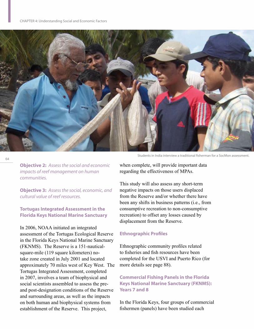
64
CHAPTER 4: Understanding Social and Economic Factors
Students in India interview a traditional fisherman for a SocMon assessment.
Objective 2: Assess the social and economic impacts of reef management on human communities.
Objective 3: Assess the social, economic, and cultural value of reef resources.
Tortugas Integrated Assessment in the Florida Keys National Marine Sanctuary
In 2006, NOAA initiated an integrated assessment of the Tortugas Ecological Reserve in the Florida Keys National Marine Sanctuary (FKNMS). The Reserve is a 151-nauticalsquare-mile (119 square kilometers) no-take zone created in July 2001 and located approximately 70 miles west of Key West. The Tortugas Integrated Assessment, completed in 2007, involves a team of biophysical and social scientists assembled to assess the pre-and post-designation conditions of the Reserve and surrounding areas, as well as the impacts on both human and biophysical systems from establishment of the Reserve. This project,
when complete, will provide important data regarding the effectiveness of MPAs.
This study will also assess any short-term negative impacts on those users displaced from the Reserve and/or whether there have been any shifts in business patterns (i.e., from consumptive recreation to non-consumptive recreation) to offset any losses caused by displacement from the Reserve.
Ethnographic Profiles
Ethnographic community profiles related to fisheries and fish resources have been completed for the USVI and Puerto Rico (for more details see page 88).
Commercial Fishing Panels in the Florida Keys National Marine Sanctuary (FKNMS): Years 7 and 8
In the Florida Keys, four groups of commercial fishermen (panels) have been studied each

Students in India interview a traditional fisherman for a SocMon assessment.
year since 1998 to track impacts of fishing regulations. The panels were designed to monitor the impacts of the no-take areas in effect since July 1, 1997, and establish a baseline panel for the Tortugas Ecological Reserve, which went into effect on July 1, 2001. The four panels are: (1) general commercial fishermen not displaced from the no-take areas (used as the control panel); (2) marine life collectors for the aquaria trade; (3) fishermen displaced from the Sambos Ecological Reserve; and 4) Tortugas fishermen, all of whom were displaced from the Tortugas Ecological Reserve on July 1, 2001. Information collected from these fishermen each year includes total catch, spatial distribution of catch, revenue, costs, and net earnings.
An assessment will be made of the eight years of data to assess whether the no-take areas in the FKNMS had any financial impact on the commercial fisheries. Information from the Tortugas panel is also being used in the Tortugas Integrated Assessment (see Objective 2). The research team is recommending the panels be converted to regionally oriented panels and integrated with the biological/ ecological monitoring in the region.
Knowledge, Attitudes, and Perceptions of Regulations and Management Strategies in the FKNMS
In 2005, NOAA funded a ten-year replication of a baseline study completed in 1995-1996 by researchers at the University of Florida and the University of Miami’s Rosenstiel School of Marine and Atmospheric Sciences, through a Florida Sea Grant Project. Baseline information was obtained on the knowledge, attitudes, and perceptions about regulations and management strategies being proposed for the FKNMS, in particular the no-take areas, which went into effect in 1997. The baseline
and ten-year replication will assess changes in the knowledge, attitudes, and perceptions of FKNMS regulations and management strategies for three user groups: commercial fishermen, dive shop owners and operators, and members of local environmental groups.
In 2006, the surveys of commercial fishermen and dive shop owners/operators were completed. A 100 percent response rate was achieved on a random sample of 300 commercial fishing operations, and a 95 percent response rate was achieved for all 65 dive shop owners/operators in the Florida Keys in 2006. The survey of members of local environmental groups began in December 2006, were completed in May 2007, and the analyses and reports are expected to be completed by December 2007.
U.S
. Co
ral R
ee
f Ta
sk
Fo
rce
20
04
- 20
06
Re
po
rt to C
on
gre
ss
65

66
CHAPTER 4: Understanding Social and Economic Factors

Status and Exploitation of Reef Resources on Navassa Island Navassa Island, a USFWS National Wildlife Refuge, is a small, isolated island 35 miles (56 kilometers) west of Haiti. The reefs and waters around the island are home to 286 species of fish, and are rich in sponges, algae, and coral. The island provides nesting habitat for over 5,000 red-footed boobies, and is home to endemic lizards.
NOAA, along with the USFWS, has completed reef assessment cruises to Navassa Island. Recent results show fishing is having an impact on the area’s fisheries, with significant declines in size and abundance of reef fishes (two very active hurricane seasons may be impacting ecosystem health as well). Other significant results from research on Navassa include a guide to the island’s sponge community, completion of multibeam and single-beam hydroacoustic (partial) habitat maps, long-term monitoring of the island’s benthic community structure, genetic characterization of Navassa’s Acroporid corals, documentation of a coral disease outbreak in 2004, and discovery of 49 previously undocumented reef fishes (Miller, et. al., 2007).
Scientists uncovered an active fishery on Navassa Island, and contracted with the Fondation pour la Biodiversite Marine (FoProBIM), an NGO specializing in coastal resource issues in Haiti, to complete a comprehensive description of the fishery at Navassa. The study indicates 75 percent of Haiti’s southwest region income is from fishery-related activities, and 1,000 to 1,500 families may be entirely dependent on fisheries operations. Between 300 and 400 fishermen frequent Navassa Island when not fishing close to home. The Navassa Island fisheries alone may account for $200,000 to $500,000 a year for those villages known to frequent the island (yearly total fishing-related value for these villages is between $1 million and $2 million). The distance from Haiti and dangers of crossing between the islands, along with a lack of food and water supply at the island, appear to be key contributing factors saving Navassa Island from over exploitation. None of the Haitian fishermen interviewed were aware of Haitian and U.S. fishery regulations. The study provided a range of recommendations related to research, management of the island resources, and outreach to the fishing community. As a follow-up to this study, Haitian fishermen have received outreach and education materials on coral reef habitats, endangered species, and about the refuge itself. In addition, dialogue with the fishermen continues and a representative from FoProBIM has visited them in their home towns.
U.S
. Co
ral R
ee
f Ta
sk
Fo
rce
20
04
- 20
06
Re
po
rt to C
on
gre
ss
67

68
CHAPTER 5: Improving the Use of Marine Protected Areas
CHAPTER 5:
Improving the Use of Marine Protected Areas

CHAPTER 5:
Improving the Use of Marine ProtectedAreas
Goal: Improve management of coral reef resources through a strengthened and expanded network of coral reef marine protected areas.
The federal, state, and territorial agencies represented on the USCRTF recognize that successful conservation of coral reef ecosystems requires identification and management of ecologically important reef areas within the broader marine environment. As a result, the USCRTF has provided formal acknowledgement of MPAs as an important coral reef management tool, and has taken measures to incorporate this tool into their marine resource management efforts. Creating a network of well-managed MPAs helps protect the biodiversity and resilience of coral reef resources. MPAs can also play an integral role in an ecosystem-based approach to management and conservation. MPAs can protect critical habitats and endangered species, enhance tourism and recreation, and play important roles in public education and outreach. MPAs can also provide a framework for the application of adaptive management, maintaining feed-back loops between science, management, and policy decisions.
U.S
. Co
ral R
ee
f Ta
sk
Fo
rce
20
04
- 20
06
Re
po
rt to C
on
gre
ss
69

70
CHAPTER 5: Improving the Use of Marine Protected Areas
The National Action Strategy of 2002 calls for “improving the use of marine protected areas in coral reef ecosystems.” The USCRTF also called for strengthening the Nation’s existing network of MPAs¹ with particular attention to increasing the number of “no-take” marine reserves² —areas where extractive uses are prohibited—with the goal of protecting at least five percent of all coral reefs and associated habitats in each major island group and Florida by 2002, at least ten percent by 2005, and at least 20 percent by 2010. In addition, the USCRTF called for designing coordinated networks of coral MPAs in U.S. waters and other areas to ensure the long-term viability, ecological integrity, and sustainable use of coral reefs.
In 2004-2006, federal and state/territory members of the USCRTF worked with partners to expand coral reef MPA networks and strengthen the effectiveness of existing coral reef MPAs. As a result of these efforts,
Established eleven new MPA sites, including the Papahanaumokuakea Marine National Monument located in the Northwestern Hawaiian Islands—one of the single largest conservation areas under the U.S. flag;
Development of new MPA management plans is underway in all seven domestic jurisdictions on the USCRTF as well as the Pacific Freely Associated States;
Published the first inventory and
assessment of MPAs managed by state and territory governments in the seven U.S. states and territories with coral reef ecosystems;
Established a new network of Pacific Island MPA managers to help build MPA management capacity; and
Commitment by USCRTF jurisdictions in Micronesia to expand effective conservation of marine and terrestrial resources through the Micronesia Challenge.
Accomplishments by Objective
Objective 1: Conduct and support national, state, and territory assessments of the effectiveness and gaps in the existing system of U.S. coral reef MPAs.
Ongoing monitoring and assessment of resources within and surrounding designated MPAs provides essential data to determine their effectiveness. For example, with assistance from the USFWS, Guam, conducted inshore fisheries surveys and stock assessment surveys of marine preserves³ and control sites, and provided technical assistance to quantify sedimentation and its effects on fish populations and benthic habitat.
The USFWS and NOAA cooperated in an expedition to reassess the status and biodiversity of coral reefs at seven National Wildlife Refuges in the Central Pacific and the islands of
¹ Marine Protected Area is used as defined in the MPA Executive Order 13158 as “any area of the marine environment that has been
reserved by federal, state, territorial, tribal or local laws or regulations to provide lasting protection for part or all of the natural or
cultural resources therein.”
² Reserve in this case is defined in the National Action Plan to Conserve Coral Reefs. Ecological reserves are no-take zones used for
maintaining biodiversity, productivity, and ecological integrity of coral reefs and other habitats.
³ The Government of Guam uses the term “preserves” to refer to no-take ecological reserves.

American Samoa. Reports and a photo library were prepared of surveys at over 120 sites.
NOAA has also been monitoring the abundance of several reef fish species with economic importance at two deeper, offshore MPAs in the northern Gulf of Mexico— Madison-Swanson and Steamboat Lumps. Work at Madison-Swanson has shown a rate of increase about an order of magnitude greater than the eastern Gulf as a whole. These increases are for gag grouper, the species these MPAs were designed to help; other members of the shallow-water grouper-snapper complex have shown similar results, although not as pronounced as seen for the gag grouper species. Steamboat Lumps, farther offshore than Madison, has shown slower rates of increase of economically important grouper species than in the general eastern Gulf.
DoD completed an inventory of coral reef
ecosystem resources at the Marine Corps Base Hawai‘i (MCBH) at Kane‘ohe Bay, O‘ahu, Hawai‘i. Noteworthy biological resources were documented, such as indicator or ecologically significant species; rare, endemic or alien species; valuable benthic habitat; and significant symbiotic species associations. In addition, potential natural and human threats to significant coral reef resources were identified. Recommendations to augment existing protection and management of base resources will be developed based on the survey.
In addition, DoD conducted baseline assessments and monitoring for threatened and endangered sea turtles, endangered monk seals, and Essential Fish Habitat and coral reef ecosystems at four geographic locations used heavily by DoD—the Pearl Harbor Entrance Channel, adjacent areas offshore of Hickam Air Force Base, and the Bellows Beach portion of MCBH. Within each of these areas, surveys
Left: Ecosystem of the Madison-
Swanson Reserve and South
Atlantic Bight proposed marine
protected areas.
Right: USVI National Park
Underwater Trail.
U.S
. Co
ral R
ee
f Ta
sk
Fo
rce
20
04
- 20
06
Re
po
rt to C
on
gre
ss
71

72
CHAPTER 5: Improving the Use of Marine Protected Areas
Report on the Status of Marine Protected Areas in Coral Reef Ecosystems of the U.S. Volume 1: Marine Protected Areas Managed by U.S. States, Territories, and Commonwealths
In conjunction with state, territorial, and federal partners on the USCRTF, NOAA completed the first assessment of U.S. coral reef protected areas. The report focuses on MPAs managed by state and territorial governments in the seven jurisdictions on the USCRTF—American Samoa, the CNMI, Florida, Guam, Hawai‘i, Puerto Rico, and the USVI. This report provides an inventory of existing coral reef MPAs and MPA management efforts in these seven jurisdictions, and is the first of several assessments needed for understanding the scope and effective use of MPAs for coral reef conservation in the United States. The report uses data collected in the National Marine Managed Inventory (http://www.mpa.gov) as well as the expertise of NOAA and state and territory co-authors to explore the management status of 207 MPAs located across the jurisdictions. Most of these sites are permanent (86 percent) and provide constant protection throughout the year (97 percent). Twenty-nine percent (49 sites) offer some level of no-take protection. While many sites have ongoing management activity, only 20 percent (42 sites) have approved management plans. Eighty-one sites contain fish spawning areas and threatened or endangered species have been observed in 164 sites. Finally, and perhaps of greatest significance, of the 126 sites providing information on challenges to effective management, the majority of sites identified five main challenges that must be addressed to help MPAs achieve management goals and objectives: enforcement, funding/resources, management capacity, monitoring, and public support. The ultimate success of these MPAs is contingent upon the resolution of these obstacles to effective management challenges.
are being conducted to assess the distribution and health of stony corals and selected macroscopic benthic invertebrates. Results of the long-term monitoring at these sites will be used to evaluate the effectiveness of mitigation measures applied to military activities in these locations. Data will be collected from existing long-term monitoring stations, and additional stations will be established.
Objective 2: Enhance the effectiveness of existing MPAs and strengthen their capabilities to protect coral reef resources through existing authorities, management plans, programs, and the involvement of all constituencies.
Hawai‘i formed two new community groups to assist in community-based management in the two most-used MPAs: Pupukea, O‘ahu, and Honolua, Maui. These groups are assisting in a variety of projects to raise the level of awareness and mitigate impacts of recreational misuse in coral reef habitats.
Draft management plans were produced for the Luis Pena Channel, Cordillera, and Mona Island Natural Reserves, and the Tres Palmas Marine Reserve in Puerto Rico. The Luis Pena Channel, Tres Palmas and Cordillera processes are cooperative efforts between the local communities and the Department of Natural and Environmental Resources (DNER) and will serve as a model for cooperative MPA management for other sites within Puerto Rico’s marine and natural reserve system. DNER prioritized additional sites (La Parguera and Caja de Muertos) within their natural reserve system for management plan development over the next five years.
The USFWS and NOAA have provided support to enhance CNMI’s MPA management. CNMI hired an MPA specialist who has taken the initial steps to assist CNMI
in developing an MPA Plan. At one particular MPA—the Sasanhaya Bay Fish Reserve— the USFWS funded a project involving Rota High School students in demarcating the boundaries of the existing reserve by constructing and deploying MPA markers. Students will also conduct community outreach to inform local users about the existence and purpose of the MPA.
In 2006, American Samoa held a Participatory Learning and Action workshop for several villages participating in the DMWR Community Fisheries Management Program. Community members learned techniques for identification of problems, causes, and solutions; threat prioritization; stakeholder analysis; and Community Action Plan development. The participating communities will use their Community Action Plans as guides to better manage and plan projects to improve their MPA sites and resources.
The Pacific Islands Marine Protected Area Community
In 2005, a new network of Pacific Islands MPA managers was developed. The Pacific Islands Marine Protected Area Community (PIMPAC) was established to address the unique challenges faced by Pacific Island MPA managers such as isolation, lack of human and financial resources, and lack of capacity-building opportunities. PIMPAC was initiated in September 2005, when over 50 MPA managers and practitioners from ten Pacific Island jurisdictions came together to discuss the development of a regional MPA community to share information, resources, and technical assistance. PIMPAC is represented by the Pacific Island jurisdictions of American Samoa, the CNMI, Guam, Hawai‘i, Republic of Palau, and Republic of the Marshall Islands and the FSM (including the states of Chuuk,
U.S
. Co
ral R
ee
f Ta
sk
Fo
rce
20
04
- 20
06
Re
po
rt to C
on
gre
ss
73
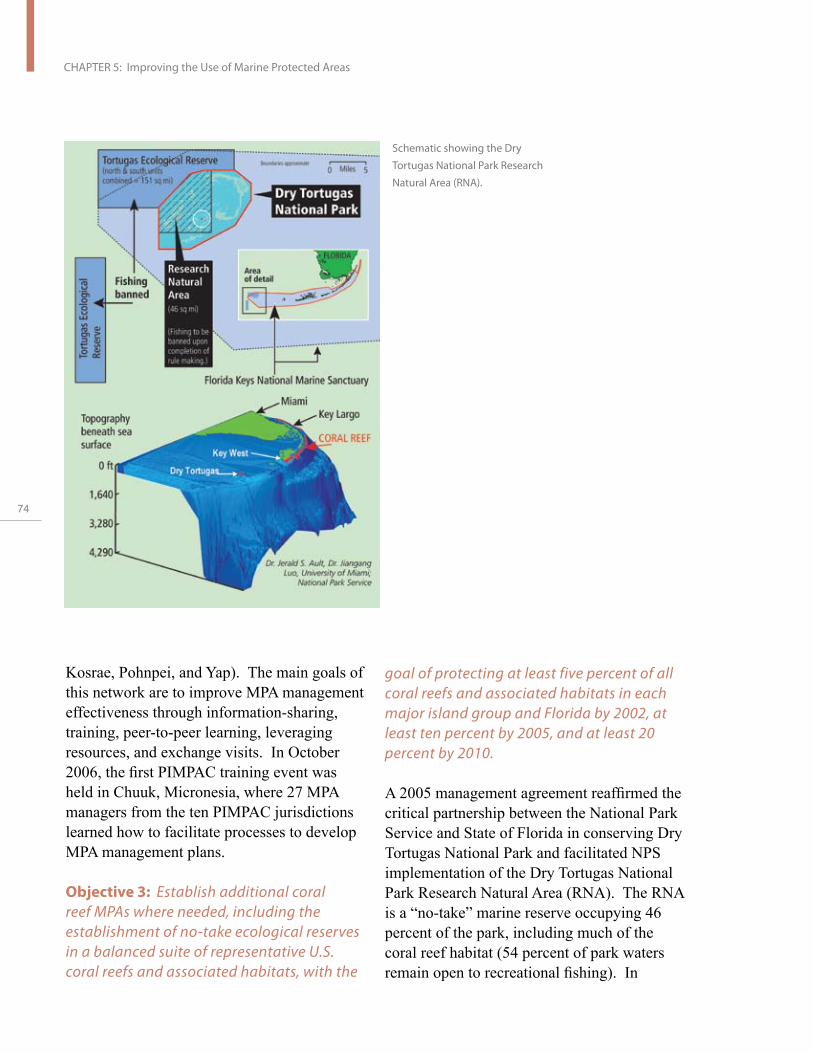
74
CHAPTER 5: Improving the Use of Marine Protected Areas
Schematic showing the Dry
Tortugas National Park Research
Natural Area (RNA).
Kosrae, Pohnpei, and Yap). The main goals of this network are to improve MPA management effectiveness through information-sharing, training, peer-to-peer learning, leveraging resources, and exchange visits. In October 2006, the first PIMPAC training event was held in Chuuk, Micronesia, where 27 MPA managers from the ten PIMPAC jurisdictions learned how to facilitate processes to develop MPA management plans.
Objective 3: Establish additional coral reef MPAs where needed, including the establishment of no-take ecological reserves in a balanced suite of representative U.S. coral reefs and associated habitats, with the
goal of protecting at least five percent of all coral reefs and associated habitats in each major island group and Florida by 2002, at least ten percent by 2005, and at least 20 percent by 2010.
A 2005 management agreement reaffirmed the critical partnership between the National Park Service and State of Florida in conserving Dry Tortugas National Park and facilitated NPS implementation of the Dry Tortugas National Park Research Natural Area (RNA). The RNA is a “no-take” marine reserve occupying 46 percent of the park, including much of the coral reef habitat (54 percent of park waters remain open to recreational fishing). In

February 2007, the NPS published the Final Rule to establish the RNA and implement other regulatory changes at the Park. The RNA is designed to restore and protect fish populations essential to the marine ecosystem, to maintain spawning and recruitment of regional fish stocks, and to protect coral reefs and other benthic habitats from anchor damage (anchoring is prohibited). The Tortugas region is also seen as important because spawning fish and invertebrates in this region are thought to be the larval source for many fish species that support the multi-billion dollar recreational and commercial fisheries in the Florida Keys. The RNA complements the adjacent Tortugas Ecological Reserve managed by the FKNMS, and now comprises the largest marine reserve in North America. The Park Service and the State of Florida are developing a science plan for evaluating and monitoring the RNA.
American Samoa established three additional sites in their Community Based Fisheries Management Program, for a total of 11 sites in this system, which is designed to assist villages in managing and conserving their inshore fishery resources. DMWR received increased support in 2005 to begin implementing the former Governor’s 20 percent no-take MPA declaration. The MPA program aims to create new no-take areas in order to ensure various and diverse marine resource habitat, and to ensure that spawning stocks are available to populate reefs on a regular basis and after disasters. The MPA Program has filled three new staff positions, including an MPA program leader, an environmental specialist, and a technician.
In 2004, Puerto Rico designated the Tres Palmas Marine Reserve to protect the threatened elkhorn coral (Acropora palmata). Two new sites in Puerto Rico’s natural reserve system were also established: Boqueron
State Forest and Cienaga las Cucharillas. In addition, existing sites were strengthened by the passage of the Puerto Rico Fishing Regulation No. 6768, which declared 0.5 nautical miles of the waters surrounding existing sites in their natural reserve system— including Monito, Isla de Mona, and Isla de Desecheo—as no-take areas. These regulations also identified a new no-take area in Laguna del Condado.
Objective 4: Strengthen and support cooperation with and among the Freely Associated States and international partners to establish networks of MPAs to protect and conserve reef ecosystems.
In 2006, the USCRTF island jurisdictions of Palau, the FSM, the Republic of the Marshall Islands, the Territory of Guam, and the CNMI presented the Micronesia Challenge to the U.N. Convention on Biological Diversity. The Micronesia Challenge is a commitment by each of these island jurisdictions to provide effective conservation of 30 percent of nearshore marine resources and 20 percent of terrestrial resources by 2020.
The USFWS has worked with local partners in both Palau and the FSM to increase capacity for managing and enforcing MPAs. In the FSM, the USFWS provided technical assistance for community-based planning and management of MPAs, which included creating management plans, training community stewards, and delineating and marking boundaries. And in Palau, the USFWS funded a project to assist the local community of Hatohobei State to delineate and manage an existing 259,000 square meter MPA at Helen Reef Atoll. Funds will be used to help the community finalize and mark the protected area and to assist them in management, monitoring, and educational activities.
U.S
. Co
ral R
ee
f Ta
sk
Fo
rce
20
04
- 20
06
Re
po
rt to C
on
gre
ss
75

76
CHAPTER 5: Improving the Use of Marine Protected Areas
Our Sea of Islands: A Regional Forum for Oceania on Marine Managed Areas and World Heritage.
Co-sponsored by NOAA, DOI, and the United Nations Educational, Scientific and Cultural Organization World Heritage Programme, this forum brought together representatives from over 20 Pacific states to build local and regional pride across Oceania (i.e., Micronesia, Melanesia, Polynesia, and Australia) and enhance our natural and cultural heritage through information-sharing, relationship building, and adaptive use of management tools regarding marine managed areas. The Forum included work sessions with topics such as: Science—An Integral Element of Effective Management, Customary Marine Management Practices in Oceania, Marine Managed Area Representation, Remote Surveillance and Enforcement, Conservation Finance, and World Heritage Designation. This forum provided an opportunity for managers, government officials, and practitioners from around Oceania to discuss shared experiences.

Papahānaumokuākea Marine National Monument
The Papahānaumokuākea Marine National Monument in the Northwestern Hawaiian Islands was created by Presidential proclamation on June 15, 2006. The Monument is one of the largest conservation areas under the U.S. flag and the largest marine conservation area in the world. It encompasses 362,062 square kilometers of the North Pacific Ocean–an area larger than all the U.S. national parks combined. The extensive coral reefs found in Papahānaumokuākea–truly the “rainforests of the sea”–are home to over 7,000 marine species, one-quarter of which are found only in the Hawaiian Archipelago. Many of the islands and shallow-water environments are important habitats for rare species such as the threatened green sea turtle and the endangered Hawaiian monk seal. Papahānaumokuākea is also of great cultural importance to Native Hawaiians with significant cultural sites found on the islands of Nihoa and Mokumanamana.
The NWHI was designated a Coral Reef Ecosystem Reserve in 2000 by Presidential Executive Order, and, in 2006 NOAA initiated an extensive administrative and public review process for designating the NWHI as a National Marine Sanctuary under the National Marine Sanctuaries Act. Before final action was taken on this designation, however, President Bush declared the NWHI to be a National Monument through a Presidential Proclomation, using his authority under the Antiquities Act of 1906.
In September 2005, Hawai‘i Governor Linda Lingle proclaimed the NWHI state waters and lands as a State Marine Refuge, a no-take reserve with commercial fishing phased out over five years and allowing only limited sustenance fishing, while recognizing Native Hawaiian cultural practices. This conservation action paralleled the management practices of the USFWS, which has had jurisdiction over the Hawaiian Islands National Wildlife Refuge since 1909 and over Midway Atoll National Wildlife Refuge since 1998. The Monument was designated in June 2006, and was later given the Hawaiian name Papahānaumokuākea Marine National Monument in a ceremony on March 2, 2007. Under this proclamation, the DOI and DOC, with the State of Hawai‘i, are identified to co-manage the Monument, including the Federal National Wildlife Refuges, the State reserve areas, and the waters of the coral reef ecosystem reserve, in a seamless fashion. A joint (USFWS, NOAA, and State of Hawai‘i) set of regulations and a permit process for the Monument has been implemented as well as joint management plans, including research and operations, are being developed with opportunity for public review and comment.
U.S
. Co
ral R
ee
f Ta
sk
Fo
rce
20
04
- 20
06
Re
po
rt to C
on
gre
ss
77

78
CHAPTER 6: Reducing the Adverse Impacts of Fishing
CHAPTER 6:
Reducingthe Adverse Impacts of Fishing

CHAPTER 6:
Reducing the AdverseImpacts of Fishing
Goal: Reduce the adverse impacts of fishing and other extractive uses to protect coral reef ecosystems and ensure sustainable fisheries.
Coral reefs and associated habitats provide important commercial, recreational, and subsistence fishery resources in the United States and around the world, and represent a critical source of food. Fishing plays a central social and cultural role in many island communities. The rich biodiversity of reefs also supports a valuable marine aquarium industry, and promises a rich genetic resource for pharmaceuticals and other natural products. However, human population growth, the emergence of export fisheries, and the use of more efficient fishing equipment have led to overfishing and fishing-related impacts on habitats and ecosystems. Inadequately regulated fishing may significantly alter ecological balance, contributes to the degradation of coral reef ecosystems, and threatens the social and economic sustainability of communities depending on these valuable resources. USCRTF members and partners are working to reduce the adverse impacts of fishing and increase the sustainable management of coral reef fisheries through
U.S
. Co
ral R
ee
f Ta
sk
Fo
rce
20
04
- 20
06
Re
po
rt to C
on
gre
ss
79

80
CHAPTER 6: Reducing the Adverse Impacts of Fishing
improved scientific information, coordination, enforcement, targeted management approaches, and education.
Accomplishments by Objective
Objective 1: Identify, monitor, and protect critically important U.S. coral reef fisheries habitats and spawning populations through an expanded network of no-take ecological reserves; ensure effective enforcement of existing no-take marine reserves; monitor reef fish stocks in no-take marine reserves and reference sites to evaluate the effectiveness of reserves; and identify and protect new areas necessary to ensure the integrity of fisheries and ecosystems.
The members and partners of the USCRTF are evaluating the effectiveness of established MPAs to improve fish stocks and protect spawning aggregations (when fish gather at a particular time and place for simultaneous reproduction en masse). A goal of many established marine protected areas is to protect spawning aggregations of fish important for commercial and cultural uses.
Researchers studying the reserves in Florida and the Dry Tortugas have documented increased numbers and sizes of reef fish important from economic and ecological perspectives—such as black grouper (Mycteroperca bonaci), and yellowtail snapper (Ocyurus chrysurus)—within the protected areas. At Riley’s Hump in the Dry Tortugas, researchers have documented the reformation of a mutton snapper (Lutjanus analis) aggregation since this site is now protected from fishing. In Pohnpei in the FSM, researchers found the no-take year-round Kehpara Marine Sanctuary is effective in protecting squaretail coralgrouper, and adjacent spawning aggregations of brown-marbled grouper (Epinephelus fuscoguttatus), and
camouflage grouper (E. polyphekadion). But, it was also evident that many reproductively active groupers never reach the spawning site and are taken along migration routes or in staging areas adjacent to the Sanctuary, thus reducing overall annual reproductive output for the spawning population.
Southeast Florida Coral Reef Initiative Fishery Profile
In support of the goals of the Southeast Florida Coral Reef Initiative (SEFCRI), NOAA described total landings, effort, and trends in recreational, headboat, and commercial fisheries off Dade, Broward, Palm Beach, and Martin counties of southeastern Florida (SEFCRI Local Action Strategy region). A NOAA Technical Report released in 2006 illustrated the value of reef resources to southeast Florida fisheries. In southeast Florida fishery landings from 1990-2000, reef fishes comprised nearly a quarter of all landings, an annual average of 4.79 million pounds. Reef fishes comprised 27 percent of recreational fish landings, 38 percent of headboat landings, and 17 percent of commercial landings. The report—Description and Discussion of Southeast Florida Fishery Landings, 1990-2000—is available online at: https://grunt.sefsc.noaa.gov/P_ QryLDS/DisplayDocuments. jsp?min_series_code=&min_ record_id=&direction=next&total_ rows=&description=SEFSC%20Technical%20 Memorandum#.
An additional activity to end overfishing in the Caribbean includes the Puerto Rico Department of Natural Resources (PRDNR) recently published regulations prohibiting all fishing of red hind during their spawning season around the entire shelf in Puerto Rico jurisdictional waters, complementing federal fishing measures. This management action was

Big Eye in National Park.
the direct result of NOAA and the PRDNR’s hydroacoustic research on fish spawning aggregations showing their re-appearance in specific locations in the Puerto Rico shelf. Closures apply to commercial and recreational fishing under Puerto Rico Fishing Regulations.
Objective 2: Reduce overfishing by monitoring coral reef fisheries, assessing the adequacy of current fishing regulations, revising regulations as needed (using existing statutory processes in the case of federal regulations), and providing enhanced enforcement and education.
Key elements of effective fishery management include understanding the current state of the fishery resources, implementing effective regulations, enhancing and strengthening enforcement capacity, and providing information on regulations to the fishing communities. USCRTF members and partners actively work to address information and
capacity gaps to improve the state of the coral reef fisheries.
For example, USCRTF members are assessing reef fish populations and fishing activities to improve upon current fishery management activities. In Florida, NOAA, working with partners, completed a four-year study of the reef fishes along all three reef tracts of Broward County, surveying 208 species. Progressive increases in mean species richness, biomass, and abundance were seen from inshore to offshore across the three reef tracts. Of concern are the low number of legal-sized groupers and snappers found off Broward County. Researchers saw only two out of 232 red groupers of legal minimum size and observed no legal-sized gag (Mycteroperca microlepis), yellowfin (Mycteroperca venenosa), or scamp (Mycteroperca phenax) groupers. This indicates an important group of predators is now largely missing from this reef system.
U.S
. Co
ral R
ee
f Ta
sk
Fo
rce
20
04
- 20
06
Re
po
rt to C
on
gre
ss
81
82
CHAPTER 6: Reducing the Adverse Impacts of Fishing
Information collected as part of the NOAA Coral Reef Conservation Program provided important fisheries data for NOAA stock assessment activities in the South Atlantic, Gulf of Mexico, and U.S. Caribbean (The Southeast Data, Assessment and Review process). Data from fishery-independent surveys provided information on fishery distribution and abundance and habitat interactions essential to many recent reef stock assessments, including yellowtail snapper, conch, red grouper, and mutton snapper. This type of data is of special importance when assessing Caribbean resources, which tend to be data-limited.
In the south Atlantic, Coral Reef and Live/ Hardbottom Habitat Plan is the basis for coral reef ecosystem management. The Plan prohibits harvest of stony corals, seafans, coral reefs and live rock except as authorized for scientific and educational purposes. The harvest of allowable octocorals for the aquarium trade is limited in number and only allowed south of Cape Canaveral, Florida. In addition Coral Habitat Areas of Particular Concern (HAPC), the Oculina Bank and Satellite Coral HAPCs have been designated in the South Atlantic. Within those areas, habitat damaging fishing gear is prohibited including bottom tending trawl gear, traps, dredges, and bottom longlines. Anchoring or the use of grapples is also prohibited for all fishing vessels. The Plan also established criteria for issuance of permits to take prohibited coral for scientific research and educational purposes and a permit system for use of allowable chemicals and harvest of octocorals. NOAA has been successful in protecting the fragile coral resources in the South Atlantic from degradation due to direct harvest and/or unintended damage from bottom tending fishing gear.
The Grammanik Bank, located nine miles south of St. Thomas in the U.S. Virgin Islands, is a charismatic, multi-species spawning
aggregation site for aggregations of 35,000 – 84,000 fish annually; including yellowfin, yellowmouth, and tiger grouper; and cubera and dog snapper. NOAA activities led to the discovery of these previously undocumented snapper aggregations. Although Nassau grouper are present at the Bank, numbers have not returned to the critical mass needed to reform the spawning aggregation. NOAA provided funding for research on the resources in this area which informed the decision by the Caribbean Fishery Management Council to institute a seasonal closure of the bank to protect spawning aggregation sites in 2005. This closure, in addition to protecting fish populations, allows researchers to monitor and study spawning aggregations of Nassau grouper, which appear to be returning in increasing numbers to the bank. They are returning presumably to spawn (spawning coloration and behavior are present), but actual spawning has yet to be observed. Monitoring of Grammanik Bank continues, collecting information on grouper and snapper distribution, abundance and behaviors. A new facet of this project includes an extensive acoustic component to help passively monitor movements of fish to and from the area.
Across U.S. Pacific Island reefs analyses of fish data show strong correlations between the population status of targeted reef fish species and local human densities. Scientists found the highest fish biomass around the uninhabited or sparely populated and protected islands such as the NWHI and Howland, Baker, Jarvis, Wake, Palmyra, and Kingman islands. Fish biomass on these reefs ranged from two to six metric tons per hectare. In contrast, scientists found the lowest fish densities (~0.5 metric tons per hectare (0.01 square kilometer)) around islands with large populations, such as O‘ahu and Guam.
In 2005, CNMI reinstituted inshore creel surveys

Juvenile Snowy Grouper.
(an estimate of overall fishery yield) in Saipan, to increase understanding of the coastal fish species targeted by local fishermen and to collect data on inshore fisheries, an important component of the CNMI coral reef fishery. Initial surveys concentrated on the heavily utilized Saipan Lagoon area to monitor fishery-dependent trends in food fish abundance and biomass.
NOAA has also provided information leading to management decisions undertaken by the State of Hawai‘i to protect coral reef-associated fish stocks from harmful fishing practices. Fisheries information collected in 2005 and 2006 led to a lay gill net ban on parts of O‘ahu and all of Maui, as approved by Governor Lingle in March 2007.
Activities Related to Improving Regulations
To reduce fishing pressure and restore fish stocks, USCRTF members have implemented new regulations, and furthered the
development of fisheries management plans. The Puerto Rico DNER published regulations prohibiting all fishing of red hind during their spawning season (December 1–February 28th) around the entire shelf in Puerto Rico jurisdictional waters. This management action was based on results of hydroacoustic research on red hind (Epinephelus guttatus) spawning aggregations along the Puerto Rico shelf. The closures apply to commercial and recreational fishing under Puerto Rico Fishing Regulations.
Florida and the NPS have taken steps to implement an agreement to adopt a joint Fisheries Management Plan between the State of Florida and Biscayne National Park to address increased park visitation and declines in reef fisheries. The park hosts more than 500,000 visits per year at its location to the immediate south of Miami. The NPS and the Florida Fish and Wildlife Conservation Commission intend to publish a proposed Draft Environmental Impact Statement on the plan. The goals of the joint plan are to restore
U.S
. Co
ral R
ee
f Ta
sk
Fo
rce
20
04
- 20
06
Re
po
rt to C
on
gre
ss
83

84
CHAPTER 6: Reducing the Adverse Impacts of Fishing
depleted fish stocks and sustain recreational opportunities at Biscayne National Park.
NOAA has also taken several actions for its Gulf of Mexico reef fish complex to address or prevent overfishing. During 2005 and 2006, moratoria on the issuance of additional commercial and charter/headboat vessel permits for reef fish were established, as well as a moratorium on shrimp vessel permits (shrimp vessels have a bycatch of reef fish). In addition, all vessels with a reef fish permit were required to install and use a vessel monitoring system, and to carry de-hooking devices for the incidental take of protected turtle species.
For red snapper, NOAA approved a rebuilding plan in 2004 and implemented it in July 2005. In 2006, an individual fishing quota system was established for the commercial red snapper fishery, which in part, was intended to reduce fishing mortality. In late 2006, NOAA Fisheries began developing additional
Blue striped grunt and grey
snappers in waters off the
Florida Keys.
harvesting restrictions to address overfishing of red snapper during 2007.
For groupers, several harvesting restrictions, including seasonal closures and bag limits were implemented in 2005 and 2006. Additional harvesting restrictions are currently being developed by the Gulf Council to end overfishing of several grouper species as well as other reef fishes.
Within the Caribbean Exclusive Economic Zone (EEZ), actions to address overfishing included: seasonal area closures to possession of members of the snapper/grouper complex at various times of the year; a requirement that fish captured or possessed in the EEZ not be filleted at sea and be landed with heads and fins intact; prohibitions against the use of gill and trammel nets to catch Caribbean reef fish or spiny lobster; and prohibition on the use of pots/traps, gill/trammel nets, and bottom longlines on coral or hard bottom year-round in existing seasonally closed areas and Grammanik Bank.

The western Pacific addresses the management of its coral reef species through ecosystem-based management. The Coral Reef Ecosystem Plan of the Western Pacific Region (CREFMP) is the first ecosystem-based fishery management plan for U.S. waters. The coral reefs that are managed under the CREFMP are healthy and, based on the best scientific information available, are not overfished or experiencing overfishing conditions. Management measures under the CREFMP, established a coral reef ecosystem regulatory area with no-take and low-use marine protected areas (MPAs); special permitting and reporting requirements for low-use MPAs; large vessel no-anchoring zone on the offshore southern banks around Guam; gear restrictions in the remote U.S. Pacific Islands, such as no spear fishing at night with SCUBA gear. The CREFMP also contains a framework regulatory process that enables the Western Pacific Fishery Management Council and NOAA to implement regulatory adjustments in a timely manner to address overfishing of coral reef ecosystem stocks that include shallow-water marine fauna and flora.
Activities Related to Improving Enforcement
Effective law enforcement is an essential part of successful management and conservation of coral reef fishery resources. The USCRTF has long recognized the need to build the capacity of local enforcement offices though training and increases in materials and personnel. Federal members of the USCRTF, through the Enforcement Working Group, trained territorial enforcement personnel on the federal legal authorities available to address pollution, illegal fishing, and other illegal activities affecting coral reefs. The workshops provided effective strategies for addressing environmental compliance and other problems affecting coral reef
conservation. Workshop locales included St. Croix, St. Thomas, and Puerto Rico.
To address needs of law enforcement, officers in Puerto Rico received guides to identifying and reporting violations of fisheries laws, marine resource protection laws, coastal habitat protection laws, and other laws affecting impacts to the coral reef ecosystem and associated habitats. An additional tool developed with NOAA funding was a Marine Species Identification Guide depicting marine species protected by Puerto Rico regulations. The guide included photos of fish and other species out of the water as well as species often confused with those regulated. The manual highlighted characteristics of each species and applicable regulations to help officers better enforce existing regulations. Two workshops were held to train Puerto Rico rangers in the use of this tool. A third workshop on enforcement procedures included representatives of the Puerto Rico Department of Justice, Puerto Rico Tribunal, DNER Legal Division, DNER Ranger Corps, and the Department of the Police Maritime Unit. This workshop was the first forum promoting the increased interaction between different law enforcement disciplines working in coral reef and fisheries enforcement.
CNMI hired three new enforcement officers and implemented a joint enforcement operations plan with NOAA. The plan has provided increased funds to support enforcement operations in terms of fuel, equipment, uniforms, and other operational expenses.
In American Samoa, the Community Fisheries Management Program (CFMP) provides an enforcement program for participating villages, empowering village communities by deputizing the village mayor and one village policeman to assist DMWR in CFMP enforcement efforts.
U.S
. Co
ral R
ee
f Ta
sk
Fo
rce
20
04
- 20
06
Re
po
rt to C
on
gre
ss
85

86
CHAPTER 6: Reducing the Adverse Impacts of Fishing
Violators may be brought in front of the Village Council to determine punishment at the village level, but when higher-level enforcement is needed, legal support is provided through this set of regulations. A menu of village by-laws has been drafted by an attorney, incorporating all existing village by-laws regulating the use of a village marine protected area. This final draft under the DMWR Code is in its final stages before adoption and registration. This regulation strengthens enforcement capabilities by the CFMP village communities and DMWR.
In Guam, local agencies developed a user-friendly, pocket-sized, water-resistant booklet to increase public knowledge of fishing regulations. It includes descriptive photos and diagrams of legal-size fish; and locations of marine preserves, fish aggregation devices, and shallow-water mooring systems. To improve enforcement of marine preserves, Guam created a Conservation Reserve Officers Program, which will increase the number of enforcement officers in the field by 50 percent (Guam now has ten full-time enforcement officers). This program provides stipends, uniforms, and equipment for peace officers, who are employed by enforcement divisions of other local agencies. Peace officers are paired with existing conservation officers to increase shift coverage. In addition, Guam passed a law creating the Marine Preserve Eco Permit, which restricts certain non-fishing activities in the Marine Preserves.
Objective 3: Enhance coordination on coral reef fishery issues with the U.S. territories in the Caribbean and Western Pacific.
NOAA has held a number of workshops to improve coordination among federal, state, and territory USCRTF members and to increase communication and interaction with local fishing communities and stakeholders. For example, NOAA held several workshops on
Tutuila, American Samoa for public input on management needs for coastal fisheries. Fisheries biologists tailored presentations with the objective of providing the fundamental scientific and management information for effective management of a coral reef fishery. The workshops provided an introduction to assessing the status of fish stocks and fishing effort on a coral reef and covered life histories of fish species, impacts of water quality and poor watershed management, and the benefits and risks of particular management approaches (e.g., area closures, seasonal closures, gear regulations, etc.). The participants suggested additional training on more specific topics including in-depth coral reef fish life histories, coral reef water-quality parameters and monitoring requirements, and analysis of fishery data and management needs. Based on the success of this workshop, the USCRTF is considering conducting a similar effort for other U.S. Pacific Islands.
Objective 4: Reduce adverse environmental impacts of fishing by assessing essential fish habitat; identifying the effects of fishing gear; implementing actions or additional gear and fishing vessel anchoring restrictions to reduce habitat damage; eliminating destructive fishing practices; assessing and mapping deeper coral reefs, banks, and beds; and developing strategies to conserve these deeper ecosystems.
Deeper reef ecosystems provide essential habitat for many fish species. Some fish inhabiting these deeper reef systems spend their entire lives there while others, such as some snappers and groupers, may migrate between shallower reefs and deeper reefs, and still other species may spend their juvenile stages in shallower waters and move to the deeper reefs as adults.
USCRTF members have made an effort to protect deeper reefs and habitats. For

GIS-based tool for
managing the bottomfish
fishery in Hawai‘i.
example, researchers developed a GIS-based tool for managing the bottomfish fishery in Hawai‘i, which has been declared in a state of overfishing. GIS layers derived from the bathymetry include hill-shades and depth contours, and biological and fishing information helped make the GIS map an effective tool for managing this fishery. Hawai‘i has used this GIS map to revise a bottomfish Restricted Fishing Area plan encompassing quality habitat and to reduce fishing pressure.
Objective 5: Incorporate ecosystem-scale considerations into coral reef fishery management by performing targeted research, including the development of models, to understand the ecosystem effects of fishing and the socioeconomic impacts of fishery management.
Ecosystem-based coral reef and fishery management, including the use of place-based management tools (e.g., MPAs),
requires an understanding of the origins of fish larvae, their movements, and habitat needs. NOAA researchers, in partnership with El Colegio de La Frontera Sur in Chetumal, Mexico, are mapping spawning aggregations, larval distributions, and oceanic currents in the Caribbean to determine potential coral reef population connections with Florida reefs. Floating drifters (ocean current detection devices) released in the Yucatan quickly left the region and headed north toward Florida, suggesting fish larvae could travel along the same path with relative ease. Light trap collections off Mexico yielded an unprecedented diversity of fish larvae, including tuna, bonefish, and groupers, all of which could be heading toward Florida.
Coral reef ecosystems provide economic and cultural benefits to human communities worldwide. Through cultural assessments of fishing communities, scientists, and managers can obtain broad, region-wide overviews
U.S
. Co
ral R
ee
f Ta
sk
Fo
rce
20
04
- 20
06
Re
po
rt to C
on
gre
ss
87
88
CHAPTER 6: Reducing the Adverse Impacts of Fishing
of fishing activities and characterize the economic and sociocultural importance of reef resources. Socioeconomic information helps managers include human dimensions in comprehensive coral reef ecosystem management. Social scientists from NOAA have characterized the fishing communities in Puerto Rico and the USVI. Highlights from interviews with the Puerto Rico fishing community include:
Increasing family involvement in fishing enterprises is often associated with adding value to catches through further processing of seafood products, establishing restaurants, and direct retail sales from home markets;
Most fishermen surveyed in Puerto Rico believe MPAs are achieving their biological objectives, but they are more ambivalent about the sociological benefits of MPAs; and
Most fishermen feel that management efforts in Puerto Rico focus on the preservation and conservation of fish stocks without considering the preservation of fishing communities and the importance of fishing ways of life to Puerto Rican culture and coastal heritage.
NOAA conducted interviews with indigenous fishermen on Saipan, Rota, and Tinian to understand perceptions and attitudes related to CNMI fishery resource management; the results will feed into a tailored outreach effort. The fishermen showed interested in increasing their understanding of fisheries biology, fisheries management, human impacts affecting fisheries, marine protected areas, and the principles of marine conservation.
Objective 6: Reduce the over-exploitation of reef organisms for the aquarium trade by banning the domestic commercial collection of coral and “live rock” and monitoring the collection of other species, developing new management measures or ecologically sound alternatives to wild collection, evaluating the effectiveness of existing legal authorities and policies governing the collection and importation of coral and other reef-dwelling species, and addressing inconsistencies among federal and state/territory regulations on collection and trade of ornamental coral reef species.
In late 2006, Department of Justice (DOJ) prosecutions were completed in a USFWS investigation that documented the theft and illegal interstate sale of more than 140 tons of coral and live rock from Hawaiian waters. This case secured more than $135,000 in restitution from defendants for use in State marine conservation efforts.
The Puerto Rico Fishing Regulations manage the aquarium trade of ornamental fish and crustaceans through a quota of allowed species for this activity. Only 20 species of fish and eight species of invertebrates are allowed to be captured in Puerto Rico for the aquarium trade. Taking of live rock is also banned through these regulations which also prohibit the take, sale, and barter of any coral for commercial purposes. New coral reef regulations will protect other invertebrates such as sponges and mollusks, among others.
Objective 7: Develop a process to evaluate issues and possibly develop guidance related to coral reef aquaculture in conjunction with stakeholders and relevant interagency groups, including the Aquatic Nuisance Species Task Force and the National Invasive Species Council.

Nassau grouper on a deep reef off the west coast of Puerto Rico
Aquaculture is a growing industry in and around coral reef resources. Although aquaculture can provide jobs for economically depressed coastal communities and increase regional and domestic food supply and security, aquaculture practices may have unintended adverse effects on the surrounding ecosystem. To promote best management practices, NOAA developed monitoring and permitting criteria to address potential impacts to coral reef ecosystems from several large proposed mariculture projects for the cage farming of cobia and other fish, including shellfish, in Culebra, Humacao, and Rincón, Puerto Rico. The monitoring and permitting criteria will inform the appropriate location and design of these and other future projects.
The USCRTF formed an ad-hoc Aquaculture Working Group to provide a forum for information sharing and to better coordinate the efforts of its members. Thus far, this working group has consisted of USCRTF
federal agency members playing a significant role in regulating, permitting, or researching aquaculture activities. The group compiled input on environmental concerns related to aquaculture and provided resources pertaining to existing environmental guidelines.
U.S
. Co
ral R
ee
f Ta
sk
Fo
rce
20
04
- 20
06
Re
po
rt to C
on
gre
ss
89
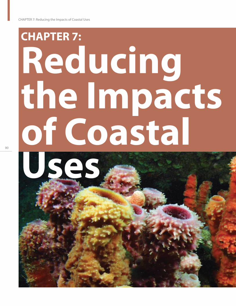
90
CHAPTER 7: Reducing the Impacts of Coastal Uses
CHAPTER 7:
Reducingthe Impactsof Coastal Uses

Goal: Reduce the impact of human coastal activities on coral reef ecosystems.
Coral reef ecosystems are being continually, and in some cases, irreparably damaged by a number of human activities. For example, dredging for navigation or marinas, beach re-nourishment, pipeline and cable installation, and coastal development and modification projects can degrade water quality in nearshore habitats. In addition, although reefs contribute to tourism revenues, a boom in coastal tourism can lead to direct impacts (i.e., diving, fishing, and recreational boating) and indirect impacts (i.e., increasing demand for coastal development, sewage discharge, and vessel traffic) on coral reef resources, compounding the adverse effects of coastal development. As the number of people using and transiting coral reef areas has increased, so too has the damage from careless snorkeling and diving practices (handling and breaking coral, leaving refuse, etc.) and increases in vessel groundings, which damage coral reef ecosystems by destroying habitat, releasing pollutants, and displacing resident
U.S
. Co
ral R
ee
f Ta
sk
Fo
rce
20
04
- 20
06
Re
po
rt to C
on
gre
ss
91
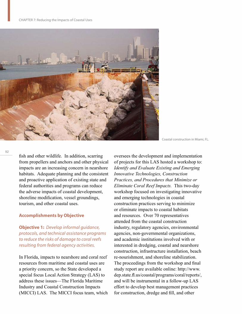
92
CHAPTER 7: Reducing the Impacts of Coastal Uses
fish and other wildlife. In addition, scarring from propellers and anchors and other physical impacts are an increasing concern in nearshore habitats. Adequate planning and the consistent and proactive application of existing state and federal authorities and programs can reduce the adverse impacts of coastal development, shoreline modification, vessel groundings, tourism, and other coastal uses.
Accomplishments by Objective
Objective 1: Develop informal guidance, protocols, and technical assistance programs to reduce the risks of damage to coral reefs resulting from federal agency activities.
In Florida, impacts to nearshore and coral reef resources from maritime and coastal uses are a priority concern, so the State developed a special focus Local Action Strategy (LAS) to address these issues—The Florida Maritime Industry and Coastal Construction Impacts (MICCI) LAS. The MICCI focus team, which
Coastal construction in Miami, FL.
oversees the development and implementation of projects for this LAS hosted a workshop to: Identify and Evaluate Existing and Emerging Innovative Technologies, Construction Practices, and Procedures that Minimize or Eliminate Coral Reef Impacts. This two-day workshop focused on investigating innovative and emerging technologies in coastal construction practices serving to minimize or eliminate impacts to coastal habitats and resources. Over 70 representatives attended from the coastal construction industry, regulatory agencies, environmental agencies, non-governmental organizations, and academic institutions involved with or interested in dredging, coastal and nearshore construction, infrastructure installation, beach re-nourishment, and shoreline stabilization. The proceedings from the workshop and final study report are available online: http://www. dep.state.fl.us/coastal/programs/coral/reports/, and will be instrumental in a follow-up LAS effort to develop best management practices for construction, dredge and fill, and other

permitted activities conducted near coral reefs. To increase preparedness and capacity to respond to coral reef damage events in the Pacific, NOAA hosted two workshops for Pacific state and territory partners on natural resource damage assessment (NRDA)—one for managers and one for practitioners. The workshop introduced participants to the principles of NRDA and discussed examples of acute and chronic damage events specific to the Pacific Islands. The 35 participants, from Hawai‘i, Guam, CNMI, American Samoa, and California, developed NRDA plans and processes for a vessel grounding and oil spill case study while considering a variety of issues, including damage to beaches, coral reefs, and special status species; planning for injury quantification studies; and working in case teams.
In general, storm water control projects in Hawai‘i have impacted the nearshore and coral reef ecosystem conditions. In 2003, the U.S. Army Corps of Engineers (USACE) and the State of Hawai‘i completed a Watershed Analysis as part of the General Investigation Study for the Ala Wai Canal Project. Ala Wai Canal feeds directly into nearshore areas having coral reef habitat. The feasibility study is scheduled to be completed in 2009. Additional studies are proposed to start in 2008 in the West Maui Watershed, Anahola Watershed, Maunalua Regional Watershed, Kekaha/Waimea Watershed, and Waialua-Kaika Watershed. The purpose of these studies was to determine the advisability of improvements in the interest of navigation, flood control, hydroelectric power development, water supply, and other beneficial water uses and related land resources. In general, studies include a watershed assessment with recommendations to improve watershed health, including marine ecosystems, in a coordinated fashion.
The USFWS, NOAA, EPA, USACE, Navy, Hawai‘i, Guam, CNMI, and American Samoa participate as members of the Pacific Region Interagency Working Group (PRIWG) for Coral Reef Mitigation. This working group was formed in response to a resolution of the USCRTF and is intended to improve the performance of resource agencies and share mitigation and restoration tools, techniques, and lessons learned. In 2006, the PRIWG developed a Coordination and Management Plan as general guidance for agency member interaction. This plan identifies group goals, objectives, and priorities in support of the effort to coordinate, review, and develop consistent measures for evaluating and implementing mitigation programs addressing impacts to coral reefs resulting from any federal action.
The USACE is a member of the Permanent International Association of the Navigation Congress (PIANC). Through the Permanent Environmental Commission Working Group #15—Dredging and Port Construction around Coral Reefs, a working group of international scientists, engineers, regulators, and industry representatives addresses the impacts of dredging and port construction on shallow, warm-water coral reefs through development of a PIANC-sponsored publication to benefit industry and resource managers worldwide. The USACE shares mitigation and restoration tools, techniques, and lessons learned.
Objective 2: Strengthen federal and state permitting and management programs for coastal development activities affecting coral reef habitats to minimize or prevent adverse impacts on coral reef ecosystems.
The USACE is responsible for reviewing and evaluating permit applications where construction and other activities (e.g., discharge of dredged and fill material) may
U.S
. Co
ral R
ee
f Ta
sk
Fo
rce
20
04
- 20
06
Re
po
rt to C
on
gre
ss
93

94
CHAPTER 7: Reducing the Impacts of Coastal Uses
Coral surveys conducted by Navy civilian ecologist in Apra Harbor in Guam.
occur in navigable waters of the United States. As part of the application review process, the USACE coordinates the various project proposals with federal, state, and local agencies; territories; tribal liaisons; and the interested public in an effort to identify potential project issues. In coral reef regions, the USACE works closely with other USCRTF members to ensure proposed activities are in the overall interest of the public. Where practicable, projects may be modified to avoid or minimize impacts on aquatic resources of the United States, including special aquatic sites, such as coral reefs, mangroves, and seagrass beds. Additional impacts may be further reduced or offset by compensatory mitigation, which may include restoring, enhancing, creating, and preserving the aquatic functions and values at risk of loss. In general, mitigation is developed in accordance with the Clean Water Act Section 404(b)(1) evaluation, the 1990 USACE-EPA Mitigation Memorandum of Agreement, and USACE
Regulatory Guidance Letters. These and other documents are available online at: http:// www.usace.army.mil/cw/cecwo/reg/rglsindx. htm. As discussed under Objectives 5 and 6 of this Chapter, the USACE and the EPA have published a proposed mitigation rule to promote “no net loss” of aquatic resources while providing greater flexibility for completing mitigation in a watershed context.
In addition, the USACE districts are further encouraged to develop local agreements in accordance with the national strategies. For example, the Honolulu District developed Compensatory Mitigation and Monitoring Guidelines (dated February 14, 2005), which are available online at: http://www.poh.usace. army.mil/pa/publicNotices/SPN20050214%20 04-448.pdf. These guidelines, coordinated with federal resource agency partners, were developed in accordance with current national policy for all types of aquatic mitigation—not just wetlands or corals. The guidelines were

Sumay Cove Area
adjacent to the Inner
Apra Harbor, Guam.
used to evaluate the Navy’s proposal for compensatory mitigation for 7.1 acres (28,733 square meters) of coral impacts associated with the improvements to Alpha-Bravo Wharves, Apra Harbor, Guam.
Although no formal local interagency agreements were developed in the course of the USACE permit evaluation of the Navy’s Alpha-Bravo Wharves improvement project, extensive coordination with the Navy, EPA, NOAA, USFWS, and Guam Department of Agriculture was conducted to identify the most suitable compensatory mitigation plan to offset impacts to the 7.1 acres of coral resources within the Inner Apra Harbor entrance channel, Apra Harbor Naval Complex, Guam. The USACE anticipates that interagency discussions related to this permit action will serve as a model for developing a comprehensive mitigation plan for future Navy activities on Guam. There is no established mitigation mechanism (i.e., mitigation bank or in lieu fee program) or, for project-specific
mitigation, any agreement that mooring buoys, coral transplantation, upland reforestation, etc., are the standard accepted practice to compensate for coral impacts on Guam.
The U.S. Coast Guard (USCG) is coordinating with Broward County, Nova Southeastern University Oceanographic Center—National Coral Reef Institute, Florida Fish and Wildlife Conservation Commission, Florida Department of Environmental Protection, NOAA, USACE, and other agencies to relocate the anchorage located offshore of Port Everglades. The existing anchorage is located between two reef lines off the coast of Broward County, Florida. In the past 14 years, more than11 acres (44, 515 square meters) of coral reef have been damaged due to ship groundings in the area. There is also extensive unquantified damage from anchor and cable drags over the reef. The anchorage relocation would move large vessels away from the shallow-water reefs and is anticipated to be authorized by the USCG in 2007.
U.S
. Co
ral R
ee
f Ta
sk
Fo
rce
20
04
- 20
06
Re
po
rt to C
on
gre
ss
95

96
CHAPTER 7: Reducing the Impacts of Coastal Uses
Case Study: Reducing Impacts of Human Activities on Coral Spawning The USCRTF passed a resolution in 2004 calling for member agencies to assess potential impacts of human activities conducted in the coastal zone on coral reproduction and recruitment. Many species of coral reproduce by releasing massive numbers of eggs and sperm into the water column. In an effort to enhance fertilization and coral recruitment success, the Coral Spawning Resolution calls for the identification and modification of the type or timing of activities that introduce nutrients, toxic chemicals, and suspended particles into coral reef ecosystems.
A Pacific Interagency Working Group was formed and includes NOAA, USFWS, the U.S. Department of Agriculture’s Natural Resources Conservation Service (NRCS), and USACE, along with other academic and state/territory partners. This working group has been instrumental in promoting and coordinating the following projects and efforts:
Obtained federal approval of CNMI Water Quality Standards providing protection to corals during coral spawning periods and used National Environmental Protection Act compliance and review to curtail coral degradation caused by road development.
The American Samoa EPA included new regulations in their 2005 Water Quality Standards Revision Administrative Rule No. 006-2005. For activities having the potential to adversely affect coral reproduction, a stoppage period of no less than 60 days, starting five days after the October full moon, will be a condition of any permit or water quality certification. (The period following an October full moon is an important time for coral spawning and survival of coral gametes.)
In the Atlantic-Caribbean, data on coral spawning times and coral reproduction have been compiled to help predict coral spawning and larval duration times in Florida and the Caribbean. This information will be provided to managers for use in designing and implementing management activities that consider the impacts to coral reproduction.

Objective 3: Initiate actions at the national and international levels to prevent vessel groundings.
Among the many threats to coral reefs, minimizing damage caused by boat anchors is easily achieved by installing mooring buoys. Anchors dropped multiple times at individual sites can produce significant and cumulative impacts on coral reefs. Mooring buoys help to diminish these impacts and encourage a reliable system for vessel operators to secure their vessels. The use of mooring buoys has proven effective in decreasing the number of recreational vessel groundings and reducing the negative impacts of anchor damage on coral reefs. Mooring buoys can also serve as a way to mark—and therefore educate vessel operators about—protected area boundaries. In recent years, mooring buoy programs have gathered momentum and are now widely accepted as an effective solution to habitat degradation caused by anchoring.
In Puerto Rico, at the Desecheo Island Marine Protected Area, eight concrete ballasts were deployed to anchor marker buoys in an effort to identify “hot spots” and install coral reef informational signage for public outreach. Also in Puerto Rico, along Green Beach in Vieques National Wildlife Refuge, the USFWS and USACE installed mooring buoys in areas with heavy transient vessel anchoring. Other areas where mooring buoys and aids to navigation were deployed include La Parguera Natural Reserve, Canal Luis Peña in Isla de Culebra, and at the La Cordillera Natural Reserve. Puerto Rico DNER maintains approximately 270 mooring buoys in coral reefs and seagrass beds within Natural Reserves, and is starting a program to identify sandy areas in Natural Reserves for use as traditional anchorage areas to complement the mooring buoys. DNER recognizes that with 270 mooring buoys and over 60,000 registered
vessels, buoys alone will never meet the demand for safe anchorage.
In Guam, the USFWS provided funding and technical assistance to the Guam Division of Aquatic and Wildlife Resources to maintain 34 shallow-water mooring buoys to reduce the impacts of boat anchors on coral reefs.
In 2006, Virgin Islands National Park implemented the storm mooring program to prevent damage to coral reef ecosystems at Hurricane Hole on St. John. Rather than tie their boats to mangrove trees during storms, which damages the mangrove habitat, more than 200 boaters have registered to use the underwater chain moorings installed by the NPS. The Park plans to install 50 additional storm moorings in 2007. The NPS also maintains 223 mooring buoys for overnight and day use, and 14 buoys for fishing and diving at various locations in the Park and the adjacent Virgin Islands Coral Reef National Monument.
The NPS and NOAA, working with local partners in the USVI and the British Virgin Islands, completed instructional visual aids on proper anchoring and mooring techniques aimed at boaters visiting the Virgin Islands National Park and Coral Reef Monument. These guides include regulations on the proper use of anchors and designated anchorage areas.
A specific mooring buoy program—Anchors Away!—awards competitive grants to install and maintain mooring buoys to protect sensitive coral reef resources from anchor damage, and to identify marine protected areas in the Gulf of Mexico and the wider Caribbean Region. Anchors Away! grants must also include an education component aimed at resource managers, dive operators, local coral reef stakeholders, and others engaged in anchoring. The program is administered by the
U.S
. Co
ral R
ee
f Ta
sk
Fo
rce
20
04
- 20
06
Re
po
rt to C
on
gre
ss
97

98
CHAPTER 7: Reducing the Impacts of Coastal Uses
National Fish and Wildlife Foundation through the Coral Reef Conservation Fund and is supported by NOAA and the U.S. Department of State (DOS).
NOAA offered a week-long vessel inspection training course for agency personnel in CNMI, Saipan. USCG personnel from Saipan and Guam also attended. Abandoned and derelict vessels are a problem in the waters around the CNMI. Because of the regular typhoons passing through the islands, such derelict vessels often break loose and ground on adjacent coral reefs and seagrass beds. This project provided training in vessel inspection for CNMI boating safety officers to help identify potential problem vessels before they sink or break apart and become a source of marine debris. By keeping unsafe vessels out of CNMI waters, the local agencies hope to reduce coral injury and avoid the much greater expense of vessel and debris removal. This training, conducted by a professional marine surveyor, is part of a larger outreach campaign targeted at boaters to prevent
the occurrence of derelict vessels and their resulting marine debris.
Objective 4: Develop standard vessel grounding response, enforcement, and injury assessment guidance and improve the ability to remove grounded and abandoned vessels and restore damaged habitat by enhancing local and regional emergency response capabilities, strengthening and standardizing enforcement and damage assessment actions, and identifying gaps in existing legal authorities.
Several USCRTF partners—including NOAA, the USFWS, Hawai‘i, and USCG—hosted a workshop in Honolulu to discuss issues related to hazards planning and vessel groundings in the NWHI. The workshop brought together agencies and response experts to discuss lessons learned from previous groundings and to lay the groundwork for developing a plan to guide future management actions.
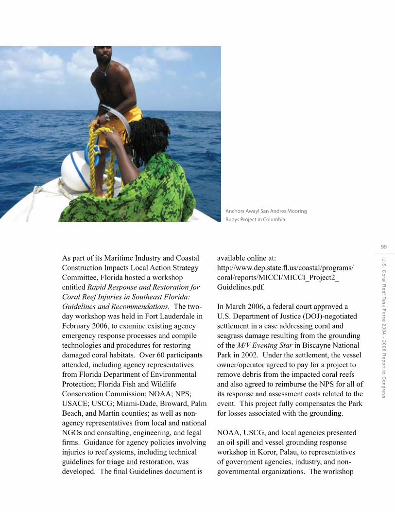
Anchors Away! San Andres Mooring
Buoys Project in Columbia.
As part of its Maritime Industry and Coastal Construction Impacts Local Action Strategy Committee, Florida hosted a workshop entitled Rapid Response and Restoration for Coral Reef Injuries in Southeast Florida: Guidelines and Recommendations. The two-day workshop was held in Fort Lauderdale in February 2006, to examine existing agency emergency response processes and compile technologies and procedures for restoring damaged coral habitats. Over 60 participants attended, including agency representatives from Florida Department of Environmental Protection; Florida Fish and Wildlife Conservation Commission; NOAA; NPS; USACE; USCG; Miami-Dade, Broward, Palm Beach, and Martin counties; as well as non-agency representatives from local and national NGOs and consulting, engineering, and legal firms. Guidance for agency policies involving injuries to reef systems, including technical guidelines for triage and restoration, was developed. The final Guidelines document is
available online at: http://www.dep.state.fl.us/coastal/programs/ coral/reports/MICCI/MICCI_Project2_ Guidelines.pdf.
In March 2006, a federal court approved a U.S. Department of Justice (DOJ)-negotiated settlement in a case addressing coral and seagrass damage resulting from the grounding of the M/V Evening Star in Biscayne National Park in 2002. Under the settlement, the vessel owner/operator agreed to pay for a project to remove debris from the impacted coral reefs and also agreed to reimburse the NPS for all of its response and assessment costs related to the event. This project fully compensates the Park for losses associated with the grounding.
NOAA, USCG, and local agencies presented an oil spill and vessel grounding response workshop in Koror, Palau, to representatives of government agencies, industry, and nongovernmental organizations. The workshop
U.S
. Co
ral R
ee
f Ta
sk
Fo
rce
20
04
- 20
06
Re
po
rt to C
on
gre
ss
99

100
CHAPTER 7: Reducing the Impacts of Coastal Uses
provided an overview of scientific issues to consider in responding to and evaluating damage from spills and groundings, the roles of NOAA and the USCG in spill response, how U.S. and Palauan response are similar and where they differ, and a review of Palau’s national contingency plan. In addition, local speakers presented case studies of events and response efforts. The workshop included joint field visits to locations where resources have been impacted by oil spills and vessel groundings.
Puerto Rico DNER established a draft Administrative Order that created a grounding response team under the Emergency Response Coordination Office. Restoration of coral reefs and associated habitats damaged by vessel groundings is mandated under Puerto Rico Law 147, enacted on July 15, 1999. A contract was signed with a specialized consulting group to provide technical assistance to the grounding response team. Since these actions
Grounding of the East
Wind freighter off of
a Broward County
Beach in Florida.
were undertaken, Puerto Rico DNER has successfully initiated NRDA activities for several major and minor vessel groundings and one major oil spill. Puerto Rico plans to work with NOAA to train new personnel to work with these issues.
Objective 5: Strengthen existing and develop new resource management programs and protected areas to address the broad range of coastal activities.
Objective 6: Develop mitigation guidance for coastal development projects deemed essential by federal, state, and territory agencies.
Habitat Equivalency Analysis: Its Use and Application
In summer 2005, USCRTF partners sponsored a Workshop on Habitat Equivalency Analysis (HEA) for Coral Reefs. HEA is a methodology that scales the level of project impacts with
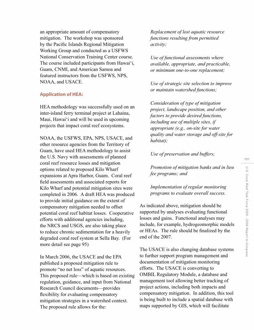
an appropriate amount of compensatory mitigation. The workshop was sponsored by the Pacific Islands Regional Mitigation Working Group and conducted as a USFWS National Conservation Training Center course. The course included participants from Hawai‘i, Guam, CNMI, and American Samoa and featured instructors from the USFWS, NPS, NOAA, and USACE.
Application of HEA:
HEA methodology was successfully used on an inter-island ferry terminal project at Lahaina, Maui, Hawai‘i and will be used in upcoming projects that impact coral reef ecosystems.
NOAA, the USFWS, EPA, NPS, USACE, and other resource agencies from the Territory of Guam, have used HEA methodology to assist the U.S. Navy with assessments of planned coral reef resource losses and mitigation options related to proposed Kilo Wharf expansions at Apra Harbor, Guam. Coral reef field assessments and associated reports for Kilo Wharf and potential mitigation sites were completed in 2006. A draft HEA was produced to provide initial guidance on the extent of compensatory mitigation needed to offset potential coral reef habitat losses. Cooperative efforts with additional agencies including, the NRCS and USGS, are also taking place to reduce chronic sedimentation for a heavily degraded coral reef system at Sella Bay. (For more detail see page 95)
In March 2006, the USACE and the EPA published a proposed mitigation rule to promote “no net loss” of aquatic resources. This proposed rule—which is based on existing regulation, guidance, and input from National Research Council documents—provides flexibility for evaluating compensatory mitigation strategies in a watershed context. The proposed rule allows for the:
Replacement of lost aquatic resource functions resulting from permitted activity;
Use of functional assessments where available, appropriate, and practicable, or minimum one-to-one replacement;
Use of strategic site selection to improve or maintain watershed functions;
Consideration of type of mitigation project, landscape position, and other factors to provide desired functions, including use of multiple sites, if appropriate (e.g., on-site for water quality and water storage and off-site for habitat);
Use of preservation and buffers;
Promotion of mitigation banks and in lieu fee programs; and
Implementation of regular monitoring programs to evaluate overall success.
As indicated above, mitigation should be supported by analyses evaluating functional losses and gains. Functional analyses may include, for example, hydrogeomorphic models or HEAs. The rule should be finalized by the end of the 2007.
The USACE is also changing database systems to further support program management and documentation of mitigation monitoring efforts. The USACE is converting to OMBIL Regulatory Module, a database and management tool allowing better tracking of project actions, including both impacts and compensatory mitigation. In addition, this tool is being built to include a spatial database with maps supported by GIS, which will facilitate
U.S
. Co
ral R
ee
f Ta
sk
Fo
rce
20
04
- 20
06
Re
po
rt to C
on
gre
ss
101

102
CHAPTER 7: Reducing the Impacts of Coastal Uses

Protecting Corals, Saving Ships
NOAA is conducting a pilot project in the Florida Keys National Marine Sanctuary designed to protect coral reef habitats from physical destruction and pollution from ships by converting existing coral, MPA and other marine GIS information into a format suitable for use with shipboard electronic chart systems. When this layer of environmental information (known as Marine Information Objects, or MIOs) is displayed in conjunction with an Electronic Navigational Chart (ENC), it can help alert mariners to sensitive areas and any associated rules and restrictions.
Shipboard electronic chart systems can display warnings and regulations pertaining to protected areas sound alarms if a vessel’s projected course is too close to a coral reef or MPA. Automation and integration of these tools can help reduce human error and prevent vessel groundings on coral reefs.
a watershed approach for project evaluation. To mitigate impacts to approximately 59 Once installed, the USACE will work with acres (238,765 square meters) of degraded federal, state, and local parties and the general mangroves wetlands and 95 acres (384,451 public to ensure accessibility to the system. square meters) of sparsely vegetated marine
habitat, the USFWS, NOAA, USACE, and The USACE, with assistance from the local partners evaluated a mitigation and University of Hawai‘i Sea Grant Extension monitoring plan for the development of the Service, conducted a workshop at the Port of the Americas in Ponce, Puerto Rico. University of Hawai‘i in August 2004 to The Puerto Rico Ports Authority will acquire explore the feasibility of developing a coral and preserve a 693 acre (2,804,471 square reef functional assessment protocol following meters) coastal farm dominated by marsh a structured, model approach. The principal and mangrove wetlands and coastal beach purpose of the workshop was to explore the berm uplands, restore the beach berm area feasibility of adapting the Hydrogeomorphic with native trees, and perform other approved (HGM) Approach for use in coral reef projects to mitigate for impacted seagrass beds. ecosystems. The HGM Approach is a reference-based rapid assessment protocol that uses the best scientific information available to develop a series of simple conceptual models to represent the relationship between form and function of the aquatic ecosystem. The final report from the workshop was issued in March 2005.
U.S
. Co
ral R
ee
f Ta
sk
Fo
rce
20
04
- 20
06
Re
po
rt to C
on
gre
ss
103

104
CHAPTER 8: Reducing Pollution
CHAPTER 8:
ReducingPollution

CHAPTER 8:
ReducingPollution
Goal: Significantly reduce the amounts, sources, and cumulative impacts of pollution on coral reefs by fully implementing existing federal and state authorities.
Healthy coral reefs require good water quality to grow, remain viable, and provide ecosystem benefits. Both land-based and sea-based pollution can threaten reef resources by harming sensitive species, altering species compositions, disrupting critical ecological functions (photosynthesis), and impeding the normal growth and settlement of stony corals and other benthic invertebrates. Reef systems are impacted by a variety of pollutants, including sediments, nutrients, chemical contaminants, marine debris, and invasive species. Pollution enters reef ecosystems in many ways, ranging from specific point-source discharges such as sewage pipes and vessels, to more diffuse sources such as run-off associated with agriculture, coastal development, and road construction. Reef degradation is even greater in areas where the loss of wetlands or other associated habitats has reduced the system’s natural ability to filter nutrients and other pollutants before reaching the reefs. Although
U.S
. Co
ral R
ee
f Ta
sk
Fo
rce
20
04
- 20
06
Re
po
rt to C
on
gre
ss
105

106
CHAPTER 8: Reducing Pollution
The Palacios farm in the Obyan area of Saipan. The farmer is an NRCS cooperator and is currently under an EQIP contract for management practices on the tilled
areas. Practices include Conservation Crop Rotation, Nutrient Management and Pest Management. NRCS will be working with them to apply other conservation
practices in the future.

there is wide variation among the sources, characteristics, and impacts of pollution in U.S. jurisdictions, significant reductions or potential elimination of much of the pollution could be accomplished by full implementation of existing state and federal regulations and voluntary programs.
The USCRTF identified pollution as a priority area for action. Members have taken a number of actions to address these issues, such as developing regulations to limit the types and amounts of land-based waste being discharged, increasing fines for violators of coral reef environmental protection regulations, implementing new pollution-control measures, and establishing federal— local partnerships to voluntarily implement best management practices within coral reef watershed areas.
Accomplishments by Objective
Objective 1: Reduce sedimentation and other land-based sources of pollution by implementing conservation management practices in coastal watersheds through public/ private partnerships, incentive-based measures, regulatory measures, technical and financial assistance, habitat restoration, and other activities.
The USDA’s NRCS works closely with local farmers and land-owners, providing technical assistance and helping identify and implement conservation practices to reduce runoff of surface water and associated nutrients and pesticides impacting nearshore coral reef ecosystems. Examples of conservation practices include: cover crops, pest management, residue management, conservation crop rotation, contour farming, irrigation water management, field borders, waste utilization, and nutrient management.
NRCS, working through the 2002 Farm Bill, made $30 million available for application to land-based conservation efforts within the Pacific Islands Area through the Environmental Quality Incentives Program (EQIP). EQIP is a voluntary program providing assistance to farmers and ranchers who face threats to soil, water, air, and related natural resources on their land. Through EQIP, NRCS provides assistance to agricultural producers in promoting agricultural production and environmental quality as compatible goals, optimizing environmental benefits, and helping farmers and ranchers meet federal, state, tribal, and local environmental requirements. In the Pacific Islands, NRCS obligated 369 EQIP contracts from FY 2004—2006, targeting over 63,000 acres (255 square kilometers) for land-based conservation treatment.
During this time, NRCS estimates that over 105,000 tons (95,254 kilograms) of soil erosion was prevented through implementation of EQIP and other Farm Bill Programs, nearly half of which would likely have been transported as sediment to Pacific Island coral reef ecosystems. Practices utilized and installed by private landowners include water diversions, vegetative barriers, cover crops, hillside ditching, grassed waterways, mulching, conservation cover, terracing, and critical area seeding. Along with management practices such as nutrient and pest management, these efforts demonstrate improved stewardship of the health and quality of agricultural soils and provide secondary benefits for the nearshore marine environments.
In Puerto Rico, NRCS held two workshops on implementing agricultural conservation practices to increase the technical capacity of 15 agricultural producers in the Jobos Bay Estuary Watershed.
U.S
. Co
ral R
ee
f Ta
sk
Fo
rce
20
04
- 20
06
Re
po
rt to C
on
gre
ss
107
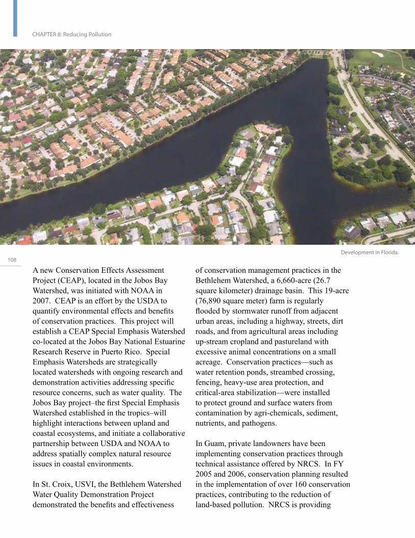
108
CHAPTER 8: Reducing Pollution
Development in Florida.
A new Conservation Effects Assessment Project (CEAP), located in the Jobos Bay Watershed, was initiated with NOAA in 2007. CEAP is an effort by the USDA to quantify environmental effects and benefits of conservation practices. This project will establish a CEAP Special Emphasis Watershed co-located at the Jobos Bay National Estuarine Research Reserve in Puerto Rico. Special Emphasis Watersheds are strategically located watersheds with ongoing research and demonstration activities addressing specific resource concerns, such as water quality. The Jobos Bay project–the first Special Emphasis Watershed established in the tropics–will highlight interactions between upland and coastal ecosystems, and initiate a collaborative partnership between USDA and NOAA to address spatially complex natural resource issues in coastal environments.
In St. Croix, USVI, the Bethlehem Watershed Water Quality Demonstration Project demonstrated the benefits and effectiveness
of conservation management practices in the Bethlehem Watershed, a 6,660-acre (26.7 square kilometer) drainage basin. This 19-acre (76,890 square meter) farm is regularly flooded by stormwater runoff from adjacent urban areas, including a highway, streets, dirt roads, and from agricultural areas including up-stream cropland and pastureland with excessive animal concentrations on a small acreage. Conservation practices—such as water retention ponds, streambed crossing, fencing, heavy-use area protection, and critical-area stabilization—were installed to protect ground and surface waters from contamination by agri-chemicals, sediment, nutrients, and pathogens.
In Guam, private landowners have been implementing conservation practices through technical assistance offered by NRCS. In FY 2005 and 2006, conservation planning resulted in the implementation of over 160 conservation practices, contributing to the reduction of land-based pollution. NRCS is providing

technical assistance to the local Department of Agriculture—Division of Forestry and Soil Resources in the form of a conservation plan for the Coral Conservation Area, which is predominantly covered by savanna vegetation with some scrub forest.
The American Samoa Soil and Water Conservation District, in coordination with CRAG and NRCS, prepared an agreement between the local farmers and the District to grow and multiply the Vetiver grass for use in soil stabilization projects. Vetiver can be used as vegetative barriers, field borders, stream bank linings, and shoreline protection, and has proven to be a low-cost, low-technology method for significantly reducing erosion. Workshops will be conducted along with site visits to demonstrate the benefits of soil erosion control methods.
NPS, working with the University of Guam and Territory of Guam, completed a study on the relationships among wildfires, upland erosion, coral reef sedimentation, and water quality in the War-in-the-Pacific National Historic Park. The study provides a basis to formulate fire prevention and watershed restoration options in and around the Park, which is adjacent to Asan Bay. Intentional fires cause changes in native plant communities and denude areas of vegetation, resulting in wildfires and high-sediment runoff rates. Sediments in the marine environment reduce light availability and can smother corals, causing adverse impacts to coral survival, reproduction, and recruitment. Preliminary park studies in Asan Bay indicate declining levels of coral recruitment.
In the CNMI, private landowners have been implementing conservation practices through technical assistance offered by NRCS. Within the Talakhaya watershed, located on the island of Rota, CNMI, 2,500 tree seedlings were
planted. The Talakhaya watershed is one of the watersheds identified in the CNMI for Local Action Strategies, Land-based Sources of Pollution (LBSP) to address the runoff and sedimentation caused by the lack of vegetative cover and annual wildfires. Ten-thousand more tree seedlings and grass plugs will be installed in June of 2007. Managaha Island, off the west coast of Saipan, is important for its endangered marine wildlife and cultural significance. The area is threatened by heavy foot traffic, shoreline erosion, and habitat encroachment. NRCS is providing technical assistance to the Department of Lands and Natural Resources and Coastal Resources Management in generating conservation practice alternatives and a conservation plan.
NRCS, with the USFWS and local CNMI agencies, initiated a project to reduce sediment flow to coral reefs by instituting traffic restrictions and planting native vegetation at the end of a beach access road. During heavy rains, the road channeled stormwater runoff and sediment onto coral reefs at Obyan Beach, Saipan, smothering reefs and altering sea turtle habitat. Additional elements of this project include educational signage, a media outreach campaign, and construction of a beach stairway to channel foot traffic to conserve native vegetation and turtle nesting areas. The plan calls for planting 11 acres (44,515 square meters) of critically eroding area with trees and shrubs, adding mulch, and rerouting foot traffic, and implementing bioengineering techniques and other management measures. The Lau Lau Watershed re-vegetation project has resulted in significant reductions in sedimentation into Lau Lau Bay and onto the Bay’s coral reefs.
As part of Hawaii’s land-based pollution LAS, EPA, USGS, and NRCS and other federal and local partners are collaborating with the Hanalei Watershed Hui to implement pollution
U.S
. Co
ral R
ee
f Ta
sk
Fo
rce
20
04
- 20
06
Re
po
rt to C
on
gre
ss
109
CHAPTER 8: Reducing Pollution
reduction activities in the Hanelei watershed, on Kaua‘i and to monitor the coral reefs. Past monitoring results showed the area of Hanalei Bay has high sediment and bacteria loading and a high prevalence of coral disease. The adverse impacts of pollutant loading in Hanalei Bay have been reduced by closing and upgrading critical cesspools on the beach and next to the river, installing check dams to trap sediments flowing out of taro fields, and constructing fences to exclude cattle from sensitive riparian areas. Related activities included a range of monitoring efforts, development of a sediment-loading model of the Hanalei watershed modified from NRCS’s Annualized Agricultural Non-point Source Pollution model, assessment of sediment transport in the watershed and Bay, and plans for construction of a community wastewater collection and treatment system. On a broader
110 scale, NRCS has worked with landowners and partnering organizations to implement over 800 conservation practices throughout Hawai‘i during FY 2004—2006.
The EPA has led strong Clean Water Act enforcement actions in Hawai‘i which have helped protect coral reefs and deter those who would violate the Act. Violations resulting in sediment damage to a coral reef on Kauai, Hawai‘i, were resolved in a settlement agreement totaling more than $7.5 million involving the EPA, DOJ, Hawai‘i, Kauai County, and Earth Justice. The violations involved grading a 400-acre (1,618,743 square meters) coastal property and filling streams without the required permits. Stormwater erosion control measures required by the permits may have prevented damage to a home, beach, and coral reef. This was the largest stormwater settlement for violations at a single site by a single landowner in the United States. The settlement includes $5.3 million to prevent erosion and restore streams at the construction site. Another 2006 settlement
with the Hawai‘i Department of Transportation will result in over $50 million in improved stormwater management for highways and airports, reducing coastal pollution for Hawaii’s coral reefs.
A particular problem facing the Pacific Island jurisdictions is impacts from piggeries (agricultural swine production facilities). Working with local partners in CNMI, Guam, American Samoa, Palau, and the FSM, the USDA and EPA have implemented demonstration projects for alternate waste management systems for piggeries. Dry litter waste systems and portable pen systems eliminate the use of water needed to remove waste. The dry litter waste systems not only reduce the risk of the disease Leptospirosis to humans, but also reduce nutrient loading to coral reefs. This project has been extremely effective in reducing pollution. Specific to American Samoa, the government has encouraged farmers to move piggeries away from streams, which has resulted in decreased bacteria counts in the nearshore waters adjacent to the outflows of those streams.
Further efforts in American Samoa include enhanced enforcement capability for illegal piggeries and solid waste by arranging for District Court Citation Authority, developing Piggery and Solid Waste Compliance Programs, and implementing required land-use permitting for piggeries.
In 2006, NOAA hosted community workshops in Hawai‘i, Puerto Rico, and USVI which provided specialized training and technical assistance to coastal managers and other stakeholders to enhance the effectiveness of their local planning and management capability for addressing land-based pollution sources threatening coral reef ecosystems. Workshop sessions focused on customized design guidelines for innovative and simple

Lau Lau Bay, Commonwealth of the Northern Mariana Islands
stormwater practices suited for small island development projects, and recommended practices to improve erosion and sediment control in island environments.
Objective 2: Improve water quality by reducing nutrient discharges from wastewater treatment facilities, vessels, industrial sources, stormwater, agricultural sources, and air deposition.
Objective 3: Reduce chemical pollution (e.g., oil, toxins, hazardous materials) from land-based sources and vessel discharges.
The EPA, primarily through the Clean Water Act, plays a lead role in regulating activities and funding and/or implementing programs focused on improving water quality. Several other USCRTF agencies contribute through enforcement action, financial support, technical assistance, training, and capacity-building efforts.
The EPA, with the DOJ, worked with Guam to reduce wastewater spills during 2004—2006 by 90 percent from 2001-2002 levels. Enforcement actions resulted in marked improvements to water utility operations, which substantially decreased pollution to reefs from sewage overflows. Also in Guam, new sewer collector lines will be installed to improve wastewater infrastructure in Agat, which will prevent sewage overflows and protect coral reefs by eliminating excess nutrient loading to the ocean.
In St. Croix and St. Thomas, USVI, wastewater treatment plants have been upgraded and new ones installed to enhance water quality and ensure compliance with federal mandates under the Clean Water Act. This collaborative project involved DOI, EPA, DOJ, and USVI.
In 2006, DOJ also completed civil and criminal prosecutions against the Puerto Rico Aqueduct and Sewer Authority (PRASA) for violations of Clean Water Act. Under a settlement and
U.S
. Co
ral R
ee
f Ta
sk
Fo
rce
20
04
- 20
06
Re
po
rt to C
on
gre
ss
111

112
CHAPTER 8: Reducing Pollution
plea agreements in those cases, PRASA will spend approximately $1.7 billion to improve wastewater treatment at all of its 61 wastewater treatment plants and related collection systems over the next 15 years. The resolution of these cases will help improve the quality of life in Puerto Rico and the quality of its waters.
EPA has been assisting the USVI government as it revises its point source discharge regulations to better address stormwater runoff from construction sites. Within the year, the USVI is expected to issue a general permit, authorizing the discharge of stormwater from construction sites if specific management practices are implemented. This federally enforceable program should lead to stricter land-based erosion controls at construction sites and reduced levels of suspended solids and sediment released into sensitive coastal areas.
Working with Florida, the EPA provided a $4.3 million construction grant to the Florida Keys Aqueduct Authority for the construction of the Little Venice Wastewater Management System and continues to conduct water-quality monitoring activities. The Little Venice Wastewater Management System is an advanced wastewater treatment system including nutrient removal and disposal of treated wastewater into injection wells. The state-of-the-art system replaces hundreds of cesspits and malfunctioning septic systems contributing nutrients and other pollutants to the nearshore waters of the Florida Keys. Canal water quality was monitored for three years prior to operation of the system, and currently is being monitored to assess anticipated improvements in nearshore water quality as a result of improved sewage treatment.
In October 2006, with guidance and direction from the FKNMS Water Quality Protection
Program Steering Committee (an interagency group), EPA made a $3.8 million grant to the Village of Islamorada, Florida. The purpose of this grant is to demonstrate and evaluate the centralized management of decentralized wastewater systems in the Florida Keys. This demonstration project is consistent with Monroe County’s Wastewater Master Plan and will result in a significant reduction of nutrient and other pollutant loading to the nearshore waters of the Florida Keys.
The City of Marathon, Florida, developed and began implementing a comprehensive plan to address anchoring, mooring, and disposal of vessel-generated wastewater into Boot Key Harbor. This project is helping boaters comply with the requirements of the no-discharge zone (NDZ) in effect for all state waters within the boundary of the FKNMS. The NDZ was requested by the Governor of Florida and designated by the EPA in 2002 in accordance with Section 312 of the Clean Water Act. From October 2005 through September 2006, the pumpout facilities at Boot Key Harbor Marina collected and properly disposed of approximately 114,000 gallons (432 liters) of wastewater from over 9,000 vessel pumpouts, thereby improving the area’s water quality.
In Puerto Rico, the USDA’s Rural Development program has approved four water and sewer system projects, which will benefit near shore habitats. These projects are: the Municipality of Añasco, to implement changes to facilities threatening public health; the Municipality of Juncos, to implement sound wastewater management, which will address sewage overflows creating a public health and environmental hazard; the Municipality of Jayuya will receive sewers and a secondary treatment plant; and the La Prieta Community, Municipality of Comerío, will receive a sanitary sewer collection facility.

Sediment testing and
control measures
conducted in the War
in the Pacific National
Historic Park, Guam.
In Hawai‘i, EPA has implemented an enforcement strategy to identify and close approximately 3,000 large-capacity cesspools (LCC) in response to an EPA ban. Cesspools pose environmental and public health risks by releasing disease-causing pathogens and other contaminants to groundwater and coastal waters. As of 2006, 447 LCC in Hawai‘i have been closed under regulatory authority, 923 cesspools are being voluntarily closed, and 906 LCC are under formal enforcement actions to close. Cesspool closure and wastewater upgrades at public beach parks, schools, plantation camps, and businesses will improve water quality for Hawaii’s coral reefs.
NPS, working in cooperation with the State of Hawai‘i has improved water quality at Kalaupapa National Historic Park by upgrading wastewater management to prevent pollution of the marine environment and reduce impacts on coral reefs. Park staff analyzed radioactive isotopes to measure algae as an indicator of groundwater seepage to
document improvements.
EPA, DOJ, and Guam have reduced the risk of fuel spills to coral reefs in the Piti Piti Marine Park Area through upgrades to two nearby fuel tanks. EPA Enforcement Actions led to an agreement in 2001 to upgrade two large fuel tanks at a powerplant in Guam. Improvements on one tank were completed in 2005, and improvements to the second fuel tank are underway and scheduled for completion in 2006.
Objective 4: Reduce the flow of marine debris and remove existing marine debris from reef ecosystems.
Marine debris poses a threat to marine life and nearshore habitats through entanglement, ingestion, and smothering. Marine debris removal projects range from highly collaborative, large-scale activities, as exhibited in the NWHI, to smaller-scale projects targeting a specific site and implemented by a few local partners.
U.S
. Co
ral R
ee
f Ta
sk
Fo
rce
20
04
- 20
06
Re
po
rt to C
on
gre
ss
113

114
CHAPTER 8: Reducing Pollution

Marine Debris Removal in the Northwestern Hawaiian Islands
USCG, NOAA, the State of Hawai‘i, and DOI collaborated to conduct large-scale marine debris removal efforts in the Northwestern Hawaiian Islands. From 1996 to 2006, over 560 tons of marine debris was removed from coral reef ecosystems and shorelines to protect habitat, promote navigational safety, and conserve threatened and endangered species; 21 tons were removed in 2006 alone, including three tons from the shorelines and the fringing coral reefs of Midway Atoll National Wildlife Refuge. These islands, now part of the Papahānaumokuākea Marine National Monument, are particularly prone to the accumulation of floating debris due to their central location in the North Pacific Subtropical Gyre. Most of the debris is derelict fishing gear that entangles and kills endangered Hawaiian monk seals, threatened green sea turtles, coral, and other wildlife. A recent study indicates the NWHI accumulates over 52 metric tons of debris each year, and future efforts will need to focus on removing as much of that accumulation as possible, developing techniques for collection “at sea” before it hits the reefs, and ultimately reducing the sources of marine debris.
The NOAA Marine Debris Program led a project to assess the extent and impact of marine debris on the main Hawaiian Islands. Hot-spot debris areas were located via aerial surveys and satellite-derived products were used to create maps of debris distribution and abundance. Surveys of Kauai, Molokai, Lanai, Maui, O‘ahu and the Big Island of Hawai‘i are now complete. As in the NWHI, the marine debris problem in the main Hawaiian Islands has proven to be greater than expected, with 711 debris sites reported. A pilot removal effort conducted on O‘ahu in 2006 removed more than 15 metric tons of debris. Maps generated during this project will aid communities and federal, state, and local coastal managers in identifying and prioritizing clean-up areas and target sites for future monitoring.
Puerto Rico, with the assistance of Amigos de Amona (a local NGO), removed one ton of derelict fishing gear and marine debris from the Mona Island Reserve in Puerto Rico. A separate effort, sponsored by NOAA, enabled the Sociedad Ambiente Marino to provide receptacles at various fishing association facilities and popular recreational and commercial fishing sites for fishermen to recycle their monofilament fishing gear. The program was so well received that a local student organization at the University of Aguadilla requested funding to install additional bins in the Aguadilla area. In 2006, at the La Parguera Natural Reserve, the reserve managers removed abandoned permanent structures from mangrove areas, such as houses, derelict live-aboard vessels, and other types of debris. Other efforts were
U.S
. Co
ral R
ee
f Ta
sk
Fo
rce
20
04
- 20
06
Re
po
rt to C
on
gre
ss
115

CHAPTER 8: Reducing Pollution
carried out to remove abandoned vessels in the Boquerón Bay, part of the Boquerón Natural Reserve.
The DoD and USCG play an important role in decreasing the amounts of marine debris entering ocean waters through their no-plastics discharge policies. Through shipboard pollution prevention programs and coastal and marine debris cleanup efforts, these two agencies are responsible for the abatement and removal of tons of debris nationwide and internationally.
In Florida, several ongoing programs focused on marine debris removal and prevention. In addition, special efforts were conducted to target areas impacted by hurricanes over the past few years.
116 The USFWS and partners continue to participate in vessel and ownership identification and removal of abandoned commercial and recreational fishing vessels; derelict live-aboard vessels or those damaged and abandoned after a hurricane; and associated marine debris such as plastics, household items, illegal artificial reefs, and assorted fishing debris. This program removes old boats and materials, which present various hazards and threaten recreational and commercial boaters, as well as marine resources.
In 2004, diver accounts of newly found debris within Florida’s St. Lucie Inlet Preserve State Park led to a public meeting where individuals voiced increased concern for reef health. This meeting prompted clean-up events conducted in association with the Reef Environmental Education Foundation and FDEP’s community-based Great Annual Fish Count. After fish abundance and diversity data were collected as a part of the Fish Count,
divers located and removed debris, including recreational and commercial fishing nets, monofilament line, and anchors. In 2004, 120 gallons (528 liters) of marine debris was collected within only a few hours. This effort led to subsequent events for the sole purpose of removing marine debris from the reef. Support for clean-up efforts to date has included FDEP, FWC, non-profit organizations such as the Florida Oceanographic Society and Port Solerno Commercial Fishing Dock Authority, and concerned citizens.
The USDA Emergency Watershed Program helped local communities remove household and construction debris as well as vegetative refuse that was deposited in the waters after three hurricanes (Charley, Frances, and Jeanne) struck South Florida in September and October 2004. These hurricanes left over 125,000 tons of debris in 1,668 miles (2,684 kilometers) of rivers, streams, canals, and waterways. The debris removal effort prevented some of these materials from moving down stream and offshore onto coral reef ecosystems.
Objective 5: Prevent and control the spread of invasive species (e.g., non-native species) in coral reef ecosystems from ballast water and other mechanisms.
Ballast water from ships is one of the primary pathways for the intercontinental introduction and spread of Aquatic Nuisance Species (ANS). The USCG established regulations and guidelines to control the invasion of ANS and the International Maritime Organization subsequently adopted the International Convention for the control and management of ships’ ballast water and sediments. This convention affects 35 percent of the gross tonnage of the world’s fleet, and will help reduce the possibility of ANS introductions and interactions with coral reef resources. The
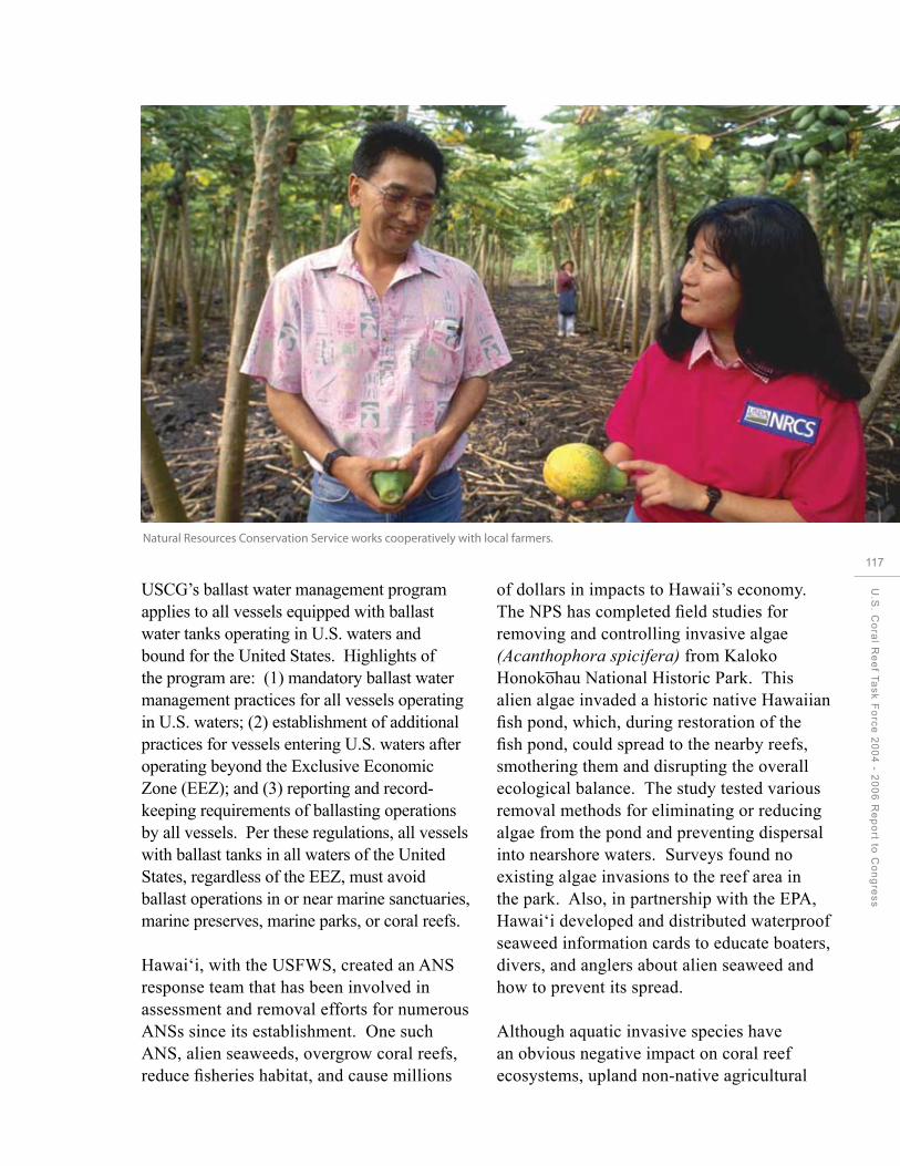
Natural Resources Conservation Service works cooperatively with local farmers.
USCG’s ballast water management program applies to all vessels equipped with ballast water tanks operating in U.S. waters and bound for the United States. Highlights of the program are: (1) mandatory ballast water management practices for all vessels operating in U.S. waters; (2) establishment of additional practices for vessels entering U.S. waters after operating beyond the Exclusive Economic Zone (EEZ); and (3) reporting and record-keeping requirements of ballasting operations by all vessels. Per these regulations, all vessels with ballast tanks in all waters of the United States, regardless of the EEZ, must avoid ballast operations in or near marine sanctuaries, marine preserves, marine parks, or coral reefs.
Hawai‘i, with the USFWS, created an ANS response team that has been involved in assessment and removal efforts for numerous ANSs since its establishment. One such ANS, alien seaweeds, overgrow coral reefs, reduce fisheries habitat, and cause millions
of dollars in impacts to Hawaii’s economy. The NPS has completed field studies for removing and controlling invasive algae (Acanthophora spicifera) from Kaloko Honokohau National Historic Park. This alien algae invaded a historic native Hawaiian fish pond, which, during restoration of the fish pond, could spread to the nearby reefs, smothering them and disrupting the overall ecological balance. The study tested various removal methods for eliminating or reducing algae from the pond and preventing dispersal into nearshore waters. Surveys found no existing algae invasions to the reef area in the park. Also, in partnership with the EPA, Hawai‘i developed and distributed waterproof seaweed information cards to educate boaters, divers, and anglers about alien seaweed and how to prevent its spread.
Although aquatic invasive species have an obvious negative impact on coral reef ecosystems, upland non-native agricultural
U.S
. Co
ral R
ee
f Ta
sk
Fo
rce
20
04
- 20
06
Re
po
rt to C
on
gre
ss
117

118
CHAPTER 8: Reducing Pollution
Upland river sampling off Hanelei Bay, Hawaii
plants and animals can also impact nearshore environments through increased erosion and sedimentation. The USFWS has been working in the Caribbean National Wildlife Refuges to address these issues. Removal of exotic plants and reforestation in uplands to restore native forests has helped stabilize steep areas of shoreline on Green Cay in the USVI and Culebra and Cabo Rojo in Puerto Rico. In Puerto Rico, efforts have continued to remove the invasive goat, rat, and monkey populations in the Desecheo National Wildlife Refuge. These efforts, in addition to helping recovery the island’s vegetation, will reduce the erosion and sedimentation damaging nearshore coral reefs.
Objective 6: Develop tools to assess and address the impacts of pollution on coral reefs.
Florida, with NOAA and partners from the University of Central Florida, National Coral Reef Institute, College of Charleston, Haereticus Environmental Laboratory, and Broward
County Environmental Protection Department, completed the pilot Southeast Florida Coral Biomarker Local Action Study, which was successfully tested the feasibility of using cellular diagnostics to link land-based sources of pollution to coral reef degradation. The pilot study report is available online at: http://www. dep.state.fl.us/coastal/programs/coral/. In 2007, a second phase of the Southeast Florida Coral Biomarker Study will expand the pilot study by incorporating screening tests for acute toxicity with exploratory contaminant analysis of pore water, sediment, and coral tissues, to identify potential sources of stress. This project will evaluate the chain of causality between land-based pollutants, the responses of individual reef-building corals, and the health of coral reef communities in the southeast Florida watershed.
A pilot study led by the USGS showed that dust collecting in the USVI during African dust conditions is toxic to some marine organisms, including the pathogenic strain of the fungus known to cause sea fan disease and mortality

of sea fans throughout the Caribbean. The USGS has developed a method to quantify the elemental composition of coral skeletons at the micron scale. This information is contributing to the goals of hindcasting the impacts of dust events on coral reef ecosystems.
USDA’s NRCS and USGS soil scientists are conducting research on the surface chemistry and nutrient content of silt-size clay sediments deposited on coral reefs. These assessments indicate that, even a thin layer of sediment on a reef could foster algal blooms. The ability of silt to carry nutrients to coral reefs is a new concept for soil researchers, who previously considered silt deposition to be only a physical impairment.
In Hawai‘i, the USGS is continuing to study sediment dynamics on the south shore of Molokai and Hanalei Bay, Kauai. Studies will estimate how much sediment in being transported, how long it stays on the reef, and what impact it is having. This information is critical to understanding the impacts of land-based pollution on coral reefs in Hawai‘i.
Objective 7: Increase awareness and understanding of the ecological health and socioeconomic impacts of land-based and marine pollution on reef resources.
Various USCRTF partners have collaborated to host workshops and training activities to enhance knowledge and capacities needed for more effective management and mitigation of pollution impacts on coral reef ecosystems.
An international workshop held in Honolulu was titled Assessing Land Based Pollution Stress on Coral Reefs. States and territories focused on designing monitoring programs to investigate pollution problems and implement Local Action Strategies targeting these issues. In Hawai‘i, information from this workshop is being used to develop pollutant-sensitive
monitoring tools to assess the response of coral reefs to pollution reductions in nearby watersheds, as part of Hawaii’s land-based pollution LAS.
A workshop held in Maui addressed innovative stormwater/wastewater technologies to help protect water quality in sensitive coastal areas. USCRTF partners, the EPA, NRCS, Hawai‘i, USFWS, and NOAA contributed and participated. Outcomes of the workshop include recommendations to the County of Maui to revise local ordinances to encourage low-impact development, and recommendations to a local landowner to reduce pollutants from planned future development adjacent to a marine life conservation area.
Two additional workshops on stormwater and erosion control were held in Maui and Molokai
119 as part of Hawaii’s land-based pollution LAS. The Center for Watershed Protection, through a contract with NOAA, conducted the workshops and assisted LAS communities with watershed planning. Design guidelines for stormwater treatment practices for Maui County were also drafted, and some of the recommendations were incorporated into revised county ordinances.
EPA, NOAA, the State of Florida, Monroe County, and other local partners developed a Water Quality Communications Plan for the FKNMS. The goal of the plan is to emphasize the importance of restoring and maintaining good water quality in the Florida Keys coral reef ecosystem, including the role of individual, local, and regional impacts.
U.S
. Co
ral R
ee
f Ta
sk
Fo
rce
20
04
- 20
06
Re
po
rt to C
on
gre
ss

120
CHAPTER 9: Restoring Damaged Reefs
CHAPTER 9:
Restoring DamagedReefs

Goal: Increase the capability of federal and non-federal managers to efficiently and effectively restore injured or degraded coral reefs.
A well-developed coral reef can represent thousands of years of slow, incremental growth in resident stony corals. Many corals living today are centuries old. In spite of the longevity and apparent natural resilience of corals and the reefs they construct, they are extremely vulnerable to destruction by human activities–either through gradual degradation of habitat quality, or through sudden catastrophic damage from vessel groundings, toxic spills, coral bleaching, or other habitat destruction events. The natural recovery of coral reef communities and fish populations is jeopardized in areas of degraded habitat and in the presence of other stressors such as pollutants, climate change, or high abundance of pest, exotic, or competing species. Natural recovery may never occur, especially if the underlying habitat structure is destroyed or prevailing environmental conditions are degraded over time. However, reducing other stressors and ensuring sources of recruits to repopulate
U.S
. Co
ral R
ee
f Ta
sk
Fo
rce
20
04
- 20
06
Re
po
rt to C
on
gre
ss
121

122
CHAPTER 9: Restoring Damaged Reefs
damaged reefs can help coral reefs resist and more rapidly recover from injury events.
The National Action Plan recognizes that preventing the loss of coral reef habitat through proactive conservation measures is preferable to restoring coral reefs after they have already been damaged. However, when reefs have been damaged by human use or misuse, removing or mitigating the stressors responsible for the reefs’ decline may enhance natural recovery. In specific situations, USCRTF members have facilitated recovery through active restoration efforts.
The practice of reef restoration is in its infancy. The USCRTF seeks to strengthen restoration science through the development, testing, and assessment of methods and tools used to repair human-caused damage and to assist in the natural recovery of coral reef ecosystem structure and function.
Accomplishments by Objective
Objective 1: Review and evaluate existing reef restoration projects to quantify the benefits gained by the restoration effort and expenditure of the restoration compared to scenarios in which no restoration efforts were undertaken and make recommendations for improvements.
Objective 2: Develop and test innovative methods and techniques to expedite reef restoration for all major categories of coral reef injury using a hypothesis-driven approach that involves rigorous, quantitative evaluation.
In 2005, NOAA revisited Aua, on the island of Tutuila, American Samoa, as part of restoration monitoring following the 1999-2000 removal of nine derelict vessels in Pago Pago Harbor. The team investigated the grounding sites, searched for residual debris, and revisited the area where over 350 corals

Coral restoration efforts following
the Magara grounding off Puerto
Rico (image taken in May 2007).
Student helps relocate 18 corals from
an offshore coral nursery near Molasses
Reef off Key Largo. Three different
genotypes transplanted were marked
with colored zip ties to more easily
track their location and growth. All 18
corals are still alive and thriving, and
most have more than doubled in size
in the last 6 months. Original photo
taken July 2007.
123
had been removed and then retransplanted terms of survival, growth, and change in live U.S
during the wreck removal operation. These tissue cover. The author concluded that coral
. C
corals had been removed to avoid burial transplantation was effective in preserving
ora
l
by temporary causeway construction and individual colonies from impending impacts,
Re
ef
were reattached in their general area of but the broader question of how and whether Ta
s
origin. Sixty-two reference colonies were transplants contribute to broader system
k F
o
measured but not transplanted. The team also recovery still needs to be investigated.
rce
surveyed the footprints of all the wrecks to
20
0
determine the extent of recovery and whether DoD (Navy) and Guam are evaluating the
4 - 2
any further removal of debris or residual feasibility of transplanting selected species
00
6
causeway material was warranted. The team of corals and other benthic invertebrates
Re
p
also surveyed other known and reported from the inner Apra Harbor entrance channel
ort t
wrecks and abandoned vessels on Tutuila to other locations within Apra Harbor. The
o C
on
grand Aunu’u Islands. The study found high study includes preparation of a detailed report
(91 to 92 percent) transplant survival rates monitoring success rates.
es
s
approximately one year following reattachment in 2001; however, by 2005, survival showed In 2006, the M/V Cape Flattery grounded on a significant decline (60 to 78 percent). This the coral reef south of the entrance channel to decline may have been associated with a Kalaeloa (Barbers Point) Deep Draft Harbor hurricane in 2004, which appeared to have on O‘ahu, Hawai‘i. In the emergency response toppled and overturned large pieces of reef and natural damage assessment phases of platform at Aua. Transplant colonies fared the vessel removal process, NOAA and the no worse than the reference colonies in USFWS implemented a multi-agency trustee
CHAPTER 9: Restoring Damaged Reefs
field assessment and coral reef restoration effort. The area with injury was estimated to exceed 15 acres (60,702 square meters). One-year monitoring of corals and substrate reattached with cement in the initial emergency restoration was completed. Measurements from control colonies were used to help model natural recovery projections for the area. Trustee agencies requested and provided oversight for Responsible Party removal of tons of incident-related, unattached reef debris, with some reattachment in flattened hull-impact areas as additional emergency restoration. In addition, Trustee agencies worked towards finalizing a list of proposed compensatory restoration projects to provide feasible offset to incident-related losses of natural resource services.
When the M/V Fortuna Reefer grounded
124 in 1997 on Mona Island, Puerto Rico, a multi-agency restoration action reattached approximately 1,800 Acropora fragments. By following the success of these colonies over time, researchers have learned which methods yield the best results. In particular, the type of substrate, the size of the attached fragments, and the method of attachment all affect coral reef restoration success. Almost a decade after these activities began, the site is still not fully recovered. But compared to comparable grounding sites not restored, the restoration sites are a vast improvement, with increasing numbers of growing coral fragments and fish abundance and diversity. Long-term, frequent monitoring of restoration activities is important in determining how restored areas respond in the face of ongoing threats and impacts to coral reefs.
NOAA worked with local partners in the FKNMS to move juvenile long-spined black urchins (Diadema antillarum) from unstable coral rubble to deeper reefs in the FKNMS, before the height of the 2006 hurricane
season. Diadema are important to the health of coral reefs because they graze on algae, which competes with corals for space on the reef. In the early 1980s, these urchins died off almost completely throughout the reefs of the Caribbean and southeast Atlantic. Although the Diadema have been returning slowly to the reefs of the Florida Keys, they have not approached their former abundance. To increase their survival rate, small urchins (three to five centimeters) were transplanted out of the high-energy rubble zone onto more protected reef areas, where it is hoped their population will increase more rapidly.
A USCRTF and university partnership project is researching settlement success of coral species and testing various methods to improve this process. Most reef-building corals reproduce by broadcasting their tiny gametes into the water column. Researchers can collect these eggs and sperm as they are released from parent colonies, and enhance fertilization and settlement success by caring for the larvae in a laboratory setting. An agency—university partnership is raising tens of thousands of coral larvae each year for various experiments and for restoration activities including direct settlement on reef surfaces or other substrates for transplantation onto reefs as they mature. Experiments are designed to determine which treatments encourage coral survivorship and growth. Researchers determined that cyanobacteria, which are locally abundant on restoration sites in the Florida Keys, appear to inhibit coral larvae settlement. A pilot study is evaluating new ceramic artificial structures to determine whether their unique design may improve survivorship of coral settlers.
Objective 3: Develop regional restoration plans that identify significant restoration alternatives and weigh the costs and benefits of natural recovery compared with restoration alternatives.

M/V Casitas aground on Pearl and Hermes Reef in the NWHI. Bow of M/V Casitas.
125
Puerto Rico DNER is initiating NRDA and the 48-meter S/Y Legacy—and negotiations U.
activities for two commercial vessel to remove both vessels are ongoing.
S. C
groundings—the M/V Kent Reliant and M/V
ora
l
Sperchios—and one recreational vessel Between October 2005 and February 2007,
Re
e
grounding on seagrasses in a Natural Reserve, 399 vessel groundings were reported in the
f Ta
and has received funding from the National FKNMS. Of those cases, 60 required injury
sk
F
Pollution Fund Center for the Vista Bella oil assessments and 42 were forwarded for
orc
spill to perform a damage assessment and enforcement action.
e 2
00
create a Restoration Plan for the coastal areas
4 -
of Puerto Rico and USVI impacted by this oil The USFWS, NOAA, USCG, and Hawai‘i
20
06
spill in 1991. continue to assess the impact of the 2005 Re
grounding of the M/V Casitas at Pearl
po
rt
Objective 4: Promote cost-effective pilot and Hermes Reef in what is now the
to C
on
grestoration of selected degraded U.S. reefs, Papahanaumokuakea Marine National focusing on habitats of high ecological, Monument. The vessel remained on the
res
s
economic, and social conservation value. reef for almost a month before salvage crews could remove fuel and prepare the
By November 2006, Monroe County, in vessel for refloating. Removal of the vessel conjunction with the Federal Emergency was successful, but because of substantial Management Agency, removed over 355 vessels hull damage, the USCG decided it was not and 45,000 lobster and crab traps that impacted safe to tow the vessel to Honolulu, and the habitats throughout the FKNMS in the aftermath decision was made to scuttle the vessel in of Hurricane Wilma in October 2005. Two deep waters at a predetermined scuttling site large vessels remain—the 24-meter Lady Luck in the Monument. A field team composed

CHAPTER 9: Restoring Damaged Reefs
Students practice crime scene investigation techniques during the “CSI for Coral Reefs” workshop conducted in conjunction with the October 2006 International
Tropical Marine Ecosystems Management Symposium in Cozumel, Mexico.
126
of representatives of the State and federal trustees, and a representative of the vessel’s owner conducted a cooperative site survey at the grounding site after the vessel was extracted. The trustee agencies are scaling a set of restoration projects to compensate for the injuries caused by the incident.
The USFWS, NOAA, USCG, and other local partners continue to conduct follow-up action from a 1993 longline fishing vessel grounding and oil spill on Rose Atoll National Wildlife Refuge. Restoration activities have involved removing a chronic source of iron associated with vessel debris, thereby promoting recovery of natural resources damaged by the oil. Monitoring of the site, including 20 permanent transects, shows partial recovery of coralline algae, corals, and giant clams, with full recovery anticipated when the restoration project is completed. In 2006, all but two tons of the ship was removed, with the remaining wreckage debris removal planned for 2007. The assessment and restoration of natural
resources injured due to the oil discharge at Rose Atoll were paid for through the Oil Spill Liability Trust Fund.
In Puerto Rico waters, the 228-meter T/V Margara grounded on April 27, 2006. The commercial vessel was carrying 13 million gallons of number six fuel oil from Venezuela to Puerto Rico. The Margara ran aground at approximately 10.5 meter depth on the reefs off of Guayanilla, Puerto Rico. Damage to the reef was significant and estimated to have impacted up to 8,500 square meter of bank type coral reef with significant cover of hard corals as well as gorgonians and sponges. As a result of the impact and ship recovery efforts, unstable reef rubble, sand and bare hard bottom areas were created. Patches of threatened Acropora cervicornis were also impacted and antifouling paint was transferred from the ship bottom to the sea floor.
A first phase of Emergency Restoration (ER) activities was initiated from July to October

2006, and ER was completed in a second phase in May 2007. The ER intended to facilitate the recovery of the impacted reef by reattaching the remaining viable corals, stabilizing rubble berms, and removing antifouling paint from the sea floor. Unattached viable corals were place upright and cached to avoid additional injury and to prepare for later restoration. Approximately 10,000 scleractinian corals and gorgonians were reattached to available substrate with hydraulic cement. The ER was a cooperative effort between Continental Shelf Associates, Inc. (representing the Responsible Party) and the co-Trustees, the Puerto Rico DNER, and NOAA. Damage assessment activities involved mapping the impacted reef areas and conducting a preliminary characterization of the surrounding unimpacted reef community. Monitoring of the ER was initiated in May 2007, with the goal of determining the relative success of coral/substrate reattachment and to detect and respond to significant changes in overall habitat characteristics and relative coral health.
The USFWS launched the Mangrove Recovery Initiative as a cooperative venture between the Federation of Fly Fishers, the USFWS J.N. “Ding” Darling National Wildlife Refuge, and local partners to recover and restore Florida’s rich and diverse mangrove forests to support strong populations of fish and wildlife. Project examples include restoration of approximately 116 acres (469,435 square meters) of mangrove habitat in Clam Bayou on Sanibel Island to support productive marine fisheries and estuarine habitat and to prevent fish kills, mangrove forest losses, and seagrass and oyster bar die-offs. The USFWS Pelican Island National Wildlife Refuge established a cooperative partnership with the Florida Department of Environmental Protection and Indian River County to restore approximately 65 acres (263,046 square meters) of coastal habitat.
Objective 5: Rehabilitate degraded fish habitat through the deployment of artificial structures and rapid, inexpensive transplant methods.
On May 17, 2006, DoD sank the retired aircraft carrier ex-ORISKANY off the coast of Pensacola to provide an artificial reef for the State of Florida. The 268-meter carrier was sunk in 64 meters of water, 24 miles (38,624 meters) off the coast. The Navy worked with partners from the State of Florida, EPA, USACE, and NOAA to ensure the reef will be safe and not cause environmental damage. The final orientation of the carrier was carefully planned by the Florida Fish and Wildlife Conservation Commission. It is expected to benefit marine life and recreational fishing and diving. Upon sinking, ownership of the carrier/artificial reef was conveyed to the Florida Fish and Wildlife Conservation Commission.
Objective 6: Transfer proven restoration tools, techniques, and lessons learned to domestic and international partners.
The USFWS National Fish and Wildlife Forensics Laboratory has been working with NOAA and other private and academia partners to identify and test crime scene investigation procedures for use in investigating damage to coral reefs. In 2006, partners hosted a five-day “CSI for Coral Reefs” training workshop for resource managers, environmental assessment specialists, criminal investigators, and litigators at the International Tropical Marine Ecosystem Management Symposium, in Cozumel, Mexico.
U.S
. Co
ral R
ee
f Ta
sk
Fo
rce
20
04
- 20
06
Re
po
rt to C
on
gre
ss
127

128
CHAPTER 10: Improving Outreach and Education
CHAPTER 10:
Improving Outreach and Education
CHAPTER 10:
Improving Outreach and Education
Goal: Increase awareness and understanding of the ecological, cultural, and socioeconomic importance of coral reef ecosystems among the widest possible audience.
An informed, engaged public is fundamental to achieving the goals of the National Action Plan. However, reducing human impacts on coral reef ecosystems requires more than information-sharing. It requires changing the human behaviors, beliefs, and decision-making criteria contributing to coral reef decline. Therefore, effective outreach and education activities attempt to understand and address existing barriers to sustainable behavior to enhance the appeal of sustainable behaviors through communications targeting public motivations and needs. Through the effective identification of motivations, managers not only make messages resonate with various segments of society, they also help ensure community needs are met while advancing coral reef conservation strategies. This approach requires ongoing dialogue with stakeholders and decision makers, regular progress assessments to enhance public understanding of the values of and threats to coral reef ecosystems, and ongoing communications based on these assessments
U.S
. Co
ral R
ee
f Ta
sk
Fo
rce
20
04
- 20
06
Re
po
rt to C
on
gre
ss
129

130
CHAPTER 10: Improving Outreach and Education
and dialogue. School-based formal education efforts that teach children environmental concepts, as well as the value and importance of environmental stewardship, are also critical to future coral reef conservation success.
The USCRTF participates in a variety of activities to inform and engage reef users, local communities, school children, and the general public in conservation efforts.
Accomplishments by Objective
Objective 1: Raise public awareness of and appreciation for coral reef ecosystems through targeted and focused communication campaigns.
Strategic outreach and education campaigns designed to change societal behavior
American Samoa initiated a Rare Pride Conservation Education Campaign using as its flagship species the sea turtle, which is an integral part of coral reef ecosystems and cultural history in American Samoa. Rare Pride Campaigns are intensive, 18-month social marketing programs using over 20 public communications tools to create an increased sense of public environmental stewardship. The campaigns have a powerful influence on emotions, attitudes, and behavior. The campaigns increased awareness and decreased destructive practices in over 28 countries, but few coral reef campaigns have been implemented, so the American Samoa campaign is a pilot approach in U.S. waters. The American Samoa Coral Reef Advisory Group recently finalized the detailed campaign plan to include goals; Specific, Measurable, Achievable, Realistic, Timely (SMART) objectives; activities; and an evaluation process to measure campaign success. With the help of the “Tino the Turtle”mascot, the campaign
is expected greatly increase in local awareness, stewardship capacity, and conservation knowledge.
Hawai‘i’s Living Reef Program is a strategic public communications effort across more than 40 organizations based on approximately 18 months of research and collaboration. Through the collaborative development of key messages, multimedia products, and innovative distribution strategies, the campaign minimizes duplication and message dilution, maximizes resources, and uses consistent messages to reach a much larger audience than would be possible through any one organization. Recent successes include the development of an annual Living Reef Awards program to recognize the organizations, groups, or individuals doing the most to preserve Hawaii’s reef ecosystem (with over 250 attendees in 2005); production of a reef etiquette video for hotel rooms, cruise ships, and airlines; development of a public service announcement campaign featuring billboards as well as radio and TV spots; and development of a major newspaper insert on marine protected areas. The Living Reef Program is a key initiative of the Hawai‘i Coral Reef Outreach Network, an unprecedented public awareness partnership founded in 2001 to cross sectors and agendas and unite Hawaii’s conservation community around integrated coral reef outreach and education. More information on this program is available online at: http://www.hawaiireef.org/.
Guam’s Coastal Management Program conducted a survey of stakeholders’ familiarity with and receptivity to coral reef and coastal resource management outreach products and messages. The results indicated a need for changes in Guam’s outreach approach. As a result, Guam embarked on several new initiatives, and staff from multiple agencies received training on strategic communications and environmental behavior change

Students from Aka‘ula School
working with their teacher to
design stormwater controls
during a workshop on Molokai.
techniques. Guam launched a multimedia coral reef awareness campaign to actively target the awareness and behavior of residents and tourists. The campaign produced an airline video, coloring books, street banners, hotel information cards, and other materials. Events each month to educate the community on the importance of Guam’s coral reefs and associated environments attracted children and adults throughout the island. This campaign has strengthened ties between the Guam Coral Reef Initiative Coordinating Committee, Guam Visitor’s Bureau, and Guam Hotel and Restaurant Association.
Coalition-building to enhance outreach impact and decrease conflicting messages
The Virgin Islands Network of Environmental Educators (VINE) brings together over 60 environmental educators in more than 30 agencies, divisions, and organizations. Founded in 2004, VINE is running two chapters, one each on St. Croix
and St. Thomas/St. John. The goal of VINE is to support sustainable use of natural and cultural resources in the USVI by leveraging available resources and decreasing fragmentation of effort and duplication across programs and by building capacity for environmental education within the territory. Achievements include collaborative participation in teacher professional development workshops; a partnership collaborative with the British Virgin Islands and Caribbean Fishery Management Council; leveraging of funds to provide on-the-job training to local educators; a multi-pronged communications campaign using murals, t-shirts, billboards, and the Internet; promotion of a more comprehensive environmental education curriculum; and the first cross-organizational assessment of outreach and education capacity gaps and staff needs throughout the USVI. More information is available online at: http:// www.stxeastendmarinepark.org/vine.htm.
U.S
. Co
ral R
ee
f Ta
sk
Fo
rce
20
04
- 20
06
Re
po
rt to C
on
gre
ss
131
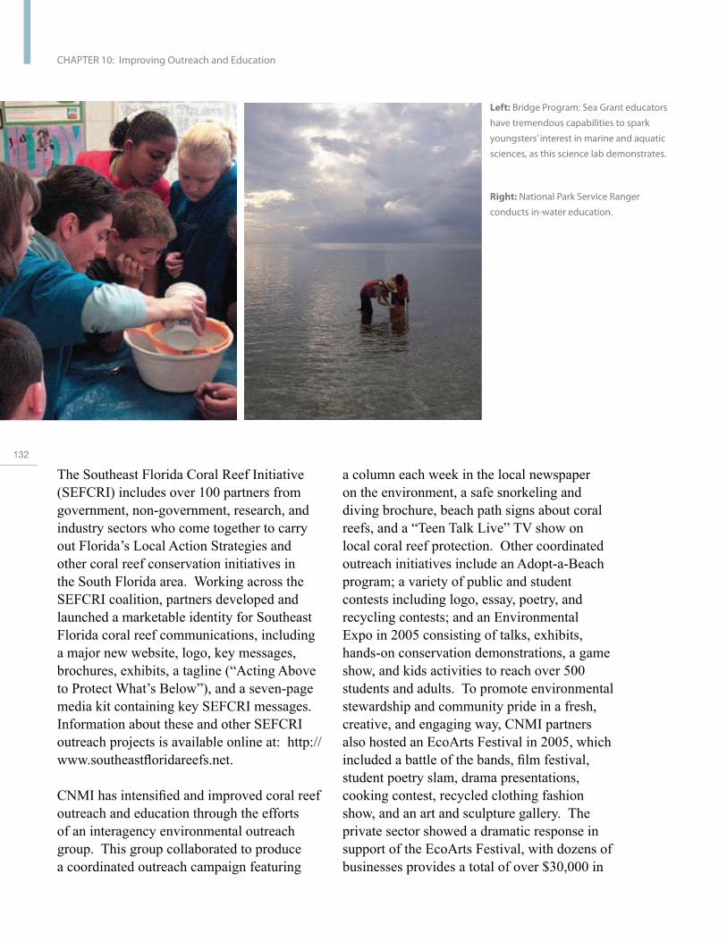
132
CHAPTER 10: Improving Outreach and Education
Left: Bridge Program: Sea Grant educators
have tremendous capabilities to spark
youngsters’ interest in marine and aquatic
sciences, as this science lab demonstrates.
Right: National Park Service Ranger
conducts in-water education.
a column each week in the local newspaper on the environment, a safe snorkeling and diving brochure, beach path signs about coral reefs, and a “Teen Talk Live” TV show on local coral reef protection. Other coordinated outreach initiatives include an Adopt-a-Beach program; a variety of public and student contests including logo, essay, poetry, and recycling contests; and an Environmental Expo in 2005 consisting of talks, exhibits, hands-on conservation demonstrations, a game show, and kids activities to reach over 500 students and adults. To promote environmental stewardship and community pride in a fresh, creative, and engaging way, CNMI partners also hosted an EcoArts Festival in 2005, which included a battle of the bands, film festival, student poetry slam, drama presentations, cooking contest, recycled clothing fashion show, and an art and sculpture gallery. The private sector showed a dramatic response in support of the EcoArts Festival, with dozens of businesses provides a total of over $30,000 in
The Southeast Florida Coral Reef Initiative (SEFCRI) includes over 100 partners from government, non-government, research, and industry sectors who come together to carry out Florida’s Local Action Strategies and other coral reef conservation initiatives in the South Florida area. Working across the SEFCRI coalition, partners developed and launched a marketable identity for Southeast Florida coral reef communications, including a major new website, logo, key messages, brochures, exhibits, a tagline (“Acting Above to Protect What’s Below”), and a seven-page media kit containing key SEFCRI messages. Information about these and other SEFCRI outreach projects is available online at: http:// www.southeastfloridareefs.net.
CNMI has intensified and improved coral reef outreach and education through the efforts of an interagency environmental outreach group. This group collaborated to produce a coordinated outreach campaign featuring
monetary and in-kind assistance, resulting in a variety of new public—private conservation partnerships in CNMI.
The USFWS worked with online auction giant e-Bay to help improve the company’s efforts to bar auctions of protected species using USFWS information and regulations. As a result of the dialogue with the USFWS, company officials reported success in using comprehensive species and product lists compiled by USFWS Law Enforcement to target and remove e-Bay listings for unlawfully advertised wildlife, including sea turtle shells and shell products.
Objective 2: Incorporate coral reef ecosystem issues in education programs to promote understanding of marine conservation.
Schools-based education to teach key science concepts and promote stewardship
American Samoa, with assistance from NOAA, increased the marine science teaching capacity of 25 local middle-school and upper-elementary school teachers through a six-day professional development workshop. The Keys to Science Education workshop resulted in the development and implementation of marine science lesson plans by the participants. Material support for the implementation of selected lesson plans was provided to teachers through the American Samoa Coral Reef Advisory Group’s annual Teacher Challenge Awards.
The SEFCRI hosted two teacher training workshops for K-12 teachers in September and November 2006 in Palm Beach and Broward counties. Eighty-five teachers from Martin, Palm Beach, Broward, and Miami-Dade counties attended the workshops, along with six students. Ninety percent of the teachers who participated were either satisfied
or very satisfied with the content provided in the workshops. There was a 35 percent average increase in knowledge about coral reef resources in southeast Florida, as measured by participant pre-tests and post-tests. The numbers provided in the program evaluations indicate that a minimum of 10,378 students per year within the four-county SEFCRI region will be exposed to coral reef curriculum, activities, and resources that were provided during these two workshops. The purpose of these training programs is to equip teachers to be part of longer-term educational change in order to better prepare the next generation to conserve coral reef ecosystems. To address the high demand for this training, two additional workshops are planned for 2007.
Making creative use of technology to provide widespread access to education materials
NOAA, in partnership with the National Science Teachers Association (NSTA), developed a suite of education and professional development resources for teachers wanting to explore coral reef ecosystem science in their classrooms. The suite includes a half-day symposium, Coral Ecosystems, given at the 2006 annual NSTA convention; the Coral Reef Ecosystem SciGuide, a comprehensive online guide to coral reef teaching resources and pedagogy developed by several academic, NGO and agency organizations; two online web seminars; and a series of online professional development tools called SciPack, created by a team of professional educators and science experts. A total of 194 teachers from 40 states and two countries participated in the symposium and web seminars, and 98 percent reported a desire for more coral reef seminars and teaching resources. The SciGuide and SciPack will reach thousands of teachers and students each year. More information is available online at: http://www.nsta.org/.
U.S
. Co
ral R
ee
f Ta
sk
Fo
rce
20
04
- 20
06
Re
po
rt to C
on
gre
ss
133
CHAPTER 10: Improving Outreach and Education
The Bridge education website serves as a one-stop portal for juried, peer-reviewed, marine science education materials. It is a growing collection of the best marine education resources available on-line, providing educators with a convenient source of accurate information on global, national, and regional marine science topics, and giving researchers a contact point for educational outreach. The Bridge’s coral reef resources include materials from NOAA, the USCRTF, the Census of Marine Life, the states of California and Florida, national and international universities, Reef Protection International, and many others. Several of these coral reef educational resources have been highlighted as “Teacher’s Top Picks” by the Bridge’s expert Teacher Reviewers of On-Line Learning, (TROLLs). The Bridge is supported by the National Oceanographic Partnership Program (NOPP),
134 the National Marine Educators Association, and Sea Grant. More information is available online at: http://www.vims.edu/bridge/.
Objective 3: Inform the public and policymakers about accomplishments and recommendations of the U.S. Coral Reef Task Force. (See Chapter 13 for more accomplishments and details related to this objective.)
The Subcommittee on Integrated Management of Ocean Resources (SIMOR) requested a briefing by the USCRTF in fall 2005. SIMOR was established to coordinate the activities of executive departments and agencies regarding ocean-related matters and to facilitate coordination and consultation among federal, state, tribal, and local governments, among others. The USCRTF co-chairs shared examples, challenges, and accomplishments concerning how the USCRTF plays these roles for coral reef ecosystems and its members, federal agencies, states, and territories.
At its May 2006 meeting, the USCRTF
provided a Congressional Briefing, which included NOAA, the DOI (as Task Force cochairs), and a representative from Hawai‘i. The briefing highlighted the USCRTF in general and two specific initiatives: the interagency response to the 2005 Caribbean coral bleaching event and the Local Action Strategies.
Objective 4: Increase understanding of coral reef ecosystems through conducting comprehensive assessments of monitoring and coral reef habitats.
Objective 5: Support outreach and education initiatives in states and territories and initiate grants to local community groups.
Building the capacity of resource managers to effectively understand and change public behavior
NOAA, in partnership with the seven USCRTF state and territory partners, developed a three-year capacity-building initiative for federal, state, territory, and non-government outreach and education specialists based in these jurisdictions. In 2005, two regional capacity-building workshops kicked off the initiative, involving approximately 70 individuals from almost 50 agencies and organizations. Workshop participants were engaged in designing and planning the trainings and helping to build a network of outreach specialists before the trainings took place. Through a combination of training modules led by global experts, small group practice, and sharing lessons learned, the workshops focused on building participants’ skills in strategic communication and outreach planning, program design, message pre-testing, and monitoring and evaluation necessary for designing effective education and communications programs to promote lasting environmental behavior change. To build on the foundation of these regional training workshops, NOAA developed a

semi-competitive small grants program. This program allows the states and territories to continue their capacity-building work through more in-depth and intensive follow-up training and implementation assistance specific to the needs of each jurisdiction. This initiative helps management agencies address human impacts to reef ecosystems by teaching them how to research and then strategically target the individual and societal motivations leading to damaging human behaviors.
Creating new partnerships for coral reef conservation
Through the Sea Partners Program, the USCG launched a public education and outreach initiative to reach an audience of over 270,000 people in 2006. Sea Partners, the USCG Marine Environmental Protection outreach and education program, operates from each of the 45 USCG Marine Safety Offices located in port communities around the Nation, including Puerto Rico and Guam. Sea Partners activities include helping communities develop an awareness of marine pollution issues, improving compliance with marine environmental protection laws and regulations, and providing ways for groups and individuals to take action to protect the marine environment.
The USCRTF, through the USFWS, U.S. Agency for International Development (USAID), and NOAA, has participated for many consecutive years in the Marine Aquarium Conference of North America (MACNA), the major national trade show and conference for the Marine Aquarium Society of North America (MASNA). MASNA is a not-for-profit organization composed of marine aquarium clubs and individual hobbyists from North America totaling several thousand individuals. Among its purposes, MASNA encourages the ethical growth of the marine aquarium hobby, supports captive breeding/
propagation, and supports efforts to eliminate abuses in collecting and transporting marine organisms. The marine aquarium trade targets a large diversity of coral reef species, some of which are collected using cyanide and other destructive practices or are being harvested at unsustainable levels. Over 75 percent of coral and 50 percent of marine fishes (volumes of 16-30 million fish worldwide per year) collected in over 45 countries worldwide are destined for U.S. markets. The MACNA conference affords the USCRTF an opportunity to provide information to aquarium industry officials, wholesalers, retailers, hobbyists, educators, and others about the state of coral reef ecosystems in the United States and abroad, as well as the USCRTF commitment to working with partners to create sustainable marine ornamental fisheries.
NOAA, in partnership with the Puerto Rico Tourism Company (PRTC), created educational materials for distribution throughout Puerto Rico. The materials were distributed in hotels, dive shops, tourist information centers, and other businesses sponsored and managed by the Tourism Company. These guides contained information on preventing damage to coral reefs during recreational activities. A 60-second public service announcement was also produced (as part of a partnership including the Puerto Rico National Parks Company). The announcement was shown in movie theaters across Puerto Rico and was aired on local cable stations to highlight the importance of the coral reef ecosystem—including coral reefs, seagrass beds, and mangroves—in creating and sustaining public beaches, and the importance of conserving these resources for future generations. This work has raised the awareness of the PRTC and the public about the importance of active participation in coral reef conservation initiatives to help protect this valuable tourism resource.
U.S
. Co
ral R
ee
f Ta
sk
Fo
rce
20
04
- 20
06
Re
po
rt to C
on
gre
ss
135
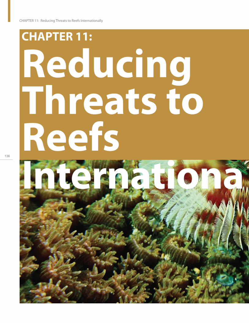
lly136
CHAPTER 11: Reducing Threats to Reefs Internationally
CHAPTER 11:
ReducingThreats to Reefs Internationa

CHAPTER 11:
Reducing Threats to Reefs Internationa lly
Goal: Exercise global leadership through commitment to and collaboration with domestic and international partners to protect and conserve coral reefs and associated ecosystems globally.
Coral reefs are found in more than 90 countries, serving important economic, social, and cultural roles and constituting the economic base in many countries, in particular in small island nations. Healthy marine ecosystems are critical to U.S. diplomatic and development strategies in many countries to promote economic and food security, social stability, improved human health, natural disaster protection, adaptation to climate change, and biodiversity conservation. New conservation and management initiatives at international, national, and local levels are showing considerable success in halting and reversing reef decline. To build on these localized activities, the United States needs help countries replicate small-scale successes on national and regional scales. The National Action Plan calls on the United States to reduce threats to coral reef ecosystems on an international level and to promote sustainable management of reef resources worldwide.
U.S
. Co
ral R
ee
f Ta
sk
Fo
rce
20
04
- 20
06
Re
po
rt to C
on
gre
ss
137

CHAPTER 11: Reducing Threats to Reefs Internationally
In response to the continuing global decline in coral reef health, USCRTF member agencies have increased international efforts and leadership to help reduce the pressures on reef ecosystems. USAID, DOS, NOAA, and DOI have engaged domestic and international partners to increase the prominence of coral reefs and associated ecosystems in various international fora. USAID provides the principal U.S. bilateral support for coral reef conservation overseas. The agency supports projects in more than 20 countries in Latin America, the Caribbean, Southeast Asia, the Middle East, and East Africa. NOAA, DOI, the EPA, and other USCRTF agencies primarily provide technical assistance, small grants, and support for targeted workshops and symposiums. DOS continues to provide substantial financial support to the International Coral Reef Initiative (ICRI)
138 and ICRI-related activities, such as the development of the biennial Status of Coral Reefs of the World. The United States, through DOS leadership, will serve as co-host of the ICRI Secretariat for 2007–2009.
Accomplishments by Objective
Objective 1: Exercise global leadership in the international arena in shaping and developing environmentally sound and comprehensive ocean and coral reef policy.
On an international level, the United States promotes environmentally sound policies and management practices including—the development of large-scale networks of MPAs—through participation in international fora and support for field programs to build resiliency to coral bleaching, reduce overfishing, and address land-based sources of pollution. USCRTF members have provided leadership through the participation in international fora, such as ICRI, the Convention on International Trade
in Endangered Species of Wild Fauna and Flora (CITES) (see Chapter 12), the 10th International Coral Reef Symposium, the International Tropical Marine Ecosystem Management Symposium, and support for activities such as the publication of the 2004 Status of Coral Reefs of the World, 2005 Status of Coral Reefs in Tsunami Affected Countries, and a focused coral reef conservation event at a meeting of the Small Island Developing States.
Objective 2: Build human and institutional capacity to manage and conserve reef ecosystems and coastal watersheds through integrated coastal management.
In an effort to strengthen management of coral reef resources; preserve coastal biodiversity by preventing habitat destruction, pollution, and over-exploitation; and promote sustainable use of coral resources, the United States provides funding and expertise to developing countries. The USCRTF has supported coral reef activities in Latin America, the Caribbean, Southeast Asia, the Middle East, and East Africa. These activities are demonstrating results in several linked areas of vital importance to sustainable development, including the conservation of biological diversity; improved governance at community, local, and national levels; and improved socioeconomic conditions. Activities resulted in enhanced integrated coastal governance; improved marine protected area management, monitoring, and patrolling; improved fisheries management, including the establishment of ecological reserves; and increased coral cover and biodiversity.
USAID helped frame the process for developing Tanzania’s Environmental Management Act, which became effective in July 2005. The Act articulates Tanzania’s natural resources management policy and the framework for decentralized implementation. Local leadership in managing public resources is encouraged.
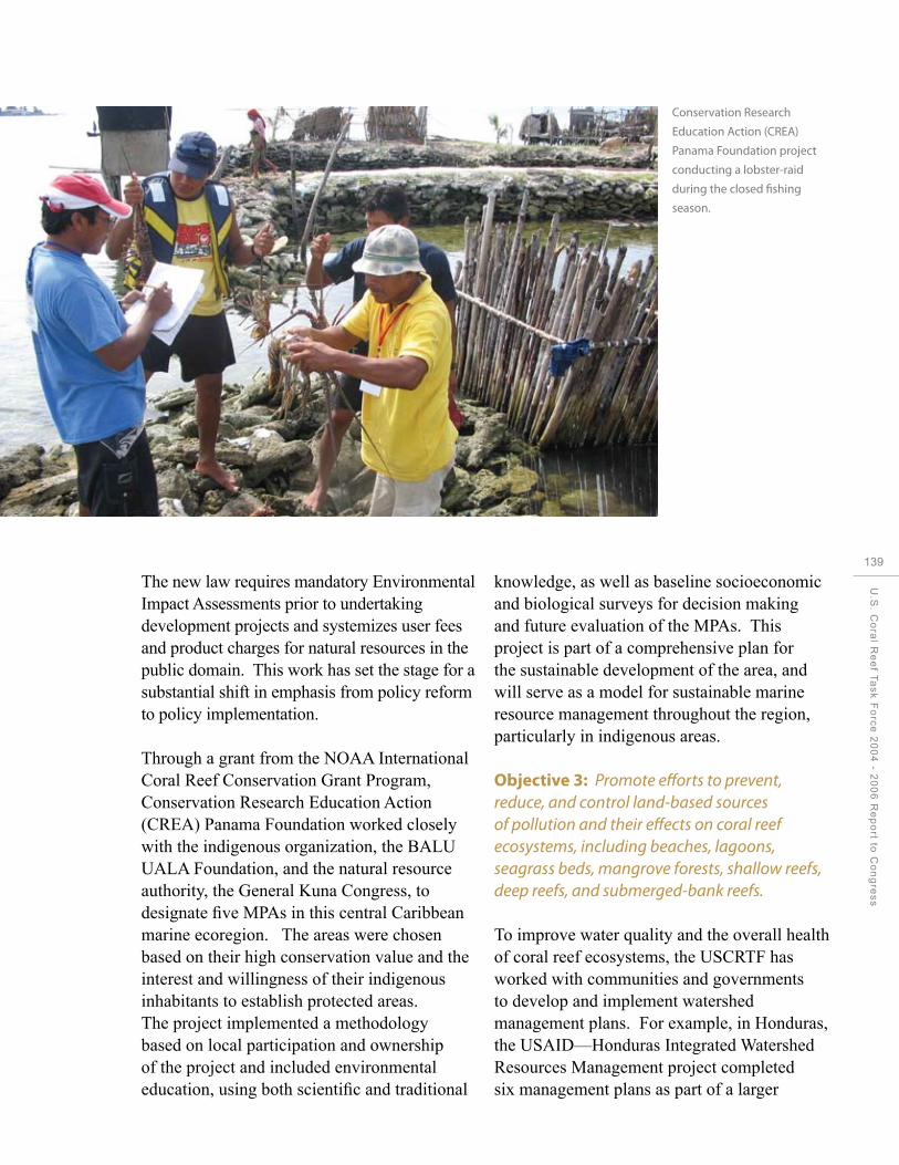
Conservation Research
Education Action (CREA)
Panama Foundation project
conducting a lobster-raid
during the closed fishing
season.
The new law requires mandatory Environmental Impact Assessments prior to undertaking development projects and systemizes user fees and product charges for natural resources in the public domain. This work has set the stage for a substantial shift in emphasis from policy reform to policy implementation.
Through a grant from the NOAA International Coral Reef Conservation Grant Program, Conservation Research Education Action (CREA) Panama Foundation worked closely with the indigenous organization, the BALU UALA Foundation, and the natural resource authority, the General Kuna Congress, to designate five MPAs in this central Caribbean marine ecoregion. The areas were chosen based on their high conservation value and the interest and willingness of their indigenous inhabitants to establish protected areas. The project implemented a methodology based on local participation and ownership of the project and included environmental education, using both scientific and traditional
knowledge, as well as baseline socioeconomic and biological surveys for decision making and future evaluation of the MPAs. This project is part of a comprehensive plan for the sustainable development of the area, and will serve as a model for sustainable marine resource management throughout the region, particularly in indigenous areas.
Objective 3: Promote efforts to prevent, reduce, and control land-based sources of pollution and their effects on coral reef ecosystems, including beaches, lagoons, seagrass beds, mangrove forests, shallow reefs, deep reefs, and submerged-bank reefs.
To improve water quality and the overall health of coral reef ecosystems, the USCRTF has worked with communities and governments to develop and implement watershed management plans. For example, in Honduras, the USAID—Honduras Integrated Watershed Resources Management project completed six management plans as part of a larger
U.S
. Co
ral R
ee
f Ta
sk
Fo
rce
20
04
- 20
06
Re
po
rt to C
on
gre
ss
139

140
CHAPTER 11: Reducing Threats to Reefs Internationally
watershed management program. Activities in the watershed management plans include: (1) forest management plans and alternative livelihood options in park-buffer zones, such as shade-grown coffee and sustainable harvest of timber; (2) low-cost practices to protect water supplies; (3) improved water storage for farming; and (4) soil conservation practices.
In Honduras, the Integrated Watershed Resources Management effort has targeted 18 terrestrial and marine protected areas for improved management. These areas cover more than 230,000 hectares and serving as reservoirs for biodiversity for improved management. A major focal point of this effort is the implementation of more than 20 flora and fauna inventories to identify potential keystone species in order to develop and implement recommendations for their conservation. Other key results of this program will be strengthened capacity of park managers, improved protected area infrastructure, and increased revenues, all of which will enhance
Local fisher shows off
his catch in Quirimbas
National Park,
Mozambique. WWF, with
support from USAID, is
building the capacity of
local communities and
park officials to better
manage marine resources.
Enewetak Conservation
Area (ECA) on Kwajalein
Atoll, the Republic of
the Marshall Islands.
the ability of park staff to monitor and protect wildlife and important habitats.
Objective 4: Support the creation of effective management of coral reef MPAs, in particular those that contain substantial ecological (i.e., no-take) reserves.
Cooperation among USCRTF members, the Mozambique Navy, and the World Wildlife Fund (WWF) has strengthened fisheries enforcement and maritime security in Mozambique. Through this collaborative effort, the Mozambique Navy has received and upgraded their first three boats to protect their coastline, including patrolling marine protected areas. This partnership will allow the Mozambique Navy to carry out their mandate to protect key marine protected areas along the coast from illegal fishing. Increased enforcement capacity will improve the health of the coral reef ecosystems and the well-being of local artisanal fishers and communities. India, South Africa, and France supplied

additional boats for this effort.
In 2004, financial support from DOS provided the impetus for Indonesia, Malaysia, and the Philippines to sign their first tri-national cooperative agreement, thereby establishing the Sula-Suluwesi Sea Ecoregion. This ecoregion is of enormous ecological and economical importance, featuring productive ecosystems such as coral reefs, seagrass beds, and mangrove forests. Its marine biodiversity includes more than 400 species of corals and 650 species of reef fishes, as well as five of the seven species of marine turtles. The ecoregion also serves as an important source of food and livelihood for countless subsistence and commercial fishermen.
The United States agreed to establish the Enewetak Conservation Area (ECA) on Kwajalein Atoll, the Republic of the Marshall Islands, based on a biological opinion on sea turtles and other conservation
recommendations. The ECA extends 300 meters from shore in all directions, and includes documented sea turtle nesting habitat and a wide range of coral reef habitats supporting diverse assemblages of marine species. The ECA will replace the resource losses associated with a current U.S. military project and serve as a type of mitigation bank to provide the means for replacing resource losses from future projects. The ECA will serve as a focus for education, non-consumptive recreation, and other passive activities compatible with conservation.
USAID’s Global Conservation Program has been providing long-term support to The Nature Conservancy, World Wildlife Fund, and Wildlife Conservation Society to institute large-scale marine planning and networks of marine protected areas in Raja Ampat, Indonesia; Wakatobi, Indonesia; the Meso-American Reef in Mexico, Belize, Guatemala, and Honduras; and the East
U.S
. Co
ral R
ee
f Ta
sk
Fo
rce
20
04
- 20
06
Re
po
rt to C
on
gre
ss
141

142
CHAPTER 11: Reducing Threats to Reefs Internationally
Local fishing villages along Thailand’s Andaman Sea coast were devastated from the Indian Ocean Tsunami.
African Marine Ecoregion in Kenya, Tanzania, and Mozambique. As a result of this support, the Indonesian Regent government designated six important areas in the Raja Ampat region as MPAs at the request of traditional leaders in December 2006. The six areas cover 654,000 hectares or 44 percent of the Regency’s coast line and will help promote more sustainable resource use.
DoD operates several facilities in Okinawa, Japan, including pier facilities at White Beach in Katsuren-wan and Tengan Pier in Kin-wan. Underwater surveys of these military piers were conducted as part of updating the Integrated Natural Resource Management Plan (INRMP) for these facilities. Navy ecologists supported by military divers gathered data on coral reefs, threatened and endangered species, essential fish habitat, and other marine ecosystem parameters. The survey results indicated healthy and diverse ecosystems around the military piers, functioning as de facto mini-sanctuaries. The revised INRMP
recommended fishing restrictions remain in place to protect this habitat.
NOAA’s commitment to global coral reef conservation is implemented through two small competitive grant programs—the NOAA International Coral Grant Program and the Coral Reef Conservation Fund, a partnership between NOAA and the National Fish and Wildlife Foundation. In addition to promoting site-based conservation efforts, these programs have advanced the development of tools for addressing threats to coral reefs around the world, including in the United States. During 2004—2006, the two programs contributed to 96 coral reef conservation projects in 34 countries.
Approximately 45 percent of NOAA international coral grants funds were awarded to projects supporting the development and/ or enhancement of effective management of MPAs (39 projects). Fifteen percent of NOAA funds supported projects to promote biophysical and socioeconomic monitoring

Interagency Response to the Indian Ocean Earthquake and Tsunami On December 26, 2004, the Indian Ocean Tsunami struck the Indian Ocean basin, affecting hundreds of thousands of people in 12 countries throughout the region and causing widespread devastation. Over 280,000 victims perished in this natural disaster. Those that survived had their livelihoods disrupted; the tsunami not only seriously affected coastal tourism, fisheries, mariculture and agricultural sectors, but also destroyed housing and public infrastructure. In addition, the tsunami caused massive destruction to coastal resources and the natural infrastructure of mangrove forests, wetlands, and coral reefs. The U.S. Government responded quickly to the disaster through a massive relief and humanitarian assistance package. Within weeks of the disaster, the United States helped design and implement recovery and reconstruction programs in India, Indonesia, the Maldives, Thailand, and Sri Lanka. U.S. efforts were shifted to rebuilding lives, livelihoods, and communities through medium- and long-term rehabilitation, with an emphasis on securing and protecting the future of coastal communities and the natural resources on which many depend.
In response to the tsunami event, USCRTF members and partners: Supported an assessment of the impact of this natural disaster by the International Coral Reef Initiative and its partners on coral reefs and associated ecosystems. The results were published in a report entitled Status of Coral Reefs in Tsunami Affected Countries: 2005.
Worked with the United Nations Environmental Programme (UNEP), experts from the affected countries, and international institutions to develop and adopt 12 principles for guiding coastal zone rehabilitation and management that are consistent with promoting more sustainable and equitable forms of coastal development, empowering coastal communities, and protecting critical coastal resources to mitigate future threats. The United States also worked with partners to promote the use of certified sustainably managed timber in reconstruction activities and the use of properly sourced concrete and lime to prevent the use of coral resources in the production of these construction materials.
Supported the development of a multi-hazard early warning system for the Indian Ocean in concert with the UNESCO/ Intergovernmental Oceanographic Commission (IOC) and the international donor community. The U.S. Indian Ocean Tsunami Warning System (IOTWS) Program serves as the U.S. contribution to the UNESCO/IOC effort to foster the tsunami warning capacity of Indian Ocean countries. The U.S. IOTWS Program works to strengthen “end-to-end” tsunami warning capabilities—from advanced technologies to resilient communities. Targeted technical support is being provided to Indonesia, Sri Lanka, India, Thailand, and the Maldives—the five countries most affected by the December 2004 tsunami. Further information is available online at: http://www.US-IOTWS.gov.
U.S
. Co
ral R
ee
f Ta
sk
Fo
rce
20
04
- 20
06
Re
po
rt to C
on
gre
ss
143

CHAPTER 11: Reducing Threats to Reefs Internationally
for coral reef management (19 projects). An additional 15 percent of NOAA funds were directed to a range of community awareness and outreach initiatives (14 projects).
Objective 5: Address the impact of global change, coral bleaching, and reef health on reefs and people.
NOAA initiated a collaborative coral reef capacity-building program as part of the Coral Reef Targeted Research and Capacity Building for Management Program developed and funded by the Global Environment Facility and the World Bank. This program is administered by the University of Queensland (Australia), and includes approximately 40 research institutes and other third parties around the world. It specifically targets coral research and capacity building at four Centers of Excellence in the
144 Philippines, Zanzibar, Mexico, and Australia, and aims to shed light on key unknowns through coordinated biophysical research, and to put this knowledge into the hands of decision makers. Under this program, NOAA has conducted seven Satellite Tools for Coral Bleaching training workshops have been conducted worldwide, with participation by more than 100 local coral reef managers. More information is available online at: http://www.gefcoral.org/.
NOAA led an international effort to model the risk of thermal stress related to coral bleaching across the waters of Palau, in collaboration with The Nature Conservancy; the Australian Institute of Marine Science; the Office of the President of Palau; the University of Guam; and various other governmental, cultural, and scientific bodies in Palau. Using oceanographic instruments and hydrodynamic modeling, a map of the thermal capacity of Palauan waters was produced and incorporated into the development of a Protected Areas Network for Palau.
Objective 6: Address unsustainable and destructive fishing practices and the U.S. role in and impact on international trade in coral reef species.
To address unsustainable fishing and destructive fishing impacts on an international scale, the USCRTF provides support to understand fishery resources, improve fisheries regulations and management, and develop sustainable harvests. For example, as a result of considerable U.S. Government efforts, the Napoleon wrasse, also known as humphead wrasse, was listed on Appendix II (i.e., species not considered threatened with extinction, but which may become so if trade is not regulated) of the Convention on International Trade in Endangered Species in 2004. Given the vulnerable state of the wrasse, this was a major accomplishment. In another example, scientists conducted baseline inventories of the coral reefs at Diego Garcia, a British Territory in the Indian Ocean used almost exclusively by the U.S. military. DoD conducted a baseline inventory of the coral reefs at Diego Garcia in August 2004 for its own purposes and to address a request from the British government. The inventory documents a flourishing coral reef ecosystem around Diego Garcia. Finfish populations are large and diverse with numerous mature specimens, and threatened species are prominent. Of particular interest, the Napoleon wrasse has a very strong presence at the atoll. As a result of the DoD survey recommendations, the British Representative on Diego Garcia issued orders for the release of accidental catches of the wrasse.
USAID supported efforts of the Philippines Bureau of Fisheries and Aquatic Resources to draft the first-ever Philippine Comprehensive National Fishery Industry Development Plan and the National Plan of Action to Combat Illegal, Unreported and Unregulated Fishing, both of which are required by the 1998 Fisheries

Reef Gleaners conducting
community-based monitoring
of cockle resources in the
Menai Bay Conservation Area
in Zanzibar.
Code. Once approved, the plans will provide a cohesive national framework for tackling fisheries management and enforcement issues. In the Philippines in 2005, the USAID programs helped coastal municipalities, the Department of Environment and Natural Resources, and local communities improve the management of more than 500 hectares of marine sanctuaries and 73,300 hectares of coastal-marine areas through ordinances, management plans, financial support, law enforcement, and the delineation of municipal waters. In the Fisheries Improved for Sustainable Harvest (FISH) Project, indicators were selected and baselines were established for monitoring fish stocks in four marine ecosystems with economic significance over a seven-year period. The goal of the FISH program is to increase fish stocks by ten percent in four sub-regions of the country through improved governance and management of these critically important resources.
The Sustainable Coastal Communities and
Ecosystems (SUCCESS) Program is working in Fumba, Tanzania. Fumbia is within the Menai Bay conservation zone and is rich in fishes, coral reefs, and mollusks. The program is working with partners including local bivalve collectors (most of whom are women) to address the accelerating threat of a depleted bivalve population due to overharvesting. At the root of the problem is poverty (little income to purchase other food protein); inequality (women have fewer alternative employment options than men); and local market forces (with little market for other income-generating products from Fumba, pressure on this one resource for food and income remains constant). Without intervention, continued fishing pressure will change the natural environment and future generations will lose a valuable food and income source. The SUCCESS Program is working to change this by introducing a zoning scheme—e.g., designating selected areas as no-take during certain periods.
U.S
. Co
ral R
ee
f Ta
sk
Fo
rce
20
04
- 20
06
Re
po
rt to C
on
gre
ss
145

146
CHAPTER 11: Reducing Threats to Reefs Internationally
Field activity during American Samoa Responding to Climate Change workshop, August 2007.

A Reef Manger’s Guide to Coral Bleaching In 2003, the USCRTF committed to develop an interagency partnership for planning a comprehensive, integrative program for understanding local and systemwide coral reef responses to climate change, including application of this knowledge for local reef management. In support of this effort, NOAA, the EPA, and DOI sponsored a workshop on Coral Reefs, Climate and Coral Bleaching, and participants included more than 100 scientists and managers from local and federal governments, universities, the private sector, and nongovernmental organizations. As a direct result of this workshop, NOAA and the Great Barrier Reef Marine Park Authority— working with International Union for the Conservation of Nature and Natural Resources, EPA, and a variety of other domestic and international partners—developed A Reef Manager’s Guide to Coral Bleaching. The guide articulates the state of knowledge on the causes and consequences of coral bleaching and presents management strategies to help local and regional reef managers prepare for and respond to mass coral bleaching. It includes contributions from over 50 experts in coral bleaching and coral reef management from 30 organizations.
A Reef Manager’s Guide to Coral Bleaching was released in fall 2006, and is available to managers as a resource for developing strategies to reduce the impacts of coral bleaching in coral reef ecosystems. It provides information on responding to mass bleaching events; developing bleaching response plans; assessing ecological, social, and economic impacts; and using tools to identify and build long-term reef resilience. The USCRTF will host three training workshops in 2007 and 2008 to help managers use this guide and develop tools for addressing coral bleaching at a local scale.
U.S
. Co
ral R
ee
f Ta
sk
Fo
rce
20
04
- 20
06
Re
po
rt to C
on
gre
ss
147

148
CHAPTER 12: Reducing Impacts from International Trade
CHAPTER 12:
ReducingImpacts from International Trade
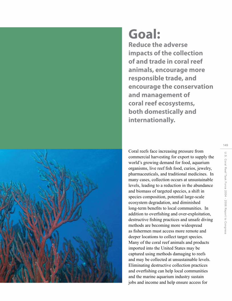
CHAPTER 12:
Reducing Impacts fromInternational Trade
Goal: Reduce the adverse impacts of the collection of and trade in coral reef animals, encourage more responsible trade, and encourage the conservation and management of coral reef ecosystems, both domestically and internationally.
Coral reefs face increasing pressure from commercial harvesting for export to supply the world’s growing demand for food, aquarium organisms, live reef fish food, curios, jewelry, pharmaceuticals, and traditional medicines. In many cases, collection occurs at unsustainable levels, leading to a reduction in the abundance and biomass of targeted species, a shift in species composition, potential large-scale ecosystem degradation, and diminished long-term benefits to local communities. In addition to overfishing and over-exploitation, destructive fishing practices and unsafe diving methods are becoming more widespread as fishermen must access more remote and deeper locations to collect target species. Many of the coral reef animals and products imported into the United States may be captured using methods damaging to reefs and may be collected at unsustainable levels. Eliminating destructive collection practices and overfishing can help local communities and the marine aquarium industry sustain jobs and income and help ensure access for
U.S
. Co
ral R
ee
f Ta
sk
Fo
rce
20
04
- 20
06
Re
po
rt to C
on
gre
ss
149

150
CHAPTER 12: Reducing Impacts from International Trade
Live rock mining in Fiji
U.S. consumers to quality products without impacting the health and sustainability of coral reefs. The USCRTF has strengthened human and institutional capacity to develop and implement sustainable management plans, enforce relevant laws and regulations, develop environmentally sound collection practices and alternatives, and implement other measures to protect and conserve coral reef ecosystems.
Accomplishments by Objective
Objective 1: Assess the nature and extent of trade in coral reef species and both positive and negative impacts associated with the trade.
Trade-driven damage to coral reef ecosystems is an issue of great importance to the United States, one of the world’s largest consumers of marine ornamental products for aquaria, curios, and jewelry. The USCRTF supports projects to improve coral reef management
and environmental law enforcement to reduce illegal fishing and negative impacts associated with international trade. For example, in the Philippines, the Coastal Resources Management Program helped establish three coastal law enforcement councils in the province of Bohol. Training, which included building general capacities and basic investigative techniques, increased the confidence and effectiveness of officers from councils and other local maritime and fishery enforcement groups. The enforcement councils reported a 95 percent success rate in prosecuting cases filed in court against illegal fishing methods. The councils have also helped municipal governments standardize laws and fines related to coastal resource management and launched information campaigns in popular illegal fishing hot spots.
The international trade in coral reef animals and products not only causes physical harm to the reef, but also undermines the rule of

Humphead Wrasse
law and efforts to promote sustainable and equitable management. An assessment in the Philippines of the marine aquarium trade found 80 percent of the animals were collected by illegal, roving collectors (i.e., collectors operating outside of their own jurisdiction). Many of these roving collectors were using cyanide, a collection practice illegal in the Philippines and destructive to reefs.
Objective 2: Evaluate and implement approaches to mitigate negative impacts associated with trade.
One approach used by the USCRTF to reduce the trade in rare, ecologically important species and unsuitable species unable to survive in captivity is to work through CITES. CITES is an international agreement between governments and aims to ensure that international trade in specimens of wild animals and plants does not threaten their survival. In 2004, the United States
developed and submitted a CITES Appendix II listing proposal for the humphead wrasse (Cheilinus undulates), a vulnerable, long-lived fish targeted for the live reef food fish trade. Through unanimous vote, the Parties at the 13th Conference of Parties of CITES adopted this proposal. The United States worked with CITES Parties to adopt a minimum export size of ten-centimeters for wild-caught seahorse specimens as a voluntary interim measure for making non-detriment findings as required for export of CITES-listed species. Participants at a workshop in Mazatlan, Mexico, developed guidelines for sustainable management of seahorse fisheries, methods to improve capability of law enforcement to identify and verify CITES shipments of seahorses, and criteria for non-detrimental aquaculture operations. The United States successfully defended the retention of live rock (coral rock) used in home aquaria as part of the CITES Appendix II listing for stony corals, thereby retaining restrictions on international trade,
U.S
. Co
ral R
ee
f Ta
sk
Fo
rce
20
04
- 20
06
Re
po
rt to C
on
gre
ss
151

152
CHAPTER 12: Reducing Impacts from International Trade
and did not support consideration of these specimens as “fossil coral,” which is exempt from CITES controls.
One aspect of improving the effectiveness of CITES to reduce the trade in rare or endangered coral reef species is to increase the capacity of enforcement throughout the CITES Parties. To help improve enforcement, the United States supported and participated in capacity-building trainings and workshops including the following:
In each year covered by this report, the USFWS provided wildlife crime investigative training at the International Law Enforcement Academy in Botswana to officers from sub-Saharan African nations, including the coral reef countries of South Africa, Tanzania, and Kenya. The two-week program covered CITES and other endangered species laws, intelligence gathering, undercover
Corallium, pink coral necklaces.
operations, and preparation of cases for court.
Working with partners, the USFWS conducted a two-week criminal investigators program for 30 officers from Thai agencies charged with protecting the nation’s wildlife and marine resources and two observers from the Philippine National Bureau of Investigations. The program covered CITES and other endangered species laws, intelligence gathering, undercover operations, raid planning and execution, and preparation of cases for court.
The USFWS and DOJ participated in a three-day Wildlife Enforcement Network Workshop conducted by the Association of Southeast Asian Nations in Thailand. The U.S. representatives provided overview presentations on legislative, investigative, and prosecutorial

strategies for combating trafficking in protected species. USAID supported the establishment of the Wildlife Enforcement Network in Southeast Asia, in a coordinated effort to address the illegal trade in wildlife.
Intercepted Illegal Trade of Coral Reef Species
The USFWS has a 30-year history of implementing the CITES, the only international treaty designed specifically to control, monitor, and regulate international trade in certain animal and plant species now or potentially threatened with extinction. CITES is one of the most effective forces in the world today for conserving threatened fauna and flora; it is effective both in halting the trade in species and in fostering sustainable use of other vulnerable species. A number of coral species and species associated with coral reefs, such as the humphead wrasse are among the approximately 35,000 species protected by CITES, of which roughly 224 are species associated with coral reef ecosystems.
The USFWS monitors wildlife trade at 38 U.S. ports, five of which were first staffed by inspectors since 2004. Following are highlighted cases of interdictions of coral-related species:
In Charleston, South Carolina, inspectors seized 4,791 coral pieces and shells imported without the required declaration or CITES permits. Seven undeclared giant clam shells (each weighing 50+ pounds) hidden in a commercial shipment of antiques were also discovered. The seized coral pieces and shells are on loan to the Georgia Aquarium in Atlanta for use in an education display about safeguards for coral reefs and reef species.
In Atlanta, Georgia, inspectors report an increased number of violations involving the importation of CITES live and dead corals as well as other reef species. One seizure consisted of 163 pieces of coral and queen conch shells; another involved 25 pounds of whole, freshly killed sea turtle meat from El Salvador.
In Miami, Florida, inspectors seized commercial shipments of queen conch meat from Haiti, Turks and Caicos and intercepted multiple shipments of black coral and queen conch. They also foiled a smuggling attempt of sea horses in which an individual arrived from Peru with 320 specimens hidden in his baggage.
In Los Angeles, California, a cooperative investigation documented the smuggling of live Clarion angelfish, Holocanthus clarionensis (a rare coral reef species). The defendant had concealed 160 of the rare fish in a shipment of other tropical fish; Clarion angelfish sell for as much as $2,600 each.
U.S
. Co
ral R
ee
f Ta
sk
Fo
rce
20
04
- 20
06
Re
po
rt to C
on
gre
ss
153

ty
154
CHAPTER 13: Improving Coordination and Accountability
CHAPTER 13:
Improving Coordination and Accountabili

CHAPTER 13:
Improving Coordinationand Accountabili
ty
Goal: Increase communication, collaboration, and accountability within and among Task Force members.
Effective communication and collaboration are essential for the successful implementation of coral reef conservation efforts recomended in the National Action Strategy (2002), the National Action Plan (2000), and the specific projects and needs identified in each jurisdictions Local Action Strategies. Given the frequency with which coral reef ecosystems span a broad range of geographical and organizational jurisdictions, coordination across federal, state, and local governments and with non-governmental organizations is essential for designing and implementing effective management and conservation solutions. Executive Order 13089 on Coral Reef Protection recognizes the value of coral reef ecosystems and directs the U.S. Government agencies to work independently “to ensure actions they authorize, fund, or carry out will not degrade the conditions of such ecosystems.” Federal agencies are also directed to work together through the USCRTF to address, in a collective and strategic way, the threats to
U.S
. Co
ral R
ee
f Ta
sk
Fo
rce
20
04
- 20
06
Re
po
rt to C
on
gre
ss
155
CHAPTER 13: Improving Coordination and Accountability
coral reef ecosystems and to lead, coordinate, and strengthen U.S. Government actions to conserve coral reef ecosystems, both domestic and international. Co-chaired by DOC through NOAA and DOI, the USCRTF membership includes senior leaders from 12 federal agencies, seven states, and territories and the three Freely Associated States. To implement the policies and requirements of the Executive Order, the USCRTF has provided a forum for coordinated planning and action among federal agencies, state and territorial governments, and non-governmental partners. To fulfill its mission, the USCRTF developed national strategies, targeted initiatives, and new partnerships to strengthen stewardship of the coral reef ecosystems in the United States and around the world. The USCRTF uses a variety of mechanisms to promote collaborative planning, priority-setting,
156 coordination, and partnership building.
In the nine years since its inception, the USCRTF has taken a variety of actions to reduce key threats and adverse impacts to coral reef ecosystems. It has led the development of national and local strategies to conserve coral reefs, increased collaboration among federal agencies and jurisdictions in coral reef regions, and helped its members launch new actions to protect and manage reef ecosystems. The USCRTF meets twice a year to discuss key issues, propose new actions, present progress reports, and update the coral community on past accomplishments and future plans. In addition, the USCRTF’s Steering Committee—made up of representatives from each of the participating federal agencies, states, and territories—meets each month to discuss progress of current USCRTF initiatives and plan new areas for collaboration.
USCRTF Members
Co-Chairs U.S. Department of Commerce, NOAA U.S. Department of the Interior
Federal Agencies
U.S. Agency for International Development U.S. Department of Agriculture U.S. Department of Defense U.S. Department of Homeland Security U.S. Department of Justice U.S. Department of State U.S. Department of Transportation U.S. Environmental Protection Agency National Aeronautics and Space Administration National Science Foundation
States and Territories
Commonwealth of the Northern Mariana Islands Commonwealth of Puerto Rico State of Florida State of Hawai`i Territory of American Samoa Territory of Guam Territory of the US Virgin Islands
Freely Associated States
Federated States of Micronesia Republic of the Marshall Islands Republic of Palau

U.S. Coral Reef Task Force Members and staff.
Accomplishments by Objective
Objective 1: Coordinate the submission of coral reef protection implementation plans, annual reports, and other documents by USCRTF members.
Objective 3: Coordinate the annual submission of agency reports of programs, policies, and actions.
The USCRTF completed the report to Congress: Implementation of the National Coral Reef Action Strategy: Report on U.S. Coral Reef Agency Activities from 2002 to 2003, which highlights the activities of the USCRTF under each of the 13 national conservation goals defined by the 2002 National Action Strategy.
The USCG re-published Ocean Steward, the USCG Marine Protected Species Strategic Plan to achieve its overall goal of protecting natural resources and its specific performance goal
of enforcing federal regulations resulting in all living marine resources achieving healthy, sustainable populations. Ocean Steward provides a well-defined strategy for the USCG role in helping the Nation recover and maintain healthy populations of marine protected species. Ocean Steward complements the fisheries enforcement strategic plan, Ocean Guardian. Together, Ocean Steward and Ocean Guardian provide a roadmap for the Coast Guard’s efforts to ensure the Nation’s waterways and their ecosystems remain productive by protecting all the Nation’s living marine resources.
Several of the USCRTF Working Groups developed reports highlighting recent accomplishments, challenges, outstanding needs, and plans. The Water Quality Working Group presented its report to the USCRTF in 2006. Many of the highlights from the report are included in Chapter Eight of this report. The Pacific Region Interagency Mitigation Working Group, which includes
U.S
. Co
ral R
ee
f Ta
sk
Fo
rce
20
04
- 20
06
Re
po
rt to C
on
gre
ss
157

CHAPTER 13: Improving Coordination and Accountability
USFWS, USACE, NOAA, EPA, USCG, Hawai‘i, and Guam, developed a Management Plan outlining the authorities, roles, and responsibilities of each agency (more information on this working group is included on page 95).
In compliance with EO 13089, the USCG developed a Coral Reef Protection Implementation Plan (COMDTINST 16000.2) to identify measures the USCG could take to further coral reef protection. The plan includes providing coral-focused enforcement as needed and when resources allow, developing Statements of Purpose to minimize adverse impacts on reefs, working with relevant stakeholders to review adequacy of aids to navigation, and ensuring coral reefs are included in area contingency plans. DoD developed a similar Coral Reef Protection
158 Implementation Plan, which identifies DoD authorities, policies, and programs utilized to protect coral reef ecosystems and to minimize the impact to coral reefs of DoD activities. DoD also provides funding for coral reef stewardship.
The USCRTF as a body and its individual members provide updates on accomplishments, activities, and opportunities for collaboration at the USCRTF biannual meetings. These updates are made available following the meetings via the USCRTF website: http:// www.coralreef.gov.
Objective 2: Coordinate planning and development of cross-cutting initiatives; promote exchange of information on activities, needs, and concerns; and facilitate resolution of issues related to coral reef conservation.
U.S. Coral Reef Task Force Decision Items
The USCRTF has taken a number of formal actions in the form of resolutions or decision
items to be more effective and specific in meeting the 12 substantive goals outlined in the National Action Plan. Since its establishment in 1998, the USCRTF has adopted a total of 71 resolutions (i.e., major decisions), including 133 decision items. The resolutions and decision items span a range of topics and activities, from general statements of USCRTF support to specific calls for action and deliverables. Several resolutions are highlighted throughout this document as they relate to one of the 12 specific goals of the USCRTF. Examples include the 2005 Caribbean Coral Bleaching Event response, coral spawning, and others.
Of the 133 USCRTF decision items, 55 (41 percent) have been completed, 71 (53 percent) are being worked on, and seven (five percent) are inactive or deferred. Continued (and in some cases additional) effort is needed to complete “active” items. Original text for each of these decision items and updates, where applicable, are available on the USCRTF website. The following are some examples of actions the USCRTF has taken during 2004 to 2006.
U.S. Coral Reef Task Force Working Groups
The USCRTF conducts much of its work through issue-specific working groups. These working groups are established to develop, coordinate, and oversee implementation of the National Action Plan and other duties of the USCRTF. Working groups consist of member staff with expertise in the designated area and may collect information from a variety of government and non-government sources and engage a broad variety of stakeholders as they develop coral reef conservation strategies. A sampling of the active USCRTF Working Groups include:

Mapping and Information
International Trade
Water Quality
Education and Outreach
International Year of the Reef
Response Tools for Coral Reef Injury Events
Cooperative Conservation
Mitigation
Coral Spawning
Enforcement
Aquaculture (ad-hoc)
Climate Change
Enforcement Working Group Training Workshops
Strong enforcement is an essential component of any effective coral reef conservation program. Federal members of the USCRTF have worked cooperatively to develop and conduct training workshops to help build enforcement capacity and increase effectiveness in many jurisdictions. These training workshops broadly addressed multiple issues impacting coral reef ecosystems, including land-based pollution, illegal fishing, coastal development, pollution discharges from vessels, and other illegal activities. In conducting these workshops, DOJ and NOAA were joined by other USCRTF partners including the EPA, USFWS, USCG, and the USACE. The first of these three-day training programs was conducted in Guam and CNMI in November 2004. Thereafter the agencies presented trainings workshops in American Samoa in March 2005, and St. Croix and St. Thomas, USVI, in May 2005. The training was also given in Puerto Rico in February 2007. The workshops helped increase local understanding of the federal legal tools available to address environmental problems, promoted more effective cooperation
and coordination among territorial and federal agencies in pursuing appropriate enforcement action, and provided guidance and instruction on basic techniques and methods for conducting inspections and preparing enforcement cases.
Federal Agency Grant and Opportunities Workshops
During the March 2005 USCRTF meeting in Washington, D.C., USCRTF members supported a proposal for USCRTF federal agencies with grants and funding opportunities addressing coral reef ecosystem conservation to assist stakeholders in U.S. island states and territories to understand, apply, and compete for federal grants aimed at coral reef ecosystem conservation. DOI-USFWS and NOAA, along with many USCRTF members helped organize and conduct these informational and interactive workshops on federal grant opportunities related to coral reef ecosystems. These workshops were held in Puerto Rico and the USVI in 2005, where participants numbered 40 in Puerto Rico and 31 in the USVI, with 12 federal representatives presenting 53 grant programs and funding opportunities. Similar workshops were held in Hawai‘i, CNMI, and Guam in 2006, with the final workshop in American Samoa summer 2007. In each location, the workshop content and format was tailored to meet the specific management and conservation needs identified by each jurisdiction.
The workshops presented a unique opportunity for attendees to learn about a variety of funding, partnership, and technical assistance opportunities. And in turn, these workshops gave the federal partners an opportunity to identify ways to improve coordination among federal agency coral reef grant programs to help deliver more support for on-the-ground coral reef conservation.
U.S
. Co
ral R
ee
f Ta
sk
Fo
rce
20
04
- 20
06
Re
po
rt to C
on
gre
ss
159

CHAPTER 13: Improving Coordination and Accountability
The workshops also provided a constructive forum for local agency, NGO, and academic representatives to network and discuss potential partnerships and collaborations within and between the various organizations, and helped the attendees understand the various ways to seek funding through partnerships and potential alternatives to combine funding opportunities through cross-agency grant requests.
Building Local Capacity through Internship and Fellowship Opportunities
Tauese P.F. Sunia Memorial Coral Reef Conservation Summer Scholarship Award
In 2004, the USCRTF developed the Tauese P.F. Sunia Memorial Coral Reef Conservation Summer Scholarship Award. This award is
160 in recognition of the late American Samoan Governor’s outstanding leadership in and contribution to the conservation of coral reef ecosystems, as he is remembered for being an eloquent and impassioned advocate for coral reef protection and management at the local level, not only in American Samoa but throughout the Pacific Region and the United States. This award is intended to continue the Governor’s legacy by providing an outstanding college or university student the opportunity to develop professional coral reef management skills to be applied in his or her local jurisdiction. This internship is available for students from Guam; the CNMI; Hawai‘i; American Samoa; Puerto Rico; the USVI; or the Freely Associated States of Palau, the Marshall Islands, and the FSM. The 2007 interns, from Guam and the USVI, were jointly hosted by DOI – Office of Insular Affairs (OIA) and USFWS and NOAA.
The first Sunia Coral Scholars from USVI and Guam were hosted by NOAA. The Summer 2005 Coral Scholars, hosted by
DOI’s Office of Insular Affairs and USFWS, were from Hawai‘i and Puerto Rico. In 2006, NOAA hosted Coral Scholars from American Samoa and Hawai‘i. This internship provides students a unique opportunity to gain valuable, professional experience in coral reef conservation policy and management while also contributing to the overall efforts of the hosting agency and the USCRTF.
U.S. Coral Reef Task Force Coral Management Fellow Program
The Coral Reef Management Fellowship was established to respond to a need for additional coral reef management capacity and capability in the U.S. Flag Pacific and Caribbean Islands. The fellowship program has provided highly qualified individuals with professional, on-the-job education and training on island-level coral reef management and has provided policy and management support to the U.S. Flag Islands for coral reef issues. Fellows are placed every other year for two years in each of the U.S. state and territory insular areas to work on specific projects and activities determined by each island’s lead coral reef management agency. The first round of fellows was placed in January 2004, and the current round started their fellowships in January 2006.
All Islands Coral Reef Initiative Coordinating Committee
The U.S. All Islands Coral Reef Initiative Coordinating Committee (All Islands Committee) was established in 1999 by the USCRTF governor-appointed Points of Contact from the U.S. island jurisdictions of American Samoa, CNMI, Guam, Hawai‘i, Puerto Rico, and the USVI. The All Islands Coral Reef Secretariat was established in 2002, to provide policy support and coordination for the Committee’s full participation as members of the USCRTF. As a state member of the

Coral Management Fellows USCRTF Sunia Scholars with USCRTF Co-Chairs
161
USCRTF, Florida was invited to participate in At each biannual meeting, the USCRTF U
the All Islands Committee meetings in 2005. provides an opportunity for the public to
.S.
submit written and oral comments. Since
Co
ra
NOAA and DOI’s Office of Insular Affairs 2005, the USCRTF has been collecting these
l Re
provide functional and financial support for comments, posting them online at: http://www.
ef T
a
the All Islands Committee and Secretariat. coralreef.gov, and working with individual
sk
F
A new Secretariat was hired in 2005 to help members to provide responses as needed.
orc
coordinate the activities of the All Islands
e 2
0
Committee, to better link the needs of the U.S. Objective 5: Work with the Council on
04
-
states and territories with priority activities Environmental Quality, federal agencies, and
20
0
of the USCRTF, and to serve as a vital link other interested entities to develop guidance
6 R
e
between the federal USCRTF co-chairs and the and tools assessing alternatives and potential
po
rt
state, territory, and commonwealth members impacts of actions through the National of the USCRTF. Through the leadership of the Environmental Policy Act (NEPA) and Executive
to C
on
g
Secretariat, in 2007 the All Islands Committee Order 12114.
res
s
will release a five-year strategic action plan and charter, will launch an All Islands The USFWS began preparing background Committee website, and help develop the next materials and draft NEPA documentation for phase of LAS in each jurisdiction. several proposed Comprehensive Conservation
Plans for National Wildlife Refuges protecting Objective 4: Coordinate the process for the coral reefs, including those in Howland, Baker, public inquiry about and agency response to Jarvis, Rose, Kingman, Palmyra, and Guam. issues or concerns relating to federal agency actions and coral reef protection.

162
CHAPTER 13: Improving Coordination and Accountability
Overview of LAS threat areas addressed by each jurisdiction.
American
Samoa
CNMI Guam Hawaii Florida USVI Puerto
Rico
Land-based Pollution ♦ ♦ ♦ ♦ ♦ ♦ ♦ Overfishing ♦ ♦ ♦ ♦ ♦ª ♦ ♦ Recreational Overuse ♦ ♦ ♦ * ♦ ♦ Lack of Awareness * ♦ ♦ ♦ ♦ ♦ ♦ Disease, Bleaching, and Climate ♦ ◊ ♦ Other ♦ ♦ ♦
♦ LAS complete and being implemented ◊ LAS still under development * “Other” threats include Population Pressure - American Samoa; Aquatic Invasive Species – Hawaii; Maritime Industry and Coastal Construction – Florida; and cross-cutting education and outreach and capacity needs in American Samoa and coral reef resources management needs in CNMI. ª Florida’s Overfishing LAS includes fishing, diving and other uses.
Local Action Strategies – Linking National Goals to Local Action
In 2002, the USCRTF launched development of three-year Local Action Strategies (LAS) by each of the seven member U.S. states, territories, and commonwealths to help link local action to the national goals and objectives in the National Action Plan. These LASs are locally driven roadmaps for collaborative and cooperative action among federal, state, territory, and non-governmental partners to reduce key threats to local coral reef resources. Applying a collaborative decision-making process based on local needs, concerns, and capacities, each jurisdiction developed strategies containing a variety of projects designed for implementation over a three-year period (2005–2007). The LAS framework has allowed the USCRTF to more clearly identify and address local needs, connect local priorities to national goals, and coordinate federal agency actions to better support each local jurisdiction’s management of reef resources.
The LAS identified six primary threats to coral reef ecosystems: • Land-basedsourcesofpollution,
• Overfishing,
• Recreationaloveruseandmisuse,
• Lackofpublicawareness,

• Climatechangeandcoralbleaching,and
• Disease.
In addition, several jurisdictions developed LASs to address three other significant threats:
• Populationpressure,
• Aquaticinvasivespecies,and
• Maritimeindustryandcoastalconstruction.
A Status Report on Implementation of the Local Action Strategies covering the fiscal years 2002 to 2006
identified approximately 760 total projects across the seven jurisdictions of which roughly 65 percent are being
implemented (493 total projects) and some of which have already been completed.
The total estimated cost to implement all LAS projects is $61.8 million (total project costs for all seven
jurisdictions). Approximately $25 million from numerous government and non-governmental sources has been
applied to project implementation to date (2003-2006). The $25 million in project implementation funds come
from numerous sources including federal agencies (NOAA, DOI, EPA, USDA/NRCS, DOJ, U.S. Forest Service, and
USGS), state/territory and county agencies, universities and research institutes, non-governmental organizations,
and private corporations and foundations. Local agencies have leveraged hundreds of thousands of dollars
in volunteer services and in-kind resources, including time and skills, which have not been quantified in the
U.S
. Co
ral R
ee
f Ta
sk
Fo
rce
20
04
- 20
06
Re
po
rt to C
on
gre
ss
163

164
CHAPTER 13: Improving Coordination and Accountability
total amounts of support received. The LAS focus areas having the greatest number of tasks are land-based
sources of pollution, with the largest remaining funding need identified for watershed restoration and capital
improvement projects and long-term water quality monitoring projects. A total of $36.8 million in funding is still
needed to complete the identified LAS projects.
The LAS process has resulted in a number of important accomplishments during the five years since this
initiative was launched in 2002. Overall, the most notable progress made to date has been in the areas of
developing new or expanded partnerships among numerous governmental, nongovernmental, and academic
institutions, and in the area of increasing outreach and public awareness of coral reef issues. Specific LAS
activities will be highlighted in more depth throughout the document as they relate to the 13 goals of the
USCRTF. A few highlights follow:
In the area of new or expanded partnerships, for instance:
• AninteragencywatershedgrouphasbeenworkingeffectivelyinCNMIforthepastfewyearson
watershed protection,
• ApartnershipwasestablishedbetweentheFloridaDepartmentofEnvironmentalProtection,
the Florida Fish and Wildlife Conservation Commission, and the National Coral Reef Institute to
comprehensively map and initiate long-term monitoring of southeast Florida’s reefs, and
• AnimportantpartnershipwasestablishedinPuertoRicobetweentheDepartmentofNaturaland
Environmental Resources (DNER) Coral Reef Initiative and the Puerto Rico Tourism Company to produce
educational pamphlets for tourists.
In the area of increasing outreach and public awareness:
• A“GuardiansoftheReef”initiativewaslaunchedinGuamtoengagehighschooljuniorsandseniorsin
delivering coral reef education programs to elementary classes, and
• TheSoutheastFloridaCoralReefInitiativesponsoredaseriesofworkshopsforthelocalmarinetourism
industry to encourage sustainable marine tourism.
Progress has also been made in building local capacity to address management issues and improving our understanding of coral reef processes:
• Commercial and recreational fishers workshop and enforcement training for coral reef protection were
held in Puerto Rico, and
• CNMIsuccessfullyhostedasummerinternshipprogramtointroducecollegestudentstonatural
resource careers and provide hands-on experience in coral reef resource management.

To increase understanding of coral reef ecosystems:
• The Southeast Florida Coral Reef Initiative (SEFCRI), in partnership with the University of Central
Florida, College of Charleston, Broward County Environmental Protection Department, and Haereticus
Laboratories, completed the first phase of a biomarker study aimed at linking land-based sources of
pollution to coral reef degradation and initiated the second phase of this study,
• TheaquaticinvasivespeciesteaminHawai‘icompletedaseriesofsurveysandisdesigningcontrol
techniques to better understand and address detrimental impacts of invasive species on Hawaii’s reefs.
Moreover, the LAS effort has led to significant advancement and improvement in coral reef management in all jurisdictions:
• In Guam, Eco-Permit legislation was enacted to manage activities in Guam’s Marine Preserves, and
a Conservation Officer Enforcement program ensures greater protection for natural resources in the
Marine Preserves, and
• AnewframeworkformarinemanagedareasisunderdevelopmentinHawai‘i.
The LAS framework has allowed the USCRTF to more clearly identify and address local needs, connect local priorities to national goals, and coordinate federal agency actions to better support each local jurisdiction’s management of reef resources.
U.S
. Co
ral R
ee
f Ta
sk
Fo
rce
20
04
- 20
06
Re
po
rt to C
on
gre
ss
165

166
Appendix A
Appendix A List of Acronyms
ANS AS ASSWCD ATRIS AVIRIS AWT BRT CAP CDHC CEAP CFMP CITES CNMI CO2 CoRIS CRCA CRAG CREMP CRES DMWR DNER DoD DOI DOJ DOS EAR ECA EEZ ENC EO EPA EQIP ER ESA
Aquatic Nuisance Species American Samoa American Samoa Soil and Water Conservation District Along-Track Reef Imaging System Airborne Visible Infrared Imaging Spectrometer Advanced Wastewater Treatment Biological Review Team Community Action Plan Coral Disease and Health Consortium Conservation Effects Assessment Project Community Fisheries Management Program Convention on International Trade of Endangered Species of Wild Fauna and Flora Commonwealth of the Northern Mariana Islands Carbon dioxide Coral Reef Information System Coral Reef Conservation Act Coral Reef Advisory Group (American Samoa) Coral Reef Evaluation and Monitoring Program Coral Reef Ecosystems Studies Department of Marine and Wildlife Resources (American Samoa) Department of Natural and Environmental Resources U.S. Department of Defense U.S. Department of the Interior U.S. Department of Justice U.S. Department of State Electronic Acoustic Recorders Enewatak Conservation Area (Republic of the Marshall Islands) Exclusive Economic Zone Electronic Navigational Chart Executive Order U.S. Environmental Protection Agency Environmental Quality Incentives Program Emergency Restoration Endangered Species Act

FAS
FDEP FGBNMS FISH FKNMS FRRP FSM FWC GAFC GBR GI GIS GPS HEA HGM HMT IOC ICRI INRMP IOTWS LAS LCC LSI LTER MA MACNA MASNA MCBH MBRS MHI MICCI MIO MMS
Freely Associated States (Republic of Palau, Federated States of Micronesia, Republic of the Marshall Islands) Florida Department of Environmental Protection Flower Garden Banks National Marine Sanctuary Fisheries Improved for Sustainable Harvest Florida Keys National Marine Sanctuary Florida Reef Resilience Program Federated States of Micronesia Florida Fish & Wildlife Conservation Commission Great Annual Fish Count Great Barrier Reef General Investigation Geographic Information System Global Positioning System Habitat Equivalency Analysis Hydrogeomorphic Hybrid Mapping Tool Intergovernmental Oceanographic Commission International Coral Reef Initiative Integrated Natural Resource Management Plan Indian Ocean Tsunami Warning System Local Action Strategy Large capacity cesspools Lee Stocking Island Long-Term Ecological Research Marianas Archipelago Marine Aquarium Conference of North America Marine Aquarium Society of North America Marine Corps Base Hawai‘i Mesoamerican Barrier Reef System Main Hawaiian Islands Maritime Industry and Coastal Construction Impacts Marine Information Object Minerals Management Service
U.S
. Co
ral R
ee
f Ta
sk
Fo
rce
20
04
- 20
06
Re
po
rt to C
on
gre
ss
167

Appendix A
MODIS MPA NASA NC NCRI NDZ NEPA NGO NHP NOAA NP NPS NRCS NRDA NSF NSTA
168 NWHI OIA PARC PIANC PIMPAC PRASA PRDA PRDNER PRIA PRIWG PRTC RAMP RMI RNA ROV RSMAS SeaWiFS SEFCRI SEFSC SEW SFCN SIMOR SocMon
Moderate Resolution Imaging Spectroradiometer Marine Protected Area National Aeronautics and Space Administration New Caledonia National Coral Reef Institute No-discharge Zone National Environmental Policy Act Non-governmental Organization National Historic Park National Oceanic and Atmospheric Administration National Park National Park Service Natural Resources Conservation Service Natural Resource Damage Assessment National Science Foundation National Science Teachers Association Northwestern Hawaiian Islands Office of Insular Affairs Palmyra Atoll Research Consortium Permanent International Association of the Navigation Congress Pacific Islands Marine Protected Area Community Puerto Rico Aqueduct and Sewer Authority Puerto Rico Department of Agriculture Puerto Rico Department of Natural and Environmental Resources Pacific Remote Islands Areas Pacific Region Interagency Working Group Puerto Rico Tourism Company Reef Assessment and Monitoring Program Republic of the Marshall Islands Research Natural Area Remotely Operated Vehicle Rosenstiel School of Marine and Atmospheric Science (University of Miami) Sea-viewing Wide Field-of-View Sensor (NASA) Southeast Florida Coral Reef Initiative Southeast Fisheries Science Center Special Emphasis Watershed South Florida/Caribbean Inventory and Monitoring Network Sub-committee for Integrated Management of Ocean Resources Global Socioeconomic Monitoring Initiative

SUCCESS TER UNESCO USACE USAID USCG USCRTF USDA USGS USFWS USVI UV VINE WWF
Sustainable Coastal Communities and Ecosystems Tortugas Ecological Reserve United Nations Educational, Scientific and Cultural Organization U.S. Army Corps of Engineers U.S. Agency for International Development U.S. Coast Guard U.S Coral Reef Task Force U.S. Department of Agriculture U.S. Geological Survey U.S. Fish and Wildlife Service U.S. Virgin Islands Ultraviolet Virgin Islands Network of Environmental Educators World Wildlife Fund
U.S
. Co
ral R
ee
f Ta
sk
Fo
rce
20
04
- 20
06
Re
po
rt to C
on
gre
ss
169
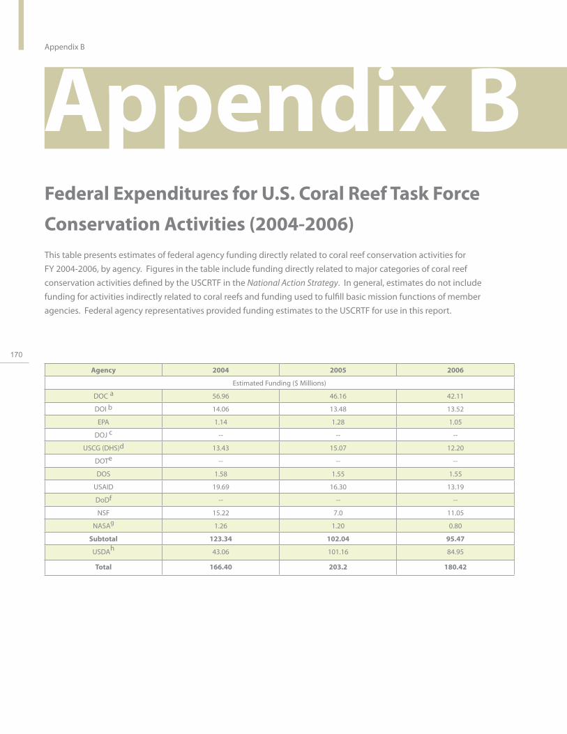
170
Appendix B
Appendix B Federal Expenditures for U.S. Coral Reef Task Force
Conservation Activities (2004-2006) This table presents estimates of federal agency funding directly related to coral reef conservation activities for FY 2004-2006, by agency. Figures in the table include funding directly related to major categories of coral reef conservation activities defined by the USCRTF in the National Action Strategy. In general, estimates do not include funding for activities indirectly related to coral reefs and funding used to fulfill basic mission functions of member agencies. Federal agency representatives provided funding estimates to the USCRTF for use in this report.
Agency 2004 2005 2006
Estimated Funding ($ Millions)
DOC a 56.96 46.16 42.11
DOI b 14.06 13.48 13.52
EPA 1.14 1.28 1.05
DOJ c - - -
USCG (DHS)d 13.43 15.07 12.20
DOTe - - -
DOS 1.58 1.55 1.55
USAID 19.69 16.30 13.19
DoDf - - -
NSF 15.22 7.0 11.05
NASAg 1.26 1.20 0.80
Subtotal 123.34 102.04 95.47
USDAh 43.06 101.16 84.95
Total 166.40 203.2 180.42

a DOC budget figures reflect funding for NOAA’s Coral Reef Conservation Program and other NOAA programs directly
related to coral reef conservation activities.
b For DOI, these figures may represent multi-purpose activities or programs directly or indirectly benefiting coral reef
conservation, and as a result the amounts shown may be larger than the amounts expended solely for the benefit of coral
reefs. It is currently not practical to break the expenditures down further to show only the coral reef-related portion.
c The DOJ engages in actions in this area as part of the normal course of its work, but does not specifically allocate
funds for coral reef habitats.
d The USCG does not have any explicit line items in its budget for coral reef activities. Figures in this table represent
funds expended by various USCG components in support of coral reef protection. Normally, the USCG support
involves law enforcement efforts and response to marine pollution incidents.
e U.S. Department of Transportation (DOT) Federal Highway Funding does not directly fund coral reef conservation
activities; however, specific road projects funded through this program are required to have water quality protection
measures in areas where it is a possible threat.
f The DoD does not have explicit Congressional authorization line item funding in its budget for coral reefs activities.
However, as part of mission related activities, DoD funds projects and programs to conserve and protect coral reefs in
proximity to DoD installations and activities.
g The National Aeronautics and Space Administration (NASA) funds research projects which are selected based on a peer-
reviewed, competitive search process. The scientific community competes for research funding through NASA Research
Announcements. There is no budget line specific to coral reef research within the agency’s annual budget, but NASA
Research Announcements generally include opportunities to fund strategic research on various coral reef topics.
h USDA programs and activities are not authorized for the sole purpose of providing direct beneficial impacts to coral
reef ecosystems. The budget numbers represent spending for specific conservation programs that have impacts on
water quality in the seven coral reef jurisdictions. These programs provide benefits to aquatic ecosystems through
nonpoint source, nutrient, and sediment reduction from land-based sources. Activities take place in watersheds that
outlet into estuaries linked to coral reef ecosystems or into waters where coral reefs are directly located. The FY 2005
figure includes the Emergency Watershed Program (EWP) funding to address hurricane damage.
U.S
. Co
ral R
ee
f Ta
sk
Fo
rce
20
04
- 20
06
Re
po
rt to C
on
gre
ss
171

172
Appendix B
Federal Agency Funding Directly Related to Coral Reef Conservation by Goal Area (2004-2006) This table presents estimates of federal agency funding directly related to coral reef conservation activities for FY 2004-2006. The data is organized by the major goal or coral reef conservation activity areas defined by the USCRTF in the National Action Strategy. Agency funding estimates are shown under each goal or activity area. In general, estimates do not include funding for activities indirectly related to coral reefs and funding used to fulfill basic mission functions of member agencies. Funding estimates were provided by federal agency representatives to the USCRTF for use in this report. As all agencies do not track expenditures by the following 13 categories, they are not represented in this table and, therefore, total expenditures are much lower than shown in the previous table.
GOAL ESTIMATED FUNDING ($ MILLIONS)
2004 2005 2006
1. Map All U.S. Coral Reefs
DOC a 1.88 2.14 2.16
DOI b 0.53 0.27 0.27
NASA d 0.10 0.10 0.10
Subtotal 2.51 2.51 2.53
2. Assess and Monitor Reef
Health
DOC a 7.81 6.94 8.17
DOI b 2.77 3.34 3.46
EPA 0.82 0.75 0.77
NASA d 0.15 0.10 0.10
Subtotal 11.55 11.13 12.5
3. Conduct Strategic Research
DOC a 15.26 9.77 7.16
DOI b 4.97 3.90 3.96
EPA 0.15 0.50 0.22
NASA d 0.81 0.80 0.40
NSF 13.76 6.48 10.32
Subtotal 34.95 21.44 22.05
4. Understand Social and
Economic Factors
DOC a 1.27 0.21 0.32
DOI b 0.04 0.01 0.01
Subtotal 1.31 0.22 0.33
5. Improve Use of Marine
Protected Areas
DOC a 12.59 4.53 4.38
DOI b 2.75 2.99 2.70
Subtotal 15.34 7.52 7.08

GOAL ESTIMATED FUNDING ($ MILLIONS)
2004 2005 2006
6. Reduce Impacts of Fishing and
Other Extractive Uses
DOC a 5.38 2.27 2.33
DOI b 0.57 0.37 0.37
USCG c 6.53 6.69 6.08
Subtotal 12.48 9.78 8.78
7. Reduce Impacts of Coastal Uses
DOC a 1.04 1.63 1.27
DOI b 0.32 0.60 0.52
EPA 0.20 0 0
USCG c 6.53 6.69 6.08
Subtotal 7.91 8.92 7.87
8. Reduce Pollution
DOC a 4.05 3.43 1.17
DOI b 0.34 0.19 0.28
USDA e 43.06 101.16 84.95
EPA 0.12 0 0.63
USCG c 0.35 1.67 N/A
Subtotal 47.92 106.45 67.46
9. Restore Damaged Reefs
DOC a 0.94 1.11 1.07
DOI b 0.18 0.27 0.41
Subtotal 1.12 1.38 1.48
10. Improve Education and Outreach
DOC a 1.49 1.40 1.51
DOI b 0.45 0.30 0.29
EPA 0.03 0.03 0
USCG c 0.02 0.02 0.03
NASA d 0.20 0.20 0.20
NSF 1.46 0.52 0.73
Subtotal 3.65 2.47 2.76
11. Reduce Threats to International
Coral Reefs
DOC a 0.88 0.65 0.68
DOI b 0.96 1.11 1.11
DOS 1.58 1.55 1.55
Subtotal 3.42 3.31 3.34
U.S
. Co
ral R
ee
f Ta
sk
Fo
rce
20
04
- 20
06
Re
po
rt to C
on
gre
ss
173
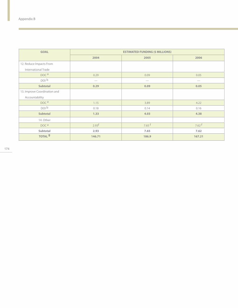
174
Appendix B
GOAL ESTIMATED FUNDING ($ MILLIONS)
2004 2005 2006
12. Reduce Impacts From
International Trade
DOC a 0.29 0.09 0.05
DOI b -- -- --
Subtotal 0.29 0.09 0.05
13. Improve Coordination and
Accountability
DOC a 1.15 3.89 4.22
DOI b 0.18 0.14 0.16
Subtotal 1.33 4.03 4.38
14. Other
DOC a 2.93f 7.65 f 7.62 f
Subtotal 2.93 7.65 7.62
TOTAL g 146.71 186.9 167.21

a DOC budget figures reflect funding for NOAA’s Coral Reef Conservation Program and other NOAA programs
directly related to coral reef conservation activities.
b These figures may represent multi-purpose activities or programs directly or indirectly benefiting coral reef
conservation, and as a result the amounts shown may be larger than the amounts expended solely for the
benefit of coral reefs. It is currently not practical to break the expenditures down further to show only the coral
reef-related portion.
c The USCG does not have any explicit line items in its budget for coral reef activities. Figures in this table
represent funds expended by various USCG components in support of coral reef protection. Normally, USCG
support involves law enforcement efforts and response to marine pollution incidents.
d The National Aeronautics and Space Administration (NASA) funds research projects which are selected based
on a peer-reviewed, competitive search process. The scientific community competes for research funding
through NASA Research Announcements. There is no budget line specific to coral reef research within the
agency’s annual budget, but NASA Research Announcements generally include opportunities to fund strategic
research on various coral reef topics.
e USDA programs and activities are not authorized for the sole purpose of providing direct beneficial impacts to
coral reef ecosystems. The above budget numbers represent spending for specific conservation programs that
have impacts on water quality in the seven coral reef jurisdictions. These programs provide benefits to aquatic
ecosystems through nonpoint source, nutrient, and sediment reduction from land-based sources. Activities
take place in watersheds that outlet into estuaries linked to coral reef ecosystems or into waters where coral
reefs are directly located.
f Funding includes overarching management grants and capacity building initiatives.
g Total funding does not include USAID funds, which are not distributed by Goal.
U.S
. Co
ral R
ee
f Ta
sk
Fo
rce
20
04
- 20
06
Re
po
rt to C
on
gre
ss
175

References
References Acropora Biological Review Team. 2005. Atlantic Acropora Status Review Document. Report to National Marine Fisheries
Service, Southeast Regional Office. March 3, 2005.
Aeby, G.S., and D.L. Santavy. 2006. Factors affecting susceptibility of the coral Montastraea faveolata to black-band disease.
Marine Ecology Progress Series 318:103-110.
Agardy, D.T. 2001. Scientific research opportunities at Palmyra Atoll. A Report Submitted to The Nature Conservancy.
Andrefouet S., F. E. Muller-Karger, J. A. Robinson, C. J. Kranenburg, D. Torres-Pulliza, S. A. Spraggins, and B. Murch. 2005.
Global assessment of modern coral reef extent and diversity for regional science and management applications: a view from
space. Pages 1732-1745. in Y. Suzuki, T. Nakamori, M. Hidaka, H. Kayanne, B. E. Casareto, K. Nadaoka, H. Yamano, M. Tsuchiya,
176 and K. Yamazato (eds). Proceedings of the 10th International Coral Reef Symposium. Japanese Coral Reef Society, Okinawa.
Coral Reef Conservation Act of 2000. 16 U.S.C 6401, 6403: P.L. 106-762.
Collier, C., R. Dodge, D. Gilliam, K. Gracie, L. Gregg, W. Jaap, M. Mastry, and N. Poulos. 2007. Rapid Response and Restoration
for Coral Reef Injuries in Southeast Florida: Guidelines and Recommendations. Florida Department of Environmental
Protection Report.
Establishment of the Northwest Hawaiian Island National Monument. News release. Available:
http://www.whitehouse.gov/news/releases/2006/06/print/20060615-18.html
Federal Register 1998. Presidential Documents. Executive Order 13089. 63(115). U.S. Government Printing Office,
Washington, DC.
Federal Register 2000. Presidential Documents. Executive Order 13158. 65(105). U.S. Government Printing Office,
Washington, DC.
Federal Register 2001. Presidential Documents. Executive Order 13196. 66(15). U.S. Government Printing Office,
Washington, DC.
Houk, P. 2005. Assessing the effects of non-point source pollution on American Samoa’s coral reef communities II. Technical
report submitted to the American Samoa Environmental Protection Agency, Pago Pago, American Samoa.
Houk, P., G. DiDonato, J. Iguel, R. van Woesik. 2005. Assessing the effects of non-point source pollution on American Samoa’s

Referencescoral reef communities. Environmental Monitoring and Assessment 107: 11-27.
Johnson, Darlene R., D.E. Harper, G.T Kellison, and J.A. Bohnsack. 2007. Description and Discussion of Southeast Florida
Fishery Landings, 1990-2000. NOAA Technical Memorandum NMFS-SEFSC-550.
Kenyon J.C., G.S. Aeby, R.E. Brainard,J.D. Chojnacki, M.J. Dunlap, and C.B. Wilkinson. 2006. Mass coral bleaching on high-
latitude reefs in the Hawaiian Archipelago. Proceedings of the 10th International Coral Reef Symposium, June 28 to July 2
2004, Okinawa, JAPAN: 631-643
Kenyon J.C., R.E. Brainard. 2006. Second recorded episode of mass coral bleaching in the Northwestern Hawaiian Islands.
Atoll Res. Bull. 543: 505-523
Kolinski, Stephen P. 2006. An Assessment of Corals Five Years Following Transplantation at Aua, Tutuila, American Samoa.
NOAA National Marine Fisheries Service Pacific Islands Regional Office.
Langdon C. and M.J. Atkinson. 2005. Effect of elevated pCO2 on photosynthesis and calcification of corals and interactions
with seasonal change in temperature/irradiance and nutrient enrichment. Journal of Geophysical Research 110(C09S07).
Marshall, P. and H. Schuttenberg. 2006. A Reef Manager’s Guide to Coral Bleaching. Great Barrier Reef Marine Park Authority,
Townsville, Australia. (ISBN 1-876945-40-0). Available: http://www.coris.noaa.gov/activities/reef_managers_guide/pdfs/reef_
managers_guide.pdf
Miller M.W., D.B . McClellan, J.W. Wiener, and B. Stoffle. 2007. Apparent rapid fisheries escalation at a remote Caribbean island.
Environmental Conservation 34:92-94.
Mora, C., S. Andrefouet, M. Costello, C. Kranenburg, A. Rollo, J. Veron, K. Gaston, and R. Myers. 2006. Coral reefs and the global
network of marine protected areas. Science 312 :1750-1751.
National Oceanic and Atmospheric Administration (NOAA). 2002. A National Coral Reef Action Strategy: Report to Congress.
Silver Spring, MD. Available: http://www.coralreef.noaa.gov
Puglise, K.A. and R. Kelty (eds.). 2007. NOAA Coral Reef Ecosystem Research Plan for Fiscal Years 2007 to 2011. Silver Spring,
MD: NOAA Coral Reef Conservation Program. NOAA Technical Memorandum CRCP 1.
Scopelitis, J., S. Andrefouet, and C. Largouet. 2007. Modeling coral reef habitat trajectories: evaluation of an integrated timed
U.S
. Co
ral R
ee
f Ta
sk
Fo
rce
20
04
- 20
06
Re
po
rt to C
on
gre
ss
177

References
automata and remote sensing approach. Ecological Modeling 205: 59-80.
Sheng, J., L. Wang, S. Andrefouet, C. Hu, B. Hatcher, F. Muller-Karger, B. Kjerfve, W. Heyman, and B. Yang. In press. Upper ocean
response of the Mesoamerican Barrier Reef System to Hurricane Mitch and coastal freshwater inputs: a study using SeaWiFS
ocean color data and a nested-grid ocean circulation model. Journal of Geophysical Research.
Tang, L., J. Sheng, B. Hatcher, and P. Sale. 2006. Numerical study of circulation, dispersion, and hydrodynamic connectivity of
surface waters on the Belize shelf. Journal of Geophysical Research 111(C1): C01003.
Tetra Tech EC, Inc. 2006. Southeast Florida Coral Reef Initiative Maritime Industry and Coastal Construction Impacts
Workshop. Available at: http://www.dep.state.fl.us/coastal/programs/coral/reports/MICCI/MICCI_Project3_Report.pdf
U.S. Army Corp of Engineers. 2005. Honolulu District Compensatory Mitigation and Monitoring Guidelines. Public Notice
200400448. Fort Shafter HW.
U.S. Coast Guard. 2000. USCG Marine Protected Species Strategic Plan. Washington D.C. Available: http://www.uscg.mil/
178 lantarea/aole/OceanSteward.pdf
U.S. Coast Guard. 2004. USCG Fisheries Enforcement Strategic Plan. Washington D.C.
United States Coral Reef Task Force (USCRTF). 2000. The National Action Plan to Conserve Coral Reefs. Washington, D.C.
Available: http://www.coralreef.gov/taskforce/actionplan.html
U.S. Coral Reef Task Force. In Press. A Status Report on Implementation of the Local Action Strategies. Washington D.C.
Waddell, J.E. (ed.). 2005. The State of Coral Reef Ecosystems of the United States and Pacific Freely Associated States: 2005.
NOAA Technical Memorandum NOS NCCOS 11. NOAA/NCCOS Center for Coastal Monitoring and Assessment’s Biogeography
Team. Silver Spring, MD.
Wilkinson, C. (ed.). 2002. Status of Coral Reefs of the World. Australian Institute of Marine Science, Townsville, Queensland.
Available: http://www.aims.gov.au/pages/research/coral-bleaching/scr2002/scr-00.html
Wilkinson, C. (ed.). 2004. Status of Coral Reefs in Tsunami Affected Countries: 2005. Australian Institute of Marine Science,
Townsville, Queensland. Available: http://www.aims.gov.au/pages/research/coral-bleaching/scr-tac2005/index.html)
Wilkinson, C., S. David, and J. Goldberg. (ed.). 2004. Status of Coral Reefs of the World: 2004. Australian Institute of Marine
Science, Townsville, Queensland. Available: http://www.aims.gov.au/pages/research/coral-bleaching/scr2004/index.html
William D.E., M.W. Miller, K.L. Kramer. 2006. Demographic Monitoring Protocols for Threatened Caribbean Acropora spp.

Corals. NOAA Technical Memorandum NMFS-SEFSC-543.
Woodley, C., and A. Bruckner, A. In Press. Coral Health and Disease in the Pacific: A Vision for Action. Silver Spring, MD.
NOAA Report.
Wusinich-Mendez, D., and C. Trappe (eds.). 2007. Report on the Status of Marine Protected Areas in Coral Reef Ecosystems
of the United States Volume 1: Marine Protected Areas Managed by U.S. States, Territories, and Commonwealths: 2007.
NOAA Technical Memorandum CRCP 2. NOAA Coral Reef Conservation Program. Silver Spring, MD.
Yates K. K., and R.B. Halley. 2006. CO32- concentration and pCO2 thresholds for calcification and dissolution on the Molokai
reef flat, Hawai‘i. Biogeosciences 3: 1-13.
U.S
. Co
ral R
ee
f Ta
sk
Fo
rce
20
04
- 20
06
Re
po
rt to C
on
gre
ss
179

sPhoto Credits
Photo Credit Cover Photo: Photographer: George Cathcart
Page 2: George Cathcart
p. 4 Stephen H. Smith, Navy civilian marine ecologist
p. 6 Jim Maragos, U.S. Fish & Wildlife Service
p. 7 NOAA Center for Coastal Monitoring and Assessment Biogeography Branch
180 p. 8 Carolina, Anchors Away! funded project
p. 9 Papahānaumokuākea Marine National Monument
p. 10 Heleci Ramírez
p. 13 William Smith, U.S. Fish and Wildlife Service
p. 14 & 15 George Cathcart
p. 20 & 21 George Cathcart
p. 22 & 23 NOAA Center for Coastal Monitoring and Assessment Biogeography Branch
p. 24 Liane Guild, NASA
p. 26 John Brock, USGS Florida Integrated Science Center
p. 27 NOAA Center for Coastal Monitoring and Assessment Biogeography Branch
p. 28 NOAA Center for Coastal Monitoring and Assessment Biogeography Branch
p. 30 & 31 George Cathcart
p.34 D. Paul Brown, Marine Biologist, National Park of American Samoa
p. 37 Dave Gilliam, National Coral Reef Institute
p. 39 NOAA Center for Coastal Monitoring and Assessment Biogeography Branch
p. 40 NOAA Coral Reef Conservation Program, Coral Reef Watch
p.42 Dave Gilliam, National Coral Reef Institute
p. 44 & 45 George Cathcart
p. 46 Keith Seydel
p. 49 William Smith, U.S. Fish and Wildlife Service
p. 51 Kathy Chaston, Hawaii
p. 53 Jim Hendee, NOAA
p. 54 Andy Bruckner, NOAA Fisheries
p. 57 Map created by Jennifer Moore, NOAA Fisheries, with data from ESRI
p. 58 Caroline Rogers, USGS The elkhorn is photo credit Michael Barnette, NMFS
p. 60 & 61 Jim Maragos, U.S. Fish and Wildlife Service
p. 64 Vineeta Hoon.
p. 66 Keith Pamper, Shedd Aquarium
p. 68 & 69 Jim Maragos, U.S. Fish and Wildlife Service
p. 71 left photo: Andy David right photo: National Park Service Submerged Resources Center
p. 74 National Park Service Submerged Resources Center
p. 76 Map courtesy of Papahānaumokuākea Marine National Monument
p. 78 & 79 Jim Maragos, U.S. Fish and Wildlife Service
p. 81 National Park Service Submerged Resources Center
p. 83 Andy David
p. 84 Andy Bruckner, NOAA Fisheries
p. 87 NOAA Fisheries
p. 89 Andy Bruckner, NOAA Fisheries

Photo Credit s p. 90 & 91 George Cathcart
p. 92 Florida Fish and Wildlife Conservation Commission
p. 94 Stephen H. Smith, Navy civilian marine ecologist
p. 95 Photo courtesy of Guam
p. 96 National Coral Reef Institute
p. 98 Carolina, Anchors Away! funded project
p. 99 Carolina, Anchors Away! funded project
p. 100 Dave Gilliam, National Coral Reef Institute
p. 103 George Cathcart
p. 104 & 105 George Cathcart
p. 106 Natural Resources Conservation Service –Pacific Island Area
p. 108 John Oliver
p. 111 Natural Resources Conservation Service –Pacific Island Area
p. 113 National Park Service Submerged Resources Center
p. 114 NOAA Pacific Island Fisheries Science Center
p. 117 Natural Resources Conservation Service –Pacific Island Area
p. 118 Photo courtesy of Bess Gillelan
p. 120-121 George Cathcart
p. 122 Ken Nedimyer
p. 123 Tom Moore, NOAA Fisheries
p. 125 U.S. Coast Guard
p. 126 Ken Goddard, U.S. Fish and Wildlife Service
p. 128 & 129 George Cathcart
p. 131 Cathy Chaston
p. 132 Left photo: New Hampshire Sea Grant Right photo: National Park Service Submerged Resources Center
p. 136-137 George Cathcart
p. 139 Renate Sponer
p. 140 Peter Bechtel, World Wildlife Fund
p. 141 U.S. Fish and Wildlife Service
p. 142 USAID Regional Development Mission/ Asia.
p. 145 Karen Palmigiano, Coastal Resources Center, USAID-University of Rhode Island Sustainable Coastal Communities and Ecosystems Program
p. 146 NOAA Coral Reef Conservation Program, Coral Reef Watch
p. 148 & 149 George Cathcart
p. 150 Andy Bruckner, NOAA Fisheries
p. 151 Amy Hall 181
p. 152 Andy Bruckner, NOAA Fisheries
p. 154 &155 George Cathcart
p. 157 Bill Millhouser, NOAA Ocean Service
p. 161 Left photo: Meghan Gombos, NOAA Right photo: Elizabeth Dieveney, NOAA
p. 163 Michael Barnette, NMFS
Editor : Elizabeth Dieveney, NOAA
Graphic designer: Zhe Liu
U.S
. Co
ral R
ee
f Ta
sk
Fo
rce
20
04
- 20
06
Re
po
rt to C
on
gre
ss

REPORT TO CONGRESS

REPORT ON U.S. CORAL REEF TASK FORCE AGENCY ACTIVITIES FROM 2004 TO 2006

184
Carlos M. Gutierrez Secretary of Commerce United States Department of Commerce
Conrad C. Lautenbacher, Jr. Vice Admiral, U.S. Navy (Ret.) Under Secretary of Commerce for Oceans and Atmosphere National Oceanic and Atmospheric Administration