hydrology project - data.opencity.indata.opencity.in/documents/recent/hp-project.pdf · taluk a. in...
TRANSCRIPT
HYDROLOGY PROJECT
Hydrology Project Phase-I was implemented with the assistance of World Bank and
technical consultancy assistance from Govt.of Netherlands and the project come to effective
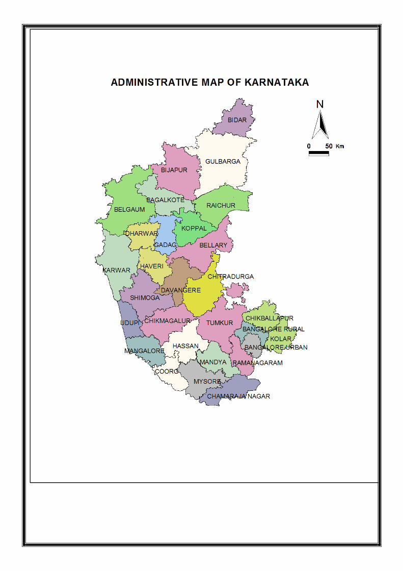
in Karnataka State on 10-12-1996. The project was implemented over a period of 7 years
and ended on 31-12-2003.
The overall project implementation objective was to develop an Integrated
Hydrological Information System providing reliable, accurate, comprehensive and timely
hydrological, meteorological and water quality data.
In order to achieve the set objectives various infrastructure like well designed
monitoring network for groundwater levels, installation of digital water level recorders
(DWLR’S) upgrading of water quality laboratories, establishment of data centers were
implemented over the period of project. The groundwater level monitoring network is
increased by constructing 500 purpose built piezometers across the State. The Department
was monitoring the groundwater levels through 1561 stations which included 1058 dug wells,
503 piezometers prior to implementation of project.
After the implementation of project the number of monitoring network increased to
1819 stations which included 785 dug wells and 1034 piezometers.
The other components implemented under Hydrology Project Phase I are:
• Installation of 500 Nos.of DWLR’S in the State.
• Establishment of two Regional Data Centre at Mysore & Bellary and 19 District Data
Centers.
• Computerization of all Historical and current data in respect of station details,
lithology water level, water quality etc.
• Upgradation of one level 2+ laboratory at Bangalore and four level 2 laboratories at
Mysore, Bellary, Belgaum and Gulbarga.
• Advanced water quality equipments like AAS, Gas chromatograph, ion meters was
procured for high end analysis
• As part of human resource development 1067 number of officials were trained in
various subjects like basic computers, Hydrometry, basic chemistry., GWDES, GEMS
etc.,
• Total project cost Rs.131.68 millions.
Hydrology Project phase-II is a follow on project of Hydrology Project Phase-I. Main
project developmental objective is to extend is promote the sustained and effective use of
Hydrological Information system, developed under phase-I, by all potential users connected
with water resources planning and management leading to improvement in productivity and
cost effectiveness of water related investments.
Main components of the project are:
I. Institutional strengthening
II. Vertical Extension
Decision Support System – (Planning):
The Consultants will be developing five generic DSS and they are
1. Surface water planning
2. Integrated reservoir operation
3. Conjunctive use of water
4. Water quality management
5. Drought management
Two on going DSS(P), studies in Karnataka are -
a. Tungabhadra b. Palar
Purpose Driven Studies (PDS):
The project taken up under purpose Driven Study is “ Urban Groundwater Hydrology
and water quality in and around Bangalore City’. The main objectives of the project are:
• Identify problematic areas with reference to each problem.

• To strengthen network stations for monitoring micro level changes in water
level and water quality.
• To study the harmful effect of commercial exploitation of groundwater on
aquifer system and suggest remedial measures.
• Indentify areas suitable for infiltration galleries in the city to recharge the
aquifer.
• To identify future water resource infrastructure needs and develop plans to
address them.
• To formulate best fit groundwater wage model for the city environment.
• Assessing the cumulative effects of management actions to minimize the
impacts of urbanization on tanks.
• Provide baseline geologic and geohydrologic information for a typical
crystalline rock aquifer setting in Bangalore.
• To create rapid awareness among different water users.
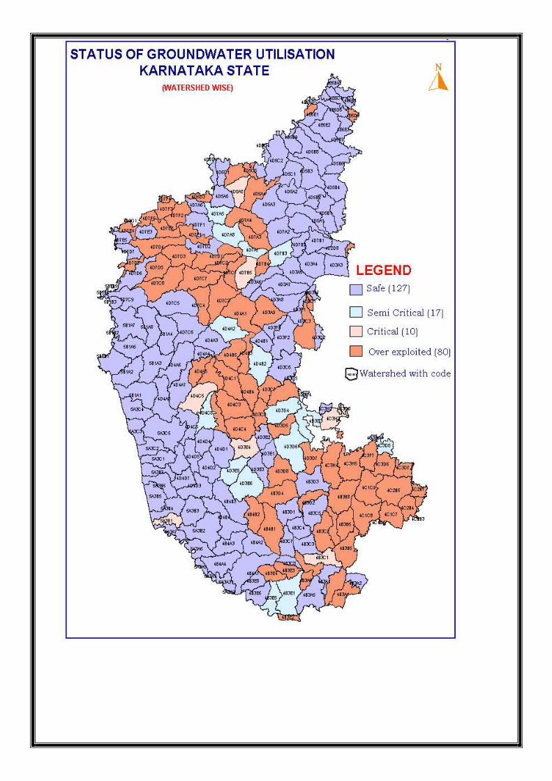
Status of Ground water utilization in Karnataka State: (as on 31-03-2004)
The Groundwater assessment for Karnataka State is done on watershed basis and the same have been reappropriated to taluks. Details are as follows:
• Net annual ground water availability – 15.29 lakh hectare meter
• Existing ground water draft for all users – 10.71 lakh hectare meter • Ground water available for further irrigation development – 6.47 lakh hectare meter
Categorisation of watersheds as per the assessment made for all the 234 watersheds :
a. Overexploited : 80 b. Critical : 10 c. Semi Critical : 17 d. Safe : 25 e. Mixed (OE-C-SC) : 102
TALUK
a. In 15 districts 43 taluks categorised as OE b. In 23 districts 69 taluks categorised as Mixed


District/taluk wise details of Over exploited, Critical and Semi-critical blocks of Groundwater in Karnataka (as on 31-03-2004)
Sl.No. District Over exploited taluks Mixed category taluks (OE, Critical and Semi-critical)
1 Bagalkot Badami, Bagalkot and Hunagund Bilgi, Jamakhandi and Mudhol 2 Bangalore(Rural
) Devanalli, Doddaballapur, Hoskote and Nelamangala
3 Bangalore(Urban)
Anekal, Bangalore North and Bangalore South
4 Belgaum Athani and Ramadurg Bailahongal, Chikkodi, Gokak, Hukkeri, Raibagh and Soundatti
5 Bellary Hadagali Bellary, H.B.Halli , Kudligi and Sirguppa
6 Bidar Bhalki and Bidar
7 Bijapur Bagewadi, Bijapur, Indi, Muddebihal and Sindagi
8 Chamarajnagar Chamarajnagar, Gudlupet and Kollegal
9 Chikkaballapur Chikkaballapur, Chintamani, Gouribidanur, Gudibande and Shidlaghatta
Bagepalli
10 Chikkamagalur Chikkamagalur, Kadur and Tarikere
11 Chitradurg Holalkere and Chitradurg Challakere, Hiriyur and Hosdurga
12 DakshinaKannada
Bantwal and Mangalore
13 Davanagere Chennagiri, Davanagere, Harapanahalli, Harihar and Jagalur
Honnali
14 Dharwad Navalgund 15 Gadag Naragund and Ron Gadag and Mundaragi 16 Gulbarga Afjalpur and Shorapur
17 Hassan Arasikere, Belur, C.R.Patna, Hassan and Holenarasipura
18 Haveri Byadagi and Ranebennur Haveri and Hirekerur
19 Kolar Bangarpet, Kolar, Malur, Mulabagilu, and Srinivasapur
20 Koppal Yelburga Gangavati, Koppal and Kushtagi
21 Mandya K.R. Pete and Malavalli Maddur, Pandavapur and SrirangaPattana
22 Mysore H.D.Kote, Hunusur, Mysore, Nanjanagud, T.Narasipur
23 Raichur Lingasugur 24 Ramanagar Channapattana, Kanakapur and
Ramanagar Magadi
25 Shimoga Shikaripur and Shimoga 26 Tumkur Koratagere, Madhugiri and Tiptur CNHalli, Gubbi, Kunigal, Pavagad,
Shira, Tumkur and Turuvekere
Total District: 15, Taluks: 43 District: 23, Taluks: 67 OE=more than 100% , Critical= 90% to 100%, Semicritical= 70% to 90% of Groundwater utilisation.
Out of 29 districts Kodagu, Udupi and Uttarakannada are in the category of Safe districts and out of 175

taluks 65 are safe. This categorisation does not apply for Command Area Villages.
The observation borewell located at Doddaguni village, Tumkur district
indicates that the water level was at 20mts depth during 2000, from 2002 onwards and upto 2007 the water level has continuously fallen and reached nearing 60 mts depth. During 2008 the water level has increased by about 12 mts.