humboldt our mission t redwoods - california state … history native people the sinkyone people...
TRANSCRIPT
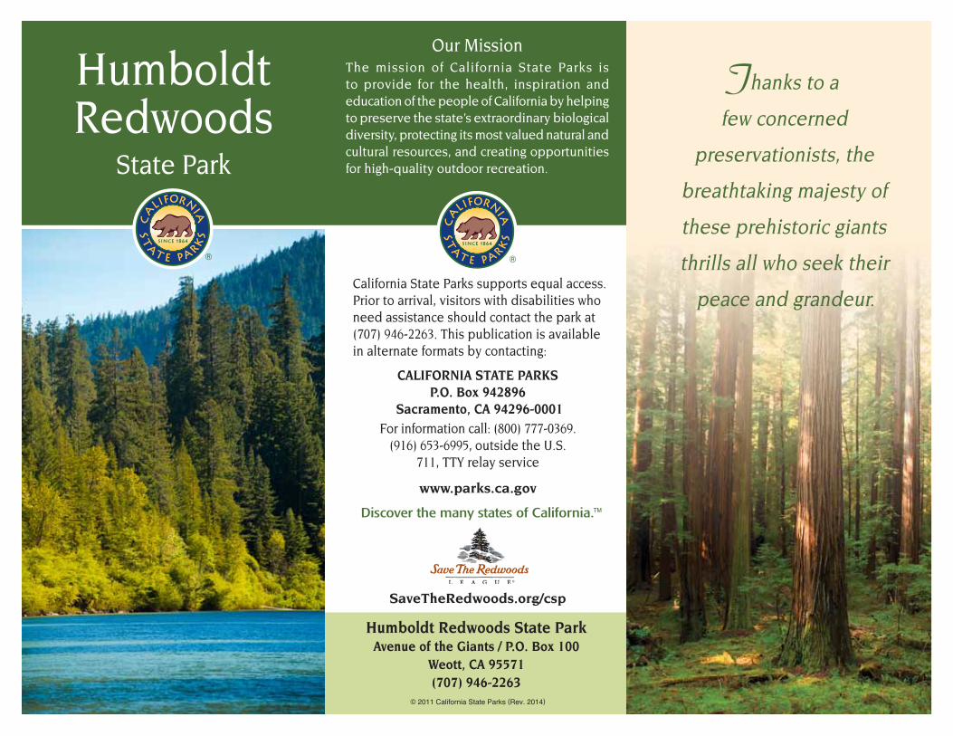
Humboldt Redwoods
State Park
Our MissionThe mission of California State Parks is to provide for the health, inspiration and education of the people of California by helping to preserve the state’s extraordinary biological diversity, protecting its most valued natural and cultural resources, and creating opportunities for high-quality outdoor recreation.
California State Parks supports equal access. Prior to arrival, visitors with disabilities who need assistance should contact the park at (707) 946-2263. This publication is available in alternate formats by contacting:
CALIFORNIA STATE PARKSP.O. Box 942896
Sacramento, CA 94296-0001For information call: (800) 777-0369.
(916) 653-6995, outside the U.S. 711, TTY relay service
www.parks.ca.gov
Discover the many states of California.™
SaveTheRedwoods.org/csp
Humboldt Redwoods State ParkAvenue of the Giants / P.O. Box 100
Weott, CA 95571(707) 946-2263
© 2011 California State Parks (Rev. 2014)
Thanks to a
few concerned
preservationists, the
breathtaking majesty of
these prehistoric giants
thrills all who seek their
peace and grandeur.

umboldt Redwoods State Park harbors the largest remaining old-growth redwood forest in the world. The park’s unique 52,000-acre environment has more than 17,000 acres of breathtaking ancient coast redwood and Douglas-fir trees. Varied recreational areas beckon to all adventurous park visitors.
Weather changes quickly on the north coast. Between October and May, the park receives about 80 inches of rain, and temperatures range from lows in the 20s to highs in the mid-50s. Though not a common event, snow may fall at elevations above 1,500 feet. Summers are usually dry, with occasional rainy days and morning fog that generally burns off by noon.
PARK HISTORY
Native PeopleThe Sinkyone people lived in the area of Humboldt Redwoods State Park’s southern region for thousands of years before European contact. The boundaries of Sinkyone lands extended east to the main stem of the Eel River and the river’s South Fork, south beyond today’s town of Leggett, and west to the ocean.
The name Sinkyone was assigned by 20th-century ethnographers to classify separate political groups who spoke the same dialect of the Athabascan language family. Each distinct political group maintained its
own geographic area and self-identity, but all groups formed a larger economy that delivered goods for trade as far as the Eastern United States.
This area was likely more densely populated before European incursion than it is now. Today more than ten percent of the population of Humboldt County are Native American, including many
people of Sinkyone descent who live along the north coast.
The traditional practices passed down through generations of Sinkyone experience created a highly productive environment. Conservation and restoration projects headed by local tribal groups, using time- tested methods, have been instrumental in bringing healing to the landscape.
Saving the TreesBeginning in the 1850s, European settlers in the area began to cut large stands of redwood trees to clear the land for pastures and farms. Lumber soon became a vital industry, and forested land suddenly increased in value.
Many people, however, believed that the huge old redwood trees were inherently significant and should be held in perpetual trust. In 1918, the Save the Redwoods League was formed to accomplish what their
name implies — the salvation of one of the world’s great wonders. Thanks to the League and its supporters, more than 189,000 acres of California’s redwood forest lands have been preserved for future generations of park visitors to enjoy.
NATURAL RESOURCES
Plant Communities Some of the coast redwood (Sequoia sempervirens) trees at Humboldt Redwoods are thought to be as old as 2,000 years. They are not the oldest trees on Earth — both the Sierra redwood or giant sequoia (Sequoiadendron giganteum) and the bristlecone pine (Pinus longaeva) tree species are older. However — growing up to 370 feet in height — the coast redwoods are the tallest trees on Earth. Trillium, fairy lanterns and calypso orchids grow in profusion at their venerable feet. The lush redwood undergrowth includes several species of fern and the pink or white blossoms of ever-present redwood sorrel.
Old-growth redwood forest
H

Away from the redwoods, Douglas-fir, California laurel, madrone and tanoak dominate the forested areas. Prairie-like areas form grassy meadows; big-leaf maples, willows and black cottonwoods grow along the stream banks.
WildlifeTracks of black-tailed deer give away their presence in the park. Chipmunks, raccoons and skunks number among the smaller wildlife inhabitants here. On rare occasions, bobcats, coyotes and black bears leave tracks or scat along sand bars and river beaches. River otters play in the water. Bird watchers will also notice red-tailed hawks, wild turkeys, ospreys and golden eagles among the redwoods. All of
the park’s visible wildlife are outnumbered by more than 140 species of insects.
Corvids, such as ravens, crows and Stellar’s jays, are intelligent, curious birds, but they prey upon endangered marbled murrelets. Corvids look for scraps of food in the park, where they often find and attack marbled murrelet chicks and eggs. Please help murrelets nest in peace. Do not feed wildlife, keep a clean camp, and be careful not to drop food while hiking.
Geology The coastal area to the west of the park at Cape Mendocino is one of the most seismically active in the San Andreas fault system. Cape Mendocino is the site of the Mendocino triple junction, where the North American continental plate joins the Gorda and the Pacific tectonic plates.
RECREATIONAL ACTIVITIESAuto Tour — Visitors can drive along 32 miles of the Avenue of the Giants to see park highlights in eight stops.Hiking — The park has more than 100 miles of trails, rated from easy to strenuous.Camping — The park has three family campgrounds (seasonal Albee Creek and Hidden Springs, and year-round Burlington). Camp only in designated campsites. Register at a campground kiosk prior to selecting or occupying any campsite. To make site-specific reservations in advance, call (800) 444-7275 or visit www.parks.ca.gov.Environmental Sites — Five seasonal environmental campsites have tables, fire rings, chemical toilets and bear-resistant storage. Water is untreated. After registering at the nearest campground kiosk, campers will receive access information.Trail Camps — Open fires are not allowed in these primitive sites; water is untreated.Bicycling — Paved roads and multi-use trails are suitable for bicycles. Observe all posted trail signs and wear helmets.Horseback Riding — Equestrians may ride on hiking/equestrian or multi-use trails. Watering troughs are located along the trails.Swimming — Thirty miles of the South Fork and the main stem of the Eel River run through the park. Swimming and wading are allowed in several creeks.Boating — Winter, spring and early summer are best for boating on the river. After heavy rains, the river may not be safe for boating.Fishing — Catch-and-release fishing for salmon and steelhead is allowed on the
Golden eagle
Climate ChangeClimate change affects all living things within the redwood forest. Some scientists fear that the area’s increase in average temperature and a decrease in thick summer fog and rain endangers coast redwoods, along with other plants and creatures that depend on the redwood environment.

South Fork and main stem of the Eel River during fall and winter. Fishing is not allowed elsewhere in the park. Anglers 16 or older must carry a valid California fishing license. See www.dfg.ca.gov for details.
ACCESSIBLE FEATURES Family campgrounds have accessible sites and restrooms (help may be needed with shower controls). Burlington Campground has an accessible site with a pull-through driveway. The mounting platform at Cuneo Creek Horse Camp is accessible. Picnic sites and restrooms are accessible in the Founders, Williams and California Federation of Women’s Clubs groves.
The accessible visitor center has listening and sight assistance. The Founders Grove
Loop, the Gould Grove Nature Loop, the Fleishmann Grove Trail, the Drury-Chaney Loop and the Rockefeller Loop trails are accessible.
Accessibility is continually improving. For updates, call (916) 445-8949 or visit the website at http://access.parks.ca.gov.
NEARBY STATE PARKS• Grizzly Creek Redwoods State Park
16949 Highway 36, Carlotta 95528 (707) 777-3683
• Benbow Lake State Recreation Area Off U.S. Highway 101 at Benbow exit Garberville 95542 (707) 247-3318
• Richardson Grove State Park 1600 U.S. Highway 101, Garberville 95542 (707) 247-3318
PLEASE REMEMBER
Dogs must be attended at all times. They must be on a leash no more than six feet long and must be confined to a tent or vehicle at night. Except for service animals, pets are not allowed on trails.
Quiet Hours — between 10 p.m. and 6 a.m. Operate generators only between 10 a.m. and 8 p.m.
Fires — Use only barbecues or fire rings provided or your own camp stove. Do not leave fires unattended. Do not gather firewood. Prevent the spread of tree diseases; buy firewood only at family campground kiosks.
Collecting — All natural and cultural features of the park are protected by state law and may not be disturbed or removed.
Water Activities — In late summer, blue-green algae may bloom when the river flow is low. Ingesting algae can be hazardous to humans and pets. Check for algae warnings.
Always use caution in and around the river; no lifeguards are on duty.
River Bar Access — Some river bars (exposed dry riverbed sections) are open to licensed 4WD vehicles but are subject to closure. Exhibitions of speed, ATVs and driving in the waterway are prohibited.
Hunting — Any form of hunting is prohibited. Firearms may not be brought into state parks.
Speed Limit — In campgrounds and day-use areas, the speed limit is 15 mph.
Avoid Inviting Wildlife — Store all food and scented items when not in use, and dispose of trash in the receptacles provided.
Recreational opportunities abound—check with the visitor center for a schedule of interpretive programs and walks.

400
800
400
800
800
400
800
800
1200
400
400
800
1200
1600
1200
1600
400
800
1200
400
800
1200
1600
800
400
800
1200
1600
1600
1200
800
400
2000
2000
2400
1200
1600
400
400
400
400
800
1200
800
1200
1200
1600
1600
2000
800
400
800
800
1200
1600
1600
2000
16001200
2000
800
1200
1600
2000
2000
1600
1200
20002400
2400
2000
1600
1200
20001600
24002400
2400
2800
2400
1200
800
1600
2000
2800
2800
2400
2000
1600
2400
400
400
400
800
400
800
800
400
800
800
1200
400
400
800
1200
1600
1200
1600
400
800
1200
400
800
1200
1600
800
400
800
1200
1600
1600
1200
800
400
2000
2000
2400
1200
1600
400
400
400
400
800
1200
800
1200
1200
1600
1600
2000
800
400
800
800
1200
1600
1600
2000
16001200
2000
800
1200
1600
2000
2000
1600
1200
20002400
2400
2000
1600
1200
20001600
24002400
2400
2800
2400
1200
800
1600
2000
2800
2800
2400
2000
1600
2400
400
400
Bull
Creek
Bull Creek
Panther
Cre
eksee Albee Creekdetail map below
see Dyervilledetail map
see Burlingtondetail map
Mill Creek A
lbee C reek
Patton C
reek
Nelson
Cree
k
Har
per
Cre
ek
North Fork
Cuneo Creek
South
Fo
rk
Burn
s Creek
Slide Creek
Bul
l
Cre
ek
Salmon
Creek
Mill Creek
Kerr
Creek
CoonCree
k
Truss C
reek
Mowry
Creek
Brid
ge
C
reek
Dev
ils E
lbo
w Creek
Poison O
ak Creek
Chadd Creek
Bea
r
Cre
ek
Fi sh
Cree
k
Butte
C
reek
Salm
on Creek
Elk Creek
Can
oe
Cre
ek
Canoe Creek
North Fork
Mill C
reek
Corn
er C
reek
Dec
ker
Creek
Tepee
Cree
k
Connick C
reek
Miller Creek
Squa
wCree
k
Calf C
reek
Cow C
re
ek
Fox Cam
p Creek
Rat
tlesn
ake
Cre
ek
Feese Cr
eek
Robin
son
Cree
k
Bear River
Eel R
iver
Eel R
iver
Eel River
SouthFork
E
el River
South Fork Eel R
iver
South Fork Eel R
iver
Bull Creek
Cabin Creek
101
101
101
High RockRiver BarAccess
GouldRiver BarAccess
HiddenSprings
Campground
LandsdaleRiver BarAccess
Burlington - Park
Headquarters
Maple HillsRiver BarAccess
AlexanderRiver Bar
Williams GroveDay Use and
Group Camps
Marin GardenClub Grove
Group Camp
Cuneo CreekHorse Camp
Hamilton BarnEnvironmental
Camp
Albee CreekCampground
BaxterEnvironmental
Camp
PioneerCemetery
Whiskey FlatTrail Camp(No Fires)
JohnsonTrail Camp(No Fires)
GrasshopperTrail Camp(No Fires)
Hanson RidgeTrail Camp(No Fires)
Bull CreekTrail Camp(No Fires)
Weott
MyersFlat
Miranda
Redcrest
HiddenSpringsBeachTrail
Dry Creek Trail
Stephen’sGrove Loop
F.K. LaneGrove Loop
Five Allens’ Trail
High RockRiver Trail
Bull Creek Trail North
Bull Creek Trail South
River Trail
Grasshopper
Trail
Johnson
Camp Trail
Burlington-Weott Trail
Williams Grove Trail
Williford Trail
Perimeter
Trail
Grieg Trail
Grie
g
Trai
l
South Prairie Trail
Kemp Trail
Grieg Trail
Tanb
ark
Trai
l
Perimeter
Trail
Perim
eter Trail
(Panther Gap Rd)
Mat
to
le Road
Mattole R
d
Mattole Road
Mattole Roa
d
Avenue of the Giants
Avenue of the Giants
Avenue of the Giants
Avenue of the Giants
Hanson Ridge Trail
Sq
uaw Cre
ek R
idg
e Tr
ail
Gra
ssho
pper
Tr a
il
Grasshopper Trail
Hom
est
ead
Trai
lPole Line Road
Indian Orchard Trail
Fox Camp Trail
Peavine
Ridge Trail
Thornton Trail
Peavine Ridge Trail
Look
Pra
irie
Trail
Baxter
Trail
Peavine Ridge Trail
to Garberville
to Eureka andNorthern Extent Area
C A R L “ A ” A N D E R S O N
R E D W O O D S N A T U R A L
P R E S E R V E
F O U N D E R S
G R O V ER O C K E F E L L E R
F O R E S T
P R I V A T E
L A N D
P R I V A T E
L A N D
P R I V A T E
L A N D
P R I V A T E
L A N D
P R I V A T E
L A N D
P R I V A T E
L A N D
B U L L C R E E K
S T A T E W I L D E R N E S S
S O U T H E R N S E C T I O N
D Y E R V I L L E
A R E A
B U L L C R E E K
S T A T E W I L D E R N E S S
N O R T H E R N S E C T I O N
H U M B O L D T
R E D W O O D S
S TAT E PA R K
© 2011 California State Parks (Rev. 2014)Map by Eureka Cartography, Berkeley, CA
2.4 Kilometers
1.5 Miles
1.2
0.25 0.5 0.75 1.0 1.25
0.80.4
0
0 2.01.6
Legend
Major RoadPaved Road
Railroad Tracks
Trail: HikingTrail: Hiking and HorseMulti-Use Trail: Hiking, Horseand BicycleAccessible TrailWilderness Area and NaturalPreserve AreaAccessible Feature
Campground
Hike/Bike Campsite
Picnic AreaPrimitive CampgroundRestrooms
SwimmingTelephone
Park Headquarters/Visitor Center
No Dogs AllowedHorse Campground
Trail Closure
Group CampgroundEnvironmental Campground
Campfire Center
Showers
Seasonal Bridge
400
800
400
800
400
400
400
800
400
800
400
400
S. Fork Eel River
Canoe C
reek
101
Visitor Center/Park Headquarters
Garden Club of America Grove Day Use Area
BurlingtonCampgroundGould
GroveNatureLoop
Fleishmann Grove Trail
River Trail
Grasshopper Trail
Canoe Creek Trail
Kent-MatherLoop
B U L L C R E E K
S T A T E W I L D E R N E S S
S O U T H E R N S E C T I O N
B U R L I N G T O NA R E A
Avenue of the Giants
0.25 0.5 Mi
0.4
0
0 0.8 Km
see main outset map
see Northern Extentdetail map above left
101
H U M B O L D T
R E D W O O D S
S TAT E PA R K
6 Mi
8642 10 Km
0 1 2 3 4 5
0
400
400
400
800
800
400
400
400
800
800
Cabin Creek
Bull Creek
River Trail
Bull Creek TrailS. Fork Eel R
iver
101
Dyerville RiverBar Access
Bull CreekFlats
FoundersGroveLoop
GoosepenLoop
MahanPlaqueLoopRockefeller
Loop
Big Cut
Tra
il
Mat
tole
Road
Dyerville Loop Rd
Avenu
e of
the Giant
s
D Y E R V I L L EA R E A
R O C K E F E L L E R
F O R E S T
C A L I F O R N I AF E D E R A T I O N O FW O M E N ’ S C L U B S
G R O V E
0.25 0.5 Mi
0.4
0
0 0.8 Km
800
400
400
800800
400
800
400
400
800800
400
Albee C
reek
Squa
w Creek
Bul lCree
k
Harper
Creek
Cemetery
Big TreesDay Use
Area
BlueSlide
Day UseAreaAlbee Creek
Campground
Tho
rnton Trail
Lo
ok Prairie Trail
Grasshopper Tra il
Homestead Tr
ail
Bull Creek Trail South
Bull Creek Trail North
Ad
die Johnson Trail
Homestead Trail
JohnsonCamp Trail
Mattole Road
A L B E EC R E E KA R E A
0.25 0.5 Mi
0.4
0
0 0.8 Km
400
400
400
400
400
800
800
800
400
400
400
400
400
800
800
800
Eel RiverShive
ly C
reek
101
Pepperwood
Gre
enlo
w
Cre
ek Drury-ChaneyLoop Trail
Greig-French-BellTrail
Avenue of the Giants
N O R T H E R NE X T E N T
A R E A
1.2
0.25 0.5 0.75 1.0 Mi
0.80.4
0
0 1.6 Km
Eel
Fork River
Eel
River
PacificO
cean
HumboldtBay
South
36
101
299
3
3
36
101
1011
SixRivers
NF
SixRivers
NF
Shasta-TrinityNF
MendocinoNF
Shasta-TrinityNF
Myers Flat
Eureka
Fortuna
Willow Creek
RioDell
Redcrest
Weaverville
Hayfork
Piercy
Leggett
BenbowGarberville
Standish-Hickey SRA
Benbow Lake SRA
John B. DewittRedwoods SNR
Grizzly CreekRedwoods SP
Fort Humboldt SHP
RichardsonGrove SP
SinkyoneWilderness
SP
HumboldtRedwoods SP
to San Francisco
toRedding
to Crescent City
0 30 Km
0
20
10 20 Mi
10
Cape Mendocino
Auto TourInformation
State ParkHumboldt Redwoods
This park receives support in part through the Humboldt Redwoods Interpretive
Association, P.O. Box 276, Weott, CA 95571(707) 946-2263
www.humboldtredwoods.org