highway route surveys and location mubarek zeyne e-mail: [email protected] office: informatics...
TRANSCRIPT
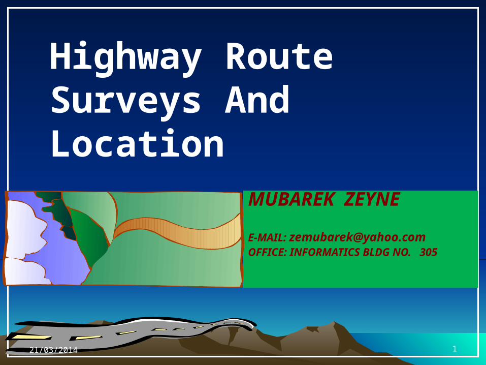
Highway Route Surveys And Location
MUBAREK ZEYNE
E-MAIL: [email protected]: INFORMATICS BLDG NO. 305
21/03/2014 1
HIGHWAY ALIGNMENT
• Definition: The position or the layout of the centre line of the highway on the ground is called the alignment.
It consists of:-– Horizontal alignment consists of straight paths and horiz. curves– Vertical alignment consists of grades and vertical curves
• Centerline of alignment:-determines the amount of cut and fill, cross-section details, drainage design, construction costs and environmental impacts.
• Once the road is aligned and constructed, it is not easy to change the alignment due to increase in cost of adjoining land and construction of costly structures by the road side.
21/03/2014 2
Requirements of an ideal alignment
• Requirements of an ideal alignment between two terminals include:
– Short• A straight alignment would be the shortest,
though there may be several practical considerations which would cause a deviation from the shortest path
– Easy • Easy to construction• Easy to maintain• Easy for operation with easy grades and curves
21/03/2014 3
– Economical
• Design should consider initial capital cost,
maintenance cost, and operation cost
– Safe• Safe enough for construction and
maintenance from the view point of stability
of natural slopes, embankments, cut slopes,
and foundations• Safe for traffic operations with ease
geometric features such as sharpness of curves, grades, sideslopes and etc.
Requirements of an ideal alignment...
21/03/2014 4
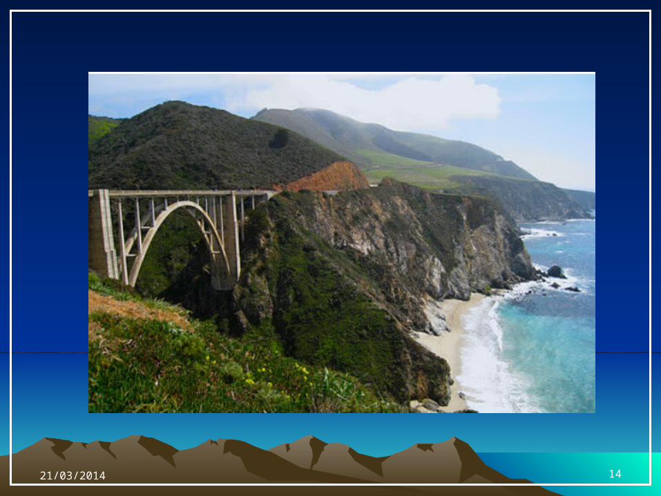
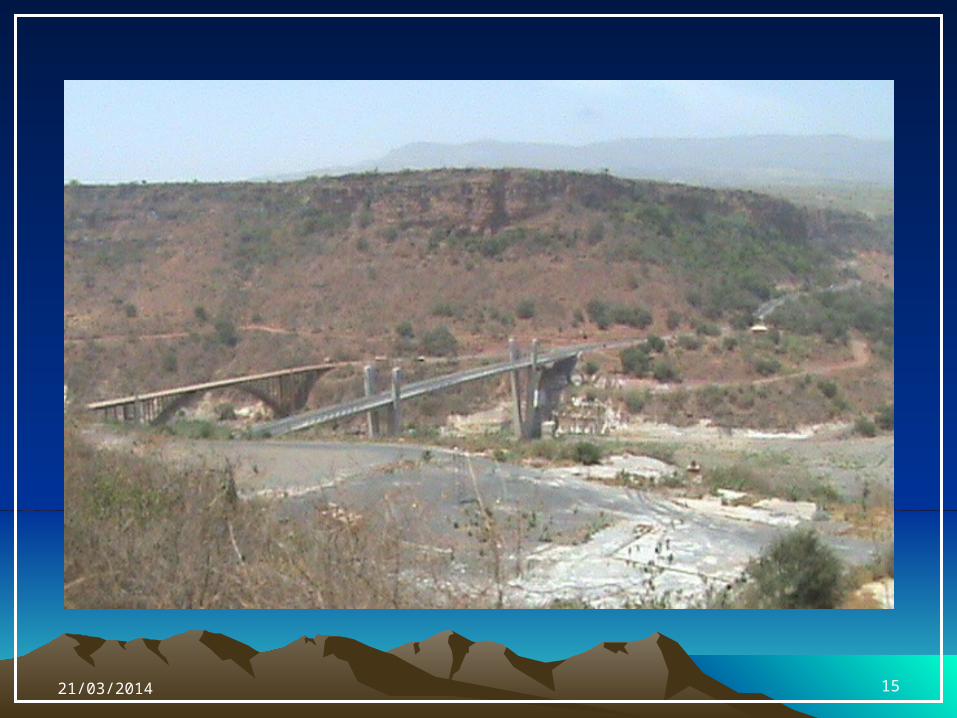
Factors Controlling Highway Alignment
• Obligatory Points– Points through which the alignment is
to pass– Chosen Bridge Site,– Intermediate town to be accessed between the termini, – a mountain pass, etc.
– Points which should be avoided– Areas requiring costly structures, – highly developed expensive areas,– Cultural or religious places – marshes and low lying lands subject to flooding,– hilly terrain where there is a possibility of land slides, etc.
21/03/2014 5
• Traffic– The alignment should suit the traffic
requirements– Present and future travel patterns should be
observed & forecasted – Traffic “Desire line” should be drawn showing
path of traffic flow• Geometric Constraints
– Design factors such as max. gradient, minimum radius of curve, minimum available sight distance, maximum allowable super-elevation, etc. should be within the limits of allowable design values which are governed by the expected traffic speed
Factors Controlling Highway Alignment...
21/03/2014 6
• Economy
– Total transportation cost including initial
construction cost, maintenance cost, and
operation cost• Example :
– Deep cuttings, high embankments, no. of bridges that need to be constructed, etc. increases the initial cost of construction.
• Other considerations– Drainage considerations– Hydrological factors– Political considerations– Monotony
Factors Controlling Highway Alignment...
21/03/2014 7
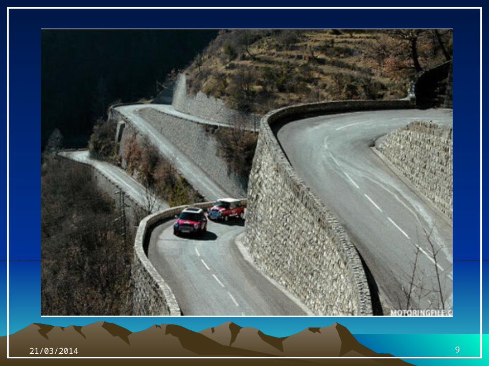
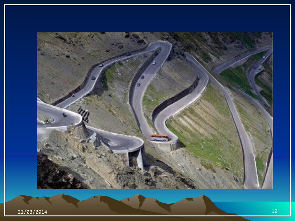
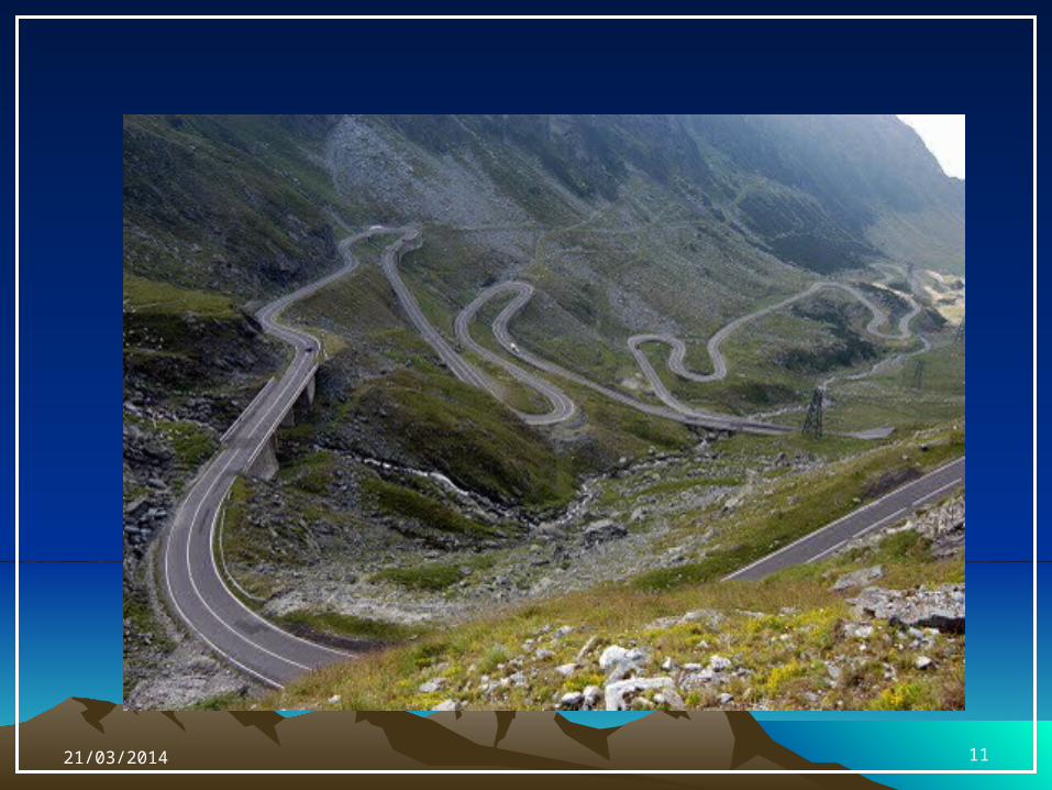
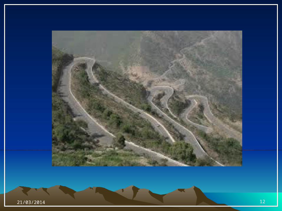
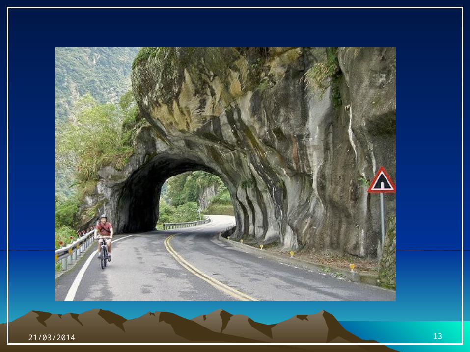
Special considerations on Hilly Roads
• Slope Stability – a common problem in hill roads is land slide. Special
care should be taken to choose the side that is more stable
• Drainage – Numerous hill-side drains to adequately drain the water
across the road should be provided– But, attempts should be made to align the road where
the number of cross-drainage structures are minimized• Geometry
– Different standards of grades, curves, sight distances, speeds and other related features are followed in hill roads
• Resisting Length – The resisting length should be kept as low as possible.
Thus, the ineffective rise and excessive fall should be kept minimum
21/03/2014 8
21/03/2014 9
21/03/2014 10
21/03/2014 11
21/03/2014 12
21/03/2014 13
21/03/2014 14
21/03/2014 15

•So... how can we arrive at such final alignments?
21/03/2014 16
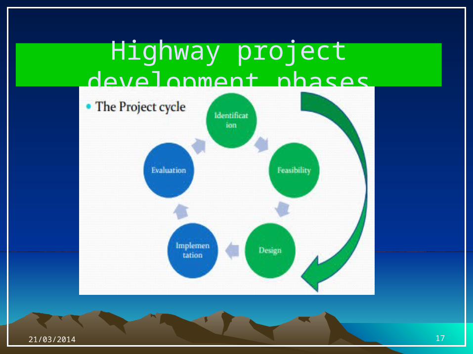
Highway project development phases
21/03/2014 17
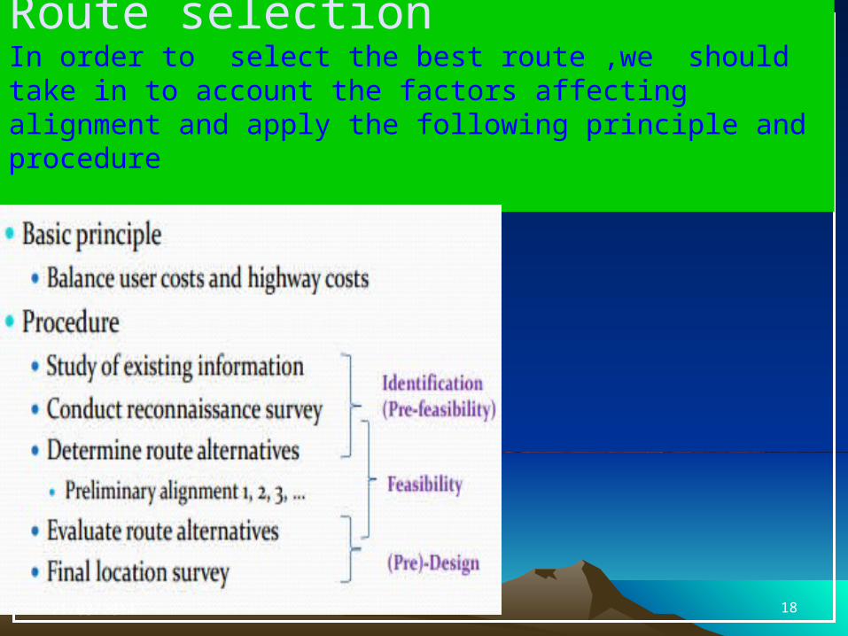
Route selectionIn order to select the best route ,we should take in to account the factors affecting alignment and apply the following principle and procedure
21/03/2014 18
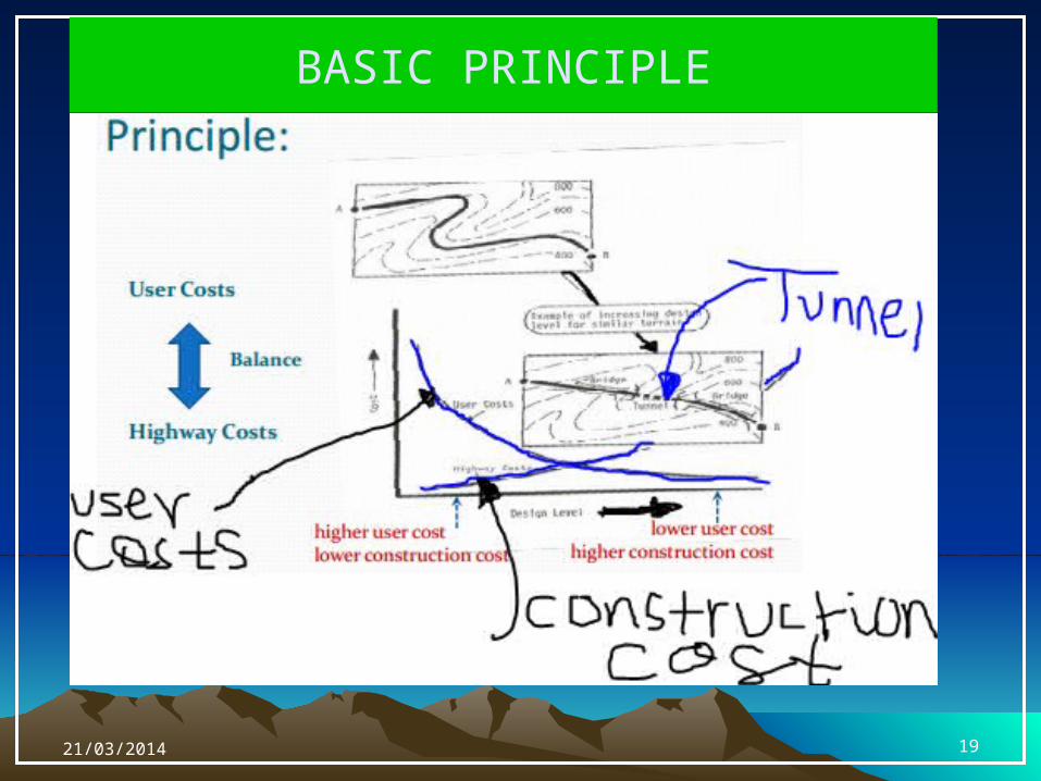
BASIC PRINCIPLE
21/03/2014 19
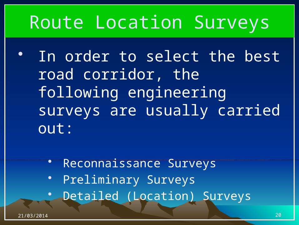
Route Location Surveys
• In order to select the best road corridor, the following engineering surveys are usually carried out:
• Reconnaissance Surveys• Preliminary Surveys• Detailed (Location) Surveys
21/03/2014 20
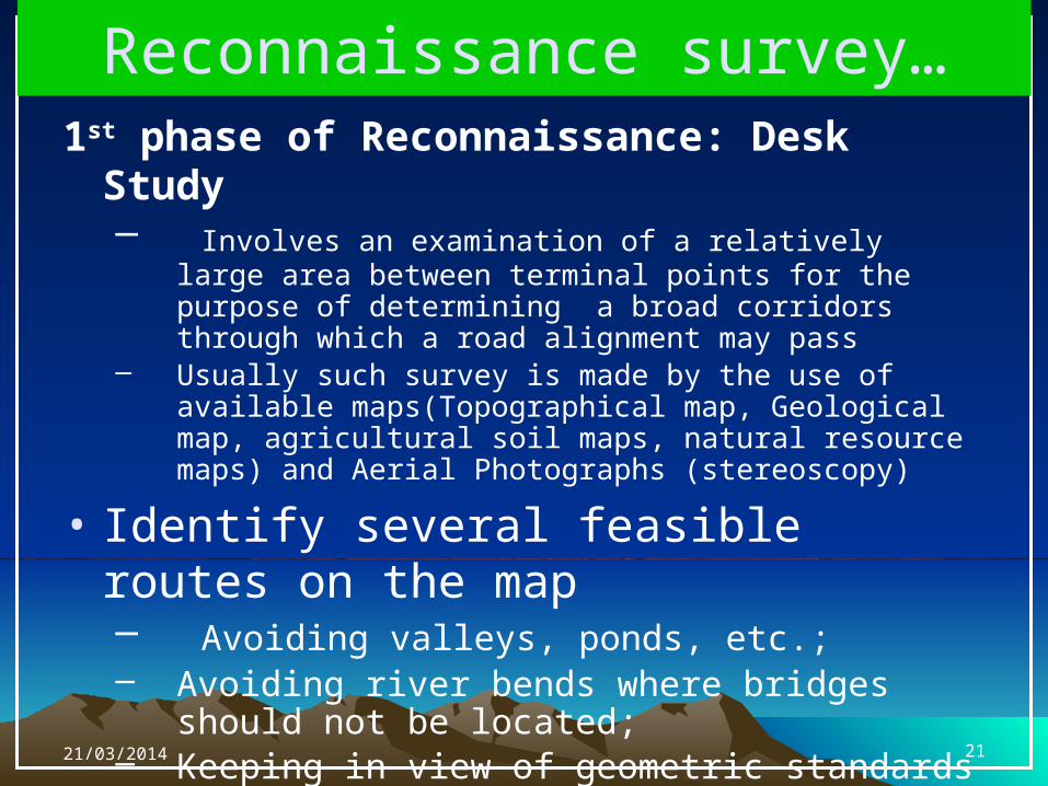
Reconnaissance survey…1st phase of Reconnaissance: Desk Study
– Involves an examination of a relatively large area between terminal points for the purpose of determining a broad corridors through which a road alignment may pass
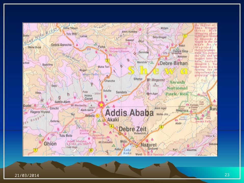
– Usually such survey is made by the use of available maps(Topographical map, Geological map, agricultural soil maps, natural resource maps) and Aerial Photographs (stereoscopy)
• Identify several feasible routes on the map– Avoiding valleys, ponds, etc.; – Avoiding river bends where bridges should not be
located; – Keeping in view of geometric standards (e.g.
avoiding steep topographies, etc)
21/03/2014 21
Reconnaissance survey…
Factors considered:
- Terrain & soil conditions
-Availability of construction materials water
-serviceability to industrial & population areas
-Intersections with other transportation facilities
* rivers, railroads, other highways
-Directness of route
Establish control points, if any
21/03/2014 22
21/03/2014 23
Reconnaissance survey…
2nd phase of Reconnaissance: Field Study – Involves inspection of each band (identified
during the desk study) to determine the most feasible route based on some basic criteria.
– A survey party inspects a fairly broad stretch of land along the proposed routes identified on the map during the 1st phase and collects all relevant details not available on the map
Eg.- valley, ponds, lakes, marshy land, ridge, hills, permanent structures, & other obstructions (probable gradients and curves are established)
- sources of construction materials, water and location stone quarries
– A rapid field study of the area, especially, when it is vast and the terrain is difficult may be done by aerial survey
21/03/2014 24
Criteria to evaluate the most feasible routes
• Design standards – Minimum design standards (max permissible gradient, etc ) are normally
fixed prior to the survey and any one of the feasible routes that economically fits in these standards would be feasible
• Grading and Earthwork – Grading is a function if ruggedness of terrain and routes following
contour is cheaper– The type of material encountered is another factor in the cost of
earthwork. Excavation of Hard Rock might need blasting and thus expensive!!
• Foundation Conditions – Complete foundation study is not done during Reconnaissance, but the
presence of Marshy and bogy areas are unsuitable• Geological Conditions
– Related to stability of side slopes, good quality and quantity of construction materials near site
• Drainage – Likely surface & sub-surface drainage problems, type and number of
drainage structures
21/03/2014 25
• Right of Way – Acquisition of land for the location of a transportation system
may cost much; shifting the alignment a little may reduce the cost considerably
• Effect on Population – Services offering the nearby population, its effect on the
development of the community – schools, churches, public buildings, etc, undesirable effects such as pollution, etc
• Traffic Characteristics – how best will a route fit with traffic requirements of the area
• Maintenance Costs – An extraordinary maintenance cost (land-slide, etc), and
user costs from inconveniency due to closure of the facility due to maintenance problems
After evaluating the alternative routes proposed, one or more routes will be recommended. If more than one routes passed the reconnaissance survey detail study is made to choose one best route in the preliminary survey
Criteria to evaluate the most ...
21/03/2014 26
Preliminary survey
• Consists of running an accurate traverse line along the routes already recommended as a result of reconnaissance survey in order to obtain sufficient data for final location.
• Objectives– Survey and collect necessary data
(topography, drainage, soil, etc.) on alternate alignments
– To estimate quantity of earthwork, material, … of different alternatives
– Compare alternate alignments– Finalize the best alignment from all
considerations21/03/2014 27
• The preliminary survey may be carried out by one of the following two methods:
• Modern: Aerial Survey – using photo interpretation techniques, information on topography, soil, geology, etc. can be obtained. This also includes computer graphics- GIS and others.
• Conventional: a survey part carries out surveys using the require field equipment taking measurements, collecting topographical and other data and carrying out soil survey . It involves Ground Survey by equipments such as theodolites, levels, and EDM (Total stations).
Preliminary survey…
21/03/2014 28
Conventional Method
• Establishing primary Traverse following the line recommended in the reconnaissance survey
• Record all topographical features• Levelling work: to determine the Centre Line, Profile &
Typical Cross-sections (just sufficient to approximate earthwork)
• Hydrological Data: to estimate type, number, & size of cross-drainage structures, and the grade line is decided based on the hydrological and drainage data
• Soil Survey: the suitability of proposed alignment is to be finally decided based on the soil survey data. The soil survey at this stage helps to workout details of earthwork, slopes, suitability of materials, sub-soil and surface drainage requirements, pavement type and approximate thickness requirements
Preliminary survey…
21/03/2014 29
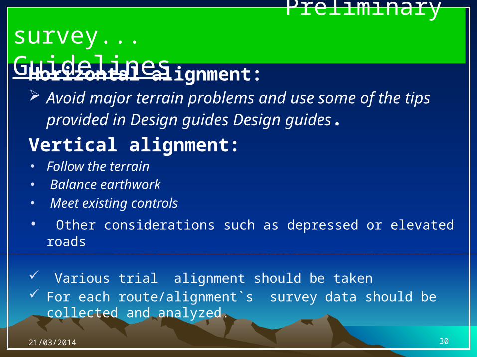
Preliminary survey...Guidelines
Horizontal alignment: Avoid major terrain problems and use some of the tips
provided in Design guides Design guides.
Vertical alignment:• Follow the terrain• Balance earthwork• Meet existing controls
• Other considerations such as depressed or elevated roads
Various trial alignment should be taken For each route/alignment`s survey data should be collected and
analyzed.
21/03/2014 30
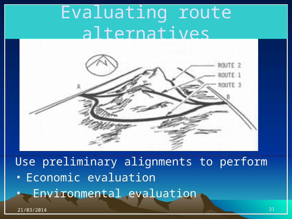
Evaluating route alternatives
Use preliminary alignments to perform• Economic evaluation• Environmental evaluation21/03/2014 31
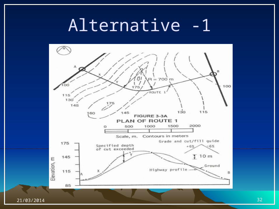
Alternative -1
21/03/2014 32
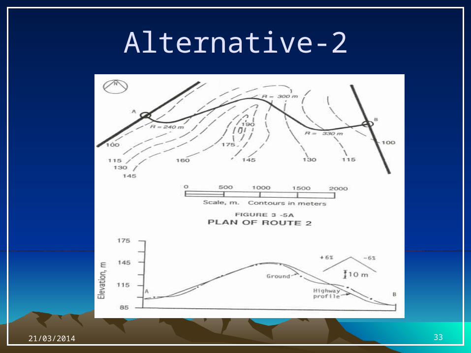
Alternative-2
21/03/2014 33
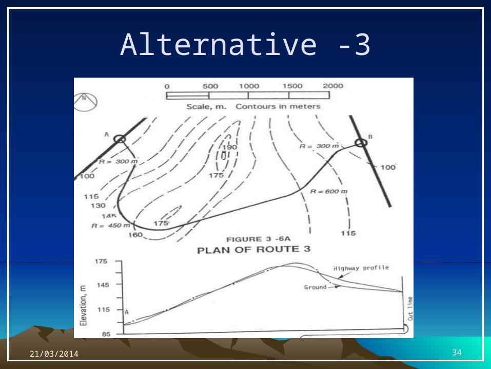
Alternative -3
21/03/2014 34
Final Location SurveyPurpose
o To fix the centre line of the selected alignment and collect additional data for the design and preparation of working drawings. If extensive data is collected earlier the survey work here might be limited.
21/03/2014 35
• Tasks include:
1. Pegging the centre line: usually done at stations established at 30m intervals with reference to preliminary traverse/ base line (if used earlier) or a control survey (if aerial survey was used).
2. Centre-line Levelling: at the stations and at intermediate points between stations where there is a significant change in the slope to obtain the representative profile of the ground
Final Location Survey...
21/03/2014 36
3. Cross-section Levelling: at each station (!) and at points with significant change in ground slope
4. Intersecting Roads: the directions of the centre line of all intersecting roads, profiles, and cross-sections for some distance on both sides
5. Ditches and Streams: horizontal alignment, profile, and cross section levelling of the banks of the stream/river
Final Location Survey...
21/03/2014 37
Drawings & Reports• The data, after the necessary investigation and final
location survey, is sent to the design office to be used for– geometric design, pavement design, and design of
drainage and other structures, preparation of drawings, reports, and specifications
• A complete sets of drawings for a road design includes:– Site plan of proposed alignment– Detailed Plan & Profile– Cross-sections for Earth work– Typical Roadway sections at selected locations (e.g.
junctions)– A mass-haul diagram– Construction details of structures like bridges, culverts,
….21/03/2014 38

Thank you!
Questions?
21/03/2014 39