hawke’s bay land and water management strategy · in hawke’s bay, land and water are highly...
TRANSCRIPT

HAWKE’S BAY LAND AND WATER MANAGEMENT STRATEGY

Contents
3.0 Strategy & Actions
3.1 Objectives
3.2 Policies and actions
- Planning and Governance- Sustainable land use- Sustainable water use- Information and communication
3.3 Priority actions for Hawke’s Bay Regional Council
3.4 Performance monitoring - key milestones, implementation structure
4.0 Summary of Catchment Values
5.0 Glossary
6.0 Resources
1.0 Introduction
1.1 Foreword
1.2 A note from the Reference Group
1.3 Introduction
1.4 Executive summary
2.0 Strategy Development
2.1 Purpose of this Strategy
2.2 Strategy development process
2.3 Drivers for change
2.4 Essential elements of managing land and water use
2.5 Values
2.6 Guiding principles
2.7 Evaluation criteria
2.8 Implementing the Strategy - roles ISBN 1-877405-60-4
Land Water Us: Hawke’s Bay Land and Water Management Strategy.
HBRC plan No 4287

Our Vision:IN HAWKE’S BAY, LAND AND
WATER ARE HIGHLY VALUED, USED WISELY AND SUSTAINABLY
MANAGED - BY ALL, FOR ALL
THE HAWKE’S BAY LAND AND WATER MANAGEMENT STRATEGY OUTLINES THE REGION’S VISION
AND STRATEGIC DIRECTIONS FOR THE FUTURE MANAGEMENT OF LAND AND WATER. IT INVOLVES
AND AFFECTS THE ENTIRE COMMUNITY.
1

1.1 Foreward
On behalf of Hawke’s Bay Regional Council and the
members of the Reference Group who committed
their valuable time to work with us to develop this
Land and Water Management Strategy, it is my
pleasure to present it to the wider Hawke’s Bay
community.
Hawke’s Bay is fortunate to have productive soils
and signifi cant water resources. The region’s people,
businesses and communities rely on land and
water for their prosperity and quality of life and it is
essential to maintain these resources in a healthy
state for the long term.
Land and water are vital economic resources – but
they are also much more than that. They support
social, cultural, ecological and recreational values.
Hawke’s Bay has the potential for enhancements
in all of these values if the land and water is used
wisely. A common community vision is needed to
ensure that these precious resources are looked
after and that they are used to the best advantage for
the whole region.
There are a number of critical issues around
land and water in Hawke’s Bay that need to be
addressed. Some of the challenges have been going
on for a long time, such as erosion and the impacts
of drought, while newer challenges being faced
include degraded water quality and climate change
effects on security of supply. The problems are
complex and require multi-faceted solutions.
This Strategy sets out how the region will respond
to these challenges and create new opportunities
through good management, innovation and through
better use of new technologies. It signals signifi cant
changes in the way we manage our use of land and
water.
We need to improve our understanding of our land
management systems; that will require us to be
innovative with technologies and to undertake more
measuring and monitoring than has been possible in
the past.
We need to move from an individual self interest
focus to a community interest focus particularly with
respect to water use, and we need to move from
short term thinking to long term thinking
I would especially like to thank the members of
the Reference Group, who came together bringing
a range of world views, values, and solutions to
the table over the last 12 months towards the
development of this strategy.
Ongoing leadership from all levels of government
and from all sectors, and continued co-operation
and collaboration is critical to the success of this
strategy and its implementation.
Cr Fenton Wilson
Chairman Hawke’s Bay Regional Council
2
1.0 Introduction

As a group of individuals representing a range of
sectors and interests, we have valued the experience
of working together and listening to different
perspectives on the development of this Land and
Water Management Strategy for Hawke’s Bay.
We fi nd that our environmental values are not so
different. We each want a healthy environment for
our children and grandchildren and we all want
our region to prosper. We acknowledge the strong
values that tangata whenua hold for the mauri of
the land and water and all that it supports and have
endeavoured to incorporate these values where
appropriate.
We are practical people. We recognise that we need
to work together and align our efforts for improving
the way we care for land and water in Hawke’s Bay.
We need to focus our efforts where the pressure is
highest or the potential is greatest.
While this strategy sets the direction, its delivery is
just as important. We have put forward possible
actions that will require further development and
scrutiny to fi nd solutions which are consistent with the
guiding principles and meet the evaluation criteria.
The process over the last 12 months has established
new relationships and made existing ones stronger
and we are positive that we can make this work.
We look forward to a prosperous future, a clean and
healthy environment and a resilient quality of life.
Reference Group
Marei Apatu, Nikola Bass, Lloyd Beech, Dan Bloomer, Alastair Bramley, Mark Clews / Craig Thew, Ru Collin, Neil Cook, Murray Douglas, Johan Ehlers, John Freeman, Brett Gilmore, Mike Glazebrook, Jan Hania / Neil Grant, Peter McIntosh, Dale Moffatt, Evert Nijzink, Andy Pearce, Hugh Ritchie, Adele Whyte, Paul Franklin.
Hawke’s Bay Regional Council Councillors and Staff
Fenton Wilson (HBRC Chair), Liz Remmerswaal (Councillor), Christine Scott (Councillor), Andrew Newman, Helen Codlin, Bruce Corbett, Darryl Lew, Tim Sharp. Facilitator - Donna Caddie
1.2 A note from the Reference Group
3
1.0 Introduction

4
1.3 Introduction
Hawke’s Bay’s competitive agricultural advantage
lies in its temperate climate, availability of productive
land, and potentially abundant water supplies. The
quality and quantity of our land and water resource
is therefore critical.
The wellbeing of everyone and everything in the
region depends on how land and water is managed.
Through implementing the latest knowledge and
best practices, opportunities exist whereby the
region’s economic aspirations can be met, while
at the same time environmental biodiversity is
enhanced.
Land and water support about 40% of the region’s
economy and enable a great many of us to be
employed in the region. Landowners and supporting
industries have made signifi cant investments over
many decades in Hawke’s Bay and it is important
for the region to support these essential industries.
The natural environment and primary industries also
provide a platform for the region’s tourism industry.
As well as providing opportunities the region’s land
and climate present challenges. The dry, sunny
climate creates droughts that cause considerable
hardship and can take many years to recover from.
Even in normal years, summers are dry and water
restrictions place strain on the productive backbone
of the region.
Conversely, periodic or prolonged rain causes serious
fl ooding. The worst effects of fl ooding are mitigated
by fl ood protection works but devastating events can
still occur. The April 2011 fl oods in the southern
coastal regions caused widespread destruction. The
impact on livelihoods and signifi cant loss of soils
during such events threatens the future productivity
of the region. The predicted impacts of climate
changes add to the existing challenges.
The loss of land and soil through erosion and
degradation, and the devaluation of eco-system
services through intensive land uses, must be
addressed.
A core value and key attraction for many in Hawke’s
Bay is the ability to enjoy a healthy lifestyle in a
healthy environment. Most of the region’s waterways
are of extremely high quality but lowland rivers and
streams are showing declining water quality.
Everyone in the community has a role in improving
the region’s economic and environmental wellbeing.
This Strategy addresses how our land and water
resources should be managed with that fi rmly in
mind.
This strategy is driven by current water quantity and
water quality pressures and outlines the immediate
and medium term actions to address them. Long
term aspirational outcomes for the region will evolve
through other foresight activities and broader
strategies such as biodiversity and integrated
management strategies.
1.0 Introduction
5
1.4 Executive Summary
Hawke’s Bay’s competitive agricultural advantage
lies in its temperate climate, availability of productive
land and potentially abundant water supplies. The
quality and quantity of our land and water resource
is therefore critical.
This Strategy provides direction and a common
focus for the management of land and water
in Hawke’s Bay for improved economic and
environmental outcomes. It recognises that
development potential and pressures vary across
the region as do the values associated with the land,
rivers, lakes and wetlands. Different responses are
therefore required.
The Strategy was developed collaboratively using a
multi-sector Reference Group as a sounding board.
The recommended strategy that resulted from that
process was largely unchanged by Hawke’s Bay
Regional Council when it was adopted.
The Strategy is based on four themes: Planning and
Governance; Sustainable Use of Land; Sustainable
Use of Water; and Information and Communication.
There is also a section on Performance Monitoring.
Planning and Governance focuses on collaboration,
strategic prioritisation of resources, enabling
decision-making to occur at appropriate levels,
transparency of cost distribution and ensuring
adequate transition processes.
Sustainable Use of Land focuses on utilising
good industry practice based on site specifi c
knowledge and conditions to improve productivity
and profi tability while reducing the environmental
footprint. Re-vegetation of erosion prone land,
retention of water in the landscape and recognising
the ecological services provided by indigenous
vegetation and wetlands are key elements.
Sustainable Use of Water recognised that forward
thinking decisions that provide for long term
environmental, economic, social and cultural
wellbeing are important. The Sustainable Use of
Water theme considers water quantity management
and water quality management.
Elements of the water management framework are
set out and effi cient water use is paramount. It is
recognised that users need to move from a position
of self interest to collective interest in order to gain
effi ciencies and make the best use of available
water. Measuring, recording and reporting water
use, so that there is transparency about how much
is used and when, is a critical element for improved
water management.
Setting of water quality limits is a requirement
of the National Policy Statement for Freshwater
Management (NPSFM) and the implementation
of the NPSFM is refl ected in the Strategy. The
Strategy also seeks active exclusion of stock from
water bodies where practicable. Riparian fencing
and planting and other initiatives associated
with managing farming systems for a reduced
environmental footprint are duplicated here from
the Sustainable Use of Land theme recognising the
impacts of land use on water quality.
Information and Communication focuses on
making information and research fi ndings more
readily available to the public, land managers
and water users. It also highlights the need for
improved community understanding of values
and the importance of water through water action
campaigns.
The fi nal section, Performance Monitoring, highlights
the need for annual action plans and... (cont)
1.0 Introduction

6
1.4 Executive Summary (cont)systems for regular monitoring and reporting. Many
of the proposed actions will require innovative
and practical ways by which to implement them.
Maintaining a collaborative multi-sector group on
an ongoing basis will ensure the ownership of the
strategy is retained by all stakeholders.
Outcomes anticipated from the implementation
of the Strategy include:
Adoption of land and water management practices •
that meet economic and environmental goals
Land and catchment management that minimises •
erosion risk, particularly in areas of vulnerable
sedimentary hill country and on wind erodible soils
Land and catchment management that minimises •
nutrient losses into rivers, lakes and groundwater.
A more dynamic water management framework •
which promotes water effi ciency and decision
making at the appropriate level
A water allocation model which reduces over-•
allocation and aims to minimise water restrictions
The setting of water quality standards and targets •
in regional planning documents which meet the
agreed management objectives for the catchment
and the region
Improved understanding of the ecological services •
provided by indigenous vegetation and wetlands
Improved community understanding of resource •
availability and issues through better distribution of
knowledge and information
Overall, environmental outcomes include:
Re-establishment of ecological processes and •
ecosystems
Greater variety and diversity of habitats that •
sustain our most valued species
1.0 Introduction
7
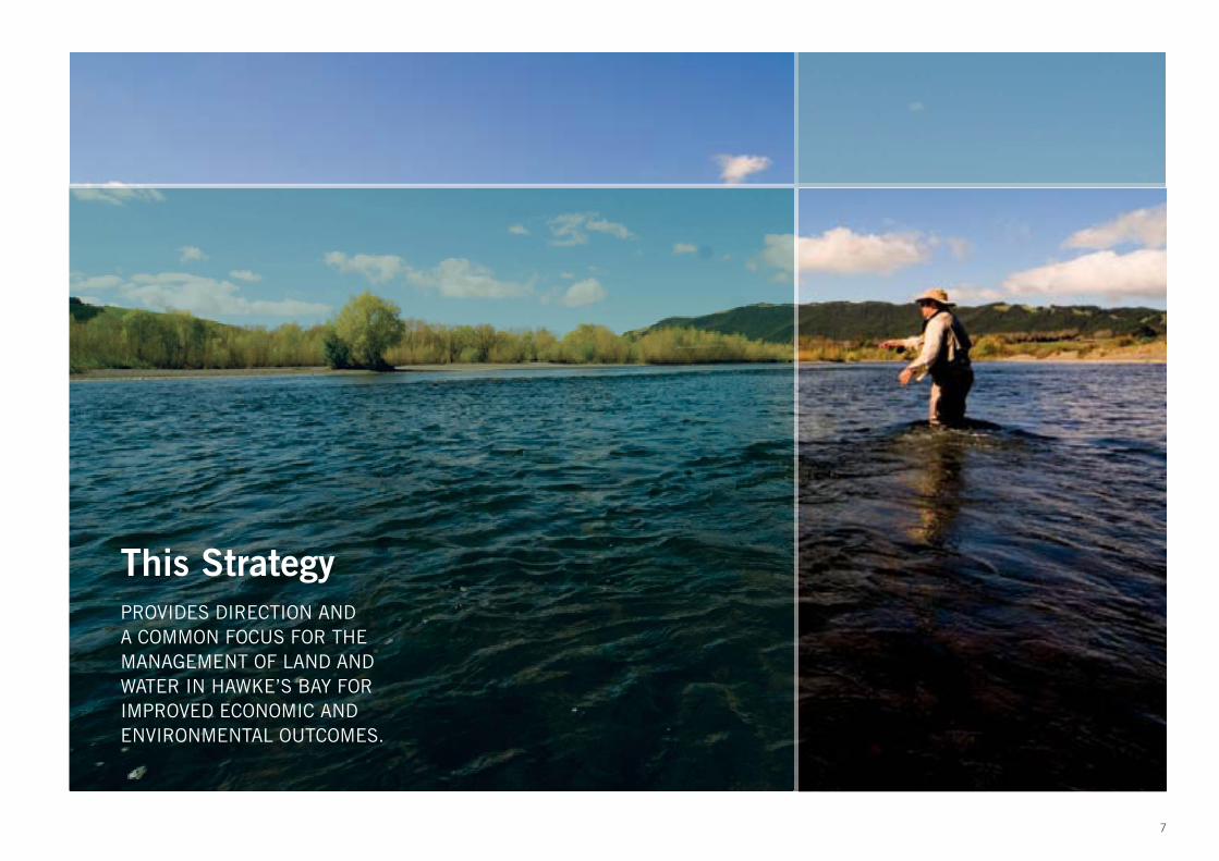
This StrategyPROVIDES DIRECTION AND A COMMON FOCUS FOR THE MANAGEMENT OF LAND AND WATER IN HAWKE’S BAY FOR IMPROVED ECONOMIC AND ENVIRONMENTAL OUTCOMES.

8
2.0 Strategy Development
2.1 Purpose of this Strategy
This Strategy provides direction and a common
focus for the management of land and water
in Hawke’s Bay for improved economic and
environmental outcomes.
It identifi es a vision, as well as the objectives,
policies and a range of actions necessary to
achieve the vision. It identifi es which agency has
responsibilities for implementing the actions and
it will enable agencies undertaking land and water
management initiatives to co-ordinate and align with
the vision and strategic direction.
The Strategy signals signifi cant changes in the
way we manage our use of land and use water. It
acknowledges that both rural and urban land uses
impact on the quality of the region’s freshwater
bodies and on the coastal environment as well.
We need to improve our understanding of our land
management systems and that will require us to be
innovative with technologies and to undertake more
measuring and monitoring than has been possible
in the past. We need to move from an individual
self interest focus to a community interest focus,
particularly with respect to water use, and from short
term to long term thinking.
The Strategy recognises that the development
potential and pressures vary across the region, as do
the values associated with the land, rivers, lakes and
wetlands. Different strategy responses are required
in order to protect these values as much as possible
– achieving socio-economic prosperity, safeguarding
environmental baselines and providing for the
cultural, aesthetic and recreational values attached
to landscapes and water bodies.
The process of developing the strategy has
provided HBRC and stakeholders with a greater
understanding of the issues, a common vision, and
agreement on the direction and actions required
from here. There is a continued desire to work
collaboratively through regional plan processes to
further develop and refi ne the resource management
framework within which land and water will be used.
Policies and actions are prioritised to target the most
pressing issues facing Hawke’s Bay (page...) and
provide tools for improvements in the key strategy
areas.
2.2 Development process
The Land and Water Management Strategy has been
developed through a collaborative process with the
community.
In 2010, 115 people from throughout the region
participated in the Hawke’s Bay Regional Water
Symposium to discuss the most important issues
around water quantity. The necessity to integrate
water quantity with land use and water quality was
strongly identifi ed.
Nominations collected at the Symposium helped to
establish an External Reference Group to develop
the vision, guiding principles and objectives for the
management of the region’s water resources. The
External Reference Group continued to encourage
Hawke’s Bay Regional Council to include land use and
water quality within its scope. As a result, land use
and water quality have been included in this Strategy.
Hawke’s Bay Regional Council would like to thank
the members for their participation, contributions
and robust discussion in 6 meetings over the last 12
months.

9
2.0 Strategy Development
2.3 Drivers for change
The need for an integrated regional strategy to
address the land and water issues in Hawke’s Bay
is highlighted by a number of critical factors. These
include:
Impacts of global, national and local economic •
shifts on Hawke’s Bay
Increasing local, national and global concern •
for environmental and social (e.g. cultural,
recreational) values and standards
Government policy, regulations and directions in •
relation to land and water, including the National
Policy Statement for Freshwater Management and
Resource Management (Measuring and Reporting
of Water Takes) Regulations
Declining water quality in some catchments as a •
result of both point source and diffuse discharges
Water demand sometimes outstripping water •
supply - peak demand occurring during low fl ow
periods
Expiring water consents and a need for clear •
direction in plans
Desire for community participation and •
collaboration in sustainable land and water
management
Values based information and new scientifi c •
information including Matauranga Maori and
cultural monitoring tools indicating inadequate
provisions for in-stream fl ows and ecological health
Increased competition for agricultural land by •
primary producers and by urban and industrial
expansion (The Heretaunga Plains Urban
Development Strategy (HPUDS) largely addresses
this issue.)
Reduced productivity, accelerated soil erosion and •
related decreasing water quality resulting from
poor land management practices
The risk and uncertainty of changing weather •
patterns as a result of climate change
Loss of wetland habitat and the ecosystems •
services they provide
Recognition of the need to retain ecosystem •
services of land and water
Need for proactive, long-term, strategic •
approaches
Improved understanding and technologies for the •
measurement and investigations into the state of
our region’s water resources
Notwithstanding climate change, increasing •
competition for the water resource for residential,
industrial, agricultural and recreational purposes.

10
2.4 Essential elements of managing land and water use
Many factors defi ne the natural environment.
They include geology, soil (type, structure, fertility,
water holding capacity, drainage), altitude, climate
(rainfall, temperature), vegetation cover and water
bodies. Agricultural farming systems make use of
these elements to produce food and fi bre, and often
increase productivity through enhanced plant and
animal genetics along with inputs of fertiliser and
water.
The way agricultural activity is managed and the
way water is used can modify the soil resource
and impact on associated freshwater bodies. For
example, pastoral farming on steep unstable hill
country makes it more vulnerable to slipping in
severe rain events. The loss of topsoil can lead to
long term losses of productivity because it takes
many decades for topsoil to re-establish on slip
scars. On fl atter land, intensive cropping systems
can increase the risk of wind erosion, can result
in degradation of soil structure, and can increase
leaching of nutrients through the soil profi le. Over
time these nutrients then enter groundwater and
surface water bodies.
The way urban activity is managed can have direct
impacts. A high proportion of urban land is covered
by impermeable surfaces like roads and buildings.
Rainwater and contaminants from vehicles and other
land based activities are collected into stormwater
drainage systems which fl ow into rivers, streams,
estuarine or coastal environments.
The amount of water available for irrigation,
industrial and municipal water supplies is a fi nite
resource (although supplies can be augmented
through storage of high fl ows). Effi ciency is therefore
a key element of managing water use.
Making the available water go further could be
achieved through more fl exible allocation models.
Where effi ciency gains at an individual level are not
adequate, decentralisation of water management to
groups of water users may provide further effi ciency
and allow users to allocate the water resources to
where it is needed most. If that is not enough to
meet demand, alternative sources would need to be
explored.
Sustaining the land and water resources so that they
can continue to support future generations requires
good land and water management practices – right
choices at the right time. This requires knowledge
and good decision making in selecting the right
farming system or urban design for the land.
Essential elements of managing land use and water
use are summarised in the following charts..
2.0 Strategy Development

11
Essential elements of land use To successfully manage land use it is essential to know:
What landresources we have
What land use benefi ts we want.
Where theproblems are
How improvementscan be made
What theconstraints are
How to incentivise appropriate behaviour
Heretaunga and Ruataniwha Plains
River valleys and terraces
Rolling hill country
Steep hill country
Mountain ranges
More profi table farming systems
Versatile land and productive soils for future generations
Collective action towards agreed water quality and biodiversity outcome
Highly erodible hills
Intensively cropped soils
High fertility production systems
Ineffi cient farming systems
Unsustainable land management practices
Loss of eco-system services
Activities in sensitive land-water margins
Site specifi c management using tools such as:
Precision agriculture
Minimum tillage cropping
Effective nutrient management planning
Riparian fencing and planting
Water and nutrient balance
Soil conservation practices and afforestation / open planting within farms
Integrated landscape management
Work with industry to develop market and price incentives
Science alliances which will deliver management and technical solutions
.
Self interest vs. collective interest
Public demand for environmental protection
Competition for land and related production system resources ( water, labour, transport, processing capacity)
Urban encroachment on agricultural land
Landowner rights
Lack of detailed natural resource inventory (e.g. soils, indigenous vegetation, wetlands) and management information
Limited knowledge of site specifi c management opportunities, tools and techniques
External economic infl uences
Increase knowledge
Develop collaborative continuous improvement groups
HBRC Regional Landcare Scheme
Support development of good practice guidelines
Link farm management to industry GAP programmes
Sustainable Farming Fund
Provide more fl exible conditions/management to groups with audited self-management systems
Note: The contents of this table are not listed in any order of priority.

12
Essential elements of water use To successfully manage water use it is essential to know:
What waterresources we have
What water use benefi ts we want.
Where theproblems are
How improvementscan be made
What theconstraints are
How to incentivise appropriate behaviour
Seven major river catchments and many smaller ones
Two major aquifer systems and a number of smaller ones
Five major lakes and many smaller ones
Ten major freshwater and estuarine wetlands and numerous smaller wetland environments
More productive economy
Recreational use of rivers and lakes
Healthy freshwater ecosystems
Restoration of mauri
Community awareness of the value of water
Plenty of water overall but an issue of timing and distribution – peak demand during low fl ow periods.
Some catchments are over allocated
Potential demand not provided for
Current minimum fl ows may not be suffi cient to maintain appropriate habitat protection
Do not know the actual water used
Declining water quality in some catchments
Defi ne effi ciency standards and promote benchmarking
Allow users greater control of re- allocation and use decisions (decentralisation and resource sharing)
Timely measurement, recording and reporting of actual water use
Increase supply reliability through augmentation
Urban demand management and conservation strategies
Allocation tied to good management practice
Avoid water banking
.
Centralised decision making
Need to address multiple and often competing values and demands
Self Interest vs. collective interest
Affordability
Limited knowledge of actual use
Remove disincentives - reduce diffi culties in sharing allocated water
Increase knowledge
Support community driven collaborative processes
Support development of good practice guidelines
Link farm management to industry GAP programmes
Support audited self-management systems
Note: The contents of this table are not listed in any order of priority.

13
2.5 Values
Land and water are fundamental needs and are
inextricably linked. They are valued for their social,
cultural, environmental and economic values. From
the Land we establish our communities and defi ne
our identities. We produce food, fi bre and fuel to
sustain ourselves.
Land is valued for the income that it generates and •
for the future opportunities it will provide.
Land provides a sense of place for people and •
communities.
Land is an essential and integral part of Maori •
identity and Matauranga Maori.
Land supports the fl ora and fauna which make up •
the regional biodiversity.
Land ecosystems provide a range of vital services •
including carbon absorption and water fi ltering.
Landscapes provide cultural identity, aesthetic •
enjoyment and recreational opportunities.
Hawke’s Bay’s natural land features like Te Mata •
Peak and Cape Kidnappers have value in and of
themselves – they have intrinsic value.
Water also helps defi ne our identities. For Mana
whenua, water is integral to who they are (Ko wai),
where they are from (No wai), and their future
(Ma wai). Water is the basis of all life and is used
for drinking and washing, stock drinking, fi re
fi ghting, irrigation, industrial use, energy generation,
recreation, food production and processing,
transport and tourism.
Clean drinking water is a basic human right •
Freshwater bodies are valued for their natural •
form, intrinsic qualities and mauri. They provide
a sense of place for people and communities and
are a source of inspiration.
Water supports the fl ora and fauna which make up •
the regional biodiversity.
Well-functioning waterbodies provide mahinga kai. •
Water is a critical ingredient for businesses, •
including agriculture and processing, that
underpin the Hawke’s Bay economy
Water provides opportunities for recreational •
activities and tourism.
All the values above are important regional values
of land and water. Many of the values compete
with each other and land and water management
requires an aligning of interests to fi nd common
ground for mutually benefi cial outcomes. This can
be within catchments or across the whole region.
Catchment values for each major area of Hawke’s
Bay are listed on page ...??... This summary list
evolved from the Water Symposium and subsequent
Reference Group meetings and is to highlight that
catchments have different values and therefore may
require a different management response.
2.0 Strategy Development

14
2.6 Guiding principles
The development of this Strategy is based on the
following guiding principles:
Accountability: The Hawke’s Bay Regional Council
(HBRC) will be accountable for developing a
Regional Land and Water Management Strategy,
and any statutory regional planning changes
required to give effect to it. The delivery of the
Strategy will involve HBRC and partnerships with
other parties including central government. To the
extent practicable, decision making and matching
accountability will be devolved to local/community of
interest groups of land and water users.
Integrative: A holistic approach will be used which
accounts for the inter connectedness of land and
water, different community values, diverse world
views and scientifi c interpretations.
Evidence-based: HBRC will seek and consider
science and information on land and water
resources; social science to inform policy and
decision making direction; and Matauranga Maori to
inform both.
Partnering and Collective Responsibility: HBRC will
build and maintain alliances and encourage capacity
building and a greater role for others to help deliver
land and water management objectives.
Inclusive and participatory: Inclusive and
participatory processes for the development and
implementation of the strategy and plan change
processes will be facilitated by HBRC.
Recognition of Matauranga Maori: Maori knowledge
and approaches to resource management will
be recognised and incorporated into strategy
implementation and plan change processes.
Transparent and equitable: Transparent and
equitable processes for the allocation of water and
setting of environmental quality limits will improve
the certainty of access to water and necessary land
management practices for social, cultural, economic
and environmental needs.
Effi ciency: Refers to the need to not waste resources
and also to minimise transaction costs, while
achieving effective results.
Adaptive: An adaptive management approach will
be taken so policies and actions can be tailored to
catchment-specifi c issues and responsive to new
information.
Long term: A long term and forward thinking view
will be taken for land and water management to
promote inter generational equity.
Simple: HBRC will work towards simplifying
and streamlining planning and decision-making
processes to make them more effi cient, effective,
and easier to understand.
Information in public domain: Data and information
collected by or provided to HBRC for assessment of
environmental outcomes and other matters of public
interest relating to land and water consents will be
placed in the public domain unless there is sound
reason that such release would compromise privacy
matters, commercial competitiveness, or land/
business values. This will be done as close to real
time as practicable.
2.0 Strategy Development

15
2.7 Evaluation criteria
Objectives and policies were developed with respect
to the following evaluation criteria:
Ecological Impacts
Consider the hydrological system as a whole to •
include the relationship between land and water
Maintain and/or improve the overall quality of •
freshwater ecosystems for agreed management
objectives.
Effi ciency
Ensure economic, technical and dynamic •
effi ciency in the use of natural resources
Allow for, and incentivise, improvements in •
resource use effi ciency
Ensure effi ciency does not compromise resilience•
Social Acceptability
Improve opportunities for amenity and recreational •
benefi ts from freshwater environments
Cultural acceptability
Acknowledge and respect the values, interests and •
aspirations of Mana whenua
Have regard to deeds of settlement for Treaty of •
Waitangi claims
Operational practicality
Involve parties responsible for implementation in •
the development of policies and practices
Ensure the benefi ts of policies and actions are not •
outweighed by the costs in the long term
Embrace innovative solutions and technologies •
and empower best practice
Encourage continuous improvement and provide •
for adaptive management
Legality
Complement national directions such as the •
National Policy Statement for Freshwater
Management
Not contrary to any statute•
Certainty
Acknowledge uncertainty in natural systems and •
agricultural production
Recognise that knowledge will never be complete •
and adaptability is an essential requirement for
resilience
To the extent possible, limit uncertainty for current •
and future generations
Provide for adaptability to climate change•
Provide clear goals, realistic timeframes and •
practical transitional methods
Economic acceptability
Enable wise use of land and water resources•
Support long-term investment decisions•
Enable economic potential•
2.0 Strategy Development

16
2.8 Implementing the Strategy - Roles
The following groups have a key and active role in the
implementation of this Strategy. Responsibilities are outlined in the
Policies and Actions section.
Hawke’s Bay Regional Council
Mana whenua (including Treaty Claimant Groups)
Territorial authorities
Government agencies (Department of Conservation, Ministry
of Agriculture and Forestry, Ministry for the Environment,
Environmental Protection Authority)
Fish and Game
Irrigation NZ
Primary sector organisations
Water consent holders
Water user groups
Businesses
Landowners
Community
2.0 Strategy Development
17
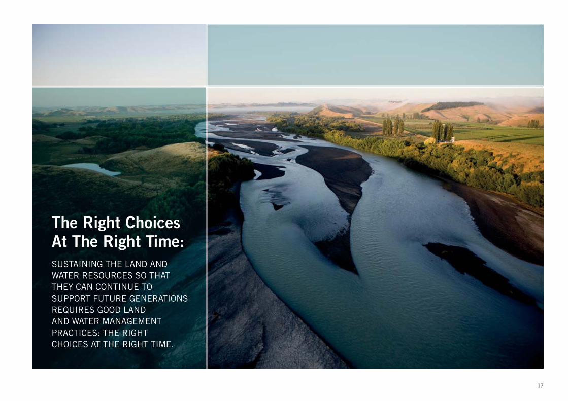
The Right ChoicesAt The Right Time:SUSTAINING THE LAND AND WATER RESOURCES SO THAT THEY CAN CONTINUE TO SUPPORT FUTURE GENERATIONS REQUIRES GOOD LAND AND WATER MANAGEMENT PRACTICES: THE RIGHTCHOICES AT THE RIGHT TIME.

3.1 Objectives
The Strategy targets four areas which are essential
to improving land and water management. Each
section has an over-arching objective.
1. Planning and Governance
Objective: Government agencies, land owners, Mana
whenua, and stakeholders work together towards
the unifi ed goal of sustainable land and water
management.
2. Sustainable Land Use
Objective: The future viability and resilience of
Hawke’s Bay’s land and landscapes is enhanced
and water quality is improved through appropriate
land management and land use practices.
3. Sustainable Water Use
Objective: Long-term prosperity of the region
is enhanced through sustainable and effi cient
water use while maintaining and/or improving the
overall quality of freshwater ecosystems for agreed
management objectives.
4. Information and Communication
Objective: Relevant and timely resource information
is collected and communicated in a transparent
manner to all interested parties.
3.2 Policies and actions
1. Planning and Governance
2. Sustainable Land Use
3. Sustainable Water Use
4. Information and Communication
The following tables provide a summary
of these target areas:
3.0 Strategy and Actions
18

1. Planning and Governance
Policies Possible Actions - HBRC will: Responsibility
1.1 Hawke’s Bay Regional Council is thelead agency in the development of landand water strategies in Hawke’s Bay
Prepare and revise the Hawke’s Bay Land and Water Management Strategy on a regular basis.
Implement the National Policy Statement for Freshwater Management (NPSFM) in Hawke’s Bay.
HBRC
1.2 Hawke’s Bay Land and Water Management Strategy guides the actions and decisionsof all relevant sector stakeholders
Prepare an annual action plan.
Stakeholders’ initiatives are in alignment with actions which will achieve the strategy outcomes
All
1.3 HBRC works closely with partneragencies and stakeholders on waterand land management
Work with Mana whenua, such as Treaty claimant groups, iwi authorities and hapu representatives. This will include a Regional Planning Committee (comprising equal representation of Treaty claimant groups) established through Treaty negotiations, Deeds of Settlement and legislation. This committee will consider and make recommendations on natural resource management.
Encourage Mana whenua and wider community input into planning processes and land and water related events / opportunities.
Work with primary sector organisations and will facilitate the establishment of self-empowering catchment groups for local land and water management initiatives.
Work with regional and central government agencies on a national water framework which provides practical direction and tools for the water management issues facing Hawke’s Bay.
All
1.4 Decision making occurs at theappropriate level (regional/local,collective/individual) for greatereffi ciency, fl exibility, accountabilityand autonomy
Work with relevant industry sectors and community groups to establish structures for decentralised decision making and water management.
Support the development of locally managed water user groups, and empower water user groups where appropriate.
Encourage shared consents.
Where appropriate, HBRC will shift from a direct regulatory role to a verifi cation / auditing role.
All
1.5 Land and water management is tailoredand prioritised to address the key valuesand pressures of each catchment.
Changes to the Regional Policy Statement and Regional Plan policies and methods (including rules) will be prioritisedand tailored to meet these values and pressures on a catchment basis
HBRC
1.6 Water management cost allocation is transparent and equitable
Continue to develop and refi ne funding policies which fairly allocate actual and reasonable costs of regional water management to those who benefi t. This includes science, information and communication systems, water user group management, costs of auditing/compliance.
HBRC
1.7 Relevant HBRC investments arealigned with the Strategy
Explore investment opportunities which achieve/contribute towards strategy outcomes. HBRC
1.8 Adequate transition times and pathwaysfor changes to water allocation and to reach water quality targets are workedout with communities
Regional Policy Statement and Regional Plan set out timeframes to establish a more effi cient and equitable allocation framework and to achieve water quality targets and environmental standards
All
1.9 Progress towards objectives is monitored and regularly reported
Establish a performance monitoring system for the Land and Water Management Strategy.
Monitoring data will be made publicly available as close as practicable to real time.
HBRC
19

Policies Possible Actions - HBRC will: Responsibility
2.1 Farming systems are managed based on site-specifi c knowledge and conditions and to good practice industry standards to minimise losses of nutrients, soil, bacteria and water
Support industry participation in applied research into understanding farming systems and the associated assessment of impacts on the receiving environment.
Expect water and nutrient management plans to be provided as conditions of access to water for irrigation either through resource consent applications or community storage agreements.
Explore regulatory and market mechanisms for managing impacts of land use on water quality. Those couldinclude requiring certain land management practices through irrigation ‘use’ consents, discharge or land use rules.
Industry sectors will advocate to their members for ‘whole of farm’ water and nutrient management plans and industry audited GAP programmes.
Primary sector organisations • HBRCWater consent holders • Water user groupsBusinesses • Landowners
2.2 Re-vegetation of erosion prone hill country pasture with tree and bush species is incentivised
Investigate the establishment of a regional equivalent to the Afforestation Grant Scheme
Industry sectors will advocate for re-vegetation (including open space planting) of inappropriately managedClass VIe and VIIe land.
Primary sector organisations • HBRC Water consent holders • Water user groupsLandowners • Community
2.3 Research and development investment is aligned to support long term farm potential including preparing for climate change.
Support development of good practice and site specifi c management including adoption of ‘Precision Agriculture’ tools and techniques where appropriate.
Review Regional Landcare Scheme.
Primary sector organisations • HBRCWater user groups • Businesses
2.4 Riparian planting and fencing in appropriate areas is promoted
Prioritise fi nancial assistance for riparian planting and fencing (Regional Landcare Scheme) in areas where nutrients, soil and bacteria losses are impacting on aquatic ecology and recreational activities. Any fi nancial assistance should be subject to an agreed management plan.
Industry and primary sectors will advocate for riparian planting and fencing
HBRC • Water consent holders Water user groups • BusinessesLandowners • CommunityQEII • Nga Whenua Rahui
2.5 Effective pest control reduces vegetation loss and increasesfarm productivity, profi tabilityand biodiversity
Continue to work with farmers on pest control programmes to meet and maintain target populationsin the Regional Pest Management Strategy.
Recognise the benefi ts of pest control on afforested Crown Land and the subsequent contribution to biodiversity,soil conservation and downstream water quality
HBRC • Primary sector organisations Landowners • DoC
2.6 Effi cient managementof water in the landscape.
Increase the capacity of the landscape to retain water through soil and water conservation plans. These will include collecting runoff, appropriate planting and shelter belts, and will be assisted throughextension advice, pilot studies and focus farms.
Water consent holders • Water user groupsLandowners • Primary sector organisations
2.7 Ecologically signifi cantwetlands are protected
Wetlands are identifi ed and categorised to determine ecological signifi cance. Wetlands deemed ecologically signifi cant are given protection consistent with the National Policy Statement for Freshwater Management (NPSFM)
HBRC • DoC • Fish and Game • Mana whenua
2.8 Indigenous vegetation and wetland areas are recognised for their contribution to farming systems, biodiversity, cultural and recreational values.
Indigenous vegetation and wetlands are assessed for their value provision and management practices are established with landowners to maintain and improve their functionality
Develop a regional biodiversity strategy in the context of land and water management.
HBRC • Landowners • DoC • F&G • TLAs
2. Sustainable land use
20

3. Sustainable water use
Policies Possible Actions - HBRC will: Responsibility
General
3.1 Forward-thinking water management decisions are made in the interests of long-term environmental, economic, social and cultural benefi ts
Use futures scenario thinking to understand plausible futures resulting from different water management decisions. All
Water Allocation Framework
3.2 Water allocation is treated holistically to take into account the inter connectedness of water bodies
Treat surface water and groundwater as a single system where appropriate, such that a single allocation limit or minimumfl ow/level limit may apply to both surface water and groundwater.
HBRC
3.3 Allocation will provide for a known security of supply and level of protection for aquatic habitat tailored to the values of the catchment
Set catchment-specifi c allocation limits and environmental fl ows to meet a known security of supply and level of protection for aquatic habitat
HBRC
3.4 High fl ows are able to be harvested and stored Set high-fl ow allocation limits and minimum fl ow limits to enable collection or harvesting of higher fl ows for storage whilemaintaining the hydraulic and ecological functions of freshwater bodies and maintaining or enhancing downstream water quality
HBRC
3.5 Determine an allocation model which most fairly distributes the allocatable volume.
Consider apportioning part of the allowable allocation to different water uses HBRC
3.6 Water is not over-allocated Where there are no current allocation limits, set allocation limits through regional plan changes for agreed managementobjectives and which meet legislative requirements. Review existing allocation limits and reset allocation limits through regional plan changes for agreed management objectivesand which meet legislative requirements.Phase out any over-allocation within fi ve years of the relevant policy provision becoming operative.
HBRC
3.7 Water allocated for irrigation can be used fl exibly between properties and managed at a local level for increased effi ciency and accountability.
Promote shared consents.Explore market mechanisms and other innovative approaches to water sharing.Give a shared consent with audited self management to a single legal-entity which:
- Establishes an effective irrigation management plan;- Measures, records and reports individual and cumulative takes in a way that provides real time monitoring (e.g. with telemetry;- Ensures all land owners within command area have equal opportunity to access water;- Monitors compliance by members.
HBRC Water Users
3.8 Large scale community storage infrastructure which can provide increased water security in water scarce catchments is recognised as a key element of long term sustainable solutions.
Undertake feasibility studies for augmentation and supply through storage and, subject to the outcome of these studies,consider how such infrastructure may be funded, built and operated for the benefi t of all.
HBRCCentral Government
3.9 Priority is given to the needs of people andanimals during low fl ow and drought conditions.
Urban water supplies will not be subject to minimum fl ows bans but the volume taken may be restricted in accordance with conservation strategies to minimize the impacts on the freshwater ecosystems.Water shortage directions under the RMA may be used where necessary to require further restrictions on urban and permitted domestic water supplies when surface water fl ows are below the minimum fl ows for extended periods of time.
HBRCTLAs
21

Policies Possible Actions - HBRC will: Responsibility
Water Use
3.10 Irrigation systems (management and infrastructure) enable effective and effi cientuse of water.
Support locally-managed Water User Groups.Irrigation industry will improve irrigator knowledge and capability of irrigation management and infrastructure throughbest practice training and encouraging regular system calibration and auditing, and effi cient application scheduling.Farmers, Water User Groups and industry will work together for effi ciency gains.
HBRCPrimary sector organisationsWater consent holders Water user groupsIrrigation NZ
3.11 Water conservation and demand management strategies are developed by municipal and industrial water users.
Municipal water suppliers and industrial water users will publish their demand management and conservation strategies online.Strategies will include extra conservation procedures for low fl ow restriction periods and educational initiatives for the community.Rainwater collection and recycling for domestic supply is enabled by District Plans and engineering codes of practice.
Territorial authoritiesIndustrial users
3.12 Water is measured to increase knowledge about water use and to increase public transparency about how much water is used and when it is used.
In the following catchments, all consented surface water and groundwater takes will be required to be metered and reported real time to Council’s information systems to enable transparency of use (e.g. through telemetry): TukitukiKaramu/CliveNgaruroroTutaekuriAhuririEsk. In all other catchments where actual water demand reaches or exceeds 70% of the allocation limit, all consented takes will be required to be metered and reported in real-time (e.g. through telemetry) to Council’s information systems to enable transparency of use.
HBRCPrimary sector organisations Private sector
3.13 Effi cient water use is encouraged. Priority is given to users who can demonstrate site specifi c water and land management decisions and practices such as industry audited GAP programmes. Examples of where priority may be exercised include during times of low fl ow, access to more secure water allocation, consent duration.
HBRC
Potential Water Demand
3.14 Potential demand and supply impacts as a result of climate change and potential land use change are understood.
Complete Regional Water Demand and Availability Study.New residential developments are required to demonstrate ability to provide adequate water supply without adversely affecting existing lawful users.
HBRCTerritorial Authorities
Water Quality
3.15 Water quality limits are set for eachwater body in Hawke’s’ Bay
Prepare and adopt a plan for implementing National Policy Statement for Freshwater Management (NPSFM)water quality limits for freshwater bodies in Hawke’s Bay.The following catchments have priority for the setting surface water and groundwater quality limits through regional plan changes:Tukituki River catchment including Ruataniwha groundwater Ngaruroro River, Karamu Stream and Tutaekuri River catchmentsHeretaunga Plains groundwaterUpper Mohaka catchmentsWhere existing water quality is below the water quality limit specifi ed, the limit becomes a target to be met.
HBRC
3. Sustainable water use (continued)
22

3. Sustainable water use (continued)
Policies Possible Actions - HBRC will: Responsibility
Water Quality
3.16 Target areas where there are high risks to water quality. Improve water quality where it is poor.
Identify high risk areas and establish action plans to mitigate water quality degradation in these areas and to improve water quality where it is poor.
HBRC
3.17 Heretaunga Plains aquifer water quality is maintained.
Manage land uses and discharges to ensure the water quality of the Heretaunga Plains aquifer maintains a potable standard without treatment
HBRCTerritorial authorities
3.18 Exclusion of stock from water bodiesis actively sought
Investigate options within its fl ood control scheme to prevent stock entering the river. This may include reviewing the need for stock grazing as a means of maintaining fl oodway capacity.Industry establishes implementation plan for stock exclusion from water bodies. This will include measures such as riparian fencing and planting; providing shade and water away from water bodies. Where reticulated stock water provision is not possible or practical, and natural surface water is the sole source of water for grazing animals, provision for access to water may be acceptable.
Primary sector organisations Private sectorHBRC
3.19 Riparian planting and fencing in appropriateareas is promoted.
Prioritise fi nancial assistance for riparian planting and fencing (Regional Landcare Scheme) in areas where sediment,nutrients and faecal bacteria losses from farms are impacting on aquatic ecology and recreational activities.Target HBRC works and services in fl ood control scheme areas where enhancement of existing wetlands and riparian plantingwill be effective.Industry and primary sectors will advocate for riparian planting and fencing.
HBRCPrimary sector organisations Private sector
3.20 Farming systems are managed based on site specifi c knowledge / conditions and to good practice industry standards to minimise lossesof nutrients, soil, bacteria and water
Expect water and nutrient management plans to be prepared and supplied as conditions of access to water for irrigation either through resource consent applications or community storage agreements.Explore regulatory and market mechanisms for managing impacts of land use on water quality. This could include requiring certain land management practices through irrigation ‘use’ consents, discharge or land use rules. Industry sectors will advocate to their members for water and nutrient management plans.
Primary sector organisations Private sector HBRC
3.21 Research and develop solutions to mitigate existing water quality problems
Work towards all municipal sewage currently being discharged to freshwater, to be discharged to land based systems where practicable. Where there are seasonal or environmental constraints, aim for land-based discharges for as much of the year as possible. Regional and local efforts to fi nd solutions to degraded water quality are supported. Examples include:
Tukipo Stream – Floating wetlands for nutrient stripping;• Huatokitoki catchment – Monitoring stock movement patterns around water bodies. •
All
3.23 Develop an integrated catchment approach to stormwater management
Work towards urban stormwater being managed using comprehensive, catchment-based stormwater management plans HBRCTerritorial authorities
3.24 Develop an integrated catchment approach to land and water management
Prepare integrated catchment plans on a prioritised basis to assist sustainable water and land management HBRCLandownersTerritorial authorities
23

4. Information and Communications
Policies Possible Actions - HBRC will: Responsibility
4.1 Scientifi c and monitoring information gathered by HBRC is available online to water users and the wider community.
Establish and continue to develop web-based communications for all HBRC scientifi c investigations HBRC
4.2 Improved community understanding of the values and importance of water using a range of water-related council activities, events and communications.
Develop a Hawke’s Bay regional water action campaign to encourage community action on water conservation and healthy waterways. Initiatives could include:
Education to encourage natural solutions such as water effi cient planting
Use of non potable water where appropriate (e.g. fountains)
Subsidies for improved building systems and appliances
Recycling of stormwater
All
4.3 Facilitate open processes for community and stakeholder collaboration and informed participation on policy development and implementation of this Strategy.
HBRC will work together with community, water user and industry groups to take a collaborative approach to the implementation of the actions in this Strategy and the development of policy in Regional Plans
HBRC
4.4 Fit for purpose monitoring, analysis and SOE reporting, including cultural and plan effectiveness monitoring
Prepare monitoring strategies and programmes.
Explore opportunities with Mana whenua for capacity building and joint monitoring programmes.
Use monitoring results to inform timely review of land and water management including iterative feedback loops.
HBRCMana whenua
4.5 Land managers have access to applied research undertaken by industry sectors and crown research organisations
Collate relevant research and disseminate it through fi eld day focus farm initiatives, web based tools, social media. Farmer institutionsPrivate sectorHBRC
4.6 Relevant land and water consent data and information is publicly available
Place data and information in the public domain, as close as practicable to real time - except where it can be shown that economic competitiveness, land or business values or privacy matters would be compromised by such disclosure.
HBRC
24
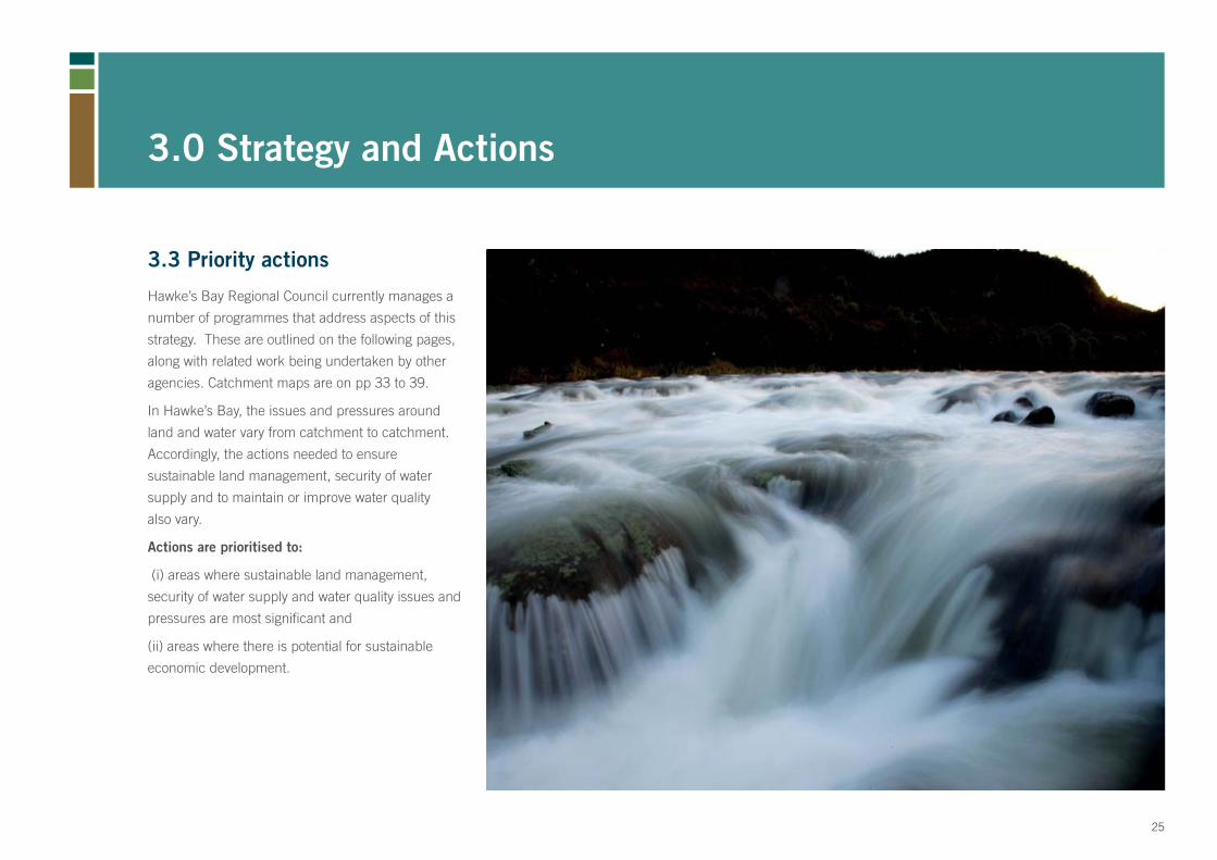
3.3 Priority actions
Hawke’s Bay Regional Council currently manages a
number of programmes that address aspects of this
strategy. These are outlined on the following pages,
along with related work being undertaken by other
agencies. Catchment maps are on pp 33 to 39.
In Hawke’s Bay, the issues and pressures around
land and water vary from catchment to catchment.
Accordingly, the actions needed to ensure
sustainable land management, security of water
supply and to maintain or improve water quality
also vary.
Actions are prioritised to:
(i) areas where sustainable land management,
security of water supply and water quality issues and
pressures are most signifi cant and
(ii) areas where there is potential for sustainable
economic development.
3.0 Strategy and Actions
25
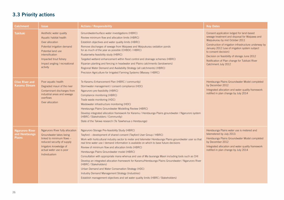
Catchment Issue Actions / Responsibility Key Dates
Tukituki Aesthetic water quality
Aquatic habitat health
Over allocation
Potential irrigation demand
Potential land use intensifi cation
Impacted trout fi shery
Impact angling / recreational activity
Groundwater/surface water investigations (HBRC)
Review minimum fl ow and allocation limits (HBRC)
Establish objectives and water quality limits (HBRC)
Remove discharges of sewage from Waipawa and Waipukurau oxidation pondsfor as much of the year as possible (CHBDC / HBRC)
Ruataniwha feasibility study (HBRC)
Targeted wetland enhancement within fl ood control and drainage schemes (HBRC)
Riparian planting and fencing in headwater and Plains catchments (landowners)
Regional Water Demand and Availability Strategy (all catchments) (HBRC)
Precision Agriculture for Irrigated Farming Systems (Massey / HBRC)
Consent application lodged for land-based sewage treatment and disposal for Waipawa and Waipukurau by mid October 2011
Construction of irrigation infrastructure underway by January 2012 (use of irrigation system subjectto consent decision)
Decision on feasibility of storage June 2012
Notifi cation of Plan change for Tukituki River Catchment July 2012
Clive River and Karamu Stream
Poor aquatic health
Degraded mauri of the river
Contaminant discharges from industrial areas and sewage overfl ows
Over allocation
Te Karamu Enhancement Plan (HBRC / community)
Stormwater management / consent compliance (HDC)
Ngaruroro pre-feasibility (HBRC)
Compliance monitoring (HBRC)
Trade waste monitoring (HDC)
Wastewater infrastructure monitoring (HDC)
Heretaunga Plains Groundwater Modelling Review (HBRC)
Develop integrated allocation framework for Karamu / Heretaunga Plains groundwater / Ngaruroro system (HBRC / Stakeholders / Community)
State of the Takiwa research (Te Taiwhenua o Heretaunga)
Heretaunga Plains Groundwater Model completedby December 2012
Integrated allocation and water quality framework notifi ed in plan change by July 2014
Ngaruroro River and Heretaunga Plains
Ngaruroro River fully allocation
Groundwater takes beinglinked to minimum fl ows – reduced security of supply
Irrigators knowledge ofactual water use is poor
Individualism
Ngaruroro Storage Pre-feasibility Study (HBRC)
Twyford – development of shared consent (Twyford User Group / HBRC)
Work with horticultural industry sector to meter and telemeter Heretaunga Plains groundwater user so that real time water use / demand information is available on which to base future decisions
Review of minimum fl ow and allocation limits (HBRC)
Heretaunga Plains Groundwater model (HBRC)
Consultation with appropriate mana whenua and use of Ma tauranga Maori including tools such as CHI
Develop an integrated allocation framework for Karamu/Heretaunga Plains Groundwater / Ngaruroro River (HBRC / Stakeholders)
Urban Demand and Water Conservation Strategy (HDC)
Industry Demand Management Strategy (Industries)
Establish management objectives and set water quality limits (HBRC / Stakeholders)
Heretaunga Plains water use is metered and telemetered by July 2013.
Heretaunga Plains Groundwater Model completedby December 2012
Integrated allocation and water quality framework notifi ed in plan change by July 2014
3.3 Priority actions
26

Catchment Issue Actions / Responsibility Key Dates
Upper reachesof the Mohaka River
Degraded water quality in Taharua and Upper Mohaka from intensive land uses
Develop Taharua Strategy through community stakeholder group (TSG / HBRC / Mana whenua)
Embed water quality targets and timeframes in Regional Plan (HBRC)
Set policy and rule framework to manage land use towards achieving targets (HBRC)
Develop Action Plan (TSG / HBRC / Community)
Notifi cation of Plan Change - 2012
Northernand Southernhill country Southern coast
Erosion
Loss of land potential
Water quality impacts
Hill Country Erosion Project (HBRC)
Investigate AGS equivalent with a view to establishing such a scheme to incentivize afforestation(mixed species) of erosion prone land within farms (HBRC, landowners, other partners)
Huatokitoki Catchment Study (Community/HBRC/Massey/others)
Consultation of Regional AGS throughLong Term Plan 2012-22
Mahia Poorly performing on-site wastewater systems,particularly during peakholiday periods
Land based community wastewater scheme – Infrastructure and management (WDC),Land ownership and forestry management (HBRC)
Resource consent gained Construction scheduled for January 2012
3.3 Priority actions (continued)
27

3.4 Performance Monitoring
Implementation of the Strategy will be monitored
and reported to stakeholders and the wider public
on a regular basis. The following outcomes are
anticipated from the implementation of the Strategy:
Adoption of land and water management practices •
that meet economic and environmental goals
Farm and catchment management that minimises •
erosion risk, particularly in areas of vulnerable
sedimentary hill country and on wind erodible soils
Farm and catchment management that minimises •
nutrient losses into rivers, lakes and groundwater.
A more dynamic water management framework •
which promotes water effi ciency and decision
making at the appropriate level
A water allocation model which reduces over-•
allocation and aims to minimise water restrictions
The setting of water quality standards and targets •
in regional planning documents which meet the
agreed management objectives for the catchment
and the region
Improved understanding of the ecological services •
provided by indigenous vegetation and wetlands
Improved community understanding of resource •
availability and issues through better distribution of
knowledge and information
Overall, environmental outcomes include:
Re-establishment of ecological processes and •
ecosystems
Greater variety and diversity of habitats that •
sustain our most valued species
Key Indicators
Many actions are required to implement this Strategy
to achieve the objectives and anticipated outcomes
and to achieve the vision. Many different indicators
will paint the picture as to whether progress is being
made. Monitoring a range of indicators and reporting
on them in the context of this strategy is an essential
element of implementing and reviewing the Strategy.
Timeframes for achieving the objectives have not
been set in stone in this Strategy. This is an area
where it is recognised that further community
participation would help decide whether progress is
being made fast enough.
The process for setting timeframes for a lot of
the milestones related to HBRC responsibilities
is through the Long Term Plan and Annual Plan
processes as well as within Regional Planning
documents. However, strategy management
milestones are included.
3.0 Strategy and Actions
28

Objective Indicator Source of Information
Planning and Governance
- Strategy action plans and monitoring reports
- Meetings and recommendations from the Regional Planning Committee
- Level of water management decision-making
- Funding policy
- Status and progress of regional plans to incorporate water quantity and quality limits
HBRC reports
Implementation Plan for National PolicyStatement for Freshwater Management (NPSFM)
RPS
Regional Plans
SustainableLand Use
- Land use change – includes area (ha) of new forest plantings and area (ha) new irrigated farming systems
- Areas of indigenous bush and wetlands under formal protection
- Uptake of site specifi c land management practices (right decision for the land) – includes use of wetland services, riparian management and fencing, use of precision agriculture tools, water and nutrient management plans, changes to existing cropping and farming systems
- Area of land under pest control programmes
- Number of Integrated catchment management initiatives underway
HBRC reports
QEII reports
LandWISE reports
DoC reports and surveys
SustainableWater Use
- Level of allocation (including over allocation)
- Periods of water restriction
- Water use vs. water allocated by consent
- Number / proportion of takes metered and or telemetered
- Decentralisation (number and success of shared consents, water user groups)
- Regional GDP trends for primary sector and associated manufacturing and processing
- HBRC Investment Company alignment
- Recreational bathing standards
- Aquatic health (MCI)
- Wetland state
- Native fi sh populations
- Fishery health
- Bird populations
- Other parameters
(will get more specifi c as regional plans establish catchment specifi c water quality limits)
State of the Environment Reports
Compliance reports
Consents database
Water Information website
Economic reports
Recreational Bathing MonitoringProgramme report
State of the Environment Monitoring Reports
Catchment specifi c monitoring reports
Cultural Health, State of the Takiwa reports(iwi and hapu)
DoC reports and surveys
Fish and Game reports
Information and Communication
- Reporting on science and other information
- Data and information availability to the public
HBRC reports
HBRC website
3.4 Performance Monitoring
29

3.5 Key milestones 3.5 Implementation Structure
Successful implementation of the Strategy is directly related to the quality of the working
relationships between the key parties. A continued collaborative approach, building on
the understanding, agreement and commitments contained in this Strategy document is
proposed.
3.0 Strategy and Actions
Milestone Date
Land and Water Management Strategy published November 2011
First Review of Strategy undertaken November 2014
Implementation Plan for NPSFM adopted November 2012
Annual Action Plan for Strategy published August each year
Annual Monitoring Reports for Action Plan and Strategy published
November each year
Group Membership Terms of Reference
Land and Water Strategy Implementation Team
HBRC staff, plus keyagency staff as required
Develop annual action plans which identify all the initiatives that contribute to the implementation of the strategy, in liaison with key agencies
Prepare annual monitoring reports for the action plans and key indicators
Present draft action plans and monitoring reports to the External Reference Group.
Present fi nal reports to HBRC
ExternalReferenceGroup
HBRC WDC NCC HDC CHBDC Mana whenua DoC MAF Fish and Game Forest and BirdPrimary Sectors Groups Environmental Groups
Individual members to review and provide feedback draft annual monitoring reports and action plans
Discuss any matter related to the Land and Water Management Strategy and its implementation
Where appropriate, the group may make recommendations to relevant funding agencies with respect to their programmes or initiatives.
30

Key Indicators:MANY ACTIONS ARE REQUIRED TO IMPLEMENT THIS STRATEGY TO ACHIEVE THE OBJECTIVES AND ANTICIPATED OUTCOMES AND TO ACHIEVE THE VISION.
31

Summary of Catchment Values
BASED ON THE VALUES SUMMARISED FROM THE WATER SYMPOSIUM HELD IN NOVEMBER 2010, THE FOLLOWING ARE CONSIDERED TO BE THE KEY DRIVERS (IN ORDER OF IMPORTANCE) IN RELATION TO LAND AND WATER MANAGEMENT FOR EACH CATCHMENT IN HAWKE’S BAY. CATCHMENTS ARE LISTED FROM NORTH TO SOUTH.
CULTURAL VALUES ARE CONSIDERED TO APPLY ACROSS ALL CATCHMENTS IN THE REGION. ‘LIFE SUPPORTING CAPACITY’ REPRESENTS A BOTTOM LINE STATE BUT IT DOES NOT MEAN A ‘NO ADVERSE EFFECTS’ STATE.
32

WairoaNatural character•
Life supporting capacity of • rivers, lakes and wetlands
Existing economic • development (includes tourism)
Recreation•
33

Mohaka
Natural Character•
Life Supporting Capacity Of • Rivers, Lakes And Wetlands
Existing Economic Development • (Includes Tourism)
Native And Trout Fishery•
Recreation•
34

Esk - Tutira
Life supporting capacity of • rivers, lakes and wetlands
Existing economic development • (includes tourism)
Recreation and education•
35

Heretaunga
Life supporting capacity• of rivers, lakes and wetlands
Municipal water supplies•
Substantial existing and • some potential economic development (includes tourism)
Native and trout fi shery•
Recreation•
36

Tukituki
Life supporting capacity• of rivers, lakes and wetlands
Existing and substantial• potential economic development (includes tourism)
Native and trout fi shery•
Recreation•
37

Southern CoastLife supporting • capacity of rivers, lakes and wetlands
Coastal water and• habitat quality
Existing economic • development
38

PorangahauLife supporting • capacity of rivers, lakes and wetlands
Existing economic • development
39

GlossaryAquifer An underground deposit of water-bearing sand, gravel or rock capable of yielding supplies of water.
Catchment The total area draining into a river, reservoir or other body of water.
Diffuse discharges Pollutants sourced from widespread or dispersed sources (e.g. from pasture runoff of animal wastes, fertiliser and sediments as well as runoff of pollutants from paved surfaces in urban areas)
Ecosystem A system formed by all plants, animals, and micro- organisms in a particular area interacting with the non-living physical environment as a functional unit.
Ecosystem Services The benefi ts people obtain from ecosystem processes. These include water and air purifi cation, fl ood control, erosion control, generation of fertile soils, detoxifi cation of wastes, resistance to climate and other environmental changes, pollination, and aesthetic and cultural benefi ts that derive from nature.
Environmental fl ows The fl ows and water levels required in a water body to provide for a given set of values which are established through a regional plan or other statutory process.
Freshwater The agreed upon objectives for managing freshwater management catchments. Catchments will have different management objectives objectives depending on the values associated with them. For example, if the value is primarily contact recreation, the management objective will be to ensure the bacterial quality and clarity of the water body is suitable for contact recreation.
Good agricultural Industry-led programmes which promote practice changes practice (GAP) to improve industry performance.
Kaitiakitanga Guardianship or custodianship, e.g. in the protection or maintenance of resources such as land and water.
Mana whenua Tangata whenua whom have the authority to preside over decision making which affects Maori
Mātauranga Māori: Māori knowledge originating from Māori practices, observations, science, ancestors, including the Māori world view and perspectives, creativity and cultural practices.
Mauri The inner life-force or essence, for example, of a river
Minimum fl ow: Limits the amount of abstraction during low river fl ows. A minimum fl ow determines when consent holders have to reduce, and ultimately stop, abstracting.
National Policy Statement Instrument available under the Resource Management Act (NPS) for Freshwater 1991 to provide guidance and direction to local government Management on the national priorities and importance of sustainable freshwater management.
Resilience The ability to withstand and recover quickly from diffi cult or challenging conditions or circumstances.
Riparian zones, The strip of land that runs alongside a waterbody such as a strips, margins river, stream or lake.
Riparian management The planting of vegetation along riparian margins to provide shade for waterbodies, thereby reducing algal growth and maintaining cool water temperatures, which are generally more favourable for aquatic fauna. Riparian vegetation also reduces bank erosion and intercepts sediment and other contaminants before they enter a waterbody.
Sediment / sedimentation Unconsolidated mineral and organic particulate material in the waterbody.
40

Soil conservation The protection of soil from erosion and other types of deterioration, so as to maintain soil fertility and productivity and prevent property and ecosystem damage. The principal approach to soil conservation is to maintain a protective vegetative cover and employ land use management strategies that minimise soil disturbance.
Stormwater Rainwater which has landed either on the ground, a roof or other impervious area and has run off into drains, waterways, etc
Strategic direction/planning The long-term or overall aims and interests as well the means of achieving them.
Sustainability Development that meets the needs of the present without compromising the ability of future generations to meet their own needs.
Water allocation limits The amount of water available to be extracted from a water source for use (e.g. for public supply, irrigation etc). The total allocation is limited to protect in-stream values and provide security of supply to water users.
Water banking Holding resource consents for water without demonstrated reasonable need.
Water governance The processes and framework which enables decision-makers and stakeholders to manage water sustainably. It includes the plans, rules and regulations, the agencies responsible for decision making and the information, policies and procedures used to make decisions.
Water use effi ciency Technical effi ciency – the amount of water benefi cially used in relation to that taken
Economic effi ciency – water use which results in the optimum outcome for the environment and community
Dynamic effi ciency – adaptability of water allocation to achieve ongoing improvements in effi ciency.
Wetland Permanently or intermittently wet land, shallow water and land- water margins. Wetlands may be fresh, brackish or saline and are characterised in their natural state by plants and or animals that are adapted to living in wet conditions. Wetland functions include nutrient fi ltering, sediment trapping, preventing fl ooding, carbon sequestration, habitats, recreation, education, cultural value.
41

159 Dalton Street, Private Bag 6006, Napier 4142. Telephone: 06 835 9200. Freephone: 0800 108 838. Fax: 06 835 3601 www.hbrc.govt.nz