grading erosion and sediment control report for solar - exhibit g - gesc report.pdf · i hereby...
TRANSCRIPT

Grading Erosion and Sediment Control Report For
Sundance, LLC Elbert County, CO
Elbert County Case No. ___-___
Prepared For:
Cypress Creek Renewables 3250 Ocean Park Boulevard Suite 355
Santa Monica, CA 90405 Telephone: 303-881-3087
By:
RINA Consulting 705 South Main Street Suite 260
Plymouth, MI 48170 Telephone: 734-634-4088
August 11, 2017
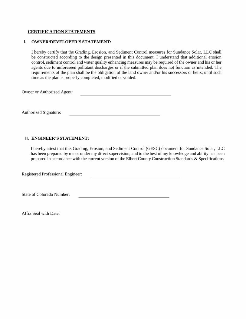
CERTIFICATION STATEMENTS
I. OWNER/DEVELOPER’S STATEMENT:
I hereby certify that the Grading, Erosion, and Sediment Control measures for Sundance Solar, LLC shall be constructed according to the design presented in this document. I understand that additional erosion control, sediment control and water quality enhancing measures may be required of the owner and his or her agents due to unforeseen pollutant discharges or if the submitted plan does not function as intended. The requirements of the plan shall be the obligation of the land owner and/or his successors or heirs; until such time as the plan is properly completed, modified or voided.
Owner or Authorized Agent:
Authorized Signature:
II. ENGINEER’S STATEMENT:
I hereby attest that this Grading, Erosion, and Sediment Control (GESC) document for Sundance Solar, LLC has been prepared by me or under my direct supervision, and to the best of my knowledge and ability has been prepared in accordance with the current version of the Elbert County Construction Standards & Specifications.
Registered Professional Engineer:
State of Colorado Number:
Affix Seal with Date:

Table of Contents
PAGE
GESC REPORT
I. PROJECT DESCRIPTION............................................................................................................. 4 II. EXISTING SITE CONDITIONS ................................................................................................... 4 III. ADJACENT AREAS ...................................................................................................................... 4 IV. SOILS ............................................................................................................................................. 5 V. EARTHWORK AREAS AND VOLUMES ................................................................................... 5 VI. EROSION AND SEDIMENT CONTROL MEASURES .............................................................. 5 VII. TIMING/PHASING SCHEDULE .................................................................................................. 6 VIII. PERMANENT STABILIZATION ................................................................................................. 6 IX. STORMWATER MANAGEMENT CONSIDERATIONS ........................................................... 7 X. MAINTENANCE ........................................................................................................................... 7 XI. OPINION OF PROBABLE COST FOR INSTALLATION OF BMPS ......................................... 7 XII. CALCULATIONS ......................................................................................................................... 7
TABLE OF APPENDICES
APPENDIX A – MAPS & SOIL INFORMATION
Project Location Map FEMA FIRM Map NRCS Soil Information
APPENDIX B – SUPPORTING DOCUMENTS
Engineer’s Cost Estimate for Soil Erosion & Sediment Control BMPs Elbert County Standard Seed Mix Information Impervious Area & Runoff Coefficient Calculations GESC Plans

PROJECT DESCRIPTION
This Grading, Erosion, and Sediment Control (GESC) Report provides remediation for site disturbance resulting from the development of Sundance, LLC. The intent is to obtain a grading and GESC permit to perform the construction operations associated the development of the site. The project is a proposed 75 megawatt community-owned solar facility incorporating a tracker system on approximately 606 acres, within parcels containing 915 acres in Elbert County Colorado. The site is located at southeast corner of Kiowa-Bennett Road and County Road 154 in Kiowa, Colorado, and includes a portion of the south half of Township 7 South, Range 63, West of the 6th Principal Meridian, located within Sections 27, 28, 29 & 33. The site is currently undeveloped agricultural land. Pre-existing drainage patterns will not change throughout the construction of the project. The racking support structure for the tracker system will be mounted on I-beams driven into the ground. The existing ground will not be manipulated to construct the solar system. There will be short gravel access roads that will be constructed to provide access into the solar facilities. A total of approximately 4.7 acres (0.8% of the solar facility area) is proposed to be disturbed during the construction of the project. The project site is located at the southeast corner of the intersection of Kiowa-Bennett Road and County Road 154 in Elbert County. The Elbert County Assessor’s records identifies the pieces of land within the project site as the following parcel ID numbers: 7327200027, 7321400259 & 7327200027. A Project Location Map for the site can be found in Appendix A. EXISTING SITE CONDITIONS
The solar facility area is currently undeveloped and has naturally occurring slopes typically primarily below 10 percent and is covered with native vegetation. Additional detail of the slopes within the solar facility area (within the security fence limits) are listed below. 0 to 5 Percent Slopes = 51.4% of the solar facility area 5 to 10 Percent Slopes = 41.8% of the solar facility area 10 to 15 Percent Slopes = 5.0% of the disturbed area Greater than 15 Percent Slopes = 1.8% of the disturbed area The project areas primarily sheet drain to the west and north except for the portion of land east of Creek 45 Road, which drainage to the east. The site is tributary to Kiowa Creek to the west and Wolf Creek to the east. The site is not located in the 100-year flood boundary based on the FEMA flood insurance rate maps (FIRM). A copy of the FIRM maps, panel 08039C0300C (dated March 17, 2011) can be found in Appendix A. ADJACENT AREAS
The subject properties are adjacent to primarily undeveloped land except for a few residential properties and the existing Intermountain Rural Electric Association substation located on County Road 154. Refer to the Project Location Map included within Appendix A. SOILS
The hydrologic soil characteristics of the watershed areas were obtained from USDA National Resources Conservation Service (NRCS), and available Geographical Information Systems (GIS). The primary soil types are listed below and supporting NRCS soil information for the soil types and names, mapping unit, permeability, hydrologic soil group, texture, etc. is provided in Appendix A.

EARTHWORK AREAS AND VOLUMES
The existing drainage patterns for the proposed site will not change. Grading will be limited to the proposed access roads, any underground utilities, and erosion and sediment control practices. The grading activities for Sundance Solar, LLC will disturb approximately 4.7 acres, and no cuts or fills are proposed as the proposed development will maintain the existing grades and site drainage. The total acreage of the proposed project is approximately 606 acres. EROSION AND SEDIMENT CONTROL MEASURES
Several erosion and sediment control measures are being implemented as part of the proposed soil disturbance activities for Sundance Solar, LLC. The structural erosion and sediment control practices for the site include the use of silt fences, vehicle tracking, and staging areas. Non-structural erosion and sediment control practices for the site include seeding and mulching of all disturbed areas. Installation of the erosion control measures shall conform to the Elbert County Roadway Construction Standards & Specifications, the Elbert County Detail Sheets and Urban Drainage and Flood Control District Urban Storm Drainage Criteria Manual. The contractor will be responsible for maintaining the erosion and sediment control measures, and repairing or replacing one or all of the items if they should fail to function as intended. The contractor shall be required to inspect and maintain all erosion and sediment control facilities per Elbert County and UDFCD requirements. Refer to the Grading, Erosion and Sediment Control plans for Sundance Solar, LLC for the location, installation, and maintenance of all proposed grading and erosion control measures. Repairs and clean out of BMP’s are required as necessary. More frequent inspections and repairs shall be required during winter conditions due to freeze/thaw problems. Daily inspections of silt fences and vehicle tracking control are also required. SILT FENCE
Silt fence barriers will be installed adjacent to disturbed areas and surrounding the proposed solar field area, to catch sediment being carried in stormwater flow. Silt fences will be staked into place at no more than 15 foot increments, with the stakes on the down-slope side of the fence fabric. The silt fence shall be 2 to 3 feet in height above grade
Symbol Description Hydrologic Group
5 Bresser sandy loam, 0 to 4 percent slopes B
6 Bresser sandy loam, cool, 5 to 9 percent slopes B
9 Bresser-Truckton sandy loam, 8 to 25 percent slopes B
32 Nunn clay loam, 0 to 4 percent slopes C
41 Truckton sandy loam, 4 to 8 percent slopes B
43 Weld loam, 0 to 4 percent slopes B

with the stakes buried below ground ½ the height of the silt fence above grade (12 inches minimum). The toe of the fence will be buried under soil or gravel to keep sediments from being washed under the silt fencing. Silt Fences shall be inspected daily and following any storm event, maintained and repaired as necessary, and any silt collected shall be removed and reused in site grading activities. VEHICLE TRACKING CONTROL
Vehicle tracking control facilities shall be installed at each entrance/exit from the site to remove loose soil from construction equipment tires, and to prevent the accumulation of soils onto existing streets adjacent to the site. The control pads will be minimum 20-foot-wide by 50-foot-long and will consist of minimum 1-1/2” crushed rock, at a depth of 6” minimum. It shall be the responsibility of the contractor to inspected daily and following storm events, and remove any soil that is tracked onto the existing streets daily. CONCRETE WASHOUT AREA
A concrete washout is a shallow excavation on-site area with a small perimeter berm to isolate concrete truck washout operations. The location of the Concrete Washout Area will be near the construction entrance for the site, and inspected weekly and following storm events, whichever is more frequent. SEEDING AND MULCHING
Seeding shall be applied to all disturbed areas after all grading activities have ended. A proper seed mix shall be used for the site. Refer to the Elbert County standard seed mix information provided in Appendix B. If newly seeded areas need to be temporarily protected, a cover of mulch can provide protection for areas that will not require temporary vegetation. All areas that have been seeded must be mulched. The mulch shall be anchored by mechanical crimps. TIMING/PHASING SCHEDULE
Prior to the commencement of construction, all erosion and sediment control practices outlined on the GESC plans will be installed. This would include the installation of silt fence, vehicle tracking control, concrete washout areas and the stabilized staging areas. All other erosion and sediment control practices will be installed as required after construction has begun. BMP’s associated with the final GESC plan will be installed as part of final site construction. This includes seeding and mulching as required. A chain link fence will be constructed as an initial/interim practice, and shall act as a construction fence. However, the fence shall remain in place for the life of the project for security measures. The anticipated construction of the project will commence on June 2018 until approximately June 2019, for a total of 12 months. After construction has been completed and proper vegetation has been established in accordance with the GESC plans, any temporary BMPs shown to be removed on the GESC plans shall be removed. This is at the discretion of the GESC Inspector. The remaining BMPs shall remain in place until vegetation is established for the site. Initial BMP’s will be installed prior to the start of grading operations. Interim BMP’s will be installed after utility construction prior to site paving. Final BMP’s will be installed after all site construction is completed. PERMANENT STABILIZATION
All disturbed areas on-site without hardscape will be seeded and mulched with permanent seed mix or landscape per the plan. Application of the approved seed mix will be performed by the approved methods in the Elbert County Roadway Construction Standards & Specifications and the Elbert County Detail Sheets. All seeded areas shall be mulched after seeding on the same day.

STORMWATER MANAGEMENT CONSIDERATIONS
Runoff will travel through the site by following the existing drainage patterns. Stormwater runoff velocities during construction shall be controlled in all areas of disturbed soils. Measures such as silt fence surrounding the project site and located down slope of disturbed areas adjacent to existing water areas on-site are provided to control velocities of stormwater runoff and prevent silt from construction activities from traveling offsite or into the on-site water areas. MAINTENANCE
The GESC Manager shall plan, install and maintain all erosion control measures as indicated on the GESC plan as necessary to prevent sediment deposition off-site. The GESC Manager is responsible for cleanup of sediment or construction debris tracked onto adjacent paved areas. Paved areas including streets are to be kept clean throughout build-out and shall be cleaned with a street sweeper or a similar device at first notice of accidental tracking or at the discretion of the GESC inspector. All erosion and sediment control measures will be cleaned and repaired as outlined in the standard notes and details, which can be found on the GESC plans. No special maintenance requirements are needed at this time. OPINION OF PROBABLE COST FOR INSTALLATION OF BMPS
The estimated cost for the soil erosion and sediment control BMPs is $103,305.00. A cost estimate spreadsheet is included in Appendix B. CALCULATIONS
Per the UDFCD Manual, the runoff coefficients of the existing (historical) and proposed conditions of the subject parcels were calculated. The existing (historical) conditions has a 100-yr storm Runoff Coefficient (CH) of 0.20. The proposed conditions will result in in a 100-yr storm Runoff Coefficient (CD) of 0.2008. The proposed solar facility will result in an increase in the 100-yr storm Runoff Coefficient of 0.0008. Based on this minor increase, permanent stormwater BMP’s such as stormwater detention facilities have not been designed for this site. Refer to the Runoff Coefficient Calculations in Appendix B for further detailed impervious area calculations.

Appendix A Project Location Map
FEMA FIRM Map NRCS Soil Information
RINA Consulting 705 S Main St., Suite 260 Plymouth, MI 48170
Sundance Solar - Kiowa, CO Final GESC Report
Page 8

Image courtesy of USGS Earthstar Geographics SIO © 2017 Microsoft Corporation
PROPOSED SUBSTATION
EXISTING SUBSTATION
PROPOSED ACCESS
DRIVE, TYP.
PROJECT LOCATION MAP
SUNDANCE SOLAR LLC - KIOWA, CO
KIO
WA
-B
EN
NE
T R
OA
D
COUNTY ROAD 154
PROPERTY
LINE, TYP.
PARCEL 'A'
PARCEL 'B'
PARCEL 'C'
CR
EE
K 45 R
OA
D
PROPOSED
EQUIPMENT PAD, TYP.
PROPOSED SOLAR
PANELS, TYP.
RINA Consulting 705 S Main St., Suite 260 Plymouth, MI 48170
Sundance Solar - Kiowa, CO Final GESC Report
Page 9

������������ �������������������
��� ����������� ������ ������ ���
������� ������� �!�������"������#��
������� ��$����%%� �&��'���%()
*+�,���&������-"������������.���/
���$�'������������������ �������
���������
012345�6789:;7<�0<::=�>7?7@=�A7BC@�DEFF9
G97<H
�I����-���$�� �&� ���J�������-
�J����+�����!��K���$������'���+��-L
M�-�J����#�� ����!��K���
���%%� �&��'���%()*+�,�
NOPQ�RSTUSV�WX�YZ[\]̂_
M��J� "II���!� M���� -�J��# ��� -���$�L̀�$�a�& $���� M����M� �� �-L��%�-���$�b� � a�& $�� �����a�& $���� -���$�L̀�$�b� �� cd�� &��e� �� -���$�L̀�$ J��&�����-���$+� �������-���$+� �����I � $����� �$�-���$ L̀�$ f'gd�� &��e� �� -���$�L̀�$ -&&���e� $��� � cd�� &��e� �� -���$�L̀�$ ����+���J�$&��$ J��/� &����M�!��
hiU
RINA Consulting 705 S Main St., Suite 260 Plymouth, MI 48170
Sundance Solar - Kiowa, CO Final GESC Report
Page 10

RINA Consulting 705 S Main St., Suite 260 Plymouth, MI 48170
Sundance Solar - Kiowa, CO Final GESC Report
Page 11

Cus
tom
Soi
l Res
ourc
e R
epor
tS
oil M
ap
43608004361200436160043620004362400436280043632004363600
43608004361200436160043620004362400436280043632004363600
5453
0054
5700
5461
0054
6500
5469
0054
7300
5477
0054
8100
5485
0054
8900
5493
0054
9700
5453
0054
5700
5461
0054
6500
5469
0054
7300
5477
0054
8100
5485
0054
8900
5493
0054
9700
39° 2
5' 1
7'' N
104° 28' 28'' W39
° 2
5' 1
7'' N
104° 25' 18'' W
39° 2
3' 4
2'' N
104° 28' 28'' W
39° 2
3' 4
2'' N
104° 25' 18'' W
N
Map
pro
ject
ion:
Web
Mer
cato
r C
orne
r coo
rdin
ates
: WGS
84
Edge
tics
: UTM
Zon
e 13
N W
GS84
010
0020
0040
0060
00Feet
030
060
012
0018
00Met
ers
Map
Sca
le: 1
:20,
700
if pr
inte
d on
A la
ndsc
ape
(11"
x 8
.5")
shee
t.
RINA Consulting 705 S Main St., Suite 260 Plymouth, MI 48170
Sundance Solar - Kiowa, CO Final GESC Report
Page 12

MA
P LE
GEN
DM
AP
INFO
RM
ATIO
N
Are
a of
Inte
rest
(AO
I)A
rea
of In
tere
st (A
OI)
Soils
Soi
l Map
Uni
t Pol
ygon
s
Soi
l Map
Uni
t Lin
es
Soi
l Map
Uni
t Poi
nts
Spec
ial P
oint
Fea
ture
sB
low
out
Bor
row
Pit
Cla
y S
pot
Clo
sed
Dep
ress
ion
Gra
vel P
it
Gra
velly
Spo
t
Land
fill
Lava
Flo
w
Mar
sh o
r sw
amp
Min
e or
Qua
rry
Mis
cella
neou
s W
ater
Per
enni
al W
ater
Roc
k O
utcr
op
Sal
ine
Spo
t
San
dy S
pot
Sev
erel
y E
rode
d S
pot
Sin
khol
e
Slid
e or
Slip
Sod
ic S
pot
Spo
il A
rea
Sto
ny S
pot
Very
Sto
ny S
pot
Wet
Spo
t
Oth
er
Spe
cial
Lin
e Fe
atur
es
Wat
er F
eatu
res
Stre
ams
and
Can
als
Tran
spor
tatio
nR
ails
Inte
rsta
te H
ighw
ays
US
Rou
tes
Maj
or R
oads
Loca
l Roa
ds
Bac
kgro
und A
eria
l Pho
togr
aphy
The
soil
surv
eys
that
com
pris
e yo
ur A
OI w
ere
map
ped
at1:
24,0
00.
Ple
ase
rely
on
the
bar s
cale
on
each
map
she
et fo
r map
mea
sure
men
ts.
Sou
rce
of M
ap:
Nat
ural
Res
ourc
es C
onse
rvat
ion
Ser
vice
Web
Soi
l Sur
vey
UR
L:C
oord
inat
e S
yste
m:
Web
Mer
cato
r (E
PS
G:3
857)
Map
s fro
m th
e W
eb S
oil S
urve
y ar
e ba
sed
on th
e W
eb M
erca
tor
proj
ectio
n, w
hich
pre
serv
es d
irect
ion
and
shap
e bu
t dis
torts
dist
ance
and
are
a. A
pro
ject
ion
that
pre
serv
es a
rea,
suc
h as
the
Alb
ers
equa
l-are
a co
nic
proj
ectio
n, s
houl
d be
use
d if
mor
eac
cura
te c
alcu
latio
ns o
f dis
tanc
e or
are
a ar
e re
quire
d.
This
pro
duct
is g
ener
ated
from
the
US
DA
-NR
CS
cer
tifie
d da
ta a
sof
the
vers
ion
date
(s) l
iste
d be
low
.
Soi
l Sur
vey
Are
a:
Elb
ert C
ount
y, C
olor
ado,
Wes
tern
Par
tS
urve
y A
rea
Dat
a:
Vers
ion
12, S
ep 2
3, 2
016
Soi
l map
uni
ts a
re la
bele
d (a
s sp
ace
allo
ws)
for m
ap s
cale
s1:
50,0
00 o
r lar
ger.
Dat
e(s)
aer
ial i
mag
es w
ere
phot
ogra
phed
: A
pr 1
5, 2
011—
Sep
22, 2
011
The
orth
opho
to o
r oth
er b
ase
map
on
whi
ch th
e so
il lin
es w
ere
com
pile
d an
d di
gitiz
ed p
roba
bly
diffe
rs fr
om th
e ba
ckgr
ound
imag
ery
disp
laye
d on
thes
e m
aps.
As
a re
sult,
som
e m
inor
shift
ing
of m
ap u
nit b
ound
arie
s m
ay b
e ev
iden
t.
Cus
tom
Soi
l Res
ourc
e R
epor
t
RINA Consulting 705 S Main St., Suite 260 Plymouth, MI 48170
Sundance Solar - Kiowa, CO Final GESC Report
Page 13

Map Unit Legend
Elbert County, Colorado, Western Part (CO623)
Map Unit Symbol Map Unit Name Acres in AOI Percent of AOI
5 Bresser sandy loam, 0 to 4percent slopes
177.9 18.8%
6 Bresser sandy loam, cool, 5 to9 percent slopes
476.5 50.3%
9 Bresser-Truckton sandy loams,8 to 25 percent slopes
150.3 15.9%
32 Nunn clay loam, 0 to 4 percentslopes
20.8 2.2%
41 Truckton sandy loam, 4 to 8percent slopes
79.3 8.4%
43 Weld loam, 0 to 4 percentslopes
41.9 4.4%
Totals for Area of Interest 946.6 100.0%
Custom Soil Resource Report
RINA Consulting 705 S Main St., Suite 260 Plymouth, MI 48170
Sundance Solar - Kiowa, CO Final GESC Report
Page 14

Cus
tom
Soi
l Res
ourc
e R
epor
tM
ap—
Dra
inag
e C
lass
43608004361200436160043620004362400436280043632004363600
43608004361200436160043620004362400436280043632004363600
5453
0054
5700
5461
0054
6500
5469
0054
7300
5477
0054
8100
5485
0054
8900
5493
0054
9700
5453
0054
5700
5461
0054
6500
5469
0054
7300
5477
0054
8100
5485
0054
8900
5493
0054
9700
39° 2
5' 1
7'' N
104° 28' 28'' W39
° 2
5' 1
7'' N
104° 25' 18'' W
39° 2
3' 4
2'' N
104° 28' 28'' W
39° 2
3' 4
2'' N
104° 25' 18'' W
N
Map
pro
ject
ion:
Web
Mer
cato
r C
orne
r coo
rdin
ates
: WGS
84
Edge
tics
: UTM
Zon
e 13
N W
GS84
010
0020
0040
0060
00Feet
030
060
012
0018
00Met
ers
Map
Sca
le: 1
:20,
700
if pr
inte
d on
A la
ndsc
ape
(11"
x 8
.5")
shee
t.
RINA Consulting 705 S Main St., Suite 260 Plymouth, MI 48170
Sundance Solar - Kiowa, CO Final GESC Report
Page 15

MA
P LE
GEN
DM
AP
INFO
RM
ATIO
N
Are
a of
Inte
rest
(AO
I)A
rea
of In
tere
st (A
OI)
Soils So
il R
atin
g Po
lygo
nsE
xces
sive
ly d
rain
ed
Som
ewha
t exc
essi
vely
drai
ned
Wel
l dra
ined
Mod
erat
ely
wel
l dra
ined
Som
ewha
t poo
rly d
rain
ed
Poo
rly d
rain
ed
Very
poo
rly d
rain
ed
Sub
aque
ous
Not
rate
d or
not
ava
ilabl
e
Soil
Rat
ing
Line
sE
xces
sive
ly d
rain
ed
Som
ewha
t exc
essi
vely
drai
ned
Wel
l dra
ined
Mod
erat
ely
wel
l dra
ined
Som
ewha
t poo
rly d
rain
ed
Poo
rly d
rain
ed
Very
poo
rly d
rain
ed
Sub
aque
ous
Not
rate
d or
not
ava
ilabl
e
Soil
Rat
ing
Poin
ts
Exc
essi
vely
dra
ined
Som
ewha
t exc
essi
vely
drai
ned
Wel
l dra
ined
Mod
erat
ely
wel
l dra
ined
Som
ewha
t poo
rly d
rain
ed
Poo
rly d
rain
ed
Very
poo
rly d
rain
ed
Sub
aque
ous
Not
rate
d or
not
ava
ilabl
e
Wat
er F
eatu
res
Stre
ams
and
Can
als
Tran
spor
tatio
nR
ails
Inte
rsta
te H
ighw
ays
US
Rou
tes
Maj
or R
oads
Loca
l Roa
ds
Bac
kgro
und A
eria
l Pho
togr
aphy
The
soil
surv
eys
that
com
pris
e yo
ur A
OI w
ere
map
ped
at1:
24,0
00.
Ple
ase
rely
on
the
bar s
cale
on
each
map
she
et fo
r map
mea
sure
men
ts.
Sou
rce
of M
ap:
Nat
ural
Res
ourc
es C
onse
rvat
ion
Ser
vice
Web
Soi
l Sur
vey
UR
L:C
oord
inat
e S
yste
m:
Web
Mer
cato
r (E
PS
G:3
857)
Map
s fro
m th
e W
eb S
oil S
urve
y ar
e ba
sed
on th
e W
eb M
erca
tor
proj
ectio
n, w
hich
pre
serv
es d
irect
ion
and
shap
e bu
t dis
torts
dist
ance
and
are
a. A
pro
ject
ion
that
pre
serv
es a
rea,
suc
h as
the
Alb
ers
equa
l-are
a co
nic
proj
ectio
n, s
houl
d be
use
d if
mor
eac
cura
te c
alcu
latio
ns o
f dis
tanc
e or
are
a ar
e re
quire
d.
This
pro
duct
is g
ener
ated
from
the
US
DA
-NR
CS
cer
tifie
d da
ta a
sof
the
vers
ion
date
(s) l
iste
d be
low
.
Soi
l Sur
vey
Are
a:
Elb
ert C
ount
y, C
olor
ado,
Wes
tern
Par
tS
urve
y A
rea
Dat
a:
Vers
ion
12, S
ep 2
3, 2
016
Soi
l map
uni
ts a
re la
bele
d (a
s sp
ace
allo
ws)
for m
ap s
cale
s1:
50,0
00 o
r lar
ger.
Dat
e(s)
aer
ial i
mag
es w
ere
phot
ogra
phed
: A
pr 1
5, 2
011—
Sep
22, 2
011
The
orth
opho
to o
r oth
er b
ase
map
on
whi
ch th
e so
il lin
es w
ere
com
pile
d an
d di
gitiz
ed p
roba
bly
diffe
rs fr
om th
e ba
ckgr
ound
imag
ery
disp
laye
d on
thes
e m
aps.
As
a re
sult,
som
e m
inor
shift
ing
of m
ap u
nit b
ound
arie
s m
ay b
e ev
iden
t.
Cus
tom
Soi
l Res
ourc
e R
epor
t
RINA Consulting 705 S Main St., Suite 260 Plymouth, MI 48170
Sundance Solar - Kiowa, CO Final GESC Report
Page 16

Table—Drainage Class
Drainage Class— Summary by Map Unit — Elbert County, Colorado, Western Part (CO623)
Map unit symbol Map unit name Rating Acres in AOI Percent of AOI
5 Bresser sandy loam, 0 to4 percent slopes
Well drained 177.9 18.8%
6 Bresser sandy loam,cool, 5 to 9 percentslopes
Well drained 476.5 50.3%
9 Bresser-Truckton sandyloams, 8 to 25 percentslopes
Well drained 150.3 15.9%
32 Nunn clay loam, 0 to 4percent slopes
Well drained 20.8 2.2%
41 Truckton sandy loam, 4to 8 percent slopes
Well drained 79.3 8.4%
43 Weld loam, 0 to 4percent slopes
Well drained 41.9 4.4%
Totals for Area of Interest 946.6 100.0%
Rating Options—Drainage Class
Aggregation Method: Dominant Condition
Component Percent Cutoff: None Specified
Tie-break Rule: Higher
Hydrologic Soil Group
Hydrologic soil groups are based on estimates of runoff potential. Soils areassigned to one of four groups according to the rate of water infiltration when thesoils are not protected by vegetation, are thoroughly wet, and receive precipitationfrom long-duration storms.
The soils in the United States are assigned to four groups (A, B, C, and D) andthree dual classes (A/D, B/D, and C/D). The groups are defined as follows:
Group A. Soils having a high infiltration rate (low runoff potential) when thoroughlywet. These consist mainly of deep, well drained to excessively drained sands orgravelly sands. These soils have a high rate of water transmission.
Group B. Soils having a moderate infiltration rate when thoroughly wet. Theseconsist chiefly of moderately deep or deep, moderately well drained or well drainedsoils that have moderately fine texture to moderately coarse texture. These soilshave a moderate rate of water transmission.
Custom Soil Resource Report
RINA Consulting 705 S Main St., Suite 260 Plymouth, MI 48170
Sundance Solar - Kiowa, CO Final GESC Report
Page 17

Group C. Soils having a slow infiltration rate when thoroughly wet. These consistchiefly of soils having a layer that impedes the downward movement of water orsoils of moderately fine texture or fine texture. These soils have a slow rate of watertransmission.
Group D. Soils having a very slow infiltration rate (high runoff potential) whenthoroughly wet. These consist chiefly of clays that have a high shrink-swellpotential, soils that have a high water table, soils that have a claypan or clay layer ator near the surface, and soils that are shallow over nearly impervious material.These soils have a very slow rate of water transmission.
If a soil is assigned to a dual hydrologic group (A/D, B/D, or C/D), the first letter isfor drained areas and the second is for undrained areas. Only the soils that in theirnatural condition are in group D are assigned to dual classes.
Custom Soil Resource Report
RINA Consulting 705 S Main St., Suite 260 Plymouth, MI 48170
Sundance Solar - Kiowa, CO Final GESC Report
Page 18

Cus
tom
Soi
l Res
ourc
e R
epor
tM
ap—
Hyd
rolo
gic
Soi
l Gro
up
43608004361200436160043620004362400436280043632004363600
43608004361200436160043620004362400436280043632004363600
5453
0054
5700
5461
0054
6500
5469
0054
7300
5477
0054
8100
5485
0054
8900
5493
0054
9700
5453
0054
5700
5461
0054
6500
5469
0054
7300
5477
0054
8100
5485
0054
8900
5493
0054
9700
39° 2
5' 1
7'' N
104° 28' 28'' W39
° 2
5' 1
7'' N
104° 25' 18'' W
39° 2
3' 4
2'' N
104° 28' 28'' W
39° 2
3' 4
2'' N
104° 25' 18'' W
N
Map
pro
ject
ion:
Web
Mer
cato
r C
orne
r coo
rdin
ates
: WGS
84
Edge
tics
: UTM
Zon
e 13
N W
GS84
010
0020
0040
0060
00Feet
030
060
012
0018
00Met
ers
Map
Sca
le: 1
:20,
700
if pr
inte
d on
A la
ndsc
ape
(11"
x 8
.5")
shee
t.
RINA Consulting 705 S Main St., Suite 260 Plymouth, MI 48170
Sundance Solar - Kiowa, CO Final GESC Report
Page 19

MA
P LE
GEN
DM
AP
INFO
RM
ATIO
N
Are
a of
Inte
rest
(AO
I)A
rea
of In
tere
st (A
OI)
Soils So
il R
atin
g Po
lygo
nsA A
/D
B B/D
C C/D
D Not
rate
d or
not
ava
ilabl
e
Soil
Rat
ing
Line
sA A
/D
B B/D
C C/D
D Not
rate
d or
not
ava
ilabl
e
Soil
Rat
ing
Poin
tsA A
/D
B B/D
C C/D
D Not
rate
d or
not
ava
ilabl
e
Wat
er F
eatu
res
Stre
ams
and
Can
als
Tran
spor
tatio
nR
ails
Inte
rsta
te H
ighw
ays
US
Rou
tes
Maj
or R
oads
Loca
l Roa
ds
Bac
kgro
und A
eria
l Pho
togr
aphy
The
soil
surv
eys
that
com
pris
e yo
ur A
OI w
ere
map
ped
at1:
24,0
00.
Ple
ase
rely
on
the
bar s
cale
on
each
map
she
et fo
r map
mea
sure
men
ts.
Sou
rce
of M
ap:
Nat
ural
Res
ourc
es C
onse
rvat
ion
Ser
vice
Web
Soi
l Sur
vey
UR
L:C
oord
inat
e S
yste
m:
Web
Mer
cato
r (E
PS
G:3
857)
Map
s fro
m th
e W
eb S
oil S
urve
y ar
e ba
sed
on th
e W
eb M
erca
tor
proj
ectio
n, w
hich
pre
serv
es d
irect
ion
and
shap
e bu
t dis
torts
dist
ance
and
are
a. A
pro
ject
ion
that
pre
serv
es a
rea,
suc
h as
the
Alb
ers
equa
l-are
a co
nic
proj
ectio
n, s
houl
d be
use
d if
mor
eac
cura
te c
alcu
latio
ns o
f dis
tanc
e or
are
a ar
e re
quire
d.
This
pro
duct
is g
ener
ated
from
the
US
DA
-NR
CS
cer
tifie
d da
ta a
sof
the
vers
ion
date
(s) l
iste
d be
low
.
Soi
l Sur
vey
Are
a:
Elb
ert C
ount
y, C
olor
ado,
Wes
tern
Par
tS
urve
y A
rea
Dat
a:
Vers
ion
12, S
ep 2
3, 2
016
Soi
l map
uni
ts a
re la
bele
d (a
s sp
ace
allo
ws)
for m
ap s
cale
s1:
50,0
00 o
r lar
ger.
Dat
e(s)
aer
ial i
mag
es w
ere
phot
ogra
phed
: A
pr 1
5, 2
011—
Sep
22, 2
011
The
orth
opho
to o
r oth
er b
ase
map
on
whi
ch th
e so
il lin
es w
ere
com
pile
d an
d di
gitiz
ed p
roba
bly
diffe
rs fr
om th
e ba
ckgr
ound
imag
ery
disp
laye
d on
thes
e m
aps.
As
a re
sult,
som
e m
inor
shift
ing
of m
ap u
nit b
ound
arie
s m
ay b
e ev
iden
t.
Cus
tom
Soi
l Res
ourc
e R
epor
t
RINA Consulting 705 S Main St., Suite 260 Plymouth, MI 48170
Sundance Solar - Kiowa, CO Final GESC Report
Page 20

Table—Hydrologic Soil Group
Hydrologic Soil Group— Summary by Map Unit — Elbert County, Colorado, Western Part (CO623)
Map unit symbol Map unit name Rating Acres in AOI Percent of AOI
5 Bresser sandy loam, 0 to4 percent slopes
B 177.9 18.8%
6 Bresser sandy loam,cool, 5 to 9 percentslopes
B 476.5 50.3%
9 Bresser-Truckton sandyloams, 8 to 25 percentslopes
B 150.3 15.9%
32 Nunn clay loam, 0 to 4percent slopes
C 20.8 2.2%
41 Truckton sandy loam, 4to 8 percent slopes
B 79.3 8.4%
43 Weld loam, 0 to 4percent slopes
C 41.9 4.4%
Totals for Area of Interest 946.6 100.0%
Custom Soil Resource Report
RINA Consulting 705 S Main St., Suite 260 Plymouth, MI 48170
Sundance Solar - Kiowa, CO Final GESC Report
Page 21
Cus
tom
Soi
l Res
ourc
e R
epor
tM
ap—
K F
acto
r, W
hole
Soi
l
43608004361200436160043620004362400436280043632004363600
43608004361200436160043620004362400436280043632004363600
5453
0054
5700
5461
0054
6500
5469
0054
7300
5477
0054
8100
5485
0054
8900
5493
0054
9700
5453
0054
5700
5461
0054
6500
5469
0054
7300
5477
0054
8100
5485
0054
8900
5493
0054
9700
39° 2
5' 1
7'' N
104° 28' 28'' W39
° 2
5' 1
7'' N
104° 25' 18'' W
39° 2
3' 4
2'' N
104° 28' 28'' W
39° 2
3' 4
2'' N
104° 25' 18'' W
N
Map
pro
ject
ion:
Web
Mer
cato
r C
orne
r coo
rdin
ates
: WGS
84
Edge
tics
: UTM
Zon
e 13
N W
GS84
010
0020
0040
0060
00Feet
030
060
012
0018
00Met
ers
Map
Sca
le: 1
:20,
700
if pr
inte
d on
A la
ndsc
ape
(11"
x 8
.5")
shee
t.
RINA Consulting 705 S Main St., Suite 260 Plymouth, MI 48170
Sundance Solar - Kiowa, CO Final GESC Report
Page 22
MA
P LE
GEN
DM
AP
INFO
RM
ATIO
N
Are
a of
Inte
rest
(AO
I)A
rea
of In
tere
st (A
OI)
Soils So
il R
atin
g Po
lygo
ns.0
2
.05
.10
.15
.17
.20
.24
.28
.32
.37
.43
.49
.55
.64
Not
rate
d or
not
ava
ilabl
e
Soil
Rat
ing
Line
s.0
2
.05
.10
.15
.17
.20
.24
.28
.32
.37
.43
.49
.55
.64
Not
rate
d or
not
ava
ilabl
e
Soil
Rat
ing
Poin
ts.0
2
.05
.10
.15
.17
.20
.24
.28
.32
.37
.43
.49
.55
.64
Not
rate
d or
not
ava
ilabl
e
Wat
er F
eatu
res
Stre
ams
and
Can
als
Tran
spor
tatio
nR
ails
Inte
rsta
te H
ighw
ays
US
Rou
tes
Maj
or R
oads
Loca
l Roa
ds
Bac
kgro
und A
eria
l Pho
togr
aphy
The
soil
surv
eys
that
com
pris
e yo
ur A
OI w
ere
map
ped
at1:
24,0
00.
Ple
ase
rely
on
the
bar s
cale
on
each
map
she
et fo
r map
mea
sure
men
ts.
Sou
rce
of M
ap:
Nat
ural
Res
ourc
es C
onse
rvat
ion
Ser
vice
Web
Soi
l Sur
vey
UR
L:C
oord
inat
e S
yste
m:
Web
Mer
cato
r (E
PS
G:3
857)
Map
s fro
m th
e W
eb S
oil S
urve
y ar
e ba
sed
on th
e W
eb M
erca
tor
proj
ectio
n, w
hich
pre
serv
es d
irect
ion
and
shap
e bu
t dis
torts
dist
ance
and
are
a. A
pro
ject
ion
that
pre
serv
es a
rea,
suc
h as
the
Alb
ers
equa
l-are
a co
nic
proj
ectio
n, s
houl
d be
use
d if
mor
eac
cura
te c
alcu
latio
ns o
f dis
tanc
e or
are
a ar
e re
quire
d.
This
pro
duct
is g
ener
ated
from
the
US
DA
-NR
CS
cer
tifie
d da
taas
of t
he v
ersi
on d
ate(
s) li
sted
bel
ow.
Soi
l Sur
vey
Are
a:
Elb
ert C
ount
y, C
olor
ado,
Wes
tern
Par
tS
urve
y A
rea
Dat
a:
Vers
ion
12, S
ep 2
3, 2
016
Soi
l map
uni
ts a
re la
bele
d (a
s sp
ace
allo
ws)
for m
ap s
cale
s1:
50,0
00 o
r lar
ger.
Dat
e(s)
aer
ial i
mag
es w
ere
phot
ogra
phed
: A
pr 1
5, 2
011—
Sep
22, 2
011
The
orth
opho
to o
r oth
er b
ase
map
on
whi
ch th
e so
il lin
es w
ere
com
pile
d an
d di
gitiz
ed p
roba
bly
diffe
rs fr
om th
e ba
ckgr
ound
imag
ery
disp
laye
d on
thes
e m
aps.
As
a re
sult,
som
e m
inor
shift
ing
of m
ap u
nit b
ound
arie
s m
ay b
e ev
iden
t.
Cus
tom
Soi
l Res
ourc
e R
epor
t
RINA Consulting 705 S Main St., Suite 260 Plymouth, MI 48170
Sundance Solar - Kiowa, CO Final GESC Report
Page 23

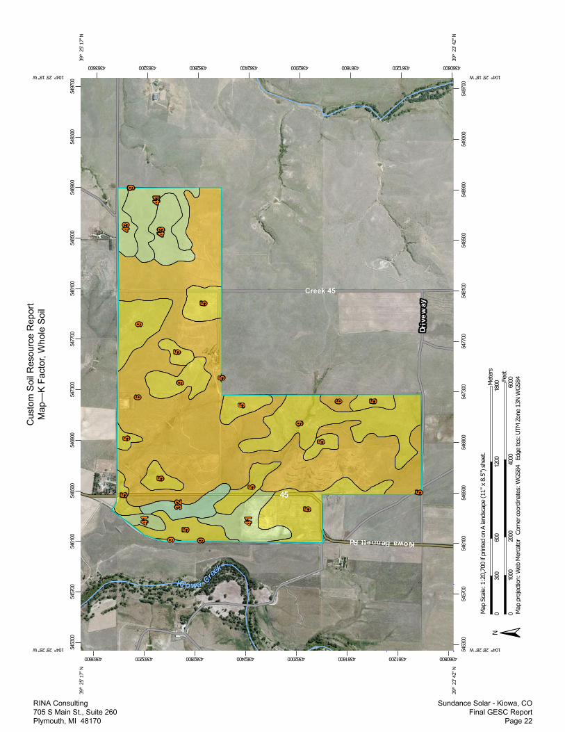
Table—K Factor, Whole Soil
K Factor, Whole Soil— Summary by Map Unit — Elbert County, Colorado, Western Part (CO623)
Map unit symbol Map unit name Rating Acres in AOI Percent of AOI
5 Bresser sandy loam, 0 to4 percent slopes
.17 177.9 18.8%
6 Bresser sandy loam,cool, 5 to 9 percentslopes
.15 476.5 50.3%
9 Bresser-Truckton sandyloams, 8 to 25 percentslopes
.17 150.3 15.9%
32 Nunn clay loam, 0 to 4percent slopes
.28 20.8 2.2%
41 Truckton sandy loam, 4to 8 percent slopes
.24 79.3 8.4%
43 Weld loam, 0 to 4percent slopes
.24 41.9 4.4%
Totals for Area of Interest 946.6 100.0%
Custom Soil Resource Report
RINA Consulting 705 S Main St., Suite 260 Plymouth, MI 48170
Sundance Solar - Kiowa, CO Final GESC Report
Page 24

Appendix B Engineer’s Cost Estimate for Soil Erosion & Sediment Control BMPs
Elbert County Standard Seed Mix Information Runoff Coefficient Calculations
GESC Plans
RINA Consulting 705 S Main St., Suite 260 Plymouth, MI 48170
Sundance Solar - Kiowa, CO Final GESC Report
Page 25

Project: Computed: KMKClient: Checked: JJHLocation: Date: August 8, 2017
Check Dam CD LF 24.00$ -$ Construction Fence CF LF 2.00$ -$ Concrete Washout Area CWA EA 2,500.00$ 3 7,500.00$ Diversion Ditch DD LF 1.60$ -$ Inlet Protection IP EA 200.00$ -$ Sediment Basin SB AC 1,000.00$ -$ Sediment Trap ST EA 600.00$ -$ Seeding and Mulching SM AC 1,500.00$ 4.7 7,050.00$ Stabilized Staging Area SSA SY 2.00$ 7,500 15,000.00$ Silt Fence SF LF 1.50$ 47,170 70,755.00$ Vehicle Tracking Control VTC EA 1,000.00$ 3 3,000.00$ Straw Bale Barrier STB LF 2.00$ -$
Total Cost of BMPs = 103,305.00$
Sundance Solar, LLCCypress Creek RenewablesKiowa, Elbert County, CO
INSTALLATION UNIT COST
UNITSPLAN IDBMP DESCRIPTION BMP QUANTITY BMP COST
Engineers Cost Estimate for Soil Erosion & Sediment Control BMPs
RINA Consulting 705 S Main St., Suite 260 Plymouth, MI 48170
Sundance Solar - Kiowa, CO Final GESC Report
Page 26

RINA Consulting 705 S Main St., Suite 260 Plymouth, MI 48170
Sundance Solar - Kiowa, CO Final GESC Report
Page 27

Proj
ect:
Sund
ance
Sol
ar, L
LCCo
mpu
ted:
KMK
Clie
nt:
CCR
Chec
ked:
JJH
Loca
tion:
Kiow
a, E
lber
t Cou
nty,
CO
Date
:Au
gust
8, 2
017
Parc
elTo
tal P
arce
l Are
aGr
avel
Gree
nbel
ts, A
gric
ultu
ral
Impe
rvio
us A
rea*
Impe
rvio
us A
rea*
Impe
rvio
us A
rea
per A
cre*
(Acr
es)
(Acr
es)
(Acr
es)
(acr
e)(A
cre
per A
cre)
A31
4.05
0.0
314.
12.
00%
6.28
0.02
0B
286.
040.
028
6.0
2.00
%5.
720.
020
C31
5.18
0.0
315.
22.
00%
6.30
0.02
0TO
TAL
OR
AVG.
915.
270.
091
5.3
2.00
%18
.31
0.02
0
Incr
ease
inPa
rcel
Tota
l Par
cel A
rea
Grav
elCo
ncre
te P
ads
Conc
rete
Pad
sSo
lar A
rray
Pan
els
I-Bea
ms
I-Bea
ms
Gree
nbel
ts, A
gric
ultu
ral
Impe
rvio
us A
rea*
Impe
rvio
us A
rea*
Impe
rvio
us A
rea
per A
cre*
Impe
rvio
us A
rea
(Acr
es)
(Sft
)(S
ft)
(Sft
)(A
cres
)(a
cre)
(Acr
e pe
r Acr
e)(A
cre
per A
cre)
A31
4.05
7,78
214
3,50
015
6,89
715
,496
6,19
831
3.6
2.09
%6.
570.
021
0.00
1B
286.
040
375
035
,802
3,53
61,
414
286.
02.
02%
5.77
0.02
00.
000
C31
5.18
34,9
6916
4,00
014
0,61
613
,888
5,55
531
4.2
2.16
%6.
820.
022
0.00
2TO
TAL
OR
AVG.
915.
2742
,751
338,
250
333,
315
32,9
2013
,168
913.
82.
09%
19.1
60.
021
0.00
1*
- Per
cent
age
Impe
rvio
us V
alue
s fro
m E
lber
t Cou
nty
Cons
truc
tion
Stan
dard
s & S
peci
ficat
ions
, Sec
tion
611.
05.
Pave
d =
100%
, Gra
vel =
40%
Impe
rvio
us, G
reen
belts
, Agr
icul
tura
l = 2
% Im
perv
ious
, Hist
oric
al F
low
Ana
lysis
= 2
%
SITE
RUN
OFF
CO
EEFF
ICEN
T CA
LCUL
ATIO
NS
Parc
elRu
noff
Coef
ficie
nt (C
H)
Runo
ff Co
effic
ient
(CH)
Runo
ff Co
effic
ient
(CH)
Runo
ff Co
effic
ient
(CH)
Runo
ff Co
effic
ient
(CD)
Runo
ff Co
effic
ient
(CD)
Runo
ff Co
effic
ient
(CD)
Runo
ff Co
effic
ient
(CD)
2-yr
stor
m5-
yr st
orm
10-y
r sto
rm10
0-yr
stor
m2-
yr st
orm
5-yr
stor
m10
-yr s
torm
100-
yr st
orm
2-yr
stor
m5-
yr st
orm
10-y
r sto
rm10
0-yr
stor
mA
0.00
000.
0100
0.05
000.
2000
0.00
080.
0108
0.05
080.
2008
0.00
080.
0008
0.00
080.
0008
B0.
0000
0.01
000.
0500
0.20
000.
0002
0.01
020.
0502
0.20
010.
0002
0.00
020.
0002
0.00
01C
0.00
000.
0100
0.05
000.
2000
0.00
130.
0115
0.05
150.
2015
0.00
130.
0015
0.00
150.
0015
TOTA
L O
R AV
G.0.
0000
0.01
000.
0500
0.20
000.
0008
0.01
080.
0509
0.20
080.
0008
0.00
080.
0009
0.00
08
Proj
ect I
mpe
rvio
us A
rea
& R
unof
f Coe
ffic
ient
Cal
cula
tions
PRO
POSE
D SI
TE C
ON
DITI
ON
S
EXIS
TIN
G (H
ISTO
RICA
L) S
ITE
CON
DITI
ON
S
EXIS
TIN
G (H
ISTO
RICA
L) S
ITE
CON
DITI
ON
SPR
OPO
SED
SITE
CO
NDI
TIO
NS
INCR
EASE
IN R
UNO
FF C
OEF
FICI
ENT
(C)
RINA Consulting 705 S Main St., Suite 260 Plymouth, MI 48170
Sundance Solar - Kiowa, CO Final GESC Report
Page 28