gis in tourism - a zimbabwean perspective
TRANSCRIPT

197
GIS IN TOURISM - A ZIMBABWEAN PERSPECTIVE
Ch. Dondo *, S. T. Bhunu, U. Rivett
Department of Geomatics, Faculty of Engineering and Built Environment, University of Cape Town 7701, Rondebosch, CapeTown, South Africa, [email protected], [email protected], [email protected]
KEYWORDS: GIS, Tourism, Zimbabwe
ABSTRACT:
The success of tourism in any country depends on the ability of that country to sufficiently develop, manage and market the tourismfacilities and activities in that country. Most developing countries depend mainly on tourism for economic growth and diversity.Zimbabwe, a developing country in Southern Africa, is one such country. In Zimbabwe, agriculture and tourism are two of thelargest foreign currency earners. Because of the uncertainties in agriculture resulting from the unpredictable climate conditions andfluctuations of prices of agricultural products on the international market, among other issues, tourism remains the only reliablesource of investments and foreign currency. Therefore, there is the need to invest into the industry and develop it to meetinternational standards. This paper gives a background on tourism in Zimbabwe and how Zimbabwe Tourism Authority, the largest,government-owned tourism organisation in Zimbabwe, is managing it. An analysis of the shortfalls of the system in place isinvestigated and a discussion on an initiative for the development and the implementation of Geographic Information Systems in theorganisation and the advantages it has to offer.
* Corresponding author.
1. INTRODUCTION
Definition of Tourism"Tourism is a composite of activities, facilities, services andindustries that deliver a travel experience, that is, transporta-tion, accommodation, eating and drinking establishments,entertainment, recreation, historical and cultural experiences,destination attractions, shopping and other services availableto travelers away from home." (Tourism and Leisure Com-mittee, 1997)
Worldwide, the significance of tourism, as defined by Ghosh(1998), is, among other, one of the major items of interna-tional trade. The industry helps in facilitating the flow of for-eign currency amongst countries. In developing countries,according to Medlik et al. (1991), tourism is mainly seen as agrowth industry as the flow of tourists in these countries dis-tributes foreign currency. During the UNCTAD June 1998summit, tourism was cited as the only major sector, interna-tionally, in which developing countries have consistently hadsurpluses, the positive balance in their travel account havingimproved from six billion United States dollars in 1980 tosixty two billion United States dollars in 1996. Developingcountries account for nearly 30 per cent of world tourism re-ceipts.
In Zimbabwe, tourism is one of the industries with thestrongest effect on the economy because it helps in develop-ing other sectors. According to statistics supplied by SADC(1999), tourism in Zimbabwe contributes about five percentto the Gross Domestic Product (GDP). The sector employsapproximately eighty thousand people directly and indirectly.The tourism sector is estimated to have generated two billionZimbabwe dollars in 1996/1997 for the country. This makes
it the third highest earner of foreign currency, after agricul-ture and mining. Tourism has the potential of becoming thehighest generator of foreign currency for Zimbabwe.
According to Fridgen’s (1991) study of an American model,the success of any tourism business could be determined by:
� Tourism planning� Tourism development and research� Tourism marketing
According to Van Arragon and Wessels (1994), there has al-ways been a direct relationship between tourism and cartog-raphy. From the definition of tourism above, tourism is con-cerned with travelling between close and distant places andmaps are an important aid for location of these places. Noother social activity involves the use of maps and thematicinformation for communication as much as does the tourismsector. Maps of travel routes and general information aboutthe areas to visit are used in selecting the destination and inplanning travel and stay.
On a continental scale, in June 1999, Noel de Villiers de-signed a concept called the African Dream in which GIS, sat-ellite technology and the Internet would be integrated to forma continuous network of Afrika tourism routes from Cape toCairo, with the Patron of the organisation being Mr NelsonMandela. This approach to tourism is unique and is a way ofconserving the environment, creating jobs and promotingtourism (Open Africa, 2002).
Locally, the Zimbabwe Council of Tourism carried out astudy on the importance on tourism research in decision-making and tourism development. Zimbabwe Council of

The International Archives of the Photogrammetry, Remote Sensing and Spatial Information Sciences, Vol. XXXIV, Part 6/W6
198
Tourism investigated the use of GIS in Tourism Research instoring, manipulating and analysing the voluminous tourismdata and survey carried out. It also discussed the possibilityof producing graphics on paper or on screen to broadcast theresults.
2. THE SITUATION
Operators of tourist facilities in different towns and cities inZimbabwe have been coming together and forming their owninformation centres or publicity associations, for exampleKariba Publicity Association and the Masvingo Publicity As-sociation. These associations come up with successful mar-keting strategies for their individual areas. Travel agenciesare also private organisations that provide information on thecountry’s tourist facilities and arrange personal holidaypackages. These organisations successfully market them-selves or hire other organisations to do so, mainly on theInternet, on local and international media and using colourfulbrochures and publications.
The main shortfalls of these Publicity Associations and travelagencies are that they only market tourism facilities and ac-tivities in their specific areas and not the whole country.They also only concentrate on tourism marketing and hencethere is no planning, development and research in the area tofurther improve the tourism sector.
The Government of Zimbabwe set up the Zimbabwe TourismAuthority to successfully market tourism in Zimbabwe and tofurther develop the industry. The organisation is divided intothe following four divisions:
� Human Resources and Standards� Marketing and Communications� Finance and Administration� Research and Development
The Marketing and Communications division is the backboneof the whole organisation. This division disseminates infor-mation on tourist facilities and activities to international andlocal people, as a way of advertising. Without advertising,there would be no thriving tourism industry. Clients usuallyrequest for the information via the phone, e-mail or personalvisits to this division. According to an interview by personnelat ZTA, the following is a list of typical queries:
� Travel arrangements in the country, whether youneed visas and so on
� Information on the tourist facilities in the country,regarding location and facilities on offer.
� Advice on the best possible holiday option� Restrictions on travelling, the best transport mode
to use, timetable of flights� Students and persons working in education looking
for statistics and other general information
To respond to the queries, personnel refer to either some in-formation in Microsoft Excel, Microsoft Word, Smartsuitedatabases or brochures and paper files.
3. PROBLEMS BEING FACED
One of the problems encountered in the tourism industry isthe need for quick update and maintenance of the voluminous
tourism data. In Zimbabwe, tourism authorities are continu-ously collecting data on tourist facilities. At the ZimbabweTourism Authority, most of this information is stored inhardcopy format. Some of the information gets lost aftersome time.
The current procedures for publishing the data are madeavailable through traditional channels like booklets, bro-chures and journals. Tourist facilities operators produce mostof these brochures but since production is very expensive,they make them available to ZTA at their own discretion andin small quantities. The Marketing Division has to rely onthese brochures for visual representations of the facility andthe rates but these usually run out fast as a copy is handedout to a visiting client who requires it and also the informa-tion is not very detailed. There is also lack of information onother tourist facilities.
With the information in different places, some in paper files,some on the computer, it usually takes a long time to respondto a client’s query, especially if they are phoning for the in-formation. This gives pressure on the employee and can leadto dissemination of poor quality information.
When the company underwent computerisation a few yearsago, their computers where not put on a network. The un-availability of a network leads to each division storing its in-formation on their own computers. Anybody from one divi-sion and requiring information from another division has tophysical go to that department to get it. There is also redun-dancy as each division keeps a copy of the same tourist in-formation.
4. DEVELOPMENT OF THE GIS
According to the New York State Archives GIS Develop-ment Guide, database planning is the single most importantactivity in GIS development. For designing this database,relational database modelling was used in Microsoft Access.Figure 1 below is a diagram indicating the flow of informa-tion into and out of the GIS and some of the information,which was involved in the data capturing stage.
Figure 1. Flow of information in the GIS
The International Archives of the Photogrammetry, Remote Sensing and Spatial Information Sciences, Vol. XXXIV, Part 6/W6
199
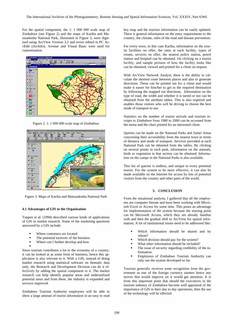
For the spatial component, the 1: 1 000 000 scale map ofZimbabwe (see Figure 2) and the maps of Kariba and Ma-tusadonha National Park, illustrated in Figure 3, were digit-ised using ArcView Version 3.2 and errors edited in PC Ar-cEdit (ArcInfo). Avenue and Visual Basic were used forcustomisation.
Figure 2. 1: 1 000 000 scale map of Zimbabwe
Figure 3. Maps of Kariba and Matusadonha National Park
4.1 Advantages of GIS to the Organisation
Toppen et al. (1994) described various kinds of applicationsof GIS in market research. Some of the marketing questionsanswered by a GIS include:
� Where customers are located� The potential turnover of the business� Where can I further develop and how�
Since tourism contributes a lot to the economy of a country,it can be looked at as some form of business, hence this ap-plication is also relevant to it. With a GIS, instead of doingmarket research using statistical software on thematic dataonly, the Research and Development Division can do it ef-fectively by adding the spatial component to it. The marketresearch can help identify popular areas and underutilizedpotential areas and from these, the industry is expanded andservices improved
Zimbabwe Tourism Authority employees will be able toshow a large amount of tourist information in an easy to read
key map and the tourism information can be easily updated.There is general information on the entry requirements to thecountry, the climate, rules of the road and disease prevention.
For every town, in this case Kariba, information on the tour-ist facilities on offer, the rates at each facility, types ofrooms, services on offer, the nearest police station, petrolstation and hospital can be obtained. On clicking on a touristfacility, and sample pictures of how the facility looks likecan be obtained, viewed and printed for a client on request.
With ArcView Network Analyst, there is the ability to cal-culate the shortest route between places and also to generatedirections. These can be printed out for a client and wouldmake it easier for him/her to get to the required destinationby following the mapped out directions. Information on thetype of road, the width and whether it is tarred or not can beobtained from the attribute tables. This is also required andenables those visitors who will be driving to choose the bestmode of transport to use.
Statistics on the number of tourist arrivals and tourism re-ceipts to Zimbabwe from 1980 to 2000 can be accessed fromthe menu and the chart printed for an interested client.
Queries can be made on the National Parks and Safari Areasconcerning their accessibility from the nearest town in termsof distance and mode of transport. Services provided at eachNational Park can be obtained from the tables. By clickingon several points in each park, information on the animals,birds or vegetation in that section can be obtained. Informa-tion on the camps in the National Parks is also available.
This list of queries is endless, and unique to every potentialtourist. For the system to be more effective, it can also bemade available on the Internet for access by lots of potentialvisitors from the country and other parts of the world.
5. CONCLUSION
From the situational analysis, I gathered that all the employ-ees are computer literate and have been working with Micro-soft Excel or Access for some time. This poses an advantagefor implementation of the system because the starting pointcan be Microsoft Access, which they are already familiarwith and then the gradual shift to ArcView for spatial infor-mation. A lot of institutional issues need to be addressed like:
� Which information should be shared and bywhom?
� Which division should pay for the system?� What other information should be included?� The issue of security regarding credibility of the in-
formation� Employees of Zimbabwe Tourism Authority can
only use the system developed so far.
Tourism generally receives some recognition from the gov-ernment as one of the foreign currency earners hence anymoves that would improve on it would get attention. It isfrom this important point that should the executives in thetourism industry of Zimbabwe become well appraised of theimportance of GIS in their day to day operations, then the useof the technology will be effected.

The International Archives of the Photogrammetry, Remote Sensing and Spatial Information Sciences, Vol. XXXIV, Part 6/W6
200
REFERENCES
Fridgen, J.D., 1991. Dimensions of Tourism. AH&MAEducational Institute, East Lansing, MI.
Ghosh, B., 1998. Tourism and Travel Managemen. VikasPublishing House Pvt Ltd.
Medlik, S., Jenkins, C.L., 1991. Managing Tourism.Butterworth-Heinemann.
Open Africa, 2002. The African Dream. www.openafrica.org.(accessed 6 March 2002).
SADC, 1999. Tourism in Zimbabwe. Official SADC Trade,Industry and Investment Review,http://www.sadcreview.com/country%20profiles%202001/zimbabwe/zimTourism.htm (accessed 6 March 2002).
Toppen, F., Wapenaar, H., 1994. GIS in Business: Tools forMarketing Analysis. Proc. EGIS 1994, EGIS Foundation,www.odyssey.maine.edu/gisweb/spatab/egis/eg94204.html
Van Arragon, J., Wessels, C., 1994.Travelling by thecomputer: application of GIS in tourism and recreation. Proc.EGIS’94,http://www.odyssey.ursus.maine.edu/gisweb/spatdb/egis/eg94202.html (accessed 7 March 2002).
ADDITIONAL INFORMATION SOURCES
Mejia, R.C., De Ugrte, N.C., Molina, N., Indriago, J., 2000.Sigtur-Zulia: An Application of GIS Technologies forTourism Planning. Proc. ESRI User Conference 2000,http://www.esri.com/library/userconf/proc00/professional/papers/PAP709/p709.htm (accessed 7 March 2002).