gis for tourism - weebly
TRANSCRIPT

GIS for Tourism
“Tourism Impacts and Sustainability: A Sharing of
International Best Practices”
Saint Paul University Manila
October 03, 2016
Eric Brillantes Information Technology Officer ll NAMRIA

What is NAMRIA?
National Mapping and Resource Information Authority
“NAMRIA shall act as the central mapping agency
which will serve the needs of the line services of the DENR
and other government offices with regard to information
and researches, and shall extend its capability in the
production and maintenance of maps, charts and similar
photogrammetry and cartography materials”
Section 22(a) of E.O. 192, S. 1987:

“By 2020, NAMRIA is a center of excellence
building a geospatially-empowered
Philippines”
“To provide accurate, timely and accessible
topographic maps, nautical charts, and
other geospatial products and services”

NAMRIA Main Office,
Fort Andres Bonifacio,
Taguig City


CORE FUNCTIONS
1. Geodetic Reference System Development
2. Topographic Base Mapping
3. Hydrography, Physical Oceanography and Nautical Charting
4. Environment and Natural Resource Mapping
5. Maritime Zones and Boundaries Mapping
6. Geospatial Information Management and Services

PRODUCTS:
• Topographic Base Maps
• Thematic Maps and
Administrative Maps
• Nautical Charts and Other
Maritime Publications
• Geographic Information
Systems
• Geospatial Digital Data
• Technical Publications

SERVICES:
• Geodetic Surveys
• Geodetic Information
Databasing
• Topographic and
Photogrammetric Surveys
• Hydrographic Surveys
• Land Classification Surveys
• Thematic Mapping
• Geomatics Training
• Geospatial Information
Services
• Systems Development and
Programming
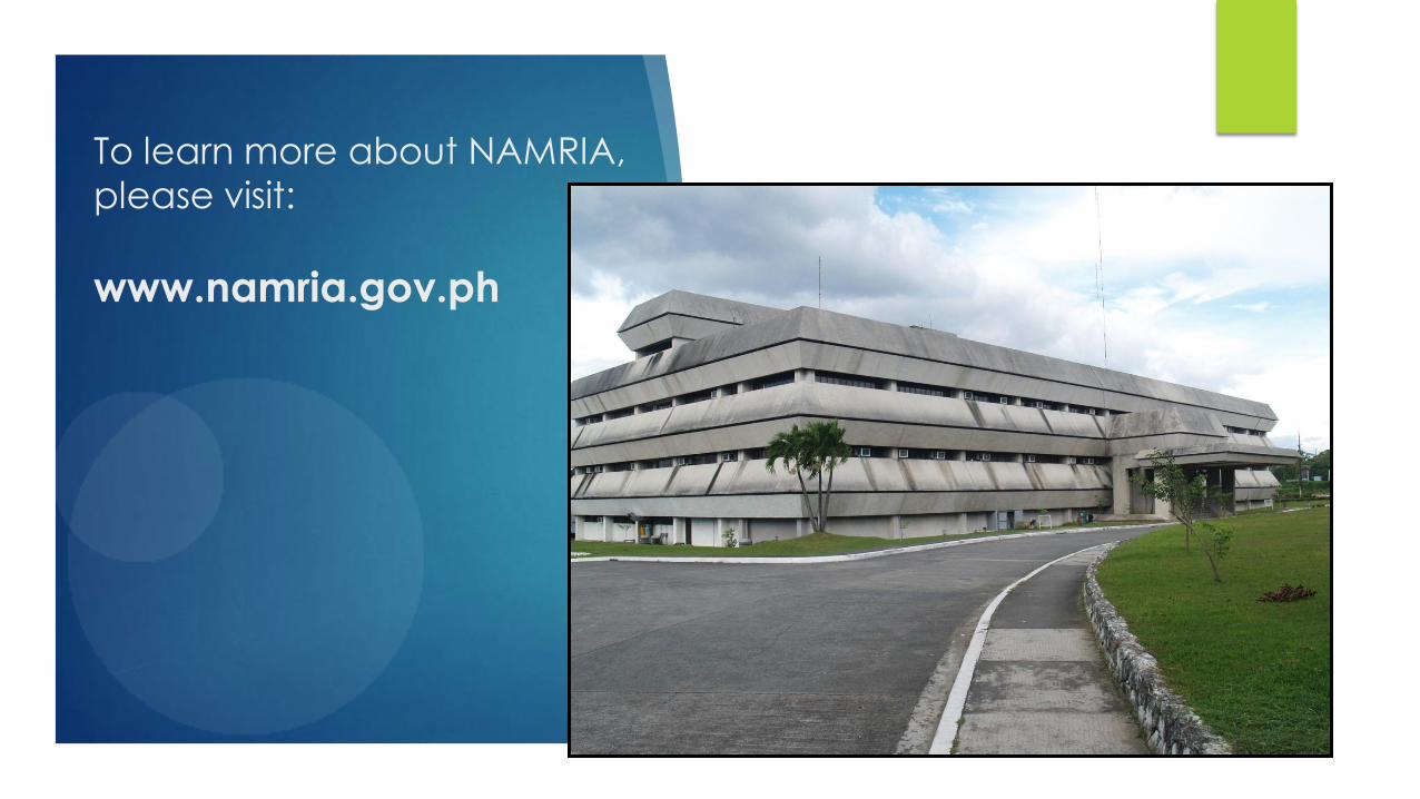
To learn more about NAMRIA,
please visit:
www.namria.gov.ph

What is GIS?
GIS or Geographic Information System is a specific information system applied to geographic data and is mainly referred to as a system of hardware, software, personnel and procedures designed to capture, manage, manipulate, analyze, model and display spatially referenced data for solving complex planning and management problems [Burroughs, 1986; NCGIA, 1990].

Components of GIS

What is GIS?
GIS data are arranged
in layers

Data Sources for GIS
maps
aerial photos
satellite images
technical descriptions
GPS data
What is GIS?

Kinds of Data GIS Handles
• Spatial data
• usually translated into simple objects: points, lines, areas and grids (pixels).
• represented as maps.
• Example: a parcel of land
• Attribute data (Non-spatial or Aspatial Data)
• are descriptive information about specified spatial objects.
• often have no direct information about the spatial location but can be linked
to spatial objects they describe.
• Usually organized in tables
• Example: the owner of a parcel of land
What is GIS?

Tourism is a major source of revenue for the development of a
country. Most developing countries depend largely on tourism for
economic growth and stability. The success of tourism industry in any
country depends on the ability to efficiently develop, manage and
market the tourists destinations.
Why use GIS in Tourism?
GIS can be an effective tool to achieve a sustainable tourism
development. GIS data (spatial) can be used to study the socio-
economic and environmental impacts and assist in decision-making
processes.

Why use GIS in Tourism? GIS can help in:
• Visualizing the locations of
tourist sites

• Displaying important information about a particular tourist spot
- Pictures - Videos - Facilities/Amenities available
Why use GIS in Tourism? GIS can help in:

• Preparing maps (tourist maps) – locations of tourist spots
Why use GIS in Tourism? GIS can help in:

• Selecting suitable sites for tourism development
- Hazard-prone or hazard-free? - Is it accessible? - Utilities available?
Why use GIS in Tourism? GIS can help in:

• Planning for expansion and
marketing or promotion
• Identifying the tourism
economic zones
Why use GIS in Tourism? GIS can help in:

• Identifying future tourist
destinations
Palumbanes Islands, Catanduanes
Why use GIS in Tourism? GIS can help in:

• Monitoring and analysis of
tourist influx as input to
tourism planning and
management
Why use GIS in Tourism? GIS can help in:

Why use GIS in Tourism?
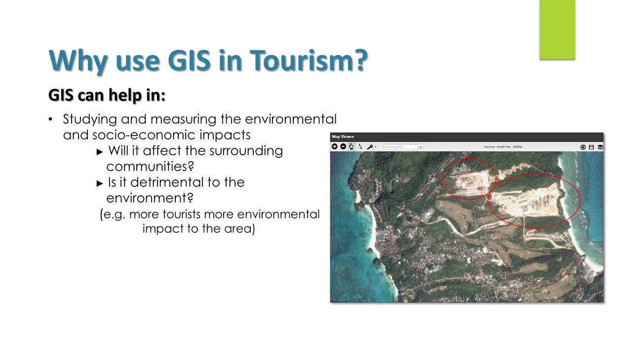
• Studying and measuring the environmental
and socio-economic impacts
► Will it affect the surrounding
communities?
► Is it detrimental to the
environment?
(e.g. more tourists more environmental
impact to the area)
Why use GIS in Tourism? GIS can help in:

GIS can be of help to a small tourism facility up to large tourism
development
Benefits of using GIS in Tourism?
• Better management and planning
• Improved communication
• Geographic data and statistics are efficiently stored

Demo:
Manifold GIS
Philippine Geoportal System