future of land imaging presentation to the usgs executive
TRANSCRIPT
Jeff Sloan USGS-Geosciences & Environmental Change Science Center National UAS Project Office Denver, Colorado USA October 2015
uas.usgs.gov
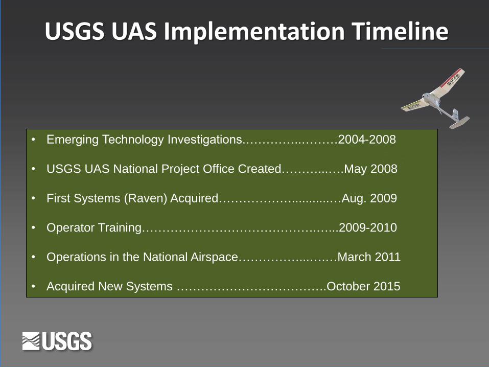
USGS UAS Implementation Timeline
• Emerging Technology Investigations.…………..………2004-2008
• USGS UAS National Project Office Created………...….May 2008
• First Systems (Raven) Acquired………………...........…Aug. 2009
• Operator Training…………………………………….…...2009-2010
• Operations in the National Airspace……………...….…March 2011
• Acquired New Systems ……………………………….October 2015

Policies: How to Operate in the United States National Airspace
• Certificate of Authorization (COA): - Authorization issues by the Air Traffic organization to a public operator for a specific UAS activity on a case-by-case basis.
• Memorandum of Agreement (MOA): - Originally signed Dec. 24, 2013 (updated Sept. 2015) FAA and DOI
- Information Bulletin No. 14-04 - under 1,200’ - line of sight - 5 nm from an airport (control tower) - 3nm from an airport (published instrument procedures) - 2nm from an airport (not having published instrument procedures) - 2nm from a heliport - not over people or urban settings - NOTAM - VFR weather minimums and allowed to fly at night
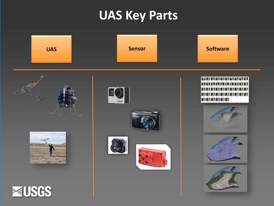
UAS Key Parts
UAS Sensor Software
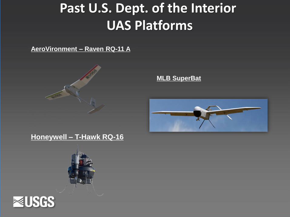
Past U.S. Dept. of the Interior UAS Platforms
AeroVironment – Raven RQ-11 A
Honeywell – T-Hawk RQ-16
MLB SuperBat
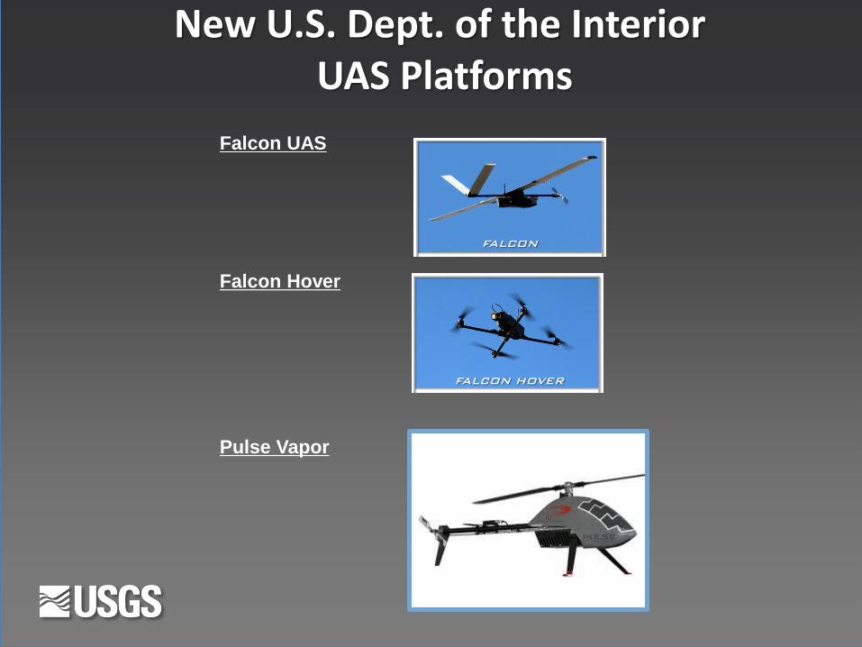
New U.S. Dept. of the Interior UAS Platforms
Falcon UAS
Falcon Hover
Pulse Vapor
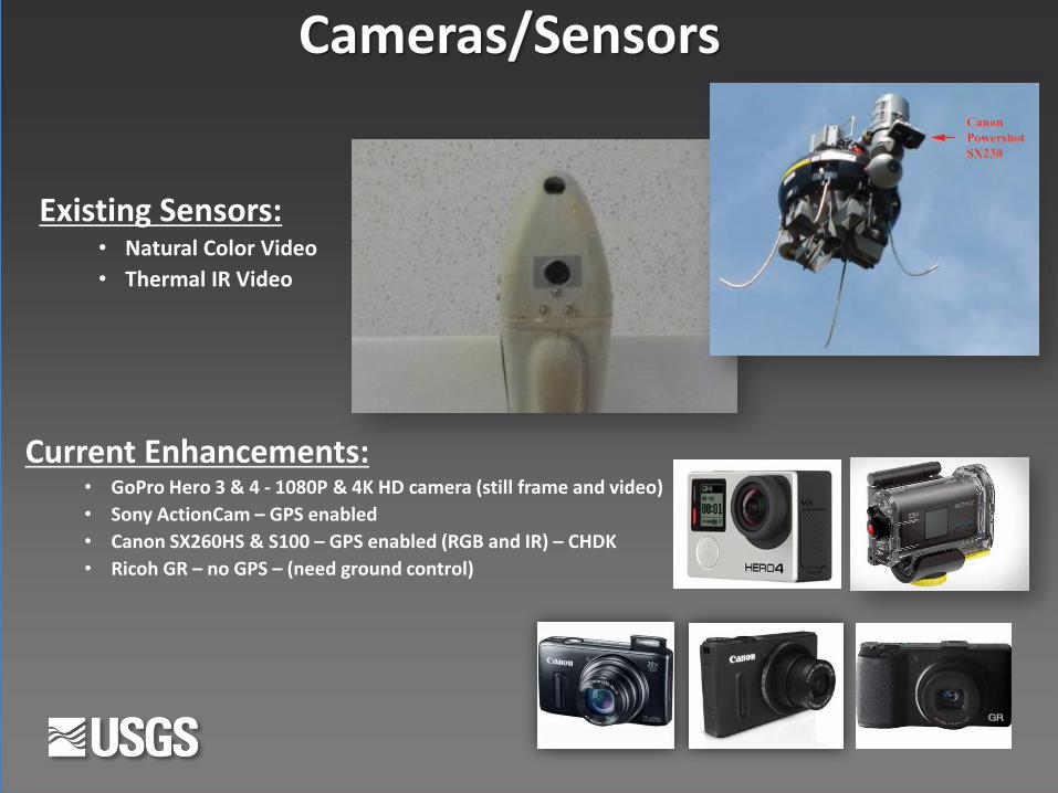
Existing Sensors: • Natural Color Video
• Thermal IR Video
Cameras/Sensors
Current Enhancements: • GoPro Hero 3 & 4 - 1080P & 4K HD camera (still frame and video)
• Sony ActionCam – GPS enabled
• Canon SX260HS & S100 – GPS enabled (RGB and IR) – CHDK
• Ricoh GR – no GPS – (need ground control)

New Sensors
5-Channel Multispectral Sensor Calibrated Thermal Sensor
5-Band MultiSpectral NDVI Courtesy of MicaSense Sample Images Courtesy of FLIR Tau 2 Sample Images
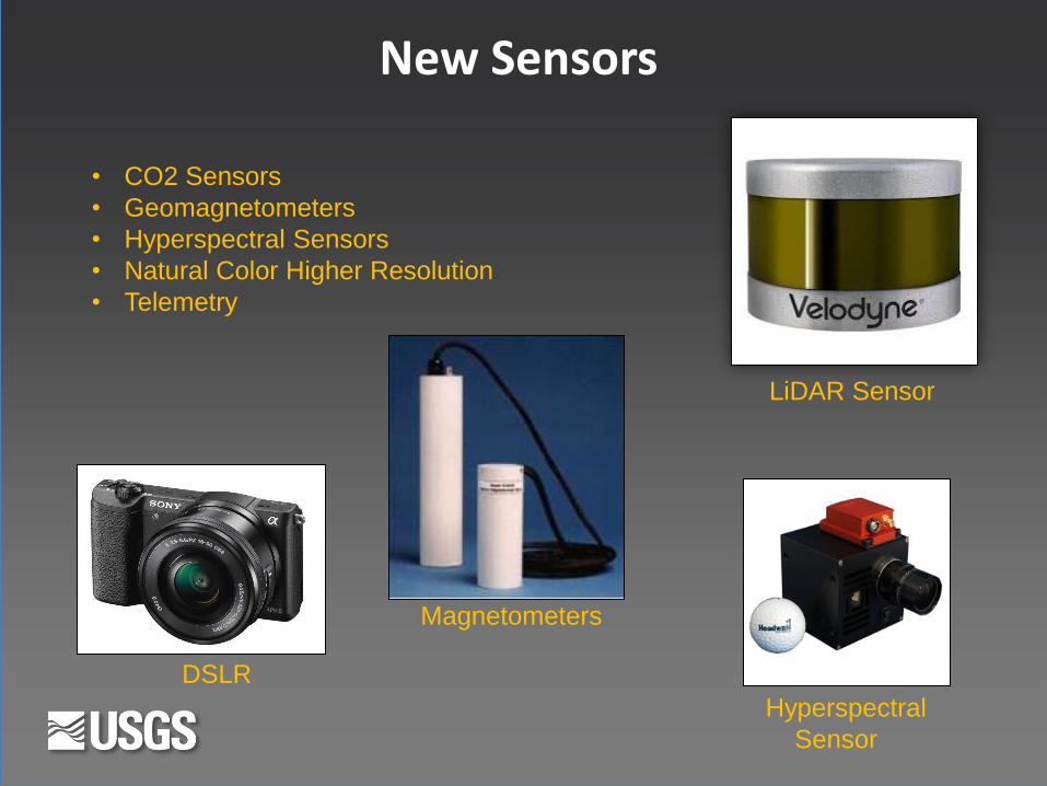
LiDAR Sensor
• CO2 Sensors
• Geomagnetometers
• Hyperspectral Sensors
• Natural Color Higher Resolution
• Telemetry
Magnetometers
Hyperspectral
Sensor
DSLR
New Sensors
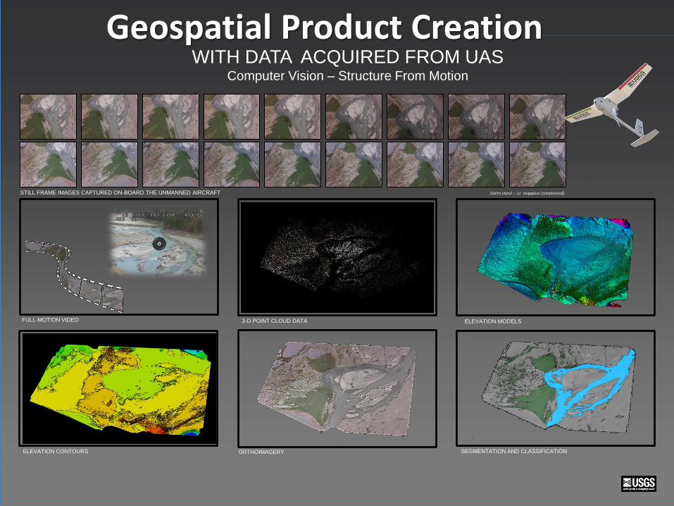
STILL FRAME IMAGES CAPTURED ON-BOARD THE UNMANNED AIRCRAFT GoPro Hero2 – 11 megapixel (compressed)
ORTHOIMAGERY ELEVATION CONTOURS
3-D POINT CLOUD DATA ELEVATION MODELS FULL-MOTION VIDEO
SEGMENTATION AND CLASSIFICATION
WITH DATA ACQUIRED FROM UAS Computer Vision – Structure From Motion
Geospatial Product Creation

UAS Derived Product Examples
Color Infrared - NDVI
Point Cloud Generation
Elevation Models Feature Extraction
KML – 3D Modeling Orthophotography Contour Generation Volumetric Measurements

UAS Data Production Process
Acquire Process Manage Exploit Disseminate
& Archive

UAS Data Production Process
Acquire Process Manage Exploit Disseminate
& Archive
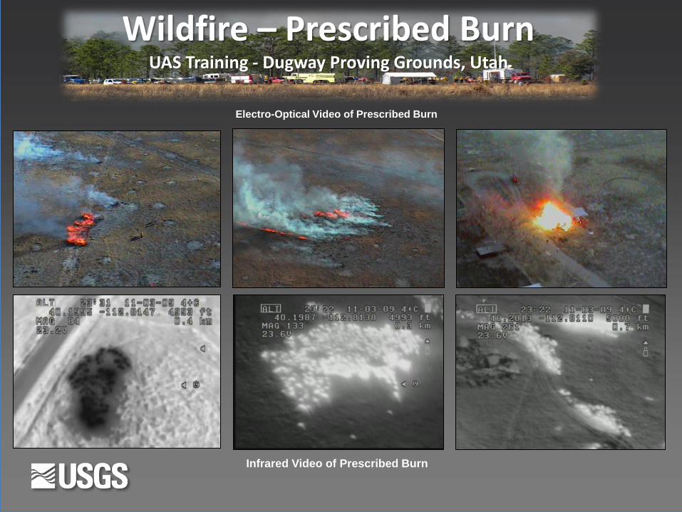
Infrared Video of Prescribed Burn
Electro-Optical Video of Prescribed Burn
Wildfire – Prescribed Burn UAS Training - Dugway Proving Grounds, Utah


Elwha Dam Removal and River Restoration Olympic National Park, Washington
Monitoring sediment volumes eroded from the reservoir
and deposited downstream, where the mobile sediment
can potentially affect salmon habitat.
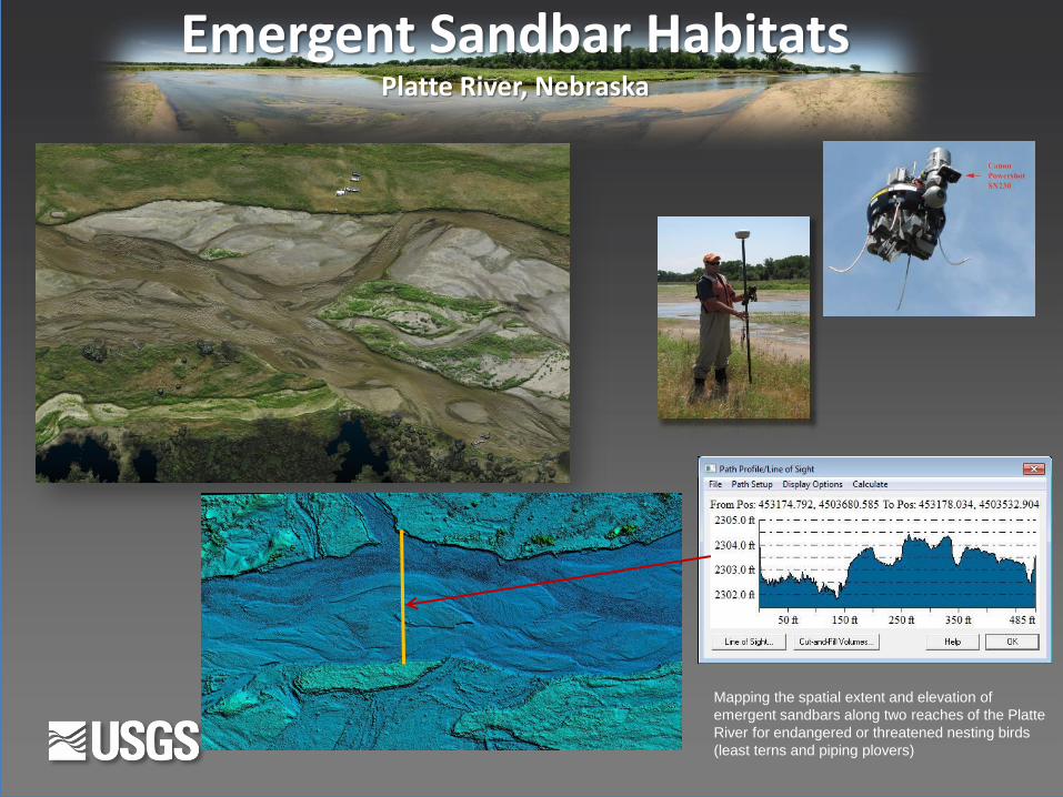
Emergent Sandbar Habitats Platte River, Nebraska
Mapping the spatial extent and elevation of
emergent sandbars along two reaches of the Platte
River for endangered or threatened nesting birds
(least terns and piping plovers)
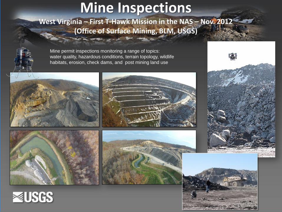
Mine Inspections West Virginia – First T-Hawk Mission in the NAS – Nov. 2012
(Office of Surface Mining, BLM, USGS)
Mine permit inspections monitoring a range of topics:
water quality, hazardous conditions, terrain topology, wildlife
habitats, erosion, check dams, and post mining land use

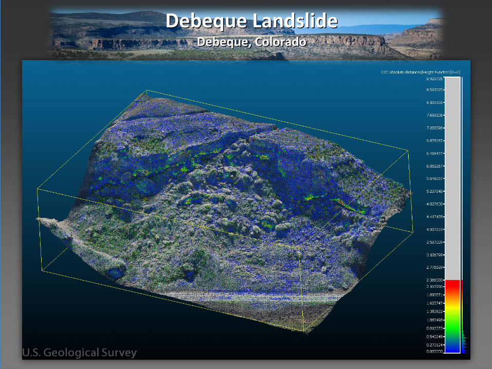
Debeque Landslide Debeque, Colorado
June 2013
October 2013
Temporal series of
Landslide models
monitoring
geomorphic
processes.
Debeque Landslide Debeque, Colorado

Digital Elevation Model Hillshade Volumetric Measurements (Cubic Yards)
Mining Stockpile Volumetric Measurements Kentucky – 2014
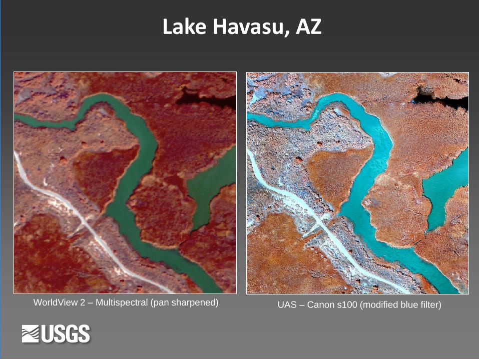
Lake Havasu, AZ
WorldView 2 – Multispectral (pan sharpened) UAS – Canon s100 (modified blue filter)

NDVI Low NDVI High
Color Infrared & Normalized Difference Vegetation Index (NDVI)
UAS Data Processing
Image collected from UAS – Canon SX230 HS – 400’
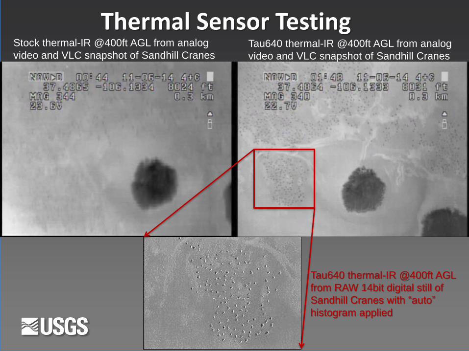
Thermal Sensor Testing Stock thermal-IR @400ft AGL from analog
video and VLC snapshot of Sandhill Cranes Tau640 thermal-IR @400ft AGL from analog
video and VLC snapshot of Sandhill Cranes
Tau640 thermal-IR @400ft AGL
from RAW 14bit digital still of
Sandhill Cranes with “auto”
histogram applied
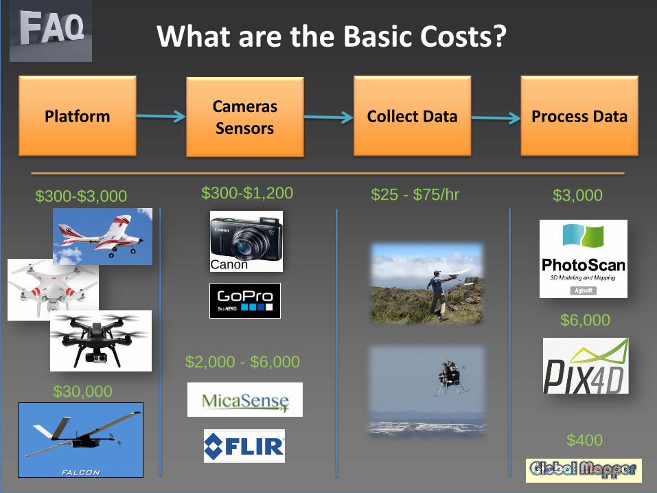
What are the Basic Costs?
Platform Cameras Sensors
Collect Data Process Data
$300-$1,200 $25 - $75/hr $3,000
$2,000 - $6,000
$400
$30,000
Canon
$300-$3,000
$6,000
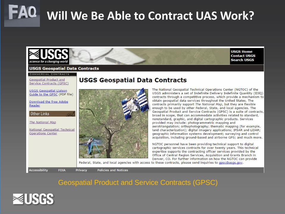
Will We Be Able to Contract UAS Work?
Geospatial Product and Service Contracts (GPSC)
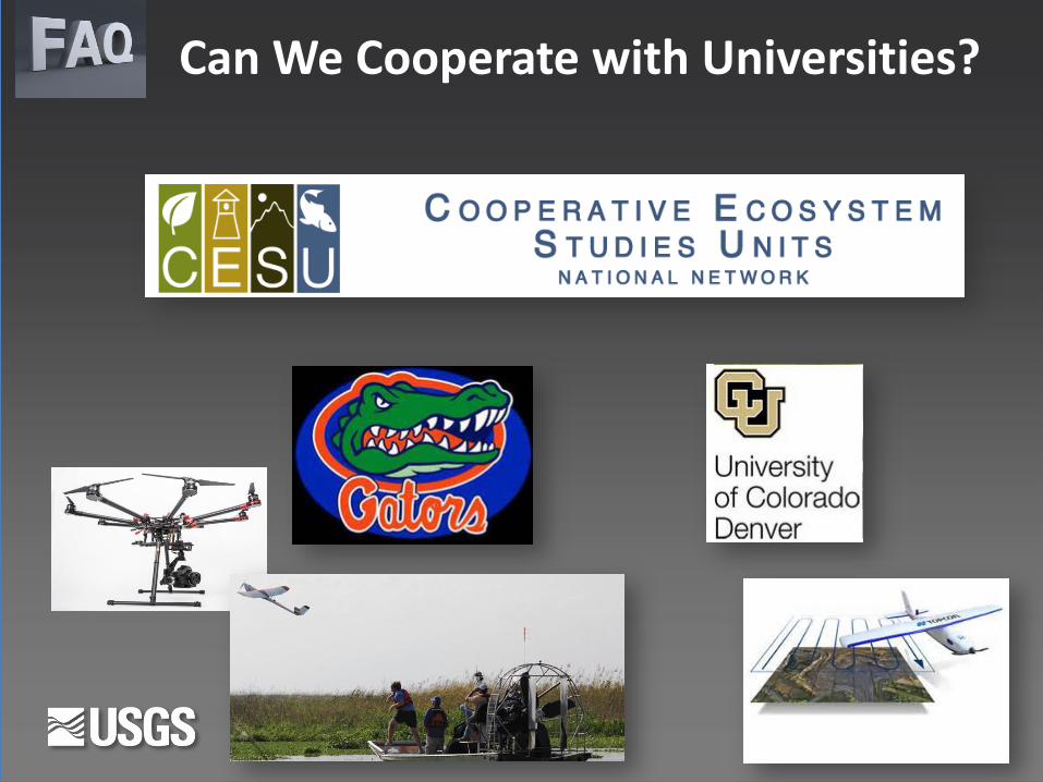
Can We Cooperate with Universities?
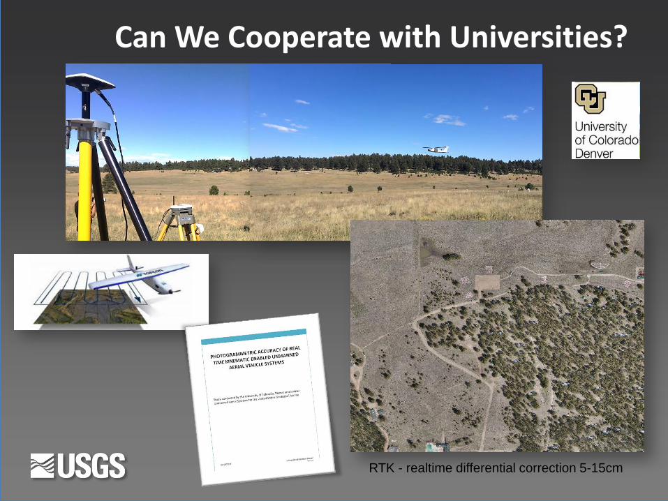
Can We Cooperate with Universities?
RTK - realtime differential correction 5-15cm
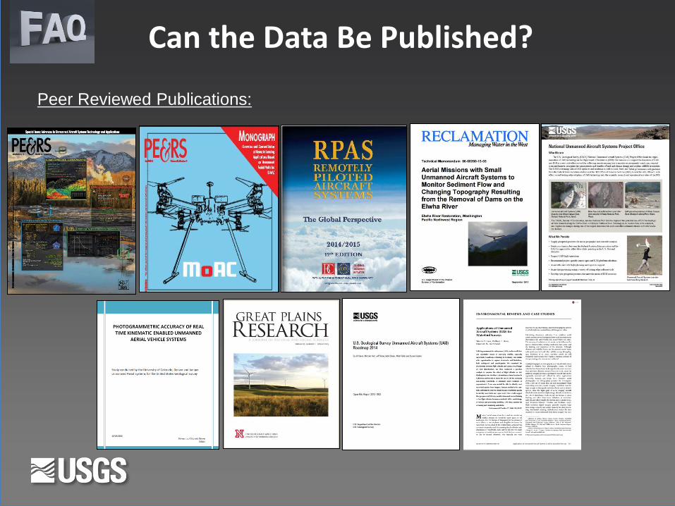
Can the Data Be Published?
Peer Reviewed Publications:
2016 USGS UAS Work
• Microclimate Studies
• Surface Water Dynamics
• Ground Water Surveys
• Agricultural Tile Line Surveys
• Tamarisk – Ground Water Surveys
• Fault Line Surveys
• Coastal Erosion
• Coastal Cliff Morphology
• Paleowetland Surveys
• Asian Carp, Waterfowl, Sea Turtle, Fur Seal Surveys
• Mine Surveys

2016 USGS UAS Work
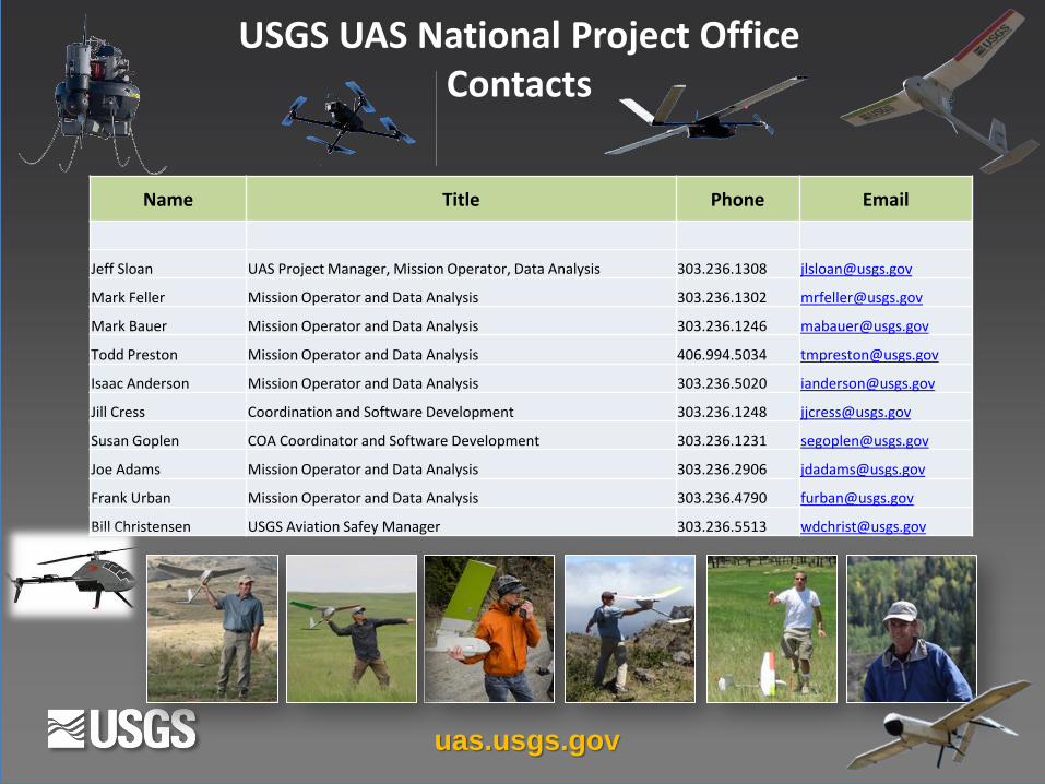
USGS UAS National Project Office Contacts
uas.usgs.gov
Name Title Phone Email
Jeff Sloan UAS Project Manager, Mission Operator, Data Analysis 303.236.1308 [email protected]
Mark Feller Mission Operator and Data Analysis 303.236.1302 [email protected]
Mark Bauer Mission Operator and Data Analysis 303.236.1246 [email protected]
Todd Preston Mission Operator and Data Analysis 406.994.5034 [email protected]
Isaac Anderson Mission Operator and Data Analysis 303.236.5020 [email protected]
Jill Cress Coordination and Software Development 303.236.1248 [email protected]
Susan Goplen COA Coordinator and Software Development 303.236.1231 [email protected]
Joe Adams Mission Operator and Data Analysis 303.236.2906 [email protected]
Frank Urban Mission Operator and Data Analysis 303.236.4790 [email protected]
Bill Christensen USGS Aviation Safey Manager 303.236.5513 [email protected]