february 16, 2010 january 5,2010 december 1,2009 october 5
TRANSCRIPT
ZONING CHANGE REVIEW SHEET
CASE: C 14-2008-0220 — Double Creek Village Z.A.P. DATE: October 6,2009November 3, 2009November 17, 2009December 1,2009January 5,2010February 16, 2010April 20, 2010October 5,2010November 2, 2010
ADDRESS: 10200— 10614 South JR 35 Service Road Southbound
OWNER: Sterling/Babcock & Brown AGENT: Alice Glasco ConsultingDouble Creek LP (Alice Glasco)
(Drew Ireland)
ZONING FROM: J-RR; CS Tth CS-MU AREA: 48.44 acres
SUMMARY STAFF RECOMMENDATION:
The Staffs recommendation is to grant general commercial services — mixed use —
conditional overlay (CS-MU-CO) combining district zoning. The Conditional Overlayprohibits the following uses: adult-oriented uses; bail bond services, campground;commercial blood plasma center; drop-off recycling collection facility; equipment sales;exterminating services; kennels; monument retail sales; pawn shop services; residentialtreatment; and transitional housing.
The Restrictive Covenant includes all recommendations listed in the Traffic Impact Analysismemorandum, dated October27, 2010. as provided in Attachment A.
ZONING AND PLATTING COMMISSION RECOMMENDATION:
October 6, 2009: APPROVED A POSTPONEMENTREQUESTBY STAFF To NOVEMBER3, 2009: BY CONSENT
[T. RABAGO; C BANKS— ZJ (7-0)
November 3, 2009: APPROVED A POSTPONEMENT REQ VEST BY STAFF TONOVEMBER 17, 2009; BY CONSENT
[[3. TJEMANP £ BALDRJD GE —
j (7-01
November 17, 2009: APPROVED A POSTPONEMENTREQUESTBY STAFF TODECEMBER], 2009; BY CONSENT
[5. BALDRIDGE; T. RABAGO - 2ND] (6-0) D. TIEMANN-ABSENT

C14-2008-0220 Page 2
December 1, 2009: APPROVED A POSTPONEMENT REQUESTBY STAFF TO JANU4RY5, 2010; BY CONSENT
[D. TIEMANN; C BANKS - 2ND] (7-0)
January 5, 2010: APPROVED A POSTPONEMENT REQUESTBY STAFF TO JANUARY19. 2010; BY CONSENT
[D TIEMA1MV, C BANKS - 2ND] (3-01 T. K4BAGO - NOT YETARRIVED:G. BOURGEOIS- ABSENT
February 16, 2010: A PPRO VED A POSTPONEMENT REQ LIEST BY THE APPLICANT TOAPRIL 20, 2010: BY CONSENT
[S. BALDRIDGE. G. BOURGEOIS - 2ND] (7-0,)
April 20, 2010: TO GRANTANLVDEFINITE POSTPONEMENTAS STAFFRECOMMENDED: BY CONSENT
[S. BALDRIDGE, D. TIEMANN - 2ND] (7-0)
October 5, 2010: APPROVED A POSTPONEMENTREQUESTBY THE STAFF TONOVEMBER 2, 2010.
[5. BALDPJDGE; T. RABAGO- 2ND] (7-0)
November 2, 2010: APPROVED STAFF RECOMMENDATION OF CS-MU-CO DISTRICTZONING WITH CONDITIONS OF THE TIA; BY CONSENT
[P. SEEGER; D. TIEMANN - 2/ (7-0)
NOTE: STAFF READ INTO THE RECORD THAT RIGHT-OF- WAY FOR THE NEW LOOPROAD WAS A CONDITION OF TM APPRO VAL AND WOULD BE DEDICATED AT THETIME OF ZONING.
ISSUES:
The Applicant has met with representatives of the Onion Creek Homeowners Association todiscuss the zoning request.
DEPARTMENT COMMENTS:
The subject zoningi’rezoning area is undeveloped, has access to the TH-35 frontage road andOld San Antonio Road. The majority of the subject area is zoned interim — rural residence (IRR) district, with the portion extending down to FM 1626 zoned general commercial services— conditional overlay (CS-CO) by way of a 2003 case also named Double Creek Village.This extension between the IH 35 frontage road and FM 1626 was shown as StablewoodDrive on a Preliminary Plan of Stablewood at Slaughter Creek. The Preliminary Plan alsoinciuded adjacent properties to the north, west and south. Since this particular area of thePreliminary Plan did not proceed to the final plat stage, it has expired. Within the pastseveral years, zoning for new commercial development and redevelopment has beenapproved for properties south of West Slaughter Lane in proximity to the IH-35 frontage

C14-2008-0220 Page 3
road and at its intersection with FM 1626 (zoned OR-CO — Wal-Mart, South Park Meadows;CS-CO — Janssen Tract, Double Creek Village Phase 1; CS-MU-CO — Harrell Tract #5, andDouble Creek Village Phase II). Please refer to Exhibits A (Zoning Map), A-l (VicinityMap), A-2, (Aerial Vicinity Map) and A-3 (Aerial View).
The Applicant proposes to zone the property general commercial services — mixed use —
conditional overlay (CS-MU-CO) district for up to 250.000 square feet of shopping centeruses, 400 hotel rooms, 48,000 square feet of sit-down restaurants. 16,000 square feet ofrestaurants with drive-through service, and 8,000 square feet of financial services with drive-through services, to be constructed in two phases. It is anticipated that Phase I will becomplete in 2013 and Phase 2 in 2018. The Mixed Use designation would allow forresidential development to occur in conjunction with commercial development. TheApplicant has offered to prohibit several uses and these have been incorporated into the Staffrecommendation.
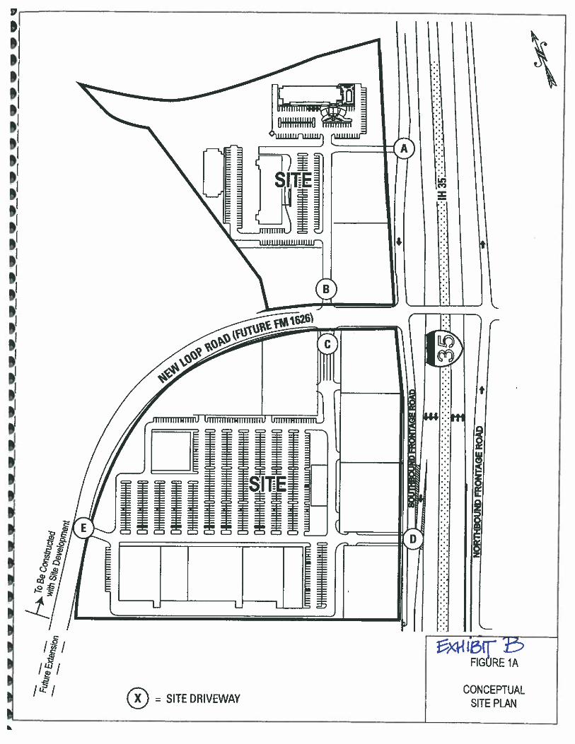
The zoning area also includes right-of-way for a loop road extending between FM 1626 andIH 35 (Tract 3), which will be dedicated at the time the zoning is finalized. As shown inExhibit B, two driveways are proposed to the southbound 11-1 35 frontage road and threedriveways are proposed to the new loop road. Vehicular access is not proposed to Old SanAntonio Road. That portion of Old San Antonio Road that is west of the (approximately)triangular OR-CO area (C 14-03-0053 as shown on Exhibit A) and extending to FM 1626 isproposed to be vacated with a cul-de-sac installed at the north portion. The vacated portionwill be available to the adjoining MF-3-CO/GR-MU-CO and GR-CO properties to the westand east, respectively.
Staff recommends CS-MU-CO district zoning based on the following considerations of theproperty: I) location on the southbound IH-35 frontage road which is suitable forcommercial uses; 2) properties to the north that access Slaughter Lane and south along theIH-35 frontage road have been approved for OR-CO or CS-CO zoning for similarcommercial and retail development; and 3) the Traffic Impact Analysis requires right-of-waydedication for the new loop road, and establishes intersection improvements for the new looproad at the IH 35 frontage road and FM 1626, as well as in proximity to the site.
EXISTING ZONING AND LAND USES:
ZONING LAND USESSire I-RR; CS-CO UndevelopedNon/i CS-MU-CO; OR- Undeveloped; Single family residence; Restaurant,
MU-CO; GR-CO; Theater, Auto repair serviceOR-MU-H-COI-RR; SF-2; CS-CO; Undeveloped; Auto sales
South CS-MU-COEast N / A Southbound service road of IH 35West GR-CO; SF-2; I-RR; Undeveloped; A few single family residences; Akins High
MF-2-CO School and football field

C 14-2008-0220 Page 4
AREA STUDY: N / A TIA: Is required — please refer to Attachment A
WATERSHEDS: Onion / Slaughter Creeks DESIRED DEVELOPMENT ZONE: Yes
CAPITOL VIEW CORRIDOR: No SCENIC ROADWAY: No
NEIGHBORhOOD ORGAMZATIONS:
26—Far South Austin Community Association627 — Onion Creek Homeowners Association742 Austin Independent School District 777 — Parkside at Slaughter Creek HOA786 — Home Builders Association of Greater Austin1037— Homeless Neighborhood Association 1075 — League of Bicycling Voters1113 — Austin Parks Foundation 1164— Austin Southwest Association1200— Super Duper Neighborhood Objectors and Appealers Organization1224— Austin Monorail Project
SCHOOLS:
Menchaca Elementary School Paredes Middle School Akins High School
CASE HISTORIES:
NUMBER REQUEST E COMMISSION CITY COUNCILC14-2010-01 11 — MF-2-CO to Scheduled for Scheduled for10301 Old San MF-2-CO. to November 2, 2010 November 4, 2010Antonio Road change aRezone condition of
zoning regardingdriveway access
C14-05-01 19— I-RR to CS To Grant CS-CO with Approved CS-CO asP.C.W. CO for 2,000 trips CommissionConstruction recommended (9-29-Equipment and 05).Sales— 10704South 11-1 35Service RoadSouthboundC14-04-0160 — I-RR to CS-MU- To Grant CS-MU-CO Approved CS-MU-COHarrell Tract #5 — CO with CO prohibiting as Commission10184— 10224 certain uses and recommended (12-2-South IH-35 limiting development 04).Service Road to 2,000 daily tripsSouthbound; 10101— 10139 Old SanAntonio Road

C 14-2008-0220 Page 5
C 14-04-0126 —
Harrell Tract #4 -
10100—10182I South 11-1-35
Service RoadSouthbound; 10100— 10128 Old SanAntonio RoadC14-03-0053 —
Double CreekVillage— 11000Block of South IH35 Service RoadSouthbound
C14-02-0052 —
Wedding Facility,Catering andRestaurant — 10300Old San AntonioRoad
CI4H-01-0104 —
Wedding/CateringFacility (MatthewBrown Homestead)— 10140 Old San
• Antonio Road
To Grant CS-CO withCO for list ofprohibited uses, RC forthe TL4 and establishthat the minimum sizefor a stand-alonerestaurant is 300 squarefeetTo Grant CS-CO forTract 1; SR-CO forTract 2, with conditionsof the TIA. CO is forlist of prohibited uses;and prohibits access toOld San Antonio Road.Restrictive Covenantfor the TIA.To Grant SR-MU-COwith CO limitingdevelopment of theproperty to bed andbreakfast residential,indoor and outdoorentertainment andrestaurants, 200 tripsper day, height of 35feet and 50% buildingcoverage. RCspecifying types ofevents and reservationof r-o-w on Old SanAntonio RoadTo Grant GR-MU-COH for Tract 1; SR-MU-CO for Tract 2, withCO for 35’ height,1,000 tnps per day,50% building coverage,60% impervious cover,uses limited to bed andbreakfast. RC to definethe types of gatheringsthat would occur; r-o-won Old San AntonioRoad
Approved CS-CO asCommissionrecommended (12-2-04).
Approved CS-CO forTract I and SR-CO forTract 2 withRestrictive Covenantfor the TIA asrecommended by ZAP(12-11-03).
Approved SR-MU-COwith RC asCornmissionrecommended (8-22-07).
Approved SR-MU-H-CO for Tract 1; GRMU-CO for Tract 2,with CO and RC asCommissionrecommended, withadditional permitteduses of indoor andoutdoor entertainment,
• and restaurants except• t(1 1/29/01).
C14-00-2031 — I-RR to MF-2 To Grant MF-2-CO j Approved MF-2-CO as
I-RR to CS-CO
I-RR to CS
I-RR to SR-MU-CO
I-PR to SR-MUCO-H for Tract1; SR-MU-COfor Tract 2
C1420080220 Page 6
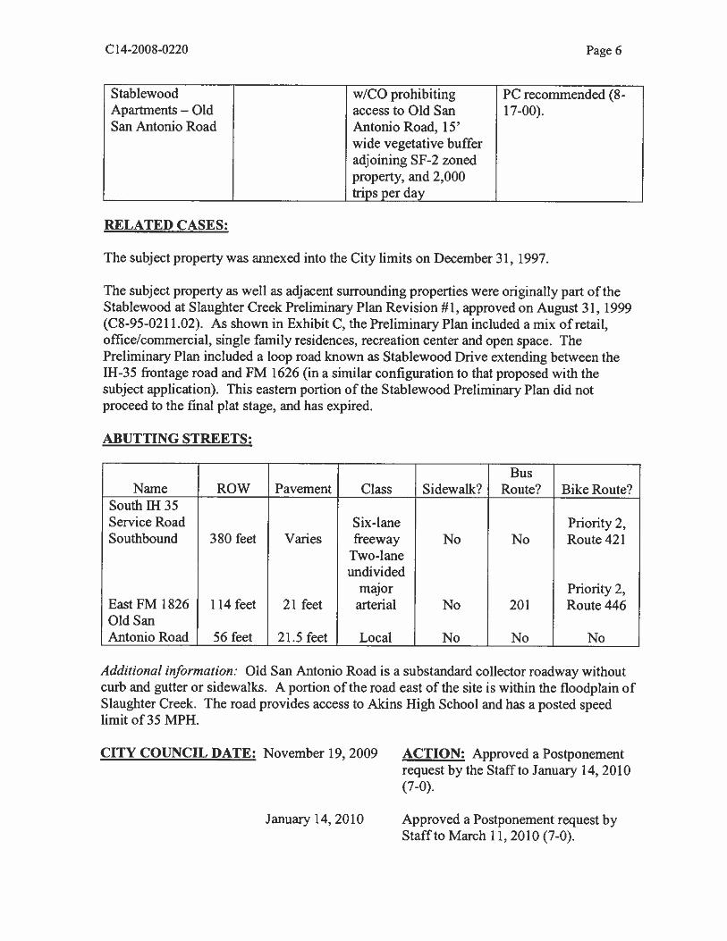
Stablewood wICO prohibiting PC recommended (8-Apartments — Old access to Old San 17-00).San Antonio Road Antonio Road, 15’
wide vegetative bufferadjoining SF-2 zonedproperty, and 2,000
I trips per day
RELATED CASES:
The subject property was annexed into the City limits on December 31, 1997.
The subject property as well as adjacent surrounding properties were originally part of theStablewood at Slaughter Creek Preliminary Plan Revision #1, approved on August 31, 1999(C8-95-021 102). As shown in Exhibit C, the Preliminary Plan included a mix of retail,office/commercial, single family residences, recreation center and open space. ThePreliminary Plan included a loop road known as Stablewood Drive extending between the11-1-35 frontage road and FM 1626 (in a similar configuration to that proposed with thesubject application). This eastern portion of the Stablewood Preliminary Plan did notproceed to the final plat stage, and has expired.
ABUTTING STREETS:
BusName ROW Pavement Class Sidewalk? Route? Bike Route?
South 11-1 35Service Road Six-lane Priority 2,Southbound 380 feet Varies freeway No No Route 421
Two-laneundivided
I major Priority 2,East FM 1826 114 feet 21 feet arterial No 201 Route 446Old SanAntonio Road 56 feet 21.5 feet Local No No No
Additional information: Old San Antonio Road is a substandard collector roadway withoutcurb and gutter or sidewalks. A portion of the road east of the site is within the floodplain ofSlaughter Creek. The road provides access to Akins High School and has a posted speedlimit of 35 MPH.
CITY COUNCIL DATE: November 19, 2009 ACTION: Approved a Postponementrequest by the Staff to January 14, 2010(7-0).
January 14, 2010 Approved a Postponement request byStaff to March 11,2010(7-0).

C 14-2008-0220 Page 7
March 11,2010
April 29, 2010
November 4, 2010
November 18, 2010
Approved a Postponement request byStaff to April 29, 2010 (7-0).
Approved an Indefinite Postponementrequest by Staff (7-0).
Approved a Postponement request byStaff to November 18, 2010 (7-0)
READINGS: 1” 3rd
CASE MANAGER: Wendy Rhoades PHONE: 974-7719
ORDINANCE
ORDINANCE NUMBER:
e-mail: wendy.rhoadesci.austin.tx.us

I —p
.P7
\GROØ_SL fl!T
• // y- 1t’b,,—..,. -—-_ .--—- -- ...—-1/, .F
/ ./ 1//I °“° E/ I 1//AS 3 I Lte.Lo4Eo
-, /(-I *1
I / I ISE-it’ 1--—>2) S //1 .0 / : sc
MF-2-CO/ I P / r—J:‘ I /
I-Re / /
1 ‘
:‘I fre13D-4I1 .arz / z z ri ,- a• s HeNSCH0OL 4
•-% FOOTB4LL 5 K
/ S 1SR
E • TRACT3
I I $Tfl3cfl 1/
/1I •r
$ #0 kI P t__. $
‘- 0 1 l-
>9 ‘
I * -—, /ø-—• !r%_ Ii /I
_
•4 sc,cc..s.c&isios I Cc.8Tax—o.sAIr.S5jzv.CEr
:j : /
tvK / : r— ‘ /——.., / .0 f 44 ‘c / e40 7 / —-/ ‘-.s ‘?$ ØGR-CO / / P-2Sc / /.7 MF-3-CO
6/ / //I_Ic4.
0,/ a
5 OI%C -._
j 1/ 7 CS-Co I
06 / / IV 0%_ / / SGM-MU-CO I % pg / - I
I / / pGM-MU-CO g 0 / /
-4--- -—- *4 / / :0
S
6 / 7/ 1-
— / // oraw.. .
// /7 / i——-:.:.. /
///‘
ocv / CS-MU-CO / -a5m /- - / /
-/
17 %.4 /
/_
/
___ ____ ________
N //JSUBJEcTTRACTA
___
A
PENDING CASE
— _ZONING BOUNDARY
1’ = 600’
ZONING
*— : O44G
I —‘-c1 /S_ g.. MF-2-CO
NN/14-’Mft .7
I a /
\ N..# :--“t .4
a
°
—-. GM-CO
.4
I
,J TRACT 1I
*S
SI
I
,R.nnieirs
*4Th
S
VI
II
Gj
I9———
:——-—..
.p4q a-a-IS —
I,’5
7 5J-25*I C74.-JS-OGl
-
- / L24wa551
GA-MU-Co II .15CS-MU-CO
ib_b
C / #&r%)7S% Zn.
1. /94;_b%
:%;4t-cç ciAc7
“-a,- rsF—( ;.‘— —N cs-c
GRCOW :crr \ \OçD4 .j—
:c’sI I-SF-2 ; 4 0, a,d!!*e- I-MR
,‘-tr4’ 24-J°J
*
---1p
u-a-al)5
54-Solo S
p*
ZONING CASE#:LOCATION:
SUBJECT AREA:GRID:
MANAGER:
Cl 4-2008-022010200-10614 S P1 35 SVRD SB48.144 ACRESF 11-12WENDY RHOADES
This map has been produced by the Communications Teohnology Management Dept. on behalf of thePlanning Development Review Dept. tot the sole purpose of geographic reterenca No warranty is made bythe Ctv of Austin reoardina snecufic accuracy or comoleteness.
= PROPOSED ROADWAY
= AVERAGE DAILY TRAFFIC
(VEHICLES PER DAY)
0 = SITE DRIVEWAY-o-o.-o-o- = ROADWAYTO BE REMOVED
42,200 VPD
/
SM LW
Pop 325
-1
LEGEND
1’
XXX VPO
I/
I,‘I
/(
( AREA LOCATION MAP

DOUBLE CREEK VILlAGE - ZONING

3 cs-MU-CO
UNDEV
.O4oD2O.jr I . -V. ao---’.--. kr --..-I
I /
I
4”
SP6-O292C
[-9124
‘U •
,/1—‘ SUBJECT
TRACT1* “9.:.
fl4T‘:‘/ 1)
/4!JIM
SQl DL
I 4 w4;! 1
34
T -CONSTRUCTIONI’-
•_
p44— .A
‘-1
F-/: jbti
rw
—w
——
w—
C)
-u-U
-—
ensiG
n
S 0,
m C C I
II

t[IITI1TL¶I
-—i—!&I-I’jtti—I
Ii
‘z2.119I)’t4a111ii1i1iflIIHIII!’I P:
thI‘lll’H’I
i;ht’ I!!!inirIII S
kr4
U
I iEkt
mijfj
J1IjI I,IJ—
I
I‘“‘pr;U
IiIIF!2
j1gIgIiiPit1IA quj
—II
itB!‘BI1
I‘141 —2
H
/
Li
F;
‘
—-i00
0
‘C
3’
C
—rr-r,
--5-a00—c
-1
n>r2a
3d,
Th[
-J
r‘‘—
“‘
2—->_
111•0N)>-<
L*J
I
Ill 1’V1I1ll1ML’MIIIIiWIIunil!:Hf
I’II1f’1ti.Jft
‘I’jfiti4gQ
lull!ll1’!H‘
uP”L: 1n..4i-
IIIIRIflIU•
thhE1T..s.as
U4WIEi’iim
1iiji1jiiiáiiiáii
II
:I.*t
I•11u1111111]]11 H(!tI!I
—‘
I/11
II
I
—
II
C,
C0c-fl
—3
b
:Il;iIjjflIt
STABLEW000ATSLAUGHTERCREEK
ERELYMINARYPLAN“‘“
QWNE:
1ORGINGSIS
ONYTSINC
IL”
_________________

LE
GE
ND
fl!fto
fl
,—
cn’-
NO
I0
rutO
EF.u
MW
iW.W
tWtA
LL
W00
Alr’r
OFLI
IiAL
[AI.
uz1’
4IC
..
1L
-
.of:
-I—
200
2000
:
SCAL
E:I
200
r014
2000
CoT
lut
aT?
OFAU
STiN
U1A
N00
00L
All
C8—
950’

Date: October 27, 2010
To: Wendy Walsh, Case Manager
CC: Kathy Hornaday, P.R. HDRIWHM
Reference: Cityview at Double Creek - TIA Final Memo C14-2008-0220
The proposed Cityview at Double Creek development is located at the southwest corner of the
intersection of IH 35 West Frontage Road and Old San Antonio Road. in Austin, Texas. This
30.6-acre development is anticipated to consist of 250,000 square feet of shopping center, two
hotels with 200 rooms each, 48,000 square feet of high turnover restaurant. 16,000 square feet of
fast food restaurant with drive-thru. and 8,000 square feet of drive-in bank. The property is
cunently vacant and the development is anticipated to be completed in two phases. Phase I will
be completed in 2013 and Phase 2 in 2018.
Access to the development is proposed via two driveways on IH 35 West Frontage Road and
three driveways on proposed New Loop Road. An extension of Slaughter Creek Overpass is
proposed as part of the Cityview at Double Creek development. This extension, New Loop
Road, will traverse the site and connect to Slaughter Creek Overpass at IH 35 West Frontage
Road.
The Transportation Review Section has reviewed the Traffic Impact Analysis for the Cityview at
Double Creek TIA, dated October 20, 2008 (revised October, 2010), prepared by Kathy
Hornaday, P.E., HDRJWHM and offer following comments:
TRIP GENERATION
Based on the standard tñp generation rates established by the Institute of Transportation
Engineers (1TE), the development will generate approximately 31,901 unadjusted average daily
4J74cuMwr4

thps (ADT) upon build out (18,200 trips in Phase I and 13,701 trips in Phase 2). The table below
shows the adjusted trip generation by land uses for the proposed development:
Table 1: Adjusted Trip Generation
ASSUMPTIONS
I. Traffic growth rates for the area were examined using previously collected traffic volumes
from TxDOT and were assumed at four (4) percent annually.
2. Background traffic volumes for Year 2013 include estimated traffic for the Double Creek
Village - Phase II and Saunders 143 developments.
I Reductions taken for pass-by and internal capture are shown in Table 2 below.
Table 2: Summary of Pass-By, Internal Capture and Transit Reductions
Pass-By Reductions % Internal capture %Land Use AM Peak PM Peak AM Peak PM Peak
Shopping Center 0 34 5 5Hotel 5 5
High Turnover Restaurant 0 43 5 5Fast-Food Restaurant with Drive-Thru 49 50 5 5Drive-in Bank 0 47 5 5
Proposed Land Use Size (si) ADT AM Peak Hour PM Peak HourEnter Exit Enter Exit
Phase IShopping Center 250,000 9,714 157 101 345 374Hotel (Rooms) 200 1,695 74 53 65 68HighTurnoverRestaurant 5,000 474 29 27 18 11Fast-Food Restaurant withDrive-Thru 3,000 714 39 38 26 24Drive-in Bank j 8,000 1,433 52 41 92 92Subtotal 14,030 351 260 546 569
Phase 2
Hotel (Rooms) - 200 1.695 74 53 65 68High Turnover Restaurant 43,000 4.077 245 226 155 99Fast-Food Restaurant withDrive-mm 13,000 3,094 171 164 III 103Subtotal 8,866 490 443 331 270
Total 22,896 841 703 877 839
EXISTING AN]) PLANNED ROADWAYS
III 35 is classified as a six-lane freeway between Slaughter Lane and FM 1626 by the Austin
Metropolitan Area Transportation Plan (AIvIATP) and the Capital Area Metropolitan Planning
Organization (CAMPO) 2030. According to TxDOT traffic counts, die 2006 traffic volume on
li-I 35, north of Slaughter Lane, was approximately 110,100 vehicles per day (vpd). The Austin
Bicycle Plan recommends Priority 2 Route 421 from WilLiam Cannon Drive to FM 1626 on the
IH 35 frontage roads.
According to the CAMPO 2030 Mobility Plan, IH 35 is planned to be upgraded to an eight-lane
freeway with managed lanes between Slaughter Lane and FM 1626. According to the AMATP,
Il-i 35 is planned to be upgraded to an eight—lane freeway between Slaughter Lane and FM 1626.
FM 1626 is classified as a two-lane undivided major arterial and a four-lane divided major
arterial between IT-I 35 and Manchaca Road per the CAMPO 2030 Transportation Plan and
AMATP. According to TxDOT traffic counts, the 2006 traffic volume on FM 1626, west of IH
35. was approximately 10,500 vpd. The Austin Bicycle Plan recommends Priority 2 Route 446
along FM 1626 from IH 35 to Manehaca Road. FM 1626 is planned to be upgTaded to a four-
lane divided major arterial between 111 35 and Manchaca Road by Travis County (and others),
between Bliss Spiller Road and TH 35.
Slaughter Lane is classified as a six-lane divided major arterial between Manchaca Road and
Onion Creek per the AMATP and the CAMPO 2030 Transportation Plan. 24-hour traffic data
are not available at this location; however, based on a review of the 2008 peak period traffic
counts, approximately 42,200 vpd are estimated on Slaughter Lane. west of lB 35. The Austin
Bicycle Plan recommends Priority 1 Route 86 along Slaughter Lane from IH 35 to South First
Street.
Slaughter Creek Overpass is a two-lane bridge over IH 35. 24-hour traffic data are not
available at this location; however, based on a review of the 2008 peak period traffic counts,
approximately 5,900 vpd are estimated on Slaughter Creek Overpass. An extension of Slaughter

Creek Overpass is proposed as part of this development project. This extension, New Loop
Road, will traverse the site and terminate inmiediately south of the proposed development. As
part of the FM 1626 project, Slaughter Creek Overpass will also be widened to a five-lane bridge
section with U-turn lanes by TxDOT.
South First Streetlconroy Lane is a four-lane divided roadway, north of FM 1626. 24-hour
traffic data are not available at this location; however, based on a review of the 2008 peak period
traffic counts, approximately 8,100 vpd are estimated on South First Street, north of FM 1626.
Conroy Lane aligns with South First Street and is a two-lane undivided roadway, south of FM
1626. The Austin Bicycle Plan recommends Priority 2 Route 222 along South First Street from
Slaughter Lane to FM 1626.
Old San Antonio Road is a two-lane undivided roadway. 24-hour traffic data are not available
at this location; however, based on a review of the 2008 peak period traffic counts,
approximately 3,000 vpd are estimated on Old San Antonio Road, west of IH 35 West Frontage
Road. No improvements are currently planned for this roadway near the site.
INTERSECTION LEVEL OF SERVICE (LOS)
The TIA analyzed 12 intersections, two of which are signalized. The results are summarized in
table below. The build-out condition level of service (LOS) assumed that all roadway and
intersection improvements recommended in this TIA are constructed.
Table 3 : Intersection LOSI Phase I Phase 2
2013 20182013 2018Site+ Site+
2008 Forecasted ForecastedForecasted Forecasted
without withoutExisting with with
ImproveinImprovemImprovements* ents* Iniprovements eats
fl-I 35 and Slaughter Lane F F F F F F F F F FSouth First Street/Conroy Lane and
C D E F B D D 13 13 DFM l626

F lI-I 35 West Frontage Road and BFBF-I-]--1--Slaughter Creek Overpass I IIH 35 East Frontage Road andSlaughter Creek Overpass/Private F F F F - - - - - -
Driveway
11-1 35 and Slaughter CreekOverpass/New Loop Road(FM - - - - D D D C D C1626)/Private Driveway
III 35 West Frontage Road and OLd —;:i---;-- A CA A A A A ASan Antonio Road
A DA A A A AlA A A11-1 35 West Frontage Road and FM1626 I IOldSanAntonioRoadandFM 1626 D A f F F C D F D B AFM 1626 and Old FM 1626 - -‘- - A E A DIN 35 West Frontage Road and - - -
- A A A A A ADriveway ANew Loop Road and Driveway - - -
- A B A C C CB/DrivewayC —
11-1 35 West Frontage Road and - -
- A A A A A ADriveway D -
NewLoopRoadandDrivewayE -- - - A A AAA A= Signalized
RECOMMENDATIONS
1. Right-of way dedication for the New Loop Road (called out as Tract 3 in the field notes) as
shown in the zoning map for case C 14-2008-0220 will be required prior to the3[d
reading of
the Council.
2. Pro-rata share of fiscal is requ red to be posted for the following improvements prior to any
site development permit. Cost estimates must be approved by TxDOT and COA
Transportation Departhient Signals Division.
IDterscction Improvements
i. Re-striping of the eastbound Slaughter Lane approach toprovide three through lanes.
IN 35 and Slaughter Lane ii. Construction ofan eastbound right-turn deceleration baywith the associated southbound acceleration bay at the IH35 West Frontage Road.
South First Street! Conroy Lane and i. Construction of a westbound right turn laneFM 1626
i. Installation of traffic signals along Slaughter CreekIN 35 and Slaunhier Creek
Overpass at both the lI-I 35 East and West Frontage RoadsOverpass/New Loop Road/Private(To be installed and funded by TxDOT).
Drivewayii. Re-stripe the northbound approach of IH 35 East Frontage
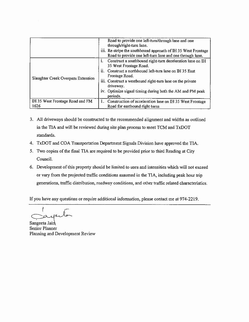
Road to provide one Ieft-turiiitlirough lane and onethrough/right-turn lane.
iii. Re-stripe the southbound approach of IH 35 West FrontageRoad to provide one left-turn lane and one through lane.
1. Construct a southbound right-turn deceleration lane on fl-I• 35 West Frontage Road.
ii. Construct a northbound left-turn lane on TN 35 East. Frontage Road.Slaunhter Creek Overpass Extension ...
‘ iii. Construct a westbound right-turn lane on tne privatedriveway.
iv. Optimize signal timing during both the AM and PM peakperiods.
11-135 West Frontage Road and FM L Construction of acceleration lane on N 35 West Frontage1626 Road for eastbound right turns
3. All driveways should be constructed to the recommended alignment and widths as outlined
in the TIA and will be reviewed during site pian process to meet TCM and TxDOT
standards.
4. TxDOT and COA Transportation Department Signals Division have approved the TIA.
5. Two copies of the final TIA are required to be provided prior to third Reading at City
Council.
6. Development of this property should be limited to uses and intensities which will not exceed
or vary from the projected traffic conditions assumed in the TIA, including peak hour trip
generations, traffic distribution, roadway conditions, and other traffic related characteristics,
If you have any questions or require additional information, please contact me at 974-2219.
-C
Sangeeta Jain\Senior PlannerPlanning and Development Review

C14-2008-0220 Page 8
SUMMARY STAFF RECOMMENDATION:
The Staffs recommendation is to grant general commercial services — mixed use —
conditional overlay (CS-MU-CU) combining district zoning. The Conditional Overlayprohibits the following uses: adult-oriented uses; bail bond services, campground;commercial blood plasma center; drop-off recycling collection facility; equipment sales;exterminating services; kennels; monument retail sales; pawn shop services; residentialtreatment; and transitional housing.
The Restrictive Covenant includes all recommendations listed in the Traffic Impact Analysismemorandum, dated October 27, 2010, as provided in Attachment A.
BASIS FOR LAND USE RECOMMENDATION (ZONING PRINCIPLES)
I. The proposed zoning should be consistent with the purpose statement of the districtsought.
General commercial services (CS) district zoning is intended for commercial or industrialuses that typically have operating characteristics or traffic service requirements generallyincompatible with residential enviromnents. The MU, Mixed-Use district is intended toallow for office, retail, commercial and residential uses to be combined in a singledevelopment.
The property has access to the IH-35 southbound frontage road.
2. Zoning changes should promote an orderly and compatible relationship among land uses.
Staff recommends CS-MU-CO district zoning based on the following considerations ofthe property: 1) location on the southbound IH-35 frontage road which is suitable forcommercial uses; 2) properties to the north that access Slaughter Lane and south alongthe IH-35 frontage road have been approved for GR-CO or CS-CO zoning for similarcommercial and retail development; and 3) the Traffic Impact Analysis requires right-of-way dedication for the new loop road, arid establishes intersection improvements for thenew loop road at the IH 35 frontage road and FM 1626, as well as in proximity to the site.
EXISTING CONDITIONS
Site Characteristics
The subject property consists of undeveloped land. The northern portion of the propertyslopes towards Slaughter Creek which forms the northern boundary- The southern portion ofthe site is relatively flat and there appear to be rio significant topographical constraints.
Impervious Cover
The maximum impervious cover allowed by the CS zoning district is 80% based on the morerestrictive watershed regulations described below.

C 14-2008-0220 Page 9
Environmental
The site is not located over the Edwards Aquifer Recharge Zone. The site is in the DesiredDevelopment Zone. The site is in the Slaughter Creek Watershed and the Onion CreekWatershed of the Colorado River Basin, which are classified as Suburban Watersheds byChapter 25-8 of the City’s Land Development Code. Under current watershed regulations,development or redevelopment on this site will be subject to the following impervious coverlimits:
Development Classflcation % ofNet Site Area % with TransfersSingle-Family 50% 60%(minimum lot size 5750 sq. ft.)Other Single-Family or Duplex 55% 60%Multifamily 60% 70%Commercial 80% 90%
According to flood plain maps, there is a floodplain within, or adjacent to the projectboundary. Based upon the close proximity of flood plain, offsite drainage should becalculated to determine whether transition zone exists within the project location. If transitionzone is found to exist within the project area, allowable impervious cover within said zoneshould be limited to 30%.
Standard landscaping and tree protection will be required in accordance with LDC 25-2 and25-8 for all development andior redevelopment.
Numerous trees will likely be impacted with this rezoning case. Please be aware that anapproved rezoning status does not eliminate the requirements to meet the intent of the treeordinances. If further explanation or specificity is needed, please contact the City Arborist at974-1876. At this time, site specific information is unavailable regarding other vegetation,areas of steep slope, or other environmental features such as bluffs, springs, canyon rimrock,caves, sinkholes, and wetlands.
Under current watershed regulations, development or redevelopment on this site will besubject to the following water quality control requirements:
• Structural controls: Sedimentation arid filtration basins with increased capture volumeand 2 year detention.
At this time, no information has been provided as to whether this property has any preexisting approvals that preempt current water quality or Code requirements.
Transportation
A traffic impact analysis is required and has been received. Additional right-of-way,participation in roadway improvements, or limitations on development intensity may berecommended based on review of the TIA [LDC, Sec. 25-6-142]. Comments are provided inAttachment A.

C1420080220 Page 10
Water and Wastewater
The landowner intends to serve the site with City of Austin water and wastewater utilities.The landowner, at his own expense, will be responsible for providing the water andwastewater utility improvements. offsite main extensions, system upgrades, utilityrelocations and or abandonments required. The water and wastewater plan must be inaccordance with the City of Austin utility design criteria. The water and wastewater utilityplan must be reviewed and approved by the Austin Water Utility. All water and wastewaterconstruction must be inspected by the City of Austin. The landowner must pay the Cityinspection fee with the utility construction. The landowner must pay the tap and impact feeonce the landowner makes an application for a City of Austin water and wastewater utilitytap permit.
Site Plan and Compatibility Standards
Any new development is subject to Subchapter E. Design Standards and Mixed Use.Additional comments will be made when the site plan is submitted.
The site is subject to compatibility standards. Along a portion of the west property line, thefollowing standards apply:
No structure may be built within 25 feet of the property line zoned or used as SF-2.No structure in excess of two stories or 30 feet in height may be constructed within 50 feet
of the property line.No structure in excess of three stories or 40 feet in height may be constructed within 100
feet of the property line.No parking or driveways are allowed within 25 feet of the property line.In addition, a fence, berm, or dense vegetation must be provided to screen adjoining
properties from views of parking, mechanical equipment, storage, and refuse collection.
Additional design regulations will be enforced at the time a site plan is submitted.

PU
BL
ICH
EA
RIN
GIN
FO
RM
AT
ION
Thi
szo
ning
/rez
onin
gre
ques
tw
illbe
revi
ewed
and
acte
dup
onat
two
publ
iche
arin
gs:
befo
reth
eL
and
Use
Com
mis
sion
and
the
City
Cou
ncil.
Alt
houg
hap
plic
ants
and/
orth
eir
agen
t(s)
are
expe
cted
toat
tend
apu
blic
hear
ing,
you
are
not
requ
ired
toat
tend
.H
owev
er,
ifyo
udo
atte
nd.
you
have
the
oppo
rtun
ity
tosp
eak
FOR
orA
GA
INS
Tth
epr
opos
edde
velo
pmen
tor
chan
ge.
You
may
also
cont
act
ane
ighb
orho
odor
envi
ronm
enta
lor
gani
zati
onth
atha
sex
pres
sed
anin
tere
stin
anap
plic
atio
naf
fect
ing
your
neig
hbor
hood
.
Dur
ing
itspu
blic
hear
ing,
the
boar
dor
com
mis
sion
may
post
pone
orco
ntin
uean
appl
icat
ion’
she
arin
gto
ala
ter
date
,or
may
eval
uate
the
City
staf
fsre
com
men
dati
onan
dpu
blic
inpu
tfo
rwar
ding
itsow
nre
com
men
dati
onto
the
City
Cou
ncil
.If
the
boar
dor
com
mis
sion
anno
unce
sa
spec
ific
date
and
tim
efo
ra
post
pone
men
tor
cont
inua
tion
that
isno
tla
ter
than
60da
ysfr
omth
ean
noun
cem
ent,
nofu
rthe
rno
tice
isre
quir
ed.
Dur
ing
itspu
blic
hear
ing,
the
City
Cou
ncil
may
gran
tor
deny
azo
ning
requ
est,
orre
zone
the
land
toa
less
inte
nsiv
ezo
ning
than
requ
este
dbu
tin
noca
sew
illit
gran
ta
mor
ein
tens
ive
zoni
ng.
How
ever
,in
orde
rto
allo
wfo
rm
ixed
use
deve
lopm
ent,
the
Cou
ncil
may
add
the
MIX
ED
US
E(M
U)
CO
MB
ININ
GD
IST
RIC
Tto
cert
ain
com
mer
cial
dist
rict
s.T
heM
UC
ombi
ning
Dis
tric
tsi
mpl
yal
low
sre
side
ntia
lus
esin
addi
tion
toth
ose
uses
alre
ady
allo
wed
inth
ese
ven
com
mer
cial
zoni
ngdi
stri
cts.
As
are
sult,
the
MU
Com
bini
ngD
istr
ict
allo
ws
the
com
bina
tion
ofof
fice
,re
tail,
com
mer
cial
,an
dre
side
ntia
lus
esw
ithi
na
sing
lede
velo
pmen
t.
For
addi
tiona
lin
form
atio
non
the
City
ofA
usti
n’s
land
deve
lopm
ent
proc
ess,
visi
tou
rw
ebsi
te:
ww
w.c
i.au
stin
.tx.
us/d
evel
opm
ent
Writ
ten
com
men
tsm
ust
besu
bmitt
edto
the
boar
dor
com
mis
sion
(or
the
cont
act
pers
onlis
ted
onth
eno
tice)
befo
reor
ata
publ
iche
arin
g.Y
our
com
men
tssh
ould
incl
ude
the
boar
dor
com
mis
sion
’sna
me,
the
sche
d&ed
date
ofth
epu
blic
hear
ing,
and
the
Cas
eN
umbe
ran
dth
eco
ntac
tpe
rson
liste
don
the
notic
e.
Cas
eN
umbe
r:C
14-2
008-
0220
Con
tact
:W
endy
Rho
ades
,51
2-97
4-77
19P
ubli
cH
eari
ng:
Oct
.5,
2010
,Zo
ning&
Pla
ttin
gC
omm
issi
onN
ov.
4,20
10,
City
Cou
ncil
;C
Kb4i
2y?.H
oa,4
4I
I
.Ilf
llam
infa
vor
You
rN
ame
‘p1e
aspr
int,)
áo,iS
4jIe
oth,f_I
obje
ct
io3
°icdn7
oíe
d•Y
our
addr
ess(
es,)
affe
cted
byth
isap
plic
atio
n
93
o-)
oS
igna
ture
Dai
me
Tel
epho
ne:
/0yq
coO
Dat
e
Com
men
ts:Q
ro
roo
er
43?oc
4tn
ne5S
Nro
k9+4€
cykI
e)Q
rd( P
opeq
t1
.trO
PE
t,
otu
flQ
(j5
UN
WIL
L-I
W&
*p
rnv
pip
oessw
ece
9ue5*
p5sc
aq’d
LI)
9ti
He
cfh
isi
Ifyo
uus
eib
isfo
rmto
com
men
t,it
may
bere
turn
edto
:C
ityof
Aus
tinPl
anni
ng&
Dev
elop
men
tRe
view
’D
epar
tmen
tW
endy
Rho
ades
P.O
.B
ox10
88A
ustin
,TX
7876
7-88
10