executive summary introduction - cloud object … · alafia river watershed management plan...
TRANSCRIPT

Alafia River Watershed Management Plan Executive Summary
Parsons ES-1
EXECUTIVE SUMMARY
Introduction
Significant improvements in the protection and restoration of the physical, chemical, and biological integrity of the nation’s waters have been made in the last 20 years. The passage of the Clean Water Act and Safe Drinking Water Act has resulted in the control of pollution from industry and sewage treatment plants, but the federal laws have tended to focus on particular sources, pollutants, or water uses, and have not resulted in an integrated environmental management approach. Typical water quality problems are pollutants such as silt, fertilizers, sewage, toxic metals, oil, and grease being washed into our waters with urban and agricultural stormwater runoff. Other problems include riparian habitat degradation, reductions in flow, introduction and proliferation of exotic species, over-harvesting of fish and other aquatic organisms, and air deposition of toxins. These unresolved problems necessitate a comprehensive approach to a complex situation, and solutions that integrate disciplines and overlap geographical boundaries. This holistic, comprehensive approach is called a watershed management plan. The watershed management plan approach to improving the physical, chemical, and biological integrity of surface water is a three-part process. These three components include: (1) identifying the watershed’s natural boundaries, (2) applying the latest scientific methods to identify problems, and (3) coordinating the improvements within social, political, and economic constraints.
A watershed boundary incorporates all the areas that drain to a specific surface water body. The Tampa Bay watershed encompasses 2,300 square miles, and includes all lakes, rivers, estuaries, wetlands, streams, and the surrounding landscape in all or part of six counties. The Alafia River Watershed is a 418-square-mile contributing drainage basin to the Tampa Bay watershed.
In order to identify, characterize, and evaluate the problems within a watershed, the latest scientific tools, techniques, and theory must be utilized. The proposed solutions must include the latest and most cost-effective methods of watershed rehabilitation, integrating various scientific disciplines and expertise.
Watersheds are seldom contained within a single political boundary. This necessitates a team approach, incorporating local, state, and federal agencies, as well as the concerned public. Team members form a partnership and work together toward a common goal based on shared information, and an understanding of the priorities and responsibilities of all parties.

Alafia River Watershed Management Plan Executive Summary
Parsons ES-2
Coordination of a watershed management plan is beneficial for environmental, financial, social, and administrative reasons. Managers from all levels of government will be better able to understand and reduce the cumulative effects of human activities in a watershed on pollution control, increased surface water runoff, fish and wildlife protection, drinking water protection, and other water resource programs when allowed to view the “big picture,” rather than just their portion of the watershed. The most critical problems are identified, and priorities can then be set to allocate the available financial and human resources.
The watershed management approach also can result in significant savings by improving communication and coordination, which will in turn reduce costly duplication of efforts and conflicting actions. This cooperation gives an active voice in resource management to the people who depend on the area resources for their recreation, health, and overall quality of life.
The watershed protection approach that was followed for the Alafia River Watershed Management Plan is based on four major features:
Targeting Priority Problems – All significant problems within the watershed are identified and addressed. For the purpose of this watershed management plan, the problems include flooding, water quality degradation, and natural systems preservation.
Identifying and Involving Stakeholders - Creating relationships with the people most affected by the management decisions is essential to a successful watershed management plan. This ensures that environmental, economic and cultural goals are integrated into the planning and implementation activities. Those affected by the watershed planning process are known as the stakeholders, and include state environmental, public health, agricultural, and resource agencies local/regional boards, commissions, and agencies, public representatives, private wildlife and conservation organizations, water supply providers, the academic community, and private citizens.
Integrated Solutions – Because the stakeholders work together, actions are based upon shared information and a common understanding of the responsibilities of all parties. This approach builds teamwork and improves the likelihood of sustaining long-term environmental improvements. The solutions to the problems identified during the development of the plan should look at the “big picture” of watershed planning, and

Alafia River Watershed Management Plan Executive Summary
Parsons ES-3
include benefits to the other facets of the study. For example, a project that is constructed for flood abatement should also include design considerations that will enhance wildlife habitat and water quality.
Measuring Success - Monitoring the progress of the project is important to determine the success of measures implemented to address the problems in the watershed. One of the easiest parameters to measure to determine the effectiveness of the implemented solutions is water quality. Water quality sampling programs are essential to tracking the success of the watershed management plan.
Stakeholder Interests
Southwest Florida Water Management District
The SWFWMD has recently completed a Comprehensive Watershed Management Plan (CWM) for the Alafia River. The purpose of the CWM plan was to coordinate the various projects relating to water resources within the watershed. The CWM plan used existing data and input from local governments to form the basis for identifying and prioritizing actions and funding strategies for improvements within the watershed. It established a watershed team that includes local governments and other stakeholders who established goals that included the following:
? Collect, integrate and analyze the existing information pertinent to each watershed and create a database for analytical purposes;
? Identify and prioritize existing and future water resource management issues relating to water supply, flood protection, water quality and natural systems;
? Develop preventative or remedial management actions to address these resource management issues;
? Identify funding sources and partnerships to support action plan projects; and,
? Implement and monitor the effectiveness of selected actions and the overall process and recommend potential revisions.
Tampa Bay National Estuary Program
Stormwater management goals for the Tampa Bay watershed have also been developed by the Tampa Bay National Estuary Program (TBNEP), a partnership of federal, state, and local government agencies in which Hillsborough County is an active member. Stormwater-related goals adopted by the TBNEP participants (TBNEP 1996) include:

Alafia River Watershed Management Plan Executive Summary
Parsons ES-4
? Cap nitrogen loadings to Tampa Bay at existing levels (1992-1994 average) to encourage the regrowth of an additional 12,350 acres of seagrass.
? Protect relatively clean areas of the bay from increases in toxic contamination, and minimize risks to marine life and humans associated with toxic contaminants in impacted areas.
? Reduce bacterial contamination in impacted areas of the bay to levels safe for swimming and shellfish harvesting.
Alafia River Basin Stewardship Council
During 1999, a citizens group entitled the Alafia River Basin Stewardship Council (ARBSC) and an interagency team comprising representatives of the Hillsborough County City/County Planning Commission, several other County departments, and the SWFWMD undertook an effort to develop more effective linkages between land and water management in the area. The group developed the following series of goals or “visions” for future conditions in the watershed, all of which are relevant to future stormwater management activities:
- To eliminate flooding; - To employ best management practices (BMPs) for stormwater treatment; - To protect riparian habitat; - To improve water quality by reducing pollutant discharges; - To implement a water quality monitoring program; - To promote restoration of wetlands along the river; - To reduce rate of development and protect wildlife habitat; - To improve maintenance of existing drainage systems; and - To exclude development within the 100-year floodplain.
Public Involvement Program
Hillsborough County held three public meetings to provide the residents of the watershed an opportunity to provide input to the process of developing the Alafia River Watershed Management Plan. At the first meeting the County asked that the residents provide information regarding what they thought were the problems in the watershed with respect to stormwater, water quality, and natural systems, and the existing conditions that should be addressed. During that meeting, residents described specific roadway and yard flooding problems, lack of maintenance of existing drainage systems, water quality degradation, and other issues. At the second meeting, Parsons and the County presented potential solutions to the problems that were identified over the course of watershed evaluations, including those identified in the first public meeting, and solicited additional comments. Those comments were used to develop a range of alternative solutions to the problems. The purpose of the third public was to present the alternatives and recommendations to the public and to solicit comments.

Alafia River Watershed Management Plan Executive Summary
Parsons ES-5
Alafia River Watershed Management Plan
The Alafia River Watershed Management Plan was part of a program authorized in 1998 by the Board of County Commissioners to complete plans for all the major watersheds within unincorporated Hillsborough County (Florida). Policy goals of the Hillsborough County stormwater management program have been identified by the Board of County Commissioners through the local government comprehensive plan (Hillsborough County 1994). These goals are to provide County residents with a managed system of stormwater infrastructure that will:
1. Minimize the occurrence of damages due to flooding; 2. Improve the quality of surface waters; 3. Re-establish and create wetland habitats; 4. Improve the recharge of potable water supplies; and 5. Provide opportunities for recreational benefits and water reuse.
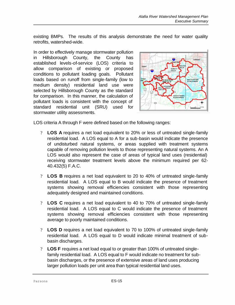
The Alafia River Watershed is approximately 270,000 acres, or 418 square miles, covering approximately one third of Hillsborough County, and extending into the western edge of Polk County. Approximately 62% of the watershed is located within Hillsborough County, with the remainder in Polk County. Figure ES-1 shows the study area as determined for this watershed management plan. It is the largest in area of the 17 major watersheds in Hillsborough County. The headwaters of the major flow contributor to the Alafia River originate in a swamp and prairie area south of Mulberry in Polk County and then flow 24 miles before entering the southeastern corner of the Hillsborough Bay. There are numerous springs along the river, but surface water runoff contributes most of the flow. The major problems occurring within the watershed are associated with flooding, water quality, natural systems, and water supply. The watershed has had a history of water quality problems, with the majority of the pollution occurring as a result of the phosphate mining industry that dominates land usage throughout much of the watershed. Flooding problems have occurred in the past, especially during the El Niño year of 1997/1998. Open areas and wildlife habitat are rapidly being lost to urban sprawl, mining, and expanding agricultural concerns. Burgeoning population growth has led to water supply shortages.
To ensure consistency with state and regional watershed management efforts, the Alafia River Watershed Management Plan addresses three primary topic areas: (1) flood abatement/protection, (2) water quality enhancement, and (3) natural systems protection, enhancement, restoration, and creation.

Alafia River Watershed Management Plan Executive Summary
Parsons ES-6
Figure ES-1 (11x17)

Alafia River Watershed Management Plan Executive Summary
Parsons ES-7
Flood Protection
Watershed Hydrologic and Hydraulic Model Development
Perhaps the most important aspect of the watershed master plan is the proper representation of the hydrologic and hydraulic processes throughout the watershed that define flooding conditions. A good understanding of these watershed processes is necessary to determine the most effective means of controlling flooding and protecting public safety and environmental resources. This understanding comes from the compilation of a large amount of data that describe the physical attributes of the watershed and its stormwater management infrastructure, including: topographic and aerial mapping; land use conditions; soil types; land slope and cover; dimensions and elevations of culverts, bridges, pipes, weirs, and control structures; channel and floodplain cross sections and roughness coefficients; and storage relationships for ponds, lakes, wetlands and depressions. These data are needed to develop a computer model of the watershed.
As a part of the study, a field survey plan was executed based on the specific needs of the hydraulic model. The emphasis of this survey was placed on areas within the basin where there were no available sources of as-built record drawings and surveys. This comprehensive field survey program resulted in the survey of a total of 533 drainage structures and 1193 channel cross sections throughout the Alafia River Watershed (in Hillsborough County).
For the purpose of the Alafia River Watershed Management Plan study, the Hillsborough County version of the EPA SWMM model (HCSWMM) was used. The County has developed this program as a standard for all watershed management plans within Hillsborough County. The Alafia River Watershed was divided into the following eight major subwatersheds, as shown in Figure ES-1: Bell Creek, Buckhorn Creek, English Creek, Fishhawk and Little Fishhawk Creek, North Prong Alafia River, South Prong Alafia River, Turkey Creek, and Alafia River Main Stem. The Alafia River Main Stem Subwatershed includes the drainage areas that drain directly to the Alafia River or minor tributaries to the Alafia River. To provide the level of detail that was deemed necessary to accurately define and properly analyze the primary drainage facilities within the Alafia River Watershed, it was divided into a total of 2092 discrete subbasins. Each of these subbasins was described by its land use and soil type distribution using an electronic Geographic Information System (GIS) database. This GIS database was also used as a tool to store and retrieve all watershed information gathered and generated over the course of the watershed study.
The hydraulic model (HCSWMM) of the Alafia River Watershed consists of a network of open channel segments, culverts, bridges, storm sewers, weirs, lakes, ponds, and wetlands that comprise the primary drainage system within the watershed. HCSWMM

Alafia River Watershed Management Plan Executive Summary
Parsons ES-8
uses a conduit-junction concept to idealize the prototype drainage system. A junction is a discrete location in the drainage system, while conduits are the connections between junctions that convey water through the system. The entire network of junctions and conduits forms the hydraulic model network and serves as the computational framework for HCSWMM. The Alafia River Watershed hydraulic model is quite comprehensive. It comprises a total of 3060 junctions and 4962 linkages in its structure, including 2873 closed conduits and open channels, 2084 weirs, and 4 pump stations.
The Alafia River Watershed hydrologic and hydraulic model was tested through a rigorous process of calibration and verification to ensure that the model was properly representing the flooding conditions throughout the watershed. Model calibration refers to the adjustment of model parameters within reasonable limitations so that the model results (i.e., streamflow and water elevations) are in reasonable agreement with a set of measured data. The model is calibrated to several different storm events that represent a variety of volumes, intensities, and distributions. The model verification process tests the calibration by comparing resulting stage, flow, and volume information to data measured or recorded at established gaging stations for a set of comparable independent events without any model adjustments. The Alafia River Watershed hydrologic/hydraulic model was calibrated and verified to three separate historical storm events including the September 1988, September 1997, and December 1997 floods. Model results for these events were compared to the flows, volumes, and water elevations recorded at several locations in the watershed and the model was deemed successful in its emulation of the observed conditions.
Flooding Level of Service Deficiencies and Problem Identification
Upon completion of the development and calibration of the hydrologic and hydraulic model(s) of the Alafia River Watershed primary drainage systems, the next step of the flooding conditions analysis was to apply the model(s) to assess the performance of the basin-wide drainage facilities for a given set of design storm events. Results of these simulations were then analyzed with respect to Hillsborough County’s adopted flooding level of service (LOS) criteria to identify locations within the watershed where the LOS criteria are not being met. These were compared to known flooding problem areas which were identified during the recent 1997 and 1998 flood events to prepare an assessment of the existing flooding conditions within the watershed, and to target the
Alafia River at LithiaSeptember 5 - 15, 1988 Calibration Storm Event
0
1000
2000
3000
4000
5000
6000
7000
8000
9000
10000
9/5 /1988 9/6 /1988 9/7 /1988 9/8 /1988 9/9 /1988 9/10/198
8
9/11/198
8
9/12/198
8
9/13/198
8
9/14/198
8
9/15/198
8
Time (days)
Recorded
Simulated

Alafia River Watershed Management Plan Executive Summary
Parsons ES-9
principle areas to be addressed in the development of the watershed management plan. The LOS definition that has been adopted by the County establishes the assigned LOS designation based primarily on the road crown elevation, and relates the existence of significant street, yard and/or structure flooding to the depth of flooding of the street. The numerical criteria that were adopted as a means of providing measurable depth definitions of “significant flooding” are listed in the following table. Note the addition of two new LOS designations, D* and O, which were not included within the original County Comprehensive Plan.
Flooding Level of Service
Hillsborough County Comprehensive Plan
Definition
Alafia River Watershed Management Plan Definition
A
No significant street flooding Street flooding is less than 3” above the crown of road
B No major residential yard flooding
Street flooding is more than 3” above the crown of road, but less than 6”
C No significant structure flooding
Street flooding is more than 6” above the crown of road, but less than 12”
D No limitation on flooding
Street flooding is more than 12” above the crown of road
D* No limitation on flooding*
Flood elevation is greater than finished floor elevation, and street flooding is less than 12” above the crown of road
O N/A
No structure and no street to compare with flood elevation
The Board of County Commissioners, in the Comprehensive Plan, promulgated the 25-year/24-hour/B flooding level of service as the target level of service for all watersheds within the county, including the Alafia River Watershed. Road crown elevations were compared with flood elevations generated by the model for the hypothetical 25-year/24-hour design storm event to determine the LOS provided. Those locations that do not attain the County’s target level of service (‘B’ LOS) were identified as flooding level of service violations.
In addition to the LOS deficiency areas that were identified through the modeling of the existing hydrologic and hydraulic conditions, other flooding problem areas were

Alafia River Watershed Management Plan Executive Summary
Parsons ES-10
identified based on input received during public meetings, from interviews with Hillsborough County Service Unit staff, and from the County’s historical flooding complaint database. These problem areas were investigated where there was sufficient information provided and alternative measures analyzed. In some cases, further detailed study is needed. In many instances, the problem was related to a maintenance issue and it was added to a list of recommended maintenance needs and adopted as a part of the watershed management plan.
Water Quality Evaluation and Pollutant Loading Estimates
The majority of water quality problems that have been identified in the Alafia River Watershed are associated with nutrients and coliforms; in addition, low dissolved oxygen levels are problematic in some tributaries, and concerns exist in some tributaries due to metals concentrations in excess of state standards.
Anthropogenic influences on water quality in the watershed are numerous. These influences include urbanization associated with rapid population growth that is occurring in some portions of the watershed as well as a variety of intensive industrial and agricultural activities (e.g., phosphate mining and processing; citrus production; truck-farming of fruits and vegetables; concentrated animal feeding operations).
Phosphate mining and the production of fertilizers and other phosphate-based products are significant activities in the watershed. “Barren land,” a byproduct of surface strip mining of phosphate ore, makes up a significant portion of the watershed, primarily in the South Prong sub-basin. Ore processing and fertilizer production facilities represent a significant land use in the North Prong sub-basin.
The mouth of the Alafia River has been modified extensively by dredge and fill activities, most of which were completed by 1930 (Fehring 1985). A deep-water channel was dredged to the river from the main ship channel in Tampa Bay to provide shipping access to a phosphate processing plant that is located immediately west of U.S. Highway 41. The manmade shipping channel bypassed the river’s natural mouth, passing immediately to its north. The former river mouth was then partially filled with the excavated material, effectively changing the location of the mouth. Over the years sediment from a dredge-spoil area has accumulated in the historic river mouth, reducing it to a small tidal creek with little or no connection to the river (Stoker et al. 1996).
The Upper Alafia is particularly degraded; both the North and South prongs of the Alafia have high phosphorus levels. The Lower Alafia has elevated nutrients, low dissolved

Alafia River Watershed Management Plan Executive Summary
Parsons ES-11
oxygen levels, and occasional fish kills and algal blooms. Radionuclide concentrations in the Alafia are the highest among Florida’s west coast rivers; the source is unknown but likely results from phosphate-mining residues and discharges. Gypsum stack discharges have built up calcium fluoride deposits at the mouth of the Alafia and in Hillsborough Bay. Because these sediments do not support healthy biological communities, they have been partially excavated; new gypsum stacks and on-site stormwater storage treatment ponds have been constructed to decrease future loadings.
Major potential pollution sources and other water quality issues within the Alafia River Watershed include:
Phosphate Mining and Processing. Major pollutant sources associated with mining include point source discharges, runoff from mined and barren lands, and discharge from gypsum settling ponds. Most phosphate processors are on the North Prong; while mining occurs in both the North and South Prong, processing appears to cause worse pollution than mining. Pollutants specific to the mining process include strong acids, phosphates, fluorides, sulfates, ammonia, and low levels of radiation.
Nitrate Loadings from Lithia and Buckhorn Springs. Lithia and Buckhorn Springs discharge nitrate-rich waters into the Alafia River. The springs contribute approximately 157 tons of nitrate-nitrogen to the Alafia River annually, or about 22 percent of the nitrate-nitrogen contributed to Tampa Bay by the Alafia River (Jones and Upchurch, 1993). Stormwater seepage through sinkholes, historical citrus farming (fertilizer use), livestock operations, septic systems and other human activities in this area have been named as possible sources aided, in part, by relatively rapid recharge rates present in the area.
Periodic Spills. Numerous unintentional releases of acidic and clay-settling pond waters have occurred in the Alafia Watershed over the years. The most recent major spill occurred in December 1997 when the wall of a phosphogypsum stack in Mulberry was breached. This spill sent about 50 million gallons of acidic process water into the Alafia River.
Urbanization. The negative impacts of urbanization on surface waters have been well documented in a number of sources, including the Nationwide Urban Runoff Program (NURP) and the state 305(b) reports. The practice of converting natural areas to land uses that have increased areas of impervious surfaces results in increased runoff volumes and pollutant loadings. Urban development in Hillsborough County in the Alafia River Watershed is concentrated in and adjacent to Brandon, Valrico, Riverview, and Plant City.

Alafia River Watershed Management Plan Executive Summary
Parsons ES-12
TMDL Status and Summary of Parameters of Concern
Basin TMDL
Priority Parameters of Concern
Lower Alafia Low DO, coliforms, nutrients
Buckhorn Creek Low Nutrients (high NOx & algal
blooms) Bell Creek Low DO, coliforms, nutrients
Fishhawk Creek - Coliforms, nutrients Turkey Creek Low Coliforms, nutrients, turbidity English Creek Low Coliforms, nutrients
North Prong * Low DO, coliforms, nutrients,
metals South Prong Low Coliforms, nutrients, metals
Agriculture. Approximately 30% of the land use in the Alafia River Watershed is agricultural, including cropland, pasture, tree crops, ornamental plant nurseries, fish farms, dairies, and horse farms. Croplands and pasture are the predominant land uses, especially in the eastern portion of the watershed. Nutrients, sediment, animal wastes, and pesticides are the primary concerns from agricultural runoff. Direct impacts to the habitat of aquatic species can also occur due to livestock, equipment, or water management activities.
Sewage Disposal. Sewage disposal activities in the watershed have the potential to impact surface water quality. These activities include septic tank usage and septage spreading.
Septic Tanks - The use of septic tanks for sewage disposal is prevalent in the Alafia Watershed, and sewer service in not available in much of the watershed. Septic tank effluent is a source of nitrogen, phosphorus, organic matter and bacterial and viral pathogens.
Septage Spreading - For the most part these sites are privately owned agricultural lands. The septage has value as a fertilizer; therefore, landowners either pay to have the waste delivered or simply grant permission to disposal companies to spread the waste on their land. This waste originates from pumped-out septic tanks. This activity can impact surface water runoff quality as well as ground water due to high concentrations of nutrients, trace metals, and organic compounds.
One of the most significant water resource issues facing the county with respect to regulation is Total Maximum Daily Load (TMDL) compliance. Section 303(d) of the Clean Water Act (CWA) requires states to develop a list of waters not meeting water quality standards or not supporting their designated uses. Ten stream segments in the Alafia are listed on the state’s 1998 Section 303(d). The 1998 list is the most current edition of the impaired waters list that has been approved by the EPA. The Florida Watershed Restoration Act outlines the process by which the list is refined through more detailed water quality assessments. Total TMDLs are required for the waters determined to be impaired based on these detailed assessments because technology-based effluent limitations, current effluent limitations required by state or local authority, or other pollution control requirements are not stringent enough to meet current water quality standards. TMDLs describe the amount of a pollutant that a water body can receive without violating standards.
A nonpoint source loading model was prepared to estimate stormwater runoff quality from the Alafia River

Alafia River Watershed Management Plan Executive Summary
Parsons ES-13
Watershed. This model uses the EPA Simple Method, which is an event mean concentration (EMC) approach. In this approach, mass loads are calculated as the product of the EMC and the stormwater runoff volume. The stormwater runoff volume is estimated as the fraction of rainfall appearing as runoff multiplied by the rainfall depth and basin area. The EMC is constant; thus, this method is also referred to as the “constant concentration” method.
Land use is the factor that most affects the outcome of the loading analysis. Watershed land use is shown on Figure ES-2. Overall watershed land use is split relatively evenly between agricultural (28%), mining (27%), and natural areas (24%). Agriculture is most prevalent in the Fishhawk (49%), English (43%), Bell (39%), and Turkey (36%) Creek subwatershed with the majority of mining concentrated in the North (49%) and South (46%) Prong Alafia subwatersheds. Buckhorn Creek is, by far, the most urban of the watersheds (65%).
According to the loading model, wash-off loads to the Alafia River total around 14 million pounds of suspended solids, one and one-half million pounds of nitrogen, and one-half million pounds of phosphorous per year, on average. Existing treatment areas remove a portion of the load; however, the net loads are not reduced significantly due to the relatively small percentage of the watershed that receives treatment and, in the case of nitrogen, due to low removal efficiencies for
0% 10% 20% 30% 40% 50% 60% 70% 80% 90% 100%
Bell Creek
Buckhorn Creek
English Creek
Fishhawk Creek
North Prong Alafia River
Alafia River - Main Stem
South Prong Alafia River
Turkey Creek
Overall
Agricultural
Mining
NaturalUrban
Open/Recreational

Alafia River Watershed Management Plan Executive Summary
Parsons ES-14
Figure ES-2 (11x17)
Alafia River Watershed Management Plan Executive Summary
Parsons ES-15
existing BMPs. The results of this analysis demonstrate the need for water quality retrofits, watershed-wide.
In order to effectively manage stormwater pollution in Hillsborough County, the County has established levels-of-service (LOS) criteria to allow comparison of existing or proposed conditions to pollutant loading goals. Pollutant loads based on runoff from single-family (low to medium density) residential land use were selected by Hillsborough County as the standard for comparison. In this manner, the calculation of pollutant loads is consistent with the concept of standard residential unit (SRU) used for stormwater utility assessments.
LOS criteria A through F were defined based on the following ranges:
? LOS A requires a net load equivalent to 20% or less of untreated single-family residential load. A LOS equal to A for a sub-basin would indicate the presence of undisturbed natural systems, or areas supplied with treatment systems capable of removing pollution levels to those representing natural systems. An A LOS would also represent the case of areas of typical land uses (residential) receiving stormwater treatment levels above the minimum required per 62-40.432(5) F.A.C.
? LOS B requires a net load equivalent to 20 to 40% of untreated single-family residential load. A LOS equal to B would indicate the presence of treatment systems showing removal efficiencies consistent with those representing adequately designed and maintained conditions.
? LOS C requires a net load equivalent to 40 to 70% of untreated single-family residential load. A LOS equal to C would indicate the presence of treatment systems showing removal efficiencies consistent with those representing average to poorly maintained conditions.
? LOS D requires a net load equivalent to 70 to 100% of untreated single-family residential load. A LOS equal to D would indicate minimal treatment of sub-basin discharges.
? LOS F requires a net load equal to or greater than 100% of untreated single-family residential load. A LOS equal to F would indicate no treatment for sub-basin discharges, or the presence of extensive areas of land uses producing larger pollution loads per unit area than typical residential land uses.

Alafia River Watershed Management Plan Executive Summary
Parsons ES-16
Natural Systems Evaluation
The Alafia River Watershed encompasses some of the most valuable habitat remaining in Hillsborough County. Approximately 14% (23,106 acres) of the entire watershed within Hillsborough County is now in public ownership and another 7% (11,646 acres) is under negotiation for purchase and preservation, largely due to the efforts of the County’s Environmental Lands Acquisition and Protection Program (ELAPP) and interlocal agreements with the Southwest Florida Water Management District. Figure ES-3 depicts the land within the watershed already purchased under the ELAP program, as well as areas that are under negotiation for purchase. Also shown on this figure are other lands under public ownership, such as public parks and conservation areas.
One of the main objectives of the Alafia River Watershed Management Plan was to determine what actions should be taken to improve and preserve the natural systems within the Hillsborough County portion of the watershed. Natural systems are an essential part of the watershed in that they help prevent water quality degradation, aid in flood abatement, and provide habitat for wildlife. In order to determine what improvements were needed, the natural systems were identified and the existing conditions of the natural systems were assessed using established criteria. These criteria included the quality of the vegetative cover, the extent of nuisance vegetation infestation, the condition of the soils and hydrology, the presence of protected species, available contiguous area, proximity to other natural areas, and the potential hydrological and water quality benefits each site may provide to the watershed.
The following table lists the areas identified as the best remaining natural systems for wildlife habitat and natural resources within the Alafia River watershed.
- Cargill West - Alafia Scrub Preserve - Williams Property - Four Winds Estate - Buckhorn Springs & Creek - Rhodine Scrub - Bell Creek Preserve - Balm-Boyette Scrub - Fishhawk/Thomas Ranch - Fishhawk Ranch - Fishhawk South - Lithia Springs - River Crossing Estates - Boy Scout Parcel - Alderman Ford Add. West - Alderman Ford Add. East - Alafia River South Prong - Triple Creek - English Creek - Alafia River North Prong
These twenty areas vary significantly in the types of benefits they provide or may potentially provide to the watershed as a whole. Each site is described as to the

Alafia River Watershed Management Plan Executive Summary
Parsons ES-17
Figure ES-3 (11x17)

Alafia River Watershed Management Plan Executive Summary
Parsons ES-18
quality of the vegetation communities present, the benefits presented currently by the site, and the potential benefits that preservation and/or restoration of the site would offer. In addition, an aerial photograph is provided showing the location, boundaries, and land cover of each of the sites.
Problems identified within the watershed with respect to the natural systems were all related to the dwindling green space and urban sprawl. Habitat is being fragmented by residential and commercial development, agricultural activities and mining. Specific habitat for important species like the coastal nesting white ibis and economically important fish and shellfish species is disappearing. The green spaces that remain are being overtaken by exotic vegetation, or have been impacted by changes in hydrology and degraded water quality. Other existing habitat is being degraded as a result of surface water quality impacts.
Plan Recommendations
The plan contains recommendations aimed at reducing flooding, improving and protecting water quality, and enhancing and protecting natural systems as well as recommendations directed at improving the County’s overall stormwater management program. Specific project recommendations are provided in Table ES-1 located at the end of this chapter along with a map (Figure ES-4) showing the project’s locations.
Flood Control Recommendations
Alternatives were developed and evaluated to address the identified flooding problem areas. The proposed alternatives were analyzed and evaluated using the design storm events to establish a proposed level of service for each subwatershed corresponding to the County’s target LOS. Alternatives were compared with respect to effectiveness in alleviating the identified problems, capital cost, environmental impacts, water quality impacts, permittability, implementability, and public acceptance. Based on these ranking criteria, a set of flood protection projects was recommended – collectively, these projects comprise the flood control element of proposed watershed management plan. Other key recommendations include:
The photograph above shows typical bank erosion along the Alafia River caused by the wave action from speeding watercraft. The erosion degrades water quality and habitat.

Alafia River Watershed Management Plan Executive Summary
Parsons ES-19
Operation And Maintenance - Comprehensive, regular maintenance of stormwater management systems is essential to ensure the efficient function of existing stormwater conveyances and that new stormwater facilities, once constructed, continue to function within their original design parameters for many years. Maintenance is also often required for prevention of water quality degradation, exotic species control, aesthetics, and safety reasons. The Alafia River Watershed Management Plan includes recommended practices and schedules for mowing and clearing, erosion control, and stormwater management facility maintenance and rehabilitation. The plan also lists specific locations in the watershed with immediate maintenance requirements and a recommended course of action to be taken. These sites were identified over the course of this study during field investigations, interviews with County Service Unit personnel, and review of field survey records and photographs recorded by survey crews.
Revision of Hillsborough County Flood Level of Service Definitions - The current flood level of service definitions contained within the Hillsborough County Comprehensive Plan are poorly defined and subject to a wide range of interpretation (e.g. “significant” road flooding, “significant” yard flooding, etc.).
Stormwater Management Regulations for Closed Drainage Basins - It is recommended that Hillsborough County adopt a more strict set of stormwater management regulations for development within closed drainage basins.
Graphical User Interface for County Model - The County should consider developing a Graphical User Interface (GUI) for the Hillsborough County SWMM.
Regulatory Use of Alafia River Watershed Model - It is recommended that Hillsborough County develop a regulatory framework around the Alafia River Watershed Model. The County would require that new hydrologic and hydraulic data submitted by developers, engineers, and hydrologists – meet County standards so that the County might use these data to ensure that groups wishing to modify the hydrologic system meet various Federal, State, and local regulations. This regulatory framework may require that an ordinance or rule be passed that details data submission requirements.
Flooding Complaints - It is recommended that Hillsborough County improve its flooding complaint strategy. The County needs an effective strategy to record, assess, and respond to flood complaints as they are received.

Alafia River Watershed Management Plan Executive Summary
Parsons ES-20
Water Quality Improvement Recommendations
Recommended water quality improvement projects for the Alafia River Watershed Management Plan are summarized in the table located at the end of this chapter. Most of the proposed projects are surface water treatment marshes. Some of these projects involve the excavation of uplands for creation of treatment areas and some involve retrofitting existing ponds or other depressional areas for water quality improvement.
In addition to the specific construction projects recommended in this plan, various general recommendations are made. These recommendations relate to specific Alafia River Watershed issues as well as general water quality improvement. These recommendations include:
Monitoring - Nonpoint source problems are not just reflected in the water chemistry. Instead, nonpoint source problems are often more evident in the biology and habitat of the aquatic system. Therefore, the monitoring program should include a combination of chemical, physical, and biological components. The recommended programs include additions to the ambient monitoring program as well as new programs for wet weather sampling, macroinvertebrates sampling, and fish sampling. Six new monitoring stations are proposed. Four of these stations are proposed to provide coverage for major subwatersheds that are currently not included in existing programs, and two stations are proposed to monitor water quality at the county line.
Improved Water Quality Model - The County should consider using an improved water quality model. One of the limitations of the County’s existing nonpoint source assessment methodology rests in the fact that each basin “stands alone”; that is, connectivity is not considered. This inhibits efforts to determine loadings at particular points of interest and prohibits simulation of multiple BMPs in series. In addition, the use of continuous simulations would improve model results, as would the ability to consider hydraulic and water quality-loading rates in BMP evaluations. The ability to incorporate point source loads and use different “buildup” and “washoff” algorithms would also represent significant improvements to nonpoint source assessments in Hillsborough County.
Agricultural Stormwater Management Practices - The County needs to find ways to encourage the farming community to improve agricultural practices. One of these ways

Alafia River Watershed Management Plan Executive Summary
Parsons ES-21
would be to form partnerships with the farm community and to build alliances that foster cost-effective, durable solutions to key problems.
Control of Nitrate Loadings from Lithia and Buckhorn Springs - One alternative to reduce nitrate loads is source control, and management practices designed to address septic tank and fertilizer usage (below) are advisable. Water use alternatives that aim to remove the nitrate-rich water from the system should also be considered.
Phosphate Mine Spill Containment/Prevention - The SWFWMD has proposed at number of measures aimed at reducing the likelihood or mitigating future spills. It is recommended that Hillsborough County support these proposals and initiate a feasibility study to determine which of these, or other, solutions should be implemented.
Septic Tank Regulation - It is recommended that the County investigate management measures to reduce water quality impacts of septic tank usage. Some of the management actions that should be considered are central sewer systems, a pump-out ordinance, and inspections.
Septage Disposal Practices - The Hillsborough County Water Department has investigated the feasibility of accepting 100 percent of the county’s septage at wastewater treatment plants (WWTP's). The water department estimates that the capacity to dispose of 180,000 gallons of septage per day is needed to serve the needs of the entire county. The capital cost of WWTP improvements needed to accept the septage was estimated at $4.6 million. Operating costs are estimated at $80 per 1,000 gallons and three new employees would be needed. Public meetings were held in 1998 and the issue of discontinuing septage spreading in Hillsborough County is still under consideration. The proposal to cease this practice should be revived.
Alafia River Watershed “River Keeper”- A great deal of the many problems that have been identified over the course of the Alafia River Watershed Management Plan could be addressed within the existing regulatory and government services framework if there were an adequate inspection and monitoring program, and a central authority to coordinate activities within the watershed. For this purpose, it is recommended that a new county-staffed position be created for an Alafia River Watershed “River Keeper”.
Public Awareness and Involvement Programs - An essential component of any watershed management plan is a focused and integrated public education and involvement program. The following recommendations are directed at increasing public awareness and involvement.
- Watershed and Stream Crossing Signage - Hillsborough County should consider installing signs at stream crossings and at the Alafia River Watershed boundaries. These signs will foster stewardship by helping the public to identify with the streams and watershed in which they live or visit and to understand the

Alafia River Watershed Management Plan Executive Summary
Parsons ES-22
far-reaching consequences of actions that degrade water quality in these waterbodies.
- Storm Drain Marking Program - A storm drain marking program for the Alafia River Watershed is recommended. This program enlightens citizens about the potential adverse effects of stormwater runoff entering surface water bodies..
- Proper Use of Pesticides and Fertilizers - The Hillsborough County Cooperative Extension Service has free information regarding the most environmentally friendly fertilizers to purchase, and how they should be applied. The county should make every effort to encourage dissemination and practice of this information.
Low- Impact Development - It is recommended that Hillsborough County engage in the Low-Impact Development approach for all County projects and encourage the use of this paradigm by private developers as well. The County might review regulations and ordinances to encourage flexibility and provide incentives to implement innovative engineering and site planning. A program for public outreach and education is recommended.
Natural Systems Recommendations
The solutions to the natural systems problems identified during the study were simple: preserve as much of the undeveloped land as possible and improve the existing habitat as much as possible. To meet these objectives the following actions were proposed:
- Clean up the exotic vegetation. A list of the exotic species present in the area is
provided in the Alafia River Watershed Management plan as Appendix F, a map of the worst areas of infestation is provided as Figure 8-25, and an exotic species management plan is located in Section 15.7.2.
- Preserve habitat. Four areas were identified as potential preservation areas.
Preserving these areas will increase habitat connectivity, provide more foraging and breeding areas for wildlife, and potentially add public recreation or education areas. The areas proposed for preservation include the Williams Property, Buckhorn Springs, the Pringle Branch Property, and the John Moore Road Property.
- Enhance habitat. This can be accomplished by restoring what was historically
present in the watershed, or by adding features that would make the existing habitat more compatible to wildlife use. Habitat restoration can be proposed on existing public lands, or on disturbed lands as justification for their purchase. Five areas were identified as potential habitat enhancement sites or opportunities; a wildlife underpass on Balm-Boyette Road, vegetation community restoration on Triple Creek Ranch, a water quality treatment and habitat

Alafia River Watershed Management Plan Executive Summary
Parsons ES-23
enhancement project for the Balm-Boyette Scrub, red fish nursery enhancement on the Alafia River, and erosion protection on the river banks at the Riverview Community Center.
Increasing habitat connectivity can be accomplished by preserving and/or restoring lands that will contribute to the Hillsborough County Greenways Program or to an established wildlife corridor, or by installing wildlife underpasses. Some of the proposed projects create wetlands that will provide important foraging or breeding areas for wildlife, especially for species of special concern like the white ibis, or for species of recreational or commercial importance like redfish. The habitat restoration projects will convert previously disturbed lands into wildlife habitat and water quality treatment areas. And in order to enhance the benefits of certain proposed projects, multiple uses can be recommended, such as passive use parks or science education facilities.
General Recommendations
Maintenance and Updates of Alafia River Watershed Management Plan - It is recommended that Hillsborough County adopt a strategy to update the Alafia River Watershed Stormwater Management Model.
Maintenance and Updates of Geographic Information Systems (GIS) - It is recommended that Hillsborough County adopt strict standards and protocols for the continued maintenance and update of the Geographic Information Systems database developed for its watershed management planning efforts.
Digital Topographic Mapping - To provide the required mapping needed to conduct and administer its stormwater management program, it is recommended that Hillsborough County procure a complete digital 1-foot topographic elevation coverage for the entire County.
Internet Web Site Maintenance - Currently, public information is presented through the Alafia River Watershed Management Plan Internet site (www.alafiariver.org). At the completion of this project, the site will not be maintained. It is recommended that the County migrate the information, results of the investigation and future activities to the County’s watershed atlas site (http://www.hillsborough.wateratlas.usf.edu/) .
Public Relations and Educational Materials - To assist in its public relations efforts, it is recommended that Hillsborough County publish a series of fact sheets to explain complex technical concepts in common, plain, non-technical language.

Alafia River Watershed Management Plan Executive Summary
Parsons ES-24
Table ES-1 (9 pages – 8.5 x 11)