estuary processes and geomorphology: outputs of erp2 · geomorphology: outputs of erp2. project...
TRANSCRIPT

Project FD2119 Estuaries Research Programme Phase 2 Training Event November 2007
Alun Williams
Project FD2119 Estuaries Research Programme Phase 2 Training Event November 2007
Estuary Processes and Estuary Processes and Geomorphology:Geomorphology:Outputs of ERP2Outputs of ERP2

Project FD2119 Estuaries Research Programme Phase 2 Training Event November 2007
Overview
• UK Estuary Types• Estuary Processes• ERP2 Projects:
– FD1905 - Estuary Process Research Project (EstProc)
– FD2107 - Hybrid Estuary Model Development – FD2116 - Review of Geomorphological Concepts – FD2117 - Estuary Simulators Development
(EstSim)
Project FD2119 Estuaries Research Programme Phase 2 Training Event November 2007
Classification of UK Estuary Types
• ERP2 developed UK database based on:– EMPHASYS database– Futurecoast database – JNCC inventory.
• Futurecoast (Dyer, 2002) classification amended and simplified:- Working typology for UK estuaries
• Identify range of UK Estuaries:– Behavioural estuary types;– Geomorphological elements present within each.
Project FD2119 Estuaries Research Programme Phase 2 Training Event November 2007
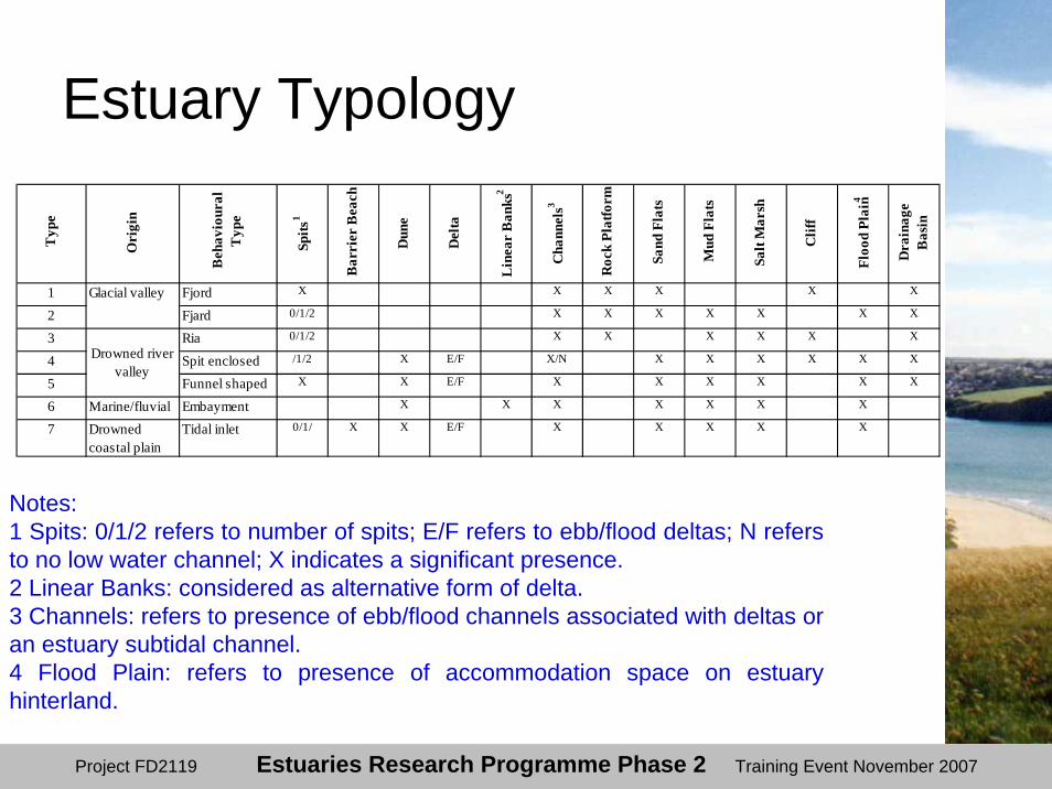
Estuary Typology
1 Fjord X X X X X X
2 Fjard 0/1/2 X X X X X X X
3 Ria 0/1/2 X X X X X X
4 Spit enclosed /1/2 X E/F X/N X X X X X X
5 Funnel shaped X X E/F X X X X X X
6 Marine/fluvial Embayment X X X X X X X
7 Drowned coastal plain
Tidal inlet 0/1/ X X E/F X X X X X
Typ
e
Ori
gin
Beh
avio
ural
T
ype
Spits
1
Floo
d Pl
ain4
Dra
inag
e B
asin
Cha
nnel
s3
Roc
k Pl
atfo
rm
Sand
Fla
ts
Mud
Fla
ts
Glacial valley
Drowned river valley
Salt
Mar
sh
Clif
f
Bar
rier
Bea
ch
Dun
e
Del
ta
Lin
ear
Ban
ks2
Notes:1 Spits: 0/1/2 refers to number of spits; E/F refers to ebb/flood deltas; N refers to no low water channel; X indicates a significant presence.2 Linear Banks: considered as alternative form of delta.3 Channels: refers to presence of ebb/flood channels associated with deltas or an estuary subtidal channel.4 Flood Plain: refers to presence of accommodation space on estuary hinterland.
Project FD2119 Estuaries Research Programme Phase 2 Training Event November 2007
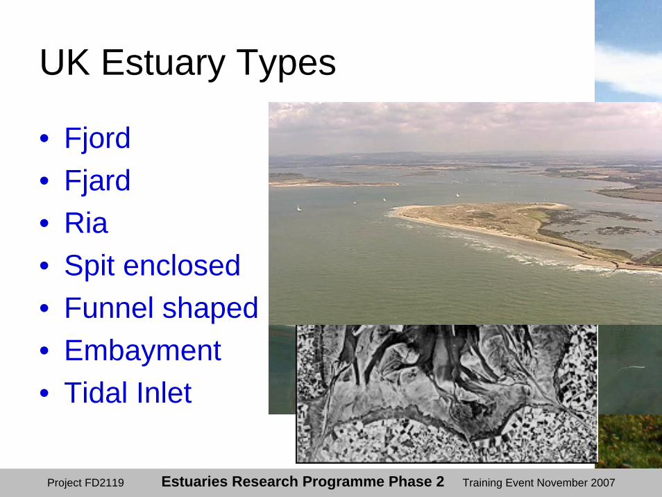
UK Estuary Types
• Fjord• Fjard• Ria• Spit enclosed• Funnel shaped• Embayment• Tidal Inlet

Project FD2119 Estuaries Research Programme Phase 2 Training Event November 2007
Estuary Geomorphic Elements
• Cliff• Barrier Beach• Dunes• Delta• Rock Platform• Channel• Mudflat• Sandflat• Saltmarsh• Drainage Basin
Project FD2119 Estuaries Research Programme Phase 2 Training Event November 2007
Characteristic Features of UK Estuaries• Extensive intertidal areas including saltmarshes,
mudflats and sand flats;• Semi-diurnal tidal regime;• Wave shelter;• Water layering and mixing;• Temperature and salinity gradients;• Sediment suspension and transport; • High productivity;• High levels and rapid exchange of nutrients; • Presence of plants and animals particularly adapted
to these conditions; and • Presence of migrant and seasonally fluctuating
populations of birds.

Project FD2119 Estuaries Research Programme Phase 2 Training Event November 2007
Estuary Processes
• Area of transition from tidal to fluvial;• Area of transition from saline to
freshwater;• Mixing can lead to a marked interface
and internal waves;• Salinity gradients can set up density
flows along and across estuaries;• Water movements complicated by
surface waves.
Project FD2119 Estuaries Research Programme Phase 2 Training Event November 2007
Estuary Processes - 2
• Waves can form within the estuary as well as propagate into the estuary from outside;
• Complexity reflected in sediment transport within the system;
• Sediment supply from marine and freshwater sources;
• Sediment reworking leading to zones of erosion and deposition.

Project FD2119 Estuaries Research Programme Phase 2 Training Event November 2007
Estuary Processes - 3
• Intertidal areas can appear stable in the medium term but are generally dynamic;
• Sediments can be cycled on different timescales, over a tide or in response to changing sea levels, especially fine sediments.
• Diverse environment – need to consider estuary system as a whole.

Project FD2119 Estuaries Research Programme Phase 2 Training Event November 2007
ERP2 Research Projects
• FD1905 - Estuary Process Research Project (EstProc)
• FD2107 - Hybrid Estuary Model Development
• FD2116 - Review of Geomorphological Concepts
• FD2117 - Estuary Simulators Development (EstSim)

Project FD2119 Estuaries Research Programme Phase 2 Training Event November 2007
FD1905 – Hydrobiosedimentary Processes in Estuaries (EstProc)• Delivery of new science and algorithms;• Application of physics-based biology in
estuary process models;• Inclusion of wave-current interaction;• Improved parameterisation of bed
exchanges:– mud/sand erosion, settling, sedimentation;
• Dynamical hypothesis for estuarine morphology – taken forward in FD2107.

Project FD2119 Estuaries Research Programme Phase 2 Training Event November 2007
New algorithms• Improved process knowledge and tools:
– tools = methods and models;– component parts of physical processes;– 29 algorithms for specific processes.
• Parameterisation suitable for whole estuary models.• For example: physical representation of frictional
effects of vegetation.• Calibration:
– Dengie Peninsula, Essex (floristically diverse saltmarsh)
– Paulinashor, Western Scheldt estuary (monospecific Spartina marsh)
Source: Cambridge Coastal Research Unit and WL|Delft Hydraulics

Project FD2119 Estuaries Research Programme Phase 2 Training Event November 2007
Western Scheldt, Netherlands

Project FD2119 Estuaries Research Programme Phase 2 Training Event November 2007
0
1
2
3
4
5
6
7
8
9
10
-1 1 3 5 7 9 11 13 15 17 19 21 23 25
Distance Salt Marsh (m)
Sig
. Wav
e he
ight
(cm
)
Observed SWAN
Measured and calculated Hsig for a transect in the Paulinapolder saltmarsh
Wave dissipation on saltmarsh
Project FD2119 Estuaries Research Programme Phase 2 Training Event November 2007
FD2107 - Hybrid Estuary Model Development • To improve confidence in model
predictions of estuary form;• Various models (B-U, T-D, Hybrid);• Eight varied UK estuaries • Compare model approaches and
estuaries.

Project FD2119 Estuaries Research Programme Phase 2 Training Event November 2007
Models (& Type)
• Emulator Hybrid• Hybrid Model Interface Hybrid
Down• “2.5D” Bottom Up• ASMITA-type Top Down• Realignment Hybrid• Particle Tracking Hybrid• Inverse Hybrid
Project FD2119 Estuaries Research Programme Phase 2 Training Event November 2007
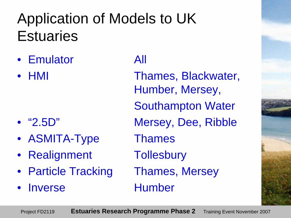
Application of Models to UK Estuaries• Emulator All • HMI Thames, Blackwater,
Humber, Mersey, Southampton Water
• “2.5D” Mersey, Dee, Ribble• ASMITA-Type Thames• Realignment Tollesbury• Particle Tracking Thames, Mersey• Inverse Humber

Project FD2119 Estuaries Research Programme Phase 2 Training Event November 2007
Hybrid Model Interface (HMI)• HMI links a 1D hydrodynamic model (bottom
up) with Regime morphodynamic top down model.
Initial Condition Defined Outside the HMI
Regime Hybrid
Simulation
Initial bedform
Stable?
Hydraulic model todetermine flow
conditions
New form
Boundaryconditions
Define regimerelationships
Alter form ( e.g.engineering works)
or boundaryconditions (e.g. slr)
Yes
Apply scheme toadjust bed
Hydraulic model todetermine flow
conditions
No
HMI
Project FD2119 Estuaries Research Programme Phase 2 Training Event November 2007
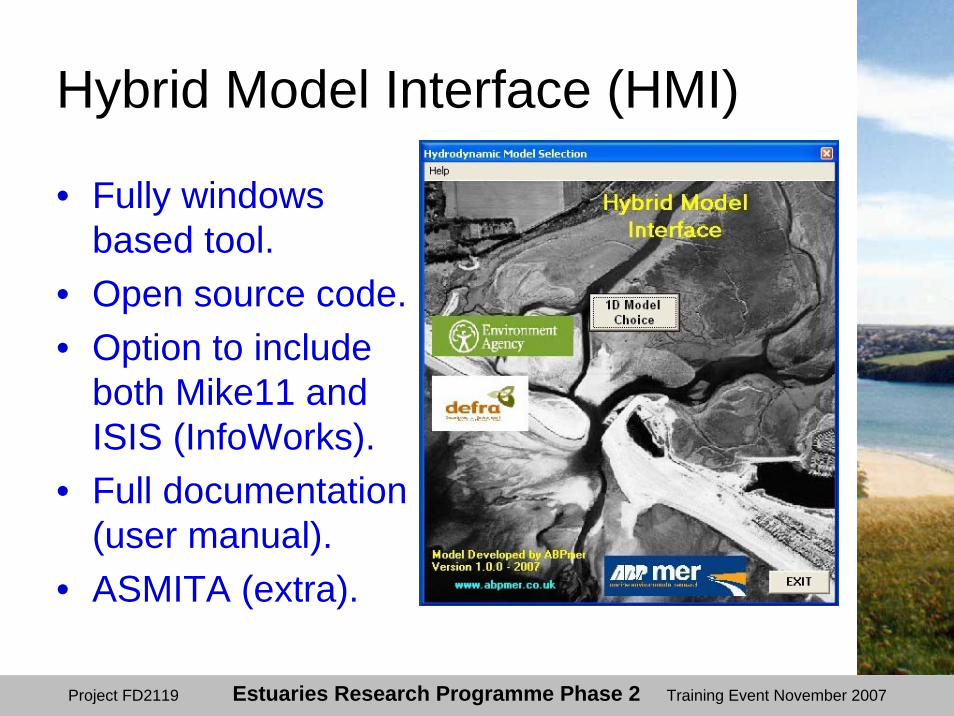
Hybrid Model Interface (HMI)
• Fully windows based tool.
• Open source code. • Option to include
both Mike11 and ISIS (InfoWorks).
• Full documentation (user manual).
• ASMITA (extra).

Project FD2119 Estuaries Research Programme Phase 2 Training Event November 2007
HMI Results
• New morphology• Areas• Volumes• Water levels• Velocities• Discharges• Habitats

Project FD2119 Estuaries Research Programme Phase 2 Training Event November 2007
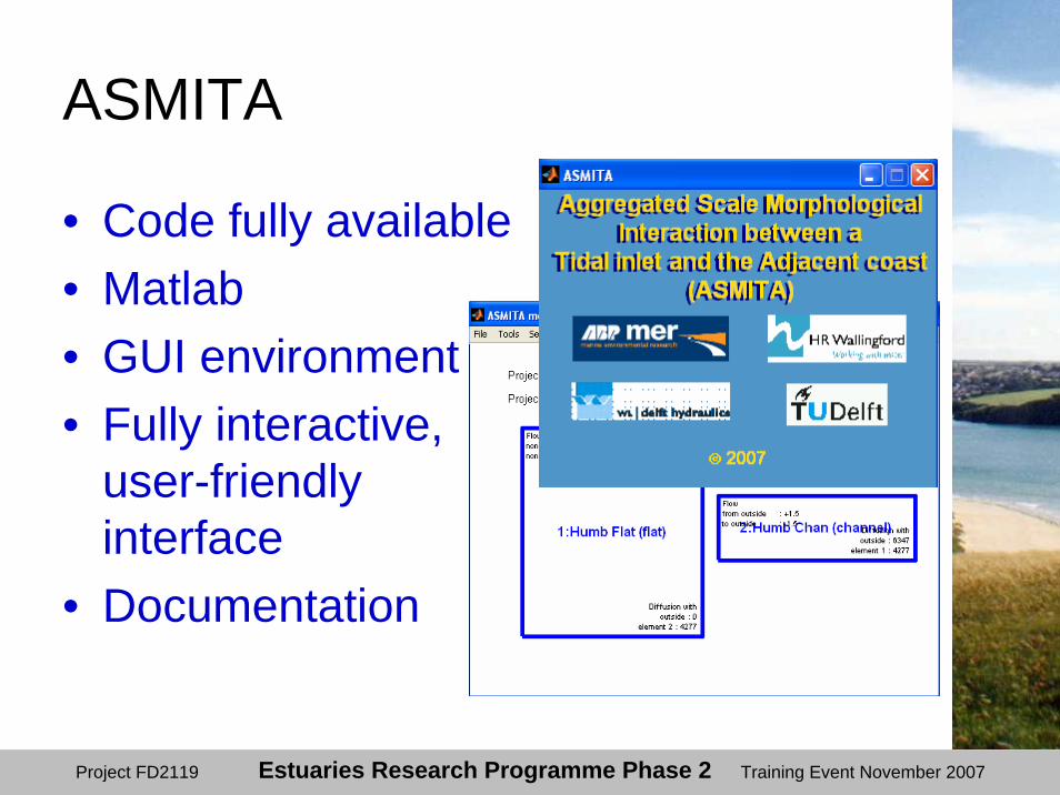
ASMITA-type model• Developed as a tool to study impacts of
sea level rise on Dutch coastline.
• “Aggregated scale” approach: interactions between blocks of channel, flats or delta.
• Hybrid model: simplifies hydrodynamics using semi-empirical relationships.
• Represents changes in the volume of channel/flat/delta elements.
Project FD2119 Estuaries Research Programme Phase 2 Training Event November 2007
ASMITA
• Code fully available• Matlab• GUI environment• Fully interactive,
user-friendly interface
• Documentation

Project FD2119 Estuaries Research Programme Phase 2 Training Event November 2007
Application of the HMI: Regime and ASMITA• Model the long-term change in the
equilibrium form of the estuary;• In response to change in forcing
factors:– Climate change, e.g. increase in sea level;– Management of the estuary, e.g. flood
defences.

Project FD2119 Estuaries Research Programme Phase 2 Training Event November 2007
FD2107 - Conclusions• Best practice:
– Validate against historic change;– Otherwise generate ensemble of possible
outcomes.• Ideally compare model results with
alternatives for validation, don’t rely on output from one model.
• Predicted trends should be broadly consistent with results of bottom-up models.
• Results show sensitivities of different estuaries to a range of climate change scenarios.
• Not all estuaries respond in the same way.
Project FD2119 Estuaries Research Programme Phase 2 Training Event November 2007
FD2116 - Review of Geomorphological Concepts • Rigorous approach to Expert
Geomorphological Assessment (EGA):• Applies to all methods.
• Detailed review of top down methods:• including Historical Trend Analysis
• Potential to lead directly to improvements in the quality and effectiveness of morphological studies associated with flood defence and estuarine impacts.
Project FD2119 Estuaries Research Programme Phase 2 Training Event November 2007
Methods
• FD2116 covered the following methods within EGA framework:1.Historical Trend Analysis (HTA);2.Regime theory and relationships;3.Estuary translation or Rollover model;4.Entropy-based relationships;5.Tidal asymmetry analysis and relationships;6.Analytical methods and solutions;7.Sediment budget analysis and modelling;8.Geological methods for estuarine studies; and,9. Intertidal profile form.
Project FD2119 Estuaries Research Programme Phase 2 Training Event November 2007
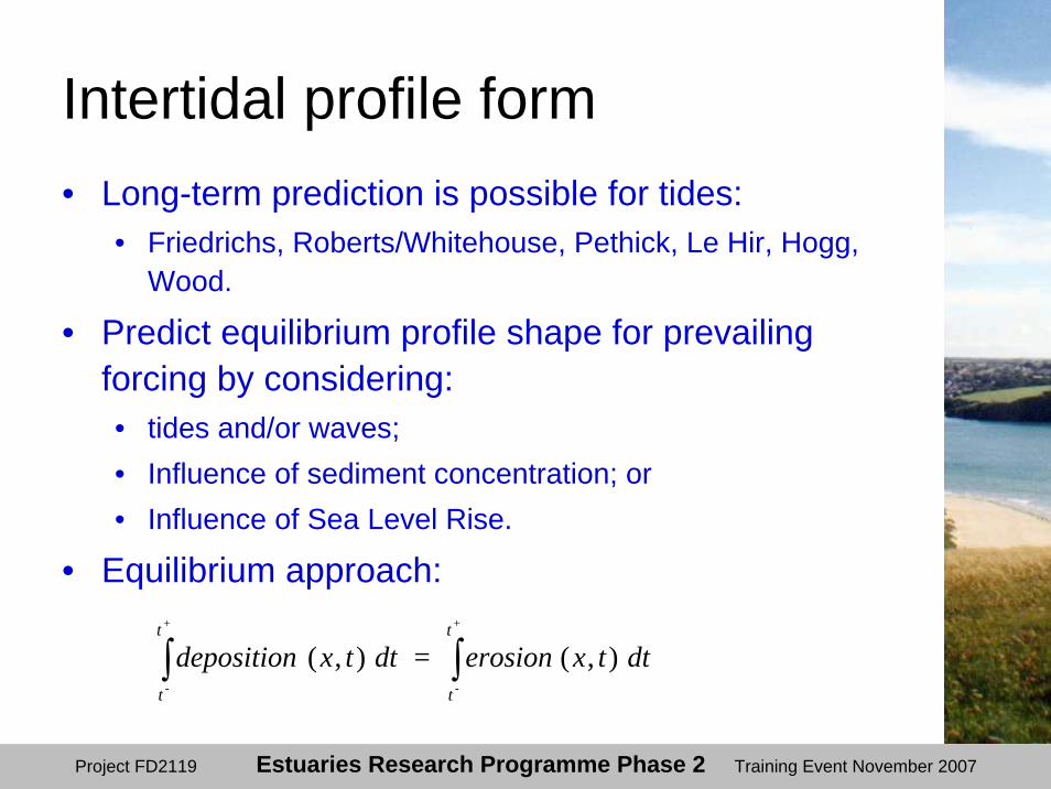
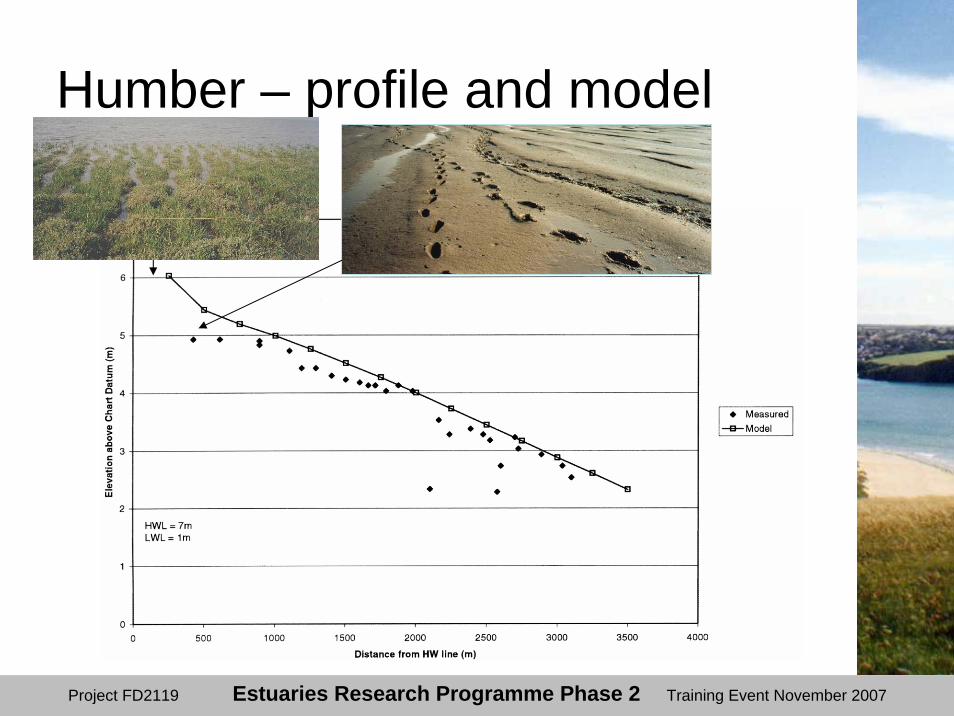
Intertidal profile form• Long-term prediction is possible for tides:
• Friedrichs, Roberts/Whitehouse, Pethick, Le Hir, Hogg, Wood.
• Predict equilibrium profile shape for prevailing forcing by considering: • tides and/or waves;• Influence of sediment concentration; or • Influence of Sea Level Rise.
• Equilibrium approach:
dttxerosion = dttxdepositiont
t
t
t
+
-
+
-
),(),( ∫∫
Project FD2119 Estuaries Research Programme Phase 2 Training Event November 2007
Humber – profile and model

Project FD2119 Estuaries Research Programme Phase 2 Training Event November 2007
Humber mudflat
Influence of sediment concentration on profile
Project FD2119 Estuaries Research Programme Phase 2 Training Event November 2007
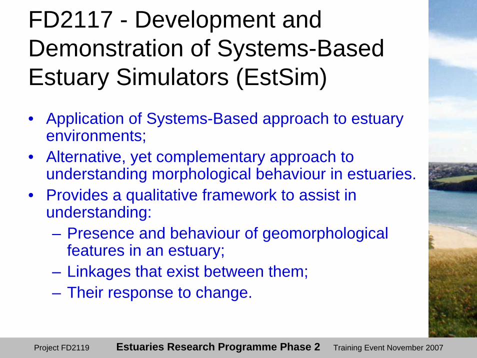
FD2117 - Development and Demonstration of Systems-Based Estuary Simulators (EstSim)• Application of Systems-Based approach to estuary
environments;• Alternative, yet complementary approach to
understanding morphological behaviour in estuaries.• Provides a qualitative framework to assist in
understanding:– Presence and behaviour of geomorphological
features in an estuary;– Linkages that exist between them;– Their response to change.
Project FD2119 Estuaries Research Programme Phase 2 Training Event November 2007
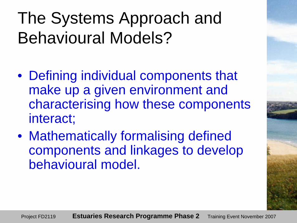
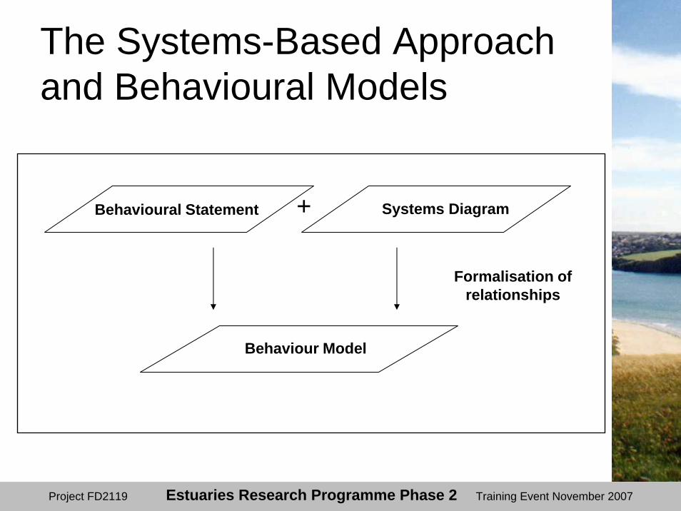
The Systems Approach and Behavioural Models?
• Defining individual components that make up a given environment and characterising how these components interact;
• Mathematically formalising defined components and linkages to develop behavioural model.
Project FD2119 Estuaries Research Programme Phase 2 Training Event November 2007
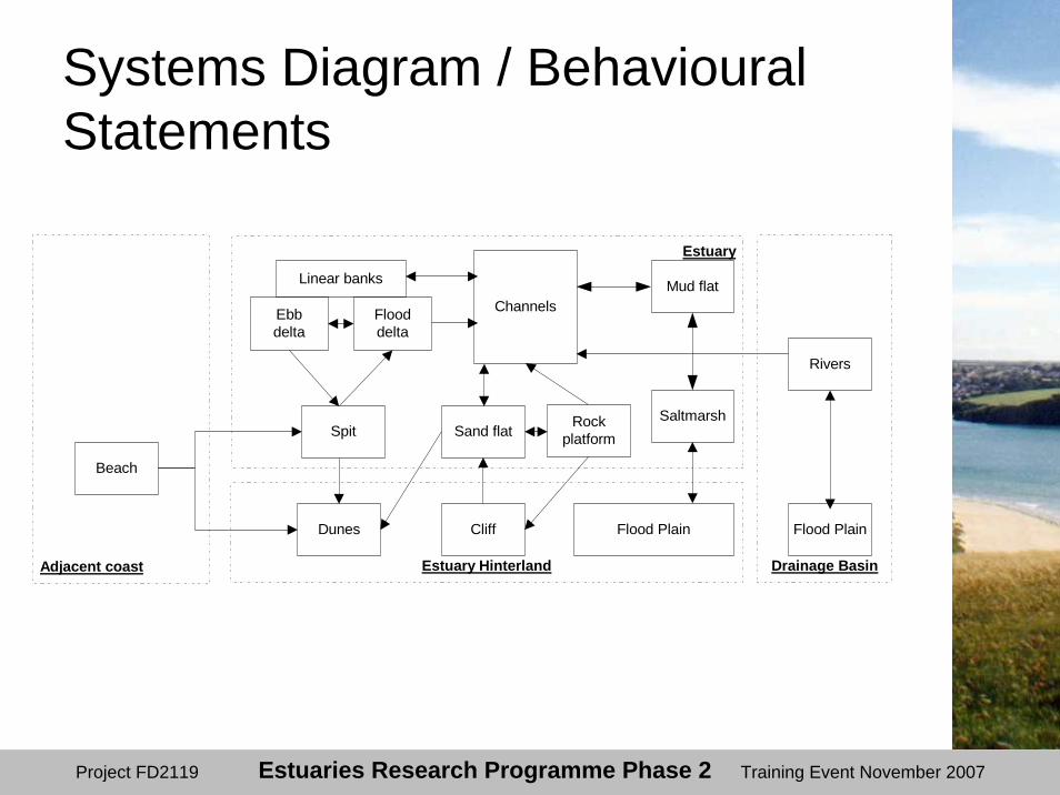
Systems Diagram / Behavioural Statements
Drainage Basin
Estuary
Estuary HinterlandAdjacent coast
Ebbdelta
Flooddelta
Dunes
Beach
Cliff
Linear banks Mud flat
SaltmarshSand flatSpit
Channels
Flood Plain
Rivers
Flood Plain
Rockplatform
Project FD2119 Estuaries Research Programme Phase 2 Training Event November 2007
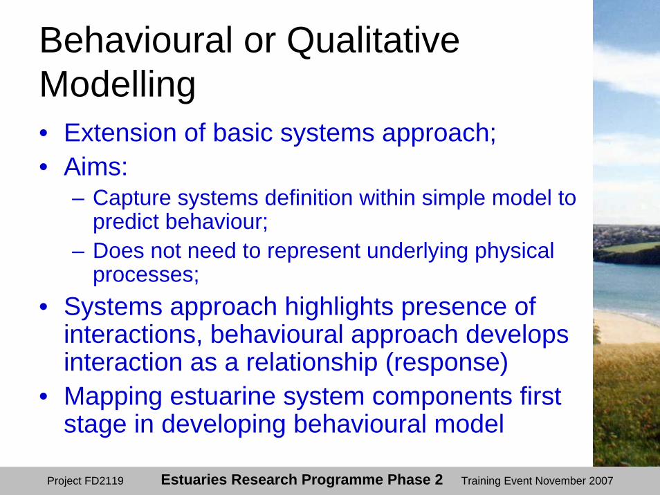
Behavioural or Qualitative Modelling• Extension of basic systems approach;• Aims:
– Capture systems definition within simple model to predict behaviour;
– Does not need to represent underlying physical processes;
• Systems approach highlights presence of interactions, behavioural approach develops interaction as a relationship (response)
• Mapping estuarine system components first stage in developing behavioural model
Project FD2119 Estuaries Research Programme Phase 2 Training Event November 2007
Systems DiagramBehavioural Statement
Behaviour Model
+
Formalisation ofrelationships
The Systems-Based Approach and Behavioural Models
Project FD2119 Estuaries Research Programme Phase 2 Training Event November 2007
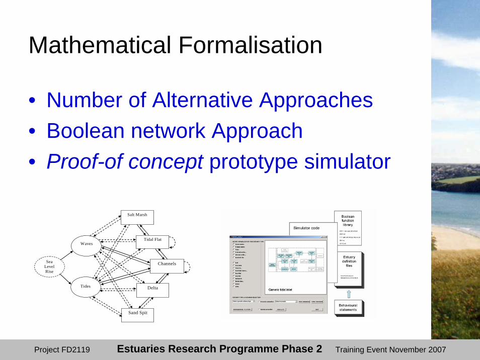
• Number of Alternative Approaches• Boolean network Approach• Proof-of concept prototype simulator
Salt Marsh
Tidal Flat
Channels
Delta
Sand Spit
Waves
Tides
Sea Level Rise
Mathematical Formalisation

Project FD2119 Estuaries Research Programme Phase 2 Training Event November 2007
• Web based graphical user interface• Simulation functionality• UK Estuary typology
Manager-System Interface

Project FD2119 Estuaries Research Programme Phase 2 Training Event November 2007
• Definition of Key Management Questions • Consultation / Review of Legislation
• Pilot Testing of Prototype Simulator• Thames and Teign Estuaries
Pilot Testing
Project FD2119 Estuaries Research Programme Phase 2 Training Event November 2007
Project Delivery
• Development of UK estuary typology;• Framework for estuary behavioural
statements;• Means to promote systems based
knowledge and understanding;• Web-based graphical user interface;• Open source Matlab code for academic
community;• Demonstration of potential of approach.
Project FD2119 Estuaries Research Programme Phase 2 Training Event November 2007
EstSim Conclusions• Exciting development of system
approach• Essentially still a research tool• Requires specialist knowledge to set up
tool for a specific estuary• Should allow formulation of
geomorphological knowledge to be represented and tested
• May be options to combine with more quantitative techniques (e.g. ASMITA)

Project FD2119 Estuaries Research Programme Phase 2 Training Event November 2007
FD2117 EstSim - Outputs
• Web-based graphical user interface;– http://www.discoverysoftware.co.uk/estsim/EstSim
.html;• Open source Matlab code for academic
community;– www.geog.ucl.ac.uk/ceru/estsim;
• Demonstration of potential of approach.

Project FD2119 Estuaries Research Programme Phase 2 Training Event November 2007
Summary: Methods and Models and System Abstraction