esri swuc 2014
TRANSCRIPT

Mapping a Traditional GIS Course Onto a Quest-Based Learning
Platform
Michael N. DeMers
NMSU Geography
New Mexico Geographic Alliance

WHY QUEST-BASED LEARNING
BADGES

LEVELING UP

LEADERBOARD


QUESTS

REWARDS LIST

RANKS
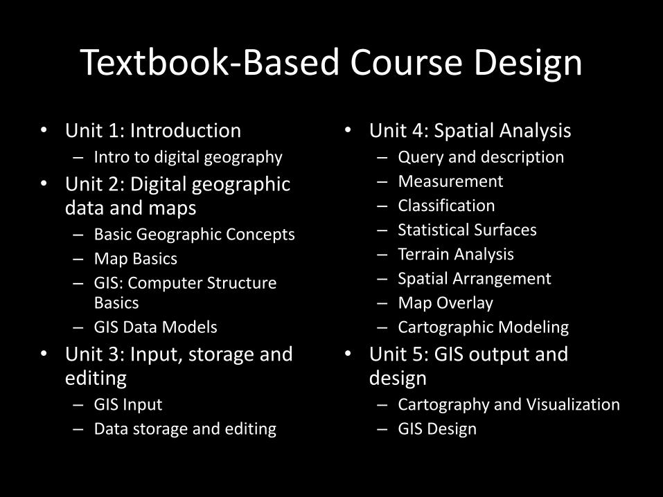
Textbook-Based Course Design
• Unit 1: Introduction– Intro to digital geography
• Unit 2: Digital geographic data and maps– Basic Geographic Concepts
– Map Basics
– GIS: Computer Structure Basics
– GIS Data Models
• Unit 3: Input, storage and editing– GIS Input
– Data storage and editing
• Unit 4: Spatial Analysis– Query and description
– Measurement
– Classification
– Statistical Surfaces
– Terrain Analysis
– Spatial Arrangement
– Map Overlay
– Cartographic Modeling
• Unit 5: GIS output and design– Cartography and Visualization
– GIS Design

Unit 1Unit 2
Unit 3Unit 4
Linear Flow (traditional course)

• Level 0: Course introduction– How to turn in assignments quest
• Level 1 Introduction to the topic– GIS History quest– Basic Geographic Definitions quest– The GIS Industry quest
• Level 1 Geographic and cartographic background– Geographic fundamentals quest– Earth reference system quest– Map basics and abstraction quest– Analog to digital conversion quest
• Level 1 Output from analysis quest– Cartographic output quest– Non-cartographic output quest
• Level II: Computer aspects– Computer science fundamentals
quest– Graphic data representation quest– Information system quest– Database management quest
• Level II: Computer aspects– Computer science fundamentals
quest
– Graphic data representation quest
– Information system quest
– Database management quest
• Level III: Editing, manipulation and analysis– Storage, retrieval, editing,
compilation quest
– Analysis I (single layer)quest
– Analysis II (multiple layer) quest
– Analysis III (statistical surface) analysis quest
– Analysis IV (terrain analysis) quest
– Analysis V (modeling) quest
• Level IV: Design– Database design quest
– Application design quest
– Institutional design quest

Level 0
Level I
Level II
Level III Level III
Level IV
Level II
Level I
Level II
Level III Level III
Level IV
Level III
Leveled (quest-based) with choice


100% (starting point) - A
0% - F
5000 points (for an A)
Life-long Learning
0 points
Traditio
nal G
radin
g Qu
est-Based
Grad
ing
