environmentally friendly drilling program to reduce … library/research/oil-gas...the...
TRANSCRIPT

CONTENTSEnvironmentally Friendly Drilling Program ............................1
Commentary ...................................2
Shale Water Technologies .........6
Nine New Projects ........................8
Air Monitoring ............................. 10
Ice Road Construction ...............13
Hurricane Study .......................... 16
Innovative Water Management ................................19
E&P Snapshots ............................ 22
Upcoming Meetings and Presentations ............................... 24
CONTACTSRoy Long
Technology Manager— Ultra-Deepwater, Strategic Center for Natural Gas & Oil
281-494-2520
Albert Yost
Technology Manager—Exploration & Production, Strategic Center for Natural Gas & Oil
304-285-4479
Oil & Natural Gas Program NewsletterWinter 2009
1
Environmentally Friendly Drilling Program To Reduce Impact of Operations on EcosystemsThe oil and gas industry has made great strides in protecting the environment, while increasing natural gas production in the U.S. However, the challenges facing producers to cost effectively produce more natural gas in environmentally sensitive areas are daunting. The Houston Advanced Research Center (HARC) and its partners offer a program to reduce the impact of oil and gas operations in environmentally sensitive ecosystems. The Environmentally Friendly Drilling (EFD) program combines new low-impact technologies that reduce the footprint of drilling activities, integrates light weight drilling rigs with reduced emission engine packages, addresses on-site waste management, optimizes the systems to fit the needs of a specific development sites and provides tools to enhance industry’s stewardship of the environment (Figure 1). In addition, the EFD program offers a way to include industry, the public, environmental organizations, and elected officials in a collaboration that addresses concerns on development of unconventional natural gas resources in environmentally sensitive areas.
Figure 1. Decreasing the footprint of drilling activities is a key goal of the Environmentally Friendly Drilling Program. Photo courtesy of the Houston Advanced Research Center.

2
This newsletter is available online at http://www.netl.doe.gov/E&P Focus
CommentaryReaffirming our commitment to environmental stewardship in oil and natural operations is important, whatever our role may be: industry player, public servant, academic researcher, or concerned citizen. Demonstrating that commitment with concrete action is equally, if not more, important. In this issue of E&P Focus we proudly showcase our ongoing commitment to concrete action on issues key to environmental stewardship in oil and natural gas operations.
By way of background, NETL has, for a number of years, engaged in broad research and development of technologies and methodologies that are helping to diminish the environmental footprint of the exploration, drilling and production industry. In our directly implemented environmental program we focus specifically on produced water management and clean up, regulatory streamlining and Federal land access. Through our funding to the Ultra-Deepwater and Unconventional Natural Gas and Other Petroleum Resources Research and Development Program established by the Energy Policy Act of 2005, we also support environmentally friendly solutions for America’s small producers as well as for operations in ultra-deep water and exploitation of unconventional gas resources.
Altogether, NETL has fully or partially funded nearly 80 completed R&D projects in the environmental sector over the last few years and has another 27 environmental projects in progress. This issue of E&P Focus highlights a number of environmentally-focused projects selected from the various elements of the NETL R&D Program.
In addition to supporting development of impact-mitigation technologies, NETL’s Strategic Center for Natural Gas and Oil is also active in the larger environmental issue of climate change through research to advance carbon dioxide enhanced oil recovery as a path for sequestration of anthropogenic carbon dioxide emissions.
I hope you find this issue to be worthwhile reading. Should you have any questions regarding the progress or purpose of any of the projects described in this issue, please contact the individuals listed at the end of each article or the technology managers listed on page 1 of this newsletter.
John R. Duda Director, NETL Strategic Center for Natural Gas and Oil
National Energy Technology Laboratory
1450 Queen Avenue SWAlbany, OR 97321541-967-5892
2175 University Avenue South Suite 201Fairbanks, AK 99709907-452-2559
3610 Collins Ferry RoadP.O. Box 880Morgantown, WV 26507-0880304-285-4764
626 Cochrans Mill RoadP.O. Box 10940Pittsburgh, PA 15236-0940412-386-4687
13131 Dairy Ashford, Suite 225 Sugar Land, TX 77478 281-494-2516
Visit the NETL website at:www.netl.doe.gov
Customer Service:1-800-553-7681
E&P Focus is published by the National Energy Technology Laboratory to promote the exchange of information among those involved in natural gas and oil operations, research, and development.

3
The program is based on a previously co-funded U.S. DOE/industry JIP program led by Texas A&M University (TAMU) and Houston Advanced Research Center (HARC) that created a government, industry, public partnership to reduce the environmental footprint of drilling systems in sensitive ecosystems. The 2005 - 2008 EFD program showed that the industry could achieve more than 90% reduction in the impact on the environment if low impact technology was combined into a complete system. More than 120 specific technologies were identified for use to reduce impact. A prototype Systems Engineering Methodology Model was developed to optimize selection of these low impact technologies for a specific drilling well plan and an EFD Scorecard was conceived to evaluate the environmental impact of different processes and practices and to allow comparison among different options.
The 2005-08 EFD program provides the foundation of the new EFD program that is funded in part by the Ultra-Deepwater and Unconventional Natural Gas and Other Petroleum Resources Research and Development Program established by the Energy Policy Act of 2005 (EPAct) and managed by the Department of Energy. It offers an organizational structure that both identifies new technologies and transfers those technologies to areas of development that must incorporate new practices to address environmental concerns. Regional U.S. partners manage the EFD program and optimize technologies to fit the needs of their locale. Partners in each region work to incorporate such systems into operations in the Rockies, in the Southwest desert, and in the Appalachia region of the U.S. The program includes, among a much large number of projects: (a) development of small footprint rig packages ; (b) identification and testing of improved technologies and equipment to reduce the footprint of access roads and well pads (Figure 2); and (c) commercialization of technology to reduce NOx emissions in drilling and production operations.
Figure 2. Reducing the environmental impact of lease roads leading to drilling and production sites is the primary focus of the EFD’s Disappearing Roads Project. Photo courtesy of the Houston Advanced Research Center.

4
Prototype Small Footprint Drilling RigThere are a number of emerging rig technologies found in certain areas that offer low impact. Examples include the Huisman LOC 250, LOC 400 and the National Oilwell VARCO Rapid Rig. The DOE funded microhole drilling program identified a number of technologies to greatly reduce the cost of drilling shallow- and moderate-depth holes for exploration, field development, long-term subsurface monitoring, and to a limited degree, actual oil and gas production. In addition, the EFD program developed the concept of alternative power solutions for unconventional natural gas activities, including rig and production activities. Further, TAMU and M-I SWACO have formed a partnership to integrate membrane water desalination technology into rig site waste management practices (Figure 3). All of these programs are at the tipping point of profitability and acceptance by the industry. If the costs of these processes can be reduced, and their benefit to low impact drilling realized by the public and policy makers, then many unconventional natural gas developments that are uneconomic today could become economically viable in the future.
Disappearing RoadsThe impact of access roads and drilling pads has been identified by the EFD as one of the major problems to be managed when conducting oil and gas operations in environmentally sensitive areas. Since 2005, the EFD program has been identifying technology and sponsoring research in reducing surface impact. Two major projects are underway specifically addressing such technology.
Figure 3. Mobile Desalination Equipment at Field Trial. Courtesy MI Swaco.

5
The “Disappearing Road Competition” is a yearly, nation-wide scholastic competition sponsored by Halliburton to create a new concept of moving men and materials to and from well sites. The University of Wyoming (UW), in collaboration with the Bureau of Land Management and major upstream gas production companies, won first prize in the initial completion with a layered mat, roll-out road system incorporating a modular frame design to minimize the impact of oil field access roads to well pads. The concept came from the need to minimize soil disruption and wildlife fragmentation in the Jonah Field and Pinedale Anticline Production Area (PAPA) of the upper Green River Valley. Now the UW and the EFD teams are conducting a field test of a scale model of the low impact road concept at the Pecos Desert Research Test Center that incorporates some of the practices being planned for the project with recycled road materials (drill cuttings). The deliverables from this task will be a report documenting the development of the prototype lay down road system and documentation of a field test to be performed for sponsors.
In addition, NETL is funding a new EFD project by TAMU to construct and demonstrate low impact O&G lease roads designed to reduce the environmental impact of field development in sensitive new desert ecosystems. A summary of the winning projects can be found at: Low Impact Access Roads Demonstration (Pecos Research Test Center)
NOx Air Emissions StudiesMeasurement and control of emissions such as oxides of nitrogen (NOx), highly volatile organic compounds (HVOC), carbon dioxide (CO2) and other green house gases are becoming a high priority within the industry. Currently, there are no guidelines on the measurement or control approaches concerning these emissions. The project is developing guidelines concerning the measurement of oxides of nitrogen (NOx) for a drilling/production site as well as guidelines concerning technologies that can be implemented to reduce NOx emissions. On behalf of the State of Texas, HARC has been managing a program to develop and implement technologies to reduce diesel engine emissions. Leveraging this effort, guidelines concerning the application of selective catalytic reduction (SCR) technologies will be developed for drilling and production applications. For additional information about this project, contact Charlotte Schroeder ([email protected] or 281-690-5506) or Rich Haut ([email protected] or 281-364-6093).
6
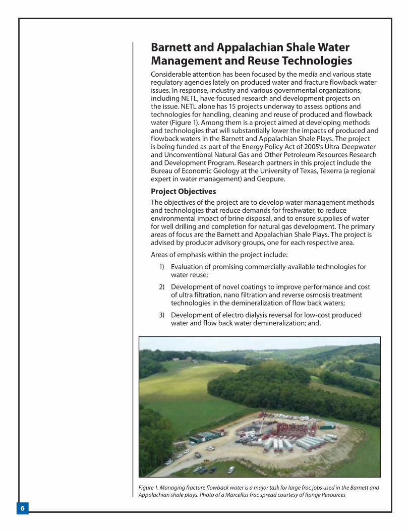
Barnett and Appalachian Shale Water Management and Reuse TechnologiesConsiderable attention has been focused by the media and various state regulatory agencies lately on produced water and fracture flowback water issues. In response, industry and various governmental organizations, including NETL, have focused research and development projects on the issue. NETL alone has 15 projects underway to assess options and technologies for handling, cleaning and reuse of produced and flowback water (Figure 1). Among them is a project aimed at developing methods and technologies that will substantially lower the impacts of produced and flowback waters in the Barnett and Appalachian Shale Plays. The project is being funded as part of the Energy Policy Act of 2005’s Ultra-Deepwater and Unconventional Natural Gas and Other Petroleum Resources Research and Development Program. Research partners in this project include the Bureau of Economic Geology at the University of Texas, Texerra (a regional expert in water management) and Geopure.
Project ObjectivesThe objectives of the project are to develop water management methods and technologies that reduce demands for freshwater, to reduce environmental impact of brine disposal, and to ensure supplies of water for well drilling and completion for natural gas development. The primary areas of focus are the Barnett and Appalachian Shale Plays. The project is advised by producer advisory groups, one for each respective area.
Areas of emphasis within the project include:
1) Evaluation of promising commercially-available technologies for water reuse;
2) Development of novel coatings to improve performance and cost of ultra filtration, nano filtration and reverse osmosis treatment technologies in the demineralization of flow back waters;
3) Development of electro dialysis reversal for low-cost produced water and flow back water demineralization; and,
Figure 1. Managing fracture flowback water is a major task for large frac jobs used in the Barnett and Appalachian shale plays. Photo of a Marcellus frac spread courtesy of Range Resources

7
4) Identification and evaluation of alternate sources of water that may be useful as replacements for groundwater or surface waters that serve as community water supplies.
This work will engage the operators of the most successful current field units treating flow back/produced waters as well as research scientists and engineers to address each of the four technical areas listed above. For example, the large majority of the water volumes needed for Barnett Shale wells is for fracturing (Figure 2). Only a very small percentage of the water is recycled at this point, with make-up water coming roughly equally from surface and subsurface sources. The goal is to increase the volume of water being recycled.
Producer ParticipantsAll aspects of the project will be under frequent, periodic review by the Barnett Shale Water Conservation and Management Committee (BSWCMC) and the Appalachian Shale Water Conservation and Management Committee (ASWCMC) to ensure that development efforts are directed toward meeting the needs of the natural gas industry in the Barnett and Appalachian Shale Plays. Membership of these committees includes over 20 producing companies in the respective shale gas plays: Anadarko, Atlas, Chesapeake, Chief, Cabot, CNS, ConocoPhillips, Devon, East Resources, EnCana, EOG, Equitable, Exco-North Coast, Harding Company, J-W Operating, Marathon, Pioneer Resources, Pitts Oil, Quicksilver, Range Resources, Seneca, Williams Production, and XTO Energy.
Impact and Project Benefits The project is expected to produce a number of benefits. First, it should reduce industry’s demand for freshwater for shale gas developments and ease water availability constraints for well developments and completions. Further, it should decrease the environmental impacts resulting from water transport activity, including fugitive dust and engine emissions, road degradation from increased heavy truck traffic. Finally, the project should provide for more efficient and cost effective methods for water handling. The technologies and methods developed in this project will be extended to the development of other shale gas plays. For more information, contact Kent Perry, Gas Technology Institute ([email protected] or 847-768-0961).
Figure 2. Barnett Shale water use and sources.

8
NETL Selects Nine New Projects for Environmental Management of Produced and Flowback WaterThe Office of Fossil Energy’s National Energy Technology Laboratory (NETL) has selected nine new projects targeting environmental tools and technology for shale gas and coalbed methane (CBM) production. NETL’s goals for these projects are to improve management of water resources, water usage, and water disposal, and to support science that will aid the regulatory and permitting processes required for shale gas development.
A primary goal of Fossil Energy’s Oil and Natural Gas Program is to enhance the responsible development of domestic natural gas and oil resources that supply the country’s energy. A specific objective is to accelerate the development and demonstration of technologies that will aid our country’s independent producers in dealing with use and treatment of water related to natural gas and oil production.
Operators face new challenges as well as new opportunities in developing resources such as shale gas. The following recipients will help provide the new technologies, tools, strategies, and knowledge toward reliable and environmentally responsible development of natural gas. All of these projects were launched in October 2009.
ALL Consulting, Tulsa, Okla.—The objective of this project is to develop a modeling system that will allow operators and regulators to plan all aspects of water management associated with shale gas development, including water supply, transport, storage, use, recycling, and disposal. This system will be used in planning, managing, forecasting, permit tracking, and compliance monitoring (duration 36 months).
General Electrical Global Research, Niskayuna, N.Y.—This project will develop a low-cost, mobile process to treat the total dissolved solids in the flowback water from hydraulic fracturing operations. The researchers will develop both a flowback water pretreatment process and a membrane-based partial demineralization process that yields an effluent suitable for reuse as hydraulic fracturing water (duration 18 months).
West Virginia University, Morgantown, W.Va.—The primary objective of this project is to develop and demonstrate a treatment process for frac water returns from Marcellus Shale wells. The process will include a pretreatment filter coupled with a combination of one or more treatment elements (duration 32 months).

9
University of Arkansas, Fayetteville, Ark.—The ultimate goal of this project is to develop a water management decision-support system by modifying and integrating a state-of-the-art water resource simulation model with a modern enterprise geographic information system (GIS). This will provide a science-based tool that can be used to support development of energy resources in the Fayetteville Shale region of Arkansas (duration 24 months).
Ground Water Protection Research Foundation, Oklahoma City, Okla.—This project will develop a new hydraulic fracturing module as an add-on to the well known Risk-Based Data Management System. The module will assist regulators and operators in enhancing protective measures for source water and streamlining the well-permitting process (duration 24 months).
Geological Survey of Alabama, Tuscaloosa, Ala.—The primary objective of this research is to analyze and develop strategies for water management in the CBM reservoirs of the Black Warrior basin. The study will develop a large, high-quality database and GIS that will provide a basis for more efficient development of CBM and identification of beneficial uses of produced water (duration 36 months).
Altela Inc., Albuquerque, N.M.—This project will demonstrate that the AltelaRain technology can be successfully deployed in a cost-effective manner to treat the produced and flowback water from Marcellus Shale, and that it can operate within state and federal regulatory requirements (duration 18 months).
University of Pittsburgh, Pittsburgh, Pa.—This project will evaluate the potential for combining and treating two waste streams (flowback water and acid mine drainage) for reuse as a frac fluid, and will also develop novel viscosity modifiers for water high in total dissolved solids (duration 36 months).
Texas Engineering Experiment Station, College Station, Tex.—This project will identify an efficient and cost-effective pretreatment methodology for use in processes employed to treat and reuse field-produced brine and fracture flowback waters. The project aims to develop and demonstrate a mobile, multifunctional technology specifically for pretreatment of brine (duration 24 months).
Additional information on any of these projects can be found on the SCGNO webpage (http://www.netl.doe.gov/technologies/oil-gas/index.html).

10
Air Monitoring Efforts by NETL Focus on Oil and Gas Operations ImpactsIn February 2009, the Secretary of Interior cancelled 77 Bureau of Land Management (BLM) oil and gas leases in eastern Utah citing concerns about air emissions from oil and gas production activities. Oil and gas activities can lead to emissions of fine particulate matter, volatile organic compounds (VOCs), nitrogen oxides (NOx), sulfur dioxide (SO2), and hydrogen sulfide (H2S) during exploration, drilling, and production phases that may significantly impact air quality. The most notable recent impacts are the mid-winter, ground-level ozone exceedances that have occurred in the Jonah-Pinedale Anticline Gas Field in west-central Wyoming. Visibility impairment and acid deposition linked to emissions from oil and gas operations continue to concern air quality specialists in the Rocky Mountain region. Further, creating inventories of greenhouse gas emissions from oil and gas operations is expected to be a near-term regulatory requirement.
Regional estimates of the impact of oil and gas exploration and production activities on air quality traditionally have been based on models that treat air emissions from these activities as a single point source at worst, and as a series of generic point source pollution emitters at best. These gross assumptions have resulted in prediction of air quality impact that is very different than the real impact of the many small, widely dispersed sources that exist. NETL’s Office of Research and Development (ORD) has embarked on a project that will use source-receptor and/or atmospheric dispersion modeling based on historic emissions literature, air quality monitoring, and laboratory simulations to establish the impact of oil and gas production activities on local and regional air quality. The following areas summarize NETL’s approach to improving assessment of air quality impacts from oil and gas operations.
Figure 1. Self-contained mobile emissions monitoring lab

11
Mobile Laboratory for Air Quality Monitoring A mobile air monitoring laboratory has been constructed to conduct monitoring of air emissions from oil and gas activities (Figures 1 and 3). The laboratory is equipped with instruments to monitor ozone and ozone precursors, including NOx and VOCs, components of acid deposition, greenhouse gases, and aerosols that contribute to regional haze (visibility impairment). It is also equipped with a meteorological station.
The mobile laboratory will initially be deployed in the Kane Experimental Forest Area of the Allegheny National Forest (ANF) to monitor the impact of intense oil and gas activity there on air quality. ANF is a 513,000 acre forest in northwestern Pennsylvania that has seen the drilling and completion of 4,000 wells since 2005. Following the assessment of ANF, the mobile laboratory will be relocated to an area in the Uinta Basin of eastern Utah where concern about air emissions (and lack of monitoring) prompted the Secretary of Interior to deny the BLM leases earlier this year.
Siting of the mobile laboratory is critical to successful air quality monitoring. For example, the location must be downwind of oil and gas E&P activities and removed from other un-related sources of air pollution. In addition, the local meteorology must allow for the capture of air emissions. The site must have adequate access to electricity, be easily accessible, and secure from unauthorized access.
Air Emissions Monitoring Using Unmanned Aerial VehiclesIn addition to the mobile laboratory, NETL will use sensors deployed on unmanned helicopters (Figure 2) to obtain multi-elevation surveys of emissions from oil and gas operations. These multi-elevation surveys will allow three dimensional emission plume modeling, a level of detail in monitoring that has been unavailable in the past. Unmanned helicopters are a relatively inexpensive way to fly reproducible flight plans that enable repeat surveys when meteorological conditions are different or other sensory inputs are desired. Proof-of -concept flights will take place at the
Figure 2. Unmanned helicopters configured with sensors to gather emissions data

12
Naval Petroleum Reserve No. 3, a Government-owned, operating oil and gas field northeast of Casper, Wyoming.
Air Quality Modeling Data from the mobile laboratory and unmanned aerial vehicle experiments will be used as input to existing air quality models including atmospheric dispersion and source-receptor models. The enhanced data quality should enable researchers to employ these models to better quantify the actual impacts of oil and gas activity, and provide a science-based foundation for emission mitigation or reduction efforts.
Key Academic Research CollaboratorsTwo collaborators are providing assistance to the air quality project. West Virginia University (WVU) is providing gas well drill sites with the means to monitor emissions through the use of site-specific air models. In addition, WVU has established a network of wireless, on-site monitors (Zigbee transceiver modules that communicate over long distances) to relay real-time data.
A second partner, Carnegie Mellon University (CMU), is employing a smog chamber to examine photochemical oxidation and to quantify secondary aerosol production for a range of atmospheric conditions. To date, CMU has carried out isothermal dilution and thermodenuder measurements to develop a complete volatility distribution of primary emissions, which drive organic aerosol formation. In addition, they have analyzed mixing of anthropogenic and biogenic aerosols by using mass spectra resolved by particle size, enabling separation of two sources of two distinct size modes.
For additional information contact Natalie Pekney at NETL ([email protected] or 432 386 5953).
Figure 3. Interior view of the mobile air monitoring station showing visibility, carbon and particulate matter monitor.

13
Snow Barriers to Manage Alaskan Lake Recharge for Ice Road Construction Snow is central to activities in polar latitudes of Alaska over a very significant part of each year. With the arrival of snow, modes of travel, working and living are transformed. Oil and gas exploration operations, restricted to winter months, use ice roads and ice pads in arctic and subarctic regions. The general reasoning behind ice road construction is that, unlike gravel roads, they leave little or no trace behind and require no mitigation or reclamation activities once they are no longer used. A traditional water source for building ice roads is water withdrawal from area lakes. The Bureau of Land Management estimates that 3.8 million to 5.7 million liters (1 to 1.5 million gallons) of water is needed per mile to build an ice road 15 cm (6 inches) thick and 9-11 meters (30-35 feet) wide. Current Alaskan regulations allow withdrawing 15% of water from lakes with fish and taking all the water from lakes without fish. One concern that emerged through the North Slope Tundra Lake study -- and now has become a central problem for federal and state land agencies -- is whether the lakes are completely recharged after water is withdrawn each season.
Arctic HydrologyThe hydrological regime of Alaska’s Arctic Slope (AAS) lakes is characterized by a large spring snowmelt providing much of the recharge, followed by a subsequent drying of the lake in summer, when evaporation generally exceeds precipitation. Some of the surface storage deficit is made up during the early fall period when precipitation is generally at an annual maximum while evapotranspiration is rapidly shutting down. Late summer precipitation may result in runoff from upland tundra areas to partially recharge pond storage. Depending on the available surface storage deficit (dry summer and fall), winter precipitation and ablation rate, a pumped lake may or may not be filled to its full capacity by winter.
This project evaluates the use of snow management and snow barriers to augment lake water supplies (Figure 1). Snow control practices will be implemented in order to enhance snow drift accumulation, which leads to decreased snow sublimation, increased melt water production, and an extended melting season that will recharge a depleted lake despite potentially unfavorable climate and hydrological conditions (i.e. surface storage deficit or/and low precipitation).
Figure 1. Snow Barriers can concentrate snow to provide melt water for Arctic lakes. Photo courtesy of the University of Alaska Anchorage.

14
Snow barriers are widely used to control the amount of snow accumulated or eroded. They are designed to reduce wind speed, therefore causing snow to deposit at designated areas. The size and shape of snow drifts are quite distinctive and repeatable when wind direction is consistent, as it is on AAS. Although snow barriers can augment water supplies by altering snow distribution, they also make “new” water available by reducing the sublimation losses from blowing particles and the erosion process on large lakes. Up to twenty percent of the blowing snow sublimates over transport distances of 3000 meters (about 2 miles). In addition to enhanced accumulation and “new” snow, increased snow depth at the barrier prolongs snowmelt and makes additional water available through mid-summer.
It is important to note that the cost of additional water obtained by using snow barriers appears to be very low. It has been reported that, based on data over a six year period, if the snow barrier and construction cost were amortized over 25 years, the cost of the water would be about $0.077 per cubic meter (thirty cents per thousand gallons). Finding an optimum location for a given snow drift would increase the probability that this snow will effectively recharge the associated lake through most of the summer.
Project ObjectivesUniversity of Alaska Fairbanks (UAF) will construct a snow barrier for two consecutive winters on AAS in the vicinity of Prudhoe Bay. Two lakes with similar water balances will be selected and monitored. One will be an experimental lake where a snow barrier is installed (Figure 2); the second will be a control lake, where the natural regime is preserved. This project will assess the snow barrier’s effects on: 1) ”new” water available due to reduced sublimation losses from blowing snow and decreased snow erosion on the lake; 2) duration of snowmelt runoff from the snow barrier’s drift and its effect on lake water balance; 3) lake-volume net increase; and 4) the cost, feasibility, and environmental consequences of this approach. These characteristics will be examined through a full suite of field observations, modeling and sensitivity analyses of snow transport by wind, and water balance assessment.
Figure 2. First approximation of water retained in the snow drift (for the barrier of 2.4 m height).

15
Potential Impacts This project will yield practical insight on using artificial barriers to prolong additional melt water recharge to the lake systems. It is important to assess the effects of artificial barriers on “new” water available due to reduced sublimation losses from blowing particles and decreased snow erosion on the lake; increased duration of snowmelt runoff from the artificially created snow drift and its effect on lake water balance; lake-volume net increase; and the cost of additional water. This research will lead to more efficient use of water resources for ice road and ice pad construction.
Accomplishments to DateThe research site was located and land use permits authorizing installation of a snow barrier and equipment to collect snow and hydrology data were obtained from the Alaska Department of Natural Resources and the North Star Borough. Permission for land use was obtained from the Alyeska Pipeline Service Company and the Alaska Department of Transportation.
Data compilation and data preprocessing were performed for the selected location. The research location will be monitored by the weather tower maintained by a group at the Water and Environmental Research Center (WERC) at University of Alaska Fairbanks. Weather data recorded at the station will be used for modeling.
Beginning in October 2008, researchers set up an observational program for the experimental lake and control lake in the vicinity of Prudhoe Bay. Instrumentation was installed to measure water balance components, snowpack, vegetation height, and ground temperatures. Field work for a pretreatment study was conducted in spring-summer 2009 to define major water sources and sinks for both lakes in their natural regime.
Ongoing WorkThrough this winter (2009-2010), the experimental lake’s water balance will be modified with an artificial barrier. Researchers will use the snow evolution model system SnowModel (Liston and Elder, 2006) to simulate snow erosion/deposition, the amount of “new” snow (sublimation and drifting from the lake) and melt with variety of snow barrier combinations and different positions around the lake. Such a sensitivity study will provide the necessary background information for optimal snowdrift position to effectively augment the recharge of the lake. Franklin Bluffs meteorological data and NRCS precipitation will be used for the model simulations.
Weather data analysis indicated that the length of the snow accumulation season is September to June, prevailing wind direction and snow drift orientation is north-east, and the mean winter precipitation is 105 mm. Potential snow barrier dimensions were estimated from the weather data. Snow barrier height should be 3.2m and snow barrier length should be equal or greater than 130m.
The project investigators believe that finding an optimum position for the snow drift would increase probability that this snow management project will be successful and effectively augment the recharge of the lake by the time water is needed for ice road construction. Practical recommendations on using snow barriers for ANS water resources management will be an important outcome of this project. For more information on this project, contact Sandra McSurdy, NETL Project Manager ([email protected] or 412-386-4533).

16
Hurricane Study Could Lead to New Design Standards and Safer Operations in Gulf of MexicoHurricanes in the Gulf of Mexico have had devastating effects. The 2005 hurricane season, in particular, produced two catastrophic storms, Katrina and Rita. Loss of life and property was severe. Offshore, in the Gulf of Mexico oil and gas province, damage was equally severe, although there was no loss of life due to the timely evacuation of over 25,000 offshore workers. Still, the oil and gas industry, and the nation, suffered a brutal blow. The storms destroyed 111 production platforms and a number of mobile drilling units. Worse yet, production of oil and gas in the Gulf of Mexico virtually stopped in the wake of both storms. Nearly 1.6 million barrels of oil was produced daily off the Texas and Louisiana coasts in 2005, amounting to 7.6% of the nation’s oil supply. That supply was severely curtailed. In addition, about 17% of the nation’s total natural gas supply came from the Gulf of Mexico. That, too, was severely curtailed (Figure 1).
Oil and gas production from the area did not return to full strength until more than six months after the storm. In the wake of the shut ins, oil prices doubled, natural gas prices moved significantly higher, the Strategic Petroleum Reserve was tapped, nearly one third of the country’s refining capacity was shut in at one point immediately after Rita, commercial petroleum stocks fell and motor fuel standards were temporarily relaxed to help increase available fuel supplies. The combined effect was a 5% increase in the US Transport Consumer Price Index (CPI) and a 2-3% increase in overall CPI.
Given these statistics, it is clear that a thorough understanding of the potential for weather development activity in the North Atlantic, that spawns Gulf of Mexico hurricanes, is crucial to offshore safety,
Figure 1. Damage to Shell’s Mars deepwater Gulf of Mexico platform caused by Hurricane Katrina. Photo courtesy of Oil Rig Photos (www.oilrig-photos.com).

17
energy security and the national economy, especially in light of current suggestions that accelerated global warming might exacerbate hurricane severity. According to a recent National Oceanic and Atmospheric Agency synthesis and analysis report (CCSP 2008), global warming will likely cause fewer, but more severe, hurricanes to form in the North Atlantic. If true, this raises the possibility that new coastal and offshore facilities, with expected working lives of many decades, are being under designed for future hurricanes, and that older facilities may need structural or operational modification in order to maintain currently acceptable risk levels. This is borne out by analysis of platform losses, by vintage, from hurricanes Ivan, Katrina and Rita during 2004 and 2005 (see Figure 2).
The Department of Energy, in partnership with the National Center for Atmospheric Research (NCAR) and the Georgia Institute of Technology (GA Tech), has launched a project to study the Effect of Global Warming on Hurricane Activity in the North Atlantic (07121-DW1801). The goal of this project is to evaluate the impacts of global warming on North Atlantic hurricane activity using a nested climate modeling approach that combines existing global climate simulations with more detailed regional simulations of individual storms and hurricanes, and advanced statistical techniques.
Results of the modeling and simulation will allow industry to evaluate current design standards and regulations in relation to the probability of stronger Gulf of Mexico hurricanes or changes in other critical characteristics (such as number of storms and length of time in the Gulf) due to global climate variability and change. This is economically significant if increased extremes, on the order of 10%, in areas like significant wave height have to be designed for. Designing for a 10% increase in significant wave height could increase total capital costs by $100 million, or more, for a single, deepwater structure. While less dramatic, changes in year-to-year hurricane activity could also impact evacuation costs, which sometimes run as high as $500 million per year for the offshore industry.
Figure 2. Lost Platform Vintage (for Hurricanes Ivan, Katrina and Rita) Source: F.J. Puskar, S.M. Varrett, C. Roberts, Fixed Platform Performance During Recent Hurricanes: Comparison to Design Standards, OTC paper 18989, Offshore Technology Conference, Houston, 2007.

18
Climate simulations are being carried out for the North Atlantic, with a focus on the Gulf of Mexico (see Figure 3). The large-scale climate component is provided by global climate simulations from the NCAR Community Climate System Model (CCSM). This is one of the leading global climate models in existence and has undergone careful review and testing by the scientific community. It has been extensively documented and provides one of the best available future projections of ocean and atmospheric changes in the North Atlantic under greenhouse warming scenarios. However, these global scale simulations are too coarse in their spatial resolution to model hurricane activity so the research team has nested its Nested Regional Climate Model (NRCM) into the CCSM model for a closer look at the North Atlantic and, more specifically, the Gulf of Mexico. By nesting the regional model into the global model, the project team will be able to conduct a series of downscaling simulations for current and future climate and hurricane activity in the Gulf of Mexico. All results will be archived by NCAR for use by other researchers.
The project is currently in its initial phase. Model set up, and testing has been completed, as has global CCSM simulations from 1950 to 2050 and the first stage of the nested NRCM simulations in time slices of 1995-2005, 2020-2030 and 2045-2055. These are being combined with a set of statistical and analytical downscaling approaches to build up a comprehensive analysis of how hurricanes might change. Also being undertaken is an analysis of how ocean surface and deep water in the Gulf is likely to change. Further, higher resolution NRCM simulations will follow. The end result will be a combined 50-year hindcast and 50-year forecast for hurricane activity and oceanic conditions in the North Atlantic and Gulf of Mexico.
For more information, contact Art Schroeder ([email protected]) or Greg Holland ([email protected]).
Figure 3. The nesting domains used for NRCM simulations. The outer grid at 36 km horizontal resolution is nested directly into the global CCSM simulation. Inner grids of 12 and 4 km are nested inside each other.

19
Innovative Water Management Technology Can Reduce Environmental Impacts of Produced Water Production of oil and gas generates large volumes of water, and new methods are needed for the efficient handling of produced water using environmentally acceptable technology. The quality and quantity of waters from development of conventional and unconventional resources vary widely from site to site. Constituents that may need to be treated prior to reuse or discharge of the water include anions, cations (including metals), organic compounds, dissolved solids, and suspended solids. Examples of specific elements of concern that may be present in some produced waters are arsenic, iron, magnesium, chromium, zinc, boron, barium, selenium, and manganese. Oil shale produced waters are typically derived from retorting, mine drainage, and leachate from spent oil shale because of the methods used for extracting hydrocarbons from shale. Waters generated from oil shale can contain many of the same constituents of concern (e.g. metals, arsenic, selenium, organics, and chlorides) present in other produced waters.
Current technologies for treating produced waters are relatively costly, especially considering the large volumes of water involved and the energy required for treatment, and yet still may be unable to achieve new, rigorous water-quality standards individually. Current treatment options include: ion exchange, reverse osmosis, electro dialysis reversal, mechanical evaporation, as well as others. A major limitation of most of these technologies is that their operating cost rises dramatically as the price of energy increases. Metals, organic compounds, and added biocides are among the more difficult to treat and tend to limit the utility of these waters for reuse or other purposes. Mercury, arsenic, and selenium present difficult challenges for many of the current treatment options, and concentrations of these constituents in some produced waters can be high relative to the extremely small levels that need to be obtained for reuse under current regulations. New technology is needed that will be economic for large-scale treatment and management of produced waters. The costs of treatment using constructed wetland systems are typically at least an order of magnitude less than alternative technologies.
Constructed Wetland SystemsConstructed wetland systems for treating produced waters can include centralized facilities (pipe or haul to the location and treat) or decentralized facilities designed for a single well or for a few nearby wells. Even portable or “package” constructed wetland treatment systems can be designed to be pulled to a site by truck and capable of immediately treating water after set up. These “ready-to-go” systems could be very useful during fracture stimulation or high initial water production from unconventional gas wells.
An example of a centralized system is shown in Figure 1. Design profiles for cells of constructed wetland treatment systems follow one of two variations: surface flow or subsurface flow (Figure 2). The components of a cell (hydrosoil, vegetation, and hydroperiod, in effect the residence time) are selected to produce conditions that promote specific biogeochemical treatment processes. Hydrosoil (planting medium) contains sand, clay, and organic matter with proportions dependent upon desired conditions. Examples of vegetation include Schoenoplectus californicus or bulrush (Figure 3) when reducing conditions are needed and Typha latifolia (cattail)

20
to promote oxidizing conditions. Hydroperiod is managed initially for rapid plant growth and then to sustain treatment performance. The length of wetland cells in typical full-scale constructed wetlands ranges from a few m to over 100 m.
Potential ImpactsThe use of constructed wetland treatment systems has great potential for contributing to the development of oil and gas resources by providing an effective and low cost method of treating the produced waters for beneficial use and discharge. In addition to greatly reducing the environmental risks associated with current practices, produced waters renovated by
constructed wetland treatment systems have the potential to be used for a variety of purposes, such as irrigation, livestock watering, cooling-tower water, municipal water use, domestic use, discharge to receiving aquatic systems for other use downstream, and support of critical aquatic life and wildlife. This can allow continued operation of existing wells in mature fields with high water cuts and also lead to increased drilling and production, increasing the contribution of domestic energy resources to our national energy supply.
Project GoalsThe goal of this project is to develop constructed wetland systems for treatment and beneficial use of produced water, and to conduct scientific studies to address ecological, environmental, and regulatory concerns that limit options for managing produced water, including surface discharge.
Figure 1: Full-scale constructed wetland treatment system near Aiken, South Carolina. The Savannah River National Laboratory is in the upper left.
Figure 2. Design profiles for A) surface flow and B) subsurface flow constructed wetland systems. After Rodgers and Castle (2008, Environmental Geosciences, v. 15, no. 1, p. 1-8). AAPG©2008, reprinted by permission of the AAPG whose permission is required for further use.

21
The project will investigate the use and design of constructed wetland treatment systems to decrease targeted constituents in produced waters to achieve reuse criteria or discharge limitations established by the National Pollutant Discharge Elimination System and Clean Water Act. These treatment systems will be designed to support the transfer and transformation of targeted constituents in produced waters. It will be important to accumulate and sequester potentially toxic inorganic elements in nonbioavailable forms within the hydrosoil of the constructed wetland treatment system. Organics must be retained and biodegraded. To achieve reduction of targeted constituents, design of the systems will be based in sound biogeochemical theory and modeling, as well as in published literature. Design parameters will be incorporated that take into account factors such as footprint, life expectancy, and closure plan.
Range of Water Sources and Constituents to be StudiedProduced waters being investigated include those produced from conventional gas, coalbed methane, tight gas, and shale gas. To date, a literature review has been conducted on natural gas produced water using published sources and databases from the United States Geological Survey (USGS) and DOE. The data, which include both analytical data and geological source information, have been compiled into an Excel spreadsheet. A produced water inventory of these data compiled from literature sources has been created, listing the produced water data by geologic basin and formation.
To obtain additional data on produced waters, researchers have contacted various potential data sources including state geological surveys, state oil and gas boards, and industry personnel. Many of the conventional gas produced water data have been obtained from basins that co-produce both oil and natural gas. The database currently contains records for 625 samples of co-produced water from 28 geologic basins. The majority of the produced water data for unconventional gas has been obtained from formations from which coal bed methane (CBM) is produced. Data from 319 CBM samples from several geologic basins, including San Juan, Raton, Powder River, and Arkoma, have been entered into the database. Efforts are currently focused on adding data for waters produced from gas shales and tight gas sandstones.
Current StatusIn the first year of the project, researchers will further assess the environmental factors associated with produced waters that impact development of U.S. oil and gas reserves. Chemical, physical, and risk characteristics of produced waters from both conventional and unconventional resources will be identified, and treatment requirements for these waters will be evaluated based on their characteristics. Guidelines for reuse of treated produced water in agriculture (irrigation and livestock) and industry (scaling, corrosion, and biofouling) will be compiled. Data collected in this year will be used to evaluate treatment options including, but not limited to, the applicability of constructed wetland systems for treating produced water.
For more information, contact NETL Project Manager Sandra McSurdy ([email protected] or 412-386-4533) or Principal ResearcherJames Castle ([email protected] or 864-656-5015) with Clemson University.
Figure 3. Schoenoplectus californicus or bulrush shown in test containers

22
E&P Snapshots
NETL Unveils Ultra-deep Drilling Simulator The Extreme Drilling Laboratory (XDL) at the National Energy Technology Laboratory (NETL) announces the debut of its prototype Ultra-deep Drilling Simulator (UDS). Drilling research will begin soon with pressures capable of reaching 30,000 pounds of force per square inch and temperatures exceeding 480 °F. One of the many unique features of this facility is that 100 percent of the “drilling” will occur above ground, within a high pressure/high temperature cell. The UDS operating pressure and temperature ranges are significantly greater than those found in similar drilling simulators and are representative of conditions found in ultra-deep wells (i.e., depths near 30,000 feet). The UDS will allow researchers to study the physical phenomenon of the cutter-to-rock interface, so they can explore and develop the technology required to efficiently drill rock under high-pressure, high-temperature (HPHT) conditions.
The high-tech facility, located in Morgantown, W. Va., was conceived in cooperation with industry and funded by the Department of Energy. In addition to exploring the dynamic interaction between the rock cutter and the rock using the UDS, the XDL researchers will have at their disposal a state-of-the-art Drilling Fluids Lab and a Mineralogy, Modeling, and Materials Lab. These supporting facilities will provide the means to identify and analyze the singular aspects of rock properties and formations that can influence both the economic and operational processes of ultra-deep drilling.
IOGCC Selects HARC Program for Award The Environmentally Friendly Drilling Systems (EFD) Program, a collaborative project led by the Houston Advanced Research Center (HARC), has been selected by the Interstate Oil and Gas Compact Commission’s (IOGCC) Stewardship Award Subcommittee as the winner in the Environmental Partnership category. The award was presented at the Commission’s annual meeting in Biloxi, Mississippi on October 5.
In 2001, the IOGCC initiated the annual Chairman’s Stewardship Awards, representing the Commission’s highest honor for exemplary efforts in environmental stewardship. The awards recognize achievement and challenge organizations, companies and individuals nationwide to demonstrate innovation, dedication and passion for our environment.
The EFD program (see related story on page one) seeks to
• combine new low-impact technologies that reduce the footprint of drilling activities,
• integrate light-weight drilling rigs with reduced emission engine packages,
• address on-site waste management,
• optimize the systems to fit the needs of a specific development sites,
• provide stewardship of the environment.
The program involves industry, the public, environmental organizations,

23
and elected officials in a collaboration that addresses concerns on development of unconventional natural gas resources in environmentally sensitive areas. Partners bring their regional expertise together in a synergistic manner to address the needs across the country.
Deputy Assistant Secretary VisitsOn December 9, 2009, Christopher Smith, the newly appointed Deputy Assistant Secretary (DAS) for Oil and Gas, visited NETL in Morgantown, WV and met with SCNGO management and scientists to discuss ongoing plans for research in support of the Administration’s energy, environmental, and economic goals. In addition to a series of programmatic briefings, discussions of NETL’s systems analysis and on-site research were conducted with DAS Smith. The DAS was also provided a tour of several research facilities during his NETL visit, including the Simulation and Visualization Laboratory as well as the Extreme Drilling Laboratory (EDL). A stop at the Ultra High Pressure High Temperature Drilling Simulator was included as a key function of the EDL.
Deputy Assistant Secretary Christopher Smith (foreground, center) on a recent visit to NETL’s Morgantown, WV site.
Deputy Assistant Secretary Christopher Smith (center) with NETL staff at the laboratory’s Technology Support Facility in Morgantown, WV.

24
JanuaryPTTC 1/14 Texas/SE New Mexico workshop: What’s Your Bottom Line: Assessing Operating Costs (Midland College PPDC) – Midland, TX. Contact: 432-683-2832
PTTC 1/14-15 Rocky Mountain workshop: Fluvial Stratigraphy – Golden, CO. Contact: 303-273-3107
PTTC 1/20-21 Rocky Mountain workshop: Applied Hydrodynamics in Petroleum Exploration & Production – Golden, CO. Contact: 303-273-3107
February 2010PTTC 2/1 Rocky Mountain workshop: Petra Basics – Golden, CO. Contact: 303-273-3107
PTTC 2/11 Rocky Mountain workshop: Economics of Oil and Gas – Golden, CO. Contact: 303-273-3107
March 2010RPSEA 3/8-9 Effect of Global Warming in Hurricane Activity in the North Atlantic, National Center for Atmospheric Research, Boulder, CO. (www.rpsea.org to register)
RPSEA 3/11 Ultra-Deepwater Joint Geoscience and Reservoir Engineering TAC Quarterly Meeting, Anadarko, 1201 Lake Robbins Drive, The Woodlands, TX (www.rpsea.org to register)
PTTC 3/25 Eastern workshop: Michigan Field Experiences – Mt. Pleasant, MI. Contact: 269-387-8633
April 2010PTTC 4/5-9 Rocky Mountain workshop: Complex Well – Core Competency 2010 – Golden, CO. Contact: 303-273-3107
May 2010NETL/SCNGO 5/3 Offshore Technology Conference, Press Presentation on the Knowledge Management Database, 9:00 a.m., Reliant Center, Houston, TX
PTTC 5/7-10 Eastern workshop: Marcellus and Utica Shale Core Workshop & Field Trip (Pittsburgh Association of Petroleum Geologists) – Central New York. Contact: 304-293-2867 x 5443.
June 2010 RPSEA 6/1 Ultra-Deepwater Reservoir Engineering TAC Quarterly Meeting, Anadarko, 1201 Lake Robbins Drive, The Woodlands, TX (www.rpsea.org to register)
RPSEA 6/7 Ultra-Deepwater Geoscience TAC Quarterly Meeting, Chevron Bellaire Facility – BAX Auditorium, 4800 Fournace Place, Bellaire, TX (www.rpsea.org to register)
PTTC 6/13 Rocky Mountain workshop: Source Rocks 101, What the Exploration Geologist, Geophysicist and Production Engineer Should Know About Petroleum Source Rocks (RMS-AAPG) – Durango, CO. Contact: 303-273-3107
Upcoming Meetings and Presentations