environmental risk management plan historic waste disposal ... › ... › landfill ›...
TRANSCRIPT

Unit 107, 2719 - 7 Avenue NE, Calgary, Alberta T2A 2L9 T. 403-640-9009 F. 403-640-9006
Environmental Risk Management Plan Historic Waste Disposal Site
McKenzie Trails Recreation Area The City of Red Deer
Prepared For: The City of Red Deer Prepared By: Tiamat Environmental Consultants Ltd. Date: November 26, 2014 File: 12-435

12-435 Page i ERMP – McKenzie Trails Recreation Area Historic Waste Disposal Sites, The City of Red Deer
Tiamat Environmental Consultants Ltd. Electronic Version 02
Preface The City of Red Deer is aware of several historic waste disposal sites containing municipal solid waste situated within fully developed urban areas. The Alberta Municipal Government Act, specifically Part 2, Section 13 of the Subdivision and Development Regulation AR 43/2002 specifies a minimum setback distance between the closed historic landfill to certain types of land developments. Restrictions of types of subdivision associated with this regulation include residential, food establishment, school or hospital. This regulation includes provisions for the Provincial Deputy Minister to consider a request to vary the minimum setback distance for a specific development application, provided the local municipal subdivision or development authority supports the proponent’s specific development application. The underlying objective of the project is to develop a level of understanding of the environmental risks arising from each historic waste disposal site leading to a site specific environmental risk management plan (ERMP). To structure the project into manageable components, the work was divided into the following three stages:
1. Phase I ESA Compilation and review of information pertaining to a historic waste disposal site.
2. Phase II ESA Subsurface investigation to verify and characterize information from the Phase I ESA.
3. ERMP Develop a site-specific environmental risk management plan to serve as an aid for the municipal development review process.
This document reflects the third stage, specifically presenting the ERMP for the historic landfill area situated within the McKenzie Trails Recreation Area. With the available information, the ERMP was developed on the basis of Health Canada guidelines for a preliminary quantitative risk assessment. The outcomes of the ERMP confirm the identified chemicals of concern and the relevant environmental risks are manageable to facilitate future developments which may lie within the regulated setback distance to the historic waste disposal site. This ERMP provides a first-order evaluation for potential future subdivision and development with a focus on methods to minimize the risk of human exposure to landfill gas and other hazards to the environment resulting from the historic waste disposal site. Ultimately, the goal is to have an effective and timely review process for specific future subdivision and development applications while preserving an appropriate/equivalent level of protection for each stakeholder be it regulatory, developer, owner, public or the natural environment.

12-435 ERMP – McKenzie Trails Recreation Area Historic Waste Disposal Sites, The City of Red Deer
Tiamat Environmental Consultants Ltd. Electronic Version 02
Page ii
TABLE OF CONTENTS
Preface …………………………………………………………………… i
1.0 Introduction …………………………………………………………… 1
1.1 Scope of Work …………………………………………… 4
1.2 Summary of Previous Work & Project Status …………... 5
1.2.1 Site Description and Environmental Setting …………… 6
1.3 Regional Geology and Hydrogeology …………………… 7
1.4 Environmental Guidelines & Regulations …………………… 9
2.0 Contaminant Situation …………………………………………… 10
2.1 Groundwater …………………………………………………… 11
2.2 Soil Vapour …………………………………………………… 12
2.3 Exposure Pathways …………………………………………… 14
3.0 Environmental Risk Assessment …………………………………… 15
3.1 Identified Environmental Health Concerns …………………… 18
3.2 Boundary Conditions for PQRA …………………..…..…… 19
3.2.1 Hazard Assessment …………………………………… 20
3.2.2 Exposure Assessment …………………………………… 20
3.2.3 Receptor Characterization ………………………….... 21
3.2.4 Risk Characterization …………………………………… 22
3.2.5 Potential Municipal Administrative Controls …………… 23
4.0 Conceptual Site Model (CSM) ……………………………………. 23
4.1 Contaminant Fate and Transport ……………………………. 24
4.1.1 Volatile Organic Compounds in Soil ……………………. 25
4.1.2 Volatile Organic Compounds in Groundwater ……. 25
4.1.3 Combustible Headspace Vapours ……………………. 26
4.1.4 Lateral Transport of Groundwater ……………………. 26
4.1.5 Volatilization and Vapour Migration from Impacted Soil
and Groundwater ……………………………………. 26
4.2 Summary of CSM ……………………………………………. 27
5.0 Proposed Site-Specific Environmental Risk Management Plan ……. 29

12-435 ERMP – McKenzie Trails Recreation Area Historic Waste Disposal Sites, The City of Red Deer
Tiamat Environmental Consultants Ltd. Electronic Version 02
Page iii
TABLE OF CONTENTS continued
5.1 Outline of Generic Mitigative Measures ……………………... 35
5.2 Strategy For Subdivision And Development Within 100 M ........ 36
5.3 Strategy For Subdivision And Developments Between
100 to 300 M …………………………………………………….. 37
5.4 Strategy For Subdivision And Development Beyond 300 M 37
5.5 Strategy For Other Commercial Developments &
Subsurface Utilities …………………………………………… 37
5.6 Proposed Regulatory Monitoring and Quality Assurance ......... 38
5.7 Proposed Risk Communication Plan ..…………………………… 38
5.8 Considerations For Protection/Preservation of Water Bodies
Man-Made Pond and the Red Deer River ……………………. 38
5.9 Future Review and Update to ERMP ……………………………. 39
6.0 Statement of Limitations ……………………………………………. 40
7.0 Closure ……………………………………………………………. 41
References ……………………………………………………………………. 42
Table 1 General Site Attributes for Exposure to Soil Vapour Inhalation Table 2A Identified Chemicals of Concern – Physical Attributes Table 2B Identified Chemicals of Concern – Guidelines and Toxicological Values Table 3A Residential Land Use – Calculated Hazard Quotients for Identified
Chemicals of Concern Table 3B Food Establishment Land Use – Calculated Hazard Quotients for
Identified Chemicals of Concern Table 3C School & Hospital Developments Land Use – Calculated Hazard
Quotients for Identified Chemicals of Concern Table 3D General Retail Developments Excluding Food Establishments Land Use
– Calculated Hazard Quotients for Identified Chemicals of Concern Table 3E Utility Infrastructure Activities Land Use – Calculated Hazard Quotients
for Identified Chemicals of Concern Table 3F Wildlife Receptors within the Vicinity of the Man-Made Pond and The
Red Deer River at the McKenzie Trails Recreation Area – Calculated Hazard Quotients for Identified Chemicals of Concern
12-435 ERMP – McKenzie Trails Recreation Area Historic Waste Disposal Sites, The City of Red Deer
Tiamat Environmental Consultants Ltd. Electronic Version 02
Page iv
TABLE OF CONTENTS
continued
Figure 1 Site Showing Surrounding Land Use Figure 2 Site Showing Interpreted Extent of Waste Figure 3 Cross Sections A-A’ and B-B’ Figure 4 Interpreted Groundwater Elevations – August 2013 Appendix A Alberta Environment Information Sheet – Requesting Consent to Vary
the Setback Distance for a Development to a Non-Operating Landfill Appendix B Glossary

12-435 ERMP – McKenzie Trails Recreation Area Historic Waste Disposal Sites, The City of Red Deer
Tiamat Environmental Consultants Ltd. Electronic Version 02
Page 1
1.0 INTRODUCTION Assessment of environmental site data to identify potential hazards and exposures is, by its nature, a risk assessment process. The use of various risk assessment tools is a common practice to decision making in professional practice. The current body of knowledge and research has produced a wide assortment of methods to conduct an environmental risk assessment. The many approaches to conducting a risk assessment range from very basic site-specific empirical information gathered from the field to complex numerical quantitative models. Typically, selection of the risk assessment protocol is determined by the type of data available and the attributes which are exposed to a potential risk. The risk management process can be a relatively straight-forward analysis to a complex evaluation involving a multi-disciplinary team of professionals. For example, a proposed residential development project within a prescribed river flood plain will have several environmental factors associated to vulnerabilities and potentials for an adverse effect to the proposed development from the river (flood, high groundwater, pollution impact from an upstream source etc.). Current practice involves multiple avenues of review ranging from regulatory requirements, design guidelines, codes of practice, industry standards and local considerations to address the potential identifiable vulnerabilities. These reviews and considerations are intended to assist the design professional to manage the identified vulnerabilities and the associated risks to ensure appropriate levels of mitigation and adaptation are incorporated into the development with the objective of having an appropriate level of protection for each stakeholder and the natural environment. Risk assessment can be broadly categorized into three main types: qualitative, semi-quantitative and quantitative. Each type has unique limitations to subjectivity of data and each have a common outcome to serve as a decision making tool for management. A commonly applied qualitative risk assessment tool can be simply illustrated in a matrix form below.
A semi-quantitative approach to risk assessment requires some first-order estimates as inputs into a risk model. The semi-quantitative approach is more sophisticated relative to the subjective qualitative screening approach and is not as numerically demanding as a quantitative risk assessment involving more complex numerical models and environmental statistics. The semi-quantitative approach is commonly applied to smaller project sites and is an appropriate approach for this project site.
High M H H Medium L M H
Low L M H Low Medium High
Level of Risk
Severity of Consequence
Probability of Occurrence

12-435 ERMP – McKenzie Trails Recreation Area Historic Waste Disposal Sites, The City of Red Deer
Tiamat Environmental Consultants Ltd. Electronic Version 02
Page 2
As noted, a semi-quantitative approach does not require analyzed probabilities or high level statistical and mathematical data sets, which may largely be subjective and difficult to verify, creating a new set of uncertainty. The semi-quantitative process includes a hierarchy of identified risks specific to the site, numerical risk estimation and an interpretation of qualitative considerations founded on professional experience and judgment. The hierarchy of identifiable risks is generally outlined into a matrix similar to the above, reflecting an order of project specific priorities. The matrix format is intended to illustrate in a logical fashion for the likelihood of a possible vulnerability and its adverse impact. Risk rankings are usually divided into three groupings: low, medium and high with a prescribed level of action appropriate to respond to a potential level of adverse consequence such as:
Low aggregate risk value. Management can decide what form of corrective action(s) to implement or accept the potential risk.
Medium aggregate risk value indicates mitigative and/or adaptive actions would
be deemed prudent to minimize the probability of an adverse effect. Immediate reaction is generally not required but action would be necessary within a site–specific time frame.
High aggregate risk value. Mitigating and/or adaptive measures are to be
exercised as soon as practical in order to reduce the identified hazard. It should be noted, to a practical level as possible, a risk assessment should be exercised in an objective fact-based manner to avoid pre-determining a desired outcome, i.e. allow the facts to “speak.” Accordingly, to effectively develop a risk management plan with a scientifically supported project decision making process, the risk assessment should be developed in a manner which is consistent and defensible while recognizing limitations to the data set and the inherent uncertainty to available site information and subsurface parameters. This knowledge can then be applied in a defensible and justified manner to make appropriate risk-based decisions. In summary, within the practice of risk assessment, there are many other methods and approaches to completing a risk assessment. Each has differing attributes and limitations. The results of a risk assessment are either applied to better understand the levels of risk to potential identified hazards or the results become an indicator to support further investigation and research. Information on the types and the merits of differing risk assessments are widely available to the reader. For this project, an evaluation of risk is a systematic process involving the identification and comparison of specific assets and its associated vulnerabilities with consideration of the likelihood for an adverse effect to occur. The development of a site-specific environmental risk management plan (ERMP) is a component of a structured risk management process utilized by The City of Red Deer.

12-435 ERMP – McKenzie Trails Recreation Area Historic Waste Disposal Sites, The City of Red Deer
Tiamat Environmental Consultants Ltd. Electronic Version 02
Page 3
The results of the risk assessment are intended to support risk-based decisions by the Management at The City of Red Deer. In order to develop a defensible risk management plan, the approach considered to be appropriate for this project is a preliminary quantitative risk assessment. Health Canada has developed guidance documents to enable a consistent and defensible evaluation of site-specific data. A simple semi-quantitative protocol rather than a detailed analytical protocol is appropriate for the level of data available. A semi-quantitative protocol is acceptable to most regulatory jurisdictions for a project of this scope and strikes a reasonable balance between a purely subjective qualitative protocol and the highly analytical intensive quantitative protocol. Health Canada refined and released the framework for environmental risk assessment in September 2010 and an update and revision in 2012. The Health Canada approach was selected over the CCME 1996 Framework for Ecological Risk Assessment. The CCME and the Health Canada risk assessment process are the two nationally accepted processes for risk assessment. Local provincial ministries have developed specific risk assessment protocols that are modeled from selected attributes of various risk protocols from various organizations. For instance, the Alberta Tier 1 and 2 Soil and Groundwater Remediation Guidelines are focused on the assessment and remediation of contaminated soil and groundwater. Generic numeric guidelines for target chemicals were derived by the application of the CCME 2006 Protocols for the Derivation of Environmental and Human Health Soil Quality Guidelines. The CCME Ecological Risk Assessment process is also focused on target chemicals at a site. These approaches are directed at the concentrations of target chemicals at a contaminated site. The Health Canada approach focusses on the risk of exposure to a receptor and not the concentration of a target chemical. Hence, for this project, in order to develop and evaluate a risk model for potential receptors at various developments to the exposure of transient soil landfill vapours emanating from the McKenzie Trails Recreation Area, the Health Canada model is considered more appropriate relative to the above noted alternative risk assessment models. Health Canada outlines a preliminary quantitative risk assessment (PQRA) in order for various industries to apply a standard method and assumptions to ensure potential environmental exposures and their risks are not underestimated in the risk model. This approach is to address historic problems during peer review. The PQRA applies a conservative interpretation to the risk outcome. Such that in the event of an identified potential risk outcome being negligible or acceptable; the actual site condition(s) will essentially present a negligible or acceptable level of risk. Conversely, should the outcome for a potential level of risk be deemed unacceptable, further investigation may be warranted to better refine the conservatism and reduce uncertainty or the actual site condition(s) become an unacceptable level of risk warranting a site-specific response to address and reduce the predicted risk for an adverse impact.

12-435 ERMP – McKenzie Trails Recreation Area Historic Waste Disposal Sites, The City of Red Deer
Tiamat Environmental Consultants Ltd. Electronic Version 02
Page 4
Key results from the Phase I and II ESA have been consolidated to construct a site-specific preliminary quantitative risk assessment. The output from the PQRA incorporates into risk management strategies and the development of a risk management plan. Tiamat Environmental Consultants Ltd. (Tiamat) presents this Environmental Risk Management Plan (ERMP) for a historic waste disposal site located within the McKenzie Trails Recreation Area. This report presents the scope of work, a summary of the PQRA and a proposed ERMP for the McKenzie Trail Recreation Area. The information presented is intended to be a standalone document. Specific site information that is deemed supplementary and not critical to the ERMP has been excluded in this report. Should the reader wish to review this type of information, the reader should peruse the Phase I and II ESA reports for the McKenzie Trails Recreation Area as prepared by Tiamat. 1.1 Scope of Work A summary of the key tasks for this ERMP are outlined below: Compile Data for PQRA Identify chemicals of concern in environmental media (soil, groundwater, soil gas); Assemble chemical and physical attributes of each identified chemical of concern; Collect toxicological information and identify data gap(s) for each identified chemical
of concern; Identify receptors (human, biota and river) and the various routes of potential
exposure; Evaluate the compiled data using a standard PQRA approach. ERMP Develop a site-specific ERMP incorporating the findings of the PQRA with
application to the four limited/restricted land uses (school, hospital, food establishment and residential), general commercial developments and the installation of infrastructure such as utilities.

12-435 ERMP – McKenzie Trails Recreation Area Historic Waste Disposal Sites, The City of Red Deer
Tiamat Environmental Consultants Ltd. Electronic Version 02
Page 5
1.2 Summary of Previous Work & Project Status Municipal records and historical information pertaining to the disposal of historic waste at McKenzie Trails Recreation Area appears to be limited. The historic waste disposal activity was apparently conducted in two phases; the south portion is circa 1930-1959 and the north portion is circa 1960-1964. The estimated age of the waste material, post closure is interpreted to be at least five (5) decades, circa 1964. For this ERMP, the most recent closure period (50 years) will be referenced as the approximate and most conservative period for this historic landfill site. Other nearby developments includes various amenities for the public recreation areas, storage yards and tree farm for City Parks and residential acreages. The Red Deer River is adjacent to the site and flows around the west and north perimeters of the McKenzie Trails Recreation Area. Previous environmental investigations for the site have been conducted since 1982.
1982 Site Assessment, prepared by the Soils Branch of Alberta Environment.
2007 Summary Report Former City Landfill Site, McKenzie Trails Recreation Area, Red Deer, Alberta, March, 2007, prepared by Stantec Consulting Ltd. and Parkland Geotechnical Consulting Limited.
Phase I Environmental Site Assessment, Historic Waste Disposal Site, McKenzie
Trail, The City of Red Deer, September 24, 2013, prepared by Tiamat.
Phase II Environmental Site Assessment, Historic Waste Disposal Sites, McKenzie Trails Recreation Area, February 12, 2014, prepared by Tiamat.
The noted documents were provided by the City of Red Deer. Key information from the referenced documents was consolidated and identified data gaps were addressed in the Phase I ESA report (Tiamat, 2013). The scope of investigation for the Phase II ESA was designed to address the environmental concerns identified in the 2013 Phase I ESA. The key results of the 2014 Phase II ESA are as follows:
Adjacent developments relative to the waste include several lots developed for residential use, tree farm and storage yards utilized by the City. There are no obvious activities which pose a high potential to adversely impact the site from activities on adjacent developments. The historic waste disposal area lies within the boundaries of the park.
12-435 ERMP – McKenzie Trails Recreation Area Historic Waste Disposal Sites, The City of Red Deer
Tiamat Environmental Consultants Ltd. Electronic Version 02
Page 6
The waste area underlies the majority of the park space that is north of the man-made pond and extends to a buffer setback from the bank of the Red Deer River. The plan area of the historic waste is calculated to be approximately 64,250 m2
(15.94 ac), more or less, and is shown on Figure 2.
Groundwater samples from four locations clearly demonstrate a varying level of contamination by various dissolved petroleum hydrocarbons, volatile organic compounds and chlorinated hydrocarbons. The detected chemicals in the groundwater comply with the referenced Alberta Tier 1 Guidelines.
One soil vapour sample from a soil vapour well located between the waste
material and the nearby residential properties indicate four broad groups of VOCs, aliphatic and aromatic hydrocarbons and siloxanes. The relative concentrations are considered to be trace to low and are not anticipated to be an environmental concern to the nearest residential developments located about 140 m southeast of the waste material.
The findings of the Phase II ESA suggest mild strength constituents in leachate are present in the groundwater and may be entering the Red Deer River. The initial assessment of landfill gas (LFG) shows the relative concentrations of soil gas constituents to be quite low and composed of numerous volatile chemicals. A summary of the identified chemicals of concern are tabulated in Table 2A. 1.2.1 Site Description and Environmental Setting McKenzie Trails Recreation Area is located within two subdivided parcels of land. The legal descriptions are as follows:
Plan 4086EO within SE 28-38-27 W4M; and
Plan 3081MC within NE 28-38-27 W4M. The above areas are zoned P1 – Parks and Recreation (Land Use Bylaw 3357/2006). The historic waste disposal area lies within the McKenzie Trails Recreation Area, currently utilized as a public recreation facility and natural park. Amenities include surface parking, picnic area, public washrooms, a man-made pond with small dock and bridge and a network of pedestrian/bicycle trails. The area overlying the historic waste material has been transformed into a natural setting with transplanted trees, shrubs and field grasses. The site is bounded on the west and north by the Red Deer River followed by Three Mile Bend Recreation Area to the north. 40th Avenue bounds the east side of the site followed

12-435 ERMP – McKenzie Trails Recreation Area Historic Waste Disposal Sites, The City of Red Deer
Tiamat Environmental Consultants Ltd. Electronic Version 02
Page 7
by a natural area and the river valley escarpment. The man-made pond bounds the historic waste site to the south, followed by the David Thompson Highway (67th Street). Single-family residential housing is located to the southeast, with the nearest housing developments located 140 m, more or less, from the historic waste. The East Hill Major Area Structure Plan (Bylaw 3499/2013) indicates the 300 m setbacks for this historic landfill extends into the residential lots along the portion of 40 Avenue between 67 Street and across the Red Deer River, refer to Figure 1. This setback could potentially influence future redevelopment for residential lots within the generic regulated setback. The Garden Heights Neighbourhood Area Structure Pan (ASP) (Bylaw 3217/A-2009) indicates the 300 m setback extends into the north and west boundary of this new neighbourhood. According to the ASP, the setback is not expected to influence residential development as the northwest portion of the neighbourhood is designated P1- Parks and Recreation and to be rezoned to A2 – Environmental Reserve in the future. Additionally, the river valley escarpment provides a natural physical buffer between the historic waste and Garden Heights located at the top of the escarpment. 1.3 Regional Geology and Hydrogeology Within the immediate area of the historic waste, there is no noted direction of principal overland flow or measures to control surface run-off. There are no obvious environmental concerns for surface water run-off or run-on throughout this area. This area is mapped within the 100-year flood fringe (Environment Canada and Alberta Environmental Protection, Edition 1, 1995). Following the June 2013 flood event, it is recognized the flood fringe may be updated following a review by the provincial authority. The Red Deer River bounds the west and north sides of the site and flows past the site from the southwest to northeast direction. The site and immediate area lies within the Red Deer River Valley and local groundwater is interpreted to be within a zone of groundwater discharge with an upward component of flow. Ground topography suggests the groundwater would trend to the north and northwest, towards the river. It should be noted that local topography, geology, land development and soil disturbances might influence the local movement and pattern of groundwater. Furthermore, groundwater may also fluctuate from seasonal and climatic conditions. A summary of the published geological and hydrogeological information is presented in the September 2013 Phase I ESA report.

12-435 ERMP – McKenzie Trails Recreation Area Historic Waste Disposal Sites, The City of Red Deer
Tiamat Environmental Consultants Ltd. Electronic Version 02
Page 8
A water well owned by the City is within the recreational park. The public washroom facility located in the picnic area within the park has no water service. There are no underground municipal utilities identified in the area of the historic waste site. The relative locations of the nearby municipal utilities are shown on Figure 2. Potential environmental concerns arising from the historic waste site are grouped into three broad categories:
Ground stability issue where the historic waste lies;
Continual generation of soil vapour from the decomposing waste materials; and
Lateral transport of groundwater, which passes through the waste material and ultimately discharges to the Red Deer River.
Several geochemical processes and physical settlement occurs as the buried historic waste materials decompose. There is visual evidence the cover for the historic waste has settled in an irregular manner. The grass and underlying loam lies in an uneven mat across areas underlain by historic waste. Landfill gas is a by-product of a geochemical process associated with the decomposing waste materials. The soil vapours comprising of constituents from landfill gas can migrate in the subsurface. The geochemical process also yields soluble hydrocarbons to the groundwater system with some volatile components capable of degassing into the soil vapour regime. As noted in Section 1.2.1 and illustrated on Figure 1, the generic regulated 300 m radius from the boundary of the historic waste encompasses a portion of the Red Deer River to the west and north, a recreation area further to the north and residential lots and community developments to the southeast. To our knowledge, there has been no documented environmental concern associated with potential LFG to impact the nearby residential buildings located on the acreages along 40th Avenue, southeast of the historic landfill; specifically lots with municipal addresses 6749, 6765 and 6781 40th Avenue. For the urban developments situated in proximity to the historic waste, the environmental health concerns are broadly defined into two categories:
1. Landfill soil gas from the waste material, and
2. Leachate as groundwater passes through the waste material. The ground stability overlying the waste area is deemed a structural maintenance issue and an avenue for water infiltration and percolation to the groundwater regime. As surface infiltration percolates through the historic waste materials and contacts the groundwater table, leachate is formed. This leachate is a potentially polluting liquid that

12-435 ERMP – McKenzie Trails Recreation Area Historic Waste Disposal Sites, The City of Red Deer
Tiamat Environmental Consultants Ltd. Electronic Version 02
Page 9
can adversely affect the local groundwater system. A summary of the site-specific attributes for potential exposure to landfill soil vapours is presented as Table 1. Concentration of landfill soil gas can be influenced by temporal effects such as temperature, precipitation, soil texture, soil moisture and the geochemical processes at the source area. Consequently, the most immediate concern to the environmental health for urban developments is the potential exposure to landfill soil gas. There is also a potential for dissolved landfill soil gas constituents to degas from leachate leaving the waste area. This degassing is also capable of contributing to migrating subsurface landfill soil gas. 1.4 Environmental Guidelines & Regulations This historic waste site has been closed from landfilling for about 50 years and is considered to be a non-operating municipal landfill. It is understood there is no regulatory requirement to remediate or decommission/remove the waste material from its present location. The discussion and reference to sections of regulations and relevant statutes in this report should not be construed as legal advice or direction. For a legal interpretation of the applicable regulations and statutes, the reader must consult with a qualified legal professional. Within the Province of Alberta Municipal Government Act, Alberta Regulation 43/2002 with amendments up to and including AB Reg. 31/2012, Part 2 Subdivision and Development Conditions, Section 13 Distance from landfill, waste sites. An excerpt is reprinted below.
Section 13(2) Subject to subsection (5), a subdivision authority shall not approve an application for subdivision for school, hospital, food establishment or residential use if the application would result in the creation of a building site for any of those uses
(b) within 300 metres of the disposal area of an operating or non-operating
landfill.
Section 13(3) Subject to subsection (5), a development authority shall not issue a development permit for a school, hospital, food establishment or residence, nor may a school hospital, food establishment of residence be constructed if the building site
(b) is within 300 metres of the disposal area of an operating or non-operating landfill.

12-435 ERMP – McKenzie Trails Recreation Area Historic Waste Disposal Sites, The City of Red Deer
Tiamat Environmental Consultants Ltd. Electronic Version 02
Page 10
The regulation has a provision of variance to the above as described in
Section 13 (5) The requirements contained in subsections (1) to (4) may be varied by a subdivision authority or a development authority with the written consent of the Deputy Minister of Alberta Environment and Sustainable Resource Development.
Other potential developments which are not stipulated in the above regulation and may also be subject to a potential exposure risk include general retail and other commercial developments. Additionally, maintenance and construction activities associated with utility infrastructure in the vicinity of a landfill may also present workers to a potential risk of exposure to VOCs. Discretionary review for these other types of developments may be viewed by The City of Red Deer to be contextually relative to an adjacent or nearby landfill. ESRD has published a guideline for requesting consent to vary the setback distance for a development to a non-operating landfill. A copy of this guideline is provided in Appendix A. Presently, The Province of Alberta does not have comprehensive reference criteria for volatile chemicals in air. For this ERMP, a systematic approach to assess the potential risk for an identified chemical of concern has been applied, refer to Section 3.0. 2.0 CONTAMINANT SITUATION Chemicals of concern identified from the Phase II ESA have been applied for the development of a site-specific ERMP. Presumptions for the identified chemicals of concern are solely sourced from the historic waste disposal site and no other off-site source. The lands bounding the historic waste disposal site are considered to be potential receptors of contaminants migrating from the historic waste disposal site. The two principal pathways for exposure are landfill soil gas and groundwater containing leachate. The available site-specific data set for the McKenzie Trails Recreation Area site reflects a summer (August 2013) testing event. To gain a “snap shot” of the seasonal range of soil vapour it is recommended a winter data set be obtained. The intent is to obtain subsurface data during frozen ground conditions where soil vapour constituents that would normally vent to atmosphere in the summer would be in a confined state and accumulate beneath the frozen ground. This scenario would reflect a “worst-case” condition to be evaluated for potential intrusion of soil vapour into a heated building.

12-435 ERMP – McKenzie Trails Recreation Area Historic Waste Disposal Sites, The City of Red Deer
Tiamat Environmental Consultants Ltd. Electronic Version 02
Page 11
2.1 Groundwater The interpreted pattern of local groundwater appears to flow in a north-northwest direction relative to the historic waste disposal site. The water quality at the down gradient test locations indicate the level of impact by landfill leachate to be relatively low with dissolved volatile compounds at low concentrations. Measured inorganic water quality parameters relevant to leachate (ammonia, chlorides, sulphates and chemical oxygen demand) were interpreted to be relatively mild. The natural gravel and sand sediments in the river valley underling the waste material are pervious. Presently, there are no conventional deep utilities (sewer pipes, water mains) within McKenzie Trails Recreation Area. However, there are records for eight (8) water source wells, (owned by The City of Red Deer), to be within a quarter section radius ( about 402 m) of the McKenzie Trails Recreation Area. It is noted, the locations of these well casings have not been field verified. In the event future subsurface deep utilities (water mains and sanitary sewer) are installed on this site, preferential pathways for groundwater may develop along the utility infrastructure. In general, the subsurface conditions within the recreational park are interpreted to not significantly influence the pattern of local groundwater. Thus, the migration of leachate would be governed by the natural pattern of flow. The seven residential acreage lots along 40th Avenue, north of 67 Street are interpreted to by hydraulically up gradient relative to the waste site. These residential acreages are not serviced by municipal water and sewer utilities. Each home is believed to have an independent water source well and a private septic system. Per the data collected in August 2013, the average linear groundwater velocity is calculated to be 2.2 m/year. The hydraulic interaction between local groundwater and the Red Deer River are considered to be influenced by bank storage. This is characterised by observations of the water level in the man-made pond, liquid levels in the monitoring wells and the elevation of the river. On the basis of this velocity field, the groundwater containing leachate constituents may not (practically) reach the river on a continuous year-round basis. For instance, during a period of high river stage, the response of the water level in the man-made pond and the elevation of the local groundwater may be lower relative to the river. There can be a time lag for water levels in the historic landfill to adjust to the seasonal or climatic fluctuations of the river stage. This can affect the manner and rate of groundwater (containing leachate constituents) to intermix with the river. To better understand the fluctuations and the relationship between the groundwater at the McKenzie Trails Recreation Area and the Red Deer River would require collection of further seasonal data. It should be noted natural seasonal fluctuations and precipitation events will influence the local groundwater table and the gradient which affects the resulting horizontal flow velocity. The river bounding the McKenzie Trails Recreation Area is interpreted to act as

12-435 ERMP – McKenzie Trails Recreation Area Historic Waste Disposal Sites, The City of Red Deer
Tiamat Environmental Consultants Ltd. Electronic Version 02
Page 12
a natural boundary to the migration of soil vapour and leachate relative to properties and developments located on the opposite side of the river. 2.2 Soil Vapour A variety of chemical types (such as VOCs, including the presence of various siloxanes) was noted and clearly suggests the presence of landfill soil gas. The concentration of landfill soil gas was not notably elevated at the test location (VW-01), located between the waste material and the residential acreages. Aside from soil landfill gas, other potential sources of indoor air vapour intrusion include radon gas, petroleum hydrocarbons and other refined petroleum solvents (chlorinated and non-chlorinated). The presence, fate and movement of these various chemical vapours vary substantially in an unsaturated zone. These boundary conditions can influence their respective persistence in the subsurface and the risk of intrusion into a building envelope. For this project, other potential sources and types of volatile soil vapours are not evaluated. A general conceptualized illustration of volatile soil vapour in the unsaturated zone along with potential naturally occurring attenuating influences is depicted below.
The fundamentals to understanding the basic composition of soil vapour can typically be determined with a reliable level of certainty. Once the chemical identification of particular constituents in soil vapour is complete, the physical properties of each compound can be developed and/or compiled from existing databases. The predictive movement for the cause and effect (fate) of soil vapour involves numerous factors of varying complexity. Thus, definitive conclusions for the behaviour of subsurface soil vapour to impact a building envelope are currently limited to a semi-empirical estimation based on available technical information, professional experience and judgement.
12-435 ERMP – McKenzie Trails Recreation Area Historic Waste Disposal Sites, The City of Red Deer
Tiamat Environmental Consultants Ltd. Electronic Version 02
Page 13
Currently, numeric models to predict transient subsurface soil vapour concentrations from a point source are complex and parameterizing a potential scenario for this project with the available data will include significant uncertainties and the output results would not be considered reliable. To evaluate whether the potential attenuation of some soil vapour constituents is occurring at a specific development would require an on-site specific evaluation. This level of assessment for the soil landfill gas encountered at the McKenzie Trails Recreation Area would require a rigorous seasonal testing program. Attenuation of a specified soil vapour constituent is the reduction of the concentration of the contaminant chemical in a subsurface plume as it migrates from the source area. Physical factors affecting the attenuation of an identified chemical contaminant in a soil vapour plume include, in no order of priority and not an exhaustive list:
Vertical and horizontal separation of the receptor building relative to the source;
Range of fluctuation, gradient and depth to groundwater;
Preferential subsurface pathways for soil vapour migration and points of ingress (POIs) into a building; and
Seasonal climatic effect from temperatures of air and soil, wind, precipitation and
barometric pressure. Chemical attributes influencing the attenuation of soil vapour constituents include:
Rate of bio-attenuation which is affected by biological (nature and type of microbial activity) processes;
Availability of subsurface oxygen;
Soil moisture content and fraction of organic carbon; and
Vapour pressure and vapour density of the soil vapour constituent.
The collection of data to determine an attenuation factor for specified contaminant chemicals of concern and whether a chemical interaction exists is a complex and expensive series of tasks and (typically) the results would likely be of limited usefulness for this project. Hence, natural attenuation factors can be inherently difficult to evaluate and conservatively for this project, attenuation of the soil landfill gas has been not been considered in the calculations for the PQRA.

12-435 ERMP – McKenzie Trails Recreation Area Historic Waste Disposal Sites, The City of Red Deer
Tiamat Environmental Consultants Ltd. Electronic Version 02
Page 14
2.3 Exposure Pathways As noted in Sections 1.2.1, 2.1 and 2.2, soil vapours and groundwater containing leachate present the potential exposure risks. This section provides a general discussion on soil vapours, groundwater and soil contamination associated with the historic waste area within the McKenzie Trails Recreation Area. Soil Vapours Subsurface soil vapour may migrate to near-by buildings (public washrooms and other park amenities). Soil vapour may migrate into buildings by way of pipe penetrations, cracks and joints in the basement floors and foundation walls that serve as point-of-ingress (POIs). The exposure pathway for vapour inhalation via vapour intrusion mechanisms is always considered as part of an evaluation for the protection of human health. Based on the laboratory results and field observations, there is a low potential for soil vapours to migrate to the nearest residential properties located southeast of the historic landfill. Field data and laboratory results for groundwater suggest the degree of saturation is very low. Thus, the potential for soil vapours containing landfill gas from the McKenzie Trails Recreation Area is proportionately considered to be low or negligible. Groundwater The policy of ESRD is to protect all water resources and guidance for managing contaminated groundwater in Alberta is applied using a risk-based approach. Dissolved organic hydrocarbons were detected in the groundwater during the summer 2013 sampling event. Presently, local groundwater is not utilized by the City at this recreational park. Notwithstanding, capped water well is registered in the Alberta Water Well Information Database. The residential acreages along 40th Avenue, is reported to have domestic water wells. Soil Contamination At the time of preparation of this ERMP, there are no buried utilities within the historic waste area. Notwithstanding, in the event a future consideration is given for an underground utility through or near the waste material, a potential exposure risk may arise for workers. Presently, given the depth to the zone of impact, direct contact, by local users of the park with the impacted soil underlying the waste material is considered to be practically negligible. However, direct contact with impacted soil and groundwater may be possible by excavation contractors involved with maintenance and construction activities relating to buried utilities within the area of concern. Contractors should be informed and made aware of the potential hazards and implement an appropriate safe work (ECO, environmental construction operations) plan.

12-435 ERMP – McKenzie Trails Recreation Area Historic Waste Disposal Sites, The City of Red Deer
Tiamat Environmental Consultants Ltd. Electronic Version 02
Page 15
3.0 ENVIRONMENTAL RISK ASSESSMENT The use of various risk assessment tools is a common practice to decision making in professional practice. For this discussion, an evaluation of risk is a systematic process involving the identification and evaluation of hazards, exposures and receptors with specific focus to its associated vulnerabilities with consideration of the likelihood for an adverse effect to occur. In general, a risk assessment is a tool to assist decision makers to manage the potential risk(s) for an adverse effect from an exposure to an identified hazard. The reliability of the results from a risk assessment is contingent upon a certain amount of information. Consequently, a natural impediment for a risk assessment can arise from data gap(s) and uncertainties associated with available information. A Factor of Safety or amplification factor is typically applied with professional judgement to compensate for the uncertainties and data gaps. Consideration of the available data and resources for this project, a preliminary quantitative risk assessment (PQRA) is viewed as an acceptable approach to conducting a risk assessment to support a site-specific environmental risk management plan. The PQRA strikes a balance between a simple qualitative (highly subjective) risk screening process and a detailed quantitative environmental risk assessment. Generally, the degree of reliability, accuracy and defensible quantification of identified risks improves as the level of uncertainty diminishes from a subjective risk assessment to a quantitative model. The PQRA may be viewed as a working model that can be further developed into a site-specific quantitative risk assessment. In essence, a PQRA can be directly developed into a site-specific quantitative risk assessment by incorporating more extensive physical data and more complex algorithms in the risk model. The PQRA applied for this project utilizes prescribed methods to ensure exposures and the assessed risks are not underestimated. Hence, when a risk outcome is deemed negligible then the actual site risk would most likely be presented as negligible. Contrary, when a PQRA shows a potential for an unacceptable level of risk, the actual site risk may be unacceptable or it may require further additional assessment to address the conservatism and uncertainty in the PQRA process such that the specific risk can be better understood and quantified.
At the McKenzie Trails Recreation Area, potential subdivision developments applicable to AB Reg. 43/2002 along with the other potential general commercial developments and activities associated with utility infrastructures and the potential receptor attributes input to the PQRA are outlined below:
Residential – is a discretionary land use for land lying within the regulated 300 m setback outlined in Section 13 AR 43/2002. Residential land use includes detached house, multi-family buildings (side-by-side, condominiums/apartments)

12-435 ERMP – McKenzie Trails Recreation Area Historic Waste Disposal Sites, The City of Red Deer
Tiamat Environmental Consultants Ltd. Electronic Version 02
Page 16
and residing janitor or custodian.
Default exposure assumptions for adults and children are 32.9 kg child over 5 years old, 70.7 kg adult over 20 years old, inhalation rate 16.6 m3/day for an adult and 14.5 m3/day for a child, total annual exposure 24 hours a day, 365 days/year for a 80 year residence time.
Non-residential Institutional includes school and hospitals with 32.9 kg child over
5 years old and 70.7 kg adult over 20 years old, inhalation rate 14.5 m3/day for a child and 16.6 m3/day for an adult, total annual exposure 8 hours a day, 5 days a week for 52 weeks/year for a 35 year period of employment for workers and 12 years for students.
Other potential land developments which are not addressed by Section 13 of AB Reg. 43/2002 such as retail and light commercial activities and the installation and maintenance of underground utilities would also be subject to potential exposure. Thus, for other retail and light commercial activities the above attributes for non-residential activities and an additional group subject to potential exposure to remote soil landfill vapours is:
Non-residential Commercial can include a diverse range of activities and land uses including low sensitive uses including warehousing, service station, secured unsheltered storage yard and more sensitive uses such as day care centre, medical clinic. Default exposure assumptions for workers are 32.9 kg child over 5 years old and 70.7 kg adult over 20 years old, inhalation rate 14.5 m3/day for a child and 16.6 m3/day for an adult, total annual exposure 8 hours a day, 5 days a week for 52 weeks/year for a 35 year period of employment.
Construction/Utility Worker at construction sites with exposure to soil vapours,
not including exposure to any other site-specific chemicals. Default exposure assumptions for workers are 70.7 kg adult, inhalation rate 1.4 m3/hr, total annual exposure 10 hours/day, 5 days a week for 48 weeks/year for a 35 year period of employment.
In general, the above exposure settings and the applied attributes are intended to yield a conservative outcome such that the real-case exposure situation would be expected to not be more than the model parameters for the given specified hazard. It is acknowledged the Health Canada protocol for residence time (80 years) and employment time (35 years) may not be reflective of the majority of situations. Regardless, this a look-to-exempt approach, meaning that if a single HQ outcome is greater than 1 in a scenario, then a mitigative requirement is identified. With receptors being “off-site” relative to the McKenzie Trails Recreation Area, the inhalation route to a volatile chemical via vapour intrusion becomes the greatest potential concern for exposure. Leachate from the site may also degas VOCs into the subsurface thereby contributing to the subsurface soil vapours.

12-435 ERMP – McKenzie Trails Recreation Area Historic Waste Disposal Sites, The City of Red Deer
Tiamat Environmental Consultants Ltd. Electronic Version 02
Page 17
Health effect(s) are contingent on a variety of factors including level, duration and frequency of exposure, toxicity of the chemical and individual sensitivity to the chemical. The principal concern for this PQRA is whether the identified chemicals of concern potentially pose an unacceptable level of risk for chronic health effects due to a long-term, low concentration exposure scenario. It is recognized, the PQRA presented herein is conducted with numerous assumptions and limitations. Consequently, this PQRA should not be viewed as a comprehensive analysis for any particular property lying within the prescribed distances from the landfill area within the McKenzie Trails Recreation Area. As noted above, the PQRA is a standardized approach developed by Health Canada, and for this project, the PQRA is intended to be utilized to support the regulatory review process for subdivision applications which fall into the regulatory framework of AB Reg. 43/2002 and other potential general commercial development and utility activities lying within the prescribed setback distance for the landfill area within the McKenzie Trails Recreation Area. The diagram below illustrates the process to formulate the risk assessment process to assist with the regulatory review process for future redevelopment within the regulatory setback distance of the historic waste disposal site within the McKenzie Trails Recreation Area.
Process of Developing ERMP McKenzie Trails Recreation Area
12-435 ERMP – McKenzie Trails Recreation Area Historic Waste Disposal Sites, The City of Red Deer
Tiamat Environmental Consultants Ltd. Electronic Version 02
Page 18
3.1 Identified Environmental Health Concerns The environmental health risks presented by this historic waste site to the existing and future developments is primarily from landfill soil gas and to a lesser degree from volatile constituents that degas from leachate leaving the historic waste site into the unsaturated zone above the groundwater table. The age of this non-operating landfill (about 50 years) suggests the production and quantity of landfill gas may have peaked and/or stabilized, as reported in the Phase II ESA. It is noted, the initial assessment for soil vapour occurred during the summer and higher subsurface concentrations may result during the winter, in frozen ground conditions. Generally, the potential risk of exposure to soil vapours increases during rising groundwater and frozen ground conditions. However, on the basis of the initial data set, the measured landfill soil vapours are not viewed to be at concentrations to be of significant concern to the existing land uses within the recreation area. A future opportunity to gather further seasonal data would assist to better understand the subsurface environmental conditions and whether potentials for transient variables persist at the McKenzie Trails Recreation Area that could present an exposure hazard. For the leachate leaving the site, the river is considered to be the most sensitive receptor. Initial results indicate the leachate is predominantly composed of a mixture of inorganic and nutrient compounds and trace concentrations of various VOCs. The measured concentrations do not suggest an immediate risk to the water quality in the river. However, there is a potential for an adverse effect to the water quality of the river at times where the river water mixes with bank water resulting in leachate constituents eluting into the river. In August 2013, dissolved volatile compounds were detected at low concentrations at the down gradient groundwater monitoring wells. On the basis of the low dissolved concentration of VOCs, it is presumed VOCs degassing from groundwater will not be a significant factor for off-site subsurface soil gas. In general, the risks associated with soil vapour and leachate to land that is off-site of the historic waste disposal area is the focus of protection by AB Reg. 43/2002. To demonstrate the complete soil vapour intrusion pathways for this project, a source, various migration routes and receptors are shown in the pictograph below.

12-435 ERMP – McKenzie Trails Recreation Area Historic Waste Disposal Sites, The City of Red Deer
Tiamat Environmental Consultants Ltd. Electronic Version 02
Page 19
Pictograph Depicting Potential Environmental Exposure Hazards of Soil Vapour Intrusion At Land Uses Near Historic Waste Disposal Sites
3.2 Boundary Conditions for PQRA The logistical boundary for the PQRA is the 300 m regulatory setback distance is shown on Figure 1. The existing residential homes lying within the regulatory setback are presumed to predate AB Reg. 43/2002. Temporal factors (seasonal climate conditions, weather, and natural disasters) can influence the level and duration of exposure. Should data be insufficient to extrapolate the temporal variation, then when necessary, a reasonable conservative assumption(s) can be applied. Critically, it is important to identify the most sensitive temporal factor(s) and consider the potential maximum and minimum fluctuations and its impact to the outcome of the risk model. Accordingly, an extreme temporal event may warrant a special exposure consideration for the ERMP. This may be considered in a future iteration of the PQRA model with inclusion of appropriate climate change adaptation factors.

12-435 ERMP – McKenzie Trails Recreation Area Historic Waste Disposal Sites, The City of Red Deer
Tiamat Environmental Consultants Ltd. Electronic Version 02
Page 20
3.2.1 Hazard Assessment For this PQRA, the chemicals of concern identified from the Phase II ESA form the basis of the list of target chemicals. The chemicals of concern are summarised in Table 2A. It should be noted, this list should be viewed as an interim/provisional list. Additional chemicals may be added as new information from future testing becomes available. A database for the identified chemicals of concern has been compiled, refer to Table 2B. Additionally, a brief abstract of each identified chemical of concern is provided in Appendix B. For consistency, physical, chemical and toxicological information was referenced from Canadian sources. It is recognized some Canadian sources do not update the chemical information as frequently as other countries. However, in many instances the values published in Canadian sources are commonly obtained from American agencies, the World Health Organization and some European countries. To maintain an updated PQRA for the McKenzie Trails Recreation Area, the toxicological information applied in this PQRA should be periodically reviewed and updated. 3.2.2 Exposure Assessment The historic waste disposal site is viewed as the source of the identified chemicals. As noted in Section 1.4, the location of the waste materials remains fixed and no further mitigative actions are planned. Consequently, the potential exposure pathways consist of the following in order of lowest to highest priority:
Biotic uptake (plants, terrestrial animals, aquatic life).
Dermal contact, soil ingestion and ponded water at the waste disposal site.
Unsaturated zone above the local groundwater table.
Groundwater migration pathway.
Inhalation of landfill soil gas. The calculated hazard quotient (HQ) is a risk estimate determined from the ratio of the estimated concentration in an environmental medium (air) and the toxicological reference value (TRV) or tolerable concentration for an identified chemical of concern.

12-435 ERMP – McKenzie Trails Recreation Area Historic Waste Disposal Sites, The City of Red Deer
Tiamat Environmental Consultants Ltd. Electronic Version 02
Page 21
3.2.3 Receptor Characterization This historic waste disposal site is viewed as the source of the identified chemicals. As noted in Section 1.4, the location of the waste materials remains fixed and the city applies administrative controls to prevent or restrict development of either enclosed and/or occupied buildings within the area encompassing the historic landfill area within the McKenzie Trails Recreation Area. Consequently, the potential receptors consist of the following in order of lowest to highest priority:
People in occupied buildings including future buildings.
Workers engaged with ground disturbance activities within the prescribed historic waste disposal areas.
Biotic factors (plants, terrestrial animals, aquatic life).
The Red Deer River.
Presently, the enclosed buildings within the McKenzie Trails Recreation Area comprises of public washroom facilities which are secured from access when the park is closed. The washroom facility is open to the atmosphere and is continuously vented in a passive manner. Thus, with the low concentration of soil vapour and the relatively short duration during the use of the facility, subjectively, the corresponding risk of exposure to a public user is likely minimal and manageable with the current building configuration. The northwest quadrant of the Garden Heights residential subdivision is situated on the East Hills overlooking the McKenzie Trails Recreational Area. The natural topographical relief between McKenzie Trails Recreation Area and Garden Heights is about 6 m, more or less. This natural upward slope is interpreted to be a natural physical barrier isolating Garden Heights from the subsurface LFG. Consequently, the Garden Heights subdivision located on the escarpment overlooking the McKenzie Trails Recreation Area is interpreted to not be a potential receptor to the environmental risks identified at the McKenzie Trails Recreation Area. As depicted on Figure 1, the 300 m regulated setback extends to parcels of land adjacent to the west and north banks of the Red Deer River. Excluding Riverside Drive, the current land use zoning for these areas are P1 (Parks and Recreation) and I2 (Heavy Industrial). The Red Deer River is considered to be a natural barrier for the identified environmental risks associated with the historic landfill at the McKenzie Trails Recreation Area. Consequently, land uses lying within the prescribed 300 m setback that are on the west side of the Red Deer River are not interpreted to be receptive to subsurface LFG and leachate originating from the historic landfill within the McKenzie Trails Recreational Area.

12-435 ERMP – McKenzie Trails Recreation Area Historic Waste Disposal Sites, The City of Red Deer
Tiamat Environmental Consultants Ltd. Electronic Version 02
Page 22
3.2.4 Risk Characterization Toxicological parameters for the identified chemicals of concern and receptor characteristics were applied to determine a Hazard Quotient (HQ). A calculated HQ less than 1 suggests the estimated potential exposure is below the TRV and the corresponding health risk to an exposed person would be negligible for this specific exposure pathway. When the HQ is greater than 1, the potential rate of exposure is predicted to exceed the established acceptable level of exposure thereby warranting a mitigative or adaptive protective requirement. The inhalation of volatile chemical vapours by humans is quantitatively predicted by:
Dose (mg/kg bw/day) = CA x IRA x RAFInh x D1 x D2 x D3 x D4
BW x LE
Where: CA = concentration of contaminant in air (mg/m3) IRA = receptor air intake (inhalation) rate (m3/day) RAFInh = relative absorption factor for inhalation (unitless) D1 = hours per week exposed/24 hours D2 = days per week exposed/7 days D3 = weeks per year exposed/52 weeks D4 = total years exposed to site (to be employed for assessment of carcinogens only) BW = body weight (kg) LE = life expectancy (years) (to be employed for assessment of carcinogens only)
The exposure (ingestion via water and plant uptake) for ecological receptors is quantitatively predicted by:
Dw = Iw x Cw Where: Dw = total dose from drinking water ingestion (mg/kg bw/day) Iw = drinking water ingestion rate (L/kg dw/day) Cw = concentration of contaminate in water (mg/L)
By definition, the HQ is the ratio of the estimated dose to the tolerable daily intake for a specific chemical of concern. Thus, an HQ value is directly proportional to the exposure concentration for a specific chemical or compound. For example, should the concentration of a chemical of concern decrease over time and the other exposure variables are unchanged, the corresponding HQ value will decrease proportionally.

12-435 ERMP – McKenzie Trails Recreation Area Historic Waste Disposal Sites, The City of Red Deer
Tiamat Environmental Consultants Ltd. Electronic Version 02
Page 23
3.2.5 Potential Municipal Administrative Controls Should soil gas and potential soil vapour intrusion controls not be feasible, other interim or permanent institutional measures can be considered by the City of Red Deer. These legal and administrative measures can include bylaw zoning conditions, restrictive covenants on land title and land use controls. 4.0 CONCEPTUAL SITE MODEL (CSM) A conceptual site model (CSM) has been developed to broadly identify the environmental concerns associated with the historic waste site. This CSM is a simplified representation of the identified chemicals of concern, the potential routes for contaminant migration and potential exposures. These various routes of migration and potential exposures are assessed to qualitatively develop the potential settings for risk (environmental liability). The reader should note, This CSM is preliminary in nature and is limited to initial information compiled from the results of the Phase II ESA. The CSM is applied to complete the PQRA. A complete environmental risk assessment and evaluation of environmental liability is beyond the context of this report. The information is solely to assist with the development of the site-specific ERMP. To provide an overview of the contaminant situation, an initial CSM consists of bridging the identified chemicals of concern to the following two main pathways of exposure:
1. Pathways for contaminant migration; and
2. Pathways for exposure. The migration pathway is illustrated by schematic cross sections. The cross sections are developed by integrating information from borehole logs, measured groundwater levels, measured groundwater indices and laboratory results. As shown on Figure 2, the selected cross sections transect the site in two directions, in the interpreted direction of local groundwater flow and traversing the flow direction. The interpreted cross sections are presented as Figure 3. The primary contaminant transport pathways are described as follows:
Lateral transport of dissolved volatile compounds in the groundwater passing through the waste material.
Natural degradation process and the volatilization/degassing of dissolved
hydrocarbon constituents from groundwater and from hydrocarbons sorbed onto soil particles which can develop into subsurface soil vapour.

12-435 ERMP – McKenzie Trails Recreation Area Historic Waste Disposal Sites, The City of Red Deer
Tiamat Environmental Consultants Ltd. Electronic Version 02
Page 24
Plume of soil vapour, which pending several physical and temporal factors, can migrate primarily through the porous media via natural advection and diffusion processes to building envelops and (if present) buried utilities. It is noted lateral migration could also be influenced by the heterogeneity of the observed texture of subsurface soil (units of silt, sand, clay and gravel).
The lateral extent of the soil vapours may extend off-site onto third party
property. However, the magnitude of the soil vapour is not considered to be significant during the summer months. Presently, there is no site data for a winter condition.
4.1 Contaminant Fate and Transport Contaminant fate and transport refers to the way a substance travels through various environmental mediums. This section discusses the physical and chemical processes that affect the subsurface migration of dissolved VOCs including chlorinated hydrocarbons identified from the Phase II ESA. The following is a general description for groundwater and the principal hydrochemical processes associated with subsurface contaminants impacting groundwater. Convection Convection is the mechanism of transport by diffusion and advection. The generation and quantity of landfill soil gas is presumed to have peaked and/or stabilized at the McKenzie Trails Recreation Area site. Consequently, the most heavily impacted area is the portion of the recreation area located between the man-made pond and the Red Deer River to the north. Landfill soil gas may migrate slowly from area of high concentration to regions of lower concentration. Preferential venting to atmosphere likely occurs during the summer. Exposure to volatile vapours exhibiting a specific gravity that is higher than air is generally low. For leachate, the transport process in advection is more rapid than diffusion as substances are usually transported via the bulk motion of groundwater to down gradient areas. In some instances, a dissolved plume can migrate at a rate exceeding the flow of groundwater. Dispersion The relative concentration of landfill soil gas in the soil and groundwater is considered low. Accordingly, a dispersion mechanism is not considered to be a dominant factor for the migration of dissolved landfill gas in the subsurface.

12-435 ERMP – McKenzie Trails Recreation Area Historic Waste Disposal Sites, The City of Red Deer
Tiamat Environmental Consultants Ltd. Electronic Version 02
Page 25
Natural Attenuation Natural bio-chemical and geochemical occurring processes can be effective in reducing the toxicity of organic contaminants in the soil and groundwater. Several factors affecting the efficiency and effectiveness of natural attenuation processes are typically monitored as a method to assess natural biodegradation. Some factors for natural attenuation include:
Mineral precipitation.
Absorption – fluid permeates or dissolved by liquid or solid.
Adsorption – formation of gas or liquid film on solid surface.
Biological Uptake – transfer of substances from environment to plants, animals and humans.
Microbiological - biodegradation phenomena where the contaminant constituents
are completely mineralized with end products of carbon dioxide and water. The results of the Phase II ESA suggest some level of reductive dehalogenation may be occurring with chlorinated ethenes such as tetrachloroethene (PCE) to basic aliphatics and ethanes from one groundwater sample. However, results from the soil vapour tests showed no detectable PCE, TCE, DCE or vinyl chloride. 4.1.1 Volatile Organic Compounds in Soil Trace amounts of petroleum hydrocarbon fraction F3, cis-1,2-dichloroethene, p-isopropyltoluene and 1,2,4-trimethylbenzene were detected in one soil sample. The concentrations are not considered to be significant. In general, the soil quality underlying the historic waste material appears to be relatively acceptable. 4.1.2 Volatile Organic Compounds in Groundwater Trace amounts of benzene, toluene, cis-1,2-dichloroethene, tetrachloroethene (PCE) and vinyl chloride were detected in collected groundwater samples. The concentrations do not exceed the referenced Alberta Tier 1 Guidelines and are not considered to be significant. It is uncertain whether this initial test result is indicative of the environmental quality of the local groundwater. Additional testing would be necessary to better understand the quality of the local groundwater leaving the site.
12-435 ERMP – McKenzie Trails Recreation Area Historic Waste Disposal Sites, The City of Red Deer
Tiamat Environmental Consultants Ltd. Electronic Version 02
Page 26
4.1.3 Combustible Headspace Vapours On August 8, 2013, combustible headspace vapour readings at test locations lying within the historic waste area ranged from non-detect to 290 ppm. A test event during frozen ground conditions would reveal the potential range of landfill soil gas outside of the waste area. Volatile vapours ranged from non-detect to 3 ppm at MW-01. 4.1.4 Lateral Transport of Groundwater Local groundwater beneath the site and the nearby areas is interpreted to be in an unconfined condition within a zone of discharge (upward flow gradient). The lateral migration of groundwater is one mechanism for the distribution of dissolved organic compounds and constituents of leachate, specifically ammonia, sulphates, chlorides and nitrates. The principal direction of flow is estimated to be north-northwest. This suggests the groundwater with leachate may mix with the river. To our knowledge, local groundwater within the McKenzie Trails Recreation Area is solely for the public washroom facilities that are owned by the City. Notwithstanding, several registered water well casings are listed in the quarter sections adjacent to the McKenzie Trails Recreation Area, refer to Section 2.1. The man-made pond is (likely) hydraulically linked to the Red Deer River. However, as experienced during the June 2013 flood event, aquatic life was adversely impacted as the river level rose and (likely) re-mobilized fractions of local groundwater with leachate which then contacted the pond water and adversely impacted some sensitive aquatic species. This observation is an example for the environmental sensitivity to aquatic life as described in Section 3.2.3. 4.1.5 Volatilization and Vapour Migration from Impacted Soil and
Groundwater The presence of various volatile organic compounds and methane are the primary components in landfill soil gas. Typically, under an equilibrium condition, the relative density of soil vapour would exhibit a vertical concentration gradient. Thus, it is expected the soil vapour pattern would exhibit an increasing concentration with depth and proximity to the groundwater table. The site information has been reviewed by Tiamat along with consideration of the relative age (50 years) of the waste material at this site. In August 2013, vapour measurements at the on-site borehole locations indicate detectable soil vapours are present at low concentrations.

12-435 ERMP – McKenzie Trails Recreation Area Historic Waste Disposal Sites, The City of Red Deer
Tiamat Environmental Consultants Ltd. Electronic Version 02
Page 27
Vapour measurements at the off-site borehole locations indicate combustible soil vapours are relatively low and are not a significant concern. Higher concentrations may occur when the ground is frozen impeding ventilation to atmosphere. The mapping of the groundwater elevations and the dissolved compounds in the groundwater suggest the pattern of groundwater flows towards the north-northwest towards the Red Deer River. Physical factors influencing the distribution of soil vapours include moisture content and texture in the soil and chemical attributes of the contaminants of concern. Soil gas also has a tendency to migrate along pathways of less resistance, including permeable pathways and/or joints/fractures in soil sediments. Attenuation factors include biodegradation processes at the subsurface aerobic/anaerobic interface; refer to illustration in Section 2.2, and the availability of dissolved oxygen. Attenuation can also occur from the vertical and longitudinal separation between source(s) of dissolved VOCs and a building envelope, and preferential flow paths. There is a significant knowledge base demonstrating aerobic based biodegradation of VOCs is the dominant mechanism to subsurface attenuation. Ideally, a site-specific test would be necessary to assess the seasonal variability of volatile soil vapour and its propensity to biodegrade within a specific soil texture, moisture regime and availability of oxygen. The relative small footprint of the historic waste area is deemed to not warrant the costs to conduct such an evaluation. Conservatively, for this initial ERMP, no attenuating factors have been considered to reduce the potential concentration of the soil vapour constituents. 4.2 Summary of CSM An initial interpretation of the subsurface stratigraphy, derived from borehole information, is presented as Figure 3. There is insufficient data to map landfill soil gas or the leachate beyond the boundaries of the waste area within the McKenzie Trails Recreation Area. A summary of the identified pathways and receptors at risk by the landfill soil gas and the leachate are as follows. Groundwater Pathway Groundwater lies at an average depth of 2.8 m below the ground surface with an upward hydraulic gradient. The groundwater table exhibits a gentle horizontal gradient of about 0.17 cm/m (northerly component) to 0.34 cm/m (northwesterly component). To our knowledge, groundwater is not utilized at locations down gradient of the waste material. The soil cover over the waste material appears to be a thin (approximately 8 to 15 cm) layer of sod or organic loam. Differential and irregular settlement of the underlying waste material and soil was evident at the historic waste disposal area. Furthermore, the texture

12-435 ERMP – McKenzie Trails Recreation Area Historic Waste Disposal Sites, The City of Red Deer
Tiamat Environmental Consultants Ltd. Electronic Version 02
Page 28
of the observed soil cover is interpreted to be a poor material to prevent surface water from infiltrating and percolating into the waste material and generating leachate. Groundwater is observed to flow radially towards the Red Deer River bounding the westerly and northern perimeter of the historic waste material, refer to Figure 4 showing the interpreted pattern of local groundwater. Select BTEX compounds and VOCs were detected at low concentrations, suggesting negligible VOCs in leachate to enter the river. There is likely a hydraulic connection between the local groundwater, the man-made pond and the river. A discussion of this relationship is presented in the Phase I and II ESA reports prepared by Tiamat. Vapour Pathway There is no information available to Tiamat for soil vapour intrusion/nuisance into nearby buildings from the contaminants identified at the site. Concentrations of combustible vapours measured from the monitoring wells ranged from non-detect to 290 ppm during field testing in August 2013. The pervious nature of the soil lying in the unsaturated zone will limit its effectiveness to minimize the lateral migration of the soil gas. Soil Contact Pathway The historic waste area has been transformed into a natural area and amalgamated into the McKenzie Trails Recreation Area. The potential for visitors to contact the underlying waste is considered low. Although, the surface cover in the natural park area was generally not more than 15 cm thick and the area is openly accessible to the public. Pedestrian pathways transect the area of the historic landfill. Other areas have been paved by asphalt for vehicle access and visitor parking. Pets and burrowing animals may disturb the relatively soft and thin soil cover with the potential to expose the underlying waste. Biotic Pathway To our knowledge, there have been no notable adverse effects to the local flora and fauna located in the vicinity of the site. At this time, there is no obvious concern for food chain transfer or plant uptake leading to a potential adverse situation or an environmental concern. Environmental Receptors Accordingly, the human exposure pathway is considered (qualitatively) to be low. Nevertheless, there will be a level of risk to soil contact and inhalation should future construction or re-development activities occur to depths of 5.8 m below surface in the areas identified by this risk management plan.

12-435 ERMP – McKenzie Trails Recreation Area Historic Waste Disposal Sites, The City of Red Deer
Tiamat Environmental Consultants Ltd. Electronic Version 02
Page 29
For potential developments adjacent and in the vicinity (within 300 m) of the landfill boundary within the McKenzie Trails Recreation Area, the risk of exposure to the identified chemicals of concern are limited to exposure via soil vapour intrusion into an enclosed building. As noted in Section 4.1, migrating leachate leaving the McKenzie Trails Recreation Area may also contribute to subsurface soil vapour by natural degasing. The primary route of exposure from the identified chemicals of concern emanating from the McKenzie Trail Recreation Area site is soil vapour intrusion and dissolved leachate constituents in groundwater entering the man-made pond and the river. Other Subsurface Contaminants It is acknowledged that other subsurface contamination can originate from other source(s) which coincidently lie within the generic landfill setback distance and/or in proximity to a proposed subdivision and development application. This situation may present other unique risks and such situations will likely require a separate and independent environmental evaluation and consideration. 5.0 PROPOSED SITE-SPECIFIC ENVIRONMENTAL RISK
MANAGEMENT PLAN Soil vapour intrusion into enclosed buildings is well documented. Preferential pathways of least resistance and various POIs present in the building foundations are concerns for potential exposure and the resulting impact to human health. Exposure to soil vapours typically arises from three scenarios:
1. Soil vapours may originate from volatile and semi-volatile organic compounds released into the subsurface.
2. Soil vapours may be sourced from specific inorganic compounds such as radon,
hydrogen sulphide and elemental mercury.
3. Soil vapours degas in the subsurface from a dissolved state in groundwater. In Canada, federal and provincial regulatory agencies have published vapour intrusion guidance information with an objective to educate and protect the environment and human health. Presently, there are no statutory requirements or regulators for soil vapour intrusion. Regulators address soil vapour intrusion on a case-by-case basis. Given the elapsed time (about 50 years, more or less) for the landfill soil gas, the natural geochemical processes may have reached its steady-state limit and degradation processes (if available and active) have likely stabilized with equilibrium conditions established. For the fully developed urban setting with consideration of the potential hazards, the level
12-435 ERMP – McKenzie Trails Recreation Area Historic Waste Disposal Sites, The City of Red Deer
Tiamat Environmental Consultants Ltd. Electronic Version 02
Page 30
of potential exposure and the potential receptors, a proposed site-specific environmental risk management plan (ERMP) is presented in this section. The proposed ERMP is a tool to assist with the review of future subdivision applications on lands lying within the regulated setback distance from the historic waste disposal site. The ERMP has considered the identified hazards from the historic waste disposal site for each of the four types of regulated land uses (school, food establishment, hospital and residential) as well as for land uses which are not provincially regulated, but fall within municipal discretionary review including general commercial developments and infrastructure utilities lying within the setback distance. The proposed ERMP is intended to serve as a tool during the review process for a proposed subdivision and/or development application that is located within the regulatory setback distance. Presently, the general process for reviewing a subdivision or a development application involves City staff and/or The City’s Municipal Planning Commission (MPC) who are variously responsible for regulatory review of an application. The MPC works with The City Planning Department and other municipal departments. Following approval of an application, The City’s Inspections and Licensing Department issues various permits and monitors the conditions of approval. The onus is on the developer to ensure the requirements for regulatory compliance are met. The proposed ERMP is consolidated into a spreadsheet format intended to assist the subdivision/development application review process and assist the municipality to respond in a timely and effective manner on applications involving the regulatory setback to this historic landfill. Where applicable, the risk management actions are presented in an objective-based format. This approach is to provide flexibility to the proponent for an application with minimal prescriptive restrictions to what and how environmental protective measures can be employed to provide the identified level of protection. Ultimately, responsibility for the specific mitigative measure(s) to effectively address the identified risk lies with the design professional that is acting on behalf of the proponent team for a proposed subdivision and/or development. It is anticipated site inspection during installation would become part of the verification process during construction. An overview of the proposed process for the screening and review of subdivision development near non-operating landfill applications is presented in the flow chart below.

12-435 ERMP – McKenzie Trails Recreation Area Historic Waste Disposal Sites, The City of Red Deer
Tiamat Environmental Consultants Ltd. Electronic Version 02
Page 31
No
Flow Chart for Development Application Decision Review Process Near A Non-Operating Landfill
School/Hospital/Food Establishment/Residential (as defined in AB Reg. 43/2002)
No Yes The primary risks for the potential ingress of landfill soil gas are a result of the initial screening of identified chemicals of concern having a Hazard Quotient greater than 1.0. Residential type developments have been identified to be the most sensitive receptors. As such, to address uncertainties, a 10x amplification factor of safety has been applied in the PQRA with no applied reduction(s) for attenuation factors. The amplification factor is subject to review and amendment when (and if) additional data such as contaminant results become available. As additional site specific information is evaluated into the PQRA, the uncertainties may also be reviewed and the level of conservatism may be adjusted or reduced. The exposure ratings for other types of land uses such as food services, public buildings retail and general light industrial buildings will generally not be more than the values for residential. These types of buildings typically include higher performance HVAC systems with greater rates of air exchanges and lower periods of human occupancy. Unique exceptions to these generalities would need to be addressed on a specific case basis. The other noteworthy activity subject to worker exposure to potential landfill soil gas is the underground utility worker and the subsurface utility line this includes public and private underground utilities. The results of the risk characterization model as calculated values of HQ for the identified chemicals of concern are summarised in Tables 3A to 3E. The uncertainties and the conservatism applied for this initial PQRA have been incorporated into the
Proposed Subdivision or Development Application within the 300 m regulated setback distance.
Consult Generic Strategy Matrix No environmental concern relative to AB Reg 43/2002
Apply Development Conditions - Environmental
Review/Verify/Variance Application
Proposed Development Proceeds Development Approval
12-435 ERMP – McKenzie Trails Recreation Area Historic Waste Disposal Sites, The City of Red Deer
Tiamat Environmental Consultants Ltd. Electronic Version 02
Page 32
baseline ERMP. Generally, a HQ value greater than 1 presents a level of risk requiring a level of mitigative and/or adaptive action. This broad-based approach is designed to improve the clarity and timeliness for the development application review process. It must be recognized and acknowledged, the proposed ERMP for the McKenzie Trails Recreation Area site is an approach based on test results obtained from the McKenzie Trails Recreation Area site. Extrapolations for potential environmental risks associated with leachate and landfill soil gas migrating from the historic waste disposal site have been factored into the proposed ERMP. In the event the City utilizes the proposed ERMP in whole or part, it is recommended, the city view the ERMP as a dynamic guide subject to periodic update, refer to Section 5.9. It is acknowledged; an applicant may accept the protocols applied in this ERMP or choose to develop their own site-specific plan. In this event, it is recommended the applicant apply a similar assessment and testing methodology to ensure the results can be standardized and compared to the information presented herein. At the discretion of The City of Red Deer and in consultation with the Provincial Ministry, a blanket application of variance may be pursued to reduce the technical and administrative burden for site-specific variance applications. The following subsections outline the suggested minimum strategy for the four stipulated types of subdivision developments identified in Part 2 Section 13, AB Reg. 43/2002 along with general commercial developments and activities associated with utility infrastructure. The strategies have been separated into three zones extending radially from the boundary of the non-operating historic waste disposal site within the McKenzie Trails Recreation Area; refer to Figure 1 for the approximate radial limits. It is impractical to envision all potential future land uses. In the event a future re-zoning occur within the prescribed setback and to adhere to the principal and intent of Section 13 AB Reg. 43/2002, this ERMP should be reviewed and, if required, updated with additional information to address the new land uses. Each level of preventative/protective action is intended to prevent the ingress of landfill soil gas constituents into a building. The two general approaches to achieve this objective are:
1. Seal individual points of ingress (POIs); or
2. Create a barrier to isolate/separate the building from the soil gas. The type of barrier is not limited to a material, a well vented air space, building pressurization or depressurization can each serve equally as a barrier to prevent vapour ingress.
Historically, either approach has been proven effective. There is a diverse range of engineered controls that can successfully satisfy a particular situation. The specifics for each are dependent on the considerations of the design professional working with specific building configuration, chemicals of concern, subsurface conditions beneath the proposed building and other parameters and boundary conditions.

12-435 ERMP – McKenzie Trails Recreation Area Historic Waste Disposal Sites, The City of Red Deer
Tiamat Environmental Consultants Ltd. Electronic Version 02
Page 33
It is noted, many design standards have unclear prescriptive directions when the design professional is reviewing potential adverse impacts which may result from a known source of environmental pollution. The decisions to manage these potential impacts will include considerations (factor of safety) to address inherent uncertainties arising from subsurface conditions. Consequently, in recognition of this and to provide flexibility to a development application, it is recommended in the event an applicant wishes to seek an alternative risk management solution, the existing site information requirements outlined by Alberta ESRD (copy provided in Appendix A) should be consulted. Generic strategies for the land developments prescribed in Section 13 AB Reg. 43/2002 is divided into three lateral zones as measured from the boundary of the McKenzie Trails Recreation Area site. The various strategies are summarised in the table below and further details are discussed Sections 5.1 to 5.3. The recommended protocols for an ERMP for subsurface utilities are discussed in Section 5.4. The present configuration of the McKenzie Trails Recreation Area and the adjacent land precludes further residential development. The community of Garden Heights is situated on terrain that overlooks the McKenzie Trails Recreation Area and is about 5 to 6 m above the park area. This difference of ground elevation is a natural barrier to the movement of soil vapour from the historic landfill area and the Community of Garden Heights. The most northerly residential acreage located along 40 Avenue and north of 67 Street lies within the 300 m regulated setback while the remaining five lots are beyond the setback. Soil vapour results from an intermediate location along the east margin of the McKenzie Trails Recreation Area and the nearest residential acreage shows no notable concern, refer to Section 2.2. Thus, at this time, the potential for soil vapour intrusion to the existing residential houses along 40th Avenue is considered to be negligible. The receptor identified to be the most sensitive to soil vapour intrusion are the enclosed public facilities (public washrooms) within the McKenzie Trails Recreation Area. As noted in Section 3.2.3, these enclosed structures are not viewed as significant locations for a long term and sustained exposure scenario by the intrusion of soil vapour. The aquatic life in the man-made pond and the water quality of Red Deer River is susceptible to adverse effects from the leachate yielded by the historic landfill area within the McKenzie Trails Recreation Area. A future development within the McKenzie Trails Recreation Area may include a retail/commercial development including a food establishment. In addition, the City or a private utility establishment may consider future utility infrastructure either within or in proximity to the McKenzie Trails Recreation Area. Thus, the PQRA for the McKenzie Trails Recreation Area considers these future potentials.

12-435 ERMP – McKenzie Trails Recreation Area Historic Waste Disposal Sites, The City of Red Deer
Tiamat Environmental Consultants Ltd. Electronic Version 02
Page 34
Proposed ERMP Strategies for Subdivision or Developments within 300 m of the Historic Landfill in McKenzie Trails Recreation Area
Distance From Boundary of
Landfill
Residential
School/Hospital
Food Establishment
Other Retail/Commercial
And Utility Infrastructure
0 – 100 m
100 – 200 m
200 – 300 m
N/A*
N/A
N/A
N/A*
N/A
N/A
Passive
NR
NR
Passive
NR
NR
Notes: 1) Above applicable to buildings with or without basement. 2) N/A* - Should residential, school or hospital be a future consideration, then a Passive/Active
measure would be warranted. 3) N/A – not applicable land use for the recreation park area. 4) NR – No requirement for potential soil vapour intrusion.
HQ values are calculated for each land use type: residential, food establishment, school/hospital, public institutions, commercial developments and underground utility infrastructure are shown in Tables 3A to 3E. Calculated HQ values are based solely on receptor variables provided from Health Canada’s PQRA.
As summarised Tables 3A to 3E, the calculated HQ values for land development uses including residential (Table 3A), food establishment (Table 3B), public institutions including schools and hospitals (Table 3C) indicate the residential land use to be the most sensitive for a receptor to soil vapours relative to the other assessed land uses. Specifically, chloromethane, benzene and tetrachlorethene measured in soil vapour from the site appear to be the highest carcinogenic chemicals of concern identified from the Phase II ESA. Accordingly, the calculated HQ values for carcinogenic compounds include chloromethane, benzene and tetrachlorethene are 56.6, 19.1 and 40.1 respectively. Two other measured VOCs having a HQ greater than 1 are styrene and 1,2,4-trimethylbenzene, HQ value 14.5 and 16, respectively. Notwithstanding the calculated HQ values for a residential exposure scenario and as discussed above, the likelihood for a future residential development in the McKenzie Trails Recreation Area is considered remote. Tables 3D and 3E outline HQ values for other commercial developments and for workers in construction and maintenance for underground utility infrastructure respectively. As shown in Tables 3B through 3E, the calculated HQ values for food establishment, public institutions and general commercial are equivalent while the HQ values for the underground utility infrastructure activities (Table 3E) are marginally less relative to the other assessed land uses (excepting the residential exposure scenario). For example, the

12-435 ERMP – McKenzie Trails Recreation Area Historic Waste Disposal Sites, The City of Red Deer
Tiamat Environmental Consultants Ltd. Electronic Version 02
Page 35
adjusted safety factor for benzene during a utility infrastructure activity is 19, compared to the other land uses, excluding residential, at 20. Calculated HQ values over 1.0 for the four land uses signify a level of concern to hazard exposure. The HQ values presented in Tables 3A and 3E are provided to illustrate the relative sensitivities of the various exposure scenarios notwithstanding whether a specified future development opportunity arises. The various generic measures to mitigate potential soil vapour intrusion for an enclosed building are outlined in the following subsections. The McKenzie Trails Recreation Area is primarily a natural habitat with recreational amenities. Adverse effects to aquatic life occurred in the man-made pond during the June 2013 flood event. Consequently, for this ERMP, a preliminary hazard assessment for select wildlife receptors is presented as Table 3F. The results indicate no significant hazard exists for the select wildlife. Dosage factors for aquatic life were not readily available for the types of aquatic animals (minnows and snails) residing in the man-made pond. 5.1 Outline of Generic Mitigative Measures The suggested approach to the implementation of mitigating the potential ingress of LFG and thereby reducing or preventing exposure to the identified chemicals of concern should consist of a passive and active mitigation measures for new residential developments. The intended approach is a progressively increasing level of protection as the relative level of hazard increases. On the basis of the initial values of HQ, the minimum level of mitigation involves a combination of passive and active measures. In order to reduce the level of a generic mitigation action presented herein, further site specific information to justify a reduction of protection would be the responsibility of the design professional for the proposed development. Generic examples of engineered mitigative actions as directed by the maximum HQ values, refer to Tables 3A to 3E, are outlined as follows: Passive Measures 1. Passive Measures for HQ values > 1 and < 5 – Level A
Compacted clay liner with a minimum thickness of 1m and confirmed maximum hydraulic conductivity of 10-6 cm/sec.
2. Passive Measures for HQ values > 5 and < 50 – Level B
Synthetic liner with type of material, thickness and installation details dependent on the design professional.
3. Passive Measures for HQ values > 50 and < 100 – Level C
Passive sub-slab depressurization (SSD) system with a minimum depressurization of 4 to 10 Pa. In some instances (such as a pervious subgrade), the actual

12-435 ERMP – McKenzie Trails Recreation Area Historic Waste Disposal Sites, The City of Red Deer
Tiamat Environmental Consultants Ltd. Electronic Version 02
Page 36
depressurization necessary may be require an active SSD or alternative active ventilation system.
Active Measures Field verify the presence of the identified chemicals of concern and other potential chemicals in the soil gas state at the development site. If confirmed, determine the most appropriate manner to prevent soil vapour intrusion. 1. Active Measures for HQ values > 100 and < 200 – Level D
Active SSD must be configures to compensate for depressurization of the building and have adequate negative pressure gradients across the entire footprint of the foundation.
2. Active Measures for HQ values > 200 – Level E Installation of geomembrane and active soil vapour extraction with system fault notification/alarm.
3. Active Measure Alternative to approach to prevent vapour intrusion – Level F
Establish a balanced building ventilation scheme to maintain an interior positive pressure gradient with adjustments for seasonal and temporal effects (extreme low and high temperatures and wind effects).
It should be noted; pending the type and configuration of a structure, the above generic alternatives for passive and active mitigative measures can be modified and/or combined by the design professional working for the specific development. 5.2 Strategy For Subdivision And Developments Within 100 m For a residential, school or hospital developments (though unlikely), a passive and active mitigative measure should be considered to prevent the ingress of LFG into the occupied building. For other non-regulated developments such as food establishment, retail and general commercial developments within 100 m of the boundary of the landfill within the McKenzie Trails Recreation Area, the above mitigative measures should be considered as a component for a proposed development. The summary of calculated HQ values for various land uses are presented as Tables 3A to 3D. For utility workers involved in ground disturbance at the historic waste areas or within this 100 m setback, an appropriate hazard assessment for the work should be undertaken with the appropriate PPE and mitigation equipment. This information should be detailed in a respective Safe Work Plan and clearly communicated to workers. In the event future additional in-situ contaminant soil gas data becomes available warranting higher exposure ratings and higher values of HQ, consideration should be

12-435 ERMP – McKenzie Trails Recreation Area Historic Waste Disposal Sites, The City of Red Deer
Tiamat Environmental Consultants Ltd. Electronic Version 02
Page 37
given to field verify the presence of the identified chemicals of concern and other potential chemicals in the soil gas state at the development site. If confirmed, determine the most appropriate manner to prevent soil vapour intrusion. 5.3 Strategy For Subdivision And Developments Between 100 m to
300 m As discussed in Sections 4 and 5, conservatively, the age of the historic waste and the relative concentrations of soil vapour measured during the August 2013 testing event are not deemed to be of sufficient concentration to adversely impact properties beyond 100 m from the boundary of the historic landfill within the McKenzie Trails Recreation Area. As noted in Section 3.2.3 natural barriers around the landfill in the McKenzie Trails Recreation Area are the natural hill slope leading to Garden Heights and the Red Deer River bounding the westerly and northerly margins of the historic landfill. Notwithstanding the natural barriers and as discussed in Section 5.0, the level of risk for future developments on land beyond 100 m of the historic landfill is viewed as negligible and not warranting special environmental mitigative or adaptive considerations at this time. The existing residential acreages along 40th Avenue are interpreted to be hydraulically up-gradient relative to the historic landfill and the man-made pond is viewed as a barrier to subsurface LFG, refer to Figure 1. It is acknowledged that other subsurface sources of contaminants originating from other source(s) which coincidently lie within the generic landfill setback distance and/or in proximity to a proposed subdivision and development application may present unique risks and such situations will likely require a separate and independent environmental evaluation and consideration. 5.4 Strategy For Subdivision And Developments Beyond 300 m There are no considerations necessary for subdivision developments beyond 300 m from a non-operating landfill in AB Reg. 43/2002. 5.5 Considerations For Other Subsurface Utilities In the event a proposed utility line crosses the historic waste area within the McKenzie Trails Recreation Area, the utility owner should review the proposed work with The City of Red Deer Waste Management Section to ensure the viability of the proposed utility line within a solid waste material environment. Maintenance activities for underground utilities including confined space entry should include a hazard assessment for the potential to encounter soil landfill gas in underground

12-435 ERMP – McKenzie Trails Recreation Area Historic Waste Disposal Sites, The City of Red Deer
Tiamat Environmental Consultants Ltd. Electronic Version 02
Page 38
vaults, manway and buried chambers.
5.6 Proposed Regulatory Monitoring and Quality Assurance A follow-up monitoring event may be required to track and verify the effectiveness of specific mitigative measure(s) incorporated into a development. The manner and specifics of verification testing should be proposed by the design professional and communicated to the City Inspections and Licensing. The Design professional shall show all installation details on as-built drawings along with Assurance Declarations – Schedules A, B, C Alberta Building Code for the generic alternatives above (Section 5.1). 5.7 Proposed Risk Communication Plan Present risk management actions consist of the current environmental site investigations and regulatory review process of Part 2 Section 13 AB Reg. 43/2002. The information compiled by the 2013/14 Phase I and II ESAs better identifies the environmental risks associated with the historic waste disposal site. This site specific information has been applied to support this site specific ERMP. In summary, a communication mechanism should be considered for local stakeholders having an interest with the function and planning of the McKenzie Trails Recreation Area. The communication objective should include a consultation process to ensure questions and issues arising from future property and infrastructure developments within the McKenzie Trails Recreation Area are responded in an appropriate manner. 5.8 Considerations For Protection/Preservation of Water Bodies
Man-Made Pond and the Red Deer River A preliminary review of HQ values for the protection of animals is calculated on the basis of the site-specific VOC chemicals of concern identified from the Phase II ESA. Aquatic species and organism (for example fish, insects, snails, worms and amphibians) were not part of this preliminary ecological review. The HQ values were derived by applying the ecological risk assessment model developed by the Federal Contaminated Sites Action Plan (FCSAP) Ecological Risk Assessment Guideline, March 2012. The animal species selected from this preliminary review was based upon available toxicological information and the anticipated type of animals which may be present in the McKenzie Trails Recreation Area. The key results are tabulated in Table 3F. The review shows no HQ value exceeding 1 (one) indicating a minimal level of risk to the specific animals for this preliminary

12-435 ERMP – McKenzie Trails Recreation Area Historic Waste Disposal Sites, The City of Red Deer
Tiamat Environmental Consultants Ltd. Electronic Version 02
Page 39
review. It should be noted the presence of VOCs in groundwater does not imply a direct presence of these chemicals in surface water either in the man-made pond or the Red Deer River. However, preliminary data does suggest a risk for inorganic leachate constituents in the local groundwater may adversely impact the quality of the water in the pond and/or the river. The Management at the City of Red Deer should consider whether further review and (if warranted) verifying whether the level of risk to the local aquatic ecosystem is tolerable. An objective of this review should assist in determining whether wildlife users are vulnerable to these identified chemicals. Similarly, exposure of the pond water and river to domestic animals/pets may also be considered. To our knowledge this type of ecological hazard assessment has not been undertaken at this site. 5.9 Future Review and Update to ERMP The identified chemicals of concern reflect the initial environmental site assessment conducted in 2013. The list of identified chemicals of concern may be expanded pending results of future testing events. Furthermore, research and development of health risk information for chemical exposures whether the exposure route is direct contact, ingestion or inhalation is an ongoing progressive effort by many organizations. Notwithstanding the above, technological advancements in building science and risk management tools continues to evolve. Accordingly, it is recommended the information presented in this PQRA be reviewed and updated as new site information becomes available. Pending the scope of an updated PQRA, a review of the ERMP should also be conducted. For instance, in the event the PQRA has been updated with higher concentrations of carcinogenic types VOCs, a review of the ERMP should then be undertaken to ensure the equivalent level of protection is preserved. Alternatively, should updates to the PQRA show no significant changes to the level of risk characterization, then the ERMP may be left as-is or amended accordingly. Regardless of the rate of update to the PQRA, a review and amendment of the ERMP should be undertaken at intervals of not more than 5-years. The objective of this proposed review and amendment strategy is to ensure the level of acceptable risk of human exposure to constituents of landfill soil gas is at an equivalent or lower level set forth in this PQRA. This proposed 5-year interval is aligned to how standards in the construction and land development industry are generally updated. Typically, regulatory agencies target efforts to publish an updated code edition at approximately 5-year intervals. This review cycle would also generally align with technical and code adaptations for industry innovations in the construction, building and related environmental technologies.

12-435 ERMP – McKenzie Trails Recreation Area Historic Waste Disposal Sites, The City of Red Deer
Tiamat Environmental Consultants Ltd. Electronic Version 02
Page 40
6.0 STATEMENT OF LIMITATIONS The conditions prevalent and noted at this time must be recognized as having a limited life. Should activities be introduced or practices change, either of which may be deemed to comply with generally accepted environmental practices, the site conditions would be altered sufficiently for this report to be invalid. This report has been prepared and is intended solely for the use of The City of Red Deer and their approved designates for the specific application described in Section 1.0 of this report. Tiamat is not the sole source of information, records or documents contained in this report. Tiamat has not verified the information, records or documents of others contained in this report and is not liable for opinions based on inaccurate or misleading information. No representation, warranty, covenant or guarantee is made or given, nor is any responsibility assumed, with respect to the completeness, accuracy or reliability of the information, records or documents contained in this report. This report reflects work in progress and as such, the data and interpretations presented herein are not absolute. However, the general environmental concerns addressed are considered representative of the conditions at the site for which the data reflects. This report does not contain all available data for this project as relevant data is presented in other documents. Tiamat reserves the right to re-evaluate the conclusions in this report should new information become available. This report has been prepared in accordance with generally accepted environmental engineering practice and no other warranty is made, either express or implied. The opinions, conclusions and recommendations presented herein reflect the best judgment of Tiamat Environmental Consultant Ltd. (Tiamat), ©2014 Tiamat, all rights reserved. Any use by a third party of this report or any reliance by a third party upon the information, records or documents in this report is undertaken solely at the risk and responsibility of such third party. Tiamat shall not in any way be responsible for any damages suffered by a third party due to decisions or actions taken by a third party on the basis of this report. This report was issued electronically in an encrypted PDF format. Notwithstanding, the file encryption, Tiamat cannot guarantee the contents of this report have not been altered. Should an authenticated copy be required, the reader should contact The City of Red Deer and our office.

12-435 ERMP – McKenzie Trails Recreation Area Historic Waste Disposal Sites, The City of Red Deer
Tiamat Environmental Consultants Ltd. Electronic Version 02
Page 41
7.0 CLOSURE We trust the information presented herein satisfies your present requirements. Should you have any questions, we invite the reader to contact our office at (403) 640-9009. Respectfully submitted, Tiamat Environmental Consultants Ltd. Per: Kristen E. Sanger, B.Sc., G.I.T. Per: Leon T. Mah, P.Eng., FEC Environmental Geoscientist Senior Engineer /tlr The Association of Professional Engineers and Geoscientists of Alberta Permit To Practice No.: P 7109

12-435 ERMP – McKenzie Trails Recreation Area Historic Waste Disposal Sites, The City of Red Deer
Tiamat Environmental Consultants Ltd. Electronic Version 02
Page 42
REFERENCES 1. Partial Report for Red Deer Old Dump SE1/4 28-38-27-W4, prepared by the Soils
Branch for the Land Reclamation Branch of Alberta Environment, circa June 1982.
2. Excerpt for Red Deer old garbage dump within SE 28-38-27-W4M by Alberta Environment. December 29, 1982.
3. Summary Report Former City Landfill Site, McKenzie Trails Recreation Area, Red
Deer, Alberta, Stantec Consulting Ltd. & Parkland Geotechnical Consulting Ltd. March 2007.
4. Phase I Environmental Site Assessment, Historic Waste Disposal Site, McKenzie
Trail, The City of Red Deer, Tiamat Environmental Consultants Ltd., September 24, 2013.
5. Phase II Environmental Site Assessment, Historic Waste Disposal Site, McKenzie
Trails Recreation Area, The City of Red Deer, Tiamat Environmental Consultants Ltd., February 12, 2014.
6. Federal Contaminated Site Risk Assessment in Canada, Part I: Guidance on Human
Health Preliminary Quantitative Risk Assessment (PQRA), Version 2.0 by Contaminated Sites Division, Health Canada, September 2010.
7. Federal Contaminated Site Risk Assessment in Canada, Part II: Health Canada
Toxicological Reference Values (TRVs) and Chemical-Specific Factors, Version 2.0 by Contaminated Sites Division, Health Canada, September 2010.
8. Federal Contaminated Site Risk Assessment in Canada, Part V: Guidance on Human
Health Detailed Quantitative Risk Assessment for Chemicals (DQRACHEM) by Contaminated Sites Division, Health Canada, September 2010.
9. Federal Contaminated Site Risk Assessment in Canada, Part VII: Guidance for Soil
Vapour Intrusion Assessment at Contaminated Sites by Contaminated Sites Division, Health Canada, September 2010.
10. A framework for Ecological Risk Assessment: General Guidance by Canadian
Council of Ministers of the Environment (CCME), 1996.
11. Federal Contaminated Sites Action Plan, Ecological Risk Assessment Guidance, March 2012.

12-435 ERMP – McKenzie Trails Recreation Area Historic Waste Disposal Sites, The City of Red Deer
Tiamat Environmental Consultants Ltd. Electronic Version 02
Page 43
REFERENCES continued
12. Background Indoor Air Concentrations of Volatile Organic Compounds in North
American Residences (1990-2005): A Compilation of Statistics for Assessing Vapor Intrusion by Office of Solid Waste and Emergency Response, U.S. Environmental Protection Agency (EPA 530-R-10-001), June 2011.
13. EPAs Vapor Intrusion Database: Evaluation and Characterization of Attenuation
Factors for Chlorinated Volatile Organic Compounds and Residential Buildings by Office of Solid Waste and Emergency Response, U.S. Environmental Protection Agency (EPA 530-R-10-002), March 16, 2012.
14. Interstate Technology & Regulatory Council (ITRC) Vapour Intrusion Pathway: A
Practical Guideline, Washington, DC, 2007. 15. Assessing the Significance of Subsurface Contaminant Vapour Migration to Enclosed
Spaces: Site-Specific Alternatives to Generic Estimates, Journal of Soil Contamination, Volume 8, No. 3 Pg. 389 - 421, Johnson, R.L, Johnson, P.C., M.W. Kemblowski, 1999.
16. Water Management Operations Report, Alberta Environment and Sustainable
Resource Development, http://www.environment.alberta.ca/apps/basins/woreport.aspx?wor=1546

12-435 ERMP – McKenzie Trails Recreation Area Historic Waste Disposal Sites, The City of Red Deer
Tiamat Environmental Consultants Ltd. Electronic Version 02
TABLES

12-435ERMP - McKenzie Trails Recreation AreaHistoric Waste Disposal Sites, The City of Red Deer
Site Description: The site is currently being used as a public recreation facility and a natural park. Amenities include surface parking lots, picnic area, public washrooms, a man-made pond with a dock, pedestrian bridge and a network of pedestrian/bicycle trails. The historic waste area has been amalgamated into the natural park by planting a mix of trees, shrubs and grasses over the waste area.
Legal Description: North Portion - Plan 3081MC within the NE 28-38-27 W4MSouth Portion - Plan 4086EO within the Se 28-38-27 W4M
Surrounding Land Use: Urban Setting (The City of Red Deer)The Red Deer River borders the west and north sides of the recreation park, followed by Three Mile Bend Recreation Area to the north. 40th Avenue bordersthe east side followed by a natural area and the river valley escarpment. A man-made pond from previous gravel mining activities is located south of the historic waste. Single family housing is located to the southeast.
Groundwater Usage: Capped water well within the park. No water in the public washroom facility at the park.Surface Water: No noted direction of principal overland flow or surface run-on or run-off control
measures. There are no obvious environmental concerns for surface water run-off or run-on throughout this area.
Underground Structures: There are no underground structures or underground utilities located within the area of the historic waste.
Special Environmental Conditions: The Red Deer River brackets the west and north side of the Recreation Area. The landfill has been closed at least five (5) decades ago, circa 1964.
Receptor Potential Exposure RoutesOxygenated Ketone Chlorinated
On-Site:Inhalation of vapours from soil
Inhalation of vapours from groundwater Ingestion of groundwater
Off-Site:The Red Deer River Inhalation of vapours from soil
Inhalation of vapours from groundwater Ingestion of groundwater
Inhalation of vapours from soil Inhalation of vapours from groundwater
Ingestion of groundwater Inhalation of vapours from soil
Inhalation of vapours from groundwater Ingestion of groundwater
Underground Utilities:City owned water source well Impact of vapours from groundwater
for public washroom facility in the Impact of vapours from soil recreational park. Ingestion of groundwater
- Potential Exposure Hazard- "Negligible" Potential Exposure Hazard
Tiamat Environmental Consultants Ltd. Electronic Version 02
Single Family Homes and Acreages (with basement)
Soil Gas
Surrounding Industrial and Commercial Businesses
Recreational Visitors or City Maintenance Workers
Table 1General Site Attributes for Exposure to Soil Vapour Inhalation
Site Information and Environmental Setting

12-435ERMP - McKenzie Trails Recreation AreaHistoric Waste Disposal Sites, The City of Red Deer
Soil Groundwater Soil Vapour Molecular Vapour Solubility Henry's Law Odour Weight Pressure in Water Constant Octanol Water Org. C Water Soil/Sediment Air Soil Threshold
mg/kg ppb ppbv g/mol mmHg Water Air mg/L Pa m3/mol log Kow log Koc kd Time Time ppm
- - - - 4,100 16.04 47,000 * 0.422 0.55 Insoluble 6.69E+04 1.09 90 - - 7 - 10 years - - - -0.010 - - 0.20 - 0.74 120.9 4,332 1.50 4.20 Insoluble 3.48E+04 2.16 356 - - 105 - 169 years - - - -0.010 2.0 0.30 - 0.92 50.5 3,800 0.92 1.80 5,000 8.94E+02 0.91 14 - - 1 year - - 10
0.050 - 0.20 0.50 - 0.70 0.18 62.5 2,508 0.969 2.2 2,760 8.82E+01 1.5 57 - - 55 hours 0.2 - 0.5 days 3,0000.010 0.50 0.20 - 0.31 137.4 690 1.49 4.70 Insoluble 9.83E+03 2.53 97 - - 52 - 207 years - - - -
- - - - 2.3 - 104 46.1 44 0.80 1.60 Miscible 5.07E-01 -0.31 1 - - 5 days - - 0.35- - - - 0.15 - 0.18 187.38 360 1.56 6.50 21 2.74E+04 2.35 225 - - 20 years - - 135
0.010 - 0.014 0.50 - 3.7 0.20 97 180 - 265 1.28 3.34 4,000 8.21E-01 1.86 250 - - 6.1 days 0.14 - 9.9 years 0.0850.010 0.50 - 3.3 0.20 165.8 14 1.62 5.80 206* 1.79E+03 3.40 200 - 237 - - 96 days 1.2 - 5.4 hours 1
- - - - 0.80 - 26 58.1 180 0.80 2.00 Miscible 1.61E+02 -0.24 0.73 - - 22 - 23 days 1 - 7 days 20
0.010 0.50 0.15 - 0.24 119.4 160 1.48 4.12 5,000* 3.72E+02 1.97 34 - 196 - - 150 days 0.3 - 1.4 days 850.010 - 0.011 - - - - 134.2 1.5* 0.857 4.62 23.4 1.11E+03 4.1 4,050 - - 1 & 34 days - - - -
0.0050 0.40 - 1.4 0.18 - 2.42 78.1 75 0.88 2.70 700 5.63E+02 2.13 85 - - 13 days - - 1.50.050 0.4 - 1.1 0.20 - 7.53 92.1 21 0.87 3.10 700 @ 23.3°C 6.73E+02 2.73 37 - 178 - - 3 days 3 hrs - 71 days 2.90.015 0.40 0.20 - 0.94 106.2 7 0.87 3.70 100 7.98E+02 3.15 520 - - 55 hours - - 2.3
- - - - 0.20 - 1.5 106.2 7 0.88 3.70 200 5.25E+02 3.12 24 - 251 - - 1.2 days - - - -- - - - 0.37 - 4.38 106.2 9 0.86 3.70 Slight 7.28E+02 3.20 166 - 182 - - 16.3 hours - - 1.1- - - - 0.37 - 4.38 106.2 9 0.86 3.70 200 6.99E+02 3.15 246 - 540 - - 27 hours - - - -0.1 0.80 0.60 - 5.88 106.2 0.896 @ 21°C 0.86 3.70 130 6.23E+02 - - - - - - 8 - 14 hours - - 0.05 - 0.27
0.050 0.50 0.20 - 0.21 104.2 5 0.91 3.60 300 2.81E+04 2.95 960 - - 3.5 - 9 hours 4 months 0.008
0.010 - 0.041 0.50 0.50 - 0.58 120.2 1 @ 13.33°C 0.88 4.10 60 5.25E+02 3.78 3.5 - - 6 hours - - 0.4- - - - 0.30 - 1.99 86.2 124 0.66 3.00 20 1.85E+05 3.90 150 - - 3 days - - 130- - - - 0.30 - 1.88 100.2 40 @ 22.2°C 0.68 4.60 3 2.03E+05 4.66 8,200 - - 54 hours - - 220- - - - 0.20 - 0.36 84.2 78 0.78 2.90 Insoluble 1.52E+04 3.44 160 - - 45 hours - - 0.41- - - - 0.40 - 4.46 72.1 132 0.89 2.50 Miscible 7.14E+00 0.46 18 - - 21 - 24 hours - - 30
- - - - 0.20 - 0.41 114.22 49.3 * 0.69 3.93 Insoluble 3.05E+05 4.08 4.35 - - 4.4 days - - - -- - - - 0.50 - 8.7 76.1 297 1.26 2.63 3,000 1.46E+03 1.94 270 - - 5.5 days - - 0.016
Notes:1) Above identified chemicals of concern are derived from the results of a 2014 Phase II ESA. Additional chemicals may be added pending future investigation and testing events.2) HQ values are calculated by the use of the highest concentration measured or the detection limit established by the analytical method.3) Solubility in water, Vapour pressure, Specific Gravity is at 20°C unless otherwise stated.4) Henry's Law Constant and any value with * Temperature at 25°C.5) - -/N/E - Not Tested, No Value Established or Not Evaluated.6) ND - Not Detected, below the limit of method detection.
Tiamat Environmental Consultants Ltd. Electronic Version 03
2,2,4-TrimethylpentaneCarbon Disulfide
1,2,4-TrimethylbenzeneHexaneHeptaneCyclohexaneTetrahydrofuran
o-Xylenem-Xylenep-XyleneTotal XyleneStyrene
Chloroformp-IsopropyltolueneBenzeneTolueneEthylbenzene
Ethanol (Ethyl Alcohol)Trichlorotrifluoroethanecis,1,2-DichloretheneTetrachloroethene2-Propanone
MethaneDichlorodifluoromethane (FREON 12)ChloromethaneVinyl ChlorideTrichlorofluoromethane (FREON 11)
Gravity
Table 2AIdentified Chemicals of Concern - Physical Attributes
Chemical Media Physical AttributesSpecific Half-lifeCoefficients

12-435ERMP - McKenzie Trails Recreation AreaHistoric Waste Disposal Sites, The City of Red Deer
Chemical Carcinogen Soil Groundwater Soil Vapour Bioconcentration Acceptable Tolerable Daily
Factor Daily Intake Intake TC UR
mg/kg ppb ppbv gm/kg or gm/l ppm mg/m3 mg/kg/day ppm bw/day mg/m3 (mg/m3)-1
Methane Non-Carcinogen - - - - 4,100 1 1,000 706 - - - - - - - -Dichlorodifluoromethane (FREON 12) Non-Carcinogen 0.010 - - 0.20 - 0.74 25 1,000 4,950 - - - - - - - -Chloromethane Carcinogen 0.010 2.0 0.30 - 0.92 3 50 105 - - 0.003 0.1 0.4Vinyl Chloride Carcinogen 0.050 - 0.20 0.50 - 0.70 0.18 <10 1 2.6 0.009 0.1 0.0088Trichlorofluoromethane (FREON 11) Non-Carcinogen 0.010 0.50 0.20 - 0.31 49 1,000 2 5,600 2 - - - - - - - -
Ethanol (Ethyl Alcohol) Carcinogen - - - - 2.3 - 104 3 1,000 1,880 - - - - - - - -Trichlorotrifluoroethane Non-Carcinogen - - - - 0.15 - 0.18 50cis-1,2,-Dichloroethene N/E 0.010 - 0.014 0.50 - 3.7 0.20 5 200 793 - - 0.002 0.15 - -Tetrachloroethene Carcinogen 0.010 0.50 - 3.3 0.20 - - 0.014 0.36 - - 0.014 0.362-Propanone N/E - - - - 0.80 - 26 3.2 250 2 590 2 - - - - - - - -
Chloroform Possible Carcinogen 0.010 0.50 0.15 - 0.24 2.9 - 10.35 10 49 - - 0.01 0.04475 0.023p-Isopropyltoluene N/E 0.010 - 0.011 - - - - 286 10 49 - - - - - -Benzene Carcinogen 0.0050 0.40 - 1.4 0.18 - 2.42 1.1 - 20 0.5 1.6 - - 0.004 - - 0.0033Toluene Non-Carcinogen 0.050 0.4 - 1.1 0.20 - 7.53 13 & 90 50 188 - - 0.22 3.8 5Ethylbenzene Possible Carcinogen 0.015 0.40 0.20 - 0.94 0.67 - 15 100 434 1.6 0.1 1 1
o-Xylene Non-Carcinogen - - - - 0.20 - 1.5 6.2 - 21 100 434 - - 1.5 0.18 - -m-Xylene Non-Carcinogen - - - - 0.37 - 4.38 6 - 23.4 100 434 - - 1.5 0.18 - -p-Xylene Non-Carcinogen - - - - 0.37 - 4.38 15 100 434 - - 0.18 - -Total Xylene Non-Carcinogen 0.1 0.80 0.60 - 5.88 1 - 24 100 434 - - 1.5 0.18 0.7Styrene Non-Carcinogen 0.050 0.50 0.20 - 0.21 13.5 85 0.133 0.12 0.092 0.26
1,2,4-Trimethylbenzene Non-Carcinogen 0.010 - 0.041 0.50 0.50 - 0.58 439 25 123 - - 0.0016 0.007 - -Hexane N/E - - - - 0.30 - 1.99 200 500 1,760 - - 0.7 - - - -Heptane N/E - - - - 0.30 - 1.88 2,000 400 1,640 - - - - - - - -Cyclohexane N/E - - - - 0.20 - 0.36 89 300 1,010 - - - - - - - -Tetrahydrofuran N/E - - - - 0.40 - 4.46 3 50 147 - - 0.9 - - - -
2,2,4-Trimethylpentane N/E - - - - 0.20 - 0.41 2.57 300 1,400 - - - - - - - -Carbon Disulfide Non-Carcinogen - - - - 0.50 - 8.7 <6.1 & <60 1 3.1 - - 0.1 0.1 - -
Notes:1) Above identified chemicals of concern are derived from the results of a 2014 Phase II ESA. Additional chemicals may be added pending future investigation and testing events.2) HQ values are calculated by the use of the highest concentration measured or the detection limit established by the analytical method.3) Solubility in water, Vapour pressure, Specific Gravity is at 20°C unless otherwise stated.4) Henry's Law Constant and any value with * Temperature at 25°C.5) - -/N/E - Not Tested, No Value Established or Not Evaluated.
Tiamat Environmental Consultants Ltd. Electronic Version 02
6) ND - Not Detected, below the limit of method detection.
8-hour Occupational TRVExposure Limit
Table 2BIdentified Chemicals of Concern - Guidelines and Toxicological Values
Media Toxicological Attributes

12-435 ERMP – McKenzie Trails Recreation Area Historic Waste Disposal Sites, The City of Red Deer
Tiamat Environmental Consultants Ltd. Electronic Version 02
Table 2 Notes
1. Eight (8) Hour occupational Exposure Limit is referenced from Alberta Occupational Health & Safety Code 2009 unless no value available in which Time Weighted Average is referenced from NIOSH standards.
2. Alberta Environment Sustainable Resource & Development.
3. Environment Canada, Health Canada.
4. Ontario Ministry of the Environment, Standards Development Branch
5. United States of America Department of Labor, Occupational Safety & Health Administration.
6. Alberta Tier 1 Soil and Groundwater Remediation Guidelines December 2010 and May 2014.
7. National Institute for Occupational Safety and Health (NIOSH) Education and Information Division.
8. Federal Contaminated Site Risk Assessment in Canada.
9. US National Library of Medicine, National Institutes of Health, Department of Health & Human Services, Hazardous Substance Database.
10. The Merck Index, 12th Edition, 1996.
11. EPA United States Environmental Protection Agency, Technology Transfer Network – Air Toxics Web Site.
12. EPA United States Environmental Protection Agency, Integrated Risk Information System (IRIS).
13. EPA United States Environmental Protection Agency, Chemical Summary Fact Sheets.
14. NOAA National Oceanic and Atmospheric Administration - Cameo Chemicals Web Site.
15. World Health Organization - International Agency For Research on Cancer.
16. UNEP - United Nations Environment Programme.

12-435ERMP - McKenzie Trails Recreation AreaHistoric Waste Disposal Sites, The City of Red Deer
Chemical Estimate Dosage Carcinogenicppm bw/day Calculated Adjusted
Chloromethane 0.2 Carcinogen 56.6 566Vinyl Chloride 0.006 Carcinogen 0.7 7Benzene 0.08 Carcinogen 19.1 191Tetrachloroethene 0.6 Carcinogen 40.1 401Ethanol (Ethyl Alcohol) 0.05 Carcinogen - - - -
Chloroform 0.02 Possible Carcinogen 1.8 18Ethylbenzene 0.03 Possible Carcinogen 0.3 3Tetrahydrofuran 0.003 Possible Carcinogen 0.003 0.03
Dichlorodifluoromethane (FREON 12) 0.0009 Non-Carcinogen - - - -Trichlorofluoromethane (FREON 11) 0.5 Non-Carcinogen - - - -Trichlorotrifluoroethane 0.0003 Non-Carcinogen - - - -Toluene 0.08 Non-Carcinogen 0.3 3o-Xylene 0.002 Non-Carcinogen 0.001 0.01
m-Xylene 0.004 Non-Carcinogen 0.003 0.03p-Xylene 0.004 Non-Carcinogen 0.003 0.03Total Xylene 0.05 Non-Carcinogen 0.04 0.4Hexane 0.002 Non-Carcinogen 0.002 0.02Carbon Disulfide 0.006 Non-Carcinogen 0.06 0.6
Styrene 1.3 Non-Carcinogen 14.5 1451,2,4-Trimethylbenzene 0.03 Non-Carcinogen 16.0 160
cis-1,2-Dichloroethene 0.0005 N/E 0.2 2p-Isopropyltoluene - - N/E - - - -2-Propanone 0.01 N/E - - - -Heptane 0.002 N/E - - - -Cyclohexane 0.0003 N/E - - - -
2,2,4-Trimethylpentane 0.0004 N/E - - - -Methane 0.6 Asphyxiant
Notes:1) HQ values are calculated solely on Health Canada exposure parameters published in the PQRA, ver 2.0 September 2010. 2) Landfill soil gas is the gaseous constituents present in the pores between soil particles. Once the soil gas enters into a structure, the soil gas is referred to as soil vapour.3) Vapour inhalation for a coarse-grained soil beneath a basement.4) - -/N/E - Not Tested, No Value Established or Not Evaluated.5) Adjusted HQ - Calculated HQ with a Factor of Safety (10) applied to address uncertainties with single data point.6) Bold & shaded reflect a calculated HQ greater than 1 signifying a level of concern to hazard exposure.
Tiamat Environmental Consultants Ltd. Electronic Version 02
Hazard Quotient
Table 3A Residential Land UseCalculated Hazard Quotients for Identified Chemicals of Concern

12-435ERMP - McKenzie Trails Recreation AreaHistoric Waste Disposal Sites, The City of Red Deer
Chemical Estimate Dosage Carcinogenicppm bw/day Calculated Adjusted
Chloromethane 0.02 Carcinogen 5.9 59Vinyl Chloride 0.0006 Carcinogen 0.07 0.7Benzene 0.008 Carcinogen 2 20Tetrachloroethene 0.06 Carcinogen 4.2 42Ethanol (Ethyl Alcohol) 0.005 Carcinogen - - - -
Chloroform 0.002 Possible Carcinogen 0.2 2Ethylbenzene 0.003 Possible Carcinogen 0.03 0.3Tetrahydrofuran 0.0003 Possible Carcinogen 0.0004 0.004
Dichlorodifluoromethane (FREON 12) 0.0002 Non-Carcinogen - - - -Trichlorofluoromethane (FREON 11) 0.1 Non-Carcinogen - - - -Trichlorotrifluoroethane 0.0001 Non-Carcinogen - - - -Toluene 0.02 Non-Carcinogen 0.08 0.8o-Xylene 0.0004 Non-Carcinogen 0.0002 0.002
m-Xylene 0.001 Non-Carcinogen 0.0007 0.007p-Xylene 0.001 Non-Carcinogen 0.0007 0.007Total Xylene 0.01 Non-Carcinogen 0.008 0.08Hexane 0.0004 Non-Carcinogen 0.0006 0.006Carbon Disulfide 0.002 Non-Carcinogen 0.02 0.2
Styrene 0.3 Non-Carcinogen 3.4 341,2,4-Trimethylbenzene 0.006 Non-Carcinogen 3.8 38
cis-1,2-Dichloroethene 0.0001 N/E 0.06 0.6p-Isopropyltoluene - - N/E - - - -2-Propanone 0.003 N/E - - - -Heptane 0.0004 N/E - - - -Cyclohexane 0.0001 N/E - - - -
2,2,4-Trimethylpentane 0.0001 N/E - - - -Methane 0.15 Asphyxiant
Notes:1) HQ values are calculated solely on Health Canada exposure parameters published in the PQRA, ver 2.0 September 2010. 2) Landfill soil gas is the gaseous constituents present in the pores between soil particles. Once the soil gas enters into a structure, the soil gas is referred to as soil vapour.3) Vapour inhalation for a coarse-grained soil beneath a basement.4) - -/N/E - Not Tested, No Value Established or Not Evaluated.5) Adjusted HQ - Calculated HQ with a Factor of Safety (10) applied to address uncertainties with single data point.6) Bold & shaded reflect a calculated HQ greater than 1 signifying a level of concern to hazard exposure.
Tiamat Environmental Consultants Ltd. Electronic Version 02
Hazard Quotient
Table 3B Food Establishment Land UseCalculated Hazard Quotients for Identified Chemicals of Concern

12-435ERMP - McKenzie Trails Recreation AreaHistoric Waste Disposal Sites, The City of Red Deer
Chemical Estimate Dosage Carcinogenicppm bw/day Calculated Adjusted
Chloromethane 0.02 Carcinogen 5.9 59Vinyl Chloride 0.0006 Carcinogen 0.07 0.7Benzene 0.008 Carcinogen 2 20Tetrachloroethene 0.06 Carcinogen 4.2 42Ethanol (Ethyl Alcohol) 0.005 Carcinogen - - - -
Chloroform 0.002 Possible Carcinogen 0.2 2Ethylbenzene 0.003 Possible Carcinogen 0.03 0.3Tetrahydrofuran 0.0003 Possible Carcinogen 0.0004 0.004
Dichlorodifluoromethane (FREON 12) 0.0002 Non-Carcinogen - - - -Trichlorofluoromethane (FREON 11) 0.1 Non-Carcinogen - - - -Trichlorotrifluoroethane 0.0001 Non-Carcinogen - - - -Toluene 0.02 Non-Carcinogen 0.08 0.8o-Xylene 0.0004 Non-Carcinogen 0.0002 0.002
m-Xylene 0.001 Non-Carcinogen 0.0007 0.007p-Xylene 0.001 Non-Carcinogen 0.0007 0.007Total Xylene 0.01 Non-Carcinogen 0.008 0.08Hexane 0.0004 Non-Carcinogen 0.0006 0.006Carbon Disulfide 0.002 Non-Carcinogen 0.02 0.2
Styrene 0.3 Non-Carcinogen 3.4 341,2,4-Trimethylbenzene 0.006 Non-Carcinogen 3.8 38
cis-1,2-Dichloroethene 0.0001 N/E 0.06 0.6p-Isopropyltoluene - - N/E - - - -2-Propanone 0.003 N/E - - - -Heptane 0.0004 N/E - - - -Cyclohexane 0.0001 N/E - - - -
2,2,4-Trimethylpentane 0.0001 N/E - - - -Methane 0.15 Asphyxiant
Notes:1) HQ values are calculated solely on Health Canada exposure parameters published in the PQRA, ver 2.0 September 2010. 2) Landfill soil gas is the gaseous constituents present in the pores between soil particles. Once the soil gas enters into a structure, the soil gas is referred to as soil vapour.3) Vapour inhalation for a coarse-grained soil beneath a basement.4) - -/N/E - Not Tested, No Value Established or Not Evaluated.5) Adjusted HQ - Calculated HQ with a Factor of Safety (10) applied to address uncertainties with single data point.6) Bold & shaded reflect a calculated HQ greater than 1 signifying a level of concern to hazard exposure.
Tiamat Environmental Consultants Ltd. Electronic Version 02
Table 3C School & Hospital Developments Land UseCalculated Hazard Quotients for Identified Chemicals of Concern
Hazard Quotient

12-435ERMP - McKenzie Trails Recreation AreaHistoric Waste Disposal Sites, The City of Red Deer
Chemical Estimate Dosage Carcinogenicppm bw/day Calculated Adjusted
Chloromethane 0.02 Carcinogen 5.9 59Vinyl Chloride 0.0006 Carcinogen 0.07 0.7Benzene 0.008 Carcinogen 2 20Tetrachloroethene 0.06 Carcinogen 4.2 42Ethanol (Ethyl Alcohol) 0.005 Carcinogen - - - -
Chloroform 0.002 Possible Carcinogen 0.2 2Ethylbenzene 0.003 Possible Carcinogen 0.03 0.3Tetrahydrofuran 0.0003 Possible Carcinogen 0.0004 0.004
Dichlorodifluoromethane (FREON 12) 0.0002 Non-Carcinogen - - - -Trichlorofluoromethane (FREON 11) 0.1 Non-Carcinogen - - - -Trichlorotrifluoroethane 0.0001 Non-Carcinogen - - - -Toluene 0.02 Non-Carcinogen 0.08 0.8o-Xylene 0.0004 Non-Carcinogen 0.0002 0.002
m-Xylene 0.001 Non-Carcinogen 0.0007 0.007p-Xylene 0.001 Non-Carcinogen 0.0007 0.007Total Xylene 0.01 Non-Carcinogen 0.008 0.08Hexane 0.0004 Non-Carcinogen 0.0006 0.006Carbon Disulfide 0.002 Non-Carcinogen 0.02 0.2
Styrene 0.3 Non-Carcinogen 3.4 341,2,4-Trimethylbenzene 0.006 Non-Carcinogen 3.8 38
cis-1,2-Dichloroethene 0.0001 N/E 0.06 0.6p-Isopropyltoluene - - 0.0001 - - - -2-Propanone 0.003 0.0001 - - - -Heptane 0.0004 N/E - - - -Cyclohexane 0.0001 0.0001 - - - -
2,2,4-Trimethylpentane 0.0001 0.0001 - - - -Methane 0.15 Asphyxiant
Notes:1) HQ values are calculated solely on Health Canada exposure parameters published in the PQRA, ver 2.0 September 2010. 2) Landfill soil gas is the gaseous constituents present in the pores between soil particles. Once the soil gas enters into a structure, the soil gas is referred to as soil vapour.3) Vapour inhalation for a coarse-grained soil beneath a basement.4) - -/N/E - Not Tested, No Value Established or Not Evaluated.5) Adjusted HQ - Calculated HQ with a Factor of Safety (10) applied to address uncertainties with single data point.6) Bold & shaded reflect a calculated HQ greater than 1 signifying a level of concern to hazard exposure.
Tiamat Environmental Consultants Ltd. Electronic Version 02
Hazard Quotient
Table 3D General Retail Developments Excluding Food Establishments Land UseCalculated Hazard Quotients for Identified Chemicals of Concern

12-435ERMP - McKenzie Trails Recreation AreaHistoric Waste Disposal Sites, The City of Red Deer
Chemical Estimate Dosage Carcinogenicppm bw/day Calculated Adjusted
Chloromethane 0.02 Carcinogen 5.7 57Vinyl Chloride 0.0006 Carcinogen 0.07 0.7Benzene 0.008 Carcinogen 1.9 19Tetrachloroethene 0.06 Carcinogen 4.1 41Ethanol (Ethyl Alcohol) 0.005 Carcinogen - - - -
Chloroform 0.002 Possible Carcinogen 0.2 2Ethylbenzene 0.003 Possible Carcinogen 0.03 0.3Tetrahydrofuran 0.0003 Possible Carcinogen 0.0003 0.003
Dichlorodifluoromethane (FREON 12) 0.0002 Non-Carcinogen - - - -Trichlorofluoromethane (FREON 11) 0.1 Non-Carcinogen - - - -Trichlorotrifluoroethane 0.0001 Non-Carcinogen - - - -Toluene 0.02 Non-Carcinogen 0.08 0.8o-Xylene 0.0004 Non-Carcinogen 0.0002 0.002
m-Xylene 0.001 Non-Carcinogen 0.0007 0.007p-Xylene 0.001 Non-Carcinogen 0.0007 0.007Total Xylene 0.01 Non-Carcinogen 0.008 0.08Hexane 0.0004 Non-Carcinogen 0.001 0.005Carbon Disulfide 0.001 Non-Carcinogen 0.01 0.1
Styrene 0.3 Non-Carcinogen 3.4 341,2,4-Trimethylbenzene 0.006 Non-Carcinogen 3.7 37
cis-1,2-Dichloroethene 0.0001 N/E 0.05 0.5p-Isopropyltoluene - - N/E - - - -2-Propanone 0.003 N/E - - - -Heptane 0.0004 N/E - - - -Cyclohexane 0.0001 N/E - - - -
2,2,4-Trimethylpentane 0.0001 N/E - - - -Methane 0.15 Asphyxiant
Notes:1) HQ values are calculated solely on Health Canada exposure parameters published in the PQRA, ver 2.0 September 2010. 2) Landfill soil gas is the gaseous constituents present in the pores between soil particles. Once the soil gas enters into a structure, the soil gas is referred to as soil vapour.3) Vapour inhalation for a coarse-grained soil beneath a basement.4) - -/N/E - Not Tested, No Value Established or Not Evaluated.5) Adjusted HQ - Calculated HQ with a Factor of Safety (10) applied to address uncertainties with single data point.6) Bold & shaded reflect a calculated HQ greater than 1 signifying a level of concern to hazard exposure.
Tiamat Environmental Consultants Ltd. Electronic Version 02
Hazard Quotient
Table 3E Utility Infrastructure Activities Land UseCalculated Hazard Quotients for Identified Chemicals of Concern

12-435ERMP - McKenzie Trails Recreation AreaHistoric Waste Disposal Sites, The City of Red Deer
Chemical Carcinogenic
Chloromethane 0.0001 0.0002 0.0002 0.0004 0.0002 0.0004 0.0001 Carcinogen 0.04 0.07 0.07 0.1 0.06 0.1 0.04Vinyl Chloride 0.00004 0.00007 0.00007 0.00015 0.00006 0.00013 0.00004 Carcinogen 0.005 0.008 0.01 0.02 0.01 0.01 0.005Chloroethane 0.0001 0.0001 0.0001 0.0002 0.0001 0.0002 0.0001 Carcinogen 0.0002 0.0003 0.0003 0.0005 0.0002 0.0005 0.0002Trichloroethylene 0.00003 0.00005 0.00005 0.0001 0.00005 0.0001 0.00003 Carcinogen 0.02 0.0001 0.03 0.0001 0.03 0.0001 0.07Tetrachloroethylene 0.00020 0.00033 0.00033 0.0007 0.00030 0.0006 0.00020 Carcinogen 0.01 0.0003 0.02 0.0003 0.02 0.001 0.05
Benzene 0.00008 0.00033 0.00033 0.00069 0.00030 0.00063 0.00020 Carcinogen 0.01 0.0003 0.02 0.0003 0.02 0.001 0.05
Chloroform 0.00003 0.00005 0.00005 0.0001 0.00005 0.0001 0.00003 Possible Carcinogen 0.003 0.0001 0.01 0.0001 0.01 0.0001 0.01Methylene Chloride 0.00012 0.00020 0.00020 0.0004 0.00018 0.0004 0.00012 Possible Carcinogen 0.002 0.0002 0.004 0.0002 0.004 0.0004 0.011,2-Dichloroethane 0.00003 0.00005 0.00005 0.0001 0.00005 0.0001 0.00003 Possible Carcinogen 0.00003 0.0001 0.00004 0.0001 0.00004 0.0001 0.0001Ethylbenzene 0.00002 0.00004 0.00004 0.0001 0.00004 0.0001 0.00002 Possible Carcinogen 0.0002 0.00004 0.0004 0.00004 0.0004 0.0001 0.00081,4-Dichlorobenzene 0.00003 0.00005 0.00005 0.0001 0.00005 0.0001 0.00003 Possible Carcinogen 0.0003 0.0001 0.00045 0.0001 0.0005 0.0001 0.001
Toluene 0.00007 0.00011 0.00011 0.0002 0.00010 0.0002 0.00007 Non Carcinogen 0.0003 0.0001 0.001 0.0001 0.001 0.0002 0.001Total Xylene 0.00005 0.00008 0.00008 0.0002 0.00007 0.0002 0.00005 Non Carcinogen 0.00003 0.0001 0.0001 0.0001 0.0001 0.0002 0.0001Styrene 0.00003 0.00005 0.00005 0.0001 0.00005 0.0001 0.00003 Non Carcinogen 0.0003 0.0001 0.0005 0.0001 0.0005 0.0001 0.0011,2,4-Trimethylbenzene 0.00003 0.00005 0.00005 0.0001 0.00005 0.0001 0.00003 Non Carcinogen 0.02 0.0001 0.031 0.0001 0.03 0.0001 0.071,3,5-Trimethylbenzene 0.00003 0.00005 0.00005 0.0001 0.00005 0.0001 0.00003 Non Carcinogen 0.002 0.0001 0.003 0.0001 0.003 0.0001 0.01
Chlorobenzene 0.00003 0.00005 0.00005 0.0001 0.00005 0.0001 0.00003 Non Carcinogen 0.003 0.0001 0.005 0.0001 0.005 0.0001 0.011,2-Dicholorobenzene 0.00003 0.00005 0.00005 0.0001 0.00005 0.0001 0.00003 Non Carcinogen 0.0001 0.0001 0.0001 0.0001 0.0001 0.0001 0.0002
1,1-Dichloroethylene 0.00003 0.00005 0.00005 0.0001 0.00005 0.0001 0.00003 N/E 0.001 0.0001 0.001 0.0001 0.001 0.0001 0.002cis-1,2,-Dichloroethylene 0.00022 0.00037 0.00037 0.0008 0.00033 0.0007 0.00022 N/E 0.1 0.0004 0.2 0.0004 0.2 0.0008 0.4trans-1,2-Dichloroethene 0.00003 0.00005 0.00005 0.0001 0.00005 0.0001 0.00003 N/E 0.1 0.0001 0.2 0.0001 0.2 0.0001 0.41,1,1-Trichloroethane 0.00003 0.00005 0.00005 0.0001 0.00005 0.0001 0.00003 N/E 0.0001 0.0001 0.0001 0.0001 0.0001 0.0001 0.0002
Notes:1) Hazard Quotients are calculated on the basis of site-specific values. Federal Contaminated Sites Action Plan (FCSAP) Ecological Risk Assessment Guideline, March 2012. 2) Factors for select animal species are applied to illustrate the relative risk for exposure on the basis of ingestion. 3) HQ Values based on drinking water ingestion rate in Wildlife Receptor Characteristics in the Ecological Risk Assessment Guidance4) - -/N/E - Not Tested, No Value Established or Not Evaluated.5) Bold & shaded represents HQ values greater than 1 signifying a level of concern to hazard exposure.
Tiamat Environmental Consultants Ltd. Electronic Version 02
White-Tailed Deer
Snowshoe Hare Muskrat Meadow Vole Red Fox
Table 3F - Wildlife Receptors within the Vicinity of the Man-Made Pond and The Red Deer River at the McKenzie Trails Recreation AreaCalculated Hazard Quotients for Identified Chemicals of Concern
Estimate Dosage (ppm bw/day) Hazard QuotientWhite-Tailed
DeerSnowshoe
Hare Muskrat Meadow Vole Red Fox Deer Mouse Deer Mouse MallardMallard
12-435 ERMP – McKenzie Trails Recreation Area Historic Waste Disposal Sites, The City of Red Deer
Tiamat Environmental Consultants Ltd. Electronic Version 02
FIGURES

iamat Environmental Consultants Ltd.TFIGURE 1
LEGEND
HISTORIC WASTE DISPOSAL
LOT BOUNDARY
100 YEAR FLOOD LINE
PARKS AND
RECREATION AREA
MAN MADE POND
DOCK
PICNIC AREA
WALKING
BRIDGE
40 AVENUE
67 S
TR
EE
T
R
I
V
E
R
S
I
D
E
D
R
I
V
E
ENVIRONMENTAL RISK MANAGEMENT PLAN
THE CITY OF RED DEER
McKENZIE TRAILS RECREATION AREA
SITE PLAN SHOWING SURROUNDING LAND USE
HISTORIC WASTE DISPOSAL SITE
100 m SETBACK
200 m SETBACK
300 m SETBACK
SOURCE
CITY BLOCK PLAN OVERLAY PROVIDED BY THE
CITY OF RED DEER ENGINEERING SERVICES
0 50
Approximate Scale 1:4000 (plotted 1:1 on 11"x17")
100 200m
GARDEN HEIGHTS
RESIDENTIAL
SUBDIVISION
RESIDENTIAL
R
E
D
D
E
E
R
R
I
V
E
R

ELECTRICAL
SANITARY
STORM
WATER
iamat Environmental Consultants Ltd.TFIGURE 2
0 20
Scale 1:2000
100m50
PHASE II TEST LOCATIONS
GROUNDWATER MONITORING WELL (5)
TESTHOLE (2)
SOIL VAPOUR MONITORING WELL (1)
SOURCE
2010 ORTHOGRAPHIC IMAGE © COPYRIGHT WITH
PERMISSION FROM THE CITY OF RED DEER.
MW-##
TH-##
VP-##
REFER TO TABLE 1 FOR TESTHOLE INFORMATION
NOTE:
LOCATION OF BURIED UTILITIES ARE APPROXIMATE,
ACTUAL LOCATIONS OF THE SHALLOW UTILITIES
AND ANY OTHER UTILITIES SHOULD BE VERIFIED
PRIOR TO ANY GROUND DISTURBANCE ACTIVITY.
LEGEND
HISTORIC WASTE DISPOSAL
LOT BOUNDARY
100 YEAR FLOOD LINE
CROSS SECTION LOCATION
MAN MADE POND
DOCK
PICNIC AREA
40 AVENUE
R
I
V
E
R
S
I
D
E
D
R
I
V
E
ENVIRONMENTAL RISK MANAGEMENT PLAN
THE CITY OF RED DEER
McKENZIE TRAILS RECREATION AREA
SITE PLAN SHOWING INTERPRETED EXTENT OF WASTE
HISTORIC WASTE DISPOSAL SITE

850
849
848
847
846
845
844
843
842
841
MW-03
EOH
B
NORTHEAST
B'
SOUTHWEST
MW-05
EOH
TH-03
EOH
TH-04
EOH
MW-02
EOH
840
839
838
850
849
848
847
846
845
844
843
842
841
851
840
839
SAND AND GRAVEL
(NATIVE)
CLAY (TILL)
SILTY SAND (FILL)
SILTSTONE
(BEDROCK)
MUNICIPAL
SOLID WASTE
NO
S
OIL
S
TR
AT
IG
RA
PH
Y IN
FO
RM
AT
IO
N
SHALE
(BEDROCK)
*
*
850
849
848
847
846
845
844
843
842
841
851
MW-203
EOH
RIVER
BANK
TH-04
EOH
MW-01
EOH
A
NORTHWEST
A'
SOUTHEAST
849
848
847
846
845
844
843
842
MUNICIPAL
SOLID WASTE
SAND AND
GRAVEL (NATIVE)
SILT (FILL)
SAND AND
GRAVEL (FILL)
SILTSTONE
(BEDROCK)
BURNED
GARBAGE
*
0 20
Horizontal Scale 1:2000
100m50
0 2
Vertical Scale 1:200
10m5
NOTE:
THE GEOLOGIC AND STRATIGRAPHIC SECTIONS SHOWN ON THIS
DRAWING ARE INTERPRETED FROM BOREHOLE LOGS. STRATIGRAPHY
IS KNOWN WITH CERTAINTY ONLY AT THE BOREHOLE LOCATIONS.
ACTUAL STRATIGRAPHY AND GEOLOGIC CONDITIONS BETWEEN
BOREHOLES MAY VARY FROM THAT INDICATED ON THIS DRAWING.
CROSS SECTIONS A - A' AND B - B'
iamat Environmental Consultants Ltd.TFIGURE 3
NOTES:
SOIL DESCRIPTORS TAKEN FROM ALBERTA ENVIRONMENT 'RED DEER OLD
GARBAGE DUMP' DECEMBER 1982
RIVERBANK AND MW-203 ELEVATION DETERMINED USING CONTOURS MAP
MW-203 WAS DESTROYED DURING JUNE 2013 FLOOD
*
*
ENVIRONMENTAL RISK MANAGEMENT PLAN
THE CITY OF RED DEER
McKENZIE TRAILS RECREATION AREA
HISTORIC WASTE DISPOSAL SITE

ELECTRICAL
SANITARY
STORM
WATER
iamat Environmental Consultants Ltd.TFIGURE 4
0 20
Scale 1:2000
100m50
PHASE II TEST LOCATIONS
GROUNDWATER MONITORING WELL (5)
TESTHOLE (2)
SOIL VAPOUR MONITORING WELL (1)
SOURCE
2010 ORTHOGRAPHIC IMAGE © COPYRIGHT WITH
PERMISSION FROM THE CITY OF RED DEER.
MW-##
TH-##
VP-##
REFER TO TABLE 1 FOR TESTHOLE INFORMATION
NOTE:
LOCATION OF BURIED UTILITIES ARE APPROXIMATE,
ACTUAL LOCATIONS OF THE SHALLOW UTILITIES
AND ANY OTHER UTILITIES SHOULD BE VERIFIED
PRIOR TO ANY GROUND DISTURBANCE ACTIVITY.
LEGEND
HISTORIC WASTE DISPOSAL
LOT BOUNDARY
100 YEAR FLOOD LINE
GROUNDWATER DATA
GROUNDWATER ELEVATION (m) AUGUST 15, 2013
INTERPRETED GROUNDWATER CONTOUR (m)
INTERPRETED GROUNDWATER FLOW DIRECTION
(850.150)
MAN MADE POND
DOCK
PICNIC AREA
40 AVENUE
R
I
V
E
R
S
I
D
E
D
R
I
V
E
ENVIRONMENTAL RISK MANAGEMENT PLAN
THE CITY OF RED DEER
McKENZIE TRAILS RECREATION AREA
INTERPRETED GROUNDWATER ELEVATIONS AUGUST 2013
HISTORIC WASTE DISPOSAL SITE
12-435 ERMP – McKenzie Trails Recreation Area Historic Waste Disposal Sites, The City of Red Deer
Tiamat Environmental Consultants Ltd. Electronic Version 02
APPENDIX A
ALBERTA ENVIRONMENT ESRD REQUESTING CONSENT TO VARY THE SETBACK DISTANCE FOR A
DEVELOPMENT TO A NON OPERATING LANDFILL

For more information call the Information Centre at 780-427-2700 (outside Edmonton dial 310-0000)
INFORMATION REQUIREMENT
Requesting Consent To Vary The Setback Distance For A Development To A Non Operating Landfill
Introduction
Section 13 of the Subdivision and Development Regulation defines the setback distance required from a subdivision development for a residence, school, hospital, or food establishment to a non-operating landfill. The Regulation allows the subdivision or development authority to vary regulated setback distance upon receiving written consent from Alberta Environment and Sustainable Resource Development.
Considerations for consent
Alberta Environment and Sustainable Resource Development (ESRD) will consider a consent to lessen the setback distance from developments near non-operating landfills, based on the following criteria:
1. All Information Requirements set out in this document must be submitted to ESRD by the
subdivision or development authority;
2. The subdivision or development authority commits to developing a mechanism whereby future
property owners are made aware of any consents issued;
3. Consent will not be considered when all three of the following conditions exist:
a. Gas levels above background are present within the waste disposal area of the landfill;
b. The land area where development is to occur has no natural physical barrier to gas
movement i.e. a valley between the development and the landfill; and
c. The development has underground infrastructure or basements
4. Where groundwater has been contaminated, consent will only be considered where:
a. potable water to the proposed development is being supplied from a municipal system;
and
b. vegetation, or other receptors or property will not be affected by the contaminated
groundwater
Consent after development
Consent to lessen the setback distance will not be considered after a development permit or subdivision approval has been issued by the local authority.
Information Requirements:
The following information is required to be provided to ESRD by the subdivision or development authority before ESRD will consider consenting to a variance request for a development near a non-operating landfill:
1. A covering letter from the subdivision or development authority requesting a variance.
2. A letter of consent from the landfill owner consenting to the encroachment.
3. A letter from the proponent (developer) stating the reasons the site must encroach the landfill
setback and the alternatives if the variance is not granted.
4. Details of the type of development within the setback (including proposed design, water supply,
wastewater and stormwater systems, topography, location of proposed residences, schools,
etc.).
May 2013
Setback distance from a residence school, hospital,
or food establishment to a non-operating landfill is 300m.
Only the subdivision or
development authority may
submit a request for variance
Consent must be provided before proceeding with
any development not adhering to landfill setback
requirements.

For more information call the Information Centre at 780-427-2700 (outside Edmonton dial 310-0000)
INFORMATION REQUIREMENT
Requesting Consent To Vary The Setback Distance For A Development To A Non Operating Landfill
Information Requirements cont.:
5. Department of Health Permit Number or Alberta Environment and Sustainable Resource
Development approval or registration number of the landfill being encroached upon.
6. An engineering report, completed by a professional registered with APEGA, that includes, as
a minimum, the following information:
a) landfill cell delineation including approximate waste depth (use of test pits, historical
aerial photography, etc.),
b) duration of operation (actual, or estimated if actual not available),
c) amount, types of waste, and degree of waste stabilization in the landfill,
d) landfill topography for site drainage,
e) landfill final cover details such as thickness and composition,
f) a visual inspection report that details, at a minimum, vegetative stress and degree of
cover, landfill settlement, exposed refuse, leachate breakout, and any other visually
notable landfill issues,
g) regional and site specific geology and hydrogeology,\
h) a map showing all water wells and residences within a 1 kilometre radius of the site
and other topographical features, such as water bodies, within 5 kilometres of the site,
i) the applicable sections of the area structure plan documenting the zoning and
expected use of the landfill and surrounding area,
j) groundwater monitoring results,
k) landfill gas monitoring results,
l) an opinion on whether encroachment is feasible (under what mitigative measures, to
what distance, etc.), and
m) if mitigative measures are proposed, the design details, monitoring, and maintenance
program for the mitigative measures.
7. Documentation from the Alberta Health Services that they have provided or refused the
variance to construct a private water well within the 450-metre setback as per the Public
Health Regulations, if applicable. (Water wells also have a setback requirement under Public
Health jurisdiction. Any development with a water well will require both waivers before it can
proceed.)
8. Documentation on how the development authority will deal with potential complaints from any
residents within the setback.
9. Documentation on how the development authority will convey information on the setback
variance to existing and successive property owners.
10. A letter from Alberta Health Services confirming that they have no concerns with the proposed
development.
*The subdivision or development authority must utilize applicable sections of the current Standards and Guidelines for Landfills in Alberta to develop the information required in (6).
May 2013
Consent is not provided for
developments that have already
occurred.
The Standards for Landfills in
Alberta can be found at:
http://environment.alberta.ca/02956
.html
For more information on
setback variances please
contact your Alberta
Environment regional office.
http://environment.alberta.ca/conta
ct.html

12-435 ERMP – McKenzie Trails Recreation Area Historic Waste Disposal Sites, The City of Red Deer
Tiamat Environmental Consultants Ltd. Electronic Version 02
APPENDIX B
GLOSSARY
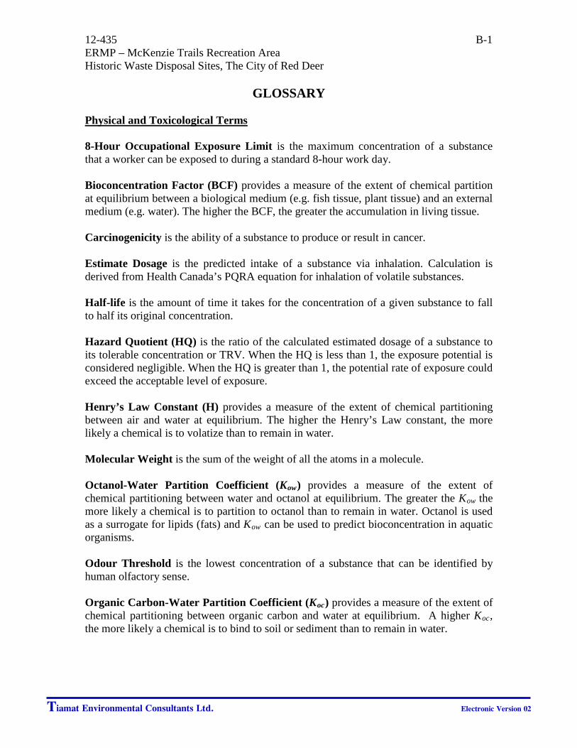
12-435 B-1 ERMP – McKenzie Trails Recreation Area Historic Waste Disposal Sites, The City of Red Deer
GLOSSARY Physical and Toxicological Terms 8-Hour Occupational Exposure Limit is the maximum concentration of a substance that a worker can be exposed to during a standard 8-hour work day. Bioconcentration Factor (BCF) provides a measure of the extent of chemical partition at equilibrium between a biological medium (e.g. fish tissue, plant tissue) and an external medium (e.g. water). The higher the BCF, the greater the accumulation in living tissue. Carcinogenicity is the ability of a substance to produce or result in cancer. Estimate Dosage is the predicted intake of a substance via inhalation. Calculation is derived from Health Canada’s PQRA equation for inhalation of volatile substances. Half-life is the amount of time it takes for the concentration of a given substance to fall to half its original concentration. Hazard Quotient (HQ) is the ratio of the calculated estimated dosage of a substance to its tolerable concentration or TRV. When the HQ is less than 1, the exposure potential is considered negligible. When the HQ is greater than 1, the potential rate of exposure could exceed the acceptable level of exposure. Henry’s Law Constant (H) provides a measure of the extent of chemical partitioning between air and water at equilibrium. The higher the Henry’s Law constant, the more likely a chemical is to volatize than to remain in water. Molecular Weight is the sum of the weight of all the atoms in a molecule. Octanol-Water Partition Coefficient (Kow) provides a measure of the extent of chemical partitioning between water and octanol at equilibrium. The greater the Kow the more likely a chemical is to partition to octanol than to remain in water. Octanol is used as a surrogate for lipids (fats) and Kow can be used to predict bioconcentration in aquatic organisms. Odour Threshold is the lowest concentration of a substance that can be identified by human olfactory sense. Organic Carbon-Water Partition Coefficient (Koc) provides a measure of the extent of chemical partitioning between organic carbon and water at equilibrium. A higher Koc, the more likely a chemical is to bind to soil or sediment than to remain in water.
Tiamat Environmental Consultants Ltd. Electronic Version 02

12-435 B-2 ERMP – McKenzie Trails Recreation Area Historic Waste Disposal Sites, The City of Red Deer
GLOSSARY continued
Soil/Sediment-Water Partition Coefficient (Kd) provides a soil or sediment-specific measure of the extent of the chemical partitioning between soil or sediment and water, unadjusted for dependence upon organic carbon. To adjust for the fraction of organic carbon present in soil or sediment (foc), use Kd = Koc H foc. The higher the Kd the more likely a chemical is to bind to soil or sediment than to remain in water. Solubility is an upper limit of the dissolved concentration of a chemical in a solvent at a specified temperature. Aqueous concentrations in excess of solubility or 100% saturation may indicate sorption onto sediments, the presence of a non-aqueous phase liquid. Specific Gravity is the ratio of the density of a substance to the density of a reference substance (in this case, water or air) at the same temperature. A substance with a specific gravity greater than 1.0 has a higher mass per unit volume than the reference substance and will therefore preferentially “sink” beneath the reference substance. Toxicological Reference Value (TRV)/Acceptable Daily Intake (ADI)/Tolerable Daily Intake (TDI) are the maximum concentration of a substance that can be ingested daily over a lifetime without risk. It is expressed based in body weight. Vapour Pressure is the pressure exerted by a chemical vapour in equilibrium with its solid or liquid form at any given temperature. It is applied for calculating the rate of volatilization of the pure chemical compound from a surface or to estimate a constant for Henry’s Law for low solubility in water. The higher the vapour pressure, the more likely a chemical is to exist in a gaseous state. Abstract for Identified Chemicals of Concern Benzene Chemical Formula: C6H6
Human Carcinogenicity: Known Carcinogen Benzene is a well-known petroleum hydrocarbon and is a known carcinogen, based on numerous toxicity studies. The odour threshold is 1.5 ppm. The current Alberta Tier 1 Guidelines for benzene in soil and groundwater are 0.078 mg/kg and 0.005 mg/L. The 1-hour Alberta Ambient Air Quality Objective for benzene is 0.009 ppm. The Alberta 8-hour occupational exposure limit is 0.5 ppm. Benzene is on Health Canada's Cosmetic Ingredient Hot List and Canada's National Pollutant Release Inventory.
Tiamat Environmental Consultants Ltd. Electronic Version 02

12-435 B-3 ERMP – McKenzie Trails Recreation Area Historic Waste Disposal Sites, The City of Red Deer
GLOSSARY continued
Carbon Disulfide Chemical Formula: CS2 Human Carcinogenicity: Non-Carcinogenic Carbon disulfide has an odour threshold of 0.016 ppm. Currently, there are no guidelines or standards in Alberta for carbon disulfide in soil and water; the 1-hour average Alberta Ambient Air Quality Objective is 0.010 ppm. The Alberta 8-hour occupational exposure Limit is 1 ppm. Carbon disulfide is not classified as toxic under the Canadian Environmental Protection Act (1999). Carbon disulfide is included in Health Canada’s Cosmetic Ingredient Hotlist. Chloroform Chemical Formula: CHCl3
Carcinogenicity: Possible Carcinogen Chloroform is a chlorinated hydrocarbon. The established odour threshold is 85 ppm. The current Alberta Tier 1 Guidelines for chloroform in soil and groundwater are 0.0010 mg/kg and 0.0018 mg/L, respectively. The Alberta 8-hour occupational exposure limit is 10 ppm. Chloroform is on Health Canada's Cosmetic Ingredient Hot List and Canada's National Pollutant Release Inventory. Chloromethane Chemical Formula: CH3Cl Human Carcinogenicity: Not Classified Chloromethane has an odour threshold of 10 ppm. There are no published standards or guidelines in Alberta for chloromethane in soil and groundwater. The State of New Hampshire has implemented a drinking water guideline of 0.03 mg/L. The Alberta 8-hour occupational exposure limit is 50 ppm. Chloromethane is on Canada's National pollutant Release Inventory. Cyclohexane Chemical Formula: C6H12
Human Carcinogenicity: Not Classified Limited information exists regarding cyclohexane. The established odour threshold is 0.41 ppm. There are no published standards or guidelines in Alberta for cyclohexane in soil or groundwater. The Alberta 8-hour occupational exposure limit is 300 ppm.
Tiamat Environmental Consultants Ltd. Electronic Version 02

12-435 B-4 ERMP – McKenzie Trails Recreation Area Historic Waste Disposal Sites, The City of Red Deer
GLOSSARY continued
Dichlorodifluoromethane Chemical Formula: CCL2F2
Human Carcinogenicity: Non-Carcinogenic Dichlorodifluoromethane (Freon 12) is part of a group of synthetic chemicals called Chlorofluorocarbons (CFC’s). An odour threshold for Freon 12 has not been established. Currently, there are no published guidelines or standards in Alberta for Freon 12 in soil or groundwater. The Alberta 8-hour occupational exposure limit is currently 1,000 ppm. cis-1,2-Dichloroethylene/ cis-1,2-Dichloroethene Chemical Formula: C2H2Cl2
Human Carcinogenicity: Not Classified cis-1,2-Dichloroethylene is a chlorinated hydrocarbon with an odour threshold of 0.085 ppm. There are no published standards or guidelines in Alberta for cis-1,2-dichloroethylene in soil or groundwater. The Alberta 8-hour occupational exposure limit is 200 ppm. Ethanol Chemical Formula: C2H6O Human Carcinogenicity: Known Carcinogen Ethanol has an odour threshold of 0.35 ppm. There are no published standards or guidelines in Alberta for ethanol in soil or groundwater. The Alberta 8-hour occupational exposure limit is 1,000 ppm. Ethylbenzene Chemical Formula: C6H5CH2CH3 Human Carcinogenicity: Possible Carcinogen Ethylbenzene is a petroleum hydrocarbon and has an odour threshold of 2.3 ppm. The current Alberta Tier 1 Guidelines for Ethylbenzene in soil and groundwater are 0.21 mg/kg and 0.0024 mg/L, respectively. The 1-hour Alberta Ambient Air Quality Objective for Ethylbenzene is 0.460 ppm. The Alberta 8-hour occupational exposure limit is 100 ppm.
Tiamat Environmental Consultants Ltd. Electronic Version 02

12-435 B-5 ERMP – McKenzie Trails Recreation Area Historic Waste Disposal Sites, The City of Red Deer
GLOSSARY continued
Heptane Chemical Formula: C7H16
Human Carcinogenicity: Not Classified Heptane vapour has an odour threshold of 220 ppm. There are no published standards or guidelines in Alberta for heptane in soil and groundwater. The State of New Jersey has adopted a groundwater standard of 0.1 mg/L. The Alberta 8-hour occupational exposure limit is 400 ppm. Hexane Chemical Formula: C6H14 Human Carcinogenicity: Non-Carcinogenic Hexane vapour has an odour threshold of 130 ppm. There are no published standards or guidelines in Alberta for hexane in soil and groundwater. The Canadian Council for the Ministers of the Environment (CCME) recommends soil guidelines ranging between 0.49 to 21 mg/kg, depending on land use. The 1-hour average Alberta Ambient Air Quality Objective is 5.958 ppm. The Alberta 8-hour occupational exposure limit is 500 ppm. p-Isopropyltoluene Chemical Formula: C10H14 Human Carcinogenicity: Not Classified p-Isopropyltoluene does not have an established odour threshold. There are currently no published standards or guidelines in Alberta for p-isopropyltoluene in soil and groundwater. The Alberta 8-hour occupational exposure limit is 10 ppm. Methane Chemical Formula: CH3 Human Carcinogenicity: Non-Carcinogenic Methane is a common component of landfill gas. Methane vapour is colourless, odourless and classified as a non-toxic asphyxiant. No odour threshold has been established. There are no published standards or guidelines in Alberta for in methane soil and groundwater. The current Alberta 8-hour occupational exposure limit is 1,000 ppm. It is highly combustible with a lower explosive limit of 50,000 ppm in air (5% by volume).
Tiamat Environmental Consultants Ltd. Electronic Version 02
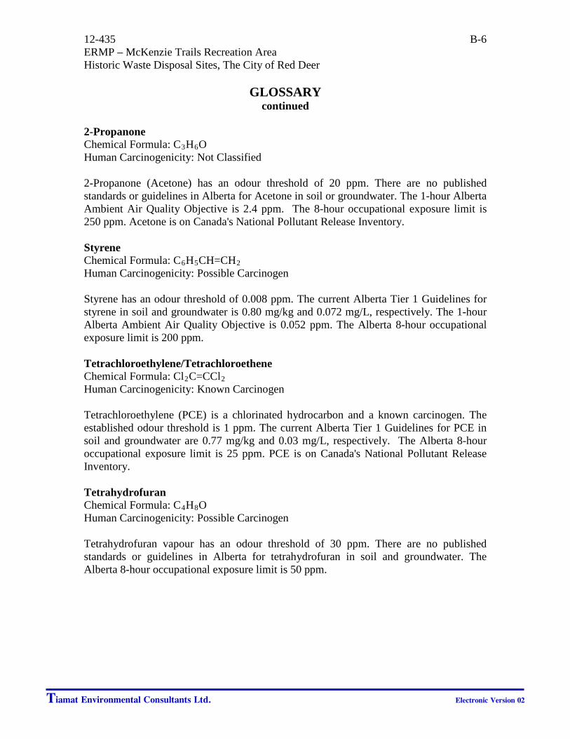
12-435 B-6 ERMP – McKenzie Trails Recreation Area Historic Waste Disposal Sites, The City of Red Deer
GLOSSARY continued
2-Propanone Chemical Formula: C3H6O Human Carcinogenicity: Not Classified 2-Propanone (Acetone) has an odour threshold of 20 ppm. There are no published standards or guidelines in Alberta for Acetone in soil or groundwater. The 1-hour Alberta Ambient Air Quality Objective is 2.4 ppm. The 8-hour occupational exposure limit is 250 ppm. Acetone is on Canada's National Pollutant Release Inventory. Styrene Chemical Formula: C6H5CH=CH2 Human Carcinogenicity: Possible Carcinogen Styrene has an odour threshold of 0.008 ppm. The current Alberta Tier 1 Guidelines for styrene in soil and groundwater is 0.80 mg/kg and 0.072 mg/L, respectively. The 1-hour Alberta Ambient Air Quality Objective is 0.052 ppm. The Alberta 8-hour occupational exposure limit is 200 ppm. Tetrachloroethylene/Tetrachloroethene Chemical Formula: Cl2C=CCl2
Human Carcinogenicity: Known Carcinogen Tetrachloroethylene (PCE) is a chlorinated hydrocarbon and a known carcinogen. The established odour threshold is 1 ppm. The current Alberta Tier 1 Guidelines for PCE in soil and groundwater are 0.77 mg/kg and 0.03 mg/L, respectively. The Alberta 8-hour occupational exposure limit is 25 ppm. PCE is on Canada's National Pollutant Release Inventory. Tetrahydrofuran Chemical Formula: C4H8O Human Carcinogenicity: Possible Carcinogen Tetrahydrofuran vapour has an odour threshold of 30 ppm. There are no published standards or guidelines in Alberta for tetrahydrofuran in soil and groundwater. The Alberta 8-hour occupational exposure limit is 50 ppm.
Tiamat Environmental Consultants Ltd. Electronic Version 02

12-435 B-7 ERMP – McKenzie Trails Recreation Area Historic Waste Disposal Sites, The City of Red Deer
GLOSSARY continued
Toluene Chemical Formula: C5H5CH3
Human Carcinogenicity: Not Classified Toluene is a petroleum hydrocarbon with an odour threshold of 2.9 ppm. The current Alberta Tier 1 Guidelines for Toluene in soil and groundwater are 0.29 mg/kg and 0.024 mg/L, respectively. The 1-hour Alberta Ambient Air Quality Objective for Toluene is 0.499 ppm. The Alberta 8-hour occupational exposure limit is 50 ppm. Trichlorotrifluoroethane Chemical Formula: C2Cl3F3 Carcinogenicity: Non-Carcinogenic Trichlorotrifluoroethane (Freon 113) is a CFC with an odour threshold of 5 ppm. Currently, there are no published guidelines or standards in Alberta for Freon 113 in soil or groundwater. No occupational exposure guideline has been established. Trichlorofluoromethane Chemical Formula: CCl3F Carcinogenicity: Non-Carcinogenic Trichlorofluoromethane (Freon 11) is a CFC with an odour threshold of 5 ppm. Currently, there are no published guidelines or standards in Alberta for Freon 11 in soil or groundwater. The NIOSH 8-hour occupational exposure limit is currently 1,000 ppm. 1,2,4-Trimethylbenzene Chemical Formula: C9H12 Carcinogenicity: Non-Carcinogenic 1,2,4-Trimethylbenzene has an odour threshold of 0.4 ppm. There are no published standards or guidelines for 1,2,4-trimethylbenzene in soil and groundwater. The State of California adopted a drinking water guideline of 0.334 mg/L. The Alberta 8-hour occupational exposure limit is 25 ppm. 2,2,4-Trimethylpentane Chemical Formula: C8H18
Human Carcinogenicity: Not Classified Limited information exists regarding 2,2,4-trimethylpentane. No odour threshold for 2,2,4-trimethylpentane has been established. Currently, there are no published guidelines or standards in Alberta for 2,2,4-trimethylpentane in soil, water or air.
Tiamat Environmental Consultants Ltd. Electronic Version 02
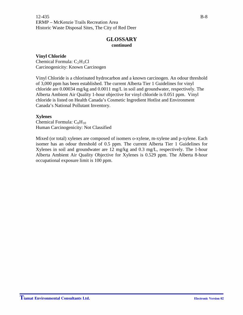
12-435 B-8 ERMP – McKenzie Trails Recreation Area Historic Waste Disposal Sites, The City of Red Deer
GLOSSARY continued
Vinyl Chloride Chemical Formula: C2H3Cl Carcinogenicity: Known Carcinogen Vinyl Chloride is a chlorinated hydrocarbon and a known carcinogen. An odour threshold of 3,000 ppm has been established. The current Alberta Tier 1 Guidelines for vinyl chloride are 0.00034 mg/kg and 0.0011 mg/L in soil and groundwater, respectively. The Alberta Ambient Air Quality 1-hour objective for vinyl chloride is 0.051 ppm. Vinyl chloride is listed on Health Canada’s Cosmetic Ingredient Hotlist and Environment Canada’s National Pollutant Inventory. Xylenes Chemical Formula: C8H10
Human Carcinogenicity: Not Classified Mixed (or total) xylenes are composed of isomers o-xylene, m-xylene and p-xylene. Each isomer has an odour threshold of 0.5 ppm. The current Alberta Tier 1 Guidelines for Xylenes in soil and groundwater are 12 mg/kg and 0.3 mg/L, respectively. The 1-hour Alberta Ambient Air Quality Objective for Xylenes is 0.529 ppm. The Alberta 8-hour occupational exposure limit is 100 ppm.
Tiamat Environmental Consultants Ltd. Electronic Version 02