emsv002 landslides in emilia romagna
TRANSCRIPT
Copernicus EU CopernicusEU www.copernicus.eu
Follow us on:
Space
Emergency Management Service Validation
Copernicus EMS User Workshop, 15-16 March 2016, Ispra
EMSV002 – Landslides in Emilia Romagna
Jonathan Spinoni, Ph.D (External consultant JRC)
Technical coordination: Joint Research Centre
Service provided by: TRABAJOS CATASTRALES, S.A.
Space User Workshop EMS Mapping, 15-16 March 2016, Ispra Name SURNAME 2
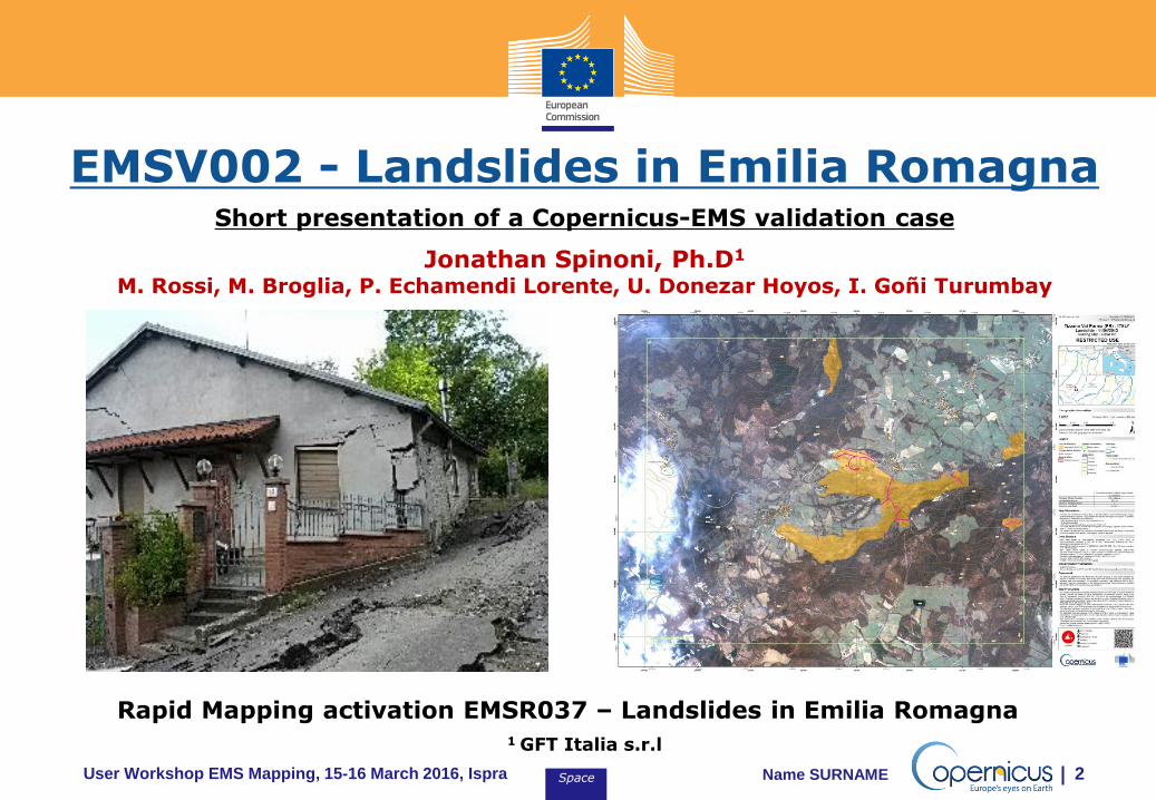
EMSV002 - Landslides in Emilia Romagna Short presentation of a Copernicus-EMS validation case
Jonathan Spinoni, Ph.D1
M. Rossi, M. Broglia, P. Echamendi Lorente, U. Donezar Hoyos, I. Goñi Turumbay
Rapid Mapping activation EMSR037 – Landslides in Emilia Romagna 1 GFT Italia s.r.l
Space User Workshop EMS Mapping, 15-16 March 2016, Ispra Name SURNAME 3
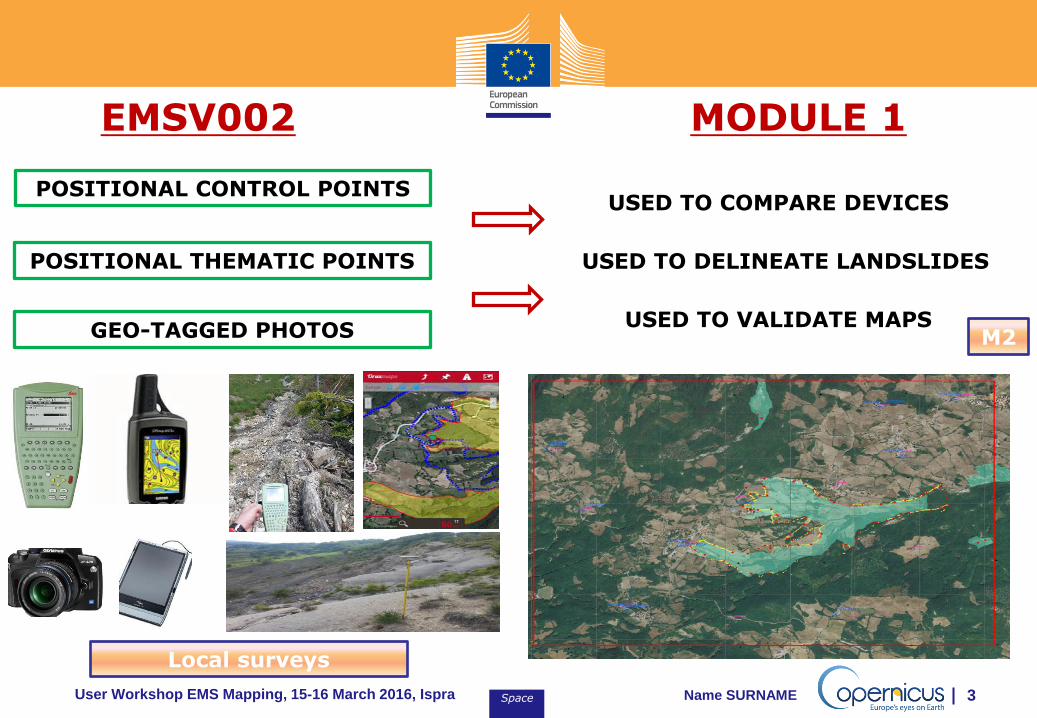
EMSV002 MODULE 1
POSITIONAL CONTROL POINTS
POSITIONAL THEMATIC POINTS
GEO-TAGGED PHOTOS
USED TO COMPARE DEVICES
USED TO DELINEATE LANDSLIDES
USED TO VALIDATE MAPS M2
Local surveys
Space User Workshop EMS Mapping, 15-16 March 2016, Ispra Name SURNAME 4
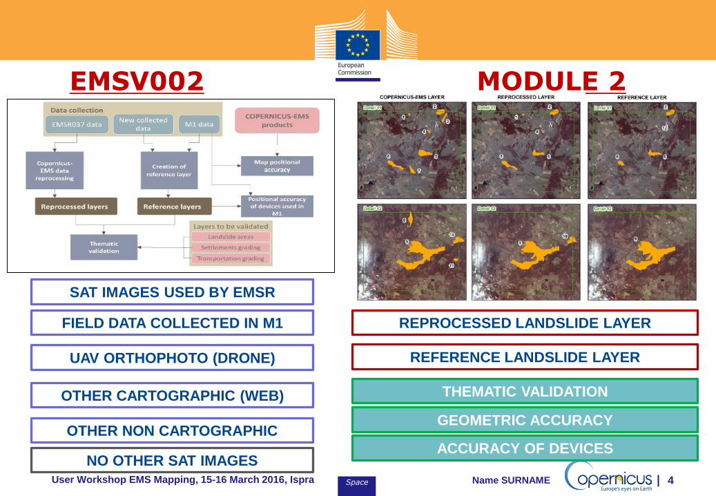
EMSV002 MODULE 2
SAT IMAGES USED BY EMSR
FIELD DATA COLLECTED IN M1
UAV ORTHOPHOTO (DRONE)
OTHER CARTOGRAPHIC (WEB)
OTHER NON CARTOGRAPHIC
NO OTHER SAT IMAGES
REPROCESSED LANDSLIDE LAYER
REFERENCE LANDSLIDE LAYER
THEMATIC VALIDATION
GEOMETRIC ACCURACY
ACCURACY OF DEVICES
Space User Workshop EMS Mapping, 15-16 March 2016, Ispra Name SURNAME 5
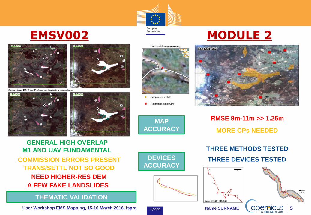
EMSV002 MODULE 2
GENERAL HIGH OVERLAP
COMMISSION ERRORS PRESENT
THEMATIC VALIDATION
A FEW FAKE LANDSLIDES
M1 AND UAV FUNDAMENTAL
TRANS/SETTL NOT SO GOOD
MAP
ACCURACY
RMSE 9m-11m >> 1.25m
MORE CPs NEEDED
DEVICES
ACCURACY
THREE METHODS TESTED
THREE DEVICES TESTED
NEED HIGHER-RES DEM
Space User Workshop EMS Mapping, 15-16 March 2016, Ispra Name SURNAME 6
EMSV002 MODULE 3
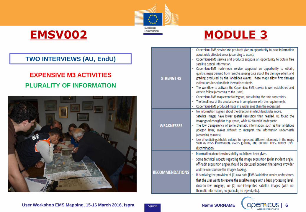
TWO INTERVIEWS (AU, EndU)
EXPENSIVE M3 ACTIVITIES
PLURALITY OF INFORMATION
Space User Workshop EMS Mapping, 15-16 March 2016, Ispra Name SURNAME 7
EMSV002 CONCLUSIONS
OLD-STYLE
VALIDATION CASE
FOCUSED ON: M1 (ONLY VAL), REF DATA, PLURAL M3
LESS FOCUSED ON: ALTERN METHODS, SAT IMG
SEARCH QUAL/COST/TIME, COMPAR EMS-OTHERS
Effective detection of the landslides by Copernicus-EMS Rapid Mapping products Use of ancillary data (UAV and field data) proved to be useful to detect landslides
Both users proficiently used the products and recommend their use
Satellite images show some distorsion and need to be recalibrated A higher resolution satellite imagery (VHR1) is recommended to exclude fake landslides Better field survey planning and use of devices needed, use of smartphones suggested
Both users suggested providing also non-interpreted satellite image as product Both users suggested including a first quick-and-dirty provision of raw delineation maps
Technical EndUser was not completely satisfied of the products
No grading could be assessed for transportation and settlement damages Both users recommend improving the readability of the crisis layers
Need of a higher-resolution DEM to provide a better delineation of landslides
Space User Workshop EMS Mapping, 15-16 March 2016, Ispra Name SURNAME 8
THANK YOU FOR THE ATTENTION
QUESTIONS???