DIVISION OFSHORE EROSION
THE EARLY YEARS
The Division was established in the OhioDepartment of Natural Resources on 11 August1949 with the enactment of Amended Senate8i13. The Dvisio'n was created as the Divi-sion of Beach Erosion. and the name wasdunged in September 1951 to the Division ofShore Erosion. Resporsibilities of the Dvisioncame from a section of the Department ofPublic Works. Substtute S€nate Bill 236er iacted on 1 May 1935 had created a BeachErosion Board within that department, andduties and responsibilities were expanded bySubstitute Senate Bill 34 enacted on 28 June1945.
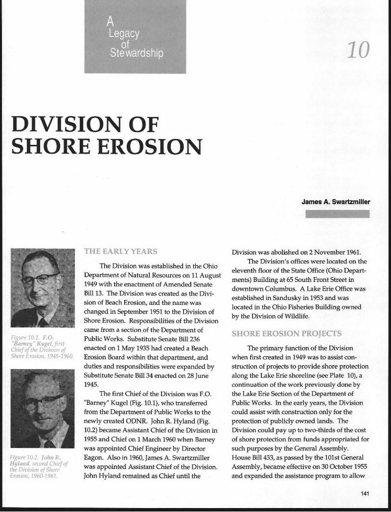
The first Chief of the Division was F.O."Bamey" Kugel (Fig. 10.1), who kansferredfrom the Deparhnent of Public works to thenewly created ODNR. lohn R Hyland (Fig.10.2) became Assistant Chief of the Division in1955 and Chief on 1 March 1960 when Bameywas appointed Chief Engineer by DirectorEagon. Also in 1950, fames A. Swartzmillerwas appointed Assistant Chief of the Division.
John Hyland remained as Chief until the
1 0
James A. Swartsmlller
-
Division was abolished on 2 November 1951,The Division's offices were located on the
elevmth floor of the State Office (Ohio Depart-ments) Building at 65 South Front Street indowntown Columbus. A Lake Erie Office wasestablished in Sandusky in 1953 and waslocated in the Ohio Fisheries Building ownedby the Division of Wildlife.
SHORE EROSION PROIECTS
The primary function of the Divisionwhen fust created in 1949 wa6 to assist con-struction of projects to provide sho're protectionalongtheLakeErieshorcline(6eePlate 10),acontimration of the work previowly done bythe Lake Erie Section of the Dqlar tment ofPublic Works. Irr the early years, the Divisioncould assist with constr uction only for theprotection of publiely ovuned lands. TheDivision could pay up to two.thirds of the costof shore pmtection hom funds appropriated forsuch purposes by the General Assembly.House Bill ,[33, as passed by the 101st GeneralAssembly, becanre effective on 30 October 1955and expanded the assbtance progr am to allow
Figur t l .A .1 . F .O."Baft er!" Kagel, f islChief a f lhc Ditisiott ofShof a t:.r asion, l94tt-1960.
Figure10.2. lohnR..Hylaud, secand Chiz f oJthe DiLtiian of ShortErosion, 196(11951.

the Dvision also to participaie in the protection of privateproperty along Lake Erie. Participation in the protection ofprivate property was limited to one-third the cost. Manyproiects were constructed for the protection of publicprope*y. However, no projects were constructed forprivate property prctection. The procedures to be followed,including public bidding, and the requirement that erosionprotection be substantial, made the two-thirds costs for theprivate owners considerably more expensive than theycould afford. Usually the private owners would constructprotection in stages accor ding to their ability to pay. Thistype of protection was not very ef fective and in most caseswas a waste of the property owners' money.
House Bill 433 also included requirements that anyshore protection constructed along Lake Erie must be donethrough a permit issued by the Dvision of Shore Erosion.This legislation was an attempt to control the type of erosionprotection being constructed and also to bring some unifor-mity in the type of protection provided. The permit require-ment was only for erosion protection facilities. Many othertypes of projects were constructed along the lake whichseriously affected erosion processes in which the Dvisionhad no contro| therefore, this permit program never reallymaterialized into a beneficial program. The erosion permitswere also a duplication of permits required by the UnitedStates Army Corps of Engineers. The Corps perrnits wererequired for any $pe of construction along the lakg and thispermitting program was considerably more effective.
The Erosion Act of 1955 (Flouse Bill Z), as passed bythe 101st General Assembly, also expanded a firnction ofthe Division regarding the extraction of minerals from Lake
Ltql ! r '1 . i l ) . -J . i l j . . , t t l f i .1
/ r i lhr ' ' r l i r i r r r . L r rs l r l i ; r r rs i l i , | t i i t t : [d iL ' i i ] t L i tkr
l:),a /ri Clfirl,lrlirJ |./krfrrr ' r , l l f r ' r ' s l / r ) i I i i la f l ] r i l ( r , i , !1
: ;n i1 0t f ipt1 lu t l t lL l t l r :Ilil;1f-/oi? ol (i'ai!,{i.rrl
Sut te4.
The Divisions
Erie. Prio( to 1955. the Dvbion contr olled the removal of
sand and gravel from designated and approved dredging
areas in the lake. Sald and gravel was temoved fot com-
mercial purposes and the Division was Paid a royalty of 15
cents per cubic yard. The Erosion Act expanded this pro-
gram to allow the removal of gas, oil and other minerais
from and under the bed of the lake.
After enactment of the legislation, salt mines were
established beneath Lake Erie at FairPort Harbor and
Cleveland through a lease arrangement with the Division'
Royalties received from the salt removed and from the sand
removal operation were used for erosion Protection con-
struction. The salt mine at Fairport Harbor was oPened in
1955 and extends to a depth of 2025 fuet. The salt seam is 22
feet thick and the mining technique used was the "loom and
pillar" concept. Full production of the mine in the late
1960's reached 3fi) to 500 tons per hour. The Cleveland
mine was star ted in 19,57 and experienced considerable
difficulty with ground-water problems. It was necessary to
grout an 88-foot-thick s€am of sandstone to eliminate water
problems. The main shaft for ihe Cleveland mine is 1816
feet deep and the mine was opened for production in 1951
(Fig. 10.3).The enactment of the Er osion Act also genemted much
interest in ddlling for oil and gas in Lake Erie. Thispro-
gram, however, never really became established due to
environmental concems regarding possible spills and
pollution of the lake waters.With the funds derived from royalties for sand and
gravel dredging within the lake and from salt removed from
under the lake along with funds appropriated by the
General Assembly, a number ofshore erosion constructionprojectswere completed. Mostof
these projects were done in
cooperation with local political
entities. Atotal of23projectswere completed from 1959 to 1951
at a total cost of $905,100. Nine ofthese proiects were in Otf awacounty (Fig. 10.4), four in Erie

19,19-1989
County, fow in Lake County, two in LorainCounty, two in Cuyahoga County (Fig. 10.5),and two in Ashtabula County. Proiecis con-structed in cooperation with local entities are tobe maintained by the local entity, an adminis-trative arrangement designed to assure thatcontinued pr otection would remain in place.
IVAIIEIiWAYS SAFETY PROCIdA, lv1S
The 101st General Assembly also cteatedthe Waterways Safety Commission within theDvision of Shore Erosion through the ErosionAct which became effective 30 September 1955.The Commission was created:
1) To advise and make recommendations to the Chief of theDivision conceming plans and programs for the construc-tion, maintenance, repair, ard operation of refuge harborsandotherproiecb for theharbo,ring, docking, and storage oflight-d.aft (recreational) vessels in accordance with provi-sions of the Act (Fig. 10.6).
2) To advise and make recommendations to the Chief as tomethods of coordinatht the shore erosion proiects of theDivisionwith therefugeof recr€ationalvesselharborproiects.
3) To consider and make recommendations upon anv matterwhich was brought to its aftention.
4) To submit to the Govemor bimnially recommendations foramendments to the laws relative to refuge and recreationalharbor projects.
The Commission membership consisted of the ODNRDirector and four member s appointed by the Govemor withthe consent of the Senate. The Chief of Dvision of ShoreErosion served as Secretary. The first members of theComnission were Director Marion; A.F. Wakefield, Vermil-ion; Henry ]. Watterson, Rocky Riveq Dr. Byron fohnson,Ashtabula; and Dr. K.D. Arnsbary, Pomeroy.
Along with the Commissiory the General Assemblycreated a Waterways Safety Fund which was to be used foracquiring, cons&ucting, and maintaining refuge and recre-ational vessel harbor pr ojects, charmels, and facilities forvessels in the navigable waters lying within the boundaries
-
l t , t i t i r ' i l l . . ! ,1 ' , , r i i i i . r f i r r i ;
Sl .?L, i : ' t i ' l i i ) r ! : r . r : r ' 1: , i r ,l 'a lar i r i ' r l a1r1l : r l i i l i i74f i r ' , r i ; r ) j i . i r . ; i r i i r r 'i l i l , is ic ; t r r , . - r i i r . i r f I r , r i r I i
l i r r ; ; ' r ' i l i / r , : ; r ' l , r ' r ' r1 i ' r ' : r l r i . ,i : ' t i : ' ; | , ! t ! l i " i : t ' i i ' , ' L ' i i i i t lr ! i / r - , / j ' . i n , t , , , , , i . /
5 i r : i i r l ra/ r r i i i r | i ) r f ( l j : r ' i i r , I 't : t t r i j l ' i 'J l i i i i : : t i t l ! i i ! r rj i r ; r r , / r ; r i f l ra,? l_ iJ / r ;i ) l i j1 , , i ( - r r i r , r i i / . l )Lr l rr -ot i r l r i : ,1; l . ' i i ' i r r r ' , , i rn l r t i , t l i r ' r i r l r ( ' j r i Sl i r r ' l !
r ' r q / , r ' i ' : i l ' i . t j r , i i . i , j , i : ;
. r \ r . a r i i i ' , i l r i . : , r r ; i ( l r l r ,
r r t t i ; t i t j i j t ' J ; , : - r , 1 i ' " i . , r r r i
i , r . \ a f t i a , r r i l r i ' , / ; r , r l , ) ; l
/ l r s r ' j r r r i i r ' r ; i i ! : l r i r ;
iui i l r ; ;c. i i r i : t i r ,1,. , ;r t l i t i t i i i .
of Ohio which are under the lurisdiction of the federalgovemment. The Liquid Fuel Tax Law was also amended tothe extent that the Marine Gasoline Fuel Tax, which waspreviously refunded upon application to owners of pleasurecraft, would be deposited to the credit of the WaterwaysSafety Fund. In subsequmt years since the original act in1955,theMarineFuelTax has been increased and has beenthe source of funds for a heavy conskuction program forboating improvernents by the Division of Watercraft withinthe Department.
IAKFi ERIE RFrgl lAR{ lT- i
Soon afier the Division was created, a geologicalresearch program on Lake Erie was developed. It wasstarted on a part-time basis in 1950, and Dr. Howard J.Pincus of the Geology Depar tment of The Ohio State Uni-versilr was in charge. From 1950 to 1953, the program wasstaffed by Dr. Pincus and Ohio State University students,with part-time technical and clerical assistance. The pro-gram operated full-time during summer field seasons. In1953, the research program was expanded with the estab-lishment of the year-round office in Sandusky which wasstaffed with a ful1-time geologist and hydrographer. ]amesL. Verber was in charge of this office ftom 1953 to 1958. In1959 until 1961. Robert P. Hartley administer ed the office.Dr. Pincus resigned from the program in 1950.
143

The types of research conducted included the completemapping of the Ohio Lake Erie shoreline with emphasis onengineering geology, mapping of bottom deposits, study ofbluff recession, subsurface data along the shoreline, bedrockgeology under the lake, wave refraction diagrams, effects ofice on the shoreline and on structutes in the lake. andstudies on water levels, currents, wind, and water tempera-fures.
The main emphasis of this research in the early yearswas placed on identifying and rmderstanding shore pro-cesses along the Lake Erie shoreline, particularly on thecauses and effects of shore erosion. I-rr later years, thisresearch was expanded to achieve a better understanding oflake processes, and to conkibute information on naturalresources lying within the state's boundaries.
A significant result of this early research was theestablishment of a baseline along 262 miles of the Lake Erieshoreline, with both horizontal and vertical control pointscoffelated with existing United States Geological Surveybench marks and triangulation stations. The baseline wasused to record shoreline topography a considerable distanceshoreward from the water's edge and to perform a hydro-graphic survey approximately 2000 feei offshore. Thesedata were used as a basis to make comparisons resulting inan accurate deterrnination of erosion or accretion ratesanywhere along the shoreline.
The results of this early research also proved invalu-able in preparing and publishing a shore etosion masterplan for Lake Erie in cooperation with the Corps of Engi-neers. This master plan was published in twelve reports
144
The Divisions
and covered the lake shore from the Michigan-Ohio line to
the Ohio-Pemslvania line. The reports are detailed and
include discussions of the geology and coastal characteris-
tics. beach and bluff composition, comparative profiles.
investigations of existing protective structures and shoreline
changes. and recommended effective and economical
methods of preventing erosion. These reports have been
used extensively by private property owners living along
the lake and as a basis for planning and desigrring many
erosion protection pr oiects. The extensive research Pre-formed by the Division throughout the 1950's has been
recorded in published and rmpublished documents located
in the Division of Geological Survey and is still used extm-
sively to understand befter the lake and its processes.
.ABC}LISFI]VTEN'I OF TIIE I]IVISION
kr 1961, the Dvision of Shore Erosion was abolished
by the 1<h General Assembly upon enactment of
Amended House BiIl 379 which became effecdve on 2
November 1961. The functions and programs of the Dvi-
sion were trarsferred to other departmental unlts. The
shore erosion coqrerative construction program and the
boating improvements construction program, along with
the issuing of shore erosion perrdts. were transfurred to the
newly created Of fice of Chief Engineer. The Waterways
Safety Commission, Waterways Safety Fund, and relatedduties and functions with this program were transferred to
the Dvision of Watercraft. The rcsponsibilities for lake Erie
research and miner al extraction permits were transferred to
the Division of Geological Suwey. All funding equipment.
supplies, and personnel were transfened with the respective
programs. and the Dvision ceased to exist.
-REFERENCES
19€-1989
Di\rision of Shore Eroeion Armual Reports. 1951-1960. Ohio DePartment ofNatural Re€owces.
Herderdo4 Charles E. 1979. The Lake Erie geologjcal research progam.195G1970, Technical Report 252. Cenler for'LkeErie Area Rese-arc6,Ohio State University. Columbus, 67PP.


