Download - David McCann-DSDP Leg 41
1 | P a g e

2 | P a g e

3 | P a g e
Figure 2. Leg 41 drill sites. Starred line marks theboundary of the Jurassic magnetic quiet zone (after Hayes and Rabinowitz, 1975).
Figure 1. North West Africa taken from Google Maps. https://www.google.co.uk/maps
4 | P a g e
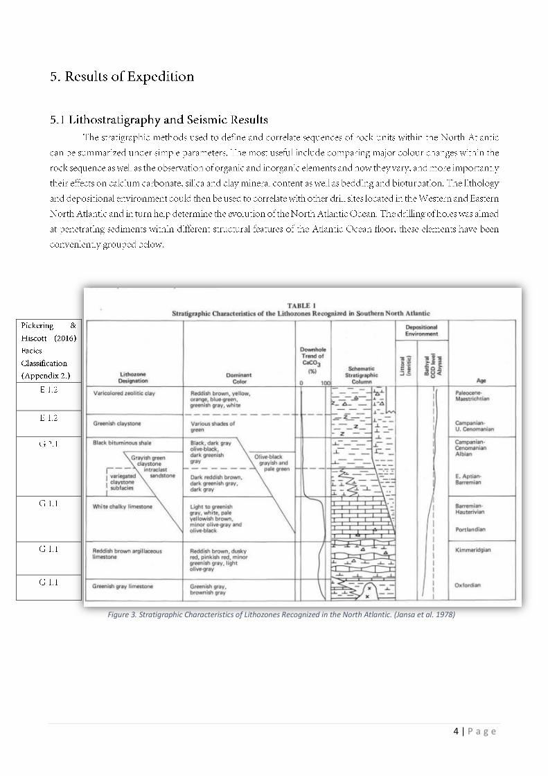
Figure 3. Stratigraphic Characteristics of Lithozones Recognized in the North Atlantic. (Jansa et al. 1978)
5 | P a g e
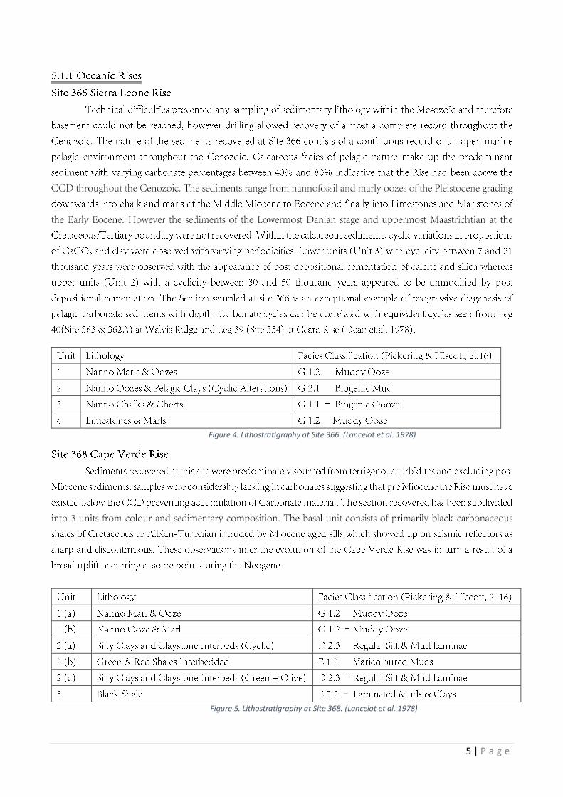
Figure 4. Lithostratigraphy at Site 366. (Lancelot et al. 1978)
Figure 5. Lithostratigraphy at Site 368. (Lancelot et al. 1978)
6 | P a g e
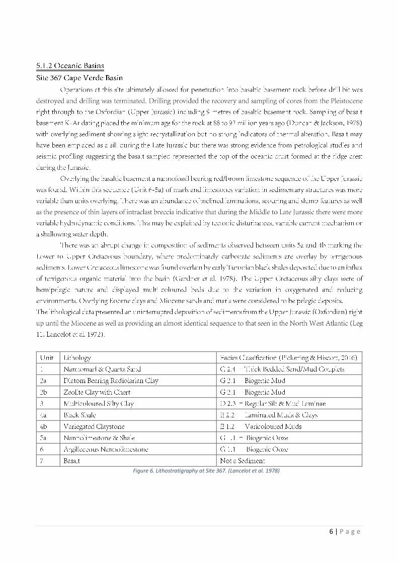
Figure 6. Lithostratigraphy at Site 367. (Lancelot et al. 1978)
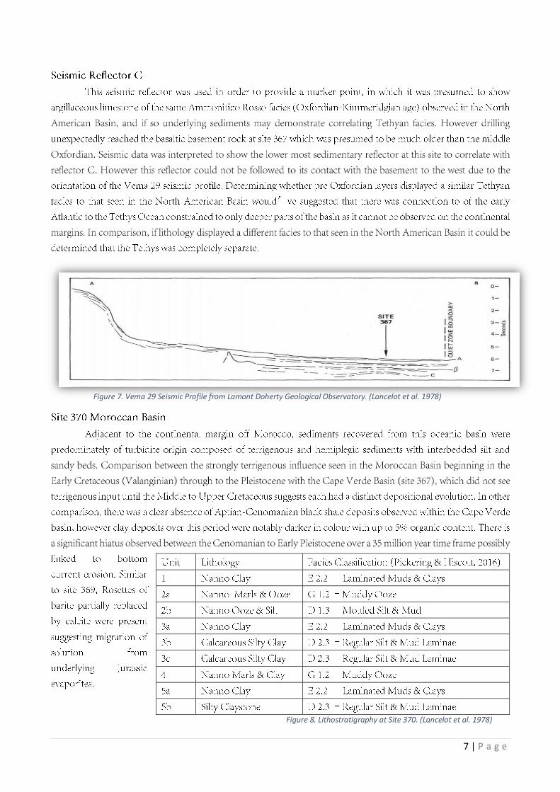
7 | P a g e
Figure 7. Vema 29 Seismic Profile from Lamont Doherty Geological Observatory. (Lancelot et al. 1978)
Figure 8. Lithostratigraphy at Site 370. (Lancelot et al. 1978)
8 | P a g e
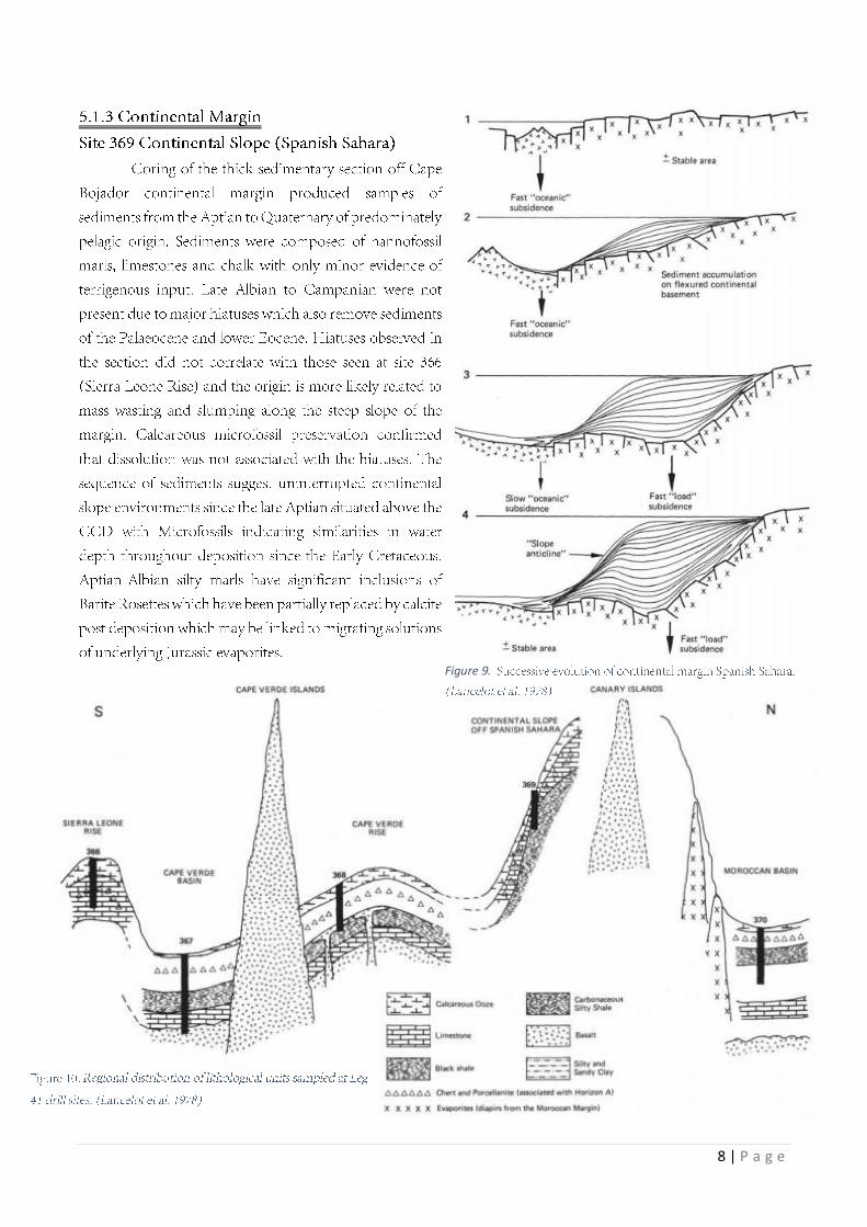
Figure 9.

9 | P a g e
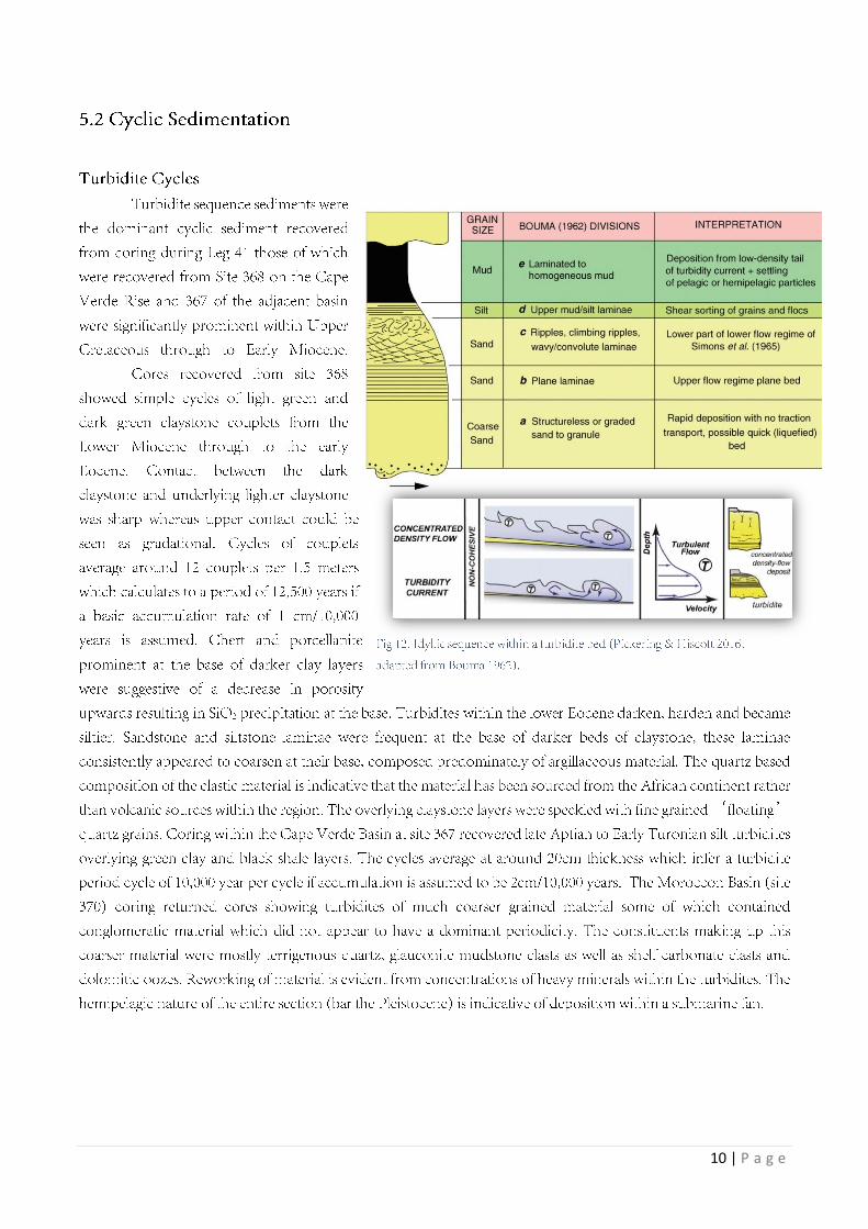
5.1
.4 S
ite Drill H
ole L
og G
rap
h S
um
ma
ry
Figu
re 11. Su
mm
ary of
Litholo
gical U
nits a
t Sites sa
mpled d
uring Leg
41. (La
ncelot et a
l. 197
8)
10 | P a g e
11 | P a g e
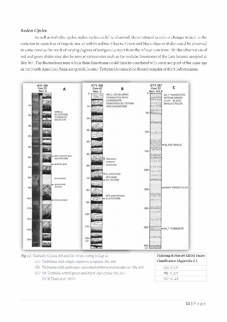
C B A

12 | P a g e

13 | P a g e

14 | P a g e

15 | P a g e
16 | P a g e
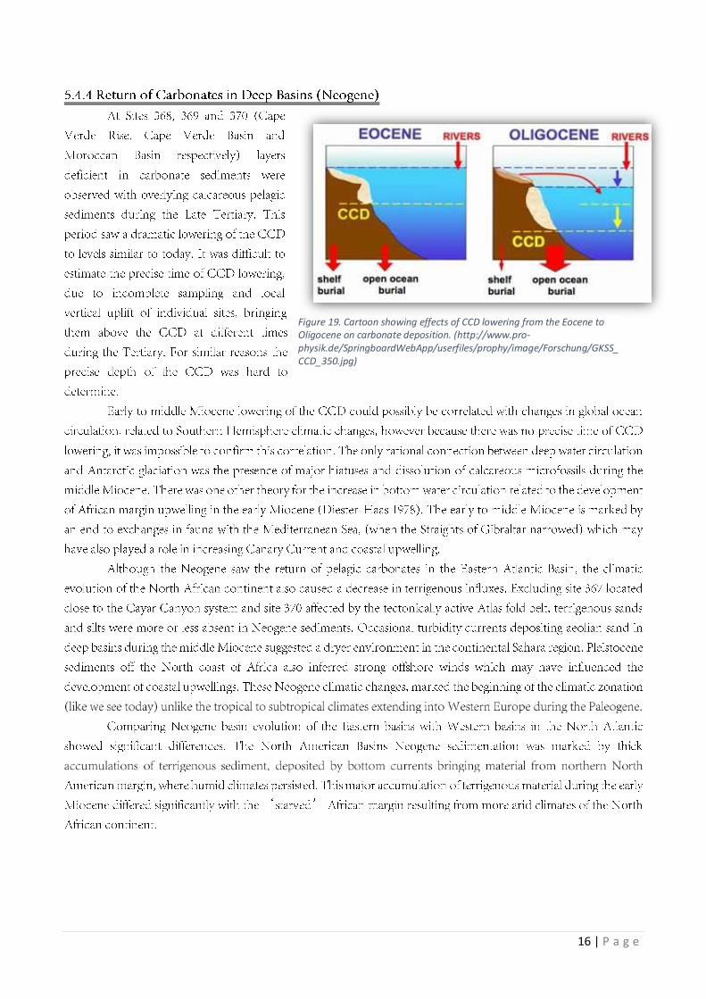
Figure 19. Cartoon showing effects of CCD lowering from the Eocene to Oligocene on carbonate deposition. (http://www.pro-physik.de/SpringboardWebApp/userfiles/prophy/image/Forschung/GKSS_CCD_350.jpg)
17 | P a g e
18 | P a g e
19 | P a g e
Geo
logic
al
Tim
esc
ale

20 | P a g e

21 | P a g e
«
ö

22 | P a g e


