developing land information management system (lims…
TRANSCRIPT

1
DEVELOPING LAND INFORMATION MANAGEMENT SYSTEM (LIMS) FOR
COUNTY GOVERNMENTS IN KENYA: A CASE STUDY KIRINYAGA COUNTY.
LIZAHMY NTONJIRA
Department of Land Administration and Information,
Technical University of Kenya
Paper prepared for presentation at the
“2017 WORLD BANK CONFERENCE ON LAND AND POVERTY”
The World Bank - Washington DC, March 20-24, 2017
Copyright 2017 by author(s). All rights reserved. Readers may make verbatim copies of this
document for non-commercial purposes by any means, provided that this copyright notice
appears on all such copies.

2
Abstract
This paper describes the development of a Land Information Management System (LIMS) for
County Governments in Kenya. In the new Constitution 2010, devolution of some national
government functions and formation of county governments was provided for. These invoked the
development of new land laws to guide the devolution processes and procedures. According to
the County Government Act 2012, all County Governments are supposed to develop digital
Geographic Information System (GIS) based spatial plans and these calls for development of
LIMS for and efficient breakthrough.
The LIMS development involves accessing manual land records that have variety standards and
inoperable from different sources, digitization of all the available data, flying Unmanned Aerial
Vehicle (UAV) where adjudication process has not taken place and no cadastral maps exists and
then developing a database of the same. In this regard, there is need to study the development of
LIMS for Kirinyaga County Government so as to give other developers of various county
governments in Kenya, a know how in future LIMS development initiatives. This paper uses
case study methodology to document the development of a LIMS for Kirinyaga County in
Kenya.
KEY WORDS: Land Information Management system, Kenya and County Governments.

3
Introduction
The constitution on Kenya 2010 introduced devolution and formation of the 47 county
governments. The enactment of new land laws and the Kenyan constitution 2010 enhanced
devolution and a need for digital LIMS and this resulted in the subsequent overhaul of Land
Laws to conform to the provisions of the Constitution. Chapter 5 (Land and Environment) and 11
(Devolution) of the constitution of Kenya 2010 have established the structure of Land
Management, the County Governments being one of them. Every county government is expected
to support land management at the county level.
In Kenya, the National Land Commission and the Ministry of Land and Physical Planning are
charged with the mandate of Land Management and Administration. In 2013, the National Land
Commission was formed to act as the lead agency in land matters, working with the Ministry of
Land and Physical Planning and county-level institutions. The strategic focus areas of National
Land Commission are: Devolution of Land management to the county level, land registration,
natural resource management, National Land Information Management System and resolution of
land-related disputes. Devolved resource management is the principle of delegating policy-
making in resource management to the lowest effective local levels of public authority.
The National Land Commission Act of 2012, section 5 (2) (d) mandates the National Land
Commission with the task of developing and maintain a nationwide Land Information
Management System at both national and county levels to help streamline operations and
management of land in Kenya. To help the Commission in this quest, the National Land
Information Management System (NLIMS) directorate was formed.
The County Government Act of 2012 Laws of Kenya requires that a county planning unit be
responsible for ensuring the collection, storage and updating of data and information suitable for
the planning process and ensuring the establishment of a GIS based Database system. The
spatial plans and the GIS Database system are a source of LIMS which enables proper land
planning and management.
The Land Act no. 6 of 2012 Laws of Kenya Section 8(a) on Management of Public Land
provides that the National Land Commission on behalf of National and County Governments

4
shall identify public land, prepare and keep a database, geo-referenced and authenticated by
Survey Department and share data with the public and relevant institutions. Section 6 of the same
Act provides that the Cabinet Secretary shall develop policies on land, facilitate the
implementation of land policy reforms, coordinate the management of National Spatial Data
Infrastructure, coordinate the formulation of standards of service in the land sector and regulate
service providers and professionals to ensure quality control.
Since the National Land commission has not yet provided the counties with the digital data;
these calls for the counties to come up with a Land Information Management System (LIMS) as
a base towards preparing the spatial plans for the counties.
The practice and management of land in Kenya is currently challenged by the fact that all records
are manual, voluminous and hence vulnerable to wear and tear, loss of records and missing files,
fraudulent and illegal alterations, while at the same time some data is illegible.
Land Information Management Systems (LIMS)
Land Information Management System (LIMS) is a system that comprises of subsystems that
supports all processes like the land ownership and rights and restrictions, registration, tax, value,
use and land laws that are normally encountered in land administration and management of a
particular land parcel.
In Kirinyaga County, the county department of Land, Housing and Urban Development resolved
to make the development of LIMS a flagship project for the financial year 2015/2016 so as to
fulfill the legal requirements and to provide an accurate basis for the development of the County
for the next ten years. The Technical University of Kenya (TUK) agreed to undertake this project
for the Kirinyaga County, on a Public to Public Partnership basis and drew a Memorandum of
Understanding for the same.
The County LIMS will help in reducing corruption, unnecessary bureaucracy through
streamlining and putting in place appropriate processes and procedures when all the services will
be in an electronic platform. The services will be accessible from the comfort of the citizens’
homes and offices without having to visit the public institutions through use of the computers

5
and mobile devices. Land transactions will be secure, transparent and straightforward and once
completed will reflect the correct status of a parcel in the LIMS and on the ground.
By converting and holding data on land parcels, ownership, production, costs and uses in digital
form, this data is safeguarded to a greater extent from loss or damage hence reduction of risk.
Having collected existing data, and integrating the data with other data topics and layers, more
useful information will be produced to support decision making and tracking, which in turn
supports greater efficiency in use of all land resources. For example, forestry production, land
and building leasing and rental and agribusiness planning all benefit from LIMS implementation
hence ensuring enhanced efficiency of resource use.
Building on the integration of relevant data, and use of key land map layers such as topography
and transport, it is possible to model and analyses scenarios of land usage. LIMS leads to
effective and efficient Analysis and Reporting Possibilities for sharing data and results of
analyses greatly increase with access to integrated data holdings augmented by mapping
information systems.
Development of LIMS
The Kirinyaga county LIMS was developed with an aim of combining all the land information
and putting it into one electronic platform. The development process of Land Information
Management System (LIMS) begins from the signing of Memorandum of Understanding.
Development Kirinyaga County LIMS involved user need evaluation, collection of data, system
development and system implementation. The user need evaluation involved getting views of
different users and stakeholder on the data that they need like and how they need it.
A field reconnaissance to determine the extent of the area of study and identify details within the
area of study was done. There was user need assessment where the users of the system, their
information needs and the data that was needed to cater for the user needs was accessed. During
LIMS development a stakeholder engagement to have a common understanding with those who
have vested interest in the set-up of the system is undertaken. As a result of inclusive
contribution, the users get a sense of ownership.

6
An innovative thinking using technology to address the needs of the users of LIMS using
hardware and software to be used for the system to be efficient without any unnecessary data
redundancy that can be a poor match for its user requirements. The data was collected in a
correct manner and stored in the correct format.
The collected data was normalized and design of the relational tables as per the attributes,
entities and relations identified during conceptual modeling. The analogue data and raster maps
were converted to digital data and vector maps systematically.
The final level was both hardware and software dependent where the data was stored and
efficiently accessed. There was testing and querying of the data with actual implementation of
the logical flow in a system. The Land Information Management System is then functional and
continuously updated to be up to date and real-time for every user accessibility and use.
Checking the readiness and accuracy of the system to access, update and retrieve data from new
files is done to locate and correct errors in the program. A Parallel run is conducted, for both new
and old systems simultaneously, providing added assurance against errors in the new system and
gives Users staff an opportunity to gain experience is done during implementation phase. The
system is adjusted to changes created by the new system evaluation and maintenance, hardware
and software periodic checks. If new information is inconsistent with the design specifications,
and then changes have to be made.
Land Information Management System (LIMS) is a customized database management system for
land. There is a three-level American National Standards Institute (ANSI) Standards Planning
and Requirements Committee (SPARC) architecture that was adopted by Connolly and Begg
(Thomas Connolly and Carolyn Begg, 2005) that was adopted. The diagram bellow shows the
levels of database development, it is important because it shows all the stages that are involved
in Kirinyaga county LIMS development.

7
User 1 User 2 User n……
Figure 1: Three-Level ANSI-SPARC Architecture External level
External level
The external level is the first stage of LIMS development that involves the user need assessment,
where the users of the system, their information needs and the data that is needed to cater for the
needs are determined. The user need assessment was done by stakeholder’s engagement and
questioner administration to get the entities, attributes and relationships in Kirinyaga land
information management system that the users are interested in.
During user needs assessment and data collection the users of the system were involved in
identification of boundaries, extents of encroachment and even the development pattern.
Adoption of participatory mapping helped in making the users feel part of the system and even
owning it.
For effective and efficient data collection an external data model for Kirinyaga County was
developed. The external data model shows what data needs to be collected and from which
source. The real world being Kirinyaga County has users who need different information from a
Conceptual schema
View 1 View n View 2
Logical schema
Database
External Level
Conceptual
Level
Logical Level
Physical data
organization

8
Land owner needs
Parcel ID
Name
Address
Area
Value
Development zone
Locality
Planner’s need
Parcel ID
Area
Development zone
Value
Conveyance’s needs
Parcel ID
Name
Tenure type
Address
Area
Registration Act
Investor’s needs
Parcel ID
Name
Address
Value
Area
Development zone
Tenure type
Locality
Surveyor’s needs
Parcel ID
Coordinates
Area
Spatial map
Taxman’s needs
Parcel ID
Area
Value
Name
Address
Gender activist’s needs
Parcel ID
Name
Sex
Locality
Real world Land
Information of
Kirinyaga County.
land parcel, that has its attributes and spatial information as shown in figure 2 below. The
external data model makes attribute data collection and keying in excel efficient and effective
hence saving on time.
Figure 2: External model
In the external data model above shows different users and stakeholders in Kirinyaga County and
different information about land that they need within a click of a button when the LIMS is
developed.

9
Data collection
The data collection involved getting all the available administrative data that the users of the
LIMS system needed and digitizing it. The attribute data was collected from the department of
Land and Housing of Kirinyaga County, land records office; the former municipal council office
and the district land registry in Kirinyaga County. The spatial maps were from the Survey of
Kenya in Ruaraka, the district survey office in Kerugoya Town, the Kirinyaga ministry of land
and housing survey department and land owners for the amendments maps.
The data collected to develop a Land Information Management System is based on the
conceptual model of database development. Data collection involves digitizing all the available
Part Development Plans (PDPs), registry index maps (RIMs) and fixed survey maps, and
collection of attribute data about ownership and tenure details of the Land parcels. The collected
data and the digitized maps are used to develop a database for LIMS using Arc Map. The
digitization aids in formation of the base map that guides in the collection of attribute data that is
related to parcel. The Land as a factor of production can only be presented in this system as
parcels. The parcels give the location and area thus providing link between the spatial
information (location) and developments.
Attribute data
To develop the attribute table, Microsoft Excel was used based on the external data model
attributes data needed by different parties. In the Excel sheet, columns were created and the data
entered. The GIS stores both spatial and non-spatial data in a database system which links the
two types of data to provide flexible and powerful ways of querying or asking questions about
the data. Attribute data collection was done by direct keyboard data entry in customized MS
excel spreadsheet. The attribute data collection was from the county department of land and
housing archive for leasehold land parcels and land registry for freehold land parcels.
10
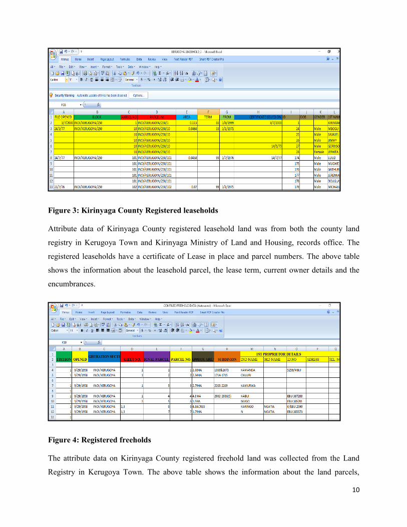
Figure 3: Kirinyaga County Registered leaseholds
Attribute data of Kirinyaga County registered leasehold land was from both the county land
registry in Kerugoya Town and Kirinyaga Ministry of Land and Housing, records office. The
registered leaseholds have a certificate of Lease in place and parcel numbers. The above table
shows the information about the leasehold parcel, the lease term, current owner details and the
encumbrances.
Figure 4: Registered freeholds
The attribute data on Kirinyaga County registered freehold land was collected from the Land
Registry in Kerugoya Town. The above table shows the information about the land parcels,

11
owners from the original owner to the current, the different subdivisions that brought about new
parcel numbers and the encumbrances.
Figure 5: Unregistered from the Former Municipal Council files
The table above shows the owner details, the allocation number, size of the parcel, ownership
document and the lease period for the unregistered leasehold parcels.
Spatial data
During development of the Kirinyaga county LIMS, the digitized cadastral maps were
georeferenced and overlaid over each other and with the Google images of the area. These
helped in showing that the developments on the ground are not in line with the proposed
planning.
The spatial data which were the cadastral maps were in analogue paper form and had to be
digitized. The digitized cadastral maps were the part development plans (PDPs), RIMs and fixed
survey maps. Digitization was by scanning and saving it as a Jpeg, in Arc map the image was
added, in the data frame properties UTM Arc 1960 37s was chosen, in georefferencing control
points were added at least 4 coordinate points were chosen, in the Arc catalogue boundary and
shape file as polygon was added and tracing of boundaries and parcels and inserting the parcel

12
numbers using Arc map. The spatial data collection involved the digitization of the all available
cadastral plans.
Digitization of the Physical Development Plan (PDP)
PDPs are obtained from the physical planning department offices in the county. The PDPs are
mainly used as the base information since they contain the current information that is being used
by the former municipal councils. The PDPs are digitized and overlaid over the cadastral maps
i.e. fixed survey plans and the RIMs.
Figure 6: Digitized PDP, Part of Kirinyaga County

13
Digitization of the registry index maps (RIMs)
A registry index map (RIM) is used for general boundary land registration under Registered
Land Act (CAP 300) laws of Kenya. The Registry Index Maps shows the general boundary.
With the general boundary, the exact location of the boundary is undetermined but assumed to be
represented by a visible physical feature such as hedges, rivers or streams or any physical feature
that may be found suitable for the definition of the position of the boundary. The Registry Index
Maps are generated from non-rectified aerial photographs hence the areas of the land parcels and
the shapes are not ground accurate. In order to convert the existing RIMs into digital format the
analogue maps were scanned, georeferencedg and tracing of the boundary lines. RIMs are
obtained from the district survey offices or from the survey of Kenya headquarters.
Figure 7: Digitized RIM, a part of Kirinyaga County
Digitization of the cadastral plans/Fixed Survey Maps
A fixed survey map is a map for the fixed boundaries. The fixed cadastral plans are obtained
from Survey of Kenya headquarters in the cadastral section. The plans are in Universal traverse
Mercator (UTM Arc 1960 Datum) Projection. The required FRs within Kirinyaga County towns
are identified from fixed general RIM map and taken for search. Features such as land parcels,
typically provide the results on a survey plan that describes the location of features relative to
each other. The plans are drawn in ArcGIS environment through Coordinate Geometry (COGO).
The list of coordinate are feed in excel and the exported to the Arc Map. These coordinates prove

14
the controls that are used to construct the lines. COGO provides means of drawing parcels by
feeding the bearing and distances.
Figure 8: Digitized Fixed Survey, A Part of Kirinyaga County
Conceptual level
This level describes what details stored in the database and the relationships among the data. The
conceptual level supports each external view, in that any data available to a user must
be contained in or derivable from the conceptual level. A model is developed that conceptualizes
the part of the real world which is relevant for a specific application [Coronel et al., 2011). The
entities relationships and attributes were identified and a conceptual data model was built which
is an entity relationship model that was created using DIA.
DIA is open source software that is used in drawing diagrams with entities and relationships as
for Kerugoya LIMS. The entity- relationship model was a check for redundancy and conceptual
model Validation against user needs and to achieve accurate representation of the data,
relationships between the data, and constraints on the data that is pertinent to the enterprise.
Kirinyaga County entity-relationship model is as shown below.

15
Figure 9: Entity-Relationship model of Kirinyaga County
In Kirinyaga LIMS, land parcel and its information is the main concern. In the entity-relationship
model above land parcel has information on use, value, location, address, tenure type,
registration Act, development zone, owner details acreage and parcel id. The relationship
between the owner and land parcel is many-to-one (n-1). Parcel owner can have a lease or not,
on the land parcel the is a property for rent that is rented by many tenants (1-n) and the property
can be used by owner only, where there can be many properties owned jointly or in shares by
many owners (n-n) in a land parcel. Parcel owner lives in a neighborhood that has a development
zone, a name and details about crime or flooding. The land parcel is conveyanced by a lawyer
who is interested in name of the owner, type of tenure in the land, address, parcel id and the
registration Act, the land parcel-lawyer relationship is one-to-many(1-n).

16
The land parcel is administered by the Kirinyaga County government Ministry of Land and
Housing, many land parcels are administered by one ministry of land and housing (n-1). Land
parcel information (address value and parcel id) is needed by taxman. The Kirinyaga Ministry of
Land has surveying department that needs the land parcel (location, acreage, coordinates, and
parcel id), valuation department that needs details on value, acreage, address, parcel id and
physical planning department that is interested on details about development zone, address,
parcel id and location. The relationship between the Kirinyaga ministry of land and housing and
the departments is one-to-one (1-1). In the spatial database the land parcel is bounded by arc that
consists of points defined by coordinates.
Logical level
The conceptual data model was translated to logical data model and validated to check that it is
structurally correct and able to support the required transactions. To represent the entities,
relationships and attributes relations were derived for logical data model. The relationship that an
entity has with another entity was represented by the primary key (parcel id)/
foreign key mechanism (Thomas Connolly and Carolyn Begg, 2005). The relations of the logical
data model were validated by normalization to ensure that each relation is structurally correct
and duplication does not happen. The logical model was validated by the users, integrity
constrains checked and the model was checked for future accommodation of changes.
Normalization was achieved by examining the relationships between attributes by using a series
of tests (normal forms) to help identify the optimal grouping for these attributes to ultimately
identify a set of suitable relations that supports the data requirements of the LIMS database,
normalization of the Excel tables is imported in Access. In the normalized table, all the entries
have the same font and format.
Physical Level
The data was organized physically. The relational database schema from the logical data model
that was be implemented in the LIMS is produced. A translation of the relations in the logical
data model into a form that can be implemented in the LIMS relational database management
system by designing a base relations, designing representation of derived data and designing

17
general constrains. Then a file organizations and indexes are determined by analyzing
transactions, choosing file organizations, choosing indexes and estimating disk space
requirement (Thomas Connolly and Carolyn Begg, 2005).
To develop a life cycle the user view that was identified during the external level is designed
and documented. A security mechanism for the Kirinyaga County LIMS database is designed as
specified by the user during user need assessment. This level is managed by the operating system
under the direction of the database management system.
Findings.
So far the Kirinyaga County pilot project on Land Information Management System is still being
implemented phase by phase. All the available Land information for the major towns has been
digitized and a database system has been developed. Some other County Governments in Kenya
are in the process of developing their Land Information Management Systems.
When developing Kirinyaga county LIMS the spatial data on some of the plots was unavailable
especially Wang’uru area because the adjudication process has not taken place yet; so there was
no spatial data available for use. The developer saw the need to use a UAV to fly the area and
generate the orthorectified images then adjust the spatial boundary and get RIMs for the area.
These is a more effective, efficient and timely way out of getting these RIMs than waiting for the
adjudication process to be undertaken by the Kenyan government that can take years before the
final output is seen. Using UAVs will lead to faster completion and implementation of the
Kirinyaga county LIMS.
During the development of Kirinyaga County various challenges were encountered which
included the legal, political, social, technical and economic challenges. These challenges are
based on the driving forces of attaining a sustainable development and sustainable Land
Information Management System.

18
Conclusion
In order to achieve the sustainable development, it is vital for every county to develop Land
Information Management System. Owing to the fact that the county resources are based on land,
there is the need to have a system that integrates all the information on the resources within the
county. With this system in place the Counties will improve economically, politically, socially
and environmentally. This is because LIMS provides a better platform for decision making on
the use of the resources.
LIMS is needed to prevent wastage of scarce resources especially in the third world countries,
hence an essential for sustainable land administration that leads to good governance (Mclaughlin,
1988). Without an appropriate Land Information Management System Counties will not be able
to deliver at scale the expected economic and social services to people in these areas, and they
will not be able to offer sustainable and affordable tenure security to the majority. They will also
not be able to increase the governance and transparency of the land system through decentralized
systems of land management using local record offices as part of the Land Information
Management System (UN-Habitat, 2003).
References
Alliance, K. L. (2004). The national land policy in Kenya.
Mclaughlin, P. F. (1988). Land Information Managment:An introduction with specia preference
to cadastral problems in third world countries.
Sarah Williams, E. M. (2014). Toward Open Source Kenya. Creating and Sharing a GIS
Database of Nairobi, 3.
Thomas Connolly and Carolyn Begg. (2005). Database systems (fourth edition ed.).
UN-Habitat. (2003). surveying and land information managment for secure land tenure.

19
Figure 1: Three-Level ANSI-SPARC Architecture external level ................................................. 7
Figure 2: External model ................................................................................................................ 8
Figure 3: Kirinyaga County registered leaseholds ........................................................................ 10
Figure 4: Registered freeholds ...................................................................................................... 10
Figure 5: Unregistered from the defunct municipal council files ................................................. 11
Figure 6: Digitized PDP, Part of Kirinyaga County .................................................................... 12
Figure 7: Digitized RIM, A Part of Kirinyaga County ................................................................. 13
Figure 8: Digitized fixed survey, A Part of Kirinyaga County ..................................................... 14
Figure 9: Entity-Relationship model of Kirinyaga County........................................................... 15