determining the depth of hydro demolition using lidar methods
TRANSCRIPT
Determining the Depth of Hydro Demolition using Lidar Methods
by
Norbert Maerz and
Ken Boyko
A National University Transportation Center at Missouri University of Science and Technology
NUTC R334
Disclaimer
The contents of this report reflect the views of the author(s), who are responsible for the facts and the
accuracy of information presented herein. This document is disseminated under the sponsorship of
the Department of Transportation, University Transportation Centers Program and the Center for
Transportation Infrastructure and Safety NUTC program at the Missouri University of Science and
Technology, in the interest of information exchange. The U.S. Government and Center for
Transportation Infrastructure and Safety assumes no liability for the contents or use thereof.
NUTC ###
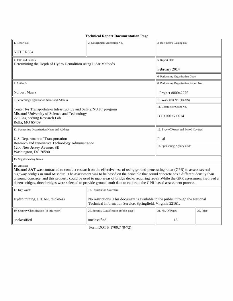
Technical Report Documentation Page
1. Report No.
NUTC R334
2. Government Accession No. 3. Recipient's Catalog No.
4. Title and Subtitle Determining the Depth of Hydro Demolition using Lidar Methods
5. Report Date
February 2014
6. Performing Organization Code 7. Author/s
Norbert Maerz
8. Performing Organization Report No.
Project #00042275
9. Performing Organization Name and Address
Center for Transportation Infrastructure and Safety/NUTC program Missouri University of Science and Technology 220 Engineering Research Lab Rolla, MO 65409
10. Work Unit No. (TRAIS) 11. Contract or Grant No.
DTRT06-G-0014
12. Sponsoring Organization Name and Address
U.S. Department of Transportation Research and Innovative Technology Administration 1200 New Jersey Avenue, SE Washington, DC 20590
13. Type of Report and Period Covered
Final
14. Sponsoring Agency Code
15. Supplementary Notes 16. Abstract Missouri S&T was contracted to conduct research on the effectiveness of using ground-penetrating radar (GPR) to assess several highway bridges in rural Missouri. The assessment was to be based on the principle that sound concrete has a different density than unsound concrete, and this property could be used to map areas of bridge decks requiring repair.While the GPR assessment involved a dozen bridges, three bridges were selected to provide ground-truth data to calibrate the GPR-based assessment process.
17. Key Words
Hydro mining, LIDAR, thickness
18. Distribution Statement
No restrictions. This document is available to the public through the National Technical Information Service, Springfield, Virginia 22161.
19. Security Classification (of this report)
unclassified
20. Security Classification (of this page)
unclassified
21. No. Of Pages
15
22. Price
Form DOT F 1700.7 (8-72)
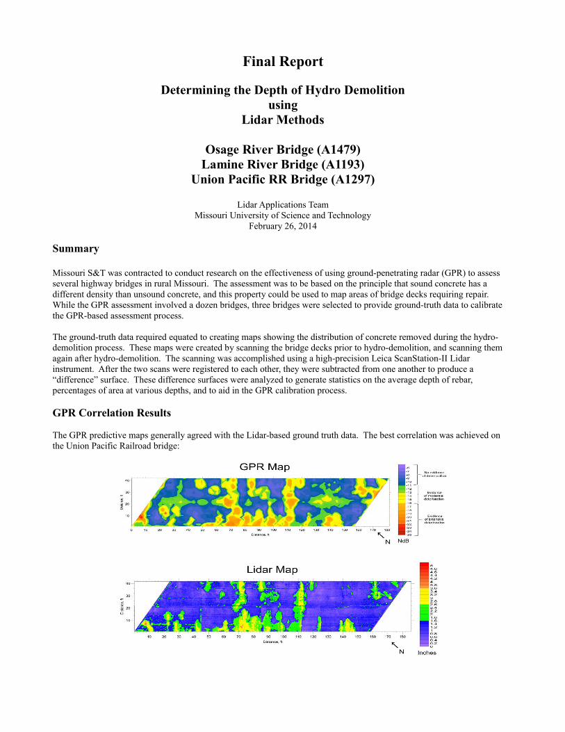
Final Report
Determining the Depth of Hydro Demolitionusing
Lidar Methods
Osage River Bridge (A1479)Lamine River Bridge (A1193)
Union Pacific RR Bridge (A1297)
Lidar Applications TeamMissouri University of Science and Technology
February 26, 2014
Summary
Missouri S&T was contracted to conduct research on the effectiveness of using ground-penetrating radar (GPR) to assess several highway bridges in rural Missouri. The assessment was to be based on the principle that sound concrete has a different density than unsound concrete, and this property could be used to map areas of bridge decks requiring repair. While the GPR assessment involved a dozen bridges, three bridges were selected to provide ground-truth data to calibrate the GPR-based assessment process.
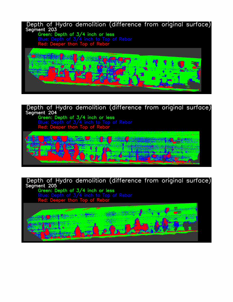
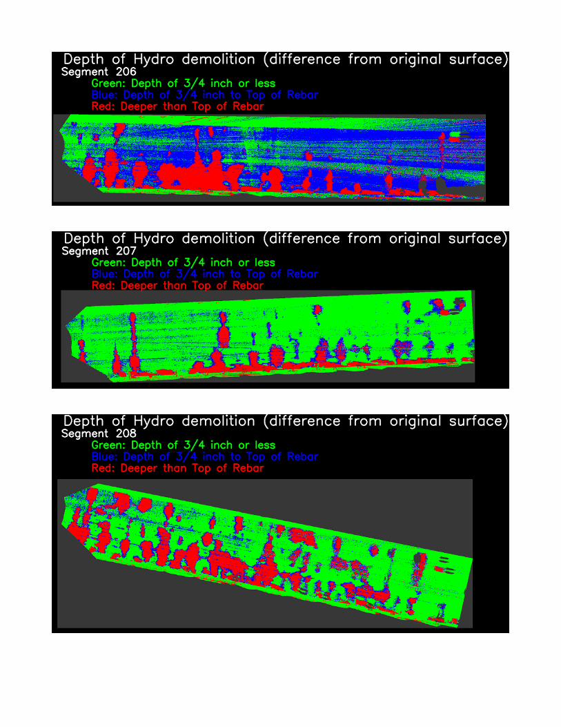
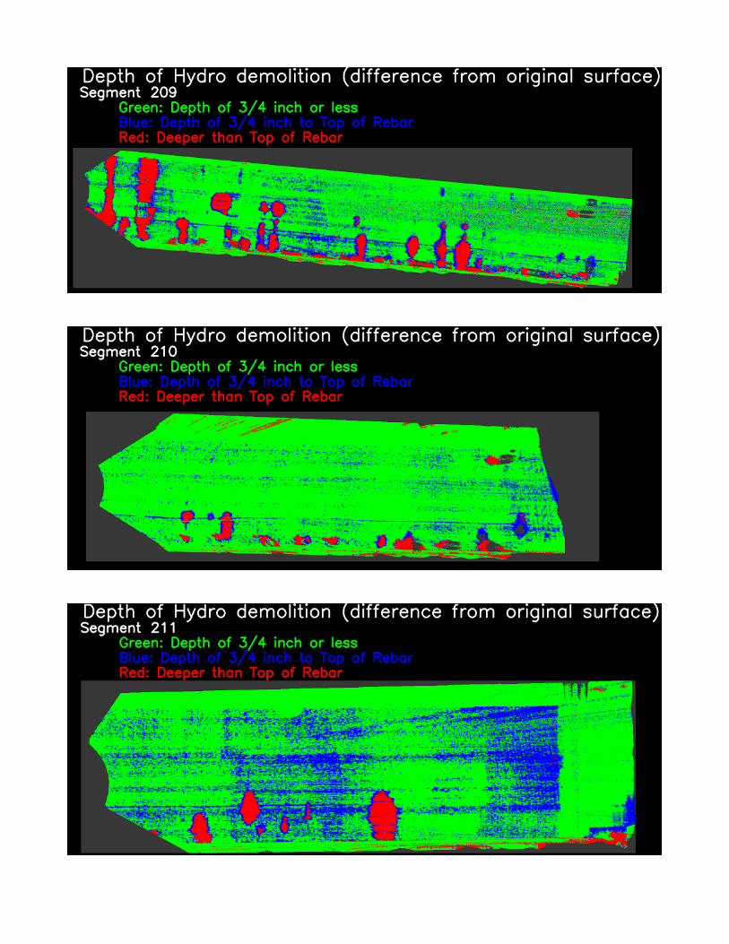
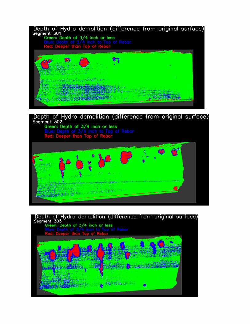
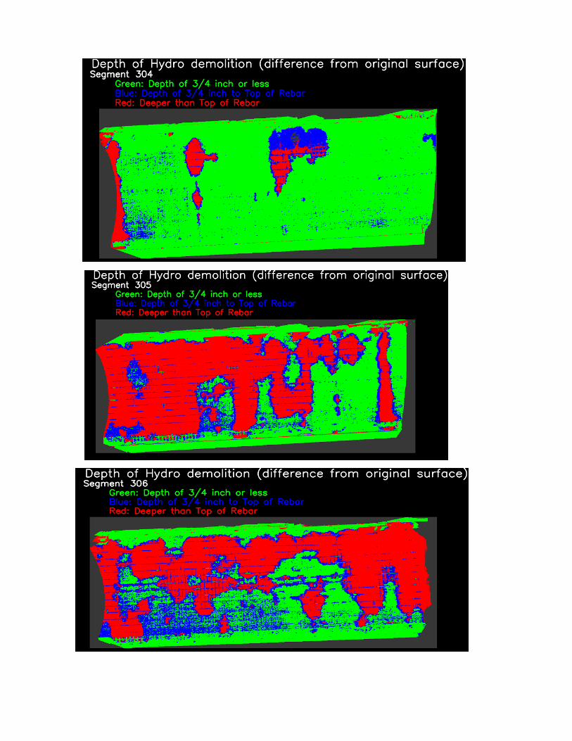
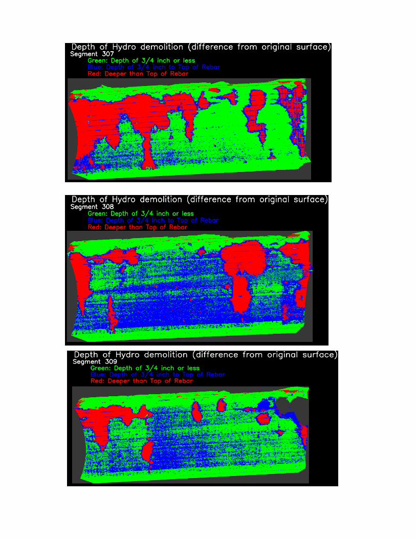
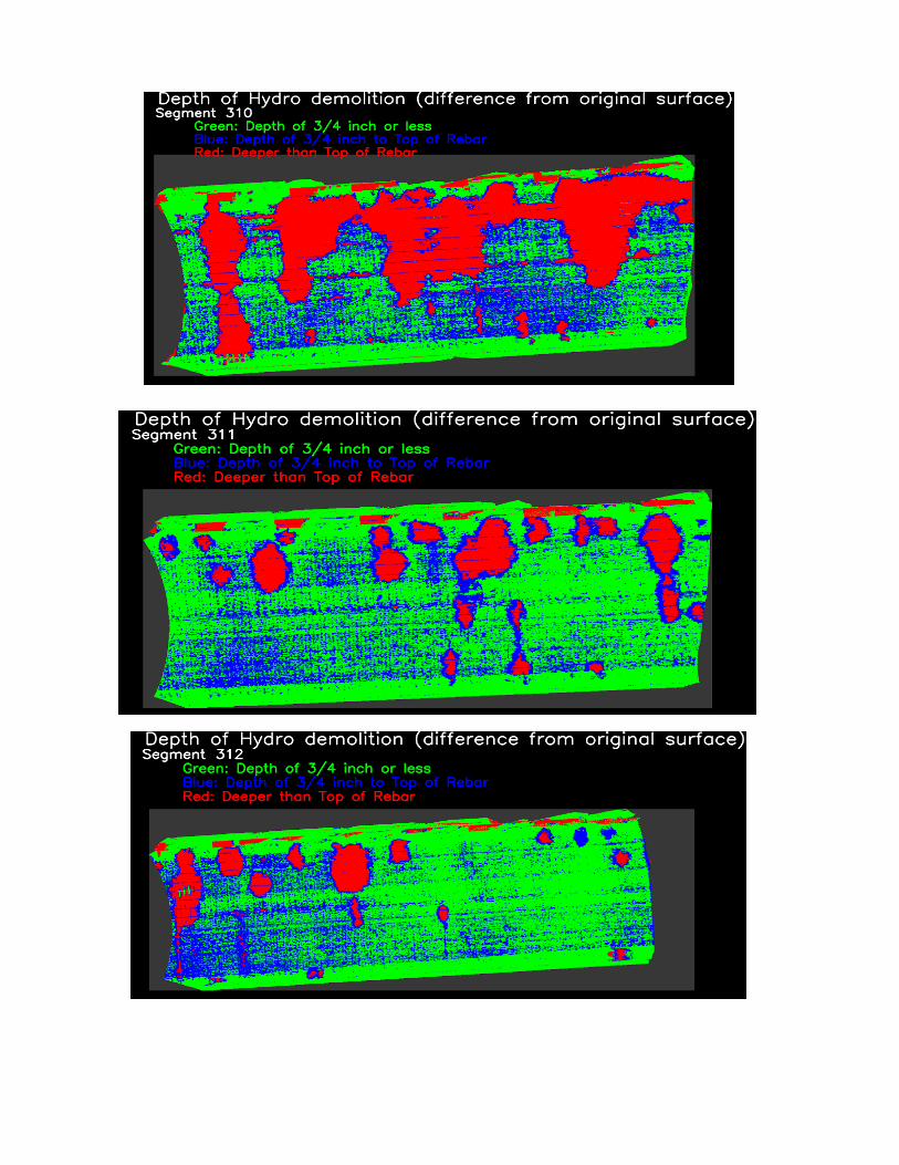
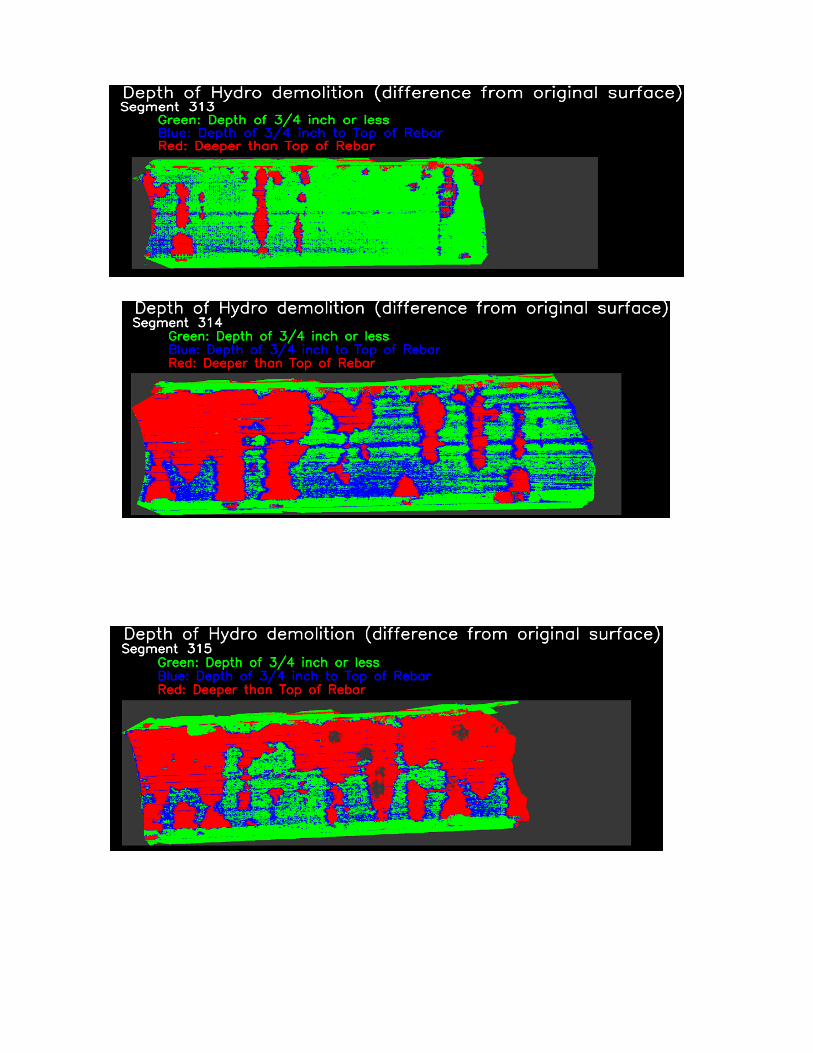
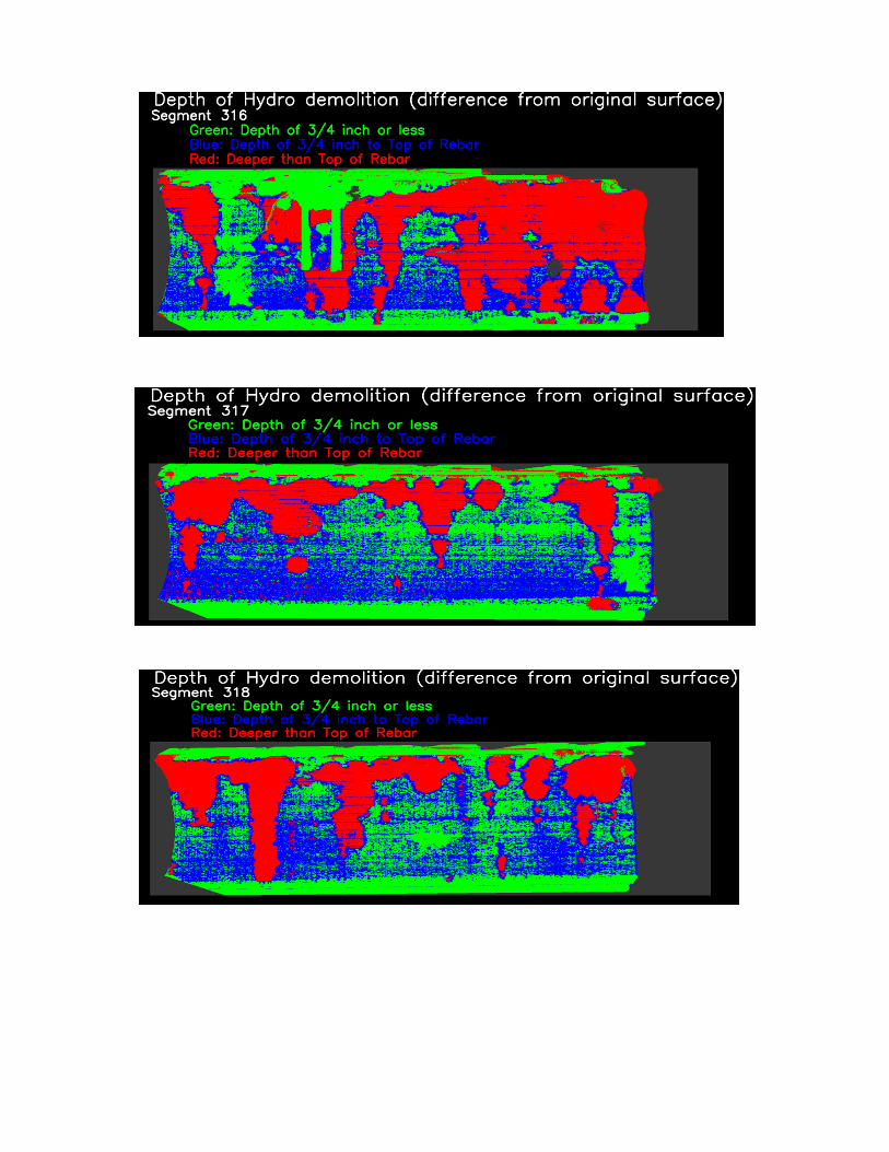
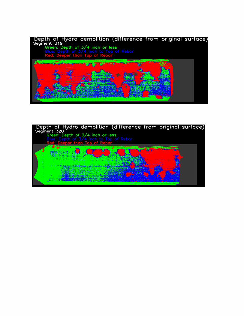
The ground-truth data required equated to creating maps showing the distribution of concrete removed during the hydro-demolition process. These maps were created by scanning the bridge decks prior to hydro-demolition, and scanning them again after hydro-demolition. The scanning was accomplished using a high-precision Leica ScanStation-II Lidar instrument. After the two scans were registered to each other, they were subtracted from one another to produce a “difference” surface. These difference surfaces were analyzed to generate statistics on the average depth of rebar, percentages of area at various depths, and to aid in the GPR calibration process. GPR Correlation Results
The GPR predictive maps generally agreed with the Lidar-based ground truth data. The best correlation was achieved on the Union Pacific Railroad bridge:
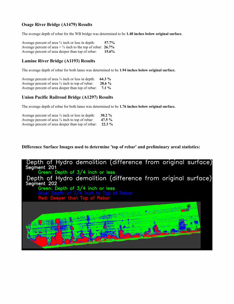
Osage River Bridge (A1479) Results
The average depth of rebar for the WB bridge was determined to be 1.48 inches below original surface.
Average percent of area ¾ inch or less in depth: 57.7%Average percent of area > ¾ inch to the top of rebar: 26.7%Average percent of area deeper than top of rebar: 15.6%
Lamine River Bridge (A1193) Results
The average depth of rebar for both lanes was determined to be 1.94 inches below original surface.
Average percent of area ¾ inch or less in depth: 64.3 %Average percent of area ¾ inch to top of rebar: 28.6 %Average percent of area deeper than top of rebar: 7.1 %
Union Pacific Railroad Bridge (A1297) Results
The average depth of rebar for both lanes was determined to be 1.76 inches below original surface.
Average percent of area ¾ inch or less in depth: 30.2 %Average percent of area ¾ inch to top of rebar: 47.5 %Average percent of area deeper than top of rebar: 22.3 %
Difference Surface Images used to determine 'top of rebar' and preliminary areal statistics: