department 2013 austin mobility: moving forward
TRANSCRIPT

1Austin Transportation Department | austintexas.gov/transportation
Austin Mobility: MoVinG FoRWARD
Austin tRAnspoRtAtion DepARtMent 2013

2Austin Transportation Department | austintexas.gov/transportation
sustAinAbleliVAble
eConoMiCAlly VibRAnt
2013 AnnuAl RepoRt
3Austin Transportation Department | austintexas.gov/transportation
Contents
1 Strategic Mobility
thinking big picture 8
imagine Austin: Compact & Connected 9
2 Key initiativeS
2.1 FResh AppRoAChes
Designing streets for people 12
Complete streets 13
Mobility: expanding Choices 14
innovative traffic Management 14
traffic & travel Data: A tool for improved performance 15
new Criteria for street Design 16
2.2 ReGionAl RoADWAy iMpRoVeMents
Mobility 35: Capital Area Corridor 17
Mopac improvement project 18
oak hill “y” 19
FM973 at sh71 19
2.3 pRojeCt ConneCt 20
3 PrograMS 3.1 lonG-RAnGe plAnninG 24
3.2 AiR QuAlity & CliMAte 28
3.3 tRAFFiC MAnAGeMent 29
3.4 tRAFFiC sAFety 32
3.5 CoRRiDoR DeVelopMent 35
3.6 peDestRiAn Mobility 36
3.7 biCyCle Mobility 38
3.8 pARkinG 40
3.9 neiGhboRhooDs & DistRiCts 43
3.10 RiGht oF WAy 47
3.11 speCiAl eVents 49
AtD oRGAnizAtionAl ChARt 52
4Austin Transportation Department | austintexas.gov/transportation
thank you for reading this Annual Report 2013, an overview of recent efforts by the Austin transportation Department.
Austin, texas, is a big, thriving economic powerhouse of a city in the fastest-growing region in the country – with the accompanying big-city transportation challenges. our region’s roadways are annually ranked as some of the most congested in the nation. We have much work to do. but in reflecting back on the five years since i came to the Austin transportation Department, in september 2008, i also realize how far Austin has come.
in 2008, we launched a full-fledged, multi-modal transportation program – Austin Mobility. to achieve it, we’ve deepened our cross-agency partnerships. We’ve led a major push to improve Mopac and i-35, resulting in emerging improvements to ease travel conditions. We’ve actively supported the opening of new MetroRail and now MetroRapid transit service. We’ve addressed many gaps in our transportation network and updated the technology that keeps traffic flowing. parking innovations have included solar-powered meters, reverse-angle parking, and an emerging wayfinding system that helps people find available parking Downtown. We’ve seen the birth of project Connect – cause for optimism about the future of regional, high-capacity transit. the City’s bicycle program and infrastructure have expanded tremendously, earning international recognition and winning converts to transportation cycling.
in looking back at Fiscal year 2012-13, a few notable milestones include:
I-35: the City of Austin and the texas Department of transportation (txDot) developed the i-35 Capital Area improvement program (CAip). Created in partnership with multiple agencies and stakeholders, the i-35 CAip has jump-started a region-wide discussion about the role and future of i-35. in 2013, the plan defined a set of individual projects, which separately and together can work to reduce congestion through Austin. projects in the first phase now are moving into environmental review and preliminary design. (see section 2.2)
Project connect: in partnership with Capital Metro and the lone star Rail District, the City of Austin funded project Connect, and completion of the next regional high-capacity transit plan for Central texas. in 2013, the project Connect plan was endorsed by Austin City Council, the Capital Metro board, and numerous other jurisdictions. in December 2013, AtD received endorsement from Council to develop a proposal for the first high-capacity investment – within the highland-east Riverside corridor that serves Downtown, the Capitol Complex, and the university of texas. (see section 2.3)
AdvAnced trAnsPortAtIon MAnAgeMent systeM: in 2013, we deployed and further developed the City’s new central traffic signal and intelligent transportation control software. our AtMs is among the most modern and progressive transportation management systems in the nation. Among other state-of-the-art benefits, the system has allowed AtD to provide new signal prioritization for MetroRapid vehicles. in early testing, Capital Metro achieved significant trip-time savings, thanks to AtMs’ capabilities. (see section 3.3)
RobeRt spillAR
letteR FRoM the DiReCtoR

5Austin Transportation Department | austintexas.gov/transportation
this is a tremendously exciting time to be in Austin improving the City’s transportation network. in the past, our transportation system has not kept pace with our economic growth. Missed opportunities to invest in all modes of transportation helped to create the severe traffic congestion we experience today. now, we are doing it differently.
Funding remains a serious challenge. but Austin is achieving the density required for robust transit and bicycle-pedestrian systems. sustainability has become the City of Austin watchword. We are advancing all modes for the transportation systems of the future.
looking ahead, the Austin transportation Department will continue its focus on a set of overarching goals:
• Provide multi-modal streets that support Austin’s evolution as a compact and connected community, with attractive streetscapes that enhance our sense of place
• Complete transportation networks, and close gaps, to ease congestion and meet the travel needs of our neighborhoods, businesses and visitors
• Achieve greater travel efficiencies and productivity, within our existing streets and mobility network, to support our region’s economic core
• Protect the public safety through street designs, signaling strategies, and continuous education and improvement
We’ll need your help and optimism as the City strives to provide strong leadership in tackling the next round of transportation improvements. in the years ahead, providing a safe and reliable transportation system will require an on-going commitment of sufficient resources by the City and all agencies. At the same time, each of us needs to make personal choices that are mindful of finite transportation resources. just as we conserve electricity and water, we need to conserve gasoline and limited transportation dollars.
With partnerships and strategic investment, we can make robust improvements and real progress. join us as we continue our mission to expand everyone’s transportation choices, provide more reliable travel, and invest wisely in Austin’s long-term future.
sincerely,
Robert spillarDirector, Austin transportation Department

6Austin Transportation Department | austintexas.gov/transportation
in june 2012, the City of Austin adopted imagine Austin, a community-created vision and plan for our sustainable future. When i first came to Austin in 2008, i was concerned about land-use-and-transportation decisions being made in the absence of an up-to-date comprehensive plan – which often resulted in me asking, “to what end?” We needed a big-picture policy guidebook. today, we have it in the imagine Austin comprehensive plan – which directs us to “invest in a compact and connected Austin.”
imagine Austin calls for managing our City’s growth in ways that promote and protect our people, economy, environment, special Austin character, health and quality of life. our transportation system is critical to Austin’s livability. imagine Austin established a policy direction of addressing land use (development patterns) and transportation as one interrelated whole with its priority program to “invest in a compact and connected Austin.”
how do we become more “connected”? it requires a transportation network that connects all of the places where people live, work, shop, play and get healthy. Austin transportation Department is planning ahead for a transportation network that expands everyone’s workable choices for how to get around Austin – by car, bus, rail, walking, and biking. it’s leading the development of “complete street” corridors to connect walkable, compact centers where people can conveniently meet a range of daily needs – allowing Austinites to make fewer, shorter trips and spend less time driving.
As this report details, our transportation Department is actively advancing solutions on multiple fronts, demonstrating vision and innovation as well as a commitment to public safety, continuous improvement, and fixing immediate problems today. i am proud of the City employees in all departments who contribute to improving and maintaining our streets and transportation system. Whether it’s a team of engineers adjusting light signalization to relieve traffic congestion, executives and planners developing long-term strategies with our regional partners, or the crew that goes out tomorrow to stripe new bike lanes, all are contributing to a livable Austin.
Achieving a more “compact and connected” Austin and region will take time, sustained focus, many partners and a coordinated approach. today we are managing transportation and urban planning – indeed, the whole City – to ensure that every program, project and major capital investment helps to move us toward that goal.
your efforts and daily transportation choices matter too. this week, try something new – join a carpool, invite someone to share a ride, run an errand by bicycle, try out the new MetroRapid service, walk to lunch. join us in being part of the transportation solution.
Marc ott
Marc A. ottCity Manager
MARC ott
letteR FRoM the City MAnAGeR

7Austin Transportation Department | austintexas.gov/transportation
thinkinG biG piCtuRe
iMAGine Austin: CoMpACt & ConneCteD
1 stRAteGiC Mobility

8Austin Transportation Department | austintexas.gov/transportation
thinkinG biG piCtuRe
Mission: the Austin transportation Department is committed to providing the most safe, efficient, cost-effective and sustainable roadway, bikeway, walkway and transit system for our community.
over the past year, Austin transportation Department (AtD) has tackled the big transportation issues and projects essential for our economy, jobs, and quality of life. informed by the values and goals expressed by the Austin community, as well as national best practices, the City of Austin worked in 2013 to plan and provide for all modes of travel.
Austin Mobility initiatives in 2013 reflected a long-term view across many complex issues. specific achievements covered the full transportation spectrum – as detailed in the following sections of this report. AtD worked to improve access to and from Downtown, help people safely navigate their neighborhoods, provide accommodations for all modes of travel, undertake improvements to major state and regional roadways such as Mopac and i-35, and advance the regional transit vision of project Connect.
Visit our website at austintexas.gov/transportation
ph
oto
: CA
pit
ol
Me
tR
o
8
9Austin Transportation Department | austintexas.gov/transportation
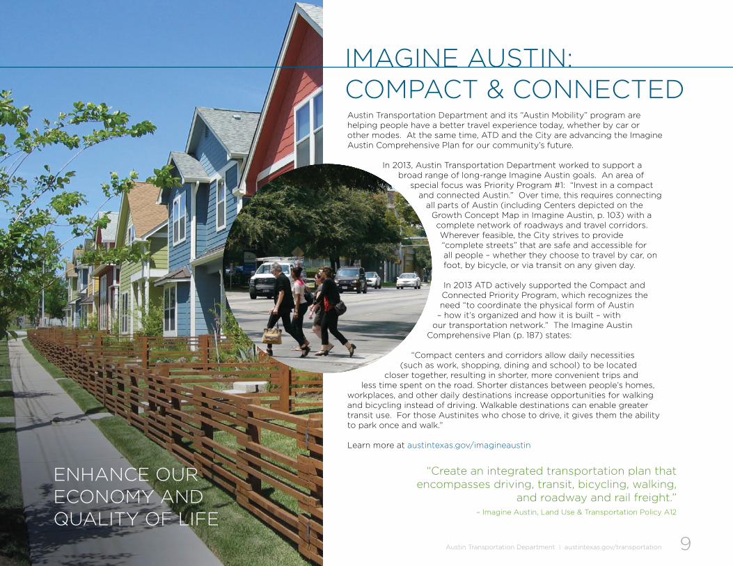
Austin transportation Department and its “Austin Mobility” program are helping people have a better travel experience today, whether by car or other modes. At the same time, AtD and the City are advancing the imagine Austin Comprehensive plan for our community’s future.
in 2013, Austin transportation Department worked to support a broad range of long-range imagine Austin goals. An area of
special focus was priority program #1: “invest in a compact and connected Austin.” over time, this requires connecting
all parts of Austin (including Centers depicted on the Growth Concept Map in imagine Austin, p. 103) with a complete network of roadways and travel corridors. Wherever feasible, the City strives to provide “complete streets” that are safe and accessible for all people – whether they choose to travel by car, on foot, by bicycle, or via transit on any given day.
in 2013 AtD actively supported the Compact and Connected priority program, which recognizes theneed “to coordinate the physical form of Austin
– how it’s organized and how it is built – with our transportation network.” the imagine Austin
Comprehensive plan (p. 187) states:
“Compact centers and corridors allow daily necessities (such as work, shopping, dining and school) to be located
closer together, resulting in shorter, more convenient trips and less time spent on the road. shorter distances between people’s homes,
workplaces, and other daily destinations increase opportunities for walking and bicycling instead of driving. Walkable destinations can enable greater transit use. For those Austinites who chose to drive, it gives them the ability to park once and walk.”
learn more at austintexas.gov/imagineaustin
iMAGine Austin: CoMpACt & ConneCteD
enhAnCe ouR eConoMy AnD QuAlity oF liFe
“Create an integrated transportation plan that encompasses driving, transit, bicycling, walking,
and roadway and rail freight.” – imagine Austin, land use & transportation policy A12

10Austin Transportation Department | austintexas.gov/transportation 10
ph
oto
: ViC
to
R o
VA
ll
e

11Austin Transportation Department | austintexas.gov/transportation
2.1 FResh AppRoAChesDesiGninG stReets FoR people
CoMplete stReets
Mobility: expAnDinG ChoiCes
innoVAtiVe tRAFFiC MAnAGeMent
tRAFFiC & tRAVel DAtA: A tool FoR iMpRoVeD peRFoRMAnCe
neW CRiteRiA FoR stReet DesiGn
2.2 ReGionAl RoADWAy iMpRoVeMents
MoVinG i-35 FoRWARD
MopAC iMpRoVeMents
oAk hill “y”
FM973 At sh71
2.3 pRojeCt ConneCt
2 key initiAtiVes

12Austin Transportation Department | austintexas.gov/transportation
people were the focus in 2013, as the City of Austin and our partners continued to update Austin’s transportation system. every transportation project happens in a neighborhood context, and Austin transportation Department respects that context and the real people affected every day.
AtD advanced many initiatives over the course of the year to ensure that our roadways and transportation network serves the needs of all people. Austin residents and visitors need the ability to choose and safely use different modes at various times – walking, bicycling, transit, and driving.
in its 2013 work program, AtD was guided by the specific documents recognized by City Council:
• Designing Walkable Urban Thoroughfares: A context-sensitive approach institute of transportation engineers/Congress
for the new urbanism• Urban Street Design Guide: national Association
of City transportation officials• Urban Bikeway Design Guide: national
Association of City transportation officials
DesiGninG stReets FoR people
2.1 FResh AppRoAChes
12
ph
oto
: MiC
hA
el
kn
ox

13Austin Transportation Department | austintexas.gov/transportation
in 2013, AtD proactively advanced a Complete streets approach to transportation planning, street improvements and design. A “complete street” is a roadway designed and operated to provide a safe, efficient, and appealing travel experience for all users and modes of travel.
looking toward a future of more compact development patterns, AtD has been planning ahead so that Austinites will be able to conveniently walk, drive, bike, and take transit between their homes, jobs and other destinations, in the years ahead. small improvements on all add up. For a number of specific roadways and intersections, AtD implemented alternative designs to better facilitate the smooth movement of all travel modes, for example.
AtD also advanced conversations with City partners in 2012-13 about the vital impact of fully connected street networks. For example, the Department helped to define and discuss short-term, mid-range and long-range goals for connecting the designated imagine Austin activity centers (see Growth Concept Map in imagine Austin Comprehensive plan, p. 103) via a complete network of roads, transit, sidewalks, trails, and bicycle infrastructure.
in December 2013, Austin City Council called for development of a Complete streets policy document. AtD prepared to lead this effort, in collaboration with other City departments and the Compact and Connected priority program team.
CoMplete stReets
“Develop complete streets design guidelines for all new road construction and reconstruction.”
– imagine Austin lut A19
ph
oto
: nA
th
An
Wil
ke
s
MAke tRAVel sAFe FoR All useRs, oF All AGes AnD Abilities
13

14Austin Transportation Department | austintexas.gov/transportation
AtD worked throughout the year to provide people in our community with reliable, efficient, and safe trips by car. At the same time, AtD actively partnered to expand the public’s transportation options.
initiatives to make “alternative” travel choices more feasible, attractive and reliable included:
• transportation Demand Management for Downtown (with Movability Austin)
• Additional taxi zones• new pedicab zones• Car sharing programs (Car2Go, zipcar)• increased night owl bus service by Capital Metro• MetroRail service on Friday and saturday nights • Free parking for motorcycles/scooters• Additional bike lanes • bike corrals for bike parking• bike sharing program
in 2013, AtD continued implementing best-practices and innovations, to improve the Central texas mobility toolkit for the 21st century. For example, the Arterial Management program focused on fresh approaches (including context-sensitive solutions) to leveraging outside partnerships, as well as City resources, for the planning, design, and implementation of roadway and intersection improvements
AtD also deployed an Advanced transportation Management system (AtMs) to enhance travel via all modes throughout Austin and the region. As the AtMs is further deployed in 2014 and beyond, Austinites will see many roadway enhancements and enjoy the related benefits – which will continue to build into 2015 and beyond.
As part of AtMs, the Department provided new transit signal priority at 79 signals for Capital Metro’s new MetroRapid (bus rapid transit) Route 1 service. the system enables MetroRapid vehicles to “talk” to the signals and extend the green time, allowing them to get through a light. by helping MetroRapid stay on schedule, this improvement makes transit a more attractive choice for getting around town.
Mobility: expAnDinG ChoiCes
innoVAtiVe tRAFFiC MAnAGeMent
“Create a transportation and congestion management plan and program to
improve the flow of traffic in and out of the Central business District…”
– imagine Austin land use & transportation policy A25

15Austin Transportation Department | austintexas.gov/transportation
AtD focused in 2013 on better managing the entire regional transportation system. this requires better data, which AtD and other agencies can use to:
• provide information to the public, allowing people to make informed travel decisions
• identify and take actions needed, in real-time• plan and prioritize current and future improvements• Assess results and system elements that need adjusting
For critical arterials serving the city center and the region, AtD worked with its partners over the past year to pursue a regional data-collection and performance measuring system. Development efforts focused on travel times, travel time reliability, trip origin and destination pattern and traffic volumes.
As an initial pilot project, AtD installed 40 sensors to collect travel-time data at key signalized intersections along south lamar boulevard. transportation planners and engineers will be using the data collected in a variety of ways to improve traffic flow – for example, to better time signals at intersections, maximize roadway capacity, react to accidents, and display estimated travel times on dynamic message signs.
AtD also continued to add volume-count stations on critical arterials – with 14 stations installed by the end of 2013. these stations report traffic volumes, vehicle class, and speeds. Volume data collected is used to make a range of informed traffic-system improvements.
AtD has identified a need for future resources, to unlock the value that “big Data” offers. Additional staff, consultant support, and/or new software tools can help us better gather and use hard, reliable data to improve life and mobility in Central texas.
tRAFFiC & tRAVel DAtA: A tool
FoR iMpRoVeD peRFoRMAnCe
ph
oto
: nA
th
An
Wil
ke
s

16Austin Transportation Department | austintexas.gov/transportation
AtD worked with other City departments starting in 2013, to update the City’s transportation Criteria Manual. A part of the land Development Code, the transportation Criteria Manual (tCM) guides the development of new roadways. it classifies and defines streets, establishes design criteria and guidelines, and provides schematic drawings for street designs.
Austin’s old tCM is no longer in step with the Compact & Connected goals for our city’s growth established in imagine Austin. An auto-centric document, it does not reflect today’s more people-centric approach. transportation Department staff coordinated with a parallel effort to update the City’s subdivision Regulations.
new provisions call for developers and street designers to follow best-practice guidelines, which promote and encourage the design of people-centric, context sensitive, complete streets.
“establish land use and street design regulations to create sustainable
neighborhoods that are child-friendly and support walking and bicycling [for] daily
needs.” – imagine Austin lut A3
16
neW CRiteRiA FoR stReet DesiGn

17Austin Transportation Department | austintexas.gov/transportation
AtD has been focused on devising near-term strategies to improve i-35 through Austin. toward this end, AtD has represented the City of Austin since 2011 in working with the texas Department of transportation (txDot) on Mobility 35. this is a comprehensive txDot effort to select the best strategies to improve i-35 statewide. Mobility 35 includes eight segments in travis County; together they make up the “Capital Area Corridor.” it is one of four i-35 corridors being studied by txDot. As with all projects, AtD advocates a context-sensitive and Complete streets approach.
An extensive public-input process began in Fall 2013. the improvements proposed address rethinking i-35 in hays, travis and Williamson Counties, including that portion of the corridor which runs through Downtown Austin (approximately Mlk to lady bird lake). Community input – including concern for the impact of i-35 on the context of Austin neighborhoods, and interest in opportunities to reconnect east and West Austin through Downtown – generated interest in below-grade (“depressed lane”) solutions. innovative reuses of the frontage roads, and the addition of new capacity within the existing corridor’s footprint, also became proposals under consideration. txDot and AtD now are engaged in further exploration of these opportunities, in accordance with community preferences.
locally, AtD’s initiative on i-35 has spawned broader regional transportation opportunities working with transportation agency partners. Austinites approved $19 million in 2010 and 2012 bonds to directly address incremental solutions, via preliminary engineering, design, corridor development, and construction.
the transportation Department, public Works Department, and other partners engaged in
2013 in the planning, design, and construction of numerous roadway improvement projects
throughout Austin. below we provide an overview of major 2013 AtD initiatives.
Mobility 35: CApitAl AReA CoRRiDoR
2.2 ReGionAl RoADWAy iMpRoVeMents

18Austin Transportation Department | austintexas.gov/transportation
since 1962, interstate highway 35 has been the transportation backbone of the region, connecting central texas to the rest of the u.s., Mexico and Canada. originally constructed to serve commerce, i-35 through Central texas also supported the development of far-flung suburbs, by offering a convenient, federally funded commuting route into Austin. today i-35 is congested with different kinds of trips: long-distance/freight and commuter/local. the corridor (and its central Austin segment) is routinely ranked as one of the most congested roadways in the region and texas. 85 percent of trips within the five-county Austin region are commuter/local.
by expanding Austinites’ workable options for efficiently making these local trips, other than driving their cars on i-35, we can help to prevent even more intense i-35 congestion in the future. the imagine Austin policy to invest in more compact-and-connected development patterns is one important solution toward this end.
loCAl tRips on i-35
ph
oto
: nA
th
An
Wil
ke
s
the Central texas Regional Mobility Authority (CtRMA) is building one express lane in each direction on north Mopac (loop 1) from lady bird lake to parmer lane. AtD has been extensively involved in this project to ensure it optimally serves the Austin community. the project also includes aesthetic enhancements, bicycle and pedestrian improvements, and the construction of sound walls. the new express lanes are scheduled to open in 2015.
For full information about the Mopac improvement project, visit the CtRMA website at mopacexpress.com
MopAC iMpRoVeMent pRojeCt
18

19Austin Transportation Department | austintexas.gov/transportation
“Develop a program and funding source to retrofit existing, incomplete roadways into complete streets.”– imagine Austin land use & transportation policy A18
Austin transportation Department worked in 2013 on near-term improvements to the “y” at oak hill, to reduce traffic congestion. AtD represented the City in collaborating with txDot and travis County on the project. Construction is underway, for interim improvements at the intersection of us 290 and highway 71 (the “y”), and on us 290. they include modified continuous flow intersections, center turn lanes, and additional left turn lanes, all funded byAustin voters.
improvements to this intersection are speeding up traffic by substantially increasing the green time for sh 71 (the main street). the project was completed in september 2013, through a partnership between txDot and AtD. Austin’s first “texas super street” intersection design prohibits left turns and through-movements from FM 973. it instead requires drivers to turn right onto sh 71, and then make a u-turn at a signalized median opening. this change also provides safer pedestrian and bicycle crossings.
in cooperation with txDot and CtRMA, design of a proposed future sh 71 express project also is underway; its construction would provide a seamless highway network through this area.
oAk hill “y”
FM973 At sh71
19

20Austin Transportation Department | austintexas.gov/transportation
AtD led the City of Austin’s active engagement throughout Fy 2012-13; the transportation Department provided leadership or input for each of the major projects below. As part of this effort, the City’s urban Rail program was integrated into the project Connect framework.
the City of Austin worked closely with Capital Metro and the lone star Rail District on a regional public process to identify the first segment for a transit system through Central Austin. this effort builds upon the City’s previous extensive research and work on urban Rail, which included preliminary engineering and many alignment studies. Rail transit for Central Austin now is being considered as part of a high-capacity system.
project Connect is a partnership among the Central texas transportation agencies responsible for implementing the high-capacity transit component of the CAMpo 2035 plan.
2.3 pRojeCt ConneCt
“With a projected 48 percent employment increase and an
expected population growth of 42 percent by 2035, more and more people will work and play in the
Central Corridor.”
– Central Corridor / project Connect
RenDeRinG by pRojeCt ConneCt
130
612N
GX
COLORADO RIVER
CO
LO
RA
DO
RIV
ER
GUADALUPE COUNTY
BEXAR COUNTY
COMAL COUNTY
BEXAR COUNTY
CALDWELL COUNTY
GUADALUPE COUNTY
TRAVIS COUNTY
BASTROP COUNTYHAYS COUNTY
CAMPOplanning
areaSA-BC MPO
planningarea
COMAL COUNTY
HAYS COUNTY
TRAVIS COUNTY
WILSON COUNTYGUADALUPE COUNTY
WILLIAMSON COUNTY
TRAVIS COUNTY
WILLIAMSON COUNTY
TRAVIS COUNTY
BA
STR
OP
CO
UN
TY
TRAV
IS C
OU
NTY
UT/Dean Keeton
W 38th
Rosedale
North Loop
Koenig West
HydePark
SoCo
Oltorf
Little TexasPleasant Hill
SouthparkMeadows
St Edward’s
South Congress
Transit Center
Triangle
Sunshine
Justin
Northcross
Ohlen
Research
Pickle
Domain
Koenig
Crestview
Hancock
Martin Luther King Jr
PlazaSaltillo
Downtown
Highland/ACC
North LamarTransit Center
Rundberg
Masterson
Chinatown
Tech Ridge
UT/West MallMuseumCapitol
Wooldridge SquareRepublic Square
Austin/Seaholm
Slaughter Ln
Kyle/Buda
San Marcos/Texas State University
New Braunfels
Schertz
Loop 1604
Loop 410/Airport
San Antonio/UTSA
Port San Antonio
City South/TAMUSA
AuditoriumShores
Barton SpringsLamar Square
Oltorf WestBluebonnet
Brodie OaksOak Hill
Westgate
Braker Ln/Domain
35th/MOPAC
McNeil Junction
Howard
Kramer
Georgetown
DowntownRound Rock
Palm Valley
Hutto
Manor
Norwood
JohnnyMorris
Elgin
Taylor
Lakeline
Leander
EllisAlleyAlamo
South TexasMedical Center
UTSA
ROUNDROCK
CEDARPARK
LEANDER
MANOR
PFLUGERVILLE
ELGIN
BASTROP
LOCKHART
SEGUIN
DRIPPINGSPRINGS
AU S T I N
S A N A N TO N I O
GEORGETOWN
Dell Children’sMedical Center
SetonMedicalCenter
ACCRio Grande
Capitol Complex
Universityof Texas
PickleResearchCenter
Domain
ACCNorthridge
St Edward’sUniversity
ACC Riverside
Texas StateUniversity
Austin-BergstromInternational Airport
StDavid’s
Regional Rail, Commuter RailMetroRail (opened 2011), LSTAR (planned)
Bus Rapid TransitMetroRapid (coming 2014)
Urban Rail(Planned)
Transit on Express LanesMOPAC (coming 2015)
Right-of-Way PreservationFor future transportation corridors
Planned corridors, stations, routes and modesof transit for planned lines are conceptual only.
ADOPTED JUNE 2012 Map Revised June 2013schematic mapnot to scale
Park & Ride
Transit Stations
OPE
RATI
NG
PLA
NN
ED
UN
DER
CO
NST
RUC
TIO
N
35
35
35
35
35
35
10
10
37
410
410
410
79
183
183
183
183
290
290
90
281
1604
1
1
1
45
45
130
71
71
130
130
151
290
FREDERICKSBURG RDVIA Primo - not all stops shown
SOU
TH C
ON
GRE
SSBU
RNETM
OPA
C
W 5TH / W 6THCESAR CHAVEZ
NO
RTH
LAM
AR
SOU
TH L
AMAR
MO
PAC
MO
KA
N
21Austin Transportation Department | austintexas.gov/transportation
Project connect vision Adopted by the transit working group, project Connect in 2012-13 developed a $4b Regional high-Capacity transit system plan, with a Conceptual Funding plan and organizational Framework. national experts provided peer reviews, to ensure best practices.
central corridor the City co-funded a new regional leadership position for this project, with Capital Metro. An Advisory Group, chaired by the Mayor, met throughout the year; a highly transparent public process resulted in recommendation and endorsement of a Central Austin route by Austin City Council and the Capital Metro board. the City also helped develop and signed an interlocal agreement for future transit development.
For the most recent information regarding the Central Corridor, please visit projectconnect.com/connect/central-corridor
north corridorsponsored by Capital Metro, this is a regional study of alternatives to link Central Austin with pflugerville, Round Rock, Georgetown and other communities. both roadways and transit are being studied. AtD has participated as a technical advisor. three finalist alternatives – high Capacity lanes, express bus, and Connect service – were studied in depth.
For the latest news on the locally preferred Alternative moving forward, visit: projectconnect.com/connect/north-corridor
Metrorailin operation since 2010, MetroRail ridership is now at capacity during peak travel times. AtD consulted on future improvements that will enable increased service, including a project to double-track the line near plaza saltillo.
MetrorapidAtD has helped prepare our streets and traffic management system for two high-capacity rapid bus routes -- along north lamar boulevard/south Congress Avenue and burnet Road/south lamar boulevard. City crews worked to complete transit priority lanes on Guadalupe and lavaca streets, from Cesar Chavez street to Martin luther king jr. boulevard, in preparation for Capital Metro’s new MetroRapid 801 to begin operation in january 2014.
2013 ACCoMplishMents
“Create a system of high-capacity transit, including elements such as urban rail
and bus rapid transit…”– imagine Austin lut A13 – imagine Austin lut A13
MoPac Improvement Project this project will provide new express lanes with access for buses and registered vanpools along Mopac between parmer lane and Cesar Chavez street and include aesthetic enhancements, bicycle and pedestrian improvements, and sound walls. the new express lanes are scheduled to open in 2015.
Lone star railthe lone star Rail District has been working with state and local governments to provide intercity passenger rail service to connect Austin to san Antonio and Georgetown along the existing union pacific rail line. Funding is a key issue. AtD, through project Connect, has been assisting with funding evaluation and planning.

22Austin Transportation Department | austintexas.gov/transportation 22

23Austin Transportation Department | austintexas.gov/transportation
3.1 lonG-RAnGe plAnninG
3.2 AiR QuAlity & CliMAte
3.3 tRAFFiC MAnAGeMent
3.4 tRAFFiC sAFety
3.5 CoRRiDoR DeVelopMent
3.6 peDestRiAn Mobility
3.7 biCyCle Mobility
3.8 pARkinG
3.9 neiGhboRhooDs & DistRiCts
3.10 RiGht oF WAy
3.11 speCiAl eVents
3 pRoGRAMs

24Austin Transportation Department | austintexas.gov/transportation
3.1 lonG-RAnGe plAnninG
ph
oto
: Au
st
in-A
Me
RiC
An
stA
te
sM
An
in May 2013, Austin City Council adopted a new long-range policy guide for the city’s growth and development – the imagine Austin Comprehensive plan (iACp). in response, the Austin transportation Department (AtD) is actively aligning its long-range planning with imagine Austin policies.
transportation planners are a critical part of achieving this big-picture vision. AtD’s long-range planning program is helping our metro area evolve in ways that will allow Central texans, in the future, to efficiently travel between compact “centers” where people can live, work, shop and recreate. to provide reliable travel and mobility choices, these centers must be connected by multimodal corridors – roadways that are safe and reliable for walking, biking, transit and driving.
A core imagine Austin policy goal: Austin needs to develop in a more sustainable, “Compact & Connected” fashion.
24

25Austin Transportation Department | austintexas.gov/transportation
obtaining significant funding for transportation projects to help achieve long-range “compact and connected” policy goals is a top AtD
and City priority. it informs City of Austin funding requests to the Capital Area Metropolitan planning organization
(CAMpo), which distributes federal and state transportation dollars. in its requests, AtD prioritizes
projects that meet not only immediate needs, but also build toward long-range goals for mixed-use centers and multi-modal corridors defined in imagine Austin and CAMpo 2035.
the City of Austin was awarded $22 million in CAMpo funds in the last call for projects (December 2011) to improve vehicle, transit, bicycle and pedestrian mobility. the initial phases of funded projects are underway, building the momentum as we advance Austin
and regional mobility options. they include:
• Advanced traffic Management system (AtMs) • Rail transit studies (project Connect Central
Corridor)• bicycle facilities (loop 1 at barton Creek,
bike/pedestrian bridge, phase i)• FM 973/Dessau Road, intersection improvements
• north lamar, sidewalks • north braker lane, multimodal complete street• sabine street promenade, multimodal
AtD is actively monitoring the next opportunity to receive funding through CAMpo, in 2014.
CAMpo’s next update to our six-county region’s long-range transportation infrastructure plan – CAMpo 2040 – will be released in May 2015. the CAMpo 2040 plan is critical to advancing imagine Austin goals and transportation strategies, because in order to receive future federal and state funding, regionally significant projects must be included in the regional plan and the related transportation improvement program (tip).
AtD is actively participating in a process whereby representatives of the six counties collectively identify, prioritize and select projects and programs for plan inclusion. in june 2013, a regionally endorsed vision, set of goals, and proposed performance measures was defined for CAMpo 2040.
AtD is working to meld imagine Austin and other City transportation policies and action items into this regional planning effort. For example, AtD’s long-range planning team has helped to develop proposed Centers concepts, updated bicycle and pedestrian policies, and supporting data.
CAMpo FunDs FoR CoMpACt & ConneCteD
plAnninG ReGionAlly FoR 2040

26Austin Transportation Department | austintexas.gov/transportation
by planning for public right-of-way (RoW) land, AtD and other city departments work to protect the needs of
the whole community, by ensuring that there will be enough space for roads and complete streets.
Vehicle and bike travel lanes, sidewalks for walking safely, street trees and landscaping,
and other design elements to create a handsome public realm all require space.
utility infrastructure often is located in the RoW as well.
For new projects, developers are required to dedicate RoW land for the building of streets and other infrastructure. the Austin Metropolitan Area transportation plan (AMAtp) identifies the land that will be needed for future right-of-way (RoW), along major arterial corridors.
in 2013, AtD began working collaboratively on an updated 2025
AMAtp. Compact and Connected objectives, and other imagine Austin
policies, inform our work. in fall 2014, the draft 2025 AMAtp will be available for
public comment; it will ultimately go to Austin City Council. upon adoption, the 2025 AMAtp
will guide all City requests of developers to dedicate the land for RoW.
expAnDinG the publiC ReAlM: RiGht-oF-WAy
When developers build new projects, the City requires them to help fund and build certain related transportation improvements. these help to serve the residents and users of the project – whether it’s a large-lot subdivision or a Downtown condo project with ground-floor restaurants. the portion the developer is required to fund – by paying fees, construction costs, or dedicating land for right-of-way – must be “roughly proportionate” to the transportation impact of the development itself, by state law.
AtD has been actively working with travis County to finalize a standard methodology for assessing these fees, in a way that provides predictable and equitable developer funding for transportation infrastructure. in 2013, City and County staff have been testing and implementing a recommended “rough proportionality” methodology.
We all benefit as both private and public interests contribute their fair share, to ensure that people in our fast-growing city will have appropriate transportation infrastructure, now and in the years ahead.
pRiVAte FunDinG FoR the publiC GooD

27Austin Transportation Department | austintexas.gov/transportation
Many diverse Austinites need to walk safely and take transit along Decker lane, yet this major corridor has historically lacked sidewalks.
thanks to a successful AtD grant application, people who walk along Decker lane (FM 3177) will have 1.6 miles of brand-new sidewalks.
social equity was among the goals that led AtD to prioritize this project for funding and construction, with County and state partners. in two bordering 2010 Census tracts, over 30.3 percent of people live below the national poverty level. per capita income ranges from $9,923 to $24,077. in the project area, 74.2 percent to 99.5 percent of people are minorities, according to the Census. this project will make their neighborhood a healthier, safer, more walkable and interconnected place – activating the imagine Austin vision. the sidewalks and a new bridge over Decker Creek will serve people walking to elementary and middle schools, bus stops, churches, shopping and homes, as well as the travis County expo Center. long-term, it will connect to Colony park (a neighborhood the City now is master planning), and to the Austin-to-Manor Rail trail, a walking and biking path being planned in an existing rail corridor.
AtD worked with travis County and txDot to develop a funding partnership; AtD submitted the grant application to the texas transportation Commission (ttC). in july 2013, ttC selected the project for an award of $1.53 million; the local partnership match is $382,000.
spotliGht:
$1.9 MILLIONwas federally funded for
Decker lane sidewalks in 2013
WAlkinG sAFely on DeCkeR lAne

28Austin Transportation Department | austintexas.gov/transportation
3.2 AiR QuAlity & CliMAteAustin transportation Department is committed to helping our region improve and manage air quality – for the benefit of public health, our environment, and our economy. Central texas’ air quality is only getting worse, and vehicle emissions are a big part of the problem. Regional data confirms that on-road vehicles account for nearly 50 percent of ozone-forming emissions released within Central texas. by encouraging people’s shifts in travel behavior, and updating traffic management and investments, AtD is working to help reduce these emissions from the transportation sector.
the transportation Department also manages the City of Austin Air Quality program, which strives to reduce the impact of all City operations on air quality. it is an outreach, policy, and information resource for Austin’s residents, and the liaison to regional Central texas efforts.
the primary air quality concern in Austin is ground-level ozone, which is the main component of smog. ozone forms when nitrogen oxides (nox) and volatile organic compounds (VoCs) combine; they are created by vehicle engines, electric generation units, industrial facilities and many everyday activities. it negatively affects our community’s health, from children with asthma to seniors with emphysema.
our region has been on the verge of violating Clean Air standards, set by u.s. epA, for almost two decades. to date, Central texas has avoided classification as a “nonattainment” area, for ozone. but as we add population, and vehicles, we must work harder to keep our air clean.
in March of 2013, Austin City Council approved several program improvements to the City’s Air Quality program. AtD, the City and its partners are implementing them over time, in the areas of:
• outreach and education• enforcement and Administration• technical Assistance• planning and Analysis• Reporting, Data Collection, and Monitoring
in 2013, the City of Austin joined a new regional ozone-reduction initiative. through the u.s. environmental protection Agency’s ozone Advance program, the City is voluntarily acting to address current ozone problems now, rather than waiting for epA to require and prescribe actions that would be triggered by nonattainment status. the City of Austin has committed to a plan that includes over 30 emission reduction efforts; it runs through 2018.
For more information, visit: epa.gov/ozoneadvance and capcog.org/ozoneadvance.
Work from Home DayCity employees participated
in a citywide event on February 8, 2013. of 12,974
total City employees, about 928 teleworked; nearly
another 200 walked, biked, or took transit to work. this
avoided an estimated 26,000 vehicle miles travelled.
28

29Austin Transportation Department | austintexas.gov/transportation
3.3 tRAFFiC MAnAGeMent
traffic is among Austin’s most challenging problems. our city’s population has increased faster than new transportation infrastructure has been funded, designed, and constructed at the local, state, and federal levels. this pattern has occurred for decades, and is still the case. As a result, Austin transportation networks remain heavily stressed. Many key travel corridors have been at maximum capacity for years; right-of-way is rarely available to expand lane capacity. Another challenge is that the City of Austin does not control many of these corridors. of the 10 roadways most often identified by the public as “major streets” on an AtD survey, only two were City-maintained streets. the rest are state highways. our texas highways and rail transit continue to face severe funding shortfalls.
Within this challenging context, AtD engineers are working diligently to identify congested roadways and respond with a range of innovations and tools to improve traffic safety and mobility, where possible, and to provide reliable travel times. Adding accommodations for transit and cycling are part of the solution. For state roads, AtD actively works to prompt or support state action.
the Austin Mobility program is about more than traffic flow; it works on a big scale to advance the safe and efficient movement of people and goods, through a complete transportation network.
29

30Austin Transportation Department | austintexas.gov/transportation
As a tool for managing traffic, technology has come a long way. AtD has deployed and is actively developing a new, state-of-the-art Advanced transportation Management system (AtMs). new sensors and other system components will allow us to measure and improve the reliability of travel times and provide information to travelers in our community.
the transportation Department is upgrading to this state-of-the-art platform to replace outdated central control software from 2000. the initial phase of the new AtMs platform is anticipated to be operational by summer 2014. it provides many new capabilities:
• Ability to better integrate and manage traffic signals, dynamic message signs, traffic cameras, detection systems, travel time monitoring equipment, and volume count stations
• transit signal priority, to reduce signal delay for MetroRapid buses • emergency vehicle preemption making it safer and quicker to pass
through traffic signals• Advanced bicycle detection • Ability for signal timing to more quickly adapt to changing traffic
patterns• online traveler information. A web page will provide information
to the public about traffic conditions, roadway closures, incidents, and events
Traffic Signal Timing. AtD strives to retime all traffic signals along arterials every three years (nationally recommended practice), to respond proactively to increasing traffic volumes and shifting traffic patterns. once an arterial reaches its optimal travel time, retiming signals is unlikely to improve travel times; however, it can assist with maintaining the reliability of these times. AtD also is developing a staffing plan to expand the capabilities of the City’s transportation Management Center. When the tMC is fully staffed, the City will gain the ability to fully utilize the AtMs, to more rapidly respond to unusual conditions with updated signal timing plans and traveler information.
AtD retimed 169 signals along 16 corridors in Fy 2012-13. this resulted in a reduction in travel time estimated at nearly eight percent, for drivers at those signals – surpassing the improvement goal of five percent. AtD is seeking additional staff resources, to allow significantly more of the City’s nearly 1000 signals to be retimed annually.
ADVAnCeD tRAnspoRtAtion
MAnAGeMent systeM (AtMs)
ph
oto
: txD
ot

31Austin Transportation Department | austintexas.gov/transportation
Working with regional partners, the City of Austin is analyzing the transportation network to identify “Critical Arterials” – major roadways that are critical to maintaining mobility throughout the City and the region. they may be either state- or City-controlled. by devoting resources to improve the reliability of people’s travel experience on these roadways, AtD is working to:
• implement imagine Austin “Compact and Connected” policies – by providing more reliable drive times, as well as multimodal choices, to and from key compact “Center” destinations
• Maximize efficiency, for travelers into and from Downtown and Central Austin
• help travelers circumvent the congested core, when that is not their destination.
AtD continuously updates its traffic signs, to help promote safe and efficient mobility. on average signs must be replaced every 8-10 years. the Department exceeded its goal for sign replacement and condition in 2012-13. Gis data and Maximo software now is being integrated to further improve monitoring, repair, and replacement of our inventory of nearly 160,000 traffic signs citywide.
CRitiCAl ARteRiAls
tRAFFiC siGns
Dynamic Message signs are an innovation that can increase the reliability of people’s travel throughout Austin. they notify travelers about conditions ahead that they will encounter, either immediately (e.g. special events or extreme weather) or within the next few days (e.g., upcoming construction lane closure, Capitol 10k and similar events). travelers may select an alternate route, based on the information provided – which can both improve their trip and relieve congestion on major roadways.
AtD has installed 13 DMs on major arterial roads and is monitoring the results. A pilot project is assessing the feasibility of displaying travel times; a resulting recommendation is expected in late Fiscal year 2013-14 or early the following year.
the City’s transportation Management Center (tMC) is the “brains” of the entire management operation. AtD staff at the tMC control traffic signals, traffic cameras, dynamic messaging signs, traffic fluctuations, traveler information systems, and more.
AtD is creating a second, more modern transportation Management Center that will provide a backup system, in the case of a natural disaster or emergency that takes down the primary tMC. Design of the backup tMC is planned for Fy 2013-14, with construction starting in late 2014 or in 2015. AtD also is pursuing modernization and improvements to the primary transportation Management Center.
DynAMiC MessAGe siGns
tRAnspoRtAtion MAnAGeMent CenteR: neW bACkup CenteR

32Austin Transportation Department | austintexas.gov/transportation
3.4 tRAFFiC sAFetysafety is a concern in every project of the transportation Department. the City and its partner agencies promote the safety of the traveling public with the six e’s: engineering, enforcement, education, encouragement, evaluation and emergency Response. the City, including AtD, is currently implementing over 35 transportation safety initiatives across those categories.
For example, AtD performs a thorough engineering investigation – safety audit – in response to each transportation fatality within the City of Austin. in most cases, driver error caused the crash. to help reduce the chance of similar crashes in the future, AtD assesses contributing factors and identifies any potential engineering improvements (e.g. enhancements to signs, markings, signal timing).
AtD also is working with both the Austin police Department and txDot to improve the City’s timely access to crash data and software tools to identify trending safety issues throughout Austin.
49 number of safety auditsFy 2012-13
85 number of on-road fatalitiesFy 2012-13
32

33Austin Transportation Department | austintexas.gov/transportation
in school zones, flashing signals protect the safety of our children. to modernize the system, AtD is installing a wireless system that communicates between AtD’s traffic Management Center and reduced-speed school zone flashers citywide – 296 zones, with about 540 flashers. this system improves efficiency by eliminating the need for technicians to travel to each school zone to enter flashing times. it also improves safety, by providing centralized monitoring that all flashers are working properly. All school zones are scheduled to be integrated into the new system by the time school starts in Fall 2014.
public Works’ related Child safety program assists elementary school children in safely crossing major intersections and streets on their way to and from school, by providing crossing guards.
sChool FlAsheRs: WiReless systeM
We are proud to report that zero deaths have occurred in construction zones (traffic control zones) in the past five years, within the City and its full-purpose jurisdiction. AtD engages in constant review and inspection efforts, to ensure safety. We stay proactive, we stay engaged with our contracting and regional partners, and we educate the construction-zone workforce to ensure that the public moves safely through traffic-control zones, incident free. A new AtD initiative is a training and licensing program for workers within public travel ways, to further protect public safety.
sAFety in ConstRuCtion zones
33

34Austin Transportation Department | austintexas.gov/transportation
Central texas’ first Regional transportation safety summit, in october 2012, brought together representatives of nearly 50 organizations to focus on one common goal: Reducing traffic-related injuries and deaths for Central texans.
hosted by the City of Austin and the Capital Area Metropolitan planning organization (CAMpo), the summit brought together citizens, technical experts, policy professionals, advocacy groups, City and other governmental staff. it initiated an important new regional conversation about transportation safety. summit goals included:
• Define key regional transportation safety issues, and impacts on public health• promote new interdisciplinary collaboration, to improve health and safety• Develop steps of action, for continuing coordinated effort to improve safety• improve crash data collection and sharing• establish roles and responsibility, for continuing a regional
transportation safety focus
the summit generated many ideas and initiatives for developing interdisciplinary approaches and cross-agency collaborations to improving safety. since the summit, four cross-agency subcommittee groups have met to further develop solutions for:
• pedestrian safety• Distracted driving• impaired driving• insufficient infrastructure (such as missing sidewalks)
CAMpo has been developing a follow-up report that defines the most pressing Central texas transportation safety issues, goals, a regional plan of action, and timeline for achieving milestone goals. CAMpo is charged with developing a Regional safety program. it is planning a follow-up summit and safety report, in conjunction with the City of Austin and regional partners.
in April 2013, AtD produced a traffic Fatality Report, with public Works and ApD. it provided an analysis of the causes of fatalities that occurred in 2012, along with other crash data for vehicle, bicycle and pedestrian incidents. it also summarized actions underway to reduce fatalities and serious injuries – both those already in place, and recommended new measures, for City transportation safety initiatives.
in August 2013, AtD hosted an FhA sponsored seminar on developing a pedestrian safety Action plan (psAp). A draft psAp now is being refined; a City of Austin pedestrian safety Action plan is scheduled to be completed and available in summer 2014. the City is committed to continuing to improve the safety of everyone who walks, bikes, rides and drives in Austin.
sAFety suMMit & RepoRt

35Austin Transportation Department | austintexas.gov/transportation
in taking a holistic approach to studying ways to improve entire corridors, AtD works to advance numerous community objectives:
• improve safety • increase mobility and accessibility for drivers, pedestrians,
bicycles and transit users• identify and make specific roadway improvements, to deliver
these outcomes• improve quality of life, for corridor travelers and neighbors • support other imagine Austin, urban design and economic
development goals
in many cases, our work on improving Critical Arterials for regional mobility goals informs AtD’s corridor studies, and vice versa.
Funding from 2010 Mobility bonds allowed in-depth studies of how to improve four key Austin corridors:
• north lamar blvd. (i-35 to 183), with burnet Road (koenig ln. to Mopac) • east Riverside Drive (i-35 to sh 71)• east Mlk, jr. blvd. (FM 969, 183 to Webberville)• Airport blvd., (n. lamar to sh 71)
the studies have addressed short-, medium-, and long-term transportation improvements. For the first set of roadway improvement projects identified, preliminary engineering has been largely completed.
CoRRiDoR stuDies
3.5 CoRRiDoR DeVelopMent
CoRRiDoR iMpRoVeMent pRojeCtsthe 2012 bonds also included funding for making specific roadway improvements, which were identified by the corridor studies:
• $15 million: north lamar blvd. and burnet Road improvements • $1 million: east Riverside Drive improvements
the public can expect to see public Works construction of these improvements beginning in late 2015 or early 2016. projects for the east Mlk, jr. blvd. and Airport blvd. corridors may be included in future bond packages.
the 2012 bond package also included funding for a new corridor study on south lamar blvd. A consultant to work with AtD staff on that project will be selected in early 2014; the study is scheduled for completion in 2015.
over time, AtD plans to gradually complete similar studies for many other corridors; over 25 arterial roadways have been identified. As funding and resources become available, this long-term program will ensure the continuous improvement of our community’s backbone roadway network.

36Austin Transportation Department | austintexas.gov/transportation
3.6 peDestRiAn Mobility
1.3 Miles of urban trails constructedFy 2012-13
imagine Austin established “walkability” as a major community goal. Walking to get around town is good for our health and supports a Compact and Connected city. in 2013, a new pedestrian Advisory Council was formed. the City also began creating an urban trails Master plan and updating the 2009 bicycle Master plan, to guide development of an “all-ages and abilities” active transportation network, that includes a system of connected trails and on-street bikeways.
in Fy 2012-13 and earlier, the City’s bicycle, pedestrian, and transportation programs were managed by the public Works department, with AtD providing consultations for planning and transportation engineering.
in 2013, the transportation and public Works departments developed a plan to gradually bring planning and programming for all modes of transportation into the transportation Department. this will allow for more integrated transportation planning for multi-modal solutions, and it aligns with City Council direction to Complete streets that are pedestrian-friendly and holistically accommodate pedestrian, bicycle, transit, and vehicular needs. in 2014 and beyond, AtD looks forward to providing City of Austin leadership for both bicycle and pedestrian efforts, to further encourage walking and cycling for transportation in Austin.
Safety. Recent improvements that benefit pedestrian safety include new school crosswalks, pedestrian hybrid beacons, new traffic signals and signal timing, roundabouts, traffic calming, sidewalk extensions, pedestrian islands, raised medians, Great streets and sidewalk widening.
Sidewalks. AtD provides transportation planning guidance to the public Works Department, which is responsible for repairing and adding sidewalks citywide. the Americans with Disabilities Act (ADA) is a driving factor in making sure that sidewalks and ramps are safe and accessible for all, as sidewalks are built and updated for both transportation and recreational use.
Trails. the urban trails program promotes environmentally conscious greenways and trails that provide important accessible routes for transportation, as well as for outdoor fitness and recreation. AtD consulted as requested with the public Works Department on trail projects, such as the boardwalk trail at lady bird lake.
ph
oto
: th
e t
RA
il F
ou
nD
At
ion

37Austin Transportation Department | austintexas.gov/transportation
to support Austin’s walkability, AtD began installing pedestrian hybrid beacons (phb) in 2009. We now lead the nation in the number of phb installed. these pedestrian-activated warning devices are located at midblock locations to help people safely cross roads with heavy traffic. When pedestrians need to cross the street, they push a button that activates the beacon. the beacon then shows a red light to drivers and a “WAlk” signal to pedestrians, allowing them to cross while traffic is stopped. the devices are proving popular, as measured by a backlog of nearly 80 phb requests from the community. Five are funded for installation in the coming fiscal year.
Midblock locations account for more than 70 percent of pedestrian fatalities. the pedestrian hybrid beacon is a great solution in such locations, when pedestrian volume isn’t high enough to warrant the installation of a signal. nationally, pedestrian hybrid beacons have been shown to provide the following safety benefits:
• up to a 69 percent reduction in pedestrian crashes• up to a 29 percent reduction in total roadway crashes
to assist pedestrians who are blind or vision-impaired, Accessible pedestrian signals communicate information about the “WAlk” and “Don’t WAlk” intervals at signalized intersections in non-visual formats (i.e., audible tones and vibrotactile surfaces). AtD’s policy is to install an Accessible pedestrian signal (Aps) at all new signals, and at existing locations as needs dictate and funding allows. to date, AtD has installed nearly 50 Aps’s city-wide.
Funding is currently available from 2012 bond funds to add about 30 additional Aps’s.
peDestRiAn hybRiD beACons
ACCessible peDestRiAn siGnAls
34 pedestrian hybrid beacons installed in Austin Fy 2012-13

38Austin Transportation Department | austintexas.gov/transportation
3.7 biCyCle Mobility
AtD regards bicycling as an important mode of transportation, and a key solution for Austin’s mobility future – as cited in the imagine Austin Comprehensive plan. Currently about 2 percent of Austinites commute regularly by bicycle; the City’s current goal is to achieve 5 percent by 2020, or sooner.
in 2012-13, AtD partnered with the public Works Department, to plan for and implement innovative bicycle and pedestrian facilities. Austin’s designation as a silver-level bicycle Friendly Community reflects the City of Austin’s commitment to providing safe, efficient, and accessible bicycle facilities for all residents and visitors. in late 2013 AtD also participated in “your path to Austin” – an initiative to gather public input as the City updates its bicycle Master plan and create a new urban trails plan. the new plan will focus on a connected and protected active transportation network.
in 2014, management of the City’s bicycle program will transition from public Works to the transportation Department. this supports the City’s goal of providing Complete streets that are bicyclist-friendly. AtD looks forward to providing strong transportation planning, community responsiveness, and leadership for this successful and important city program.
biCyCle pRoGRAM
38
2008
11 miles
27 miles
17 miles
36 miles
38 miles
39 miles
2009 2010 2011 2012 2013
new And IMProved bIke LAnes by cALendAr yeAr

39Austin Transportation Department | austintexas.gov/transportation
Cycling is encouraged across several of imagine Austin’s Core principles for Action. in this spirit, AtD is initiating an innovative pilot program to enhance the safety and mobility of cyclists at signalized intersections. the pilot program uses an application (app) running on a cyclist’s smart phone to detect cyclists at signalized intersections. the cyclist starts the app prior to beginning their trip. the app then enables the signal system to detect the cyclist at a signal and turn the signal green to facilitate their crossing. this works in the same manner as pedestrian crossing buttons to start a light change.
the pilot is anticipated to start in Fy 2013-14, with results and a recommendation issued the following Fiscal year. AtD plans to coordinate with the bicycle community throughout the project. Any impacts on drivers are being considered as well.
bike lanes, protected bikeways, and other facilities to encourage cycling are appearing all over Austin. As roadways are routinely improved, the City now adds striping for bike lanes wherever feasible.As of December 2013, examples of current City of Austin Capital
improvement projects expanding or updating the Austin bikeway network (and pedestrian, in many cases) include:
• Austin bicycle Commuting project, various City employment locations
• boardwalk trail at lady bird lake • bike boulevard, Rio Grande and nueces,
from 3rd to Mlk• 2nd street bridge and extension, shoal
Creek to West Avenue• 3rd street Reconstruction, phase 1 - brazos st. to san jacinto blvd., with lance Armstrong bikeway• 3rd street Reconstruction - phase 2, Congress to brazos & san jacinto to trinity• William Cannon bridge over onion Creek, phase 2• Austin to Manor Rail with trail • Davis/Deer improvements, from brodie to Corran Ferry• north Acres trail
• north Walnut Creek bike trail improvements
• southern Walnut Creek hike and bike trail
For more information on these projects and all roadway construction projects, including
budget, phase of work, and contact, see the Capital improvements project list maintained by
the City’s public Works Department.
enhAnCeD biCyCle DeteCtion
neW bikeWAys

40Austin Transportation Department | austintexas.gov/transportation
3.8 pARkinG
AtD’s proactive parking Management programs optimize community benefits from Austin’s parking resources. the parking enterprise strives to improve driver convenience, support our economy, enhance safety for people on foot and bikes, and reduce congestion, which causes air and climate pollution and loss of productivity.
since 2010, AtD has led a city-wide upgrade replacing thousands of traditional meters with space-saving solar-powered units that accept credit cards and coins. in 2013, AtD installed easy park, a program allowing drivers to conveniently pay for on-street parking with an in-car device.
Downtown Parking Demand. the less people drive, the less they need to park. the City of Austin is exploring and piloting various approaches to address parking demand. to help Downtown businesses and their customers, on-street parking spaces need to be available and turn over frequently. For Downtown, a key new partner has been Movability Austin. tools include:
• encouraging parking places to be sold or leased independently of residences and commercial space.
• parking requirements for projects Downtown were eliminated in 2013, with AtD’s support. by ending or reducing parking requirements, the City can boost affordability while encouraging transit use and other alternatives to single occupancy vehicles.
• parking cash-out: this incentive-based program encourages employees to forgo a parking space, in exchange for payment tied to the value of a space.
• Car-share (Car2Go, zipcar) and bike sharing (b-Cycle).
pARkinG MAnAGeMent initiAtiVes
40

41Austin Transportation Department | austintexas.gov/transportation
on-street parking is limited. by actively managing it, AtD works to improve parking availability for everyone, which supports businesses served by parking. ttoday the goal for on-street parking is to have available one to two open spaces per block (80 percent occupancy), to be primarily used for short-term parking (1-3 hours). this goal reduces driving to find parking, reduces traffic congestion, and leads to a vibrant business community and greater customer satisfaction.
Parking Benefit Districts. Austin City Council began allowing parking benefit districts in october 2011. AtD’s parking benefit District (pbD) program yields twin benefits: it both improves the availability of on-street parking and enhances the public realm. nicer streetscapes attract people to walking, cycling and transit use – and as people drive less, parking demand is easier to manage. how does the pbD program work?
in a pbD, a portion of the net revenue generated by metered parking spaces is dedicated for street and sidewalk improvements, within the defined District. these may include curb ramps, streetlamps, and bicycle lanes. Funds also can be used to encourage drivers to choose modes other than driving and parking.
Charging for parking and promoting other transportation alternatives can help reduce single occupant vehicle miles traveled. Districts are defined with input from residents, merchants, and the City.
Parking Revenues. parking is an integral component of Austin’s entire transportation system. Revenue generated by the on-street parking system is reinvested to maintain and enhance the travel network and provide a balanced multi-modal approach, as called for in the imagine Austin plan and Downtown Austin plan. City shaping and urban design projects benefiting from this revenue stream include:
• great Streets Development Program. Receives 30 percent of downtown daytime revenue.
• Downtown austin Wayfinding Program. Funded with downtown evening revenue.
• West campus Parking benefit District. this pbD will receive 51 percent of net area revenue, to fund streetscape improvements and maintenance.
on-stReetpARkinG
MAnAGeMent

42Austin Transportation Department | austintexas.gov/transportation
While most garages and surface lots Downtown are privately owned and operated, AtD has been working with owners and the Downtown Austin Alliance to encourage more efficient use of them, including public use during evening hours, to help accommodate parking demand.
Wayfinding & Parking. the transportation Department has been partnering with the planning and Development Review Department on the Downtown Austin Wayfinding program. An extensive new system of wayfinding signage will make it easier to navigate by foot or by bike. Among many other benefits, this encourages people to “park once” and then walk between their destinations downtown – such as a theater and a restaurant. encouraging “park once” behavior decreases the considerable traffic congestion caused by motorists circling to find a parking space.
in addition, prominent new signage will help people find Downtown garages and lots open for public parking. participating parking garages will have a digital sign on the exterior, which displays the number of available spaces and the price. this information will be linked to digital signs on major corridors and gateways into the Downtown, to help people find parking. electronic parking Guidance systems also are being researched, to direct people (via cell phone apps) to the locations of parking facilities with available spaces.
oFF-stReet pARkinG MAnAGeMent
42

43Austin Transportation Department | austintexas.gov/transportation
3.9 neiGhboRhooDs & DistRiCts
“While to the daily commuter, travel time and speed may be of primary importance, the community that is affected may view this goal as contrary to maintaining neighborhood integrity, overall livability, and safety.” – www.ite.org/css
to keep our neighborhoods safe and inviting, for people of all ages and abilities, AtD is emphasizing a “context-sensitive” approach to the design and improvement of city streets. it considers and respects the full context of the surrounding neighborhoods – and the people who live in, work in and visit them.
this approach, endorsed by City Council, seeks to advance a broad variety of goals for our city and improving people’s lives, rather than focusing primarily on car traffic. For information on how this approach differs from conventional street design, please see one of the guidebooks AtD references:
• Designing Walkable Urban Thoroughfares: A context-sensitive approach
http://ite.org/css
Context-sensitiVeDesiGn
43

44Austin Transportation Department | austintexas.gov/transportation
Commonly referred to as traffic Calming, the local Area traffic Management program (lAtM) responds to community requests to improve the quality and safety of neighborhood streets. in 2012-13, lAtM focused exclusively on speed mitigation issues.
lAtM installs traffic calming devices and improvements along street segments as requested, as engineering reviews and funding allow. the devices installed include roundabouts, median islands, speed humps, speed tables, speed cushions, chicanes and bulb outs.
in Fy 2012-13, 100 requests were received, 46 requests were found to be eligible for further consideration, and 15
requests were funded for construction, with a total budget of $2.08 million. As of December 2013, 58
additional eligible but unfunded requests had been logged, estimated to cost over $5.5 million.
tRAFFiC CAlMinG (loCAl AReA tRAFFiC MAnAGeMent)
44

45Austin Transportation Department | austintexas.gov/transportation
Quiet zones at railroad crossings are established to reduce the noise from train horns, which is a nuisance for neighborhood residents. however, when a train does not sound its horn for a crossing, the risk of a crash occurring increases by over 66 percent. to mitigate this risk, safety improvements (such as barriers or upgraded crossing controls) must be installed at the railroad crossing, in order to implement a Quiet zone. AtD is coordinating with union pacific Railroad (upRR) and Federal Railroad Administration (FRA) on the south Austin Quiet zone project designed to restrict the use of train horns 24 hours per day, seven days a week, at the following railroad crossings:
• Matthews lane • West stassney lane • banister lane • West oltorf street • West Mary street
AtD also is coordinating with upRR, FRA, and community stakeholders to plan and implement the Downtown Quiet zone. this project includes a gated, pedestrian-only crossing near the Amtrak station. it also includes crossing improvements at pressler Road, and at paul street just south of W. 5th street, in coordination with an adjacent multi-family development project.
RAilRoAD Quiet zones
45

46Austin Transportation Department | austintexas.gov/transportation 46

47Austin Transportation Department | austintexas.gov/transportation
3.10 RiGht-oF-WAy & publiC ReAlM
streets are vital public spaces. emulating leading cities around the world, Austin is increasingly approaching streets as places vital to the attractiveness of our community.
As part of the public realm, streets are vital to Austin’s economy and vibe. As Austin grows in a more compact and connected fashion, with many people living in homes that do not include private space outdoors, the public space of our streetscapes will only become more important to Austinites’ quality of life.
safety is an important goal of sidewalks and other public right-of-way spaces, as well. the transportation Department recognizes that our streets – and all the space within the Right of Way, including sidewalks, bikeways, street trees and other landscaping – offer tremendous potential for enhancing our city. Varied and lively streetscapes can make “getting there” as interesting as the destination itself and encourage safer walking, cycling, and use of transit.
AtD coordinates with the City’s urban Design Division, which manages the Great streets program and plans/designs many streetscape improvements in planning for corridors, small-areas, and transit-oriented development areas. in Fy 2012-13, the City developed a new Downtown Wayfinding system (to be paid for with AtD parking enterprise funds). new wayfinding signage to be installed in 2014 and beyond will be an important enhancement to our public realm. the system will help pedestrians, cyclists and motorists navigate; signage graphics and the information on nearby attractions will add to Downtown’s unique and eclectic identity.
the City’s sidewalks program also increasingly focuses on public Realm enhancement goals, in addition to basic American Disabilities Act compliance.
R.o.W. MAnAGeMentthe AtD Right of Way Management Division provides traffic planning and coordination for all temporary activities in the right of way, in the interest of public safety and mobility. the City’s right of way (RoW) typically includes all public space between private property lines on either side of a roadway. this includes streets, sidewalks and bikeways, planting strips and street trees. AtD issues permits and coordinates and responds to issues such as utility coordination, street excavations, temporary uses, parking, driveways, and vending. initiating utility planning for Google Fiber was a fresh challenge in 2013, which will continue in 2014.
Accommodations for sidewalk cafes and vending carts, “festival street” designs, and even a pilot program to convert two Downtown parking spaces into a “parklet” all exemplify ways in which goals for a vibrant public realm increasingly are being incorporated into the City’s approach to RoW management.
ph
oto
: MiC
hA
el
kn
ox

48Austin Transportation Department | austintexas.gov/transportation
Austin transportation Department has assumed active management of the City’s street banner program, formerly housed at Austin energy. in late 2013, AtD began devoting fresh resources to revamp the street banner program, in order to:
• strengthen a sense of place and district identity, in Downtown and key business districts, and along transit corridors
• enhance the streetscapes of Austin, by adding a vibrant element that enlivens Downtown, key corridors and the mobility experience for pedestrians, cyclists, transit users, and drivers
• help community nonprofits, arts and cultural groups, and other organizations better promote special events, and provide public information of interest and benefit to Austinites and visitors
in 2013-14, AtD has developed plans to actively develop and expand the reach of the program, as a placemaking tool; an important goal is for street banners to be an economically self-sustaining enterprise program. AtD plans to market the program to nonprofit groups, city departments and partners, other agencies, and event organizers. look for increased visibility of street banners as a tool to promote charitable, educational, arts, community, and public interest activities and events. Banners available:
• Lamppost Banners. sets of banners installed on streetlight lampposts Downtown.
• Over-The-Street Banners. local nonprofit organizations may install over-the-street banners at over 60 locations to promote fundraisers and special events.
Visit Atxbanners.org to learn more.
stReet bAnneR pRoGRAM

49Austin Transportation Department | austintexas.gov/transportation
3.11 speCiAl eVentsAustin is a festival and special event city. in 2012-13, the City responded by launching the newly organized Austin Center for events (ACe). large-scale events such as Formula one, sxsW and ACl are continuing to grow in scope and complexity, requiring a coordinated and proactive approach.
Managed by the Austin transportation Department, ACe oversees the use of public streets, sidewalks and alleys for athletic and sporting events, festivals, and cultural arts events. the collaborative office is staffed by the transportation, music, police, fire, and eMs departments and coordinates with other facilities and agencies. AtD provides a case manager for each event, who helps to steer applicants through the process of obtaining all necessary approvals. this includes coordinating with other parties, and following all applicable laws and regulations.
ACe also prepares for the traffic impacts and transportation issues created by major events. the office handles RoW closures and creates a traffic control plan for each event to optimize mobility for Austin residents, businesses and institutions as well as event attendees. 2013 also saw the launch of the new Citystage website, the City of Austin’s special events hub online. it provides information to help event organizers, residents, visitors, and local businesses – including a list of upcoming events and street closures.
For detailed information, please see: austintexas.gov/citystage
49

50Austin Transportation Department | austintexas.gov/transportation
the innovations developed for the first two Formula one events broke new ground for AtD and the City as a whole. to prepare for this major challenge, ACe helped strengthen existing relationships across city and state agencies and forged new ones.
AtD created innovative transportation plans, with practices that can benefit other major events, including:
• temporarily suspending public street closures and proactively managing festivals and events
• temporarily suspending public construction projects downtown• Coordinating and expanding transit options, to minimize
congestion • Adjusted traffic signal timing for cars and buses
innovative tools developed for residents and visitors included:
• A webpage template for “big events” that serves as a one-stop-shop for users
• interactive smartphone accessible map highlighting available parking, ground transportation locations, transit routes, road closures, and more
testifying to the success of the ACe approach, both Circuit of the Americas events in november 2012 and 2013 occurred smoothly. the traffic nightmares predicted did not materialize. Austin transportation systems worked well in absorbing a huge, short-term influx of visitors.
spotliGht: CiRCuit oF the AMeRiCAs & F1
ph
oto
: CiR
Cu
it o
F t
he
AM
eR
iCA
s
51Austin Transportation Department | austintexas.gov/transportation
thAnk you, teAM!
Aaron Ginsel Adam jaramilloAlan hughesAlex RiosAndrew halmAnthony AlvaradoAnthony ForcierAnthony hallAnthony seguraAnthony serranoAriana FisherArthur Acunabenjamin hensonbetty torresblake barnardbrian Craigbrian jacksonbrianna AnnasCari buetowCarlos Anguiano Carlton thomasCarmen Flores-CalderonCedric plummerCheyenne krause Chris DixonChristopher sanchezChristopher sudduthCole kittenCourtney henryCrystal torresDale bolinDamion banksDaniel hunterDariyoush MajdDave berryDavid CordellDavid smithDeliris santiagoDerek luna
Diana MartinDipti borkar-Desaieddie Floresedmund beaudetedward bryantedward Vargasepy Cortezeric polancoeric bollichesteban Gongoraeugene podhajskyeva MooreFrances hargroveFrancisco GuerreroGary schatzGeorge placencioGilbert MarreroGilbert RangeltGilda powersGordon DerrGregory pepperGuadalupe Alvaradoharrell McCaslinhank usherhillary nicholsirma suchilisidro Cardonajacqueline hrncirjake Dirrjames Colejim Dalejames lamprechtjason Redfernjavier Martinezjennifer bennett-Reumuthjeremy stephensjerry Cardenjimmy bohacjoan Caldwell
joana perezjoe Michael limonjonathan lammertjose perezjoseph Albertsjoseph Al-hajerijoseph bowiejoseph loveladyjoseph towerjoshua brinson-howardjoshua Woodyardjudith olverajulian howserjulio Woolfjulius earlykarla taylorkatherine Gregorkenneth Moseskenneth scottlarry Meyerleanne Vaughnlee Austinlee Carterlibrado Murrietalori ortegalouis Floreslupe juarezMario porrasMarisol ValderramaMarkus RobyMaryam GhazinezhadianMax MinorMichael kajimuraMichael RodriguezMichael Warrennancy Mayberry-thrallsnanette brownnathaniel Chandler nicholas torres
paloma Amayo-Ryanpatricia samudiopeter Marshpharr AndrewsRaymond littleRenee orrRicky AdamsRobert powellRobert RanumRobert spillarRoman penaRonnie bellRuben hernandezRudy estradasamantha Alexandersamson salduascott Grossseyed Ghazinezhadianshavyvonne Whiteshawn jacksonstephanie brewerstephen Grassfieldsteve Guzmansteven Romerosteven slawsonsusanne Cortezteri McManustim Vogttoby turnertoni salazartony Dubetracy lindertyrone WalkerVanessa FaulknerVictor WoolfWesley AmatoWilber santiagoWillard peavy
Austin transportation Department thanks its employees for everyone’s contributions in 2013.
Mayor lee leffingwellMayor pro tem sheryl ColeCouncil Member Mike MartinezCouncil Member laura MorrisonCouncil Member Chris RileyCouncil Member bill spelmanCouncil Member kathie tovo
employee list current as of 12/31/13
51
AtD works on behalf of the citizens of Austin and their elected representatives

52Austin Transportation Department | austintexas.gov/transportation
AtD oRGAnizAtionAl ChARt
RobeRt GooDe, p.e.Assistant City Manager
MARC ottCity Manager
RobeRt spillAR, p.e.Director
public information traffic Management
signs & Markings
Arterial Management
Administration Right of Way
Austin Center for events (ACe)
urban Rail
long-Range planning
parking operations
off-street parking enterprise
Anthony seGuRAbusiness process
Consultant
GARy sChAtz, p.e.Assistant Director,
traffic Management
GoRDon DeRR, p.e.Assistant Director,project Development
52
kARlA tAloRChief of staff

53Austin Transportation Department | austintexas.gov/transportation

54Austin Transportation Department | austintexas.gov/transportation
austin transportation Department512.974.1150 | austintexas.gov